It’s not an exaggeration to say the northwest coast of Scotland is a world-class kayaking destination, with the lochs and islands south of Skye are popular paddling venues.
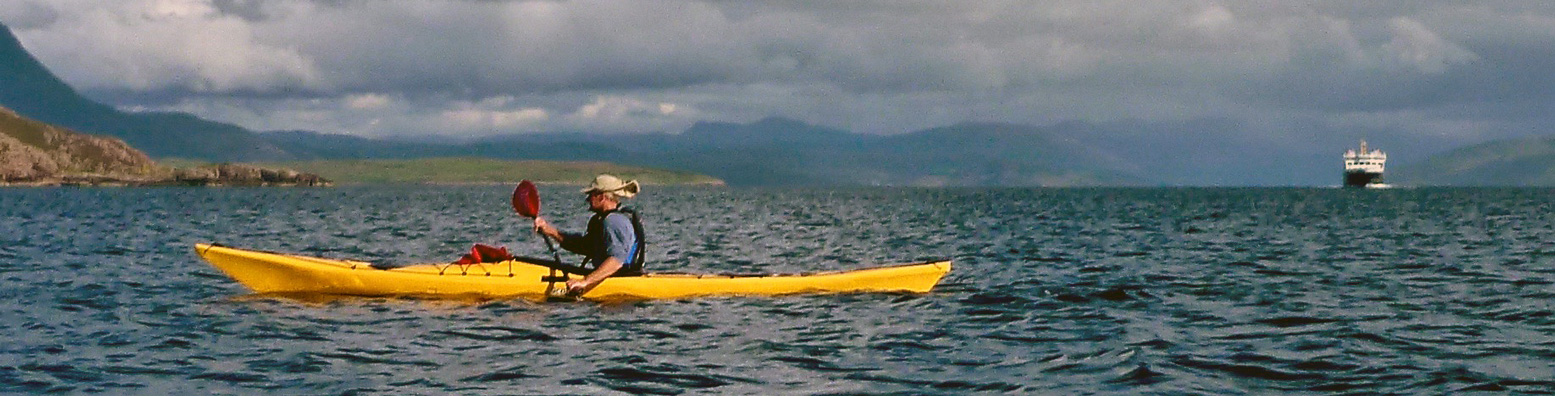
Further north, Atlantic winds and fewer settlements make the long trek a gamble, but no less rewarding if you hit a good spell, as happened to these astronauts one time (left).
Weather right now in the Summer Isles

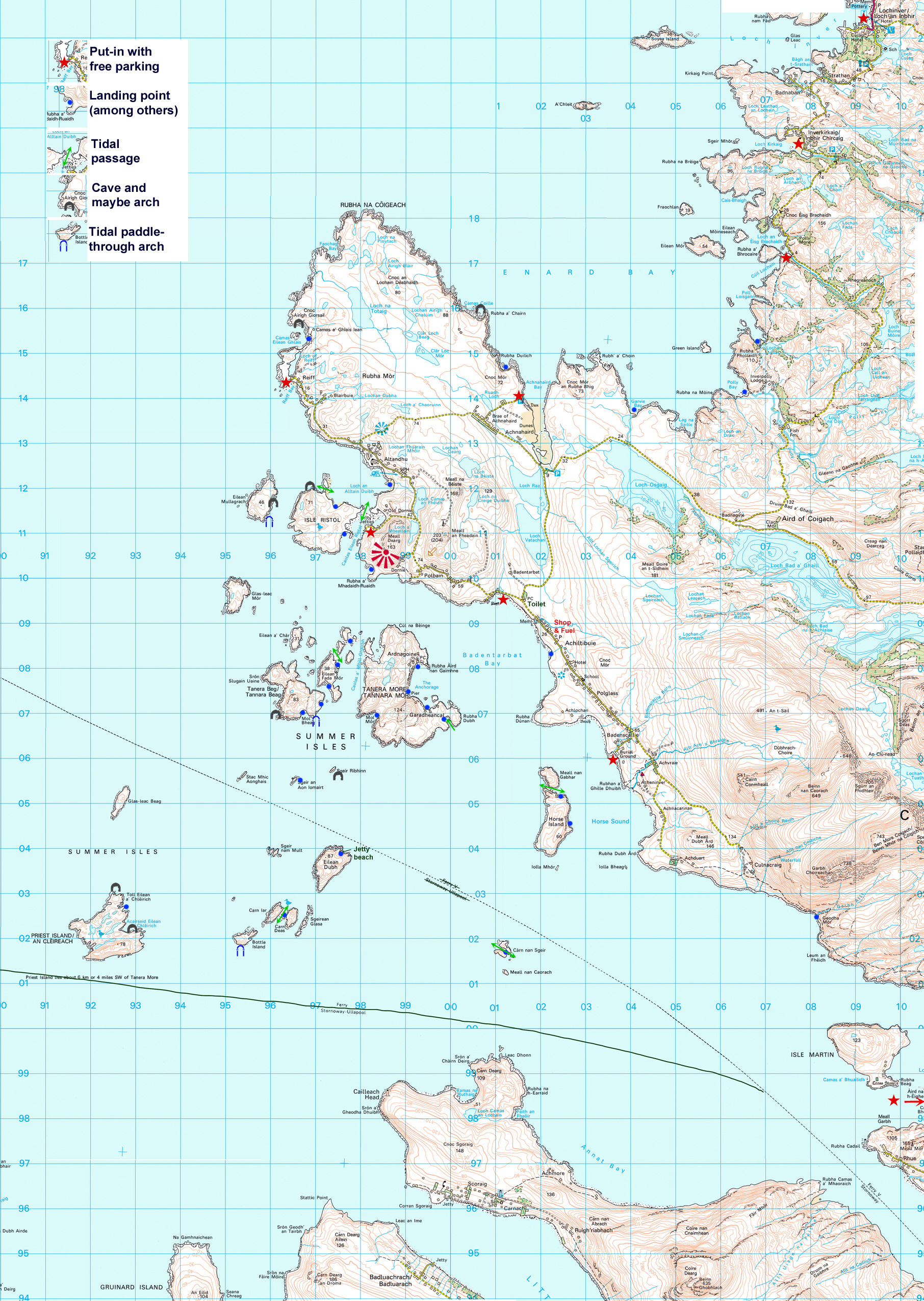
The drawback of a linear sea coast, like much of southern England, is you either paddle off one way, or the other, then paddle or shuttle back. But add some coves and inlets, then scatter an archipelago just off a peninsula like the Coigach (map left) and your route choices multiply exponentially; there’s always a different permutation or somewhere new to explore – or even somewhere to turn in if the wind kicks up.
With the Summer Isles you have more or less two island groups: the easily reached Taneras, Horse and Ristol islands which at some tides aren’t even islands. And the remoter islands out as far south as Priest Island and Carn nan Sgeir. Closer to the Gruinard or Scoraig mainland, you need a good spell to visit these two in a windprone IK and get back to the Coigach. When a southwesterly is blowing your loose laundry towards Oslo, Achnahaird on Enard Bay on the north side of the peninsula might be less rough.
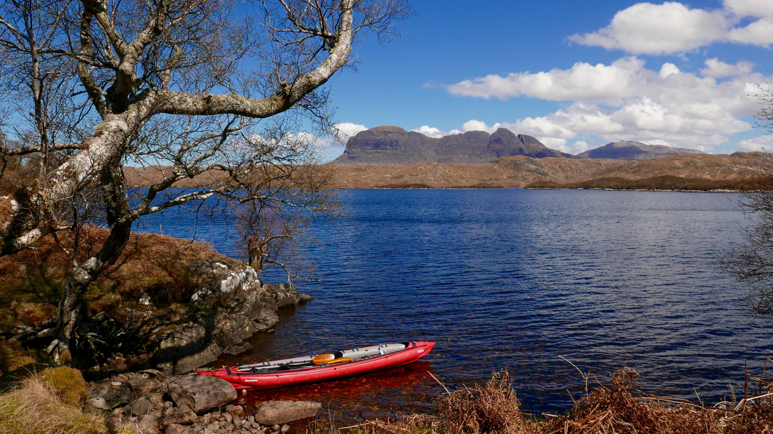

And if Enard Bay is a wash-out too, you can splash around on the Coigach’s big freshwater lochs (left) like Ossian or Lurgainn below Stac Polly mountain, or portage inland to the Polly Lochs like Sionasgaig, south of Suilven (above; most easily to Boat Bay, optionally via Loch Buine, off the WMR. Salt or freshwater, based in or around Achiltibuie, there is no shortage of paddling options.
Skip to Summer Isles paddling reports

A great place to get an overview of the Summer Isles is from Meall Dearg hill (153m) above Old Dornie harbour. A 10-minute slog up west from the cattle grid/gate at Dornie will bring you to the panorama (above) across Loch Broom, from Horse Island to Isle Ristol and with Achnahaird and Enard Bay behind you. On a clear day you can see 50 miles to the mountains of Harris, twice as far to Hecla on South Uist, the Cuillin of Skye and to the southeast, the 1062-m pyramid of An Teallach.
Below, another view of the Summers, this time westwards from Ben Mor Coigach (743m, below).

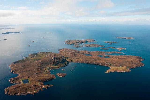
Note that the pier at Badentarbet Bay is in use again. This is thanks to the redevelopment of Tanera Mor (left), mostly around the main bay, the Anchorage. For many years it was the only occupied Summer isle, but the post office and cafe you often read about are no more. Something much more upmarket has taking their place and last I heard they discourage you from landing in the Anchorage, but elsewhere is OK. You may get a visit.
The main settlement on Coigach is Achiltibuie and the adjacent hamlets. For accommodation check out coigach.com along with all the usual booking websites.
• There’s a hotel in Achiltibuie
• A hostel down at Achininver, opposite Horse Island.
• Loads of self-catering places by the week.
• AirBnBs by the night.
• And a campsite with a small shop right on a beach below the pub in Altandhu, opposite Isle Ristol.
You can wild camp anywhere within reason, but more than a night on grassy Badentarbet beach by the pier is discouraged. Leaving vehicles here overnight while out in the Isles seems OK. At the campsite car park, while informing someone there might be better.
You can get fed at the hotel and the Altandu pub. The main shop is the Achiltibuie Stores with fuel, open six days a week and, as said, there’s a small shop at the campsite. The next nearest fuel and shops are Lochinver, 18 miles to the north, or 24 miles to Ullapool with a Tesco. The Achiltibuie post office is open mornings, Tues–Thurs.
Tour with- or hire a kayak from Norwest Sea Kayaking up in Lochinver – they’re often down here – or with Achiltibuie/Ullapool-based Kayak Summer Isles who might still run a live webcam overlooking Badentarbet Bay.

Weather of course is another matter. It’s much windier and more exposed up here than further down the west coast, but as mentioned, besides the islands there are leeward coasts and inland lochs to visit. We visited for years, renting for months at a time. Over that period there’s a good chance of catching a fine day every couple of weeks and at least one freak dry, sunny spell. 2018 was one of the driest and warmest years ever; 2019 wasn’t and for many of us, 2020 didn’t happen.
The nearest Coastguard helicopter is across the Minch at Stornoway; the nearest RNLI station is in Lochinver at the top of Enard Bay. Achiltibuie has a Fire & Rescue Service, but, unless you’ve started a bushfire, it’s probably Stornoway you want.

We’ve reliably experienced a calm, warm and dry week in May or early June. Local fishermen rate the Norwegian YR met service but as you can see at the top of the page, windy.com is now the paddler’s weather app of choice, while others say XC is the dog’s. Don’t be surprised if they’re all different. Although it often plays up, you can compare forecasts with what’s actually happening now on Ardmair campsite’s weather station. near Ullapool. Here’s a handy nautical mapp, too. Compared to other places in Scotland, it’s rarely still enough to allow midges to be a nuisance, but then again, we’re not camping up here. Beware of ticks, even on the distant islands.

Click for today’s tide on Tanera Mor. The maximum range is about 4.4m but with light winds and an appropriate route, it never really hampers exploring the islands. I have it easy in an open IK, but not all islands or skerries are that conducive to hardshell landings. Mullagrach (above, behind Old Dornie harbour and Ristol) and Bottle Island are two examples. Blue dots on my map below are known beaches; there will be others, depending on the state of the tide and how desperate you are.
I won’t spoil your adventure by suggesting routes – that’s half the fun. The map below shows the main put-ins. I also mark caves and arches I’ve found over the years. I’m sure there are a few more. Trawl through my list of accounts by clicking the ‘Summer Isles‘ category and you’ll find loads of photos and mini maps to help you get a feel for the area. Or just use the search box.
Enjoy your paddle around the Coigach and the Summer Isles.