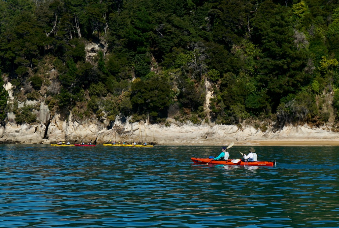
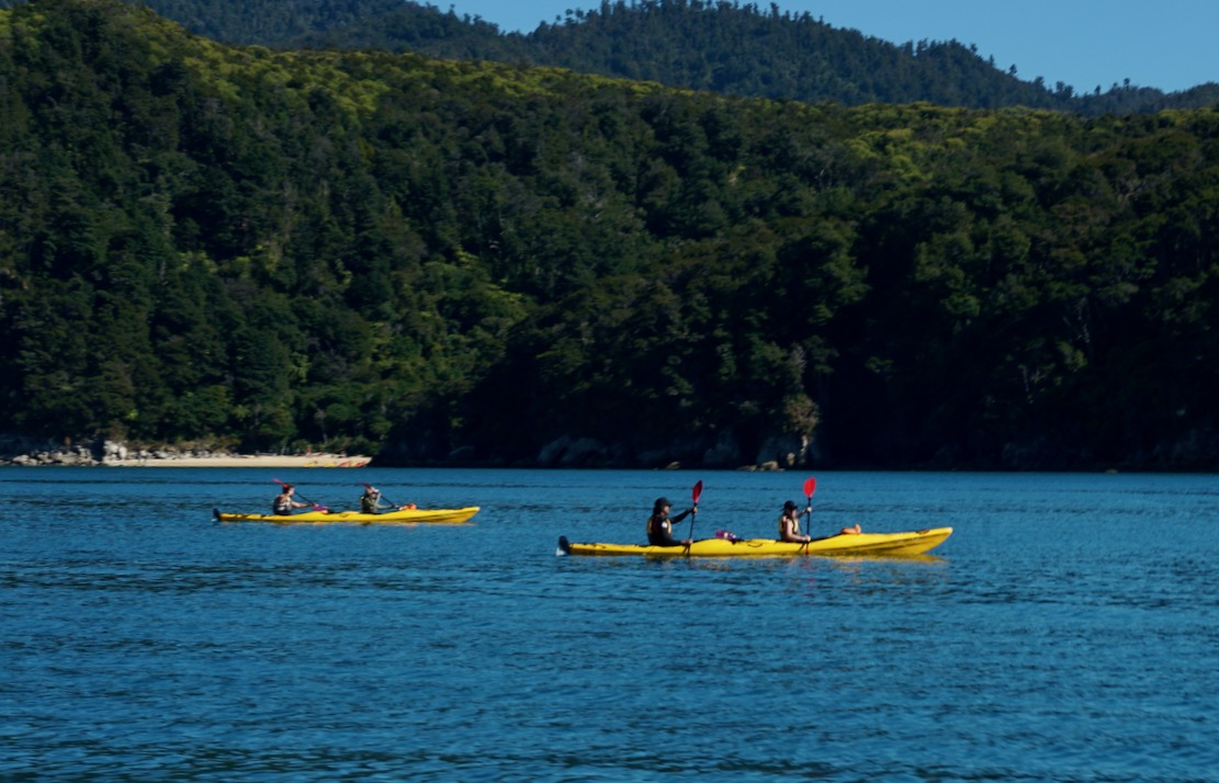
A few days after paddling Doubtful Sound we rented another hardshell double at Abel Tasman NP, at the top of the South Island. A much more popular kayaking location, a string of sandy, aquamarine bays and beaches punctuate wooded granite headlands dropping to the sea. Less rain-drenched than Fjordland, the vegetation here has a more Mediterranean appearance.
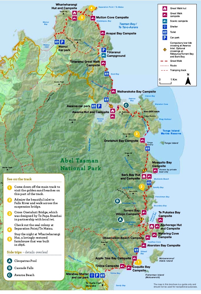
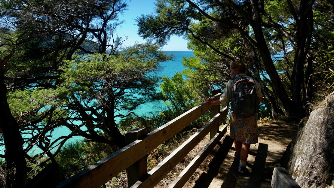
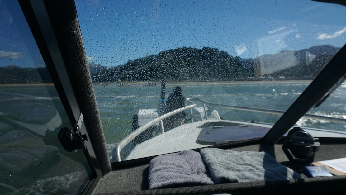
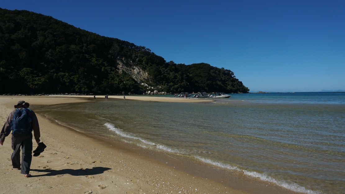
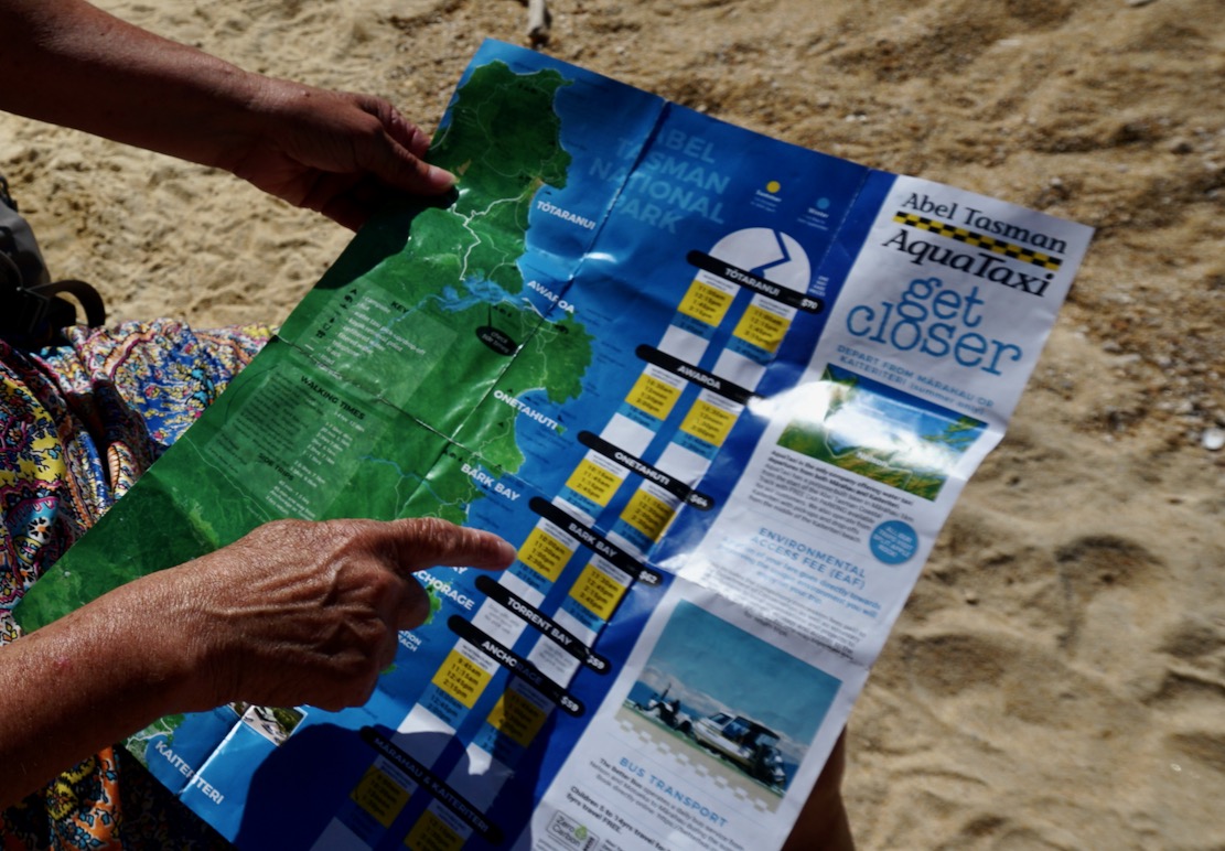
Blink and you’ll miss it Marahau is the main access point, serving visitors to the park. Here they have a really good system of water taxis which can drop or collect paddlers / walkers at any number of idyllic, granite-sand beaches along the NP’s sheltered east facing coastline. Most are walking all or parts of the 60-km Abel Tasman Track back to Marahau (as we did one day, below), staying at designated basic camp sites, if needed.
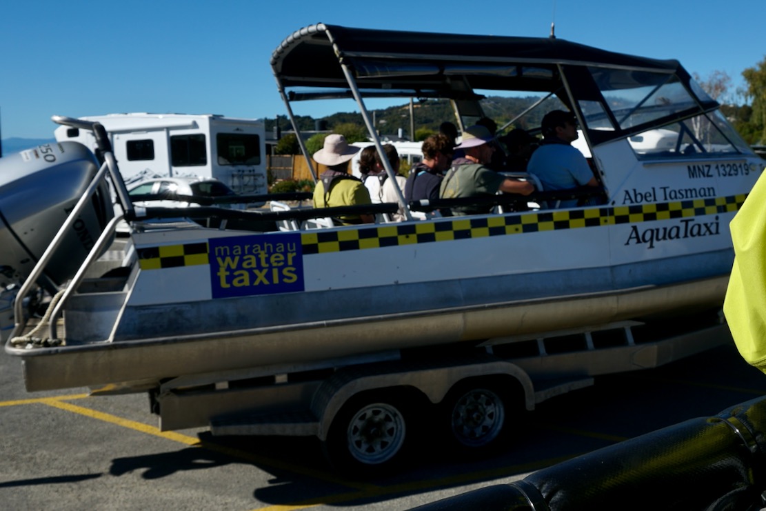
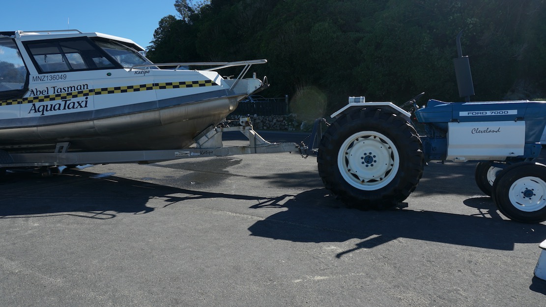
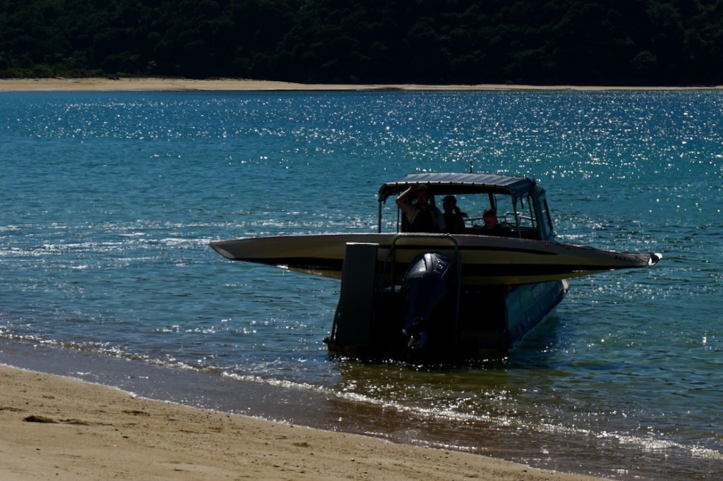
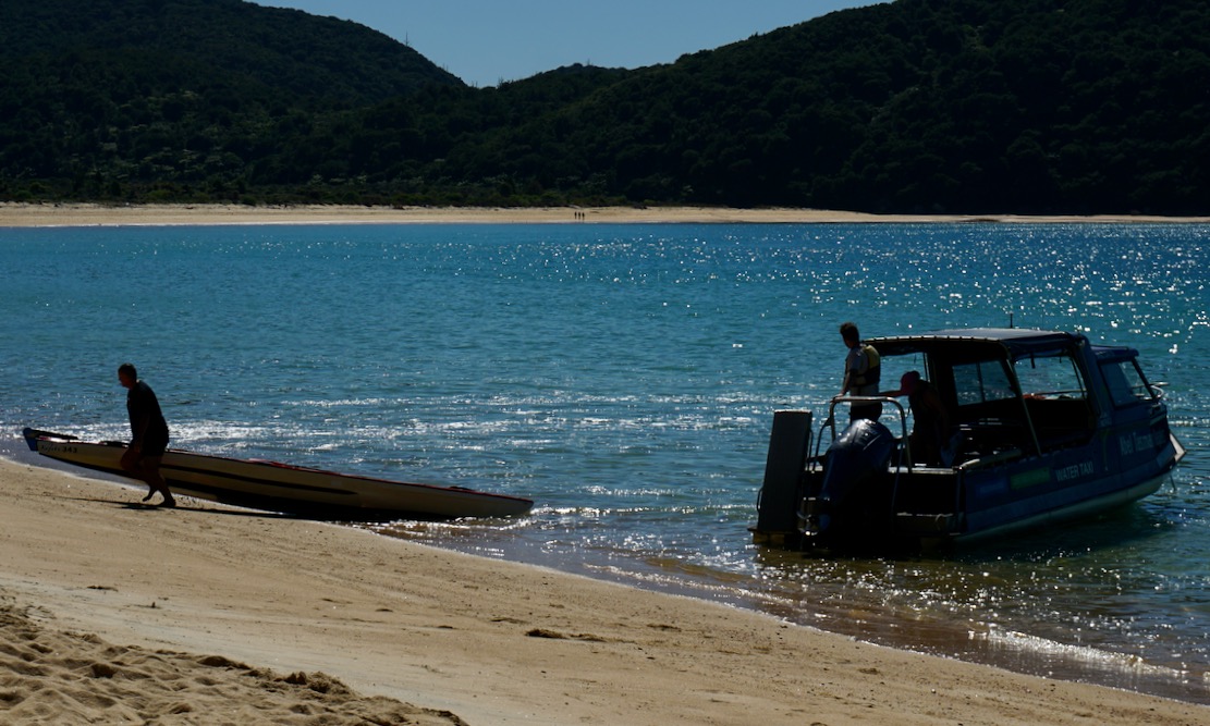
The Aquataxi operation is very slick: passengers board the motorboat on its trailer in the yard (below left), get tractored down the road to the beach and backed into the surf to head up the coast with various drops offs and collections, and of course a drole commentary. Returning to Marahau, a tractor waits axle deep in the surf, the boat takes aim and rides onto the submerged trailer, gets clamped down and we’re all driven back to the yard. It got me thinking something similar would work well along the Jurassic Coast and the Southwest Coast Path between Weymouth and Swanage in the UK to save circular walks. It’s true there’s a bus, but boating the coast would be loads more fun to or from a walk. I imagine rougher weather for nippy beach launches, plus a host of red tape kills this idea stone dead.
Hello? Is this legal?Deep water speed berthingTaxaaaaay!
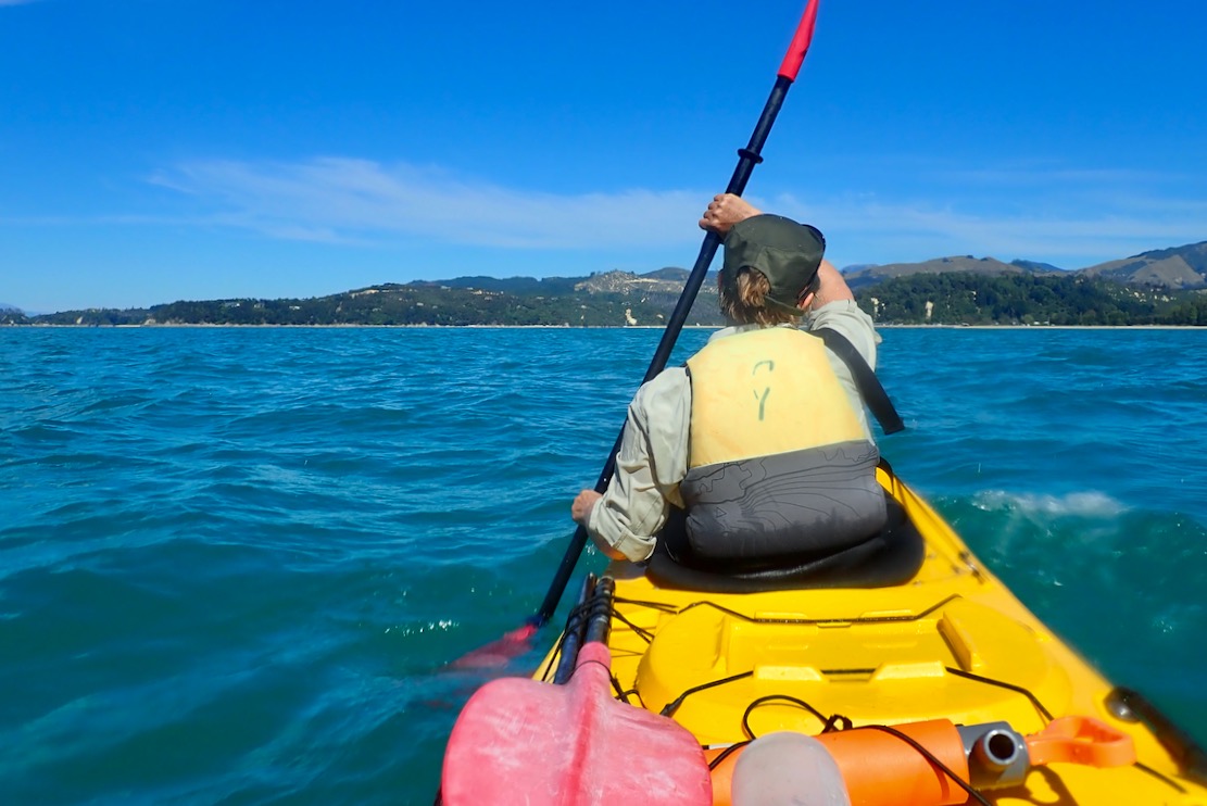
The rental agencies offer the same service with their kayaks, but on day-paddles get you to paddle out from Marahau before bringing you back, where getting dropped off first to paddle back would be more fun. But with your own paddle boat, a taxi can drop you at the top of the park (below) to make your own way to Marahau. We may have struck unusually good weather again, but as we saw it, this would easily be doable in a packraft. Each day a late morning northerly sea breeze wafts you back down to Marahau.
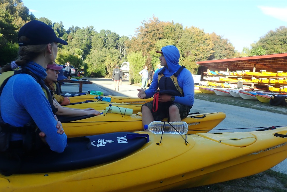
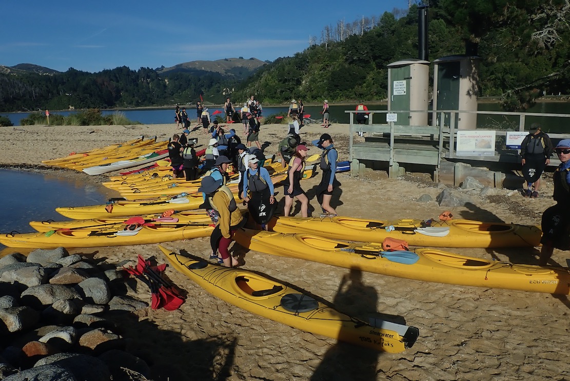
The reason the rental outfits require you to set off from Marahau is to give you a detailed safety briefing (left) before watching you set off in a plastic sea kayak. The boats were well equipped with a spare paddle, bilge pump and flare, but despite the demo of the technique, righting a 50-kilo double full of water, then getting back in and pumping out sounded quite daunting. On a day like today that was exceedingly unlikely unless you messed up a beach landing (or were in a tippier single; see below), but even then there are plenty of water taxis bombing around to help out if needed. I also spotted some double SoTs, much shorter and slower for sure, but which could be covered in a 5-second safety briefing: ‘Fallen out? Silly Billy! Clamber back aboard; paddle on ;-)’
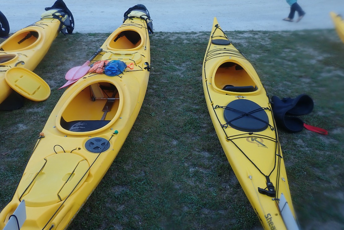
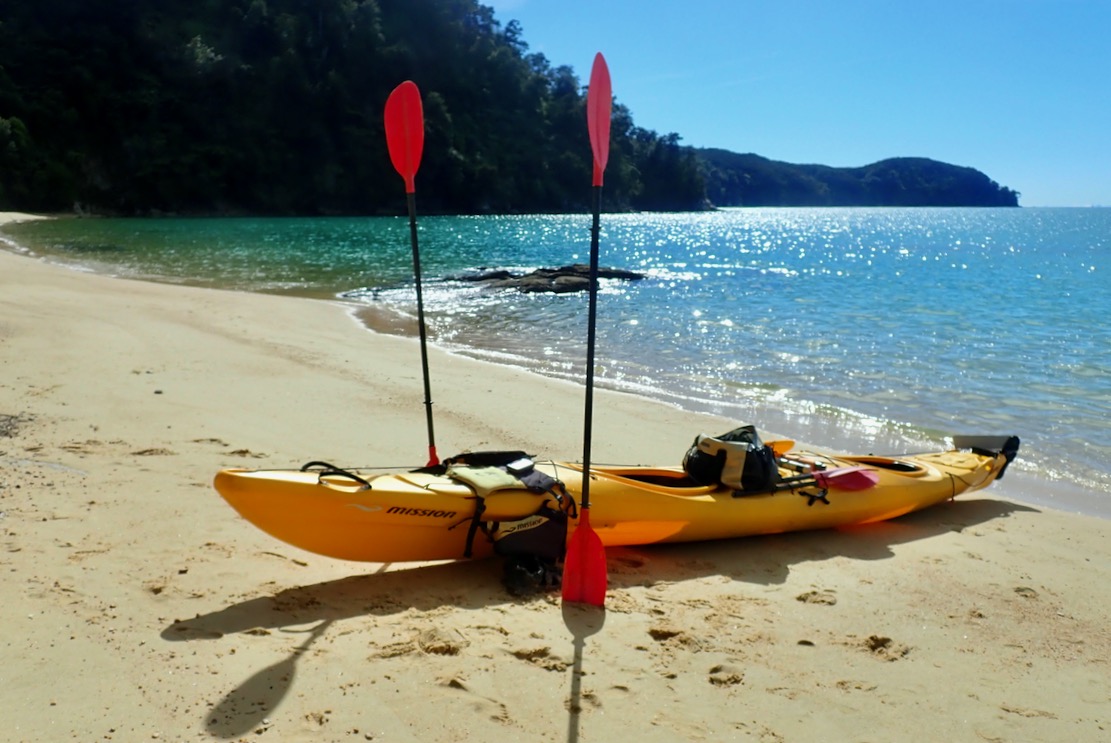
After the safety briefing, they took us to the beach and watched us get in and acclimatise to the Mission Eco Niizh 565s (18.5’). It was a similar classic to the Necky we used in Doubtful, except it was no less than 77cm wide and weighed a massive 55 kilos in the extra-rugged outfitters version designed to be knocked out for years by rental operators and their clients. But once on the water the Niizh had one big advantage over the Necky: a much better car-type pedal arrangement for the rudder, not the Necky’s awkwardly angled, self-folding side pegs. The action was much more taught and responsive too; we both found it much easier to track straight in the kayak without continuous micro-adjustments.
You can feel quite smug in your untippable, bath-wide, Eco Niizh double, but I don’t think I’d have been quite so sanguine once greased up and stuffed into a Shearwater single (above right) which, at 4.8m, is nearly as long, but 61cm wide and with a notably smaller hatch. They do look great though, like a proper sea kayak does.
I took the GPS this time but we only clocked 8kph flat out, though could easily sit on 6-7kph. I suppose that’s normal for a relatively wide and very heavy double where no amount of extra effort will overcome its shape and mass. As with IK doubles, two paddlers don’t add up to more power, just a potentially greater range. The Mission felt less uncomfortable too, but we only had a morning to spare here.
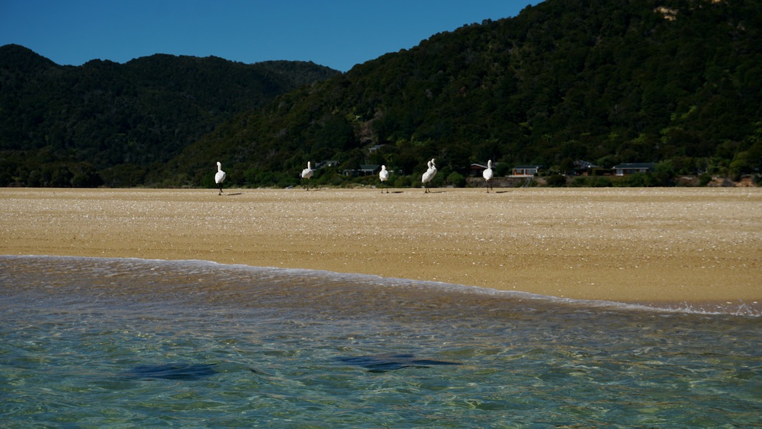
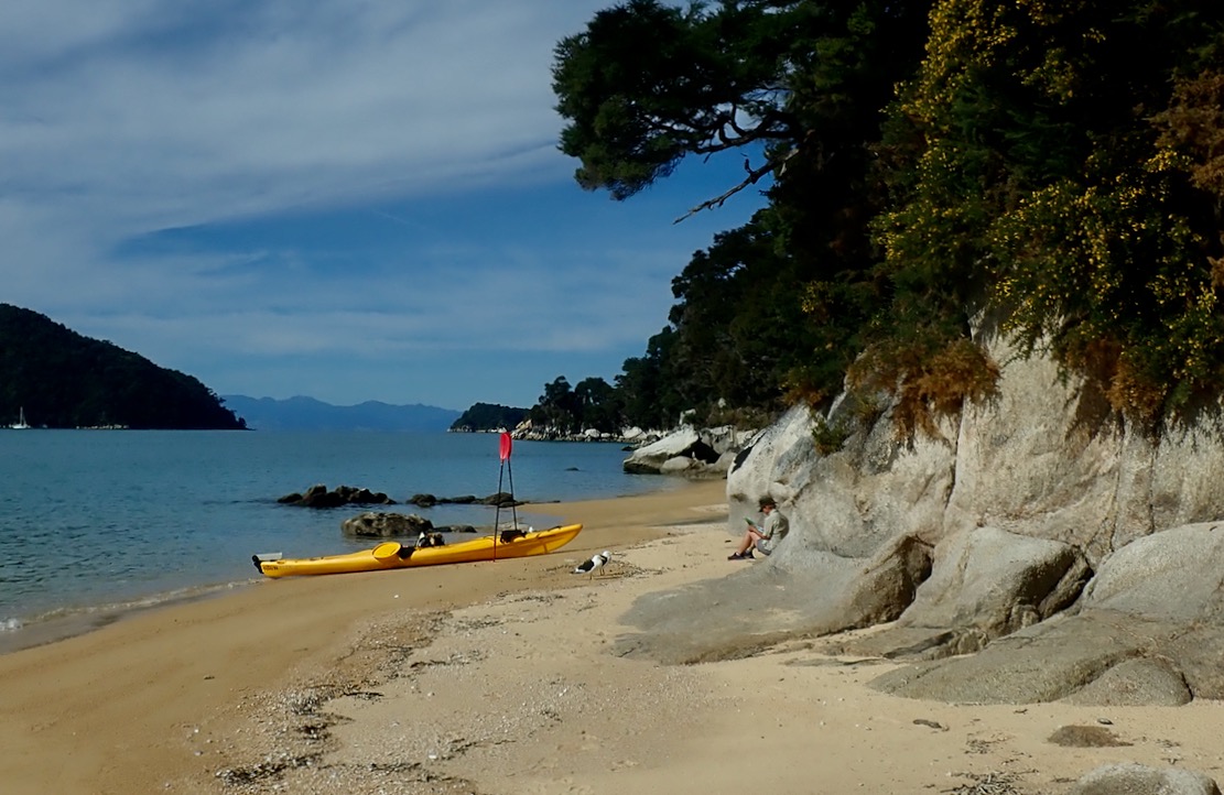
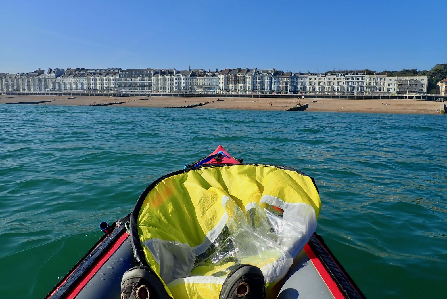
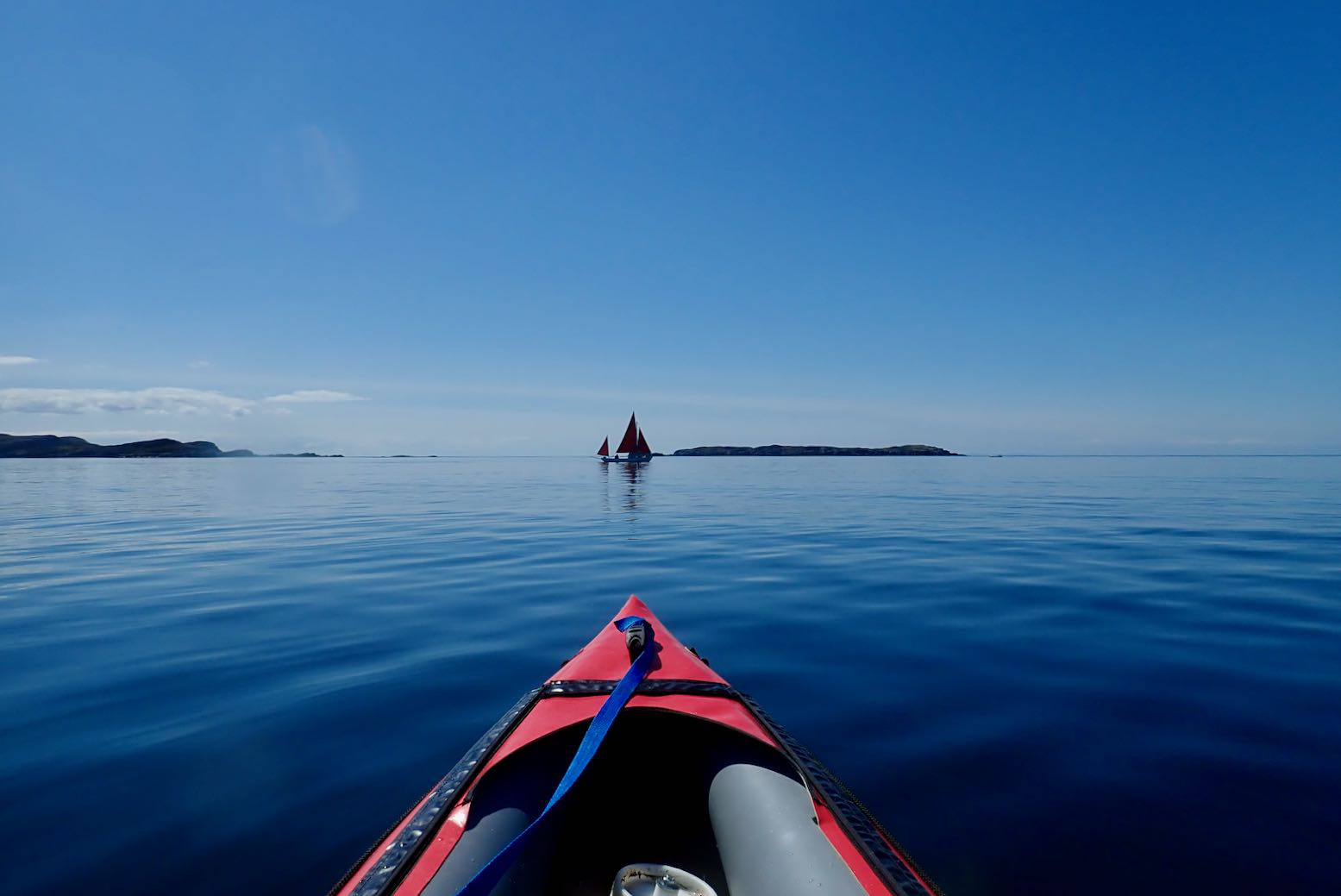
So now I can vouch that Abel Tasman would have been one spot where lugging my TXL packraft would have paid off. With loads of storage in the side tubes, relatively sheltered conditions, coastal path access and even water taxis to hail if it all gets too hard. A sail could even catch the afternoon sea breeze and on the way you might pass egrets and stingrays (left), except this in predator-free NZ, not Australia, so the stingrays don’t even sting.
I’ve done a few IK paddles in Southeast England between Rye and Portsmouth, but the Sussex and Hampshire coasts aren’t that inspiring. So it’s about time I started exploring the far more interesting and much more extensive Southwest Coast. From the Isle of Wight to Cornwall and back up to the Severn there are scores of inshore excursions possible in an inflatable. Just as in the far northwest where I mostly sea paddle, all you need is a fair tide and paddle-friendly winds, the latter a bit less rare down south.
In a blobby packraft? You cannot be serious!
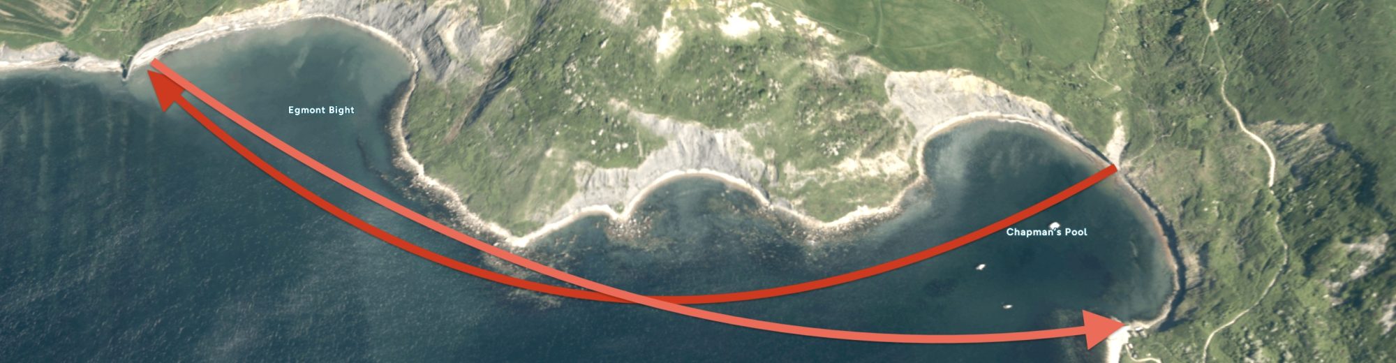
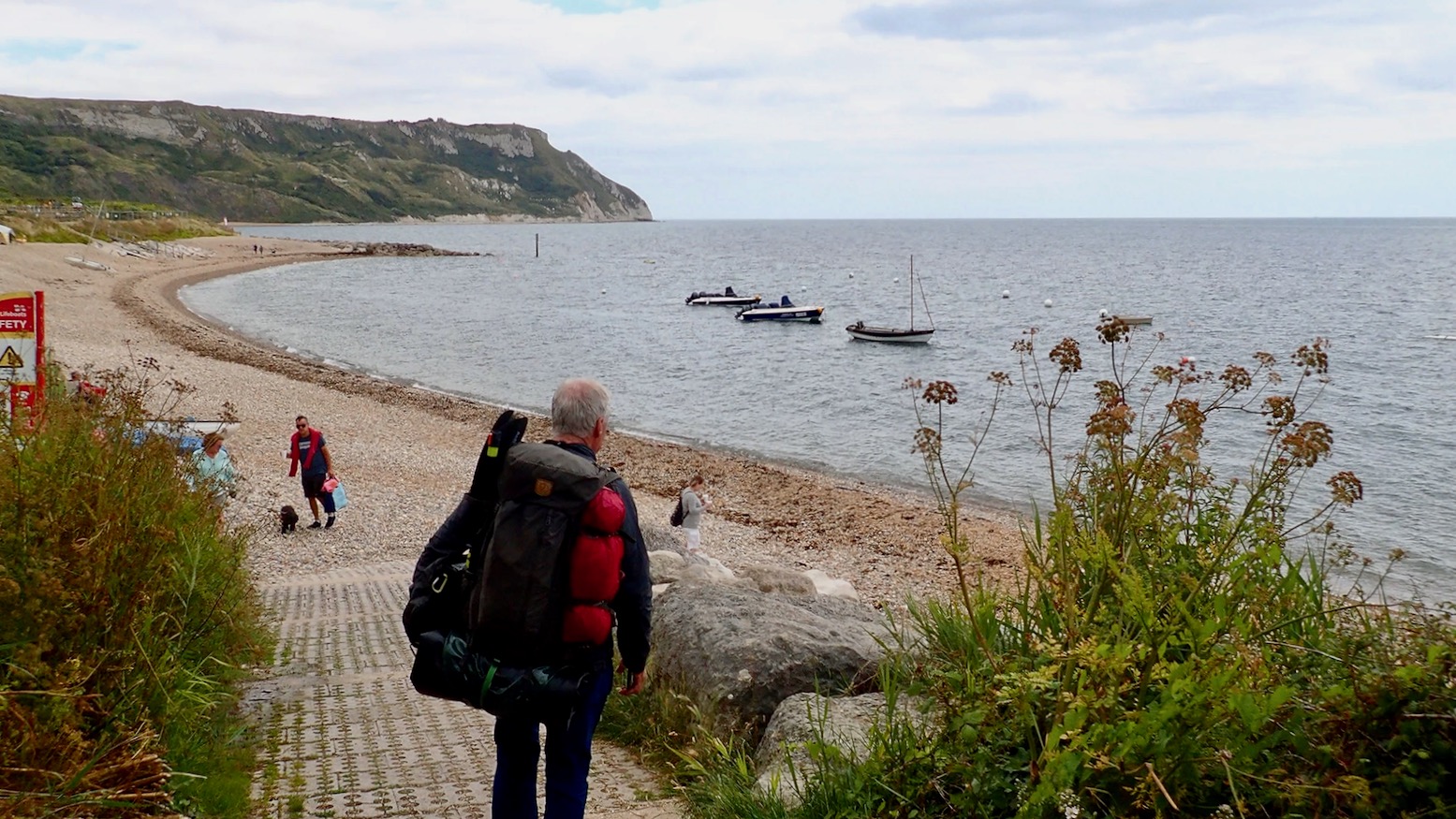
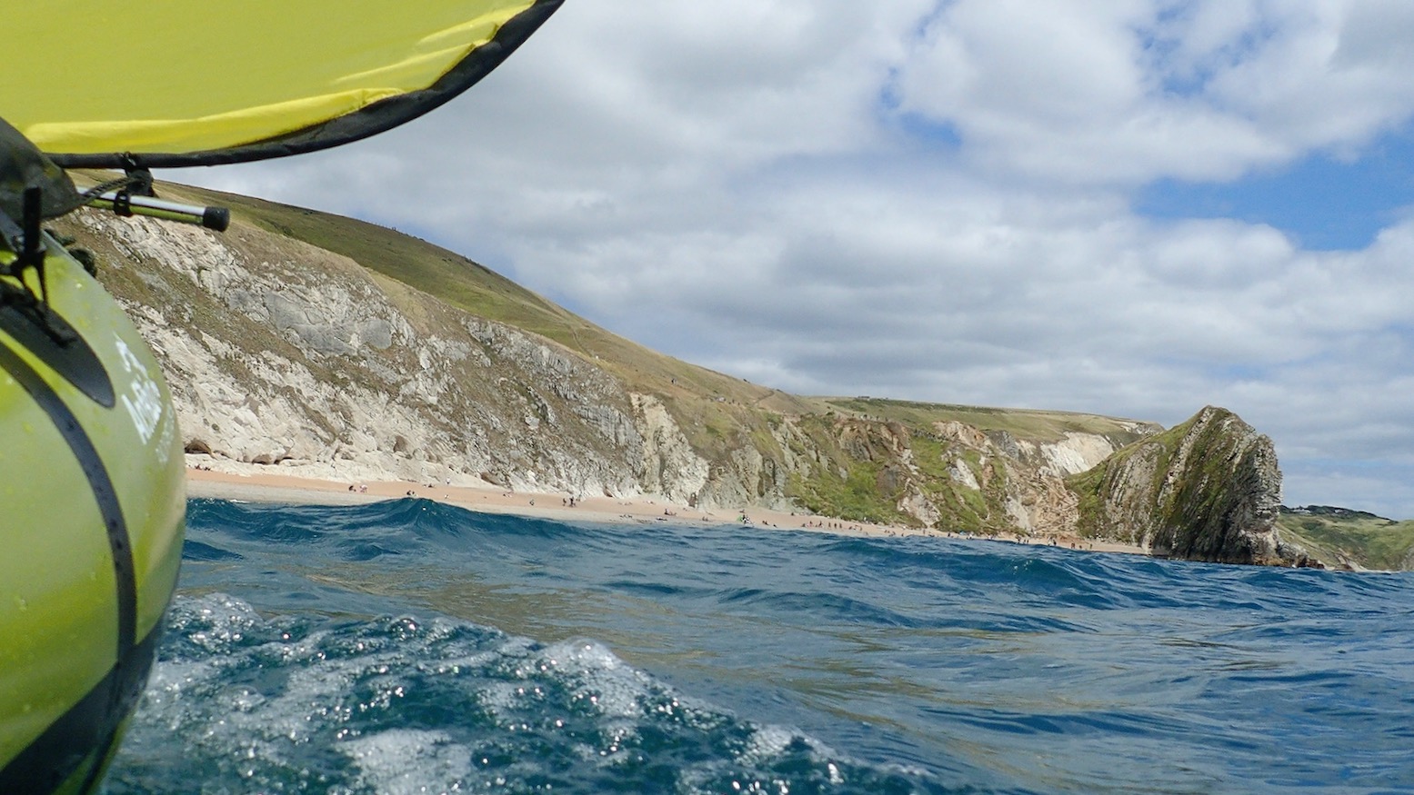
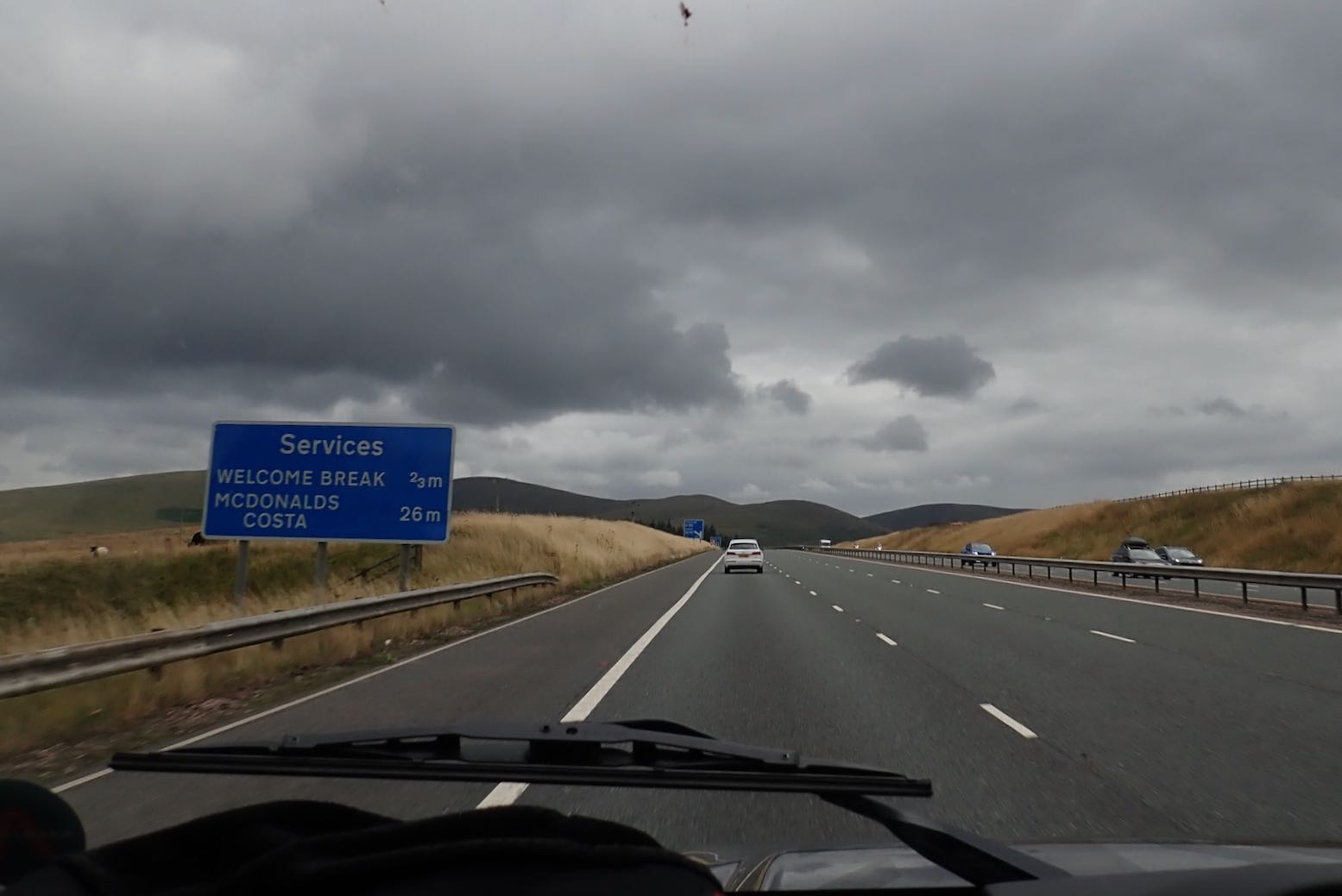
So in the face of predicted moderate winds I cooked up a 50-km Jurassic overnighter from Weymouth to Swanage in Dorset. I’m pretty sure they opportunistically rebranded the plain old Purbeck or just ‘Dorset’ coast as the ‘Jurassic Coast‘ soon after that 1993 movie and haven’t looked back since. Like much of the Southwest coast, the beaches and country lanes become a logjam of holidaymakers on a warm summer’s day. On the water, our paddle would pass below sections of cliffs a couple of miles long and take us to the famed landmarks of Lulworth Cove, Durdle Door arch (top of the page) and Dancing Ledge. We could even carry on back north past Old Harry’s Rocks and across Studland Bay right into Poole Harbour to catch out trains home.
TXL at sea
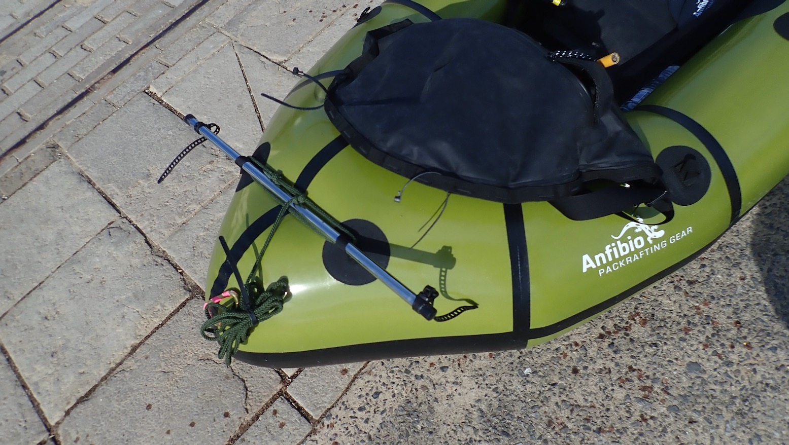
Compared to using regular (solo) packrafts, my confidence in my TXL for sea paddling is a revelation. After all, it’s still just another blobby, single-chamber packraft. It must be a combination of the added size giving a kayak-like perception of security (as I found in my MRS Nomad), as well as the responsiveness and speed from a longer waterline and, I now recognise, the sometimes noticeable added glide from the Multimat floor. There’s also the fact that paddlechum Barry was up for the Dorset run in his similar MRS Nomad, making this untypical packraft outing less daunting.
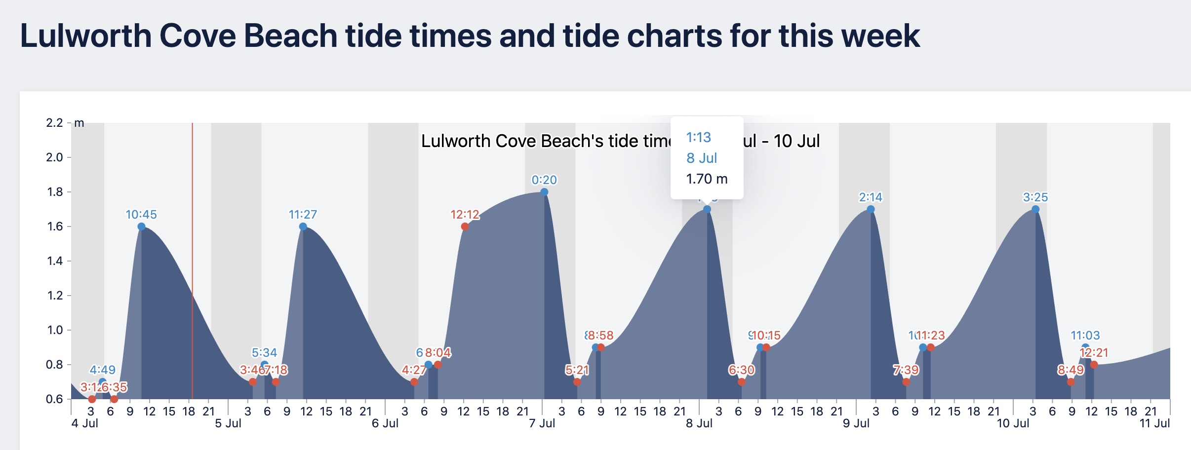
Lulworth tides – all or nothing (of not much).
Modest, two-metre tides off Purbeck
For some bathymetric reason – possibly the Atlantic tidal surge backing up in the Straits of Dover, plus hidden offshore shelves – the tides off the east Dorset coast are very odd: they can rise or drop all day, but have a range of just two metres, about as low as it gets in the UK. That ought to mean moderate ebb flows pushing up against prevailing westerlies, plus we were heading into neaps. And while often cliff-bound, if we stayed alert to escape routes we could easily bail and walk or climb out with our packrafts.
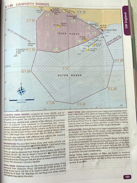
East of Lulworth Cove the Jurassic Coast‘s bucket & spade Babylon is interrupted by a 5-mile wide Danger Area – an army firing range. This was probably not one of UNESCO’s criteria for World Heritage status, but the SW coastal path also gets closed for a similar distance. Barry’s Reeds Almanac had a page or two on this (left), as well as useful tidal flow charts (drops to the west; rises east). I left it to Barry to call the ‘0800 DUCK!’ number, but imagined surely they’d leave the target practice to the off season. In fact they’re all it most of the time Mon–Fri, including an evening session 9pm to midnight: all we had to do was click this.
fishing.app – handy and similar toa Reeds Almanac but free
Early train to Weymouth
With a plan taking shape, I in turn bought a copy of Pesda’s South West Sea Kayaking in the hope of being alerted to local anomalies. I’m glad I did. It turned up with just hours to spare and identified that the run from Kimmeridge Bay round the Purbeck corner to Swanage was a grade up from the easy section from Weymouth. With headlands, submarine ledges and long lines of cliffs, without a foot recce I decided we may be better off skipping this bit.
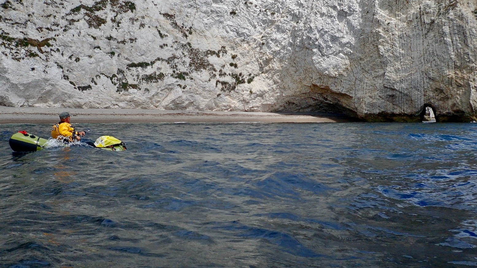
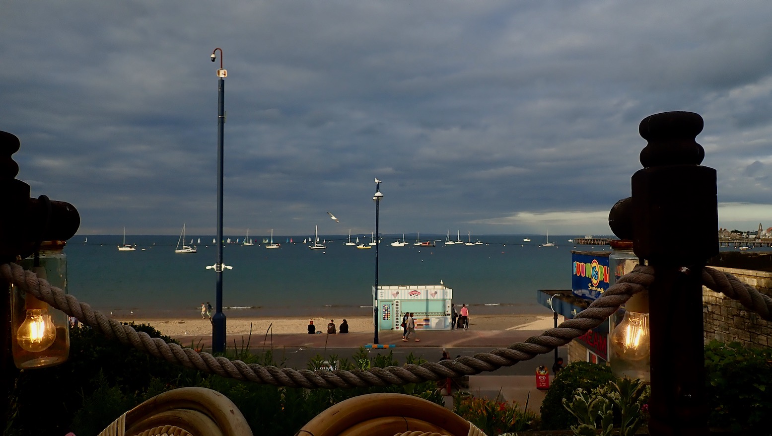
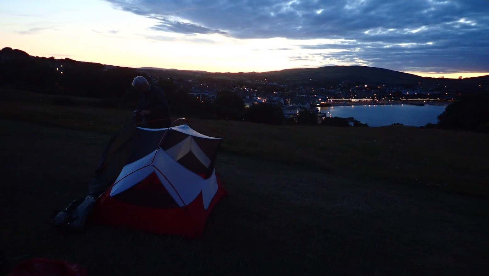
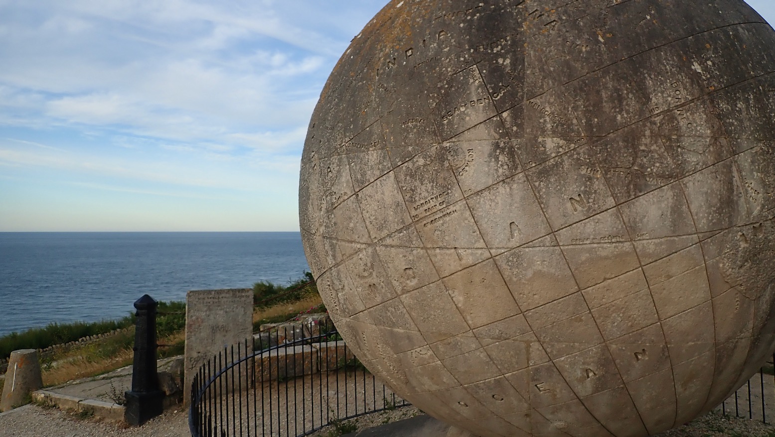
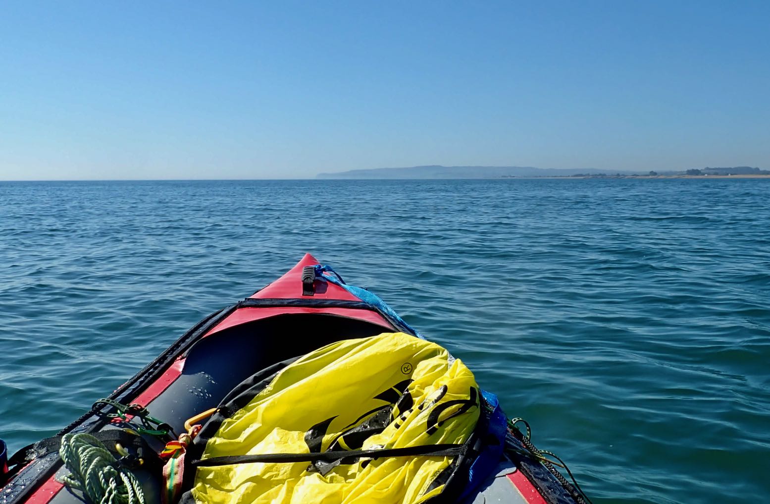
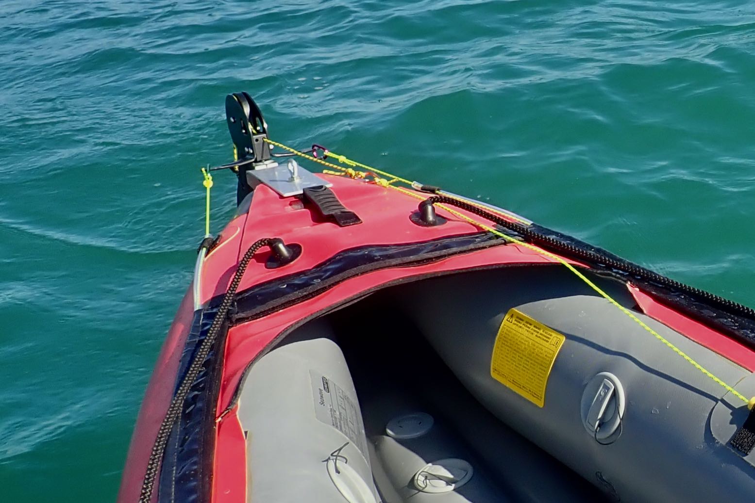
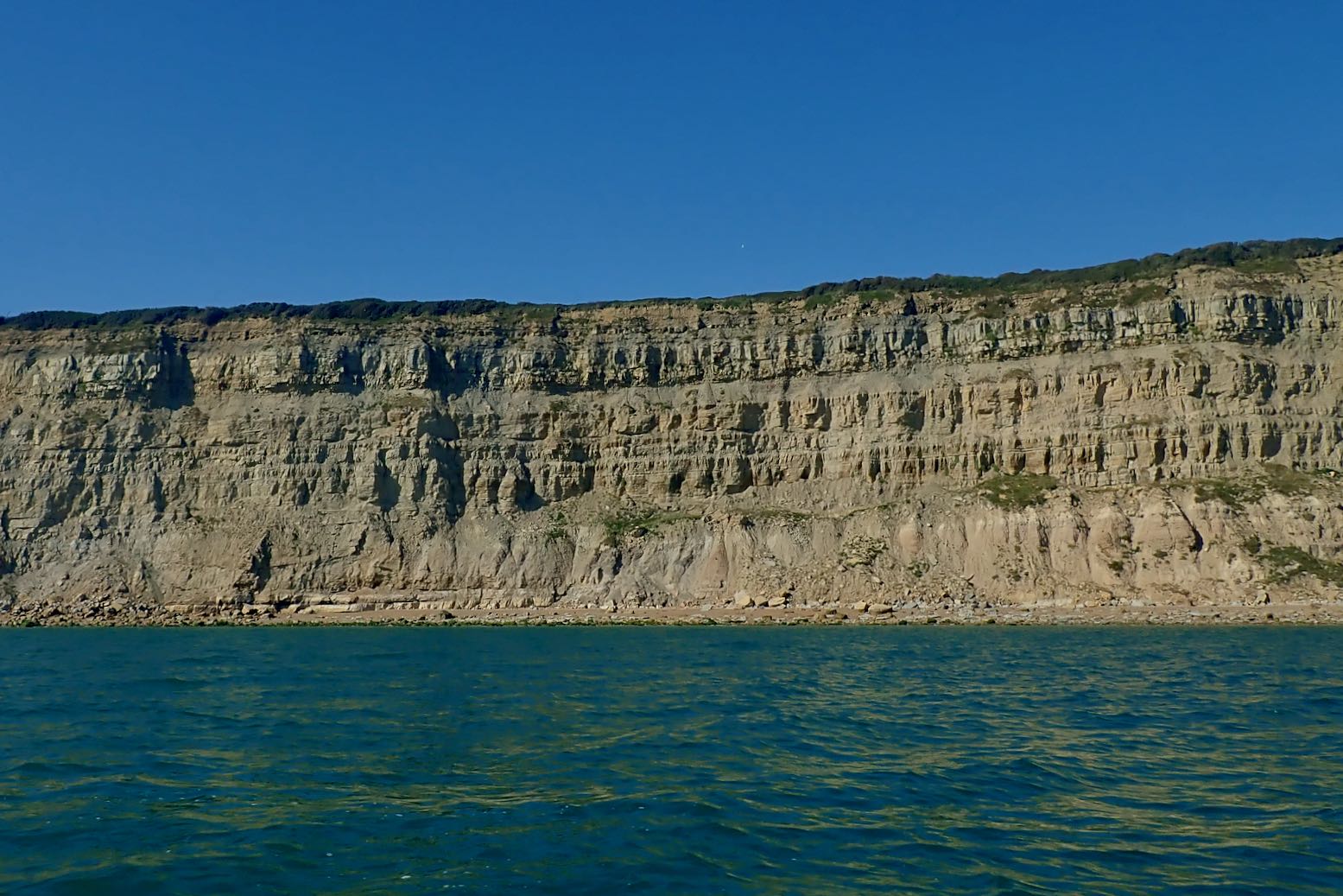
It’s noon in Weymouth, but with offshores now predicted by late afternoon, we fast forward by taxi to Ringstead Bay, 5 miles in. That first section from Weymouth looks nothing special.Put in at Ringstead. Ten mph westerlies blowing against an ebbing neap tide.My Mk2 transverse bowsprit for a wide WindPaddle sail mount to limit swaying in stronger winds. I’m giving the Multimat floor yet another go too, all the better to skim over the water. We’re on the water at 1pm, hoping to reach Chapman’s Pool, about 21km away. But around 5pm winds are said to veer offshore and strengthen, so we’ll see. We sail at about 5-6kph – not much faster than paddling – but I note my TXL creeps forward about half a click faster than the MRS – must be the stiffening Multimat.Propelled at paddling speed by his inflatable AirSail, Barry casually checks his investment portfolio.The cliffs below Chaldon Downs. At times we paddled as we sailed to make less work for the wind.Forty five minutes in, I pull in the sail and line the TXL up to thread Bat’s Head arch. Note how the layers of chalk beds here have been pushed up to nearly vertical. Give it half a million years and Bat’s Head will be as big as nearby Durdle Door.Approaching the famous Durdle Door arch alongside a crowded beach. The TXL still weathercocks a bit under sail; I keep having to steer hard inland, but the bowsprit ‘stick’ limits the sail’s ability to twist. Or maybe the wind’s bouncing off the cliffs and blowing us offshore a little. Sitting further back to weight the back end over the waves may help.Sunbathers watch spellbound as Barry smoothly ‘Durdles the Door’ – a Southwest kayaker’s rite of passage.The Door has been durdled. Some claim ‘Dorset’ (formerly Wessex) was named after this famous arch. In high summer young bloods jump off the 60-metre arch. Appropriately, it’s called ‘tombstoning’.Near the entrance into Lulworth Cove things get choppy. Sat high on the airmat floor, if I feel unstable I can easily let it down. As we head through the Cove’s narrow neck a patrol boat circles back and instructs Barry we can’t carry on east; the army ranges are firing. ‘I thought you said you were going call them, Barry? You had one job to do…’ ‘But you said they hardly ever do this on a balmy, July’s day!’ And so it went on…360° selfing in sheltered Lulworth Cove.I spot some IK compadres lugging an AE Elite.A salty-eared boatman tells us the army pack up about 5pm, about 2.5 hours from now by which time the offshores may be on us as we cross the Kimmeridge Ledges mentioned in the Pesda book. As we slurp a 99 with sprinkles the odd gust blows offshore. We can’t even pack up and walk the cliff path; it’s closed too, and so is the B3070 road. Barry wants to paddle on a 5pm, but I propose we bus to Swanage rather than risk being be left high and dry. Tomorrow we’ll paddle north towards Poole – or as far as the predicted headwinds allow.So a paltry 5 miles – but the classic stretch of the Jurassic Coast.A couple of hours later we enjoy a pint and…a lavish seafood medley overlooking Swanage Bay.But there’s no campsite till August, so we pitch for free up in Durlston Country Park to the sound of beery revellers and Tuesday-night hoons doing burn-outs along the seafront. What can it be like on a Saturday night?Six am next morning, a light breeze blowing from the northwest means no condensation ;-)) The Anfibio Multimat passed the sleeping test, too.I walk a mile south to Purbeck’s corner at Durlston Head to inspect the tidal stream. Two hours before LW, it’s negligible, but further west, St Albans Head just out of Chapman’s Pool is said to be stronger. I must do that walk sometime. Above, a ferry heads from Poole to the Channel Islands.Durlston’s famous 1890 Great Globe.‘The Earth is a planet and one of God’s glorious creations.’Looking back north you just see our tents on Peveril Point, Ballard Down chalk cliffs and pinnacles stretch out beyond, and Bournemouth’s at the back.I’m amazed how Barry always manages to roll his MRS up so compactly.A modest breakfast in the Swanage sunshine.At the cafe we meet Rach and Mark setting off on the final day of a staggering 630-mile walk along the Southwest coast from Minehead in north Devon. Their picture above taken a few hours later.Meanwhile we prime our boats for the 6.3 miles past Old Harry to Poole Harbour Entrance. We may carry on to Poole itself, but a strengthening wind may nix that idea.No sailing today, Barry inches into the light morning breeze across Swanage Bay. We reversed this trip a couple of months back.Ballard cliffs in the wind’s lee at glassy low water.Ideal paddling conditions – a chance to explore tidal caves I’ve never noticed before.Ballard’s spike, thought by some to be a fossilised Dendrosauraus tooth.We approach the Pinnacles to the squawk of agitated seabirds.Arches ripe for threading as far as the eye can see.But this morning the tide is too low.And it means there’s a lot of this string-weed floating about. It catches in our skegs but I have a solution.Leaving Harry’s, Barry’s is a bit of a Lethargic Larry cutting across Studland Bay. Halfway across, I remove a metre-long, kilo of Swanage string-weed caught in his skeg.It’s all going nicely until 10.30am when the wind kicks up, then picks up some more. But the GPS revealed we kept plugging on at 5kph, just with a lot more effort. As Barry observed, it was a slog but good to know our packrafts can progress against this sort of wind.With brain-out jet-skiers, sailboats, motorboats, working boats and the rattling Sandbanks chain ferry, we have to time our crossing across the busy vortex of Poole Harbour Entrance. Hitting 8kph, we cross a sharp eddyline where the incoming tide clashed with still-draining Poole Harbour. Barry hops out quick before the chain ferry trundles back. (Turns out it’s actually free for northbound pedestrians).From Swanage to Sandbanks, followed by a 90-minute walk to Poole station for the train home.
I just dug out this story I wrote a few years ago about our packrafting adventure in northwest Australia. There’s more here, including vids. Originally published in Terra magazine2011.
In the far northwest of Australia is a barely tamed region of spinifex-clad tablelands, big seasonal rivers and the world’s largest expanse of tropical savannah woodland. About the size of California but with a population of just 40,000, the Kimberley hosts marginal, million-acre cattle stations, tracts of land returned to local Aboriginal people, remote wildlife conservation ventures and undeveloped national parks.
But the Kimberley might be better compared with Alaska, a wilderness that is under threat. Inaccessible by road for the rainy half a year, the Kimberley is such a relentlessly tough environment that unlike in the rest of Western Australia (WA), exploiting the valuable mineral resources known to be here only now become viable. WA itself is a state the size of India but with 3% of its population, and continues to thrive on a century-old mineral boom. The Kimberley is under pressure to join the party, but as a parallel environmental awareness to conserve Australia’s last tropical wilderness has grown, industrial development of the region has become controversial, not least with the current plans to turn the ochre cliffs of James Price Point 20 miles north of Broome into a vast LNG plant. No one wants to see the Kimberley end up like the Pilbara highlands, 600 miles to the southwest, criss-crossed with private railroads and pitted with huge iron ore excavations as hills are turned into holes to ship the ferrous rubble to resource-staved Far East. But the Kimberley one other abundant resource which the populated southern rim of Australia is crying out for: water.
Most visitors experience the same Kimberley; they transit the 450-mile Gibb River Road, a dirt track which bisects the region between the former cattle ports of Wyndham and Derby in the west. With a branch track leading north to Kalumburu on the coast, it’s the Kimberley’s only track, dotted with fern-clad gorges, waterfalls and swimming holes. It was an area I’d visit eagerly when updating an Australia travel guide, often spending too much time and fuel money researching out of the way spots that ended up as just a few lines in the finished book. But even then I knew I’d barely got beneath the Kimberley’s skin and my work there left me wanting to see more. Specialized trekking outfits used local contacts, helicopters and seaplanes to access outback areas, but charged several thousand dollars.
Follow a river – that was the way to do it. With high humidity and average daytime temperatures over 90°F, the constant need for water was solved, while the boat took the weight off feet and shoulders. I’d researched short trips with inner tubes or float bags, but they weren’t really sustainable. Then in 2010 I discovered Alpacka packrafts and knew I had a tough, lightweight craft with which to explore a Kimberley river.
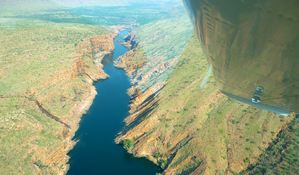
All that remained was to choose a river. Most of the big Kimberley rivers, the Durack, Drysdale and King Edward drained into the Timor Sea lapping an uninhabited and fjord-riddled coastline of 1500-miles on which the small Aboriginal outpost of Kalumburu was the only settlement. But up here the presence of estuarine or saltwater crocodiles as well as 35-foot tides heaving through rocky gaps to form ‘horizontal waterfalls’ made bobbing around in a tiny raft a risky idea.
Horizontal Falls, where the falling spring tide rushes back out of the lagoons through narrow gaps
The key for this visit was to pin down an amenable stretch of water with easy access and exit points and without the menace of saltwater crocodiles. I knew well that no matter how easy you made it – the coolest period, the flattest river – the harsh conditions in the Kimberley would take its toll. My mate Jeff and I didn’t want to be abseiling down ravines, hacking through snake-infested rainforest or looking twice at every passing bit of driftwood in case it slowly started swinging its tail from side to side.
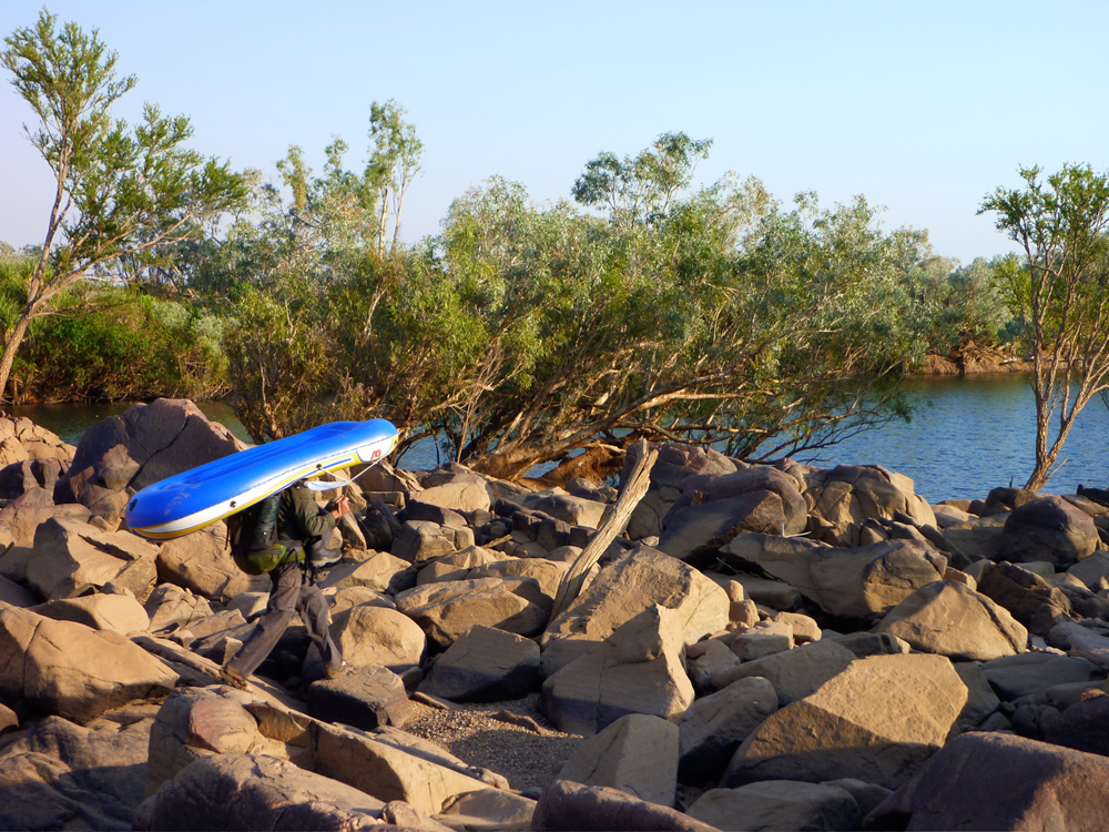
The most likely candidate was the Fitzroy, at 500 miles the Kimberley’s biggest river and in peak flood, the highest volume river in Australia, flowing at up to 30,000 cfs under the Highway 1 bridge at the town of Fitzroy Crossing. Running the churning Fitzroy in the unpredictable Wet sounded a little extreme for me. The good thing with packrafts is that extended portages are relatively effortless; the excess payload adds up to a 5lb raft and a 4-piece paddle. So Jeff and I decided September, the end of the dry season, would make an easier introduction; cooler and less humid just as long as we were prepared to walk between the pools.
Mornington
The take out was obvious: the bridge at Fitzroy Crossing, the only town for a couple of hundred miles along Australia’s peripheral Highway 1. And some eighty miles upriver, Mornington Wilderness Camp seemed like the best place to start. A former cattle station spread across the King Leopold Ranges. I’d visited the Camp a decade or so earlier, soon after the Australia Wildlife Conservancy had taken it over and de-stocked it. It’s one of nearly two-dozen sanctuaries the AWC manages on the continent and at nearly 800,000 acres, one of the largest, with a range of unique ecosystems as well as high levels of biodiversity which included several rare and threatened species.
When we arrived at the Camp, following a 30-minute flight from Fitzroy Crossing, the Camp’s manager Diane was midway through a pre-dawn finch census lasting several days and assisted by volunteers from all over Australia. The ranges around Mornington are one of the preferred habitats of the stunningly colourful Gouldian Finch, an endangered passerine or ‘songbird’ whose breeding patterns and habitats have been disturbed by changes in the bushfire regime as well as introduced predators, topped by the feral cat – the scourge of indigenous birds right across Australia.
When I think of the Kimberley, it is above all the chorus of the largely unseen birds which evokes the spirit of northern Australia’s wild and remote corners. From just before dawn until sunset the bush resonates with avian chattering, from the strident squawks of the corellas, cockatoos and kookaburras, to the milder coo-ing of the crested pigeons. This would be the daily soundtrack for our five-day descent from the Mornington to the highway bridge.
Dimond
On the water soon after dawn, by the mid-morning of the second day we arrived at Dimond Gorge on the southern edge of the Ranges. Here the Fitzroy cuts back on itself as it pushes past the gorge walls, scoured smooth by the monsoonal torrent. At the southern exit where the gorge walls are just a few hundred feet apart, a dam had been proposed to match those on the Ord river in the eastern Kimberley. In 1960 the original dam enabled the development of the Ord River Irrigation Scheme (ORIS), the new town of Kununurra and with the much bigger Ord River dam completed in 1972, the 400-square-mile expanse of Lake Argyle was formed. But the ORIS has been slow to reach any potential. Thousands of kilometres from its domestic market, the produce, mostly sugar cane and high-value sandalwood, gets shipped to Asia and the power generated from the huge dam only supplies Kununurra and a nearby diamond mine.
Water has become an acute problem in the populated southeast of Australia where the steady depletion and raising salinity of the Murray-Darling basin which fills most of New South Wales and Victoria has led to water restrictions. Meanwhile, on the opposite side of the country, the Fitzroy’s wet season run-off spills into the Timor Sea at a rate of a ‘Sydney Harbour’ every nine minutes, or evaporates from the vast 1000 km² surface of Lake Argyle. This potential was anticipated in the 1980s ago when a 1200-mile pipeline to already drought-stricken Perth was proposed, until it transpired that the cost of securing and delivering water to be six times that of local desalination. And so by 2006 the world’s first desalination plant to powered by a nearby wind farm was opened just south of the city Perth, supplying nearly a fifth of the city’s needs.
Emerging from the uplifted sandstone escarpments of the King Leopolds at lunchtime on the second day, we were having no such shortages. The preceding Wet had ended five months ago breaking all Kimberley records, and as we’d flown into Mornington a couple of days ago it was clear that, against our expectations, below us the Fitzroy was still flowing and four-fifths was open, paddleable water. There’d be a lot less walking than we’d anticipated.
Now, ahead of us lay the cattle country where we expected the river to lose its depth and definition as it meandered southwest among granite outcrops towards the highway. Sure enough, after lunch the flow soon dissipated into a jumbled rock bar with one particularly tough portage over huge boulders which left me croaking with thirst. Walking consumed so much more energy than paddling and we fully expected the stage across the cattle plains of Fossil Downs station to be tough, fly-ridden and with the menace of semi-feral stock.
Although we’d end most days exhausted, it in fact turned out to be the highlight of our traverse. There were no more rock bars but periodically the river’s main channel became choked with flood-borne sand which diverted the remaining flow into the trees along the banks. Here, under a cool canopy of river gums replete with twittering of birds, we’d wade the sandy shallows for hours, towing our rafts like sleds. Occasionally we squeezed under- or climbed over a log jam, or sank to our hips in quicksands.
Jeff was using a $30 PVC pool toy rather than a fancy, $1000 Alpacka, so had to nurse the limp raft and repair punctures almost daily. The cattle and harmless freshwater crocs (a species unique to northern Australia) usually scuttled away or stared indifferently as we sploshed by. At one point the acrid reek of urea announced a huge colony of riverside bats which once agitated, took to the wing in their hundreds with a high-pitched screech. Come the evening, we’d spread out on a sandbank with plentiful firewood within arm’s reach, and set about steadily rehydrating ourselves from the day’s efforts.
By the fifth day we sighted the Geikie Ranges, the northern gateway to an unbroken, deep channel which flowed past the distinctive ramparts of Geikie Gorge National Park. Here, eons of flooding had eroded the former limestone reef into bizarre, scalloped forms. Freshwater crocs laid their eggs on the adjacent sun-baked sandbanks while out in the 100° heat, we paddled into the twilight to complete a marathon 12-hour, 20-mile day on the river. By the following lunchtime we crawled up the steep bank below the highway bridge at Fitzroy Crossing. Jeff could barely face another moment in his excrable pool toy, but like me, he’d followed the river.
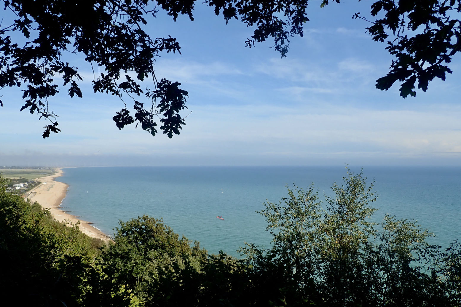
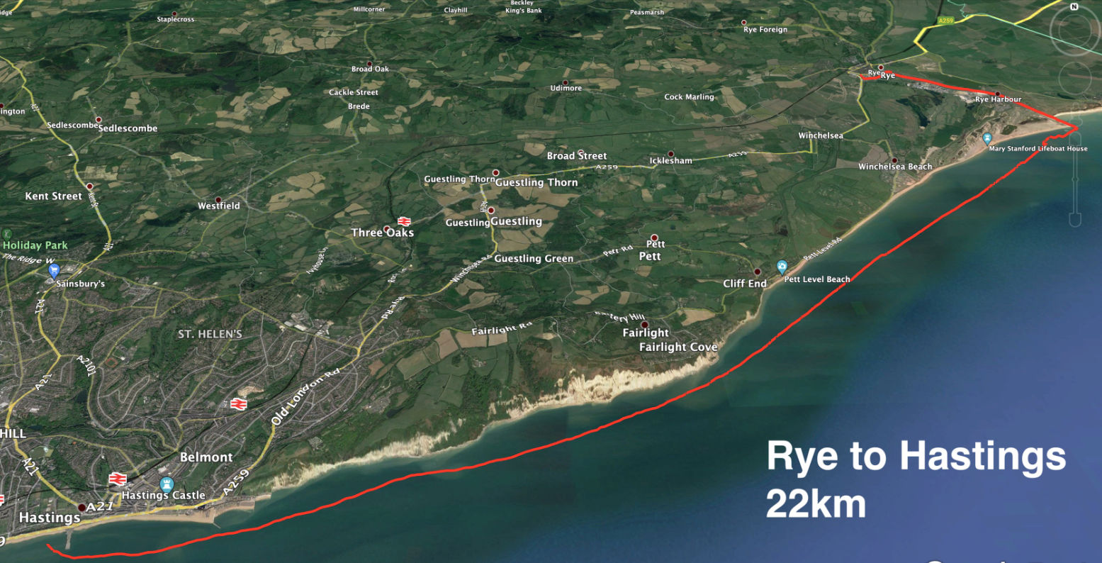
Once we were let out in the Covid summer of 2020, we did a very nice coastal walk from Hastings to Rye along the Sussex coast. Hot, but not so windy, it would have been just right for paddling. Today conditions were similar for a westbound transit from Rye back towards Hastings. High Water (and a spring tide too) was at a very reasonable noon in Rye, with a forecast of 8-14mph from the east and a bit of a kick at 3pm. I was hoping for the upper limit and a bit of splashy sport, so brought the WindPaddle I’d used on the packraft last month in Scotland in much stronger winds.
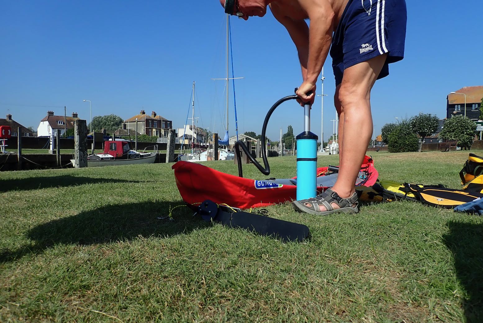
It’s only a 10-minute walk from Rye station to a boat ramp on the quay where the water was still inching up the concrete as I pumped up the Gumotex.
I was taking a gamble trying my untested new rudder set up. Because I expected it to play up, I fitted the stock skeg so I could lift a problematic rudder and carry on as normal without coming shore. To be without a rudder or skeg with a backwind at sea would not be ideal. Being the ever recirculating goldfish, I forgot to try out my sail stick mount idea.
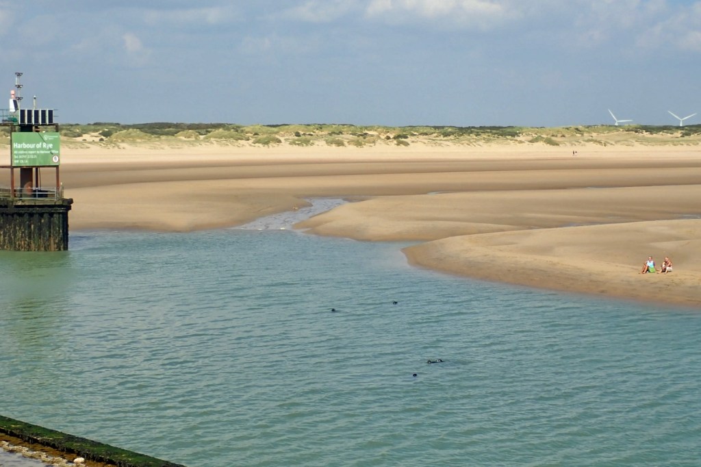
Rye hasn’t been on the coast since 1287 or so when, along with gradual land reclamation, the biggest of a series of 13th-century storms filled the adjacent marshy inlet with silt and shingle which finished off semi-abandoned Old Winchelsea and radically redrew the low-lying coastline where the Kent and Sussex borders meet. It was the same in Pevensey to the west. The gif on the left from this interesting regional website shows how the coastline of southeast England was transformed in the late medieval era. Where the Rother river once flowed directly east to enter the sea at New Romney, the filled-in bay saw it diverted south below the old hill town of Rye, now stranded two miles from the sea. The then important port of Winchelsea was rebuilt on its present site in 1288, but eventual silting saw both it and Rye’s maritime importance decline. What this area may lack in epic spaces common to the north and west of Britain, it gains in fascinating history. 1066 and all that.
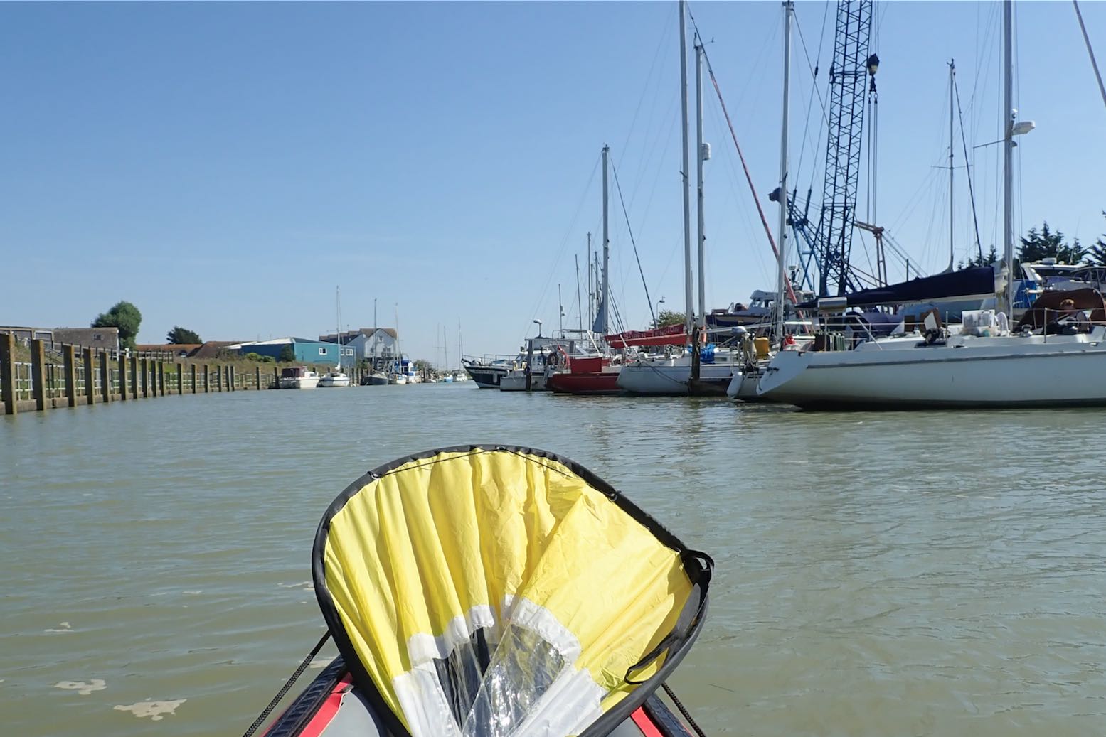
I set off along the River Brede which wraps around Rye’s south side like a moat, and soon joins the Rother. It’s about 5km to the open sea.
I’m into the wind but the grass banks are under water and the wind turbines are spinning merrily; all good signs.
Rye Harbour. The tide is high and I’m moving on.
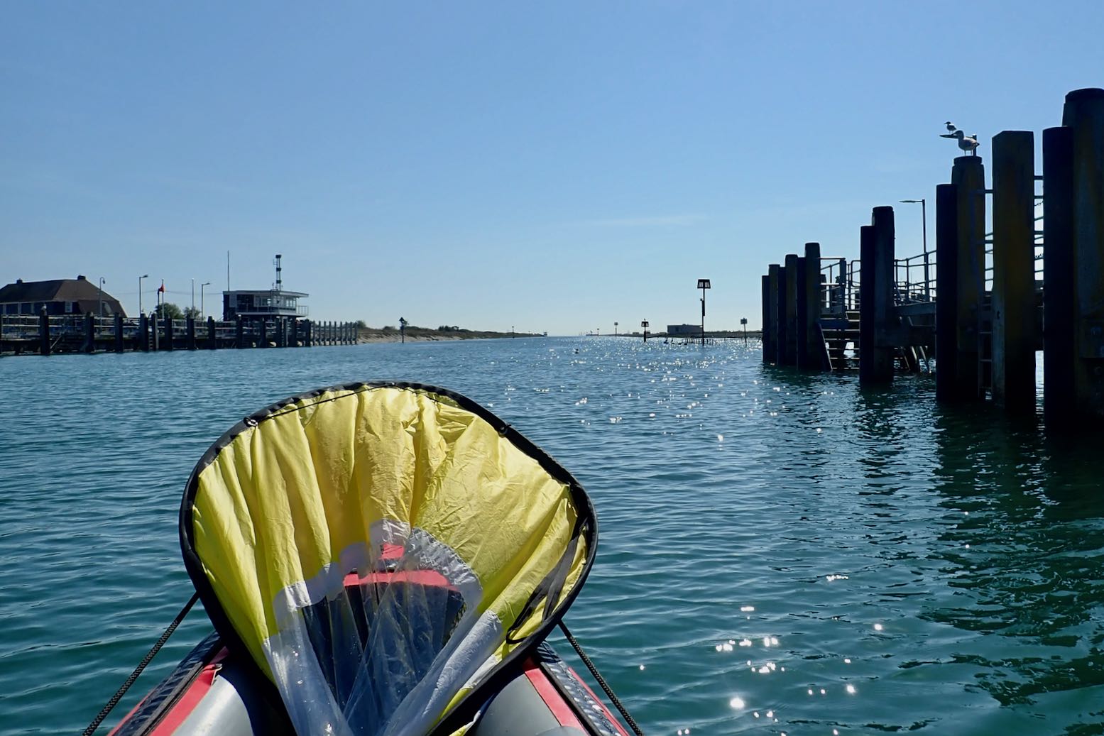
In 45 minutes I reach the old breakwater opposite Camber Sands where I recall bucket & spading as a child. The sea looks depressingly flat.
Seals at the river mouth (a few days later).
It’s nearly 10km to the distant cliffs, a two-hour haul. And with the breeze from behind, I’m soon streaming with sweat. I’m not sure my water will last.
Going with the Flow A few years ago while planning Newhaven to Brighton, I learned an odd thing about Sussex and Kent tides. For the last two hours of the incoming (eastbound) flood, the tide keeps rising but reverses westbound along the English coast as it backs up at the Straight of Dover and spills back down the sides. That makes HW is around the same time in Folkestone, and 140 miles to the west, past the Isle of Wight, but HW at all the places in between lags behind. Tidal steams are not that strong here – wind will have much more of a bearing on paddling – but this means you get only four hours eastboundflow with the flood tide and prevailing southwest winds. But if you time your run with a warm easterly off the continent and go westbound– as I did on this occasion – you get a much longer run with the tidal current; eight hours or more; maybe 45km all the way to Eastbourne. The question is: can you paddle that long.
A breeze picks up so I flick up the sail. I check my GPS and am doing 3-4kph, while I can paddle at around 5-6kph. Then the breeze drops away. I wasn’t really planning to paddle the full 30+ clicks to Cooden station, but I can always get off at Hastings, a few stops before.
At least the rudder seems to working as it should, though any quick response is dulled a little by the skeg. A rudder’s not really needed in these conditions, though it compensates for me being blown gradually onshore. I’m trying a rudder lift-line only, not a rudder lowering line as well. But once in the boat I find I can’t turn enough to even see the lifted rudder to flick it down with the paddle, so I’ll probably fit a drop-line later.
I creep along the expanse of Winchelsea Beach. It’s hot work in a backwind. Eventually I reach the start of the cliffs where the coast turns more east-west, putting the wind directly behind me. But paddling at effectively wind speed, there is no cooling effect. More familiar with paddling at the other end of Britain, I’m not used to 27°C.
Then, as predicted, around 3pm the breeze picks up and I can get the sail up.
Paddling half a mile from the shore, initially it was hard to know if I’m moving and at what speed. So waking up the GPS screen was a handy way of telling if the sailing speed was worthwhile. With the odd gust I reach nearly 7kph, but average less than 5kph, a bit slower than paddling, but I’m not dripping like a leaky tap or needing to drink. In fact I could nearly doze off.
Niblick (5b), Harrisons Rocks
The cliffs inch by. This is the sea end of the Wealden sandstone formation, less high and steep than the better known chalky Seven Sisters to the west, or Dover’s white cliffs to the northeast. Both chalk cliffs are part of the same formation or bed, but when the land was squeezed and uplifted to the dome or hump was eroded away to expose the older sandstone below. This is what they call the Weald, and near Tunbridge Wells, East Grinstead and Frant, the weathered sandstone ridge produces small outcrops where I started rock climbing as a teenager (right).
There’s barely a sensation of movement; it’s not as bracing as I was hoping
I pass the Stade, the east end of Hastings where the cliffs drop back down. A few souls are enjoying the last day of summer on the shingle beach.
I keep going to the pier and decide to have a leisurely take out there. It’s gone 4pm so another 10km to get the train 6.15 from Cooden would be a rush.
Landfall by Hastings pier. Compared to the fabulous Summer Isles, for me these southeast coast paddles lack drama and interest, but are easy to reach if tomorrow’s weather looks good. We walked Hastings to Rye again a day or two later; it took about the same time and was more enjoyable (though it was cooler). The rudder foot pivot worked fine, though needed a bit of re-tensioning at the pier. Next time I can confidently leave the skeg off, though I can see a rudder would only be needed when sailing or paddling in windier conditions. That is all I have to say for now.
Nicely shot vid with drone footage of an Ozzie father and son’s tough, 250-km paddle and portage through Alaska’s Brookes Ranges in a pair of Advance Elements Expedition Elites. After getting dropped off at Summit Lake on the Continental Divide (see map, right), they followed the Koyukuk River south, with a plan to climb the 7500′ Mt Doonerak, Alaska’s ‘Matterhorn’, not far from the river and 20 miles west of the Dalton Highway. With extra gear piled high on the decks, you do wonder if this made the 4-metre Elites unstable in what looked like relatively easy but shallow white water. That led to a couple of capsizes and the loss of the crucial sat phone. Other dramas ensue.
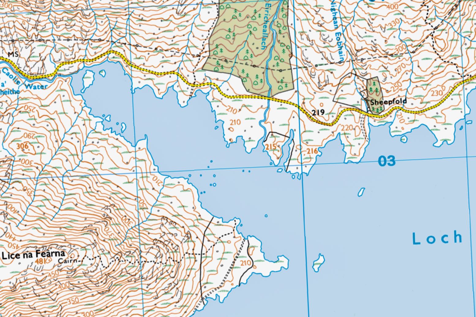
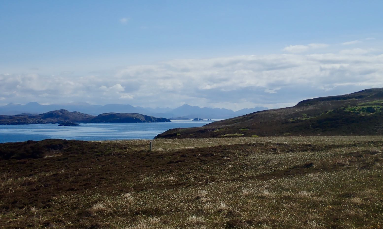
Some possible land & sea routes around Knoydart. All land routes are trails or tracks, fwiw
Looming over the Sound of Sleat opposite the Isle of Skye, Knoydart is a famously rugged peninsula that’s inaccessible by road; part of the so-called Rough Bounds. Rising north of Loch Nevis, the mountains top out at the 1020-metre (3346′) summit of Ladhar Bheinn (‘Larven’), before dropping back down to LochHourn. On an OS map, contour lines here are as dense as spaghetti and to the south, Loch Morar is Europe’s deepest body of freshwater. Sounds like packrafting country!
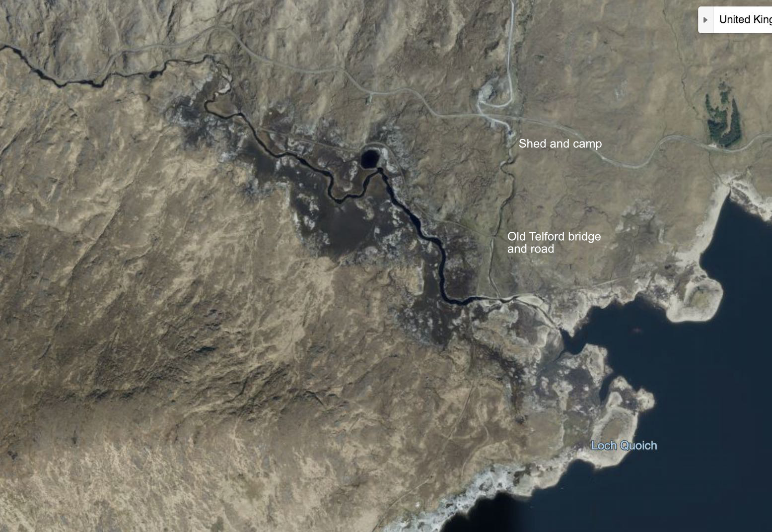
It took just a morning to stitch together a challenging three-loch loop via Loch Quioch, but once I got there the initial 20-km stage down the channel of Loch Hourn looked a bit daunting alone in the untried packraft sailing outfit and required a 4am start at Low Water if I was to do the loch in one tide. By the time I tried something else, I was pushed back by wind and tide, so I settled for a good look around, tested the sail on the Rebel 2K, the Six Moon Designs Flex PR pack harness and a new tent before returning a fortnight later with Barry with whom I’d paddled the River Wye last April.
Driving up to Mallaig freed us from train timetables, which left the weather and 18-kilo packs as our main constraints. Unfortunately, the forecast dropped an F5 headwind on the Friday we planned to paddle out of Loch Nevis back towards Morar or Mallaig. Along with agreeable tide timings, I realised this was a limitation of circularpackrafting routes on the Scottish west coast: chances are you’ll hit a prevailing southwesterly which may slow your packraft to a crawl (as I’d found). Depending on where you are, that can mean turning back or a tough walk out. Maybe both.
Red and blue: this trip. Green: earlier visits. two 1000m+ summit excursions also shown
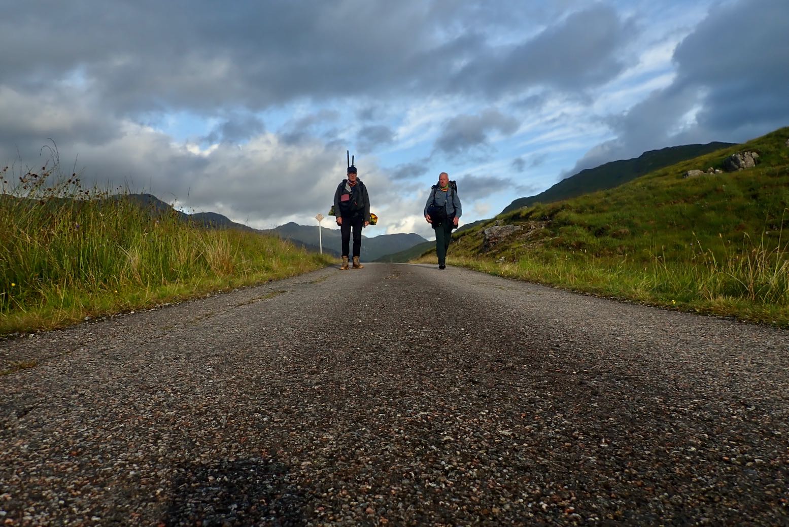
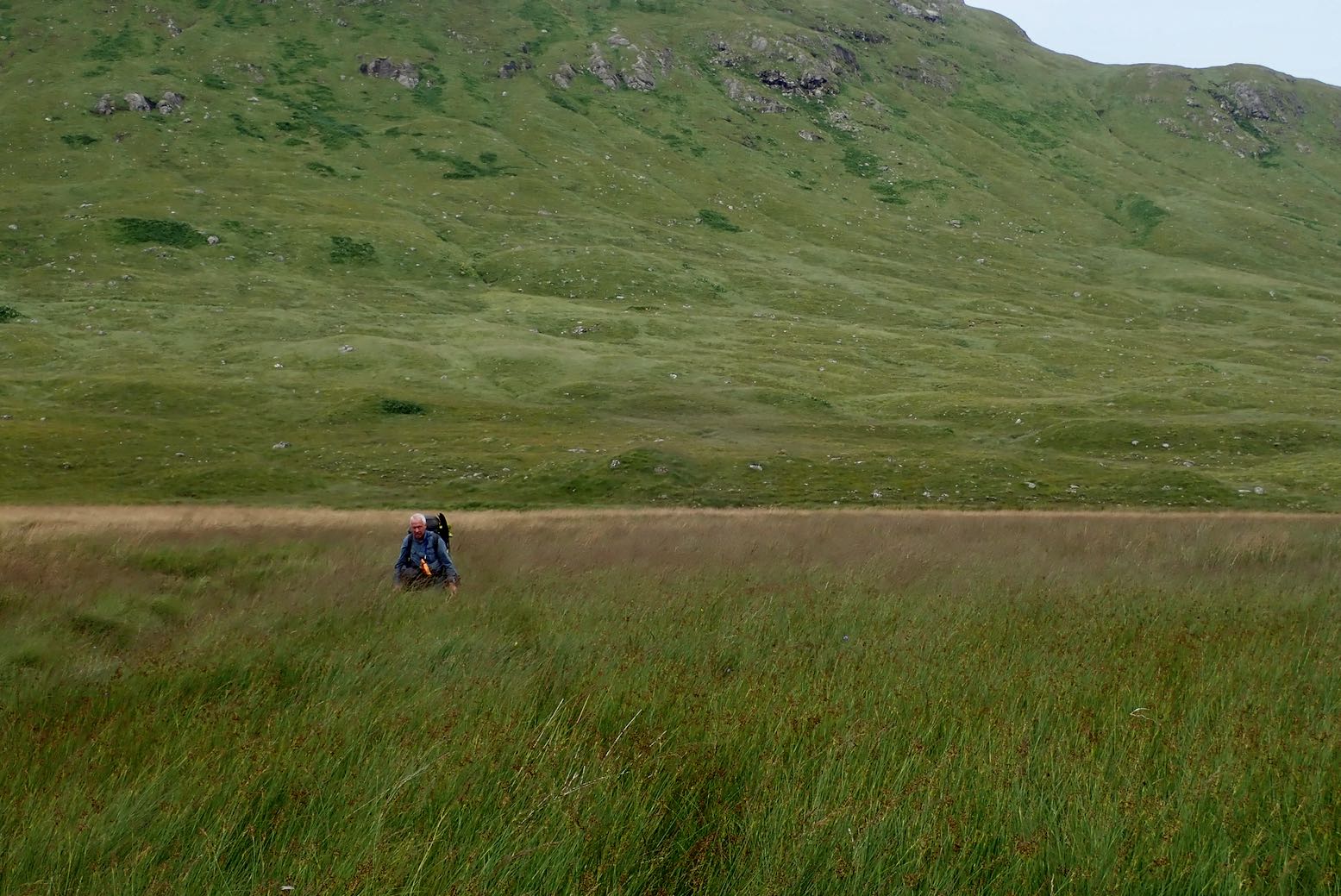
So Barry and I flipped the plan: hike 16km from Inverie (the only village on Knoydart) over to Barisdale, paddle inner Loch Hourn (7km), walk up to Loch Quoich (8km), cross it and then head 6km to a bothy in desolate Glen Kingie. From here, on Windy Friday we’d walk 6km over another pass to the 20-km long Loch Arkaig and try and sail the F5 west, maybe getting as far as Fort William via the River Lochy, though gusts out here were tagged at 40mph. At Fort William we’d catch the train back to the car in Mallaig.
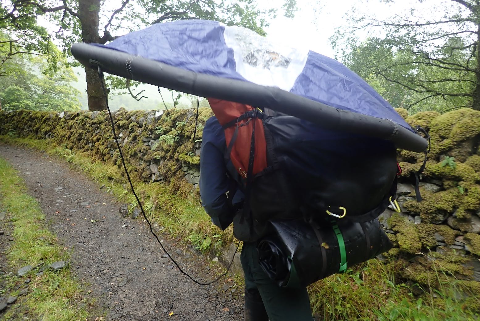
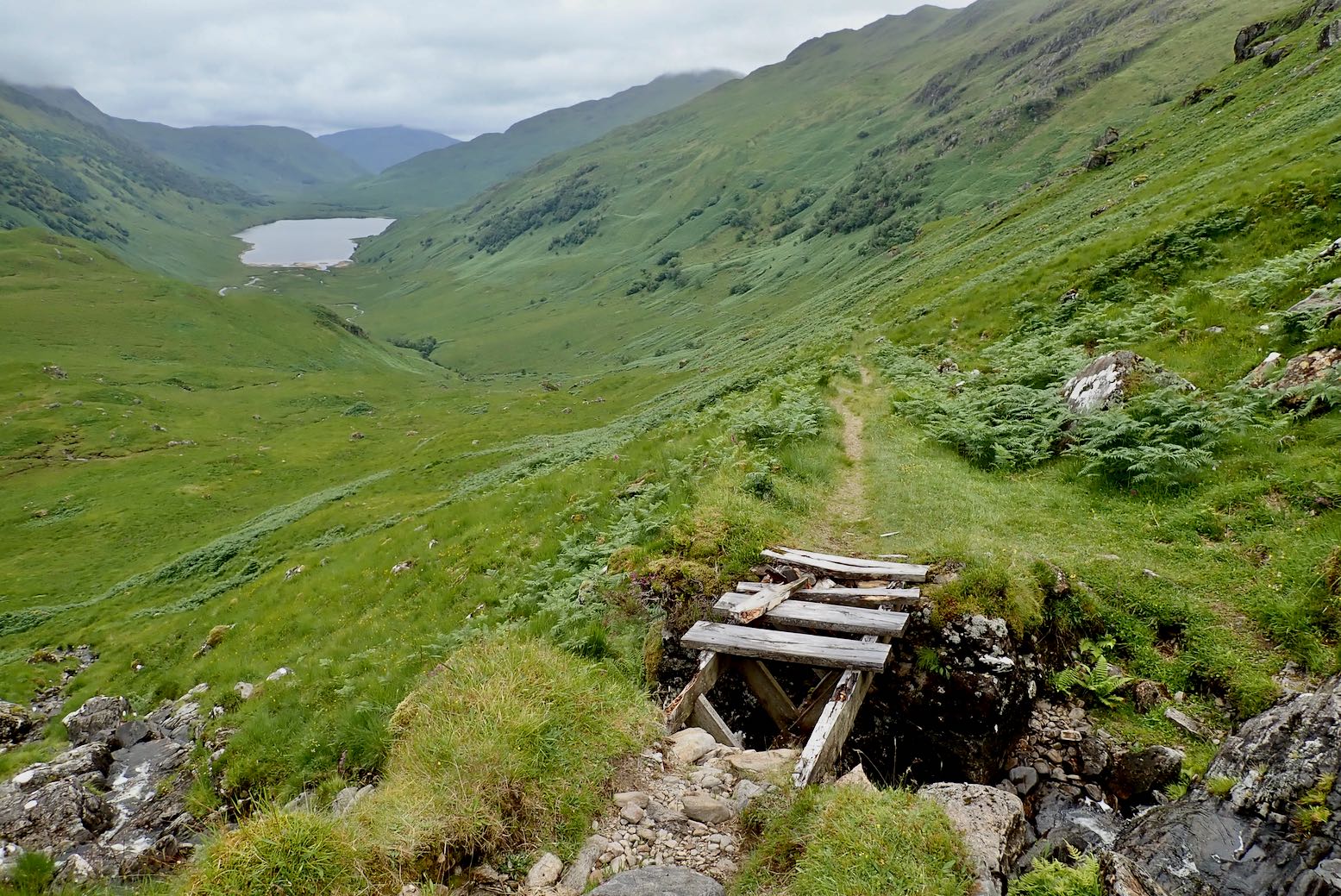
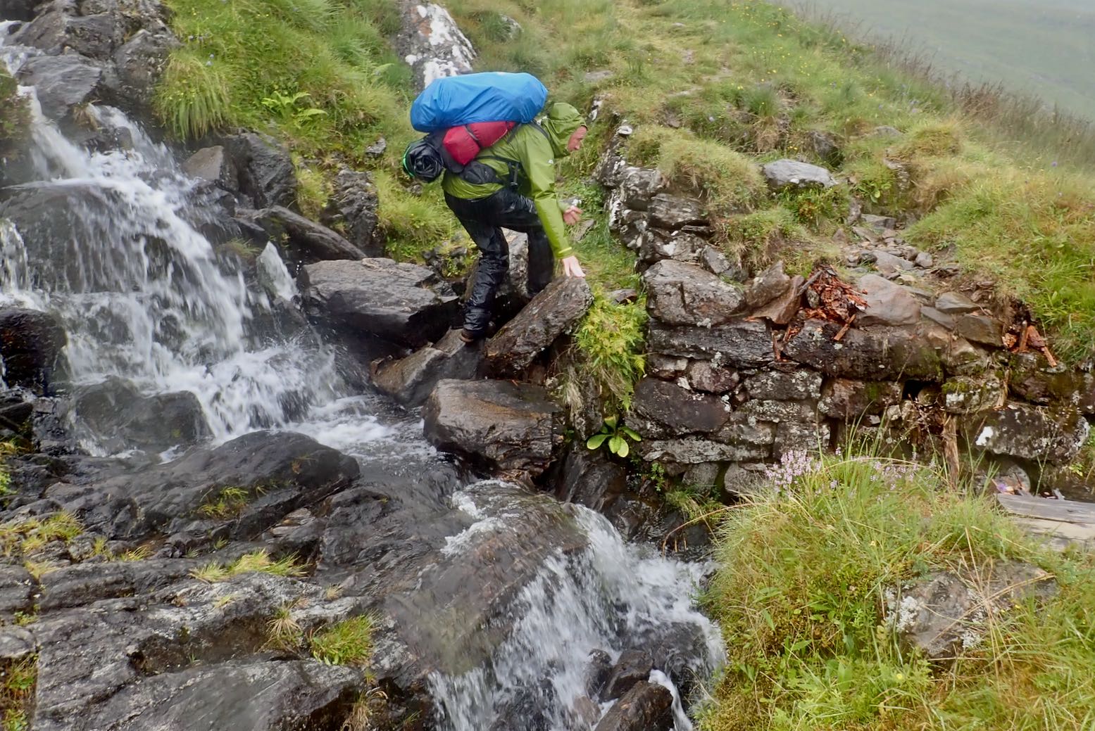
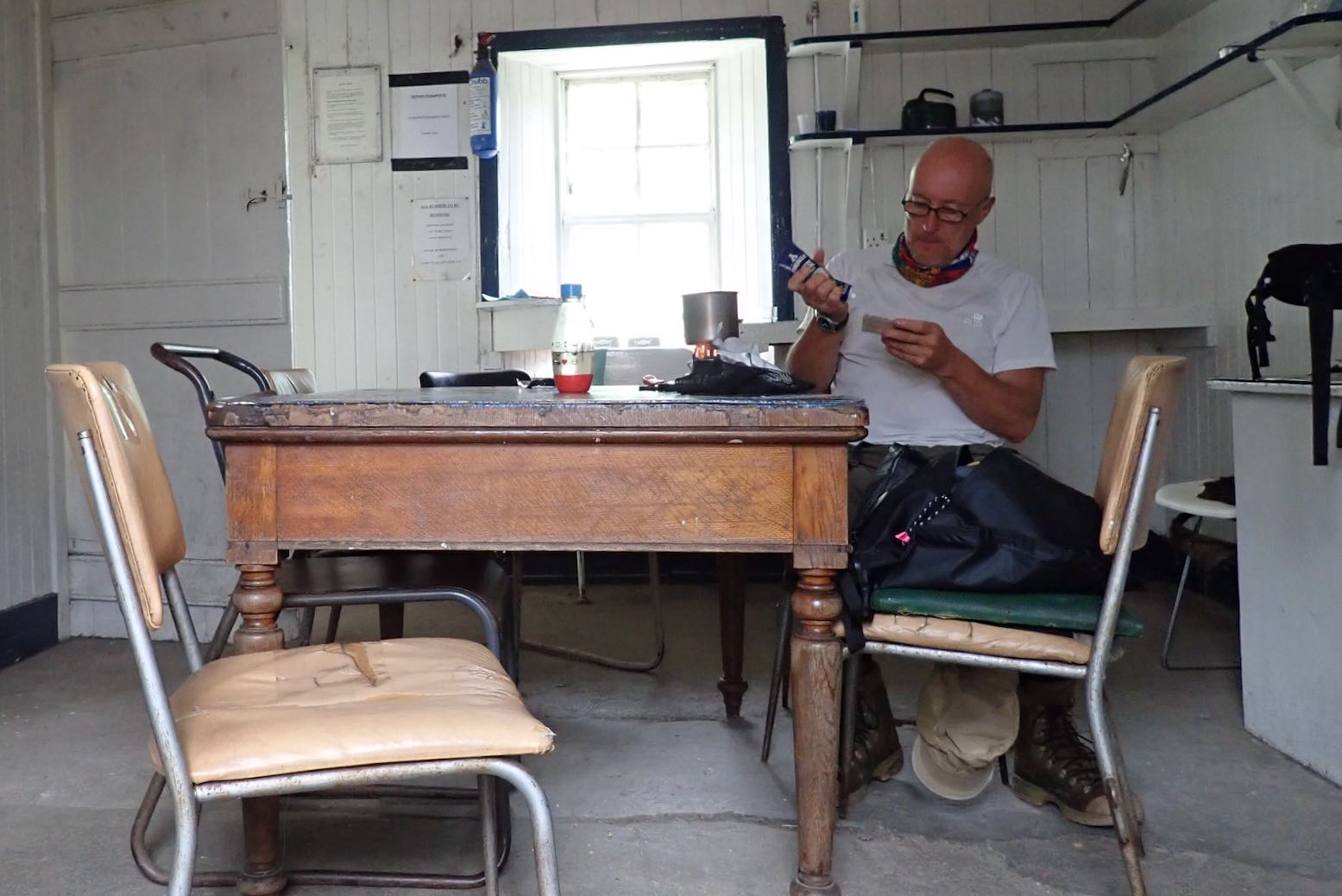
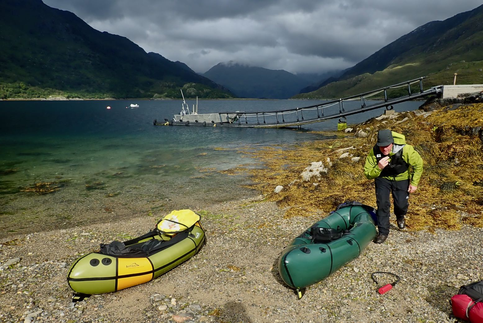
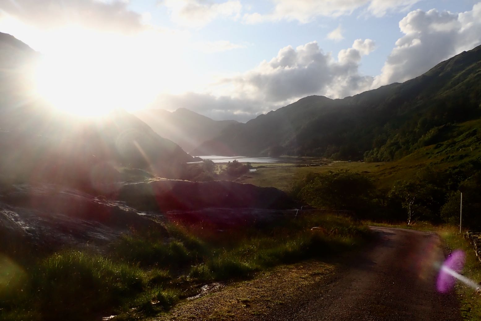
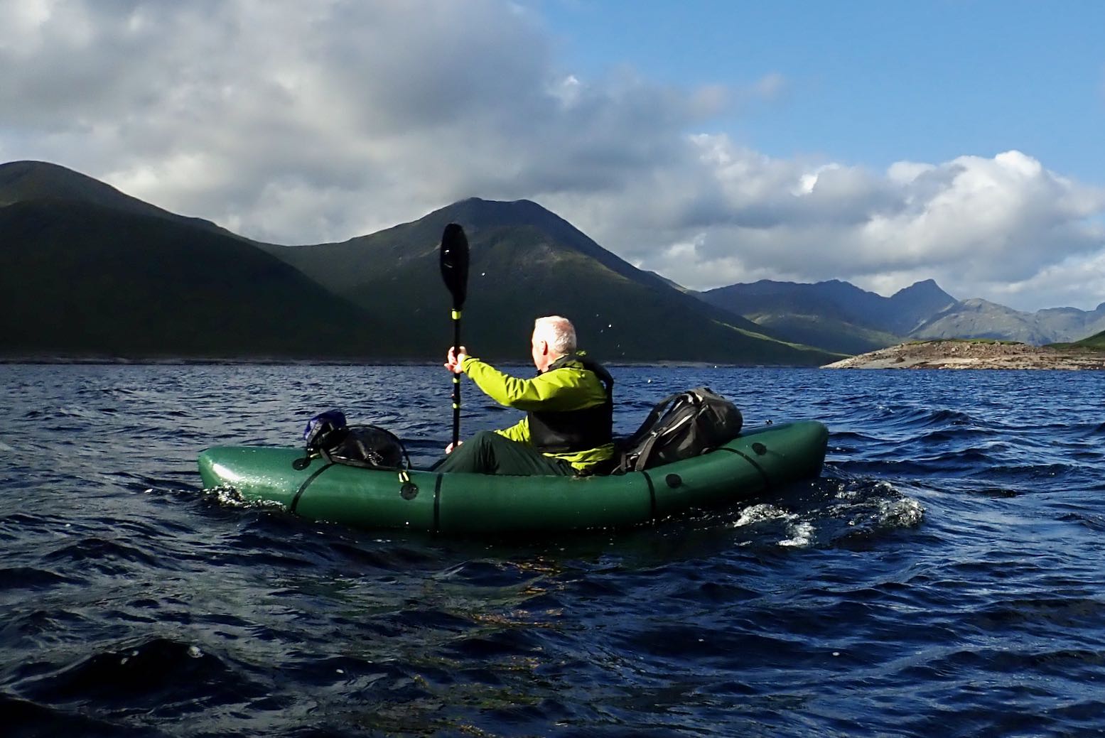
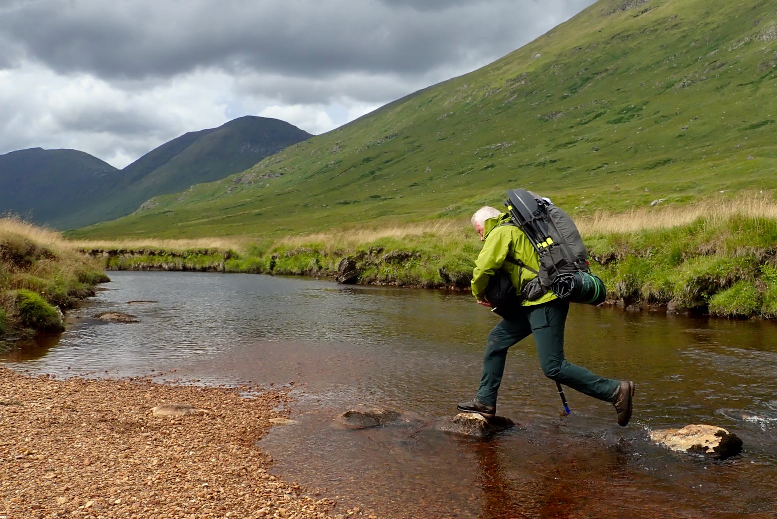
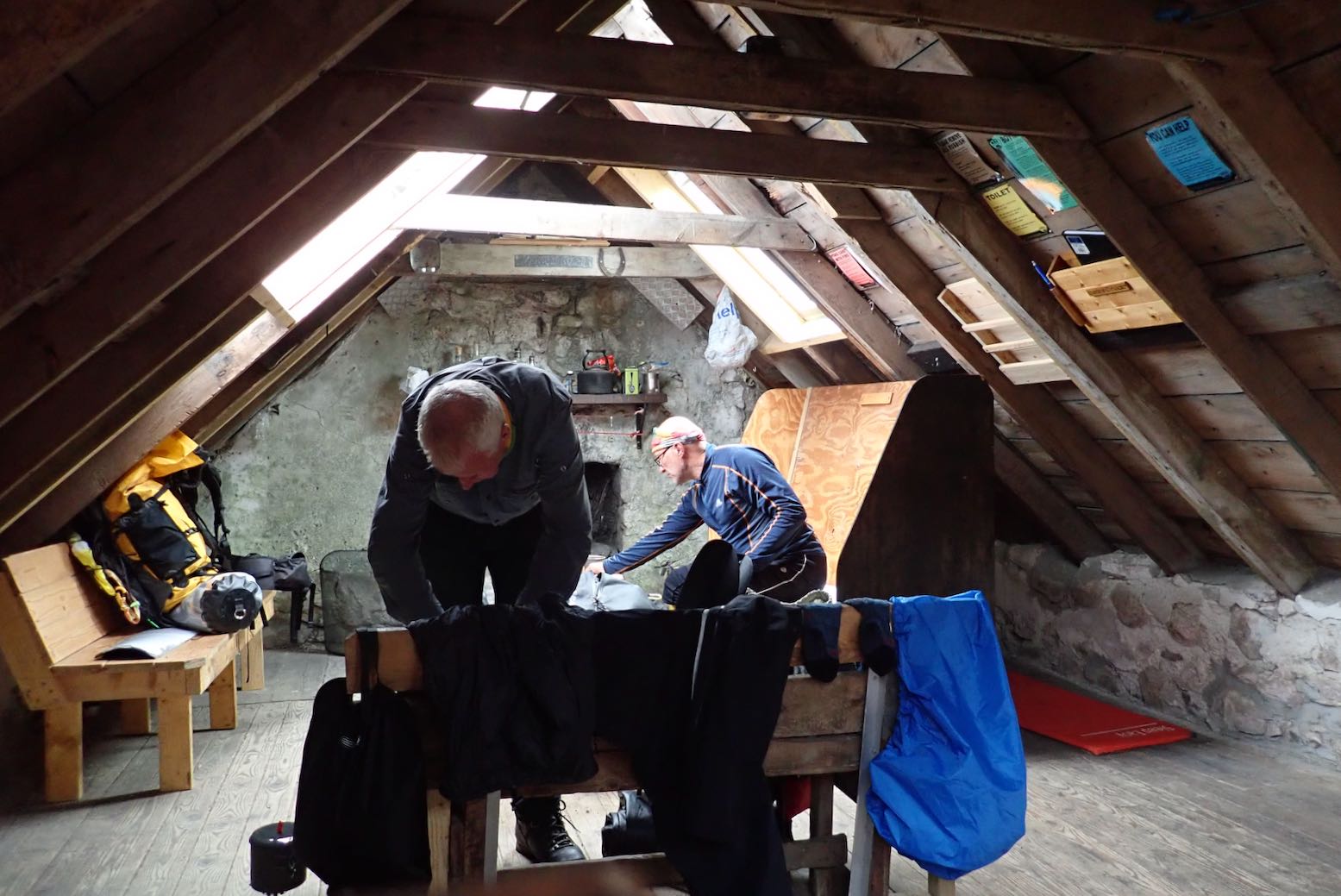
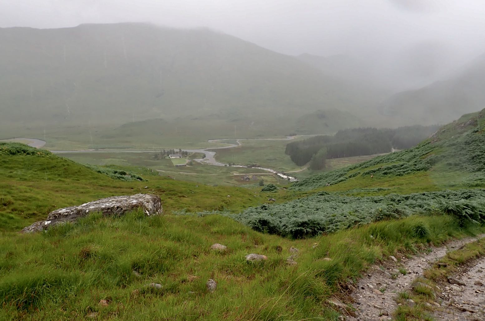
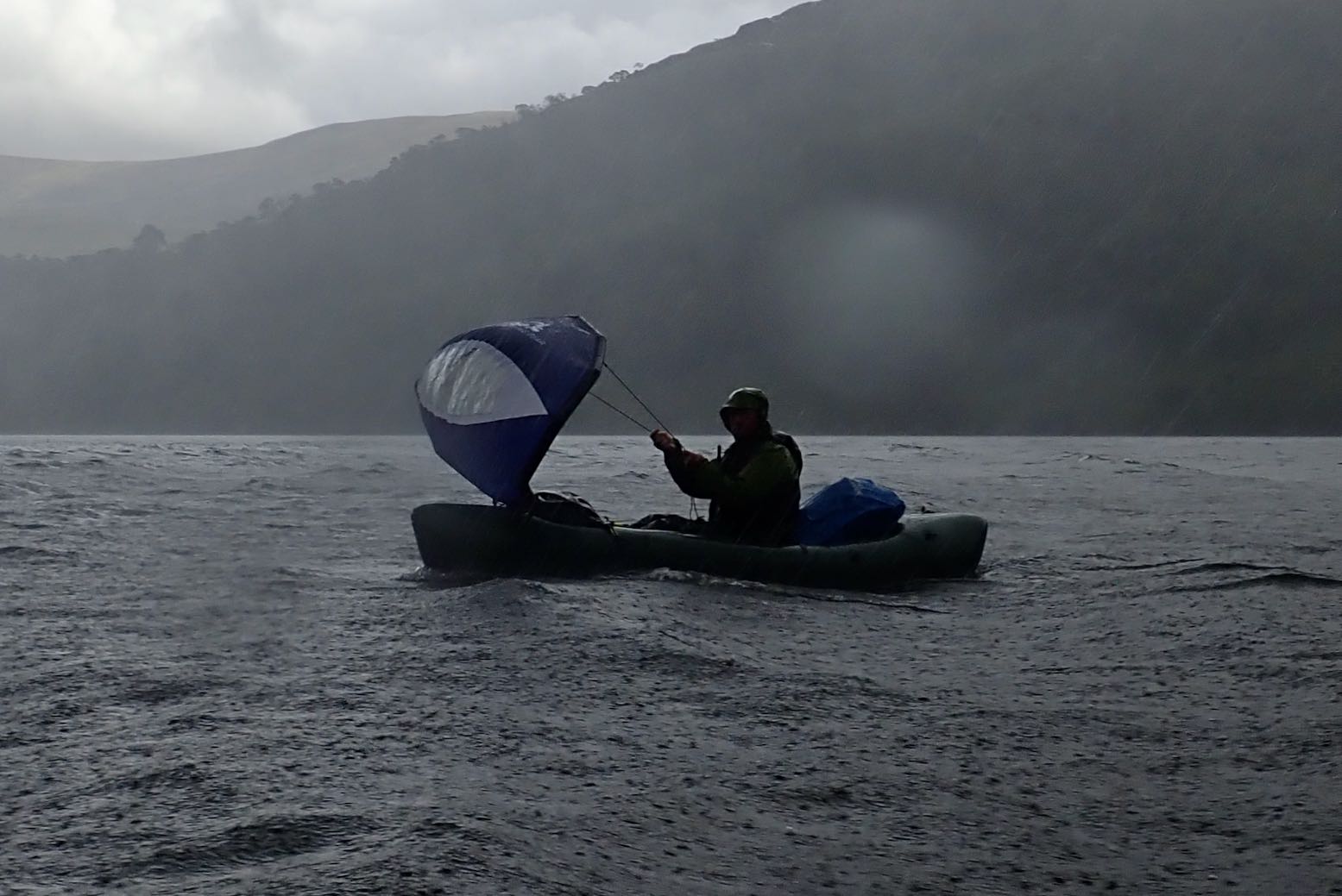
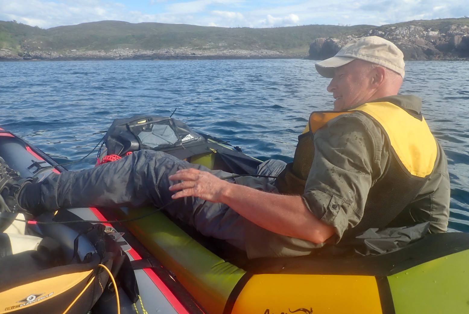
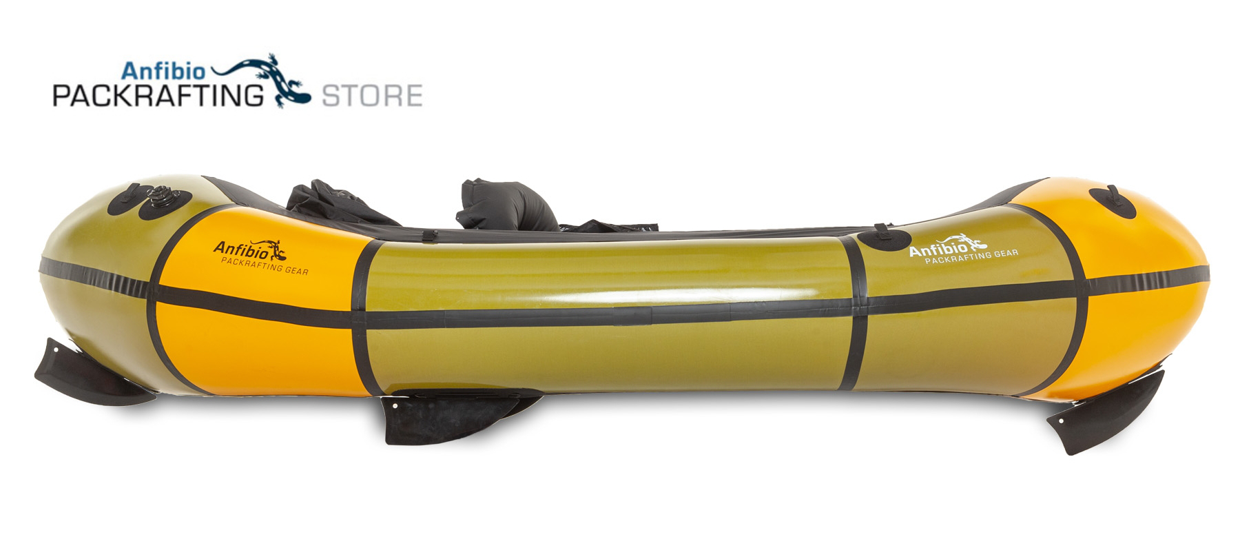
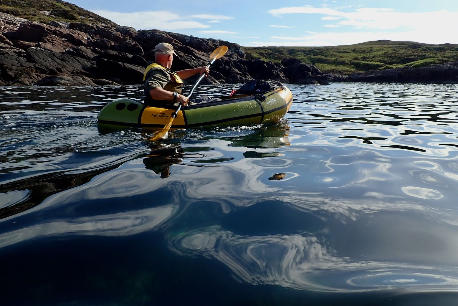
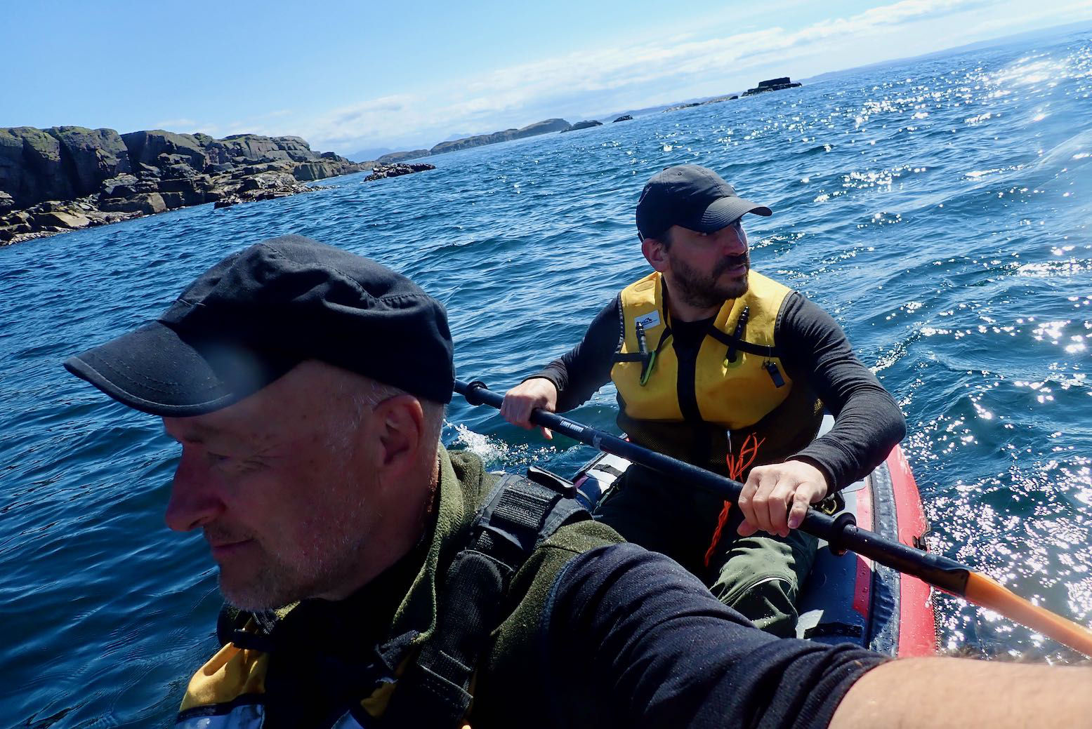
Ferry from Mallaig to Inverie; the only way to Knoydart other than walking or paddlingToday we will get wet. Barry tries his Anfibio AirSail brollyThe long walk from sea level up to the 1500-foot Barisdale passTwo weeks ago this bridge was on its last legsNow it’s gone, requiring a ford as the rain sets inTwo weeks ago I arrived in Barisdale bothy utterly knackered; this time we’re both soaked through and shivering. Hot tucker needed quick!Mid-afternoon the rain stops and the spring tide and wind are just rightWe arrive at the Loch Hourn jetty with 3-4 hours to HW and only 7 clicks to Kinloch HournHoist the mainsails and off we go!Barry’s longer MRS Nomad S1 is notably quicker than my 2KPeak flow through the Narrows. Standing waves wash over the S1’s sides and a hidden current shoves it sideways So I appreciate the Rebel’s zip-up deck. Even paddle-sailing I can’t catch the NomadWe leave Kinloch Hourn with two hours of daylight for the 7km walk to Loch QuoichThis walk is taking forever and my feet are killing me. Where is the inlet by the road?We give up and camp by a pump shed; the noisiest place for 50 miles. We’ve covered 20 miles today.Later I check Bing: unlike maps and Google, it shows Loch Quoich’s much lowered water level following the 2010 droughtNext morning the once-submerged 200-year-old Telford bridge mentioned in the link above is visible below our camp. It explains the weathered milestones we saw on the walk up from KL-HWe carry on along the road until we can get nearer to the shore without getting bogged down Opposite a small plantation we get our chance but a headwind in blowing from the southeastOnce on Loch Quoich the boats make good progress and we’re soon in the lee of the hillsBehind Barry, the 3291-foot (1110m) mountain of Sgurr Mor, with Knoydart’s peaks beyondWe didn’t want to get off Loch Q, but the time had come to plod on southwards to the next lochA rough 4×4 track makes nav a bit easier; it’s a 200m climb to the passOver the watershed and down into Glen KingieNear here Barry (a registered smartphonaholic) gets a freak whiff of wifi. “Rain expected 14:00; let’s step on it!” Up ahead is the Kinbreak bothy we’re aiming forFording the River Kingie not far from the bothyFrom the river we take a direct route. Big mistake: it’s only 700m but knee-deep tussock hellThe bothy is in sight but we end up flat on our backs more than onceNot far now…. Will it be open and vacant?Halleluia! I only learned later that MBA bothies had reopened after Covid just four days earlierSoon the rain lashes down and doesn’t stop. Let it pour!We spend the afternoon eating and drying and chatting. What a relief to be here. Thank you MBA!I had a set of these ex-army mess tins as a teenager. Now lampshade/reflectorsAt dusk three dozen deer come down from the hillsides to ensure ticks are evenly spread across the glenMy boots snag a cozy spot by the fireBy 10pm the only sound is the rain hammering on the roofWindy Friday. We wait in vain for the rain to let up, then face the inevitable. Yesterday this burn was a trickle. My boots are soaked againDespite re-applying Nikwax’s finest oitments, my 10-year-old cag is as effective as an old t-shirtAfter two hours bog-hopping, Strathan homestead rises from the murk. We’re both drenched so heat up a snack between two locked barns. It’s still a long way to anywhere. We’re fed upThere is a lochside road but it’s a 4-5 hour trudge. Then in a lull we pass a beach: “Let’s put in!” we say simultaneously Had we forgotten today was Windy Friday with forecasts of 30mph gusts?Twenty minutes later we’re holding on for dear life, pelted by torrential, wind-driven rainBut our packrafts are amazingly controllish-able, stable and much faster than walking, providing you steer off the shore80 minutes and 7km down, I need a slash and Barry needs to tip out his flooded boat. We’re both drenched and chilled. Sailing may save energy but doesn’t generate warmthThe next shower is stampeding down the glen. Barry gets another rogue signal and calls in the only black cab in Fort WilliamWith good gear like a dry suit, the rest of Loch Arkaig would have been a blast. But this was 40 quid well spentStarter preceding a delicious curry at Tiger Wall in FW. And it ain’t bag food!Long drive home with much talk of Gore Tex ProRed and blue: this trip. Green: earlier visits. two 1000m+ summit excursions also shown
Our plan fell apart like a wet paper bag on a 1200rpm spin, but what a great mini packrafting adventure that was on the fabulous Scottish west coast.
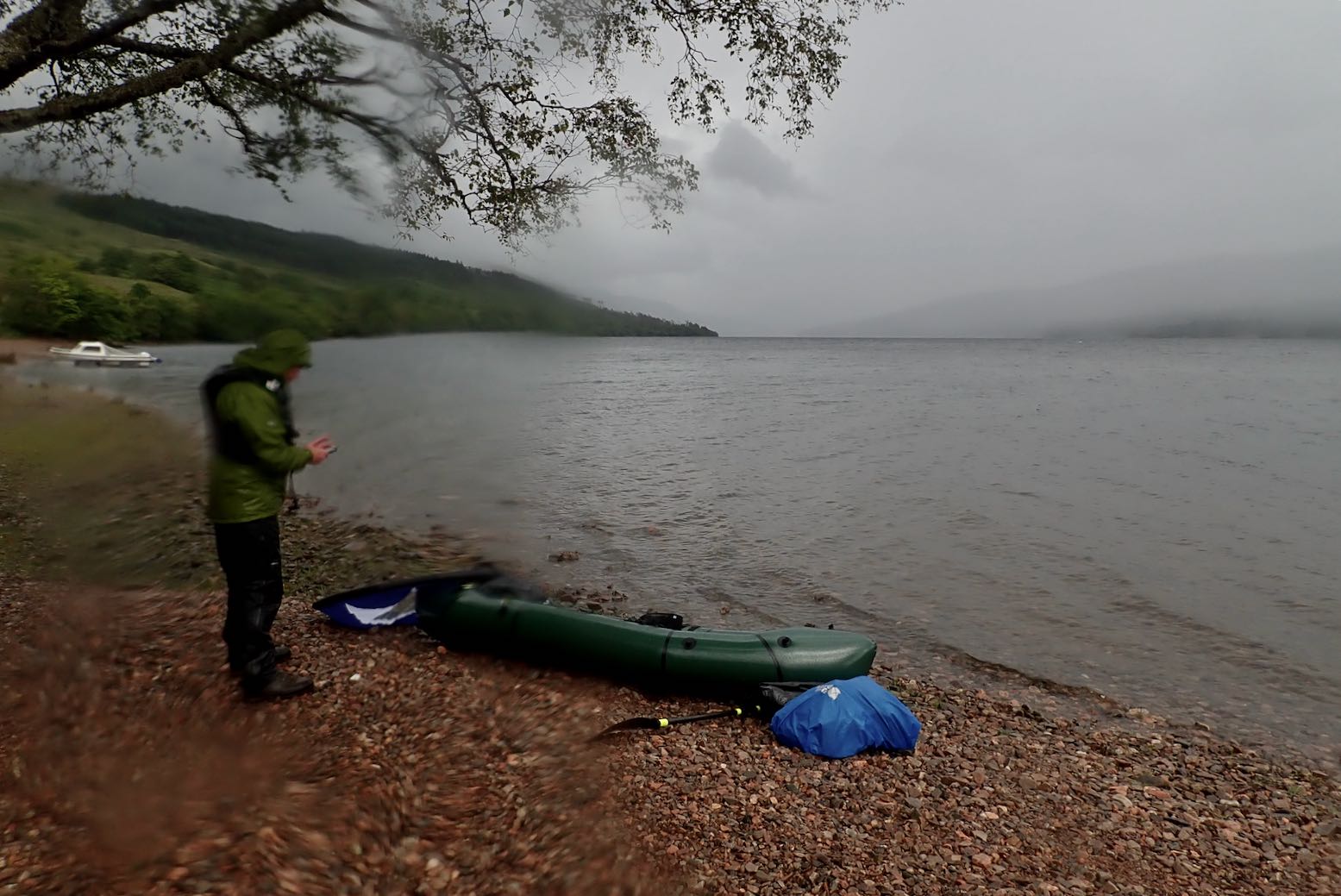
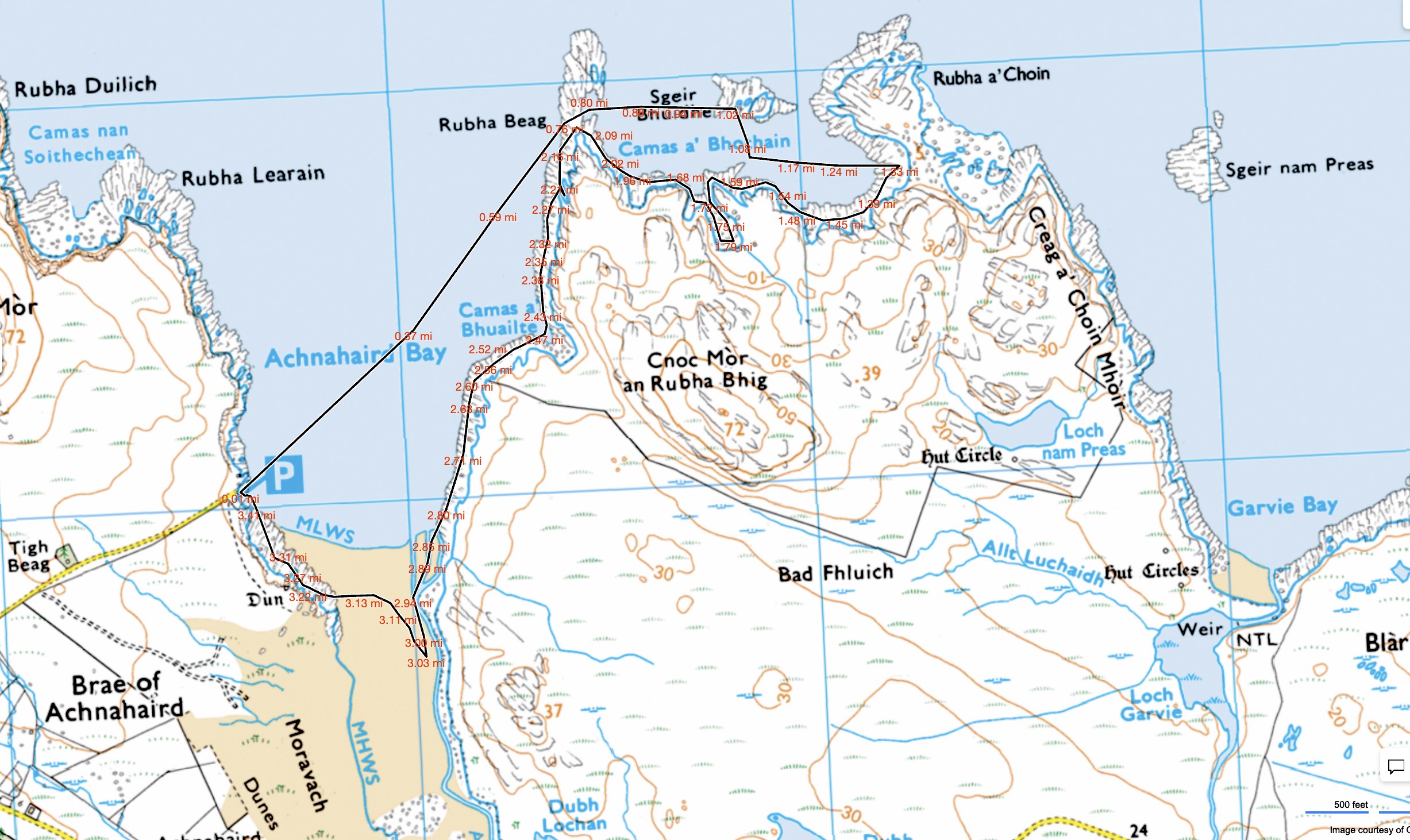
Around here the inshore sea paddling is exceptional, even if packrafting the inland lochs is also pretty good. Having done most of the latter routes, I thought I might try some coastal packrafting. Garvie Bay arcing west to Achnahaird Bay looked like a good one and happens to parallel probably the best walk on the peninsula which we’ve done many times. That route could be a 20-km combination of cycling, walking and paddling, but as it was the last calm evening for a while, we thought we’d go out together in the kayak and I’d try the packraft on the way back. That way everyone got to play.
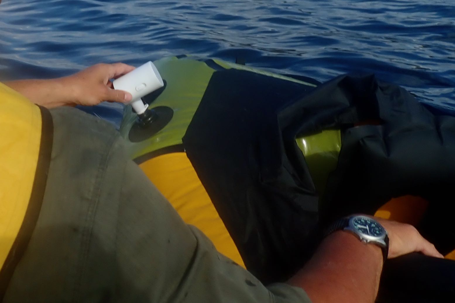
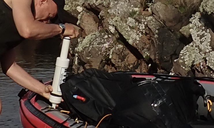
A light NW breeze blew onshore as we cut across Achnahaird Bay like a blue fin tuna. The approach of HW meant we slipped through the submerged skerries of Rubha Beag and into the crab’s claw inlet of Camas a Bhothain (Bothy Bay). This seemed a good spot to deploy the packraft with the aid of my exciting new gadget, a mini electric pump. I unrolled the boat over the water and let the pump buzz away for a couple of minutes, topped off with the hand pump, then clambered aboard.
Buzzing noise
Man the lifeboats!
Paddling away, I realised this was the first time I’ve paddled my Rebel 2K unloaded and I was a bit shocked by the bow yawing. Now fully back-heavy, one good swipe of the paddle and it could flip a 180°, just like my old 2010 Alpacka Llama.
Ah, but in my haste to launch the lifeboat I’d forgotten to fit the also-untried skeg which comes standard on the 2K. I waddled over towards Rubha a Choin beach and slipped it on easily, while the Mrs transferred to the Seawave’s front seat.
I’ve been ambivalent about the value of a skeg on a packraft, but now back on the water the yawing was notably reduced. If you think about it, a packraft actually pivots from a point around the middle of your swinging paddle, not from the stern, as it feels from the seat. The centre of mass behind the pivot point does make an unladen bow yaw more, but the stern will yaw too; just less and unnoticed.
Skegging ‘eck!
On the Wye my 2K was fully loaded with the centre of mass moved forward and which minimised any yawing, even without a skeg. (With a heavy load over the bow a reduction in yawing is well known with packrafts). Now unloaded and with the bow riding high, swish-swosh yawing was exacerbated, but is actually happening at both ends of the boat. So any type of fin or extension of the stern (like the post-2011 Alpackas – right – and all subsequent copies) will constrain this, while not affecting steering. So, bottom line: skegs work on a packraft and are easy to retro-fit.
A short-but-wide packraft actually pivots from near the centre, not from the back as the impression suggests
All the remains is a packraft’s agonisingly slow speed. These are not boats made to enjoy the sensation of flatwater paddling; they are boats to enjoy getting to out-of-the-way places easily. Any type of disturbance to progress, be it wind or current, may slow you to a stop, or worse. Something like the longer Nomad S1 I had would be better for this while still being packable. Still, in these ideal conditions it’s nice to float along observing the coastal features.
Paddling back down the east side of Achnahaird Bay, a back-breeze made progress feel achingly slow. Lately, I’ve come to value metres per second (m/s) as a metric of wind or paddling speeds. Something moving past you (or vice versa) at three metres per second is easy to visualise, though I suppose we can all visualise a 3mph walking pace, too. It’s what YR uses and is easily converted to ‘double + 10%’ for miles per hour (so 5 m/s = 11.18 mph). Or just double it and you nearly have knots (5 m/s = 9.8 kn), for what that’s worth. Crawling past the rocky coast it looked like I was doing 1 m/s at times. We had a race: diminutive Mrs in a big, long kayak; me in the packraft. Within ten seconds the Seawave streamed away while Bunter frothed up the water like a cappuccino machine.
Oh well, you’re as fast as you are. Like cycling in Tajikistan rather than Kazakhstan, for the best experience match your routes with your mobility and conditions. Next calm day I’ll do the full Garvie loop.
Another forecast of calm winds in the Summers. Or is it? The BBC and YR reports are contradictory: the former has too-strong-for-IK winds from the south; the latter shows light winds from the north. Others show light winds from the south. How can they all be so different? Maybe I should just look out across the water? All looks serene so let’s make paddle while the sun shines. I wheel back down to False Man’s Harbour and set off with two hours before high water.
No side PRVs? Am I missing not having added pressure release valves in my side tubes, as I did to my original Seawave? Not really. I am running 0.3+ bar in the sides (official: 0.25) but temperatures up here in NW Scotland are hardly tropical. I try and leave the boat in the shade at the house and de-air the side tubes for a couple of seconds after a paddle, effectively manually depressurising the sides to about 0.2 bar, rather than having fitted PRVs do it for me automatically. The more vulnerable stock PRV in the floor purges automatically at 0.25. On my next paddle I have to top up all three chambers with the K-Pump as I would have to do with all-round PRVs anyway. About 30 kpumps brings the sides back up to over 0.3 bar. The difference now is I use a manometer to check the sides are about right. Before I would just pump until the side PRVs purged. It’s about a minute’s more faffing. As with a lot of things I do to my IKs: sails, rudders, decks and now, trolleys and headwind weight transfer – it’s fun to experiment. But in the end they’re all largely over-shadowed by the simple enjoyment of paddling. With sides pumped to >0.3 bar I find I can cruise easily in the near-still conditions at 6kph.
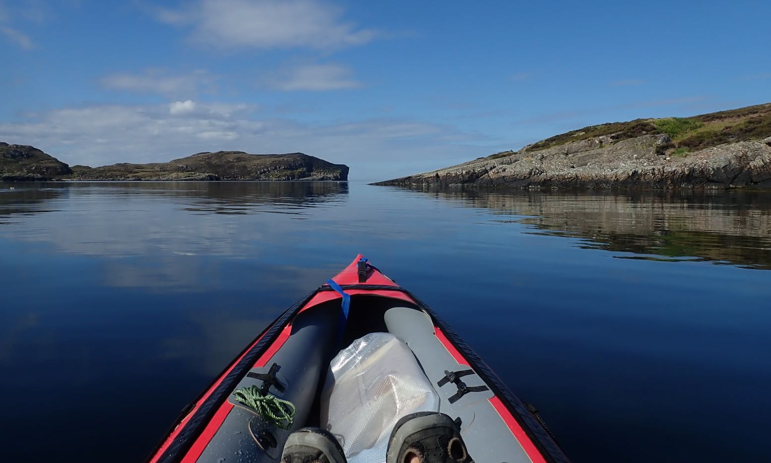
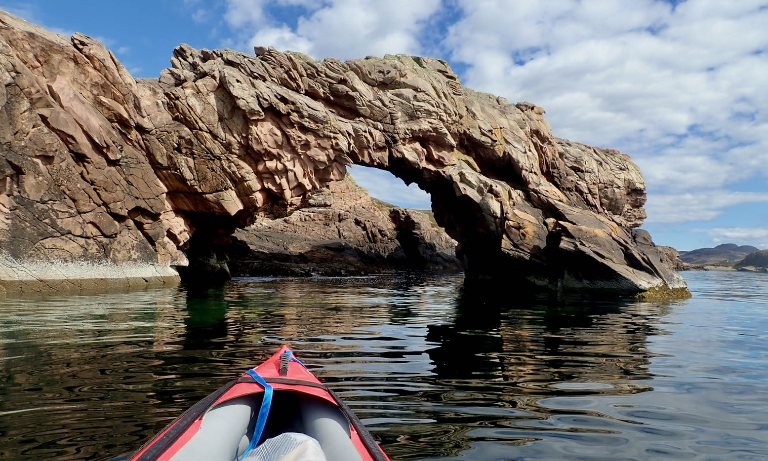
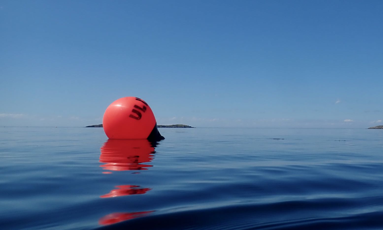
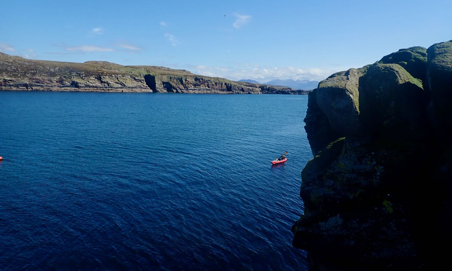
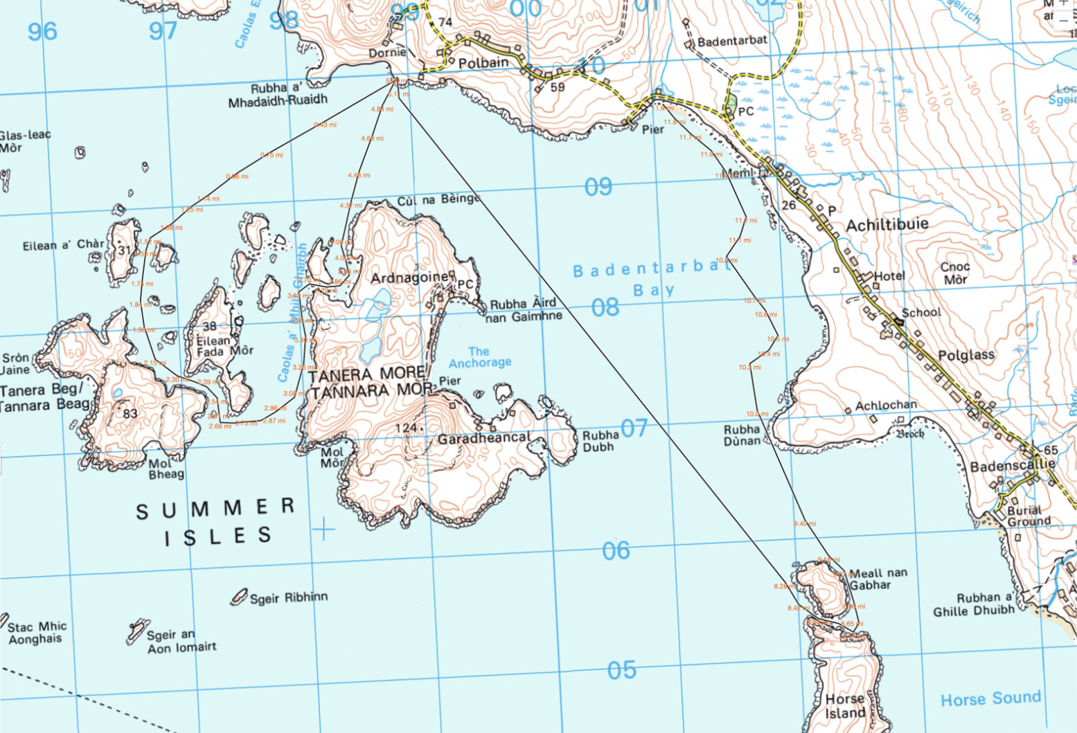
Let’s try and make the outside of Tanera Beg again. Two days ago I got blown off that idea.I fit a compass so I know which way the wind blowsAnd try out my deckbag GPS RAM mount so I can measure, not guess, distancesKayaking tour party mustering at the north cliff of T. Beg.But they seem to be dawdling, as if unsure whether to go ahead.I paddle past and on to the big cave on T. Beg’s south side. That crack at the back might be passable at max HW.The view out south towards the Wedge of Angus and Priest Island beyond.I slip through the popular arch at Tanera Beg’s southeast end.I notice a small second arch. The water is too high and gap too narrow to squeeze through with my Seawave, but it’s only a foot deep below, so the window of opportunity is as narrow as the arch. What would Freud have made of all this arch-threading.Being more exposed to the southwest, Tanera Beg has some deeply weathered sandstone cliffs.Midway through, I decide crossing over to Tanera Mor seems too easy. In the prevailing calm the three skerries to the south don’t look that far. It’s just over a kilometre to Sgeir Ribhinn (‘Stack C’) according to the GPS. That will take 11 minutes. Once there, I fail to notice the double-arched cave we found last time. But this is HW. A guard-bird observes.Over to the south side of Tanera Mor. The new owner is employing scores and spending millions here. New cottages here and there, plus tracks to isolated beaches (for building stones, I was told). They now ask you not to land in the more built-up Anchorage on the north side.There’s even a new house and other construction alongside the tidal lagoon of An Lochanach where I stop for a snack. Two kayakers pass by. Earlier, I could clearly hear them talking behind me across the flat water, long before I could see them.I cross the Bay and stop off on the mainland below our place to collect something.Looking west: a buoy with Glas Leac Mor behind. I recently read that a hazy horizon (Outer Hebrides not visible) means stability; warm, humid air. Good viz and crisp detail = cold air and wind. I head to Altandu, near the campervan-packed campsite.I drop-off and pick up a bucket. Coming back through Old Dornie harbour, a quarter headwind kicks up, pushing the bow left. I use the chance to load the bow with 10 litres of bucket-water. It does seem to make a difference: the bow bites better; no correctional paddling needed, unlike the other day. A good trick to know (I’d brought the drybag up front for that purpose).Another 13-mile day in the Summers, but I could have managed twice as far. How easy IK-ing is without wind. As is portaging with a trolley.
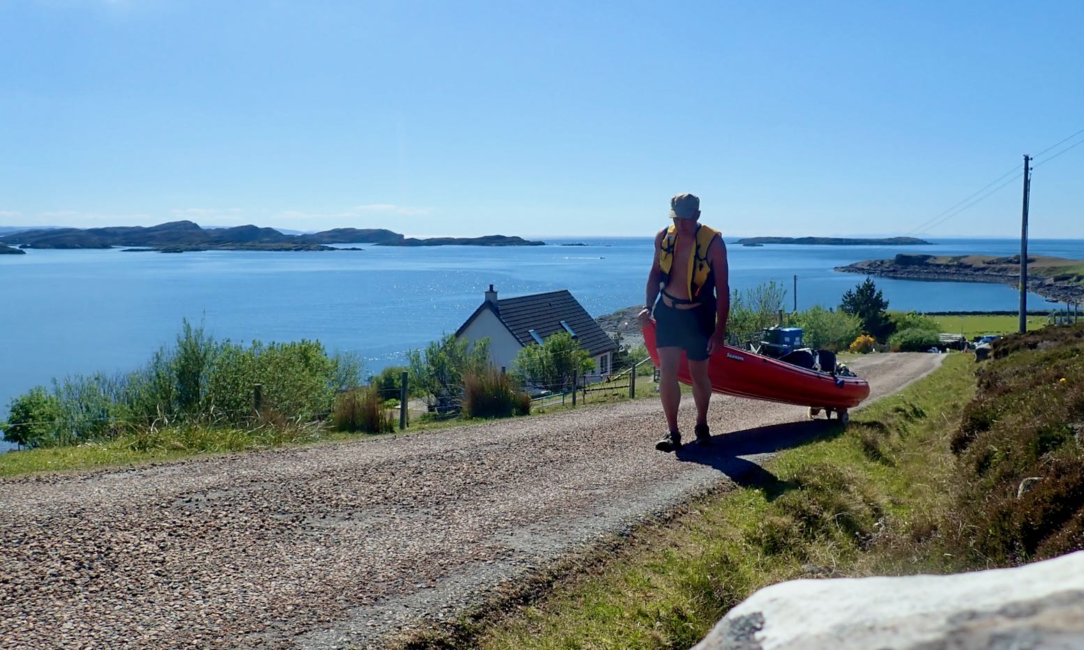
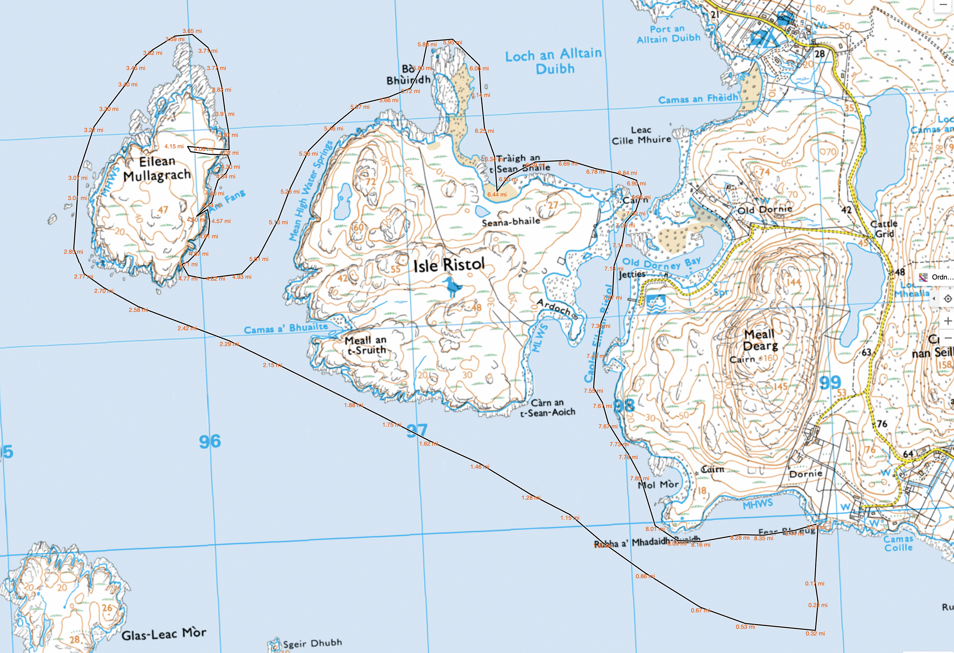
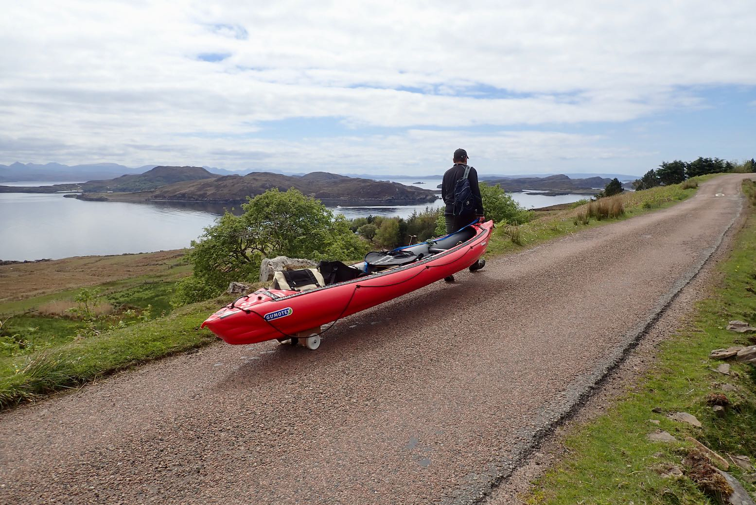
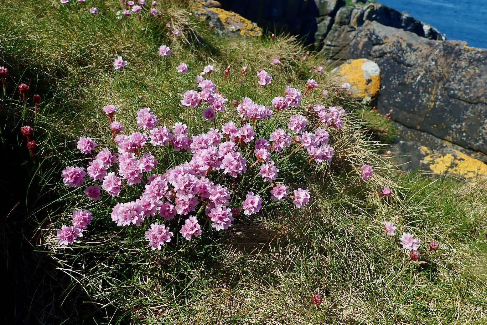
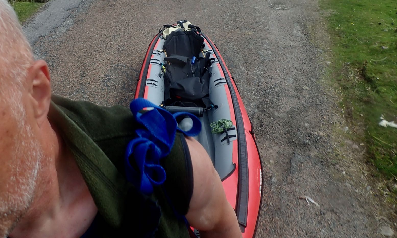
After a fortnight of chilly north winds and a diminishing woodpile, today was one of those rare days in the Summer Isles (far northwest Scotland) where you could paddle pretty much where you liked in an IK. It was also a chance for me to try out my new skeg-wheel trolley which Jon, who was staying down the road, had made for me. With no boat of his own this time, we set off in mine to see what we might see.
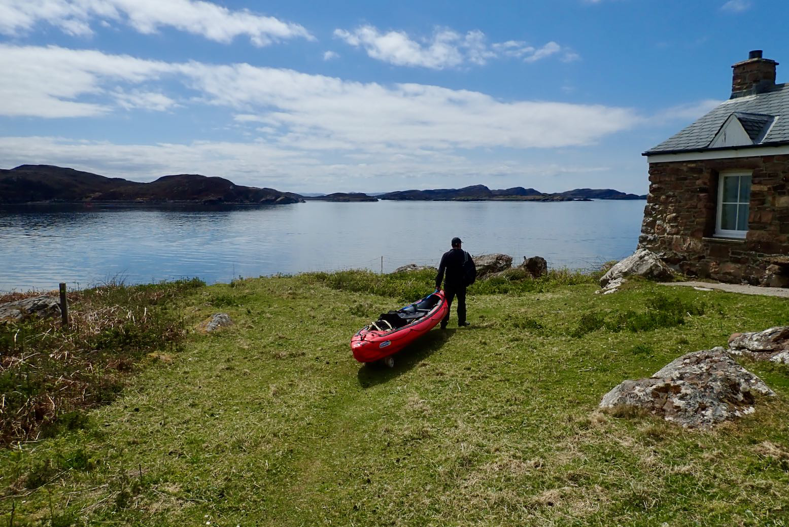
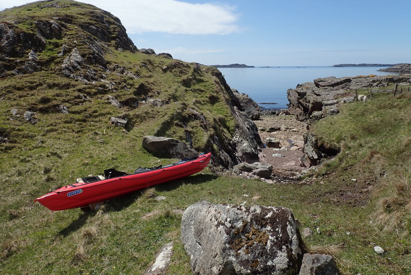
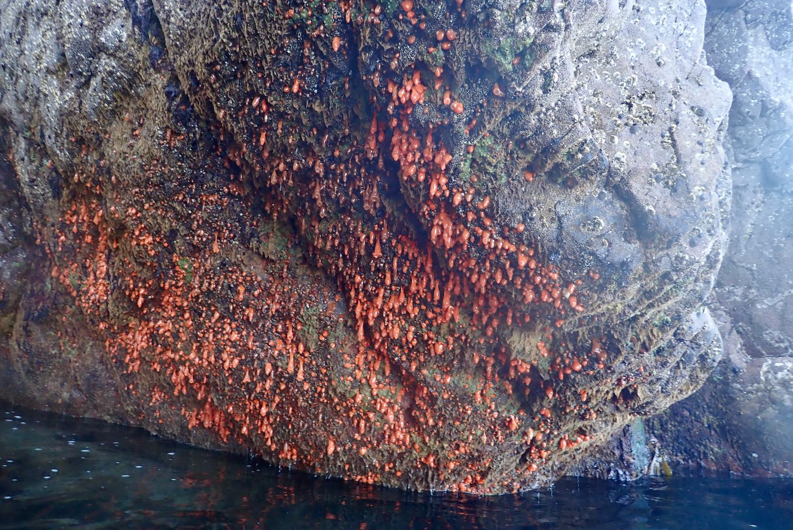
We rolled down the road to the Fox Point, the nearest and least effortful shore access from where I’m staying. Apart from the clatter of the solid wheels, the set up worked perfectly: stable and smooth.The spring tide had bottomed out so we looked for the least ankle-twisting put-in.Fear Bhreug (False Man) slot harbour looked just rightJust a few wet, slime-covered wet stones to negotiateWe have no plan so head towards the Ristol Islands across a glassy sea.With the calm, we take on the outside shore of Eilean Mullagrach; here the refracting northern after-swell makes it a bit choppier with some alarming waves breaking over reefs.Unless you’re a gannet, this is the only way to get onto Mullagrach, a gantry at the northeast tip. Usually alone, I’ve never done it, but with Jon to tend the boat, I climb up.With access so difficult, Eilean Mullagrach was never occupied or crofted. I think it’s now owned by a bird protection enterprise. Perhaps they built this guardrail and cut the steps. There’s what looks like a hut at the island’s south end, just past the (not very) high point.Nice to see sea pink and yellow lichen again. The former mostly found on the sheep-free islands and skerries.View south over the Summers to the Fisherfield mountains.The channel with Ristol behind. Better get back; the taxi’s meter is running.We visit the narrow twin-cave and nearby archPendulous sea growth emerges at very low tidesWe scoot back north out of the channel and take a break on Ristol beach before cutting through Old Dornie harbour back to False Man inlet. I leave my kayak overnight with a plan to come back for more tomorrow.Next morning I’m relieved to see my Seawave hasn’t floated off into the Minch. I top up and decide to head round the outside of Tanera Beg for starters.All is calmish as I cross Badentarbet Bay, but as I near T. Beg an unforecast southeasterly kicks up and keeps on kicking. The west side of Tanera Beg would be too exposed, so I divert into the Tanera Channel, using the lee of the smaller eileans.Nice looking wooden trawler.I’m hoping to at least visit the arch at the southeast end of T. Beg. It’s only 500m away but it’s quite lively and gusty now so I don’t risk it. Instead, I turn east to get into the lee of Tanera Mor, and take a diversion through the usually cut off pool of Acairseid Driseach (these Gaelic words just roll off the tongue).A bit disappointed, I head back to slot harbour but the wind seems less bad or may have passed. So I collect my trolley and strike out for Horse & Goat Island. I estimate it’s about 2 miles across Badentarbet Bay. The wind drops and even becomes a NW tail breeze.It’s actually more like 3.5 miles to the tidal channel between Horse & Goat. By now the spring tide is at full flow against me and I wonder if the two islands have joined up yet. I needn’t have worried; the NW breeze is stronger than any tidal current and there’s at least a foot of clearance.I pull over for a snack and a drink. Last time I was here was with my failed Semperit project. What a nice boat that could have been. I knew from here it would be a 2-mile into the wind hack to Badentarbet beach. Or even more annoyingly, a three-quarter headwind. It’s less than 10mph, but despite pushing hard with my left arm, the boat kept getting pushed right. Where is my rudder now?! I should have picked up some rocks to weight the bow at Horse Island to see if that trick works. Next time I’ll carry a waterbag to do the same; it’s something I’ve read of but never tried.From Badentarbet Beach it’s a stiff climb – 1st gear pushbike – back up the road to Polbain, but on the road the skeg-wheel trolley again makes for easy, hands free towing with the boat hanging from my shoulder via a knotted mooring line. I can walk at normal speed with loads less effort (and time) than carrying the deflated IK. Having a trolley like this makes the IK nearly as versatile as a packraft: a boat you can start here, end there and easily transport back across the difference.
So ends another great 12-mile day out in the Summer Isles whose configuration enables numerous ways to spin out a trip as pirates, winds and stamina allow, and all without getting too far out.