See also:
Seawave 2 Main Page
Newhaven to Brighton
Hayling Island
Seawave 2 rudder
Once we were let out in the Covid summer of 2020, we did a very nice coastal walk from Hastings to Rye along the Sussex coast. Hot, but not so windy, it would have been just right for paddling. Today conditions were similar for a westbound transit from Rye back towards Hastings.
High Water (and a spring tide too) was at a very reasonable noon in Rye, with a forecast of 8-14mph from the east and a bit of a kick at 3pm. I was hoping for the upper limit and a bit of splashy sport, so brought the WindPaddle I’d used on the packraft last month in Scotland in much stronger winds.
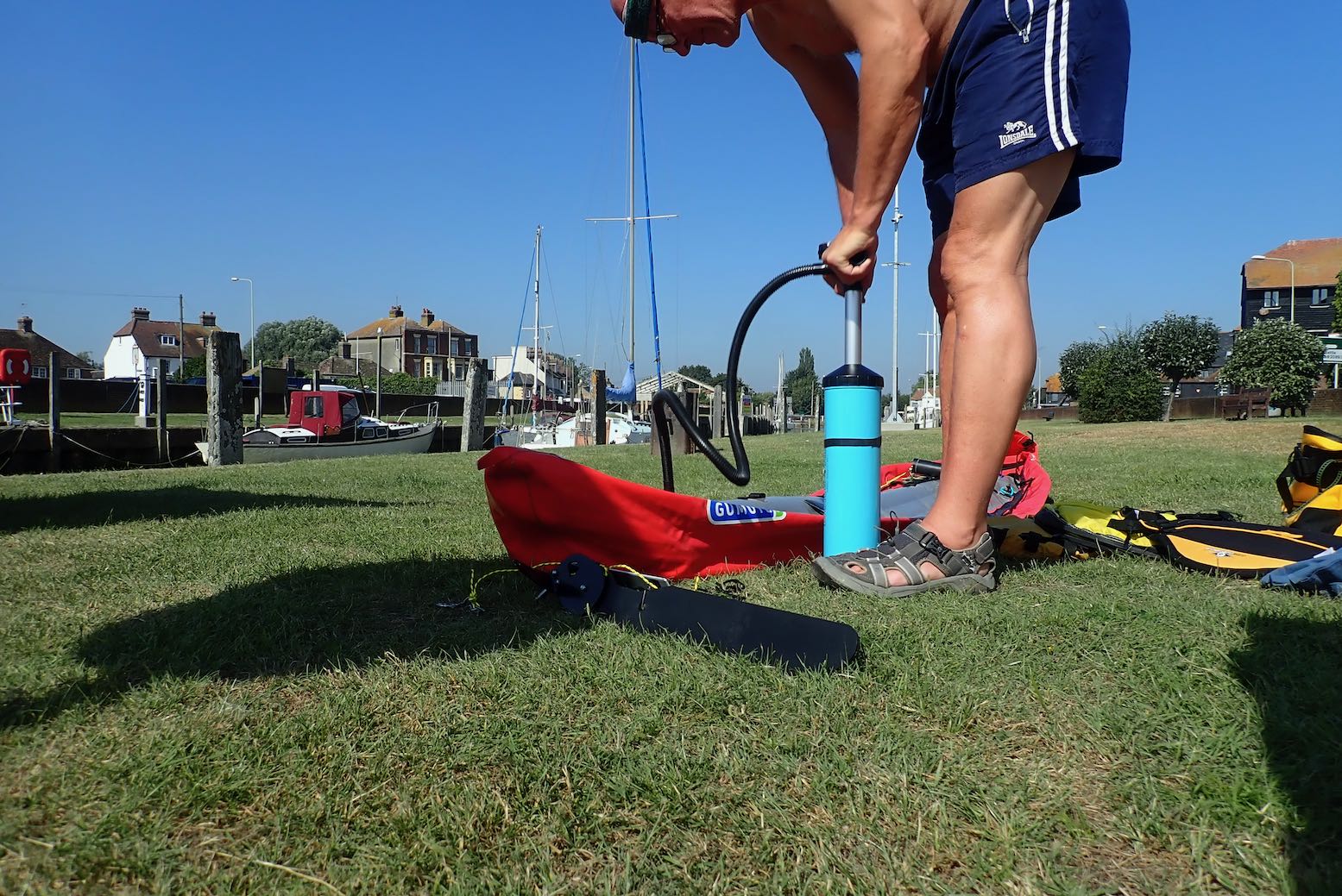
It’s only a 10-minute walk from Rye station to a boat ramp on the quay where the water was still inching up the concrete as I pumped up the Gumotex.

I was taking a gamble trying my untested new rudder set up. Because I expected it to play up, I fitted the stock skeg so I could lift a problematic rudder and carry on as normal without coming shore. To be without a rudder or skeg with a backwind at sea would not be ideal.
Being the ever recirculating goldfish, I forgot to try out my sail stick mount idea.
Rye hasn’t been on the coast since 1287 or so when, along with gradual land reclamation, the biggest of a series of 13th-century storms filled the adjacent marshy inlet with silt and shingle which finished off semi-abandoned Old Winchelsea and radically redrew the low-lying coastline where the Kent and Sussex borders meet. It was the same in Pevensey to the west.
The gif on the left from this interesting regional website shows how the coastline of southeast England was transformed in the late medieval era. Where the Rother river once flowed directly east to enter the sea at New Romney, the filled-in bay saw it diverted south below the old hill town of Rye, now stranded two miles from the sea.
The then important port of Winchelsea was rebuilt on its present site in 1288, but eventual silting saw both it and Rye’s maritime importance decline. What this area may lack in epic spaces common to the north and west of Britain, it gains in fascinating history. 1066 and all that.
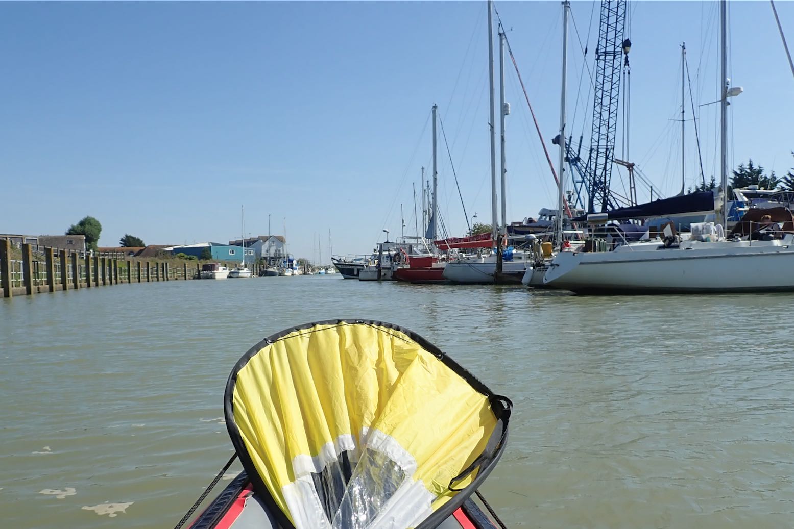
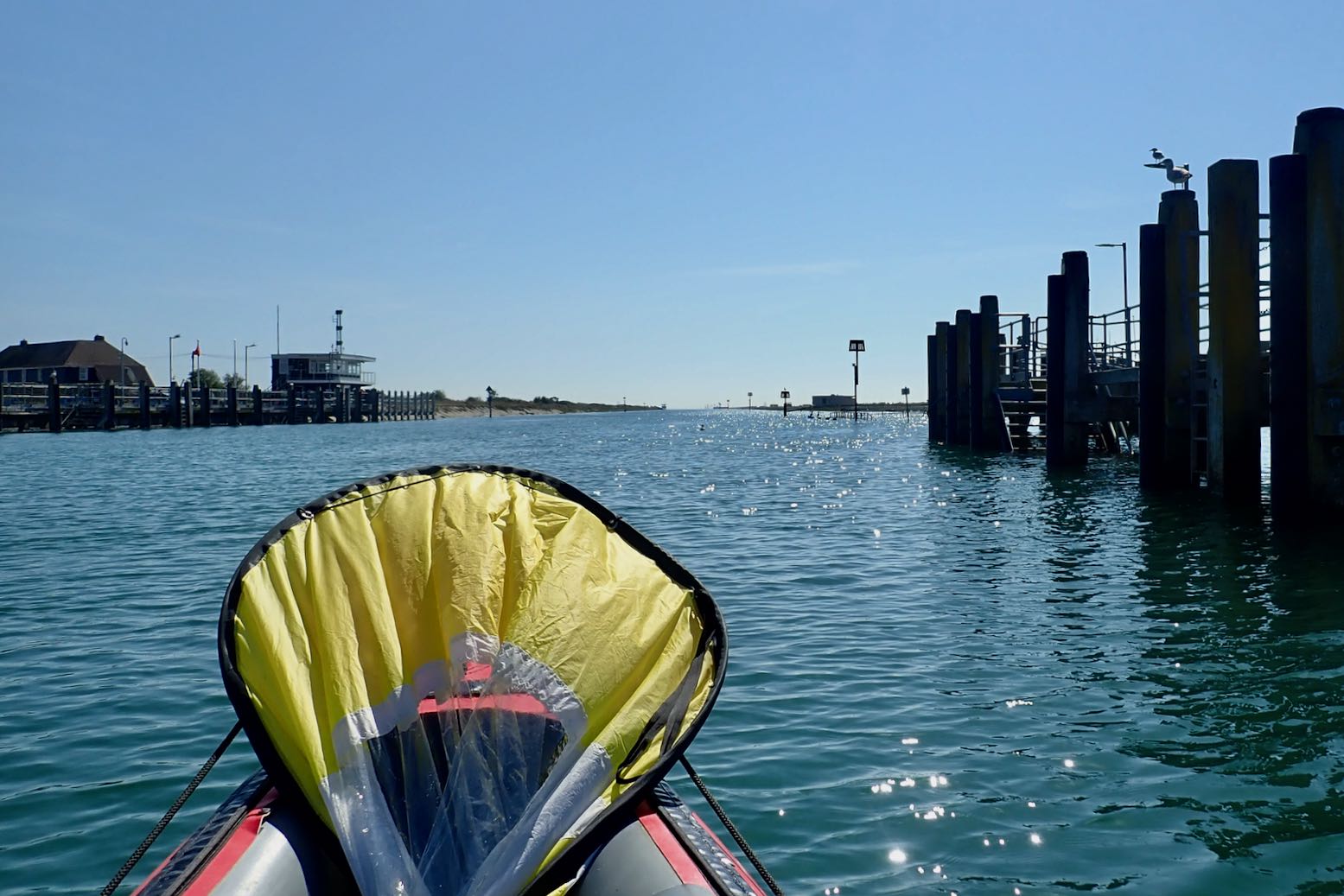
I set off along the River Brede which wraps around Rye’s south side like a moat, and soon joins the Rother. It’s about 5km to the open sea.

I’m into the wind but the grass banks are under water and the wind turbines are spinning merrily; all good signs.
Rye Harbour. The tide is high and I’m moving on.

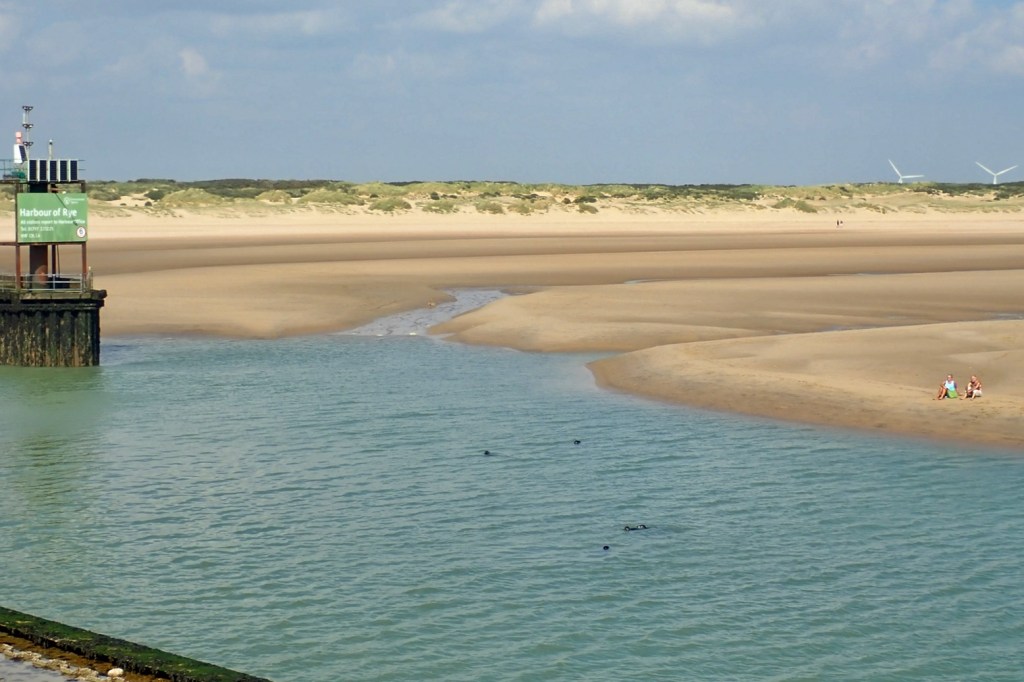
In 45 minutes I reach the old breakwater opposite Camber Sands where I recall bucket & spading as a child. The sea looks depressingly flat.
Seals at the river mouth (a few days later).
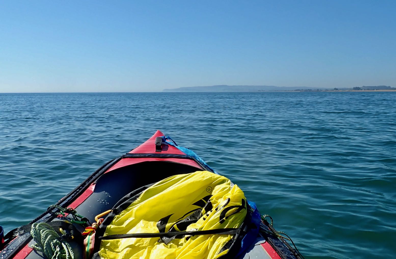
It’s nearly 10km to the distant cliffs, a two-hour haul. And with the breeze from behind, I’m soon streaming with sweat. I’m not sure my water will last.


Going with the Flow
A few years ago while planning Newhaven to Brighton, I learned an odd thing about Sussex and Kent tides. For the last two hours of the incoming (eastbound) flood, the tide keeps rising but reverses westbound along the English coast as it backs up at the Straight of Dover and spills back down the sides. That makes HW is around the same time in Folkestone, and 140 miles to the west, past the Isle of Wight, but HW at all the places in between lags behind.
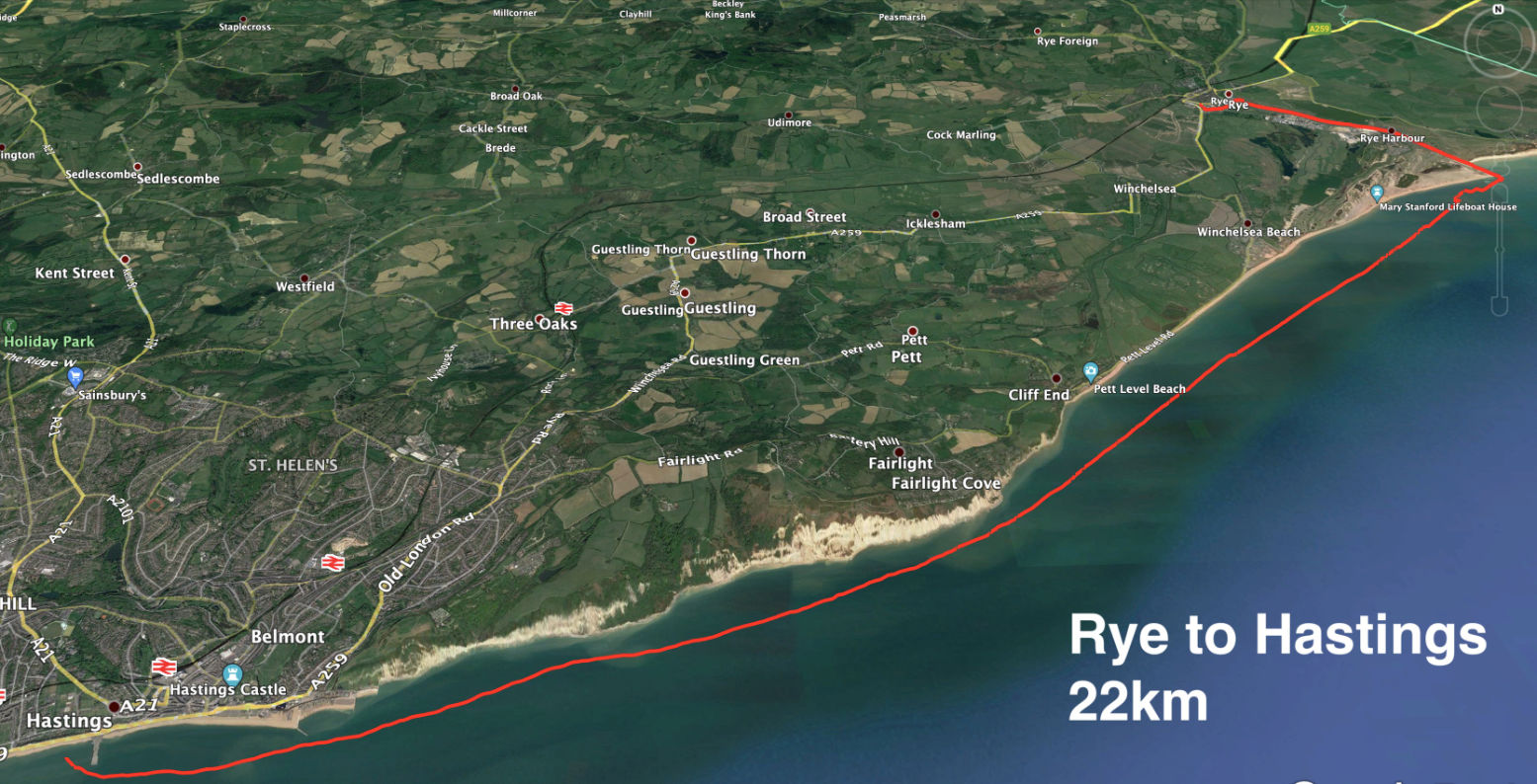
Tidal steams are not that strong here – wind will have much more of a bearing on paddling – but this means you get only four hours eastbound flow with the flood tide and prevailing southwest winds. But if you time your run with a warm easterly off the continent and go westbound – as I did on this occasion – you get a much longer run with the tidal current; eight hours or more; maybe 45km all the way to Eastbourne. The question is: can you paddle that long.

A breeze picks up so I flick up the sail. I check my GPS and am doing 3-4kph, while I can paddle at around 5-6kph. Then the breeze drops away. I wasn’t really planning to paddle the full 30+ clicks to Cooden station, but I can always get off at Hastings, a few stops before.
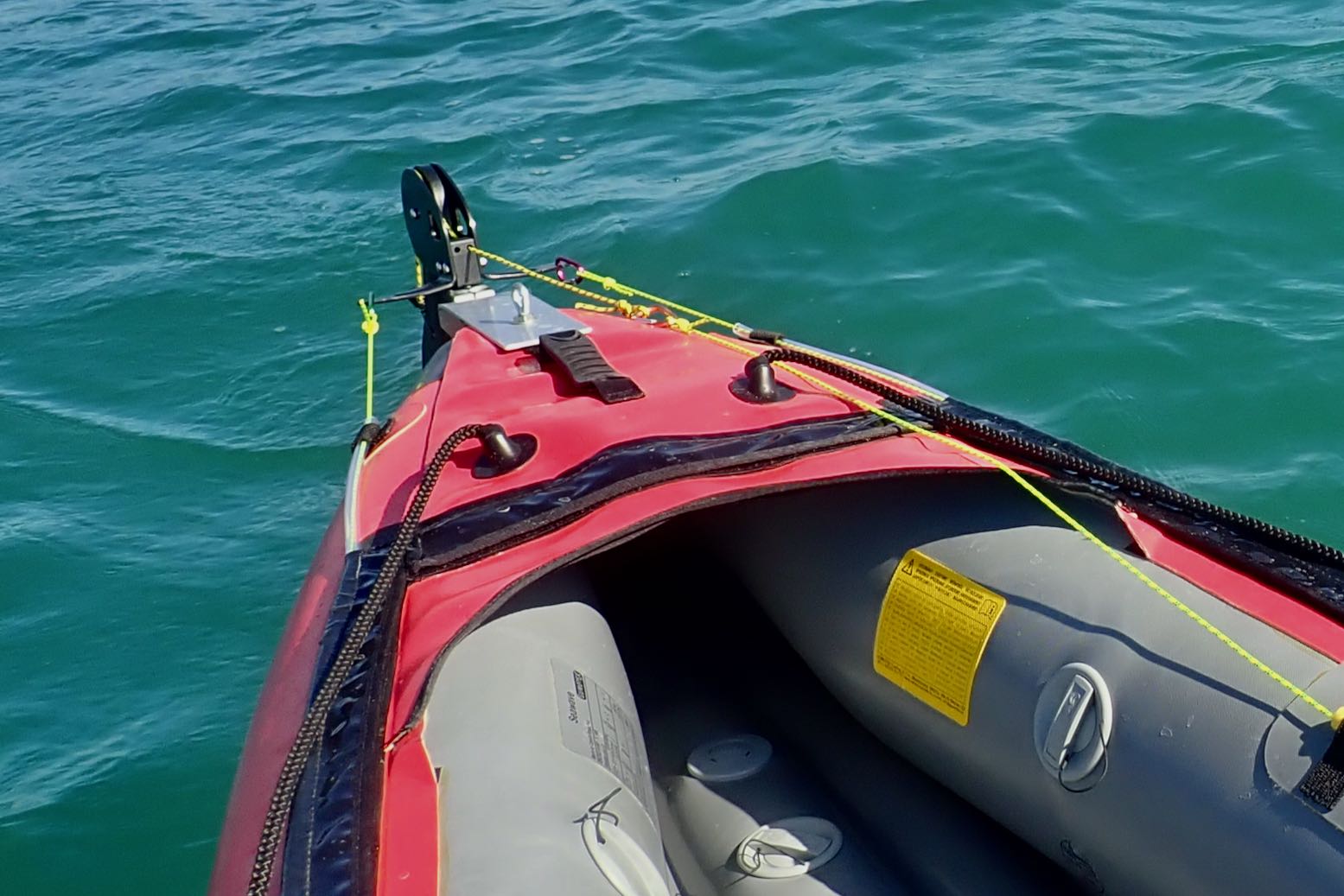
At least the rudder seems to working as it should, though any quick response is dulled a little by the skeg. A rudder’s not really needed in these conditions, though it compensates for me being blown gradually onshore.
I’m trying a rudder lift-line only, not a rudder lowering line as well. But once in the boat I find I can’t turn enough to even see the lifted rudder to flick it down with the paddle, so I’ll probably fit a drop-line later.

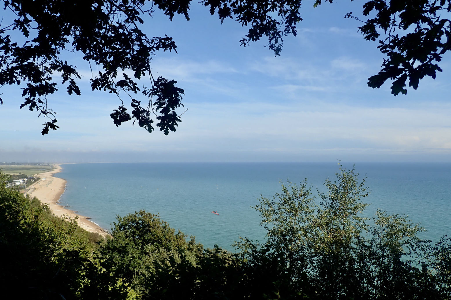
I creep along the expanse of Winchelsea Beach. It’s hot work in a backwind. Eventually I reach the start of the cliffs where the coast turns more east-west, putting the wind directly behind me. But paddling at effectively wind speed, there is no cooling effect. More familiar with paddling at the other end of Britain, I’m not used to 27°C.

Then, as predicted, around 3pm the breeze picks up and I can get the sail up.

Paddling half a mile from the shore, initially it was hard to know if I’m moving and at what speed. So waking up the GPS screen was a handy way of telling if the sailing speed was worthwhile.
With the odd gust I reach nearly 7kph, but average less than 5kph, a bit slower than paddling, but I’m not dripping like a leaky tap or needing to drink. In fact I could nearly doze off.
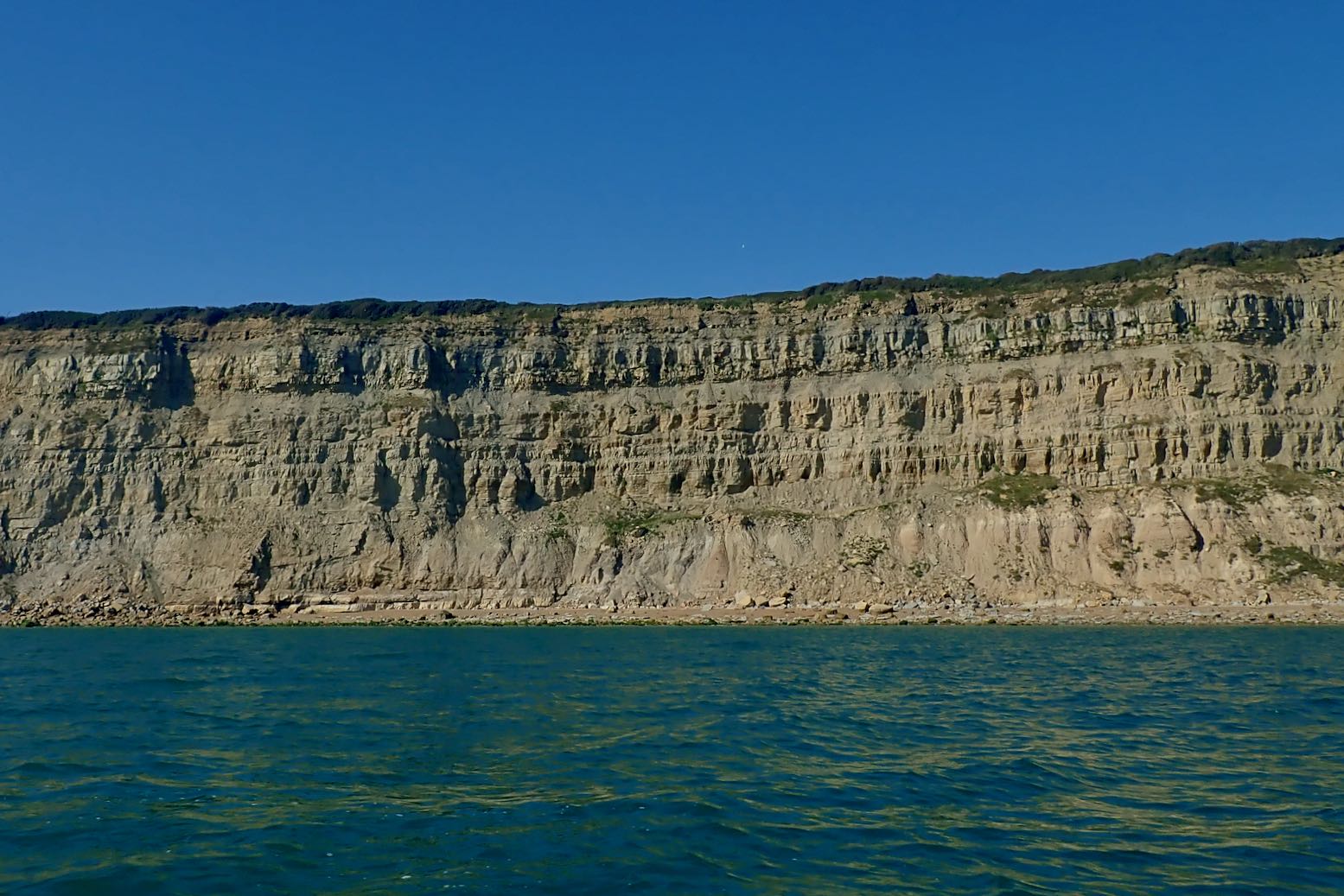


The cliffs inch by. This is the sea end of the Wealden sandstone formation, less high and steep than the better known chalky Seven Sisters to the west, or Dover’s white cliffs to the northeast. Both chalk cliffs are part of the same formation or bed, but when the land was squeezed and uplifted to the dome or hump was eroded away to expose the older sandstone below. This is what they call the Weald, and near Tunbridge Wells, East Grinstead and Frant, the weathered sandstone ridge produces small outcrops where I started rock climbing as a teenager (right).


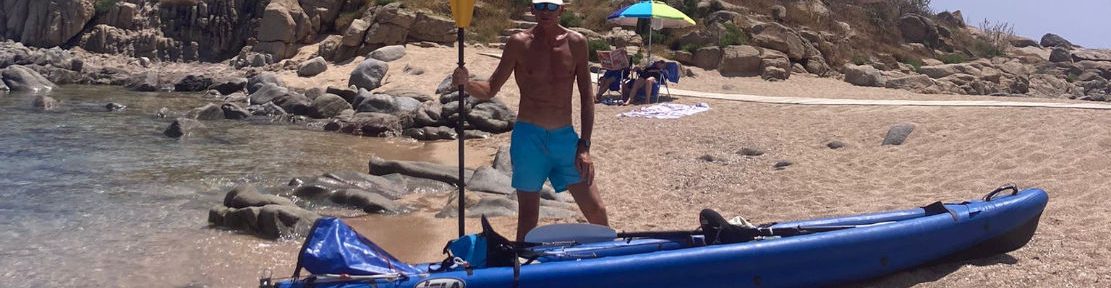
I pass the Stade, the east end of Hastings where the cliffs drop back down. A few souls are enjoying the last day of summer on the shingle beach.
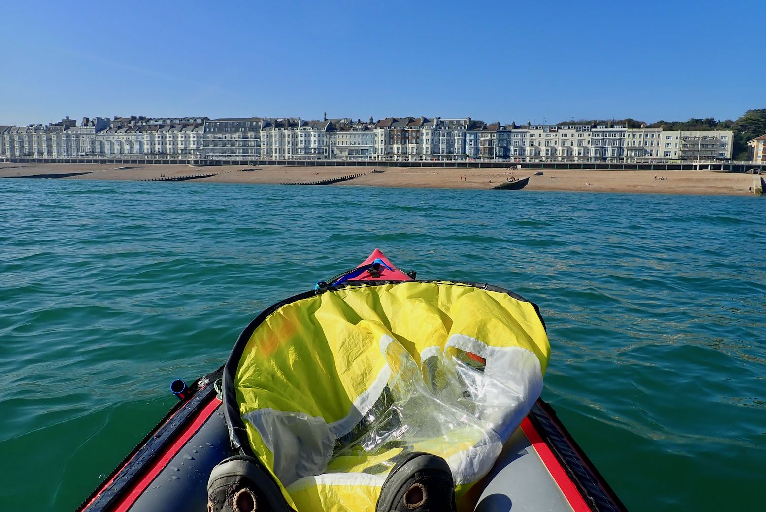
I keep going to the pier and decide to have a leisurely take out there. It’s gone 4pm so another 10km to get the train 6.15 from Cooden would be a rush.


Landfall by Hastings pier.
Compared to the fabulous Summer Isles, for me these southeast coast paddles lack drama and interest, but are easy to reach if tomorrow’s weather looks good.
We walked Hastings to Rye again a day or two later; it took about the same time and was more enjoyable (though it was cooler).
The rudder foot pivot worked fine, though needed a bit of re-tensioning at the pier. Next time I can confidently leave the skeg off, though I can see a rudder would only be needed when sailing or paddling in windier conditions. That is all I have to say for now.
