Anfibio TXL main page
Kimmeridge ledges
Swanage stacks
Dancing Ledge
Packraft sailing to Lulworth
Kimmeridge to Chapman’s Pool

‘Calm… caaaaalm’. It’s what you say to a hyperactive child. But it’s also what you observe as you scan a weather forecast: 3-4mph onshore southerly, backing southeast later. With sunshine too, it could be the Last Good Day of the Summer.
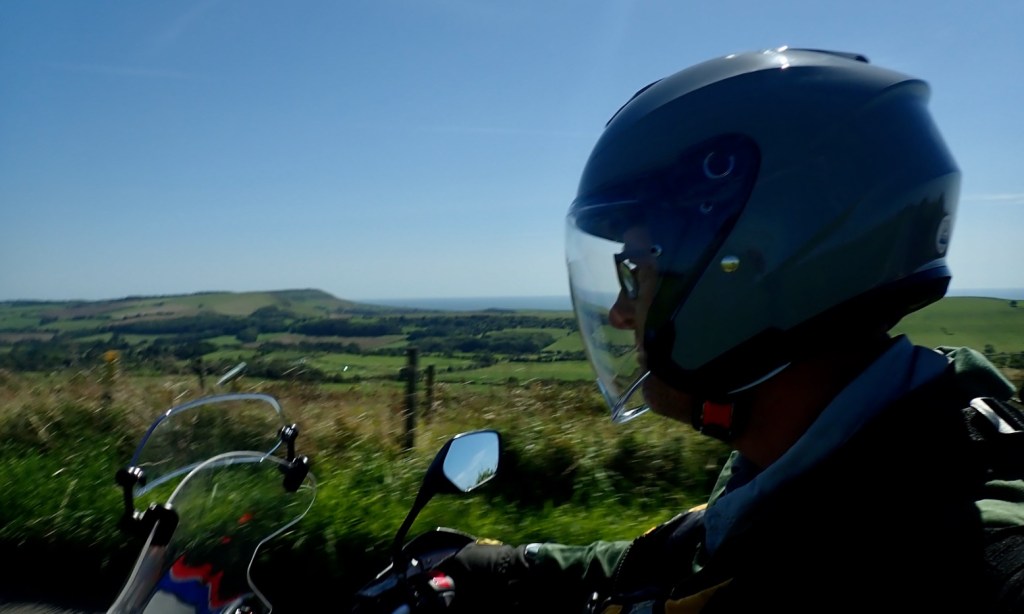
I left my moto just as they’re opening the gate down to Tyneham ghost village. From there the Mrs drives me on up the coast to lovely Lulworth Cove for a sneaky 9am bacon buttie. I do worry about my B12 levels sometimes.
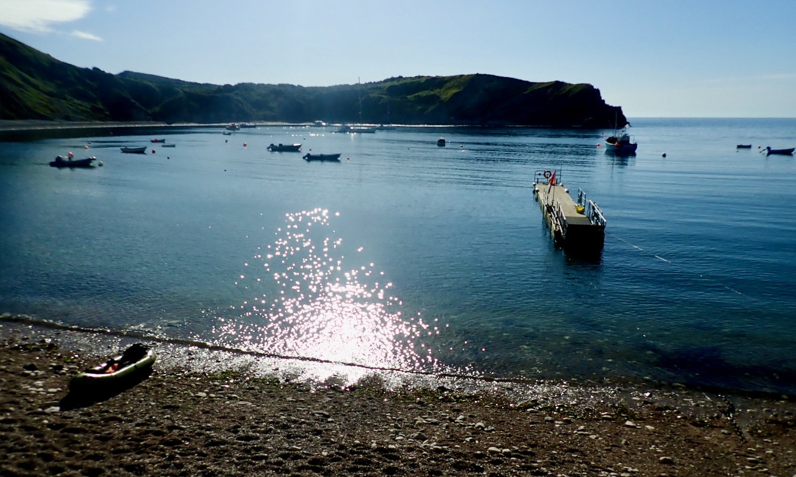

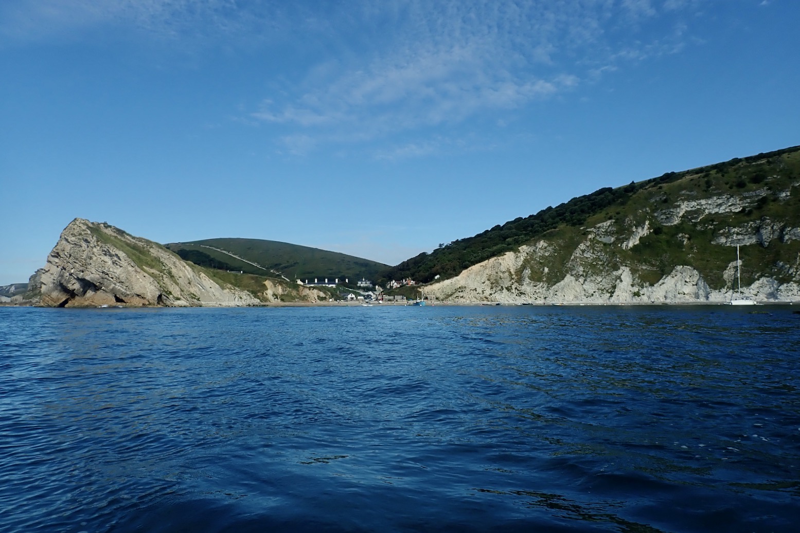
“Oh wow!” squealed a little girl as she also arrived with her family at Lulworth beach. And you can see why; it’s an amazing natural feature which along with others help make Dorset’s Jurassic Coast a World Heritage site. Within an hour the renowned amphitheatre would be standing room only but hey, it’s August on the South Coast; if you want a lone beach, pack a mac and go to the Outer Hebrides.


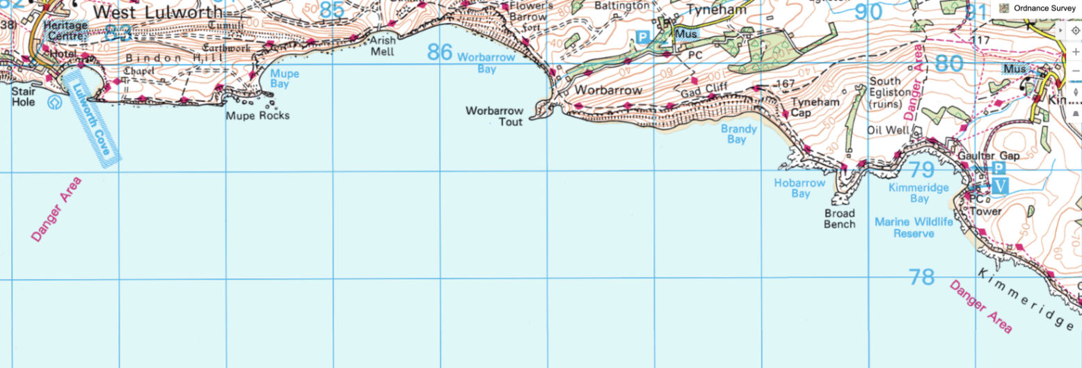
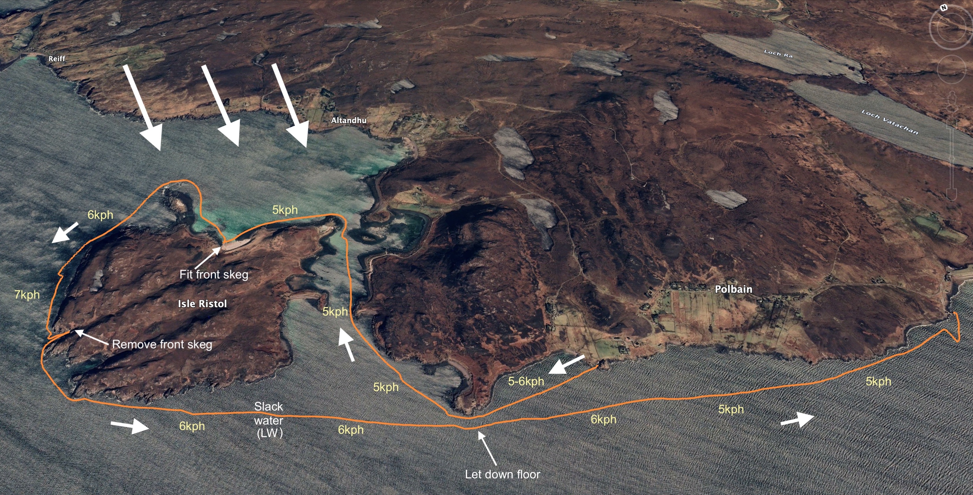
Today’s plan was head east 9km to Kimmeridge Bay as I gradually joined the dots packrafting Dorset’s Jurassic Coast.
This time last year Barrington and I sailed here from Ringstead Bay near Weymouth, before getting sent into Lulworth Cove by an army patrol boat. The following eastward section of coast is an army firing range that’s only open to the public on weekends or throughout the August holiday season. And even then, some landing spots are closed, and inland you have to stick to the paths in case you step on an unexploded bomb. Tragically that happened in 1967, though thankfully only once and as a result, today warning signs along the footpaths are everywhere.
Once out of the cosy Cove, the first section should be easy enough, but if not I could hop out at Warbarrow Tout, walk a mile to the bike at Tyneham and ride home. Continuing all the way to Kimmeridge depended on confidence and energy levels, and how the sea actually looked once out of the sheltered Cove.

Today I’ve remembered everything, including my repaired Multimat floor pad. All you need is to get into a routine; let me know how to do that. And as I set off towards the Cove’s mouth the TXL definitely has its glide on. I have two hours before the tide turned and the wind with it, but right now the boat felt great. I even remembered to pull up my knees straps, and felt nicely connected between the TXL and my paddle blades
Towards Mupe Rocks I had the odd sensation of offshore waves bouncing off the cliffs – it made getting close tricky. I see on an online marine chart (below) the seabed drops off quickly here so the swell just rolls in and boings back out.
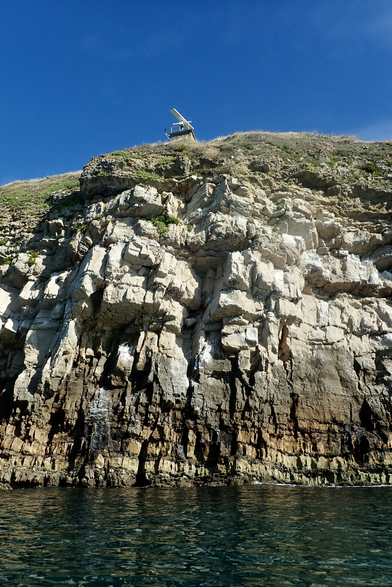
They say there’s a petrified tree here somewhere – or ‘Fossil Forest’ in over-heated tourist-speak. But I learn later it’s by a path on the cliff top where there are also periodic radars (left) and other sinsiter MoD installations.

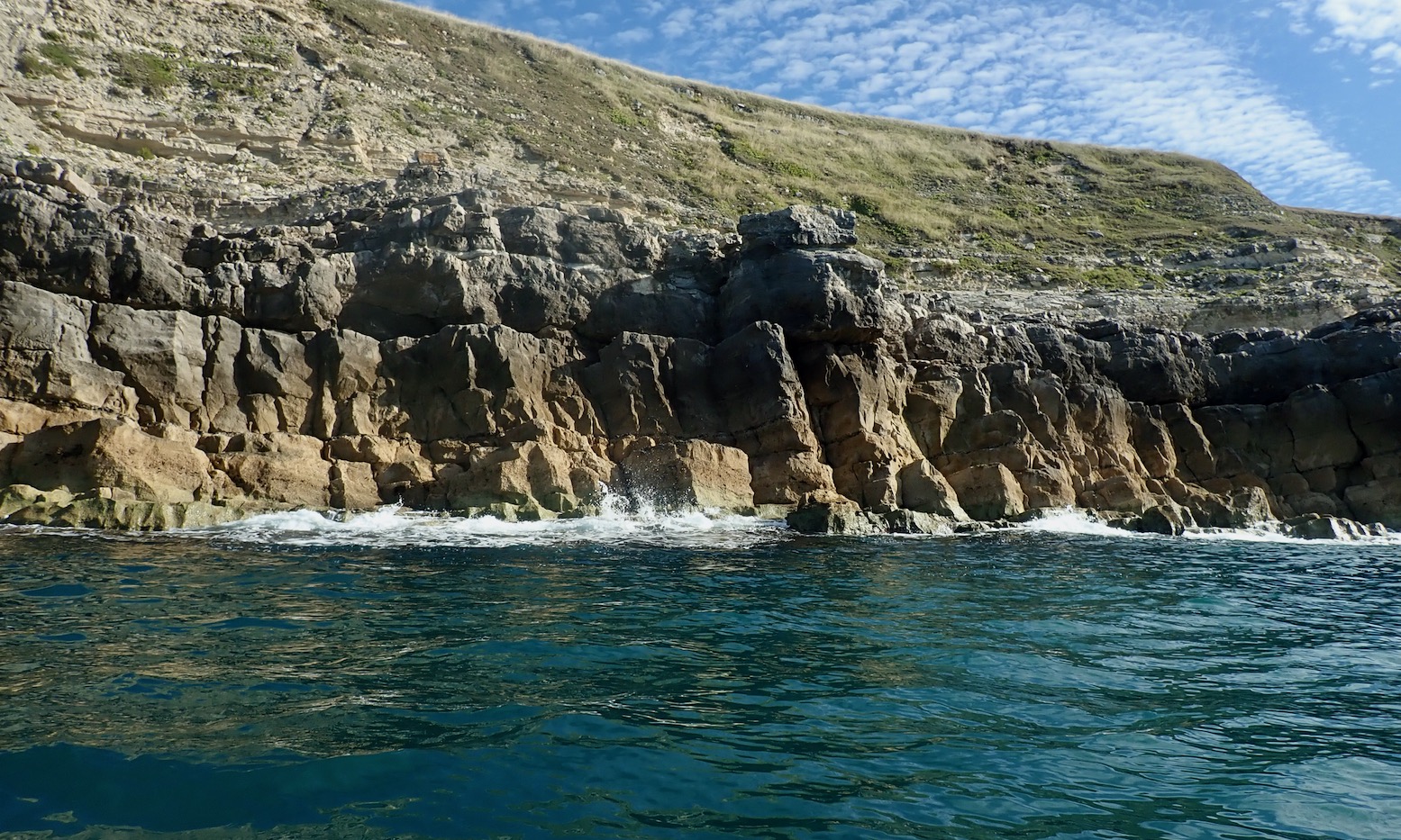
Mupe Rocks turn out to be rather ordinary remnants of fallen cliff, not like the gleaming white chalk stacks I paddled last week near Old Harry. With no interesting arches or caves, I thread about but they’re a bit disappointing.


Seaweed streams reassuringly eastwards with the rising tide, and as I round the corner Mupe Bay opens up, revealing half a dozen moored sailing boats. Behind them rise the steep chalk cliffs which you can see for miles down the coast.


I wonder about putting ashore at a gap in the cliffs called Arish Mell because I can. But perhaps I can’t, even in August, if I have interpreted the map warnings correctly.
Behind the beach I spot some huts, shipping containers, pickups and activity. As it is, my equilibrium is disturbed by some strangely large waves rolling in across the middle of otherwise calm Warbarrow Bay. A submarine shelf? They’re not crashing ashore as far as I can see, but I decide to stay out in the Bay.

Turns out Arish Mell is off limits 24/7/365, using the proven UXO gambit which didn’t seem to be bothering the chappies ashore today.
Another possible reason may be that from around 1959-1990 give or take, ‘slightly radioactive effluent’ was piped out here from the former Winfrith nuclear research facility a few miles away near Wool. They’ve been decommissioning Winfrith ever since, and we should be grateful that with much effort they saw fit to extend the outfall pipeline two miles out to sea. You can see the pipe on that marine chart above. Coincidentally, this week Japan started doing the same thing at the damaged Fukushima reactor, raising the ire of seafood enthusiasts in China. Meanwhile, this well-produced 1959 Atomic Energy Authority promotional film describing the pipeline project seems very proud of itself.
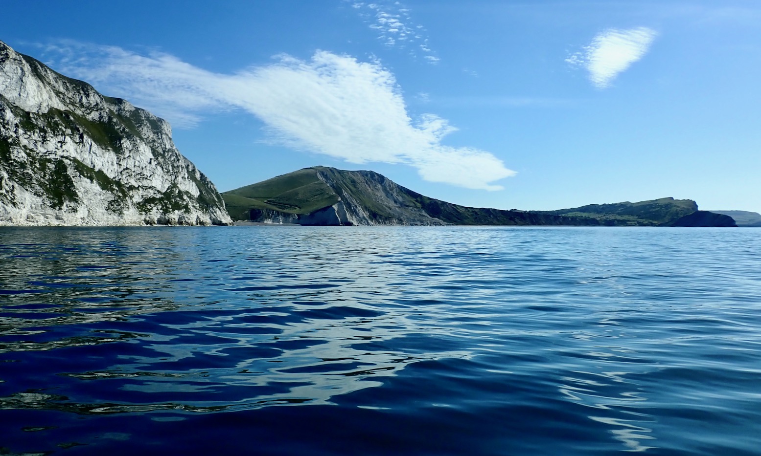
So I set course for the conical headland of Warbarrow Tout (old English for look-out) at the far end of the Bay. The sinister waves subside and something else changes: the TXL glides across the smooth surface effortlessly. I am able to draw a long, slow, kayak-like paddle cadence, not the usual thankless spinning.
Later the GPS data revealed the combination of windless conditions and the Multimat helped the raft skim along at up to 6.2kph or 3.8mph. I’m not sure it’s ever sailed that fast so, even aided by the final hour of a modest, metre-high tide, that’s quite impressive.
Actually, I don’t know why I’m so surprised. Although I seemed reluctant to admit it initially, the first time I tested the TXL with the Multimat in the Summer Isles, the evidence was right there (left), even if it wasn’t night and day.

As I neared the Tout I was anticipating some sort of disturbance from an eddy being pushed out by the eastern hook of the Bay. Sure enough, the TXL passed over a patch of clapotis without breaking it’s stride, but as I moved on past Pondfield Cove (a mini Lulworth) something changed again – the boat seemed to slow to a crawl. The coastline was creeping along but a check the GPS only registered a slightly slower speed.

As usual with winds, other anomalous currents and flotillas of irate pirates, I wondered if this would set in or get worse all the way to Kimmeridge, with get-offs but no take-outs along the way. I decided to carry on below the Gad Cliffs to the prominent Wagon Rock and if nothing changed, I’d turn back and walk out to Tyneham.

But by Wagon Rock the countercurrent had subsided and the GPS later showed I resumed the steady 6kph pace. Sea paddling alone an semi-appropriate boat makes you more alert to minute changes in conditions which a sea kayak would pass with barely a shrug. I later wondered if it was possible the eddy from the hook formed by Warbarrow Tout could draw back or suck in a current ‘beyond’ itself, as shown below. Who can fathom the mysteries of fluid dynamics?

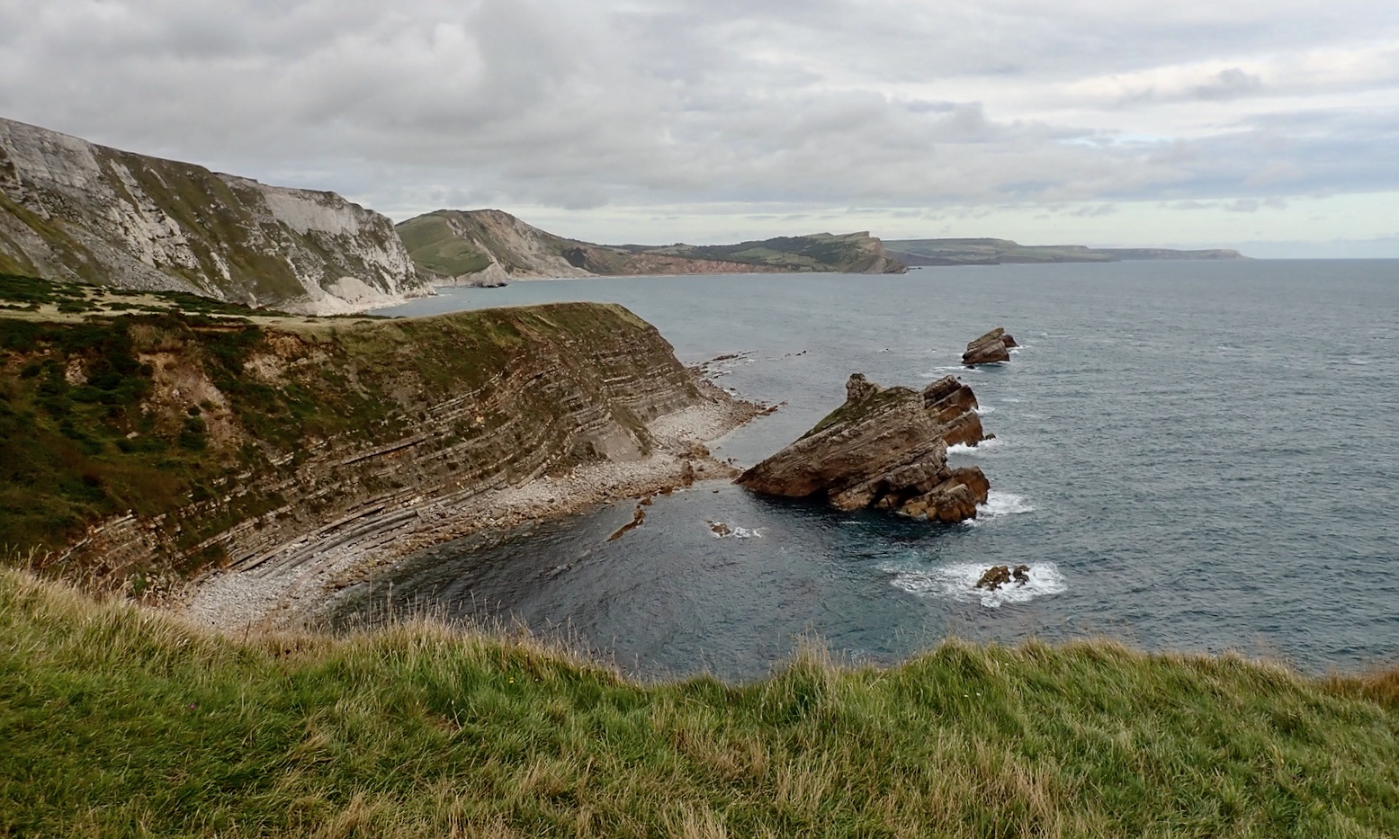
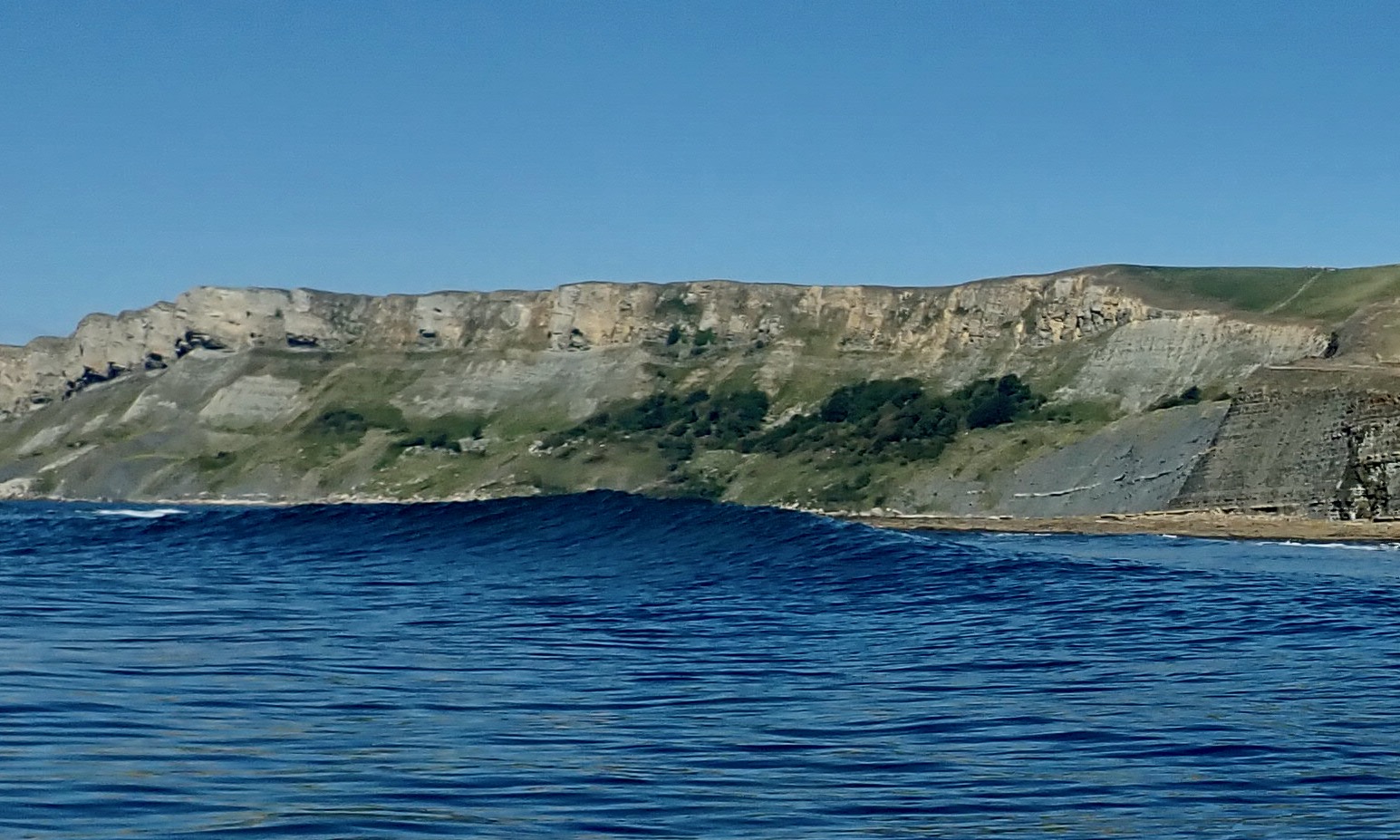
Beyond Wagon Rock the grey sweep of Brandy Bay‘s oily shale cliffs plunged down to the sea. Up ahead I was reassured by the sight of Clavell Tower, just 3km away, marking the far side of Kimmeridge Bay. Less comforting was the breaking water between me and it: the ledges of Broad Bench spotted when I paddled the Igla here a few weeks ago. It would be alarming to have one of these rise up on you out of the blue (below).

As always, the solution to such unpredictable seaside disturbances was to paddle further out, even if the instinct (and interest) was to hug the shore. I aimed for the distant St Adhelm’s Head and safely rounded the churning maelstrom of Broad Bench, with the bedrock visible a few feet below. That done, the crossing was in the bag and I worked my way towards the beach where crowds were streaming down to the shore with their dogs. Nine clicks covered in less than two hours from Lulworth. Not bad.


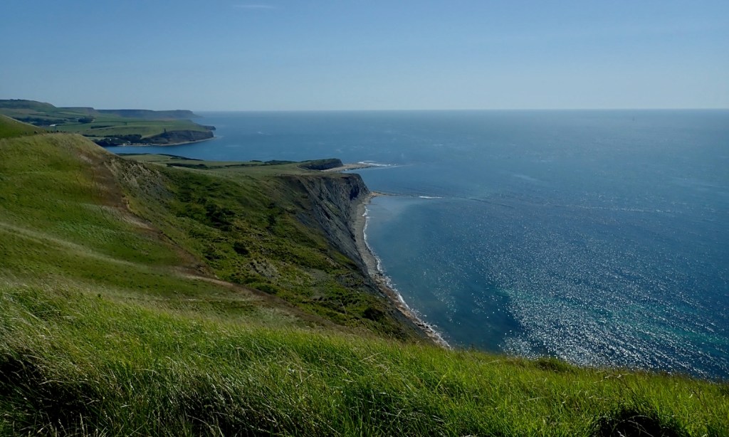


A few weeks ago we walked the coast from Tyneham on a very windy day. At low tide the ledges at Brandy were a froth of white foam (above). Today, walking back 4km to Tyneham, the Long Ebb shelf delineating Hobarrow Bay was already emerging from the retreating tide. Looking back, I was reminded the nearby big shelf (left) behind Broad Bench was worth a nose about for fossils or dubloons, even if MoD poles discourage this and you can only access it by boat. It’s one for next time.

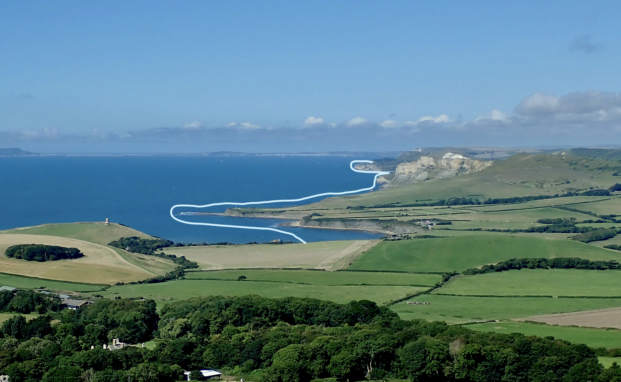
Midday and Tyneham car park is already packed. Another section of the Jurassic ticked off or recce’d for another pass. Hopefully there’ll be a chance to do the 6km from Kimmeridge to Chapmans Pool before we roll up for the winter. That will leave the two points of St Adhelms and Durlstone for the next caaalm day.