Tag Archives: Hayling Island

Kayaking Hayling Island

See also:
Brighton Coast
Rye to Hastings
Swanage stacks

hav - 6

Time to knock out a long-planned circumnavigation of Hayling Island near Portsmouth while this amazing summer lasts! P-Day came along and by chance, the weather and tides lined up: high 20s °C with a 3-m neap and a calm morning before a 10mph onshore afternoon breeze.

hav - 1

I’d ridden down and recce’d the harbour entrances a couple of years back and last year we’d tried to reach the harbour along the canal from Chichester, but that plan didn’t work out. You’ll find lots of useful descriptions online, but it pays to recall (as I learned on a run to Brighton) that on the English southeast coast the tide (which floods eastwards and ebbs to the west) turns eastwards from two hours before high water to four hours after. So while the water is still dropping the current reverses. The Brighton post explains it (and I’ve since found an interesting animatable graphic here) and it may also explain why we passed deserted beaches and got to turn north into Chichester harbour entrance surprisingly quickly, even if it was near calm. Occasionally a rogue wake rippled in from a distant freighter out in the English Channel.

haylingmap

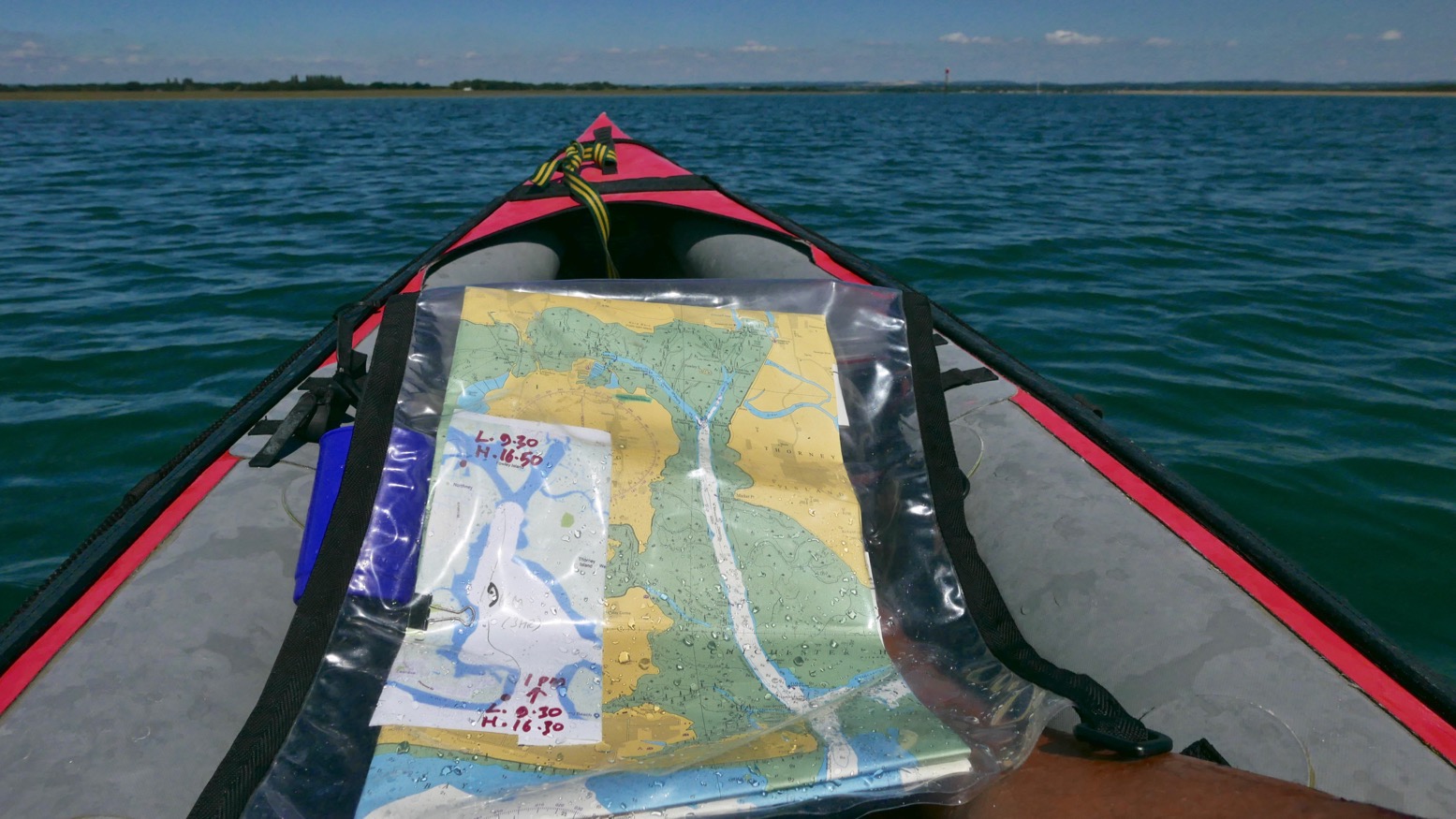
It was soon clear that my estimation to cover this 22km lap was way too long. Shooting along the channels visible on the map above, mudbanks to left and right limited side exploration and we ended up under Hayling bridge (KM13.5) in just 2½ hours including lunch and a few drifts.

hav - 5

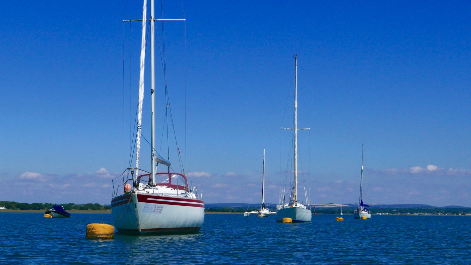
On the way we passed a lot of moss-covered sailing boats, lots of birds including oyster catchers (didn’t know you get them down south) and up nearer Northney marina, a brace of SoTs and a young couple struggling to control an under-inflated (or leaking) Sevy K2. Our high-pressure Seawave glided smugly by.

hav - 8

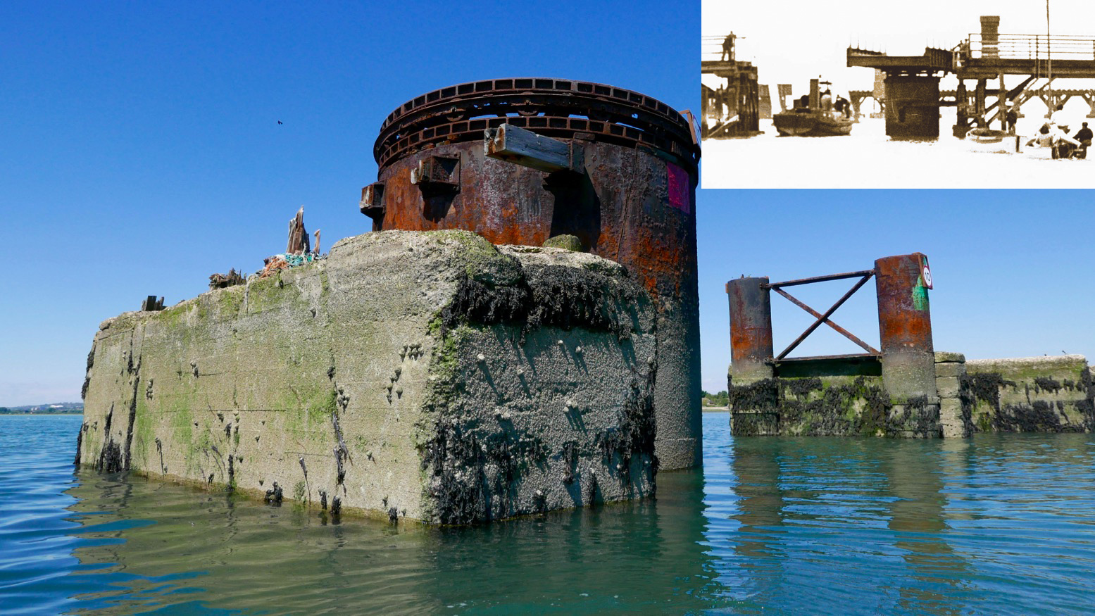
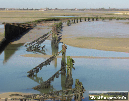
With less than half the tide in, there was already plenty of water to pass under the road bridge and between the stumps of the old railway span alongside. A huge rusting drum suggested a swing bridge to allow boats to pass; online later, sure enough, that’s what it was (left, see inset); a railway running from 1865 for just short of a century. When we drove off the island at about HW, it was the drum was only thing above water.
Chichester harbour is packed with parked-up sailboats (‘moored’ some might say), but Langstone is virtually empty, possibly because i’s shallower and with a much narrower entrance. These natural harbours formed after the last Ice Age and take about seven hours to fill, but drain in only five. And because they drain right down to unfathomable mudflats on which even a gannet in snowshoes can barely walk, exploring side creeks can only be done with the high water clock ticking.

To aim for Langstone exit channel from the bridge, head for two tall poles visible to the SSW. By now the wind was in our faces giving a greater impression of speed, but the tide was coming in for another two hours (or do I add/subtract two hours? My brain hurts). We were way too early to catch a roiling ride out the 250-metre wide Langstone channel back into the Solent. We’d have to hack our way out along the side, like a Maori war party.

hav - 10


Long before we got there we could hear the intimidating wail of jet-skis haring up and down the channel. They have such a bad rep and the two-stroke din doesn’t help endear them. If they sounded like Ducatis or Bonnevilles we’d be queuing up for a go!
We passed the famous Langstone Pumpkin (above; a lost novel by Wilkie Collins), and soon after, hopping out to wade against the tide over the shallow Sinah Bank saw me sink into the vile black quicksludge which Collins used for the demise of his fickle heroine.

hav - 11

Nearing the channel I sought to dodge the in-pouring current by passing under the gantry of the Hayling Island ferry. Then I announced ‘All hands on deck! Prepare for ten minutes of full steam ahead’.
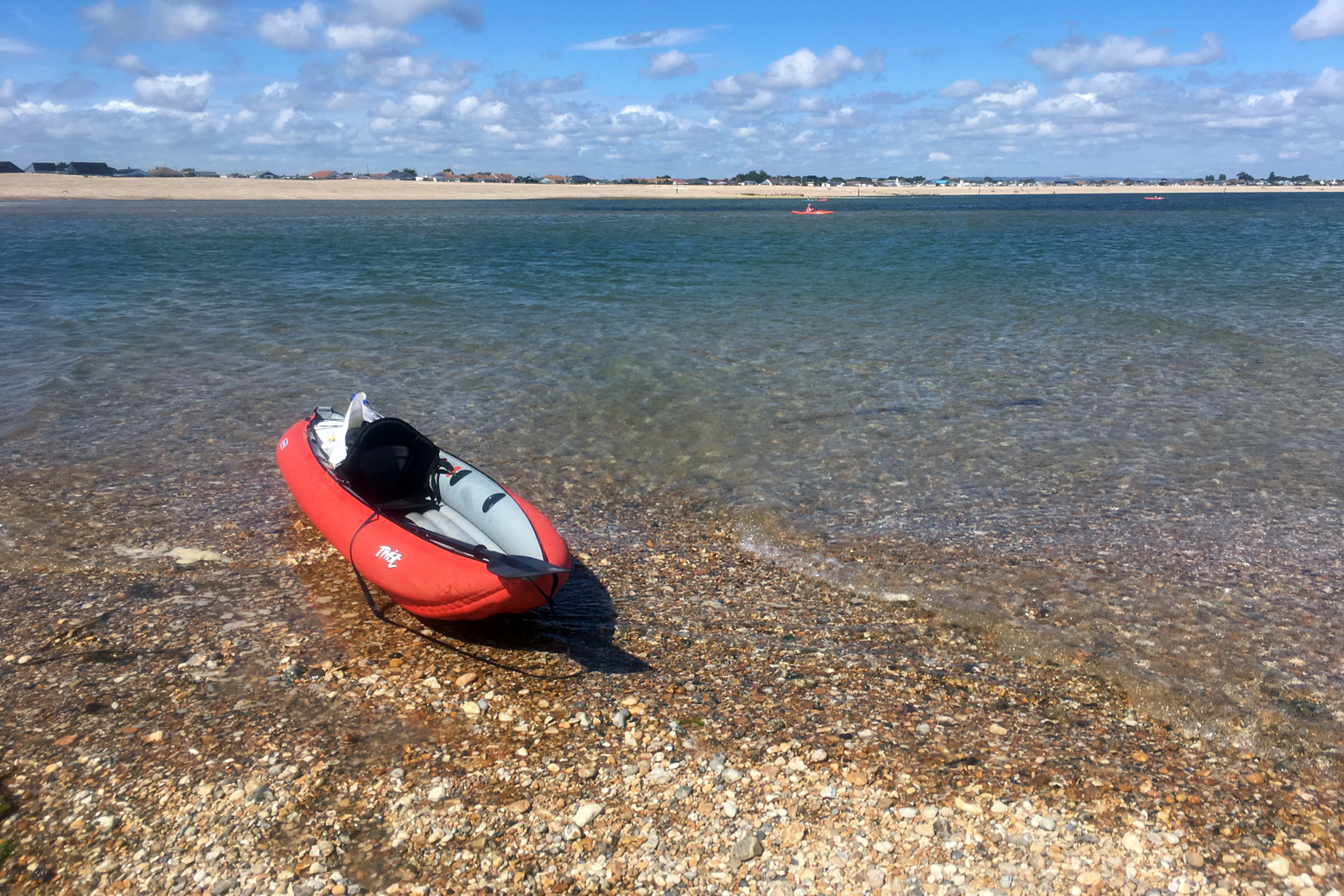
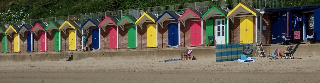
That ended up more like twenty, because keeping close to shore was made trickier by frolicking bathers, parked-up jet skis and inflatable goofballs. To the right the tide streamed past way faster than we could’ve paddled, but along the sides we managed to inch forward at a stroll’s pace; a yacht motoring out mid-channel was no faster. I kept eyeing up points where the current might splay out, but it was getting on for a mile out over the East Winner sandbank before the effort eased, the seas slapped us about a bit and we were out in the Solent for a choppy paddle back to the beach (above), now packed with frolicking sunbathers, paddleboarders and inflatable goofballs. Quite worn out, we beached the kayak and jumped back into the warm sea to wash off the salt and sweat.


It’s fun to try new stuff and paddle on a sunny day, but overall I’d say around Hayling was a bit boring compared to a sunny day in the Northwest Highlands. Who wants to pass Funland and beach houses, mudflats, marinas and more mudflats? Reminds me of Darwin harbour but without the crocs and mangroves. I suspect west of here, the Southwest coast has more promise.
I still think the morning start anticlockwise from West Town is a good idea: knock out that exposed seafront stage before an afternoon breeze (and the concomitant rise in bathers, borders and hydrofoil kiteboarders hitting the sound barrier). But I’d aim to leave West Town 3–4 hours after LW. The unintuitive tide may be turning but once in the Chichester Harbour it gets you up and around to the Langstone exit channel around HW for a short paddle along the seafront back to West Town. There’s probably a formula for doing it clockwise from Eastoke and running the flood tide through the Langstone channel, but I’ll let you work that out.

hav - 12

Chichester Canal & Pagham to Bognor

ventflex

We set out to paddle from Chichester Town Basin, down the old ship canal into the tidal Chichester Harbour at Birdham Lock. Lois and Austin in two do-it-all, drop-skeg Venture Flex 11s (left) Robin and Elliot in an old Gumo Twist 2 and a newer Nitrilon one, both of which fitted into carrier bags. Plus my Seawave lashed to a trolley.

Nearly two hundred years ago Turner depicted tall ships gliding serenely along the then new 4.5-mile canal (above). During the canal boom preceding the railways, it linked Roman-era Chichester with the huge natural inlet of Chichester Harbour and the adjacent naval fleet at Portsmouth. To the east was a canal to the Arun & Wey navigation (left) which was a short-lived inland link between London and Portsmouth commissioned at a time when Napoleonic fleets threatened the English Channel.

Our original plan had been no less napoleonic in its grandeur: a 15-mile lap of Hayling Island, but today the tides and winds were all wrong for that, and even with Plan B we’d arrive at Birdham at low tide to face an undignified, sludgey put in.

On Google maps the canal looked clear, with maybe a quick carry around a lock or two. But just two miles from the basin, a thick mat of Sargasso frogweed clogged the channel at the B2201 Selsey Road bridge (below), reducing speeds to a crawl. Worse still, over the bridge this unallied carpet of errant biomass ran on forever, and probably all the way to Birdham Lock.

Was it a high-summer frogweed bloom? The initial two miles are kept clear by rowers, paddlers and the 32-seater cruise boat which hooted past us with a lone passenger tapping at his phone. But nothing bar the Solent breeze stirred the canal west of the B2201, allowing the thick Sargassian spinach to fester and choke navigation for even the pluckiest of mallards. A picture from 2008 (above) shows less weed at the bridge and a rather squeezy thrutch through a spider-clogged culvert under the road.

chuber

Abandon Plan B all ye who Venture Flex here. Austin called in an Uber: ETA 4 mins; ET back to his Volvo: 6 mins. Total elapsed recovery time: 16 mins, give or take. The internet of things – how modern! Soon the hardshells were lashed to the roof and the rolled-up IKs heaved into the spacious boot of the Swedish landraft with class-leading crumple zones.

chwilf

A quick map check and I proposed Plan C: Pagham Harbour just down the road and out of the rising southwesterlies. I’d never heard of this medieval-era port which was now a bird sanctuary-cum-sludge repository, but Elliot had been spotting here so knew the way to the chapel at Church Norton, thought to be the mythical 7th-C source of the overdue Christianisation of pagan Sussex.

chpump
chgore

A 5-minute haul led to the shore, except the tide – which should have turned over an hour ago – was still way out, leaving only snaking channels accessible down muddy banks.  We ate lunch, waiting, like Al Gore, for sea levels to rise. But when the time came nothing but irksome clouds of marsh gnats stirred as we padded over the springy salt-scrub to the nearest channel (above).

All around, collapsed jetties, concrete groynes and other arcane structures recalled Pagham’s 19th-century heyday. Back then the sea had been successfully sealed off and the land reclaimed for farming until a storm in 1910 broke through the embankment, reflooding the harbour for fair and fowl.

chspitney
chhori

Another portage over a shingle bank got us to the main outlet leading to the sea and where the water was rushing out when it should have been filling. I realised that narrow-necked inlets like Pagham Harbour act like reservoirs, releasing their tidal fill gradually for hours after the sea tide has turned. In the tropical fjords of northwestern Australia’s Kimberley it can produce bizarre spectacles like the Horizontal Waterfall (left).

We drifted and boat-hauled through a strange, desert-like landscape of barren shingle banks speckled with forlorn fishermen and demure nudists until the spit spat us out into the English Channel like five bits of unwanted, flavourless chewing gum.

ch-harri

According to images and video on Save Pagham Beach (left), it’s staggering how fast the spit has grown once shingle management ceased around 2004; part of a new ‘natural coastline’ [money saving] policy. The spit has repositioned tidal erosion eastwards and along the shore, accelerating the scouring of Pagham’s foreshore and endangering the homes immediately behind. Recutting the Harbour’s outlet to the west (bottom picture, left) is thought to be a solution, but may transfer the flooding risk inside the harbour. Add in the protected SSSI status of the Harbour and the ‘homes vs terns’  debate becomes complex. Who’d have thought we just went out for a simple paddle.

chbog

Eastward along the coast, the assembled infrastructure of Bognor Regis rose from the horizon, while behind us the promontory of Selsey Bill kept the worst of the wind off the waves. With a helping tide and backwind we bobbed with little effort in the swell which gradually grew and started white-capping once clear of the bill. But as I often find, a sunny day and not paddling alone reduced the feeling of exposure and imminent watery doom. Only when a stray cloud blocked the sun for a minute did the tumbling swell take on a more malevolent tone. The buoyant Twists – hardly sea kayaks – managed the conditions fine and the lower, unskirted Ventures only took the odd interior rinse.

Talking of which, All Is Lost (right) was on telly the other night. Lone yachtsman Robert Redford battles against compounding reversals in the Indian Ocean after a collision with floating cargo container wrecks his boat. A great movie with almost zero dialogue.

Just near Bognor all was lost for real (above and left). Only a fortnight earlier, a similar, lone-helmed sailing boat had lost its engine and unable to sail, drifted onto Bognor’s serried timber groynes. Less than two weeks had passed and already the hull was now cracked like an eggshell and the masts were gone (maybe removed). But unlike the doomed Redford character, on the day the Norway-bound sailsman had been able to scramble ashore.

These groyne stumps – designed to limit longshore shingle drift – could also be a bit tricky in a hardshell if the swell dropped as you passed over one. And just along the shore was another wreck (above) protruding gnarly, rusted studs which may well have sliced up an IK. Mostly submerged when we passed, some post-facto internetery revealed it to be the remains of a Mulberry Harbour pontoon, one of many built in secret during WWII as far as northwest Scotland, then floated out on D-Day in 1944 to enable the sea assault on Normandy.

chhidi

Our own beach assault ended at the truncated remains of Bognor pier, proving the sea eats away at this whole coast. Bognor is a step back to Hi-de-Hi! Sixties Britain when we did like to be beside the seaside. All together now!
So ended a great day of paddle exploring. Uber!