


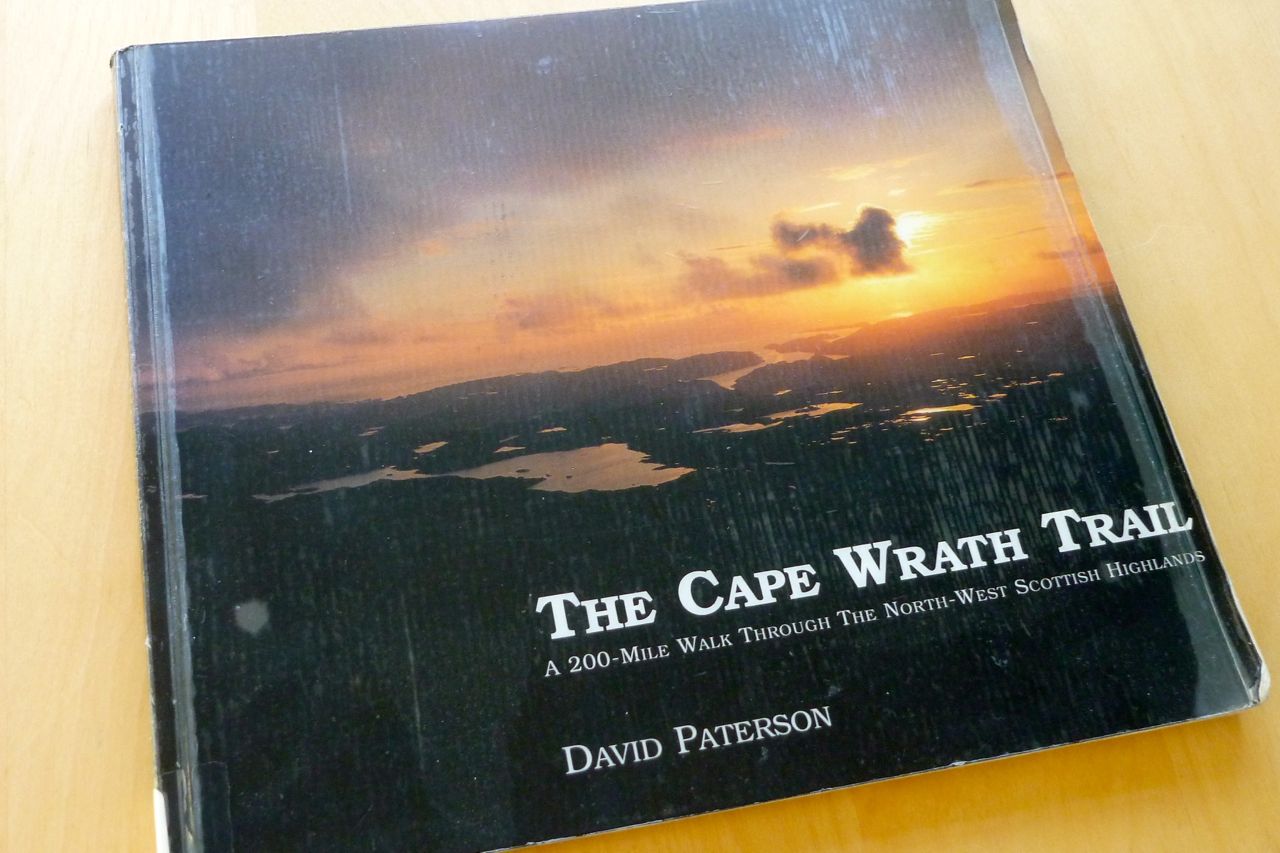
The 200-ish mile Cape Wrath Trail from Fort William to the top of Sutherland was cooked up in the early 1990s by David Paterson, a photographer who’d just come off a job shooting the West Highland Way.
Paterson wondered if you could extend the WHW through the North Western Highlands to the very tip of the British Isles in Sutherland. Over many visits he established a route and in 1996 produced a beautiful book: ‘The Cape Wrath Trail: A New 200-mile Walking Route Through the North-West Scottish Highlands’, creating what he humbly ‘dared to call the Cape Wrath Trail’.
Since then various other routes have evolved between the two points. There’s no set route, far less two helpful waymarks to rub together, but it would not be an exaggeration to describe the CWT as Britain’s toughest long-distance path. Though it’s tracklogged comprehensively on walkhighlands, follows passes and valleys, and tops out at just one 600-m summit, the terrain, weather, scarcity of resupply points or any other services in the North Western Highlands puts the CWT in a class of its own. On occasions, there is no path at all, but the advent of the 2003 Scottish Land Reform Act opened the moors to all, offering an infinity of options or ‘variants’.

Originally Paterson’s route passed from Dundonnell through Ullapool, crossing the half-mile of Loch Broom from Altnaharrie on the Scoraig peninsula using a regular ferry. That ferry ceased operating in 2003 and the CWT now reroutes itself miles inland up to the head of Loch Broom and via Oykel Bridge. But as none other than Cameron McNeish suggested in a rather hastily written ‘Foreward’ on a Cape Wrath Trail website:
‘…the route should follow a south to north line as close as possible; it should allow passage through the most scenic areas; it should try and avoid tarmac and paved roads or paths but instead follow existing footpaths and stalkers’ tracks whenever they were useful and it should avoid crossing mountain ranges and major rivers except where necessary.’
In 2013 Cicerone published The Cape Wrath Trail guidebook. They’d published an earlier version as ‘North to the Cape’ in 1999. The 2013 Cicerone author Iain Harper has a website on which he questions and then decides not to include his Coigach-Assynt route option for safety reasons. ‘… Not including an Assynt alternative in the guide was a difficult decision, but on balance I came down on the side of caution, however for the more adventurous walker it should definitely considered…’.

I’m not an especially adventurous walker and have not done the CWT, but knowing the Coigach-Assynt area, and from the walkhighlands reports I’ve read on the current route, Postman’s Path excepted (see below), the Coigach-Assynt doesn’t seem much more dangerous or remote than many other rather hairy sections on the CWT. And furthermore, our variant stays closer to McNeish’s ‘south to north line [and takes a] passage through the most scenic areas’.
The peaks of the Assynt are like nothing else in the Scottish highlands and it seems to me a shame that the original CWT route had fallen into disuse for want of a half-mile boat ride across Loch Broom.
That boat ride (or using a packraft, of course!) is the key to unlocking this Coigach-Assynt variant and on a pleasant summer’s morning it would be perfectly packraftable paddle from Altnaharrie jetty to Ullapool on the north side of the loch (David H did so in 2012 on his northwestern epic).

But after the six-mile walk up from the Badralloch turn-off near Dundonnell, arriving at Altnaharrie jetty on a rainy evening in early December 2013 with a spring tide in full ebb against a 20mph wind, paddling towards Ullapool’s harbour lights seemed less of a jolly jaunt. To cut a long story short, we ‘d contacted the harbour master to see if he could help out with a lift. At least one other CWT walker has done this. He arranged for the night shift to come over and pick us up. [It’s worth noting the former Altnaharrie Inn gourmand’s restaurant alongside the small jetty in now a private residence].

After a cozy night and a lavish brekkie in Ullapool’s Ceilidh Inn, Robin and I set off set off for the 12-mile walk to Culnacraig via the notorious Postman’s Path. We didn’t quite make it and as it involves no actual paddling, you can read about it on Walkhighlands.
In 2021 round-Britain coastal walker Quintin Lake recalled the path:
I thought I’d seen it all by now, but the postman’s “path” to Culnacraig passes over some of the steepest ground I’ve yet encountered. If there weren’t a path to lure me onwards, I’d have turned back.
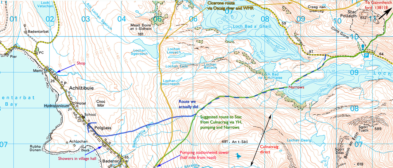
From the vicinity of Culnacraig our suggested variant takes a more direct line than the Cicerone suggestion shown in yellow (above). It crosses over to the narrows at Loch Lurgainn which are just about wadeable to a boatless walker with a stout stick, but which we paddled during a break in the December storms. You can read about that here.
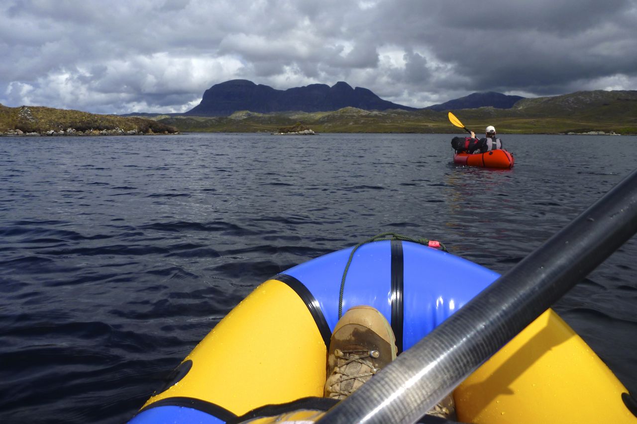
A few months later Jon and I returned to Achiltibuie with our new Alpackas to pick up the variant from the foot of Stac and follow it through to Kylesku where it rejoins the regular CWT for the last lap to Cape Wrath. It can all be walked or waded but our route was streamlined by taking three paddles (right) and a shallow wade.
You can read about that here.


Pingback: Packrafting bits of the Cape Wrath Trail (or my version of the CWT) – Dr Michael Barry MBChB BSc