See also:
Igla 410 main page
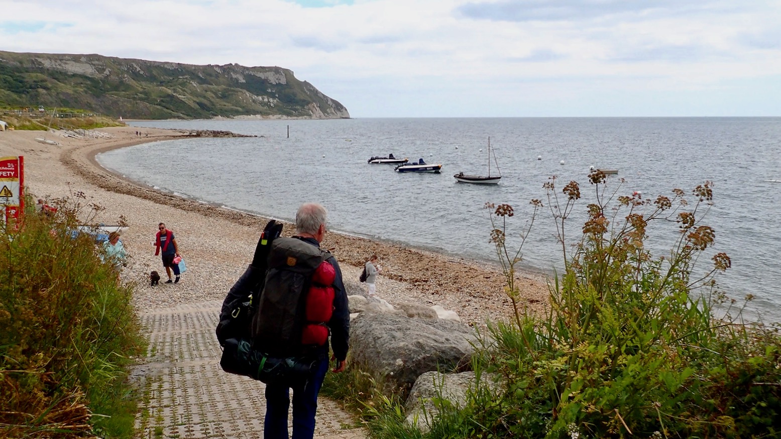
Packrafting the Jurassic Coast


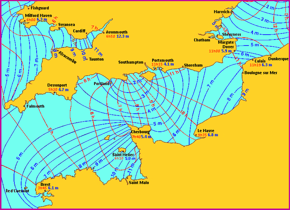
We took a lovely evening walk along the Purbeck coast east of Kimmeridge Bay, where for millennia the bands of bituminous shale have been burned or squeezed for their oil, like Kalamata olives. Good page here on Kimmeridge and its geology over the eons.

Just west of Kimmeridge Bay there’s even a lone oil well (right), nodding away incongruously since 1959 in the pastoral Purbeck idyll that inspired Enid Blyton’s Famous Five adventures which I devoured like Opal Mints in the Sixties. Blyton holiday’d for two decades in Swanage and elements of some distinctive Dorset icons, like Corfe Castle, find themselves transposed onto her book covers (left). There’s even an Enid Blyton Trail, which lists Kimmeridge.

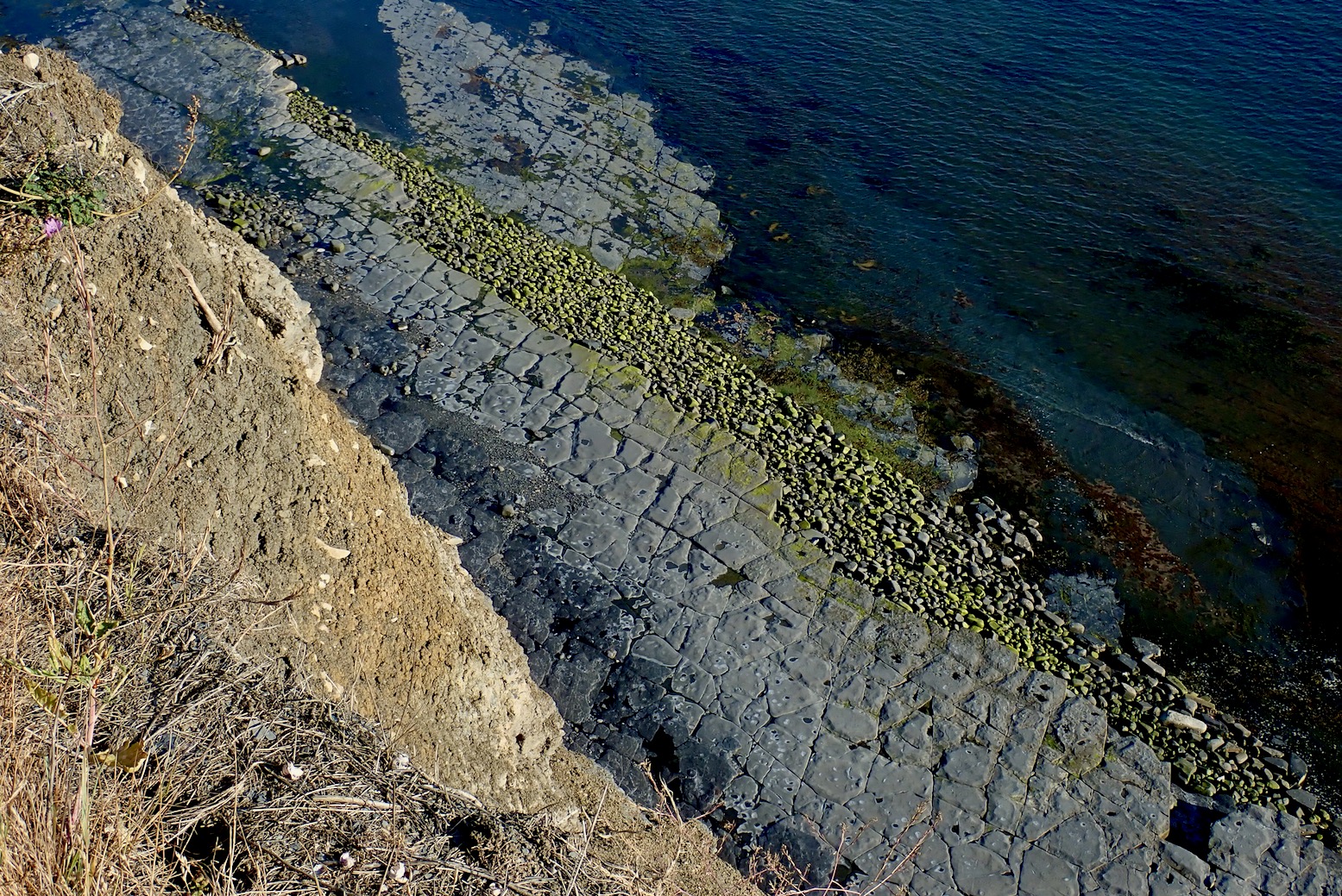
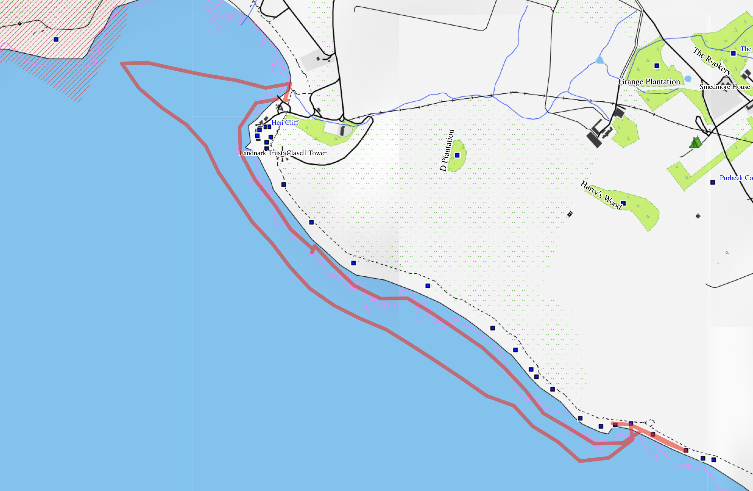
East of the bay are the notorious Kimmeridge Ledges, submarine clay or dolomite beds which reach out to sea a few hundred metres. With the right sort of swell or wind (top of the page and below) they can catch out unwary paddlers when waves suddenly rise up and break far from the shore.

Our evening walk coincided with low tide and calm conditions exposing parts of the ledges. They’re said to be rich in fossils and over the decades a local man, Steve Etches has collected enough to fill a museum in Kimmeridge village.
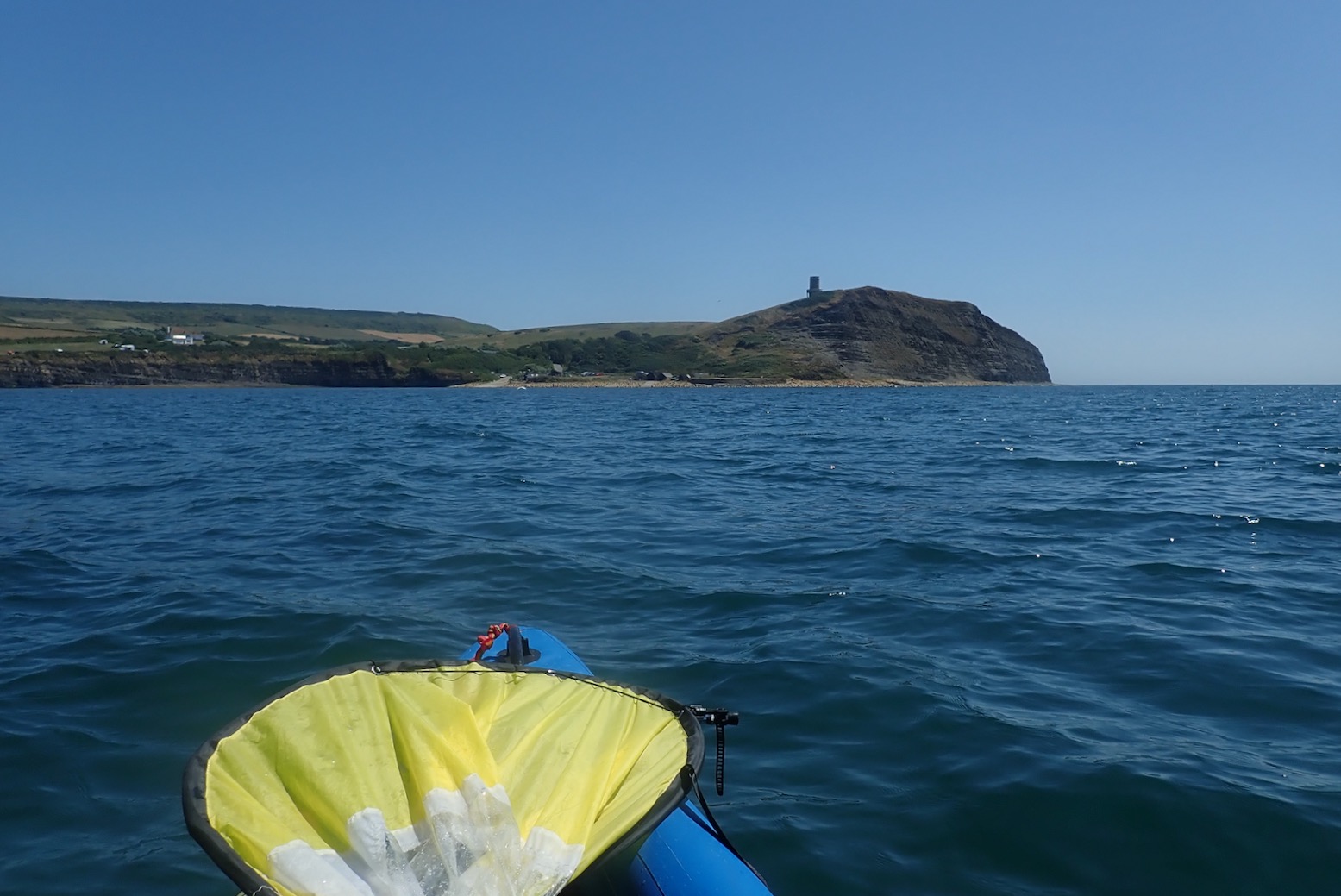
We walked as far as the outlook over Egmont Point where the path turns inland on its way over Houns Tout to Chapman’s Pool, just before St Alban’s Head (below).

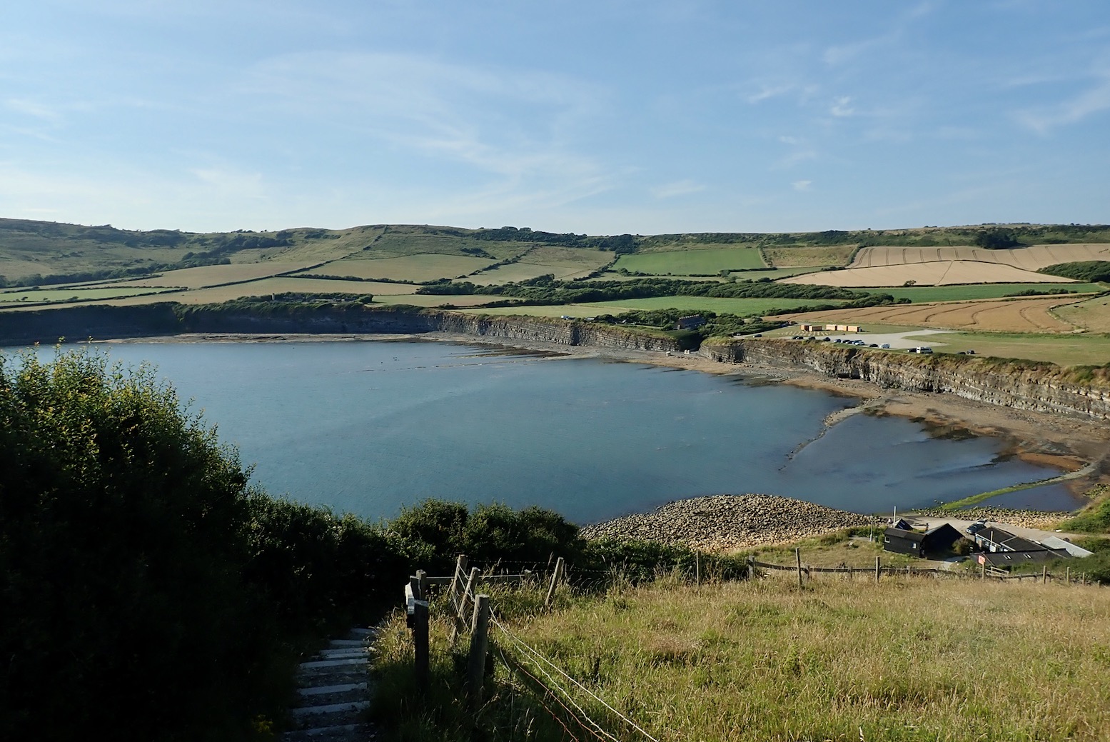
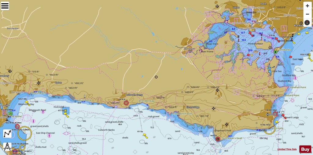
To reach Kimmeridge Bay you continue past the village onto a private toll road to a huge car park with a daytime cafe. On both visits no one was at the toll booth which saved a few quid.
The east end of the bay has a handy slipway by the Wild Seas Centre. What a luxury it is to drive down to the sea’s edge and pop the kayak straight into the water to let it cool down and soften up while I parked the car. The high tide was just on the turn, but out here away from the headlands, the effect of any tidal current is minimal compared to the wind.

I’ve got into the habit of opening the two side PRVs plus airing down the floor a bit at the end of a paddle for the drive home. Providing it’s not baking hot, I paddle with the PRVs closed which keeps the boat as rigid as a stick. Today I realised you can’t top up with a push-pull barrel pump stood in the boat on the water; you need to drag it all back ashore to stand on the ‘stirrups’. It takes just a few strokes to fully inflate the Igla back to 0.5 bar.
Round the corner the south easterly feels a bit more than the predicted 8mph. Perhaps the tall cliffs channel and accelerate the wind along their face. At least it should make for a good sail back.
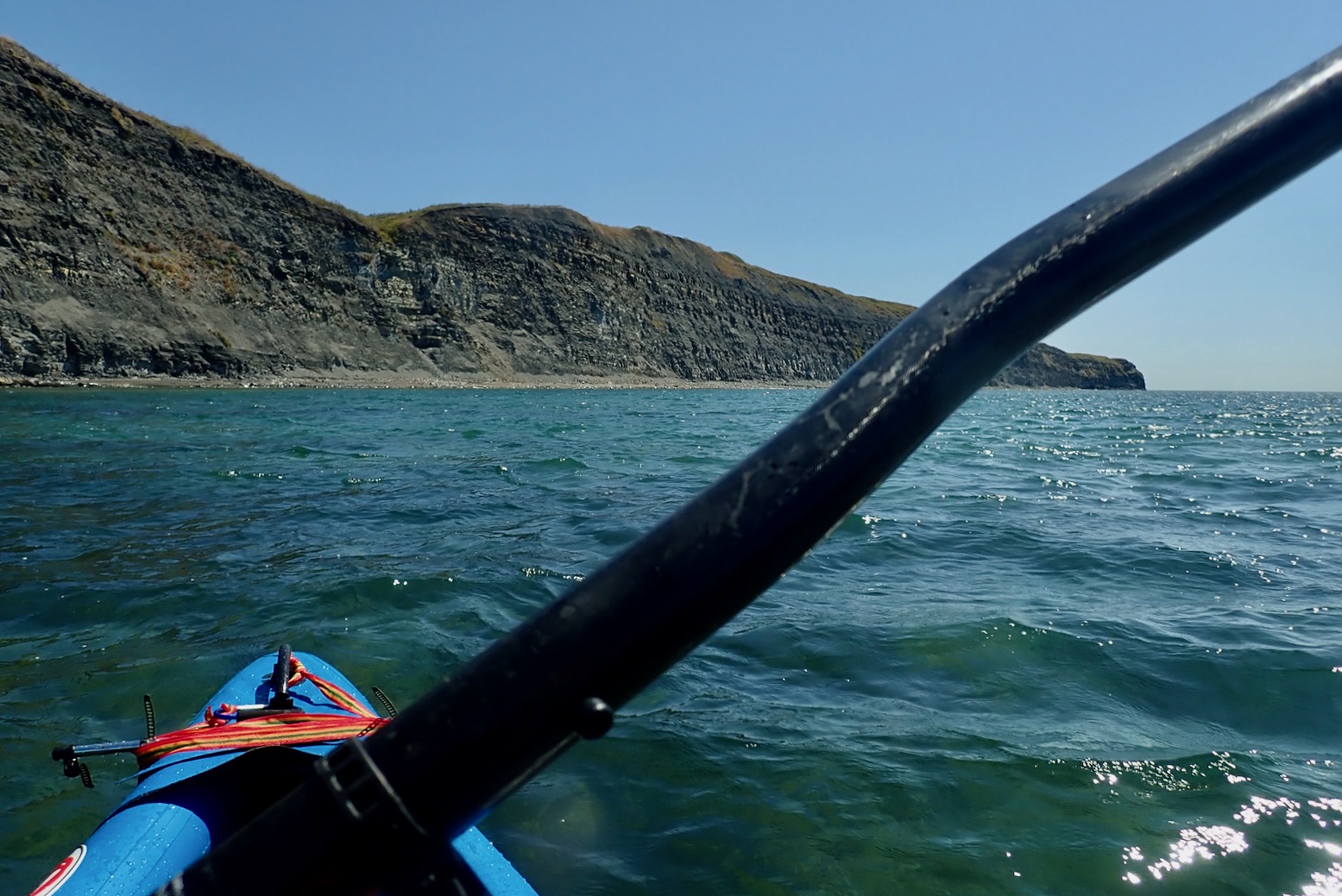
Heading southeast, I can’t help but feel a bit exposed out here; open sea to the right, rocky beach below a steep, crumbling cliffs to the left, and lethal ledges lurking ahead. What next – fireballs falling from the sky? But away from the corner the seas settle down a bit. The Igla cuts through the headwind at around 3mph.
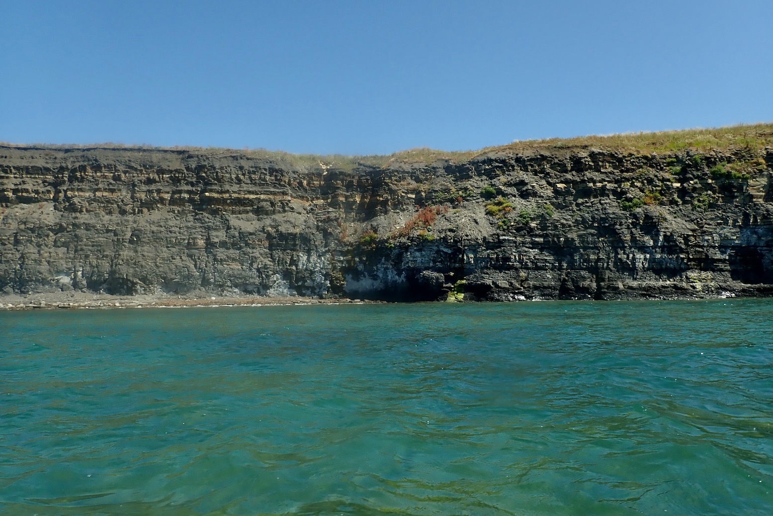
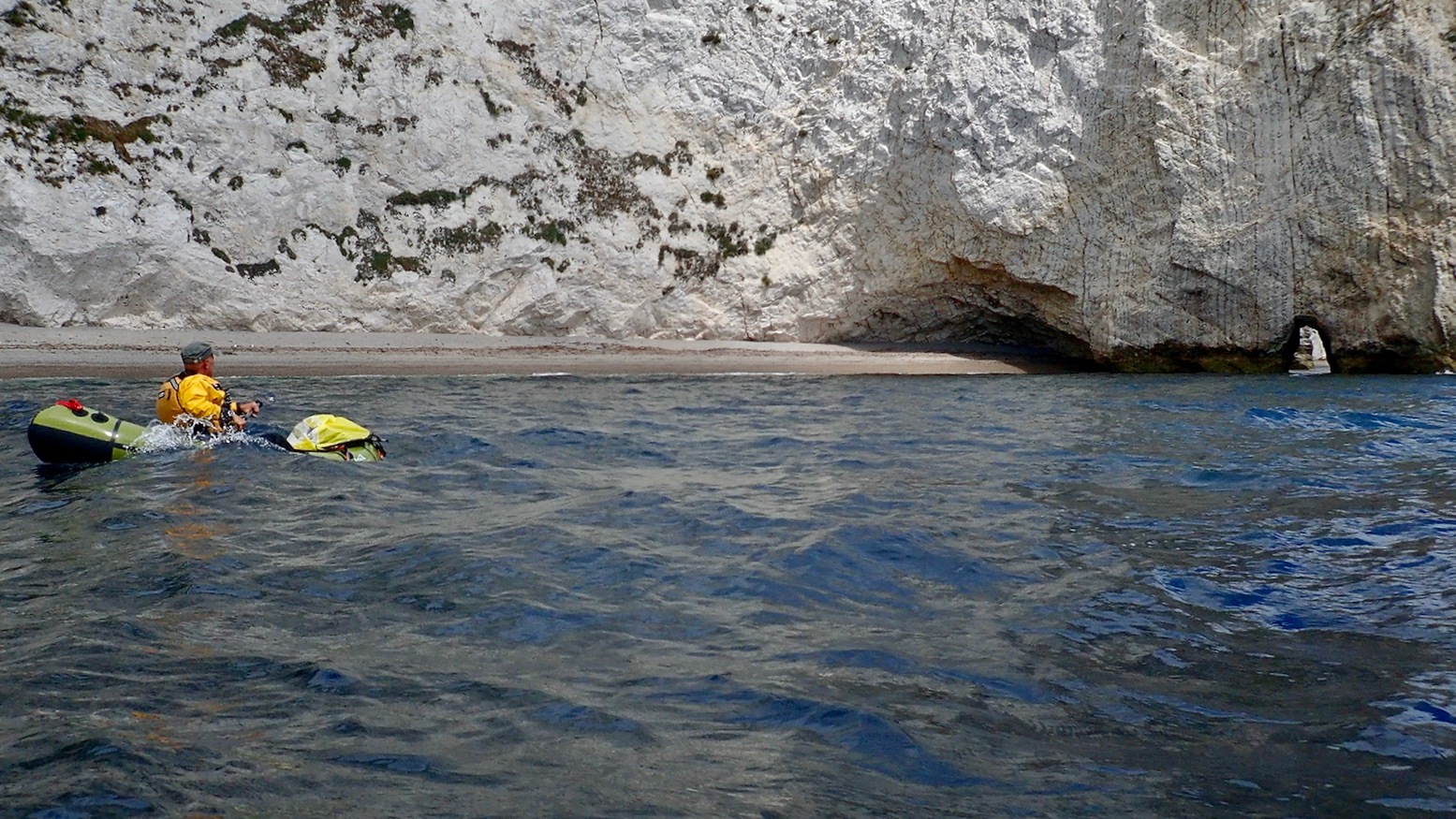
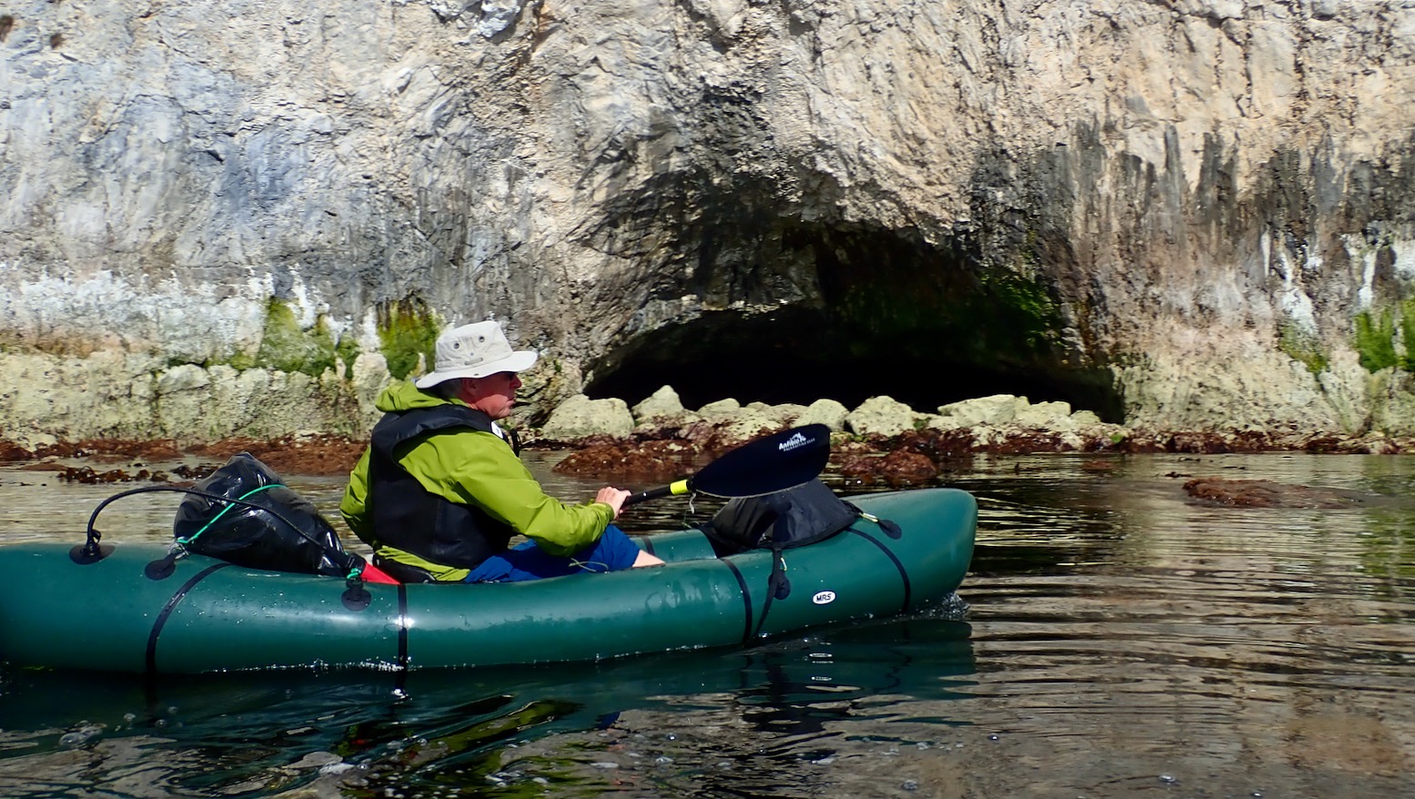
Nearer the cliffs the water turns green over the clay ledges not far below. But bigger waves rise up occasionally so I prefer to stay out which means I see less. As there are no sea caves to paddle into on this stretch and no skerries to paddled around, in a packboat I decide this unusual area might be more interesting to explore at low tide. You can easily hop in and out of an IK or packraft and wander across the ledges which few people ever access, looking for ammonites and other curiosities. Next time I’ll know.
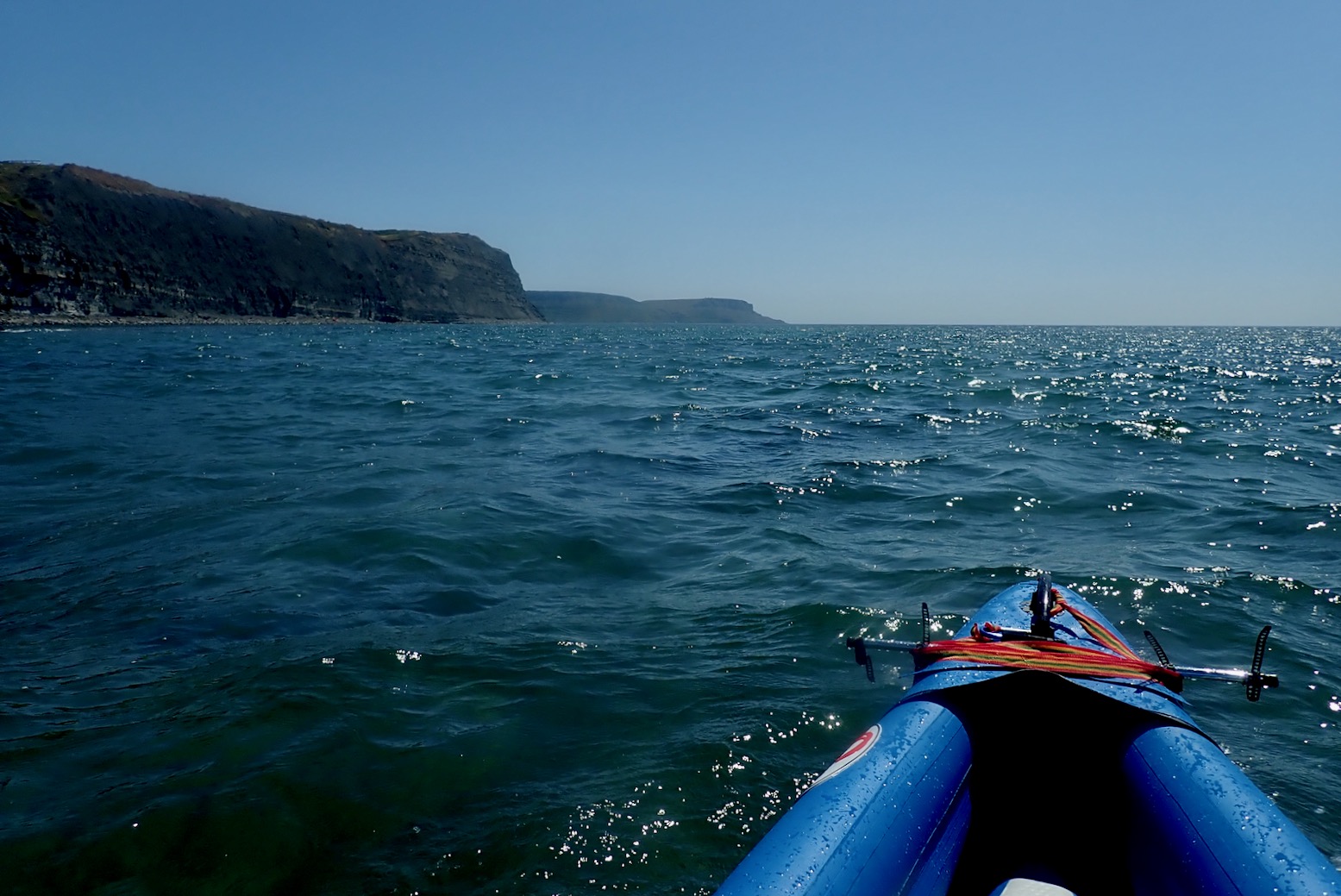
Otherwise, with linear cliff paddles, in a kayak this Jurassic Coast can be all or nothing. You either commit yourself to a full run to the next normal take-out, or go somewhere and come back.
It’s only 3.6 miles to Chapman’s Pool, but I wasn’t ready for that today. (I packrafted it in 2025). As it is, once there, with a 4-metre boat on your head it’s an unrealistic take-out up a 400-foot climb over a mile to the nearest parking.

It’s the same at the next possible take-out at Dancing Ledge. We checked that out on midsummer’s eve. In calm conditions it’s an easy enough landing providing the lower ledge is exposed, but you’d then need ropes to haul an IK, either inflated or rolled up, up a 15-foot scramble (left) before another steep walk up to Langton village via Spyways Barn. One for a packraft noseabout on the next calm day.


As it is, Dancing Ledge is on the far side of St Alban’s Head where the tide can kick up a bit (left). Good timing and some nerve are required, even if a kayak can tuck in close to the shore inside the race. This is why Mark R says in his South West Sea Kayaking book. [Kimmeridge to Swanage is 19km and …] “… a commiting trip with big tides races and few opportunities to land. This also happens to be the author’s local (and favourite) paddle.”
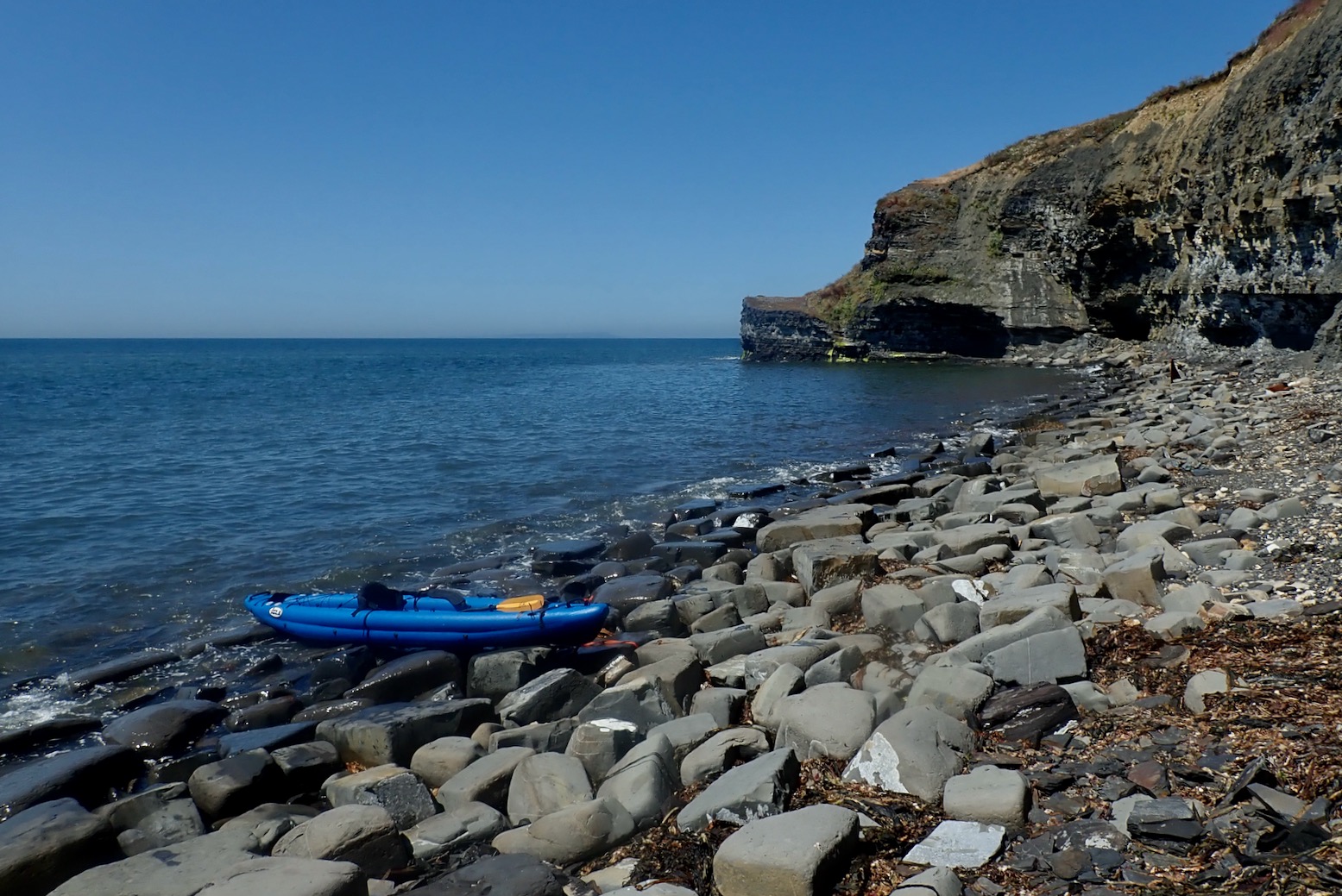
Back to the present. Lured by a curious triangle jutting up from the stones, I park up on a narrow beach and hop out for a bit on a look around. This is Clavell’s Hard, site of former shale mining.
At ordinarily inaccessible spots like this you’re bound to find something interesting.

Like a beached red plastic ‘fake clinker’ dinghy.

Anywhere near seaweed there are masses of aggressive ‘sea-horse’ flies. The other week nearby Weymouth beach was blanketed in this kelp which soon started rotting during the hottest month ever. ‘Clear it away! cried the holidaymakers. ‘Stop your whining; it’s a natural phenomenon!’ responded the local council. ‘Get a grip‘ suggested Springwatcher General Chris Packham. Buckets and spades were flying and Trip Advisor turned molten with rage.
“This decision [to ignore the seaweed] supports our commitment to preserving the ecosystem’s integrity and avoiding any potential harm that may arise from interfering with its natural course.” chirped the council unconvincingly. A week or two later later they caved in and cleared the beach. Honestly, it’s just one scandal after another these days.

Compared to northwest Scotland, I’m surprised how little fishing detritus there is here. Are southern fisher-folk more tidy? I help that effort by snagging a superb, self-draining crayfish crate-bench to add to my collection.

I approach the mysterious shark’s fin.


It looked like the upper half of a retractable drop skeg (fixed rudder) with its mounting plate, similar to kits you can buy for hardshell sea kayaks (left), except it weighed tons, not ounces. I thought it might be off some old wreck.

You can see a pivot pin up front. A cable might have winched it up and down. But then any ship that size would obviously have a rudder. Who knows, but I now think it’s abandoned mining junk.


The fin made me think of the SS Treveal which broke in two on the ledges about 1.5 miles southeast of here in January 1920. The Belfast-built steamer was on the return leg of its maiden voyage from Calcutta to Dundee, and had left Portland earlier that day where someone observed that the too northerly heading was inauspicious.
Most of the 46 crew drowned when their lifeboats capsized near the shore. It’s said the tug which came to salvage the cargo also sank alongside. There’s no trace of the Treveal now, even on marine charts and wreck maps. But how do you dispose of a 5000-ton steamer snapped in two? Bit by bit I suppose.
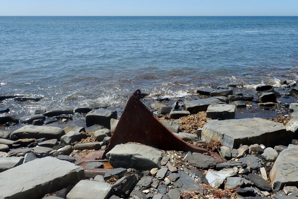
It’s unlikely subsequent storms washed that huge hunk of angular metal a mile and a half to the base of this cliff. More probably it was placed there by shale miners. There’s more on the SS Treveal on Ian West’s geological pages here (scroll to the bottom of the long page).
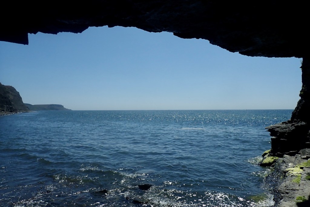
I wander into a nearby cave, perhaps excavated during the ‘Blackstone’ mining era.

Inside I see just how friable this oily shale is. I can easily peel bits off.

Underneath Silurian millipedes inhabit the tiny cracks, feeding off microbes that feed off the oil. Probably.

Time to head back. I’m all fired up for a good sail with the tide.

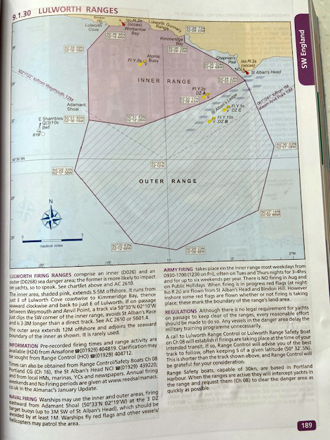
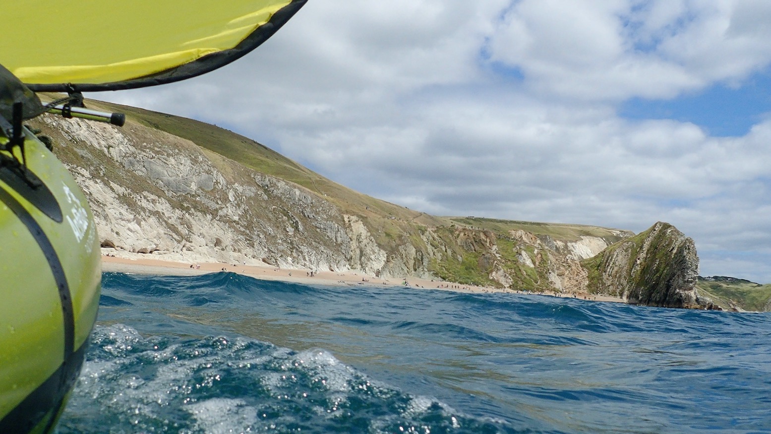
Benign, weed-covered ledges lurk not far below. On the far horizon the chalk cliffs of Mupe Bay, just next to Lulworth Cove. Might try there next, but the army firing ranges restrict weekday access. We’ve been hearing machine gun fire all week; Ukrainian soldiers getting trained for the front line.

I throw up the sail but it’s not happening. I creep along at barely 2mph. Maybe I’m too far out (left) and the wind got intensified near the cliffs.

I paddle back to the corner of Kimmeridge Bay…
And carry on to the other side where waves are breaking off Broad Bench ledge. On the left horizon is Portland Bill dangling below kelp-clad Weymouth.
I turn back to the jetty, de-air the Igla a bit and strap it to the car roof.

And though I haven’t really earned it today, I treat reward myself to a seaside seafood basket by the seashore.