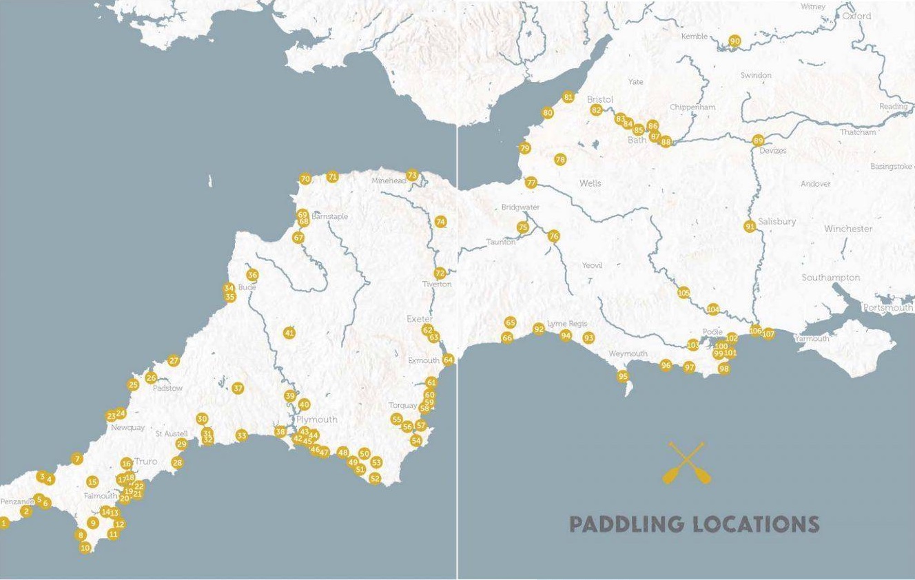
In a line Promising selection of rivers, canals and inshore SUP paddles right across the beautiful Southwest, but just one map.
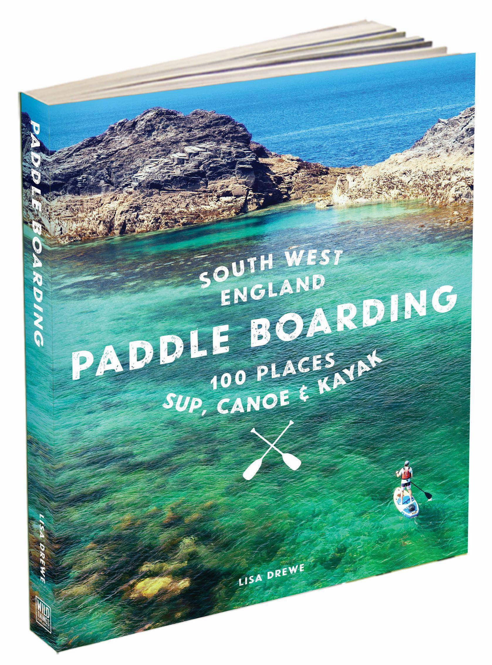
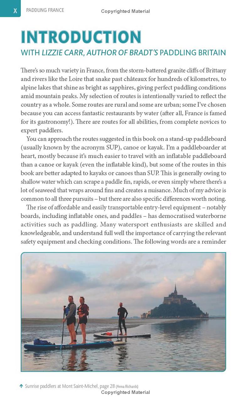
What they say Explore the best of South West England’s rivers, canals, lakes, estuaries and beaches by paddle board, canoe and kayak Paddle along meandering estuaries, wild swim and picnic on silver sands. Featuring more than 100 stunning locations across Cornwall, Devon, Dorset, Wiltshire and Somerset, this trusted guide provides all the practical information you’ll need for trips out on the water by paddle board, canoe or kayak, whether you’re a beginner or a seasoned paddler. Illustrated with sparkling photography and offering a variety of routes, this is a beautiful and inspiring book for water lovers and adventurers afloat. Rrp £18.99, £8.99, 2023, 255pp
Review copy supplied by Wild Things Publishing (WTP)
• Covers over a 100 paddles from Wiltshire to Lands End • Nicely written descriptions and genuinely useful practicalities • Most photos by the talented author, not Shutterstock etc • Responsible take on PFDs which are often pictured in use • Now uses decimal degrees (D.D°) waypoints for start/end points (and the obsolete OS grid ref). In the pdf, along with website urls, D.D° waypoints are hotlinked to Google Maps • Details for public transport returning to start point, where it exists
• No route maps means added effort required to work out what, how and where • Doesn’t say where printed so presumably not UK • The ‘Getting There’ descriptions of lefts and rights and road numbers is redundant these days. A postcode or D.D° for the satnav or phone is adequate
Review Getting in on the wild swimming craze early, WTP moved on the ‘boarding a short while after Lisa Drewe brought us her original and award winning Islandeering guide in 2020. A proper, experienced kayaker turned SUP evangelist, the author knows her paddling, in particular what’s important, safety wise. Like Bradt’s Lizzie Carr, she’s also an environmental campaigner or conservationist, and it seems her SUP epiphany in the US was similar to my own while there. Suddenly there was a new and accessible way to explore the blue bits on a map.
The book is subtitled ‘canoe & kayak’ to catch the likes of me who don’t get the SUP thing, but that’s the last mention of boats in words or most pictures. Of course, what you can SUP you can easily packraft or IK, and the range of inland and inshore paddles is much more accessible to the majority of recreational paddlers than Pesda’s South West Sea Kayaking.
Up front you get a map covering all 100+ paddles, followed by a table including gradings and distances ready for you highlighter pen. The lengthy intro leads on to choosing a board and getting trained, then there’s a detailed section on trip planning for sea or rivers and what to wear pack.
Covering one location per spread, you can flick open any page, like above or below, and be presented with a mouthwatering paddling suggestion. You get nice photos, a description and solid practical info in the yellow box, which occasionally includes public transport links for your rolled-up inflatable which might not be an iSUP.
The Pesda South West sea kayaking book knows what counts and provides sometimes near full-page maps of each suggested route. This book has pretty pictures of aquamarine bays. The lack of route maps in a route guide is baffling and relegates it into the ‘lifestyle’ category not everyone rates. How else can you effectively and concisely express this information? It’s not a space issue; any one of the generic shots could be have dropped or resized. I’d have happily paid another £1 for route maps because read any paddle description and you soon start thinking, ‘hmm, sounds good but what does it look like on the ground?’. A map depicts this information at a glance. The author’s Islandeering book (not a paddling book) had great maps and other Wild Guides, including their well-known wild swimming books at least have regional maps to supplement the main map up front. I’m told it’s a combination of space, aesthetics and cost.
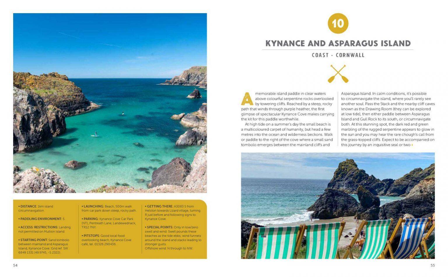
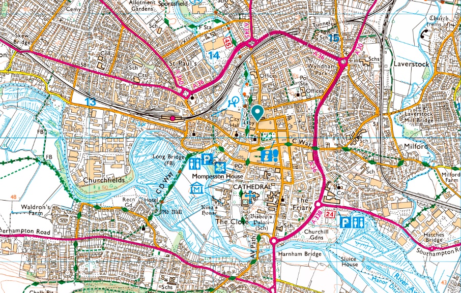
Take Route 91 for example: the ~5-km Salisbury Loop. Sounds great, easy access and a lovely picture of ‘boarding past the willows below the cathedral spire and no license required, we’re told. Now try to make sense of the dense network of rivers and canals surrounding the city (left) from the text. ‘Nadder Island’ is mentioned to avoid a weir, but it’s not even on the OS map (it’s the crescent below Churchfields). You want to hope you don’t take a wrong turn and get sucked into the municipal sewage compactor sluice. The two paddles covering Christchurch (which I bikerafted recently) are another example, and it’s the same with so many other paddles in this guide: they’d be so much easier to visualise and so get inspired by with one less photo and a basic map to cross referenced to a more detailed OS map or whatever’s on your phone. Failing that, link to an online map like here. Lisa Drewe is an ‘OS Champion‘, after all! The book ends with detailed sections or water safety and how to paddle responsibly – the sort of solid, concise but practical information which was missing from Bradt’s France book. With maps South West England Paddle Boarding would be a perfect, self-contained paddling guide to this magical region. As it is, it’ll still give you loads of ideas, even if you need to work for them.
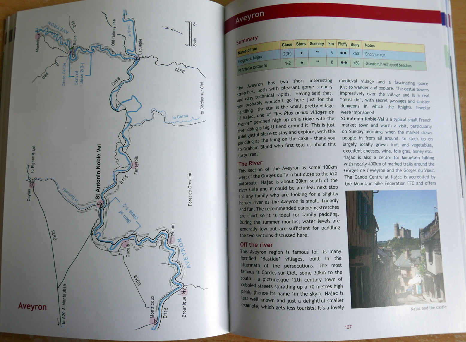
In a line Mouthwatering selection of river- lake- and inshore paddles right across France, but packboats go unmentioned, despite lauding the use of public transport.
What they say This award-winning new Bradt guidebook provides 40 itineraries for water-based exploration around France by SUP kayak & canoe to suit all abilities. It is the first practical guidebook to explore the whole country by SUP (stand-up paddleboard), canoe and kayak – waterborne activities enjoying a popularity boom. Experienced paddleboarder, travel writer and local resident Anna Richards has toured the country’s rivers, lakes and coasts to handpick 40 outstanding itineraries for water-based exploration that suit all abilities from novice to expert, enabling readers to experience Metropolitan France as never before! Rrp £19.99. 41 maps, 230pp
Review copy supplied by Bradt Guides. Book images found on online previews. Additional contextual review info by French boarder, Gael A.
• Varied selection of paddles right across the six corners of l’hexigone and Corsica • Nicely written descriptions • Maps are small but routes are short so they do the job • W3W works well for pinpointing locations • Nice layout and paper • Printed in the UK – better sustainability
• Routes appear to be composed almost entirely from set rental/guided itineraries • Most are short return paddles • When it comes to paddling knowledge, the author seems out of her depth • Nearly all photos are stock library shots • IKs and packrafts virtually unmentioned, yet as transportable as a rolled up iSUP
Review Thanks to its topography, rich history, culture and proximity to the UK, on river, lake or sea, France is a fantastic paddling destination. Paddling France: 40 Best Places to Explore by SUP, Kayak & Canoe replicates Bradt’s Paddling Britain by Lizzie Carr which, in its first 2018 edition, was a long-running hit, possibly supercharged by lockdowns when demand for inflatables boiled over. Like many others at this time, author Anna Richards discovered the wonder of paddleboarding, moved to France to become a travel writer and, knowing the country from childhood holidays, zig zagged around for over a year to write and research it all. Paddling France isn’t aimed at enthusiasts attracted to the challenge of developing skills by juggling tidal streams and winds, river flow rates or the logistics of multi-day tours. Most SUP owners are into casual day paddles, but probably outnumber the former by ten to one. But unlike Lizzie Carr’s original Paddling Britain (which I checked after writing this), faced with an equally monumental task, in most cases Anna Richards seems to have either rented kayaks (and maybe boards), used their shuttle services, or at sea sometimes joined tours. Although all are great paddles, I didn’t get the impression any routes were original selections born from years of experience, the usual prerequisite for authoring a guide book like this. Initially I understood ‘… generally withthe assistance of local clubs that kindly loaned me rigid… kayaks‘ (page xix) as a euphemism for arranging rental freebies in return for a listing in the book. But it’s possible the author actually believes ‘clubs’ – in the social/membership/lessons UK sense – is the right word to describe a commercial rental, tour and sometimes training outfit. Only Route 21 lists a ‘Club Nautique‘ sailing school which also rents kayaks and boards. All the rest call themselves versions of watersports centres or ‘location canoë-kayak‘ (kayak rentals) of which there are many more in France than in the UK. Once you get your head around this you ask yourself: well, it’s a short-cut but in France does it actually matter? What are most Brit paddle tourists’ experiences in France? Is it flying or railing down with a packboat, as I’ve done? Or is it driving around with kids or campervan, then chancing upon a lovely waterside spot which offers day rentals and a lift back? It’s almost certainly the latter. That’s what I’ve done elsewhere in the world. It’s clear the author put in the miles, paddled every route and composed a detailed description and practical info, although images of her in ‘off message’ kayaks are absent, replaced by stock library photos with fill 90% of this book. With mainstream guidebook sales in retreat and corners getting cut, these are all understandable measures to still produce a nicely designed and illustrated book in full colour for just £20 that’s printed in the UK, not the other side of the world. That alone deserves a sustainability rosette which the publisher should laud. I wouldn’t consider blagging a freebie rental in return for a mention as unethical, as long as it’s clearly flagged. Many routes start and end right outside an outfitter’s base. I could be wrong, but if that’s the case better to be upfront. Skimming through Paddling Britain, that book appears to have been written and researched the old fashioned way – though again, no mention of packboats ;-(
Ironically, Anna Richards likes iSUPs for some of the same reasons we all rate IKs and Packrafts: ease of use and transportability. Yet as said, many routes seem to be in rental hardshells, while IKs get dismissed in the Intro’s second para (left) as too awkward to travel with compared to a SUP. I looked up what a 12.5′ inflatable paddle board weighs: about the same as a Gumotex Twist 1, and 2-3 times more than a packraft, though I admit a 4-metre FDS IK (above right) is ridiculously bulky. What a shame then she missed out on made-in-France Mekongs packrafts rental service. Some rental outfitters listed even supply Mekongs. On a lively river I’m sure she’d have been thrilled. So, no IK or Ps in this book (bar photo p5), but of course, conditions permitting, all routes are suited to packboating.
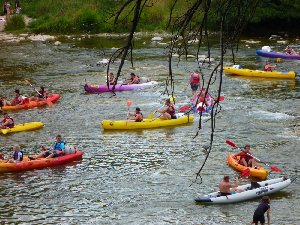
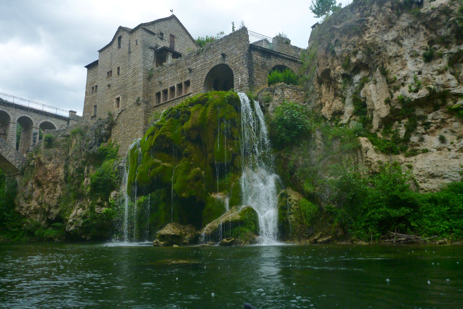
Evening splash hour on the Ardeche (Route 27). SoT and IK heaven
The author seems to be more enterprising travel writer with a SUP hobby, than experienced river runner and has a talent for filling out evocative descriptions with not much to go on. For an inspirational as much as practical title like this, that may be a better balance, but it’s a shame we can’t have both. If you’ve used serious paddle guides, Paddling France falls a little short in places. What I now realise are linguistic mistranslations of French paddling terms jar, suggesting the author was inexperienced in writing an English paddle sports guide that must include accepted terminology and elements of technique, appropriate gear, water hazards and safety regs. Page 16 and 18 excepted, the frequent use of disembark to ‘get off’ [your board/the river] but also to ‘set off’ [for the paddle – p66] get particularly grating. This is a literal translation of a similar French word which doesn’t always work in English. Marinas get described as ‘ports’ or ‘harbours’ or even ‘pleasure boat ports’ – also not the same thing. Nor is a weir a dam in English (though in the US they call them ‘low-head dams’). It took me days to realise this. I now wonder if paddling newb Anna Richards learned her paddling and nautical terminology in French while researching this book, then translated some words literally into English. Hence the odd use of port de plaisance – the clumsy French phrase for marinas. Or assuming barrage translates to dam, weir (or roadblock), when all three are quite different things. As an aside, a few times a SUP board is called a ‘paddle’: ‘inflate your paddle’ roll up your ‘paddle’. Is ‘paddle’ slang for a SUP in French? Probably not* But then an often-repeated claim dawned on me: English vocabulary is many, many times greater than French or any other language – no wonder L’Académie Française is so defensive ;-) You won’t drown horribly as a result of all this, but if writing a paddle guide in English for English readers, use or learn the right words – or check with someone who does.
Actually it is! Gael writes: Some years ago the term “paddle” has been inexplicably adopted as the official French word for SUP. Stand Up Paddleboard would translate into something like “planche propulsée en position debout au moyen d’une pagaie”, or PPPDMP which would be difficult to pronounce. Italians called it “tavola da SUP”, which is shorter but nearly as ludicrous.
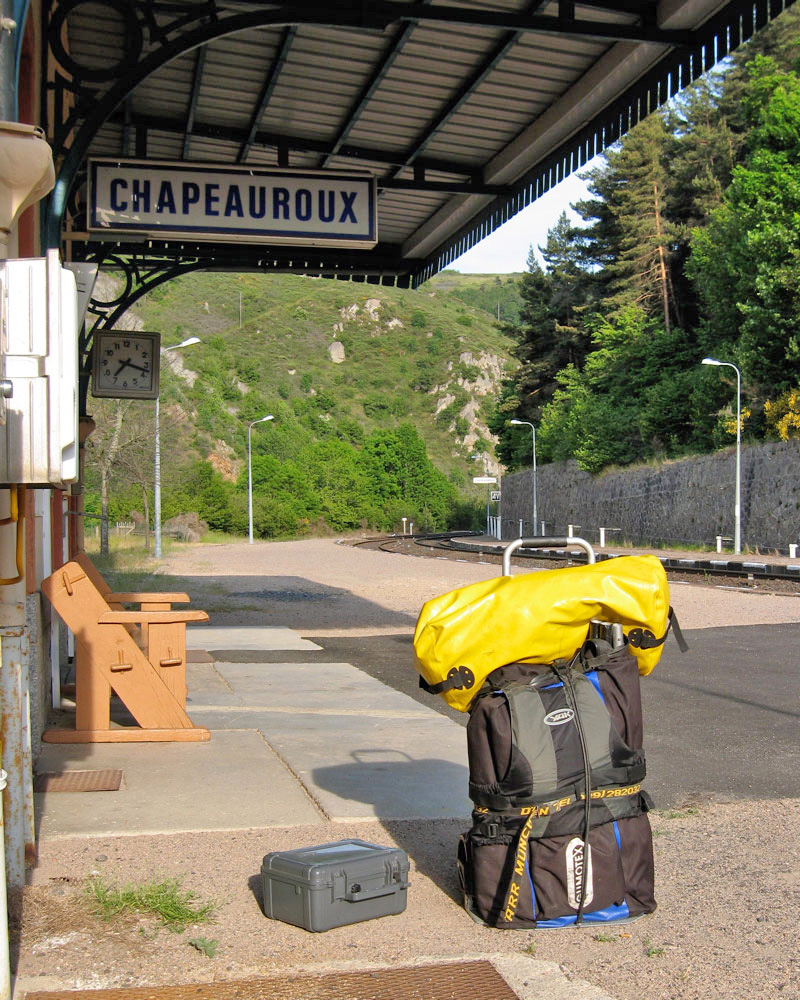
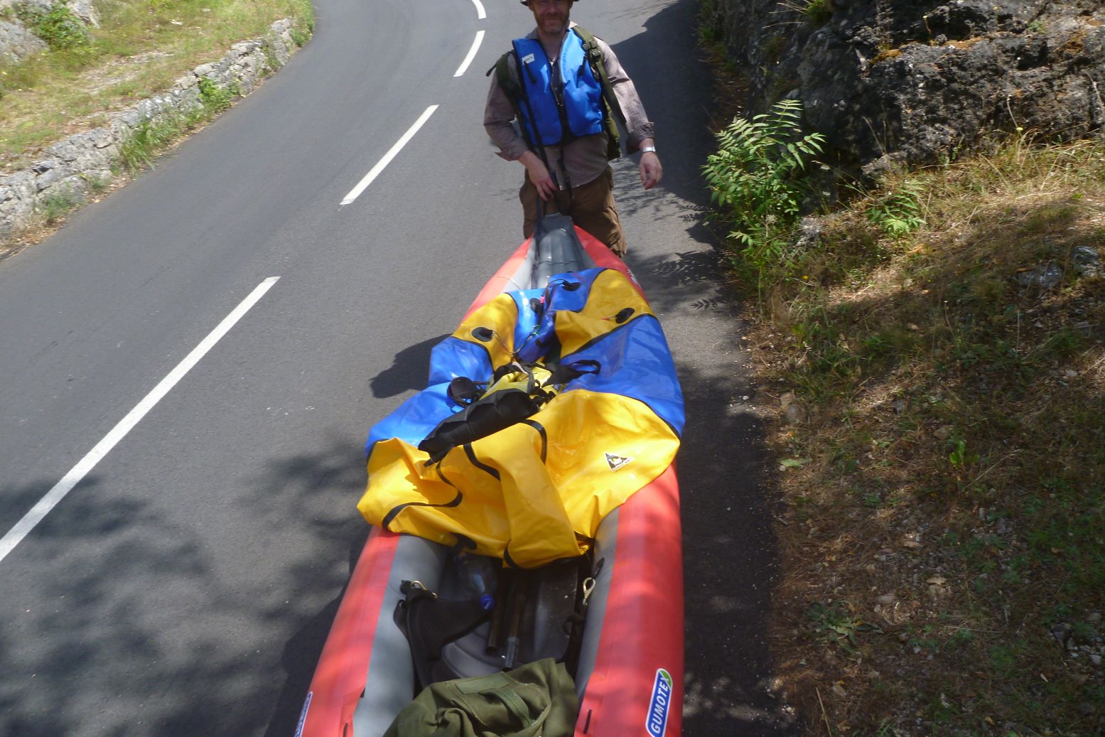
IK by train. A trolley helps
‘Paddle This Way’ Working through the book, up front after a handy country map which you’ll be referring to a lot, we get 26 (or xxvi) pages of what and how. Flying is discouraged for environmental but also supposedly impractical reasons even if, despite what’s claimed, a packboat or iSUP is easily loaded on a plane. There’s good info on the various car regulations including urban emission restrictions which could catch a foreigner out. On a Eurostar there’s no weight limit, so if you can get two bags like left (IK with camping gear on a folding trolley) you’ll not pay excess fees, despite what’s said. With a packraft there’s nothing to it. There follows a section about paddleboarding with the ‘accessibility and flexibility’ words I see mentioned so often, but which have long applied to packboats too, and especially packrafts (sorry; we’ve finished this argument, haven’t we?!). How to SUP, choosing a SUP and washing SUP; it’s all summarised. Kayaks and canoes get slightly less detailed treatment from expert contributors lifted from the Britain book who list elementary turning strokes a child would guess. Better to suggest a technique I found less intuitive: pushing on the upper arm, not yanking on the lower, as so many kayak newbs do. A box on renting boats and boards (also listed locally after each Route) recommends French outdoor retailer Decathlon’s IK rental service (and which might have included Decathlon’s packraft range, cough, cough). But I couldn’t find any rental boats on decathlon.fr and think that side of the service has been dropped.
iSUP in the bag. Gael A
Talking about gear, much of it makes sense, but it’s odd to see a manual SUP pump listed as ‘the biggest regret of the project‘, with the advice to get a 12-volt car inflator. So much for using public transport then! You can have both of course – long/thin SUP pumps are bulky compared to pocket packraft inflators, but the autonomy they offer changes the game by being able to ditch cars. A ‘Wear a Buoyancy Aid’ heading on page xx unfortunately appears right below a stock shot of half a dozen SUPists clad only in skimpy swimwear (and again two pages earlier). I read here 62% of UK ‘boarders don’t regard a PFD is an essential safety item. I rarely see them worn, but then I rarely see SUP boarders actually standing up. I suppose as long as you’re leashed to your board (the skimpies are unleashed), in deep but calm water you can crawl back on, providing you clung to you paddle. But on some of the listed rivers I know a leash can also be an entrapment hazard. Not mentioned. This is where handbooks or guidebooks written by paddling pros like Bill Mattos, Peter Knowles, Mark Rainsley, Laurent Nicholas, Luc Mehl and even Bradt’s own Lizzie Carr and Wild Thing’s Lisa Drewe have the edge. I’ve learned a whole lot from nearly all of them.
To her credit, every photo of Anna Richards on a board is in full wetsuit with pfd. What a shame there was no shot of her on Route 31 in Lyon, her home town – just more stock imagery. River rowers never wear BAs either, but it does seem to be a blind spot with SUP users. As said, most of the book’s images come from photo libraries, and of the SUPs pictured in the book, half have no BA, compared to only 1 in 10 kayakers. With off-season paddling often covered, you’d think then here’d a good place to mention the perils of cold water shock (scroll down to ‘C’) to drive the PFD message home: you drown flailing in a breathless panic long before succumbing to hypothermia. On Lake Annecy (Route 33) we’re told winter water temps are a ‘distinctly refreshing 4°C‘. There’s also no mention of the real menace of weirs (barrage in French; ‘low-head dams’ in the US) which led to that Welsh SUP tragedy and was also drummed into my paddle reading early on. There follows some boilerplate stuff on responsible paddling. Good to learn wild camping in France is a bit less illegal than I’d thought; it just emphasises how satisfying multi-day routes are (as in the Britain book). And I never knew canal paddling wasn’t allowed either*, nor the Seine in Paris. No wonder the French are so militant!
* Gael A adds: Canal paddling is allowed in many places. Inland waterways can be rivers or canals. Those capable of commercial shipping are managed by the public company Voies Navigables de France VNF. VNF decides which type of craft is authorized on each waterway or portion of waterway. For instance the Seine through Paris intra-muros is not allowed to sailing dinghies, skiffs, canoes, SUPs etc., while it is allowed downstream near Boulogne-Billancourt or Maisons-Laffittes and upstream near Saint-Fargeau for instance. VNF manages wide and deep waterways open to large barges. Older narrow gauge canals still in operation like Canal du Midi, Canal de Bourgogne or Canal de Nantes à Brest are no longer used for shipping and from now on dedicated to recreational navigation, which includes recreational barges, river yachts, canoes, SUPs, etc. For instance, when I couldn’t paddle on the river Marne because it was in spate, I went to Canal de l’Ourcq, although canal paddling is boring actually.
Division 240 sea regs With sea paddling routes included, I’d have expected a reference or at least a link to France’s Division 240 regs and how they might apply to SUPs. Another thing that could catch foreigners out, just as with driving, especially Brits from reg-slack UK. IK&P’s French SUP correspondent Gael A explains the sea regs as follows:
Division 240 applies to SUPs more than 3.50m [11.5′] long. SUPs shorter than 3.50m fall into the beach toy category, consequently they can’t go beyond 300 m from a sheltered shore. SUPs longer than 3.50m can go beyond the 300m limit up to 2 nautical miles [3.7km], by daytime only, provided they comply with watertightness, stability and buoyancy requirements described in Division 245. To make a long story short, a SUP must have 2 chambers. A SUP with only one chamber is considered a beach toy even if longer than 3.50m. Obviously watertightness and stability requirements don’t apply to SUPs. Navigation in the 300m-2nm zone requires the following safety gear: • leash • PFD 50N or wetsuit or drysuit • waterproof signal light like a strobe or a headlamp, or even a cyalume stick provided it is attached to the PFD.
So my single-chamber, 2.8-m TXL packraft would sadly be demoted to the beach toy it resembles and be restricted to less than 300m from a shore. But just as with having a high viz vest, warning triangle and breathalysers in your car (all detailed on pager xi), you do wonder how- or if all this is enforced. It’s a guidebook’s job to inform readers. Winds will always be unpredictable but there’s very little tidal information on the salt water routes, and whether it might be a factor. The much loved MagicSeaweed app listed on page xx went offline mid 2023, 10 months before the book was published, and its replacement seems surf based. (There are similar online weather and sea state resources.) Down on the Med tides aren’t a thing, but Brittany has some of the world’s highest tidal ranges, reaching 15 metres on some routes. Not everyone may fully appreciate how if could affect some paddles.
Rental SoT shoots a chute on the Tarn (Route 23)
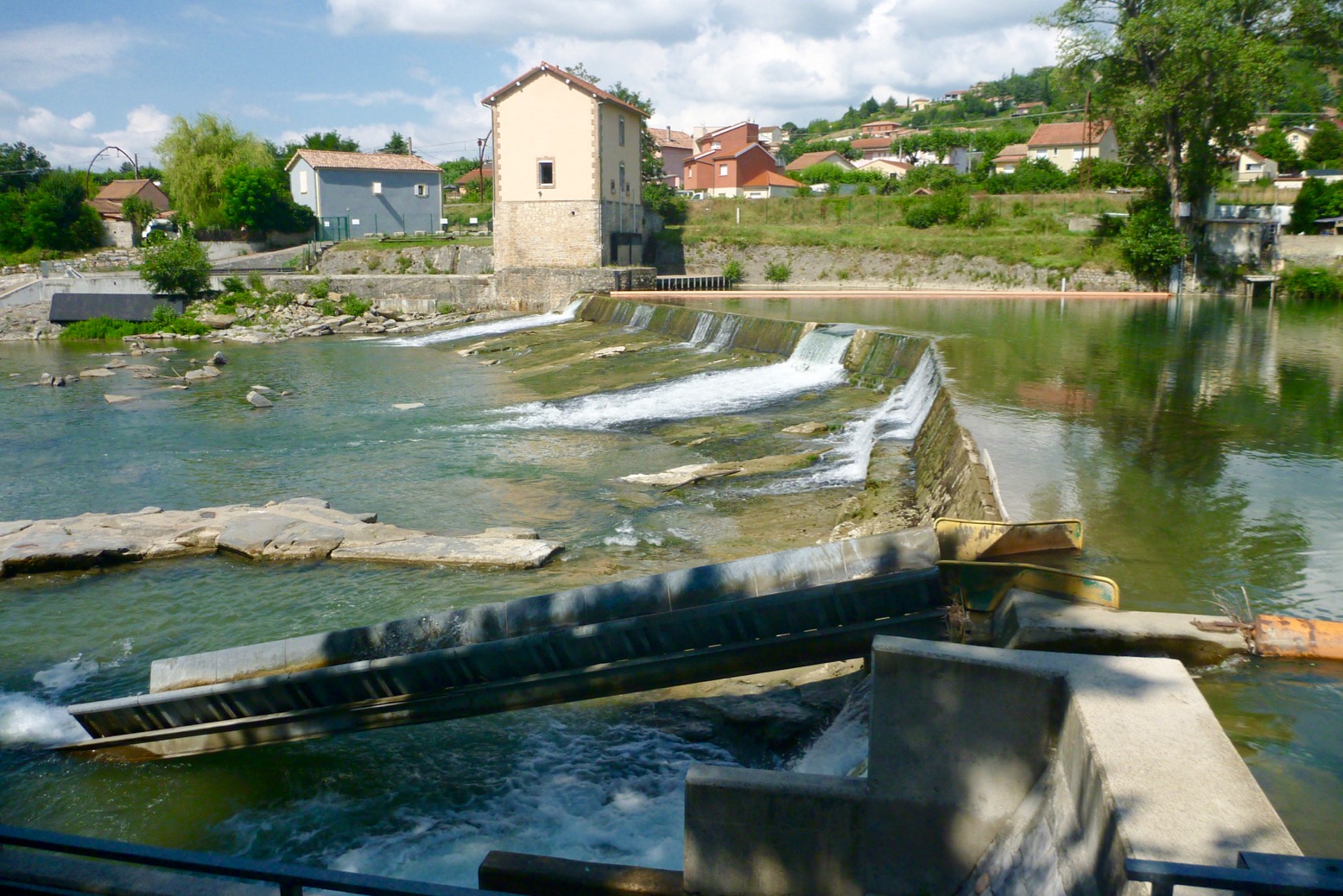
Odd that there’s no mention or imagery of thrilling glissades orpasse canoës (canoe chutes, left), a French speciality rarely seen in the UK. Built especially for paddlers (and sometimes fish) to avoid tedious portaging around weirs, glissades aren’t listed in the Paddling Vocabulary on p222. They’re an added highlight to many rivers I’ve paddled there and you’d think it might be fun to try sat on a SUP too.
Location and nav Like some other guidebooks, the Bradt uses the What3Words GPS location app to precisely pin down riverside put-ins as well as passing POIs on third-party mapping. I got into using the W3W website (not the app) to orientate myself with the book’s routes and ///graphics.dads.inched is much easier to momentarily memorise then type correctly than 48.85840, 2.29447, although the Rivières Nature en France guide uses QR codes which go straight to map; no typing needed. Only once on Route 27 did the W3W launch point end up near Tomtor in far eastern Siberia and the coldest settlement on earth. All the others were spot on. The W3W app also provides the conventional numerical D.D° waypoint equivalent (as above) which a GPS device needs, and which will work on all other mapping apps, not just W3W. Both (and QRs) are so much better than the archaic OS grid ref system used in the first edition of Britain as well Pesda guides. The world’s digital now.
Talking of maps, I’d have expected a tip towards the IGN Rando app, (left) the French equivalent of the UK’s excellent Ordnance Survey. Widely used Open Source Maps (OSM, on which the book’s mini maps are based) can be free, but in my experience you can’t beat centuries of refined cartographic know-how. And with mapping apps like IGN (or indeed Google) you can download an area of map for offline use when there’s no 4G – quite likely if backcountry France is anything like the UK. All phones have GPS so W3W will still work, or at least show points, if not background map tiles. On long river days in France I’ve often lost track of where the heck I was and how far salvation might be. A handheld GPS device (eg: Garmin) or a mobile app running offline maps is the answer to nav connectivity.
TheRoutes About three-quarters of the 40 routes (full list right) are there-and-back or loop paddles in the 5-12km range and can be just a couple of hours on the water. On a lake a loop makes sense, but where possible, I’d rather paddle a river or a coast one-way and bus or even walk back. The outdoorsy author has done big hikes herself; it’s a shame she missed out on ways to combine both for those with portable inflatables like hers, but there-and-back day trips are what most people do. About 15 routes are inshore sea paddles divided equally between Atlantic and Mediterranean. Another 15 are rivers (9 are one-way), and 7 are lakes, with a bit of overlap all round (estuaries, reservoirs, canals, weir-ed urban rivers, and so on). As you can see in the Contents, each route gets a descriptive heading which is a nice touch.
Each route also gets difficulty ratings from 1-5 for SUPs, and another for kayak/canoes. As you’d expect, most are easier or safer in a kayak, but all will be dependant on experience, river levels or coastal winds. The few one-ways are all great rivers in the Massif, like the Tarn (only 10km), Allier (11.5km) and the famous Ardeche – at a full 32km by far the book’s longest. The shortest is less than 2km, or 3km through the Il de Ré’s salt marshes (Route 16) – the sort of paddling locale probably better appreciated standing on a board.
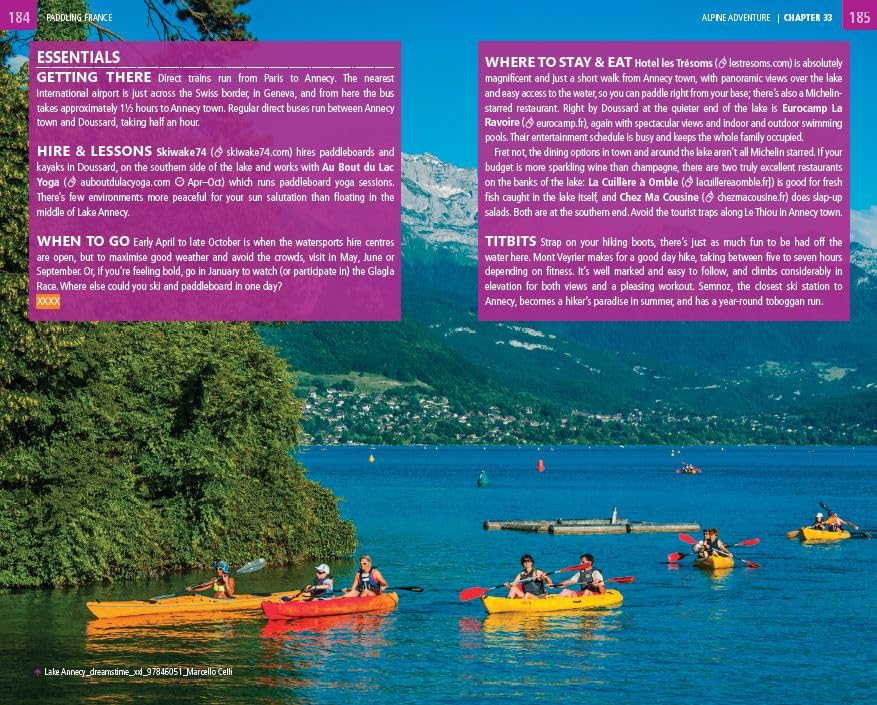
Essentials for Route 33: Lake Annecy in the Rhône-Alpes
Routes I know Like any know-all reader I ‘tested’ the four routes I’ve paddled through at least once to see how they compared with my recollections. I read a few other interesting ones too, then skimmed the rest.
€20 riverside lunch at Milandes – Dordogne (Route 20). Sure beats a Greggs on the Thames.
Route 20 on the Dordogne is a swift one-wayer of 11km passing several chateaux and ending with an easy bus trip back to the start. That’s what we want. I like the way some historical context is added into the narrative; as in the UK, it can be centuries deep in France. As it is you’ll be less than two hours on the water so best to string it out exploring some of the riverside villages. The Dordogne was my very first French paddle in 2005: a full 101-km of meanders and piffling riffles between Bretenoux and Tremolat. By the end I found it all a bit easy, but still fondly recall a deliciously expensive lunch at Milandes (above left), then randomly crawling off the river exhausted that evening, dumping the Gumotex Sunny in some undergrowth and squelching onto the grounds of what I now see was the luxury Manoir de Bellerive hotel. I was too tired to talk myself out of it.
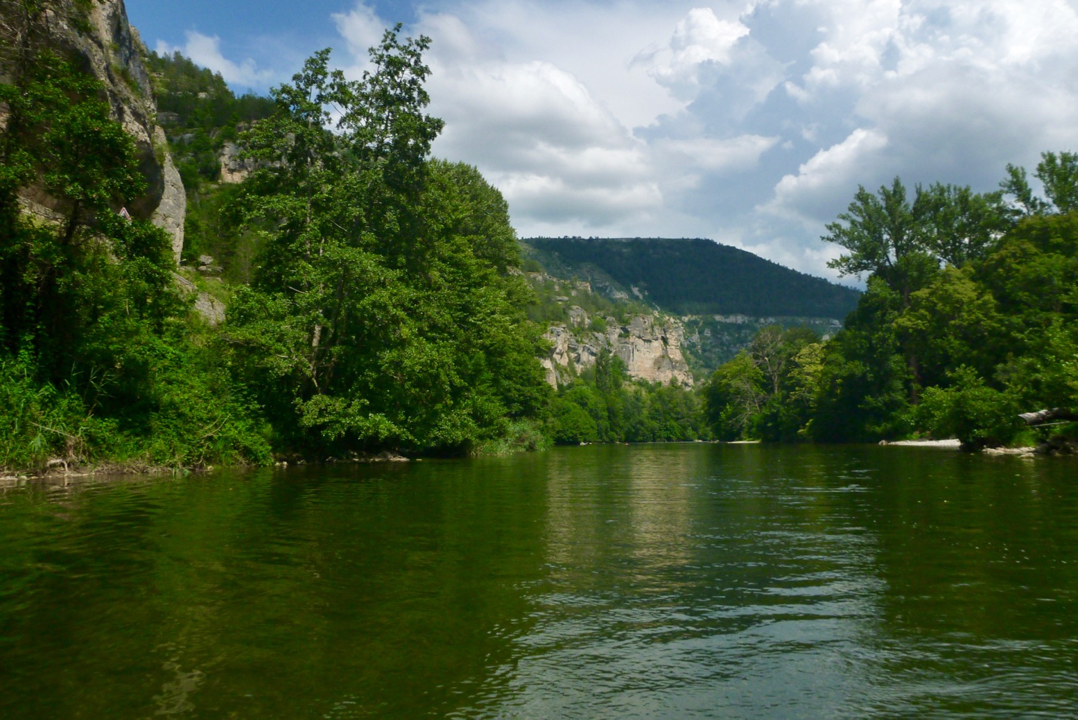
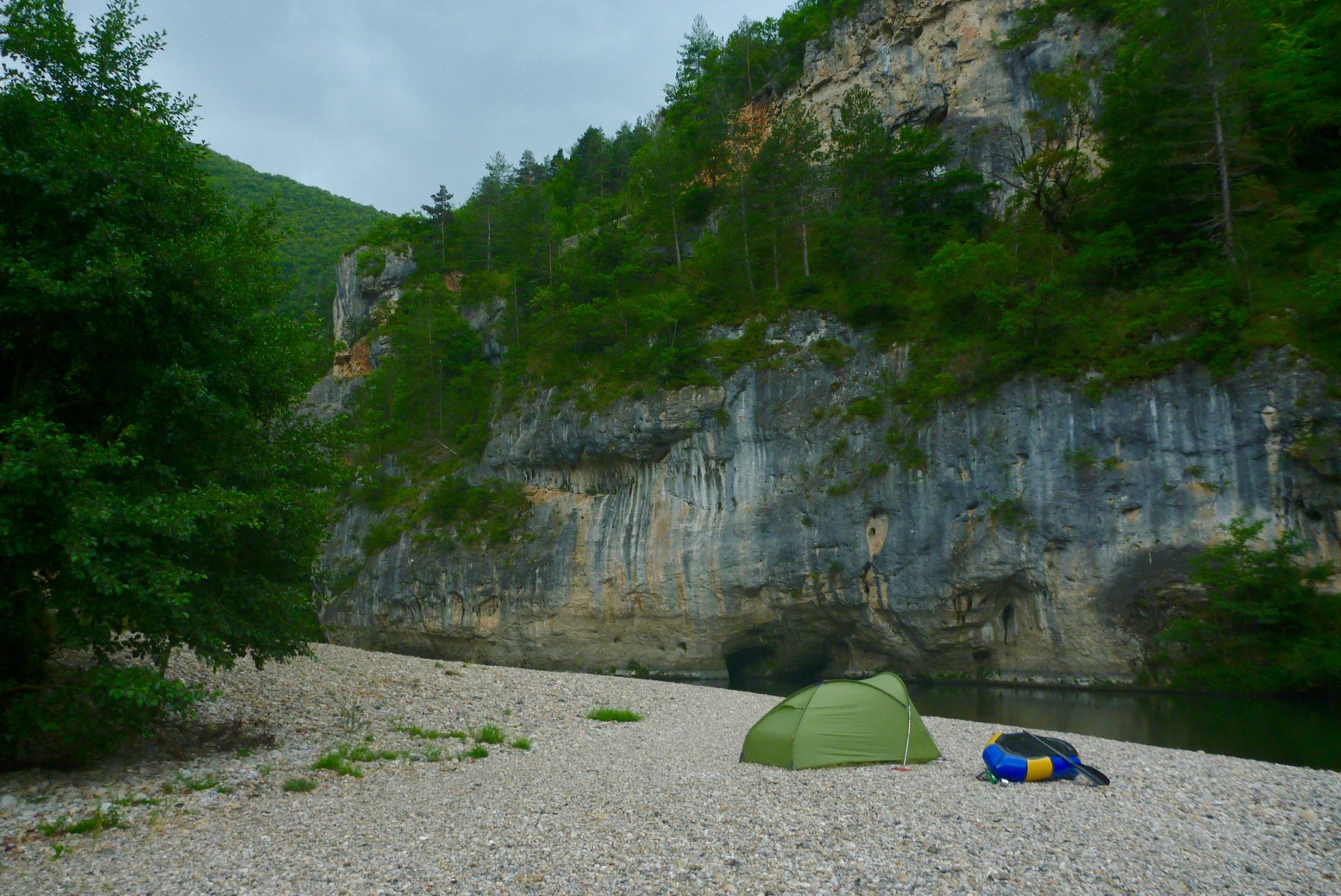
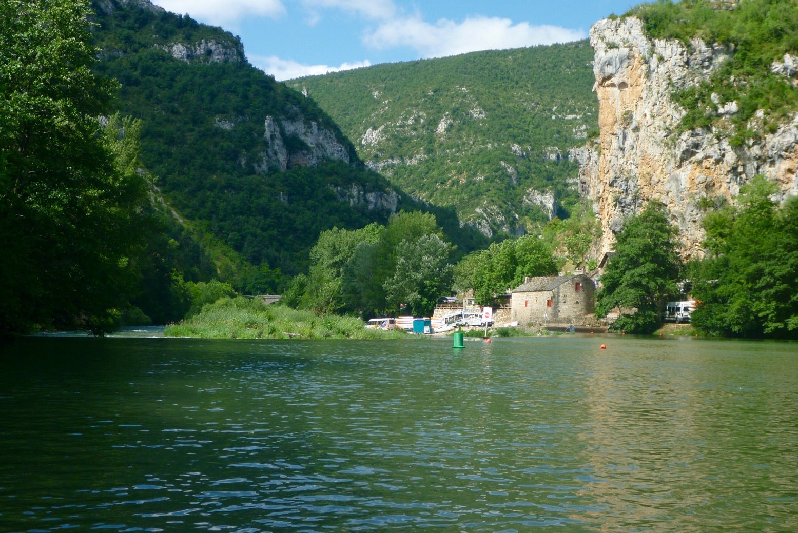
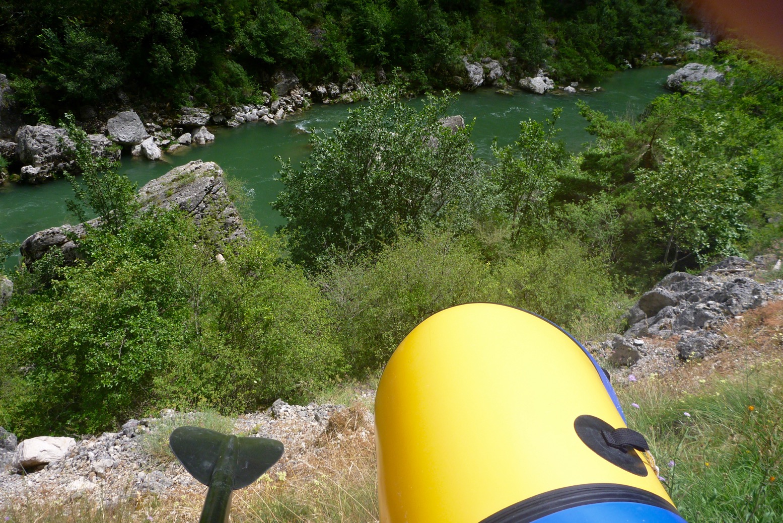
We’ve done the full 86-km of the Tarn (Route 23) from Florac to Millau at least 2.3 times using trains, planes, buses, taxis, IKs and packrafts, and the 11-km of this route took us just 90 dawdling minutes. As the book suggests, your eyes will be out on stalks, but it’s a shame to come all this way for half a morning in the amazing Tarn Gorge.
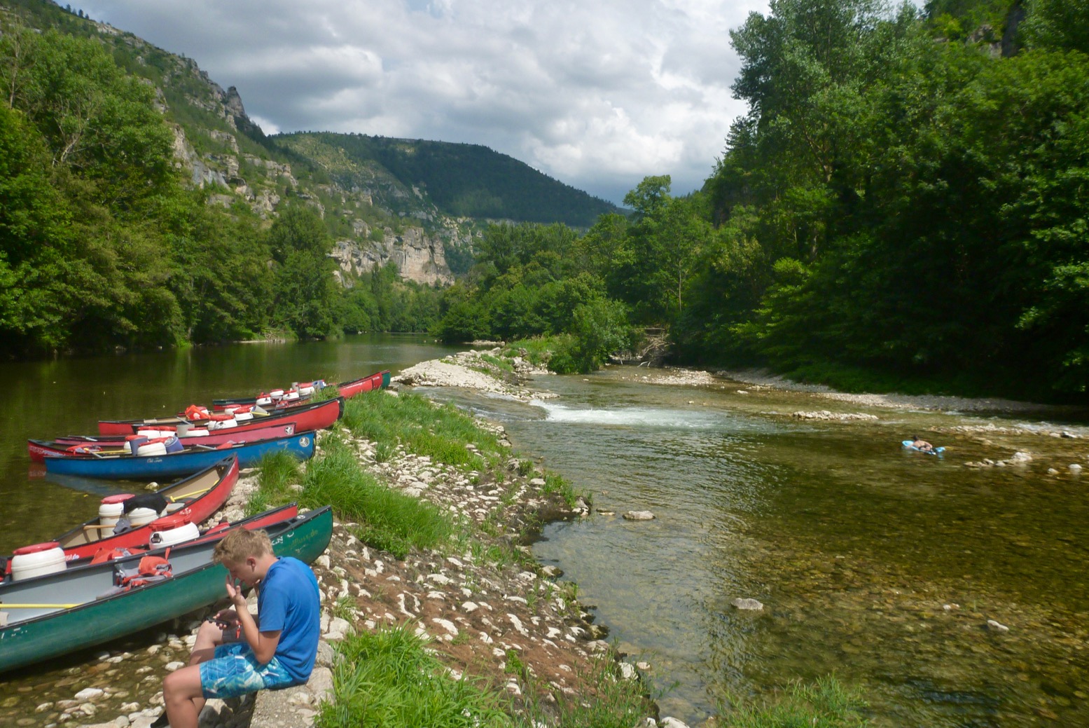
Portage around Pas de Soucy
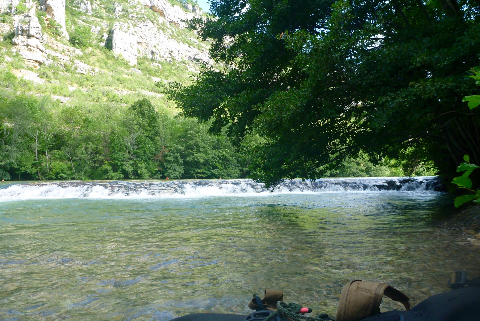
We also put in at La Malene one time, but following the easy 10-minute portage around Pas the Soucy (left; we clocked 9km), we did another 12km via Les Vignes to Le Rozier, capping a satisfying and spectacular day on the Tarn. The book advises to ‘disembark’ before Pas de Soucy a ‘gnarlywaterfall… which shouldn’t be attempted … unless you’re seriously professional‘. Shooting waterfalls can be a survivable stunt, but Soucy is a far more deadly rockfall with several syphons – another white water paddlers’ nightmare. It’s a serious mistake to make as photos show the author on her SUP so she was right there.
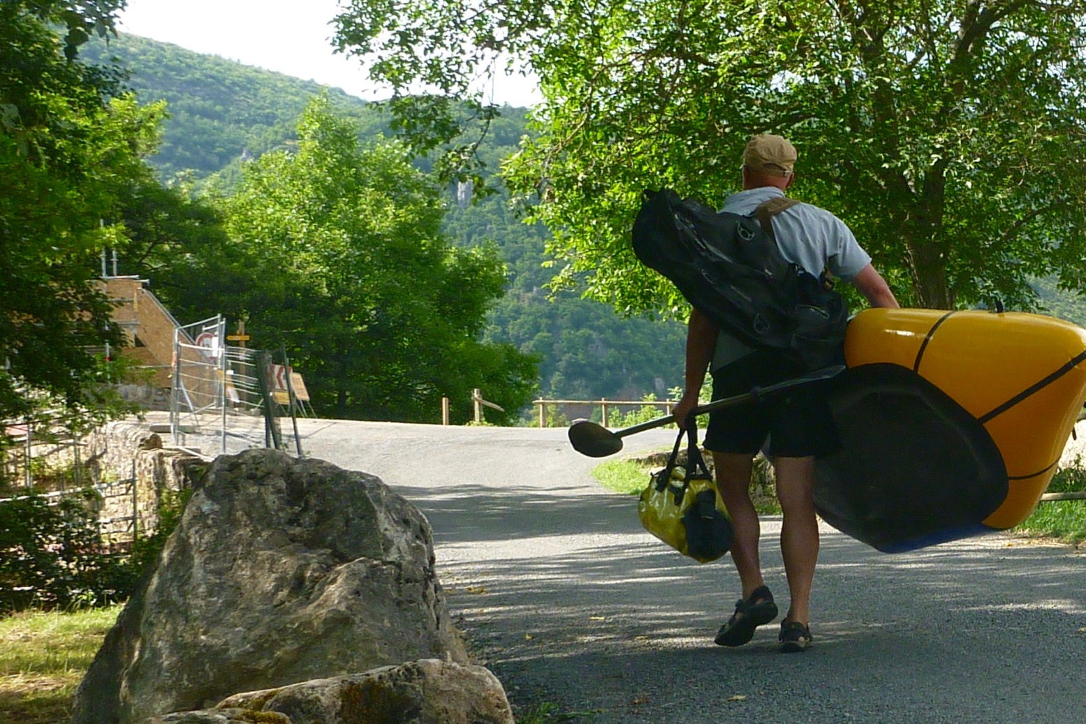
IK on the Tarn
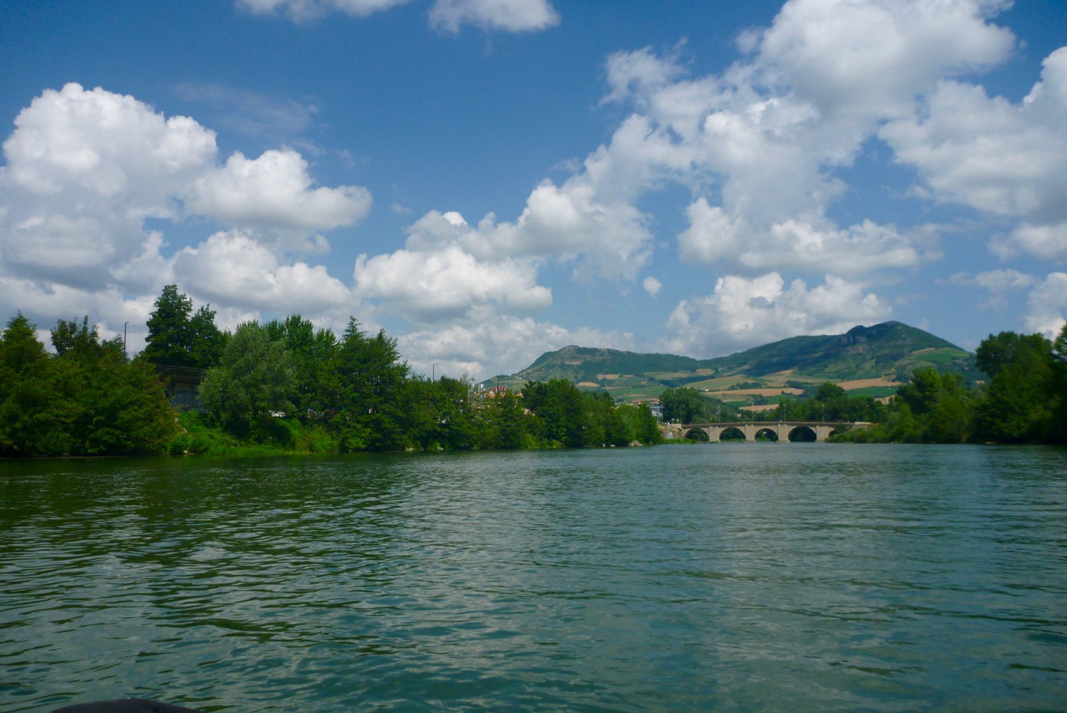
On one of my favourites, the Allier (Route 27; 11km), you wonder why choose the hard to reach put-in at le Pradel, when Prades hamlet with shops, toilets, parking and a popular put-in beach is just a mile up the road? Perhaps partly because the rental outfit dropped the author here? Many of the book’s one-way river paddles seem predicated on the put-ins and itineraries of local kayak tour/rental operators (who each get a usually sole mention), rather than what would suit independent paddlers in their own boats and other means of getting around. With or without vehicles (or unwilling to use taxis), such paddlers could do a lot worse on the Allier than Langeac to Brioude, 38km. The two towns are just four stops (30 mins) apart on the Cevenol train line which followed all the way up the Allier gorges is a day out in itself.
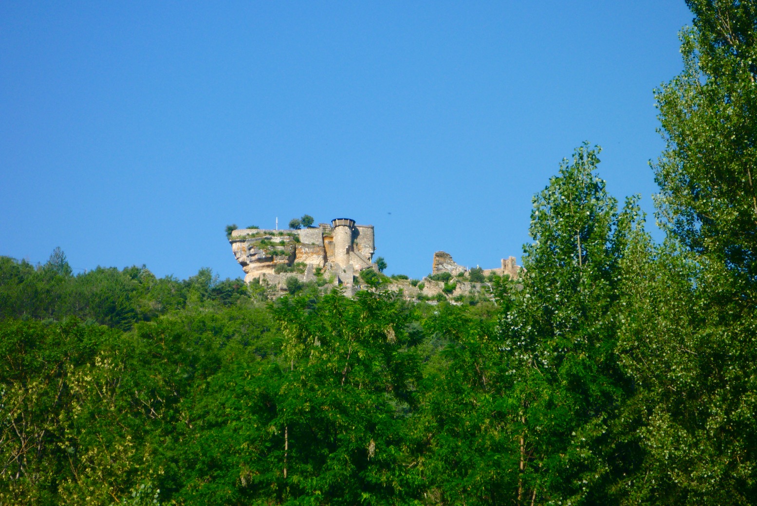
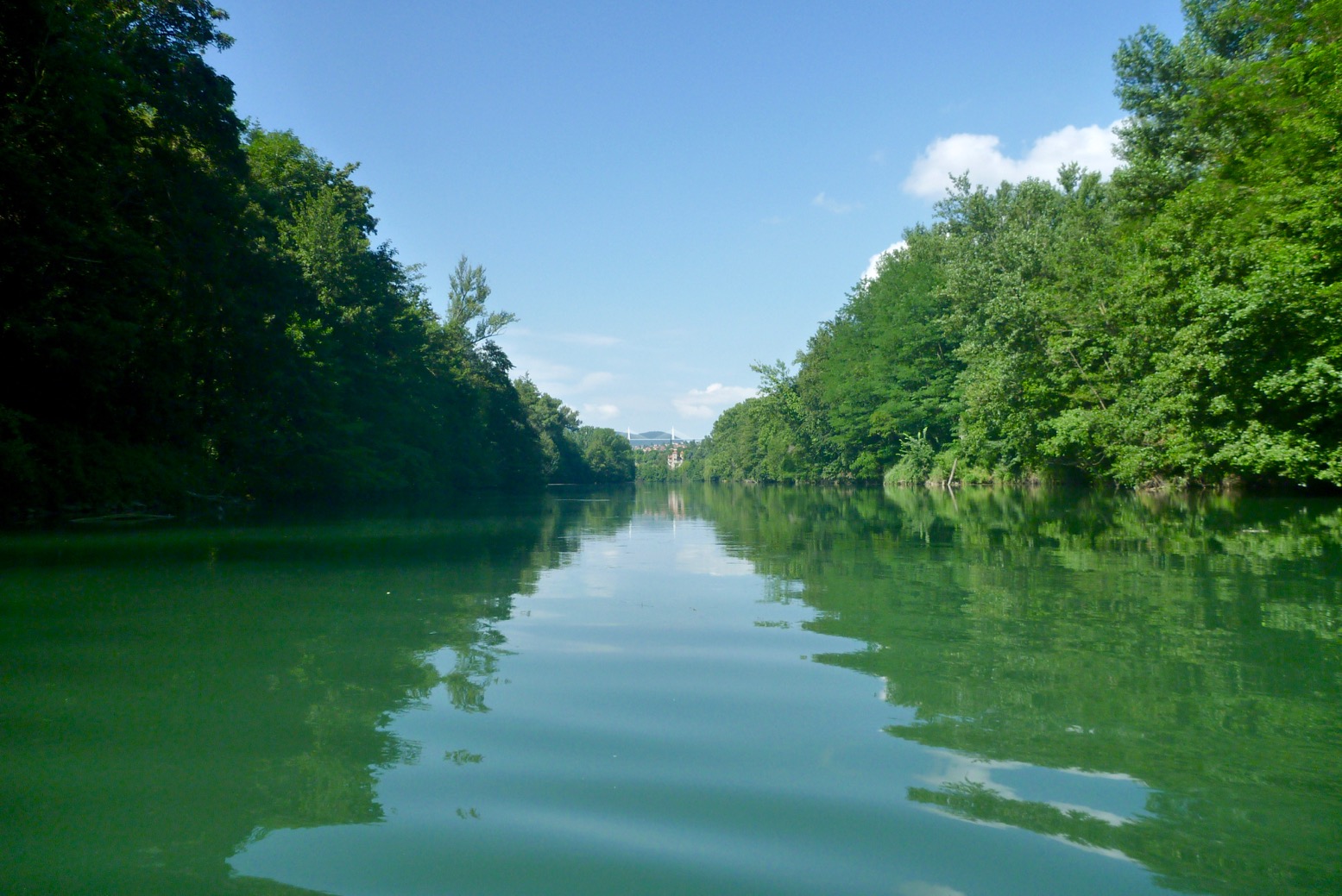
Route 29 is the Ardeche, the longest in the book by far at 32km, of which the author says: ‘If you do one route in this book, make it [the Ardeche]’. This proves Anna Richards gets the appeal of doing a full day, one-way paddle, instead of two-hour there-and-backs which can be done back home on any summer’s evening. ‘It will leave you speechless…’ she continues. There’s certainly nothing like it (or the nearby Tarn) in the UK which is why in high summer you might get crushed in a white-water logjam of upturned rentals.
Pont d’Arc
Sevy on the Ardeche joins the melee
For a long time I was put off the Ardeche, misinterpreting Rivers Publishing’s description, and for Paddling France the author recommends using an SoT over her paddleboard. A lot of the time long, damage-prone fins are given as the reason not to ‘board similar rivers, but surely shorter or bendy fins are available? I’d assume the bigger risk is losing balance and whacking your head or breaking your collarbone in shallow rapids. Or the fact that when sat down for safety, your average SUP steers like a sea kayak with half a paddle. In a bombproof packraft the Ardeche was plain good fun, made all the more memorable by the hoards of flailing revellers I’d normally seek to avoid. We came down over a week from Les Vans via the Chassezac tributary, covering about 70km. Many famous spots like the fabulously chaotic Charlemange rapids just before the arch (above and above left), and the Dent Noire rock (where emergency services stand by on busy days) go oddly unmentioned.
Fogbound SUPs at Morbihan (pic: Gael A)
Of the rest, everyone will find some great discoveries in Paddling France. Who’d know to try out the allotment-fringed canals of the hortillonnages off the Somme below Amiens’ gothic cathedral (below; Route 9). Other urban paddles also offer a novel viewpoint on a city which SUP-ing makes easier. Then there’s amazing Etretat on the Normandy coast which is probably geologically contiguous with Dorset’s Studland stacks over a hundred miles away. You’d hope that the rest of the sea paddles on this wild coast have been selected for their accessibility – probably so as rental outfitters will mean they’re a recognised thing. The sight of the book’s sole IK on p5 (Route 1, Corzon peninsula) was heartening, and the glittering granite sand spits of Glénan islands look like a mini Scilly Isles, though you’d think calm days here are infrequent. There are loads of tempting locales, and of course the book’s many brief itineraries can easily be extended if you ask around or consult other guides.
A maze of canals. Route 9 in Amiens
For her first guidebook Anna Richards has done a great job putting it all together. While it’s not that hard to find brilliant paddles in France, each route offers a locale with a proven appeal and rentals on site. Paddling France is easily worth 20 quid to have this information and inspiration in your hand to browse. A lot of my reservations are picky, but a printed guidebook from an established travel publisher carries an authority than online braying cannot match, and with it comes responsibility. Much more so for paddling, I believe, than walking or cycling guides, for example. After a quick flip through, Bradt’s Paddling Britain seems to have achieved this. As detailed above, a tiny amount of work would get Paddling France close to the calibre of that book and the other paddle guides mentioned. If the author didn’t have the paddling experience before setting out to write this guide, you’d think she had it by the time the book was finished. When I first got into river paddling I thought ‘How do you know that round the corner you won’t get swept into some deadly rapids or sluice with no way of easily getting ashore?’ For this reason, river guides are different other outdoor activities. You can’t always get off the ride quickly or at all. Your typical happy-clappy SUPy Puppy (and budget IK user, for that matter) buys a paddle craft online and hits the water, literally not knowing one side of a paddle blade from another (as the author also notes). Paddleboarding may be associated with the trendy Slow Travel movement, but on the water you can get in trouble fast, which is why it’s important to be across the risks and regs. We all have to start somewhere but in my experience, despite months of hard work, all this can often be too much to catch first time round, and to a busy publisher it’s just another title in the production line. Bradt is not a specialist in nautical publishing but a quick pass by a paddle-savvy editor would have caught most of the clangers. With a bit of distance and feedback, very often a guidebook’s second edition is what an author endeavoured to write first time round. I look forward to reviewing that one too.
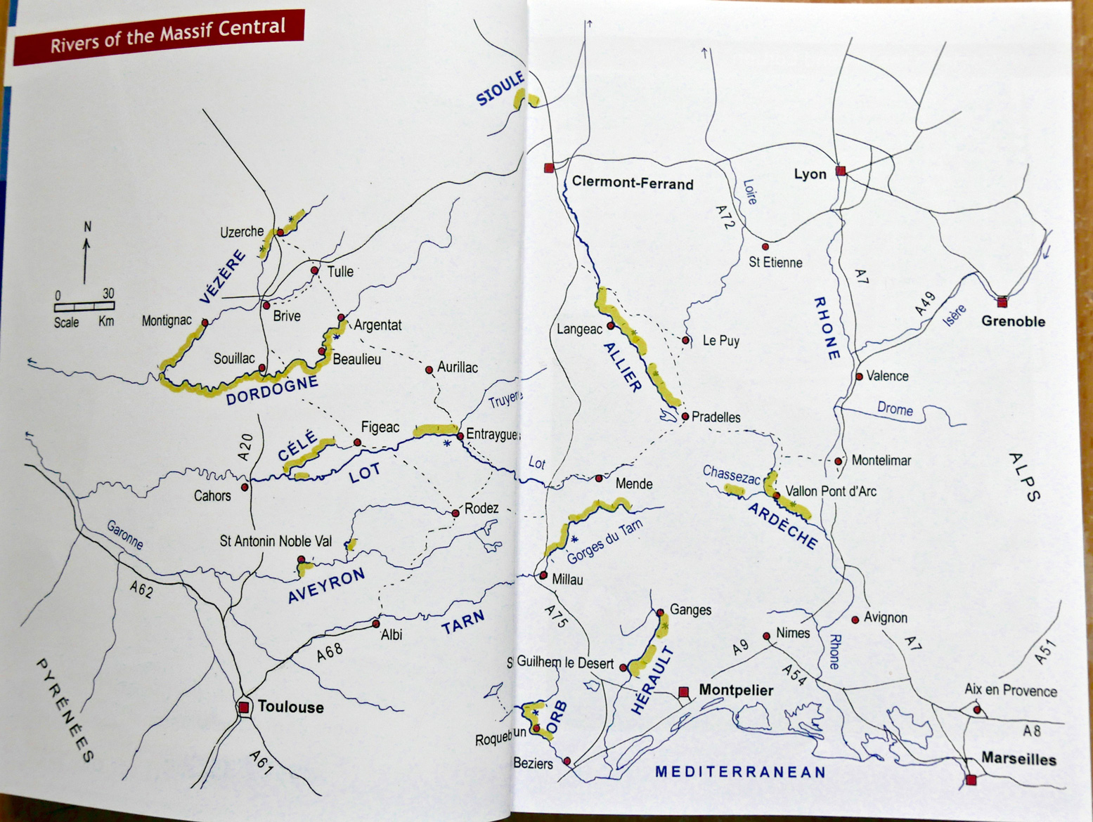
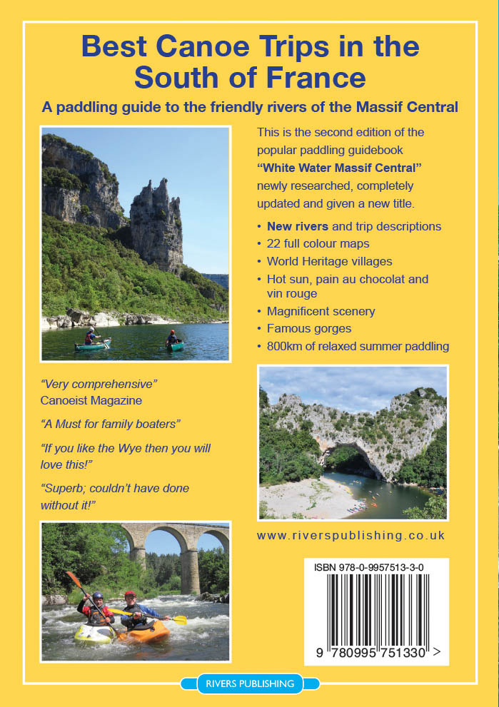
Back in print after 16 years, Rivers Publishing have updated their 2002 White Water Massif Central canoe guide, now less scarily titled: Best Canoe Trips in the South of France. Packboats aren’t mentioned, but what’s doable in a canoe is well suited to IKs and is easier still in packrafts.
Compared to a Pesda Press paddling guide, Best Canoe Trips looks old school and a bit amateurish, but there’s nothing else like it in English covering France’s inspiring Massif region (right). It’s a good example of: ‘write it and they might come’. Even now, let alone back in 2002, trying to amass this sort of information online would take days of effort and translating, (though I belatedly can see how online translation apps can make a book like Rivieres Nature en France usable by readers with limited French. Whichever you choose, this is why there’s still a place for proper, well-researched paper guidebooks.
Visiting over the years with packboats using planes and trains and mates in vans, I’ve ticked off just about all the original book’s big rivers. Like a lot of activities in France, the whole scene is so much more fun, open and less rule-bound than the UK. You can’t help but smile as you bundle into a Tarn or Ardeche rapid alongside floating barrels and screaming teenagers clinging to upturned rentals.
What they say:
[Best Canoe Trips in the South of France] is written for the recreational canoeist, kayaker, or stand-up paddle boarder going on holiday to the South of France. Rivers include the famous Gorges du Tarn, Gorges de l’Ardèche, Dordogne and Lot, besides some lesser known jewels such as the Allier, Hérault, Orb, Vézere and Célé. The Massif Central is renowned for its canoeing and the rivers in this guidebook are some of the best in the world for canoe-camping. This guide book targets those rivers that have easy white water and assured water levels in the summer months of July and August, when most families have to take their holidays. New dams, reservoirs, and guaranteed water releases means that canoe tourism is now huge in the Massif Central and this guide covers over 800km of class 1-3 [rivers], with all the details needed for a fabulous and truly escapist, holiday. This new edition has details of two new rivers, 22 detailed colour maps, updated river descriptions, recommended campsites and lots of inspiring photographs.
What I think • Great selection of brilliant rivers • Loads and loads of good colour photos show how it is
• Some maps lacking in detail and consistency • Route descriptions could be more concise • Poor updating; errors on the two rivers I paddled recently • What’s with the fake cover?
Photoshop?
Review If you know the original edition (far left), first thing you’ll spot is the near-identical cover, but with scary, frothing rapids airbrushed out and a somewhat anachronistic SUP pasted on, a embarrassingly clumsy attempt to cash-in on the current SUP craze. Some of Rivers’ other publications feature very nice retro poster-style covers (right) which would have suited Best Canoe Trips perfectly. Can a non-faked image of canoeing in the Massif be so hard to track down? The book is full of them. But if you don’t know the previous edition you’ll probably not notice the front cover photoshoppery. Imagine what AI could manage today?!
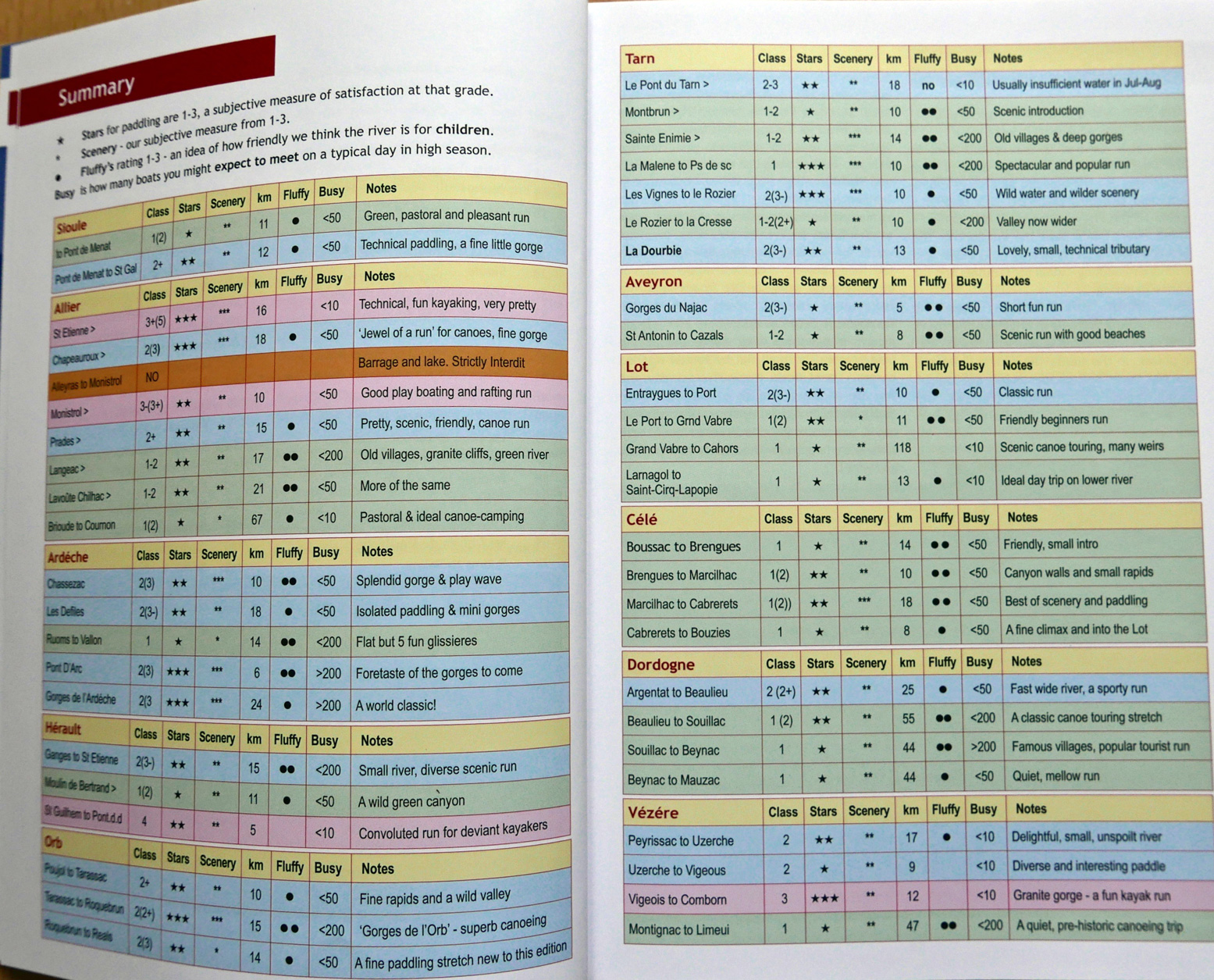
Excellent at-a-glance summary of all the rivers
Inside, it’s now full colour and twin column, like a Pesda. Two small rivers have been added: the 23-km Sioule north of Clermont, and all of 13km of the Dourbie meeting the Tarn at Millau. It’s not much which proves they did a thorough job first time around, even if some descriptions were incomplete. Up front are Planning and Resources sections before getting stuck into the 11 (actually 12, with Chassezac) river descriptions. Each river still gets a rating table for magnificence, enjoyment, child-friendliness, as well as cleanliness, temperature, flow in cumecs, and busy-ness. Of these last four, the traffic is most useful for what to expect. Without lab tests, all the rivers I’ve done looked clean enough, and temperature was what it was on the day, depending on depth or season. And who but a river pro knows what ‘7 cumecs’ looks like? There must be some rationale to it, but to me identifying the locations of more easily understood river level gauges (where present) would be much more useful, as you can refer to this handy live river levelswebsite.
The river descriptions remain long-winded – 85km of Tarn goes on for 16 pages, albeit with loads of photo padding. It makes it hard to pin down the nitty-gritty. Headings include Camping, Off the River, Food & Drink, more Camping, then Maps & Guides. Then each suggested shuttle-able day-stage is described, some getting Summary and Description headings, some not. Boxes cover asides, others list tourist offices and campsite telephone numbers where surely websites (as in the old edition) are infinitely more useful. The ‘Off the River’ heading is a nice touch, suggesting the many other things to see and do locally, and you get a recommendation for the best IGN map/s for the river. You’ll need that because, despite a handy, ‘big picture’ river map scaled-down to fit a page, with the subsequent stage maps you’ll struggle to orientate yourself unless you keep track closely, and the important detail is rendered inconsistently from map to map. All but three of the 20-odd maps are the same as edition 1. At over 1:100,000 scale (some over twice that), the 50k or bigger walking standard would be much better, such as Chassezac on p64. Only the map for the new Sioule river shows how it should have been done: a coincidentally usable scale of 71k and each weir, rapid and so on marked with a small red dash so you know what’s coming or where you are. To a nervous newb this is important. The old maps retain tiny dashes marking such things, but in blue over a blue river with blue writing that’s hard to read.
Just follow the river you might think. But when you’re wondering just how far to that nasty-sounding weir (which turns out to be nothing), without offline GPS mapping or a phone signal, a well-drawn and detailed map with bridges and other landmarks, is so much more useful and intuitive than columns and columns of text where one drossage reads very much like another. For 20 quid I’d expect to have proper, usable maps. Full, town-to-town river descriptions would also make more sense than obscure put-in to obscure take-out. We managed fine continuing beyond the half-described Chassezac (listed under ‘Ardeche’ for some reason) all the way to the actual Ardeche confluence. Same with the Tarn: Florac to Millau is a great 3-4 days. Why not just provide a full and accurate description right through to the white water course in Millau (a fun finale!) and let the reader decide where to start and end? Whoever they sent to update the Allier phoned it in. Distances (another useful aid to orientation; easily measured online) were out. Over-emphasised descriptions of ‘blink-and-you-miss-them’ pre-industrial weirs are now irrelevant, while other chute-avoiding weirs have become fun Class 2s. There are even left/right portaging errors introduced since the previous edition. See the Allier page for more detail. The ‘fluffy-duck-mascot’ joke was done to death first time round. Unfortunately, the author still thinks it has some mileage in this edition. Oh well, chacun a son gout. The switch to colour has given the book a fresh new look, but as a worthwhile improvement, the inconsistent updating has led to a missed opportunity. It’s perhaps to be expected because, as the author hints and my impressions concur, fewer families holiday like this anymore. Holiday-makers just bundle into a rental for a day and get vanned back to the campsite. All that is a shame as without the first edition I’d have missed out on a whole lot of memorable paddling adventures in lovely southern France, one of the best paddling locales in western Europe.
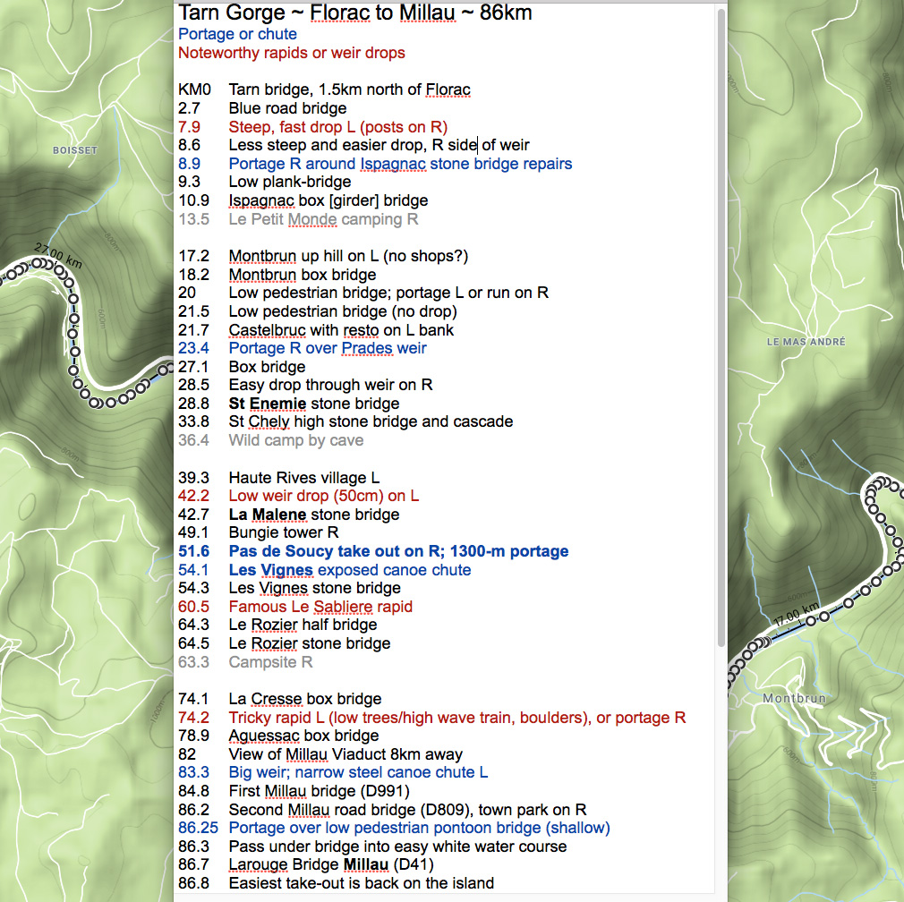
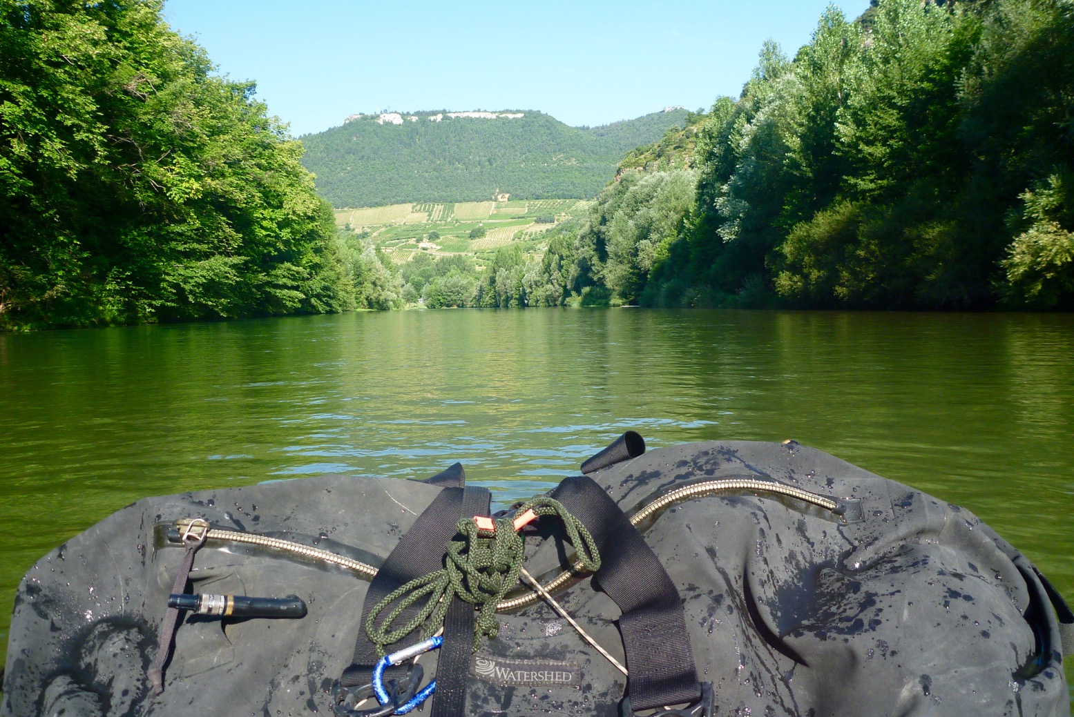
Just back from Tarn Gorge with the Yakraft, All the way from Florac to Millau; about 86km. I’m amazed the beating this boat takes, scrapping through the shallows and bouncing off the scenery. It took me two days plus two half-days each end, so about 18 hours of actual paddling. Surprisingly, I saw only day-renters or youth groups on the river – zero other private tourists like me. And from Florac to Montbrun, and Rozier to Millau I was the only boat on the water of any kind, unless you count an inflatable flying Pegasus.
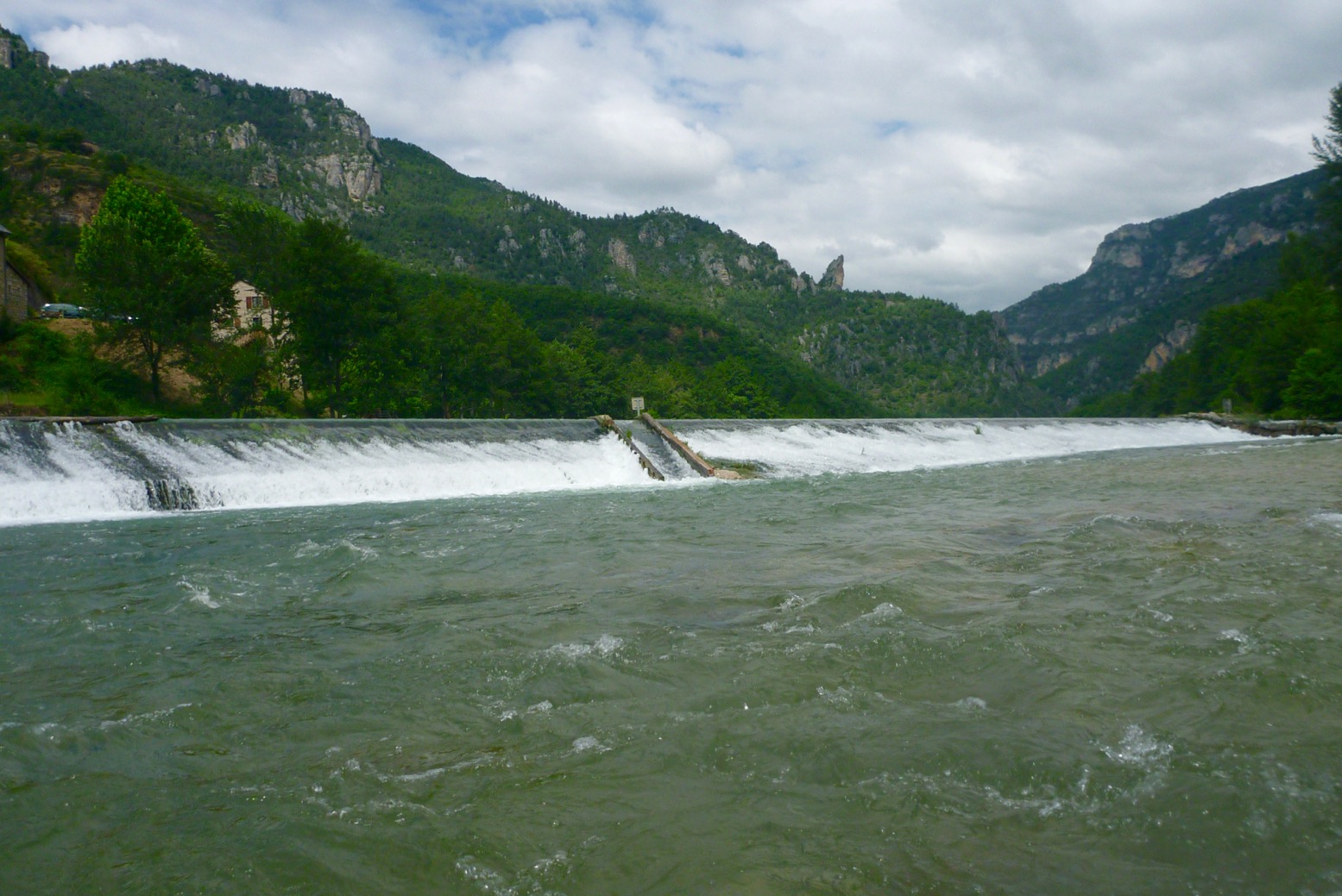
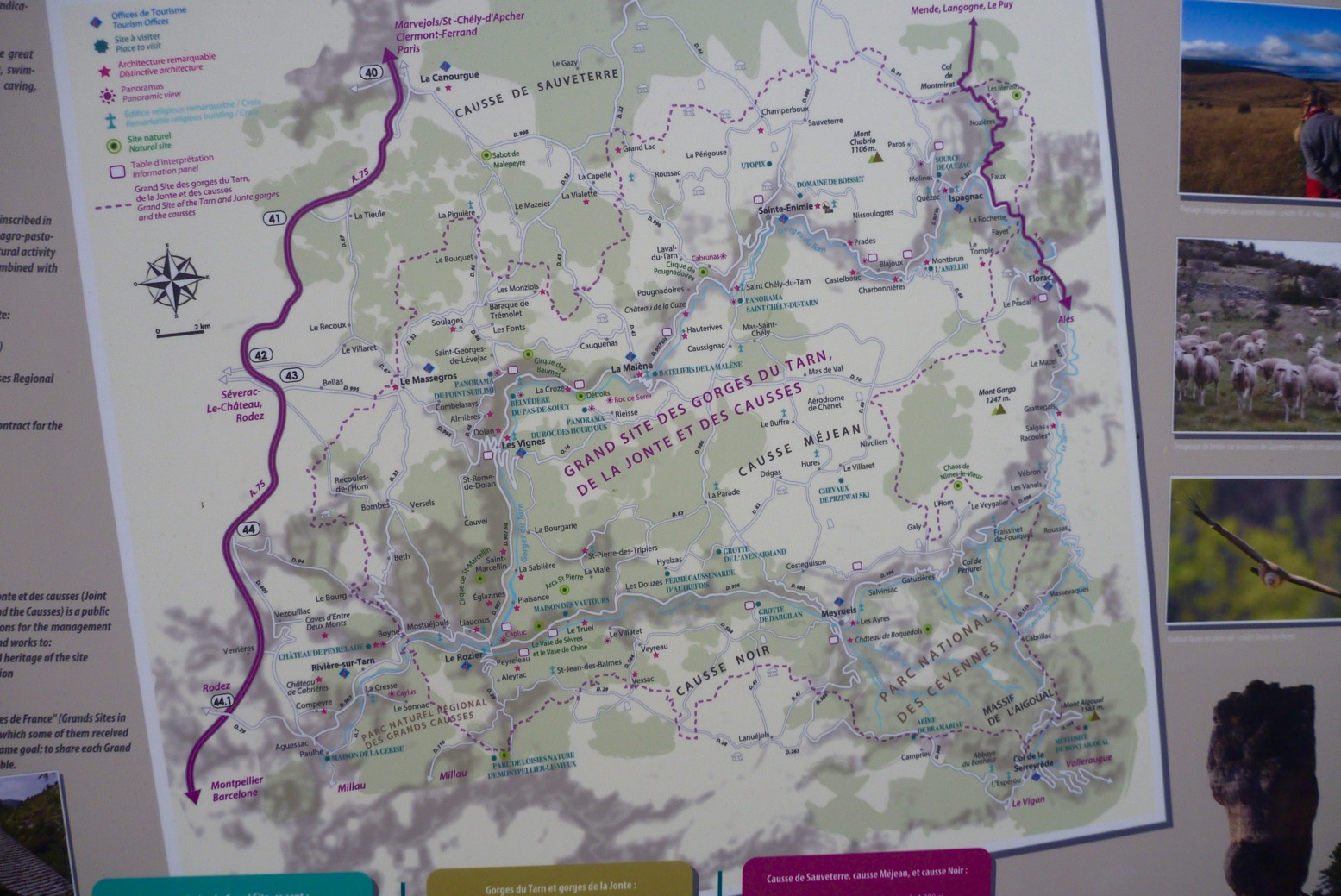
There are two unavoidable portages: Prades (KM23.4) and a longer haul at Pas the Soucy (KM51.6). There are also two canoe chutes (Les Vignes; KM54.1, and just before Millau (KM83.3) plus an odd, unsigned low weir drop at La Malene (KM42.2). See the map below.
Besides a quick 1-day-er two years ago, we last did the Tarn in 2007 in the Sunny and a Solar: Florac to Rozier. It’s worrying what I’ve either forgotten, conflated with other Massif rivers or has changed, but the Tarn is actually a perfect first-time packrafter’s camping adventure. There’s a road alongside (not always accessible without pitons); daily villages for resupply and enough WW challenges to keep things interesting. The scenery and la belle France you get for free. I shipped a few litres on rougher drops but never came close to flipping, unlike a few rental hardshell SoTs I observed.
Getting to Florac (KM0) I took the cheapest redeye Easyjet to Montpellier (there are 2–3 a day), got a train from Gare St Roch to Ales (changing at Nimes) and next day caught the only bus at 12.10 from Ales for Florac, getting on the water at 2pm. You might also try Ryanair to Nimes but the way the timetables were at the time, you’ll still miss that key 12.10 Ales bus on the same day. Another idea might be the way I came back: express bus between Montpellier St Roch and Millau (2 hours) then non-direct train and several buses back upstream towards Florac. You might just manage that in a day. Work it out with the Millau tourist office or the internet. Eurostar London to Nimes in 6-7 hours sounds so much more relaxing apart from the change in Paris, but usually costs way more than the cheapest flights, and you still won’t get that noon bus from Ales same day from London.
Knives & Gas At least on a train you don’t pay extra for baggage, but Eurostar won’t allow a useful-sized knife or camping gas cans. On a plane camping gas is also a no-no, so I planned to buy a can for my threaded burner in France. No luck as outdoors shops like Decathlon were all in out-of-town retail parks. Your classic blue Camping Gasis widely available in bigger supermarkets but has a different push-and-twist fit. I thought we sorted all this out years ago! Oh sorry, this is France. After traipsing around Ales finding only blue cans, I ended up buying the can and push-and-twist burner in St Enemie (probably could have bought in Florac too). At least next time in France I’ll have the burner and know I can get blue gas easily enough. Or you could always use a plane & rain proof ethanol Gimp Stove. I didn’t actually use my 10-function survival knife, but you know how it is; taking one makes it more of an adventure ;-) You can buy inexpensive wooden-handled Opinels easily in France.
River levels Not being a crusty demon of white water, I’ve never been that bothered about river levels, but a very good website is vigicrues.gouv.fr. You will see live measurements for the Tarn recorded at Florac (KM0); Montbrun (KM18), Mostuéjouls (KM65; near Le Rozier) and Millau. Generally in mid-summer Florac will read minus something and Montbrun will be between 0.3 and 0.5m. Let me tell you, once Montbrun gets towards 0.7m the Tarn is moving along very nicely indeed – up to 8kph in places – but 0.7m is usually a summer storm peak which subsides within a day. They say anything up to 1m at Montbrun is safe enough; beyond that things can get hairy.
Note the spike following a prolonged storm on Friday night/Saturday morning. Things sure sped up from then – last day I averaged 8kph – but never felt unsafe.
I found the old 2002 Massif Central book (right) not so helpful this time round. Even though I sort of knew what to expect – no outright Niagaras – I’d have appreciated better, bigger maps with each bridge, weir, portage and so on clearly marked to help orient myself. Also, the descriptions at each end, from Florac to Montbrun (first 18km) and beyond Les Cresses to Millau (last 12km) are either skimpy or now inaccurate, presumably because rental outfits don’t cover these sections of the river. On both these stages are rapids you’d really rather know about (see my map below). Read my review of the new edition, now renamed Best Canoe Trips in the South of France but with a near-identical Photoshopped cover (below right).
Thing is, on the Tarn you can pretty much blunder along in the dark; you won’t get lost, the rapids are never that technical, especially in a stable and agile packraft, wild camping is easy and proper bankside campsites, from basic to full-blown Hi-di-Hi holiday camps are plentiful and the main villages – St Enemie, La Malene, Les Vignes and Les Roziers are handy for snacks, drinks and pool toys. Can’t wait to get back to the Massif.


