
See also Packboating in Southern France
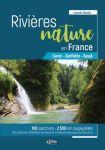
Rivieres Nature en France review
Bradt Paddling France

Back in print after 16 years, Rivers Publishing have updated their 2002 White Water Massif Central canoe guide, now less scarily titled: Best Canoe Trips in the South of France. Packboats aren’t mentioned, but what’s doable in a canoe is well suited to IKs and is easier still in packrafts.

Compared to a Pesda Press paddling guide, Best Canoe Trips looks old school and a bit amateurish, but there’s nothing else like it in English covering France’s inspiring Massif region (right). It’s a good example of: ‘write it and they might come’. Even now, let alone back in 2002, trying to amass this sort of information online would take days of effort and translating, (though I belatedly can see how online translation apps can make a book like Rivieres Nature en France usable by readers with limited French. Whichever you choose, this is why there’s still a place for proper, well-researched paper guidebooks.
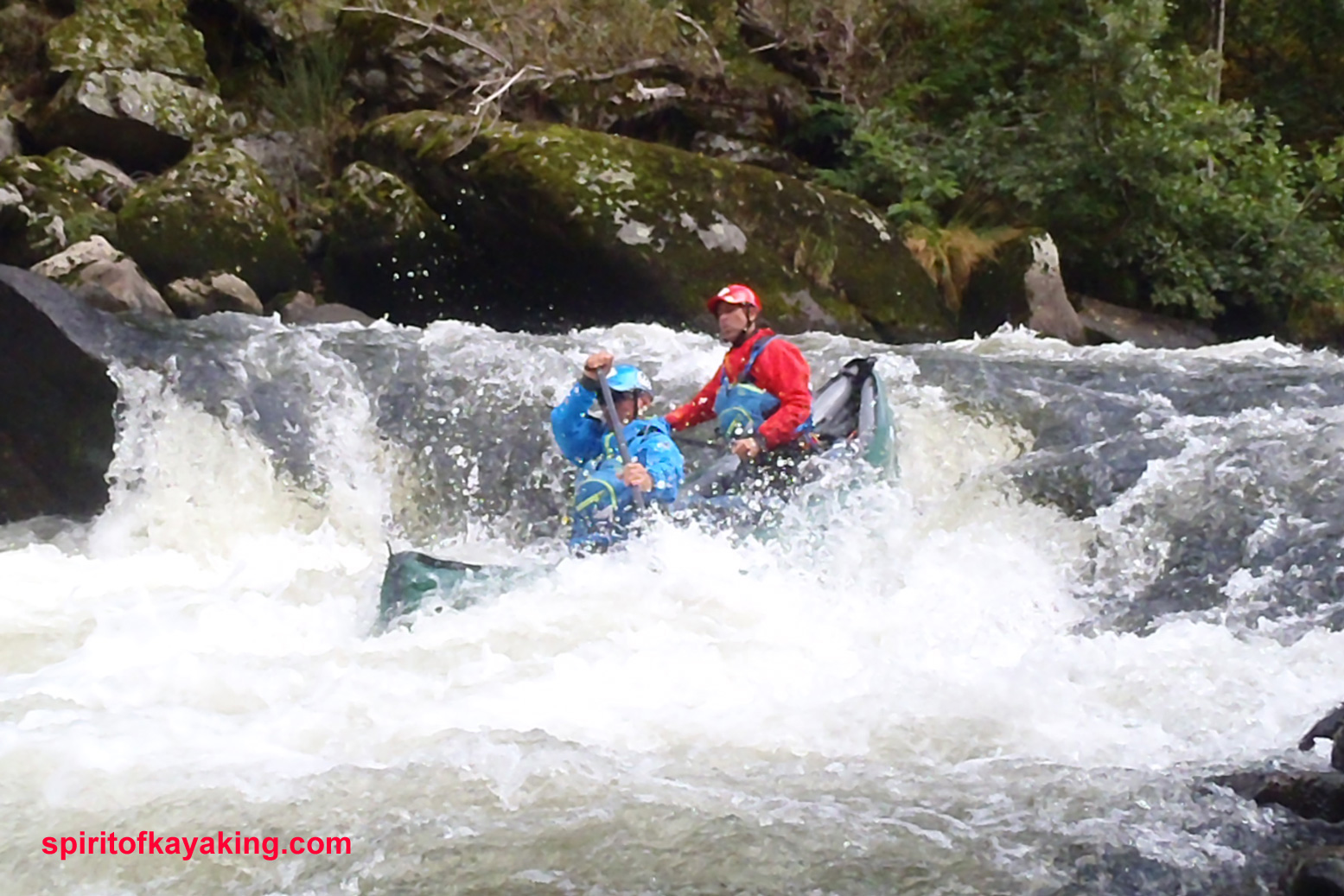
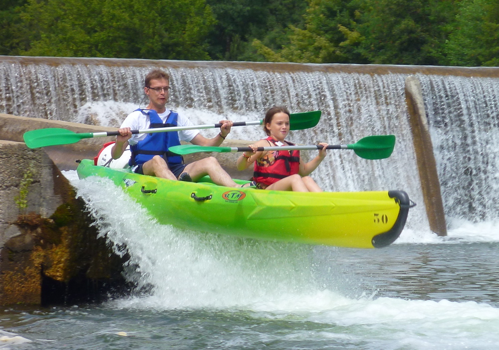
Visiting over the years with packboats using planes and trains and mates in vans, I’ve ticked off just about all the original book’s big rivers. Like a lot of activities in France, the whole scene is so much more fun, open and less rule-bound than the UK. You can’t help but smile as you bundle into a Tarn or Ardeche rapid alongside floating barrels and screaming teenagers clinging to upturned rentals.
What they say:
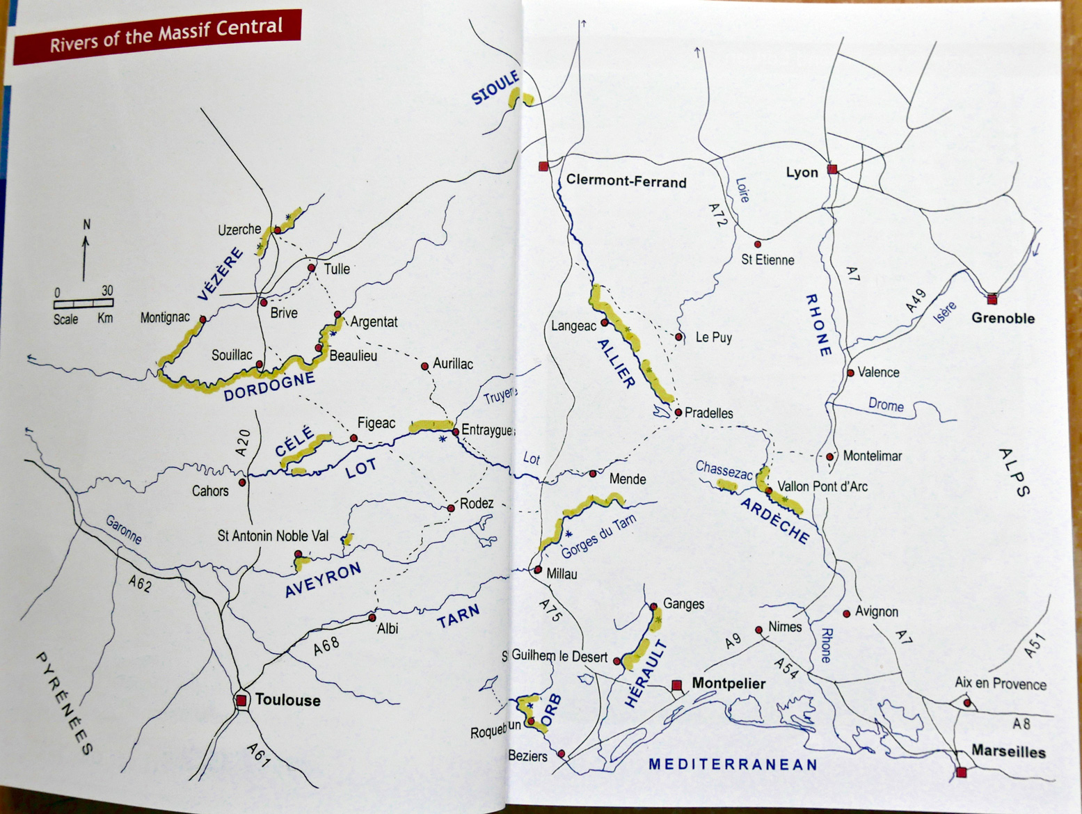
[Best Canoe Trips in the South of France] is written for the recreational canoeist, kayaker, or stand-up paddle boarder going on holiday to the South of France. Rivers include the famous Gorges du Tarn, Gorges de l’Ardèche, Dordogne and Lot, besides some lesser known jewels such as the Allier, Hérault, Orb, Vézere and Célé.
The Massif Central is renowned for its canoeing and the rivers in this guidebook are some of the best in the world for canoe-camping. This guide book targets those rivers that have easy white water and assured water levels in the summer months of July and August, when most families have to take their holidays. New dams, reservoirs, and guaranteed water releases means that canoe tourism is now huge in the Massif Central and this guide covers over 800km of class 1-3 [rivers], with all the details needed for a fabulous and truly escapist, holiday.
This new edition has details of two new rivers, 22 detailed colour maps, updated river descriptions, recommended campsites and lots of inspiring photographs.

What I think
• Great selection of brilliant rivers
• Loads and loads of good colour photos show how it is

• Some maps lacking in detail and consistency
• Route descriptions could be more concise
• Poor updating; errors on the two rivers I paddled recently
• What’s with the fake cover?


Review
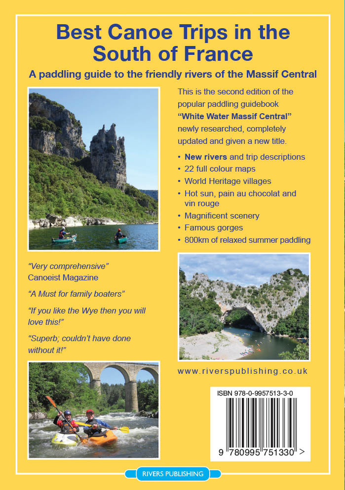
If you know the original edition (far left), first thing you’ll spot is the near-identical cover, but with scary, frothing rapids airbrushed out and a somewhat anachronistic SUP pasted on, a embarrassingly clumsy attempt to cash-in on the current SUP craze.
Some of Rivers’ other publications feature very nice retro poster-style covers (right) which would have suited Best Canoe Trips perfectly. Can a non-faked image of canoeing in the Massif be so hard to track down? The book is full of them. But if you don’t know the previous edition you’ll probably not notice the front cover photoshoppery. Imagine what AI could manage today?!
Inside, it’s now full colour and twin column, like a Pesda. Two small rivers have been added: the 23-km Sioule north of Clermont, and all of 13km of the Dourbie meeting the Tarn at Millau. It’s not much which proves they did a thorough job first time around, even if some descriptions were incomplete.
Up front are Planning and Resources sections before getting stuck into the 11 (actually 12, with Chassezac) river descriptions.
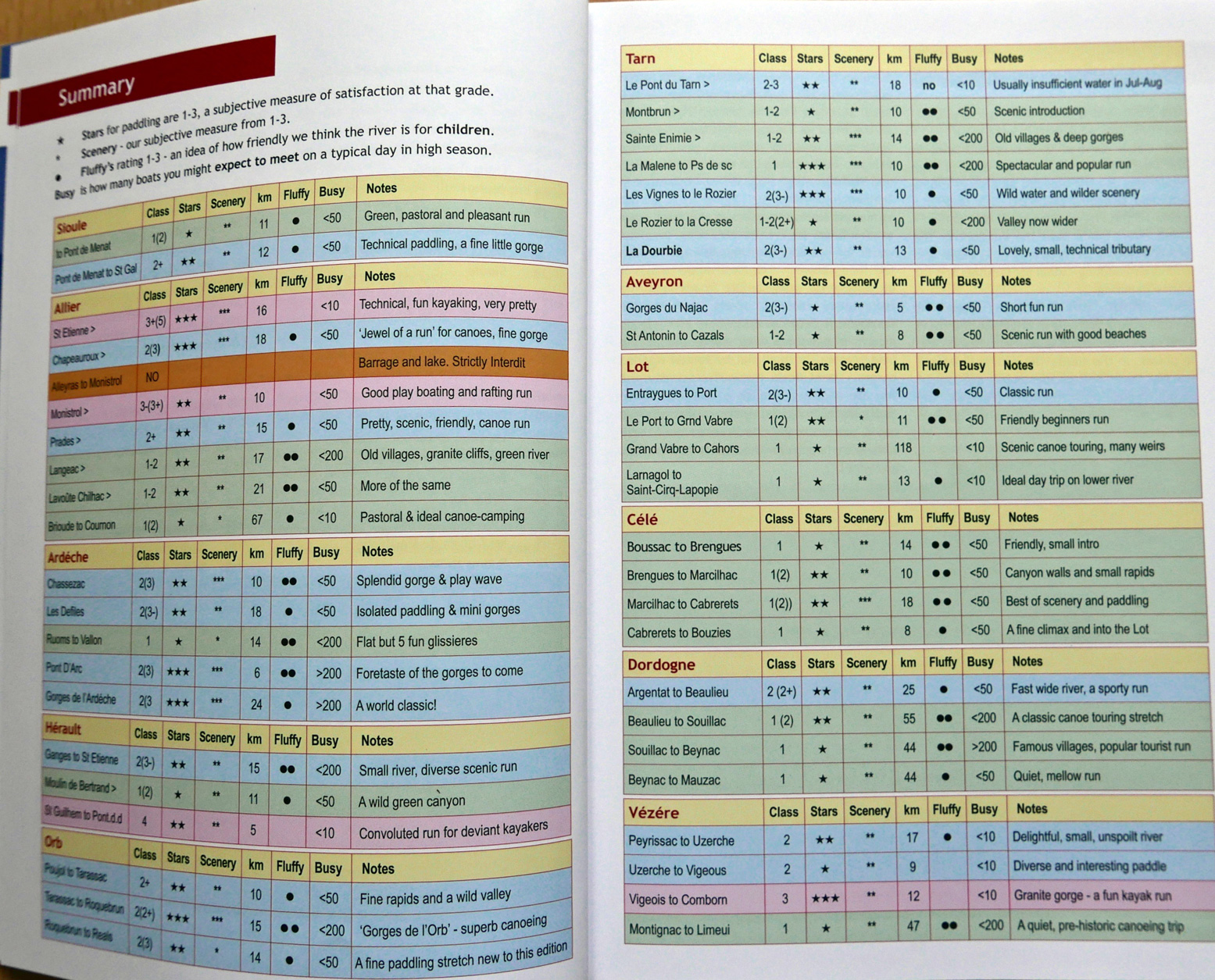
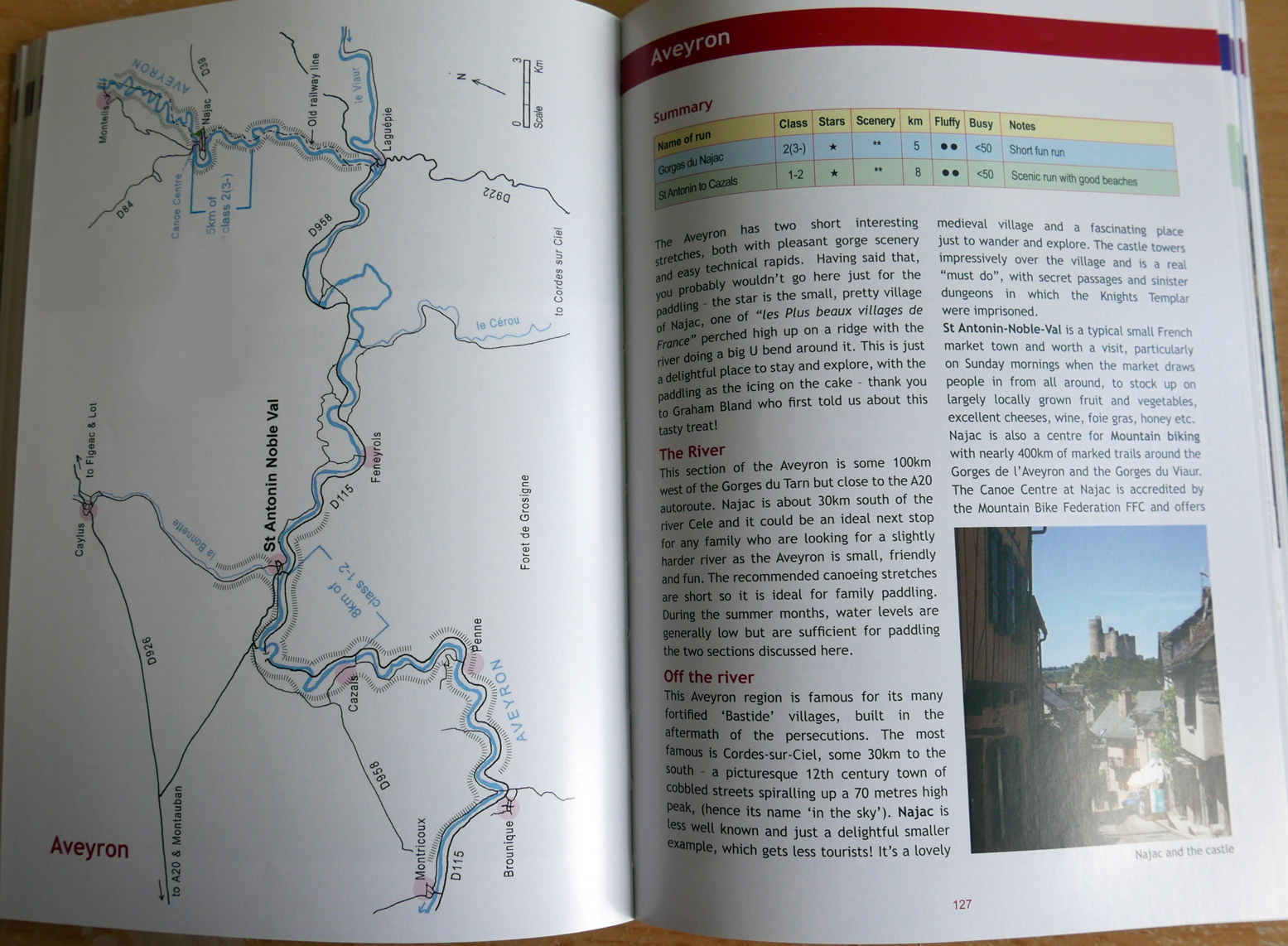
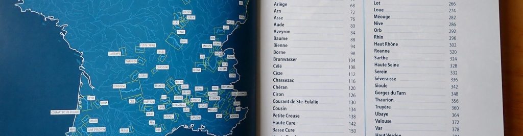
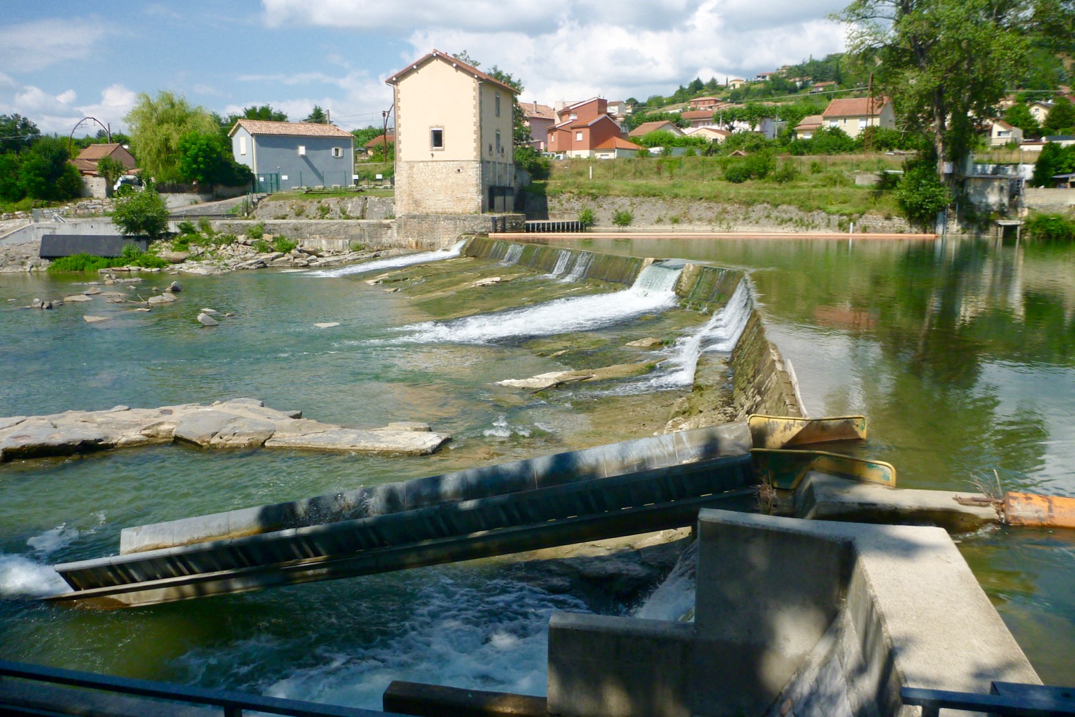
Each river still gets a rating table for magnificence, enjoyment, child-friendliness, as well as cleanliness, temperature, flow in cumecs, and busy-ness. Of these last four, the traffic is most useful for what to expect. Without lab tests, all the rivers I’ve done looked clean enough, and temperature was what it was on the day, depending on depth or season. And who but a river pro knows what ‘7 cumecs’ looks like? There must be some rationale to it, but to me identifying the locations of more easily understood river level gauges (where present) would be much more useful, as you can refer to this handy live river levels website.

The river descriptions remain long-winded – 85km of Tarn goes on for 16 pages, albeit with loads of photo padding. It makes it hard to pin down the nitty-gritty. Headings include Camping, Off the River, Food & Drink, more Camping, then Maps & Guides. Then each suggested shuttle-able day-stage is described, some getting Summary and Description headings, some not. Boxes cover asides, others list tourist offices and campsite telephone numbers where surely websites (as in the old edition) are infinitely more useful. The ‘Off the River’ heading is a nice touch, suggesting the many other things to see and do locally, and you get a recommendation for the best IGN map/s for the river.
You’ll need that because, despite a handy, ‘big picture’ river map scaled-down to fit a page, with the subsequent stage maps you’ll struggle to orientate yourself unless you keep track closely, and the important detail is rendered inconsistently from map to map. All but three of the 20-odd maps are the same as edition 1. At over 1:100,000 scale (some over twice that), the 50k or bigger walking standard would be much better, such as Chassezac on p64. Only the map for the new Sioule river shows how it should have been done: a coincidentally usable scale of 71k and each weir, rapid and so on marked with a small red dash so you know what’s coming or where you are. To a nervous newb this is important. The old maps retain tiny dashes marking such things, but in blue over a blue river with blue writing that’s hard to read.
Just follow the river you might think. But when you’re wondering just how far to that nasty-sounding weir (which turns out to be nothing), without offline GPS mapping or a phone signal, a well-drawn and detailed map with bridges and other landmarks, is so much more useful and intuitive than columns and columns of text where one drossage reads very much like another. For 20 quid I’d expect to have proper, usable maps.
Full, town-to-town river descriptions would also make more sense than obscure put-in to obscure take-out. We managed fine continuing beyond the half-described Chassezac (listed under ‘Ardeche’ for some reason) all the way to the actual Ardeche confluence. Same with the Tarn: Florac to Millau is a great 3-4 days. Why not just provide a full and accurate description right through to the white water course in Millau (a fun finale!) and let the reader decide where to start and end?
Whoever they sent to update the Allier phoned it in. Distances (another useful aid to orientation; easily measured online) were out. Over-emphasised descriptions of ‘blink-and-you-miss-them’ pre-industrial weirs are now irrelevant, while other chute-avoiding weirs have become fun Class 2s. There are even left/right portaging errors introduced since the previous edition. See the Allier page for more detail.
The ‘fluffy-duck-mascot’ joke was done to death first time round. Unfortunately, the author still thinks it has some mileage in this edition. Oh well, chacun a son gout.
The switch to colour has given the book a fresh new look, but as a worthwhile improvement, the inconsistent updating has led to a missed opportunity. It’s perhaps to be expected because, as the author hints and my impressions concur, fewer families holiday like this anymore. Holiday-makers just bundle into a rental for a day and get vanned back to the campsite. All that is a shame as without the first edition I’d have missed out on a whole lot of memorable paddling adventures in lovely southern France, one of the best paddling locales in western Europe.


