After Storm Chandra came the calm. Well, just a day of calm with a 5mph onshore breeze, sunny spells and single digit temps before seasonal deluges resumed. The artillery was pounding at Lulworth so the west side on Kimmeridge Bay within the MOD firing range was definitely off limits, but it might be nice to pootle along the base of the Kimmeridge Ledge cliffs and back. There could be a stormy after-swell, but small waterfalls may be be running too. I even thought it might be a day to sneak round St Alban’s Head from Chapman’s to Dancing Ledge…
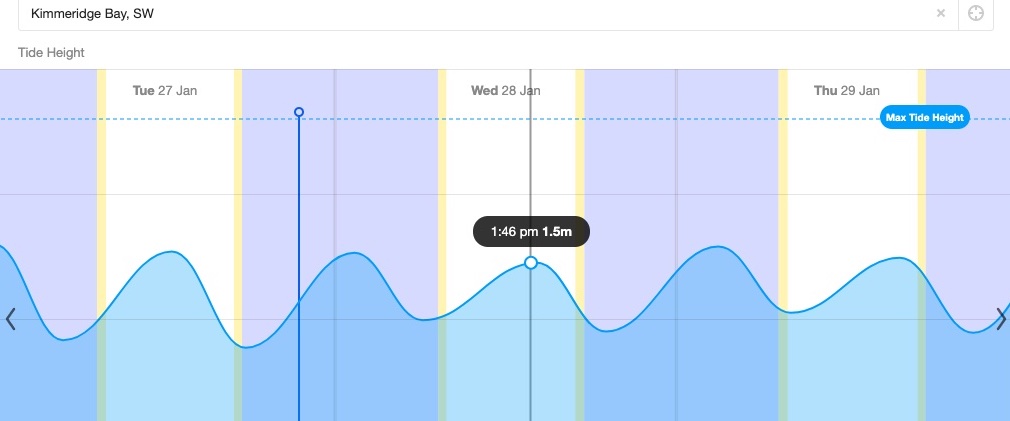
I’ve droned on about trying to pin down unlisted Kimmeridge tide times. The short answer, I’ve decided, is Willy Weather. Today a harmless neap tide was rising just half a metre in 8 hours to top out around 2pm. Interestingly, the High Water time moved by 20 minutes from the evening before, which suggests it’s not just some publish-and-forget-it table of predictions, but based on live inputs.
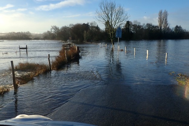
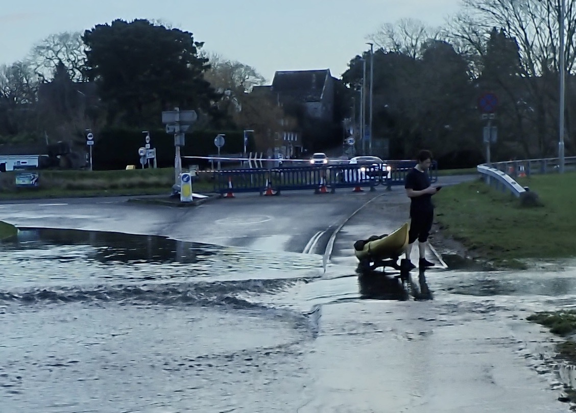
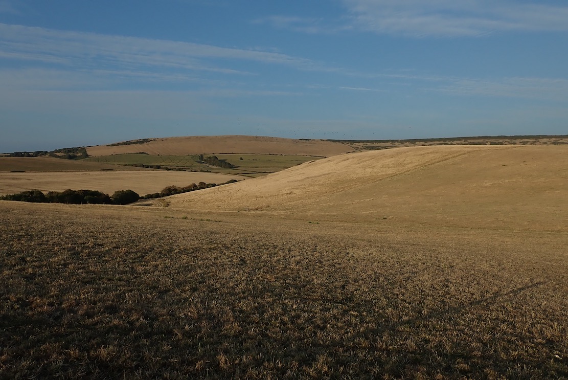
Hoping to take the scenic route, at Holme bridge the River Frome’s water meadows had spread into a vast lake, submerging the road, long before I even got close to the ford, which I read later was 5 feet deep. So after a couple of other attempts, I settled on the long way round over the flood-shedding Purbeck Hills to Kimmeridge Bay.
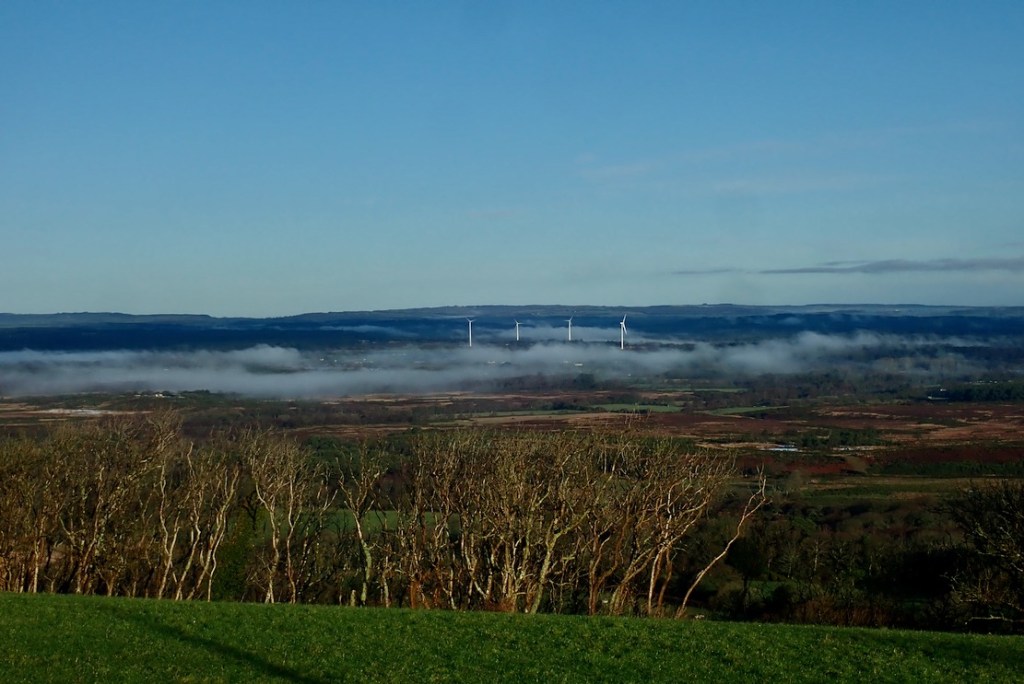
On Purbeck ridge the mist still clung to the flooded valley bottom.
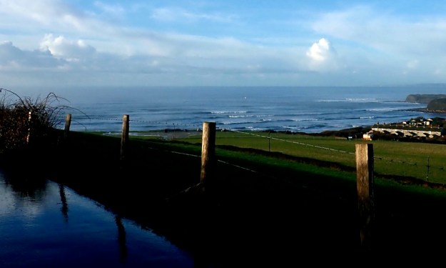
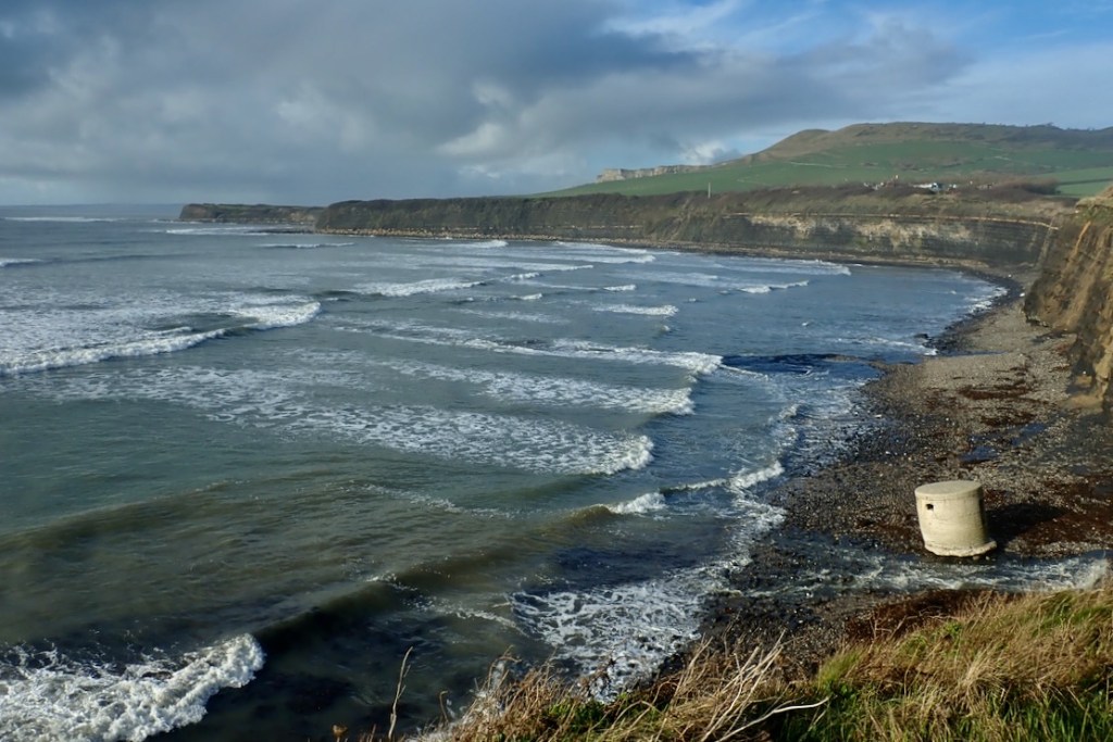
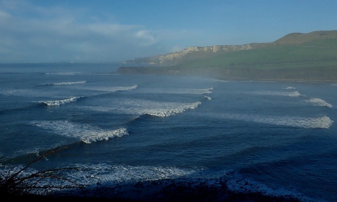
Coming over the last hill before Kimmeridge village, I realised I’d underestimated the after-swell; the stormy winds and rains may have passed but the seas were still animated.
Overlooking Kimmeridge Bay. Lively.
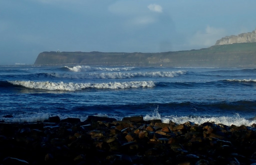
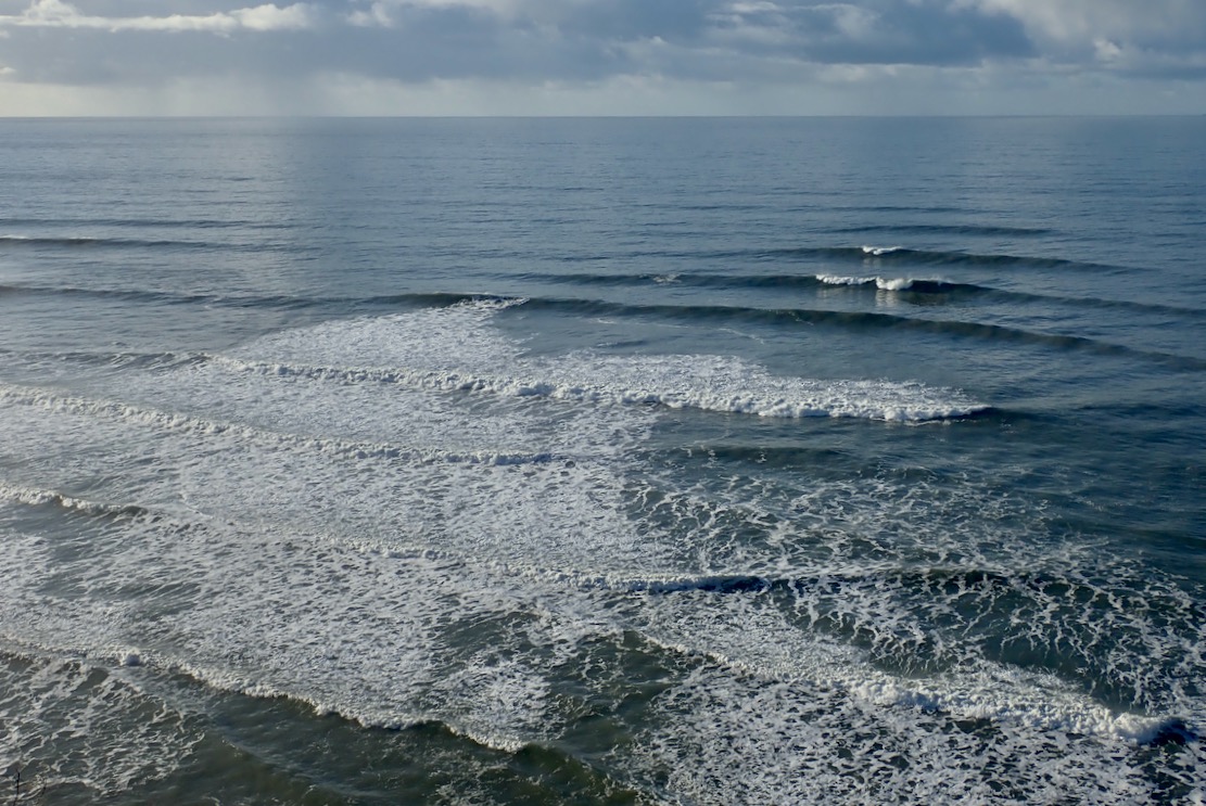
Down at sea level in a dumpy packraft it looked like it would be a struggle of good timing, desperate acceleration and luck to get out quick through this surf without getting swamped. I didn’t have my drysuit and as things looked, today was a day for a decked or bailing packraft. At times the surf seemed to flatten off and you could have scooted out on a paddle board. Then it all rolled back in, streaking the Bay with white foam.
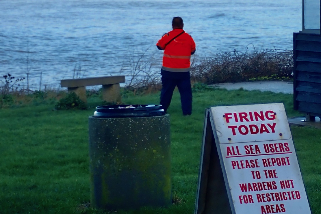
There were look-outs stationed round the bay. How thoughtful, I thought. Who lays that on then? Then I realised they were probably contracted by the MOD to make sure sea users kept away from the shells potentially raining down on the west side of the bay.
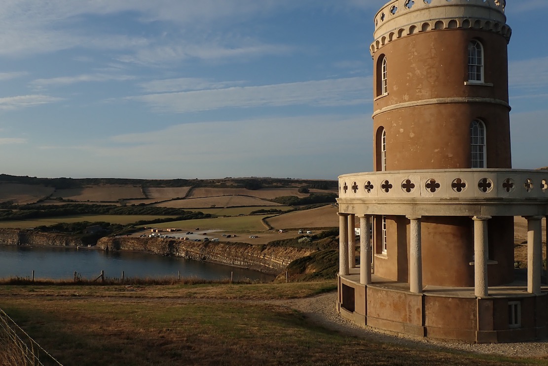
I thought if I could sneak through the east edge of the bay it would be OK round the corner, so I climbed up to Clavell Tower to have a look. Sea mist clung to the Bay.
If anything it was even more lively, with the Ledges kicking up the swell for hundreds of metres out. So much for a quiet cruise along the cliff base. Unless I went right out, I’d be forever glancing right to see what was incoming, and on the Ledges, waves can lift up out of the blue without warning.
We tried packraft surfing up at lovely Achnahaird one time, in far more benign conditions with waves barely at knee height. It was a laugh but packrafting today would take some commitment.
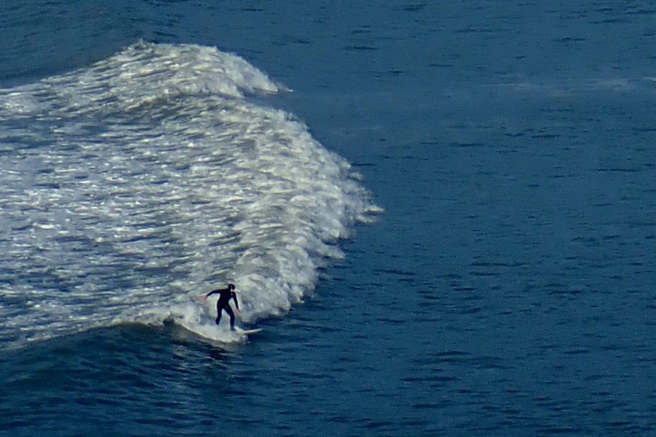
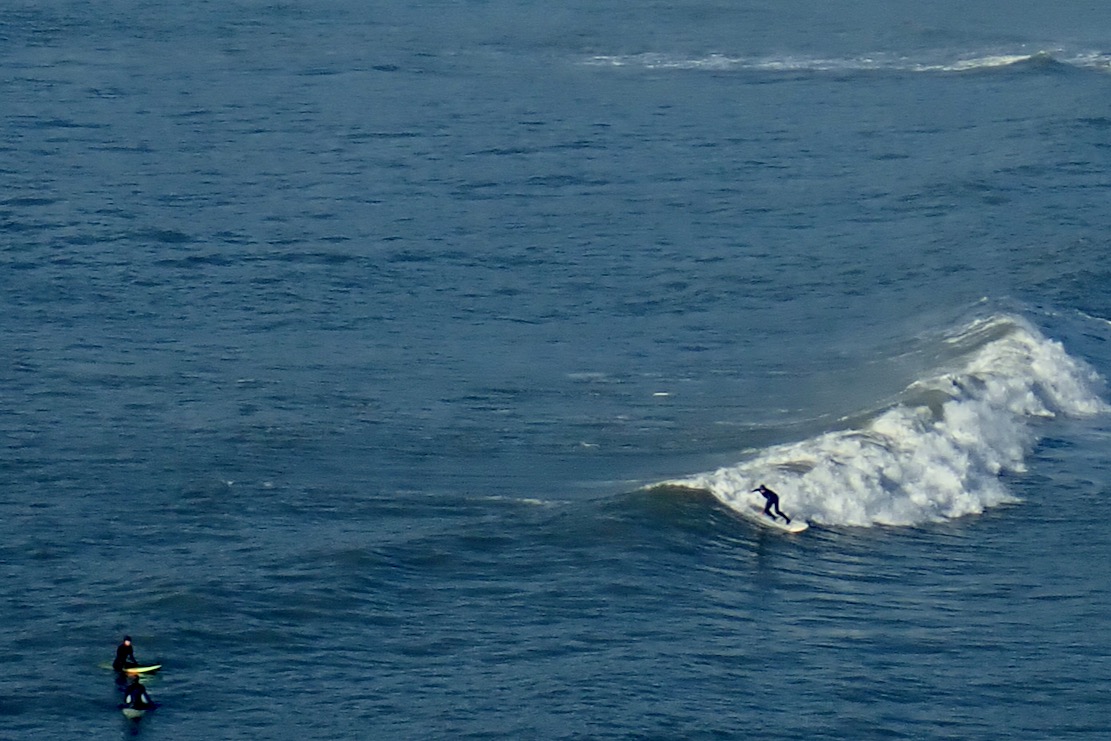
Today was a day for the surfers: get in the water and stay in it. Sadly, as I’ve noticed before, watching surfing live is not like a trailer for Big Wednesday. To paraphrase Gregory Peck: “They pay me for the waiting, the surfing I do for free“. It took me 15 minutes of watching four surfers bob around before I grabbed the shots here of a 15-second ride.
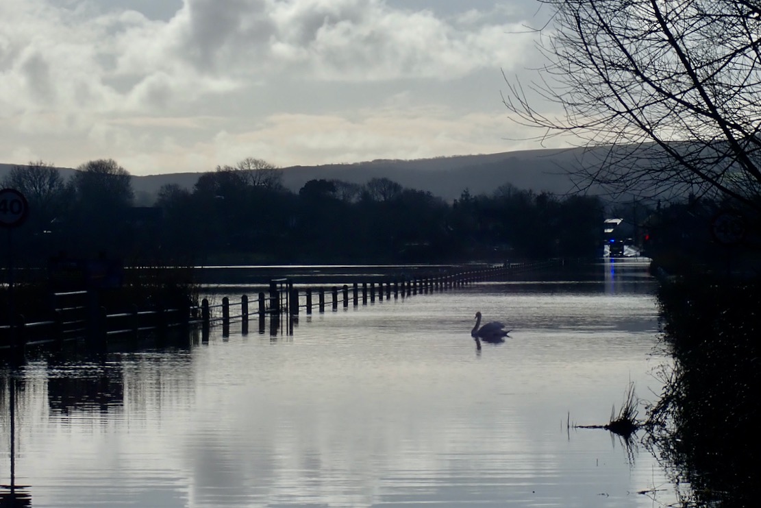
Back at Wareham, a swan was parked in the middle of the Causeway. You can see why they call it the Isle of Purbeck.
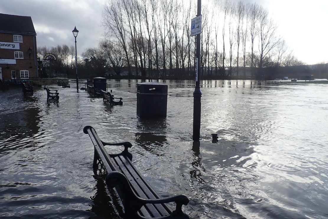
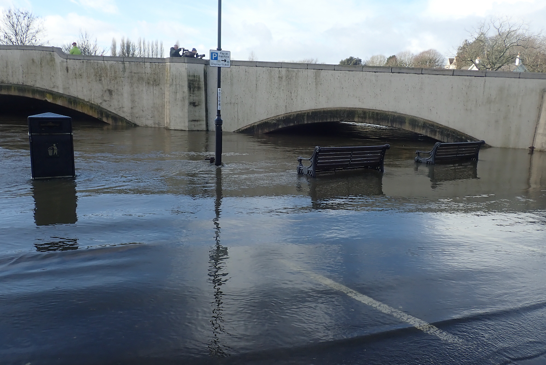
Wareham Quay was awash, with barely a foot under the road bridge to the Causeway which was why the river was backing up.
And it was only just possible to reach the station off the bypass where a bloke was putting in his sea kayak. At least someone got a paddle in today!
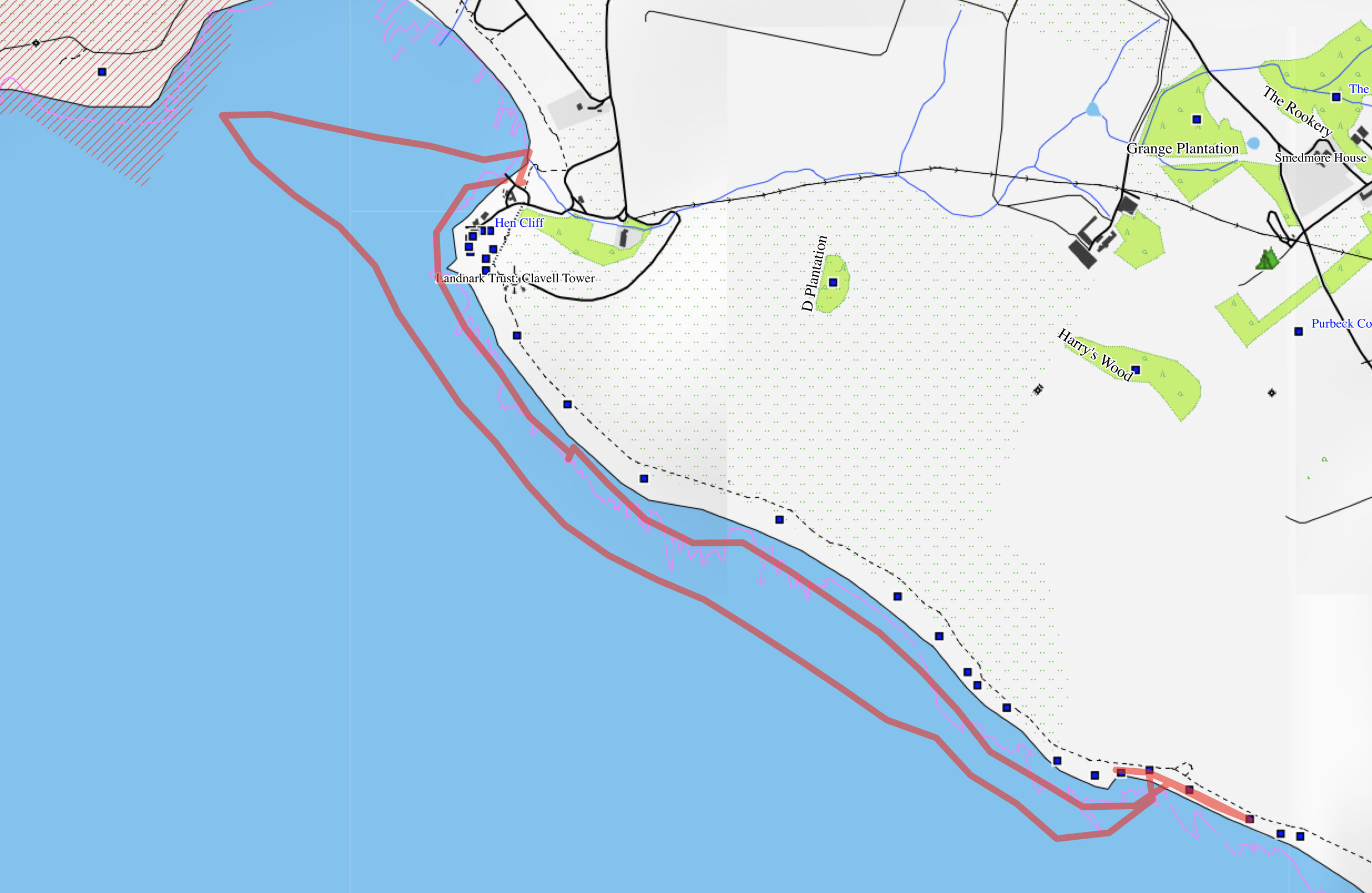
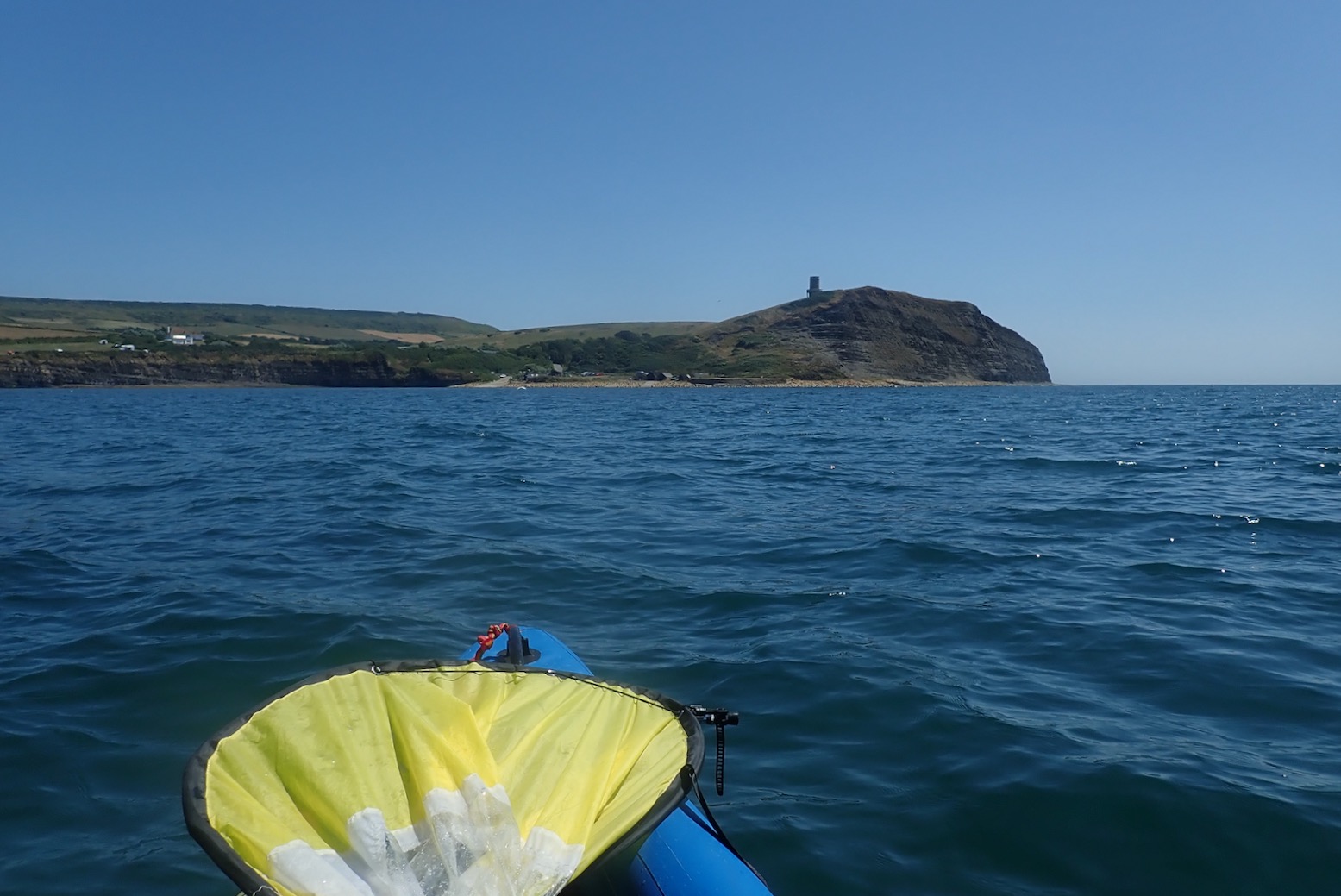
Action Stations and man the pumps. Conditions are finally benign for a paddle from Kimmeridge Bay to Chapman’s Pool – a distance of over three point six miles. It’s not exactly rowing the Pacific, but in a dumpy packraft you need to pick your moments when there are no take-outs from one end to the other, followed it’s a stiff, four-mile walk back. A big spring tide was inbound for HW about 8pm and the wind was forecast at just 8mph SSW (onshore) and dropping by late afternoon. Plus it was sunny, too. Which was nice.
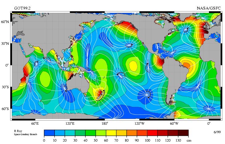
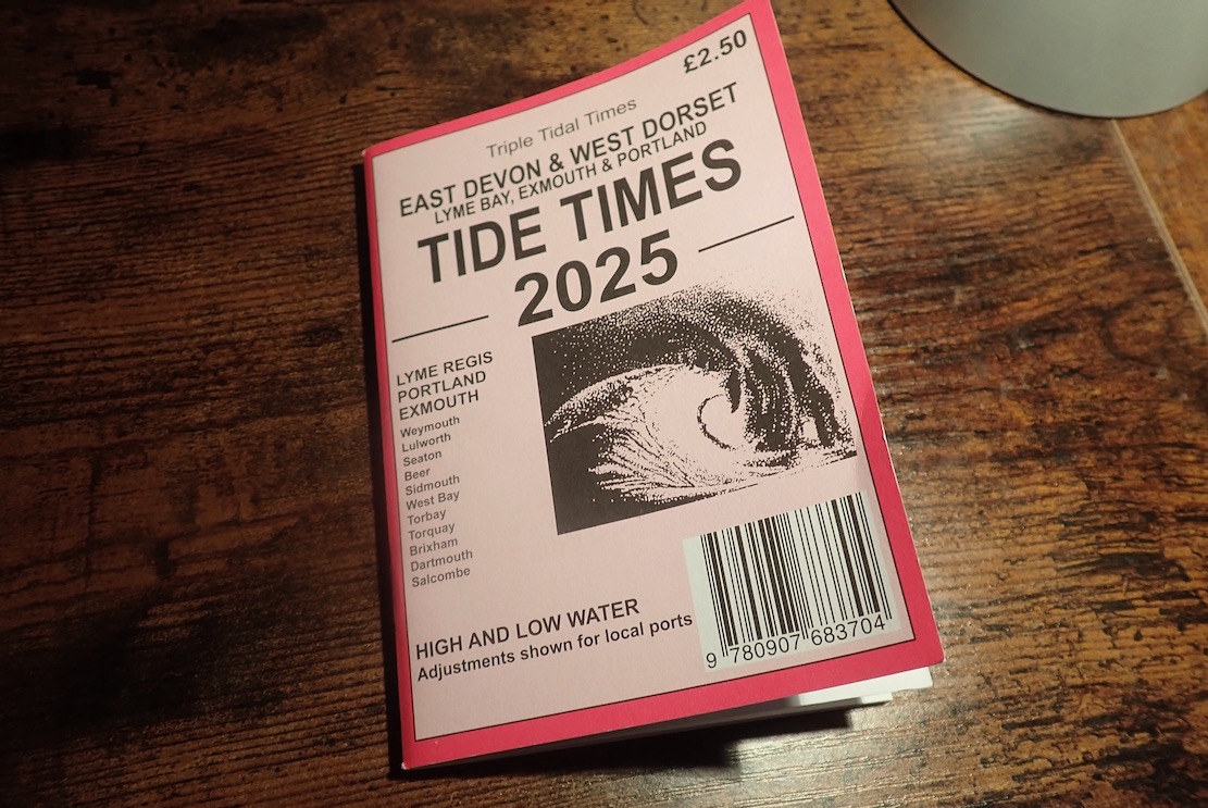
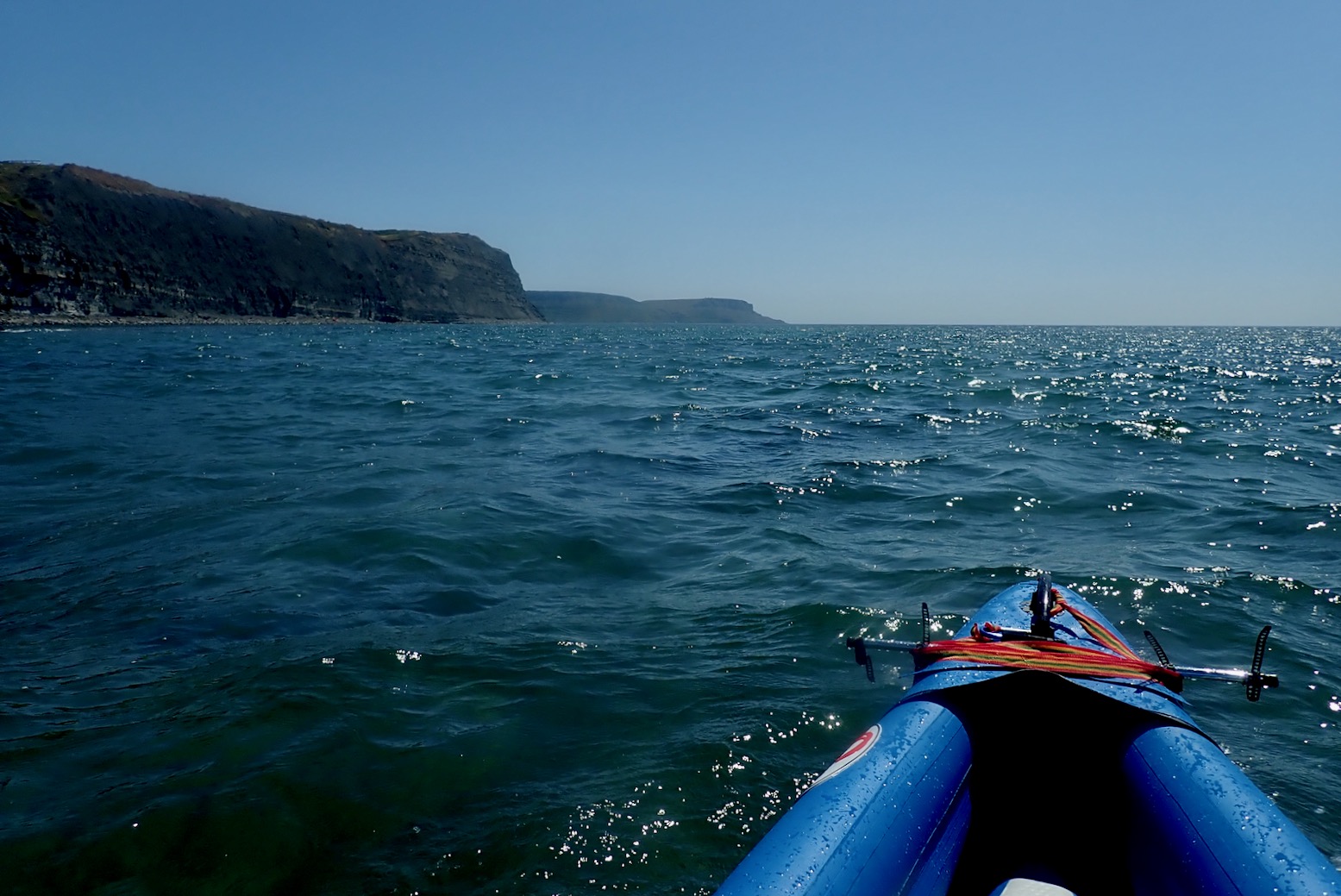
I packed a paddle in my pack and rode down to Kimmeridge Bay.At Kimmeridge Bay’s massive car park field, bikes are only £1.20, but it’s a choka bank holiday weekend so I hope the lad at the pay shed was on a percentage today. I asked him about tides which have been doing my under-stimulated brain in. ‘Err, there’s a board over there’ said laddy. At last, the Kimmeridge Question was solved, I thought, admiring the first apostrophe, but sighing at the second. It turned out the board lazily repeated UKHO Mupe Bay/Lulworth Cove timings, about 5 miles west. You’d think that would be adequate for an estimate, but not necessarily.I’m still baffled by the tides on Purbeck’s eastern Jurassic Coast. The problem is getting reliable times for Kimmeridge Bay or Chapman’s Pool, the most useful put-ins hereabouts, and timings matter the longer you’re on the water. The UKHO posts times for Mupe Bay and also Lulworth Cove which is less than a mile away. The times are identical. And then there’s nothing until Swanage, about 12 miles to the east as the black-tipped tern flies and a doable day’s paddle in a long boat. Such gaps in UKHO stations are fairly normal along the UK coast, and you’d think just estimating Mupe Bay ± ~30 mins will give a time for Kimmeridge. But around here the tidosphere is all warped. Above, a few days before neap tide, it looks like Swanage rises in synch with Mupe and then ‘holds on’ to HW for hours, before dumping five hours ‘late’.And then I found this Insta post (above) from Sharon Lee in Brighton who makes tide times posters. But not for Kimmeridge because, as she observes: ‘Notice an arc of weirdness around Dorset? That’s an amphidromic point. Which basically means the tides around Dorset (particularly the Isles of Purbeck and Portland) are utterly mad.’ Amphidromic (or a tidal node) was a new one on me, but may explain the Mupe-Swanage Incongruity (MSI), as tidal philosophers have called it since Pytheas skimmed pebbles with Posidonius. You’ll find many tide times websites supposedly offering times for non-UKHO locations, but many just list the nearest UKHO location with no real-world adjustment. As unless I am over-thinking it, Mupe Bay to Swanage needs quite a bit of Amphidromic adjustment. And while I have your attention, what is the point of UKHO listing identical times for Lulworth Cove and Mupe Bay, just a mile apart? Is it because one is civilian-touristy and the other military most days of the year? So what? Yes, there are no less than four UKHO tidal locations in western Poole Harbour (+ Wareham) as closely bunched, but it’s a busy area that drains out to mud flats at low water and the timings are all different.Mysterious tidal nodes appear all over the world. They are the Black Holes of the Oceans; go there and nothing happens. Spooky. Source Then I saw in Kimmeridge’s Etches Fossil Museum shop a locally published tide tables booklet. ‘… West Dorset’ said the cover, but ‘Covers the coast from Swanage, Dorset through to Salcombe, East Devon‘ claimed the shop’s online blurb. The publisher’s website said as much (… the whole of the Dorset and South Devon coast…). Not in the copy I bought. The tables give every day of the published year, but only for Exmouth, Lyme and Portland. There’s nothing east of Portland in the booklet, unless you include a spot check on Portsmouth or Dover. No mention of Swanage, Lulworth or other local adjustments for Purbeck. You’d think I’d not be the first to notice this, I’d have saved my money for two more moto parkings were it not for chappy behind the shop counter advising: add an hour to Portland for BST, then 15-25 minutesfor Kimmeridge. It’s Portland’s sticky out Bill that puts a spanner in Purbeck’s tidal flow, he explained. The formula was not Mupe Bay ± 30 minutes, as I’d guesstimated, but Portland + 15-25. I coughed up my £2.50 as an offering for this handy tip – I’ll appreciate it and the booklet when AI implodes the internet. But hold your paddles, there’s more! Also on the Etches website I found a link to Willy Weather with a page for Kimmeridge Bay that wasn’t just a paste from Mupe Bay, but believably adjusted times. I compared KB times many months in the future using the Portland booklet formula and Willy, and found them to be within 3-13 minutes of each other. Assuming both are broadly correct, that will do me. Willy don’t list Chapman’s Pool but do have adjacent Egmont Point which seems to be KB + 2 minutes. I’d heard of Willy Weather, but it wasn’t in my tidal bookmarks. It is now.Still reading? At the jetty by the Wild Seas Centre a pair of well prepared sea anglers were setting out in their double outrigger SoTs. Talking of gear, this is a proper sea paddle so I’m in my proper Kokatat Leviathan pfd, but it feels like wearing a folded tractor inner tube full of ice cream. Leviathan – it’s in the name. At least I won’t be too gear-shamed when the RNLI fish me out by my ear and shake me dry.I head out of the Bay and turn east. Oh MG, breaking offshore waves already! But I needn’t have worried today. There were a few more later on, but nothing the TXL+ couldn’t ride out. I actually think tackling this stage with a rising tide flooding the Ledges is the way to do it (in either direction), as any waves will diminish as the ledges submerge – won’t they? It’s more down to the wind of which there was little today, but as you paddle along you still want to glance offshore once in a while in case you’ve gotten on the inside of a building wave which can pop up out anytime, any place, any where. This is why I stayed quite far out. Not normally what I like to do alone in a packraft.
The Ledges from above.
And on a windy day west of Kimmeridge. Frothier than a Costa cappuccino with sprinkle.
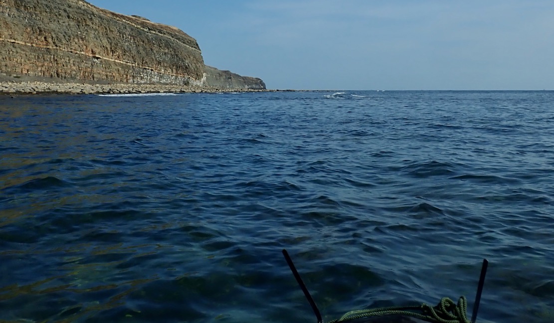
The waters are clear and green. At many points I could have hopped out and waded along.
In fact, I did for a bit.
It took me back to Shark Bay, 2011. Jeff and Sharon and me in my Gumotex Sunny wading north to a unearth a cache near Peron Point after battling a stiff headwind all morning. What a great paddle adventure that was. Easily doable in a packraft too, with added dolphins, dugongs, rays and yes, sharks.
I’m on the look out for ‘Iron Skeg Beach’ I found with the Igla IK a couple of years back. Above looks similar but is not it. In the Igla I turned back at ISB to Kimmeridge as paddling on to Chapman’s would’ve meant paddling back. First time out here and with a head full of Ledge Lore, I didn’t want to get caught out as tides and winds turned, and hauling the 17-kilo boat back along the coast path would have been too much. As I was about to find out.
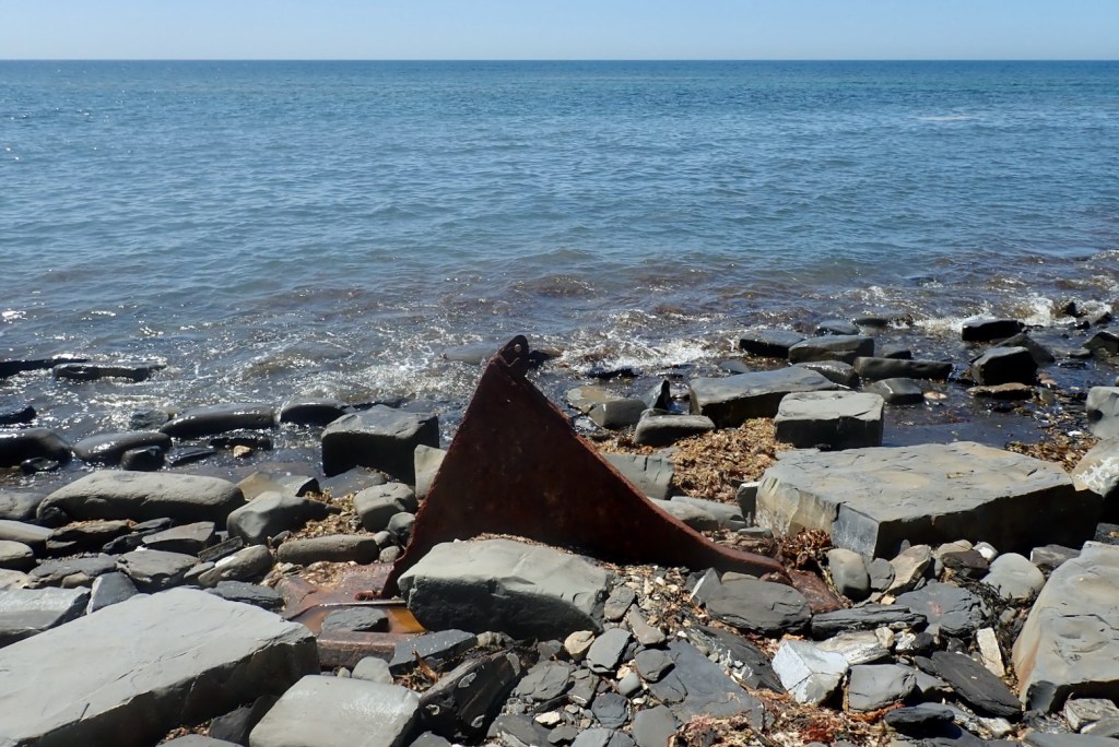
There is the rusty triangular ‘skeg’ (also below) sticking up. This is actually called Clavell’s Hard and studying Ian West’s page for this area, I think the object (below) may have been something to do with oil shale mining right here in the 1890. There’s a semi-naked castaway looking for treasure. I hope he knows how to get back.
The strange cast iron object that looked like a ship’s skeg – from the SS Treveal, wrecked at nearby Egmont Point in 1920? It’s more likely a piece mining gear, a winch stand perhaps.
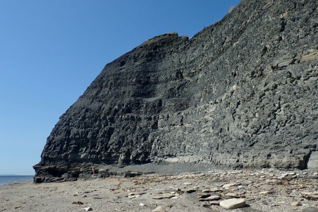
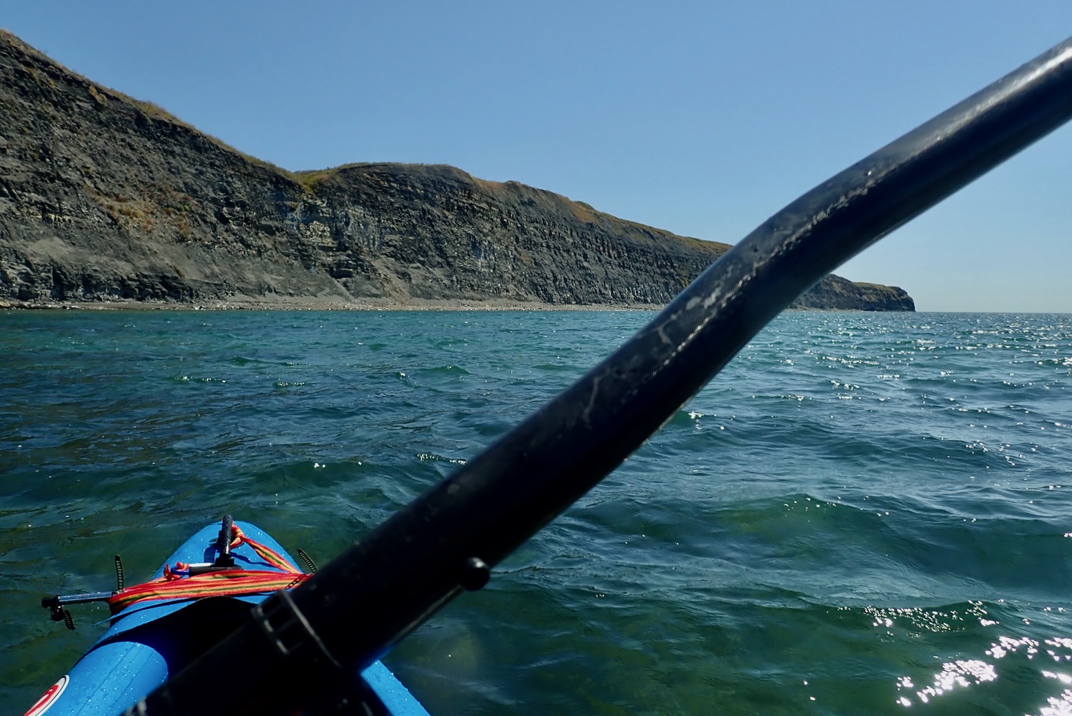
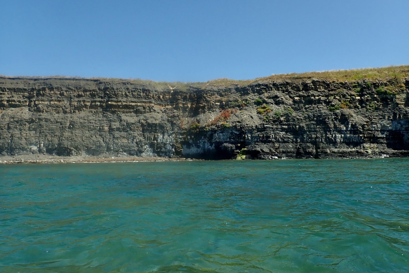
The soft, shaly grey cliffs, rich with ancient marine remnants.Four colourful kayakers close to shore, like I should be. There’s more to see there.I pass what could be Punta Pliosaurus.
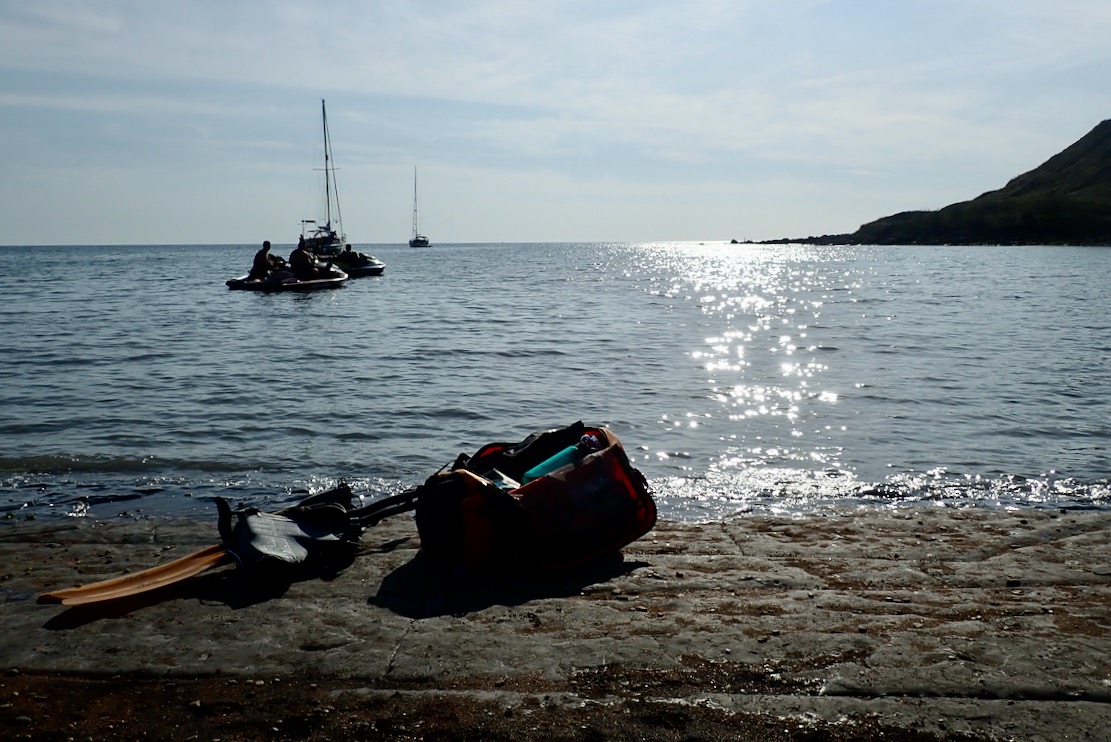
I see sailboat masts ahead behind big rocks and am a bit disorientated. Chapman’s is tucked in on the left somewhere? I check the GPS and am nearly there, getting ashore 80 minutes out of KB or 4.5kph average with a bit of dawdling, and quite a lot at 6kph, according to the Garmin. People want to know this stuff!.
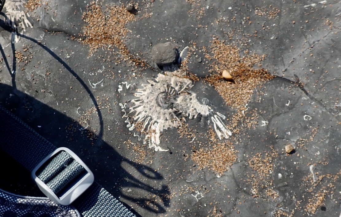
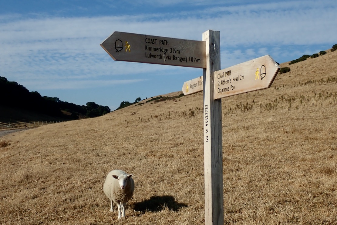
Along with some moored yachts and beach bathers is a trio of menacing jetskiers playing their satanic music. But this is Purbeck so it’s not blaring, and at least they weren’t tearing up the Pool like houns en tout.At Chapman’s there are ammonite fossils everywhere you step.Even getting off the beach by the waterfall is a loose scramble, especially backpacking a holdall. As I leave, I hear the jets gun off to Kimmeridge or Swanage. I presume that’s what they did as you can’t get a trailer down here. With a packraft you can go anywhere you can walk.Up the steep, overgrown gully and across the parched field for the 500-foot climb up to Houns-tout hill – all in less than a mile from the shore. My pulse hits the rev limiter. What does Houns-tout even mean?Kimmeridge 3 miles. In these shoes? No way, Jose.
Tranquil Chapman’s and St Alban’s Head from Houns-tout summit. And actually my Teva Omniums are not the problem; it’s the wobbly, 8-kilo holdall hanging from my shoulders. But on the way back I have a brilliant idea. More here.The steep decent from Le Tout gave the underworked knees what for. I could do with my packstaff. I sold the 4-part Vertex paddle which it fitted. I need to convert my Anfibio Wave 4P but it’ll require some whittling.
Then back home I dug out an old, 55/170cm telescopic monopod (£18 on amazon Basics). It’s more gear (370g) and may slip under pressure, but zero bodging required and will work for long-arm selfies.
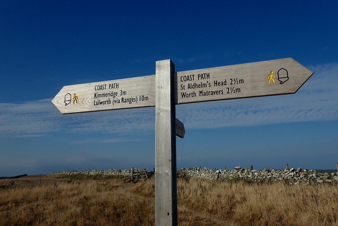
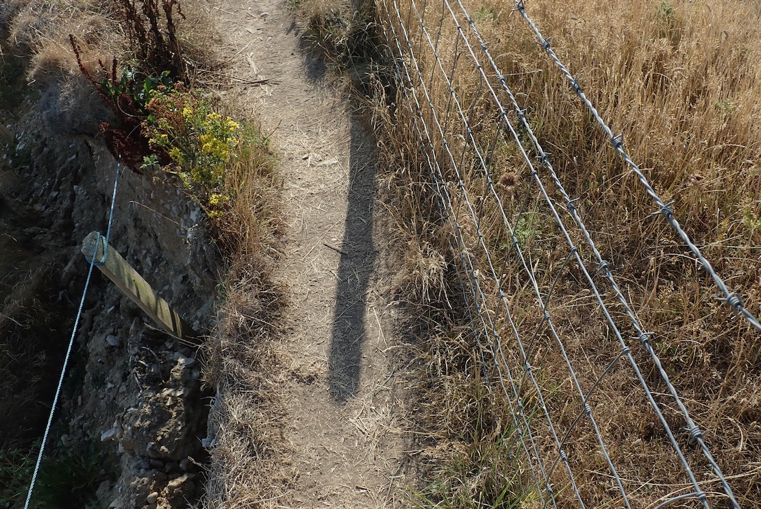
I witness a landslide near Punta Plio. This country is falling apart! I should get down there houns tout suite and see what fossil treasures came down with the rubble. ‘Get me Professor Etches, I found the tail. That pliosaur is longer than you think!’In places the path is very narrow: barbed wire right to spike my raft, big drop left to spike everything else. The first half from Chapmans is tricky in places. Don’t be part of the next landslide.The SW Coast Path is cracking up. Must be the drought. Come the next deluge it could all come apart and slide into the sea, a few feet to the left.All around as parched as southern Spain. At one point a cheerful passing walker observes ‘Ooh, paddles. What’s in the bag?’ ‘A boat‘, I reply. ‘Oooh, luvlay juvlay!’ she saysAt last, the rotund edifice of Clavell Tower just as the battery warning light starts flashing and the legs wobble. I hobble down the steps like Steptoe with a hangover, passing pouting Instagramers capitalising on the golden hour.I’m a sweaty, achey mess but it’s been a lovely summer evening’s walk up and down 340 metres along a tiny part of the South West Coast Path. They say the total elevation gain on the entire 630-mile trail from Minehead to Poole is a staggering 115,000 feet (over 35,000 meters). That’s like climbing Everest from sea level four times. And yet hundreds manage it every year, signing off with thighs like telegraph poles. They’ll see many amazing things, like Kimmeridge Bay an hour before spring HW: not a foot of a beach to spare.The ride home via a refreshing ford cools me off.There you have it: KB to Chapman’s. A lot easier to paddle than to walk. That’s another stage of Weymouth to Poole ticked off, leaving the trickiest 8 miles for last. First, Chapman’s east around St Alban’s Head 4 miles to Dancing Ledge. Then about the same distance from there to Swanage, around Durlston Head, another tidal pinch point and with no take-outs. In a sea kayak you’d swan through in one go, slicing through whatever the tides bring. But you can’t pop it in your pack and bus home. Alone in the TXL I’d pick the neapest of neaps and lightest of winds – and still break it into two manageable stages. Summer is coming to and end. Maybe soon or maybe next year.
Eastwards from near Tyneham Cap: Kimmeridge Bay and the Ledges beyond on a very windy day
We took a lovely evening walk along the Purbeck coast east of Kimmeridge Bay, where for millennia the bands of bituminous shale have been burned or squeezed for their oil, like Kalamata olives. Good page here on Kimmeridge and its geology over the eons.
Just west of Kimmeridge Bay there’s even a lone oil well (right), nodding away incongruously since 1959 in the pastoral Purbeck idyll that inspired Enid Blyton’s Famous Five adventures which I devoured like Opal Mints in the Sixties. Blyton holiday’d for two decades in Swanage and elements of some distinctive Dorset icons, like Corfe Castle, find themselves transposed onto her book covers (left). There’s even an Enid Blyton Trail, which lists Kimmeridge.
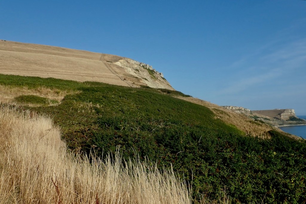
East of the bay are the notorious Kimmeridge Ledges, submarine clay or dolomite beds which reach out to sea a few hundred metres. With the right sort of swell or wind (top of the page and below) they can catch out unwary paddlers when waves suddenly rise up and break far from the shore.
Windy day looking east across Kimmeridge Bay to the jetty below the Clavell Tower
Our evening walk coincided with low tide and calm conditions exposing parts of the ledges. They’re said to be rich in fossils and over the decades a local man, Steve Etches has collected enough to fill a museum in Kimmeridge village. We walked as far as the outlook over Egmont Point where the path turns inland on its way over Houns Tout to Chapman’s Pool, just before St Alban’s Head (below).
Chapman’s Pool, just before St Alban’s Head
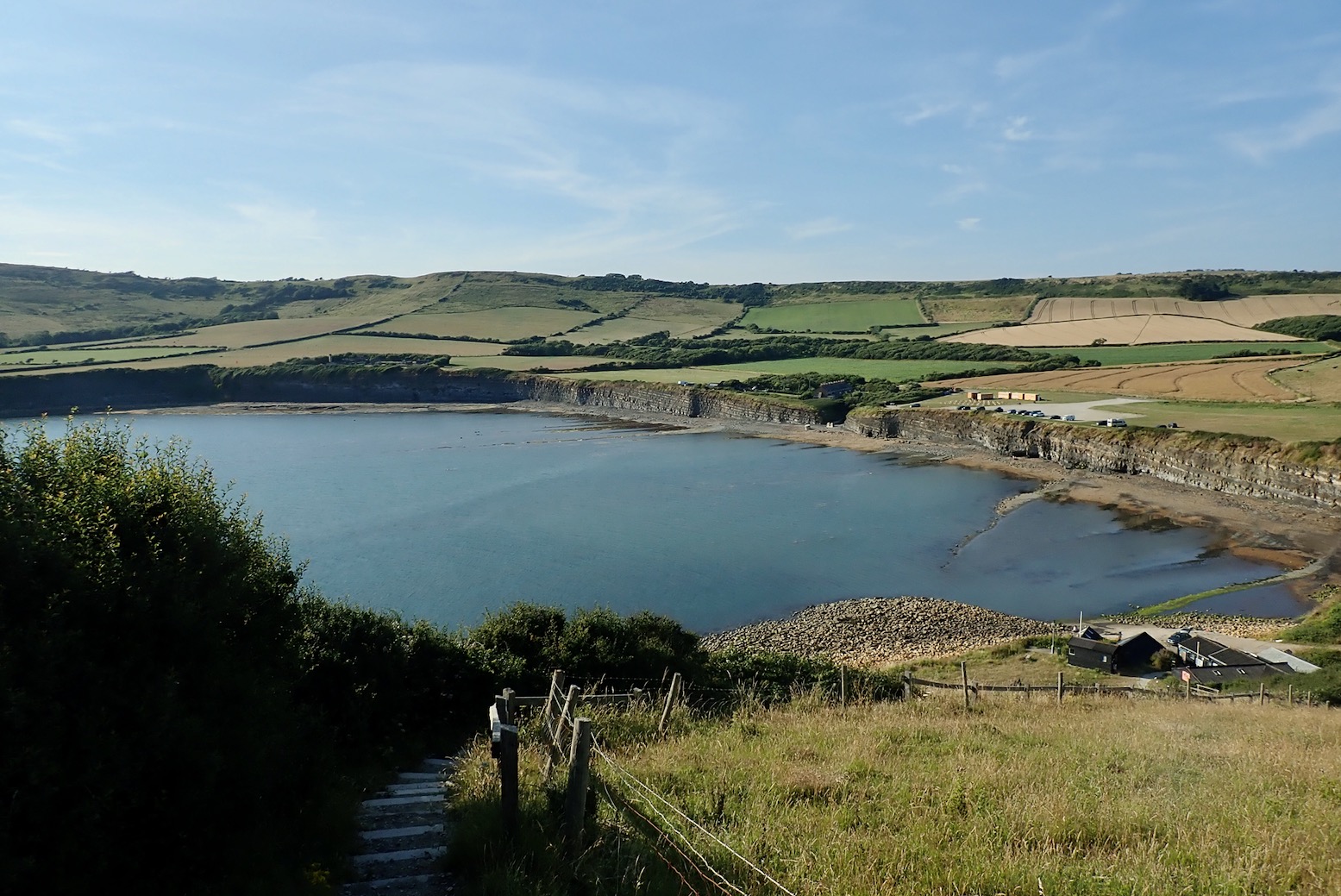
Kimmeridge Bay
To reach Kimmeridge Bay you continue past the village onto a private toll road to a huge car park with a daytime cafe. On both visits no one was at the toll booth which saved a few quid. The east end of the bay has a handy slipway by the Wild Seas Centre. What a luxury it is to drive down to the sea’s edge and pop the kayak straight into the water to let it cool down and soften up while I parked the car. The high tide was just on the turn, but out here away from the headlands, the effect of any tidal current is minimal compared to the wind.
Jetty put in
I’ve got into the habit of opening the two side PRVs plus airing down the floor a bit at the end of a paddle for the drive home. Providing it’s not baking hot, I paddle with the PRVs closed which keeps the boat as rigid as a stick. Today I realised you can’t top up with a push-pull barrel pump stood in the boat on the water; you need to drag it all back ashore to stand on the ‘stirrups’. It takes just a few strokes to fully inflate the Igla back to 0.5 bar.
Round the corner the south easterly feels a bit more than the predicted 8mph. Perhaps the tall cliffs channel and accelerate the wind along their face. At least it should make for a good sail back.
Heading southeast, I can’t help but feel a bit exposed out here; open sea to the right, rocky beach below a steep, crumbling cliffs to the left, and lethal ledges lurking ahead. What next – fireballs falling from the sky? But away from the corner the seas settle down a bit. The Igla cuts through the headwind at around 3mph.
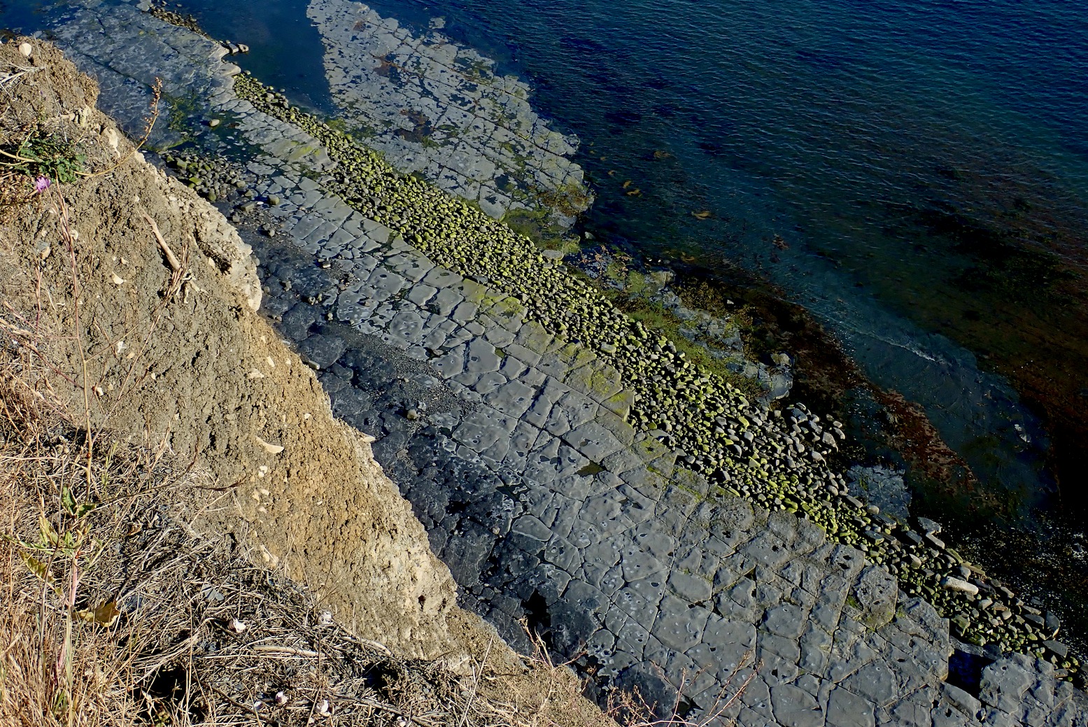
Nearer the cliffs the water turns green over the clay ledges not far below. But bigger waves rise up occasionally so I prefer to stay out which means I see less. As there are no sea caves to paddle into on this stretch and no skerries to paddled around, in a packboat I decide this unusual area might be more interesting to explore at low tide. You can easily hop in and out of an IK or packraft and wander across the ledges which few people ever access, looking for ammonites and other curiosities. Next time I’ll know.
Otherwise, with linear cliff paddles, in a kayak this Jurassic Coast can be all or nothing. You either commit yourself to a full run to the next normal take-out, or go somewhere and come back. It’s only 3.6 miles to Chapman’s Pool, but I wasn’t ready for that today. (I packrafted it in 2025). As it is, once there, with a 4-metre boat on your head it’s an unrealistic take-out up a 400-foot climb over a mile to the nearest parking.
It’s the same at the next possible take-out at Dancing Ledge. We checked that out on midsummer’s eve. In calm conditions it’s an easy enough landing providing the lower ledge is exposed, but you’d then need ropes to haul an IK, either inflated or rolled up, up a 15-foot scramble (left) before another steep walk up to Langton village via Spyways Barn. One for a packraft noseabout on the next calm day.
As it is, Dancing Ledge is on the far side of St Alban’s Head where the tide can kick up a bit (left). Good timing and some nerve are required, even if a kayak can tuck in close to the shore inside the race. This is why Mark R says in his South West Sea Kayaking book. [Kimmeridge to Swanage is 19km and …] “… a commiting trip with big tides races and few opportunities to land. This also happens to be the author’s local (and favourite) paddle.”
View from above, give or take.
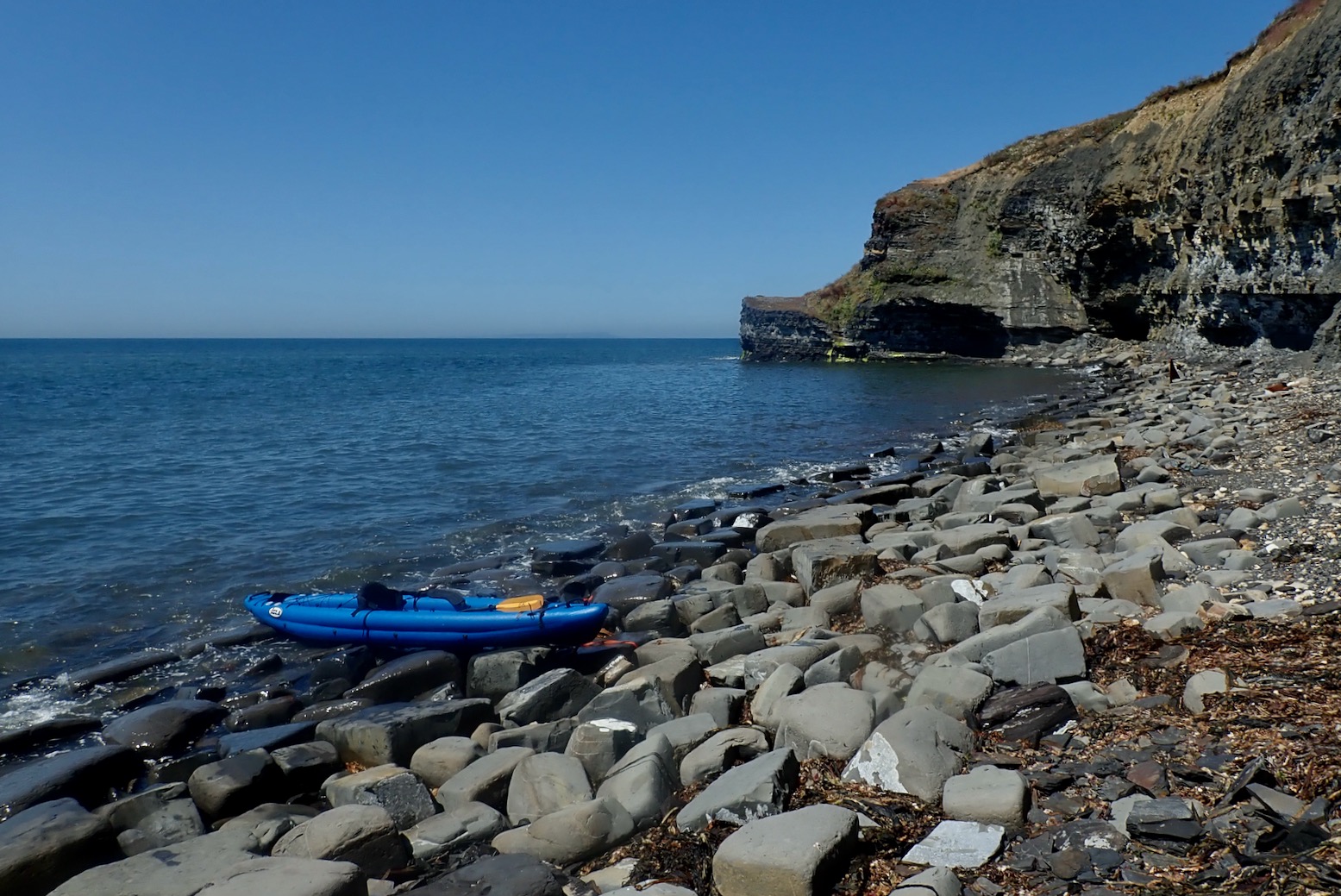
Back to the present. Lured by a curious triangle jutting up from the stones, I park up on a narrow beach and hop out for a bit on a look around. This is Clavell’s Hard, site of former shale mining. At ordinarily inaccessible spots like this you’re bound to find something interesting.
Like a beached red plastic ‘fake clinker’ dinghy.
Anywhere near seaweed there are masses of aggressive ‘sea-horse’ flies. The other week nearby Weymouth beach was blanketed in this kelp which soon started rotting during the hottest month ever. ‘Clear it away! cried the holidaymakers. ‘Stop your whining; it’s a natural phenomenon!’ responded the local council. ‘Get a grip‘ suggested Springwatcher General Chris Packham. Buckets and spades were flying and Trip Advisor turned molten with rage.
“This decision [to ignore the seaweed] supports our commitment to preserving the ecosystem’s integrity and avoiding any potential harm that may arise from interfering with its natural course.” chirped the council unconvincingly. A week or two later later they caved in and cleared the beach. Honestly, it’s just one scandal after another these days.
Compared to northwest Scotland, I’m surprised how little fishing detritus there is here. Are southern fisher-folk more tidy? I help that effort by snagging a superb, self-draining crayfish crate-bench to add to my collection.
I approach the mysterious shark’s fin.
It looked like the upper half of a retractable drop skeg (fixed rudder) with its mounting plate, similar to kits you can buy for hardshell sea kayaks (left), except it weighed tons, not ounces. I thought it might be off some old wreck.
You can see a pivot pin up front. A cable might have winched it up and down. But then any ship that size would obviously have a rudder. Who knows, but I now think it’s abandoned mining junk.
The fin made me think of the SS Treveal which broke in two on the ledges about 1.5 miles southeast of here in January 1920. The Belfast-built steamer was on the return leg of its maiden voyage from Calcutta to Dundee, and had left Portland earlier that day where someone observed that the too northerly heading was inauspicious. Most of the 46 crew drowned when their lifeboats capsized near the shore. It’s said the tug which came to salvage the cargo also sank alongside. There’s no trace of the Treveal now, even on marine charts and wreck maps. But how do you dispose of a 5000-ton steamer snapped in two? Bit by bit I suppose.
It’s unlikely subsequent storms washed that huge hunk of angular metal a mile and a half to the base of this cliff. More probably it was placed there by shale miners. There’s more on the SS Treveal on Ian West’s geological pages here (scroll to the bottom of the long page).
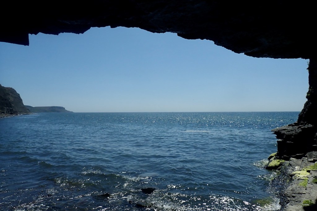
I wander into a nearby cave, perhaps excavated during the ‘Blackstone’ mining era.
Inside I see just how friable this oily shale is. I can easily peel bits off.
Underneath Silurian millipedes inhabit the tiny cracks, feeding off microbes that feed off the oil. Probably.
Time to head back. I’m all fired up for a good sail with the tide.
Benign, weed-covered ledges lurk not far below. On the far horizon the chalk cliffs of Mupe Bay, just next to Lulworth Cove. Might try there next, but the army firing ranges restrict weekday access. We’ve been hearing machine gun fire all week; Ukrainian soldiers getting trained for the front line.
I throw up the sail but it’s not happening. I creep along at barely 2mph. Maybe I’m too far out (left) and the wind got intensified near the cliffs.
I paddle back to the corner of Kimmeridge Bay…
And carry on to the other side where waves are breaking off Broad Bench ledge. On the left horizon is Portland Bill dangling below kelp-clad Weymouth.
I turn back to the jetty, de-air the Igla a bit and strap it to the car roof.
And though I haven’t really earned it today, I treat reward myself to a seaside seafood basket by the seashore.


