Seawave Index Page
Regents Canal (London)
Avon & Kennet canal (Bradford on Avon)

All hands to the barrel pump! The day will be long, sunny and warm. High time to tick off ideas matured over the winter months of Lockdown.
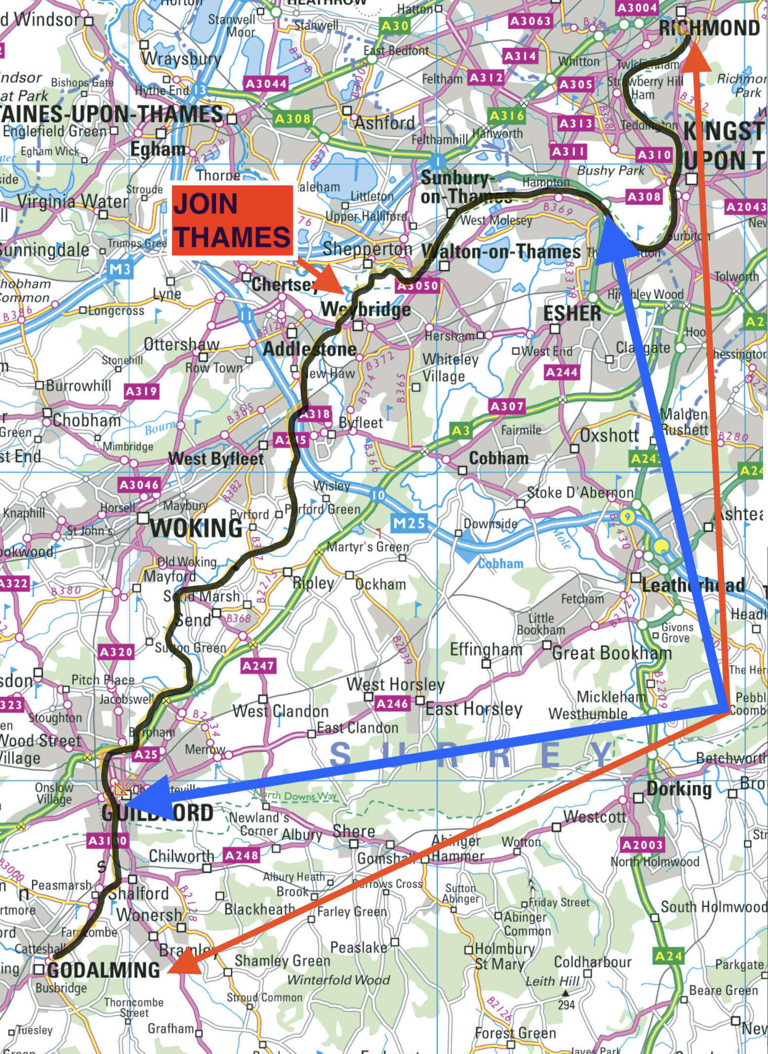
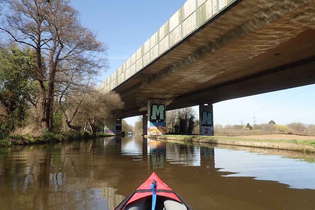
First on the list: the River Wey from Godalming to Weybridge in Surrey. Or should I say, the historic canal called the Wey Navigation which is paralleled in places by the old river. It’s one of England’s oldest navigations (commercial inland waterways) which once connected the Thames with the Navy base in Portsmouth. At the time a safe way of transporting stuff, including munitions produced near Godalming, without risking encounters with Napoleonic marauders in the Channel.
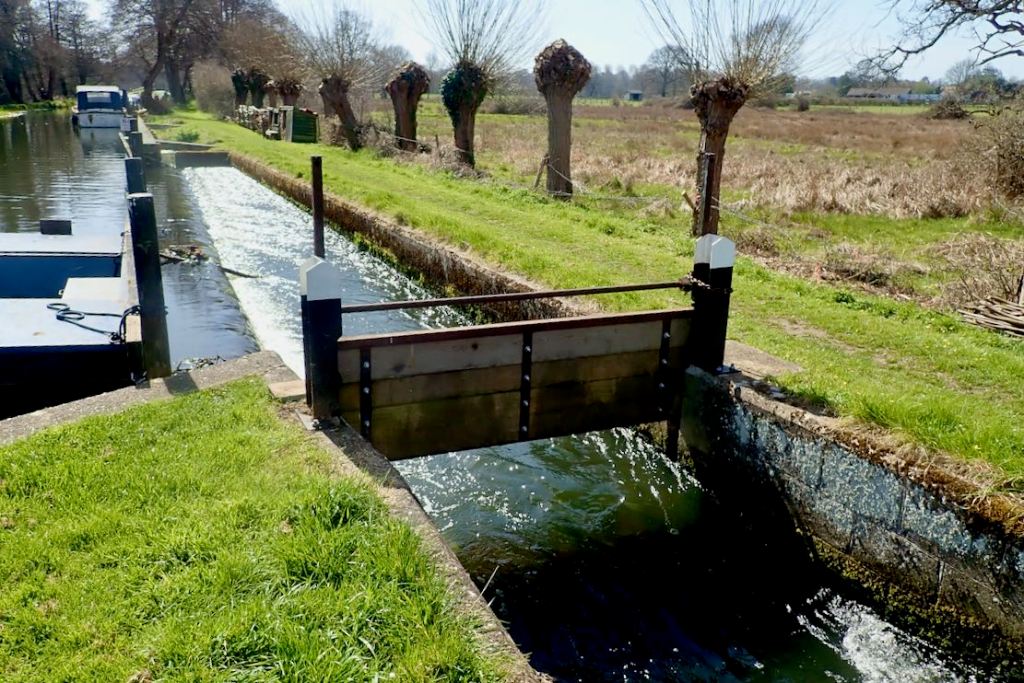
For years I’ve been unsure whether the Wey was a dreary canal with more locks than the Tower of London, or a grubby, semi-urban river with weirs and other obstructions. Turns out it’s a bit of both but better than expected. All I had to do was RTFM!

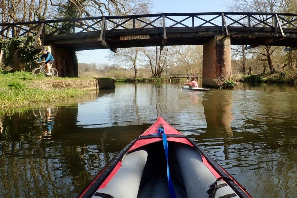
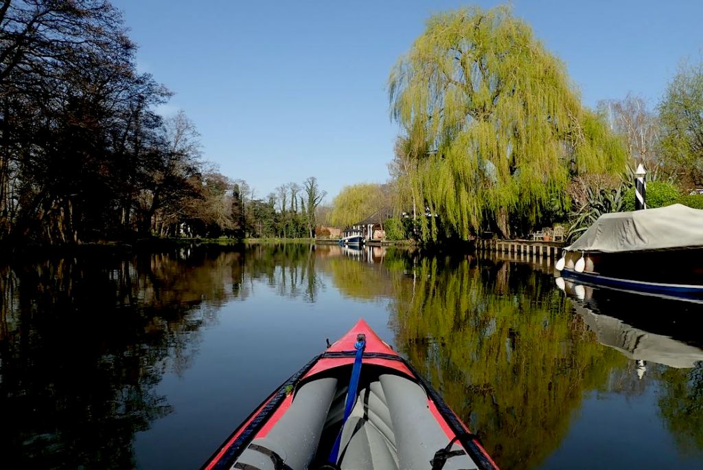
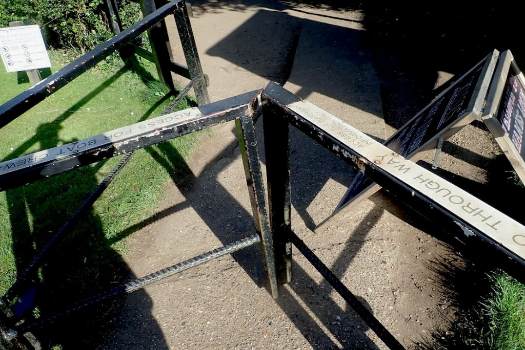
Compared to the similarly popular Medway, which I’ve done loads of times in IKs and packrafts, summer and winter, the Wey Nav feels less agricultural, more scenic and has an interesting history if you slow down enough to look. But it lacks the Medway’s unique canoe passes which scoot you down the side of each lock (right), avoiding up to three laborious carry-rounds per mile.
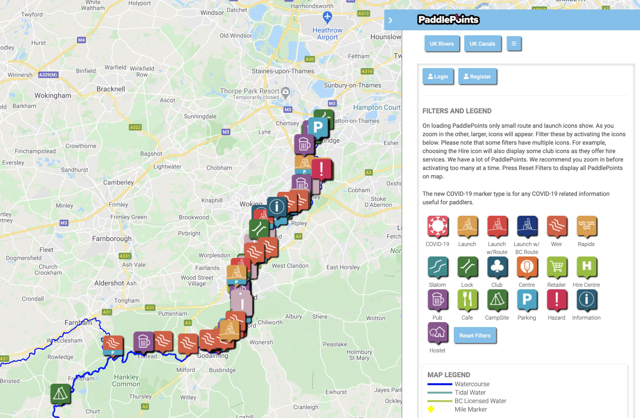
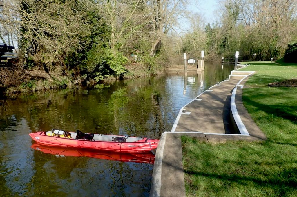
Parts of the original river survive in places to either side of the canal, which is what caused me confusion. I now realise the Navigation (managed by the National Trust) gets priority in terms of water levels and maintenance. As a result the occasionally nearby River Wey might be shallow or chocked up with fallen trees or rubbish. But you can combine both to make loops like this.
I fancied a full dawn-to-dusk recce: as much as I could fit in from Godalming (where most paddlers start) before my tank ran dry. I might even reach Richmond on the Thames, a section I enjoyed last December in the Arrowstream. That is actually quite a haul: 20 Weymiles plus another 15 on the Thames, including no less than 17 lock portages on the two rivers. But the great thing about ending a paddle in an urban area is I could air down when I got worn out and rail home.
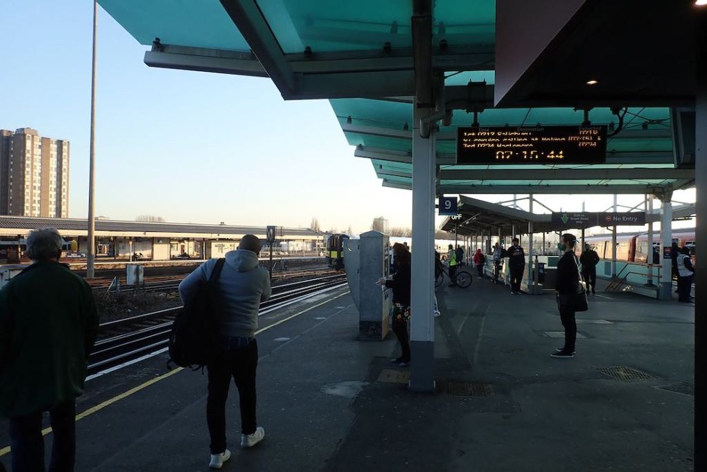
Thirty-five miles? Dream on, bro! I’ve only paddled two days since September so was far from paddle fit. Then again, the pre-dawn brain wasn’t on top form either: I set off in the right general direction, but on the wrong train.
Oh! Mister Porter, what shall I do?
I want to go to Godalming
And they’re taking me on to Hoo [k],
Send me back to Woking as quickly as you can,
Oh! Mister Porter, what a silly boy I am!
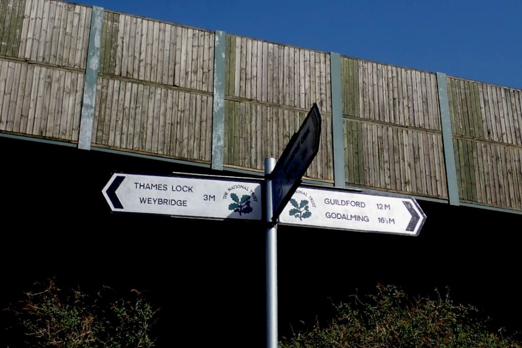
After backtracking, I decided to catch up with myself at Guildford, 5 miles downstream of Godalming and missing out 4 of the Wey’s 14 locks. I dare say I’d appreciate that later.


I’m trying out some old runners as water shoes instead of my usual Teva Omniums.


How about it, National Trust? It would be like turning Downton Abbey into a Discount Carpet Warehouse!

Flip yer paddle round, mate, you look like an amateur!


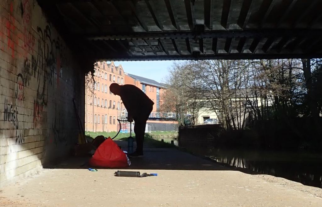
It’s an awkward portage over a narrow road bridge too. Luckily, this chap helps me out. Thanks, chum!


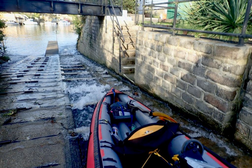
Now on the Thames, I become a great admirer of roller portages.

It’s a warm evening on the Thames and they’re all out in boats and the riverside parks. The [Covid] Rule of Six? Do me a favour!
The skiffs collect bird poo while two lads fire up their Intex Challengers. I’ve seen more Intex IKs today than anything else.
Why? Because they cost from under 100 quid, float just like a Seawave but track like a barrel.


With too much food, it all made the boat just a bit too heavy to carry easily. Where the lock-side grass was lush I dragged the boat, but I have a better idea.
Just before the GPS packed up at Basingstoke canal junction, I was averaging 5.5kph on the move. Pretty good with no current to speak of. On the livelier Thames I estimate I was moving at up to 10kph before I withered. Same as in the FDS Shipwreck in December.
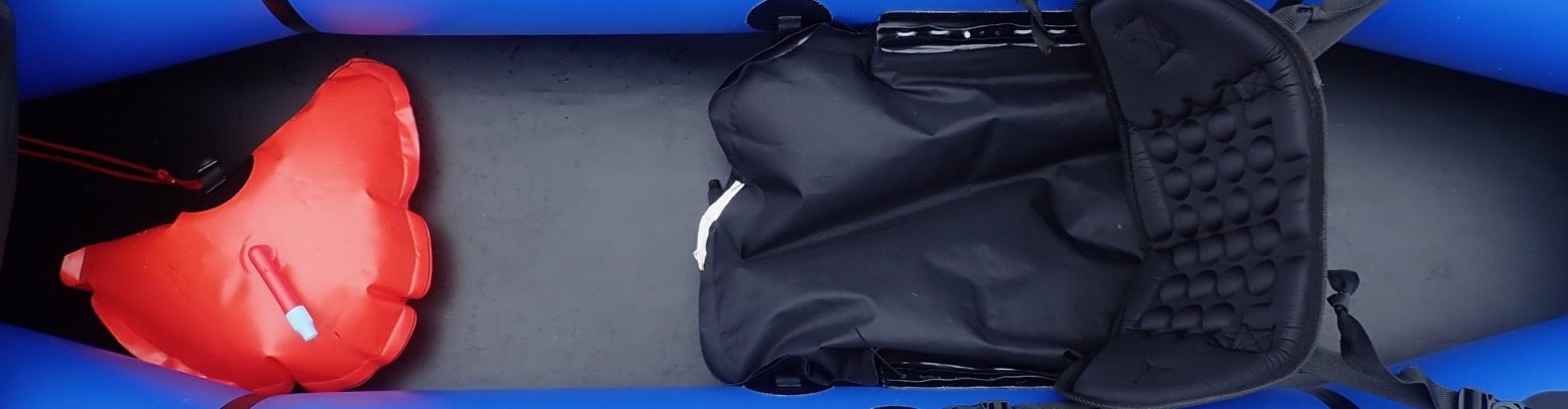
My tall BIC backrest (below left) initially felt great then collapsed on itself. Usual story: needs a stiffer insert.
I was trying out my new footrest tube attachment points which worked great. Only when one heat-welded strap broke near Addlestone was I reminded how essential footrests are to comfort, efficiency and stamina. I jury-rigged something up between two D-rings which have been staring in the face all this time.


My 2021 Wey Survey of UK Paddling Trends
- Hardshell canoes: 1
- Hardshell kayaks: 1 (+ 2 K1 racers)
- Hardshell SoT: 1
- Vinyl IKs (cheapies): 5
- PVC (bladder) IKs 3
- iSUPs: 10+ (mostly women on iSuPs, too)
- PFDs worn, almost none then again, mine’s more of a handy waistcoat)
- FDS spotted: none (interesting as readers here are mad for that page)

