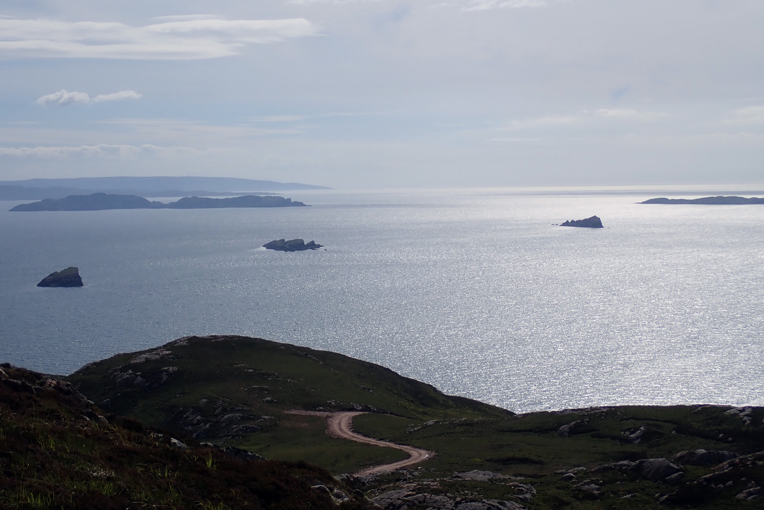
But I knew before I got on the water the tide was not with me and nor was the wind. Hauling myself through the Tanera channel, by the time the cheese-wedge profile of Angus came into view to the southwest it looked a long way away, with only Glas-leac Beag (on the right, below) between it and the inky depths of the Minch.
I paddled out into the Summers the other afternoon to see how far I’d get. What I was really eyeing up was Stac Mhic Aonghais or ‘Precipitous rocky feature of Angus’, one of three skerries bobbing just south of the Tanera islands.
I only really clocked it on last year’s crossing from Carn nan Sgeir to Tanera Beg. I suppose now I’ve visited just about all the Summer Islands I’m looking more closely at the bits in between.

So I swung east around the south side of Tanera Mor and, now with the wind and tide behind me, at the last minute decided to make a ‘training dash’ towards ‘Goat Sound’ (left) – the tidal passage between Horse and ‘Goat’ island which I guessed was flooded by now. From there it was a weary hack back against the squalls to the beach and an XL dinner.

A few days later I persuaded visiting paddlechum Jon that a tour of the Summer Isles Skerries was good use of his holiday up here. He’d just returned from a gruelling, two-day bike ride through the Assynt – part of the HT550 – so his arms were in need of some exercise.

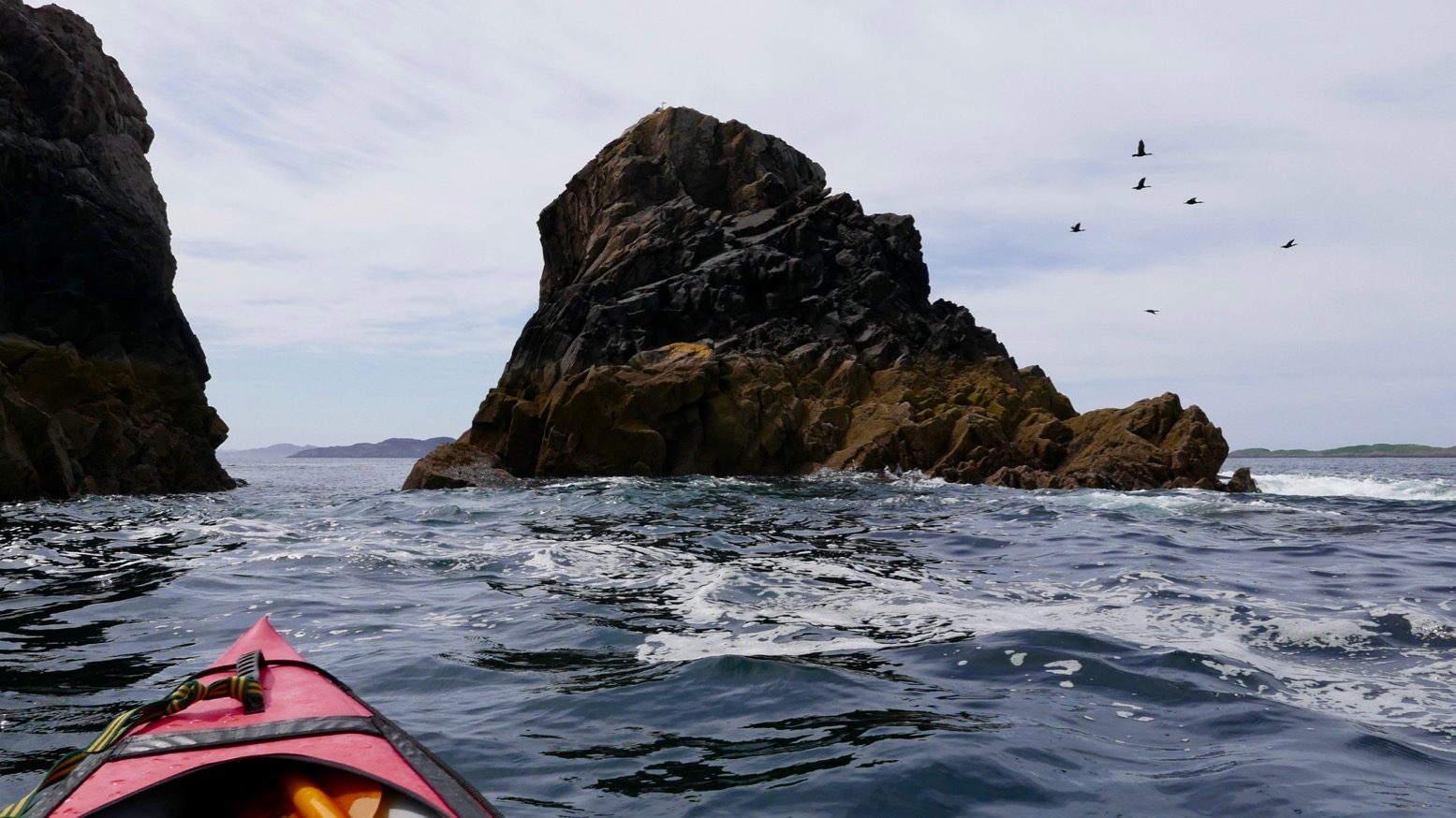
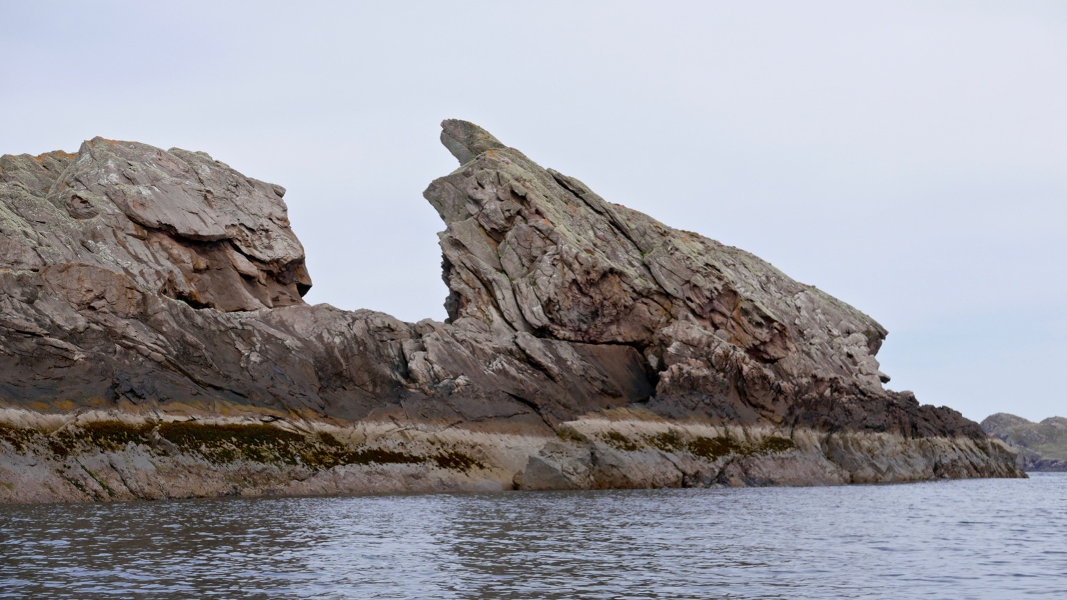
As skerries go, the supposedly 78-foot-high (26-m) Stac of Angus (see below) has a dramatic profile. From some angles a homesick Norseman pining for his mead might even call it a dragon’s tooth. It also looked fairly easy to climb to the top to get a nice shot of a kayak below.
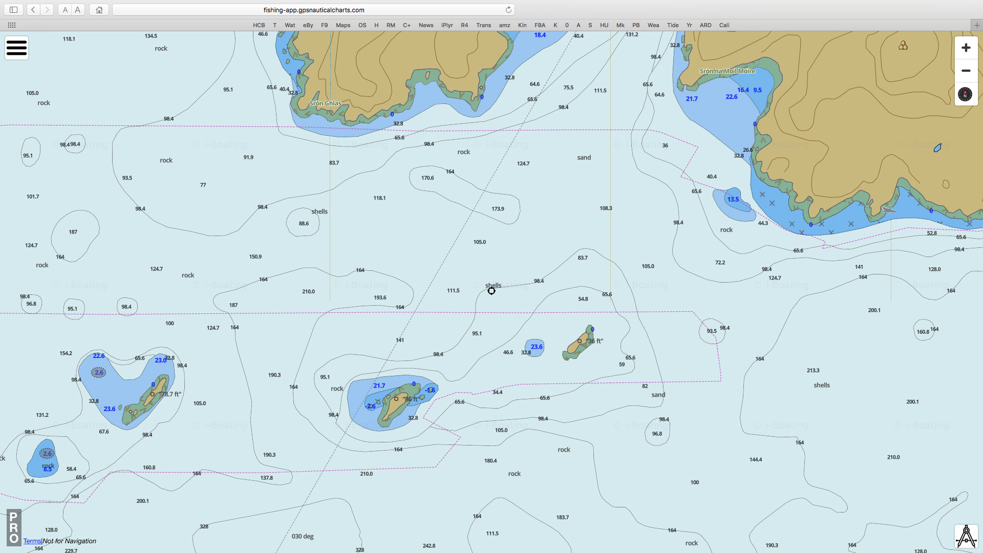
Stac Mhic Aonghais, Sgeir an Aon Iomairt and Sgeir Ribhinn or Revan. All three line up with about a kilometre between each; long thin skerries aligned on a SW/NE axis, as is much of the lower elevation topography up here; valleys and trenches carved I assume, by glaciers advancing from Scandinavia. This report suggests that 12,000 years ago during an anomalous cold spike following the end of the last Ice Age ‘…climatic factors, combined with the availability of large quantities of subglacial debris, led to the development of distinctive glacial landsystems, which may have no direct modern analogue.’ As we know, the dramatic Assynt has no topographic analogue elsewhere in Scotland and the angular claw of Stac of Angus is one of its many remnants. (Btw, that marine chart screenshot above left is from a very handy and editable online nautical ‘mapp’).

Planning paddles up here is of course a lottery but came the day, by some miracle a High had parked itself over the northern British Isles, put on the handbrake and tipped the seat back. The 4.5-m tide may have been at the peak of its fortnightly cycle, bottoming out at 2.30pm, but that could be handy if we used it right. If we left Stac around low tide, it should be an easy ride back up to Old Dornie, assisted by the rising afternoon breeze.
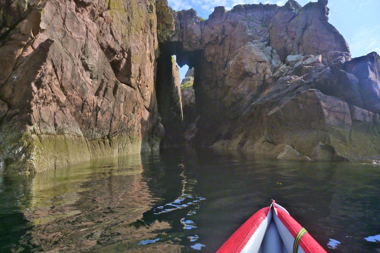
We paddled down between the Taneras with the tide, passing some other kayakers on the way. I mentioned the Tanera Beg arch just round the corner to them, but after a quick check the tide was too far gone to thread the arch.

In little more than an hour we were approaching the gnarly, storm-wracked northern prow of Angus. It’s hard to think how the 1:25,000 OS map arrives at the oft-repeated height of 26m. The picture below of Angus’ high point is about 90 minutes before a low spring tide at around 0.5m above Ordnance Datum – which is the lowest astronomical tide – ‘LAT’ – at Newlyn. So even if you add about 2m or 6 feet to measure the skerry at LAT, or just use the more likely MSL, there’s no way that adds up nearly 80 feet; it’s more like half that. It’s odd because the two other skerries we were heading for had entirely plausible heights.
Anyway, we paddled along the exposed west side looking for a landing spot but found nothing but 45-degree slopes. I was sort of hoping that low tide might reveal a platform or at least give us more rock surface to choose from, but very low tide also exposes seaweed, kelp and other crap; there’s probably as much chance of getting alongside a handy ledge at higher tides.

As we passed between the two outcrops on the south end, Jon smacked me in the head with his paddle (left). Lifted through by a 1-m swell, on the inshore side we found the least unlikely looking parking slot, where between bigger swells I could crawl out (right). If you think about it, sitting as you are on the floor of a bobbling narrow boat at sea level, there’s nothing harder to get out of than a kayak, especially once you’ve attained a certain age. IKs are easier than a proper sea kayak of course, but even a canoe’s bench seat might be easier to spring or step off.
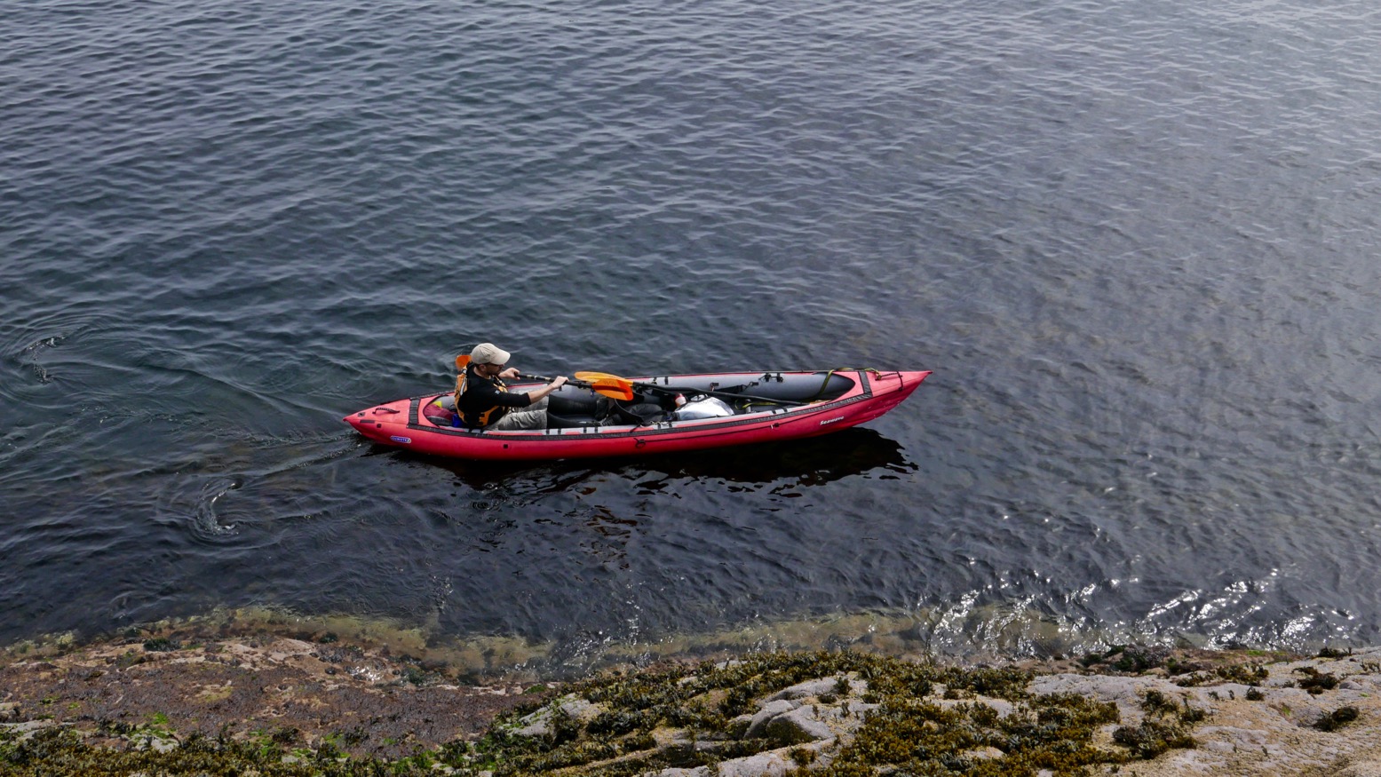
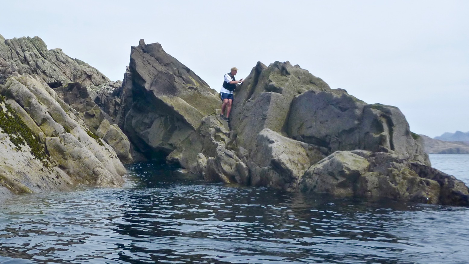
Stac Angus is nearly bisected by a punched-out breach (left) through which storm waves tumble; the higher part is in the north. Problem was getting there from the lower half of the skerry where I’d landed. Even if it wasn’t 26m above MLWS or LAT or even M&S, accessing that northern spike was a lot more of a rock-climbing challenge than I was prepared to take on. So I left it to the squawking guillemots and settled with just enough elevation to get an OK shot of Jon gliding by (below), then scrambled back down to the slot and hailed down my water taxi.


With Stac of Angus ticked off, we scooted over towards Sgeir an Aon Iomairt (in the picture above, on the right), hoping it would provide an easier landing for a civilised terrestrial lunch.
Iomairt has a similar NW-facing cliff and on its NE corner has a parking slot of sorts (right) where a kayak can wedge itself as the tide drops away below it.

The surprise here was the thick cushy duvet of soft grass and thrift flowers which capped the island. Picture left: looking south from, near the summit towards the Carns, Bottle and Priest Island. Whatever it is that makes Iomairt agreeable to lush vegetation and sea pink thrifts, while Angus makes do with lichen and bird shite, it’s found here. Perhaps because it’s less of a jutting flake and flatter, with many crevices where rainwater and sludge can gather and foment.

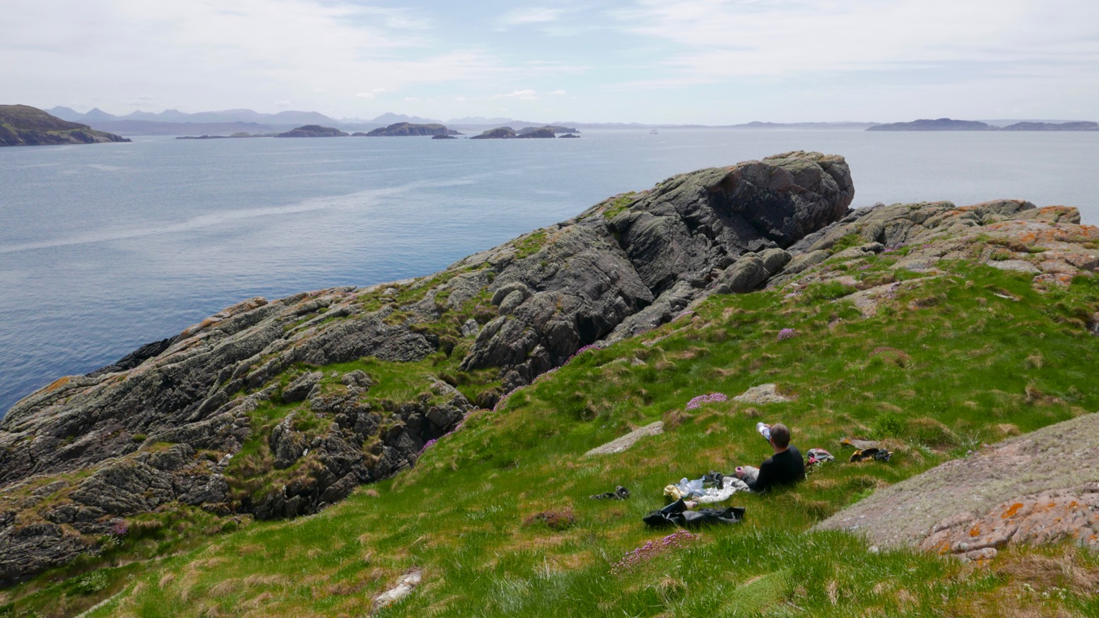

Who knows, but it was nice to be able to walk around, rather than teether on acute, barnacle-covered slabs, as I’d just done on Angus. We settled down out of the breeze – May temperatures are still barely in double figures up here – and unpacked our munchies. We had with less than an hour before the tide turned and lifted the Gumotex away. As we ate we spotted another couple of paddlers enjoying the calm conditions out to the southeast, near the two Carns which join up at low tides, like today.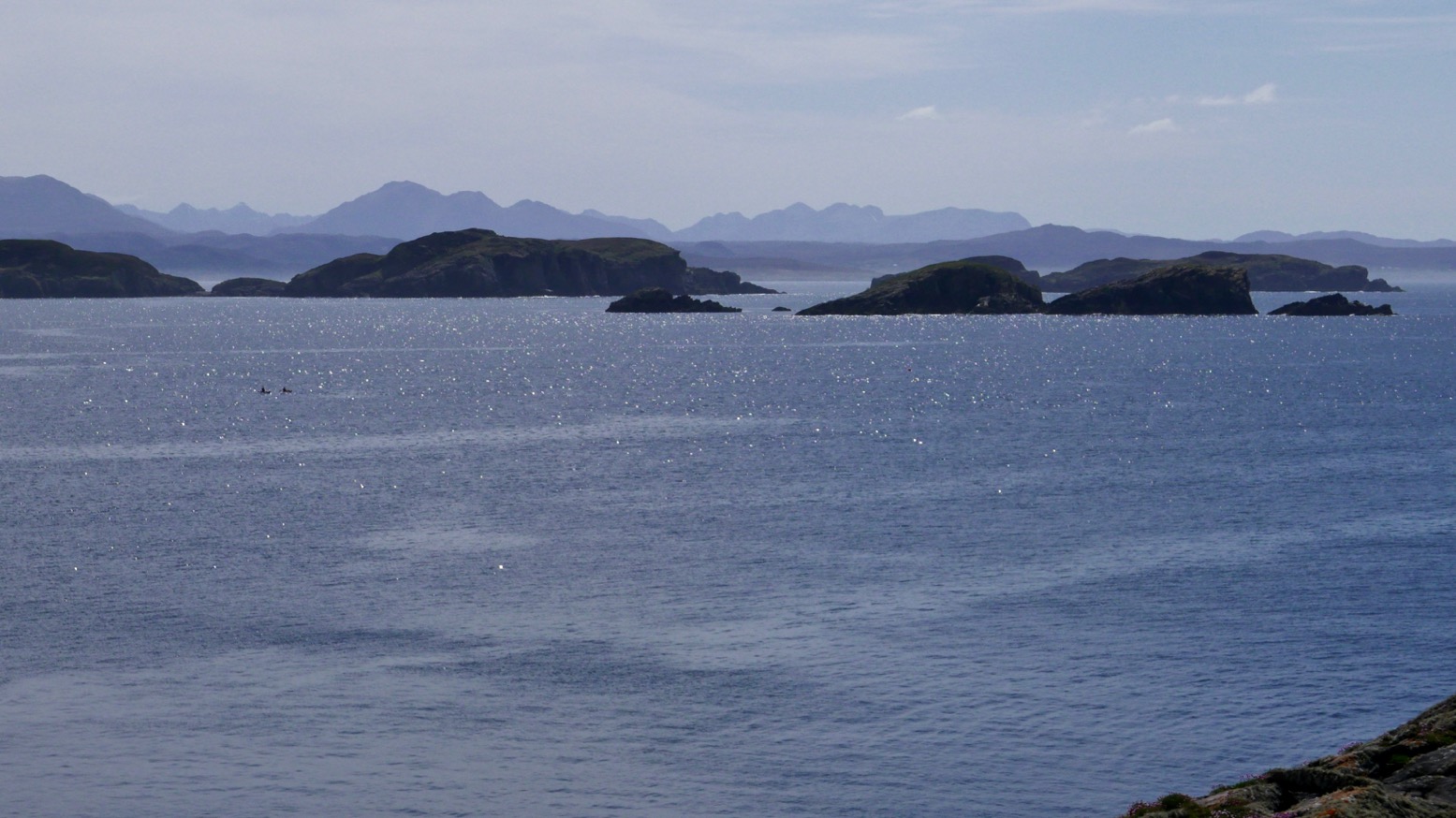 Though you’re not spoilt for choice out here in the Summer Isles, you could easily camp on Sgeir an Aon Iomairt. There’s brackish water in some pools, good enough for a wash, and enough flat patches to sleep in comfort. Hardshell or IK, for peace of mind you’d still want to lug you’re boat above the high water line unless you can find a bombproof anchorage. And the elevation of around 16m is, you’ll be pleased to know, about right.
 When our time came the tide had dropped a metre but was on the turn. Getting back in was as always an awkward shunt, slipping around on kelp and slimey molluscs to get the Seawave back on the water, but once in the pool it did manage to paddle itself out over the slimy kelp towards Sgeir Ribhinn (‘Maiden’s Skerry’), the last of our Summer Island skerries.
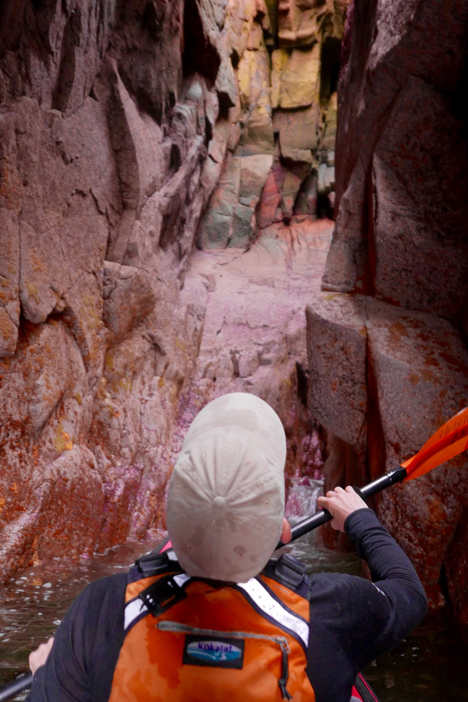
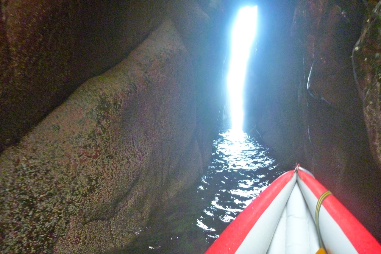
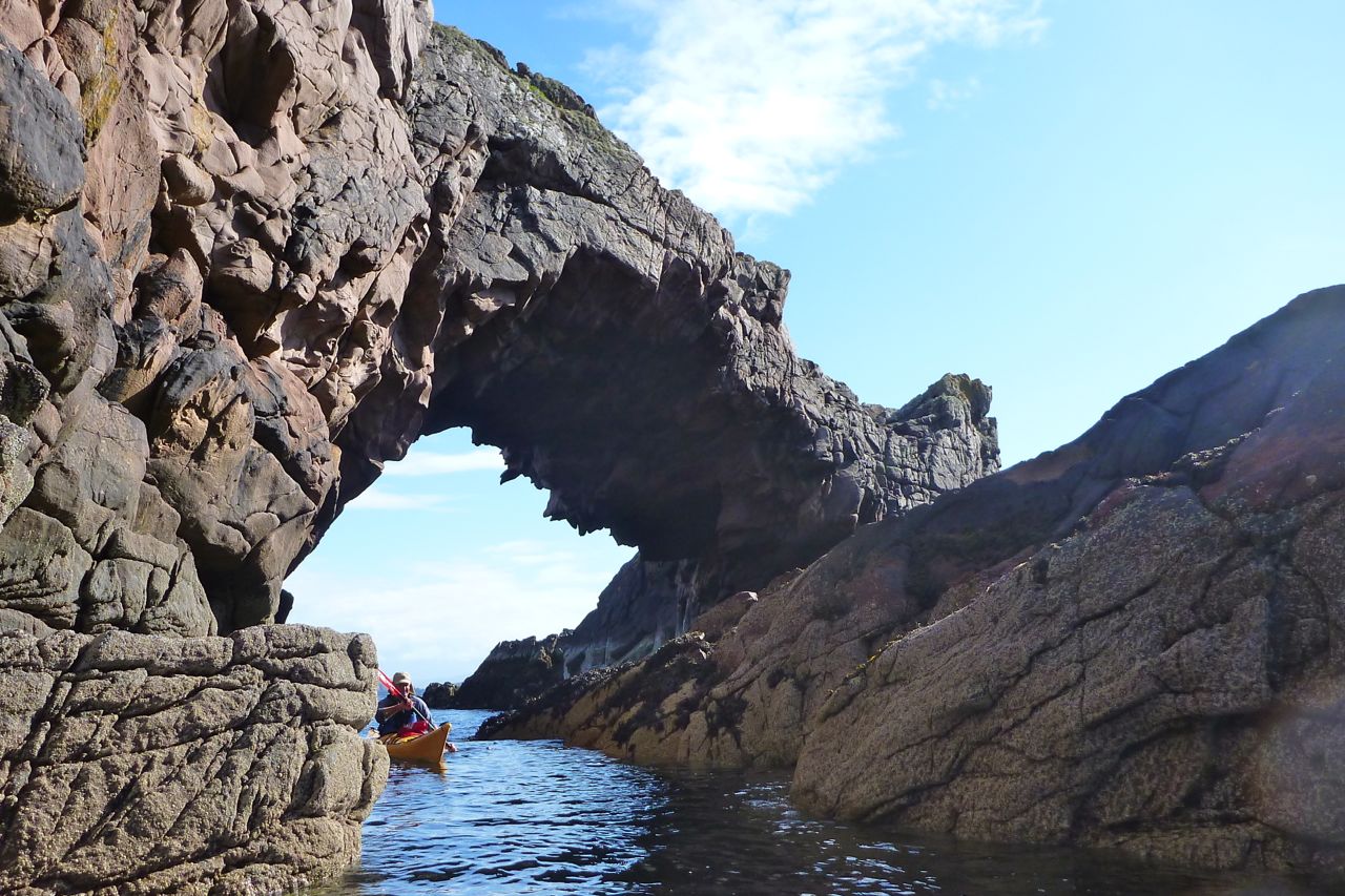
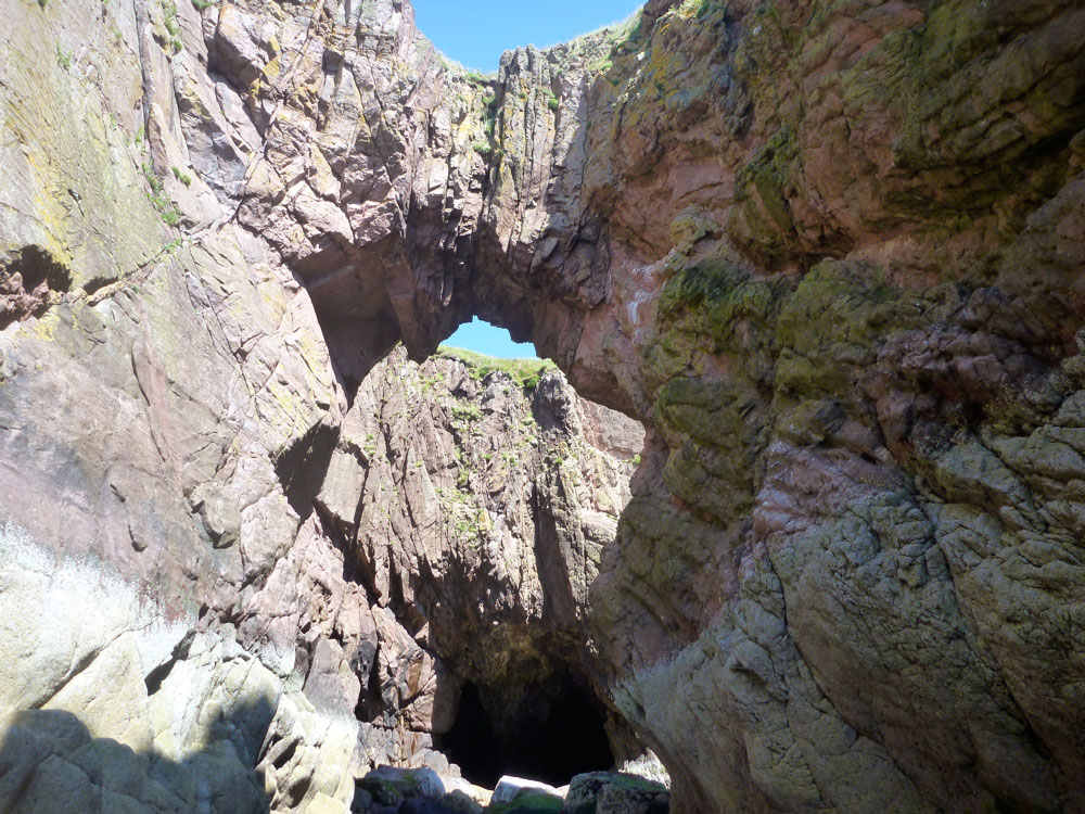
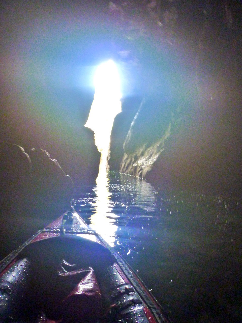
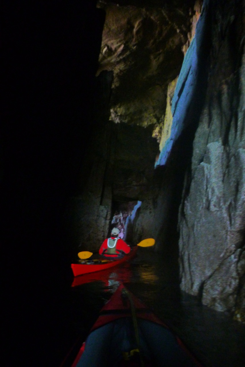
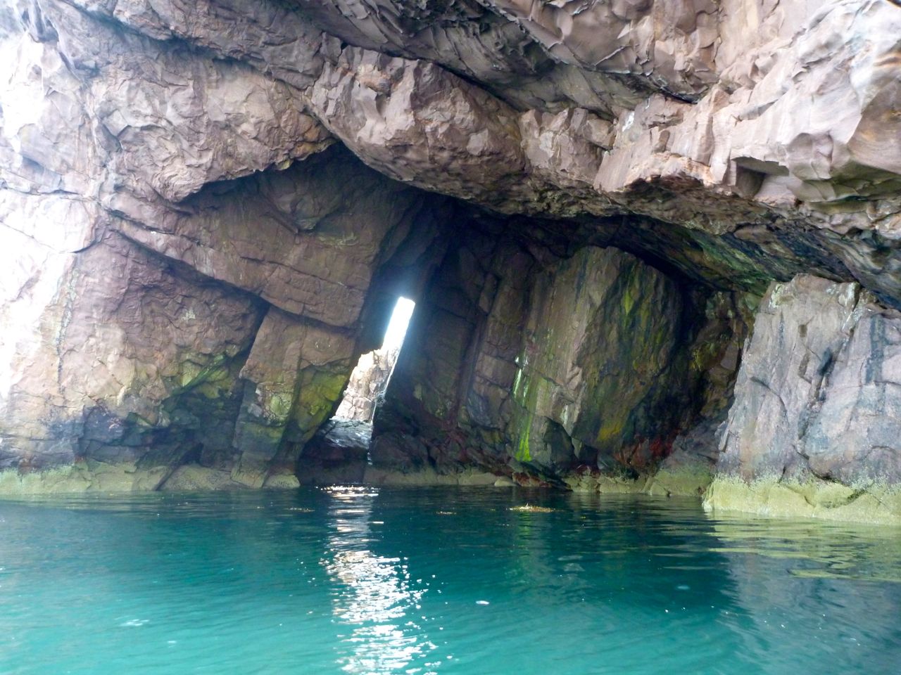
Coming round the eastern side of Ribhinn, even this skerry managed to sustain a small capping of grass. We nosed into a kayak-wide geo and found ourselves in a twin-arched cave, another paddleable arch (above) to add to my list.

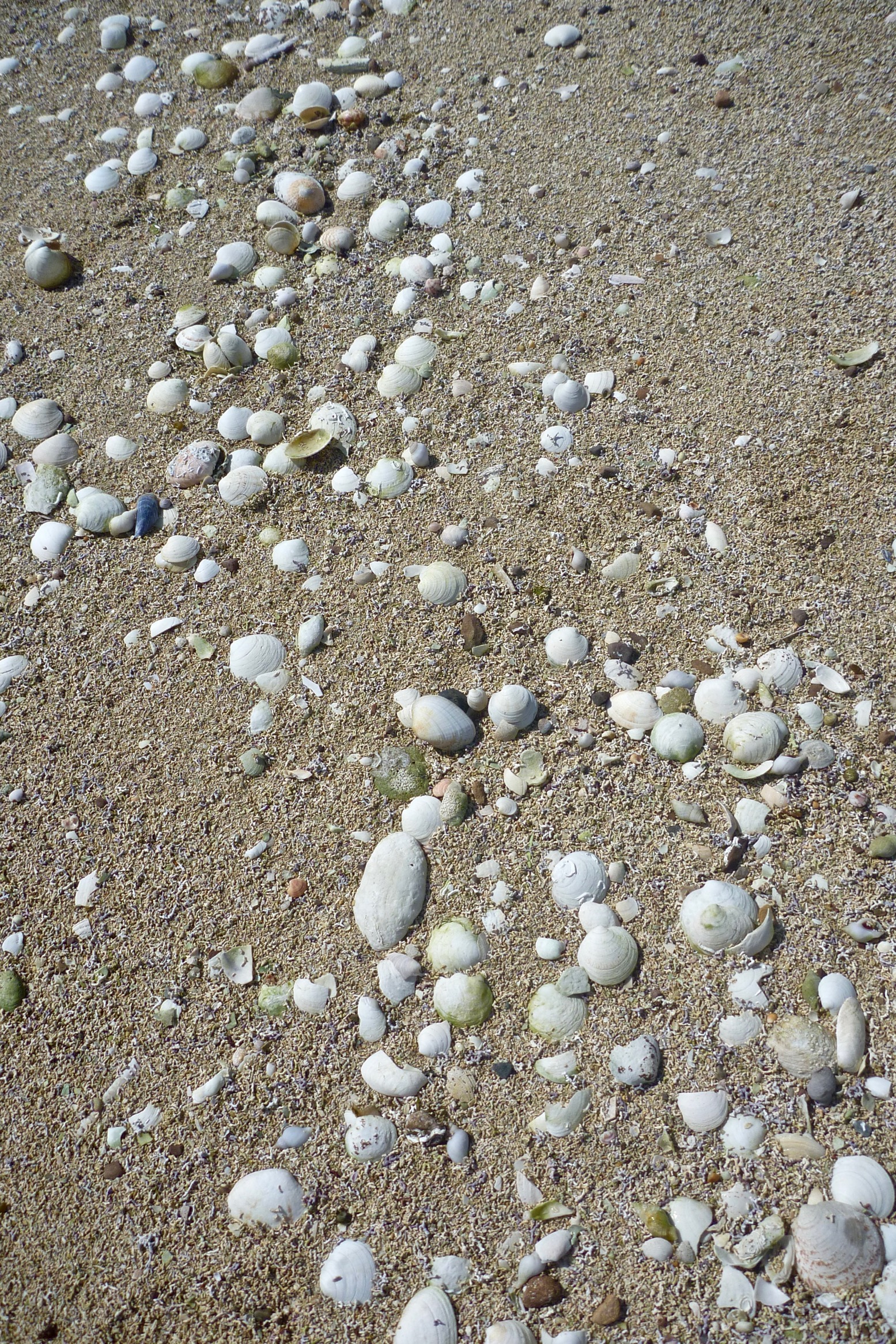
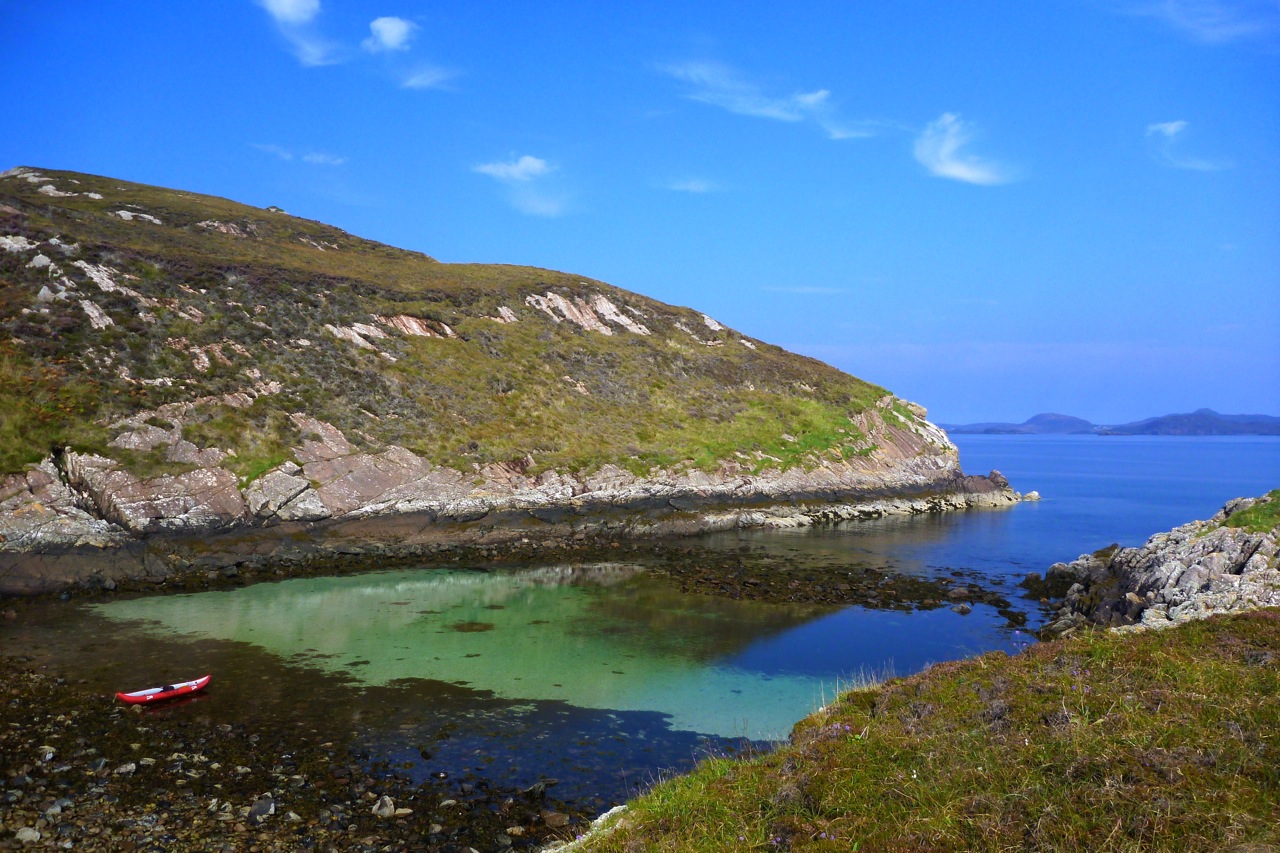
All that remained was to paddle back the way we came through the western passage of ‘Tanera Sound’, between Tanera Beg and Eilean Fada Mor. With the spring tide still low, all the shell beaches were out sunning themselves. After looking for it for years, I finally recognised a cove and beach on Tanera Beg (left) where we’d spent a lovely afternoon 12 years ago with my Gumotex Sunny and ancient Safari when we first started coming to the Summers.
Back to now, I hopped off at Eilean Fada to top up the air that had purged while out of the water over lunch, and to get a shot of Jon floating over the azure Bahaman sands (below). My kayaks have got a lot better since 2006, but the Summer Islands remain the same great place they always were for a quiet paddle.