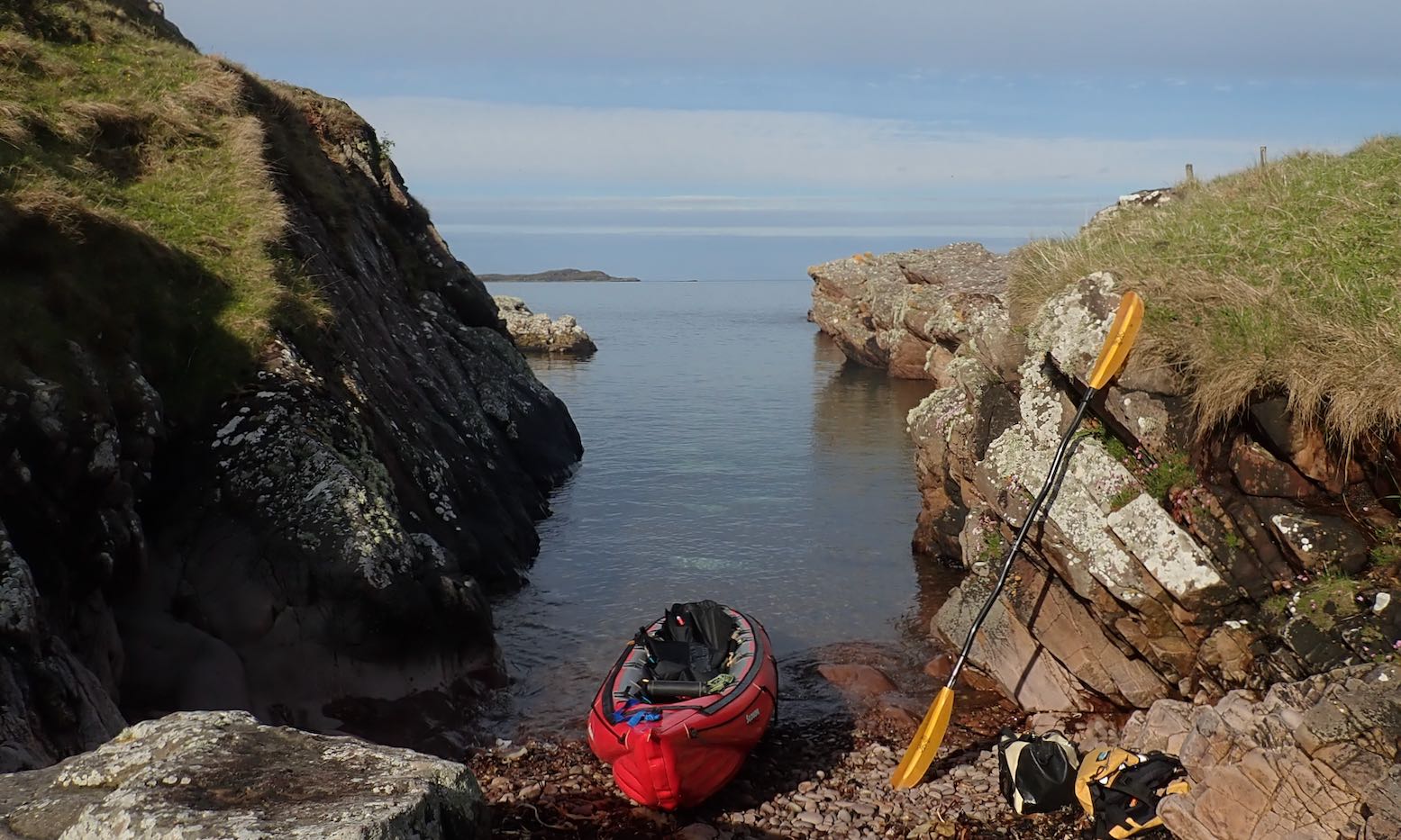
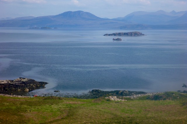
Another forecast of calm winds in the Summers. Or is it? The BBC and YR reports are contradictory: the former has too-strong-for-IK winds from the south; the latter shows light winds from the north. Others show light winds from the south. How can they all be so different? Maybe I should just look out across the water? All looks serene so let’s make paddle while the sun shines. I wheel back down to False Man’s Harbour and set off with two hours before high water.
No side PRVs? Am I missing not having added pressure release valves in my side tubes, as I did to my original Seawave? Not really. I am running 0.3+ bar in the sides (official: 0.25) but temperatures up here in NW Scotland are hardly tropical. I try and leave the boat in the shade at the house and de-air the side tubes for a couple of seconds after a paddle, effectively manually depressurising the sides to about 0.2 bar, rather than having fitted PRVs do it for me automatically. The more vulnerable stock PRV in the floor purges automatically at 0.25. On my next paddle I have to top up all three chambers with the K-Pump as I would have to do with all-round PRVs anyway. About 30 kpumps brings the sides back up to over 0.3 bar. The difference now is I use a manometer to check the sides are about right. Before I would just pump until the side PRVs purged. It’s about a minute’s more faffing. As with a lot of things I do to my IKs: sails, rudders, decks and now, trolleys and headwind weight transfer – it’s fun to experiment. But in the end they’re all largely over-shadowed by the simple enjoyment of paddling. With sides pumped to >0.3 bar I find I can cruise easily in the near-still conditions at 6kph.
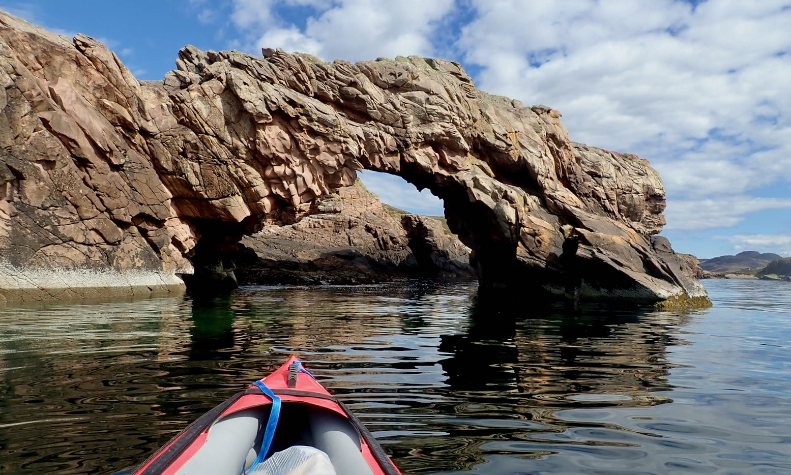
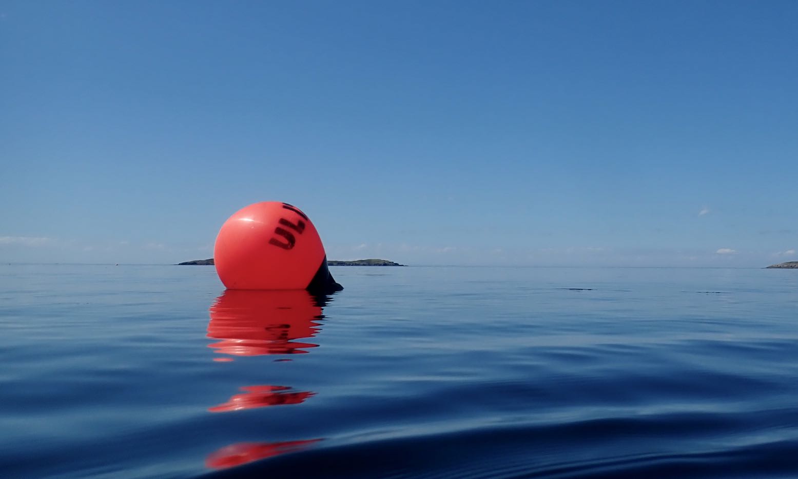
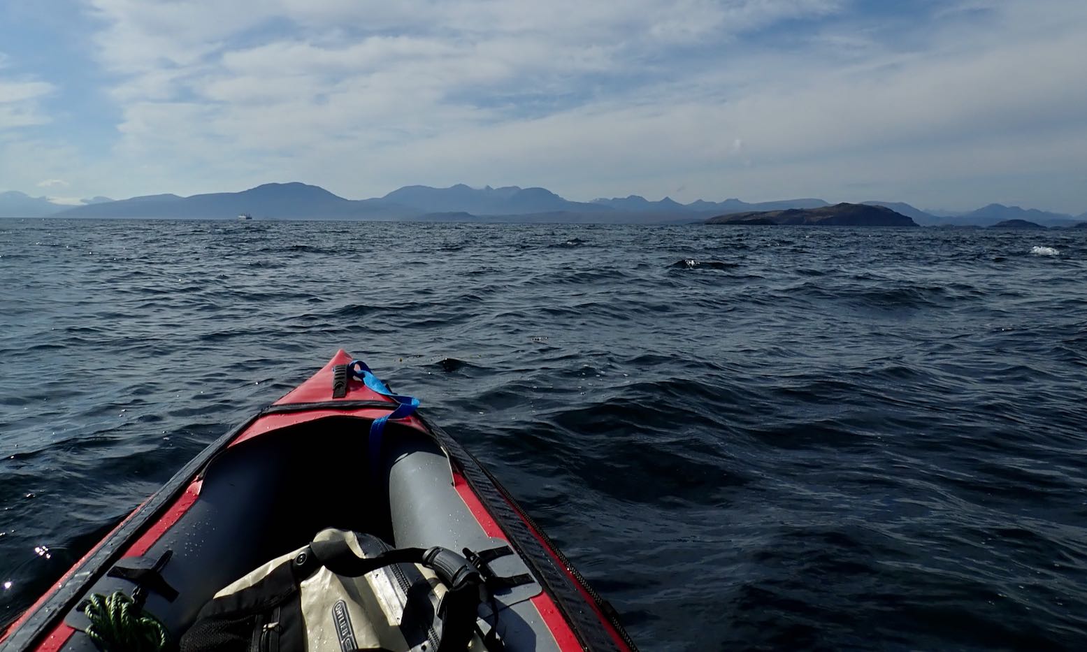
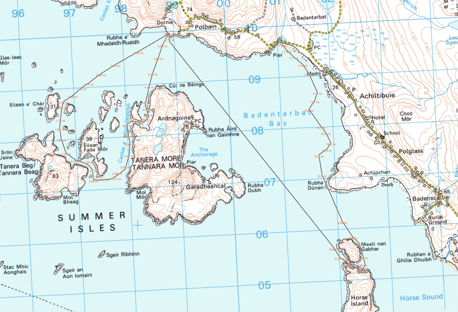
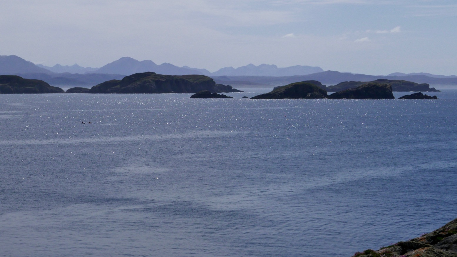
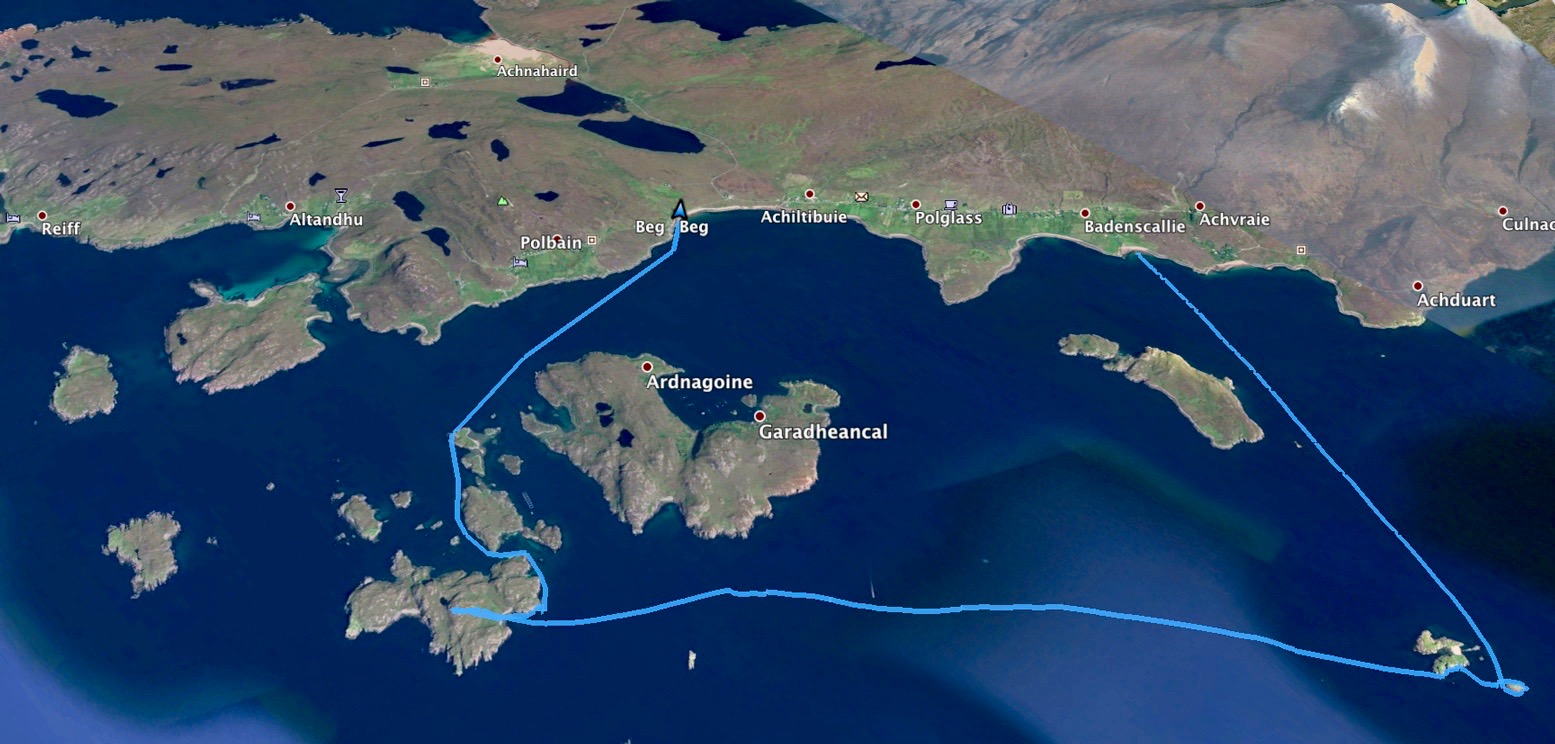
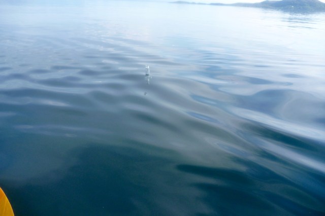
Let’s try and make the outside of Tanera Beg again. Two days ago I got blown off that idea.I fit a compass so I know which way the wind blowsAnd try out my deckbag GPS RAM mount so I can measure, not guess, distancesKayaking tour party mustering at the north cliff of T. Beg.But they seem to be dawdling, as if unsure whether to go ahead.I paddle past and on to the big cave on T. Beg’s south side. That crack at the back might be passable at max HW.The view out south towards the Wedge of Angus and Priest Island beyond.I slip through the popular arch at Tanera Beg’s southeast end.I notice a small second arch. The water is too high and gap too narrow to squeeze through with my Seawave, but it’s only a foot deep below, so the window of opportunity is as narrow as the arch. What would Freud have made of all this arch-threading.Being more exposed to the southwest, Tanera Beg has some deeply weathered sandstone cliffs.Midway through, I decide crossing over to Tanera Mor seems too easy. In the prevailing calm the three skerries to the south don’t look that far. It’s just over a kilometre to Sgeir Ribhinn (‘Stack C’) according to the GPS. That will take 11 minutes. Once there, I fail to notice the double-arched cave we found last time. But this is HW. A guard-bird observes.Over to the south side of Tanera Mor. The new owner is employing scores and spending millions here. New cottages here and there, plus tracks to isolated beaches (for building stones, I was told). They now ask you not to land in the more built-up Anchorage on the north side.There’s even a new house and other construction alongside the tidal lagoon of An Lochanach where I stop for a snack. Two kayakers pass by. Earlier, I could clearly hear them talking behind me across the flat water, long before I could see them.I cross the Bay and stop off on the mainland below our place to collect something.Looking west: a buoy with Glas Leac Mor behind. I recently read that a hazy horizon (Outer Hebrides not visible) means stability; warm, humid air. Good viz and crisp detail = cold air and wind. I head to Altandu, near the campervan-packed campsite.I drop-off and pick up a bucket. Coming back through Old Dornie harbour, a quarter headwind kicks up, pushing the bow left. I use the chance to load the bow with 10 litres of bucket-water. It does seem to make a difference: the bow bites better; no correctional paddling needed, unlike the other day. A good trick to know (I’d brought the drybag up front for that purpose).Another 13-mile day in the Summers, but I could have managed twice as far. How easy IK-ing is without wind. As is portaging with a trolley.
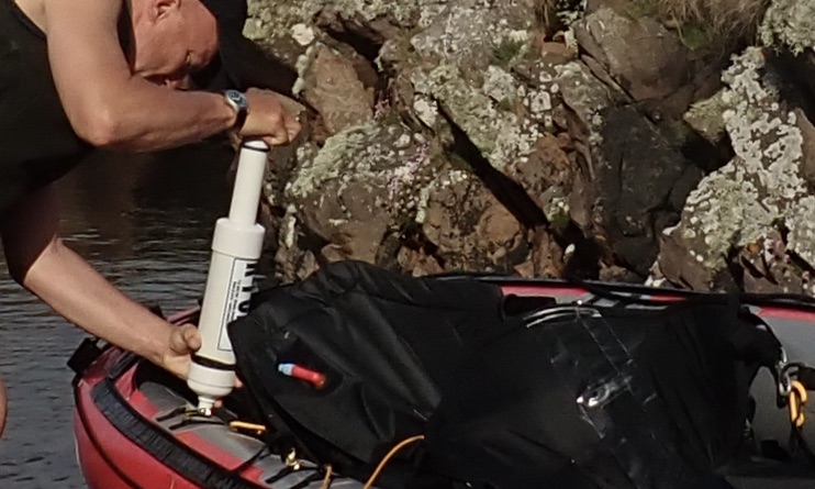
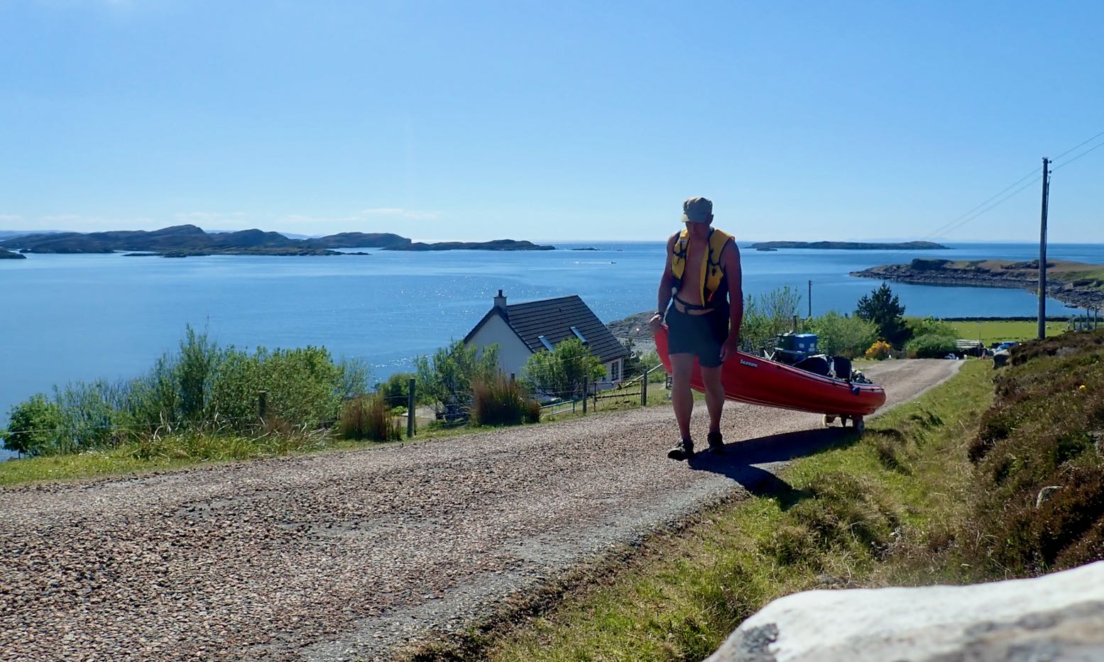
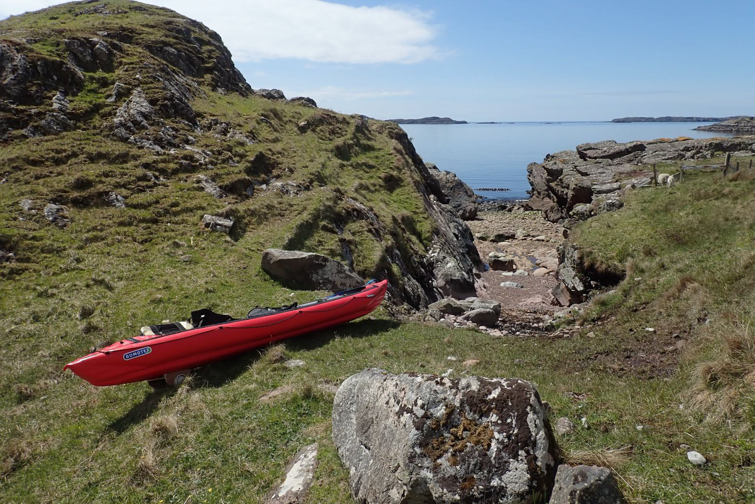
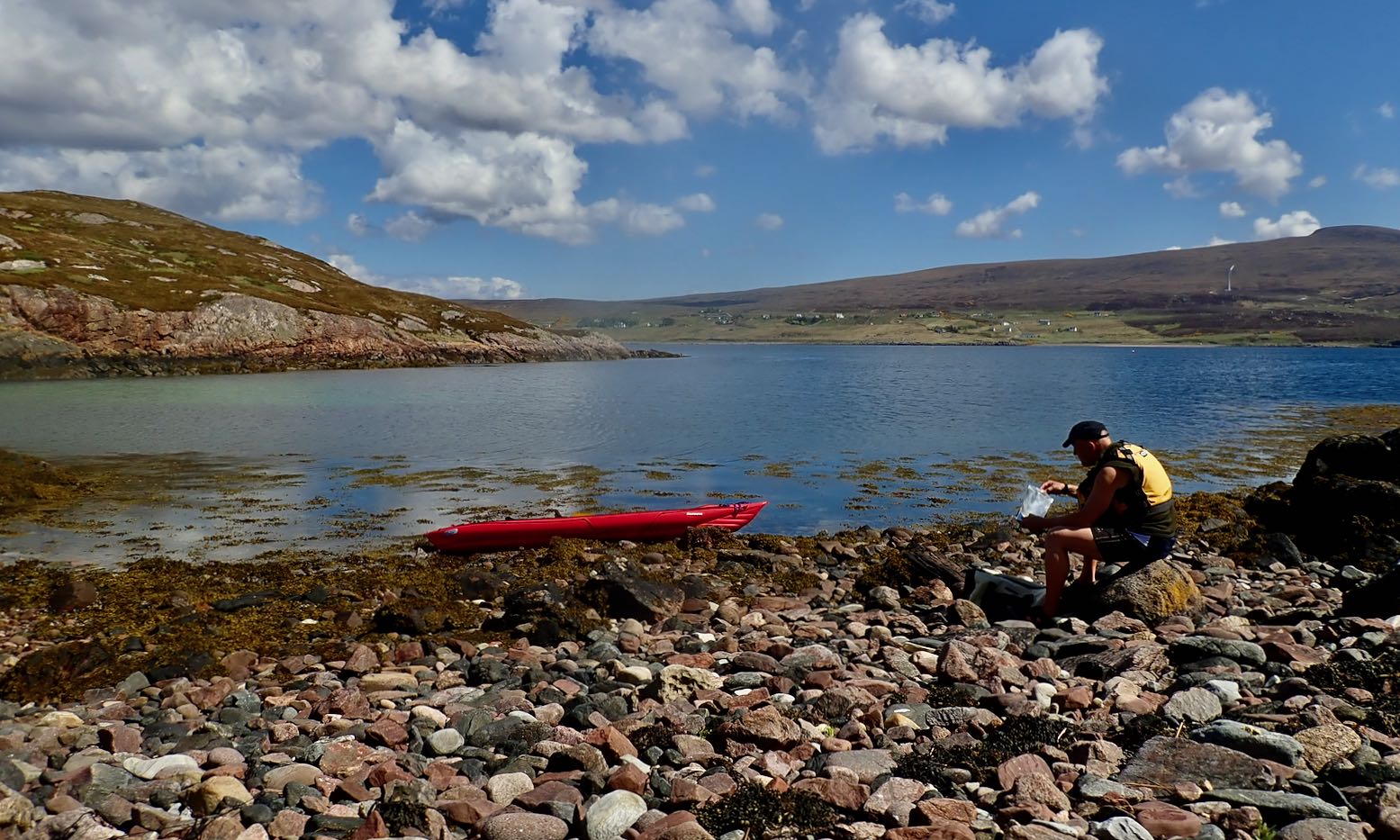
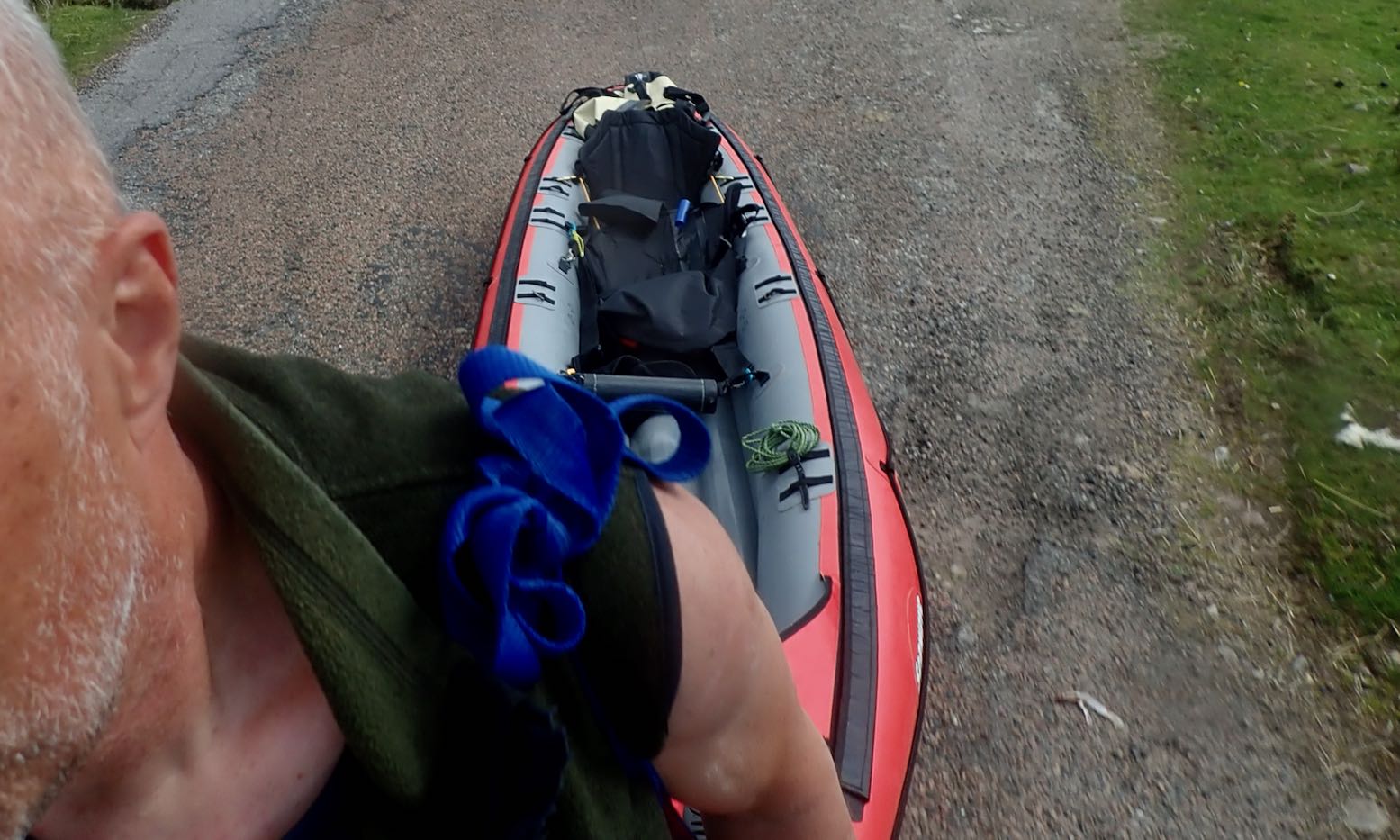
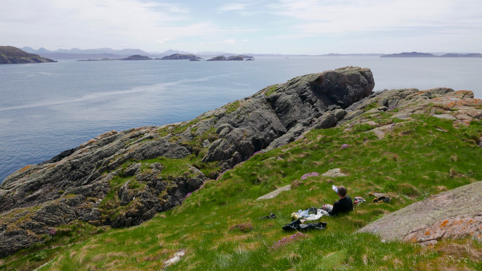
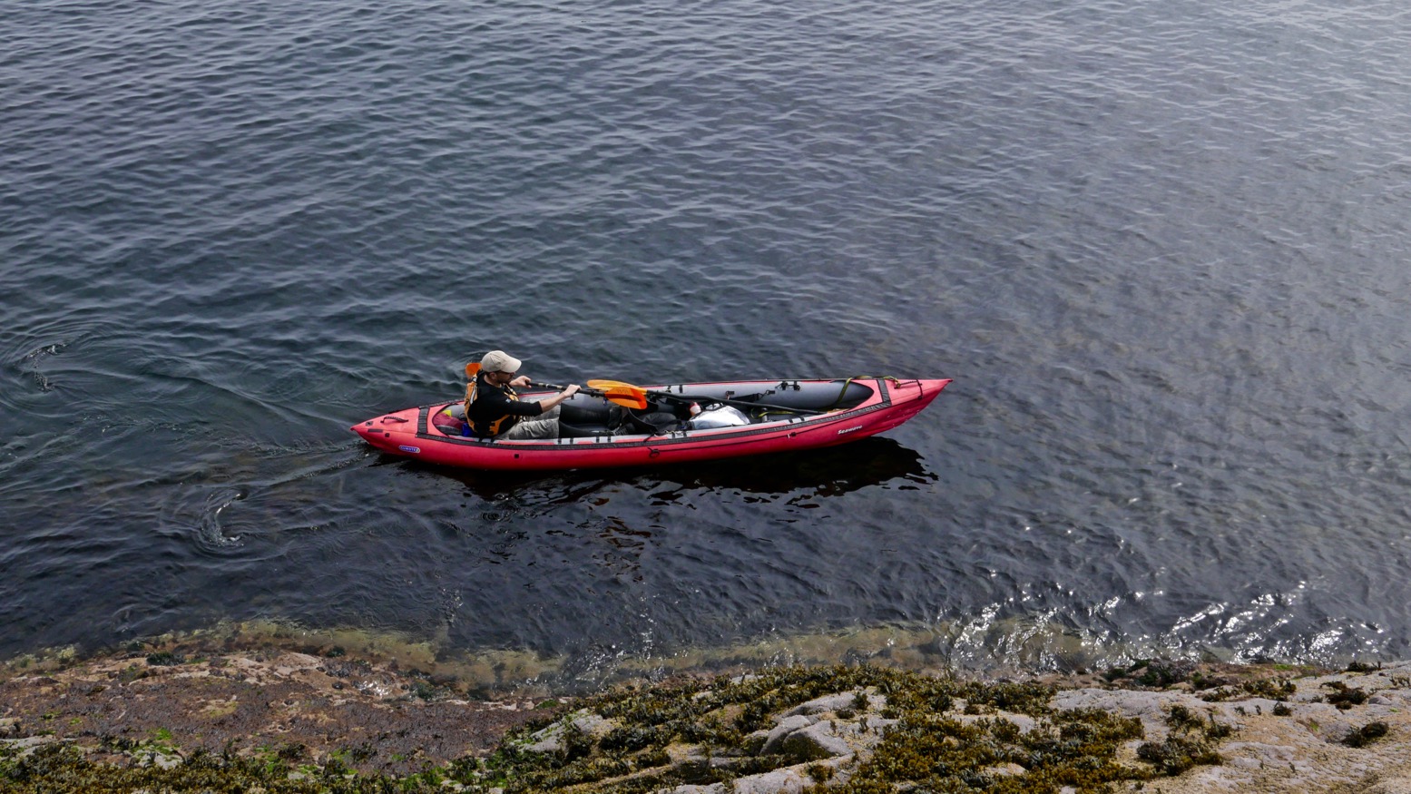
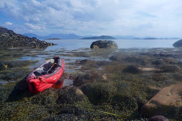
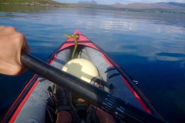
After a fortnight of chilly north winds and a diminishing woodpile, today was one of those rare days in the Summer Isles (far northwest Scotland) where you could paddle pretty much where you liked in an IK. It was also a chance for me to try out my new skeg-wheel trolley which Jon, who was staying down the road, had made for me. With no boat of his own this time, we set off in mine to see what we might see.
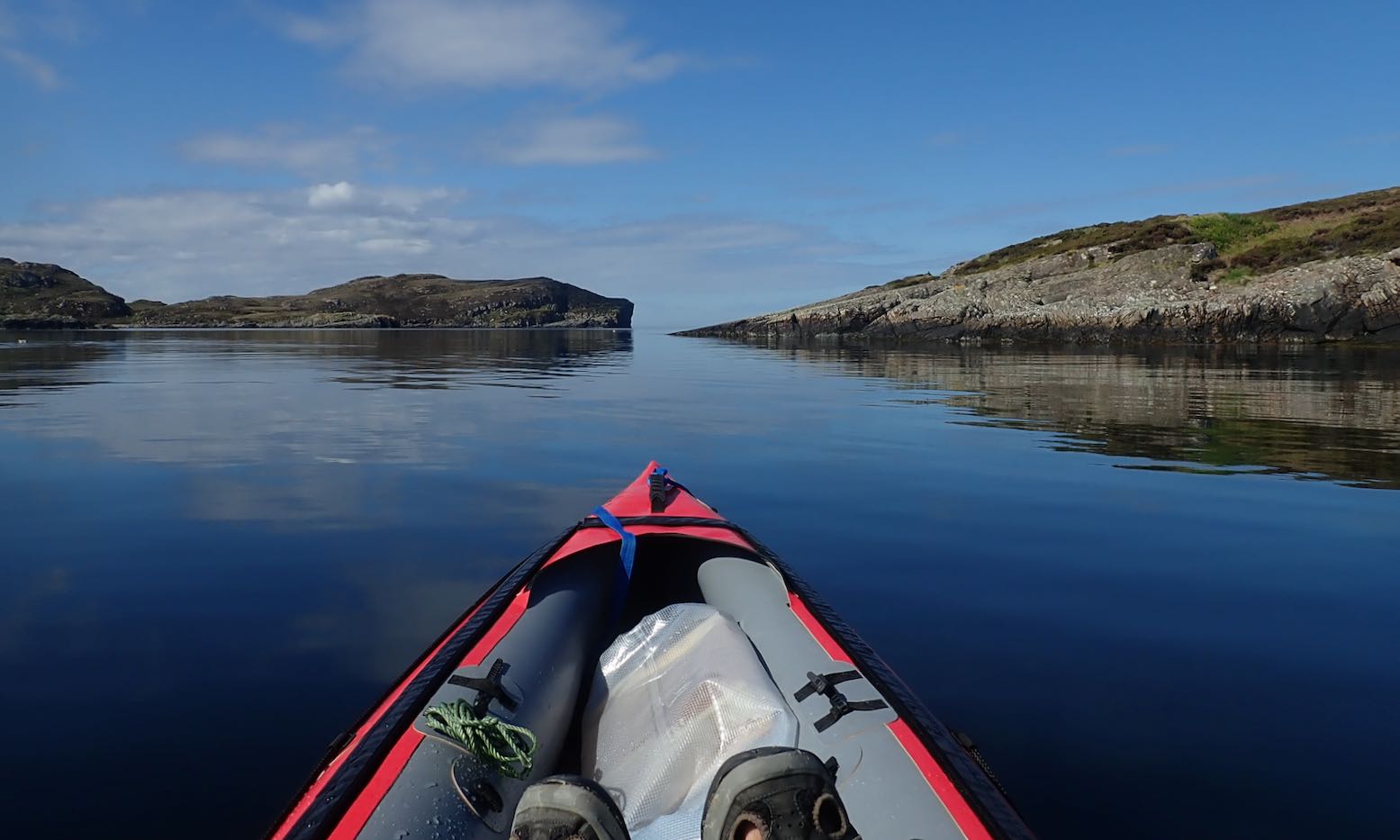
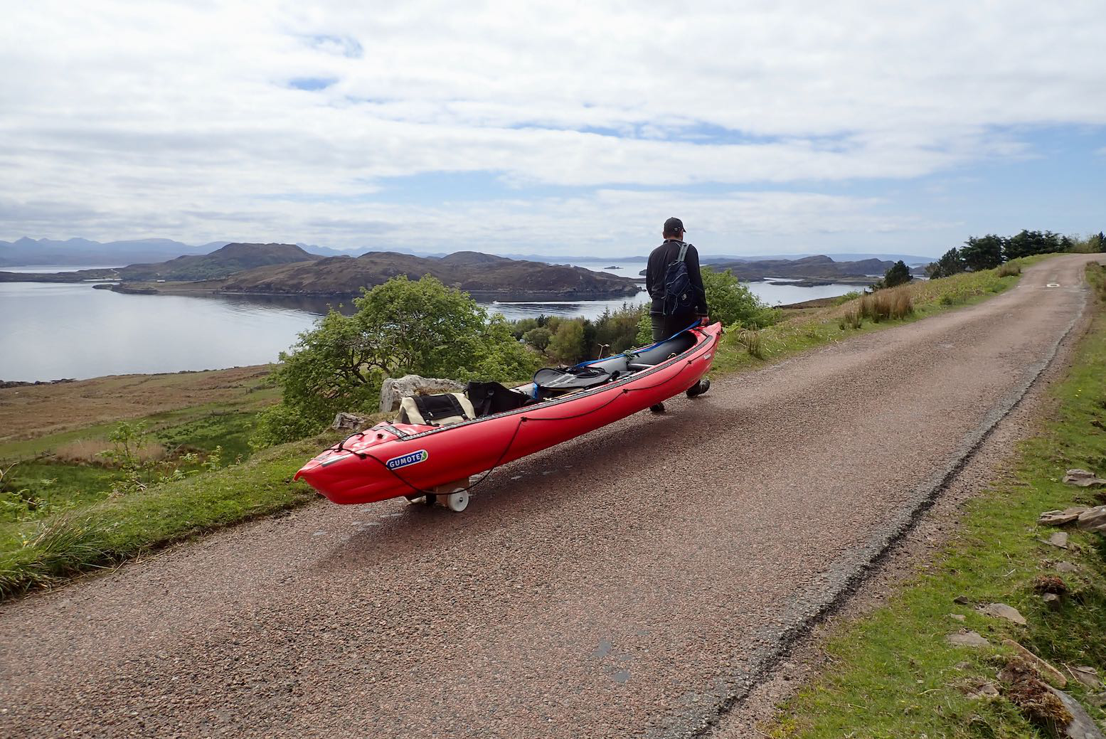
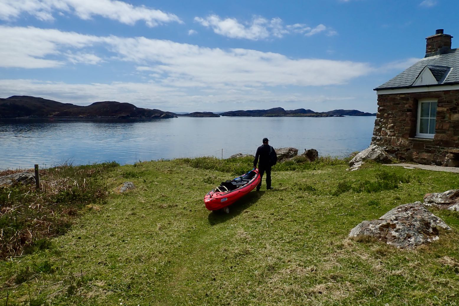
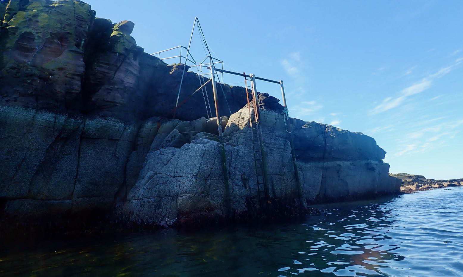
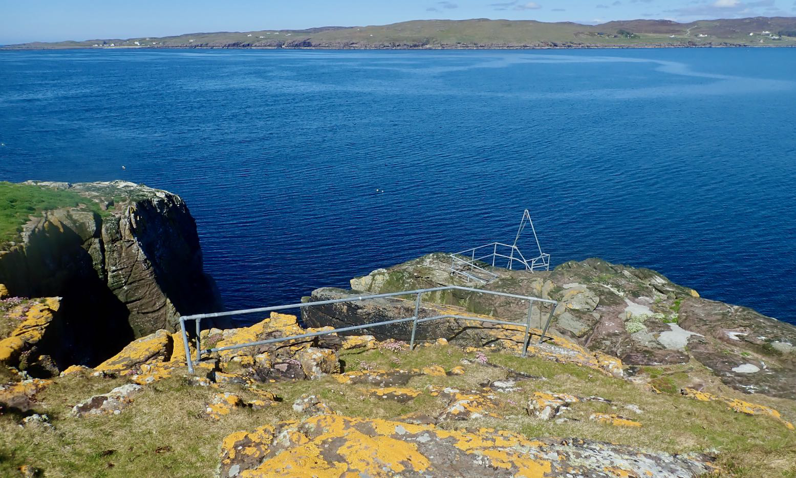
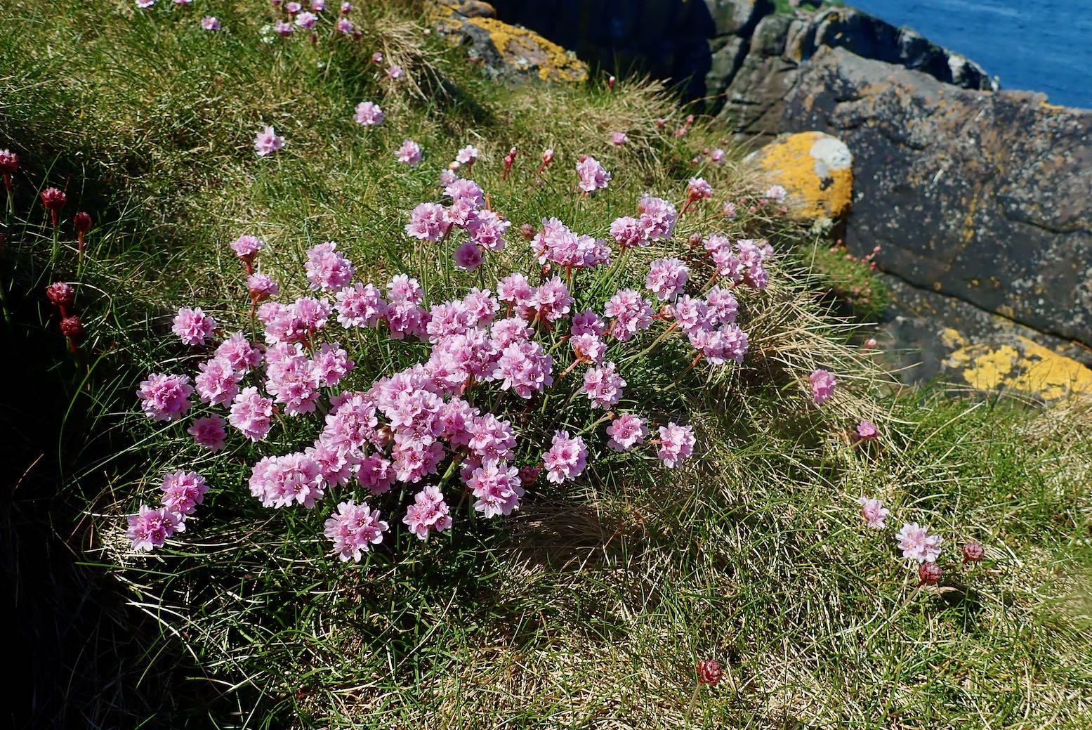
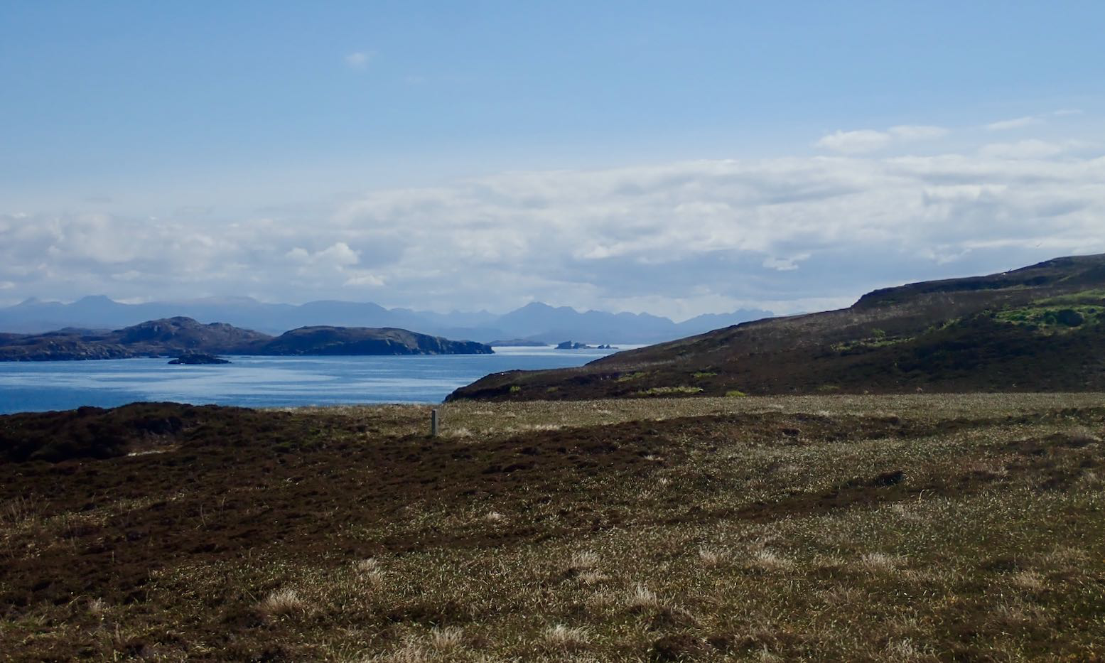
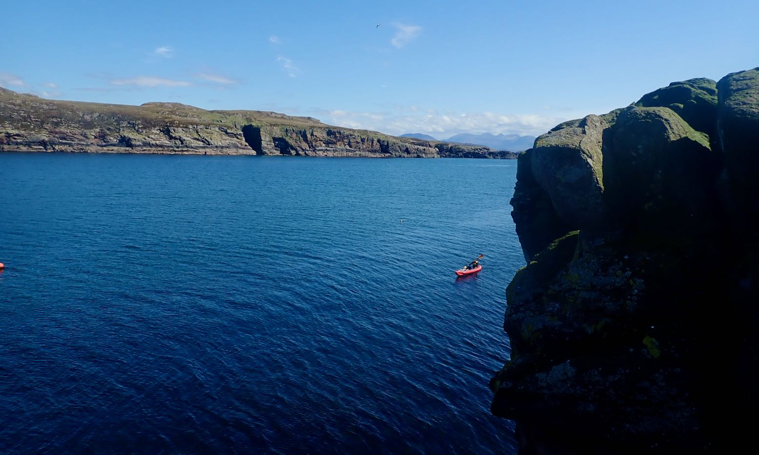
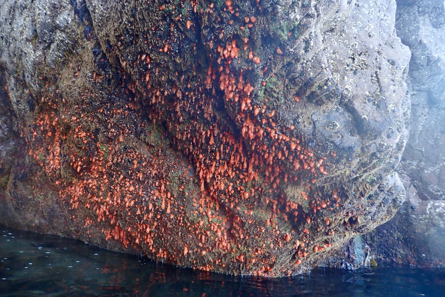
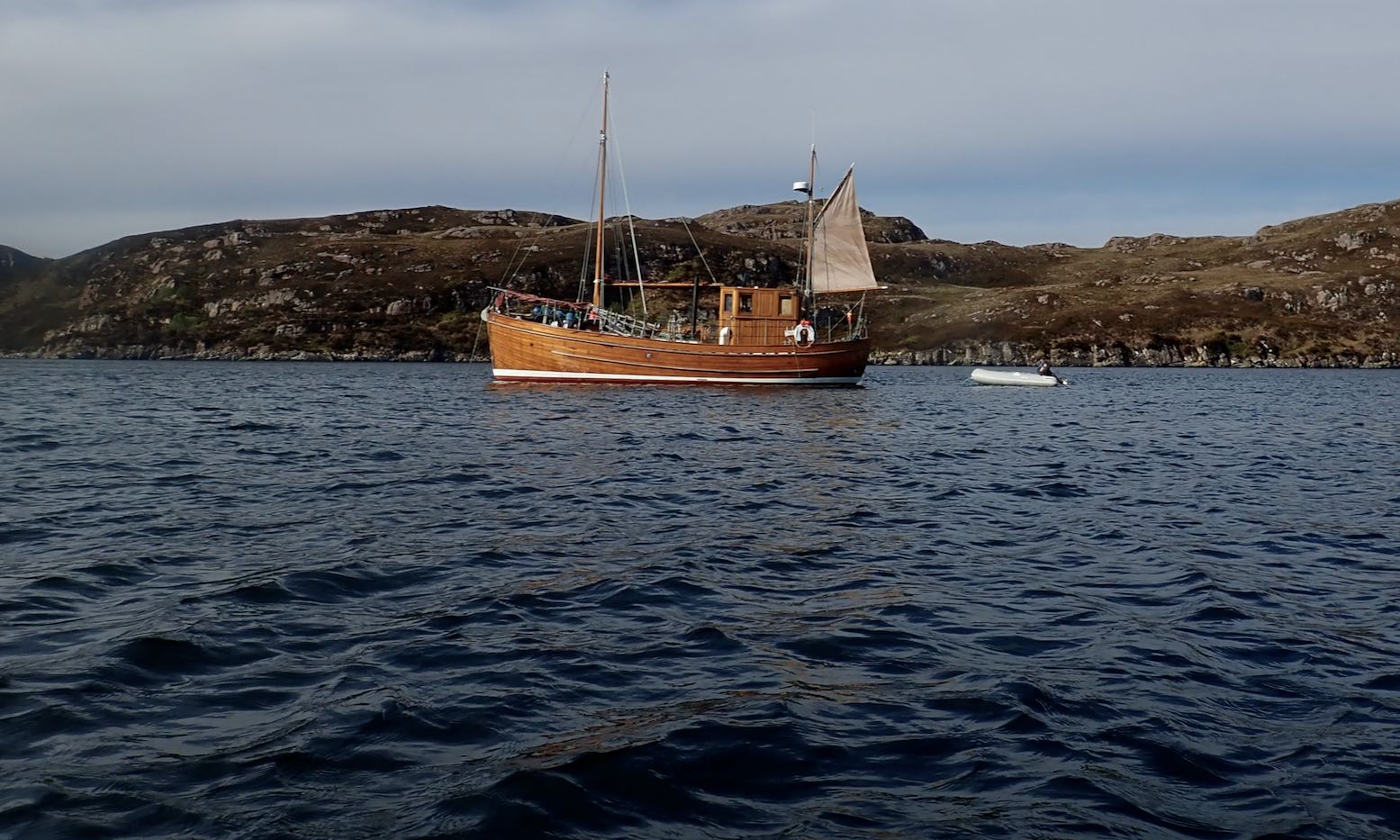
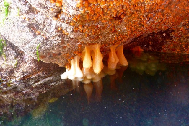
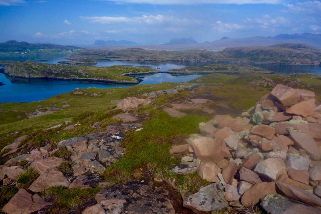
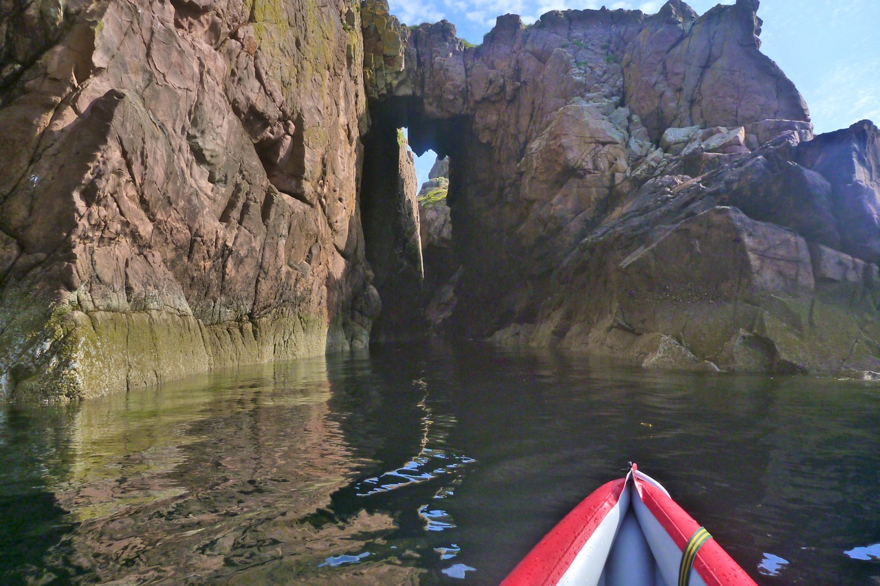
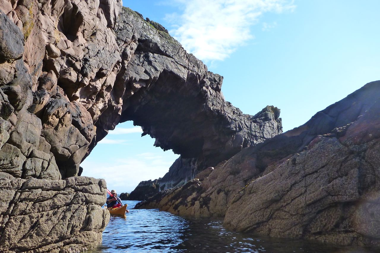
We rolled down the road to the Fox Point, the nearest and least effortful shore access from where I’m staying. Apart from the clatter of the solid wheels, the set up worked perfectly: stable and smooth.The spring tide had bottomed out so we looked for the least ankle-twisting put-in.Fear Bhreug (False Man) slot harbour looked just rightJust a few wet, slime-covered wet stones to negotiateWe have no plan so head towards the Ristol Islands across a glassy sea.With the calm, we take on the outside shore of Eilean Mullagrach; here the refracting northern after-swell makes it a bit choppier with some alarming waves breaking over reefs.Unless you’re a gannet, this is the only way to get onto Mullagrach, a gantry at the northeast tip. Usually alone, I’ve never done it, but with Jon to tend the boat, I climb up.With access so difficult, Eilean Mullagrach was never occupied or crofted. I think it’s now owned by a bird protection enterprise. Perhaps they built this guardrail and cut the steps. There’s what looks like a hut at the island’s south end, just past the (not very) high point.Nice to see sea pink and yellow lichen again. The former mostly found on the sheep-free islands and skerries.View south over the Summers to the Fisherfield mountains.The channel with Ristol behind. Better get back; the taxi’s meter is running.We visit the narrow twin-cave and nearby archPendulous sea growth emerges at very low tidesWe scoot back north out of the channel and take a break on Ristol beach before cutting through Old Dornie harbour back to False Man inlet. I leave my kayak overnight with a plan to come back for more tomorrow.Next morning I’m relieved to see my Seawave hasn’t floated off into the Minch. I top up and decide to head round the outside of Tanera Beg for starters.All is calmish as I cross Badentarbet Bay, but as I near T. Beg an unforecast southeasterly kicks up and keeps on kicking. The west side of Tanera Beg would be too exposed, so I divert into the Tanera Channel, using the lee of the smaller eileans.Nice looking wooden trawler.I’m hoping to at least visit the arch at the southeast end of T. Beg. It’s only 500m away but it’s quite lively and gusty now so I don’t risk it. Instead, I turn east to get into the lee of Tanera Mor, and take a diversion through the usually cut off pool of Acairseid Driseach (these Gaelic words just roll off the tongue).A bit disappointed, I head back to slot harbour but the wind seems less bad or may have passed. So I collect my trolley and strike out for Horse & Goat Island. I estimate it’s about 2 miles across Badentarbet Bay. The wind drops and even becomes a NW tail breeze.It’s actually more like 3.5 miles to the tidal channel between Horse & Goat. By now the spring tide is at full flow against me and I wonder if the two islands have joined up yet. I needn’t have worried; the NW breeze is stronger than any tidal current and there’s at least a foot of clearance.I pull over for a snack and a drink. Last time I was here was with my failed Semperit project. What a nice boat that could have been. I knew from here it would be a 2-mile into the wind hack to Badentarbet beach. Or even more annoyingly, a three-quarter headwind. It’s less than 10mph, but despite pushing hard with my left arm, the boat kept getting pushed right. Where is my rudder now?! I should have picked up some rocks to weight the bow at Horse Island to see if that trick works. Next time I’ll carry a waterbag to do the same; it’s something I’ve read of but never tried.From Badentarbet Beach it’s a stiff climb – 1st gear pushbike – back up the road to Polbain, but on the road the skeg-wheel trolley again makes for easy, hands free towing with the boat hanging from my shoulder via a knotted mooring line. I can walk at normal speed with loads less effort (and time) than carrying the deflated IK. Having a trolley like this makes the IK nearly as versatile as a packraft: a boat you can start here, end there and easily transport back across the difference.
So ends another great 12-mile day out in the Summer Isles whose configuration enables numerous ways to spin out a trip as pirates, winds and stamina allow, and all without getting too far out.
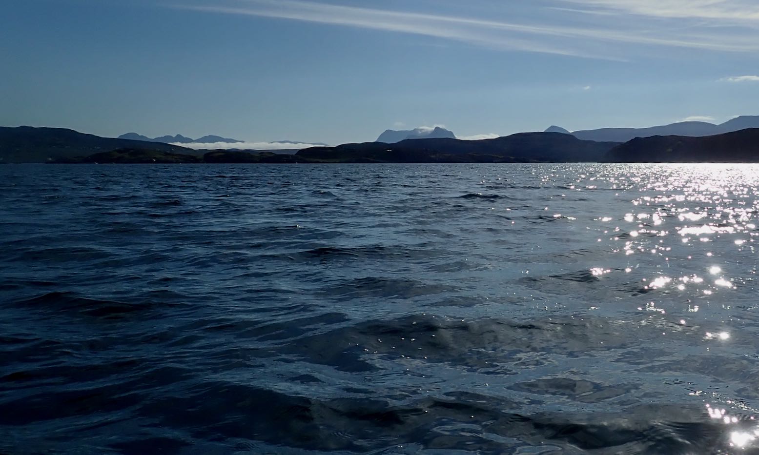
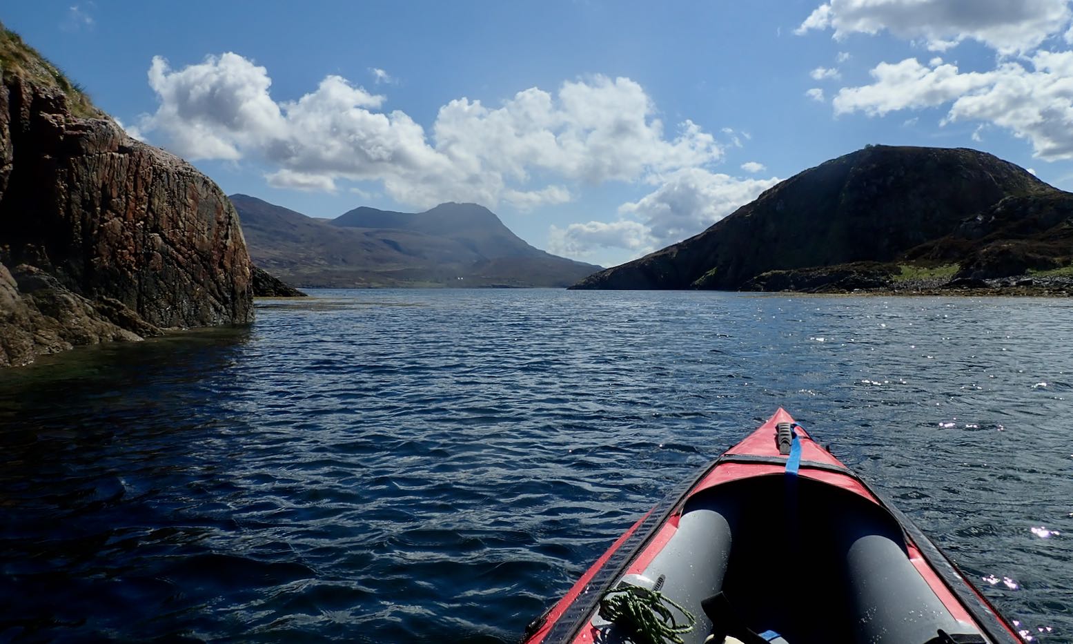
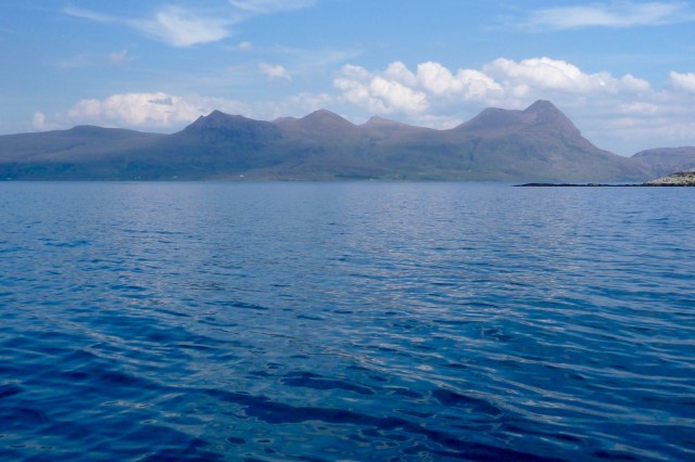
But I knew before I got on the water the tide was not with me and nor was the wind. Hauling myself through the Tanera channel, by the time the cheese-wedge profile of Angus came into view to the southwest it looked a long way away, with only Glas-leac Beag (on the right, below) between it and the inky depths of the Minch.
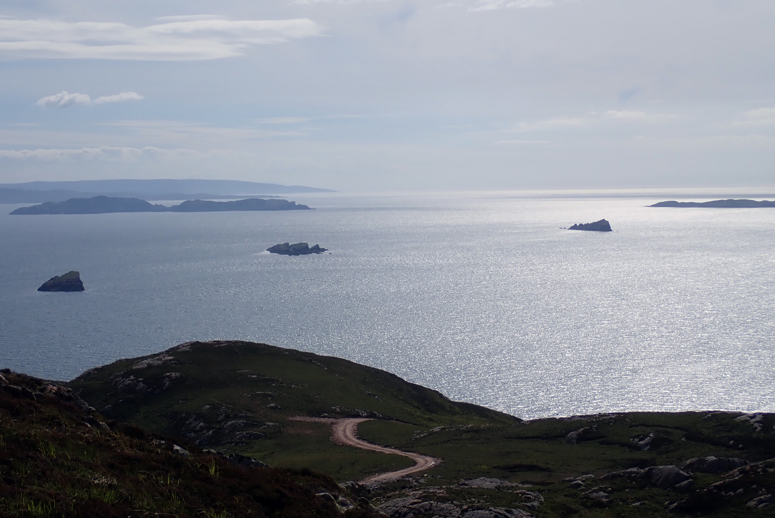
I paddled out into the Summers the other afternoon to see how far I’d get. What I was really eyeing up was Stac Mhic Aonghais or ‘Precipitous rocky feature of Angus’, one of three skerries bobbing just south of the Tanera islands. I only really clocked it on last year’s crossing from Carn nan Sgeir to Tanera Beg. I suppose now I’ve visited just about all the Summer Islands I’m looking more closely at the bits in between.
So I swung east around the south side of Tanera Mor and, now with the wind and tide behind me, at the last minute decided to make a ‘training dash’ towards ‘Goat Sound’ (left) – the tidal passage between Horse and ‘Goat’ island which I guessed was flooded by now. From there it was a weary hack back against the squalls to the beach and an XL dinner.
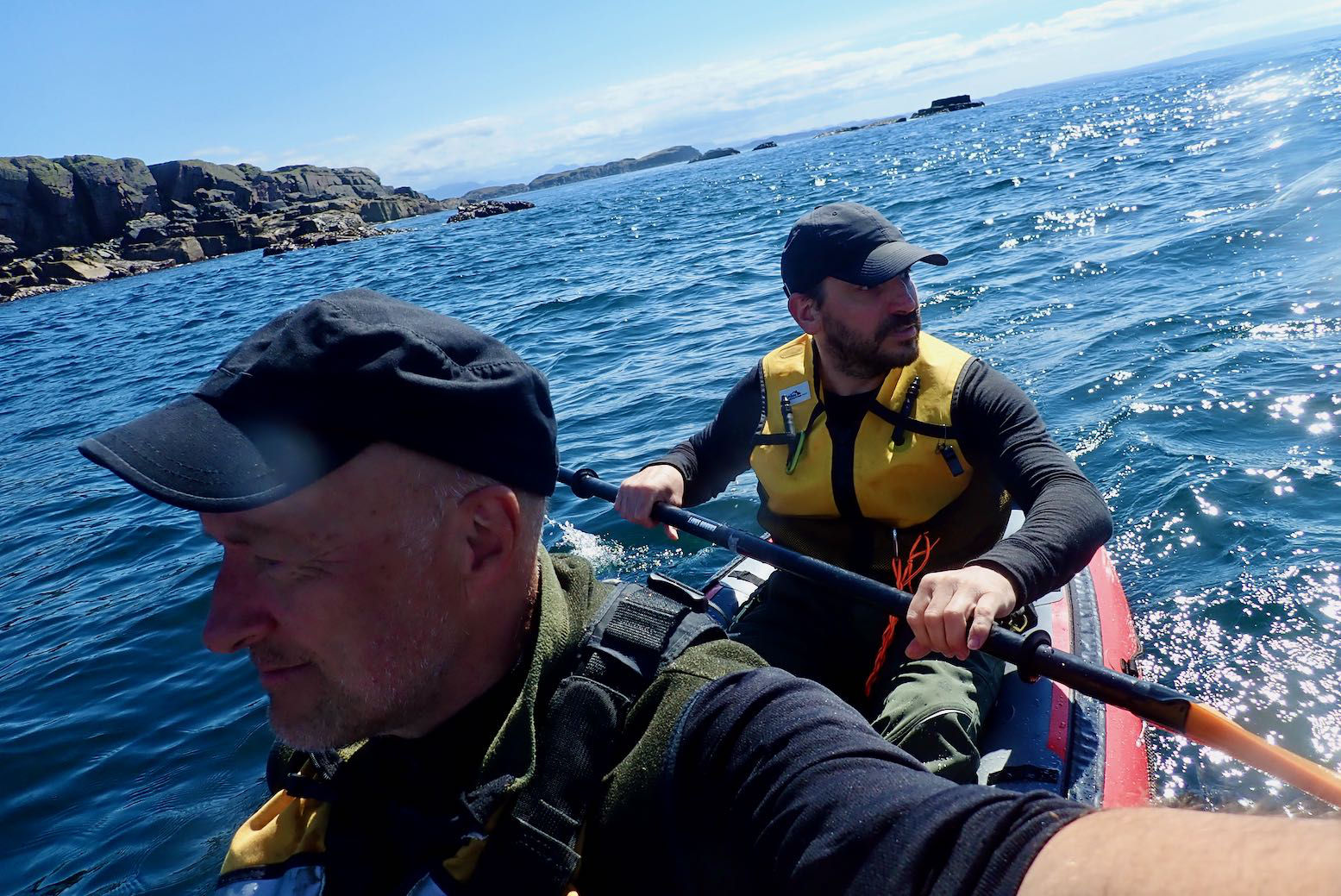
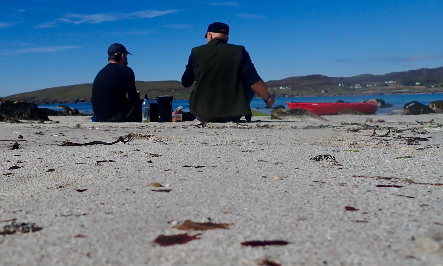
A few days later I persuaded visiting paddlechum Jon that a tour of the Summer Isles Skerries was good use of his holiday up here. He’d just returned from a gruelling, two-day bike ride through the Assynt – part of the HT550 – so his arms were in need of some exercise.
As skerries go, the supposedly 78-foot-high (26-m) Stac of Angus (see below) has a dramatic profile. From some angles a homesick Norseman pining for his mead might even call it a dragon’s tooth. It also looked fairly easy to climb to the top to get a nice shot of a kayak below.
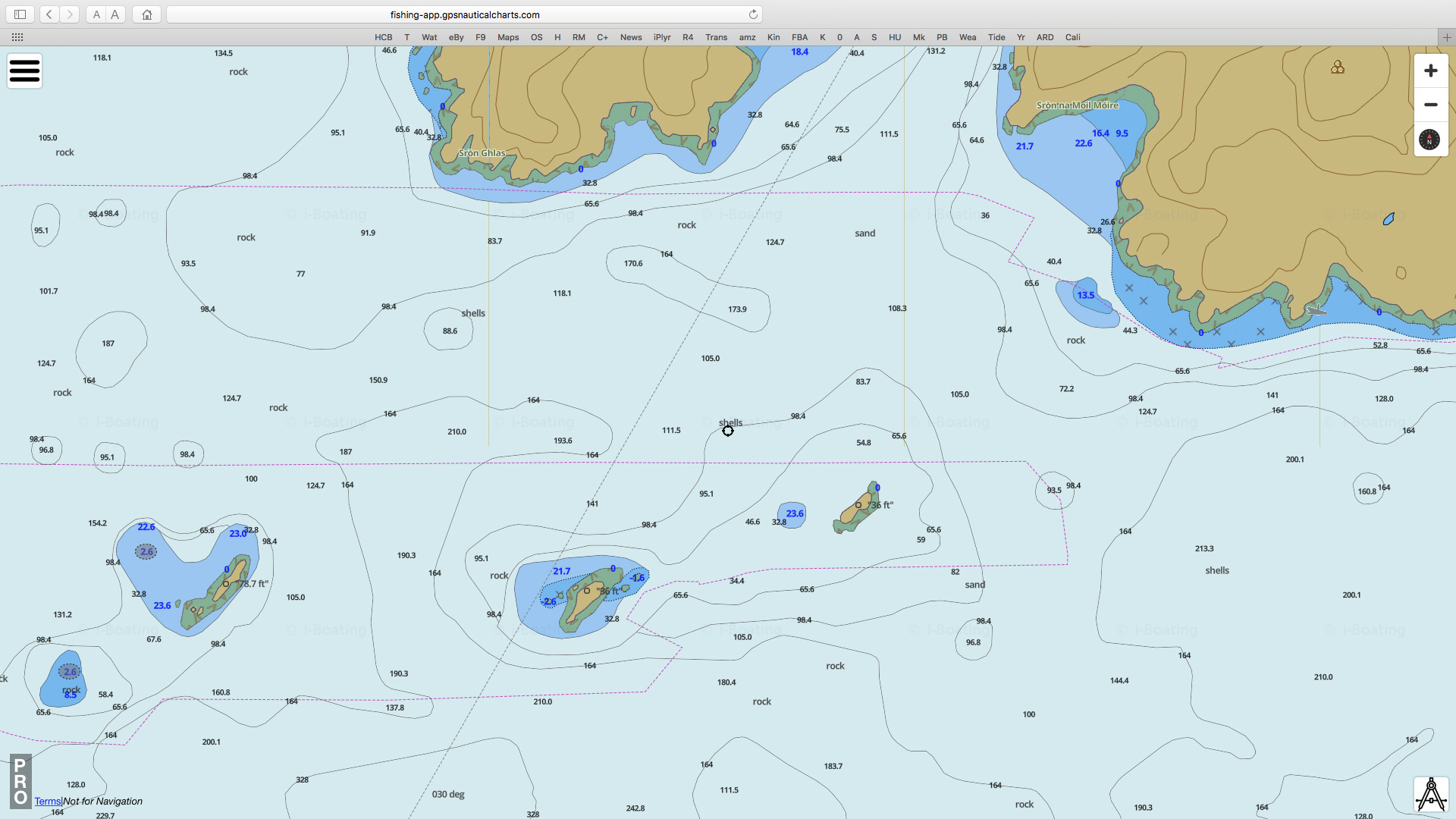
Stac Mhic Aonghais, Sgeir an Aon Iomairt and Sgeir Ribhinn or Revan. All three line up with about a kilometre between each; long thin skerries aligned on a SW/NE axis, as is much of the lower elevation topography up here; valleys and trenches carved I assume, by glaciers advancing from Scandinavia. This report suggests that 12,000 years ago during an anomalous cold spike following the end of the last Ice Age ‘…climatic factors, combined with the availability of large quantities of subglacial debris, led to the development of distinctive glacial landsystems, which may have no direct modern analogue.’ As we know, the dramatic Assynt has no topographic analogue elsewhere in Scotland and the angular claw of Stac of Angus is one of its many remnants. (Btw, that marine chart screenshot above left is from a very handy and editable online nautical ‘mapp’).
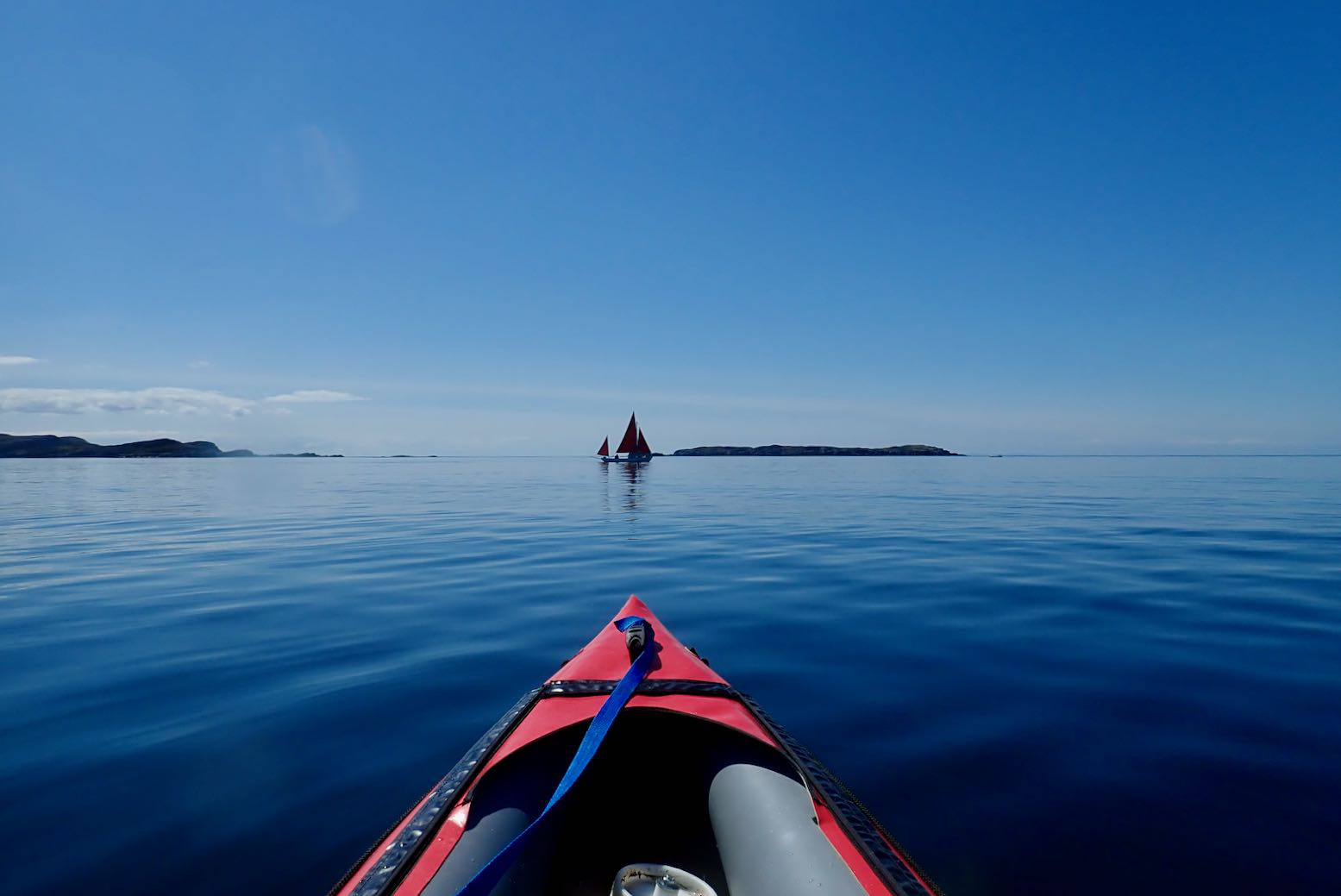
Planning paddles up here is of course a lottery but came the day, by some miracle a High had parked itself over the northern British Isles, put on the handbrake and tipped the seat back. The 4.5-m tide may have been at the peak of its fortnightly cycle, bottoming out at 2.30pm, but that could be handy if we used it right. If we left Stac around low tide, it should be an easy ride back up to Old Dornie, assisted by the rising afternoon breeze. We paddled down between the Taneras with the tide, passing some other kayakers on the way. I mentioned the Tanera Beg arch just round the corner to them, but after a quick check the tide was too far gone to thread the arch.
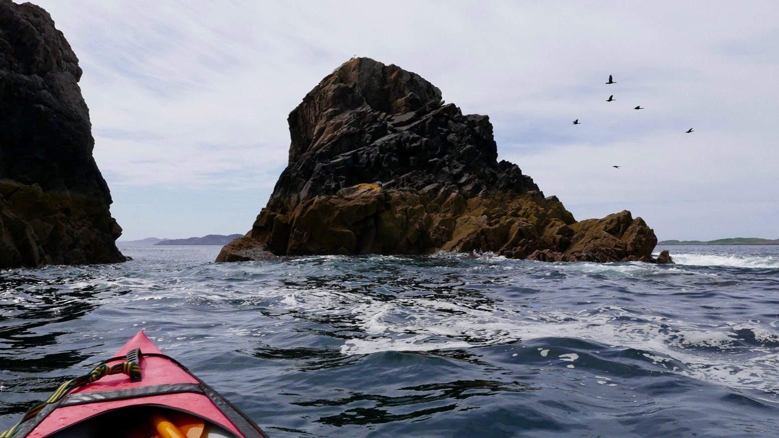
In little more than an hour we were approaching the gnarly, storm-wracked northern prow of Angus. It’s hard to think how the 1:25,000 OS map arrives at the oft-repeated height of 26m. The picture below of Angus’ high point is about 90 minutes before a low spring tide at around 0.5m above Ordnance Datum – which is the lowest astronomical tide – ‘LAT’ – at Newlyn. So even if you add about 2m or 6 feet to measure the skerry at LAT, or just use the more likely MSL, there’s no way that adds up nearly 80 feet; it’s more like half that. It’s odd because the two other skerries we were heading for had entirely plausible heights.
Anyway, we paddled along the exposed west side looking for a landing spot but found nothing but 45-degree slopes. I was sort of hoping that low tide might reveal a platform or at least give us more rock surface to choose from, but very low tide also exposes seaweed, kelp and other crap; there’s probably as much chance of getting alongside a handy ledge at higher tides.
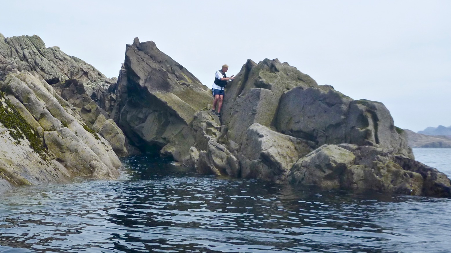
As we passed between the two outcrops on the south end, Jon smacked me in the head with his paddle (left). Lifted through by a 1-m swell, on the inshore side we found the least unlikely looking parking slot, where between bigger swells I could crawl out (right). If you think about it, sitting as you are on the floor of a bobbling narrow boat at sea level, there’s nothing harder to get out of than a kayak, especially once you’ve attained a certain age. IKs are easier than a proper sea kayak of course, but even a canoe’s bench seat might be easier to spring or step off.
Stac Angus is nearly bisected by a punched-out breach (left) through which storm waves tumble; the higher part is in the north. Problem was getting there from the lower half of the skerry where I’d landed. Even if it wasn’t 26m above MLWS or LAT or even M&S, accessing that northern spike was a lot more of a rock-climbing challenge than I was prepared to take on. So I left it to the squawking guillemots and settled with just enough elevation to get an OK shot of Jon gliding by (below), then scrambled back down to the slot and hailed down my water taxi.
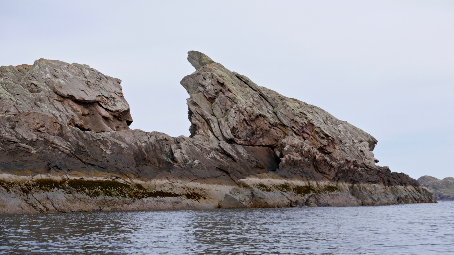
With Stac of Angus ticked off, we scooted over towards Sgeir an Aon Iomairt (in the picture above, on the right), hoping it would provide an easier landing for a civilised terrestrial lunch.
Iomairt has a similar NW-facing cliff and on its NE corner has a parking slot of sorts (right) where a kayak can wedge itself as the tide drops away below it.
The surprise here was the thick cushy duvet of soft grass and thrift flowers which capped the island. Picture left: looking south from, near the summit towards the Carns, Bottle and Priest Island. Whatever it is that makes Iomairt agreeable to lush vegetation and sea pink thrifts, while Angus makes do with lichen and bird shite, it’s found here. Perhaps because it’s less of a jutting flake and flatter, with many crevices where rainwater and sludge can gather and foment.
Who knows, but it was nice to be able to walk around, rather than teether on acute, barnacle-covered slabs, as I’d just done on Angus. We settled down out of the breeze – May temperatures are still barely in double figures up here – and unpacked our munchies. We had with less than an hour before the tide turned and lifted the Gumotex away. As we ate we spotted another couple of paddlers enjoying the calm conditions out to the southeast, near the two Carns which join up at low tides, like today. Though you’re not spoilt for choice out here in the Summer Isles, you could easily camp on Sgeir an Aon Iomairt. There’s brackish water in some pools, good enough for a wash, and enough flat patches to sleep in comfort. Hardshell or IK, for peace of mind you’d still want to lug you’re boat above the high water line unless you can find a bombproof anchorage. And the elevation of around 16m is, you’ll be pleased to know, about right. When our time came the tide had dropped a metre but was on the turn. Getting back in was as always an awkward shunt, slipping around on kelp and slimey molluscs to get the Seawave back on the water, but once in the pool it did manage to paddle itself out over the slimy kelp towards Sgeir Ribhinn (‘Maiden’s Skerry’), the last of our Summer Island skerries.
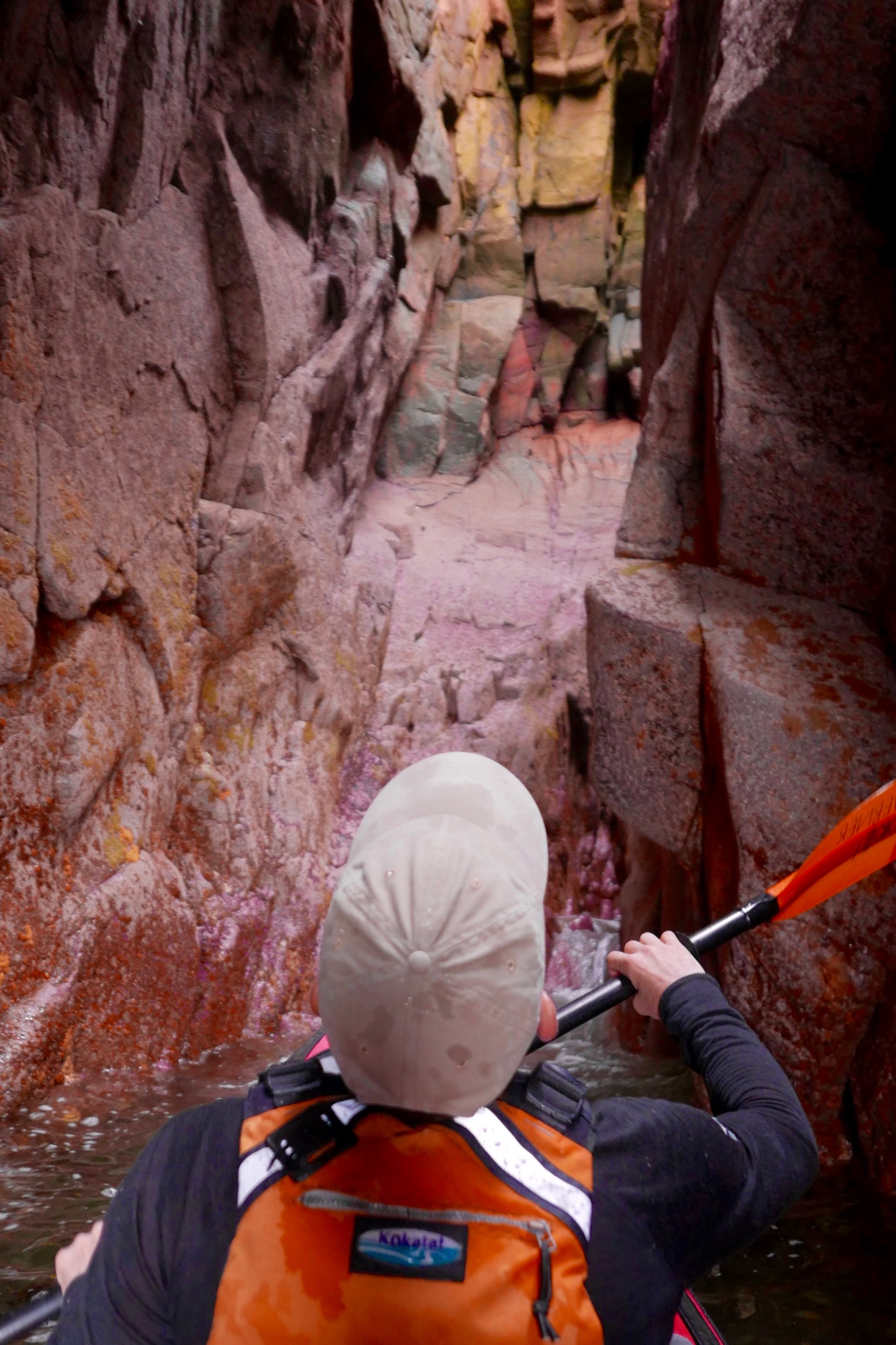
Coming round the eastern side of Ribhinn, even this skerry managed to sustain a small capping of grass. We nosed into a kayak-wide geo and found ourselves in a twin-arched cave, another paddleable arch (above) to add to my list.
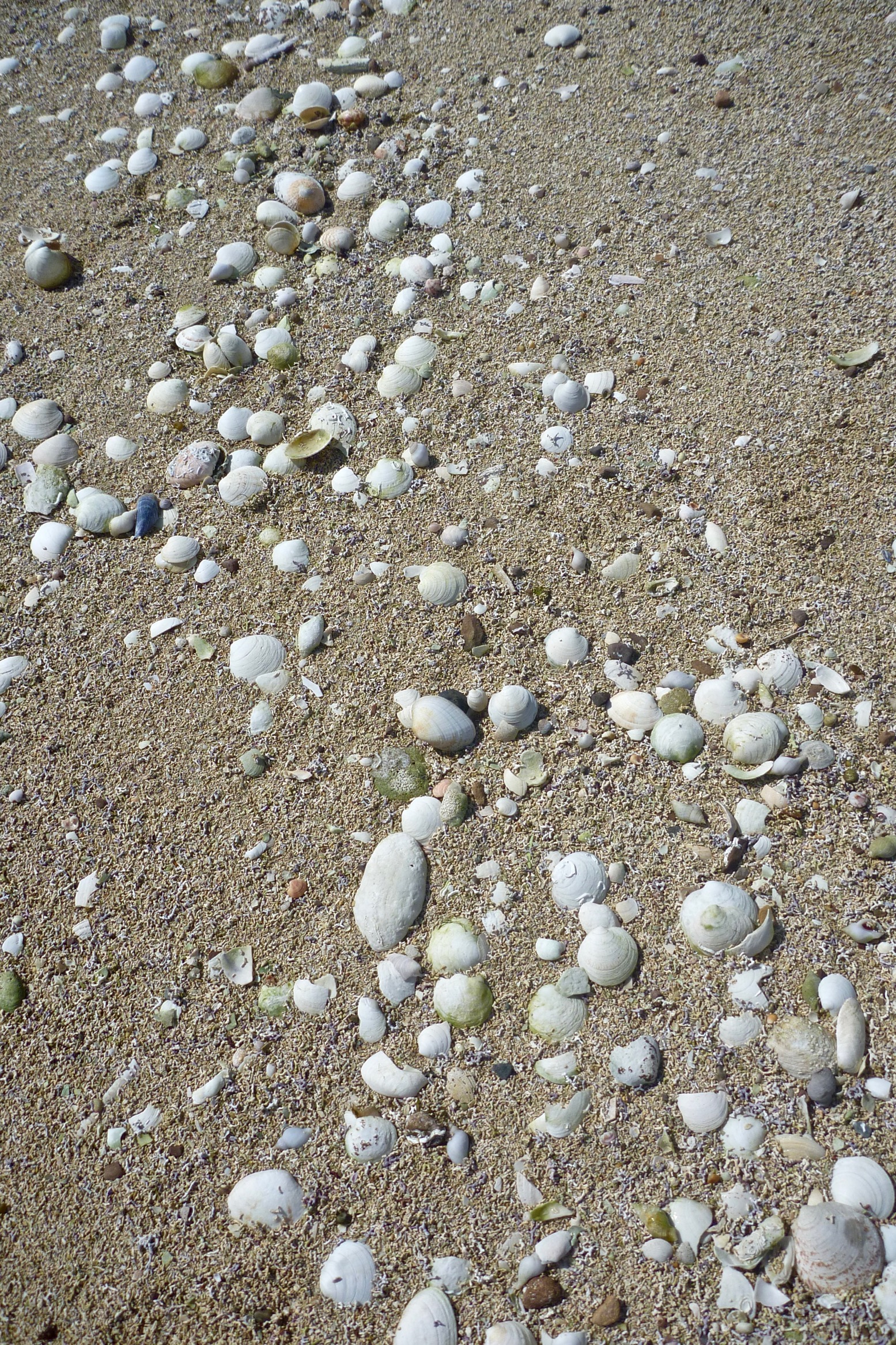
All that remained was to paddle back the way we came through the western passage of ‘Tanera Sound’, between Tanera Beg and Eilean Fada Mor. With the spring tide still low, all the shell beaches were out sunning themselves. After looking for it for years, I finally recognised a cove and beach on Tanera Beg (left) where we’d spent a lovely afternoon 12 years ago with my Gumotex Sunny and ancient Safari when we first started coming to the Summers.
Back to now, I hopped off at Eilean Fada to top up the air that had purged while out of the water over lunch, and to get a shot of Jon floating over the azure Bahaman sands (below). My kayaks have got a lot better since 2006, but the Summer Islands remain the same great place they always were for a quiet paddle.
A few pictures from a 5-hour, 22-km paddle round the Summer Isles on a rare day of near-zero wind and hot, sunny skies. From Badenscallie I went south past Horse Island and Iolla Mhor to Carn nan Sgeir, a quick loop around Meall nan Caolach, just a mile from the south side of Loch Broom, then right across to Tanera Beg to revive the legs with a walk up to the summit, and finally back to Badentarbet. Noticeable is the lack of fatigue when there’s no wind or waves to cut through. I’d have been more tired walking the same distance. A few days and a bit more wind later, I did a 14-km lap round Tanera Beg and was pooped.
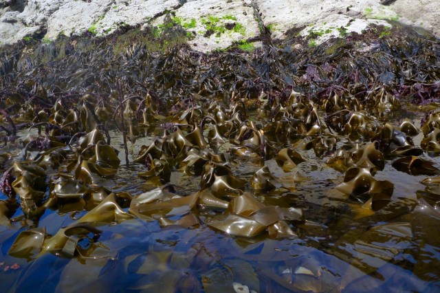
Glistening, brassy kelp round the back of Meall nan Caoloach, or Sheep’s Hill.
Strange dangular life forms you only see at very low tides.
Chestnutty limpets.
Faults and folds on Carn’s south side.
View north to Ben Mor on the way across to Tanera Beg.
South of Tanera Mor, the cabin’s roof on Eilean Dubh.
Landfall at Mol Bheag on Tanera Beg. Should I worry about the rising tide? I’ll only be gone half an hour. (Sorry – bit of lens smudge from here onwards.)
On T.Beg’s 83-m summit looking ENE towards Achiltibuie and the Assynt mountains.
Southwest, the curious wedge-skerry of Stac Mhic Aonghais – Cliff of Angus. Must try and nip out there one time.
Boat still there with two rocks on the anchor line.
Looking SE: Carn nan Sgeir back left; Eilean Dubh on the right. A trawler passes by.
Storm-mashed tin can.
I find a superb crate/bench from a Fraserburgh trawler, and a massive pearl, too. Incredibly, this one is pre-threaded for a necklace which makes it even more valuable.
In just 40 mins the tide has risen a metre. I forgot that at mid-flow the rate of change is much greater. I wade in up to my shorts and clamber on with my treasures.Round the corner I come across the Tanera Beg arch.
Enough to pass under, but not enough to get right through.
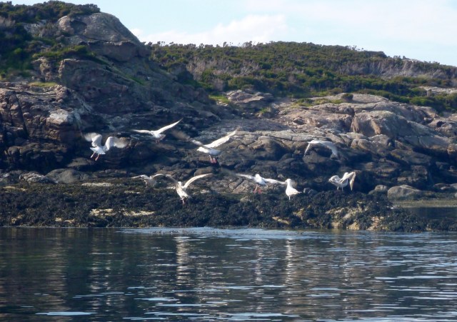
The birds are disturbed.
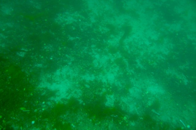
The sandy green depths between T. Beg and Eilean Fada Mor – aka: Caolas na Gainmhich.
Crystal-clear reflections – but always the racket of a boat somewhere. Makes a change from wind, I suppose.
Back towards Badentarbet after a great half-day out.
I notice several beer bottles bobbing around near the pier and sink them. Better that than smashed on a beach. Left last night by some beach campers, I suppose.
As tradition requires, I pass under the prematurely condemned pier. They say the new owner of Tanera Mor (who already has the diggers in), might replace Badentarbet pier with a floating jetty to serve his planned island restaurant. Currently, Old Dornie jetty is twice as far and tide-limited.
On the beach the owner of the cute Salmon Bothy is trying to locate an oystercatcher nest.
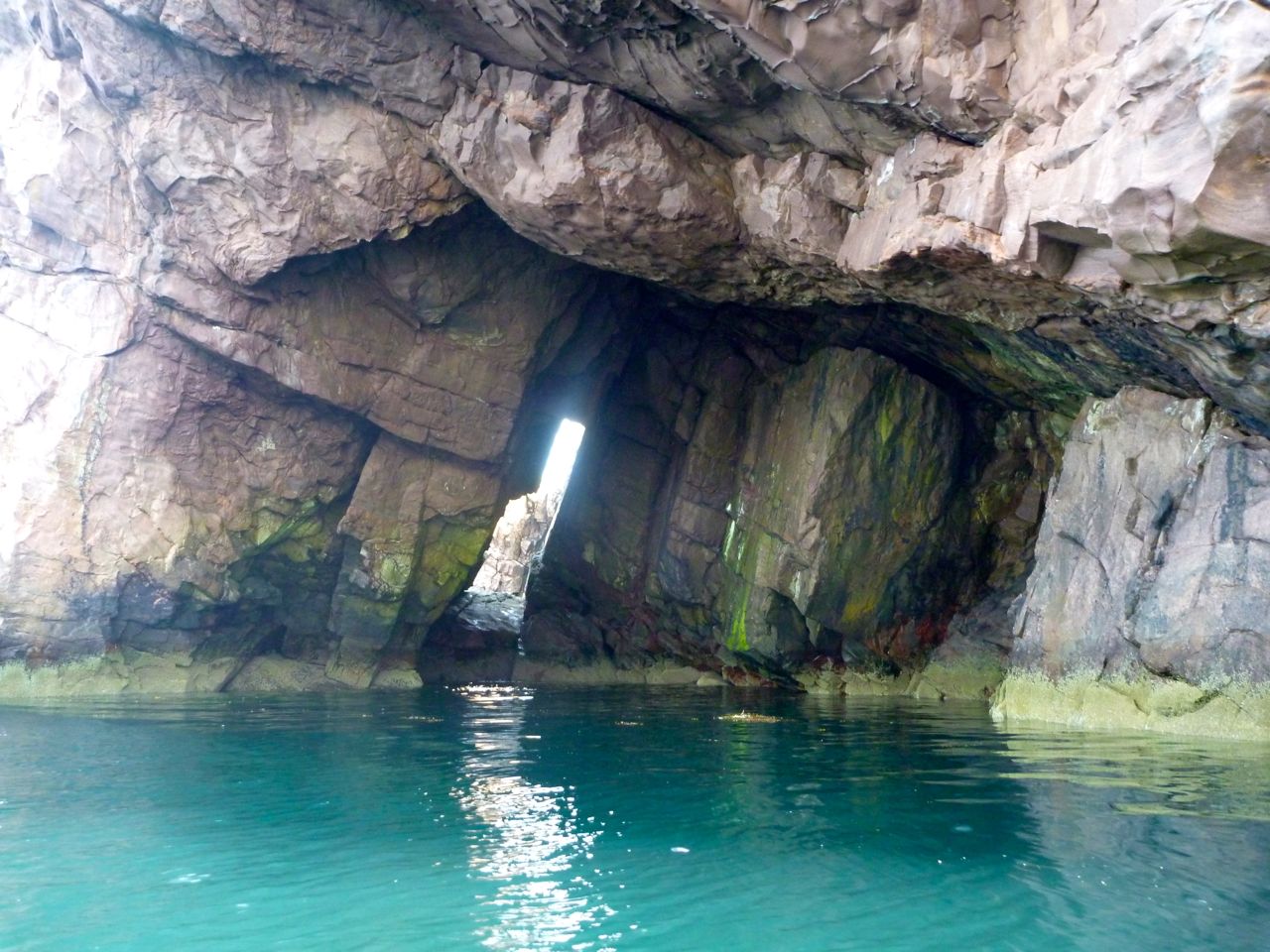
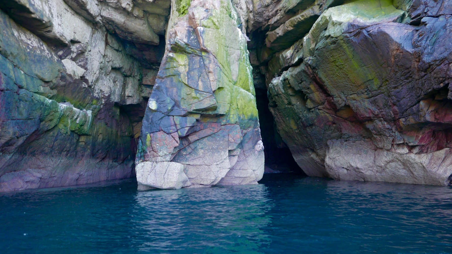
What paddler can resist the thrill of poking their bow into a cave or threading a natural rock arch? Paddling under a bridge or into a boathouse just doesn’t have the same transgressive buzz. Here are a few of my favourites, tracked down over many summers bobbing among the Isles. Most of the arches will need the top half of a tall tide, but add spring highs and a swell and some caves may require a hard hat too, or may just be too risky.
Double Arch • Bottle Island This was a great discovery – in under one arched slot with room enough below a collapsed roof cavern to turn for a paddle-stowed squeeze out of the other exit (above right) if the tide is high or the swell is right. Read more…
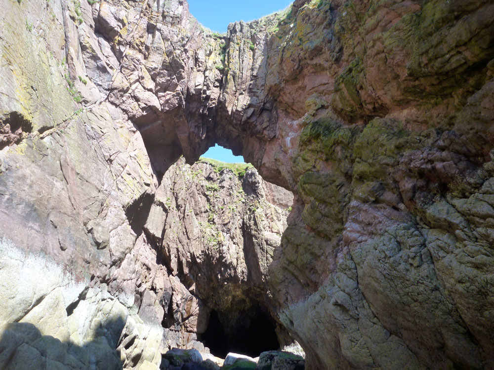
Arch • Tanera Beg The best known and best looking of kayaking arches in the Summer Isles (left). Not that easy to spot on the usual approach from the northeast I the Tanera channel, so start nosing around off the southeast side of Tanera Beg when the tide is high. Read more…
Arch • Eilean Mullagrach Another superb example of Torridian archmanship which elsewhere, in similar forms, may have given birth to the first architectural arch. Easy to find and get to as long as there’s a paddle in your hand and water under your boat. There’s a cave behind the arch (both left) which, who knows, may one day link up with the other Mullagrachcave described below. Read more…
Deep Cave • Eilean Mullagrach Just up the coast from the above arch is a hidden cave tucked in the back of a little cove – Am Fang on some maps. Look on a map or sat image and it very much looks part of the same fault as the arch above which burrows right along the eastern shore of Mullagrach. We went back the other day for a closer look with a bit more tide but which did not please the birds nesting by the entrance (left) at all. We probably got within a boat’s length of the end, using the camera flash to navigate. Read more…
Arches and Caves • Priest Island We didn’t go right round the ‘Island of the Clerics’ but passed an arch approaching the Priest’s northern tip, and I read in Fraser-Darling’s Island Years that there are deep linking chasms – crawlable not kayakable – around the northern point and another on the western end too. On the east end of the ‘Acairseid’ or bay is a narrow cave as well as a tricky right-angled tidal slot alongside a stack (right; I may be conflating the two). There’s also a less a constricted passage through the skerries just round the corner. Read more…
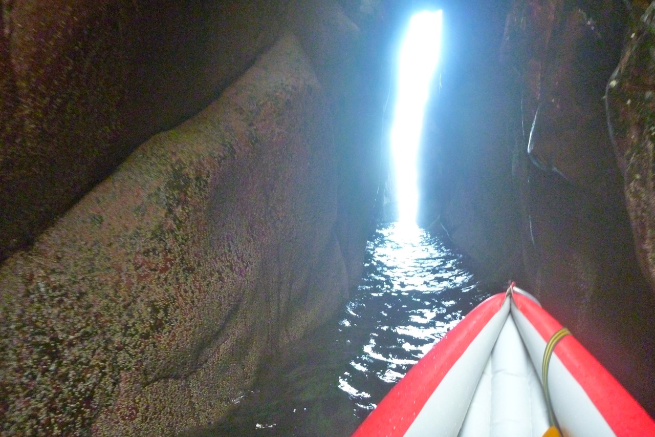
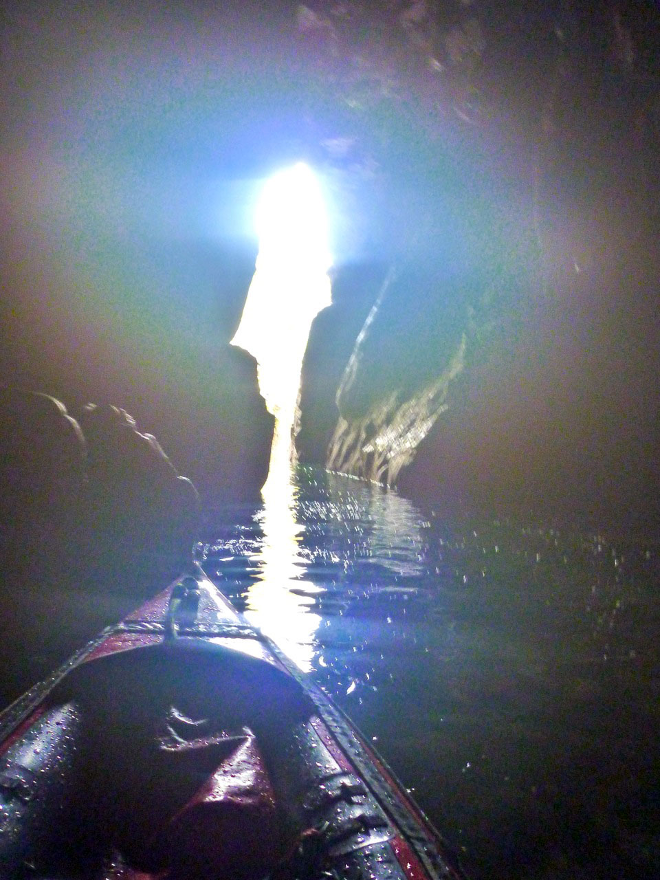
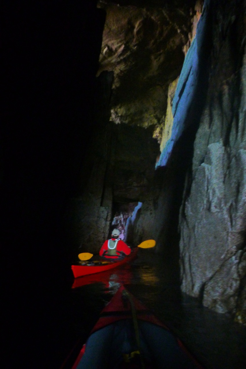
Cave • Tanera Beg On the OS map this cave is near a point labelled Sron Ghlas on at the island’s south-southeast point. ‘Cathedral Cave’ is what the boat tours call it, as they can edge right in while the captain offers a rendition of ‘Danny Boy’. With the daylight coming through the crack at the back (right), give it 100,342 years and they’ll have to reprint their brochures with ‘Cathedral Arch’. Read more…
Double Arch • Sgeir Ribhinn In a rush to get to see the main islands before the weather breaks, most would paddle by Sgeir Ribhinn, the easternmost of the three skerries south of the Taneras. But if you do pass close by, the one-kayak-wide geo on the upper east side will bring you into the cathedral gloom of big and small (left) arches overhead. Read more…
There are more caveson the Coigach peninsula cliffs facing Enard Bay, northwest of Achnahaird plus some fun tidal passages in the Isles too. Here you can catch that serene Caribbean sensation of gliding on aquamarine glass over the sandy sea bed, if not always with tropical temps, balmy winds or reggae soundtrack. My favourite is the pass between Carn Iar and Carn Deas (left), just above Bottle Island, with a lovely sandy passage on the right of Deas. Carn nan Sgeir below Horse Island is another, though you’ve got to time both at high tides.