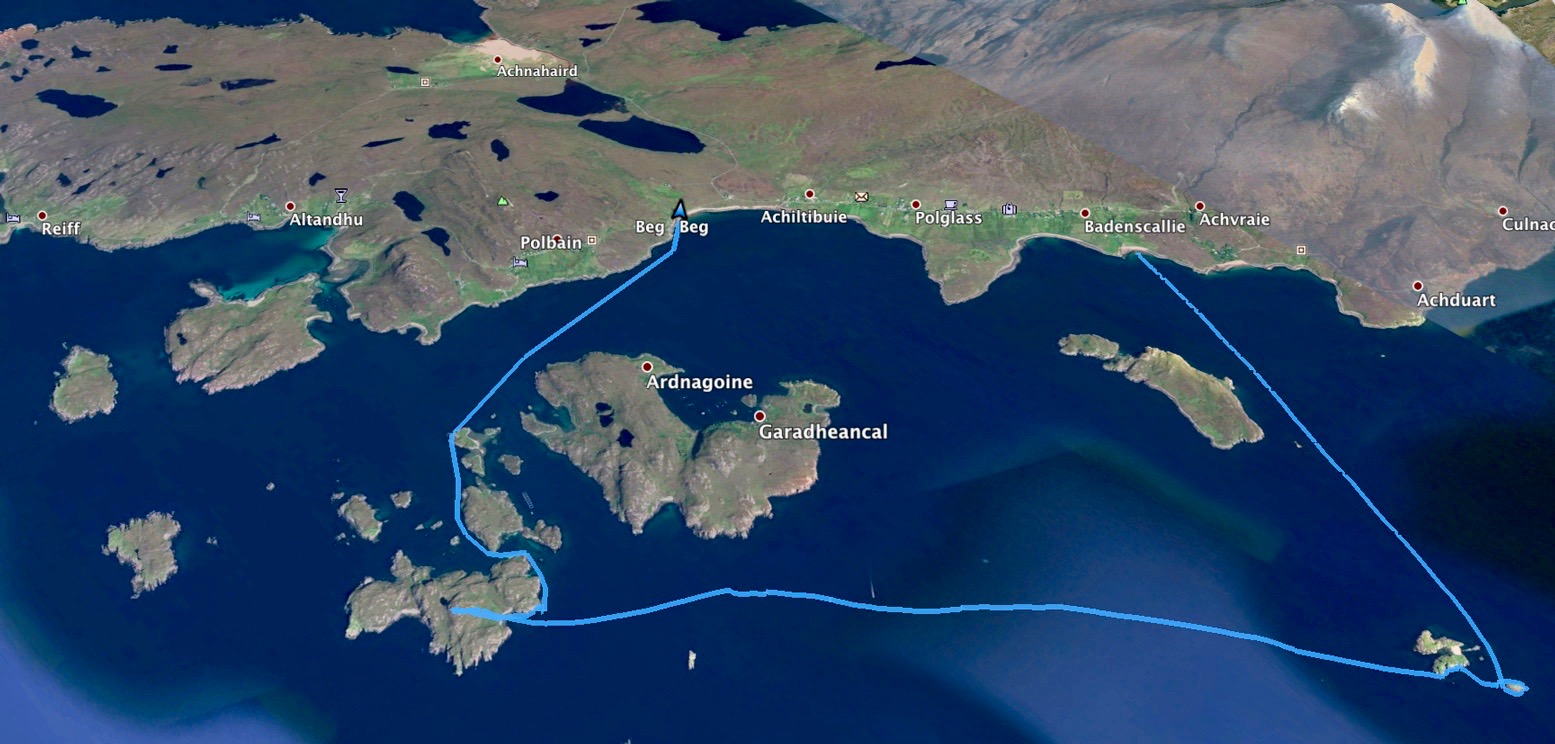
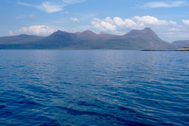
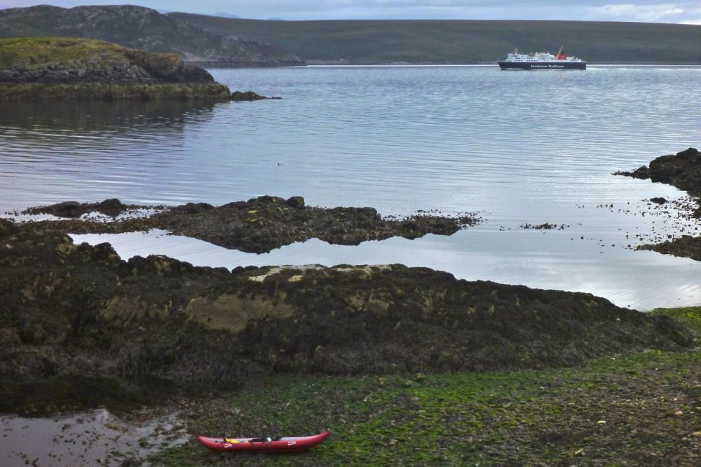
A few pictures from a 5-hour, 22-km paddle round the Summer Isles on a rare day of near-zero wind and hot, sunny skies. From Badenscallie I went south past Horse Island and Iolla Mhor to Carn nan Sgeir, a quick loop around Meall nan Caolach, just a mile from the south side of Loch Broom, then right across to Tanera Beg to revive the legs with a walk up to the summit, and finally back to Badentarbet. Noticeable is the lack of fatigue when there’s no wind or waves to cut through. I’d have been more tired walking the same distance. A few days and a bit more wind later, I did a 14-km lap round Tanera Beg and was pooped.
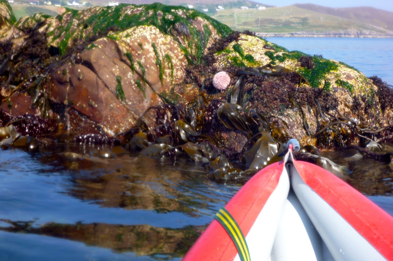
Glistening, brassy kelp round the back of Meall nan Caoloach, or Sheep’s Hill.
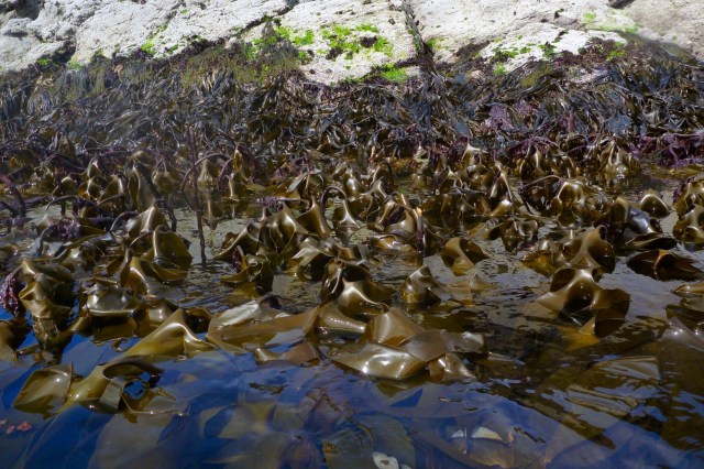
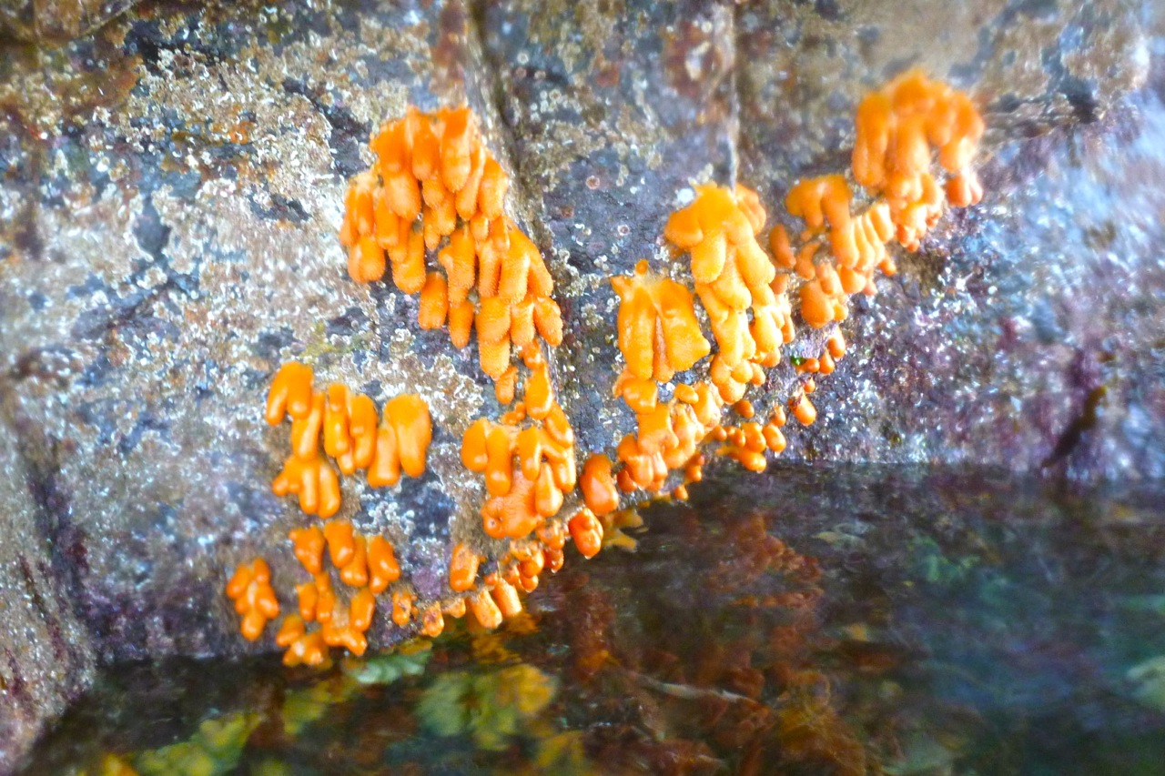
Strange dangular life forms you only see at very low tides.
Chestnutty limpets.
Faults and folds on Carn’s south side.
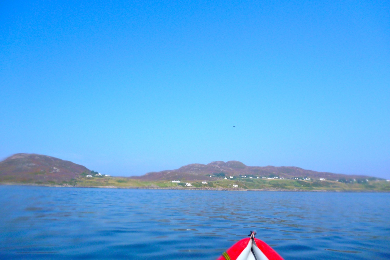
View north to Ben Mor on the way across to Tanera Beg.
South of Tanera Mor, the cabin’s roof on Eilean Dubh.
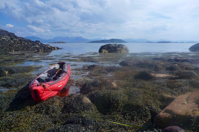
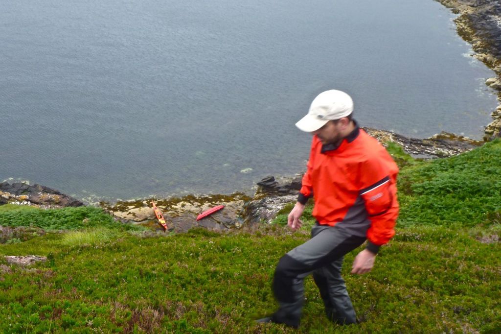
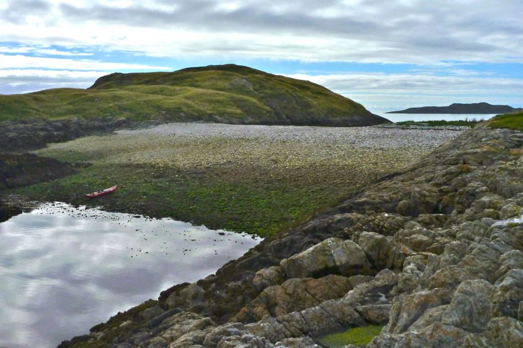
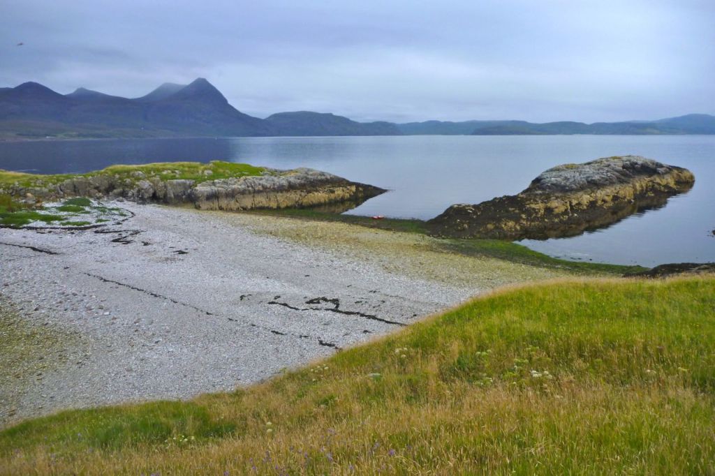
Landfall at Mol Bheag on Tanera Beg. Should I worry about the rising tide? I’ll only be gone half an hour. (Sorry – bit of lens smudge from here onwards.)
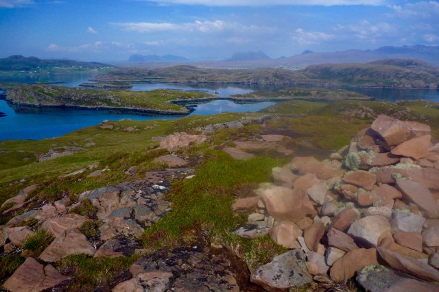
On T.Beg’s 83-m summit looking ENE towards Achiltibuie and the Assynt mountains.
Southwest, the curious wedge-skerry of Stac Mhic Aonghais – Cliff of Angus. Must try and nip out there one time.
Boat still there with two rocks on the anchor line.
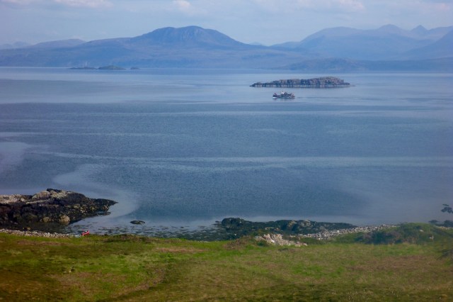
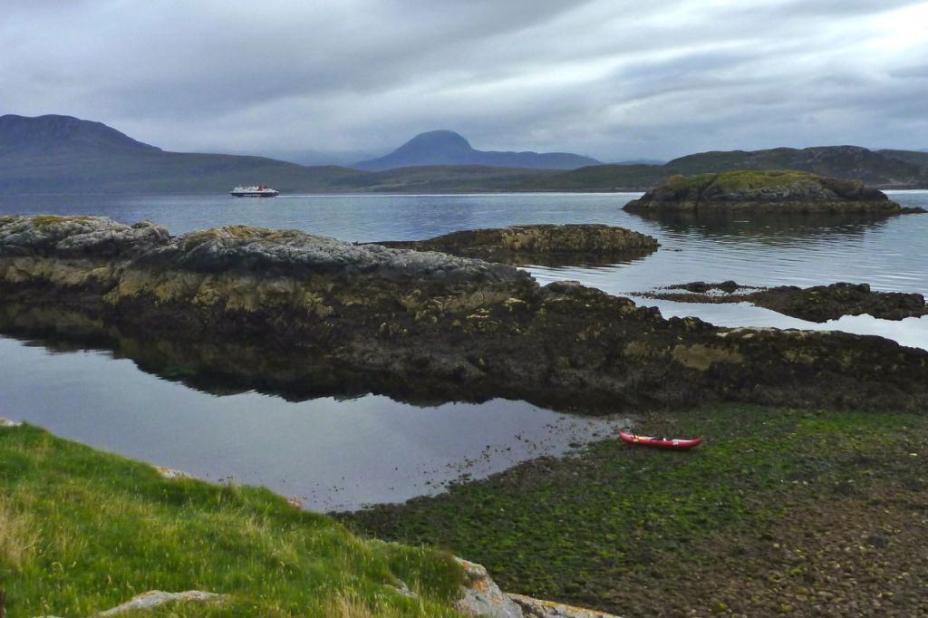
Looking SE: Carn nan Sgeir back left; Eilean Dubh on the right. A trawler passes by.
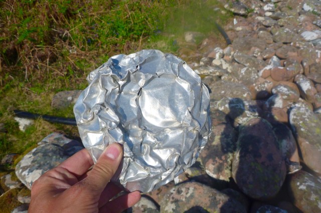
Storm-mashed tin can.
I find a superb crate/bench from a Fraserburgh trawler, and a massive pearl, too. Incredibly, this one is pre-threaded for a necklace which makes it even more valuable.
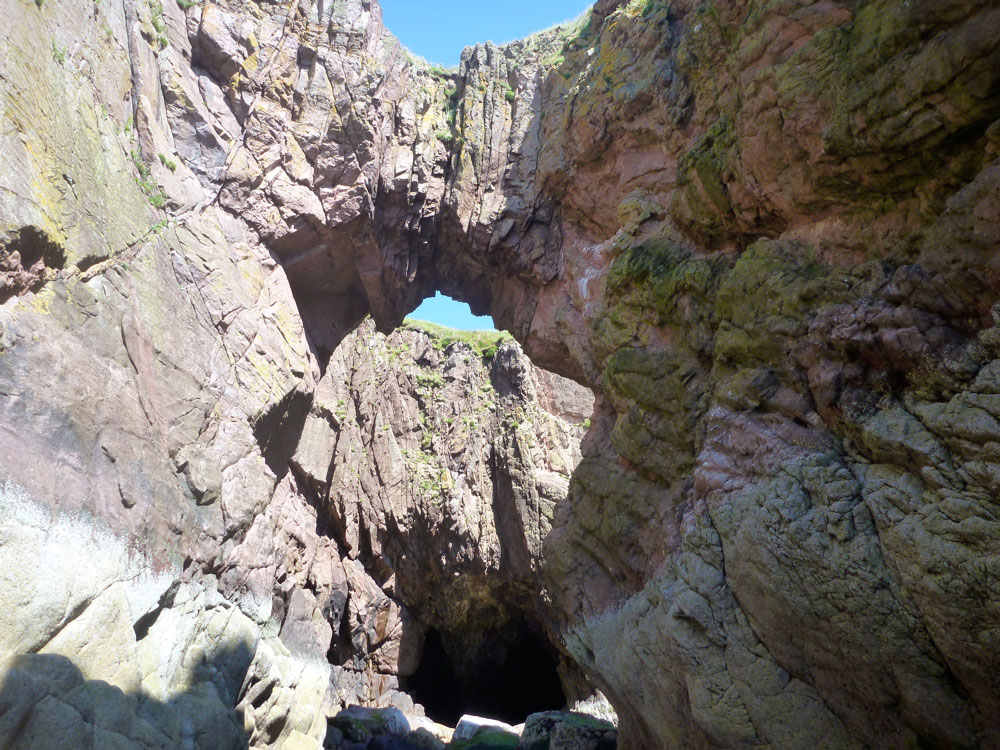
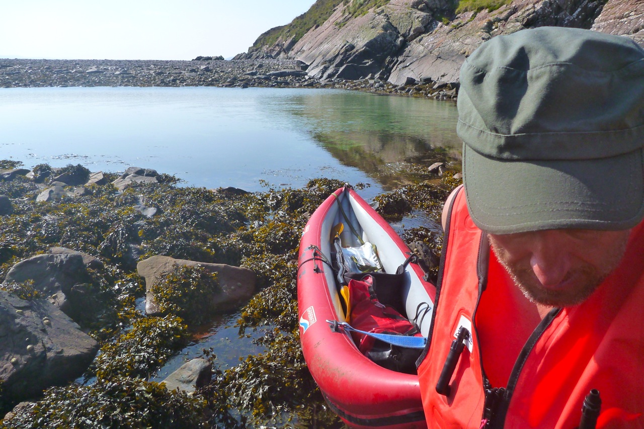
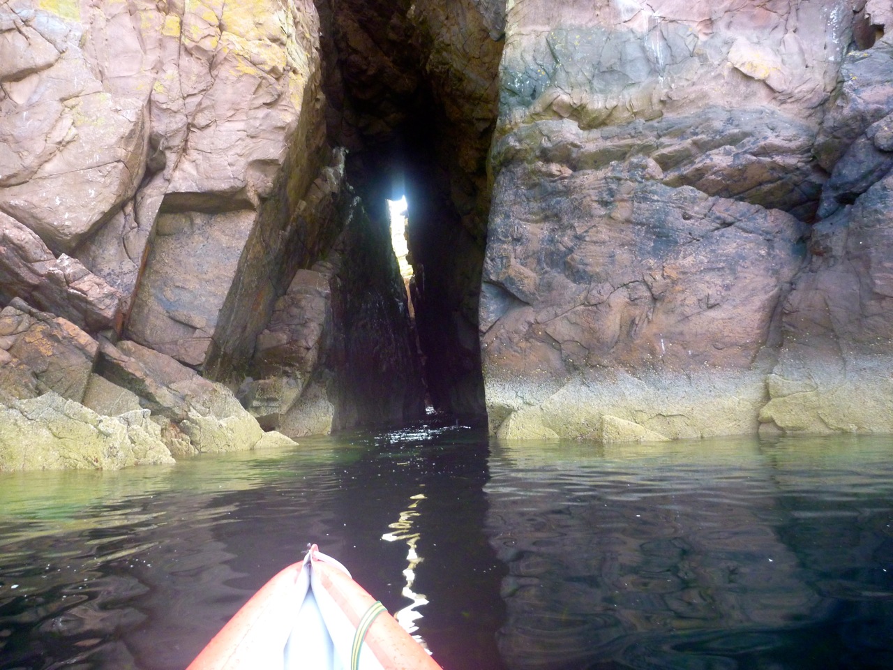
In just 40 mins the tide has risen a metre. I forgot that at mid-flow the rate of change is much greater. I wade in up to my shorts and clamber on with my treasures.Round the corner I come across the Tanera Beg arch.
Enough to pass under, but not enough to get right through.
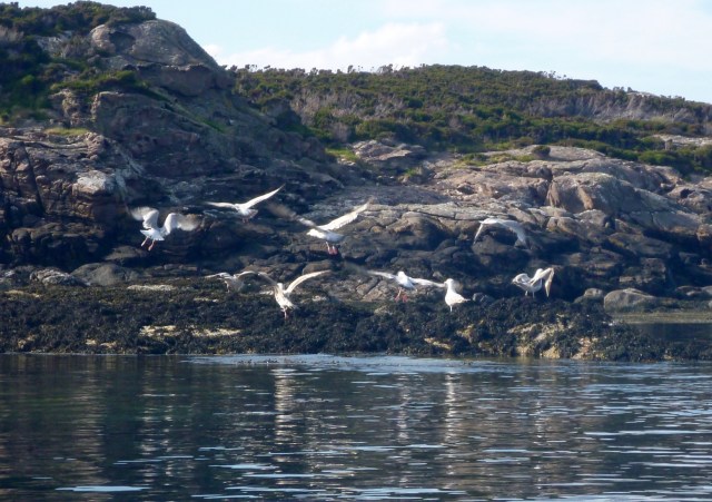
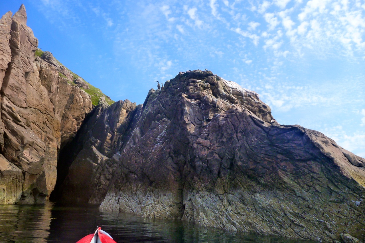
The birds are disturbed.
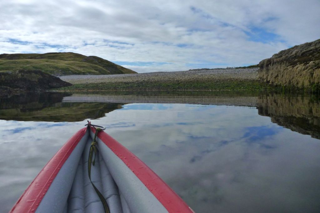
The sandy green depths between T. Beg and Eilean Fada Mor – aka: Caolas na Gainmhich.
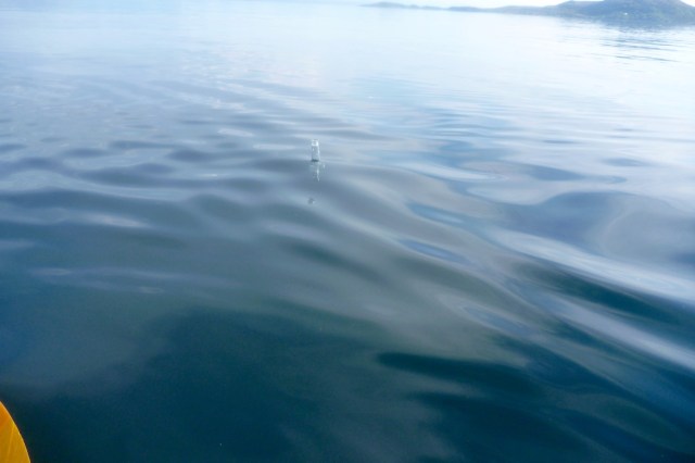
Crystal-clear reflections – but always the racket of a boat somewhere. Makes a change from wind, I suppose.
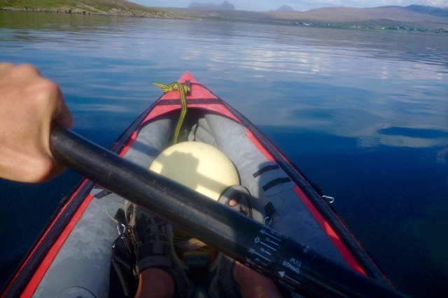
Back towards Badentarbet after a great half-day out.
I notice several beer bottles bobbing around near the pier and sink them. Better that than smashed on a beach. Left last night by some beach campers, I suppose.
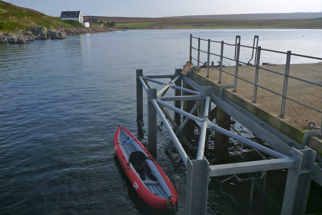
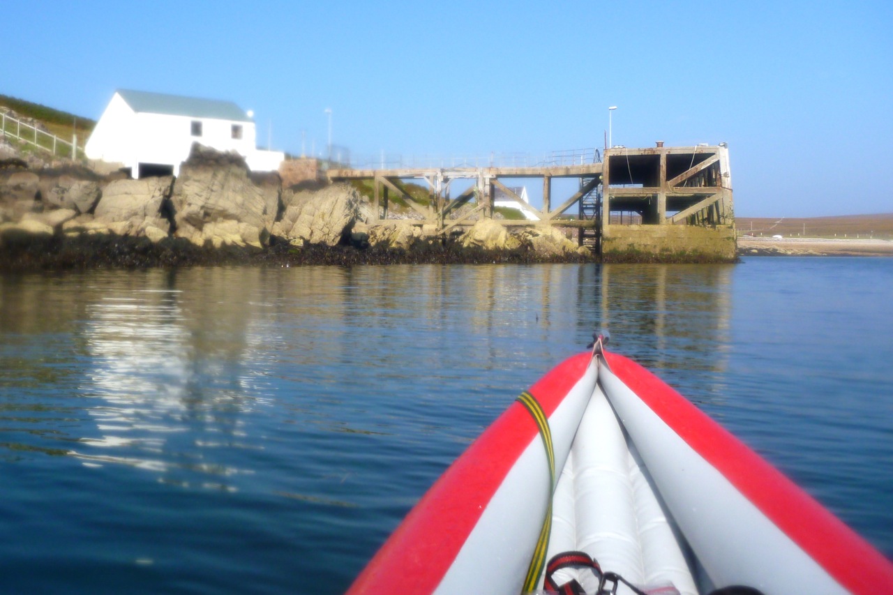
As tradition requires, I pass under the prematurely condemned pier. They say the new owner of Tanera Mor (who already has the diggers in), might replace Badentarbet pier with a floating jetty to serve his planned island restaurant. Currently, Old Dornie jetty is twice as far and tide-limited.
On the beach the owner of the cute Salmon Bothy is trying to locate an oystercatcher nest.
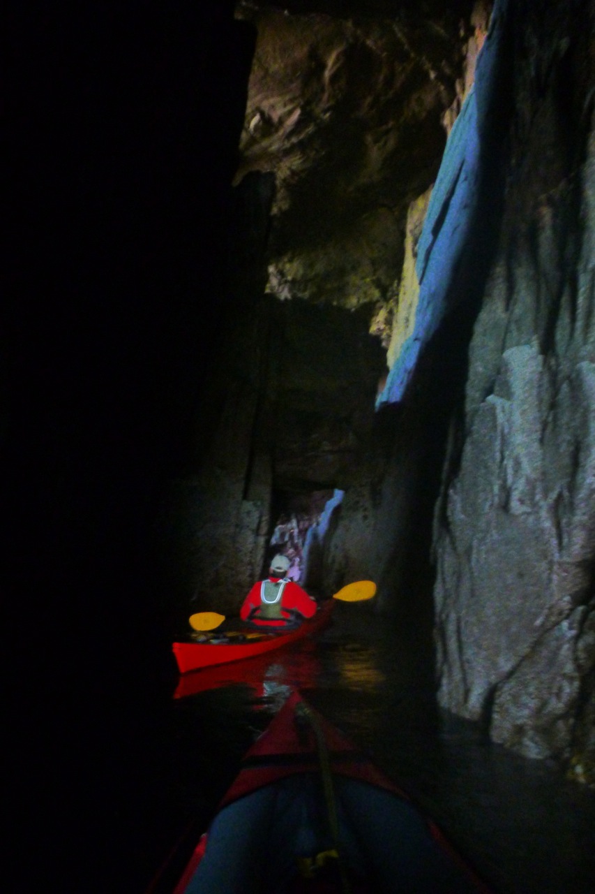
What paddler can resist the thrill of poking their bow into a cave or threading a natural rock arch? Paddling under a bridge or into a boathouse just doesn’t have the same transgressive buzz. Here are a few of my favourites, tracked down over many summers bobbing among the Isles. Most of the arches will need the top half of a tall tide, but add spring highs and a swell and some caves may require a hard hat too, or may just be too risky.
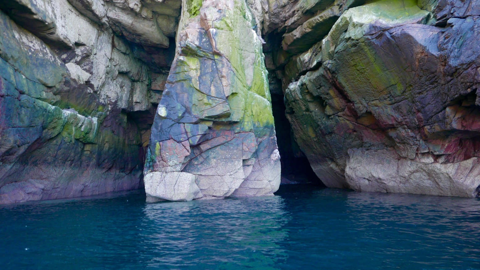
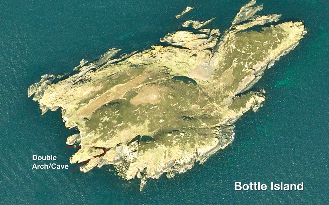
Double Arch • Bottle Island This was a great discovery – in under one arched slot with room enough below a collapsed roof cavern to turn for a paddle-stowed squeeze out of the other exit (above right) if the tide is high or the swell is right. Read more…
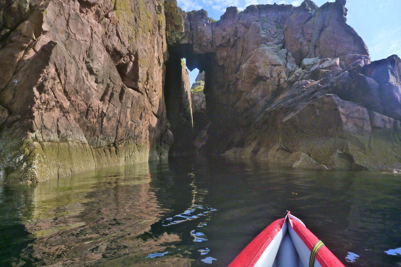
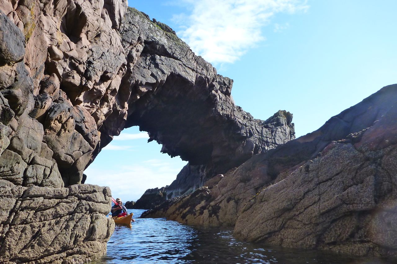
Arch • Tanera Beg The best known and best looking of kayaking arches in the Summer Isles (left). Not that easy to spot on the usual approach from the northeast I the Tanera channel, so start nosing around off the southeast side of Tanera Beg when the tide is high. Read more…
Arch • Eilean Mullagrach Another superb example of Torridian archmanship which elsewhere, in similar forms, may have given birth to the first architectural arch. Easy to find and get to as long as there’s a paddle in your hand and water under your boat. There’s a cave behind the arch (both left) which, who knows, may one day link up with the other Mullagrachcave described below. Read more…
Deep Cave • Eilean Mullagrach Just up the coast from the above arch is a hidden cave tucked in the back of a little cove – Am Fang on some maps. Look on a map or sat image and it very much looks part of the same fault as the arch above which burrows right along the eastern shore of Mullagrach. We went back the other day for a closer look with a bit more tide but which did not please the birds nesting by the entrance (left) at all. We probably got within a boat’s length of the end, using the camera flash to navigate. Read more…
Arches and Caves • Priest Island We didn’t go right round the ‘Island of the Clerics’ but passed an arch approaching the Priest’s northern tip, and I read in Fraser-Darling’s Island Years that there are deep linking chasms – crawlable not kayakable – around the northern point and another on the western end too. On the east end of the ‘Acairseid’ or bay is a narrow cave as well as a tricky right-angled tidal slot alongside a stack (right; I may be conflating the two). There’s also a less a constricted passage through the skerries just round the corner. Read more…
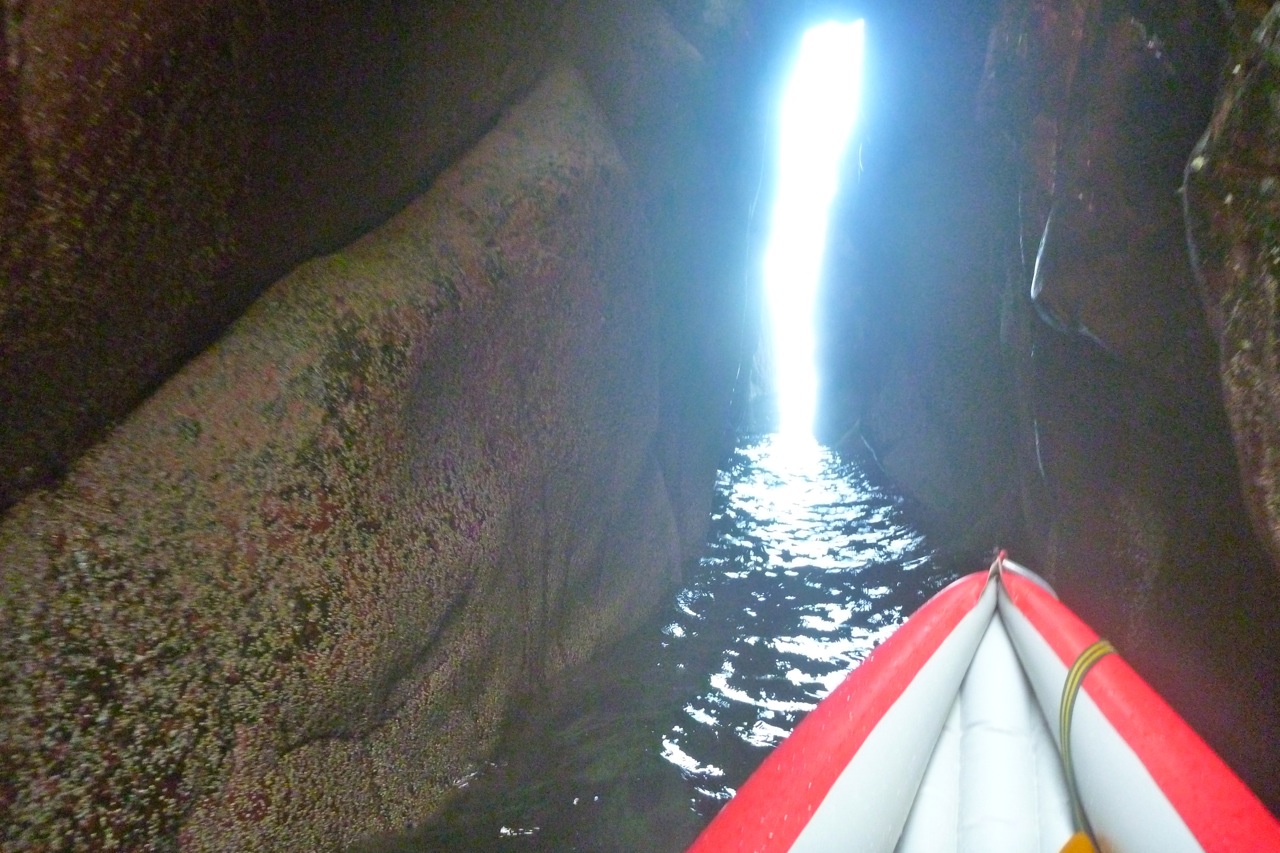
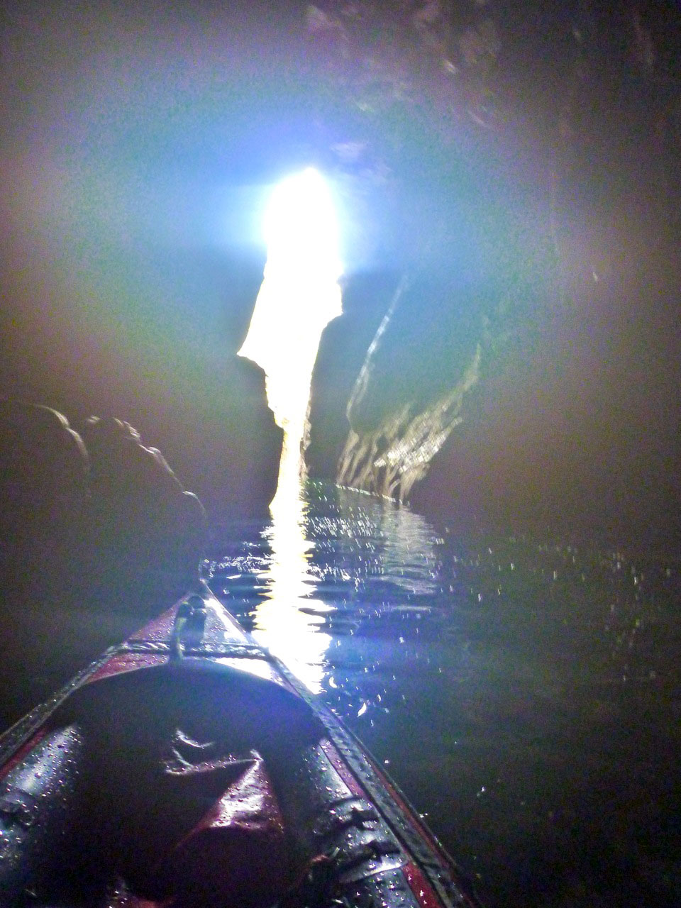
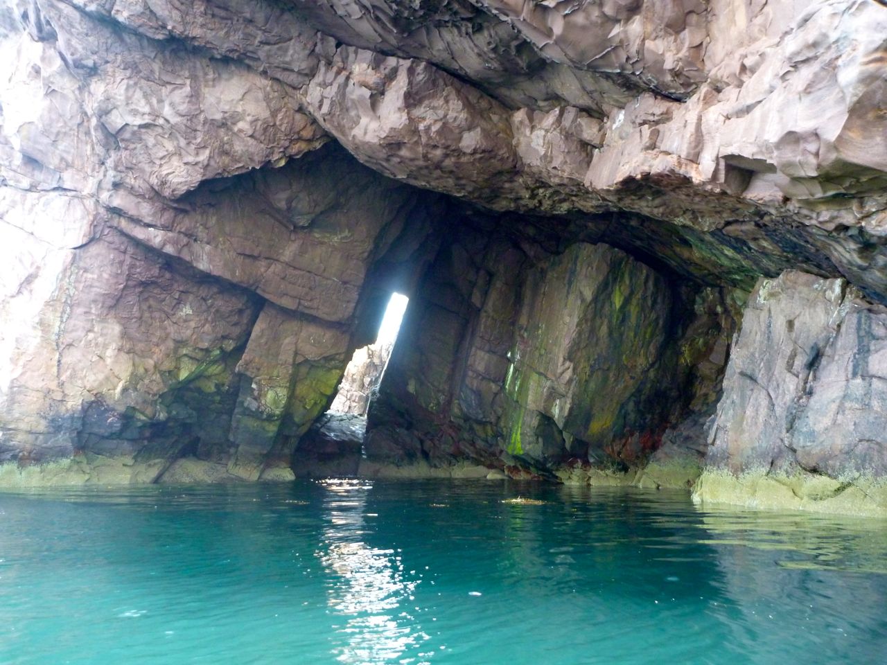
Cave • Tanera Beg On the OS map this cave is near a point labelled Sron Ghlas on at the island’s south-southeast point. ‘Cathedral Cave’ is what the boat tours call it, as they can edge right in while the captain offers a rendition of ‘Danny Boy’. With the daylight coming through the crack at the back (right), give it 100,342 years and they’ll have to reprint their brochures with ‘Cathedral Arch’. Read more…
Double Arch • Sgeir Ribhinn In a rush to get to see the main islands before the weather breaks, most would paddle by Sgeir Ribhinn, the easternmost of the three skerries south of the Taneras. But if you do pass close by, the one-kayak-wide geo on the upper east side will bring you into the cathedral gloom of big and small (left) arches overhead. Read more…
There are more caveson the Coigach peninsula cliffs facing Enard Bay, northwest of Achnahaird plus some fun tidal passages in the Isles too. Here you can catch that serene Caribbean sensation of gliding on aquamarine glass over the sandy sea bed, if not always with tropical temps, balmy winds or reggae soundtrack. My favourite is the pass between Carn Iar and Carn Deas (left), just above Bottle Island, with a lovely sandy passage on the right of Deas. Carn nan Sgeir below Horse Island is another, though you’ve got to time both at high tides.
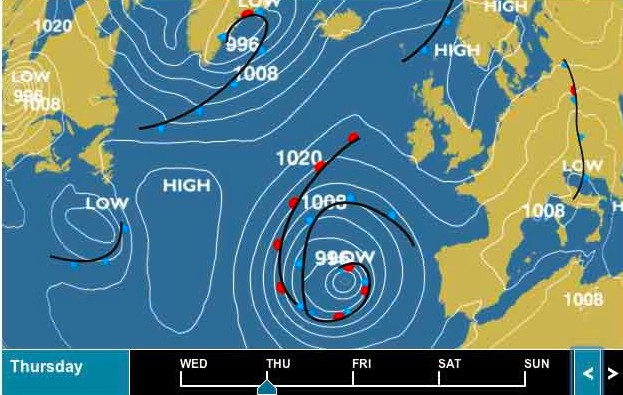
With the heather turning purple, mushrooms all over the lawn and a chill in the air, I thought it was all over for this season. But this week we’ve had a reprieve. Sat between isobars so far apart they’re in different time zones, today the Summer Isles are getting one final spell of calm, summery conditions. It could be my one and only chance to tick off the last of the Summer Isles.
Yesterday we nipped out from Old Dornie to Glas-Leac Mor (map left), another as-yet unvisited isle less than two miles out. Paddling 2-up took a bit of ‘readjustment’ and isn’t half as comfortable for me as my fuly-braced DIY solo set-up. But following a short cruise alongside Glas Mor, we were fully synched for the long way back between Ristol and Eilean Mullagrach.
Local internet chatter talked of helicopters dropping equipment to build a dwelling on Eilean Mullagrach, which we could see on the south side. Apparently professional castaway and Lego brand ambassador, Ben Fogle, tried to buy Mullagrach ten years ago, but bid too low, perhaps to the owner who’s developing to now. (Had he bought it, he could have named the 46-metre-high summit ‘Ben Fogle’). With no easy sea access that I’ve seen, you do wonder how they’re going to get to that house. As we paddled through the sound, a little dolphin popped up, huffing and puffing, and some colourful kayaks were taking a guided tour around the isles. The following day’s forecast was for similarly light winds, so I dropped the kayak off at Badentarbat jetty and next morning walked down with my gear.
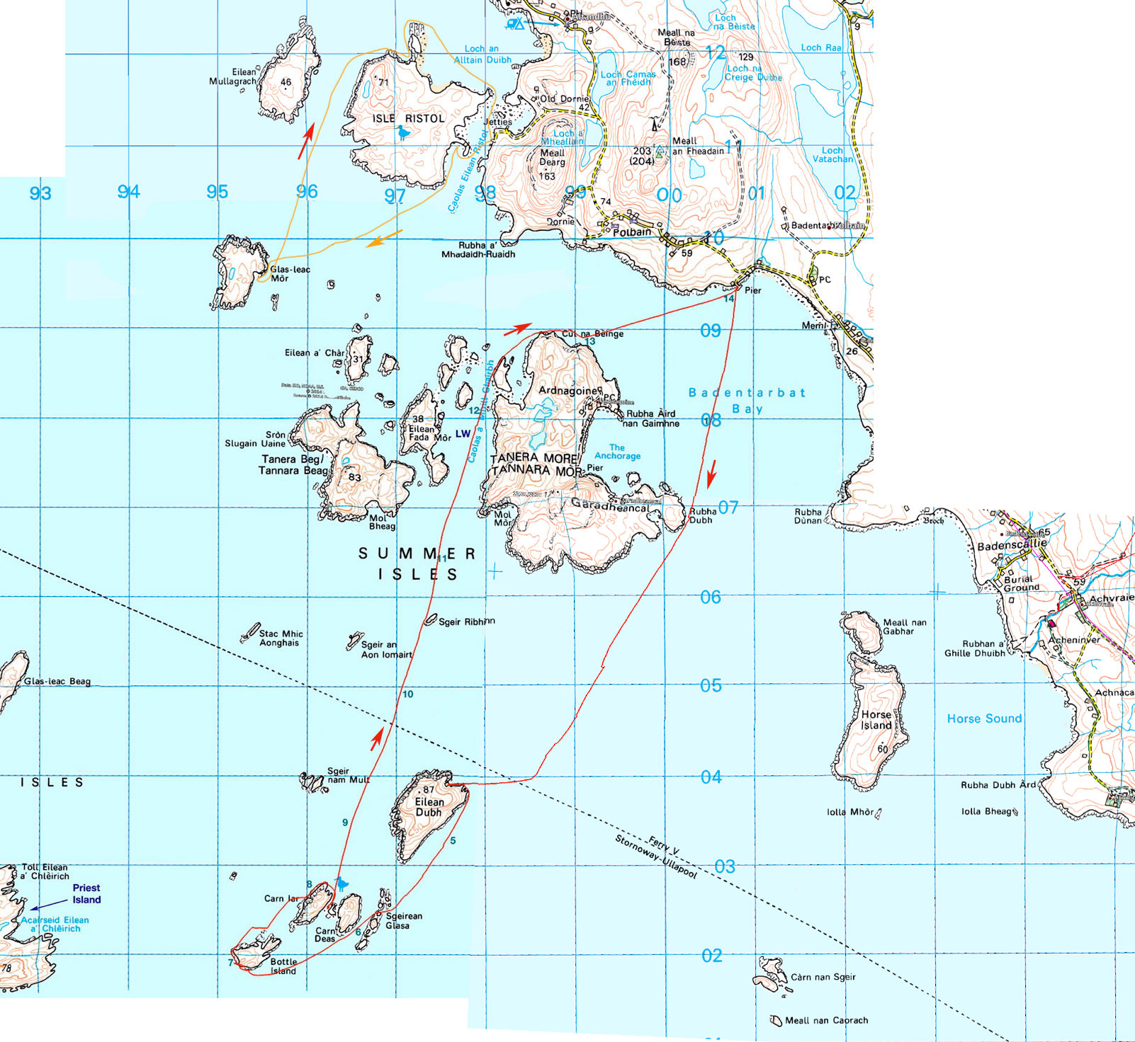
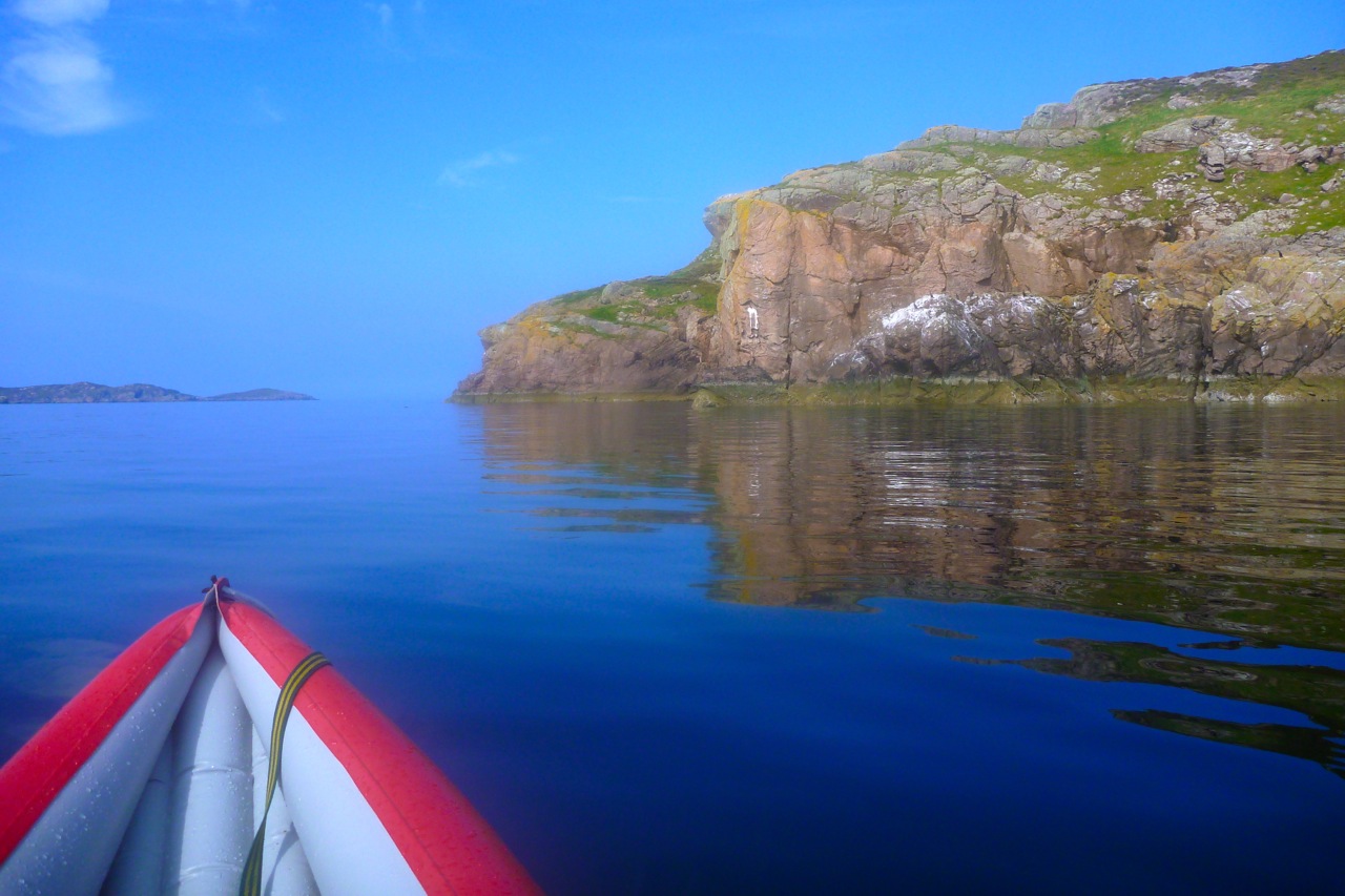
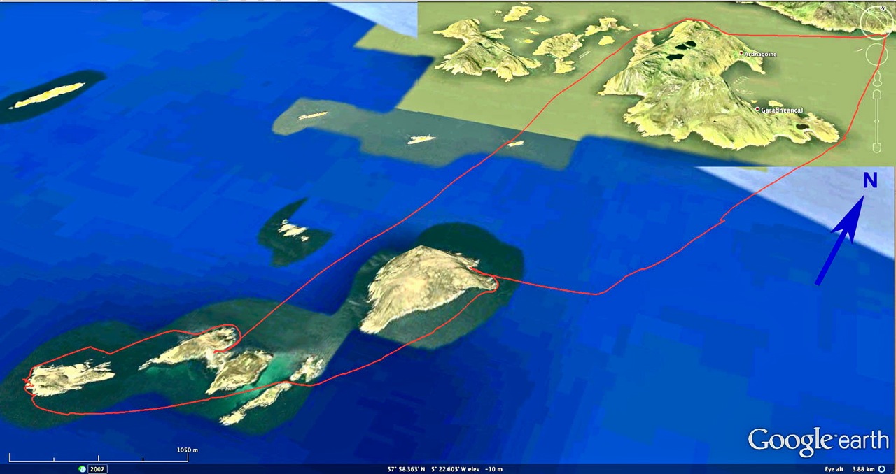
You don’t need a flat calm to visit the inner Summer Isles: the Taneras, ‘Ristols’ and Horse Island. But alone in an IK the outer Summers can feel like a bit of a reach. Priest Island is the most distant and adds up to an 18-mile tour via all the other outer isles, even though you need never be more than a mile or so from an island or inaccessible skerry of some sort. I settled on Bottle Island at the end of a cluster of isles and a 14-mile round trip from Badentarbat jetty. That’s about the same as our run to Ullapool a couple of years ago, but more open water than coastal hop.
The winds would be barely a factor until the afternoon, but a spring tide was at its 5.5-metre peak. I asked tidemaster Gael whether there was anything to consider on my route: he advised the books and charts didn’t list any dodgy currents. I was expecting a bit of flow through channels or around points at peak ebb around 11am, but could always find another way round.
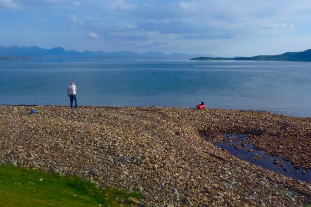
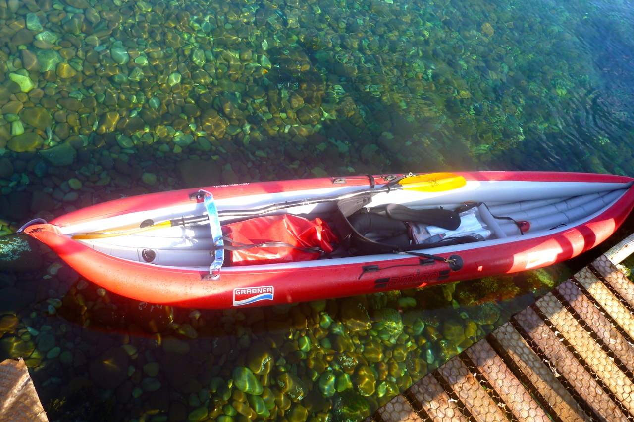
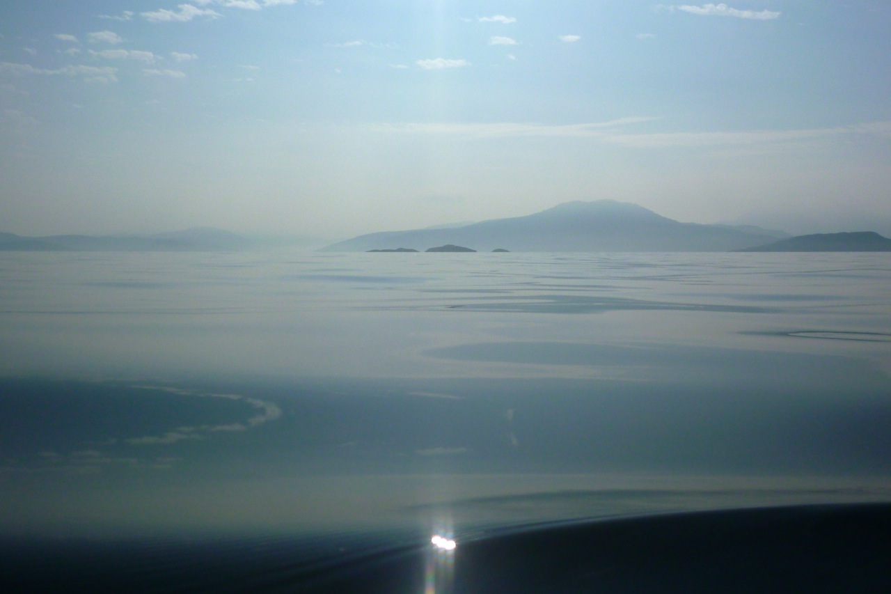
The pier at Badentarbet is condemned and blocked off with a barrier, but locals clamber round for a spot of fishing. I dropped the boat over the barrier, carried it down the steps to the water (right) and was on my way at 9.30, an hour after very high tide. Forty minutes later, I turned the east corner of Tanera Mor (still for sale, btw. Currently under £2m), rubbed the sweat from my eyes and clocked Eilean Dubh, nearly 2.5 miles ahead. Coming round Tanera put me back in a cooling breeze and the boat slid silently across the water as if on rails. To the southeast was Horse Island and Carn nan Sgeir, a remote skerry I visited last year and now floating on the glassy surface like a jellyfish with gout.
An hour before peak flow, at one point I was convinced I was being pulled west on the outgoing tide. I stopped to try and read any drift on the GPS, but couldn’t determine a direction. Turned out later I was drifting at 1mph east or inland with the breeze. So much for the impression of deadly currents. It was a lesson for the day: what you feel is happening (drift, current, ‘wind-in-the-face’ velocity) doesn’t always match the unassailable facts of the GPS. But alone on an all-day run it’s important to know what’s going on: is it ‘me’ or is it due to the conditions – so you can judge how much you have left in the tank.
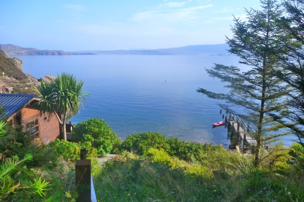
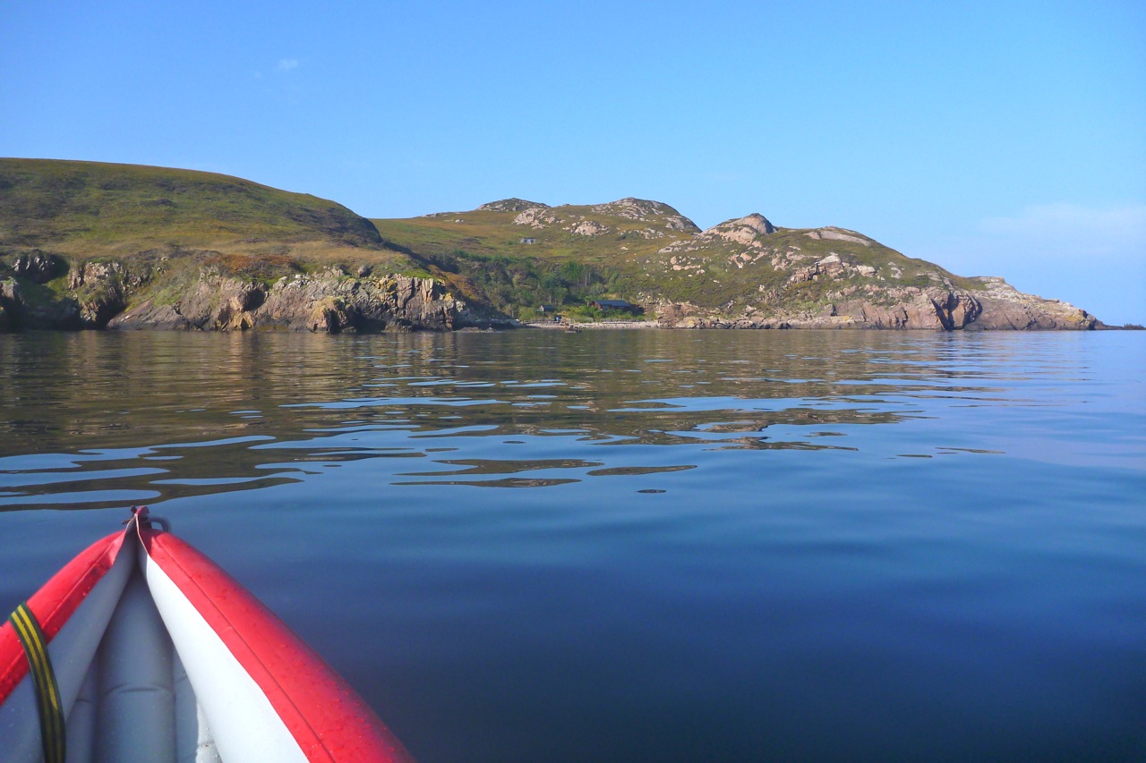
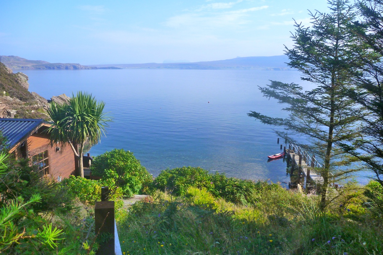
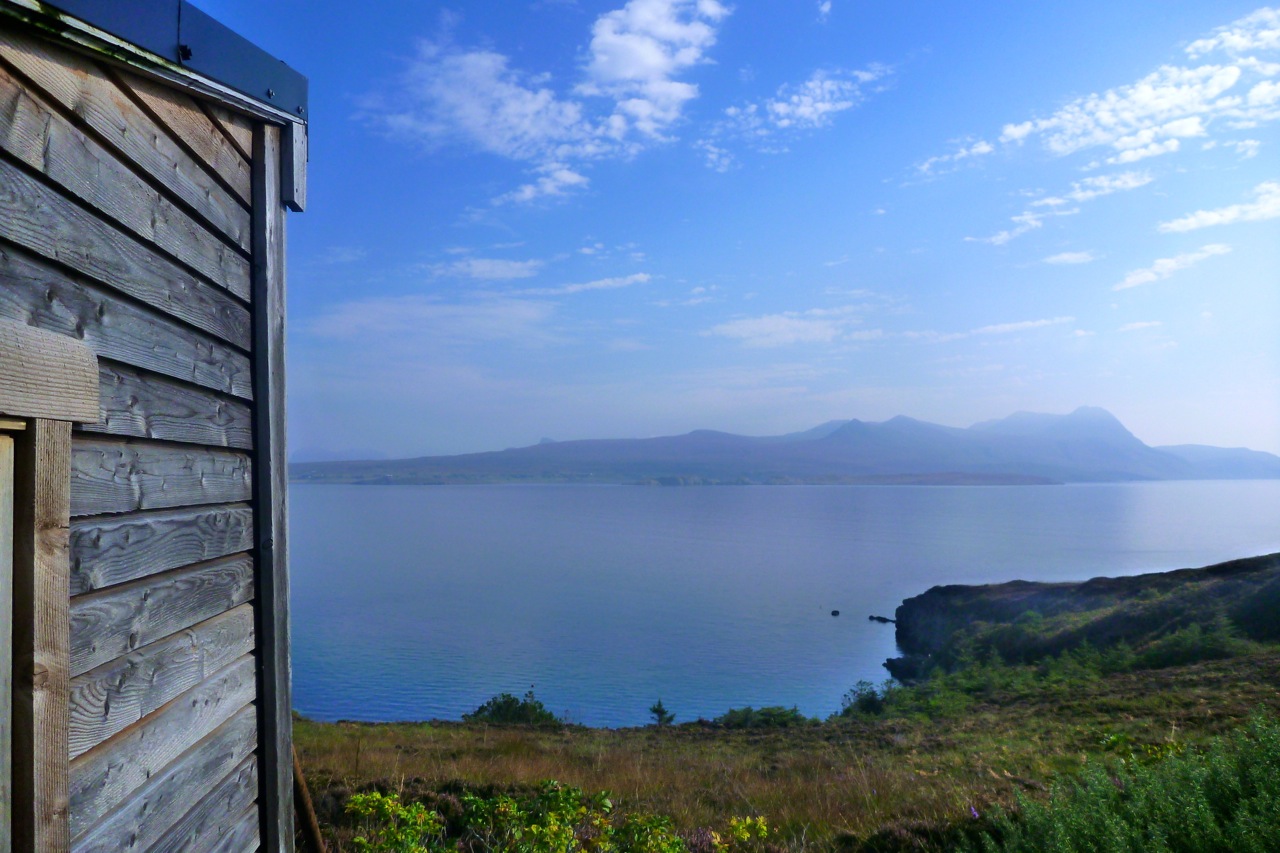
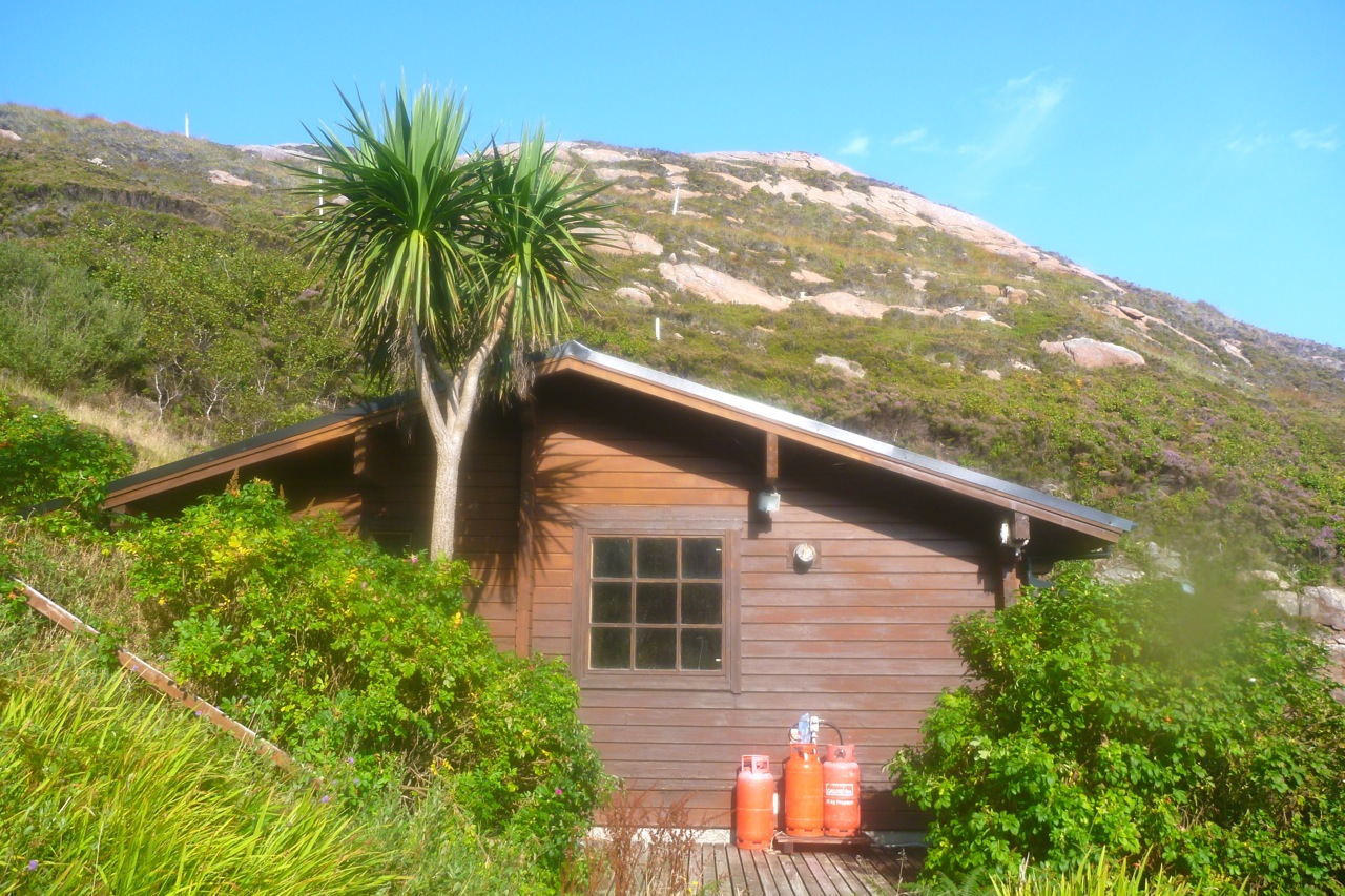
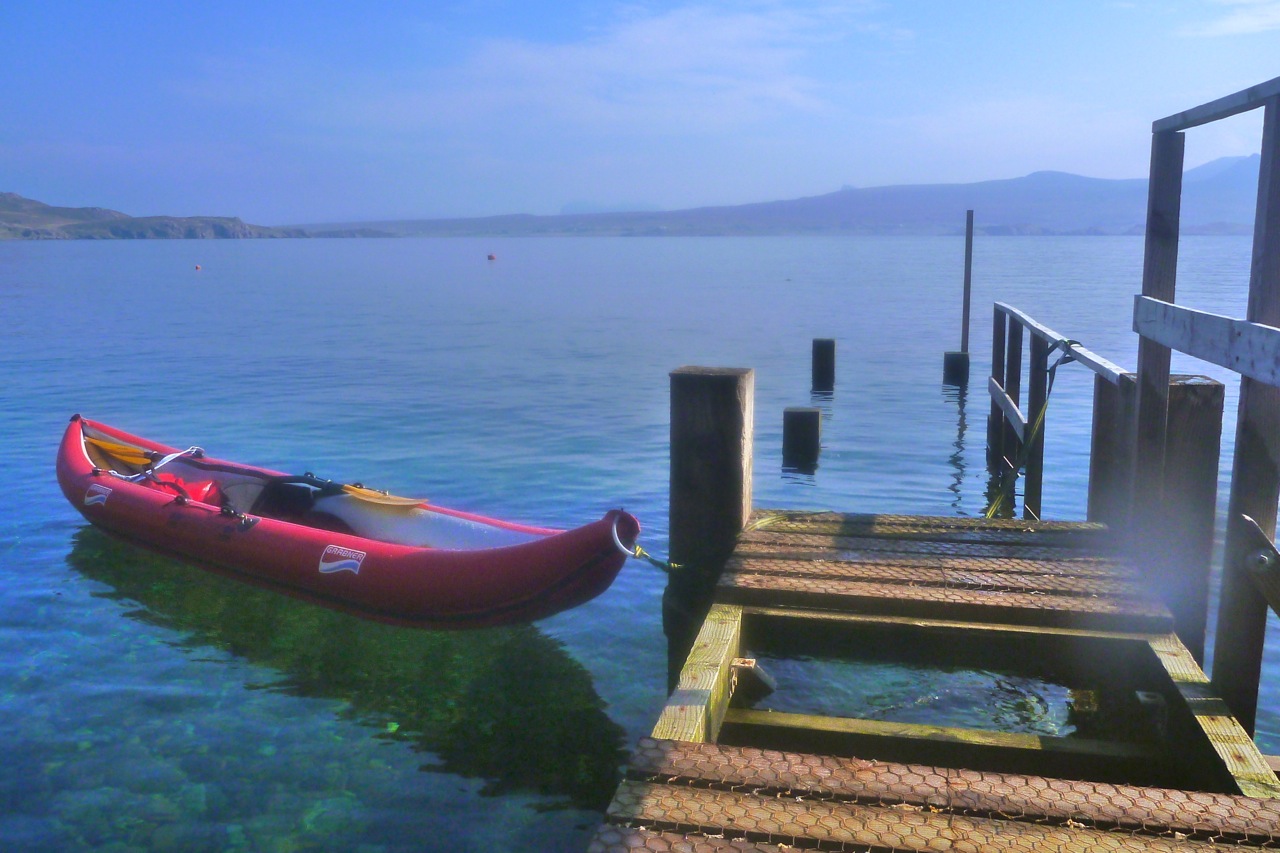
As I neared Eilean Dubh I saw what looked like a chalet in a tiny north-facing bay. A couple of years ago I’d heard about a house in an outer Summer somewhere but couldn’t find it on Google. This must be it (left). With no boat moored at the jetty, I diverting for a closer look. It was certainly the protected setting to build a dwelling: small stony beach for access; sheltered northeast aspect and a burn trickling down for water. Once ashore, the chalet reeked of lovely warm creosote and there was even a palm tree among the firs and other trees. Up the hill in the heather was little shed /painting studio. It didn’t look like anyone had been here for months.
Back on the water and coming round onto the east side of Eilean Dubh, I expected to be paddling against the ebb spilling southwestwards round either end of the island. And that’s how it felt, though again the GPS showed I was doing a normal speed or even faster, briefly hitting 4mph. It’s all in the mind. But when I came through a gap into the channel between Sgeirean Glasa and Carn Deas, I was definitely fighting against something, so moved away for the shores. Just as I did so a Tornado ripped past low overhead, close enough to see the undercarriage.
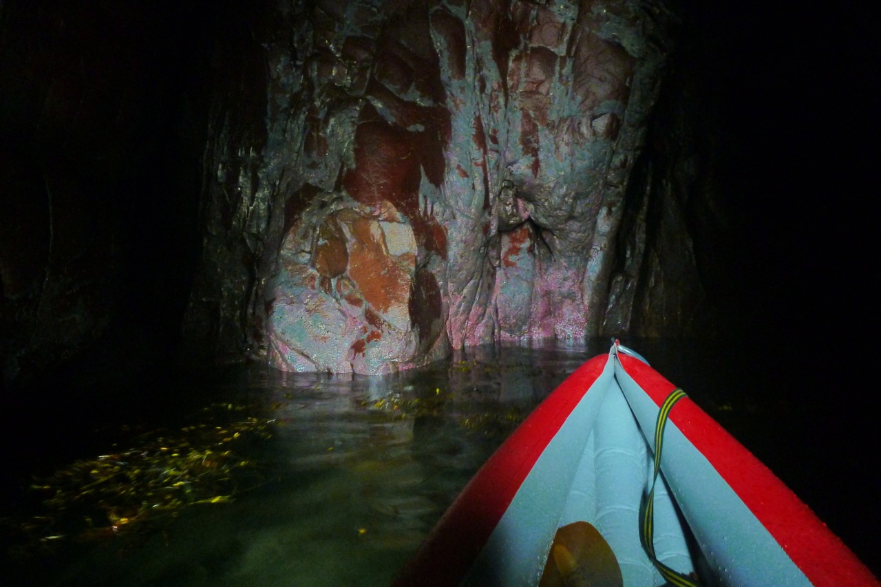
Up ahead, Bottle Island was now only a kilometre away. So far so good: I got there in two hours from the pier after deducting 25 mins nosing around on Eilean Dubh: 3.5mph cruising average. Here I nosed about some more, this time deep into a slotted geo on the south side of the island, where plinky-plonk drips and splashes echoed in the cleft. On the back of the cave the minerals in the Torridon sandstone looked like a gaudy, modern art mural (right) – or maybe petrified viscera.
There was just enough room to turn around in there when an incoming swell revealed another way out. In a corner was a chasm under another arch with an even narrower tunnel leading back out to sea (right). I inched in to see if it was wide enough and safe, then stowed the paddle and pushed through off the walls back out into the open. A double arch sea cave – who would have known!
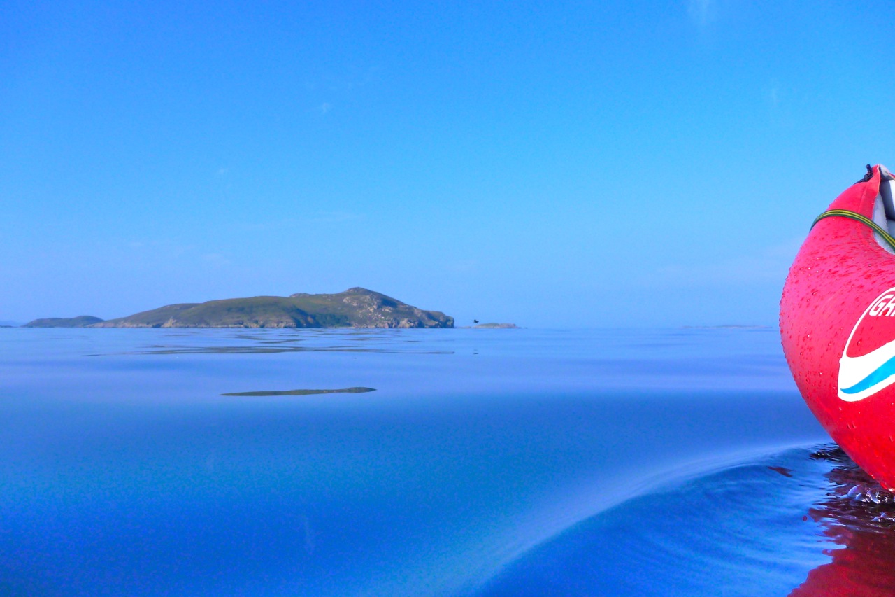
Two clicks to the west Priest Island looked far enough away to stay that way for now. It’s nice to leave something for next time (aka: ‘hold back to give an impression of calculated caution’).
So I turned back north and on the way tried and cut east between Bottle and Carn Iar to get to Carn’s beach for lunch. I didn’t want to eat in the boat if I could help it. But the flow between the islands felt too strong and I didn’t want to burn up energy I might need later. Instead, I got to the north side of that stony isthmus beach that links Carn Iar to Carn Deas, very similar to the ones on Carn nan Sgeir or Horse Island. To get onto it I just about scraped over a rock and seaweed bar into a sandy pool (left), knowing I wouldn’t get back out without a portage. But I wanted to get out of the boat, walk around a bit then have a sit-down.
Up on the grass and heather I ate and drank just about everything I had while down below a gang of seals quietly observed. As I’ve noticed before, these sheep-free islands have verdant and varied vegetation all of their own. I took a doze on a lovely machair sofa, then packed up and waded across the pool to tackle the ankle-breaking portage back out to the sea which has dropped half a metre in the meantime.
Now for the long haul back: 3 miles out in the open to Tanera Sound. I should have dozed in that machair sofa a bit longer: the big feed has taken out my energy and I found myself counting the strokes towards Sgeir Ribhinn skerry, pushing into a light northwest breeze that rippled the surface. After the glassy morning conditions, even waves a few inches high give a noticeable resistance, and for a moment I wondered if the east side of Tanera Mor might be easier. But the speeds later showed I was doing as well as ever at around 3.5 mph – it’s more likely I was unfit for all-day paddling, not having done any since we got here. Again, it makes me think that a speedo (or legible GPS readout) is a good idea as you can verify you’re going better than you feel, despite the impressions of currents and wind. It’s not like moving on land.
Alone out here, too far to swim to even the nearest skerry, you can’t help thinking ‘what if’. What if I somehow caught a stinging jellyfish with the paddle and it landed slap in my face? But the most likely ‘what if’ isn’t that or a sustained swordfish attack, but getting separated from your boat. That’s easily done when thrown out of an IK in an F5, but on a day like today it’s hard to come up with a plausible disaster scenario that would raise the slightest bit of interest in Hollywood. That’s why I ventured right out to Bottle Island.
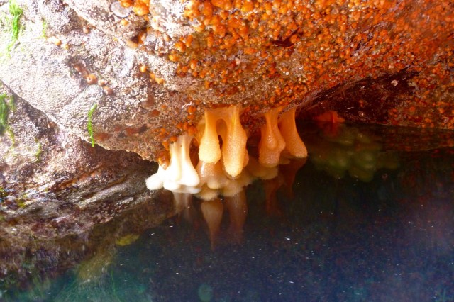
By Low Water I was right in the middle of Tanera Sound. You see new things when the tide is very low: some pendulous orange sponges tucked under an exposed overhang. And on a tidal skerry visible from our window, a prickly urchin of some kind. Don’t want to ram that with my IK.
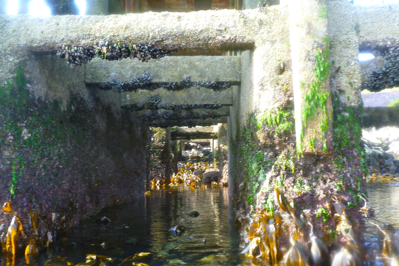
I can see our isolated house on the headland and with only a mile to go, I lie back and drift with the incoming tide drift for a bit. Then it’s back to the pier where the sea is at least 3 metres lower than it was this morning, exposing lower beams encrusted with mussels.
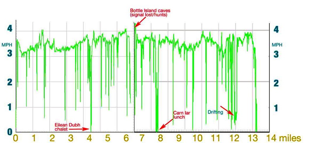
Fourteen miles and 5.5 hours; moving average (not always cruising): 3mph. On a long trip like this I have to say I miss the old Incept’s effortless glide (compare this Incept speed graph with the one below – or read this comparison post). I miss the speed not because the Incept was a bit faster, but because you definitely feel the effort required to push the wider and half-metre shorter Amigo along. The Amigo is even shorter (though much more rigid) than my old Sunny: the shortest IK on my IK comparison table.
All things being equal, that extra bit of speed can enable you to go further or get back quicker. But let’s face it, it’s always a compromise: there are days for fast boats and days for fun boats. I’m here and still breathing. My Amigo is an easy boat to live with – and a lot better than pushing a bathtub around on a trolley.
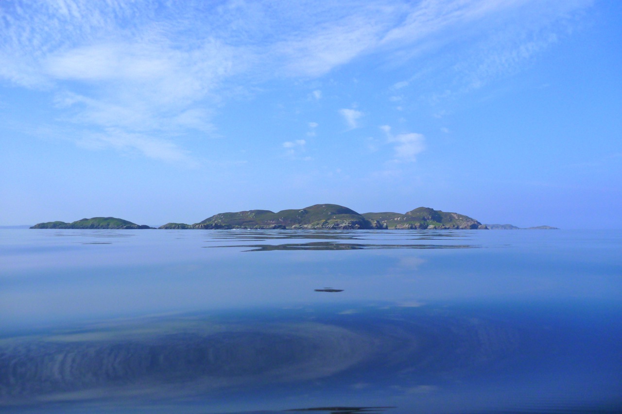
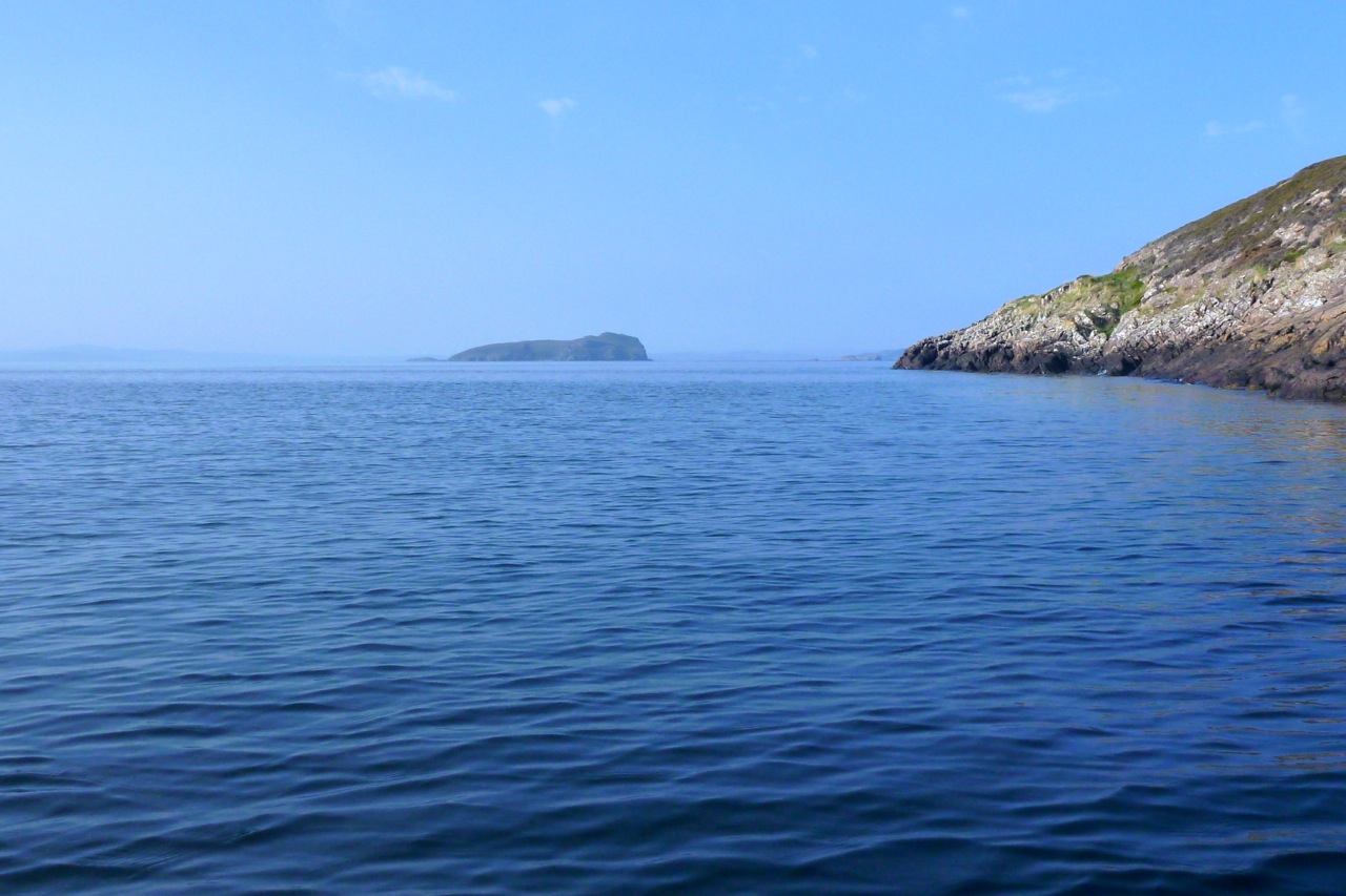
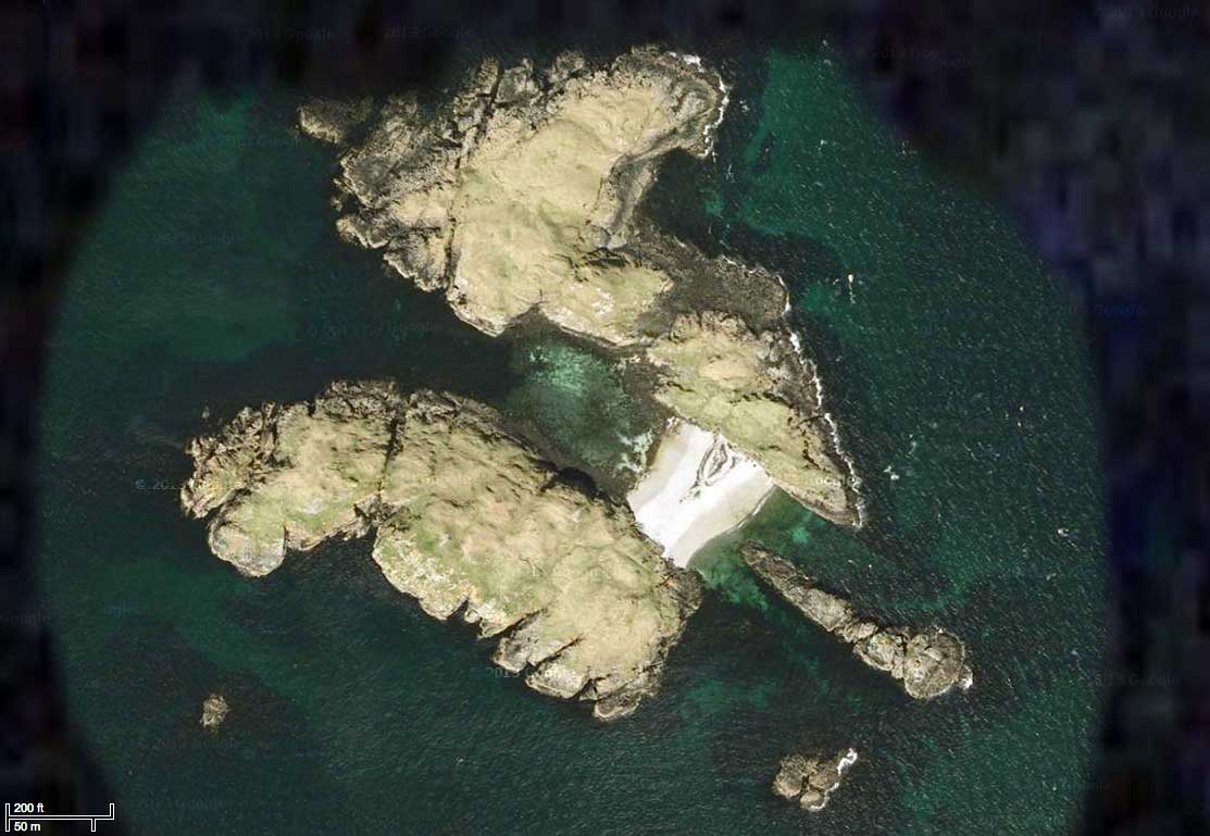
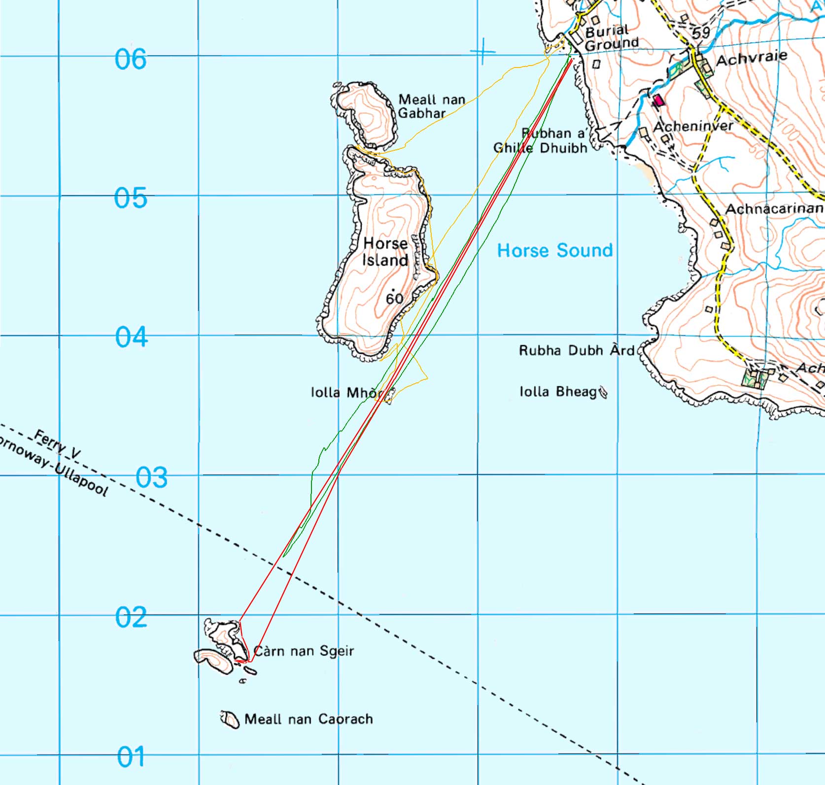
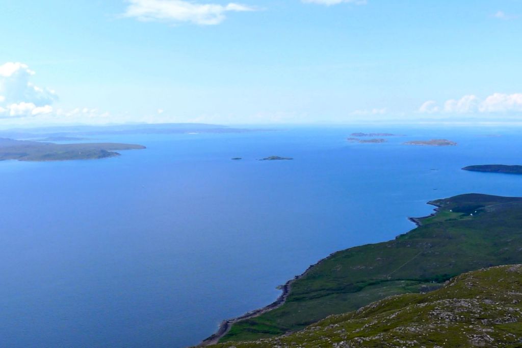
Stuck out in outer Loch Broom, the little hoof-print shaped island of Carn nan Sgeir (above) lies midway between Horse Island and the Scoraig peninsula on the southern mainland. Some call it Bird Island and four times a day the CalMac ferry passes close by, sometimes to the north, sometimes to the south. Nearly a mile-and-a-half from land, I figured getting to Carn would be a good simulation of a more exposed run out to Priest Island (marked below). Plus on the sat image it looked like an unusual place, separated at all but the highest tides by a single, shingle isthmus.
I came across this Summer Isles sea kayaking report by some intrepid members of the Braintree Canoe Club. In a week out of Ardmair they managed to do what’s taken me years, and that included two days windbound below Ben Mor mountain and an overnight on Carn nan Sgeir where, from their gallery, it looks like they saw a great sunset. And here another more recent report from the area with pics and maps: Gruinard Bay (Mellon, below) up past Stoer and Handa Island.
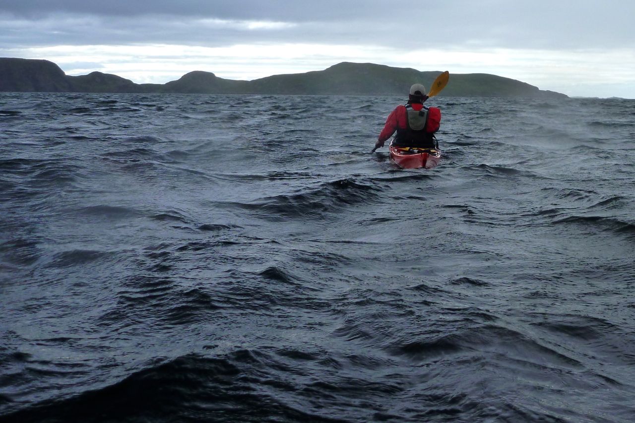
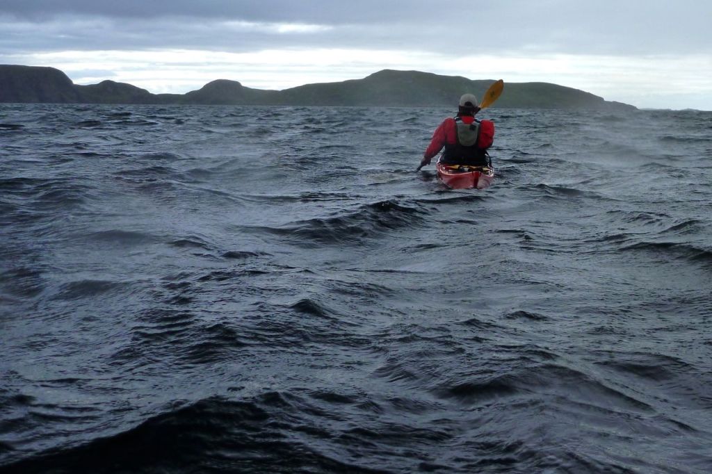
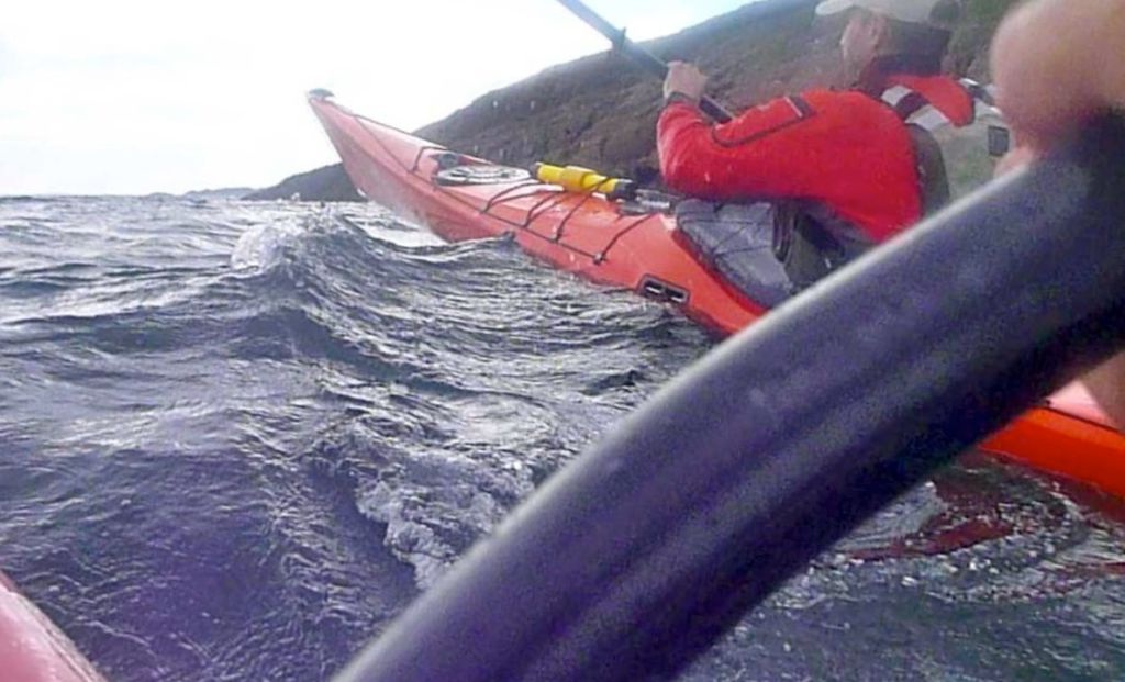
Mid-August but sometimes it feels like autumn has already arrived up here. Compared to a few weeks ago the light is thinner and there’s a chill in the air. Jon turned up, not having used his orange Scorpio LV since our outings here last year. On the day the weather wasn’t great so we set off from Badenscallie Beach opposite Horse Island for a splash about. Dark clouds pressed down on the steely swell and a westerly F4 made for a bouncy ride (above) until we got into the lee of Horse. The tide was up so we headed for the flooded gap between Horse and Meall nan Gabhar just to assure ourselves we didn’t want to go through it and out into the open.
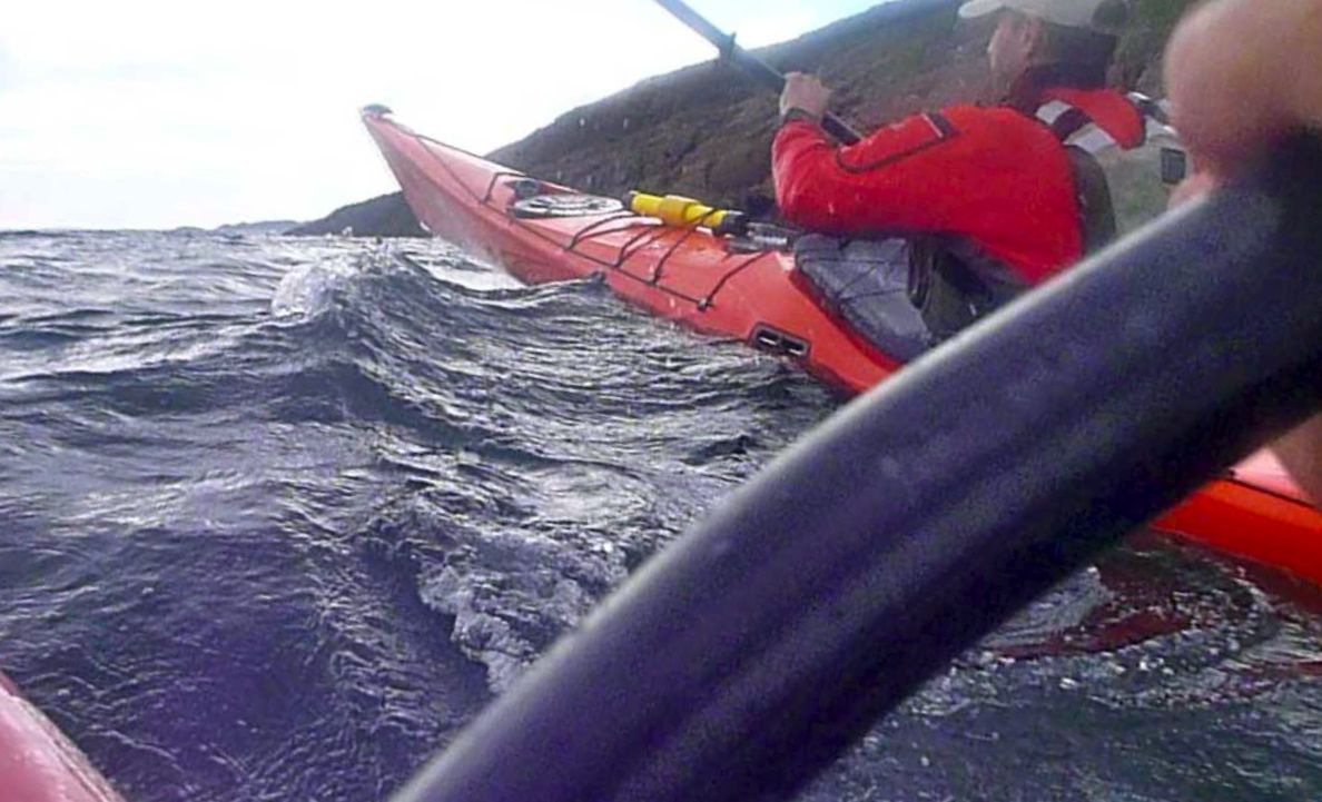
Instead, we tracked down the lee side of Horse to the southern point where we again pushed out into the winds. At times the front third of Jon’s long LV was launching off the crests, but considering he’d not paddled it for ages, he was managing fine. Perhaps these plastic coffins can be mastered after all? From any direction the Amigo handled it all too, with a brief squirt from Jon’s handy bilge pump by way of a rest.
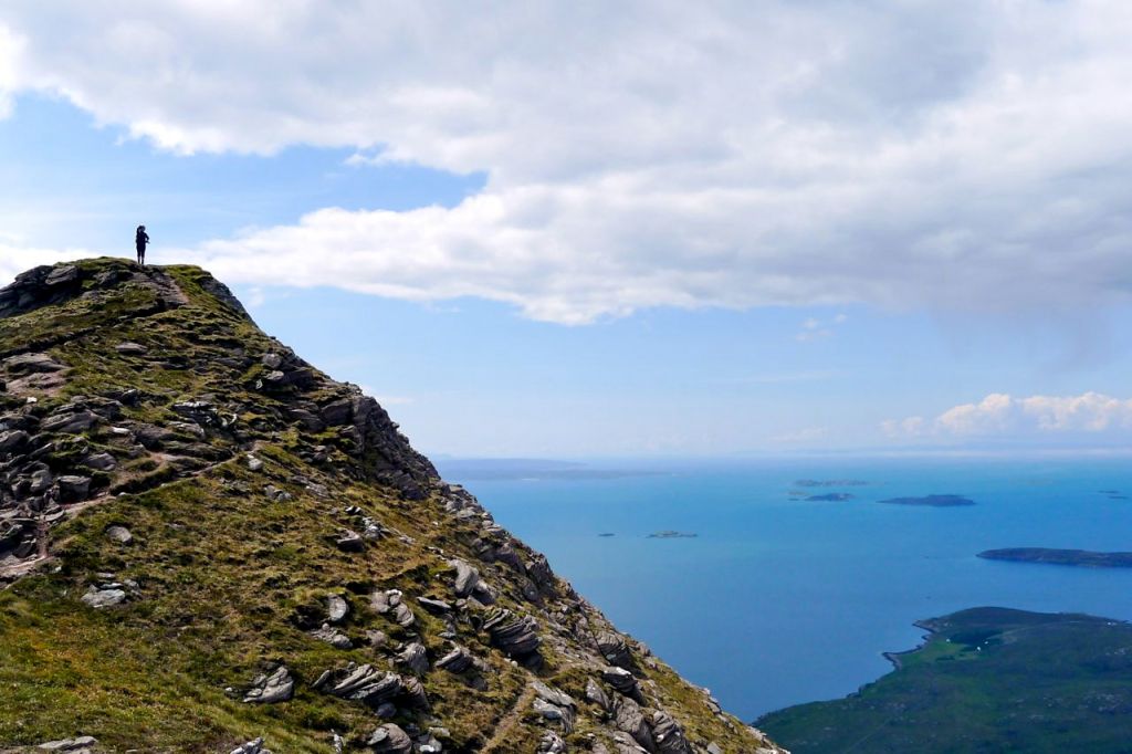
We mucked around alongside the surf breaking over the skerry of Iolla Mor and eyed up Carn nan Sgeir, some 2km away. We could make a run and probably make it, or we could play it safe. With the forecast set to worsen, we settled for a loop round Iolla, scattering some seals, then dithered again over making a break for Carn. Discretion prevailed again, so instead we landed on Horse Island and hacked through the chest-high bracken to the 60-metre summit cairn. As the disturbed birds wheeled over our heads, we looked over to isolated horseshoe of Carn and the thick clouds swathing the Torridons beyond.
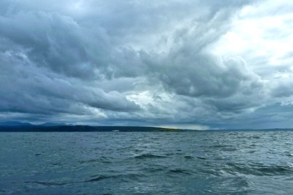
A couple of days later all looked calm out the window towards Tanera, but that was because the hill behind us was sheltering the northwest wind. I didn’t notice that until leaving Badenscallie, and very soon the Grabner felt oddly squirrelly, pivoting left on each crest. Approaching Iolla Mor again and now in the lee of Horse, things flattened off but I knew once past that point the 4-5 mile fetch building up from Badentarbet Bay might get a bit much. And so it did, pushing the boat around as it started to white cap. By the time a wave flopped over the side I’d scaled down my plans to tap Carn with the paddle and shoot back. I pressed on for a bit with that in mind but the seas seemed to be rising and it could be a nerve-wracking hour getting back. Less than ten minutes from the Carn, I turned around and scurried back to Badenscallie.
A period of calm, that’s what I needed to enjoy a relaxed paddled and look around Carn, rather than making it into a hurried dare. That afternoon came, but it didn’t stop me paddling out from Badenscallie at full steam, knowing that in a couple of hours it may all change. In the rush I’d forgotten map, GPS and watch, but I knew the way and with the clock in the camera I timed the 3 miles to the north tip of Carn nan Sgeir at just over 40 minutes. By that point sweat was wringing in my eyes, but the way the Amigo tracked in such unusually flat conditions was quite an eye opener.
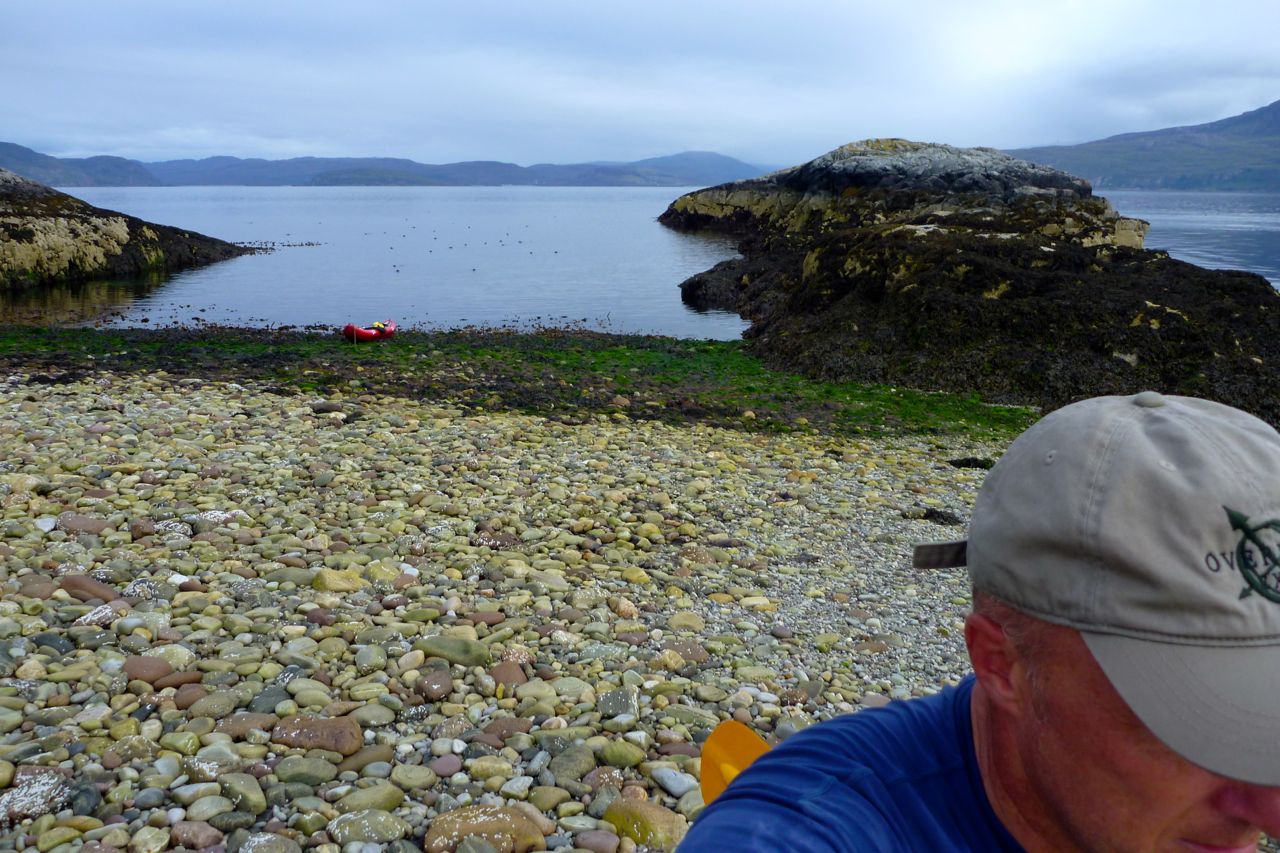
As I neared the shore of Carn, numerous seals slipped into the water and soon no less than forty of them were bobbing all around, eyeing me up. I’ve never seen so many seals up here. They followed me like a fleet of U-boats as I paddled around to the stony isthmus, and were still watching as I walked from the boat.
Getting to Carn’s high point took three minutes but doing so set off the dozing midges. As I reached the pole and rag marking the summit, the ferry was coming in from Stornaway, today passing south of the island. Midges made further exploration a misery, so I took a quick look at the grassier and less infested north isle then headed back to Badenscallie at a more relaxed pace. By now the wind had dropped right off and I stopped a few times to enjoy the silence, broken only by the splash of a seal or a distant guillemot flapping off the water. I couldn’t get over it, there seemed something uncanny about how well the boat was tracking, perhaps I’d not yet paddled in such a calm. As a test I closed my eyes and paddled on for a minute; two times out of three I remained bang on target for the beach – the other time I was off at 90 degrees. As I neared the beach a light north breeze started up, just as predicted, and in a couple of hours the sun would emerge below the cloud ceiling’s western edge to make for another sunny evening. As I’d found a few weeks ago when I paddled to Lochinver, and then around Rubha Coigach, when it’s calm up here you feel you can almost walk across the water to anywhere you like.