Hot Days & Cool Rangers • Packrafting the Fitzroy – 5/5

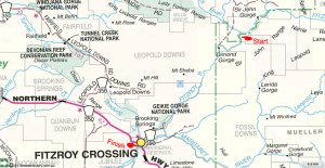
Fitzroy 1 • Fitzroy 2 • Fitzroy 3 • Fitzroy 4 • Fitzroy 5

Today, our fifth on the river, we expected to break out of the clogged-up side streams of the last two days and get on the deep, open channel which led right through Geikie Gorge national park, not far from Fitzroy Crossing.

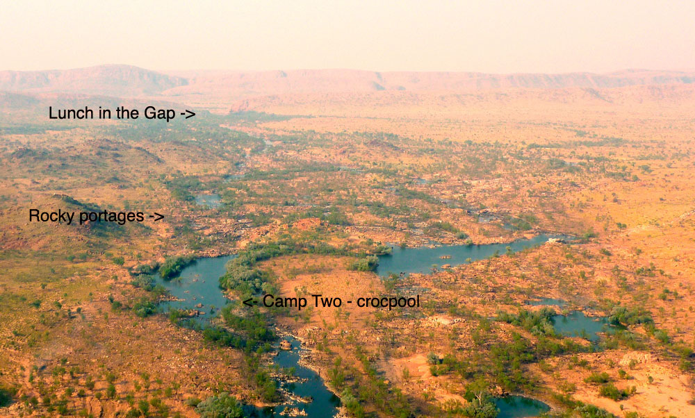
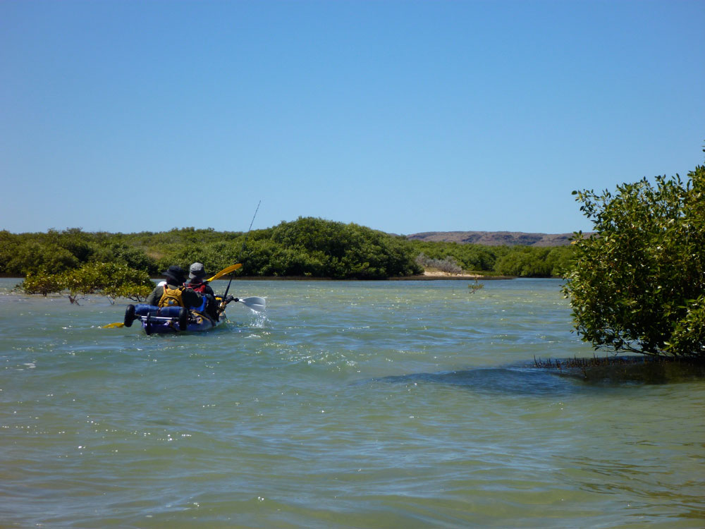
After breakfast the log jam which had defeated us last night was easily carried around, and after a couple of hours lifting over and squeezing under other blockages (left), we turned the last Big Bend and spied the northernmost outcrops of the Geikie Ranges in the distance.

This was the last of the few landmarks on the route and though the bridge was still 40km away, it marked the beginning of the final leg, just as the Gap had marked the end of the Leopolds.
As if on cue, the rock changed again from the sand-smothered granite we’d been on since leaving the Leopolds three days ago, to limestone which gave Geikie’s flood-scoured gorge walls their distinctive appearance.
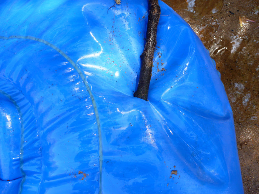
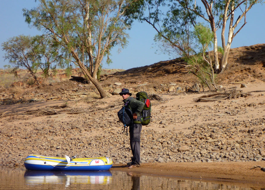
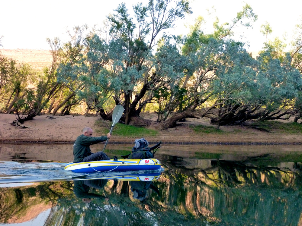
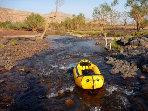
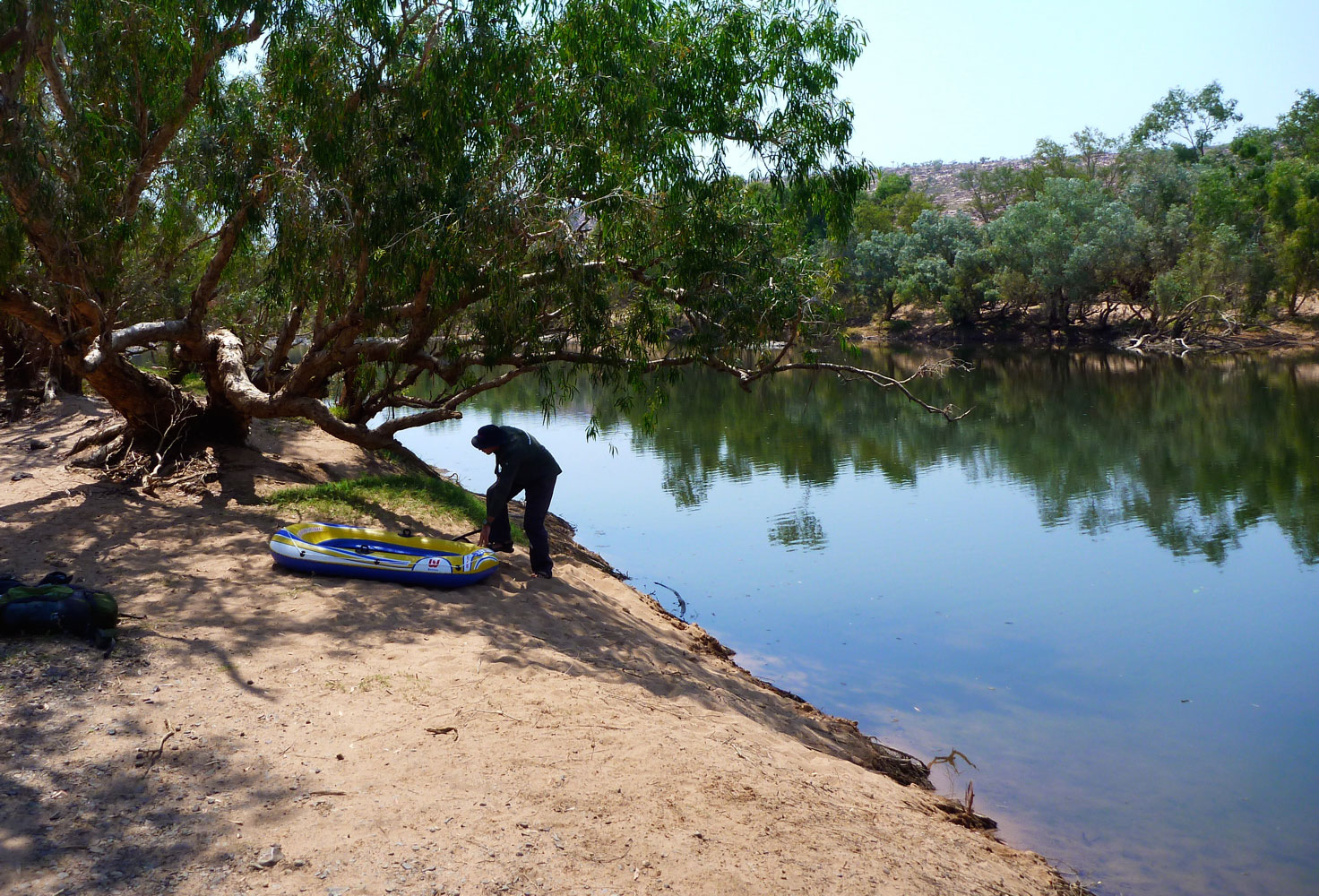
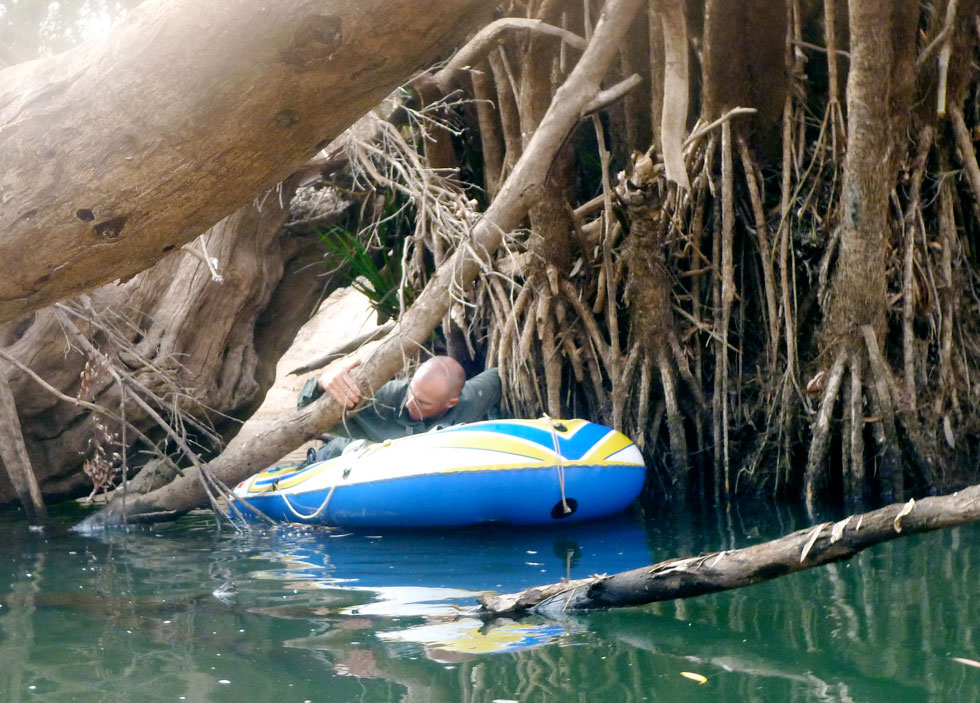
The river spread out and lost its depth, and as we picked our way over shallow but gnarly limestone rapids not unlike the Ningaloo‘s shores, Jeff’s floor got snagged and went flat. It was smoko time anyway, so while the water boiled he repaired his boat one more time.

As far as we could tell, the park’s northern boundary began at 18°S, and as you’d expect in WA, paddling there was not without its restrictions. The DEC website stated private boats were only allowed on the river before 7.30am and after 4.30pm so that the daily boat cruises wouldn’t be disturbed by people bombing around for free. At our paddle speeds, keeping to these times would be difficult, let alone getting through the 18km-long park before nightfall, because camping wasn’t allowed either.

All visitors to Geikie drive in, almost all to do the one-hour boat cruise. Aside from a couple of short walks, that’s all there is to do, even though it’s clearly a great place for paddling. As with kayaking the Ningaloo Reef, we were again expecting ranger problems due to our unorthodox arrival and mode of travel. If the Ningaloo Reef NP regulations had no category for sea kayak touring, you can be sure Geikie Gorge had no equivalent for packrafts and slackrafts coming down from the King Leopolds. Our transit would require a sympathetic head ranger; something of an endangered species up north, if experience during my guidebook years was anything to go by.

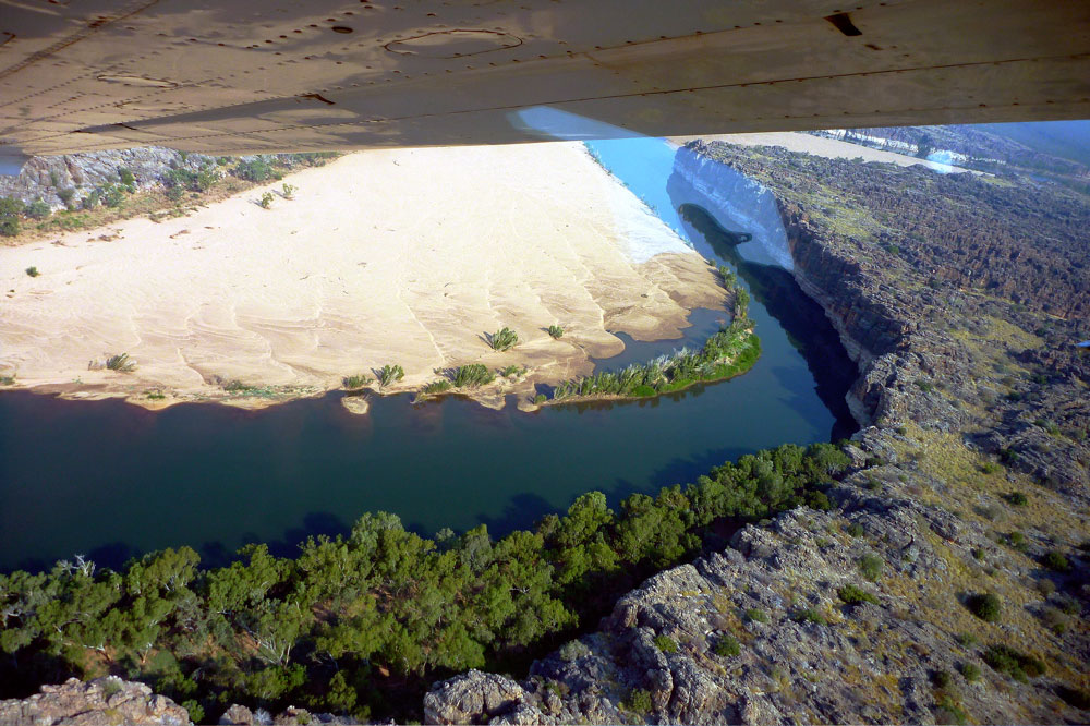
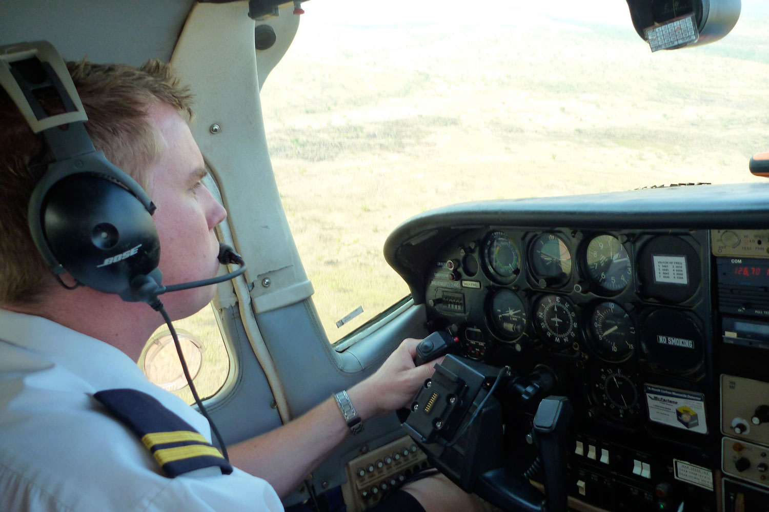
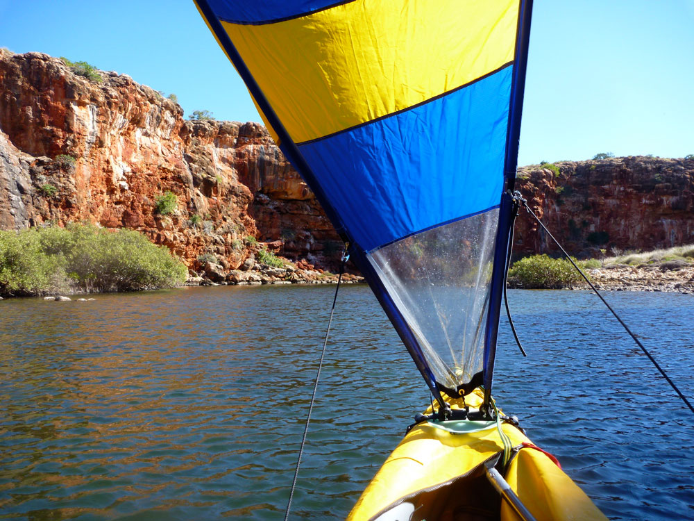
At least we’d seen from the plane that the river cut through Geikie in a deep, wide channel with minimal shallows. For me in the nippy Alpacka that was great news, but hours of unbroken paddling would be a drag for Jeff in his sluggish pool toy. Mid-morning a hot northern wind rose up and Jeff was quick to rig up a sail, but its effect was negligible; the only way forward was to dig or settle back and drift on the quarter-knot current. To our left and right, sun-bleached water marks reached ten metres up the cliff sides, demonstrating how high the Fitzroy rose during the Wet.

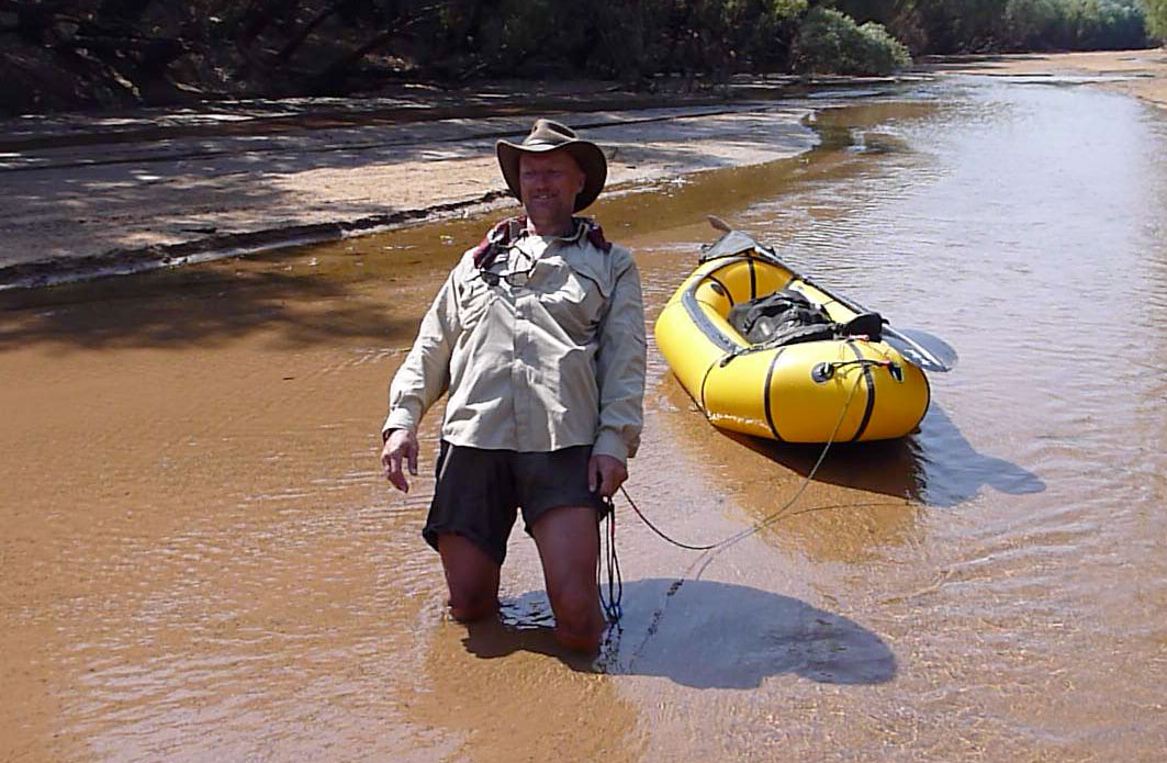
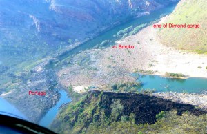
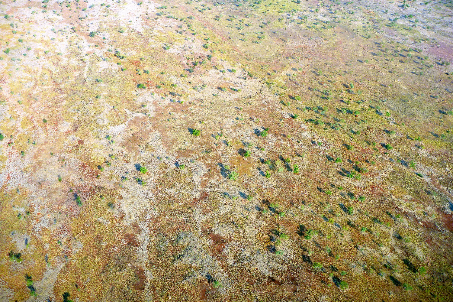
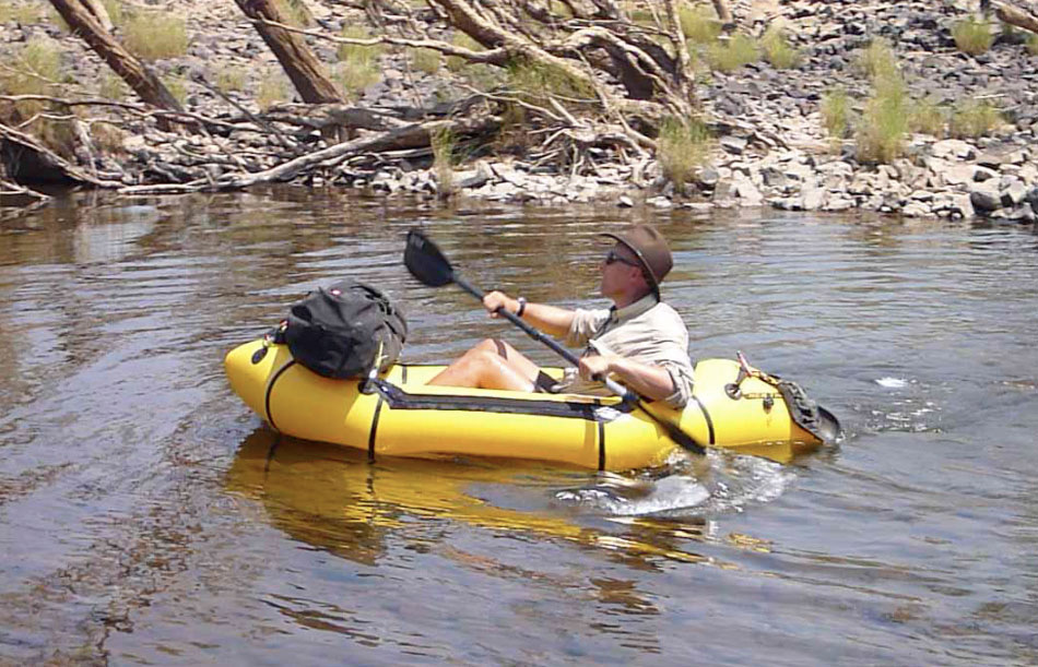
It was lunchtime, but with little flat and shaded land between the cliffs and the bank, we rocked up on a slither of an island capped with fresh green grass that no cattle had managed to reach. Later I realised I’d taken a picture of the very spot from the plane (left). While Jeff got the billy on, I emptied the Yak for a rinse and then went for a quick blast across the open river. Without its load the Alpacka skimmed across the water like a pebble.
Have a go in it” I said to Jeff when I got back. He did and of course loved it.
I shouldn’t have done that. I really shouldn’t have done that“, he realised. It made getting back is his squidgy pool toy all the more galling.

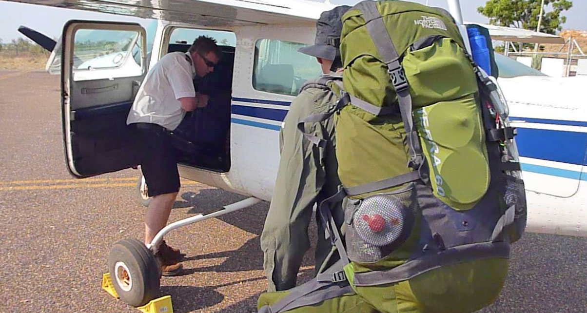
Back on the water, up ahead a motorboat was gunning towards us. Here comes the ranger; we’ve been spotted and our trip could end right here. But our paranoia was premature, it was just a bloke heading out to his favourite barra hole by some sunken trees. He explained we were in an unofficial access window tolerated between 11am and 1pm, between the two big daily tour boat cruises. He also warned us that the head ranger was a grumpy sod. No surprise there, so we decided better not to get bogged down in explaining ourselves on the sat phone, while at the same time planning to make the most of the Fossil Downs station land on much of the east bank for which we did have permission. Before we’d flown out of Fitzroy we’d tried to track down the ranger’s office in town to inform someone of our plans. We couldn’t find the place, but heard later there was no one there most of the time anyway.

As we entered the main part of the gorge, up ahead we heard the blaring of a guide giving his tour schpiel from the cruise boat. People looked to be taking pictures of us which meant we’d be seen for sure. They’d be waiting for us downriver, hands on their hips, drumming their fingers, but we decided we’d deal with that when it came. We’d talked our way out of it on the Ningaloo; we could do the same here. It’s not like we were drunk and churning the place up in jet skis.

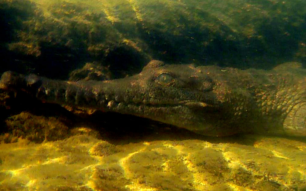
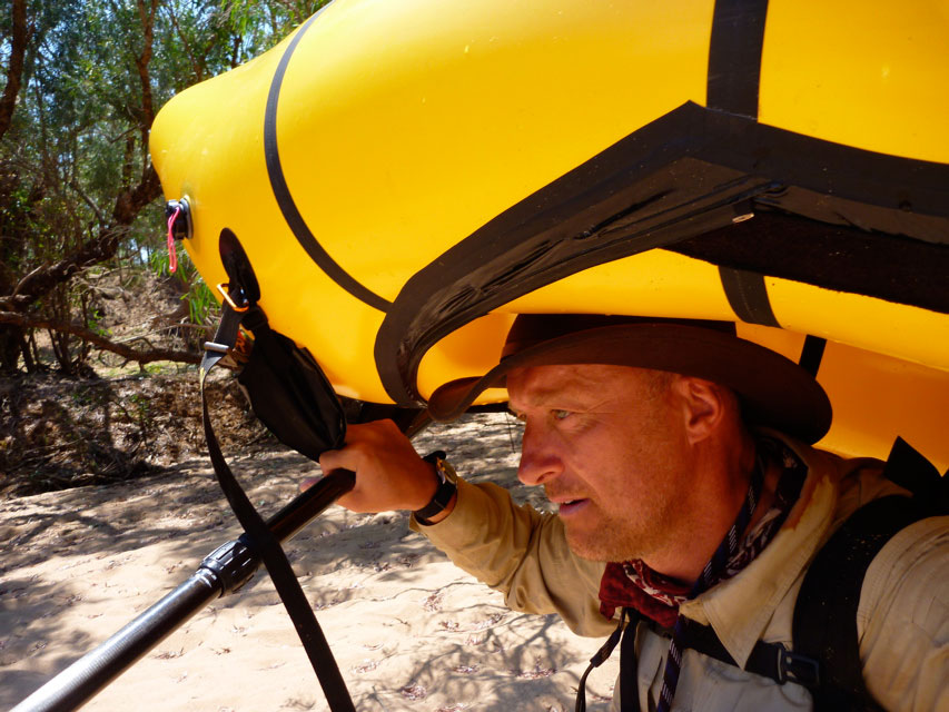
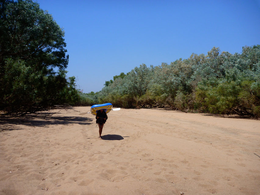
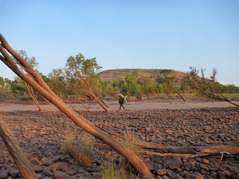
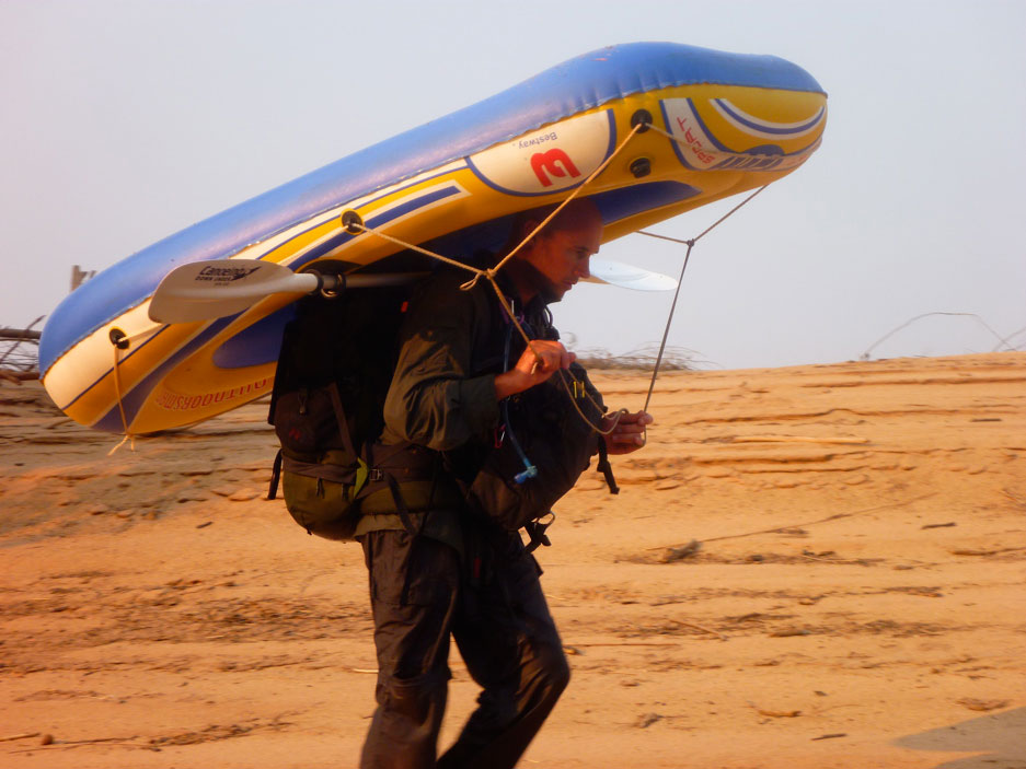
Without any overhead canopy to shade us, the full heat of the afternoon pressed down and Jeff was feeling it. After some 20kms we came to a big sandbank where crocs buried their eggs. Seeing a curve in the cliff line, Jeff could bear the paddling no more and set off on foot (left) to cut the corner. At the far end I came ashore to look for him but he was still way back. The day’s heat bounced off the glaring sand.; great for incubating croc eggs, but it reminded me that had we actually done much open country walking (as we’d expected) we’d have had a tough time of it. Wading or paddling, the surface of the river felt a good 5-10°C cooler, even out of the shade. The combination of the cool water surface as well as constant splashing kept us swathed in a temperate micro-climate which made the whole experience infinitely more tolerable. The few portages we’d taken over boulders or sand banks over the last few days had been brief reminders of how hot it actually was out there, and later that day we were told the temperature had topped out at nearly 39°C (102°F).

Unless he was training to be an Indian fakir, it didn’t look like walking across the scorched sand bank had been any kind of respite for Jeff, and he flopped back into his boat. As on the first day, I suggested I tow him for a bit and this time he was too weary to resist. He reposed on his water sofa as we set off to explore the main east wall of Geikie, where eons of seasonal flooding had carved the former subsea reef into scalloped and fluted Gaudi-esque forms.

We glided under overhangs and nosed into caves and web-drapped fissures which bigger boats couldn’t reach. As we bounced along the eroded undercliff, enjoying a break in the pace, up ahead a babe in a red kayak came into view. And as we got close she started chuckling.

“I hope you’re not laughing at us” I said with a stern grin.
It was Ingrid, the Cool Ranger, probably the only person north of the 26th parallel who was remotely impressed by our achievement.
“Good ON-ya guys!”,

she said as we filled her in on our adventure, and she meant it too. We gloated modestly at this unexpected attention as she fired off questions about our boats and a trip she’d often thought of doing herself. On the way out we’d actually spotted her red kayak from the plane, beached on a bank somewhere upriver. Turns out she was one of the dreaded park rangers, but despite six months on the job was still keen enough to use her days off to see how far she could get upriver in her SoT.
And this wasn’t just any old SoT, but an Ocean Kayak Scupper Pro – a boat I’d considered buying myself for our stay in far northwest Scotland earlier in the year. Compared to most SoT tubs, the SP is a long, slim and sleek-looking boat, much admired by spray skirt-dodging hardshell connoisseurs as being the most sea kayak-like of SoTs.
No stranger to her own outback adventures, she quizzed us about our run down, while a fellow ranger glided over to deliver her fishing rod in a dumpier OK Frenzy, the more usual door-wide slab of SoT plastic. Ingrid had caught a two-foot barra hereabouts just a few days ago, so there were fish to be had here after all.

After a long chat it was time to move on; the sun had just about set. She explained that up ahead was a big sandbank on the left where another river joined the Fitzroy. That was out of the park so we could camp there as long as we liked. Buoyed on by the hope of a fresh fish supper, Jeff trailed his lure until half an hour later we bounced into the sankbank at twilight, barefoot and fishless as usual.

To the Bridge
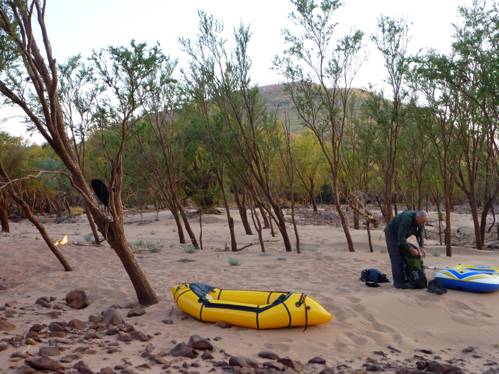
Jeff had well and truly had it with his Bestway, and the previous evening had talked about walking the last 15kms back to the van at the aerodrome and putting back in at the bridge. By dawn he’d come to his senses. After all he’d nursed his malformed lilo over a hundred kilometres, past sleeping crocs and charging bulls, over boulder fields and under fallen trees, patching it as he went. For whatever reason, yesterday had been a hot slog and the novelty of his achievement had long gone stale, but he knew he had to see it through to the end – or at least give it a go. If nothing else, he had a film to finish!

He suggested I go on ahead to the bridge, walk to the aerodrome and come back with the van, by which time he’d be arriving himself. And so at 6am we set off for the final 20-kilometre leg which I figured I’d complete by noon. Although there was no let up in obstacles – more log jams, frequent sand shallows with quicksands, as well as headwinds – by 9.30 I’d reached the original ford which at the end 19th century had given Fitzroy Crossing its name.
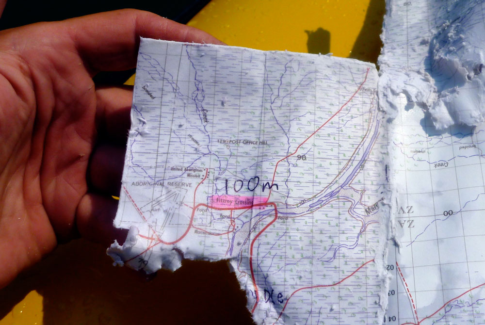
My watch had packed up days ago and for some reason the last topo map was printed on toilet paper and had quickly disintegrated. An old guy was walking his dog over the ford and as I lifted my Alpacka over the concrete rim I asked the time and how far to the bridge – groaning when he said about 4 or 5 kilometres. Oh well, about another hour then.

I attacked this final stage non-stop in one last burn up, but after 16kms I was fading. It was hot and I only had a 750-mil bottle of water. Having passed a dead animal and other rubbish, I didn’t fancy the river water down this end, and now the river was no longer wild, I was keen to get the job over with.


Another sandy, shallow bend. I hop out to wade, sink over my knees in quicksand, crawl out, stagger on, get back in to paddle a bit, ground out and go through the whole cycle again. Jabiru storks carved the airwaves overhead and Brolga cranes danced about on the sandbanks. There were a lot more roos bouncing up and down the banks here, too. But never mind the wildlife, where was that bridge? Surely around this bend… that one… or the next, until finally there it was, less than a mile away (below). Road trains sped across, oblivious to the tiny raft below with its paddler, up to his hips again in quicksand.

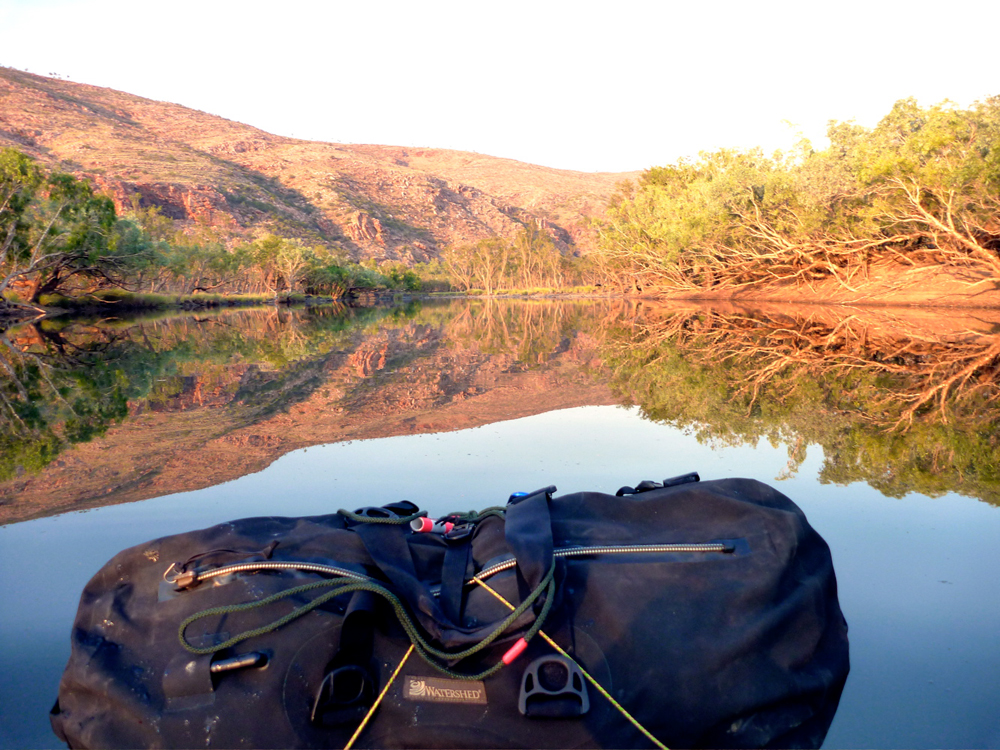
Presently a shadow passed overhead, but it wasn’t a flood-battered river gum or a rustling cadjeput; it was the bridge on Highway 1 which ringed the entire continent of Australia.
Worn out and parched, I filmed a final, slurred p2c and headed for the steep bank to pull the cork out of the Alpacka one last time.

Gold Fever & Garlic Bread • Packrafting the Fitzroy 4/5

• Fitzroy 1 [intro] • Fitzroy 2 • Fitzroy 3 ••• Fitzroy 5

Soon after dawn we stood on a small hill overlooking our camp down on the sandbank (middle point map left or picture right). For the last couple of days we’d spent most of our time in the tree-lined river channels, seemingly separated from the outside world. Here was a chance to see what lay on the outside, beyond the river.

It was the same old gum-tree spotted Australia bush which covered most of the country, but up ahead a particularly thick mass of gums obscured the course of the Fitzroy. It did not bode well for an easy day.

We set off a little later than usual, wading and paddling the shallows, but mostly walking with our boats. We passed Munsters Pool as marked on many maps, but it’s just another part of the river with a few cattle milling around. The flow braided and at one point I idly took a left stream while Jeff just ahead went right. I assumed they’d join up which they did, but not for 20 minutes or so by which time we’d lost touch with each other.
I’ll let the video above show how events unfolded, but I knew soon enough was my mistake for not following the one in the lead, even if that path might end up a dead-end. I’ve experienced this kind of unintentional separation several times in the desert on motorbikes: everyone knows best so you diverge round an obstacle as you think your way is better/easier and will soon join up anyway. Your path goes astray and round the other side you don’t meet up. The one ahead goes back looking for the one missing, the one behind thinks he’s way behind and rushes on ahead. Cue wasted time and frayed nerves.
On this occasion, once I stopped I was pretty sure Jeff was behind me, and sure enough, 40 minutes later he walked in from upriver after backtracking all the way looking for me, giving up and carrying on. Although we were both self-sufficient, from then we vowed to stick together – it was better for the film!

Soon after that we has smoko and tensions eased over a cup of tea. As we gathered wood I found a plastic bin lid which made a great over-sized frisbee and which Jeff later adapted into a seat to keep his butt out of the swill. Very soon that bin lid became handy as I came across a rich deposit of alluvial gold, sparkling in the shallows.
Jeff swilled the sediment around while I filmed, and very soon we had some colour. There certainly is gold in the Kimberley; WA’s wealth was founded on it in 1885 with the original gold rush at Halls Creek, the next town down the road from Fitzroy Crossing. And since pre-industrial times the low-energy method of surface mining has been to divert rivers into torrential ‘hushes’ which scoured away the topsoil to reveal precious mineral veins or ore. The 2011 flood on the Fitzroy had clearly exposed riches beyond our wildest dreams and I’d have to beat Jeff to death with the bin lid to get my hands on the treasure.
In the end we came to our senses and recalled that the lady’s assertion in opening line of Stairway to Heaven was most probably deluded.

The day proceeded to warm up with a series of short pools, very often preceded by tiring quicksands where the shallows became waterlogged. Elsewhere progress was slowed by log jams where the flow was forced into the trees lining the main channel which has become choked with sandy sediment dropped by the river after the flood. But along the entire route the Kimberley soundtrack of birdsong kept us company with its squawks, whistles, warbles and chirps. Today we saw a few blue-winged kookaburras and a couple of rainbow bee eaters along with the usual procession of egrets and cockatoos. In my guidebook-researching days I knew them all by heart and it was fun to jog my memory or be able to name what I saw.


Up ahead a welcome pool promised some steady progress – even Jeff was getting to like to the effortless paddling now. But very soon a strong reek of guano or urea choked the air, with the below water covered in a skanky film. A huge colony of bats where clinging to the river gums along the left bank, and with a shriek took to the wing as we slowly paddled by. Jeff explained the reason for the stench was that bats pee on themselves in an effort to keep cool.


At lunch I called Fossil Downs station to notify them a little late that we were on their land, (as they’d asked us to do). The old lady there seemed quite inspired by our mini adventure along the river which she’d never really seen but which watered most of their land. Still in the hands of the same family, Fossil Downs was established in 1885, making it the oldest cattle station in the west Kimberley. Although I’d never been there I’d always been in intrigued by tales of the comparatively palatial homestead and its marble flooring (or some such). In the Kimberley most station homesteads were functional affairs.

Final episode

Just as yesterday, within a few steps of lunch Jeff got another flat, but fixed it in a jiffy by rolling the hole up with superglue and applying a duct tape bandage for good measure. We pressed into the afternoon, squeezing under trees or lifting the boats over or around fallen logs. At one point a rather mangy bull stood in our channel, sick and clearly agitated. Normally the cattle ran away; this one tried but got stuck in quicksand and didn’t have the strength to gallop up the steep bank. It turned round and came back to stand its ground. Filming all the way, Jeff got a little too close and the thing lowered its horns and ran at him. Eventually I crawled up the steep bank, and from point downstream but safely out of reach, coaxed the ailing steer upstream past Jeff and our boats by throwing sticks.


Since the bat colony the surface of the river had been pretty rank which didn’t add to the ambience. More bat colonies followed, and about 4.30 we came across another piled-up sandbank which filled the whole channel while the flow took off left into the side trees. A knot of fallen trees required lifting round to continue so we called it a day just as a helicopter flew overhead. With cow crap and bat shit all around, it wasn’t a great spot, but would have to do as we were just about finished for the day. In fact we’d done better than we thought: 10 hours to cover 26 clicks according to the map, and not far from the second Big Bend which led down to Geikie, possible ranger issues and the final big run on wide open channels.


That night Jeff prepared a brilliant garlic damper which we cooked on the coals. Real food – you just can’t beat it! It had been a hard day to end at a grubby camp, but we felt we’d finally broken the back of the Fitzroy. 


Quicksands and Crocodiles • Packrafting the Fitzroy 3/5

• Fitzroy 1 [intro] • Fitzroy 2 ••• Fitzroy 4 • Fitzroy 5

We were up again with the light, ready for more ankle-twisting boulder portages like those which had slowed us down yesterday afternoon. Little did we know that the day would turn out to be one of our best on the Fitzroy.
Back in our boats, within minutes of leaving the camp, we emerged in an open area of rocky outcrops and knotted rapids, like the lower reaches of a mountain stream. Little crocs basked either side on the sandy banks.
As the day developed we ended up towing our loads along shady shallows, as effortless as walking a dog. The occasional quicksands, log jams, jumpy cattle and the Bestway’s first puncture only added to the day’s adventure.
We ended up camped on a broad sandbank below granite hills after a great day on the Fitzroy. Let the day’s filming and gallery below tell the full story.

Packrafting the Fitzroy 2/5

Fitzroy 1 ••• Fitzroy 3 • Fitzroy 4 • Fitzroy 5

The video above covers Day 1 (previous post) and Day 2 which is this post.

By 5am the sun had risen somewhere behind the ranges and it was light enough to get stuck into our first full day on the river. I’d slept well enough on the unrolled tent under a thin blanket and all my clothes. Some time around 3.35am a hot, phantom wind had blown through our sandbar camp from the northwest. I’ve experienced these lost night winds elsewhere in the desert and always wondered where they come from and where they went.

Like us, in the cool of the morning both boats were a little flaccid after yesterday’s exertions, but Jeff was relieved to find his Bestway was still holding good air. Even then, after a brief paddle he decided to walk the remaining five kilometres to Dimond Gorge. Me, I was pleased to stay on the water, even if it occasionally meant skating across slime-covered rocks when dragging the boat through shallow rapids (left). Right along the length of Fitzroy, another six inches water and just about all rapids could have been run in our boats, but I don’t suppose it works like that.

Jeff was now out of sight somewhere in the woods and soon enough the flow got shoved off the main channel by a blockage to burrow into the fringe canopy of trees where birds twittered and water monitors glared. This benign riverine underworld was a habitat I’d not anticipated, but was one of the most pleasant environments we found on the Fitzroy. Like a Damascene souk, shaded from the heat and glare of direct sunlight, you felt protected, cool and soothed while cockatoos squawked, rainbow bee eaters darted ahead and lanky-necked egrets stalked the pools. While pushing, pulling or paddling the boat through these cool causeways, I was reminded of that cool picture of Ed Stafford hauling his heavily loaded Alpacka through the Amazonian swamp.

A couple of hours later I was back out in the open and squeezed the Yak between two rocks to slip into the top end of Dimond Gorge (above – downstream, and above, looking upstream). MWC left a few canoes here for day visitors and I pulled over alongside them, stripped off and dived in. Jeff turned up about 15 minutes later but it didn’t look like he’d enjoyed his bush walk and he simply dropped his dinghy in and set off along Dimond, knowing I’d catch him up soon enough. The headwind already funneling through Dimond from the plains didn’t improve his mood.

Presently the gorge turned left to break through the ridge and soon choked on the effort. It was here that the dam proposed over 50 years ago would have been sited, to match the Ord Irrigation Scheme near Kununurra in the East Kimberley. Although the idea gets revived once in a while, as things stand the Fitzroy is unlikely to get dammed here.

It was already 10am and with 8 or 9 clicks behind is, it was high time for ‘smoko’ as they call it in out here. As always, firewood was within arm’s reach and soon the billy was on the boil. We’d brought a gas stove in case high winds made real fires risky; on the way in from Broome we’d seen several roadside fires. Most were deliberate, late-season burn-offs, but we’d also heard some ultra-marathon racers had been trapped by a bushfire in a gorge on El Questro near Wyndham and had been very badly burned. If nothing else, it would be extremely bad form to start a bushfire on the station land we were about to cross, but we always lit up alongside the river where things remained damp and cool.

From this point it was about 6km to the next landmark – what we called the Gap, an opening in a low ridge like those found in the West Macs out of Alice, and which here marked the southernmost ridge of the King Leopolds. We’d seen it clearly on the flight in and with the headwinds persisting, Jeff decided to head off across the boulders while I paddled on for a couple of minutes, then portaged a very gnarly section. It looks like an easy  5-minute walk on the aerial picture but let me tell you with the head wind and my unstable pack, stepping between fridge-sized rocks with a boat under my arm was not a dance the Royal Ballet will be performing any time soon. At least the Brasher trail boots both Jeff and I had bought cheap in London were earning their keep here. Out of the shade and off the water, the heat bounced off the rocks, sapping the energy expended in carefully negotiating these rocky portages. I’d have to come up with a better system like Jeff, if these rough portages were to continue downstream.

I put back in as soon as I could, noticing we were now on granite, a little less smooth but also less coated in treacherous slime in the shallows, which made wading easier. Up ahead Jeff was putting in too and despite the headwinds held his own – clearly he was refining his Bestway paddling technique. As the conclusion of the video proves, Jeff was finding his pool toy to be more versatile than he’d initially hoped.

Another sweltering rocky portage led past some sort of sentry box and pipework river left, close to where an outlying airstrip lay on Fossil Downs land. It was a clear run from here against the wind to the Gap and the end of the ranges. We clambered onto a rock for a lunch of double cuppa soup and another hot drink. While the billy boiled Jeff threw out his handline; we’d been assured in Broome that the barramundi (northern Australia’s best know fish), would be huge so Jeff had bought a 30-pound line accordingly. But there was no fish for lunch on that or any other day while we were on the Fitzroy. They must be out there, but the only fish I ever saw where the size of my finger. It’s no wonder the crocs were so stunted.

Beyond the Gap we knew the river would change character as it weaved over the savannah for 60 kilometres towards Geikie Gorge. This would be the crux of the trip. Even though the flight had revealed several long and clear river channels, we’d also spotted masses of thick woodland with no clear path. We looked back at those aerial shots in our cameras to figure out the way ahead. Our goal that afternoon was to try and get west of 126°E and onto the next map sheet, something that in the end we only barely managed.

Soon after leaving the Gap we came to another big rock pile where the river braided out into nothing paddlable. In the mid-afternoon heat, clambering with all my junk was as much fun as roller skating on cobbles while balancing a sofa on your head, and using my packstaff for the first and last time was merely another encumbrance that threatened to impale me should I trip.
I desperately floated across the smallest pool, and when it came to the next big portage I simply left the boat and set off with the UDB pack. It took twice as long of course, but being able to see ahead and use my arms to balance, it felt safer. Perhaps it was hotter than we realised – getting on for 40° maybe? – but even before I turned back for my boat I was parched with thirst and croaked to Jeff, ‘Let’s camp at the end of the next pool’. Whatever the time was, we were beat!

The GPS was no longer tracking as the batteries lasted less than a day, but it turned out we’d put in an 11+ hour day of only 20 kilometres, managing just 5km after lunch. At our poolside camp, I slung the gear into the bank, went for a swim and then drank and drank. Unless I’d some acclimatising to catch up on, this effort in portaging over the big rock bars was not sustainable; fatigue would eventually lead to a mistake and Jeff had already fallen a couple of times.
I needed to radically revise my portaging set up. My yellow Watershed ‘day bag’ was better out of the way inside the UDB which now sat in the boat not perched across the bow. That worked much better for wading and towing while I sat with feet plonked on either side in a suitably reclined paddling posture. Like this I could also access the UDB in the boat if needed, and forward visibility was better too while the Yak’s extended ‘fastback’ tail compensated for the rear-weighted trim. I’d also ditched my cumbersome water bag and now simply drank from the river. We’d brought my Katadyn and used it most evenings. Jeff stuck with it, but I found carrying a full day of water too heavy at the rate I drank it. I took care to drink from less skanky pools and flowing riffles and never got sick.


The water boiled and another two-course freeze-dried supper was wolfed down, along with several rounds of tea. Jeff was in bed by 6 – a personal best. It had been a tough first day and now we were heading into the meandering cattle lands we weren’t expecting it to get any easier as the river lost its definition. Jeff wasn’t convinced yet, but as I saw it, the key would be to keep track of the main channel and minimise arduous portaging at all costs by paddling or towing. Even then, we figured that as long as we didn’t get any more tired than we were tonight, and our once-daily bag meals continued to sustain us, we still had five full days of food for the remaining 100 kilometres and could trudge on at whatever daily distance we could manage until it finally ran out. By that time we’d surely be very close to Fitzroy Crossing.

It was a hot evening and out on the pool crocs, lizards or the elusive big fish were splashing about. I pottered around the camp for a while, putting off the unenviable moment when I had to squeeze into my too-short K-Mart tent to grab a mozzie-free night. I was still thirsty as I dozed off. Likely as not, tomorrow was going to be another tough one.

Gorges & Portages • Packrafting the Fitzroy 1/5

See also:
Slackraft Main Page

••• Fitzroy 2 • Fitzroy 3 • Fitzroy 4 • Fitzroy 5

A few minutes after the plane took off from Fitzroy Crossing (see maps) Jeff taped me on the shoulder and gave a thumbs up.
A thousand feet below, things were looking promising. Sam the pilot had agreed to fly us low for the 25-minute run to Mornington Wilderness Camp (‘MWC’) as the direct route closely followed the river which we planned to follow back over the next week.

It was soon clear that thanks to a huge Wet season a few months earlier, there was a lot more water down there than we’d ever hoped for so late in the dry season. It could well be more of a paddle and less of a walk than we expected, and having missed out on kayaking the full Ningaloo a week earlier, I was feeling optimistic.

During the Wet season (Dec-March) when tropical storms converge or a cyclone dumps over its huge catchment area, the 700-km long Fitzroy River briefly becomes the largest volume river in Australia. Expanding in width from 15 metres up to 15 kilometres across the flood plain, the 13-metre-high highway bridge at Fitzroy Crossing gets submerged for days while log debris gets rammed in the upstream side of the parapet (left).

That’s the Wet. By the end of a Dry we were expecting the river to be a string of stagnant, fly-ridden pools necessitating tiring portages. Packrafts make great walking boats of course, but September wasn’t a great time for bush walking in the Kimberley as the enervating ‘Build Up’ (pre-monsoonal heatwave) was on its way. Still, this is the Kimberley, Australia’s pre-eminent harsh and remote wilderness just 15° from the equator so it’s hot up here most days. Thirty, 35 or 40°C – we’d just have to keep in the shade. It took a few months to research the Kimberley area, pin down a viable river there, and then narrow it down to a doable section where permission from the various landowners was most likely to be given.

Having got to know the Kimberley’s regular tourist spots as a guidebook writer, I decided our 130-km section of the Fitzroy was a varied but not over-ambitious packboating introduction to the region. Even then, permission from MWC was only finally confirmed the day I flew out of London, and for Leopold station on the day we left Broome.

The way I saw it in a post I wrote earlier, the key to packrafting up here relied on uncomplicated access and exit: fly in from a town or station airstrip and paddle back to it if you can. Rendezvous with helicopters or seaplanes could be left for more ambitious trips. Since I first started visiting the Kimberley in the early 1990s I’ve been planning some sort of bush walk out here, and now finally I was going to get my chance, thanks partly to the advent of packrafts.

If things went wrong on our river there were station tracks not too far off, from where we could get recovered inexpensively in a ute. And there was no saltwater crocodile menace up here, as there is on some north Kimberley rivers draining into the Timor Sea. Like the dammed Ord to the east, the Fitzroy flows south off the massif flows into the baking savannah plains of what are really the northern reaches of the Great Sandy Desert. It then swings back west and northwest to empty into King Sound at Derby, hundreds of kilometres later.

Salties can live in freshwater and can travel far inland during the Wet, but it was very unlikely any would be far upriver at this time of year. Much more timid freshwater crocs are commonly found in the Fitzroy and the nearby Lennard River at Windjana Gorge. We saw plenty on our transit, all bar one diving for cover on detecting our splashes. Although it sounds good for the yarn, freshies are no more dangerous than lizards or snakes, and swimming, wading or paddling among them is quite acceptable.

At MWC we paid through the nose for a gourmet dinner and breakfast, but one last ‘real food’ supper was worth it to save on our supplies of bag food. I’d checked MWC out for the guidebook years ago, but the place was really more of a wildlife sanctuary for studying Kimberley fauna; the upmarket tourism side merely covered its costs. Diane, the manager, was involved in an early morning finch census when we arrived, which meant she was unable to drop us off at the riverside until 10am next day.

We’d originally planned to put in at Sir John Gorge further upstream, but Diane advised that might involve several rocky portages. Dimond Gorge was the other obvious alternative, but that would flush us out of the King Leopold Ranges in an hour or two which would be a shame. So we compromised and got dropped off midway at Cadjeput Pool, all up about 133km from the highway bridge and 20km from Dimond. Cadjeput was at around 180m elevation which only meant an 80-metre drop to Fitzroy Crossing, but as we were soon to find, the river flowed there all the way.

Jeff was in denial over his $30 Bestway Outdoorsman 200 Sport pool toy, and who can blame him. He’d only paddled it briefly in the campsite pool in Broome to see how his load sat. Anything else may have risked a catastrophic rupture. But now was the moment of truth and on the river, paddling ‘backwards’, stern first (these boats are meant for rowing and so have the additional ‘sitting’ buoyancy in the rounded bow), his dinghy didn’t look like it was going to start a bushfire anytime soon.

We set off downstream along the tree-lined pool (right), but within half an hour came to our first rock bar where the river took a 90° turn to the southeast. It was to be a pattern we’d recognise all along the Fitzroy; any significant change of course usually meant a slowing of the current and the deposition of rock or sand into a blockage which the river either worked around or seeped through.

Already mid-morning and hot, unloading the boats and tramping with full packs for the first time (left) underlined how tiring and tedious this was compared to effortless gliding in a raft. Initially Jeff’s view was quite different; walking was preferable to slow paddling, especially as he’d worked out a neat portaging solution. By putting his paddle through the rollocks (picture below) he could position the paddle shaft between his backpack and his back which located the boat securely, made a great sun shade and, with a light headwind, even generated a little lift as he tramped along, carefully avoiding any low branches.

My own boat-on-the-head arrangement using my more floppy UDB as a backpack (left) didn’t work half as well in a breeze, especially while staggering over fridge-sized boulders. Over the coming days while Jeff was happy to walk, I took to the water as soon as I could, until I figured loading the UDB with the weight low when backpacking made it much more stable.

Back on the water, before us stretched a 3km-long pool leading to the next right-angle turn to the southwest around Fitzroy Bluff where a much longer 6km pool and a headwind really tested Jeff’s Outdoorsmanship. For at least two hours he span his paddle furiously while I slid along in the Alpacka. Just like Steve on the Chassezac in France earlier this year, Jeff tried various ways of paddling: sitting on the bow, in the boat, swimming from behind. Nothing could shift the pool toy at a satisfying speed short of wearing it as a hat. It sat on the water like a jellyfish in a coma, and with the GPS I measured it running at up to 3-3.5kph while I topped out at 4.5-5kph in the Alpacka. And even to achieve 3kph Jeff had to paddle at twice my frequency, while failing to get a good catch due to the BW’s added width.


The Bestway really isn’t the best craft for touring big Kimberley rivers until you appreciate it costs less than a night’s camping in Broome or five overpriced beers at the Potshot Hotel in Exmouth. I was already wondering if Jeff would stick it out as pushing his water sofa into a headwind clearly ate him up. It was a mild reversal of the situation on the Ningaloo a week or two earlier, although being in the slower kayak there didn’t bother me as much as its handling in the high winds; you’re as fast as you are and here on the Fitzroy the reduced pace suited me just fine. I wouldn’t wear myself out and anyway, I was sure it would take us a day or two to establish an equable travelling pace. Could I carry on alone if Jeff bailed at Dimond tomorrow? What if he damaged it beyond repair and walked on while I carried the packs on long pools. Would that work? All options were on the cards for the coming days

At the next blocked bend I lifted over some logs and took off down a cool, canopied channel (left) while Jeff loaded up to haul over the sand and rocks. At the start of the next pool there was no sign of him, until backtracking on foot and shouting, I found he’d somehow got around me onto the far side of the channel.

In his exhausted haze he’d wandered up a side valley and only realised his mistake on turning on his Garmin Nuvi which had unusually good mapping, even out here (only I carried 100k paper maps). At that moment he looked rather shell shocked – I’d not seen him like that before. Just after the next shallow rapid an inviting sandbar glowed in the late afternoon light. ‘Let’s camp there‘ I pointed, and to my surprise he simply agreed; a mark of how tired he must have been.

We’d covered what I now realise was actually a pretty good 16km over about 7 hours, much of it into a valley-funnelled headwind with little shade and with no food breaks. We’d eaten our fill at Mornington, but that was going to have to change as we got to put in full days on the river.

A fire was easily lit and soon we tucked into the first of our freeze-dried bag meals followed by several cups of tea. By 6.30 it was dark and Jeff had already passed out in his mozzie dome after admitting ‘This is going to be the hardest thing I’ve ever done‘.

The video from this day is on the next post.

Kayaking Ningaloo – Part 2 (Incept K40)

Incept K40 Index Page
Part 1 is here.
Gallery at the bottom of the page.

After a spell of snorkeling in Coral Bay and reading in Exmouth, I drove round to the ocean side of the Cape and met up with Jeff and Sharon near Yardie Creek in the Cape Range National Park. Later they told me they’d had their camp swamped early one morning by the tide, but had an exhilarating run around Point Cloates dodging humpback whales and covered up to 55km a day, all under sail.

But all was not well with our ill-defined status in the national park. Most visitors arrive by car or tour bus and book their camp sites well in advance if staying a few days. Wild camping is not on, but as I’d discovered to my surprise in Exmouth, all of Cape Range’s few campsites were booked for days in advance and occupied for weeks, with newcomers queuing from 8am at the park entry gate near Tantabiddi for any vacancies. Rocking up off the sea in kayaks was highly irregular and Jeff and Sharon had been given a bollocking by the head ranger who reluctantly negotiated a fixed itinerary for us to follow through the park, ranging from 4- to 20kms a day, until we exited the park at Tantabiddi.

While waiting for the other two to arrive, I took a quick scoot in my underused boat up Yardie Creek gorge (above), a 2km cleft in the otherwise flat coastline. Official boat cruises run up here to spot bat-eared rock wombats, a trip that I must have done in my time when updating the guidebook. But even running Yardie in my own boat, I thought by WA standards this was a long drive to a very ordinary gorge. Send them off to Karajini or the Gibb River Road and leave Yardie to the speckle-chinned wallabies.

I gave my problematic V-sail another spin to remind myself it had not become a complete flop. With a more secure fixture of the mast foot straps and the elastic cord positioned right on the boat’s black nose, it worked well enough in the light breeze, but could still do with some sort of bowsprit (sticky-out front pole) to get the elastic clip still further forward – a solution that’s easier than making alternative mounts for the sails masts.

I set off to Pilgramunna Camp where a note from Jeff explained that an extramural pitch had been allocated for us boat people. Months earlier I’d spent ages on the DEC website looking for kayak touring regulations in Cape Range but had found nothing and so concluded it was the same ‘come through but leave no trace’ deal as at Cape Peron down at Shark Bay.
Turns out there are no formal regs for kayak tourers visiting the park as it seems only a few kayak parties pass through each year. But as the park is about 60km long along the shore, you’re going to need at least two nights in the half dozen official campsites which mostly probably need to be booked in advance in the more tolerable seasons. That’s something that is difficult to plan for if coming up from Coral Bay, nearly 100km away.

With our pitch allocated, I set off in my kayak to meet up with Jeff and Sharon coming up from the south. We were soon reunited on the water (above) and shared the stories of our separation. They were low on food so back at the camp were pleased to tuck into a cake Sharon had baked for the trip and which I’d managed to resist eating during my days hanging out.

Early next morning we were all set to complete the less demanding two-day run along the reef up to Tantabiddi, but now northeasterlies turned on us as the back end of a high pressure system moved east over the continent. At least these were conditions I knew the K40 and I could handle, right up to the point when our pace progress dropped to zero.

The winds scuppered any reef viewing opportunities off the boats and a momentary pause in paddling effort saw the boats stall and drift backwards at least as fast as we could move forwards. But here at least were the fabulous azure lagoons and shell-white sands of Ningaloo.

Just before Turquoise Bay we stopped for a snack at which time Jeff took a quick scoot in my empty Incept . He proclaimed my boat was light and fast but my PA sail tension was still too slack or the mast-to-elastic clip distance too short. That was something I’d thought of and re-rigged the front tensioner further forward on the nose of the boat, though I may try the bowsprit idea mentioned above.

That was academic in the current headwinds so Jeff led the boats off on a lead while Sharon and I took advantage of a current the ran along the point leading into Turquoise Bay created by the lagoon filling with overspilled surf which ran out as a riptide through a gap in  the reef. Compared to Coral Bay, there were many more soft corals here along with all the usual fishes. Coral Bay coral gardens got trashed by a cyclone a few years back.

That done we hacked on northwards across Turquoise Bay, busy with weekend day trippers, and occasionally took to walking out boats in the shallows as we’d done in Shark Bay. As we did so we passed a couple of stocky reef sharks as well as several turtles and rays.

By the late afternoon it was clear that after nearly a week at sea, Jeff and Sharon didn’t have the puff to make it to our pre-ordained camp in the portly tandem, so we pulled in on a beach for a much more satisfying wild camp and a great feed laid on by Sharon from a food cache we’d retrieved earlier in the day. To avert any alarm or searches we left a phone message with the head ranger. As the fire died down we dozed off at 8pm and the wind dropped off, promising a good night’s sleep. Its howling was replaced by the distant roar of surf breaking over the reef.

Early next morning we got the break we were hoping for: near still conditions. After forensically tidying up the camp, we headed out towards the surf line and finally had a chance to enjoy a little of what we’d come here for: gliding serenely over the reef just a few feet below, past fishes, sharks, turtles and rays. No need for a mask or glass-bottomed boat today, it was all laid out below us for an hour and a half until the north winds returned us to business as usual.

Mesa Camp came and went, with a report passed to the head ranger that we were breaking with his proscribed itinerary and making our way out of the park that day. Turtles dashed all about as we nosed into Mangrove Bay, a welcome change from the unending string of scrubby low dunes that lined the shore all the way up from Coral Bay, if not Perth itself.

Another spell of wading brought us finally to Tantabiddi boat ramp by which time I’d divined a new paddling technique probably known to all: pushing off the mushy inflatable’s footrests actually enabled a rigid torso rotation which notably increased speed for little extra effort. With energy to spare after only a day or two’s paddling, at times I was even inching past the tandem until we nudged ashore at the ramp. Jeff and Sharon performed a ‘paddle high five’ after completing their challenging 150-km run up from Coral Bay, most of it alone.

The boats and gear got hosed down at the fish station while I hitched back down to Pilgramunna to retrieve the van. It was nearly dark by the time I arrived and I must have spotted and dodged up to 100 ‘roos on the 40-km drive back. I’ve never seen so many kangaroos. The park was infested with bounding marsupials: ‘Ningaroo’ they should call it.

So, I ran out of easy conditions for a good sea paddle through Ningaloo; something I suspected might happen even before I left the UK. But I wasn’t too bothered. I got a couple of days in plus that lovely calm morning and knew that a meaty packrafting adventure lay another 1000 clicks up the road in the Kimberley (see map below). I got the impression from Jeff and Sharon that, apart from the humpbacks and not least the satisfaction of having kayaked the entire way from Coral Bay to Tantabiddi, I hadn’t missed that much. Unlike Shark Bay, here it was the reef that was special, best appreciated in calm conditions or on the end of a snorkel. Otherwise, you might as well be battling the winds anywhere along the WA coast.


I can’t be sure I’d reached the limit of the K40 (as described in part 1), but until I get more experience I’d certainly reached my limits trying to handle the kayak in very windy conditions I’d not normally tackle back in the UK. That still leaves a lot of easy sea kayaking and fun rivers to do yet.


Kayaking Ningaloo – Part 1 (Incept K40)

Incept K40 Index Page

After a great paddle in Shark Bay with Jeff and Sharon a few years ago, we’d vowed to try the more exposed transit of the Ningaloo Reef, from the small resort of Coral Bay, north along the west side of the Northwest Cape through Cape Range NP as far as Tantabiddi boat ramp. All up about 150 kilometres or a week’s paddling.

The entire coast of WA is bare, windy and exposed to swells raised by storms in the restless Southern Ocean, with few settlements and little shelter or natural sources of freshwater to speak of. Only the extensive lagoon of Shark Bay and the reef-protected shoreline of the Northwest Cape provide potentially interesting sea kayaking, sheltered from the daily sea breeze, even if access to fresh water is still a problem.

What makes Ningaloo special is that the continental shelf is relatively close to the shore compared to the northwest coast up towards the Timor Sea. This fact, as much as the presence of the reef, explains the unusual diversity of marine life which led to the marine park’s UNESCO status. Small fish, turtles, rays, small sharks and dolphins live or visit the lagoons between the main reef’ and the shore, while bigger creatures right up to humpback whales, tiger sharks and not least the whale sharks for which Ningaloo has become famous, usually feed along the outside edge.

After a 1200-km overnight drive from Perth, we arrived at the Coral Bay (CB) where Jeff’s first comment on easing himself out of the driving seat was ‘Jee-zus, look at the swell out there!’. The reef lies just below the surface a kilometre offshore here, and the Indian Ocean breaks on it unceasingly, forming a glaring band if ice-white surf, at times thrown 2-3 metres into the air. That wasn’t an undue worry for us as we were planning on staying well inside the near-continuous Reef, but the winds were another matter.

Following weather reports over the preceding weeks I was beginning to wonder if September (early spring) such a good time after all. Asking around, many said a month earlier (as we’d been at Shark Bay) would have been fine – or May, or in high summer between cyclones. Everyone had their own suggestions, but the fact was right now the forecast for the next week (left) was 20 to 30-knot winds from the east or southeast, with gusts half as much again. As a result all fishing and tourist boat charters were cancelled out of Coral Bay.

Sounds grim unless you’re into tough conditions, but the good thing about following the Ningaloo is that it’s easy to bail out and cross the low coastal dunes to a rough 4×4 track that runs just inshore. A few cars ought to pass along it each day, so I figured even though I’d never go out in an F5 or 6 in the UK (where the seas are bigger, the skies greyer and the water much colder), here with reliably sunny 30°C days I’d give it a go as we’d never be far from the shore. We’d considered starting halfway up the coast at Ningaloo Homestead and just doing the less exposed northern stage, but the other two were keen to do the full run from Coral Bay (left). And anyway, getting Jeff’s van in and out along the Homestead’s corrugated access track with his 55-kg Perception kayak on the roof was not ideal.

Sunday Jeff and Sharon drove out to leave caches of food and water at the Homestead and another point up in the Cape Range park, while I investigated logging our route plan and details with anyone who was interested. Turns out that was a short list as most marine activity in Coral Bay was concerned with nipping out through the reef in motor boats for the day of fishing. Kayaking beyond the Bay itself was unknown and I was told within a day we’d be out of range from the local volunteer rescue services anyway. But we had my sat phone, Jeff had a VHF, plus a chart and we had a GPS each. The weather wouldn’t suddenly get much worse; it would be challenging from the start, so we knew what we were taking on.

Monday 6am and Jeff was raring to go; no time for breakfast – straight to the beach from where our mission that day was to cover 40 clicks, even although we had 9 days to cover the other 110 kms to Tantabiddi during which time we planned to linger and enjoy some reef exploring.

We loaded the boats on the shore, set off and flicked up our Pacific Action V-sails. Behind us, a curious crowd of early morning dog walkers had gathered while I struggled to follow a straight line across windy Batemans Bay (‘Coral Bay’). The sea was flat enough but the Incept seemed hard to control as the sail flapped or swayed violently from side to side. I tried to imitate the sail position Jeff was running on his big tandem, but soon even he reckoned it was already too windy to use the sails, so we pulled them in and paddled around Point Maud into the big scoop of coastline that leads north some 60km to Point Cloates below the Ningaloo sheep station.

The wind still blew offshore at this time which helped flatten the seas just as Jeff predicted, but soon a mile-long gap in the reef let the ocean swell through from the left. It rolled beneath us harmlessly and crashed with occasional fury on the sandy beach far to our right. As the morning progressed we tried sailing again. With years of experience and a well set-up boat, Jeff was much more proficient at this, but during the stronger gusts I was again struggling to get to grips with the K40. Where was the 10kph+ rush the PA sail had promised? Testing it in Scotland had hinted at this potential, but now the winds were an order of magnitude greater. One problem was the force of the wind had loosened and pushed my mast feet forward, so lessening the all-important elastic tension which keeps the sail pulled upright, especially at lower angles. At one point Jeff leaned over and tightened the straps (and later I revised the straps to link directly to a couple of lugs) but as the hours passed I could feel myself losing confidence in my boat, too busy trying to control it or keeping up to even grab a drink, take photos or just look around.

At the sandy Bruboodjoo Point we pulled in for a snack after five hours paddling. Unknown to us, there was a camp here called Nine Mile, occupied by self-sufficient recreational fishermen. Having already covered 20kms, I wasn’t feeling reassured about what lay ahead, when a woman bathing nearby confirmed that the winds were set to get stronger through the week.

We set off again into what was now a strong southwesterly – the daily ‘sea breeze’ which rolls in in late morning along the entire west Australian coast and is known as the soothing ‘Fremantle Doctor’ down in Perth. In this stronger wind I was even less able to sail as steadily as the tandem. We had tried long and short line towing (rather than rafting up alongside) but under sail or not, the bobbing Incept was all over the place, fouling the Perception’s rudder and at times pulling me over or burying the bow. After a bit of that I decided to revert to paddling, but by now even doing that in a straight line was a struggle.

At the time I couldn’t pin down the source of the difficulty, but I’d probably never been out in such winds. Jeff thought my rudder was ineffective or not articulating fully, but it was doing as well as normal for a mushy foot linkage system with a bit of rudder cord drag due to the packed payload. Could the rudder be too small or short to operate with the sail? Unlikely. Later I wondered if I may have reached the operational limits of the wind-prone K40 – at least when combined with my rudimentary skills. My boat was about as high above the water as Jeff’s, but with much less weight below, and at 17kg, was less than a third of the tandem’s weight. And even with a rudder, it still lacked the sharply defined stern and bow ‘keel-edges’ of a hardshell to enable it to cut and hold a line in the water against back- or sidewinds. As it was, it was a bit like trying to ice skate in slippers; you can work up some speed sure, but directional control is minimal.

This blobby shape is an inevitable consequence of inflatable kayak design that’s difficult to get around until full dropstich came on the scene. The result – with sail or just paddling – was that the light kayak’s hull itself was as prone to back/side winds as the sail, and so weathercocked (back end coming round) as I zig-zagged inefficiently to try and counteract it. Weathercocking is not unique to IKs of course. and I don’t think the boat’s trim (load level – about 30kg) was off – there was 10kg of water right at the stern. It’s just that in the current conditions the K40’s light weight, buoyancy, rounded hull and high sides conspired to push it about on the water, even if those high sides and the boat’s innate rigidity greatly helped limit swamping compared to the bendy Gumotex Sunny in Shark Bay a few years ago. The sail needed more tension to stay up when pulled down low, but that was easy to remedy and I noticed also occurred on the Perception where Sharon had to hold up the upper mast at times.

deeptr

I can’t be certain those observations about the boat’s handling are correct, and perseverance may have overcome them, but even when the K40 had sailed steadily in less strong winds earlier that day, it was still much slower than Jeff’s 20-foot-long tandem whalesharkboat with its bigger 2.2m PA sail. I assumed weights and hull profiles of the two boats would have matched up, but as well as being a hardshell, length has a lot to do with it, so instead of keeping pace with J&S in my new, faster, sail-equipped boat, even when I sailed well I was left just as far behind as I’d been a few years ago paddling the Sunny in Shark Bay. It was all going Pete Tong and I foresaw this was how those stories in Sea Kayaker ~ Deep Trouble begin: “Jeff, Sharon and Chris left Coral Bay in clear conditions but with strong offshore winds forecast. They were equipped with blah blah but had no blah…
As the tandem surged on I sponged out the swill taken on by the towing and a bloke in an alloy dinghy or ‘tinny’ came over to ask if I was OK. It was an encounter that was to pay off soon. I set off again, paddling with the odd small wave breaking from behind. The tandem was fast becoming a speck up ahead. It was decision time because at that moment, without a chance to talk over options with the other two, getting widely separated like this didn’t seem like a good idea. After the unexpected Nine Mile Camp, there was nothing till the Homestead from where it would be more awkward to bail out if I’d had my fill by then. I looked back at the Camp, now a couple of clicks behind. Up ahead the tandem’s sail was nearly as far off with no sign of them slowing down. I decided I’d pull in. Hopefully, the other two would notice that, stop so I could catch up and get the van keys and rejoin them on the less exposed waters north of Yardie Creek in a few days time.

‘Thank God that’s over’ I remarked with relief as I landed and lifted the boat over the exposed coral slabs marking the tide line along the beach. It was about 2pm. I grabbed a bottle of water and set off north along the coast to meet up with the J&S who I was sure would do likewise soon. An hour later I reached a very conspicuous zone boundary post just before a small headland – an obvious place to wait, I thought. I climbed onto the structure and scanned the beach about a kilometre ahead. Was that a boat or just a rock? There was no sign of the distinctive PA sail and after 15 minutes nothing had moved so I decided that they had shot on ahead. Short of something holing my boat, there was no reason for them to think I couldn’t paddle ashore and they knew I had water, food and comms and so could work it all out.

I returned to the boat, finding a handy half-full water bottle on the way, and paddled slowly south into the wind for an hour and a half back to the scattered collection of caravans at Nine Mile. Over the dune I walked to the nearest van where an Australian flag curled and slapped in the wind.

Hello, is this immigration?” I said with a grin to the old guy, mimicking one of the Asian boat people who frequently beach themselves on WA’s shore.
What?”
I saw the flag and thought this was immigration

Clearly my joke was going down like a lead lure.
Oh that, I just use it to see where the wind’s blowin’ from.”
I see.
Pardon me.

Jim was one of the many retired Australians who now far outnumber backpackers up north, as they seek to escape WA’s southern winter. Coral Bay’s caravan parks were full of them and, as I was to find out soon, every site in Cape Range NP up ahead was full of ‘grey nomads’ too. Hardier and better-equipped types based themselves for longer periods at zero-facility sheep station sites like Nine Mile, where rents were cheaper and stays unlimited. Even then, Jim (the guy in the tinny who’d asked if I was OK, earlier) told me that normally Nine Mile would have had 60 vans parked up. The unseasonably strong winds over the past couple of weeks had driven off most of them, leaving just a dozen diehards. With summer on the way and fishing in such conditions difficult in a tinny, Jim was about to head south himself.

I explained my situation and asked whether he had a radio to call Ningaloo Homestead. Many vehicles have these in the north. Jeff had made an arrangement to check in with the Homestead on his untried VHF that evening, so could get my message and leave the van keys there. Jim only had a CB, but he did have Ningaloo’s phone number. He expressed repeated surprise that the other two hadn’t waited once I was so far behind, but I figured they’d recognised I’d had my fill and bailed.

I tramped back to the boat as the sun sank and on the satphone explained the situation to Jane at the Homestead who thankfully got it all in one take. They’d experienced worse kayak dramas before. She’d pass on my request for keys when Jeff turned up there next day to retrieve a cache of food and water he’d left with them just before we’d set off.

Long story short
Jeff and Sharon had stopped just a few kilometres ahead of the point I’d walked to and waited for me till next morning to turn up. When I hadn’t, Jeff walked back to Nine Mile, found out what happened, walked back and continued on towards the Homestead, arriving the next day.
Separated by 10-15kms that night, we both had rough nights of tent-flattening winds after which the site host at Nine Mile offered to drive me back to Coral Bay where he was heading anyway with his laundry. At the caravan park the host and I set to the van doors with coathangers and zip ties until they yielded. Though we couldn’t get past the immobiliser to hotwire it, the van became a handy base while I worked on a new plan.

By now on the notice boards in town there were Strong Wind Warnings for entire northwest coast of WA. I updated our status with the DEC (parks authority) and, not a little anxious myself now after more calls to the Homestead, a day later finally spoke with Jeff. He apologised for not stopping earlier – I suspect the sailing was just too good and I too had been looking forward to the rush of being batted up the coast with my feet up. His VHF didn’t get through and his walk to Nine Mile explained the day’s delay in getting to the Homestead.

With that sorted out, all that remained for me was to wander around the Coral Bay campground eyeing up likely candidates until I succeeded in persuading a young Brit backpacker that for fuel and 50 bucks, it would be an awesome adventure to drive me 120kms to the Homestead and back in his clapped-out Suzuki banger.

If Jeff’s $1500 van was rough, Rory’s 20-year-old Suzuki Swift truly had three wheels in the scrapheap. Even he admitted it would probably not make it to Darwin as he and his mates had planned. The CV joints clattered like a football rattle and I’m sure the 60 clicks of corrugations along the homestead access track brought the Suzuki’s imminent Big Bang forward a few weeks.

At the Homestead Jane confided that the southern bay up to Point Cloates was indeed the more exposed ‘open water’ stage of the Ningaloo passage and the wind had certainly come up on Monday afternoon. When it blew like that for ten days at a time, she admitted it drove her nuts. But all this as least boded well for the more sheltered northern section of the paddle in a few days time. The car got us back to Coral Bay where I started the van up and headed north to Exmouth, planning to meet J&S at Yardie Creek in three days time.

Part II and a short video

Watershed Bags: Chattooga, Ultimate Ditch Bag, Westwater

‘One Dry Bag to rule them all’

Roll-top dry bags (right) – even the best ones –  aren’t really submersion proof, are they. That’s fine for a SinK with hatches (unless they get flooded), but no so good for an IK, packraft or any open boat on rough water or in crap weather. When I pack for either packrafting or IK I find myself putting roll bags within roll bags to make sure important things stay dry while hoping I don’t flip as I know they’ll not resist a couple of minutes submersion.

A year or two ago I came across Watershed Dry Bags from the US which seal with a big rubber Zip-Lok like seal (see image below) – ZipDry they call it. They’re expensive, but were available in the UK.
In an effort to get one dry bag to you-know-what, I’ve got myself a 30-litre Chattooga ‘day bag’ duffel (below left) and by chance, on eBay an ex-demo Watershed Ultimate Ditch Bag turned up at 20% off (still £130). So that’s actually two bags.

The Chattooga is not quite the rich yellow of the brochures, but a bit translucent which actually makes seeing inside easier when the foam and fleece liner  is not used. That’s another £18, but it may absorb ‘high point’ knocks to the outer skin as well as protect what’s within, though I’ve never used it as it takes up space. The shell plastic is a hard, slippery polyurethane rather than the soft rubbery vinyl of something like a SealLine Baja bag. It’s all RF welded and very solidly built. With the bag top rolled down as it is with a roll bag (not actually necessary) I’ve found this is submersion-proof.  Once in a while a spray of 303 as a moisturiser along the seal grooves helps it seal readily. The bag sits fixed to the mid-floor lashing point in my packraft between my legs for easy on-the-water access, and it fits neatly in the front of my IK and on the back of my bike. I’ve also divined that if things get desperate the Chattooga can work as a paddle float (left). My Chattooga got nicked in 2012 and I’ve since replaced it with another which seems a little thinner and shinier material, but otherwise seals the same. 
I replaced the Chattooga with an Ortlieb Travel Zip.

Ultimate Ditch Bag (more here)

The since superseded Mk 1 Ultimate Ditch Bag (UDB; left) was unique to Watershed; a plain, big 96-litre duffel with basic detachable backpack straps, handy grab handles on each end and accessed by a single tough, dry suit-style waterproof zip, rather than the press-together ZipDry closure as with the rest of the ‘civilian’ Watershed range. My experience with dry suits is that amazingly, these zips actually work long after the material delaminates. Ortlieb have lately brought out similar bags in their usual soft fabric, but using what they call a TIZIP which looks like an ordinary YKK wetsuit zip to me and is only rated to the IPx7 standard (explained in the image right). I spent a couple of hours floating about in my Crewsaver drysuit the other weekend and nothing leaked; the UDB would manage the same while keeping the contents dry, and the fabric is much tougher than Ortlieb’s PVC. You could classify a UDB as ‘IPx∞’.

The UDB also has a complex, chunky inflation/purge valve for compression packing once the zip is done up or even to inflate the bag as a buoyancy aid if you’re in really dire straights and your boat loses air. This is reassuring when paddling a relatively flimsy packraft through a school of agitated swordfish or sea porcupines. If the boat goes flat you have a huge buoyancy aid to keep you out of the water and slow down hypothermia. And it can be used empty as an effective float bag inside a hardshell, folder or decked IK hull to limit the bailing required after capsizing or swamping.

udbb

Apart from my down sleeping bag which might be too much of a risk, I’m now able to simply pack and access things normally in the yellow Chattooga and the UD Bag and so can downsize my collection of dry bags which were gradually taking over the room.
The UDB has proved itself as a functional packrafting backpack for the walking stages – more below, sea kayaking in Australia and remote river packrafting out there too. The good thing is the detachable straps can be modified or replaced with something better, although the UDB lacks any rigidity to carry its weight on a hip belt and as I say below, the shoulder straps’ position is too central. Plus you don’t want to strain those ‘probably-not-for-hiking’ harness fittings and risk tearing them off the bag (although they’re sewn to a patch as left, which is glued to the body, so not much chance of that rupturing the bag – unlike a Gumotex IK bag).

fgw-udb-4

2013: Watershed redesigned the UDB as a smaller, 78-litre duffel now made from their tough, glossy PU-coated fabric, but still with the dry suit zip and purge valve. Or check out their pricier military range of packs, below. IMO while not perfect, harness wise, the original UDB was a better bag. The canvas textured fabric gripped better, didn’t wet out, and the size and shape were just right to slip into a slim kayak or across a packraft’s bow.

Watershed UDB
The 96-litre UDB is big enough to take the raft, a dry suit, paddle blades, tent, sleeping bag and 2 days food

Walking with the UDB
As a backpack the UDB has been surprisingly good at carrying a load in Scotland for up to 3 days (40 miles). Part of the reason for the tolerable comfort was that the UDB’s relatively rough fabric and frameless ‘coal sack’ form grips right across the entire back like weak velcro and so helps spread the load. The chest strap helps greatly too, though I’ve half a mind to try the chunky, wide clip-on thigh straps from my kayak as shoulder straps to get two uses from one thing. It does lack exterior pockets like a conventional rucsac, but that can be got around by having pockets in your jacket or a using a waist bag.

Watershed UDB

Having used the UDB again in Utah and overnight in Scotland, I’ve reconcluded that the shoulder straps are located too much towards the centre of the pack which means that the pack sits too high on your back (see walking pic, top right), making you unstable at times. Loosening the straps to make the pack sit lower but isn’t the same thing as it’ll just be loose. Up to a point you could pack heavy stuff low and anyway, it’s clearly not designed as a full-time pack, but I must say that’s how I’ve used it when packrafting. It’s so convenient to just use it as a waterproof/submersible holdall: chuck stuff in, zip it up and get on the water. Occasionally I run beeswax along the zipper; a bar of soap will do the same and smells nicer. I’ve since got myself a packframe (left) but decided an NRS Paragon pack harness was the best solution to portaging. I used the UDB like this in Turkey.

watershedwestwater

Watershed Westwater
Recently I walked and cycled the Coast to Coast with an ’80’-litre Westwater pack featuring a regular ZipDry seal, thin shoulder straps with chest and an added hip strap. (They now claim it to be 65L) The load was only about 12kg but I found myself unstable in the hills as, with no proper hip belt, the weight was hanging high from the shoulders. On the Lakes stage it was very hot and the back was very sweaty, but it carried OK. Once I got on a bike and the weather broke, the pressure on my butt became exceedingly painful (no surprise there).

The pack is handy in that in dry weather you can simply roll the top over and clip it down, not using the ZipDry seal (as above left) and so easy day access. While sealed up in the wet you know the insides will keep dry. Again, I can see the Westwater working well lashed to a Lastenkraxe packframe with the packraft rolled up beneath it, or in a harness like the NRS Paragon or Flex PR. The only drawback is the slippery texture and shortness doesn’t sit so well on the bow of a packraft  (left) compared to the UDB.

Kayak and Packraft Sails

Page moved here