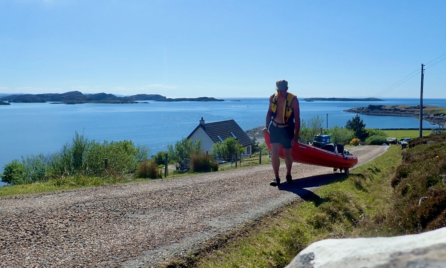
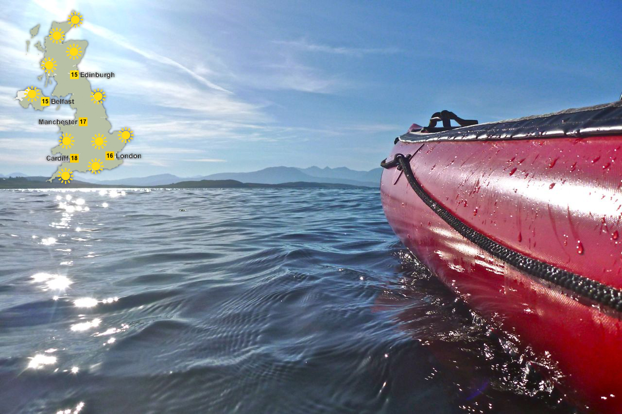
Another forecast of calm winds in the Summers. Or is it? The BBC and YR reports are contradictory: the former has too-strong-for-IK winds from the south; the latter shows light winds from the north. Others show light winds from the south. How can they all be so different? Maybe I should just look out across the water? All looks serene so let’s make paddle while the sun shines. I wheel back down to False Man’s Harbour and set off with two hours before high water.
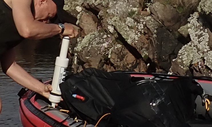
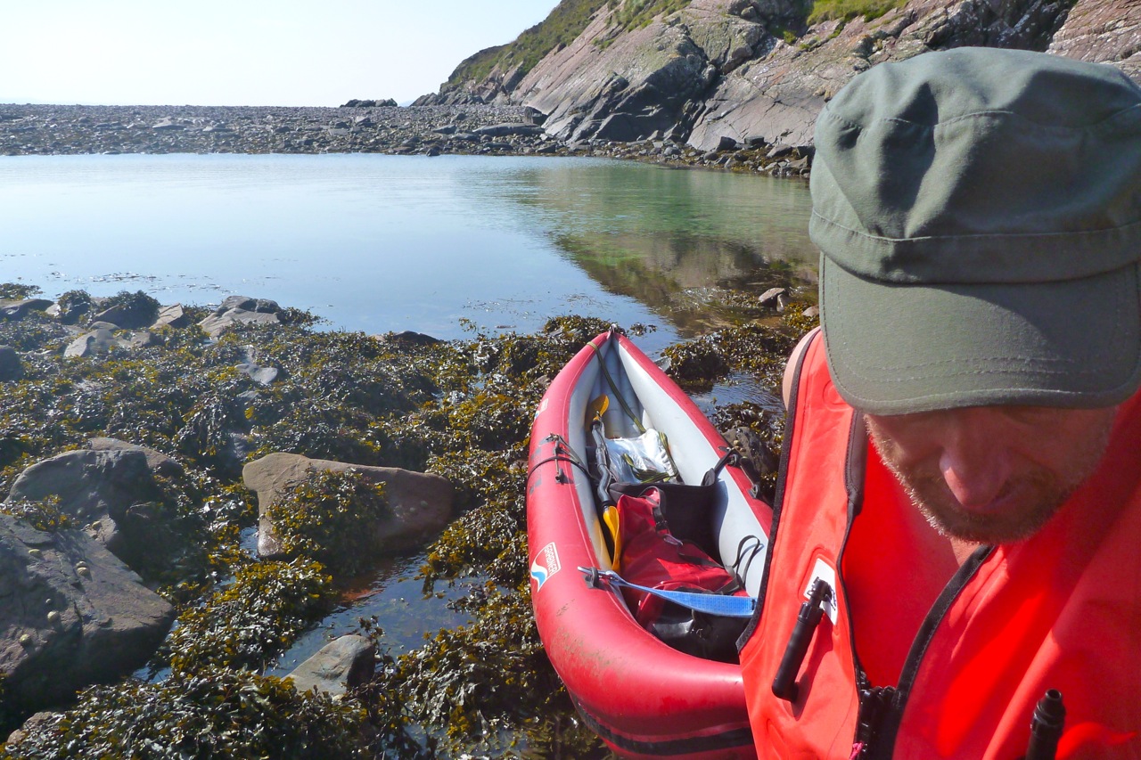
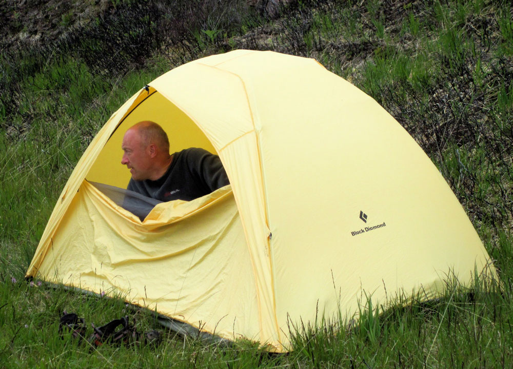
No side PRVs? Am I missing not having added pressure release valves in my side tubes, as I did to my original Seawave? Not really. I am running 0.3+ bar in the sides (official: 0.25) but temperatures up here in NW Scotland are hardly tropical. I try and leave the boat in the shade at the house and de-air the side tubes for a couple of seconds after a paddle, effectively manually depressurising the sides to about 0.2 bar, rather than having fitted PRVs do it for me automatically. The more vulnerable stock PRV in the floor purges automatically at 0.25. On my next paddle I have to top up all three chambers with the K-Pump as I would have to do with all-round PRVs anyway. About 30 kpumps brings the sides back up to over 0.3 bar. The difference now is I use a manometer to check the sides are about right. Before I would just pump until the side PRVs purged. It’s about a minute’s more faffing. As with a lot of things I do to my IKs: sails, rudders, decks and now, trolleys and headwind weight transfer – it’s fun to experiment. But in the end they’re all largely over-shadowed by the simple enjoyment of paddling. With sides pumped to >0.3 bar I find I can cruise easily in the near-still conditions at 6kph.
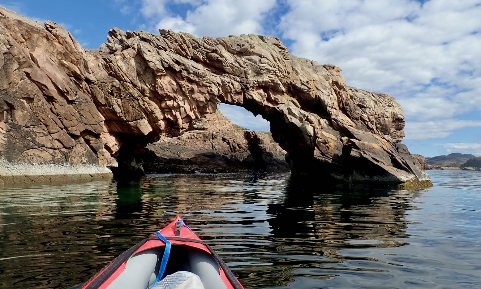
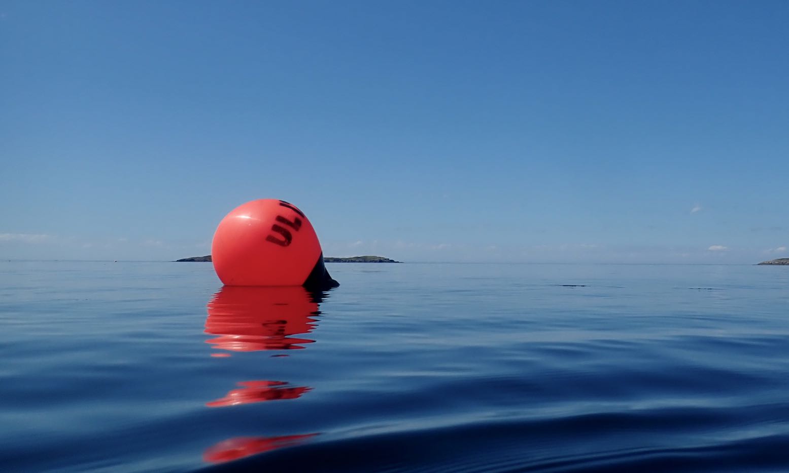
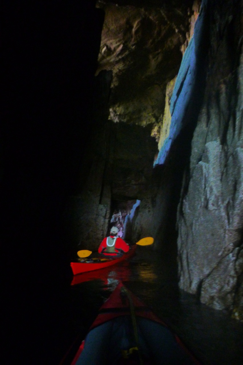
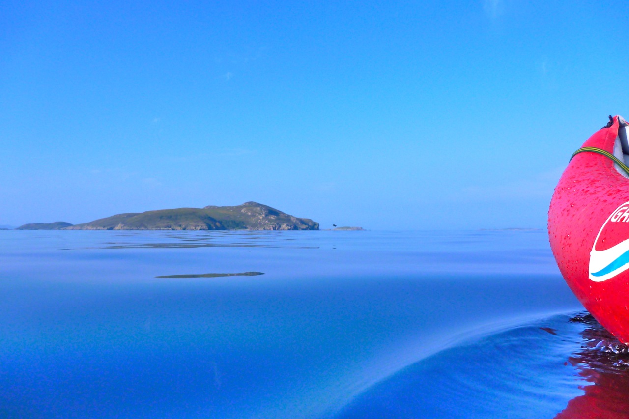
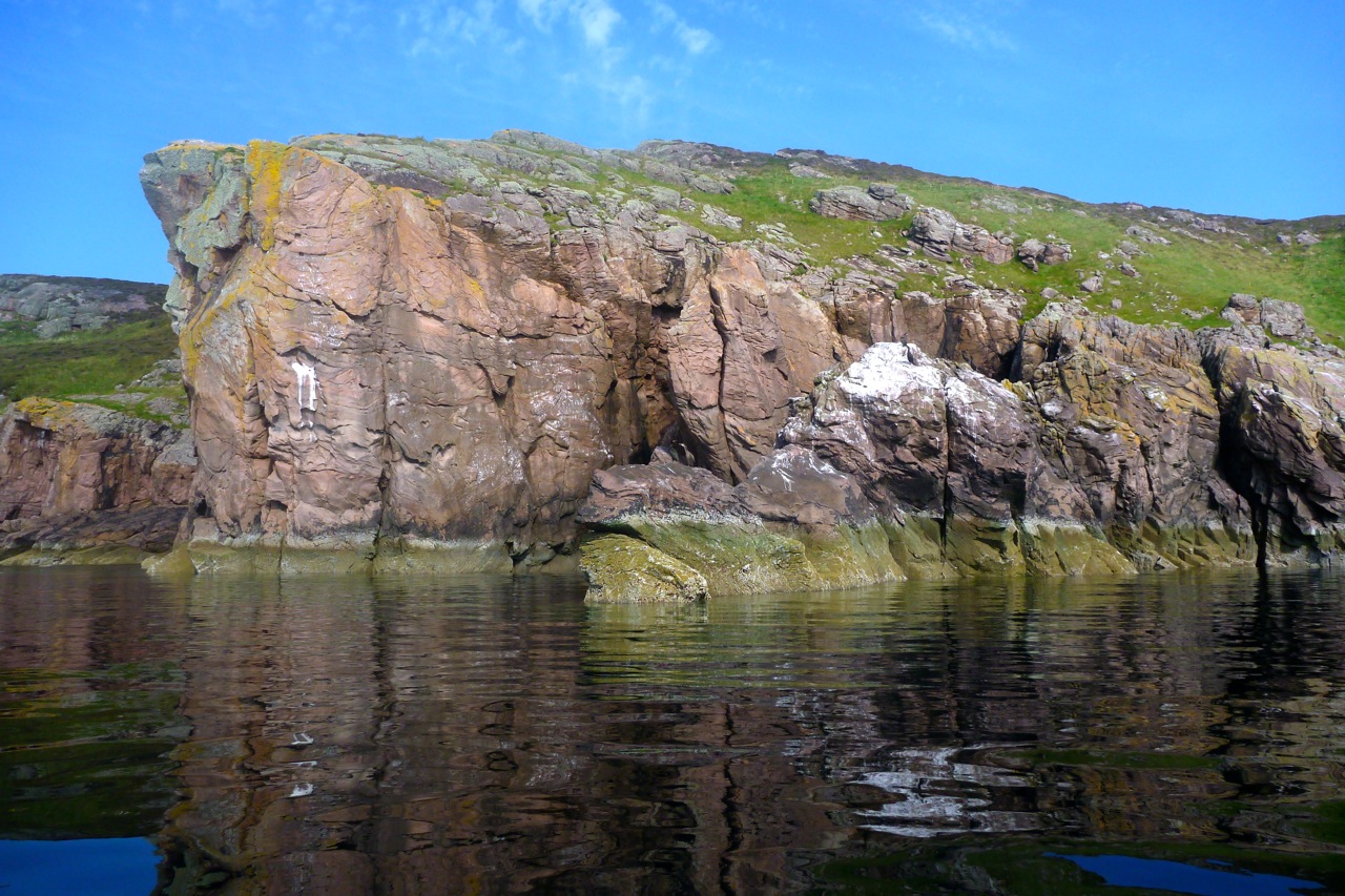
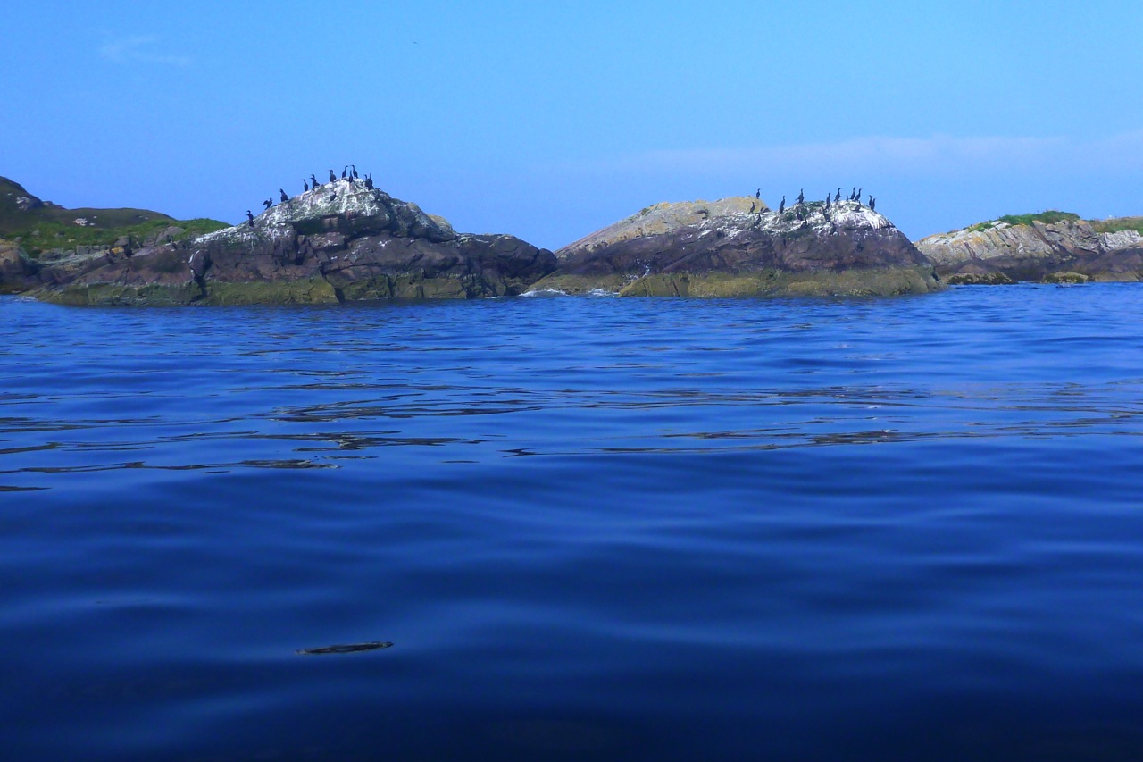
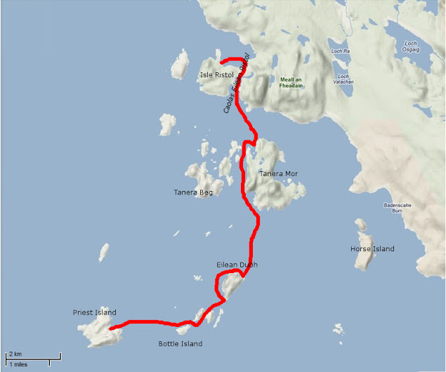
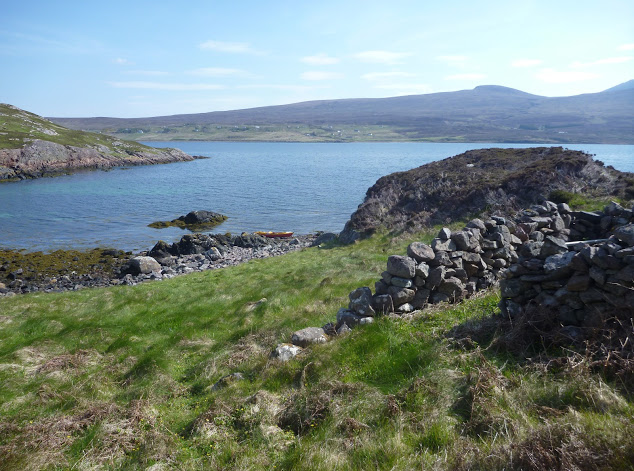
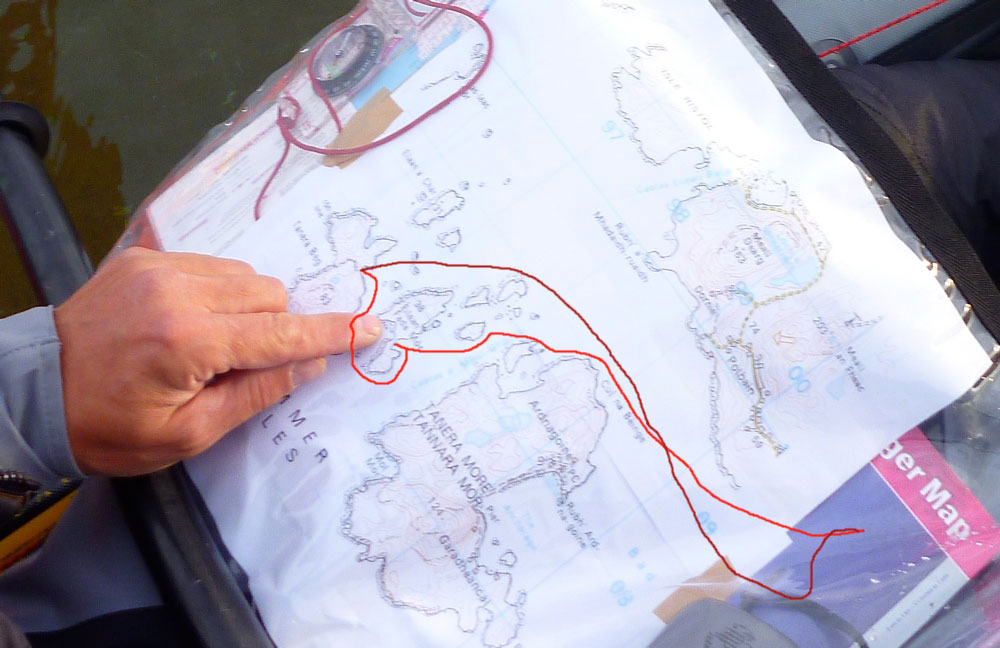
Let’s try and make the outside of Tanera Beg again. Two days ago I got blown off that idea.I fit a compass so I know which way the wind blowsAnd try out my deckbag GPS RAM mount so I can measure, not guess, distancesKayaking tour party mustering at the north cliff of T. Beg.But they seem to be dawdling, as if unsure whether to go ahead.I paddle past and on to the big cave on T. Beg’s south side. That crack at the back might be passable at max HW.The view out south towards the Wedge of Angus and Priest Island beyond.I slip through the popular arch at Tanera Beg’s southeast end.I notice a small second arch. The water is too high and gap too narrow to squeeze through with my Seawave, but it’s only a foot deep below, so the window of opportunity is as narrow as the arch. What would Freud have made of all this arch-threading.Being more exposed to the southwest, Tanera Beg has some deeply weathered sandstone cliffs.Midway through, I decide crossing over to Tanera Mor seems too easy. In the prevailing calm the three skerries to the south don’t look that far. It’s just over a kilometre to Sgeir Ribhinn (‘Stack C’) according to the GPS. That will take 11 minutes. Once there, I fail to notice the double-arched cave we found last time. But this is HW. A guard-bird observes.Over to the south side of Tanera Mor. The new owner is employing scores and spending millions here. New cottages here and there, plus tracks to isolated beaches (for building stones, I was told). They now ask you not to land in the more built-up Anchorage on the north side.There’s even a new house and other construction alongside the tidal lagoon of An Lochanach where I stop for a snack. Two kayakers pass by. Earlier, I could clearly hear them talking behind me across the flat water, long before I could see them.I cross the Bay and stop off on the mainland below our place to collect something.Looking west: a buoy with Glas Leac Mor behind. I recently read that a hazy horizon (Outer Hebrides not visible) means stability; warm, humid air. Good viz and crisp detail = cold air and wind. I head to Altandu, near the campervan-packed campsite.I drop-off and pick up a bucket. Coming back through Old Dornie harbour, a quarter headwind kicks up, pushing the bow left. I use the chance to load the bow with 10 litres of bucket-water. It does seem to make a difference: the bow bites better; no correctional paddling needed, unlike the other day. A good trick to know (I’d brought the drybag up front for that purpose).Another 13-mile day in the Summers, but I could have managed twice as far. How easy IK-ing is without wind. As is portaging with a trolley.
High pressure alert!No, my range of recreational leisurecraft weren’t about to blow, it’s the weather – and that’s not about to blow. Far from it. A high was about to lasso the north of Scotland with its concentric isobars. It may be mid-October but it’s been the sunniest and calmest spell up here for two months. Never mind Indian summer, this was turning into an Arapaho autumn. It all added up to good chance to make a break for that most troublesome and distant of the Summer Isles: Priest Island – or Eilean a’ Chleirich; ‘Island of Clerics’.
Whichever way you look at, it Priest looks way out there for someone used to staying within a mile of the shore. Mainlandwise, it’s over six miles out of Old Dornie, nearly four miles off Mellon Udrigle on the other side, and a bit more from the end of the Scoraig peninsula. Far enough out to need the full length of a good day and someone for backup. Luckily Jon thought so too and rode up late Thursday night with his Peckett & McNabb Scorchio LV.
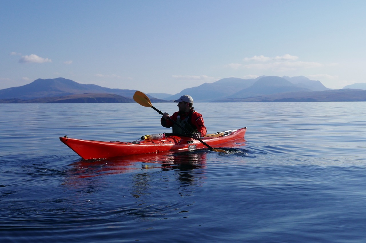
Friday, soon after dawn we were putting in at the top of the tide at Old Dornie. ETA Priest north shore: 2.5 hours. The forecast was a 6mph SE till late morning after which time it was set to drop right off to the southwest. Once clear of the back of Tanera Beg’s lee, I expected things to kick up a bit. But what a difference it is having someone else along for the ride to quell the usual neuroses. Jon agreed that he too would be nervous of taking a run out to Priest alone, and he was sea kayaking by the book: UHF, spare paddle, bluetooth bilge pump and the Semaphore Handbook in six languages, including Gaelic. Of course, this was all in a day’s work for someone like Gael A who was up here a couple of years ago in an Incept K40 at the end of his Scottish Sea Kayak Trail when he wrote.
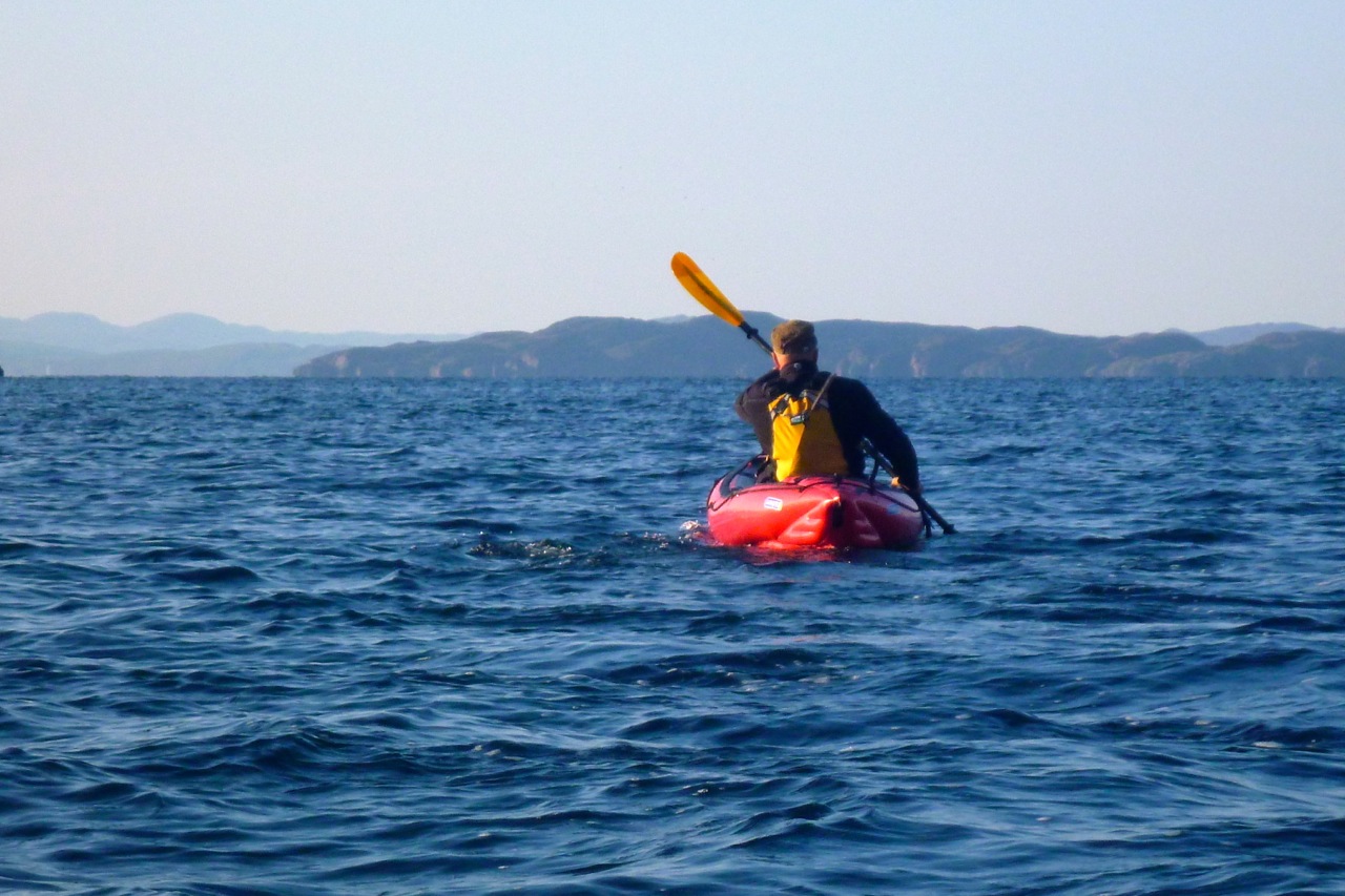
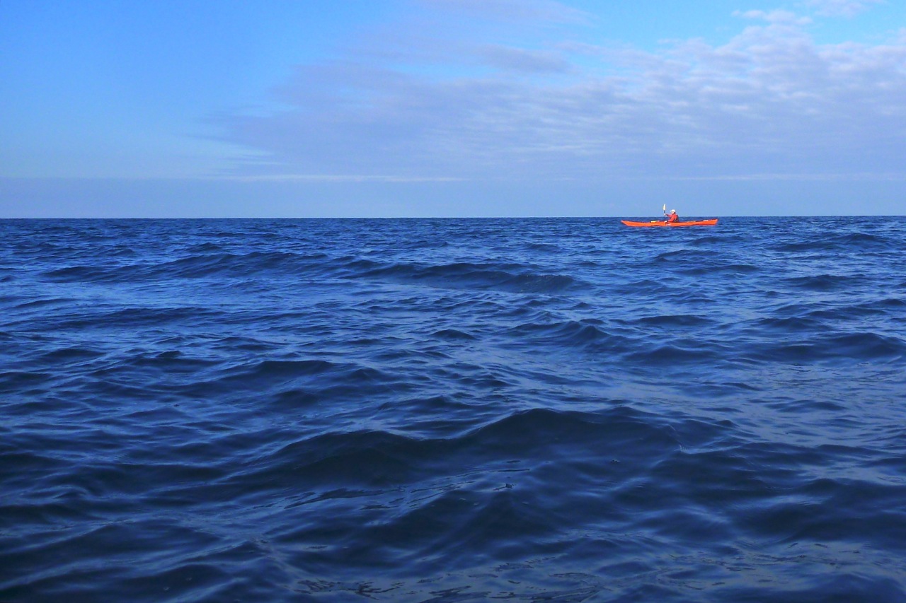
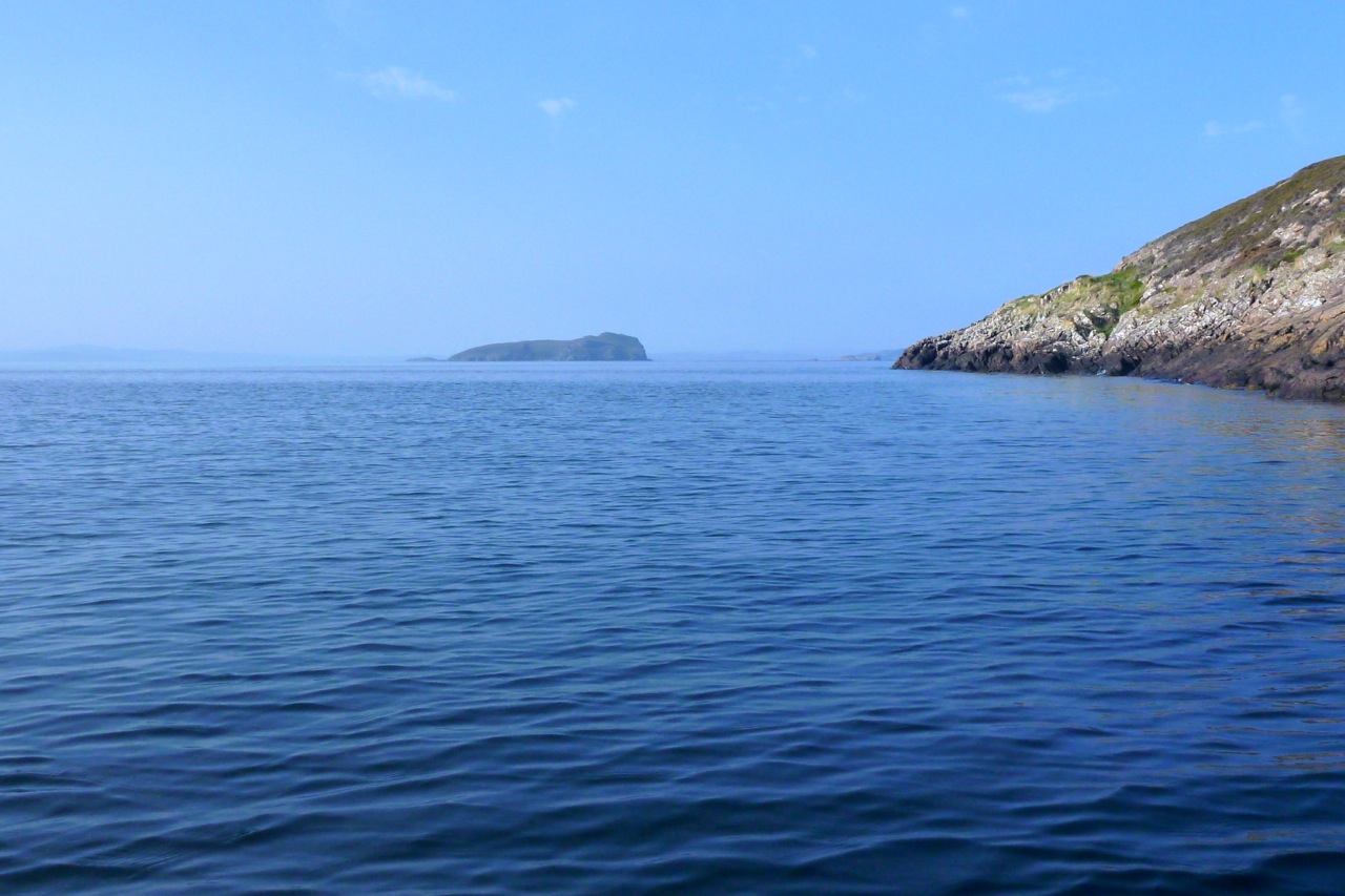
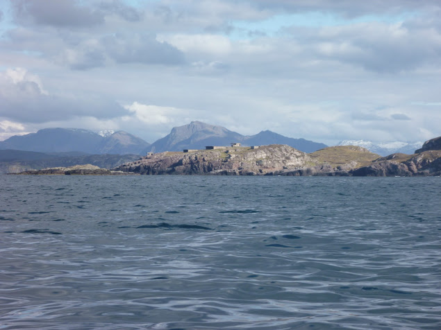
I headed towards the closest, Priest Island some 5km away. Halfway through the passage, the wind died off and the sea glassed over. The uncanny cries of the guillemots emphasised the eerie atmosphere; I felt like I was entering an unearthly space. From the SE tip of the Priest Island I carried on around the west side. It was another paddling paradise with endless features to explore in the good company of seabirds and seals.
Back to now, and I was typically under-dressed, making a concession to the season with some Ron Hill leggings and my warmer pfd. It may have been mid-October but I knew I’d cook in my drysuit and, as I guessed correctly, my high-waisted Kokotat overtrousers would complicate the inevitable pee breaks long before I got to set foot on Priest. Good thing a calm was setting in then. As we left Old Dornie Jon asked me to pull down his jammy skeg, and in the ten seconds it took me to locate it, my arm went numb with cold. Falling in out there would really not bear thinking about. The cold shock would lock your lungs like a slamming safe door. As it was, once past the back of Tanera Beg the sideslap never got that unnerving, and as we sploshed along I knew not to be concerned if the distant dark crags of Priest appeared not to grow any nearer.
Only 90 minutes in the marker of Glas Leac Beag (small green rock – above) came up on the right. I visited the bigger counterpart, Glas Leac Mor the other week, but Glas Leac Beag’s consolation in an emergency was purely hypothetical as the only way to get on it would be to leap from a boat like a frog. Still, we were going quicker than I expected despite the chop and corrections against the sidewind. The skeg-rudder idea of fellow Gumotard, Jim, would have been handy here. Every once in a while I had to give a double haul on the right. Jon’s hardshell worked by balancing the variable drop of the skeg against the force of a sidewind which would otherwise push his stern round: more sidewind, more skeg, or something like that. In that sense skegs are more like optional rudders on hardshell cheesecutters which have no need of directional aids, unlike windprone IK bloats.
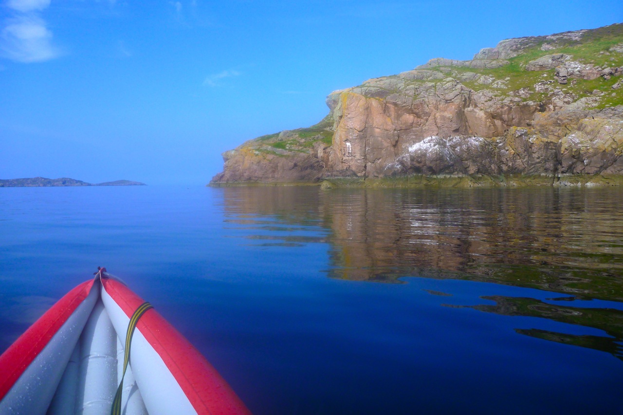
Looking at Priest with the low sun in my face, it was impossible to discern any perspective to the foreshore – it was all one long dark line of crags. The map lay right in my lap but who looks at maps once they’re on the move? I failed to recognise that the bouldered landing beach we were aiming for was further to the east, while we were heading down to the western end. Once I realised that, we changed course and passed the tip of Priest and an arch (not the needle-eye arch on the west end) which only Jon noticed. And as predicted, the wind dropped off to nothing.
We were searching for the cobble stoned beach created by the island’s NE/SW glacial gouging. We put in up a cleft (left) and staggered ashore, but it was all wrong – we had made the deadly mistake of pre-emption: scourge of the hasty navigator! If we wanted to spend any time on land, the dropping 12-foot tide would make getting back out of the cleft tricky.
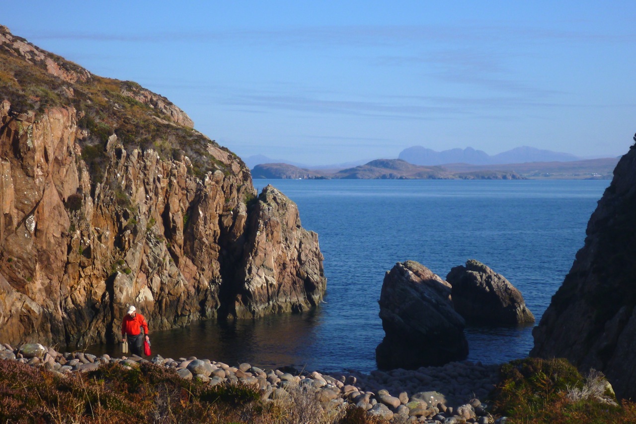
Back into the boats on the slippery seaweed boulders – surely the most awkward and risky part of sea yaking, short of tackling a typhoon. Soon we got to the correct stony beach I’d clocked on Google. A stumbly 5-minute portage from here would have led to the glassy half-km-long Lochan Fada which cuts right to the heart of the island, one of nine freshwater sources on the Priest. But, great picture though it may have made, I was a bit pooped and more interested in ham butties. We sat on a hill overlooking the still lochan when Jon noticed the back of a signboard at the other landing beach. It was a plea by the island’s RSPB owners for visitors to be careful not to crush the burrows and eggs of the 2000-strong colony of storm petrels that inhabit Priest Island.
As it happens that was made easier by a few paths leading from the two landing beaches. One led past the RSPB shed from where I carried on to the south side to check out the ‘prehistoric’ stone circles. The ones I saw (picture far below) looked more like rude shepherd shelters than mysterious Neolithic monuments (there’s more on Wiki), but to be fair, I didn’t see the others just to the north. That was because it took a bit of reorienting to locate the island’s sole ruin, a substantial but roofless four-room bothy supposedly on the site of a sixth-century Christian chapel, suggesting an origin to the island’s name. I was curious to see this place as it’s said in 1975 a pair of unlikely criminals hid out here for a few months, on the run from a collapsing series of scams.
Google ‘Jim Miller and John Bellord, Southern Organs Scandal’ and you’ll soon find Geoff Green’s recent book: Paying for the Past. In it, the author admits to falling under Miller’s mesmeric spell in the early sixties and eventually becoming one of the entrepreneurs’ close business associates. Along with many others, he was invited to make a quick buck by investing in loans to supposedly supply churches with expensive electric organs, and was later drawn into a racy, high-profile lifestyle as the manager of Southern Organs’ GP sponsorship endeavour. Alvin Stardust (right) and other celebs were part of the gang, but then around 1975 the whole cosy investment scam which supported the racing sponsorship began to crumble.
Although he knew nothing of the area, it was Green who came up with the idea for the pair to hide out on Priest Island. They jetted off on a long-overdue holiday to Calais, sent postcards back home saying they’d killed themselves, ferried back to Dover the same day where Green met them and drove up to Ullapool. He then RIB’ed over from Dundonnell to Priest, leaving them with provisions and an inadequate two-metre dinghy with an outboard.
I read the book curious to discover if this claim – that these urbane middle-aged gents (Miller lightly crippled with polio) could really have lived for ‘262 days’ on Priest Island, frying up storm petrel omelettes and brewing peat tea. Over eight months sounded far-fetched for two conmen fleeing a Rolls Royce-champagne-and-helicopter lifestyle before clumsily faking their suicides from Calais, like Reggie Perrin on telly, John Stonehouse the MP, Lucan and more recently, our hardshelled friend, Canoe Man. A desperate, ex-para axe-murdering survivalist might have been able to hack Priest for that long. But with these two, insisting as they did on a chemical toilet, it all seemed improbable. Crofting on Coigach mainland is hard enough. What chance on a 120-hectare island, even with half-a-dozen lochans? On their release they went on to explain in a BBC documentary:
… the island had reaffirmed our belief in the simple things and helped us to clear away a mass of valueless and extraneous paraphernalia with which we, like so many, has cluttered our lives.
Paying for the Past is a bit light on clerical details and dates as, after dropping them off on Priest one stormy September day (a slightly over-written episode with some implausible embellishments, IMO), the author (left) was never to see his friends again. It’s only towards the end of the book that Green suggests they may not have been on the island anywhere near as long as he claims, and once recovered to the mainland, probably used their well-polished charm and remaining cash to secure local support in Ullapool, as explained in the book.
This video is part of a documentary that portrays the events from the point of view of a psychic detective who was hired by the Express, though it wasn’t shot on Priest Island. And for all our man’s alleged clairvoyance, it was simply the police tip-off from Geoff Green (under pressure from legions of debtors and with leniency guaranteed) that got the two arrested in Ullapool. Ironically though, it was Miller’s similar esoteric beliefs in radionics, among other ‘faith healing’ therapies, that founded and then funded what became the duo’s glamourous empire.
When I found the ruin in which they say they hid, it was clearly not your average Coigach crofter’s bothy, but a more substantial dwelling supposedly built on the site of an old chapel, either by a sixth-century monk on retreat, or a banished sheep rustler with a talent for masonry. As a sign (right) we saw on the Dundonnell Estate near Scoraig last week proves, ovine rustling is still an issue here in the wild nor’ west.
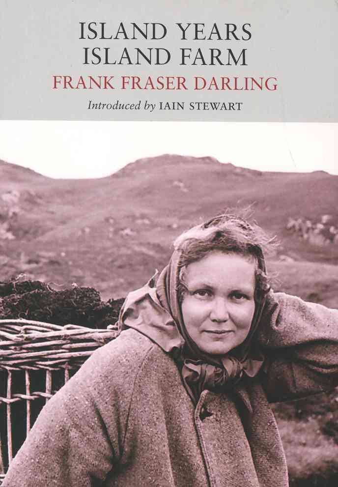
The way Green tells it, it was his auspicious discovery and reading of Frank Fraser Darling’s book Island Years, Island Farm (1943, left) which gave him the bright idea for the pair to hide out on Priest Island until it all blew over. Apparently, Miller and Bellord had holidayed in Ullapool and were fond of the area – that was all it took. Any bushcraft savvy they could pick up along the way. Darling’s Island Years mostly deals with experimenting with sustainable crofting agriculture on Tanera Mor (left) in the early 1940s (Island Farm), but he and his resilient family first tried to give a go for a few months on Priest Island a few years earlier. Having now read that book I wouldn’t say the account of Arctic-grade tents being torn to shreds would evoke a great place for a hideaway holiday, but as we know with northwest Scotland, when the weather is calm it’s brilliant, and when it’s not you just knuckle down.
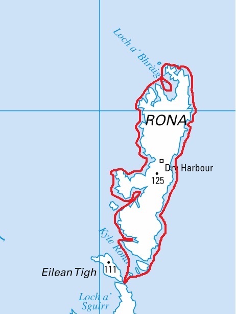
The Fraser Darling family went on to camp on the Treshnish Islands and even endured a spell on North Rona where the author had been funded to study grey seals and their effect on commercial fishing.
Miller and Bellord come across as an intriguing pair, and you can see why their background, interests and activities captured the attention of the media, and why Geoff Green’s 2014 book has gone down well with readers.
In this video published by Green a couple of weeks ago, he returns to Priest Island, but in it he mistakes the hut circles I saw (left) for the bothy which appears on the 25k OS map shown on this page, and even more clearly on Google aerial imagery. It remains as intact as it was in the first, 1979 BBC Everyman documentary featured at the end of the video above, with a bit of unsightly plastic rubbish in the adjacent burn – a job for the next RSPB volunteer visit, or anyone with a bin bag and space.
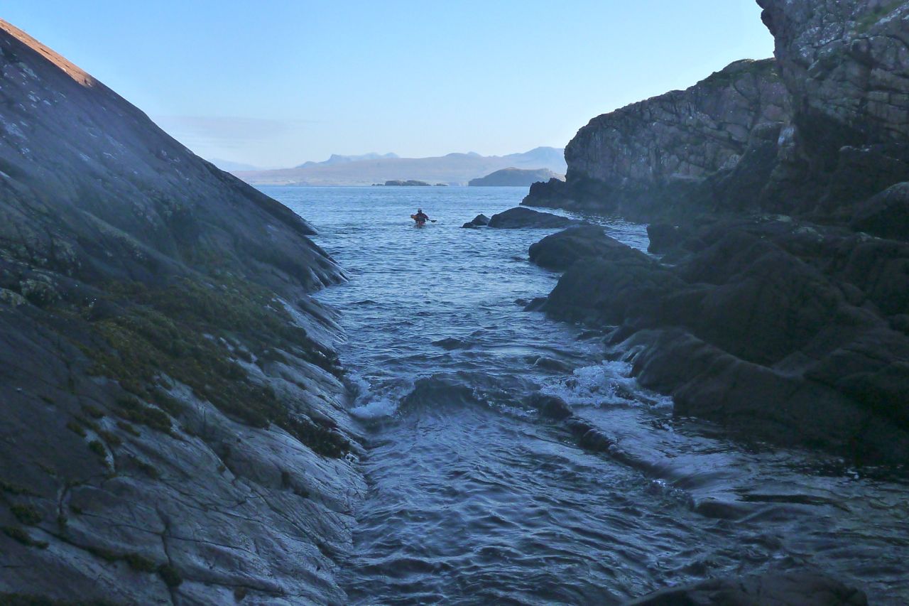
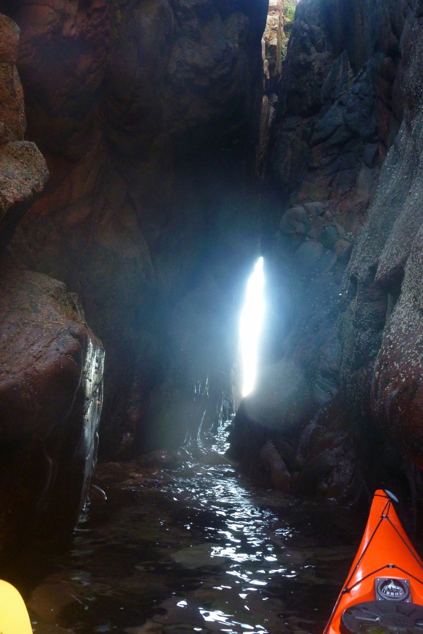
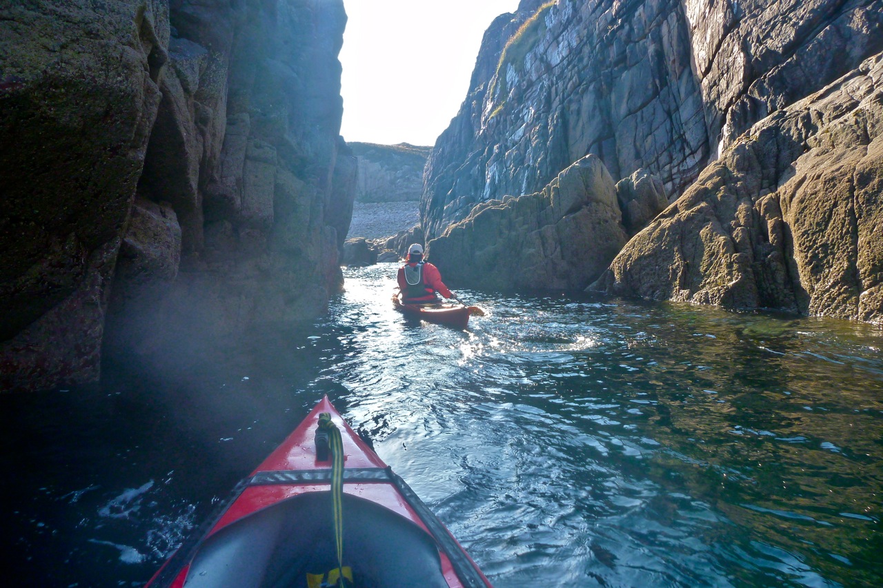
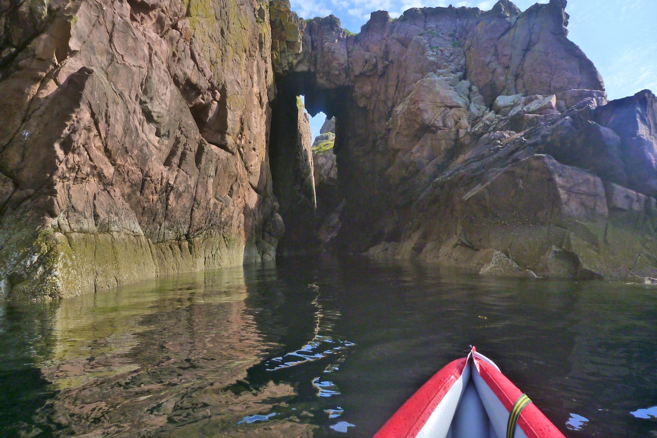
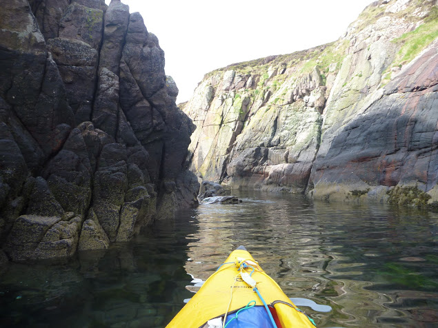
Anyway. Enough true crime confessionals. We returned to the boats and headed southeast across the big bay towards some interesting looking cliffs and clefts. One chasm led deep into the crag with promising daylight peaking out the far end. We edged in deeper, pushing off the sides, and between the swells got far enough through to see there was no way out at this point, halfway down the tide. We tried from the other end, slipping behind the outer stack visible on aerial images, but that too needed at least another foot of water to paddle through. Finally at Aird Glas, Priest’s eastern extremity, we managed to paddle behind a stack and commence our glide across the now mirrored water to Bottle Island.
It all seemed so effortless. We could have aimed at any Summer Isle we chose – over to Carn nan Sgeir even – and paddled straight there with ease. What was all the fuss about? On Bottle I was hoping to lead Jon through the southern passage I found last year, but as on Priest, the water was too low to pass through the narrower exit tunnel (right).
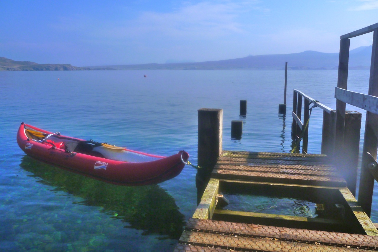
All that remained now was to follow the island chain over to nearby Carn Iar/Deas and from there pass over the sandy green channel of Caolas nan Sgeirean Glasa (I throw all these Gaelic names about like I didn’t just type them carefully off an OS map :–). We pulled in for tea break on the jetty of Eilean Dubh, ahead of the final, six-mile surge back to Old Dornie. I found this handy refuge last year and we agreed that a: the jetty was a bit short for the tidal span and b: even if it’s nice to have a secluded island cabin (right) well sheltered from the prevailing winds, it had a comparatively ordinary view back towards Achiltibuie and a chilly, sunless aspect this time of year.
The tide was on the turn now as we passed Tanera’s tidal lagoon and crossed Badetarbet Bay on home ground. I’d been asked to pick up some heavy bags of winkles somewhere on the north side of the bay on Rubhan na Buaile and drop them off at Old Dornie. But clambering along the grubby shore while Jon towed my boat, neither of us could find any trace of them. There was clearly a need for some CCTV surveillance around here, too.
We got back to Old Dornie just as everything was getting bathed in the same rosy-orange glow it had been when we set out, nine hours earlier. And after 30 clicks of sea paddling and very little similar exercise, I wasn’t as shagged as I’d expected to be, something that I’d partly put down to a lack of tension of not doing it alone.
The Bottle Island run last year was 22km but pushing the bow of the Amigo had been enough of a slog to make me buy the Seawave. I think there’s barely one kph in it, but that’s nearly 20%, and with the Seawave’s many other benefits, not least its sharper bow, I can conclude that, like the name suggests, it’s a better all-round sea boat, and also that Priest Island would be a great place to revisit.
It’s summer time in the Summer Isles and the rest of the UK too, it seems. It’s a little later than usual but we’re not complaining. Feels like the warmest day of the year. Loading the boat up, I realised I sold my footrest pipe with the Solar last week. Darn, I didn’t want to catch the wind so I quickly hacksawed a slice of plastic drainpipe on which the Seawave rests between missions. New XL footrest cut and rigged in ten minutes.
Don’t know if it was this bigger foot-tube but today the Seawave seemed set up just right. Seat, backrest, footrest, thigh braces and operator all working in perfect harmony as we sliced across Badentarbat Bay. I set off planning to gallop around Horse Island but halfway across the bay took a fancy to Tanera Mor instead. It’s a good thing I don’t leave details with the coastguard; they’d never find me if they went looking.
The breeze would be in by 2pm so I kept it simple and headed for a cove I recalled on the east corner of Tanera, just beyond Rubha Dubh Dubh. On the way in, a stream was draining a shoreside lochan into the cove, which looked odd. Then I remembered it was another one of those tidal lagoons which only fill on a spring tide, like Loch of Reiff.
I pulled up to the stream bed in my long red limousine, crossed An Lochanach and went for a wander in the ankle-twisting tussocks. Up on top, I caught a lovely view over the tranquil Anchorage from behind Garadheancal. With all the ruins and usable houses, there are a lot of buildings on Tanera – still for sale at well under £2m now.
Back at An Lochanach the sea had dropped two feet in half an hour and as I was paddling out, my skeg doubtless hooked up a load of seaweed trying to pull through the mush.
I decided to contour around Tanera’s Anchorage, past the flapping salmon pens and pull up again by the post office at Ardnagoine which was having a quite day. All appeared to be in order so I set off back home in the flat calm which usually precedes a wind starting up from another direction. According to British Stomach Time it was definitely lunchtime.
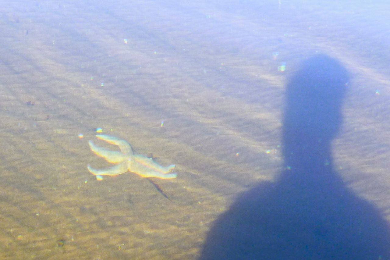
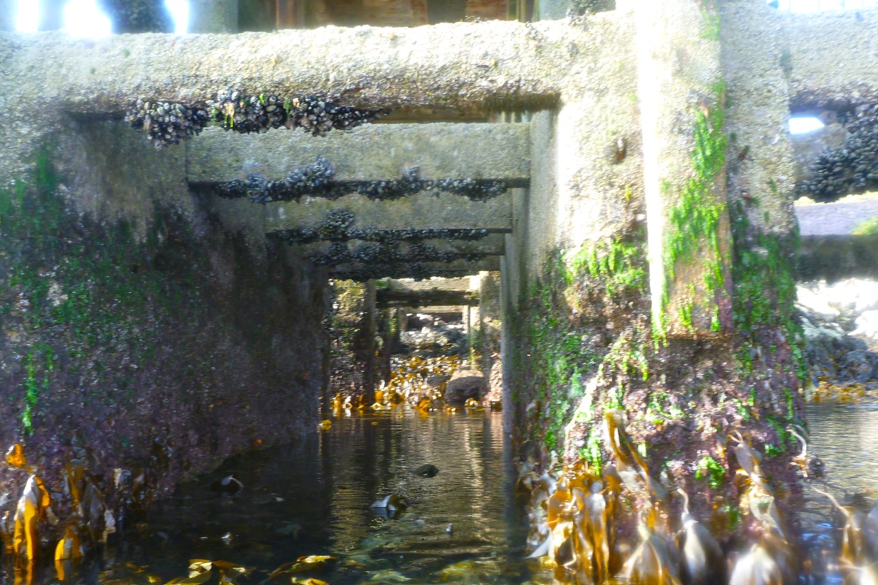
I slipped under the encrusted beams of the condemned pier and was just at the right level to pick off a few mussels for tea. On the way in the wind picked up and the ochre sands were already exposed as I glided over a mangled starfish on the seabed.
With the heather turning purple, mushrooms all over the lawn and a chill in the air, I thought it was all over for this season. But this week we’ve had a reprieve. Sat between isobars so far apart they’re in different time zones, today the Summer Isles are getting one final spell of calm, summery conditions. It could be my one and only chance to tick off the last of the Summer Isles.
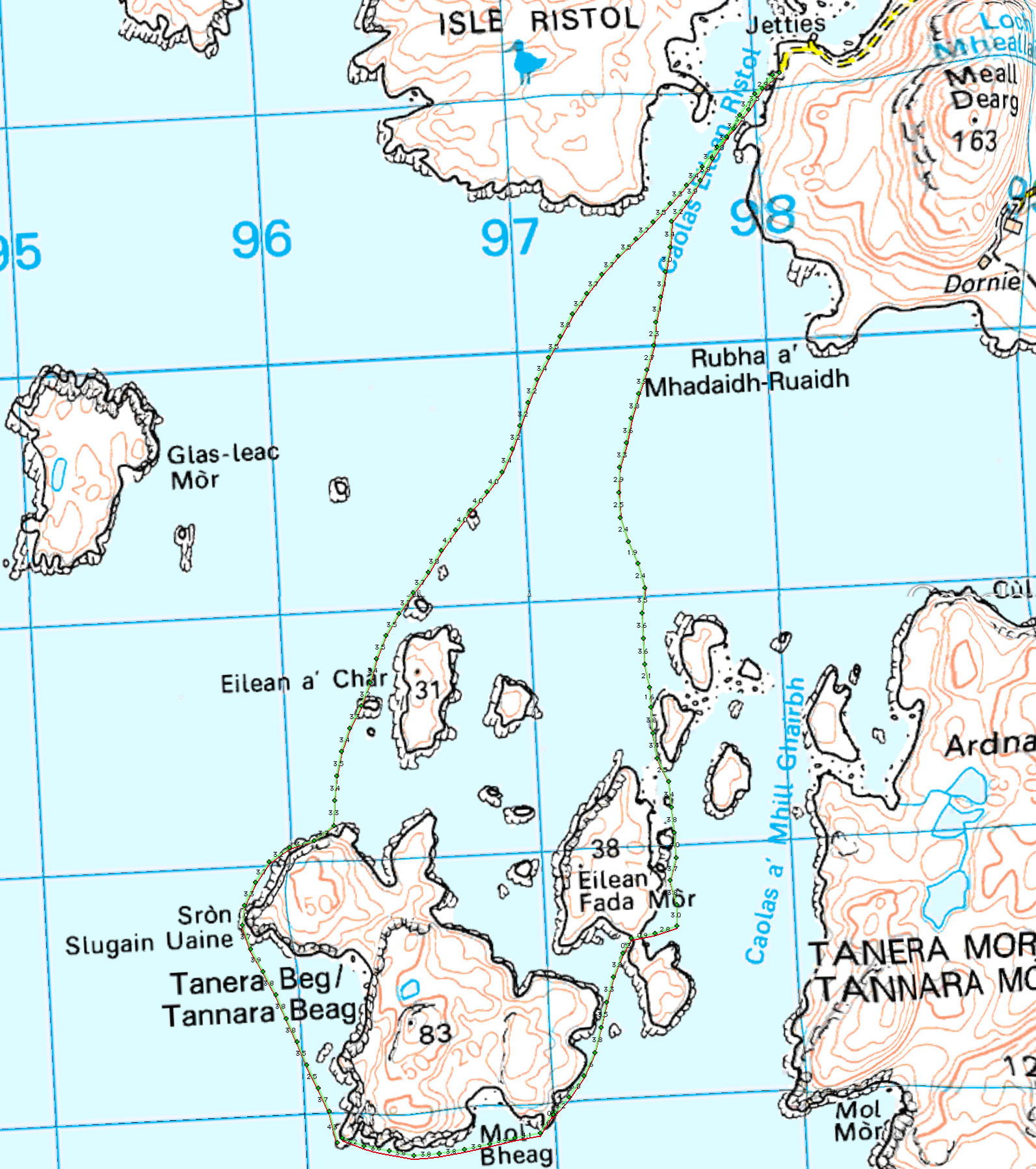
Yesterday we nipped out from Old Dornie to Glas-Leac Mor (map left), another as-yet unvisited isle less than two miles out. Paddling 2-up took a bit of ‘readjustment’ and isn’t half as comfortable for me as my fuly-braced DIY solo set-up. But following a short cruise alongside Glas Mor, we were fully synched for the long way back between Ristol and Eilean Mullagrach.
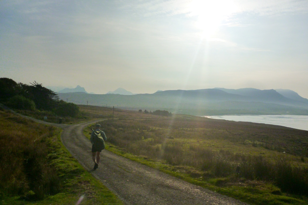
Local internet chatter talked of helicopters dropping equipment to build a dwelling on Eilean Mullagrach, which we could see on the south side. Apparently professional castaway and Lego brand ambassador, Ben Fogle, tried to buy Mullagrach ten years ago, but bid too low, perhaps to the owner who’s developing to now. (Had he bought it, he could have named the 46-metre-high summit ‘Ben Fogle’). With no easy sea access that I’ve seen, you do wonder how they’re going to get to that house. As we paddled through the sound, a little dolphin popped up, huffing and puffing, and some colourful kayaks were taking a guided tour around the isles. The following day’s forecast was for similarly light winds, so I dropped the kayak off at Badentarbat jetty and next morning walked down with my gear.
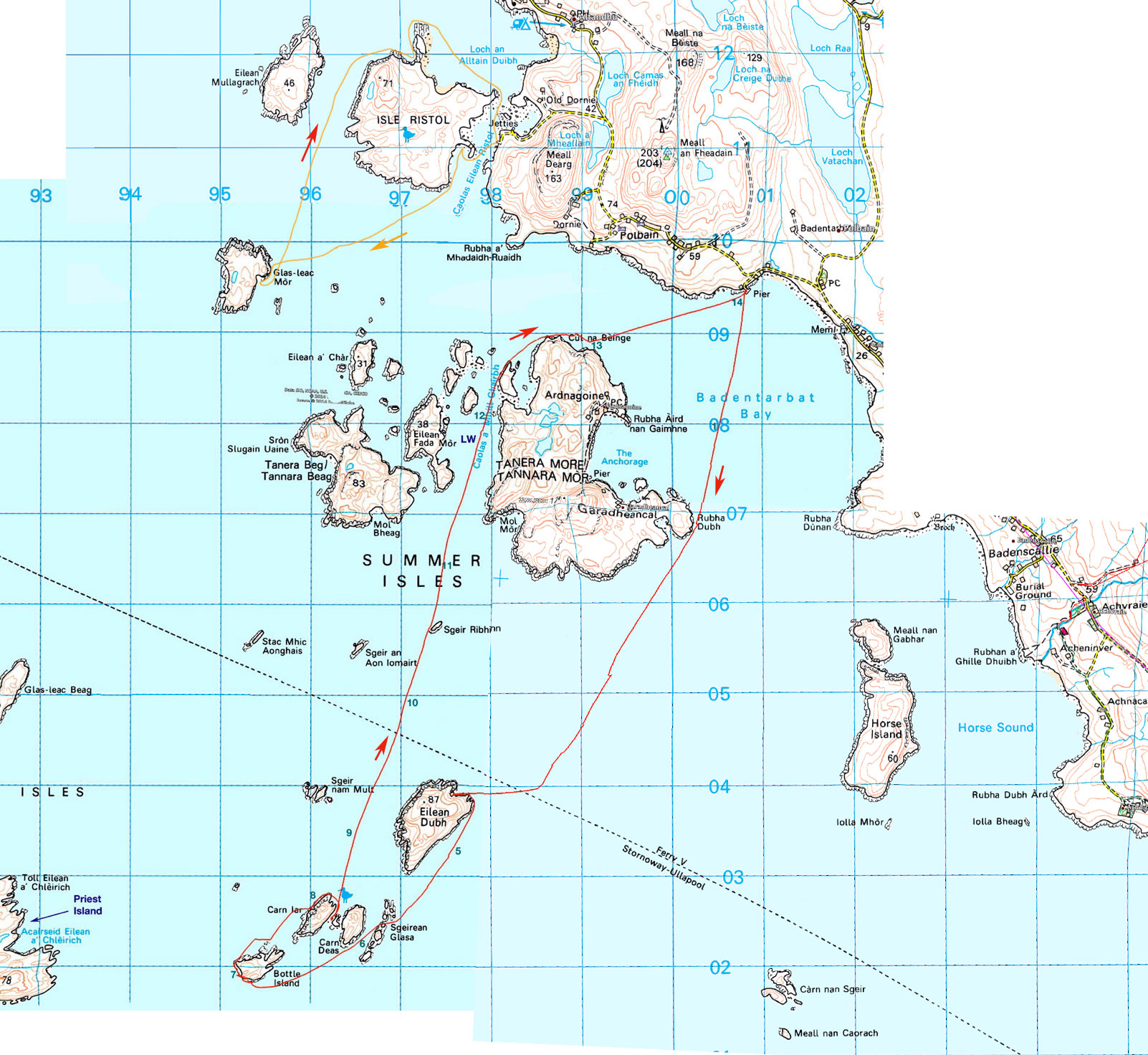
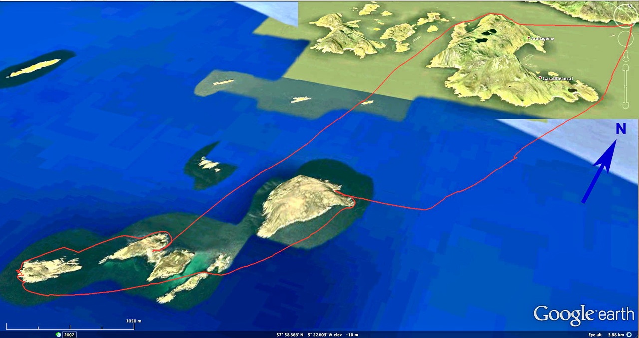
You don’t need a flat calm to visit the inner Summer Isles: the Taneras, ‘Ristols’ and Horse Island. But alone in an IK the outer Summers can feel like a bit of a reach. Priest Island is the most distant and adds up to an 18-mile tour via all the other outer isles, even though you need never be more than a mile or so from an island or inaccessible skerry of some sort. I settled on Bottle Island at the end of a cluster of isles and a 14-mile round trip from Badentarbat jetty. That’s about the same as our run to Ullapool a couple of years ago, but more open water than coastal hop.
The winds would be barely a factor until the afternoon, but a spring tide was at its 5.5-metre peak. I asked tidemaster Gael whether there was anything to consider on my route: he advised the books and charts didn’t list any dodgy currents. I was expecting a bit of flow through channels or around points at peak ebb around 11am, but could always find another way round.
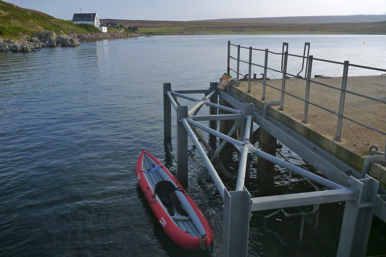
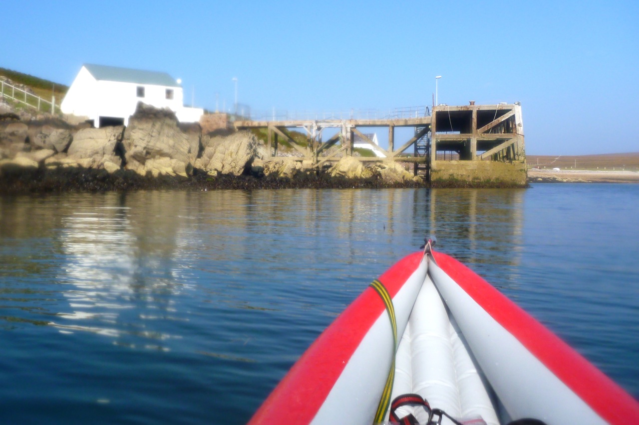
The pier at Badentarbet is condemned and blocked off with a barrier, but locals clamber round for a spot of fishing. I dropped the boat over the barrier, carried it down the steps to the water (right) and was on my way at 9.30, an hour after very high tide. Forty minutes later, I turned the east corner of Tanera Mor (still for sale, btw. Currently under £2m), rubbed the sweat from my eyes and clocked Eilean Dubh, nearly 2.5 miles ahead. Coming round Tanera put me back in a cooling breeze and the boat slid silently across the water as if on rails. To the southeast was Horse Island and Carn nan Sgeir, a remote skerry I visited last year and now floating on the glassy surface like a jellyfish with gout.
An hour before peak flow, at one point I was convinced I was being pulled west on the outgoing tide. I stopped to try and read any drift on the GPS, but couldn’t determine a direction. Turned out later I was drifting at 1mph east or inland with the breeze. So much for the impression of deadly currents. It was a lesson for the day: what you feel is happening (drift, current, ‘wind-in-the-face’ velocity) doesn’t always match the unassailable facts of the GPS. But alone on an all-day run it’s important to know what’s going on: is it ‘me’ or is it due to the conditions – so you can judge how much you have left in the tank.
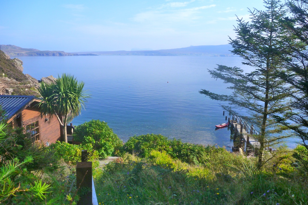
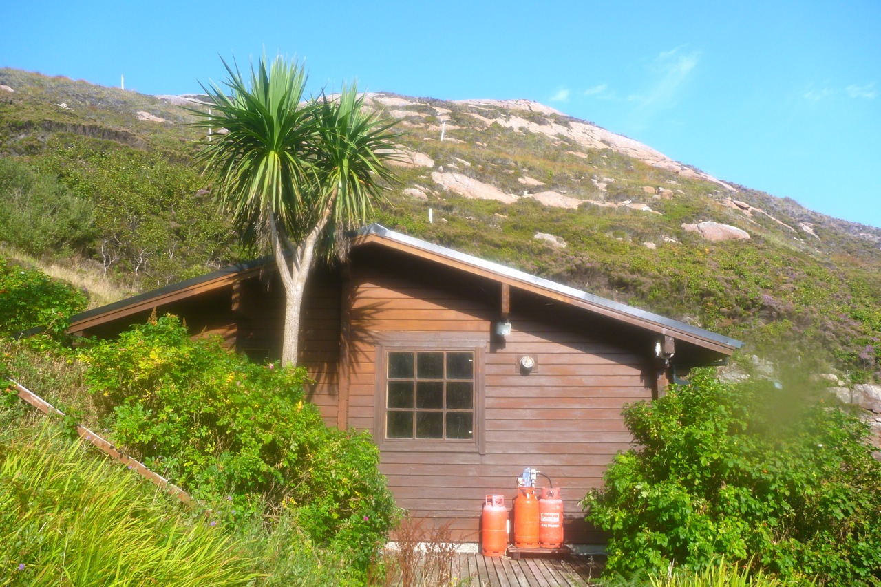
As I neared Eilean Dubh I saw what looked like a chalet in a tiny north-facing bay. A couple of years ago I’d heard about a house in an outer Summer somewhere but couldn’t find it on Google. This must be it (left). With no boat moored at the jetty, I diverting for a closer look. It was certainly the protected setting to build a dwelling: small stony beach for access; sheltered northeast aspect and a burn trickling down for water. Once ashore, the chalet reeked of lovely warm creosote and there was even a palm tree among the firs and other trees. Up the hill in the heather was little shed /painting studio. It didn’t look like anyone had been here for months.
Back on the water and coming round onto the east side of Eilean Dubh, I expected to be paddling against the ebb spilling southwestwards round either end of the island. And that’s how it felt, though again the GPS showed I was doing a normal speed or even faster, briefly hitting 4mph. It’s all in the mind. But when I came through a gap into the channel between Sgeirean Glasa and Carn Deas, I was definitely fighting against something, so moved away for the shores. Just as I did so a Tornado ripped past low overhead, close enough to see the undercarriage.
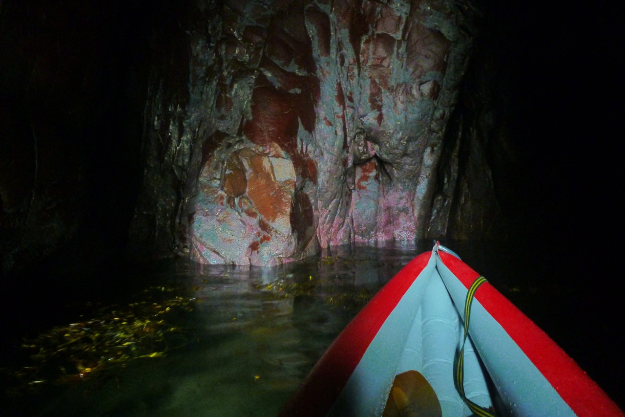
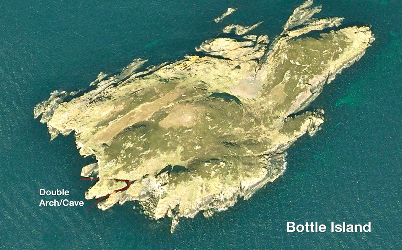
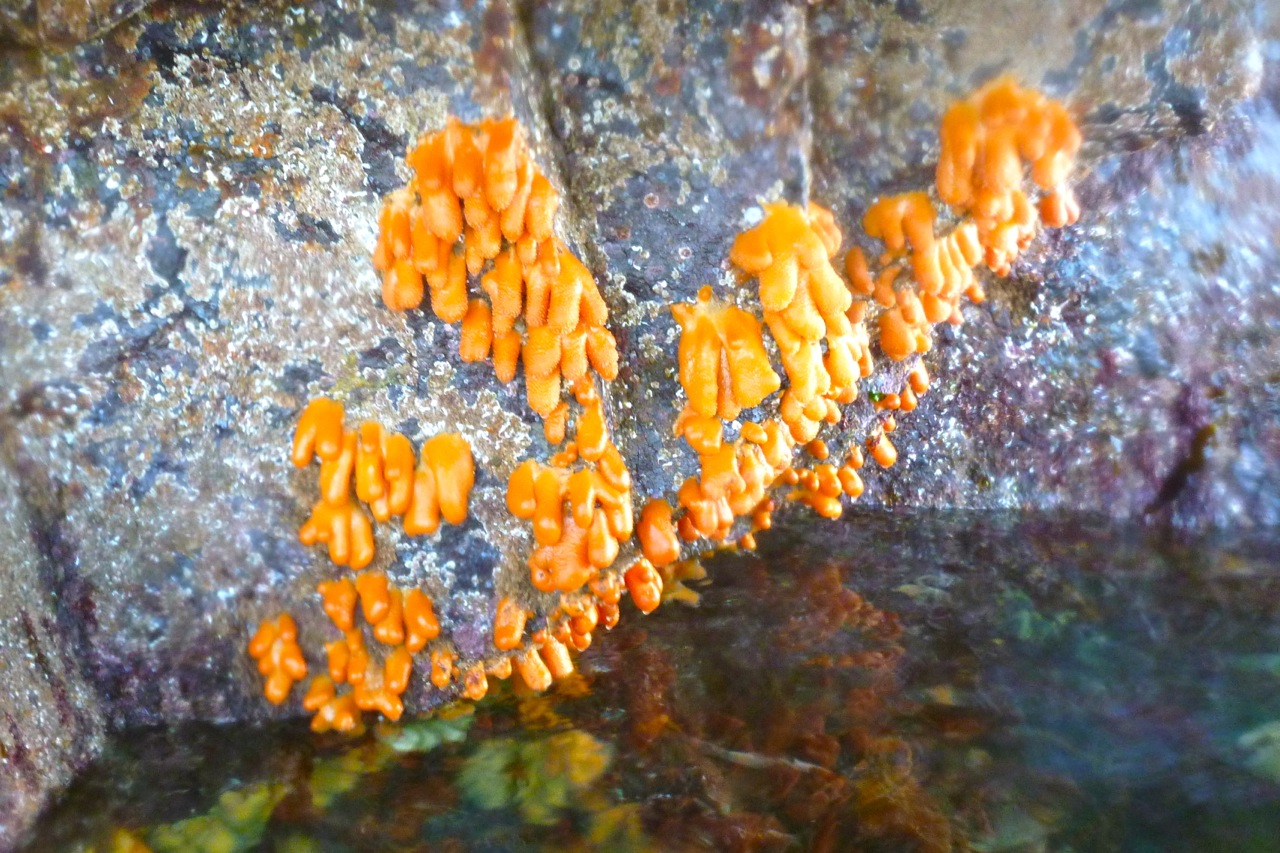
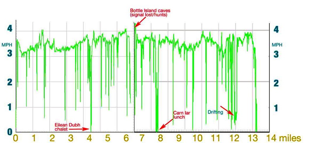
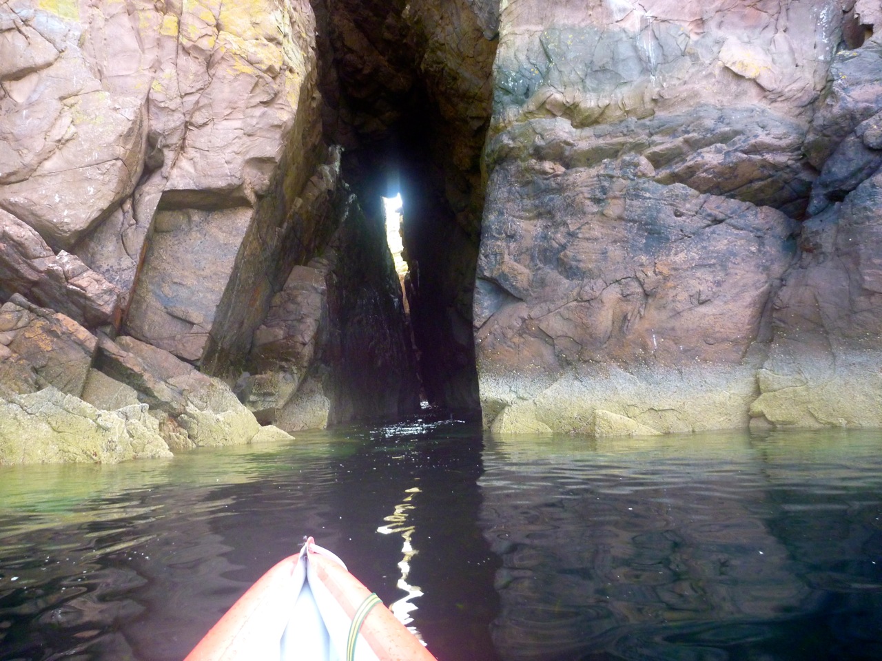
Up ahead, Bottle Island was now only a kilometre away. So far so good: I got there in two hours from the pier after deducting 25 mins nosing around on Eilean Dubh: 3.5mph cruising average. Here I nosed about some more, this time deep into a slotted geo on the south side of the island, where plinky-plonk drips and splashes echoed in the cleft. On the back of the cave the minerals in the Torridon sandstone looked like a gaudy, modern art mural (right) – or maybe petrified viscera.
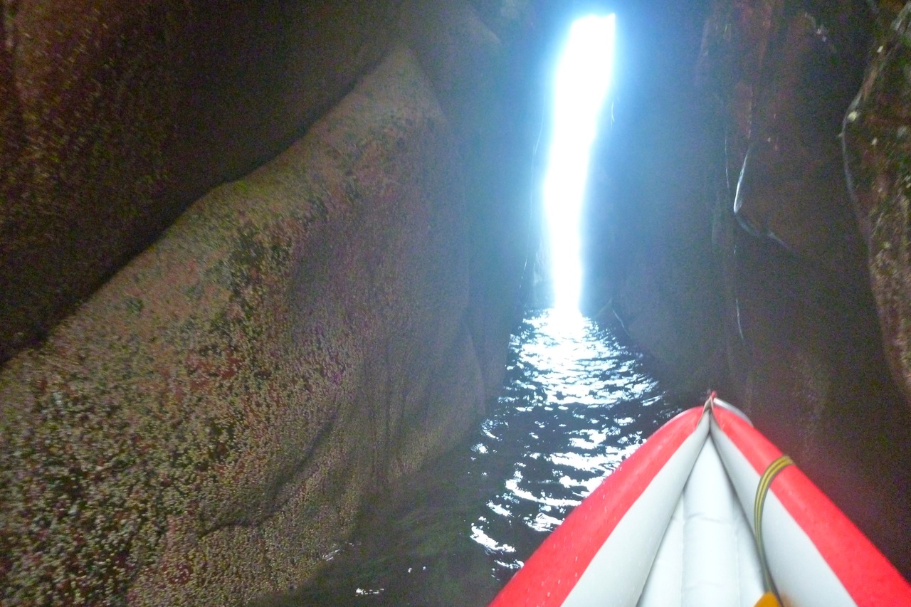
There was just enough room to turn around in there when an incoming swell revealed another way out. In a corner was a chasm under another arch with an even narrower tunnel leading back out to sea (right). I inched in to see if it was wide enough and safe, then stowed the paddle and pushed through off the walls back out into the open. A double arch sea cave – who would have known!
Two clicks to the west Priest Island looked far enough away to stay that way for now. It’s nice to leave something for next time (aka: ‘hold back to give an impression of calculated caution’).
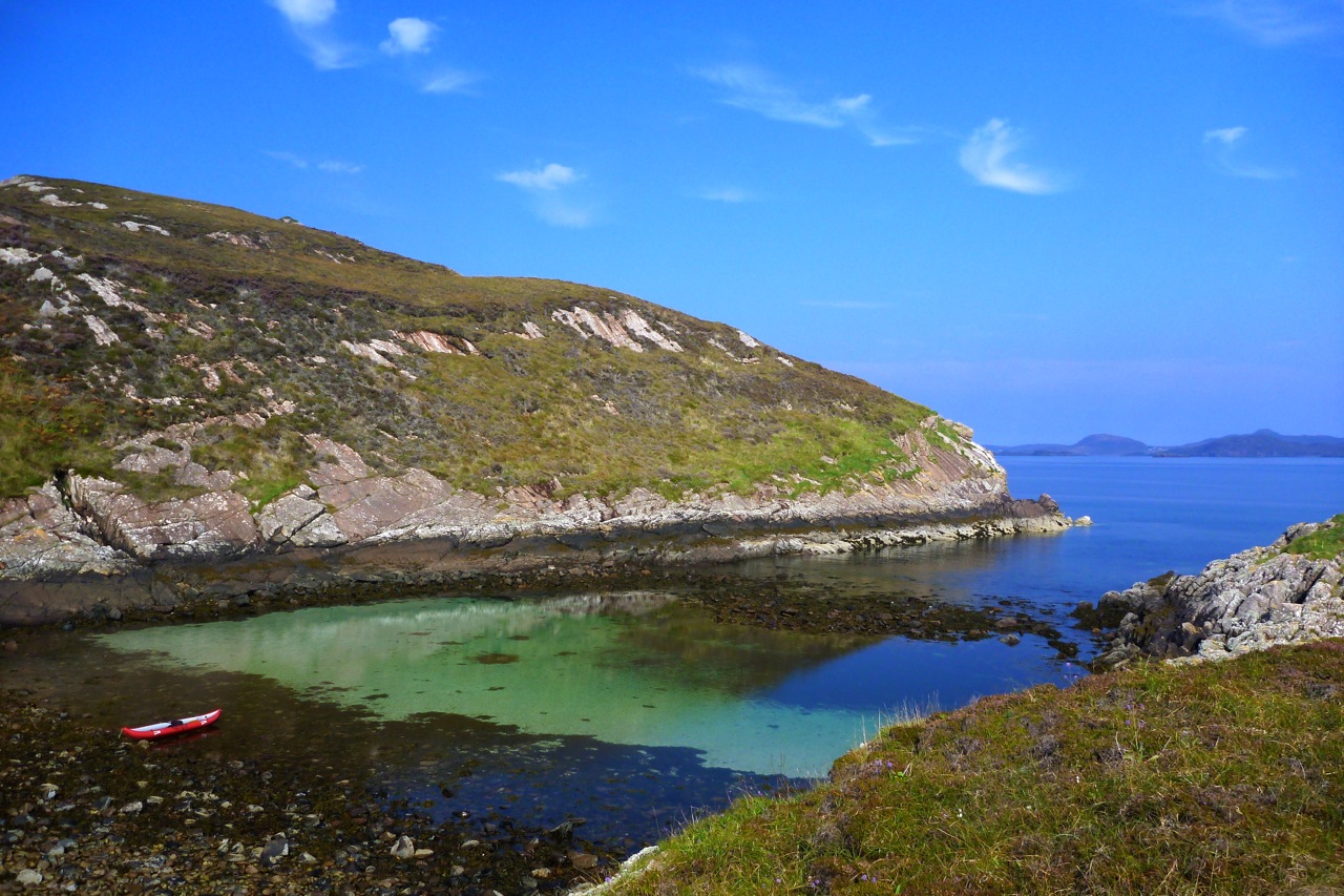
So I turned back north and on the way tried and cut east between Bottle and Carn Iar to get to Carn’s beach for lunch. I didn’t want to eat in the boat if I could help it. But the flow between the islands felt too strong and I didn’t want to burn up energy I might need later. Instead, I got to the north side of that stony isthmus beach that links Carn Iar to Carn Deas, very similar to the ones on Carn nan Sgeir or Horse Island. To get onto it I just about scraped over a rock and seaweed bar into a sandy pool (left), knowing I wouldn’t get back out without a portage. But I wanted to get out of the boat, walk around a bit then have a sit-down.
Up on the grass and heather I ate and drank just about everything I had while down below a gang of seals quietly observed. As I’ve noticed before, these sheep-free islands have verdant and varied vegetation all of their own. I took a doze on a lovely machair sofa, then packed up and waded across the pool to tackle the ankle-breaking portage back out to the sea which has dropped half a metre in the meantime.
Now for the long haul back: 3 miles out in the open to Tanera Sound. I should have dozed in that machair sofa a bit longer: the big feed has taken out my energy and I found myself counting the strokes towards Sgeir Ribhinn skerry, pushing into a light northwest breeze that rippled the surface. After the glassy morning conditions, even waves a few inches high give a noticeable resistance, and for a moment I wondered if the east side of Tanera Mor might be easier. But the speeds later showed I was doing as well as ever at around 3.5 mph – it’s more likely I was unfit for all-day paddling, not having done any since we got here. Again, it makes me think that a speedo (or legible GPS readout) is a good idea as you can verify you’re going better than you feel, despite the impressions of currents and wind. It’s not like moving on land.
Alone out here, too far to swim to even the nearest skerry, you can’t help thinking ‘what if’. What if I somehow caught a stinging jellyfish with the paddle and it landed slap in my face? But the most likely ‘what if’ isn’t that or a sustained swordfish attack, but getting separated from your boat. That’s easily done when thrown out of an IK in an F5, but on a day like today it’s hard to come up with a plausible disaster scenario that would raise the slightest bit of interest in Hollywood. That’s why I ventured right out to Bottle Island.
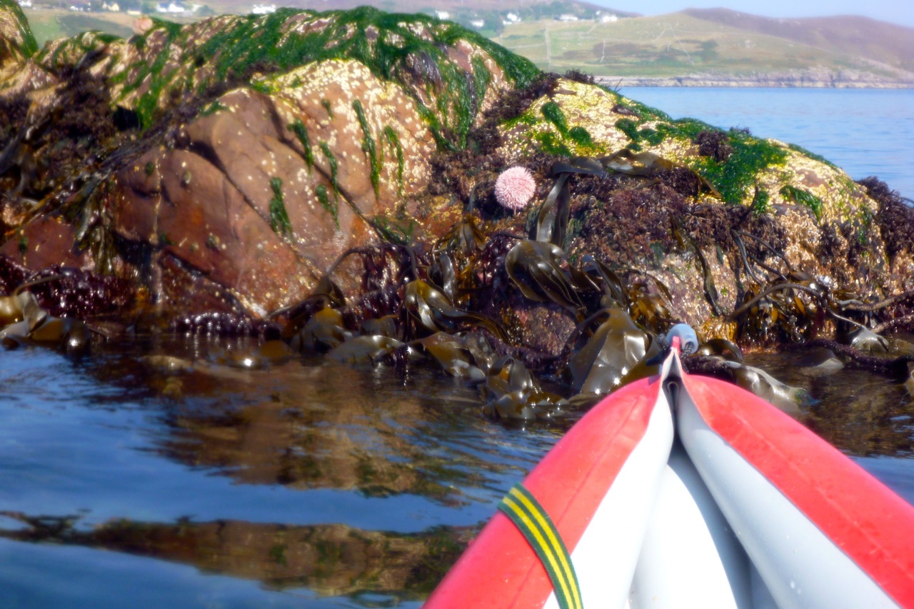
By Low Water I was right in the middle of Tanera Sound. You see new things when the tide is very low: some pendulous orange sponges tucked under an exposed overhang. And on a tidal skerry visible from our window, a prickly urchin of some kind. Don’t want to ram that with my IK.
I can see our isolated house on the headland and with only a mile to go, I lie back and drift with the incoming tide drift for a bit. Then it’s back to the pier where the sea is at least 3 metres lower than it was this morning, exposing lower beams encrusted with mussels.
Fourteen miles and 5.5 hours; moving average (not always cruising): 3mph. On a long trip like this I have to say I miss the old Incept’s effortless glide (compare this Incept speed graph with the one below – or read this comparison post). I miss the speed not because the Incept was a bit faster, but because you definitely feel the effort required to push the wider and half-metre shorter Amigo along. The Amigo is even shorter (though much more rigid) than my old Sunny: the shortest IK on my IK comparison table.
All things being equal, that extra bit of speed can enable you to go further or get back quicker. But let’s face it, it’s always a compromise: there are days for fast boats and days for fun boats. I’m here and still breathing. My Amigo is an easy boat to live with – and a lot better than pushing a bathtub around on a trolley.
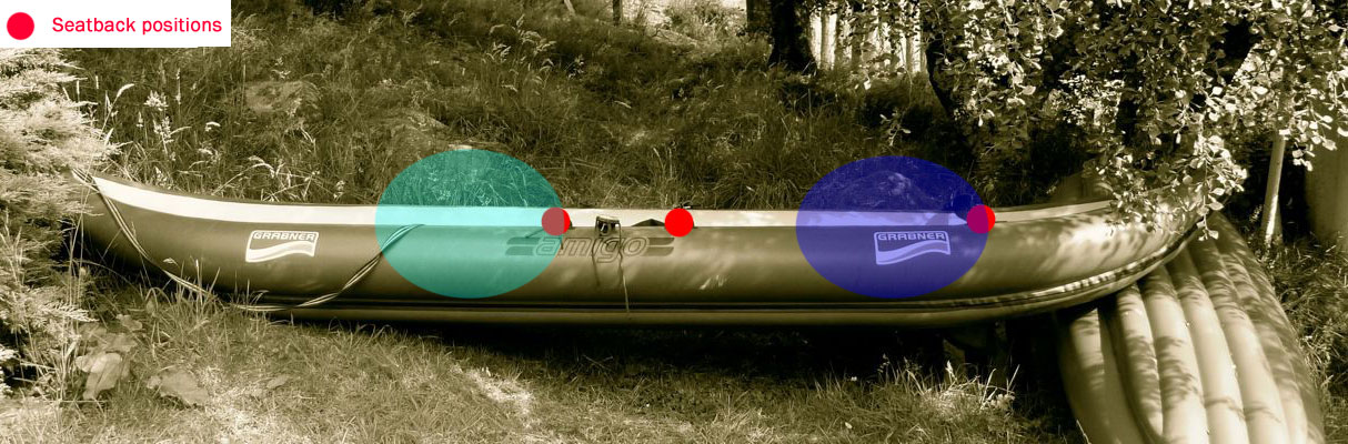
The calm continued and with it the paddling. Today we tried the Grabner Amigo two-up around Tanera Beg island out of Old Dornie. I’d <a class="wp-gallery mceItem" style="color: #000000;" title="Summer Isles Overnighter camped on the island with Jon one time but have never been right round it. For some reason I assumed better the greater weight of me in the back and half-my-weight Mrs out front. But looking at the seating positions (image below right), back is quite far back and full frontal is only a little more forward than the solo position. So the heavier person out front centres the mass a little better on the boat which must be better for control and response.
We set off me in the back, but suggestions on improving the forward operator’s poor technique and asymmetric delivery led to discord and erratic progress, as the speed recordings below testify. To be fair the g is way out of practice and also hadn’t had two hard days of paddling to tone up. However, claims that her inability to paddle straight was due to my diet and general girthlyness in the stern will have to be settled in due course by BCU lawyers.
Meanwhile, in the narrower back it was a tight squeeze for my (allegedly fat) arse and soon my legs – like my ears – were going numb. I’d initially perched on a spare Gumotex thwart but that felt unstable. It was better sat on the floor, jammed in. In this position my feet were against the back of the gf, so there’s only just enough room for my legs. As we passed between the two Taneras where a fishing boat was checking pots, I spotted an easy portage over Eilean Fada Mor, an island between the two Taneras. It gave a bit of a short-cut, but more usefully a chance to restore circulation in my legs.
We swapped places here too, although one lean back on my new q/d back strap arrangement (left, a replacement for the alloy Grabner bar which bends too easily) broke the black plastic clip. I fed a spare krab through the seat strap and tied off the other end with some cord so that clip wouldn’t break too. I was expecting such issues and anyway, big karabiners are easier to use when swapping seats (see Grabner Mods). With the force on the Grabner rubber mounting lugs now coming from an unintended angle rather than directly back when using the seat bar, I’m trying to spread and articulate the loads with cord. But with only 3 square inches of contact, even if the lugs were factory glued, I feel I ought to glue on some 4.5-inch ø D-rings instead (as on the Solar; over 15 square inches of contact). Whether it’s just my clumsiness or all this weight I hear about, it’s clear that the strain on seat mounts is greater than I thought, especially with footrests to push back off. As it was, with no footrests in the full-forward position I couldn’t rest fully against the prototype back strap, but as I noticed before, proper paddling is much easier out front as the boat narrows towards the bow. That’s another thing with big, single sidetube IKs: they’re over wide for good paddling. As it happens, should I want a footrest tube I do have a D-ring glued on the front floor in about the right place.
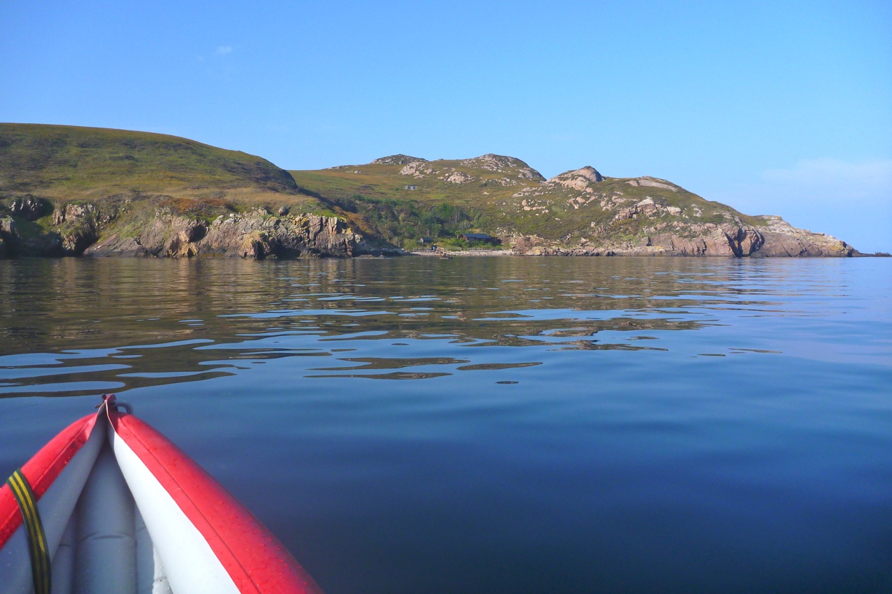
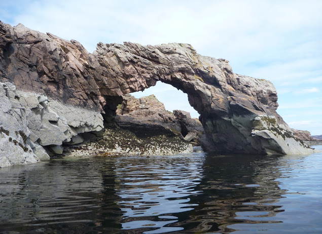
Back to the story. We were now back in paddling harmony and heading into mare incognita, the southeast corner of Tanera Beg where I’d heard there was an arch. And there it was – a very nice one too that could be paddled right through (this was 90 mins after spring HW). Its exposed position made the roof deeply scalloped by storms and weathering, reminding me of the similarly carved limestone walls of northwest Australia’s Geikie Gorge which we packrafted a year or two back. Amazingly, out here on the ocean-side of the Summers there was barely a swell or a breeze to disturb our composure. Though an hour’s paddle away, Priest Island looked enticingly near. And from Priest it’s less than 5 miles to Mellon Udrigle beach at the top of Gruinard Bay on the south side of Loch Broom. Or from either Tanera island you can take a 10-mile loop south to Priest and back north via the smaller Eilean Dubh and a few other ‘Outer Summers’. One for the next calm day and a paddling chum for back up.
We felt like we were making good speed across the south side of Tanera Beg, although rarely got over 4mph. At the southeast corner was a huge cave – big enough to break the GPS signal. With a small window at the back this will become another full arch by around AD6565. This whole exposed side of the island has deeply weathered Torridon sandstone cliffs full of interestingly rounded cracks and fissures. Tanera Beg, like the bigger Mor has the same ‘waisted’ kidney shape presumably carved by the icecap along existing fault lines. Like mountain col, the ‘waists’ usually correspond with bays backed with a handy stony beach though flat camping needs a bit more of a walk. Had the Ice Age been a bit longer (or when the polar ice caps are gone) there’ll be a few more Summer Isles to go round.
We then paddled below the 20-m cliffs on the north edge of the island (left). On a stormy day they reflect the brunt of the swells and throw up plumes of white spray over the cliffs themselves which can be visible from the road, miles away. Today, all we had to worry about was the peak of the ebbing spring tide in an hour’s time. Who knows if it mattered, but I’d deliberately circumnavigated Tanera Beg clockwise so as not to be in the inter-island channel where the current ebbing against us might have been more noticeable.
Heading back to Old Dornie the speeds indeed seemed to drop, even though we were going as fast as possible in an effort to catch the weekly fish van down in Achiltibuie. At one point the kayak slowed right down as it passed over some unseen current or eddy thrown out by Isle Ristol. But that soon passed and with a quick turnaround in Old Dornie, it’ll be fresh local halibut for dinner. So, closely analysing the data in the speed graph it seems that two-up doesn’t make the Amigo much faster than solo after all – perhaps it’s the same with tandems? I suppose the additionally weighted hull can only be pushed through the water so fast and then an IK’s unsophisticated hydrodynamics come against a wall. Instead, two-up enables greater potential duration as the paddling load is shared – and let’s not overlook the companionable element of two in a boat, as long as everyone is sitting in the right place and on form.
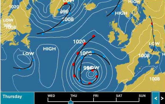
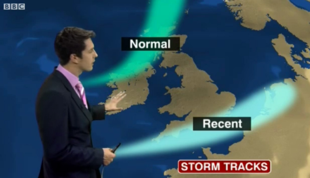
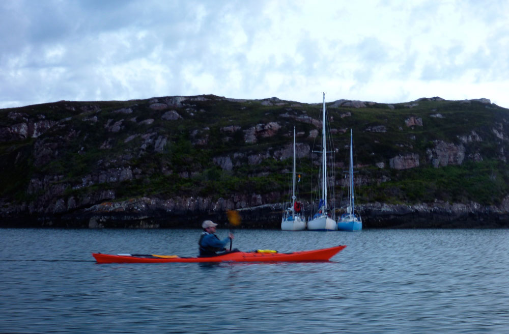
In 2011 I met Gael after he ran out of time and weather to complete the second stage of the Scottish Sea Kayak Trail he started in 2010 in his Grabner H2. According to the guy who wrote the guidebook, the SSKT is a 500-km run through the Inner Hebrides from the Isle of Gigha off the Kintyre peninsula to the Summer Isles, but with no shoreside infrastructure as such, most just follow their nose with the book’s help. In 2012 Gael returned to Skye for another go, now in the ex-demo Incept K40 be picked up from Sea Kayak Oban. In March that year Scotland experienced some very fine weather while England got the converse – a result of a misplaced jet stream (right). And so it was for Gael who managed a comparatively trouble-free run all the way to Ullapool where he rolled up his boat and bussed back to his car on Skye.
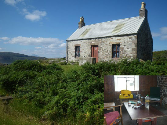
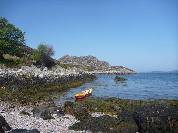
Day 1 – Kyleakin to Uags The trip began rather badly. I arrived around midnight in Kyleakin after an interminable drive from Paris with an exhausting final crossing through the Highlands mostly in the rain. I set up my tent quickly on the grass by the hostel’s backyard. Once in my sleeping bag, I fell asleep right away, lulled by the pounding of rain on the canvas and the rustle of leaves in the wind gusts. Early next morning I woke up with my feet feeling cold and wet; during my deep slumber I’d pushed them under the edge of the tent. Fortunately, my sleeping bag fill is synthetic and the nylon shell water repellent enough and with relief I found it was still dry inside. The ground all around was drenched and I could now test the effectiveness of my new Seal Skinz socks. It was still raining, so I donned my foul weather gear right away before proceeding with the usual pre-launch routine (inflate kayak, rig the accessories, sort food and equipment before closing the bags). Like last year I went to Kyle of Lochalsh Police Station to report my departure, then to the Co-op to stock up on McEwans in case I got shipwrecked.
Early in the afternoon, after a quick snack, I launched in Otter Pond by the Skye bridge. A fresh easterly was blowing out of the Loch against the flowing tide, raising the inevitable chop. I crossed the channel towards Kyle, then let myself be blown under the Skye bridge, leaving Eilean Ban to port. I paddled to Erbusaig Bay through the relatively sheltered Black Islands but decided not to proceed directly to Uags under the current crosswinds. Instead, I hugged the coast upwind towards An Dubh Aird from which the crossing would be much shorter. After vain attempts to take a picture of the two little otters which turned around me, I left the lee of An Dubh Aird and rushed towards the south coast of the Applecross peninsula. Two-thirds of the distance into the crossing I bore away and took a direct course to Uags, pushed at speed down the wind blowing along the axis of Loch Carron. Sadly I couldn’t surf the best waves though because the stern was too heavy with the beer. I landed around 6pm in Uags, and moved into the empty bothy.
Once installed, I hung my tent and sleeping bag to dry, then I rewarded myself this interesting first step with a hot tea and a thick slice of chocolate cake. Outside rain was still pounding.
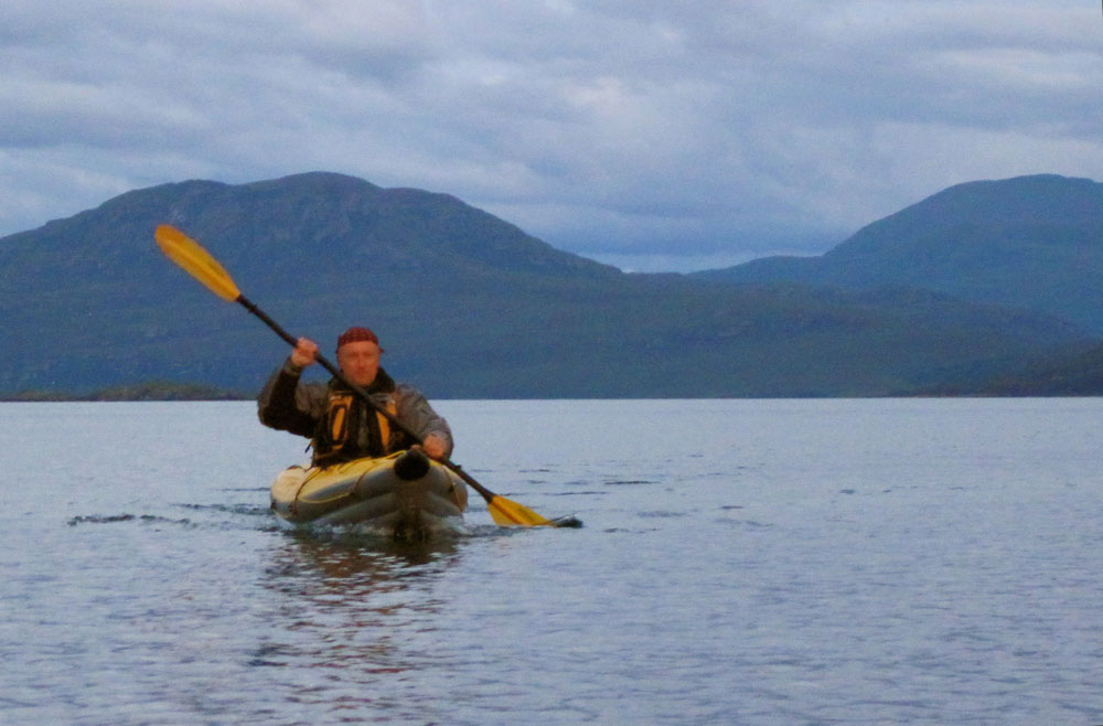
Day 2 – Uags to Red Point I woke up at dawn feeling numb as my old foam sleeping pad had been of little comfort on the floorboards. The temperature was 5°C; so much for this jet stream. I went out to stretch my body and surprised a little doe grazing in the meadow below the ruined Uags hamlet. It scampered away before I could fetch my camera (this is a double entrendre called ‘lacking reflex’). But – it had stopped raining, the air was clear and visibility was excellent. The snow-capped peaks of the Cuillins stood out beautifully against the sky (below left) but the chill air from the northeast soon sent me back inside.
Once on the way from Uags an unexpected SE tailwind pushed me gently toward Sgeir Shalash but the breeze then turned NE, as expected. In the protected lee of the shore I paddled on north without difficulty, up to Camusteel, but when I reached the mouth of Applecross Bay, I had to fight against the wind. It funneled unhindered along the valley, whipping up the waters and raising an uncomfortable chop, until I reached some shelter in the lee of Rubha na Guailne. From there the long way north to Loch Torridon seemed a never-ending trudge. The wind had picked up to the point of pushing me hard offshore whenever I got 50 meters from the shore. I kept hugging the coast, despite the uncomfortable chop and the occasional breakers, because the wind was shifting SE, thus pushing me northward. When I eventually passed Rubha na Fearna I found myself facing the wind blowing right out of the Loch.
Loch Torridon greeted me with one of its customary gusts of which I’d had the humiliating experience the year before. I took shelter as soon as I could in a tiny cove hidden behind a natural breakwater. I badly needed a feed. After a snack and some rest, I pushed off to cross the Loch. I paddled a mile inland to gain an upwind margin of safety then I headed north. Wedged into the seat, with my legs holding tight on the thigh straps and squeezing the footrest, I blithely crossed the choppy zone, kept an eye on the most threatening peaking waves and checked off some landmarks in transit which I used to control my leeward drift with the other eye while admiring the spectacular scenery of the mountains towering over Loch Torridon (yes, all at once).
I returned to quiet water in the lee of the north shore, laid the paddle across the boat and started bailing. My open decked Incept kayak had ridden well on the waves but had shipped a fair share of water which was now swashing in the bilge. I pulled ashore in the early evening on a beautiful beach near Red Point.
The ebbing tide had just retreated beyond the tombolo that connects Eilean Tioram islet to the mainland, thus forming a placid lagoon. Some cows and sheep were grazing in the dunes undulating behind the beach. I pitched my tent in a hollow, barely sheltered from the chill NE breeze and crashed out.
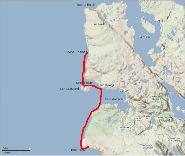
Day 3 – Red Point to Slaggan Bay The night had been cold but the clear morning sky made me hope for a warmer day. When I shoved off I didn’t know that I was about to enjoy one of the most beautiful days of my paddling life. Passing Red Point I noticed with satisfaction there was almost no swell. For once I wouldn’t be shaken by the rebounding waves and could explore the nooks and crannies of this craggy coast.
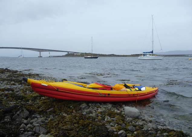
The sky became overcast and the NE wind picked up as I approached Loch Gairloch. The temperature dropped rapidly and I paddled more vigorously towards Carn Deag in an attempt to stay warm. I made a brief stop on the beach at Big Sand (left) but the chill breeze urged me on. I passed downwind along Longa Island with the hope of discovering a sheltered cove for lunch but found none. I then went on across Caol Beag, passed Rubha Ban and kept paddling north with my stomach gurgling. The beauty of the coast was worth the inconvenience of being cold, numb and hungry; huge sections of sandstone cliffs that had fallen in the sea provided an extraordinary maze of narrow passages that I enjoyed threading through. Erosion had also cut multiple geos and caves also worth exploring (I didn’t know what a geo was before reading the SSKT guidebook). I eventually reached Seana Chamas beach, largely uncovered by the outgoing tide and where I landed and dragged my kayak a few yards on a carpet of seaweed.
The sea was empty except for birds and a view that stretched westward to the Outer Hebrides. The Shiant Islands were clearly visible, standing out like a motionless line of battleships. I finished my lunch just as the tide returned up to my boat. The sky began clearing as I left and when I got past Melvaig all around me glistened under the sun.
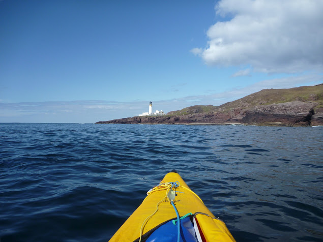
After half a mile of boulders the coast turned to sandstone crumbling cliffs again and I could resume prowling in and out of caves and geos under the bright light of this sunny afternoon. Quite suddenly behind another headland appeared – the dreaded Rubha Reidh and its striking white lighthouse. I felt the mid-tide current pick up as it dragged me over to the other side of the promontory. The whitecaps of a faster tide rip were visible out to sea but right under the lighthouse the sea was rippling gently against the reddish rocks. One of the most exposed stages on this route passed without event.
The NE wind that had been blowing since I left Kyleakin had dropped too, but there was still some swell from the north, preventing me from sneaking through the rocky labyrinth that stretched between Rubha Reidh and the beautiful beach of Camas Mor. Beyond Rubha Reid to the east the extraordinary snow-capped skyline of the Wester Ross mountain range rose from the horizon (left). Put in a trance by this sight, I carried on on an eastward course and arrived at Caolas an Fhuraidh. I took stock at the mouth of Loch Ewe before an exposed 4km crossing over to Slaggan Bay. To the SE lay Rubha nan Sasan still with it’s WWII bunkers and gun emplacements. At that time Loch Ewe had been the starting point for many Russia-bound convoys and a haven for Allied shipping. There’s still a NATO base there today. As I paddled to Ploc an t-Slagain I hoped I’d not be rammed by a nuclear submarine entering or leaving Loch Ewe; I’d read reports elsewhere in the Hebrides of these subs rising so fast the resulting wash tipped sea kayaks bow over stern. I reached Slaggan Bay at 7pm finding another perfect landing place, a crescent of fine sand surrounded by empty dunes.
Day 4 – Slaggan Bay to Isle Ristol Under ideal paddling conditions I hugged the coast towards Greenstone Point, the last critical passage of the SSKT. The Point was flat and bare and proved even less dramatic than Rubha Reidh, although its rocky shoreline was wild and beautiful. From Greenstone I paddled on to Rubha Beag. In the distance the conspicuous peak of Ben Mor Coigach was towering over the horizon and to the NW lay a scattering of islets; the long-expected Summer Isles.
I headed towards the closest, Priest Island some 5km away. Halfway through the passage, the wind died off and the sea glassed over. The uncanny cries of the guillemots emphasized the eerie atmosphere; I felt like I was entering an unearthly space. From the SE tip of the Priest Island, I carried on around the west side. It was another paddling paradise with endless features to explore in the good company of seabirds and seals.
Once I completed this circumnavigation I paddled back to a cove called Acairseid Eilean a Chleirich (it’s quite a challenge to try to explain to other people the places I visited) where I pulled ashore onto a tiny uninviting boulder beach (left). As the afternoon progressed I uneventfully hopped through the convenient chain of islets lying between Priest Island and Tanera Mor, the biggest of the Summer Isles. I had intended to land near Althandu as I needed some of the facilities of the Port a Bhaigh campground, mostly their electrical hookups to charge the batteries, freshwater and even a shower, why not? There was also a pub close by.
But as I paddled through Old Dornie harbour I came within sight of the campground and within earshot too. The place looked packed and was definitely too noisy. After four days of solitude with no other sounds than the sea and the birds, I couldn’t stand it. So much for the camera, shower and a beer. I swung my boat south towards the lovely nearby beach of Traigh an t-Sean Bhaile on Ristol. I pitched my tent on thick grass which promised a comfortable night and the chilly cold kept any irksome midges from hatching.
Day 5 – Exploring the Summer Isles I devoted this day to exploring the archipelago as all these islands offer the type of craggy shore most sea paddlers are looking for. The sea conditions were again at their best for squeezing through narrow channels between rocks, under arches or into caves with almost no swell and light winds. I proceeded anti-clockwise around Ristol, paddling along its west coast then circumnavigated Eilean Glas Mullagrach and Glas Leach Mor.
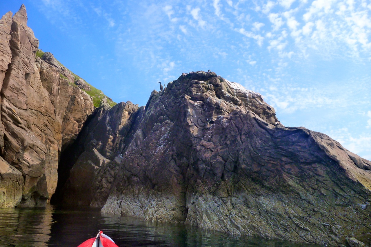
Shags had built their nests in the crevices of the cliffs overlooking the sea. They were not easy to spot as their colour merged with the cliff but their unmistakable angry squawks betrayed their presence above me whenever I got too close. From Glas Leach Mor (the ‘large green stone’ a good description actually) I crossed to Tanera Beag. Here I gave a wide berth to a skerry occupied by a large group of singing seals that I didn’t want to disturb. The haunting sound suited the scenery perfectly.
Tanera Beag is considered the most beautiful of the Summer Isles by the experts. Close to its SW corner is a cave deep enough for a tourist boat to get in and with a very high ceiling after which it’s called Cathedral Cave. Its SE corner is adorned with an elegant arch, which is another place of pilgrimage by all paddlers visiting the isles.
After completing the circumnavigation of Tanera Beag I pulled ashore for an overdue snack and a nap in a pretty little cove where the outgoing tide had left a broad sandy beach. Between Tanera Beag and Mor Eilean Fada I entered a kind of shallow lagoon of clear water. The tide was low and I saw my kayak’s shadow skip along the sandy bottom.
Later I landed in the Anchorage on Tanera Mor, a sheltered bay that opens to the east and filled with salmon pens. There is a floating dock for the tourist boat but the tea shop/post office where I’d intended to indulge in a brew and some piece of cake was closed. Tanera Mor (currently for sale) enjoys an offshore status which allows this tiny post office to issue its own stamps but no brew, no cake and no stamps for me today.
I hopped back in the boat and crossed the Anchorage diagonally and skirted Rubha Dubh, the east corner of the island. Here I entered a narrow cove choked with seaweed and backed with a pebble and boulder beach. High spring tides and gales had filled the depression beyond the beach thus forming a lovely pond, An Lochanach. I pulled ashore soon after two other kayakers. The guy didn’t look very happy to see me and curtly turned down my offer to help them to carry their heavily loaded sea kayaks. So I minded my own business, as I had just been advised to do. His wife came and offered remorsefully to give a hand, but I declined politely.
It had been a hot afternoon and I’d paddled without cag and without a cap for the first time in five days. But cold came back after 7pm and the Franco-Welsh relationships in the cove did not improve. Although our respective pitches were located 300 meters apart, each on one side of the beach, no invitation to share dinner was exchanged. It nice to be alone of course, but I like chatting with other paddlers too. Another time perhaps.
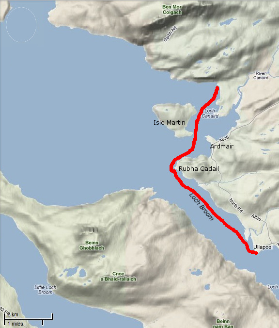
Day 6 – Tanera Mor to Ullapool On a beautiful sunny morning I headed SE towards Loch Broom and Ullapool. Sunny but cold, chilly indeed, so chilly that I had my breakfast in my sleeping bag.
In the meantime, the wind had shifted SE so I slogged against it all the way to Horse Island. I paddled through the tidal gap which divides this island from its northern tip, Meall nan Gabhar. Once through I pulled ashore and found a very convenient pitching spot. I regretted not having carried on to this place yesterday, instead of staying next to unsympathetic paddlers. So seemed to say the half-dozen seals romping about behind me. The sky was promising some fair weather that had been a long time coming. As the breeze didn’t abate I took shelter in the lee of Acheninver. But as soon as I got past Rubha Dubh Ard I fought the headwind again until I reached the base of Ben Mor Coigach.
Then I paddled below the sheer slope of the mountain until I got to what looked like the white sands of Camas Mor beach. Actually, it’s a pebble beach facing Isle Martin and the guidebook said amethysts can be found here, but I didn’t find any. By 2 o’clock clouds covered the sky and some chill air forced me back into my cold-weather gear.
I shoved off shortly after lunch and enjoyed passing the last natural monuments of the Trail. I rounded Rubha Cadail, addressed the last salute to Ben Mor Coigach and entered Loch Broom. The wind unexpectedly veered NW and pushed me gently towards Ullapool.
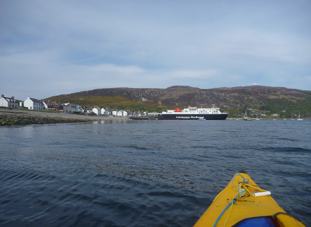
Once ashore I pitched my tent under the stares of some motorcyclists wondering where the hell I’d come from. A leather-clad fellow told me the owner was already gone and would return early next morning to collect the fee. Meanwhile, I washed the Incept to remove the grit scattered in the bilge, wiped it dry, deflated it, rolled it, and pushed it into my huge 160-l Ortlieb Kanurucksack. The K40 doesn’t fold as compactly as my good old hypalon H2 but I was relieved it crammed into the bag. I enjoyed dinner at the water’s edge overlooking at the now placid waters of Loch Broom, glowing in the satisfaction of my achievement. It has taken three years and two different boats, but I’d completed the SSKT in an inflatable sea kayak along with one of Europe’s most striking shorelines. Celebrations continued at the Ferry Boat Inn where I e-mailed friends and family, sipping some good beer, the sound of music replacing the soothing sound of the sea lapping the shore.
Ullapool to Kyleakin The weather was set to improve in the following days and I wondered whether to paddle north and round the Point of Stoer, take the ferry to Stornoway for a glimpse of the Outer Hebrides, or complete the exploration of Raasay and Rona that I’d started the year before. The first two options required maps that I was not sure to find in Ullapool. and I was also missing sailing directions.
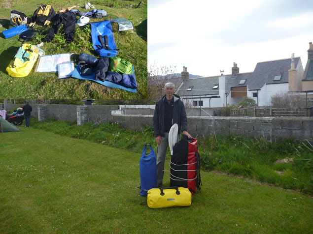
So I packed all my gear in my three-bag travelling arrangement: boat and paddling gear in the 160l Kanurucksack, camping gear and clothes in the 59l XPlorer bag, food, cooking gear, books, maps, tools and all the rest in the 49l Rackpack. The result was portable but heavy and I had a half mile walk to the bus station by the ferry terminal. Luckily the owner came by for the fee and gave me a lift. Soon we were en route to Inverness by bus; an alternative would have been leaving the bus at Garve railway station, halfway to Inverness and hopping on a train to Kyle of Lochalsh.
Eventually, I decided to park up in Kyleakin on Skye and undertook a very enjoyable three-day tour around Raasay and Rona. The year before I’d experienced the charms of these islands despite the unsettled weather – this time conditions were ideal. Back at the pier three days later, I was giving the Incept a wash on the slipway when a Land Rover towing a trailer full of sea kayaks turned in. A party of men got out of the truck, unloaded the kayaks and started putting paddling gear on. As they carried the boat to water they came over to say hello and asked about my boat and my trip. They were attending a kayak class beginning this very day. Their first-day program was a shakedown paddle in sheltered waters before a guided multi-day run to Sandaig. The guide joined the conversation and yet again I endured the usual hardsheller’s drivel about IKs. Ten minutes later I watched the student awkwardly clambering in their kayaks; for some of the clumsier it took quite a while. I told them they were lucky modern kayaks had such larger cockpit coamings – but not as big as mine! By the time I got to my car the temperature inside was like an oven, despite the screen I’d fixed over the windshield. My chocolate bars had melted. In northwest Scotland? Whatever next.
I took the K40 out across the bay for the first time since Ningaloo last September. As mentioned earlier, Australian UV being what it is, it did look pretty good after being rolled up for months. I put that down to lashings of 303. But it still went a bit flat in the few days between pumping up and paddling. Maybe I pumped it up on a hot day.
I topped it up in the water at Old Dornie, had a quick look for bubbles, took the pump with just in case, and set out back to Badentarbet beach. It had been calm for days and an ankle-high swell wafted along with a spring tide about to top out at about 3.5 metres. I passed the old ‘Wasp Factory‘ (left) still intact, and dithered a bit about crossing to the island, over-conscious about how the boat was moving on the currents that would barely push a wet paper bag. In the end, Tanera Mor got close enough, and after a couple of minutes paddling I trailed the rocky shore of red Torridon sandstone for a while before heading back across the bay. I found out later that the day before a boat tour had spotted a pod of half a dozen orcas (ropey video – start at 1:40 for the best action) right here. Someone suggested that because it’s been so dry, the salmon can’t get upstream to do their thing so have backed up along the shore where the killer whales come in for a feed. Video still below, more pictures here and see footnote.
With no dorsal fins towering over my head, I crossed the last mile over the bay with the rudder up to remind myself it was do-able. The K40 took a bit more finesse and occasional hard yanking to keep in line, same as with the old Sunny when without a skeg. A smooth, steady style works best but what it really means is that you can’t go as fast; pull hard to escape from a killer whale’s jaws and you really need your feet and a rudder to get you back in line.
As my taxi came down off the hill I passed a cheerful buoy bobbing around. Stowing the paddle and using the buoy as a marker, I noticed how quickly I was drifting back on the unseen tide, but as always, with the water and wind moving against you, you get much more of an impression of speed which is satisfying. Battling the not so agreeable tail winds off Ningaloo last September, I lost my faith in the K40 a bit, but here on a calm Highland evening, the Tasman slipped along, just as it always did.
We climbed up onto Ben Mor (right) the other evening, from where I was reminded just how close Ullapool seems from a couple of thousand feet above sea level. Looking out over Loch Broom, with one arm you can pat the Summer Isles, and with the other dab the lighthouse at Rubha Cadail (Rhue), south of Isle Martin and Ardmair (left). It’s some 13 miles or more, but with a get-out at Ardmair if need be, it would surely be doable within in the span of a tide, then to catch the afternoon bus back.
A few days later I decided my boat did have a leak in the floor somewhere. I hoped it might be a bit of easily expelled grit in the PRV and not the hull delaminating in some hard-to-get-to corner. I filled it up like a paddling pool and sure enough, it was fizzing from around the edges of the PRV (right). It took a bit of tracking down with Google (the menuless Incept NZ website is not the best), but it seems the cap needs prising off and the valves cranking down once in a while with a Halkey Roberts valve tool. Seeing as it’s not been done since new, that makes sense, so one’s on order and will hopefully do the trick. I never had to do that on the Gumotex Sunny in all its years, but the Incept does run a higher pressure and is a faster boat because of it. A day after I wrote this, over breakfast we spotted a huge pod of [probably harbour] porpoises coursing across the bay. They’re not so unusual and half an hour what looked like up to 20 of them trawled a line to an fro off the shore of Tanera Mor, presumably hunting or feeding. This is the best the zoom could manage on a murky midsummer’s morning.
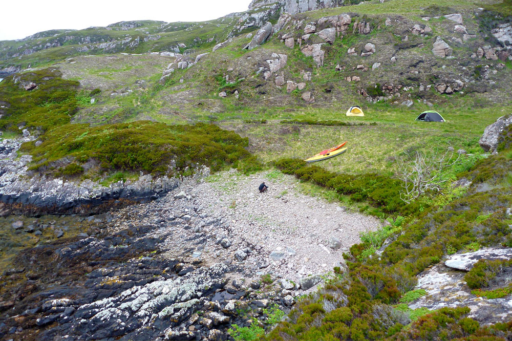
Friday night Jon and I paddled over to the Summer Isles on an exceedingly calm evening. After a bit of dithering looking for a place to camp, we hacked through the seaweed to get onto Tanera Beag about 11pm where we set up for the night. As predicted, it got windy and flapping tents meant we didn’t get much sleep, although at one point a sudden lull at 3.30am did wake me up with a start. Out over Polbain the red sky was already presaging the dawn, just 80 degrees east from where the sun had set 5 hours earlier. Heading back later that morning into an F4, it was nice when that part was nearly over. Near the each I hooked around the and tried a bit of disc sailing – it works but I definitely need a bigger sail. A few days late but I got my midsummer’s mini adventure after all.