In a line Promising selection of rivers, canals and inshore SUP paddles right across the beautiful Southwest, but just one map.
What they say Explore the best of South West England’s rivers, canals, lakes, estuaries and beaches by paddle board, canoe and kayak Paddle along meandering estuaries, wild swim and picnic on silver sands. Featuring more than 100 stunning locations across Cornwall, Devon, Dorset, Wiltshire and Somerset, this trusted guide provides all the practical information you’ll need for trips out on the water by paddle board, canoe or kayak, whether you’re a beginner or a seasoned paddler. Illustrated with sparkling photography and offering a variety of routes, this is a beautiful and inspiring book for water lovers and adventurers afloat. Rrp £18.99, £8.99, 2023, 255pp
Review copy supplied by Wild Things Publishing (WTP)
• Covers over a 100 paddles from Wiltshire to Lands End • Nicely written descriptions and genuinely useful practicalities • Most photos by the talented author, not Shutterstock etc • Responsible take on PFDs which are often pictured in use • Now uses decimal degrees (D.D°) waypoints for start/end points (and the obsolete OS grid ref). In the pdf, along with website urls, D.D° waypoints are hotlinked to Google Maps • Details for public transport returning to start point, where it exists
• No route maps means added effort required to work out what, how and where • Doesn’t say where printed so presumably not UK • The ‘Getting There’ descriptions of lefts and rights and road numbers is redundant these days. A postcode or D.D° for the satnav or phone is adequate
Review Getting in on the wild swimming craze early, WTP moved on the ‘boarding a short while after Lisa Drewe brought us her original and award winning Islandeering guide in 2020. A proper, experienced kayaker turned SUP evangelist, the author knows her paddling, in particular what’s important, safety wise. Like Bradt’s Lizzie Carr, she’s also an environmental campaigner or conservationist, and it seems her SUP epiphany in the US was similar to my own while there. Suddenly there was a new and accessible way to explore the blue bits on a map.
The book is subtitled ‘canoe & kayak’ to catch the likes of me who don’t get the SUP thing, but that’s the last mention of boats in words or most pictures. Of course, what you can SUP you can easily packraft or IK, and the range of inland and inshore paddles is much more accessible to the majority of recreational paddlers than Pesda’s South West Sea Kayaking.
Up front you get a map covering all 100+ paddles, followed by a table including gradings and distances ready for you highlighter pen. The lengthy intro leads on to choosing a board and getting trained, then there’s a detailed section on trip planning for sea or rivers and what to wear pack.
Covering one location per spread, you can flick open any page, like above or below, and be presented with a mouthwatering paddling suggestion. You get nice photos, a description and solid practical info in the yellow box, which occasionally includes public transport links for your rolled-up inflatable which might not be an iSUP.
The Pesda South West sea kayaking book knows what counts and provides sometimes near full-page maps of each suggested route. This book has pretty pictures of aquamarine bays. The lack of route maps in a route guide is baffling and relegates it into the ‘lifestyle’ category not everyone rates. How else can you effectively and concisely express this information? It’s not a space issue; any one of the generic shots could be have dropped or resized. I’d have happily paid another £1 for route maps because read any paddle description and you soon start thinking, ‘hmm, sounds good but what does it look like on the ground?’. A map depicts this information at a glance. The author’s Islandeering book (not a paddling book) had great maps and other Wild Guides, including their well-known wild swimming books at least have regional maps to supplement the main map up front. I’m told it’s a combination of space, aesthetics and cost.
Take Route 91 for example: the ~5-km Salisbury Loop. Sounds great, easy access and a lovely picture of ‘boarding past the willows below the cathedral spire and no license required, we’re told. Now try to make sense of the dense network of rivers and canals surrounding the city (left) from the text. ‘Nadder Island’ is mentioned to avoid a weir, but it’s not even on the OS map (it’s the crescent below Churchfields). You want to hope you don’t take a wrong turn and get sucked into the municipal sewage compactor sluice. The two paddles covering Christchurch (which I bikerafted recently) are another example, and it’s the same with so many other paddles in this guide: they’d be so much easier to visualise and so get inspired by with one less photo and a basic map to cross referenced to a more detailed OS map or whatever’s on your phone. Failing that, link to an online map like here. Lisa Drewe is an ‘OS Champion‘, after all! The book ends with detailed sections or water safety and how to paddle responsibly – the sort of solid, concise but practical information which was missing from Bradt’s France book. With maps South West England Paddle Boarding would be a perfect, self-contained paddling guide to this magical region. As it is, it’ll still give you loads of ideas, even if you need to work for them.
In a line Mouthwatering selection of river- lake- and inshore paddles right across France, but packboats go unmentioned, despite lauding the use of public transport.
What they say This award-winning new Bradt guidebook provides 40 itineraries for water-based exploration around France by SUP kayak & canoe to suit all abilities. It is the first practical guidebook to explore the whole country by SUP (stand-up paddleboard), canoe and kayak – waterborne activities enjoying a popularity boom. Experienced paddleboarder, travel writer and local resident Anna Richards has toured the country’s rivers, lakes and coasts to handpick 40 outstanding itineraries for water-based exploration that suit all abilities from novice to expert, enabling readers to experience Metropolitan France as never before! Rrp £19.99. 41 maps, 230pp
Review copy supplied by Bradt Guides. Book images found on online previews. Additional contextual review info by French boarder, Gael A.
• Varied selection of paddles right across the six corners of l’hexigone and Corsica • Nicely written descriptions • Maps are small but routes are short so they do the job • W3W works well for pinpointing locations • Nice layout and paper • Printed in the UK – better sustainability
• Routes appear to be composed almost entirely from set rental/guided itineraries • Most are short return paddles • When it comes to paddling knowledge, the author seems out of her depth • Nearly all photos are stock library shots • IKs and packrafts virtually unmentioned, yet as transportable as a rolled up iSUP
Review Thanks to its topography, rich history, culture and proximity to the UK, on river, lake or sea, France is a fantastic paddling destination. Paddling France: 40 Best Places to Explore by SUP, Kayak & Canoe replicates Bradt’s Paddling Britain by Lizzie Carr which, in its first 2018 edition, was a long-running hit, possibly supercharged by lockdowns when demand for inflatables boiled over. Like many others at this time, author Anna Richards discovered the wonder of paddleboarding, moved to France to become a travel writer and, knowing the country from childhood holidays, zig zagged around for over a year to write and research it all. Paddling France isn’t aimed at enthusiasts attracted to the challenge of developing skills by juggling tidal streams and winds, river flow rates or the logistics of multi-day tours. Most SUP owners are into casual day paddles, but probably outnumber the former by ten to one. But unlike Lizzie Carr’s original Paddling Britain (which I checked after writing this), faced with an equally monumental task, in most cases Anna Richards seems to have either rented kayaks (and maybe boards), used their shuttle services, or at sea sometimes joined tours. Although all are great paddles, I didn’t get the impression any routes were original selections born from years of experience, the usual prerequisite for authoring a guide book like this. Initially I understood ‘… generally withthe assistance of local clubs that kindly loaned me rigid… kayaks‘ (page xix) as a euphemism for arranging rental freebies in return for a listing in the book. But it’s possible the author actually believes ‘clubs’ – in the social/membership/lessons UK sense – is the right word to describe a commercial rental, tour and sometimes training outfit. Only Route 21 lists a ‘Club Nautique‘ sailing school which also rents kayaks and boards. All the rest call themselves versions of watersports centres or ‘location canoë-kayak‘ (kayak rentals) of which there are many more in France than in the UK. Once you get your head around this you ask yourself: well, it’s a short-cut but in France does it actually matter? What are most Brit paddle tourists’ experiences in France? Is it flying or railing down with a packboat, as I’ve done? Or is it driving around with kids or campervan, then chancing upon a lovely waterside spot which offers day rentals and a lift back? It’s almost certainly the latter. That’s what I’ve done elsewhere in the world. It’s clear the author put in the miles, paddled every route and composed a detailed description and practical info, although images of her in ‘off message’ kayaks are absent, replaced by stock library photos with fill 90% of this book. With mainstream guidebook sales in retreat and corners getting cut, these are all understandable measures to still produce a nicely designed and illustrated book in full colour for just £20 that’s printed in the UK, not the other side of the world. That alone deserves a sustainability rosette which the publisher should laud. I wouldn’t consider blagging a freebie rental in return for a mention as unethical, as long as it’s clearly flagged. Many routes start and end right outside an outfitter’s base. I could be wrong, but if that’s the case better to be upfront. Skimming through Paddling Britain, that book appears to have been written and researched the old fashioned way – though again, no mention of packboats ;-(
Ironically, Anna Richards likes iSUPs for some of the same reasons we all rate IKs and Packrafts: ease of use and transportability. Yet as said, many routes seem to be in rental hardshells, while IKs get dismissed in the Intro’s second para (left) as too awkward to travel with compared to a SUP. I looked up what a 12.5′ inflatable paddle board weighs: about the same as a Gumotex Twist 1, and 2-3 times more than a packraft, though I admit a 4-metre FDS IK (above right) is ridiculously bulky. What a shame then she missed out on made-in-France Mekongs packrafts rental service. Some rental outfitters listed even supply Mekongs. On a lively river I’m sure she’d have been thrilled. So, no IK or Ps in this book (bar photo p5), but of course, conditions permitting, all routes are suited to packboating.
Evening splash hour on the Ardeche (Route 27). SoT and IK heaven
The author seems to be more enterprising travel writer with a SUP hobby, than experienced river runner and has a talent for filling out evocative descriptions with not much to go on. For an inspirational as much as practical title like this, that may be a better balance, but it’s a shame we can’t have both. If you’ve used serious paddle guides, Paddling France falls a little short in places. What I now realise are linguistic mistranslations of French paddling terms jar, suggesting the author was inexperienced in writing an English paddle sports guide that must include accepted terminology and elements of technique, appropriate gear, water hazards and safety regs. Page 16 and 18 excepted, the frequent use of disembark to ‘get off’ [your board/the river] but also to ‘set off’ [for the paddle – p66] get particularly grating. This is a literal translation of a similar French word which doesn’t always work in English. Marinas get described as ‘ports’ or ‘harbours’ or even ‘pleasure boat ports’ – also not the same thing. Nor is a weir a dam in English (though in the US they call them ‘low-head dams’). It took me days to realise this. I now wonder if paddling newb Anna Richards learned her paddling and nautical terminology in French while researching this book, then translated some words literally into English. Hence the odd use of port de plaisance – the clumsy French phrase for marinas. Or assuming barrage translates to dam, weir (or roadblock), when all three are quite different things. As an aside, a few times a SUP board is called a ‘paddle’: ‘inflate your paddle’ roll up your ‘paddle’. Is ‘paddle’ slang for a SUP in French? Probably not* But then an often-repeated claim dawned on me: English vocabulary is many, many times greater than French or any other language – no wonder L’Académie Française is so defensive ;-) You won’t drown horribly as a result of all this, but if writing a paddle guide in English for English readers, use or learn the right words – or check with someone who does.
Actually it is! Gael writes: Some years ago the term “paddle” has been inexplicably adopted as the official French word for SUP. Stand Up Paddleboard would translate into something like “planche propulsée en position debout au moyen d’une pagaie”, or PPPDMP which would be difficult to pronounce. Italians called it “tavola da SUP”, which is shorter but nearly as ludicrous.
IK by train. A trolley helps
‘Paddle This Way’ Working through the book, up front after a handy country map which you’ll be referring to a lot, we get 26 (or xxvi) pages of what and how. Flying is discouraged for environmental but also supposedly impractical reasons even if, despite what’s claimed, a packboat or iSUP is easily loaded on a plane. There’s good info on the various car regulations including urban emission restrictions which could catch a foreigner out. On a Eurostar there’s no weight limit, so if you can get two bags like left (IK with camping gear on a folding trolley) you’ll not pay excess fees, despite what’s said. With a packraft there’s nothing to it. There follows a section about paddleboarding with the ‘accessibility and flexibility’ words I see mentioned so often, but which have long applied to packboats too, and especially packrafts (sorry; we’ve finished this argument, haven’t we?!). How to SUP, choosing a SUP and washing SUP; it’s all summarised. Kayaks and canoes get slightly less detailed treatment from expert contributors lifted from the Britain book who list elementary turning strokes a child would guess. Better to suggest a technique I found less intuitive: pushing on the upper arm, not yanking on the lower, as so many kayak newbs do. A box on renting boats and boards (also listed locally after each Route) recommends French outdoor retailer Decathlon’s IK rental service (and which might have included Decathlon’s packraft range, cough, cough). But I couldn’t find any rental boats on decathlon.fr and think that side of the service has been dropped.
iSUP in the bag. Gael A
Talking about gear, much of it makes sense, but it’s odd to see a manual SUP pump listed as ‘the biggest regret of the project‘, with the advice to get a 12-volt car inflator. So much for using public transport then! You can have both of course – long/thin SUP pumps are bulky compared to pocket packraft inflators, but the autonomy they offer changes the game by being able to ditch cars. A ‘Wear a Buoyancy Aid’ heading on page xx unfortunately appears right below a stock shot of half a dozen SUPists clad only in skimpy swimwear (and again two pages earlier). I read here 62% of UK ‘boarders don’t regard a PFD is an essential safety item. I rarely see them worn, but then I rarely see SUP boarders actually standing up. I suppose as long as you’re leashed to your board (the skimpies are unleashed), in deep but calm water you can crawl back on, providing you clung to you paddle. But on some of the listed rivers I know a leash can also be an entrapment hazard. Not mentioned. This is where handbooks or guidebooks written by paddling pros like Bill Mattos, Peter Knowles, Mark Rainsley, Laurent Nicholas, Luc Mehl and even Bradt’s own Lizzie Carr and Wild Thing’s Lisa Drewe have the edge. I’ve learned a whole lot from nearly all of them.
To her credit, every photo of Anna Richards on a board is in full wetsuit with pfd. What a shame there was no shot of her on Route 31 in Lyon, her home town – just more stock imagery. River rowers never wear BAs either, but it does seem to be a blind spot with SUP users. As said, most of the book’s images come from photo libraries, and of the SUPs pictured in the book, half have no BA, compared to only 1 in 10 kayakers. With off-season paddling often covered, you’d think then here’d a good place to mention the perils of cold water shock (scroll down to ‘C’) to drive the PFD message home: you drown flailing in a breathless panic long before succumbing to hypothermia. On Lake Annecy (Route 33) we’re told winter water temps are a ‘distinctly refreshing 4°C‘. There’s also no mention of the real menace of weirs (barrage in French; ‘low-head dams’ in the US) which led to that Welsh SUP tragedy and was also drummed into my paddle reading early on. There follows some boilerplate stuff on responsible paddling. Good to learn wild camping in France is a bit less illegal than I’d thought; it just emphasises how satisfying multi-day routes are (as in the Britain book). And I never knew canal paddling wasn’t allowed either*, nor the Seine in Paris. No wonder the French are so militant!
* Gael A adds: Canal paddling is allowed in many places. Inland waterways can be rivers or canals. Those capable of commercial shipping are managed by the public company Voies Navigables de France VNF. VNF decides which type of craft is authorized on each waterway or portion of waterway. For instance the Seine through Paris intra-muros is not allowed to sailing dinghies, skiffs, canoes, SUPs etc., while it is allowed downstream near Boulogne-Billancourt or Maisons-Laffittes and upstream near Saint-Fargeau for instance. VNF manages wide and deep waterways open to large barges. Older narrow gauge canals still in operation like Canal du Midi, Canal de Bourgogne or Canal de Nantes à Brest are no longer used for shipping and from now on dedicated to recreational navigation, which includes recreational barges, river yachts, canoes, SUPs, etc. For instance, when I couldn’t paddle on the river Marne because it was in spate, I went to Canal de l’Ourcq, although canal paddling is boring actually.
Division 240 sea regs With sea paddling routes included, I’d have expected a reference or at least a link to France’s Division 240 regs and how they might apply to SUPs. Another thing that could catch foreigners out, just as with driving, especially Brits from reg-slack UK. IK&P’s French SUP correspondent Gael A explains the sea regs as follows:
Division 240 applies to SUPs more than 3.50m [11.5′] long. SUPs shorter than 3.50m fall into the beach toy category, consequently they can’t go beyond 300 m from a sheltered shore. SUPs longer than 3.50m can go beyond the 300m limit up to 2 nautical miles [3.7km], by daytime only, provided they comply with watertightness, stability and buoyancy requirements described in Division 245. To make a long story short, a SUP must have 2 chambers. A SUP with only one chamber is considered a beach toy even if longer than 3.50m. Obviously watertightness and stability requirements don’t apply to SUPs. Navigation in the 300m-2nm zone requires the following safety gear: • leash • PFD 50N or wetsuit or drysuit • waterproof signal light like a strobe or a headlamp, or even a cyalume stick provided it is attached to the PFD.
So my single-chamber, 2.8-m TXL packraft would sadly be demoted to the beach toy it resembles and be restricted to less than 300m from a shore. But just as with having a high viz vest, warning triangle and breathalysers in your car (all detailed on pager xi), you do wonder how- or if all this is enforced. It’s a guidebook’s job to inform readers. Winds will always be unpredictable but there’s very little tidal information on the salt water routes, and whether it might be a factor. The much loved MagicSeaweed app listed on page xx went offline mid 2023, 10 months before the book was published, and its replacement seems surf based. (There are similar online weather and sea state resources.) Down on the Med tides aren’t a thing, but Brittany has some of the world’s highest tidal ranges, reaching 15 metres on some routes. Not everyone may fully appreciate how if could affect some paddles.
Rental SoT shoots a chute on the Tarn (Route 23)
Odd that there’s no mention or imagery of thrilling glissades orpasse canoës (canoe chutes, left), a French speciality rarely seen in the UK. Built especially for paddlers (and sometimes fish) to avoid tedious portaging around weirs, glissades aren’t listed in the Paddling Vocabulary on p222. They’re an added highlight to many rivers I’ve paddled there and you’d think it might be fun to try sat on a SUP too.
Location and nav Like some other guidebooks, the Bradt uses the What3Words GPS location app to precisely pin down riverside put-ins as well as passing POIs on third-party mapping. I got into using the W3W website (not the app) to orientate myself with the book’s routes and ///graphics.dads.inched is much easier to momentarily memorise then type correctly than 48.85840, 2.29447, although the Rivières Nature en France guide uses QR codes which go straight to map; no typing needed. Only once on Route 27 did the W3W launch point end up near Tomtor in far eastern Siberia and the coldest settlement on earth. All the others were spot on. The W3W app also provides the conventional numerical D.D° waypoint equivalent (as above) which a GPS device needs, and which will work on all other mapping apps, not just W3W. Both (and QRs) are so much better than the archaic OS grid ref system used in the first edition of Britain as well Pesda guides. The world’s digital now.
Talking of maps, I’d have expected a tip towards the IGN Rando app, (left) the French equivalent of the UK’s excellent Ordnance Survey. Widely used Open Source Maps (OSM, on which the book’s mini maps are based) can be free, but in my experience you can’t beat centuries of refined cartographic know-how. And with mapping apps like IGN (or indeed Google) you can download an area of map for offline use when there’s no 4G – quite likely if backcountry France is anything like the UK. All phones have GPS so W3W will still work, or at least show points, if not background map tiles. On long river days in France I’ve often lost track of where the heck I was and how far salvation might be. A handheld GPS device (eg: Garmin) or a mobile app running offline maps is the answer to nav connectivity.
TheRoutes About three-quarters of the 40 routes (full list right) are there-and-back or loop paddles in the 5-12km range and can be just a couple of hours on the water. On a lake a loop makes sense, but where possible, I’d rather paddle a river or a coast one-way and bus or even walk back. The outdoorsy author has done big hikes herself; it’s a shame she missed out on ways to combine both for those with portable inflatables like hers, but there-and-back day trips are what most people do. About 15 routes are inshore sea paddles divided equally between Atlantic and Mediterranean. Another 15 are rivers (9 are one-way), and 7 are lakes, with a bit of overlap all round (estuaries, reservoirs, canals, weir-ed urban rivers, and so on). As you can see in the Contents, each route gets a descriptive heading which is a nice touch.
Each route also gets difficulty ratings from 1-5 for SUPs, and another for kayak/canoes. As you’d expect, most are easier or safer in a kayak, but all will be dependant on experience, river levels or coastal winds. The few one-ways are all great rivers in the Massif, like the Tarn (only 10km), Allier (11.5km) and the famous Ardeche – at a full 32km by far the book’s longest. The shortest is less than 2km, or 3km through the Il de Ré’s salt marshes (Route 16) – the sort of paddling locale probably better appreciated standing on a board.
Essentials for Route 33: Lake Annecy in the Rhône-Alpes
Routes I know Like any know-all reader I ‘tested’ the four routes I’ve paddled through at least once to see how they compared with my recollections. I read a few other interesting ones too, then skimmed the rest.
€20 riverside lunch at Milandes – Dordogne (Route 20). Sure beats a Greggs on the Thames.
Route 20 on the Dordogne is a swift one-wayer of 11km passing several chateaux and ending with an easy bus trip back to the start. That’s what we want. I like the way some historical context is added into the narrative; as in the UK, it can be centuries deep in France. As it is you’ll be less than two hours on the water so best to string it out exploring some of the riverside villages. The Dordogne was my very first French paddle in 2005: a full 101-km of meanders and piffling riffles between Bretenoux and Tremolat. By the end I found it all a bit easy, but still fondly recall a deliciously expensive lunch at Milandes (above left), then randomly crawling off the river exhausted that evening, dumping the Gumotex Sunny in some undergrowth and squelching onto the grounds of what I now see was the luxury Manoir de Bellerive hotel. I was too tired to talk myself out of it.
We’ve done the full 86-km of the Tarn (Route 23) from Florac to Millau at least 2.3 times using trains, planes, buses, taxis, IKs and packrafts, and the 11-km of this route took us just 90 dawdling minutes. As the book suggests, your eyes will be out on stalks, but it’s a shame to come all this way for half a morning in the amazing Tarn Gorge.
Portage around Pas de Soucy
We also put in at La Malene one time, but following the easy 10-minute portage around Pas the Soucy (left; we clocked 9km), we did another 12km via Les Vignes to Le Rozier, capping a satisfying and spectacular day on the Tarn. The book advises to ‘disembark’ before Pas de Soucy a ‘gnarlywaterfall… which shouldn’t be attempted … unless you’re seriously professional‘. Shooting waterfalls can be a survivable stunt, but Soucy is a far more deadly rockfall with several syphons – another white water paddlers’ nightmare. It’s a serious mistake to make as photos show the author on her SUP so she was right there.
IK on the Tarn
On one of my favourites, the Allier (Route 27; 11km), you wonder why choose the hard to reach put-in at le Pradel, when Prades hamlet with shops, toilets, parking and a popular put-in beach is just a mile up the road? Perhaps partly because the rental outfit dropped the author here? Many of the book’s one-way river paddles seem predicated on the put-ins and itineraries of local kayak tour/rental operators (who each get a usually sole mention), rather than what would suit independent paddlers in their own boats and other means of getting around. With or without vehicles (or unwilling to use taxis), such paddlers could do a lot worse on the Allier than Langeac to Brioude, 38km. The two towns are just four stops (30 mins) apart on the Cevenol train line which followed all the way up the Allier gorges is a day out in itself.
Route 29 is the Ardeche, the longest in the book by far at 32km, of which the author says: ‘If you do one route in this book, make it [the Ardeche]’. This proves Anna Richards gets the appeal of doing a full day, one-way paddle, instead of two-hour there-and-backs which can be done back home on any summer’s evening. ‘It will leave you speechless…’ she continues. There’s certainly nothing like it (or the nearby Tarn) in the UK which is why in high summer you might get crushed in a white-water logjam of upturned rentals.
Pont d’Arc
Sevy on the Ardeche joins the melee
For a long time I was put off the Ardeche, misinterpreting Rivers Publishing’s description, and for Paddling France the author recommends using an SoT over her paddleboard. A lot of the time long, damage-prone fins are given as the reason not to ‘board similar rivers, but surely shorter or bendy fins are available? I’d assume the bigger risk is losing balance and whacking your head or breaking your collarbone in shallow rapids. Or the fact that when sat down for safety, your average SUP steers like a sea kayak with half a paddle. In a bombproof packraft the Ardeche was plain good fun, made all the more memorable by the hoards of flailing revellers I’d normally seek to avoid. We came down over a week from Les Vans via the Chassezac tributary, covering about 70km. Many famous spots like the fabulously chaotic Charlemange rapids just before the arch (above and above left), and the Dent Noire rock (where emergency services stand by on busy days) go oddly unmentioned.
Fogbound SUPs at Morbihan (pic: Gael A)
Of the rest, everyone will find some great discoveries in Paddling France. Who’d know to try out the allotment-fringed canals of the hortillonnages off the Somme below Amiens’ gothic cathedral (below; Route 9). Other urban paddles also offer a novel viewpoint on a city which SUP-ing makes easier. Then there’s amazing Etretat on the Normandy coast which is probably geologically contiguous with Dorset’s Studland stacks over a hundred miles away. You’d hope that the rest of the sea paddles on this wild coast have been selected for their accessibility – probably so as rental outfitters will mean they’re a recognised thing. The sight of the book’s sole IK on p5 (Route 1, Corzon peninsula) was heartening, and the glittering granite sand spits of Glénan islands look like a mini Scilly Isles, though you’d think calm days here are infrequent. There are loads of tempting locales, and of course the book’s many brief itineraries can easily be extended if you ask around or consult other guides.
A maze of canals. Route 9 in Amiens
For her first guidebook Anna Richards has done a great job putting it all together. While it’s not that hard to find brilliant paddles in France, each route offers a locale with a proven appeal and rentals on site. Paddling France is easily worth 20 quid to have this information and inspiration in your hand to browse. A lot of my reservations are picky, but a printed guidebook from an established travel publisher carries an authority than online braying cannot match, and with it comes responsibility. Much more so for paddling, I believe, than walking or cycling guides, for example. After a quick flip through, Bradt’s Paddling Britain seems to have achieved this. As detailed above, a tiny amount of work would get Paddling France close to the calibre of that book and the other paddle guides mentioned. If the author didn’t have the paddling experience before setting out to write this guide, you’d think she had it by the time the book was finished. When I first got into river paddling I thought ‘How do you know that round the corner you won’t get swept into some deadly rapids or sluice with no way of easily getting ashore?’ For this reason, river guides are different other outdoor activities. You can’t always get off the ride quickly or at all. Your typical happy-clappy SUPy Puppy (and budget IK user, for that matter) buys a paddle craft online and hits the water, literally not knowing one side of a paddle blade from another (as the author also notes). Paddleboarding may be associated with the trendy Slow Travel movement, but on the water you can get in trouble fast, which is why it’s important to be across the risks and regs. We all have to start somewhere but in my experience, despite months of hard work, all this can often be too much to catch first time round, and to a busy publisher it’s just another title in the production line. Bradt is not a specialist in nautical publishing but a quick pass by a paddle-savvy editor would have caught most of the clangers. With a bit of distance and feedback, very often a guidebook’s second edition is what an author endeavoured to write first time round. I look forward to reviewing that one too.
The other week I bought myself a Dahon folding bike, a long-established American brand with a French sounding name that’s probably made in China and in the UK is much less pricey than better known Bromptons. Folders seem to be going cheap right now as older folk move to e-bikes. I still have a couple of pedalling years left in me, I hope. At least 8 years old, my Dahon Mu has an unusual (and long discontinued) SRAM Automatix 2-speed hub, V-brakes and once folded up, weighs just 11kg (my MTB is 15kg). I could’ve waited for a 7- or 8-speed hub to turn up, but thought I’d give the Automatix a try. I don’t mind having one less cable and mechanism to operate. It shifts up automatically at a round 10kph; a bit too soon some say, but there’s an easy mechanical hack around that.
The Dahon reminds me of my Ferrari-red Raleigh Moulton I had in the late 60s, possibly my first two-wheeler. Along with being a groovy Sixties design, I think my mum thought small wheels = ‘sensible’, like a shopping bike. ‘Sensi-Schmensi? Hold my Tizer!’ My innovative ‘full suspension’ Moulton folded too, only not in a good way. Too much bombing around on Mitcham Common doing Evel Kinevel jumps one weekend saw the seat tube and stays fold backwards after one heavy landing. A decade and a half later California brought us the Apple Mac and mountain bikes and we never looked back.
Midsummer 2012, Joe Sheffer and Al Humphreys bikerafted to the top of Shetland using folding bikes. That’s my very first green Alpacka Joe’s paddling, a Denali Llama, just before Alpacka introduced the much copied extended stern.
Years ago I tried bikerafting in northwest Scotland with my MTB. Up there it didn’t really work, the few roads were empty enough, but what paths and tracks there were were tricky on a bike with a boat strapped to it. I wrote in 2012…
… add a bike and any off-roading becomes marginal up here [FNWS]. Most of the time you’ll be pushing or carrying, especially with an overnight load. No MTB is really rideable on the footpaths up here, although unlike England and Wales, since 2003 Open Access allows cycling on all footpaths (there are no bridleways). Cross country and off the footpaths, at times you can barely walk, let alone ride a bike
This time round I have a bigger packraft and a smaller bike. I pedalled down to the station and got a train to Pokesdown, a 10-minute cycle from Iford bridge (below) near the tidal limit of the River Stour. On the water I moved the seat back and dropped the folded bike at the front. Unlike a regular bike, the folded Dahon sits part in the boat so there’s no real need to strap it down on the long TXL. I put the bag under my knees and set off about 1pm on a rising neap tide (right) that was set to stay level in the harbour for the next few hours. Winds were 6-8mph from the southwest.
Iford bridge at the tidal limit of the River Stour
From Iford bridge, or Tuckton just downriver is a popular paddle boarding spot and a couple of women were putting in with me. You can see why. You soon leave any impression of urbanity and drift along between the lush trees with little other traffic.
Add the blue sky and all in all, these were as ideal packrafting conditions as you’ll get. The TXL feels a bit heavy with the 12kg bike, or I’m out of paddle practice.
I pass a chap doing up an solo ocean rowing boat. It wasn’t this one which washed up nearby recently. Even with favourable currents and winds, it amazes me a single person can row a ton of boat across an ocean. But they can and they do.
I just read about Michael Walther, who adapted a similar boat to ‘SUP the Atlantic’. He set off from Spain and in two weeks covered 1150km to the Canaries averaging 3.9kph. Explanations seemed vague (boat damaged close to the port) but the trip ended there.
Soon rows of mega boats crop up with the the priory behind. Christchurch is like a millionaires’ Wareham.
Past Christchurch the land opens out. I sense the sea ahead.
A lot of boat for a little space. But a lot more stable than a little Dahon Mu with a packraft on the back.
I stray too far north into the protected shallows with just six inches of water. The marked boating channel follows the harbour’s southern edge.
From Hengistbury hill looking north. Note the tourists train for the weary of limb.
The harbour’s narrow outlet at Mudeford Quay.
Mudeford Quay from the hill.
As I passed through the channel I was hoping to be temped ashore by the aroma of sizzling seafood.
No discernible tidal flow in the channel today. Out into Christchurch Bay it’s only 13km to the Isle of Wight
Wanting to string things out, I paddled south into the wind and tide towards Hengistbury Head. It felt a bit more fun to be pressed against the elements (knowing there’s only 10 minutes of it).
I take out at the last beach before the Head.
That was an easy and very enjoyable paddle. Only 8km over 90 minutes.
‘That’s a good set up you got there’ said a woman. ‘Yes it is’, I replied. The complete solution to amphibious mobility for the recreational enthusiast (I did not add).
I weave along trail across the beach
Harbour map. A fun place to explore with bike or boat or both.
It’s about 8km back to Pokesdown station, half of it on tracks.
Christchurch Priory and the water meadows, as not painted by Constable.
Only a tenner for 2 slices and a big cappucho. I suppose I needed the energy but that cherry slice had enough sugar in it to preserve a herd of dugong.
Looking at the OS map left, you might think it’s like packrafting through London, but nothing could be further from the truth. A tranquil, tree-lined river leads to a glittering inland marina and medieval church and a swan-speckled natural harbour beyond. Once out in the Bay, with the usual southwesterly you could carry on up the coast to Highcliffe, a couple of train stops up from Christchurch. Or with a higher tide, poke around the harbour. And just after the Priory, the Avon river comes in from the north. Someone suggested it’s possible to do a 2km tidal loop off the Stour and back. One for next time. Ironed out for some blundering around on the way back, that was about 18km from Pokestown station, with 8km of very enjoyable paddling. Without the bike it would have been a long walk back, though there is a summertime ferry from Mudeford Quay back up river. So this particular outing was well suited to bike rafting. With the wobbly payload, the comparative lack of stability, just two gears and the feeling I might snap something if I rode it like my MTB, the Dahon forces me to slow down. Not a bad thing. Next time on salt water, I might put it in a bag, so I don’t have to rinse and lube it back home, but I’m looking forward to more mini foldingbikerafting trips, where flatter roads and tracks allow.
To all Mohunes Of Fleet and Moonfleet In agro Dorcestrensi Living or dead
Moonfleet, 1960s edition
Recognise that epigraph? If you do you probably read John Meade Falkner’s Moonfleet (1898) as a conker-swinging nipper. Described as a ‘thrilling story of revenge and betrayal, of loyalty and great sacrifice, but … above all … friendship‘, I recall it being more of a ripping yarn with smugglers and treasure, set in mid 17th-century Dorsetshire or Dorcestrensi.
Like Enid Blyton in Swanage a few decades later, Wiltshire-born Falkner spent much of his time in a caravan park on the Dorset coast, and Moonfleet went on to be adapted into films (not least by Fritz Lang) as well as a few TV series. But to an 11-year-old none are as good as the book.
Fast forward half a century, I realise the 13-km long lagoon behind the pebblesome anomaly of Chesil Beach is known as the Fleet, as is a village along its shore, west of Weymouth. The novel includes many landmarks all the way to Purbeck and the Isle of Wight. That’s all the reason I needed to crack out the packraft and railcard. But wait – are there restrictions?
Small-scale use of canoes and kayaks for paddling to the mid Fleet for enjoyment and the experience … is discouraged… The Fleet seabed up to the mean high water mark is owned by the Ilchester Estates and part of the Reserve. The West Fleet is a closed, non-tidal area of water owned by the Estates and part of the Reserve. There are no boat slips bordering the Fleet that are open to the public.Boating in the mid Fleet is dissuaded as the water is shallow and the seabed comprises of soft, deep mud. There is also a tidal time lag … and strong winds … A military firing range is frequently in operation... It is hoped that the information below will reach potential boaters, … hopefully persuading them to reconsider their intentions.
‘Not swans again’
They missed out plague, pillaging pirates and pepper-spraying pangolins. Turns out the Fleet is a nature reserve. The top of the lagoon (West Fleet) has been a swannery since King Cnut of England, Norway and Denmark who actually died in Dorset. Harold (‘1066’) owned the manor of Fleet which was later listed in the first edition of the Domesday Book.
Kitchen Scene (1616) Adriaen van Nieulandt
At that time swans were a substantial food source, farmed at the newly founded Benedictine abbey in present-day Abbotsbury at the top of the lagoon. During the Dissolution the abbey was dismantled and rebuilt as the new owner’s mansion, as were many dwellings in Abbotsbury. By the mid-18th century, around the time of Moonfleet the new Earls of Ilchester established the Ilchester Estate which owns all you see here, including the Fleet seabed, not the Crown, as with most UK seashores.
Interestingly, the ancient Abbotsbury swannery is one of few where the Fowle Royale aren’t automatically owned by the monarch under Crown Prerogative, or Droit de Cygneur. Look at the West Fleet above and you’ll see the foreshore thick with the swan-necked fowl.
Given the questionable access for paddling, a foot recce was in order. We got off a bus at Chickerell and footpathed west towards Langton Herring, passing big, fat but not juicy sloe berries.
Langton Herring’s private slipway and the upper limit of ‘mid Fleet’. East of here prohibition becomes strong discouragement: … serious safety concerns [exist] even for the shallowest drafted craft in the mid Fleet: extensive intertidal mud-flats… some channels are a dead end … mud is too soft to walk on … impassable ‘flannel weed’. They really don’t want you to get to the water, do they. Along the shore regular green signs like above remind you there is no public access to the ‘hazardous foreshore‘. Additional signs warning of ‘quicksand’ on the shore. This was just like being on an English river!
The back side of Moonfleet Manor Hotel (formerly the Mohun’s Fleet House) would not win any awards.
Sorry love, you can’t sit there.Green signs as thick as tangleweed – and an old jetty.In East Fleet we visit the original church, part rebuilt after the 1824 storm which breeched the Chesil and funnelled a wave up the Fleet creek to demolish half the church. It’s said the real-life Mohuns are buried in the vaults below. In the book their coffins clank about on the rising tide to warn off superstitious folk. In fact it was also a stash for barrels of finest French brandy, the ‘Milk of Ararat’!Old maps show causeways crossing the lagoon. Handy for bringing the tax-dodging plunder inland without getting wet.Fleet and Moonfleet.The Mrs and I debate vigorously about paddling the Fleet. ‘They clearly don’t want you on the water’ vs ‘They are not prohibiting it outright’. One trick the C&FNR miss is suggesting that the Fleet might be a bit boring to paddle, with the shingle bank obscuring sea views and general tidal sludge. Kayaker ahead (not pictured)! They hack out across Butterstreet Cove (above) into the strong SW wind, then turn back. They probably put in at East Fleet Farm campsite and interpreted the sign above as ‘paddlecraft not prohibited’. Interesting. Round about here the maps show a mile of tidal mudflats to the southeast, just before the Narrows lead on to Portland. But the maps also indicate a permanent channel right alongside the Chesil shore. Stay on the Chesil side if in doubt.More good news: it appears Chickerell Firing Range is ‘closed until further notice’, though with the way of the world right now, mobilisation might be round the corner so it would always pay to check.Later on, an explanation for the litany of dissuasion and prohibition becomes clearer. The popular SWCP follows the Fleet’s north shore and is frequently busy, not least because it is probably one of the easiest, flattest days on the whole 600-mile walk. Those merry hikers need to be protected from inadvertent trespassing!Littlesea Holiday Park’s list of Dangers & Prohibitions including ‘no inflatables’. Rats! Seems odd though, establishing a camp on the coast but with no access to the shore whatsoever and by whatever means. ‘Oh well, mustn’t grumble.’At ‘Martleaves Bay’ near Weymouth the SWCP takes to the beach. Traumatised by fears of sinkmud, we hack inland though thick reeds and brambles, as other have done.The Fleet Bridge linking Weymouth with Portland.
What about the matter of unravelling the tides so as not to get stranded on the cloying mudflats for 12.5 hours? The nearest datum is Portland Harbour into which the Fleet empties. I’d guess Portland + half an hour lag at Langton, but locals at the Ferry Bridge would known better.
Weymouth. Not walked 14 miles in many years.
Thinking it all over I realise I’ve fallen into the packrafters’ mentality of putting in to take out somewhere else, not the usual ‘there-and-back’ which heavy hardshells usually do. Asking online, access into the Fleet seems straightforward: put in at Ferry Bridge and paddle no further than Langton (8km) then paddle back without touching the sides. You’ve can’t say you’ve not been warned, so woe betide if you come a cropper in the mud flats, strangleweed, rip tides and all the rest. Riding the tides may work, but you’re going to catch the wind one way, or more likely an all-day southwesterly crosswind, like we had. So this is one scenario where a wind prone packraft would be a bit too slow for enjoyment, given the other opportunities in the area.
For a couple of years Longshore International sold self-branded packrafts from China, as did a few other ‘side-hustlers’ at that time.
Tim (left) actually undertook mini adventures with his products and in 2018 we reviewed their EX280 tandem in Scotland (right). But Longshore and most others shut down, possibly due to supply issues during Covid, even if demand went off the charts at that time. The website expired and their YouTube vids were deleted, but a couple of Tim’s yarns remain online at Medium (an early SubStack?), including this two day hike and paddle along the Devons’ south coast. Interestingly, he advises that some of South Devon’s many estuaries are privately owned, something I found out myself the other day while recce’ing the Fleet lagoon near Portland. No all UK tidal waters are freely accessed it seems, but at least they are extensive. Most pics by Longshore.
Over two days we hiked and paddled about 40km. Whilst we were carrying a little more gear than other hikers we met along the South West Coastal Path, our packrafts enabled us to cut across rivers whilst they had to traipse inland looking for a crossing. We also had the option to vary our route away from the official path, exploring otherwise inaccessible creeks, coves and estuaries. I suspect the sea kayakers we launched with, arrived far quicker than us but travelling only at sea level they missed some stunning views from the jagged pinnacles and tors above the coastal cliffs. Read the rest.
Unsatisfied with my bank holiday paddle-by, two days later we hiked back to Chapman’s and packrafted back round to Punta P. We left right on LW spring, but either my tide timings were wrong (don’t start me on that) or Chapman’s shore doesn’t dramatically transform, like Kimmeridge beach. It was less than a mile’s paddle, but a strong SSE was blowing and once out of the Pool, it got choppy around Egmont Point, especially into the wind on the way back. It didn’t help that I had the TXL’s floor mat fitted for extra glide, but which I know doesn’t work well for a rear paddler: higher floor = less or no backrest = not relaxing.
Once at the cliff face and with the boat resting in the shade of the Freshwater rock spur, the Mrs easily found fragments of ammonites in the shingle (why always ammonites?). We edged round the spur’s tidal shelf onto Pliosaur beach where a woman looked down from above and asked ‘Ow d’you get down there?’ ‘We paddled.’ ‘Uh..?’
Despite an exceedingly dry spring and summer, a cascade was still dribbling down the cliff face through tendrils of moss, ferns and algae (below). It was the end of the South Gwyle, a short stream with a big catchment. Augmented by a couple of landscaped fish ponds up the valley at Encombe House (more below), ‘gwyle’ is an old Dorset word for a tree-lined stream.
Fallen and weathered concrete slabs below a protruding step on the cliff edge: the remains of the mysterious ‘Freshwater Steps’
With nothing more to learn about the pliosaur, I was curious about the odd limestone wall up on the clifftop, seemingly bridging the stream. Clearly visible on aerial imagery, I’d noticed it walking back the other day to Kimmeridge, but was too hot and bothered to explore. Perhaps the ruin of an old mill?
Landslide into Egmont Bight
On the east (other) side of the dark shaly spur from which the cascade falls, the protruding end of the wall is being undermined, and now hangs over the cliff edge (below). Cracking under its own weight, one day it’ll collapse and fall to the beach. We parked the packraft here, in the shade of the spur. The face was full of fossils, but bits of grit were constantly dropping from above. While here I had a look at the probable site of the landslide I’d seen on Saturday (left), but it must have looked more dramatic than it was on the beach, and these little slides must happen all the time.
Overhanging east end of the wall from above and the beach, slowly being undermined by the receding cliff (2025)
Photos by Phil Champion on Geograph from 2008. On the left note the ‘other’Ladies’ Steps’ (‘for ladies to climb easily to a path leading to the Carriage road‘) descending to the wall: the old footpath still part of the SWCP in the 1970s but now under thick brambles or thin air. The wire fence and all the pillars seen above have disappeared, bar one. It’s amazing it’s all lasted so long, given its exposure, but the east side of the spur has lost several feet in height and width in 17 years.
Freshwater Steps and the Hydraulic Ram, map 1901 (Source)
Back on the west side of the spur, ‘Freshwater Steps’ is a name I’ve seen on older maps (above) and, as expected, locally born geologist Ian West’s geological and historical page had some answers, as well as many fascinating old photos. In fact ‘Freshwater’ seems to have been a name for this locality (left) which preceded the Steps. Perhaps a place a boat could pull in to top up the water barrels? I’ve noticed another ‘Freshwater’ on the south coast of Devon.
Encombe House, 1857, photolithograph, John Pouncy (source)
As far as I can unravel, the story goes that round 1840, the Freshwater Steps were built down to the beach by John Scott, the 2nd Lord Eldon whose Encombe estate enveloped a grand Georgian mansion (above) bought in 1807 by his grandfather, former Chancellor Lord Eldon (also John Scott; d. 1838; right). History has not judged the first Lord too fondly according to usually impartial Wikipedia, as well as this writer who puts him alongside the famously loathed Castlereagh of the late Regency era. Since those days the estate has grown greatly.
The falls today at Freshwater Steps. The last hanging step visible top left
The surviving stone wall is actually the portal of a finely built, 60-metre, stone-lined culvert passing under the South West Coast Path (gallery above). Downstream, a cobbled canal once redirected the stream over the promontory’s tip (another image from 1965), though the 2004 Purbeck Revealed book (see below) seems to explain this as a natural feature, despite the stone-lined canal. Freshwater and sea storms eroded the spur and the stream receded to its current position (left) – the same geological process which, decades later, saw a pliosaur snout drop to the shore with an unheard thud.
200220052014
Google Earth historical imagery. In 2002 the coast path still took the old way close to the cliffs and through the scrub (as still shown of Google Maps today), the wall and canal appear intact with a pillar at each end of the wall and another (which has been moved but still survives in the grass) marking a gateway to the Steps whose lower have have collapsed to the beach. At least 2 metres of cliff have also slipped down from the eastern side of the spur. Another, more overgrown image from 2005; the canal wall remains intact and the waterfall tips off towards the end. Note the gully above the as-yet unfound pliosaur, it may have contributed to the erosion which eventually exposed the snout. By 2014 the SWCP had rerouted north, the western canal wall had collapsed, littering the beach below and putting the waterfall in its current position, although the upper Steps are still evident. The wall is collapsing on the east side. Current GE imagery appears to extend the east wall which suggests artificial enhancement, possibly AI?
Mid-19th century ‘carriage roads’
Why all this work diverting the gwyle through a culvert and building the Steps? Perhaps, along with the estate’s fine gardens and numerous carriage roads (one cutting right across long subsided Houns Tout cliff to Chapman’s; left), it was all about impressing visitors with picturesque ‘follies’ along with the supposed health benefits of bathing in sea water (see pump house below) which had helped put nearby Weymouth on the map. Purbeck Revealed (2004) by Ilay Cooper may have another explanation. Born in Swanage during WW2, the author describes larking about on the Encombe estate as a boy. According to his research, the second Lord was responding to water shortages on the estate with bold Victorian engineering, not engaging in late Regency frippery. The gwyle’s catchment was not so broad after all, necessitating the digging of long, stone-lined tunnels and laying pipes into adjacent valleys in search of springs. The Freshwater project may have been little more than a spin off while the builders and masons were in. Certainly Encombe sat right on top of lashing of Purbeck stone from which the house itself was originally built.
The Steps and Falls may have modestly been trying to outdo the 1831 Clavell Tower folly (right), three miles west along the SWCP on the adjacent Smedmore Estate. The Tower survived a little better than the Freshwater infrastructure, but a century on, it was a ruined, burned out shell. By 2007, in poor shape internally and fast becoming the ‘Leaning Tower of Purbeck’, a funding campaign finally succeeded in having it dismantled brick by brick and moved back from the cliff edge.
Note that especially on the east side, the cliff is much more receded than this modified map, based on the Definitive County Map, shows
Near the Steps, this doesn’t look like a ‘hydraulic ram’ as shown on maps.
On another visit here, exploring the area just north of the wall, a friend noticed a rusted iron fence and overgrown steps (left) leading down to a domed chamber. Inside a heavily corroded crank and flywheel (above) looked like the ‘Hydraulic Ram‘ noted on late-1800s maps (below) and listed on Dorset Heritage. But the position doesn’t line up with old maps and I must admit, the device we saw doesn’t resemble any vintage ram pumps found online, each with their distinctive bulbous ‘accumulator’ chamber. With the hand wheel and crank, this looked more like a means to vertically open a sluice valve. Maybe there’s more elsewhere or below the stone floor. At Encombe, old sources say the pump was used secondarily to move sea water up to the house where people could bathe in privacy, not on the beach like the hoi polloi. It may explain the small side shaft I noticed passing through the culvert probably directly under the pump house – an outlet for the sluice or the ram’s ‘waste valve’ perhaps? Assuming sea water bathing didn’t go on round the clock at Encombe, the chamber we found may have been a valve to get the hydraulic ram pumping. The pump house was also alongside a shorter trail to the SWCP, joining it just before the steps climb westwards.
A ‘hydram’ is an ingenious ‘uphill water pump’ invented by one of the Mongolfier brothers in 1796, a decade or more after their famous hot air balloon flight (left) also turned the concept of gravity upside down. The pump uses the free energy of a constant water source and the ‘water hammer’ effect (the bang when you shut off a tap quickly) feeding pipes fitted with a pair of one-way valves. Once balanced, it slowly but surely pumps water way above the inlet source with a little wastage from the first valve – see vid below. Requiring no external power and little maintenance, hydraulic rams and similar devices were common in the pre-electric 19th century, and have been rediscovered today by off-griders and remote villages in the developing world.
There’s a good account extracted from local born Bob Dorey’s (1892-1995) memoir – Odds & Ends from My Century (1992) – on the Kingston history page. Here, the old village pub was renamed the Scott’s Arms after WW2. OS maps also show ‘Eldon’s Seat’ half a mile to the northwest of the Steps, the first Eldon’s private viewpoint.
Finely built culvert, nearly 200 years old. Crawling through here was all a bit ‘Famous Five and the Mystery of the Freshwater Steps’. At the end of the tunnel I was expecting to find a lost smugglers’ hoard draped by a couple of skeletons. Maybe I’ve read too many books.
Storms raged and the soft shale crumbled, slowly taking the Steps, and parts of the wall and channel with them. The falls broke through to spill down the mossy cliff some time after 2005, and around 1978 (according to Purbeck Revealed) the Steps, long undercut, collapsed entirely, never to be trod again.
A castaway’s last desperate attempt at rescue.
Deary me, we have drifted a long way from packrafting and adventures in packboats. We set off back to Chapman’s, the TXL riding over bigger waves like a dead pliosaur. The Mrs was not at ease and next day Poole Coastguard reported being swamped with incidents. I was also surprised how sore the shoulders were next day after just 2.5 kms there and back in the wind and waves, compared to Saturday’s calm 6-kilo ride over from Kimmeridge. Seems it was more effort than it felt, like a short but rough MTB ride vs a longer road ride. Repeating that crossing today in a packraft would’ve been utterly exhausting if not an outright Bad Idea. But that’s why we wait and wait for the 10% chance of <10mph tailwinds with favourable tides.
They say everyone remembers where they were when the BBC aired ‘Attenborough and the Giant Sea Monster‘ on New Year’s Day, 2024. ICYMI, it’s still on iPlayer and having watched it, you’ll realise the profile of the famously fossil-rich Kimmeridge cliffs along Dorset’s Jurassic Coast has been raised further. Come high summer it’s impossible to find a park at the local Sainsbury’s.
Attenborough and the Giant Sea Monster – on BBC iPlayer last time I looked
The story goes that in 2022, fossil enthusiast Phil Jacobs was fossicking along a difficult-to-access beach at low tide when he discovered a huge, crocodile-like snout in the shingle (left). He contacted Steve Etches (below) at the nearby Etches Collection fossil museum in Kimmeridge and, long story short, a two-metre pliosaurskull was laboriously excavated from the friable cliff-face from which the snout had dropped. The BBC and Attenborough recorded it all as over months, the skull was painstaking restored and primed to go on display at the Collection the day after the documentary aired. Good article.
Steve Etches dwarfed by the massive pliosaur skull
I’d visited the usually deserted museum over Christmas a week earlier, finding another similarly huge pliosaur jaw and many other amazing marine fossils on display. Returning on a stormy January 2nd after the broadcast, the place was packed with curious visitors blithely ignoring the ‘No Photos’ edicts right under Steve Etches’ nose. Since then the Pliosaur has been rebranded as the ‘Sea Rex‘.
Smedmore Estate signs at Kimmeridge Bay (left) warn against doing many things, including fossil hunting, and yet the museum has a video on how to do this safely. So I wondered how permission worked in the technically ‘neutral’ or Crown-owned intertidal zone (ITZ) where the fossil-rich Kimmeridge Ledges lie, and further east where the snout was found. A member of staff explained that protected SSSI status (see map or below) extended into the ITZ (as it might do for coral reefs) and Etches, a local man with decades of fossil collecting behind him, is the only person with permission from the Smedmore Estate (who help fund his museum) to excavate fossils, presumably in the cliffs fringing their land above the ITZ.
Kimmeridge SSSI includes ITZ
Perhaps finding tiny, loose fossils while beach combing is tolerated. When I was packing up my packraft the other day at Chapman’s Pool, I flicked off a wet flake stuck to the boat and could swear it was a thumbnail-sized ammonite fossil, DoB: 150,000,000 BC. I tried to find it among the shingle, but the fast-rising tide was lapping at my feet, so it got away. Another time down at Chapman’s (below left), the geef easily found a curl of ammonite shell the size of a thumb. Ammonites embedded in the exposed grey bedrock are everywhere (above left).
Chapman’sPart excavated Dogosaurus
Like many who know the area, I was curious to know exactly where the fossil was found – or more accurately, solving the geo-locating challenge was a bit of ‘Wherewozit’ fun. Not surprisingly, the location was conspicuously absent from mainstream reports, but within the first minute of the BBC doc the excavation site is shown, and a couple of minutes later, snout finder Phil Jacobs’ shaky phone video pans past a waterfall in the background with a limestone wall bridging it (more below), and a mention of ‘east of Kimmeridge’. Ah Ha! The waterfall appears again in the BBC doc, so all in all you don’t have to work for GCHQ to pin down a possible location.
Fast forward a year and I finally got to paddle past what looked like Punta Pliosaurus on my way to Chapman’s from Kimmeridge. Beforehand, I’d wondered what would be there: disingenuous ‘Danger, Keep Away, Loose Cliff’ signs, evidence of excavation to retrieve the rest of the megafish’s body, or a huddle of day tourists from Swanage?
BBCPunta Pliosaurus?
Although a late-afternoon sun was casting a shadow across the cliff (above right), all I can say is, assuming I’d got the right place, they’ve done an superb job of disguising the excavation of the pliosaur skull and restoring the cliff’s natural appearance until they get a chance to come back and finish the job. That said, a couple of weeks later a regular walker who knew the story here thought natural processes had quickly obliterated the excavation but either way, once done, they’re gonna need a bigger display case. Meanwhile, something else above the beach had caught my eye. More about that here.
Walking back four miles along the Jurassic Coast the other evening (left) was a lot more tiring and took longer than paddling nearly the same distance to get there. That’s not so surprising. A steady paddle on a calm day with only your arms is a lot less effort than walking 340 metres of elevation gain, carrying the boat on your back.
NouadhiWhat? Hello?
It wasn’t helped by the fact that the TXL was in my Lomo Blaze, a holdall with basic backpack straps, so the whole weight was hanging from my shoulders. I like my Lomo; unlike a rucksack the bag is made from heat-welded PVC which is waterproof. Yes it may have a regular zip for the lid, but it cost 40 quid and is a lot easier to load, access and see what I’ve forgotten this time. I’ve even used it as a ditch bag on desert trips (left; sadly I needed to ditch that time). But Lomo is not a great backpack for long. As I neared Kimmeridge, mesmerised by the setting sun, I had a vision of a Better Way…
I’ve been through this all before …how to carry the boat and gear sustainably over land and water. Besides trolleys for train trips, there are packframes like the Lastenkraxe fit to carry a well-fed moose calf, pack harnesses like the NRS Paragon and Six Moons Flex PR which wrap around anything. Even my huge, airtight Mk1 Watershed UDB sausage bag became semi rigid when ‘pressurised’, but had a rubbish, ill-placed ‘harness’ (so needed an NRS). The wheeled Ortlieb 140 could also be backpacked – but not long term.
You want a stable, well-supported pack on terrain like this: ie; a proper backpack or harness with chest strap and hip belt
For a multi-day trip, mixing walking and paddling (aka ‘packrafting‘), like we did in Knoydart (above), packframes or just a proper rucksack make sense. But for day paddles they’re overkill and awkward to stash or keep dry on the water. My brainwave was using the paddle shafts as an external packframe to create a rigid rod from the top of my holdall to the waist (below).
Paddle shafts twisted into the Molle on the left (top of pack; not load), and then ziptied to the Molle (right) where the weight will rest on the paddle’s collar.
As we should all know by now: for longer walks over rough ground weight supported low on you waist is more sustainable than hanging high from your shoulders. It makes you less sore and much more stable which adds up to less fatigue. That’s why both the heavy hauling Lastenkraxe (below left) and Six Moons Flex come with such generously padded hip belts: it’s where most of the weight is carried.
PaddedMolle
The Lomo 60 Blaze is just a holdall with backpack straps and handy grab handles at each end; it doesn’t have a hip belt but it does have a run of Molle webbing lashing points (above right) to which I sometimes strap my paddles. The shafts from a 4-part paddle could be lashed to the Molle each side (or even a whole 2-part paddle), with the lower sticks hooking into any waist strap or belt. Though it would be nice, for a couple of hours with 8 kilos there’s no need for a fully padded belt with pockets and an SOS ripcord.
Paddle shaft zips to the bag’s Molle loops then tucks in behind any belt, even the one holding up your trousers. Minimal and reversible adaption: the bodger’s Holy Grail ;-)
The shafts are zip tied (blue) to the Molle at the lower end, so the weight rests on the shaft’s collar (above). The shaft then tucks behind a belt and the weight should at least partially be spread onto the hips, not all hanging from the shoulders. While I was at it, I decided to cut off the Lomo’s redundant carry handles. They get in the way when groping around for the backpack straps which can perform the same carrying function. I ‘zip-sewed’ the loose ends into loops (left) to take a half paddle or two on each side.
With belt and chest strap; pulls in close, weight part carried low. Better mass distribution and centralisation.Hanging from the shoulders; OK for short, flat walks
All that was needed was a chest strap (left and above left) to pull the weight in close. This alone makes a big difference to stability, I find. Tested outside with the Lomo loaded for a day paddle, it felt pretty good considering the minimal effort involved. Best of all a belt doesn’t have to be attached to the bag in any way and could even be your trouser belt. Just tuck in the shaft ends, tighten up and jog forth. The advantage is that for a day paddle ending in a walk of a couple of hours, no extra gear is needed, bar a belt or strap. In the boat the near empty holdall and belt are rolled up out of the way or stuffed in the Deckpack. Assuming you’ve not repurposed your paddle as a packstaff, your day-paddling outfit ought to be a lots easier to carry, especially over rough or steep terrain.
Action Stations and man the pumps. Conditions are finally benign for a paddle from Kimmeridge Bay to Chapman’s Pool – a distance of over three point six miles. It’s not exactly rowing the Pacific, but in a dumpy packraft you need to pick your moments when there are no take-outs from one end to the other, followed it’s a stiff, four-mile walk back. A big spring tide was inbound for HW about 8pm and the wind was forecast at just 8mph SSW (onshore) and dropping by late afternoon. Plus it was sunny, too. Which was nice.
I packed a paddle in my pack and rode down to Kimmeridge Bay.At Kimmeridge Bay’s massive car park field, bikes are only £1.20, but it’s a choka bank holiday weekend so I hope the lad at the pay shed was on a percentage today. I asked him about tides which have been doing my under-stimulated brain in. ‘Err, there’s a board over there’ said laddy. At last, the Kimmeridge Question was solved, I thought, admiring the first apostrophe, but sighing at the second. It turned out the board lazily repeated UKHO Mupe Bay/Lulworth Cove timings, about 5 miles west. You’d think that would be adequate for an estimate, but not necessarily.I’m still baffled by the tides on Purbeck’s eastern Jurassic Coast. The problem is getting reliable times for Kimmeridge Bay or Chapman’s Pool, the most useful put-ins hereabouts, and timings matter the longer you’re on the water. The UKHO posts times for Mupe Bay and also Lulworth Cove which is less than a mile away. The times are identical. And then there’s nothing until Swanage, about 12 miles to the east as the black-tipped tern flies and a doable day’s paddle in a long boat. Such gaps in UKHO stations are fairly normal along the UK coast, and you’d think just estimating Mupe Bay ± ~30 mins will give a time for Kimmeridge. But around here the tidosphere is all warped. Above, a few days before neap tide, it looks like Swanage rises in synch with Mupe and then ‘holds on’ to HW for hours, before dumping five hours ‘late’.And then I found this Insta post (above) from Sharon Lee in Brighton who makes tide times posters. But not for Kimmeridge because, as she observes: ‘Notice an arc of weirdness around Dorset? That’s an amphidromic point. Which basically means the tides around Dorset (particularly the Isles of Purbeck and Portland) are utterly mad.’ Amphidromic (or a tidal node) was a new one on me, but may explain the Mupe-Swanage Incongruity (MSI), as tidal philosophers have called it since Pytheas skimmed pebbles with Posidonius. You’ll find many tide times websites supposedly offering times for non-UKHO locations, but many just list the nearest UKHO location with no real-world adjustment. As unless I am over-thinking it, Mupe Bay to Swanage needs quite a bit of Amphidromic adjustment. And while I have your attention, what is the point of UKHO listing identical times for Lulworth Cove and Mupe Bay, just a mile apart? Is it because one is civilian-touristy and the other military most days of the year? So what? Yes, there are no less than four UKHO tidal locations in western Poole Harbour (+ Wareham) as closely bunched, but it’s a busy area that drains out to mud flats at low water and the timings are all different.Mysterious tidal nodes appear all over the world. They are the Black Holes of the Oceans; go there and nothing happens. Spooky. Source Then I saw in Kimmeridge’s Etches Fossil Museum shop a locally published tide tables booklet. ‘… West Dorset’ said the cover, but ‘Covers the coast from Swanage, Dorset through to Salcombe, East Devon‘ claimed the shop’s online blurb. The publisher’s website said as much (… the whole of the Dorset and South Devon coast…). Not in the copy I bought. The tables give every day of the published year, but only for Exmouth, Lyme and Portland. There’s nothing east of Portland in the booklet, unless you include a spot check on Portsmouth or Dover. No mention of Swanage, Lulworth or other local adjustments for Purbeck. You’d think I’d not be the first to notice this, I’d have saved my money for two more moto parkings were it not for chappy behind the shop counter advising: add an hour to Portland for BST, then 15-25 minutesfor Kimmeridge. It’s Portland’s sticky out Bill that puts a spanner in Purbeck’s tidal flow, he explained. The formula was not Mupe Bay ± 30 minutes, as I’d guesstimated, but Portland + 15-25. I coughed up my £2.50 as an offering for this handy tip – I’ll appreciate it and the booklet when AI implodes the internet. But hold your paddles, there’s more! Also on the Etches website I found a link to Willy Weather with a page for Kimmeridge Bay that wasn’t just a paste from Mupe Bay, but believably adjusted times. I compared KB times many months in the future using the Portland booklet formula and Willy, and found them to be within 3-13 minutes of each other. Assuming both are broadly correct, that will do me. Willy don’t list Chapman’s Pool but do have adjacent Egmont Point which seems to be KB + 2 minutes. I’d heard of Willy Weather, but it wasn’t in my tidal bookmarks. It is now.Still reading? At the jetty by the Wild Seas Centre a pair of well prepared sea anglers were setting out in their double outrigger SoTs. Talking of gear, this is a proper sea paddle so I’m in my proper Kokatat Leviathan pfd, but it feels like wearing a folded tractor inner tube full of ice cream. Leviathan – it’s in the name. At least I won’t be too gear-shamed when the RNLI fish me out by my ear and shake me dry.I head out of the Bay and turn east. Oh MG, breaking offshore waves already! But I needn’t have worried today. There were a few more later on, but nothing the TXL+ couldn’t ride out. I actually think tackling this stage with a rising tide flooding the Ledges is the way to do it (in either direction), as any waves will diminish as the ledges submerge – won’t they? It’s more down to the wind of which there was little today, but as you paddle along you still want to glance offshore once in a while in case you’ve gotten on the inside of a building wave which can pop up out anytime, any place, any where. This is why I stayed quite far out. Not normally what I like to do alone in a packraft.
The Ledges from above.
And on a windy day west of Kimmeridge. Frothier than a Costa cappuccino with sprinkle.
The waters are clear and green. At many points I could have hopped out and waded along.
In fact, I did for a bit.
It took me back to Shark Bay, 2011. Jeff and Sharon and me in my Gumotex Sunny wading north to a unearth a cache near Peron Point after battling a stiff headwind all morning. What a great paddle adventure that was. Easily doable in a packraft too, with added dolphins, dugongs, rays and yes, sharks.
I’m on the look out for ‘Iron Skeg Beach’ I found with the Igla IK a couple of years back. Above looks similar but is not it. In the Igla I turned back at ISB to Kimmeridge as paddling on to Chapman’s would’ve meant paddling back. First time out here and with a head full of Ledge Lore, I didn’t want to get caught out as tides and winds turned, and hauling the 17-kilo boat back along the coast path would have been too much. As I was about to find out.
There is the rusty triangular ‘skeg’ (also below) sticking up. This is actually called Clavell’s Hard and studying Ian West’s page for this area, I think the object (below) may have been something to do with oil shale mining right here in the 1890. There’s a semi-naked castaway looking for treasure. I hope he knows how to get back.
The strange cast iron object that looked like a ship’s skeg – from the SS Treveal, wrecked at nearby Egmont Point in 1920? It’s more likely a piece mining gear, a winch stand perhaps.
The soft, shaly grey cliffs, rich with ancient marine remnants.Four colourful kayakers close to shore, like I should be. There’s more to see there.I pass what could be Punta Pliosaurus.
I see sailboat masts ahead behind big rocks and am a bit disorientated. Chapman’s is tucked in on the left somewhere? I check the GPS and am nearly there, getting ashore 80 minutes out of KB or 4.5kph average with a bit of dawdling, and quite a lot at 6kph, according to the Garmin. People want to know this stuff!.
Along with some moored yachts and beach bathers is a trio of menacing jetskiers playing their satanic music. But this is Purbeck so it’s not blaring, and at least they weren’t tearing up the Pool like houns en tout.At Chapman’s there are ammonite fossils everywhere you step.Even getting off the beach by the waterfall is a loose scramble, especially backpacking a holdall. As I leave, I hear the jets gun off to Kimmeridge or Swanage. I presume that’s what they did as you can’t get a trailer down here. With a packraft you can go anywhere you can walk.Up the steep, overgrown gully and across the parched field for the 500-foot climb up to Houns-tout hill – all in less than a mile from the shore. My pulse hits the rev limiter. What does Houns-tout even mean?Kimmeridge 3 miles. In these shoes? No way, Jose.
Tranquil Chapman’s and St Alban’s Head from Houns-tout summit. And actually my Teva Omniums are not the problem; it’s the wobbly, 8-kilo holdall hanging from my shoulders. But on the way back I have a brilliant idea. More here.The steep decent from Le Tout gave the underworked knees what for. I could do with my packstaff. I sold the 4-part Vertex paddle which it fitted. I need to convert my Anfibio Wave 4P but it’ll require some whittling.
Then back home I dug out an old, 55/170cm telescopic monopod (£18 on amazon Basics). It’s more gear (370g) and may slip under pressure, but zero bodging required and will work for long-arm selfies.
I witness a landslide near Punta Plio. This country is falling apart! I should get down there houns tout suite and see what fossil treasures came down with the rubble. ‘Get me Professor Etches, I found the tail. That pliosaur is longer than you think!’In places the path is very narrow: barbed wire right to spike my raft, big drop left to spike everything else. The first half from Chapmans is tricky in places. Don’t be part of the next landslide.The SW Coast Path is cracking up. Must be the drought. Come the next deluge it could all come apart and slide into the sea, a few feet to the left.All around as parched as southern Spain. At one point a cheerful passing walker observes ‘Ooh, paddles. What’s in the bag?’ ‘A boat‘, I reply. ‘Oooh, luvlay juvlay!’ she saysAt last, the rotund edifice of Clavell Tower just as the battery warning light starts flashing and the legs wobble. I hobble down the steps like Steptoe with a hangover, passing pouting Instagramers capitalising on the golden hour.I’m a sweaty, achey mess but it’s been a lovely summer evening’s walk up and down 340 metres along a tiny part of the South West Coast Path. They say the total elevation gain on the entire 630-mile trail from Minehead to Poole is a staggering 115,000 feet (over 35,000 meters). That’s like climbing Everest from sea level four times. And yet hundreds manage it every year, signing off with thighs like telegraph poles. They’ll see many amazing things, like Kimmeridge Bay an hour before spring HW: not a foot of a beach to spare.The ride home via a refreshing ford cools me off.There you have it: KB to Chapman’s. A lot easier to paddle than to walk. That’s another stage of Weymouth to Poole ticked off, leaving the trickiest 8 miles for last. First, Chapman’s east around St Alban’s Head 4 miles to Dancing Ledge. Then about the same distance from there to Swanage, around Durlston Head, another tidal pinch point and with no take-outs. In a sea kayak you’d swan through in one go, slicing through whatever the tides bring. But you can’t pop it in your pack and bus home. Alone in the TXL I’d pick the neapest of neaps and lightest of winds – and still break it into two manageable stages. Summer is coming to and end. Maybe soon or maybe next year.

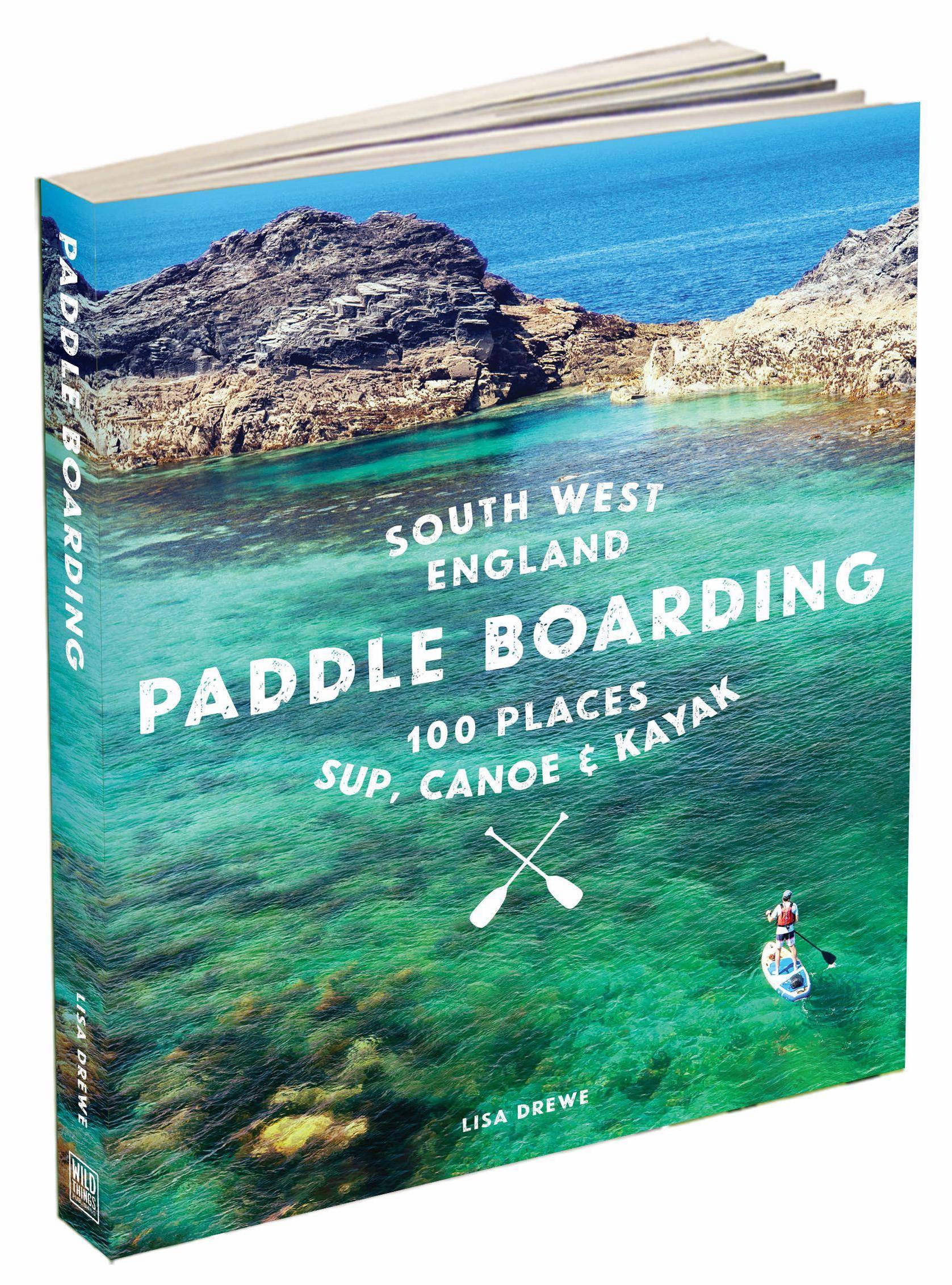


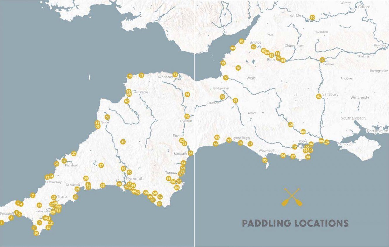
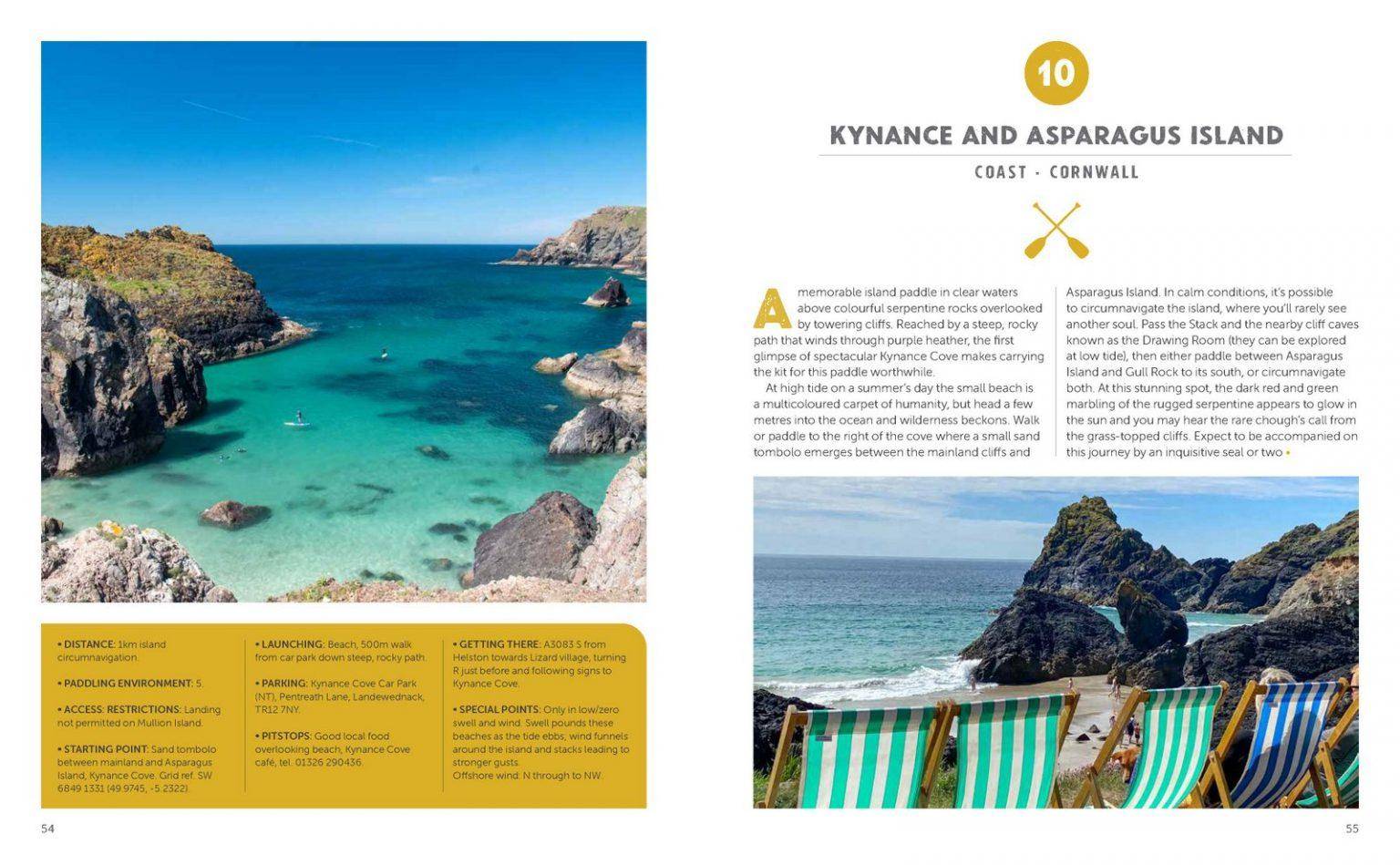
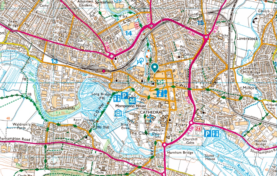
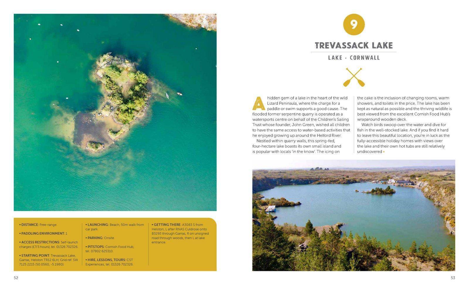


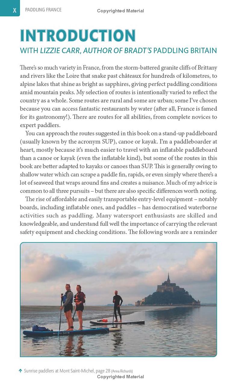
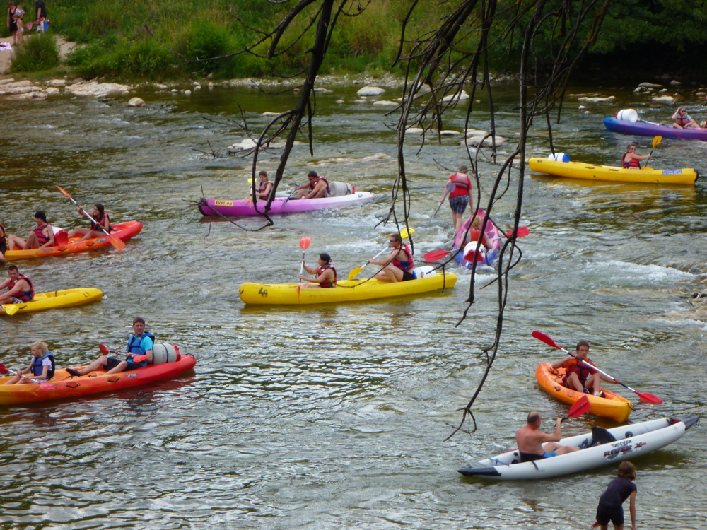
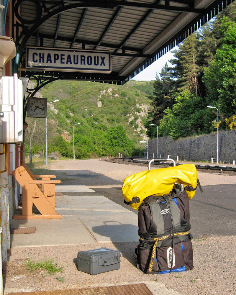


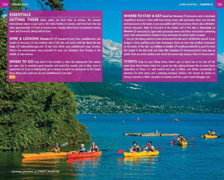


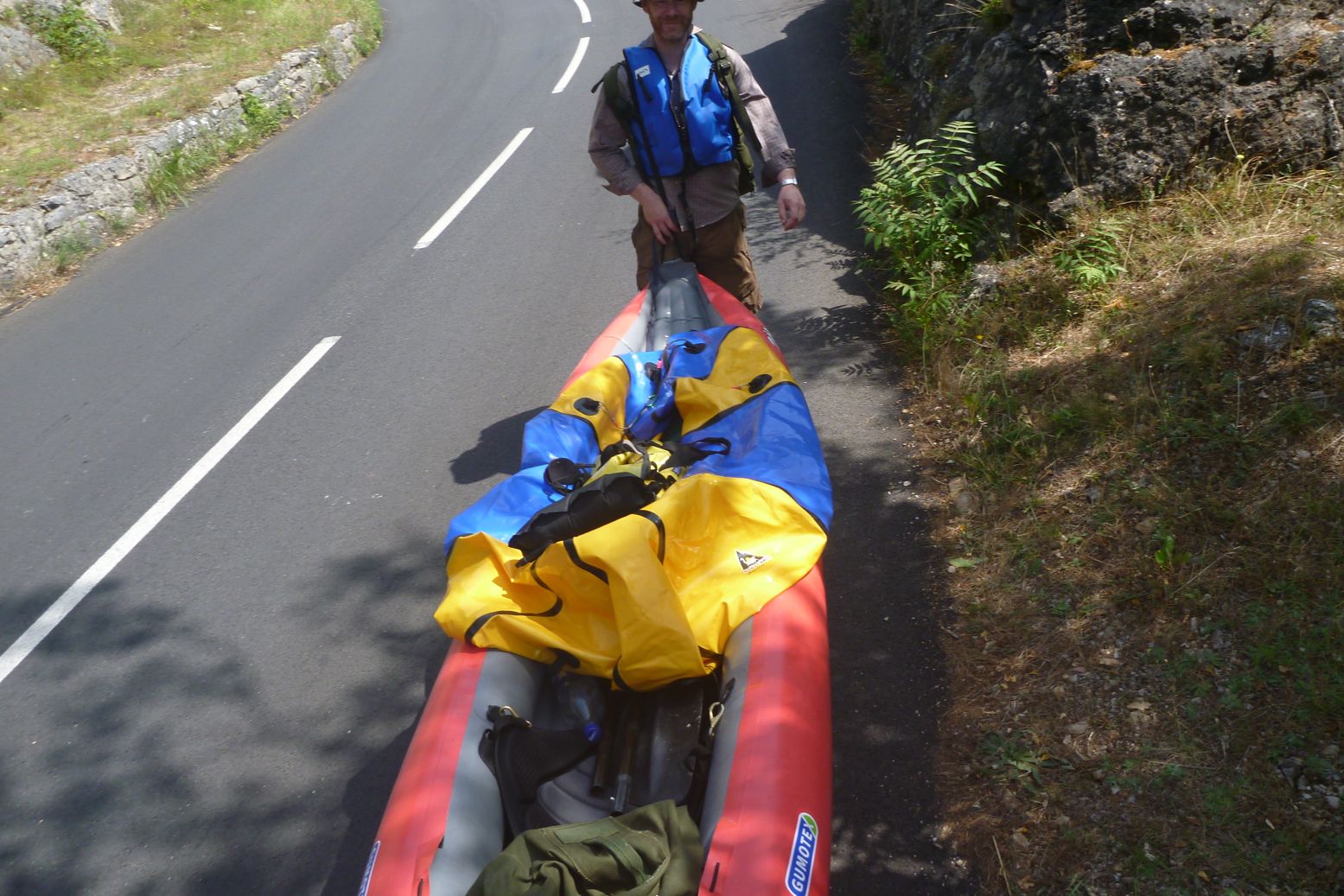


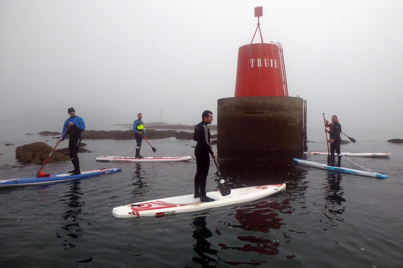

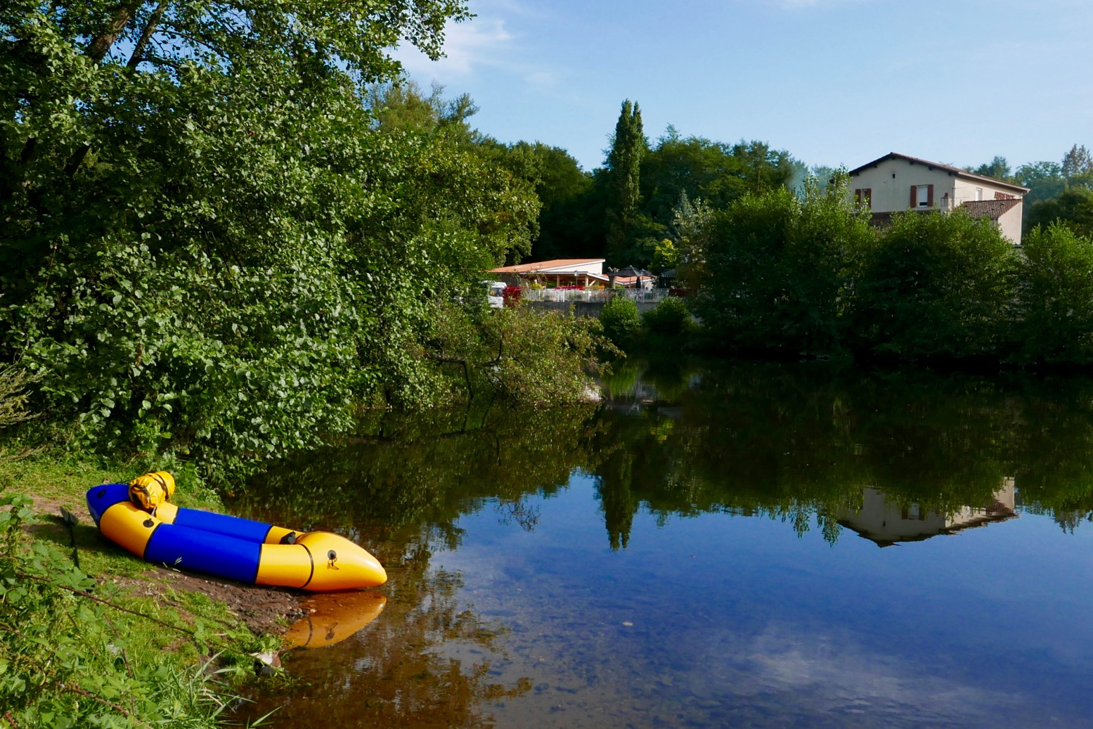

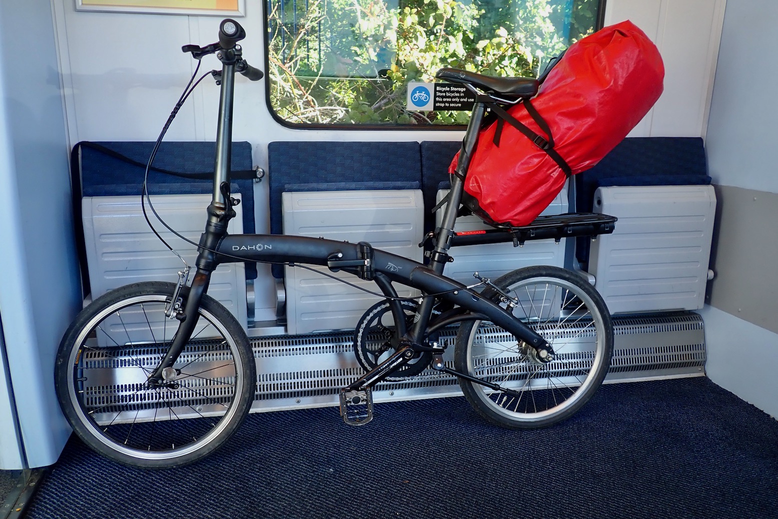
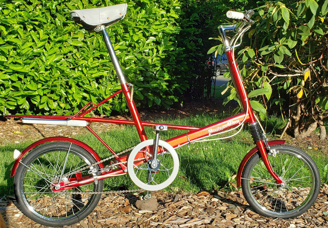
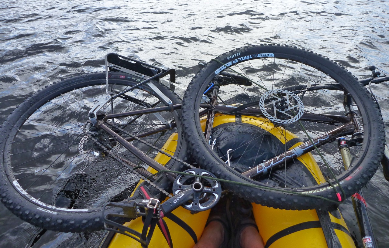


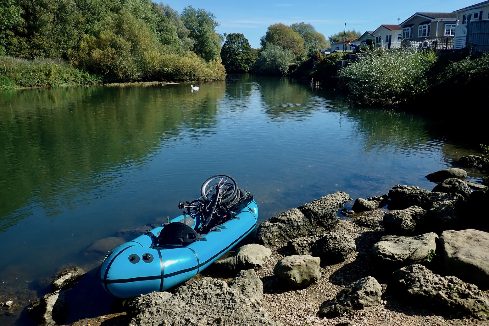


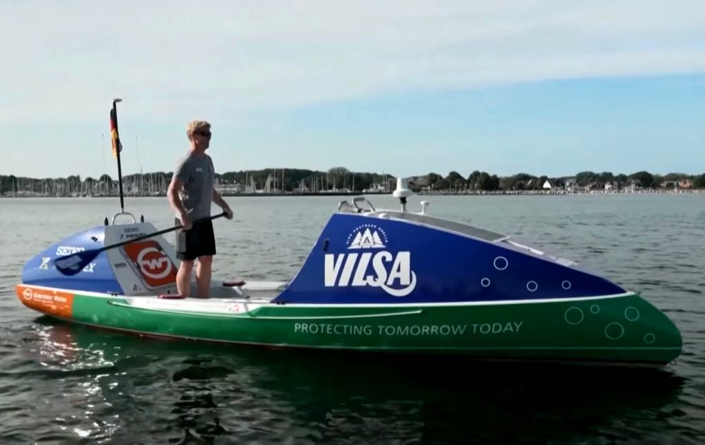


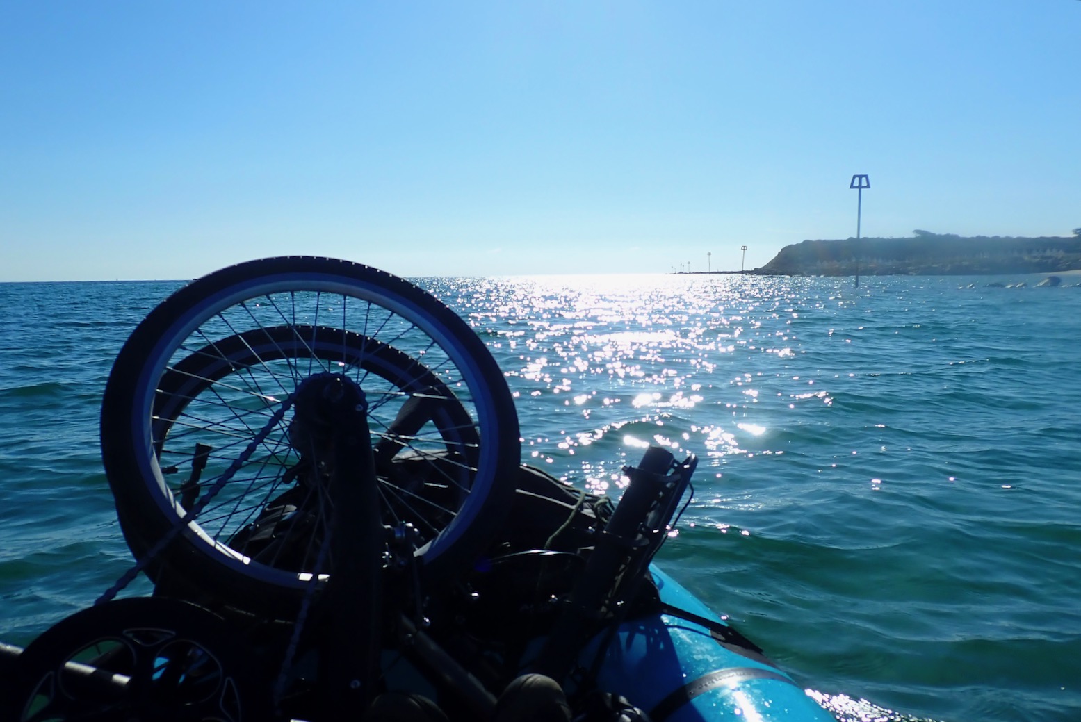
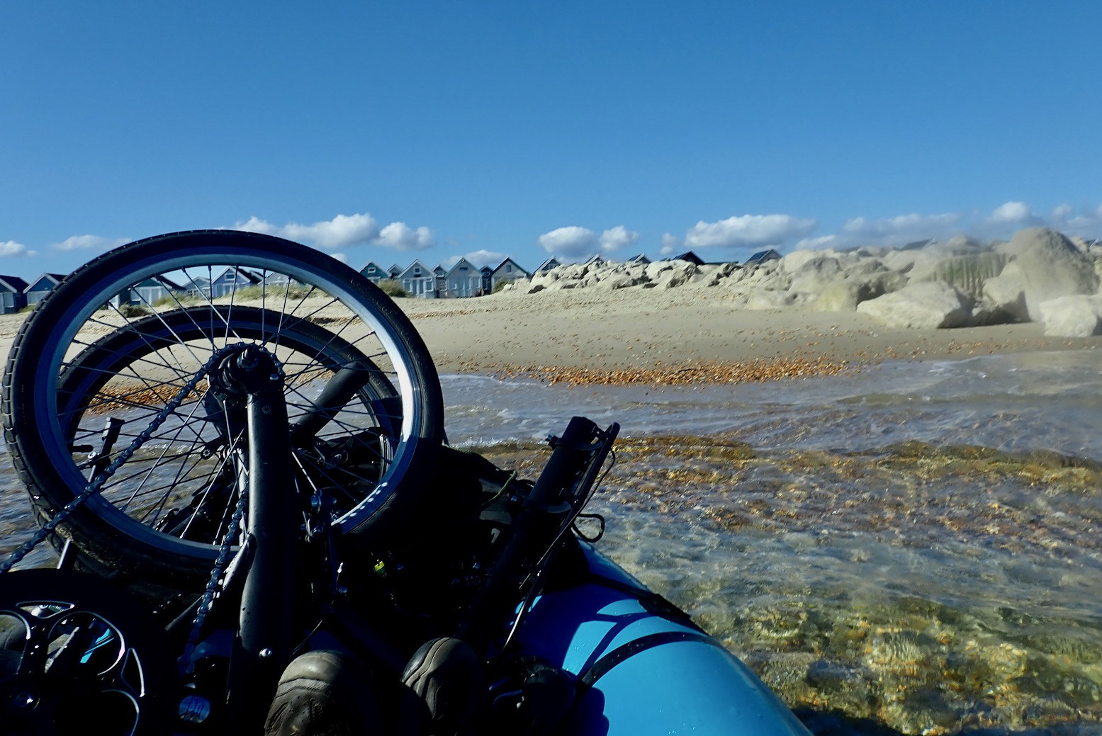


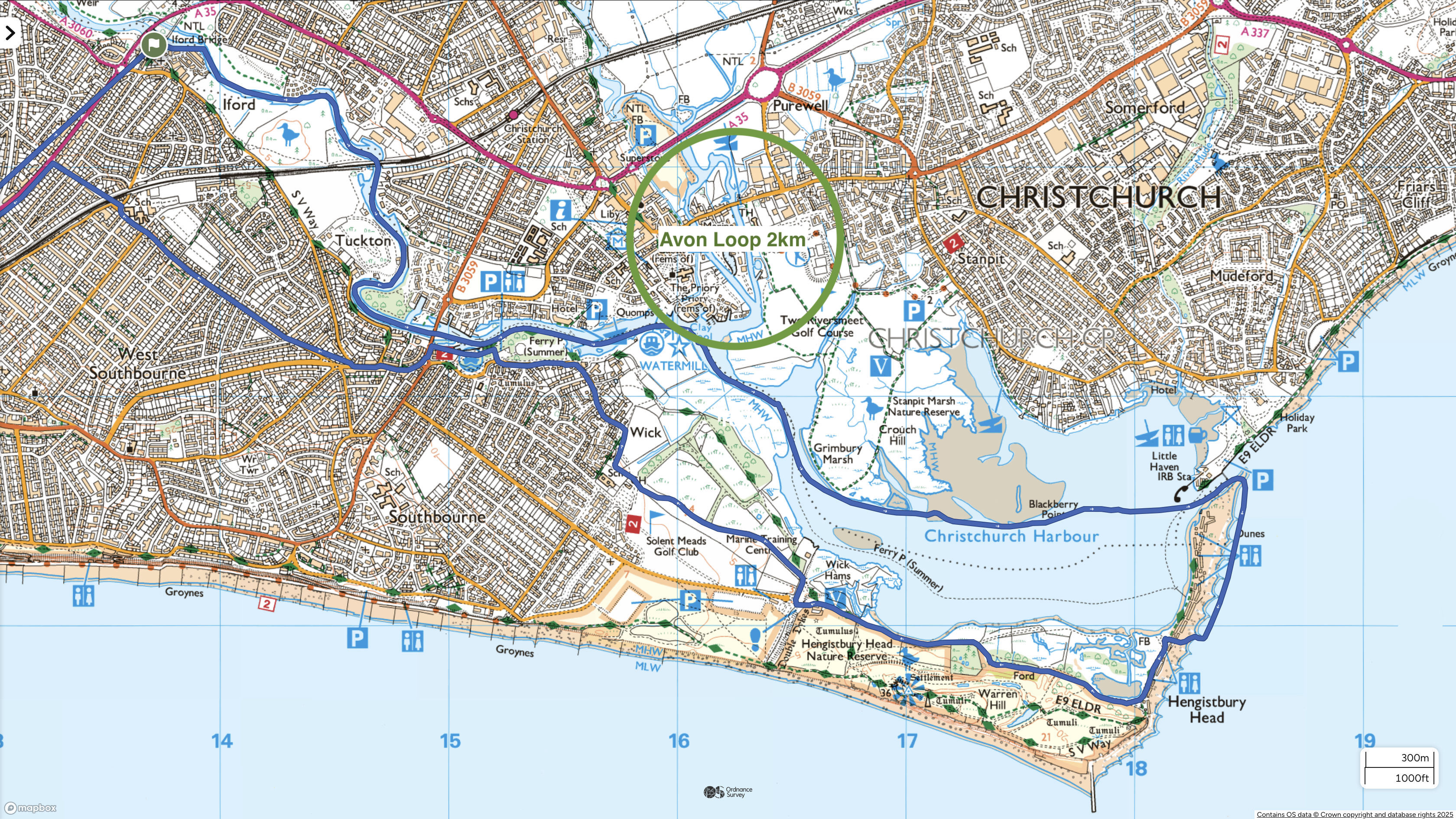


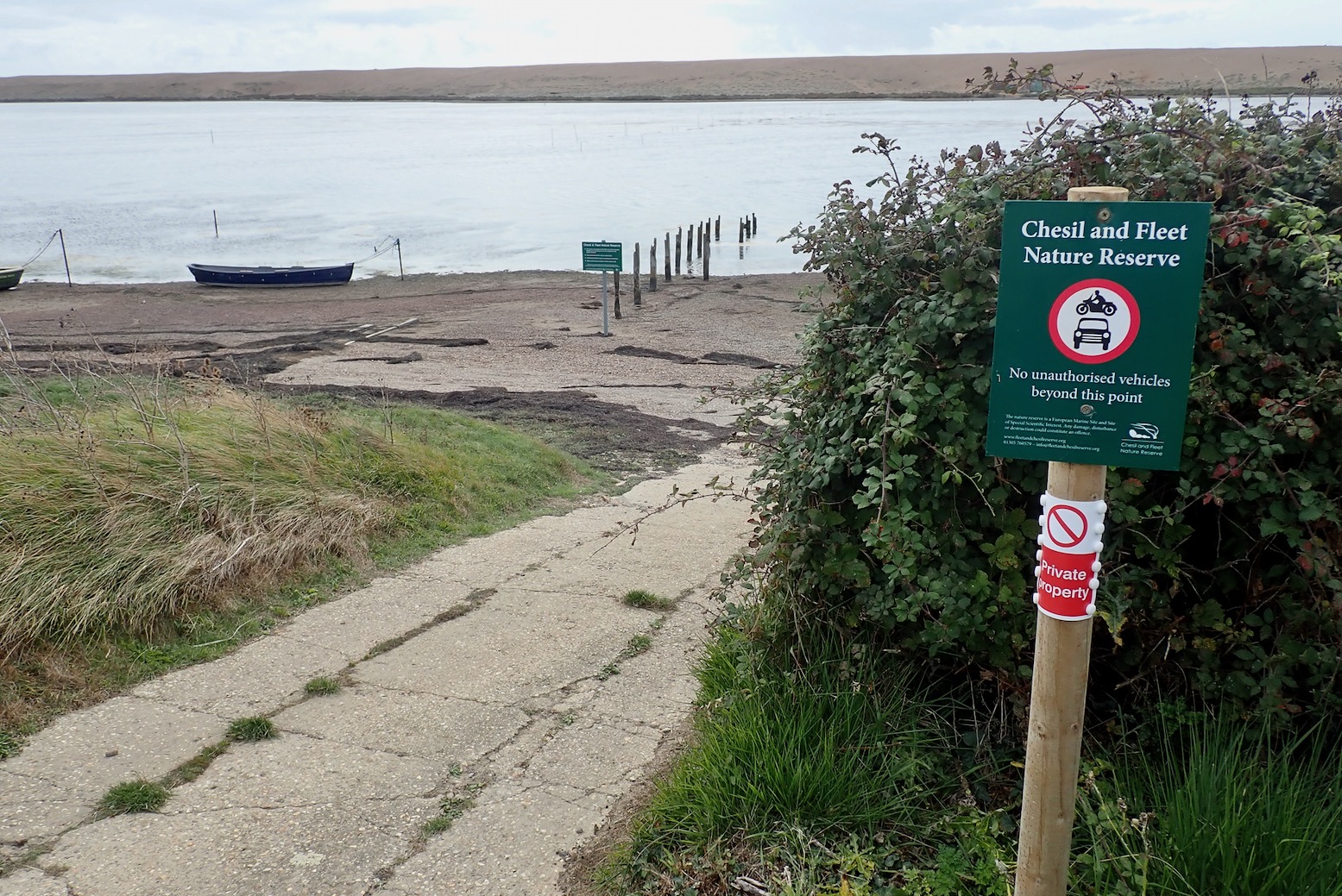


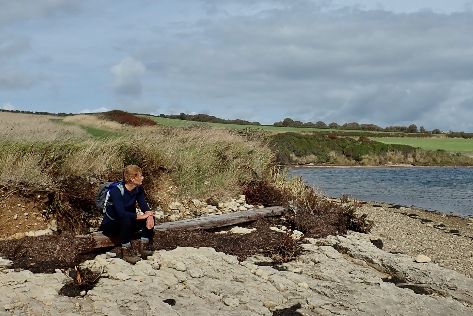


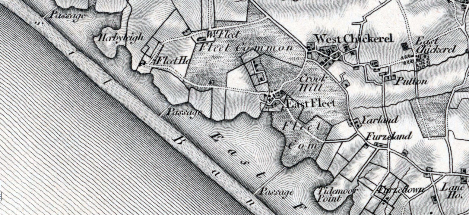


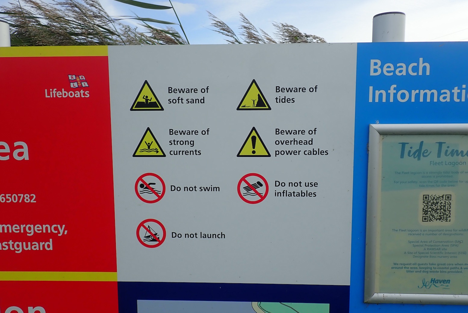
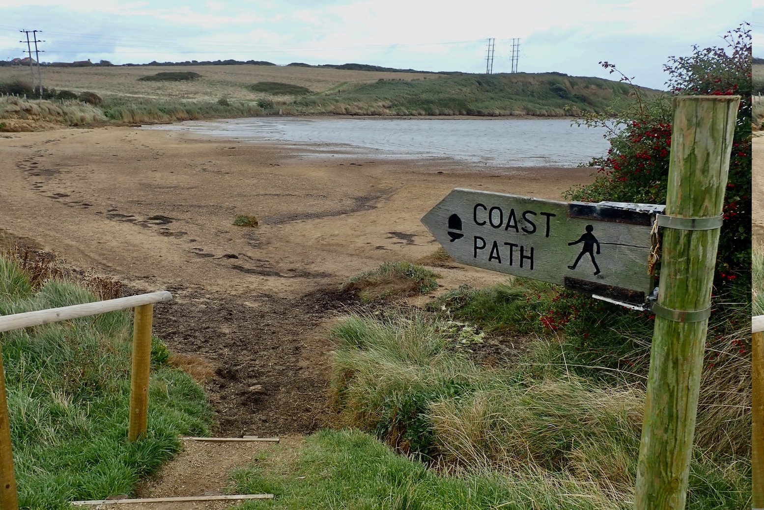


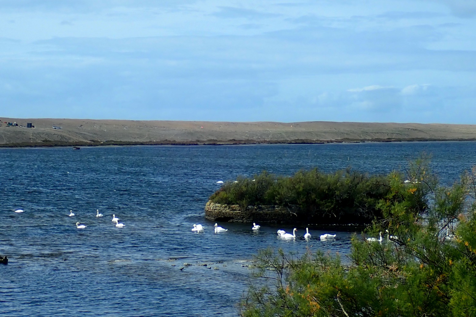


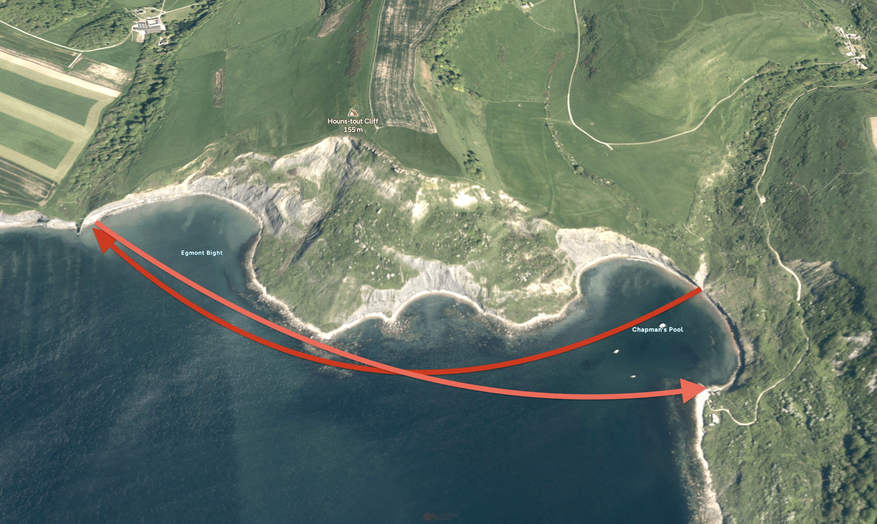

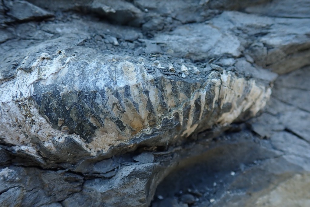

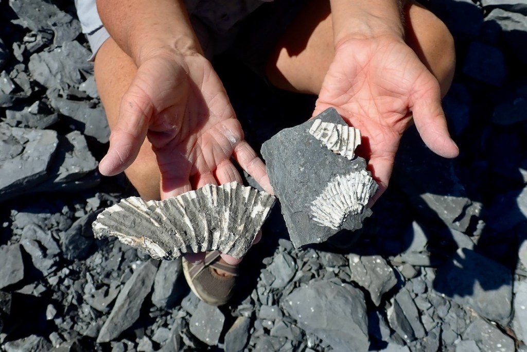


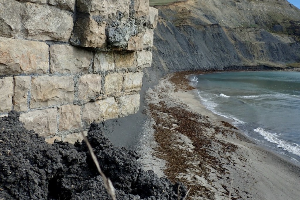

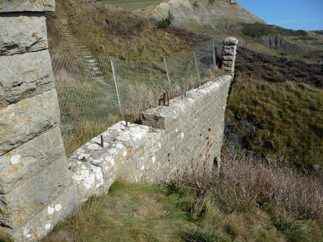


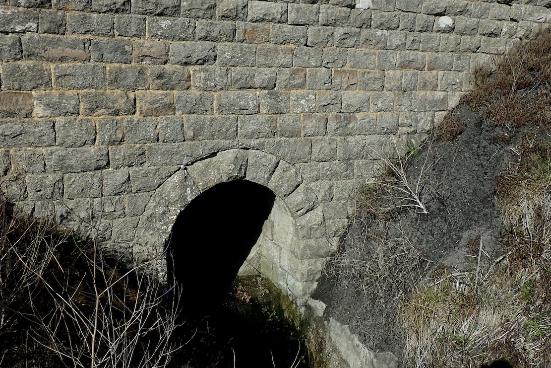


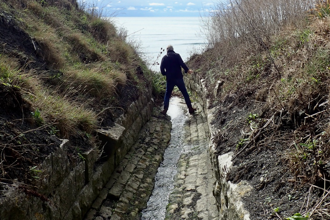
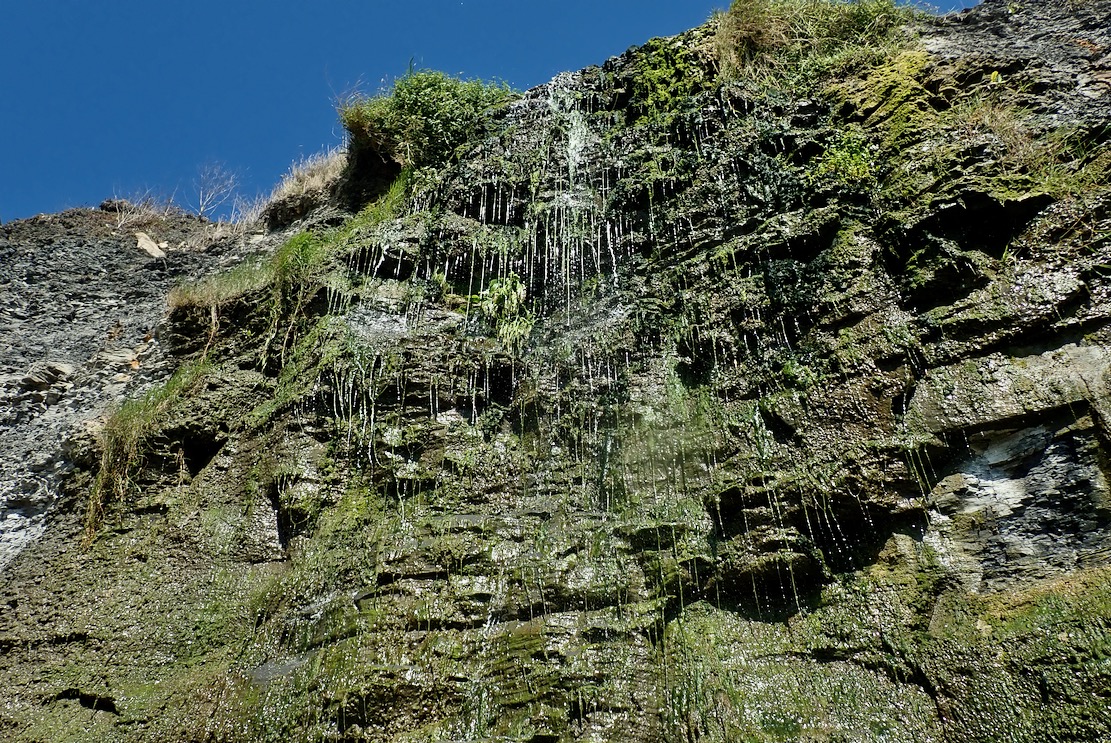
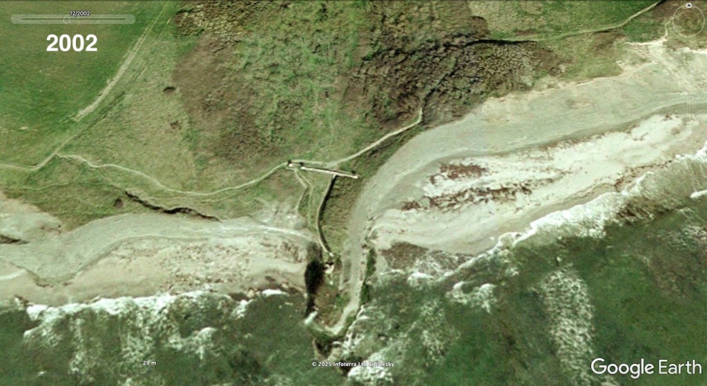


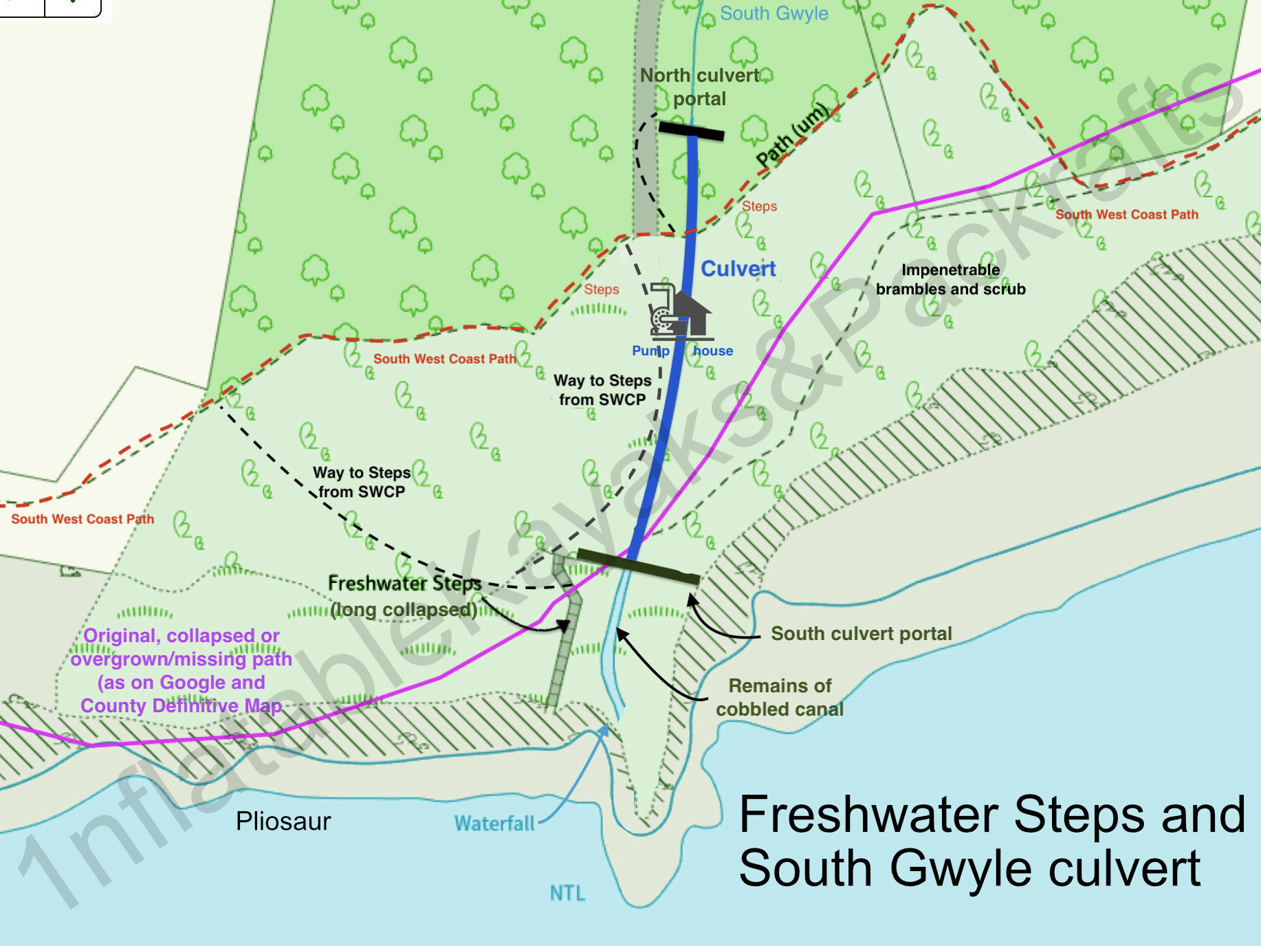


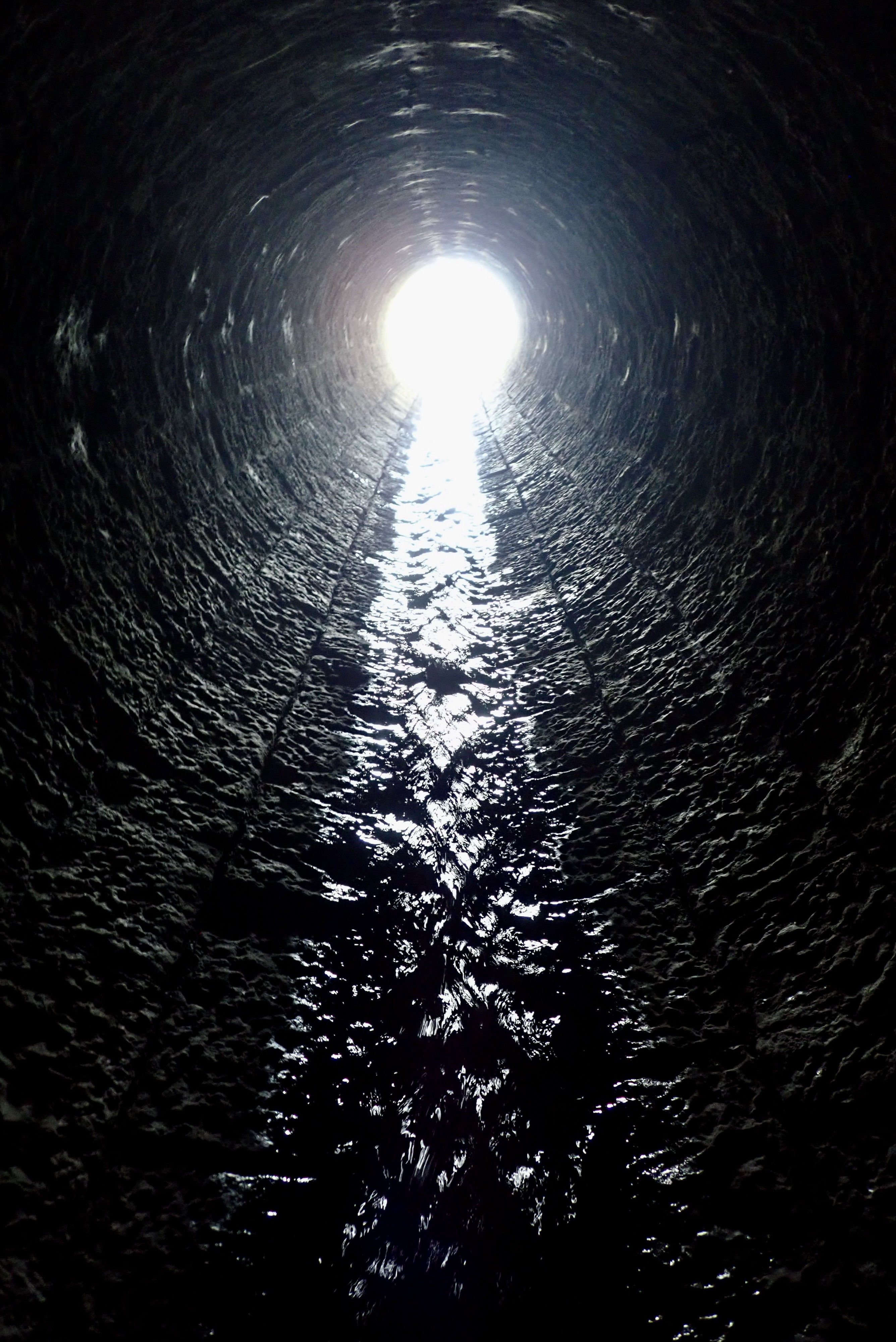


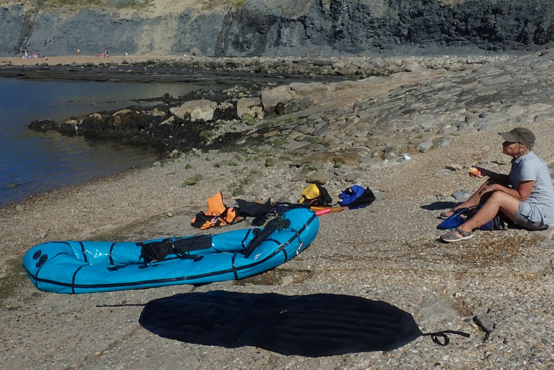


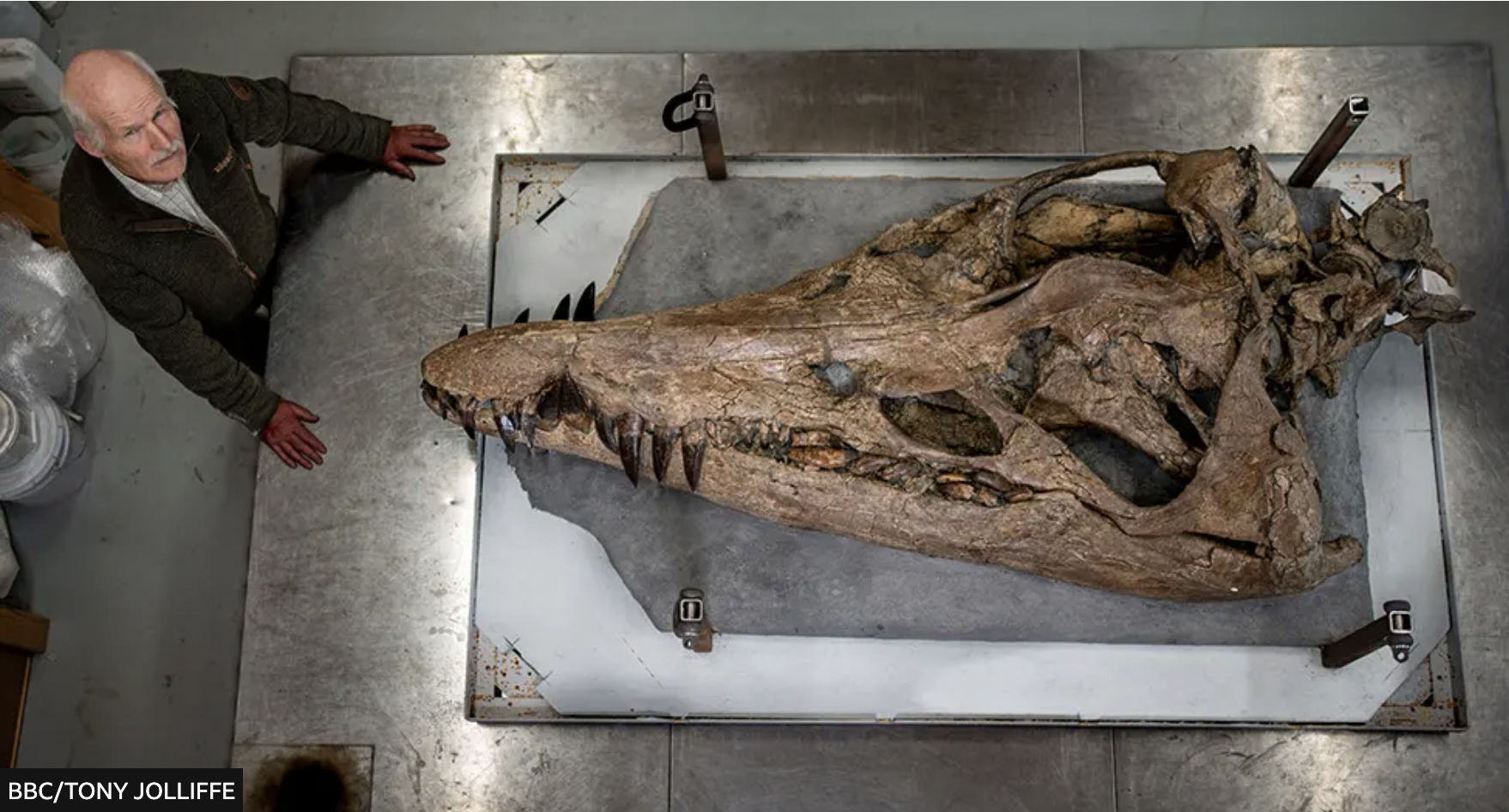


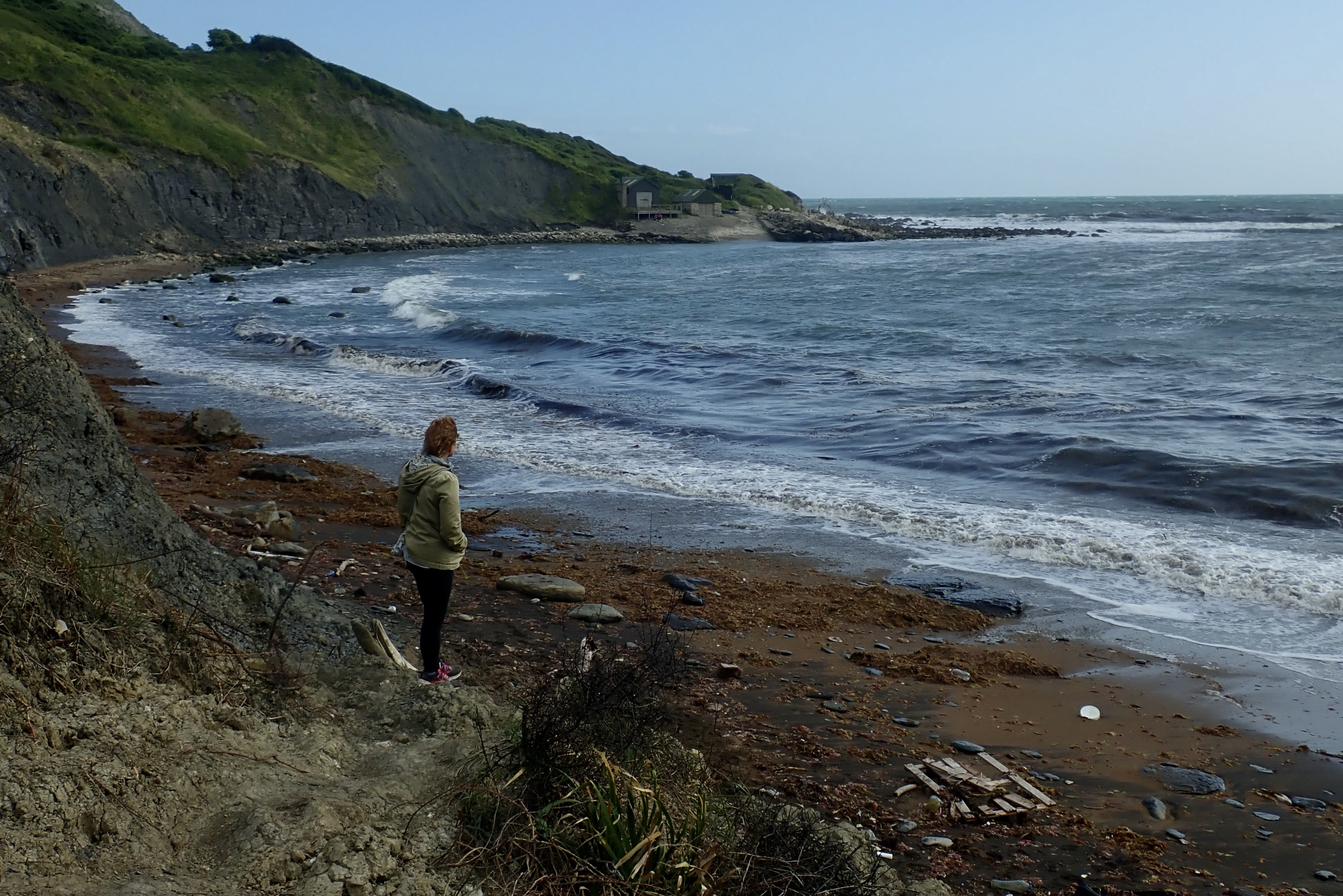
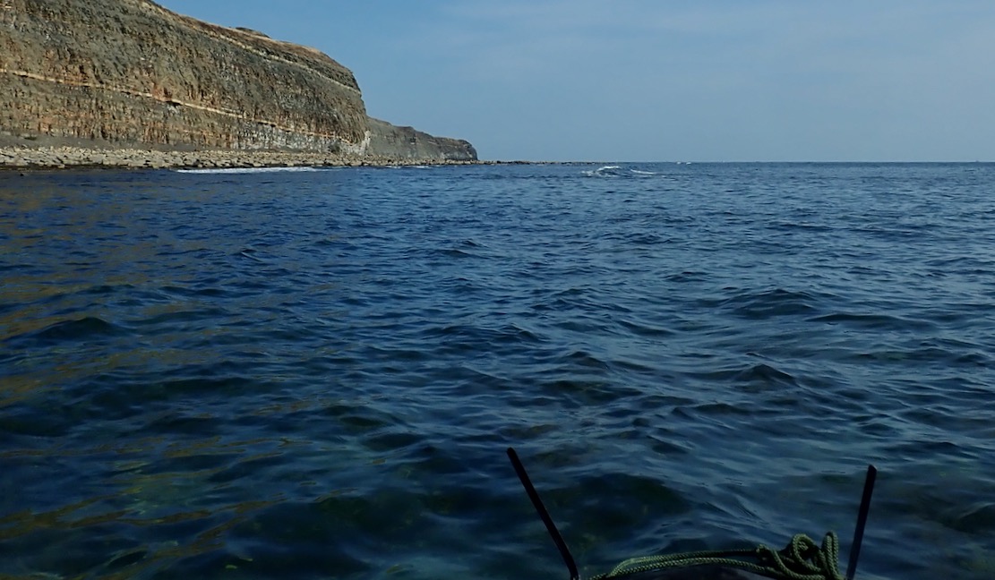


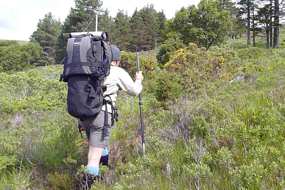
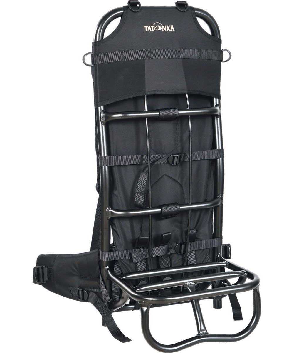


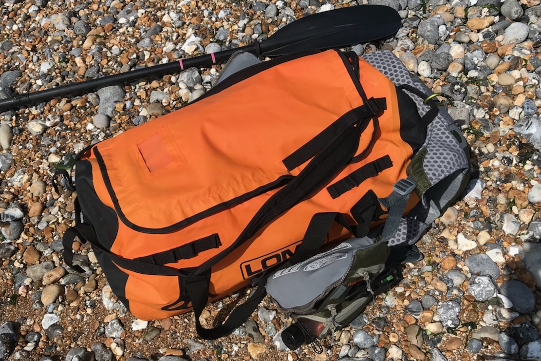


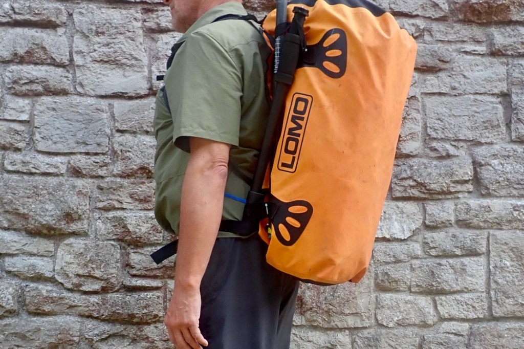


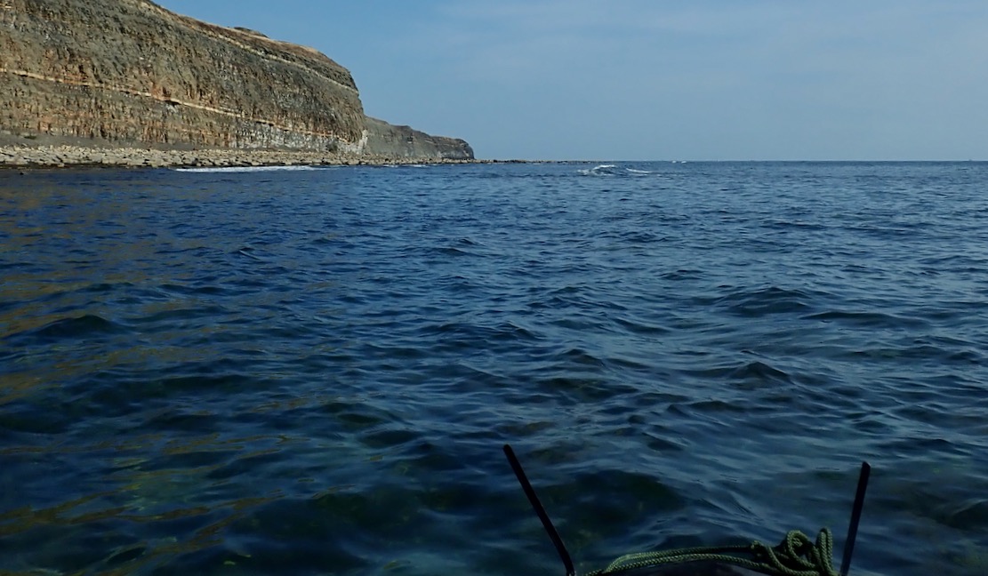


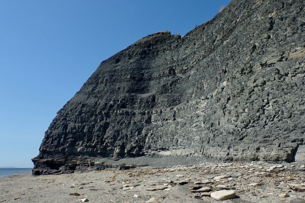
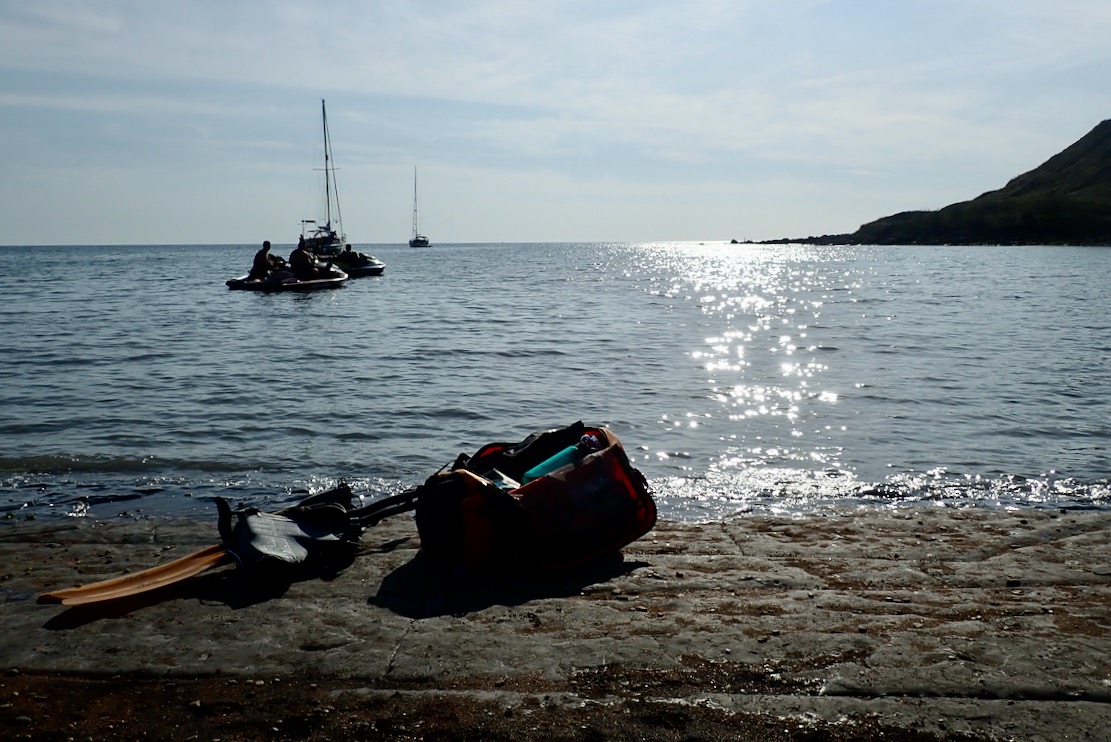
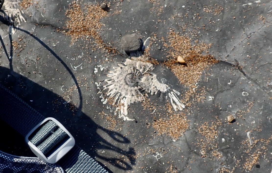


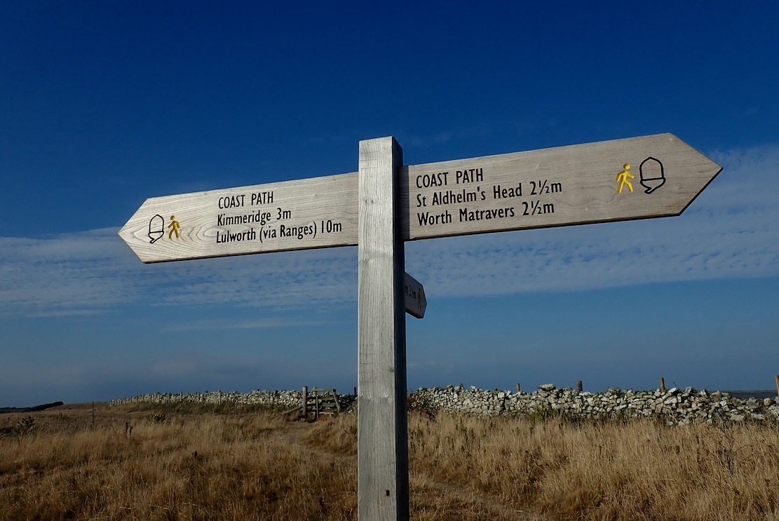
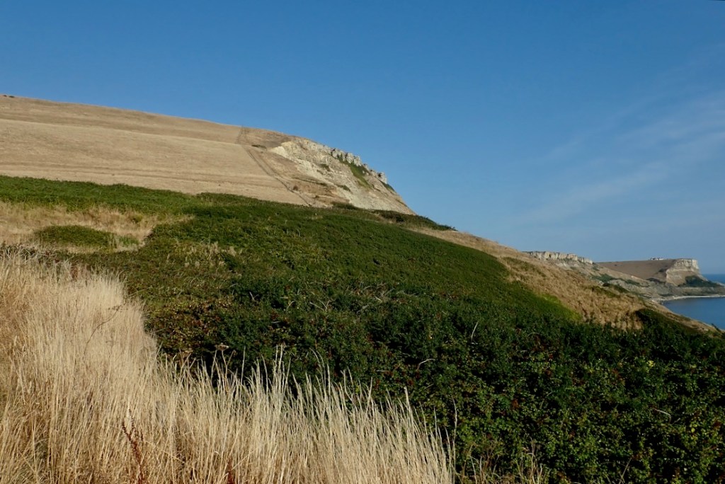

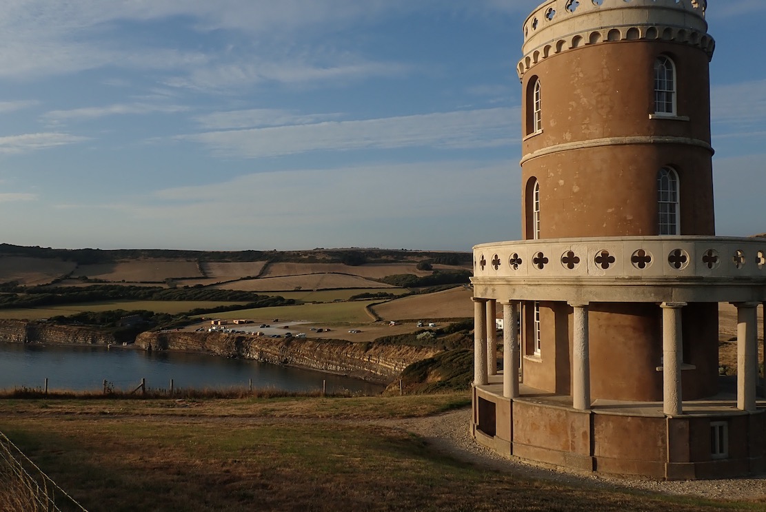


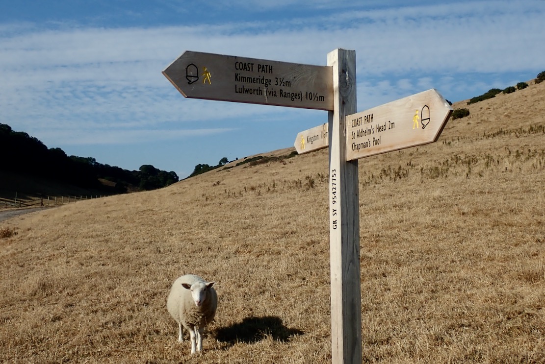
