Category Archives: Packrafts

In Search of the Kimmeridge Pliosaur

Anfibio Sigma TXL+ main page
English South Coast Day Paddles
Kimmeridge Ledges with Zelgear Igla IK
Packrafting Kimmeridge to Chapman’s Pool
The Mystery of the Freshwater Steps

They say everyone remembers where they were when the BBC aired ‘Attenborough and the Giant Sea Monster‘ on New Year’s Day, 2024. ICYMI, it’s still on iPlayer and having watched it, you’ll realise the profile of the famously fossil-rich Kimmeridge cliffs along Dorset’s Jurassic Coast has been raised further. Come high summer it’s impossible to find a park at the local Sainsbury’s.
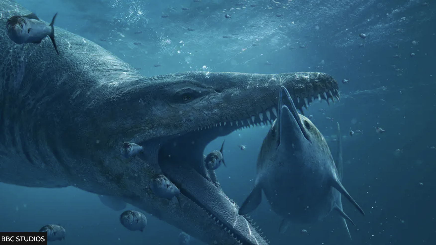
Attenborough and the Giant Sea Monster – on BBC iPlayer last time I looked

The story goes that in 2022, fossil enthusiast Phil Jacobs was fossicking along a difficult-to-access beach at low tide when he discovered a huge, crocodile-like snout in the shingle (left).
He contacted Steve Etches (below) at the nearby Etches Collection fossil museum in Kimmeridge and, long story short, a two-metre pliosaur skull was laboriously excavated from the friable cliff-face from which the snout had dropped. The BBC and Attenborough recorded it all as over months, the skull was painstaking restored and primed to go on display at the Collection the day after the documentary aired. Good article.
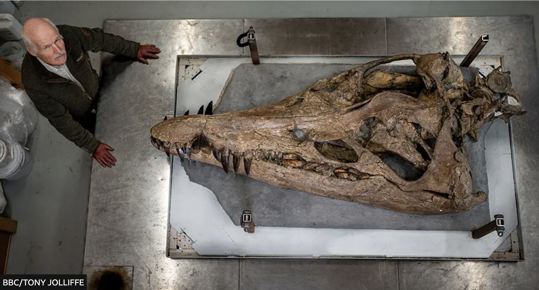
Steve Etches dwarfed by the massive pliosaur skull

I’d visited the usually deserted museum over Christmas a week earlier, finding another similarly huge pliosaur jaw and many other amazing marine fossils on display. Returning on a stormy January 2nd after the broadcast, the place was packed with curious visitors blithely ignoring the ‘No Photos’ edicts right under Steve Etches’ nose. Since then the Pliosaur has been rebranded as the ‘Sea Rex‘.

Smedmore Estate signs at Kimmeridge Bay (left) warn against doing many things, including fossil hunting, and yet the museum has a video on how to do this safely. So I wondered how permission worked in the technically ‘neutral’ or Crown-owned intertidal zone (ITZ) where the fossil-rich Kimmeridge Ledges lie, and further east where the snout was found. A member of staff explained that protected SSSI status (see map or below) extended into the ITZ (as it might do for coral reefs) and Etches, a local man with decades of fossil collecting behind him, is the only person with permission from the Smedmore Estate (who help fund his museum) to excavate fossils, presumably in the cliffs fringing their land above the ITZ.

Kimmeridge SSSI includes ITZ

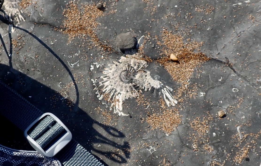
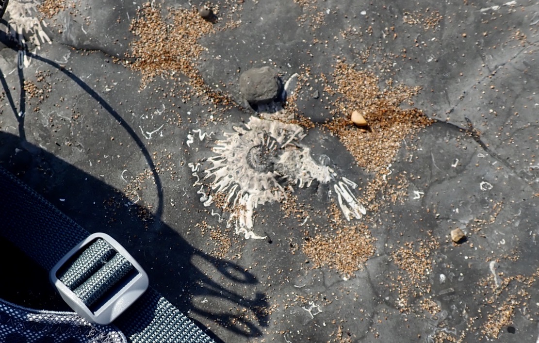
Perhaps finding tiny, loose fossils while beach combing is tolerated. When I was packing up my packraft the other day at Chapman’s Pool, I flicked off a wet flake stuck to the boat and could swear it was a thumbnail-sized ammonite fossil, DoB: 150,000,000 BC. I tried to find it among the shingle, but the fast-rising tide was lapping at my feet, so it got away. Another time down at Chapman’s (below left), the geef easily found a curl of ammonite shell the size of a thumb. Ammonites embedded in the exposed grey bedrock are everywhere (above left).
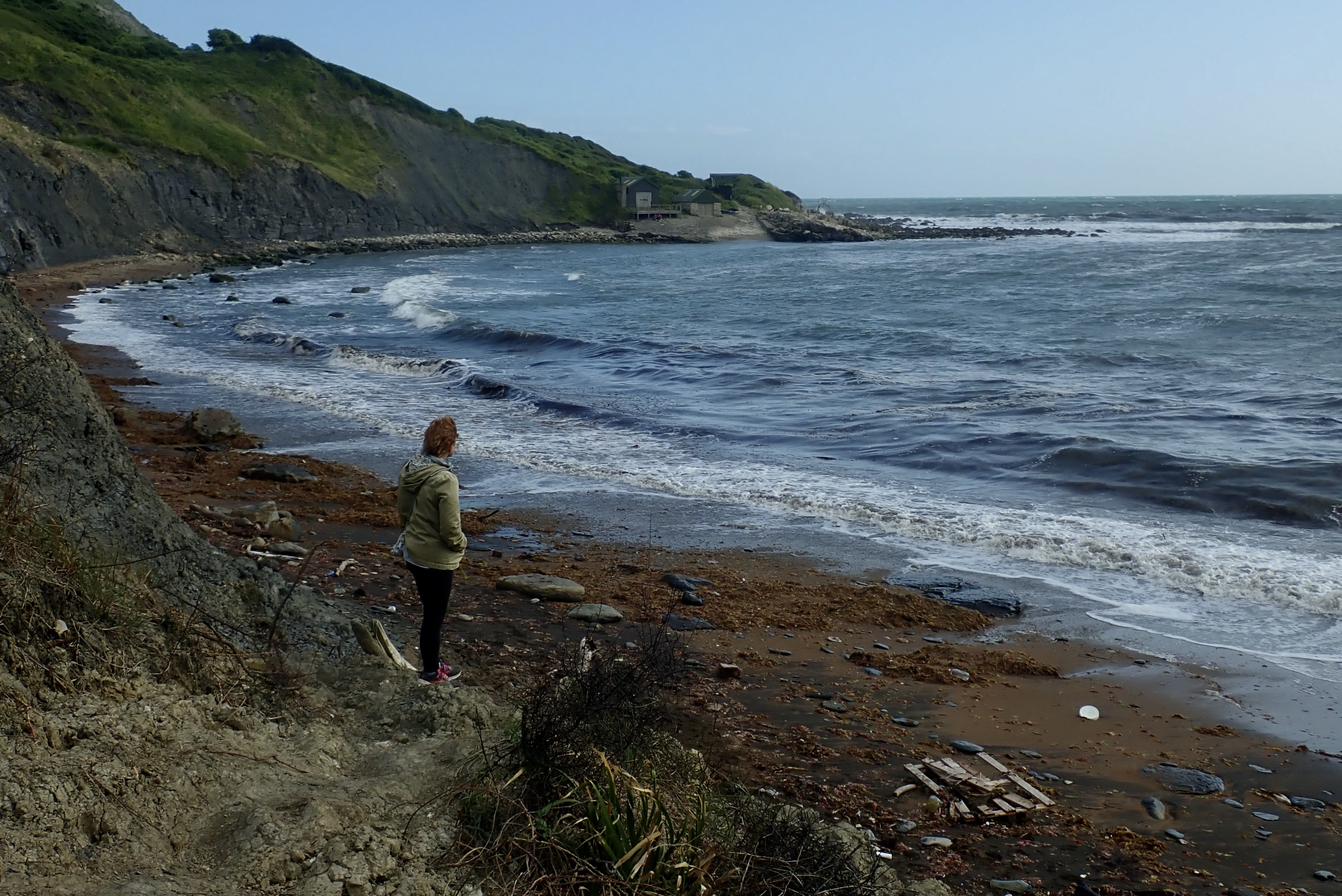
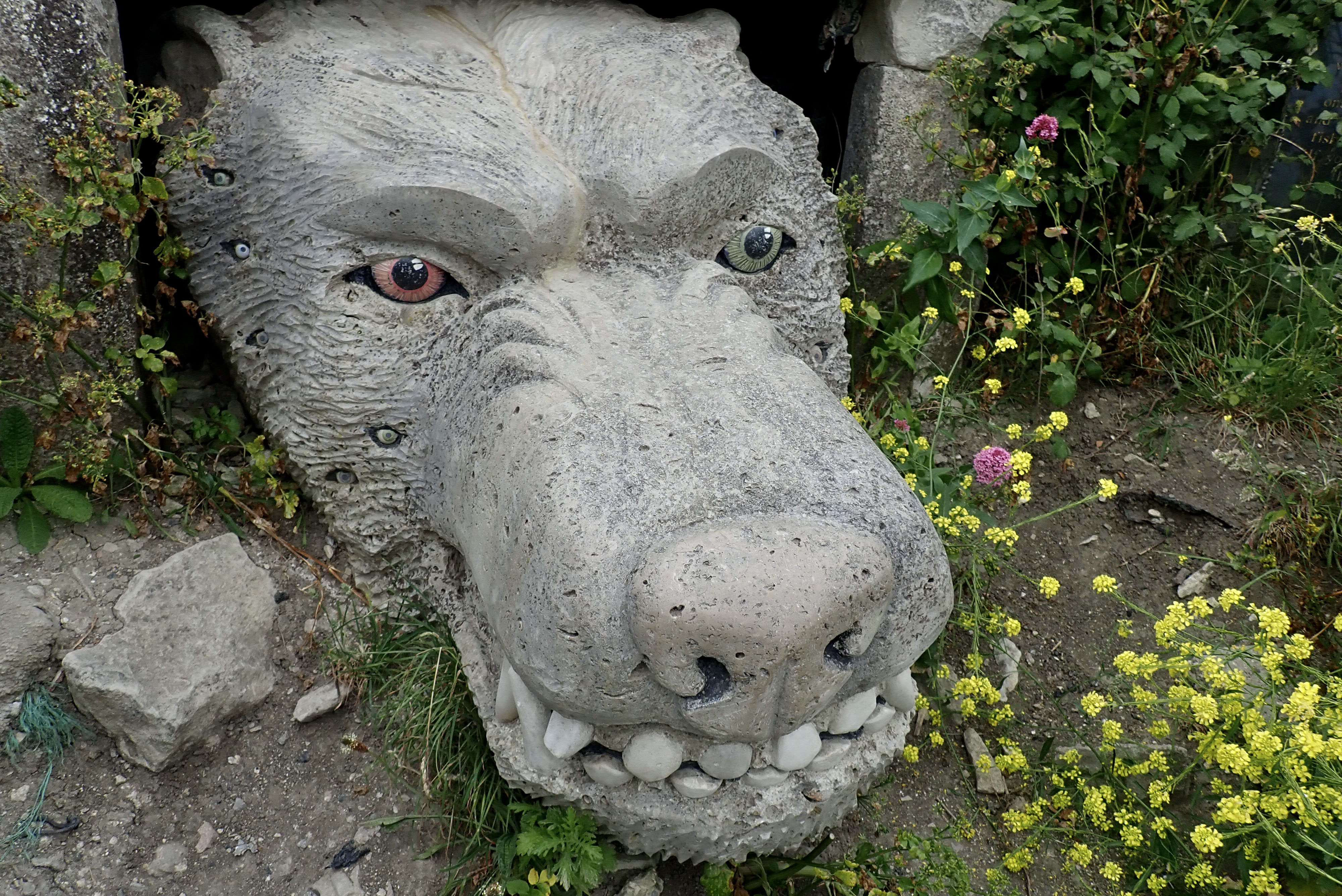
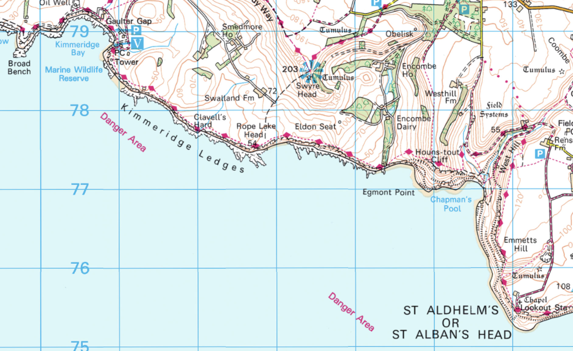
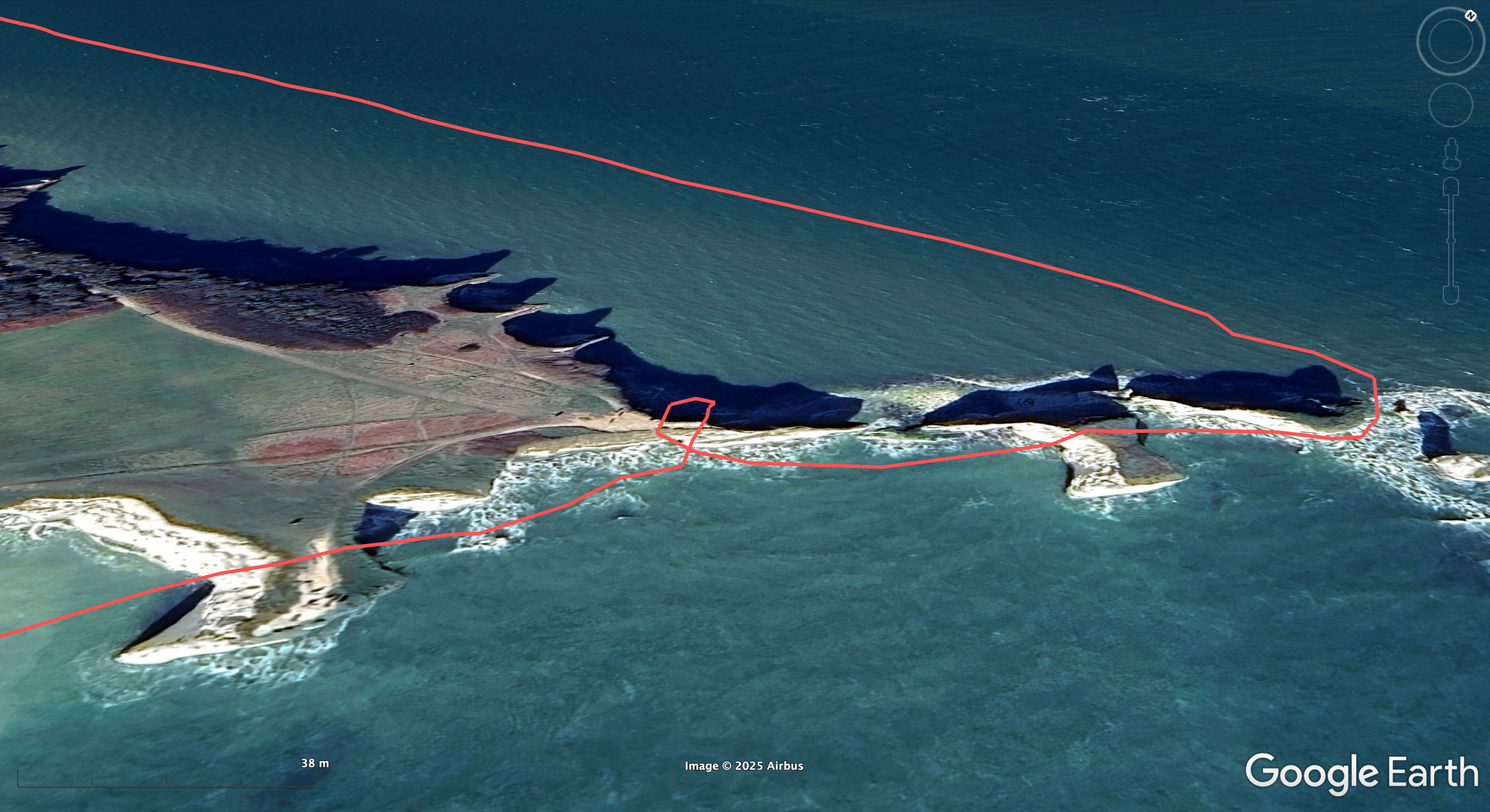
Like many who know the area, I was curious to know exactly where the fossil was found – or more accurately, solving the geo-locating challenge was a bit of ‘Wherewozit’ fun. Not surprisingly, the location was conspicuously absent from mainstream reports, but within the first minute of the BBC doc the excavation site is shown, and a couple of minutes later, snout finder Phil Jacobs’ shaky phone video pans past a waterfall in the background with a limestone wall bridging it (more below), and a mention of ‘east of Kimmeridge’. Ah Ha! The waterfall appears again in the BBC doc, so all in all you don’t have to work for GCHQ to pin down a possible location.
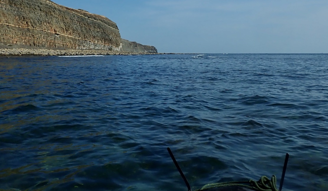
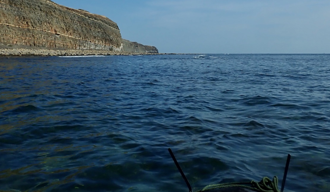
Fast forward a year and I finally got to paddle past what looked like Punta Pliosaurus on my way to Chapman’s from Kimmeridge. Beforehand, I’d wondered what would be there: disingenuous ‘Danger, Keep Away, Loose Cliff’ signs, evidence of excavation to retrieve the rest of the megafish’s body, or a huddle of day tourists from Swanage?

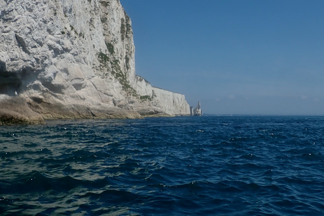
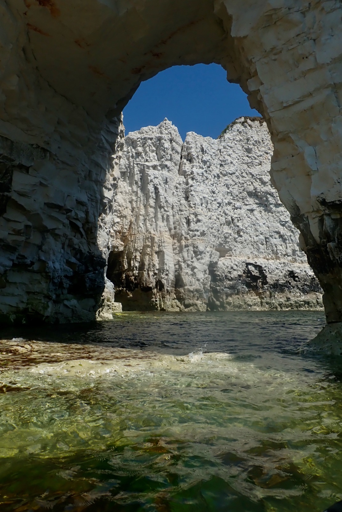
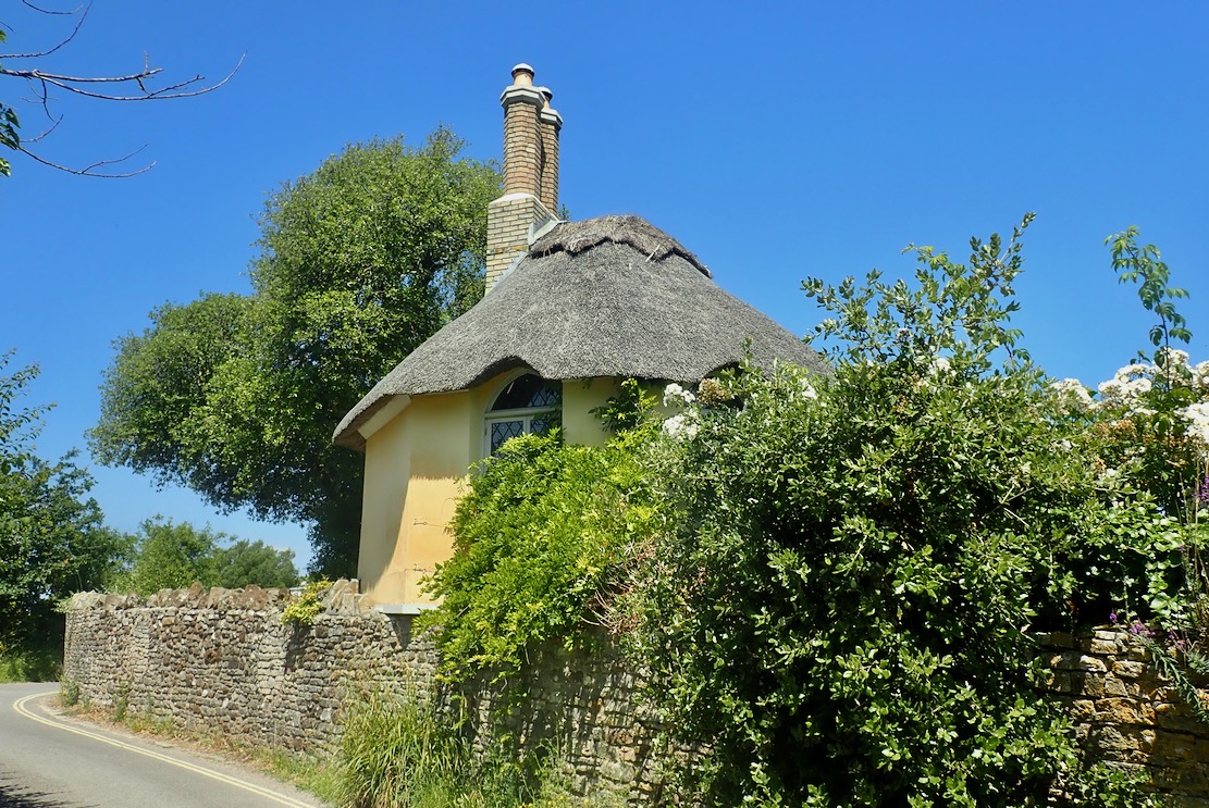
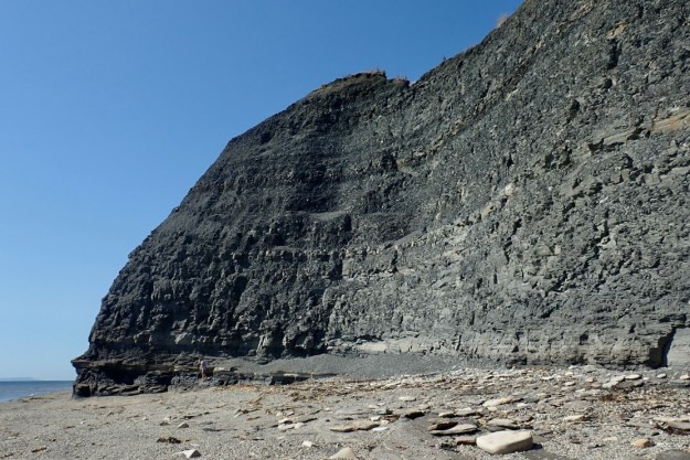
Although a late-afternoon sun was casting a shadow across the cliff (above right), all I can say is, assuming I’d got the right place, they’ve done an superb job of disguising the excavation of the pliosaur skull and restoring the cliff’s natural appearance until they get a chance to come back and finish the job. That said, a couple of weeks later a regular walker who knew the story here thought natural processes had quickly obliterated the excavation but either way, once done, they’re gonna need a bigger display case. Meanwhile, something else above the beach had caught my eye. More about that here.

Using your paddle as a packframe

See also
Pack & Bags

Walking back four miles along the Jurassic Coast the other evening (left) was a lot more tiring and took longer than paddling nearly the same distance to get there. That’s not so surprising. A steady paddle on a calm day with only your arms is a lot less effort than walking 340 metres of elevation gain, carrying the boat on your back.

NouadhiWhat? Hello?

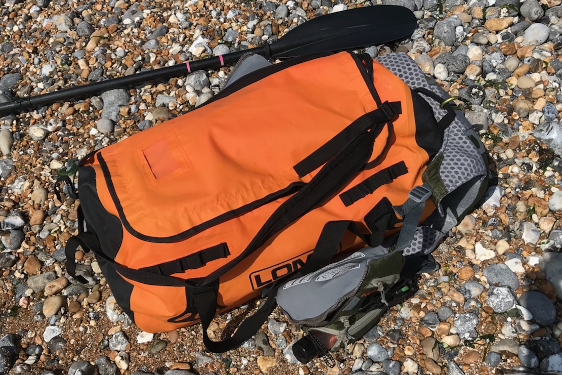
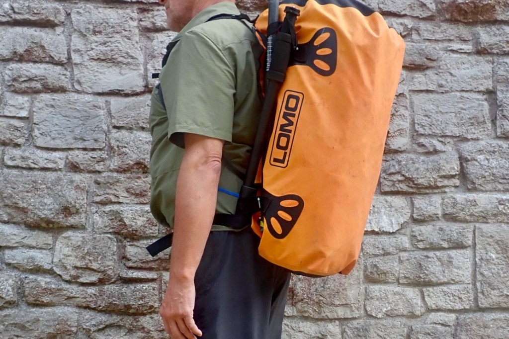
It wasn’t helped by the fact that the TXL was in my Lomo Blaze, a holdall with basic backpack straps, so the whole weight was hanging from my shoulders. I like my Lomo; unlike a rucksack the bag is made from heat-welded PVC which is waterproof. Yes it may have a regular zip for the lid, but it cost 40 quid and is a lot easier to load, access and see what I’ve forgotten this time. I’ve even used it as a ditch bag on desert trips (left; sadly I needed to ditch that time). But Lomo is not a great backpack for long. As I neared Kimmeridge, mesmerised by the setting sun, I had a vision of a Better Way…

I’ve been through this all before
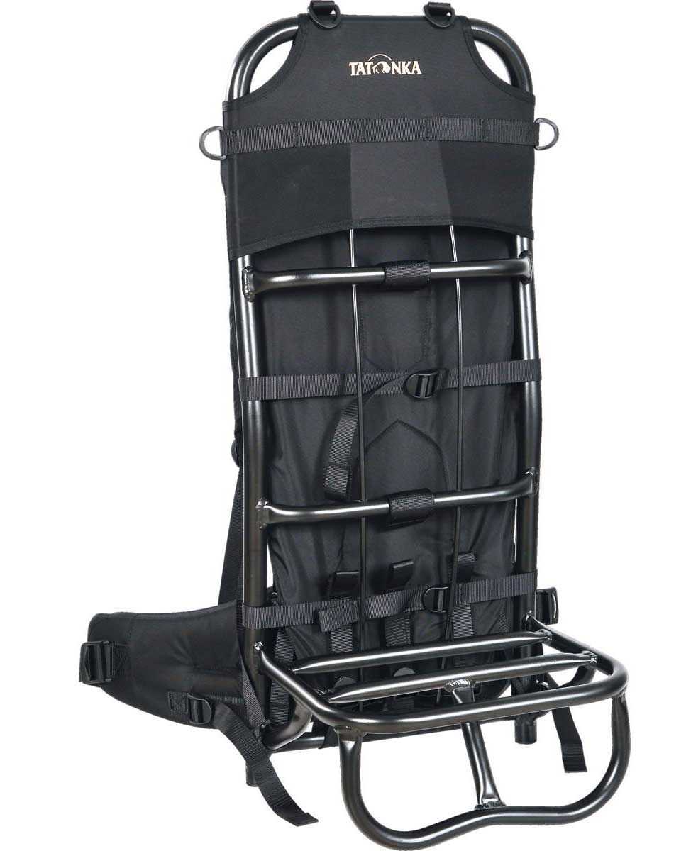
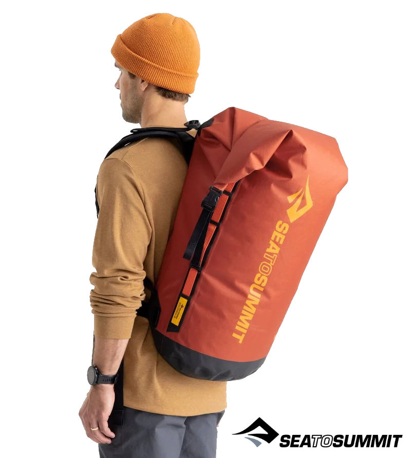
…how to carry the boat and gear sustainably over land and water. Besides trolleys for train trips, there are packframes like the Lastenkraxe fit to carry a well-fed moose calf, pack harnesses like the NRS Paragon and Six Moons Flex PR which wrap around anything. Even my huge, airtight Mk1 Watershed UDB sausage bag became semi rigid when ‘pressurised’, but had a rubbish, ill-placed ‘harness’ (so needed an NRS). The wheeled Ortlieb 140 could also be backpacked – but not long term.

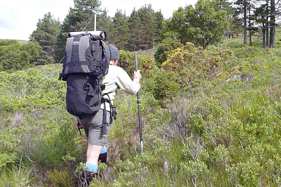
You want a stable, well-supported pack on terrain like this: ie; a proper backpack or harness with chest strap and hip belt

For a multi-day trip, mixing walking and paddling (aka ‘packrafting‘), like we did in Knoydart (above), packframes or just a proper rucksack make sense. But for day paddles they’re overkill and awkward to stash or keep dry on the water. My brainwave was using the paddle shafts as an external packframe to create a rigid rod from the top of my holdall to the waist (below).

Paddle shafts twisted into the Molle on the left (top of pack; not load), and then ziptied to the Molle (right) where the weight will rest on the paddle’s collar.

As we should all know by now: for longer walks over rough ground weight supported low on you waist is more sustainable than hanging high from your shoulders. It makes you less sore and much more stable which adds up to less fatigue. That’s why both the heavy hauling Lastenkraxe (below left) and Six Moons Flex come with such generously padded hip belts: it’s where most of the weight is carried.

The Lomo 60 Blaze is just a holdall with backpack straps and handy grab handles at each end; it doesn’t have a hip belt but it does have a run of Molle webbing lashing points (above right) to which I sometimes strap my paddles. The shafts from a 4-part paddle could be lashed to the Molle each side (or even a whole 2-part paddle), with the lower sticks hooking into any waist strap or belt. Though it would be nice, for a couple of hours with 8 kilos there’s no need for a fully padded belt with pockets and an SOS ripcord.

Paddle shaft zips to the bag’s Molle loops then tucks in behind any belt, even the one holding up your trousers. Minimal and reversible adaption: the bodger’s Holy Grail ;-)

The shafts are zip tied (blue) to the Molle at the lower end, so the weight rests on the shaft’s collar (above). The shaft then tucks behind a belt and the weight should at least partially be spread onto the hips, not all hanging from the shoulders.
While I was at it, I decided to cut off the Lomo’s redundant carry handles. They get in the way when groping around for the backpack straps which can perform the same carrying function. I ‘zip-sewed’ the loose ends into loops (left) to take a half paddle or two on each side.

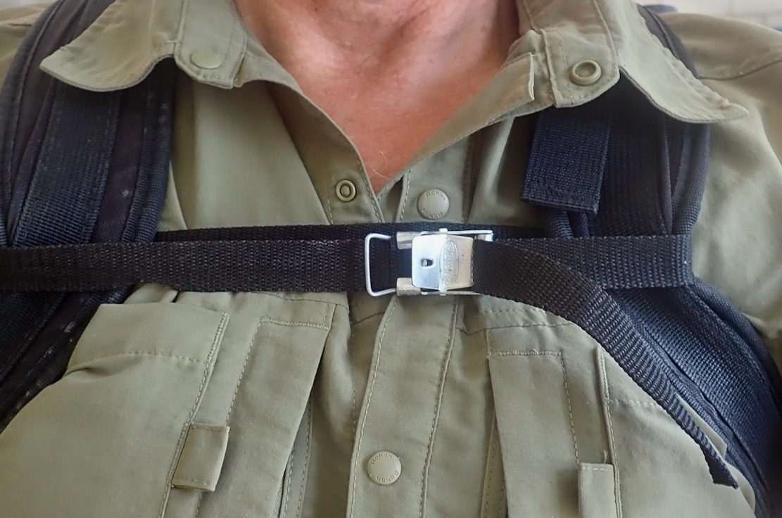
All that was needed was a chest strap (left and above left) to pull the weight in close. This alone makes a big difference to stability, I find.
Tested outside with the Lomo loaded for a day paddle, it felt pretty good considering the minimal effort involved. Best of all a belt doesn’t have to be attached to the bag in any way and could even be your trouser belt. Just tuck in the shaft ends, tighten up and jog forth.
The advantage is that for a day paddle ending in a walk of a couple of hours, no extra gear is needed, bar a belt or strap. In the boat the near empty holdall and belt are rolled up out of the way or stuffed in the Deckpack. Assuming you’ve not repurposed your paddle as a packstaff, your day-paddling outfit ought to be a lots easier to carry, especially over rough or steep terrain.


Packrafting Jurassic: Kimmeridge to Chapman’s Pool

Anfibio Sigma TXL+ main page
English South Coast Day Paddles
Kimmeridge Ledges with Zelgear Igla IK
The Kimmeridge Pliosaur
Packrafting the Jurassic Coast (video)
Packrafting Lulworth Cove to Kimmeridge
Dancing Ledge and Sea Caves

Action Stations and man the pumps. Conditions are finally benign for a paddle from Kimmeridge Bay to Chapman’s Pool – a distance of over three point six miles. It’s not exactly rowing the Pacific, but in a dumpy packraft you need to pick your moments when there are no take-outs from one end to the other, followed it’s a stiff, four-mile walk back.
A big spring tide was inbound for HW about 8pm and the wind was forecast at just 8mph SSW (onshore) and dropping by late afternoon. Plus it was sunny, too. Which was nice.

I packed a paddle in my pack and rode down to Kimmeridge Bay.
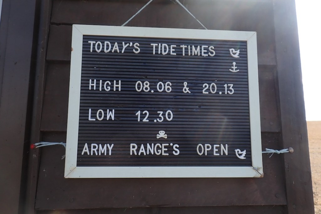
At Kimmeridge Bay’s massive car park field, bikes are only £1.20, but it’s a choka bank holiday weekend so I hope the lad at the pay shed was on a percentage today. I asked him about tides which have been doing my under-stimulated brain in. ‘Err, there’s a board over there’ said laddy. At last, the Kimmeridge Question was solved, I thought, admiring the first apostrophe, but sighing at the second. It turned out the board lazily repeated UKHO Mupe Bay/Lulworth Cove timings, about 5 miles west. You’d think that would be adequate for an estimate, but not necessarily.
I’m still baffled by the tides on Purbeck’s eastern Jurassic Coast. The problem is getting reliable times for Kimmeridge Bay or Chapman’s Pool, the most useful put-ins hereabouts, and timings matter the longer you’re on the water. The UKHO posts times for Mupe Bay and also Lulworth Cove which is less than a mile away. The times are identical. And then there’s nothing until Swanage, about 12 miles to the east as the black-tipped tern flies and a doable day’s paddle in a long boat. Such gaps in UKHO stations are fairly normal along the UK coast, and you’d think just estimating Mupe Bay ± ~30 mins will give a time for Kimmeridge. But around here the tidosphere is all warped. Above, a few days before neap tide, it looks like Swanage rises in synch with Mupe and then ‘holds on’ to HW for hours, before dumping five hours ‘late’.
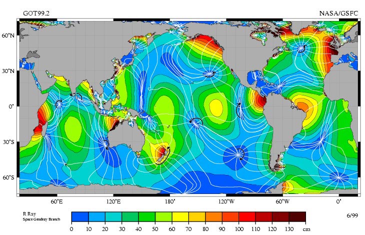
And then I found this Insta post (above) from Sharon Lee in Brighton who makes tide times posters. But not for Kimmeridge because, as she observes: ‘Notice an arc of weirdness around Dorset? That’s an amphidromic point. Which basically means the tides around Dorset (particularly the Isles of Purbeck and Portland) are utterly mad.’ Amphidromic (or a tidal node) was a new one on me, but may explain the Mupe-Swanage Incongruity (MSI), as tidal philosophers have called it since Pytheas skimmed pebbles with Posidonius. You’ll find many tide times websites supposedly offering times for non-UKHO locations, but many just list the nearest UKHO location with no real-world adjustment. As unless I am over-thinking it, Mupe Bay to Swanage needs quite a bit of Amphidromic adjustment.
And while I have your attention, what is the point of UKHO listing identical times for Lulworth Cove and Mupe Bay, just a mile apart? Is it because one is civilian-touristy and the other military most days of the year? So what? Yes, there are no less than four UKHO tidal locations in western Poole Harbour (+ Wareham) as closely bunched, but it’s a busy area that drains out to mud flats at low water and the timings are all different.
Mysterious tidal nodes appear all over the world. They are the Black Holes of the Oceans; go there and nothing happens. Spooky. Source

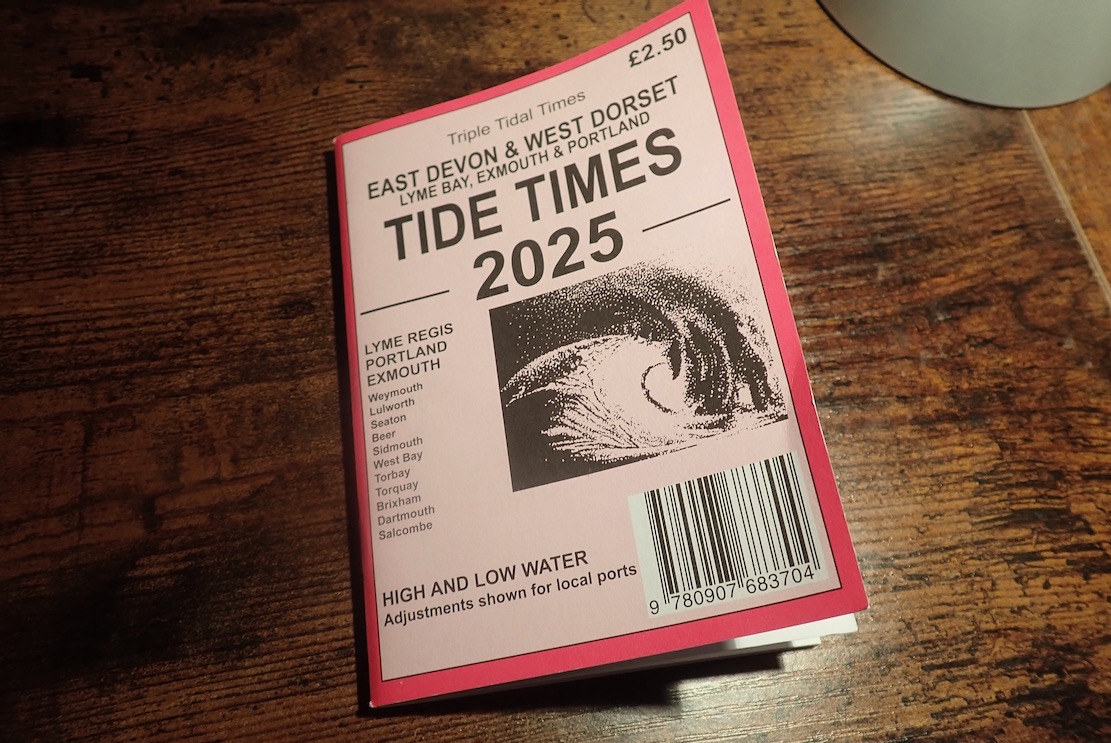
Then I saw in Kimmeridge’s Etches Fossil Museum shop a locally published tide tables booklet. ‘… West Dorset’ said the cover, but ‘Covers the coast from Swanage, Dorset through to Salcombe, East Devon‘ claimed the shop’s online blurb. The publisher’s website said as much (… the whole of the Dorset and South Devon coast…). Not in the copy I bought. The tables give every day of the published year, but only for Exmouth, Lyme and Portland. There’s nothing east of Portland in the booklet, unless you include a spot check on Portsmouth or Dover. No mention of Swanage, Lulworth or other local adjustments for Purbeck. You’d think I’d not be the first to notice this, I’d have saved my money for two more moto parkings were it not for chappy behind the shop counter advising: add an hour to Portland for BST, then 15-25 minutes for Kimmeridge. It’s Portland’s sticky out Bill that puts a spanner in Purbeck’s tidal flow, he explained. The formula was not Mupe Bay ± 30 minutes, as I’d guesstimated, but Portland + 15-25. I coughed up my £2.50 as an offering for this handy tip – I’ll appreciate it and the booklet when AI implodes the internet.
But hold your paddles, there’s more! Also on the Etches website I found a link to Willy Weather with a page for Kimmeridge Bay that wasn’t just a paste from Mupe Bay, but believably adjusted times. I compared KB times many months in the future using the Portland booklet formula and Willy, and found them to be within 3-13 minutes of each other. Assuming both are broadly correct, that will do me. Willy don’t list Chapman’s Pool but do have adjacent Egmont Point which seems to be KB + 2 minutes.
I’d heard of Willy Weather, but it wasn’t in my tidal bookmarks. It is now.
Still reading? At the jetty by the Wild Seas Centre a pair of well prepared sea anglers were setting out in their double outrigger SoTs. Talking of gear, this is a proper sea paddle so I’m in my proper Kokatat Leviathan pfd, but it feels like wearing a folded tractor inner tube full of ice cream. Leviathan – it’s in the name. At least I won’t be too gear-shamed when the RNLI fish me out by my ear and shake me dry.
I head out of the Bay and turn east. Oh MG, breaking offshore waves already! But I needn’t have worried today. There were a few more later on, but nothing the TXL+ couldn’t ride out. I actually think tackling this stage with a rising tide flooding the Ledges is the way to do it (in either direction), as any waves will diminish as the ledges submerge – won’t they? It’s more down to the wind of which there was little today, but as you paddle along you still want to glance offshore once in a while in case you’ve gotten on the inside of a building wave which can pop up out anytime, any place, any where. This is why I stayed quite far out. Not normally what I like to do alone in a packraft.
The Ledges from above.
And on a windy day west of Kimmeridge. Frothier than a Costa cappuccino with sprinkle.
The waters are clear and green. At many points I could have hopped out and waded along.
In fact, I did for a bit.
It took me back to Shark Bay, 2011. Jeff and Sharon and me in my Gumotex Sunny wading north to a unearth a cache near Peron Point after battling a stiff headwind all morning. What a great paddle adventure that was. Easily doable in a packraft too, with added dolphins, dugongs, rays and yes, sharks.
I’m on the look out for ‘Iron Skeg Beach’ I found with the Igla IK a couple of years back. Above looks similar but is not it. In the Igla I turned back at ISB to Kimmeridge as paddling on to Chapman’s would’ve meant paddling back. First time out here and with a head full of Ledge Lore, I didn’t want to get caught out as tides and winds turned, and hauling the 17-kilo boat back along the coast path would have been too much. As I was about to find out.
There is the rusty triangular ‘skeg’ (also below) sticking up. This is actually called Clavell’s Hard and studying Ian West’s page for this area, I think the object (below) may have been something to do with oil shale mining right here in the 1890. There’s a semi-naked castaway looking for treasure. I hope he knows how to get back.
The strange cast iron object that looked like a ship’s skeg – from the SS Treveal, wrecked at nearby Egmont Point in 1920? It’s more likely a piece mining gear, a winch stand perhaps.
The soft, shaly grey cliffs, rich with ancient marine remnants.
Four colourful kayakers close to shore, like I should be. There’s more to see there.
I pass what could be Punta Pliosaurus.
Two days later we came back for a closer look.

I see sailboat masts ahead behind big rocks and am a bit disorientated. Chapman’s is tucked in on the left somewhere? I check the GPS and am nearly there, getting ashore 80 minutes out of KB or 4.5kph average with a bit of dawdling, and quite a lot at 6kph, according to the Garmin. People want to know this stuff!.
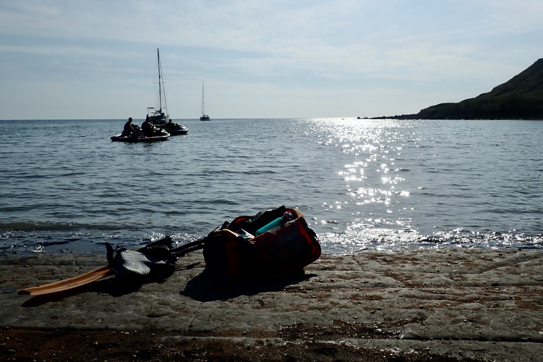
Along with some moored yachts and beach bathers is a trio of menacing jetskiers playing their satanic music. But this is Purbeck so it’s not blaring, and at least they weren’t tearing up the Pool like houns en tout.
At Chapman’s there are ammonite fossils everywhere you step.
Even getting off the beach by the waterfall is a loose scramble, especially backpacking a holdall. As I leave, I hear the jets gun off to Kimmeridge or Swanage. I presume that’s what they did as you can’t get a trailer down here. With a packraft you can go anywhere you can walk.
Up the steep, overgrown gully and across the parched field for the 500-foot climb up to Houns-tout hill – all in less than a mile from the shore. My pulse hits the rev limiter. What does Houns-tout even mean?
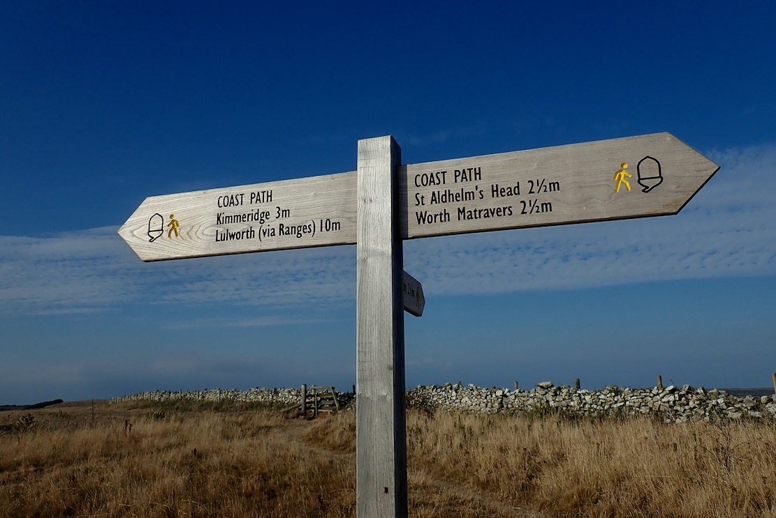
Kimmeridge 3 miles. In these shoes? No way, Jose.
Tranquil Chapman’s and St Alban’s Head from Houns-tout summit. And actually my Teva Omniums are not the problem; it’s the wobbly, 8-kilo holdall hanging from my shoulders. But on the way back I have a brilliant idea. More here.
The steep decent from Le Tout gave the underworked knees what for. I could do with my packstaff. I sold the 4-part Vertex paddle which it fitted. I need to convert my Anfibio Wave 4P but it’ll require some whittling.
Then back home I dug out an old, 55/170cm telescopic monopod (£18 on amazon Basics). It’s more gear (370g) and may slip under pressure, but zero bodging required and will work for long-arm selfies.
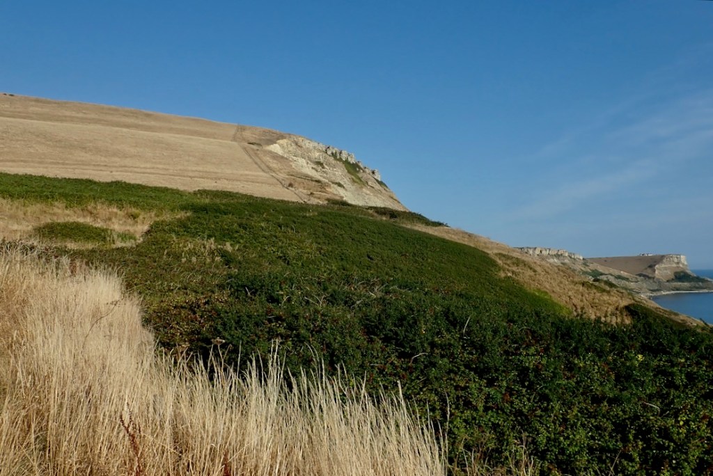
I witness a landslide near Punta Plio. This country is falling apart! I should get down there houns tout suite and see what fossil treasures came down with the rubble. ‘Get me Professor Etches, I found the tail. That pliosaur is longer than you think!’
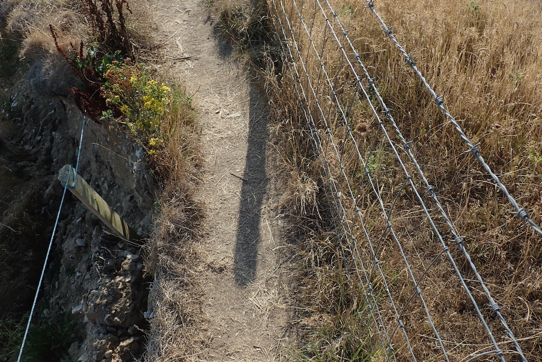
In places the path is very narrow: barbed wire right to spike my raft, big drop left to spike everything else. The first half from Chapmans is tricky in places. Don’t be part of the next landslide.
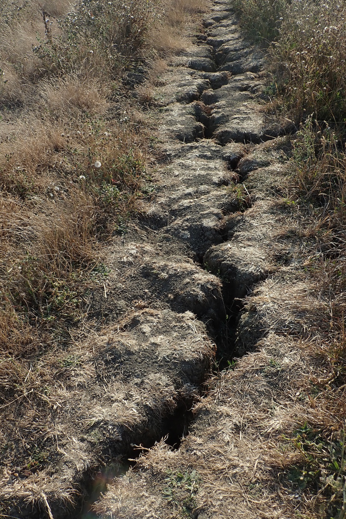
The SW Coast Path is cracking up. Must be the drought. Come the next deluge it could all come apart and slide into the sea, a few feet to the left.
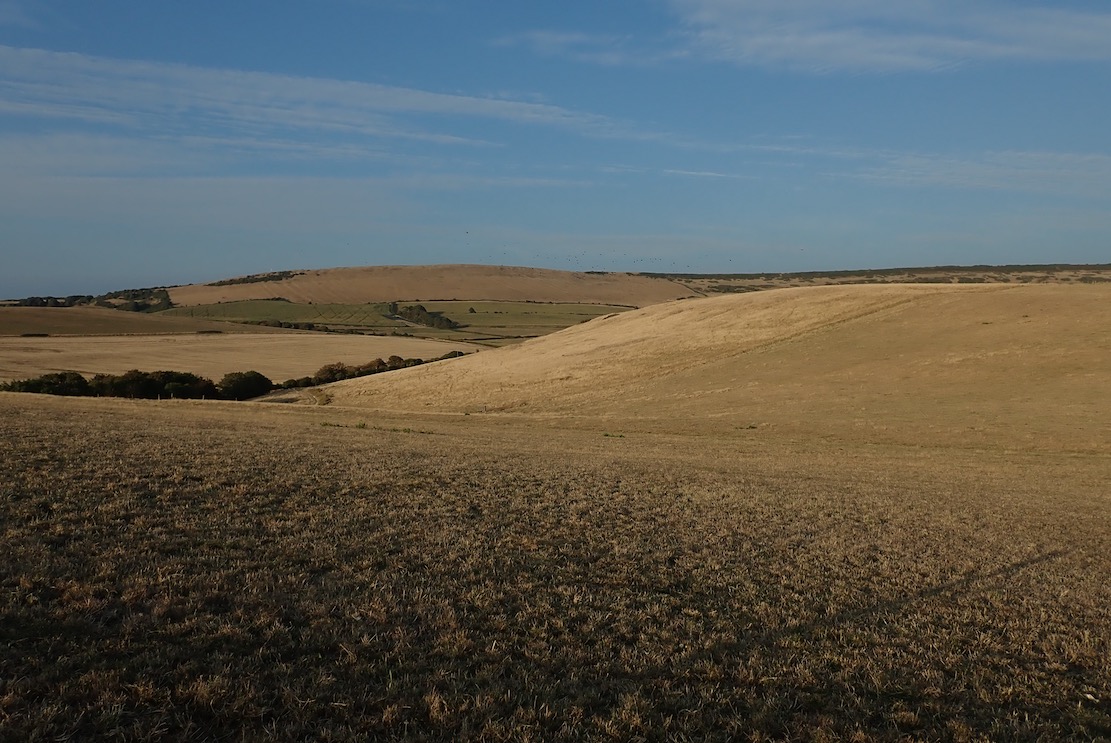
All around as parched as southern Spain.
At one point a cheerful passing walker observes
Ooh, paddles. What’s in the bag?’
A boat‘, I reply.
Oooh, luvlay juvlay!’ she says
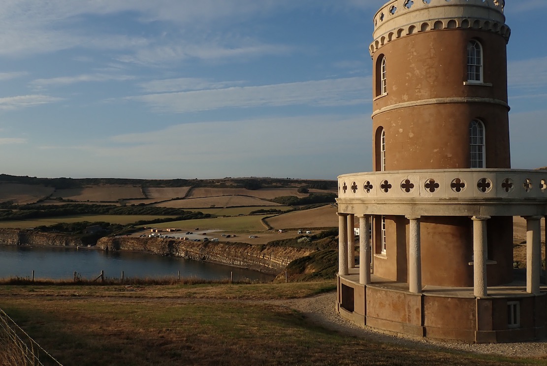
At last, the rotund edifice of Clavell Tower just as the battery warning light starts flashing and the legs wobble. I hobble down the steps like Steptoe with a hangover, passing pouting Instagramers capitalising on the golden hour.
I’m a sweaty, achey mess but it’s been a lovely summer evening’s walk up and down 340 metres along a tiny part of the South West Coast Path. They say the total elevation gain on the entire 630-mile trail from Minehead to Poole is a staggering 115,000 feet (over 35,000 meters). That’s like climbing Everest from sea level four times. And yet hundreds manage it every year, signing off with thighs like telegraph poles. They’ll see many amazing things, like Kimmeridge Bay an hour before spring HW: not a foot of a beach to spare.
The ride home via a refreshing ford cools me off.
There you have it: KB to Chapman’s. A lot easier to paddle than to walk.
That’s another stage of Weymouth to Poole ticked off, leaving the trickiest 8 miles for last. First, Chapman’s east around St Alban’s Head 4 miles to Dancing Ledge. Then about the same distance from there to Swanage, around Durlston Head, another tidal pinch point and with no take-outs. In a sea kayak you’d swan through in one go, slicing through whatever the tides bring. But you can’t pop it in your pack and bus home. Alone in the TXL I’d pick the neapest of neaps and lightest of winds – and still break it into two manageable stages. Summer is coming to and end. Maybe soon or maybe next year.

Packrafting Bradford-on-Avon 13km loop

See also
All the way to Bath
Sigma TXL index page
River Wye
Regents Canal
Wey Navigation

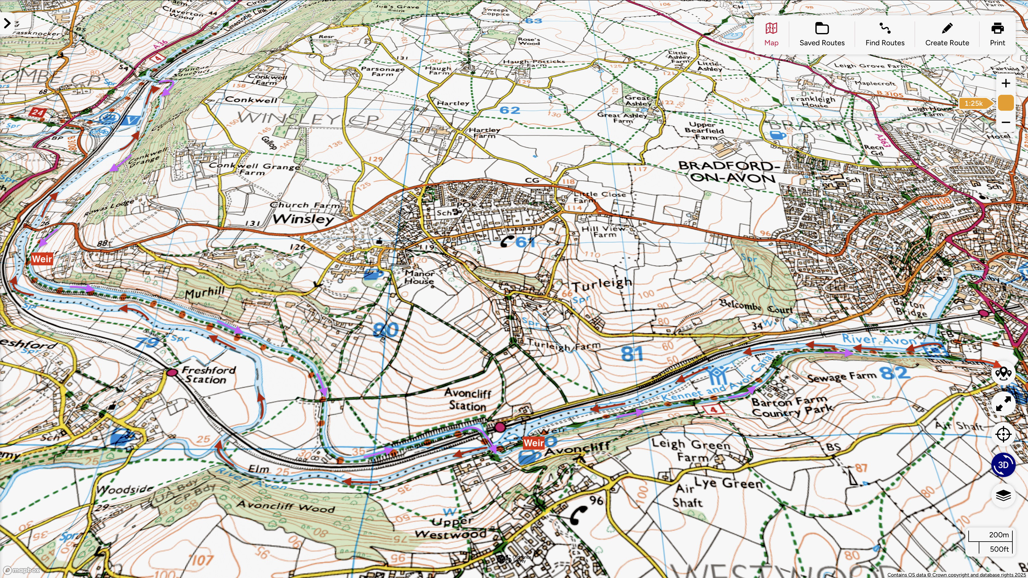
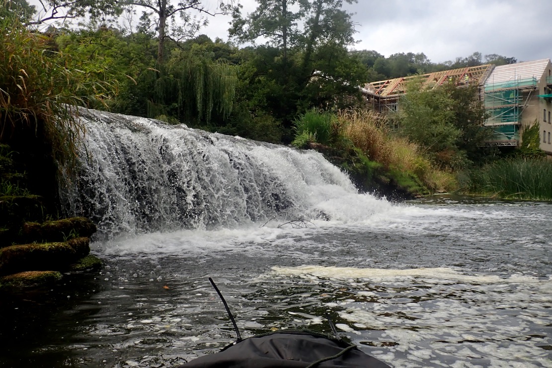
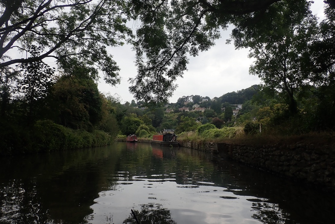
They say Bradford-on-Avon near Bath is one of England’s prettiest historical towns. I blundered through the other evening trying to outwit the satnav, and it didn’t look too shabby. With something to pick up near town, I wondered if the Avon river was paddleable, and found Andy Ballard’s nice canoeing vid above. He describes an 8-mile (13km) loop which follows the river halfway to Bath, before hopping up onto the parallel and lock-free Avon & Kennet canal at the Dundas viaduct to return to BoA. That will do nicely.

Avon 13km loop

‘Pay attention at the back!’
Completed around 1810 towards the end of the ‘Canal Mania’, the Kennet & Avon Canal essentially crossed southern England’s watershed to link the then key port of Bristol at the mouth of the Avon with London on the Thames. At Paddington in London, the Grand Union was completed around the same time, and led up to the north’s mines, foundries and mills, and where the network of canals became much denser (below right). The Regents Canal I paddled a few years a go linked these two waterways to the Thames tidal docklands.

The Thames and Avon rivers had long been navigable inland as far as Bath and Reading and the K&A linked those two towns over 87 miles. Kayaking the Wey Navigation and packrafting London’s Regents Canal taught me that Britain’s canals helped kick off the world’s first industrial revolution. At a time when roads were rubbish, they linked or added to long-established river navigations to extend inexpensive and reliable cross-country transportation of heavy, bulky or fragile commodities.
At this time the decrepit road network along ther Bath Road (A4) was still suffering from 1500-years of neglect following the Roman era. Coaches carried passengers and packhorse trains were superior to wheeled carts, but turnpike fees (tolls to help pay for road upkeep) made them costly. Hostilities with France included attacks on coastal shipping in the English Channel, necessitating secure inland transportation to help provision the war effort. The former Wey-Arun Navigation linking London and Surrey’s gunpowder mills with the navy fleet at Portsmouth was another example.

Once 18th-century nimbyism had been overcome, canals soon became a reliable investment opportunity which made nearly all shareholders richer, while seeing commodity prices drop for all. But Britain’s canal boom was short lived and 30 years after completion, the K&A was trounced by the Great Western Railway, itself trounced a century later by the M4 motorway.
Since WW2 canals and their adjacent towpaths have been widely restored and especially in cities, can be historically interesting byways. But recreationally they’re more suited to dog walkers, cyclists and powered river craft than paddlers. The lack of a current means they can work both ways, but portaging locks can break a journey’s flow, as they can on a rivers like the Thames, where canoe chutes are few. And the popularity of canals and towpaths can make them busy places compared to a natural river winding through the landscape, with the odd aerated riffle to spice things up.

I tried to do the right thing and buy a paddling day pass from the Canal & Rivers Trust in Bradford basin (not sold online, afaict). But what looked on the map like a C&RT office turned out to be a cafe and gift shop. Oh well, at least they got a fiver in their car park.

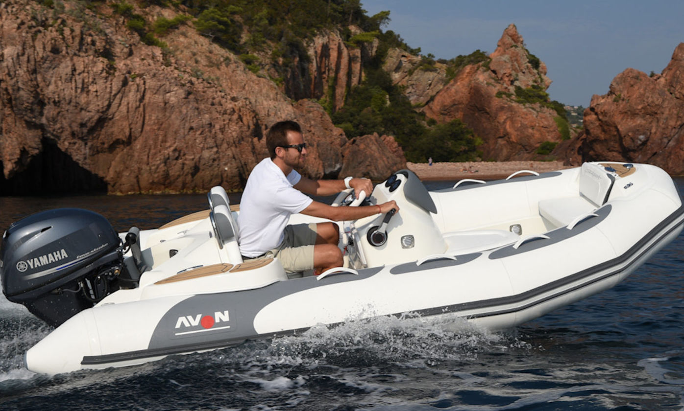
Signboard in the car park noting the dawn of rubberised fabrics in 1848 (interesting BoA Museum page) and which became Dupont hypalon we know and love, and then PVC. It explains the brand name of Avon Rubber Company and their RIBs (middle) and moto tyres (right). The factory was by the secind weir at Limpley. Avon RIBs were bought by French Zodiac in the 1990s, and after 112 years the Avon tyre factory up river in Melksham closed in 2023.

I have a mooch around the huge, 14th century Tithe Barn, a feudal tax warehouse where peasants surrendered part of what they produced to the nearby abbey. Then in the 1530s, Henry VIII grabbed all religious properties for himself.
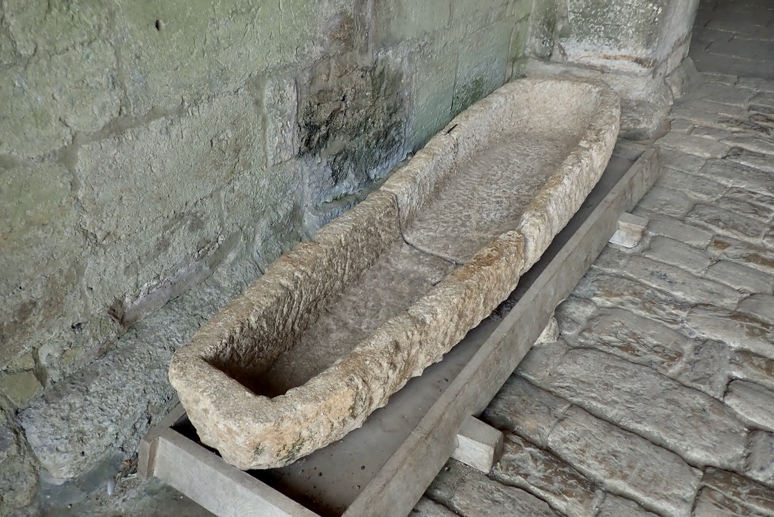
An experimental Roman dug-out canoe later repurposed as a sarcophagus. Along with a Saxon church, there are many historic buildings in BoA, most dating for the Industrial Revolution.
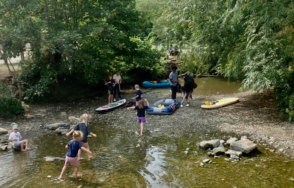
Easy put-in just by the barn. Loads of kids on paddle boards, plus a £20 slackraft to even things up a bit.
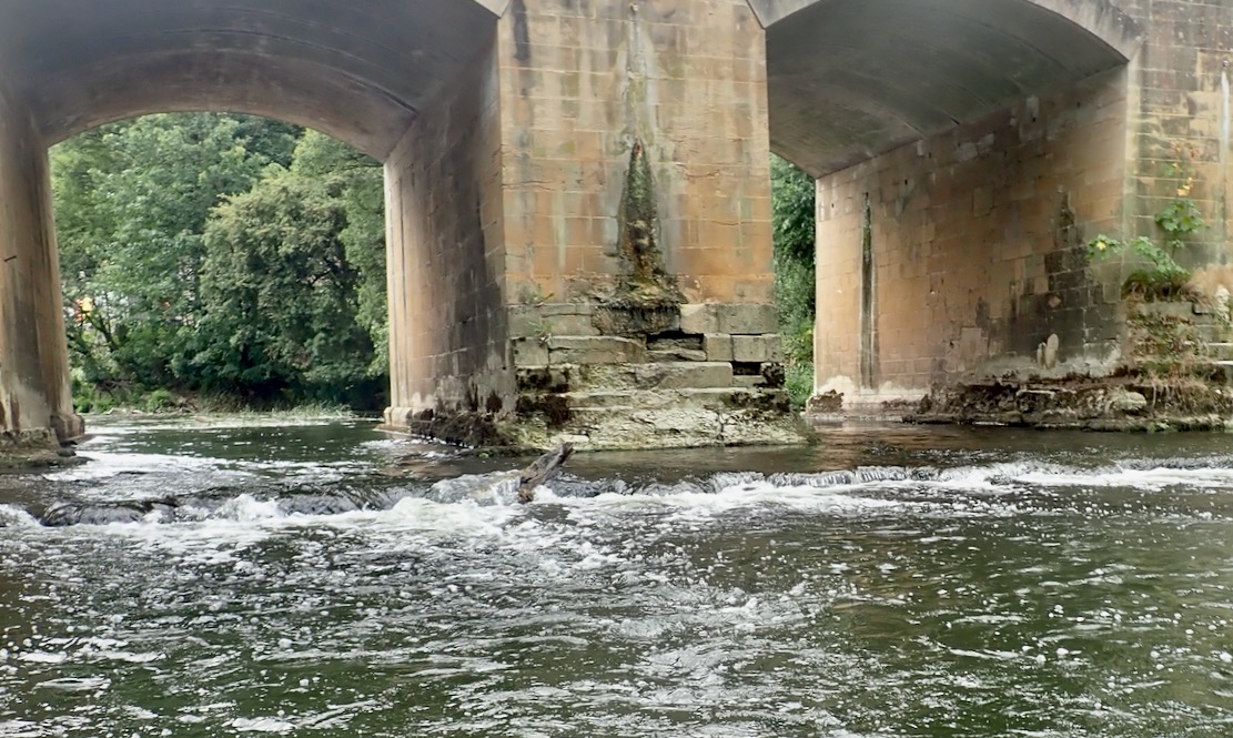
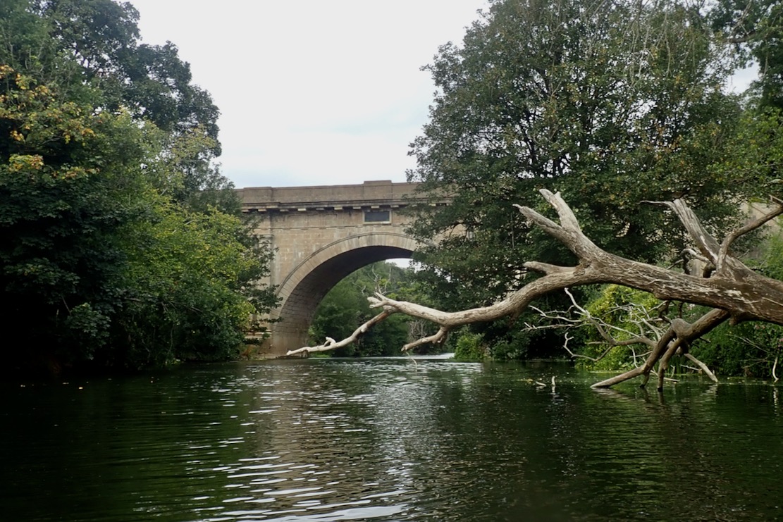
Soon I pass under the Avoncliff aqueduct which I’ll be crossing in a few hours.
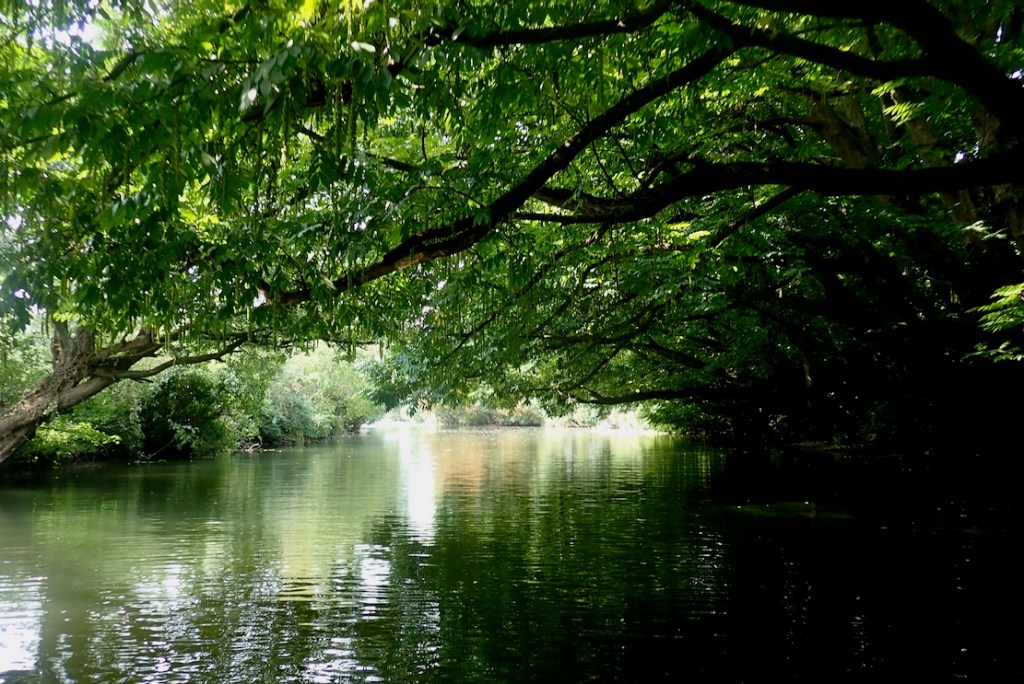
Lovely riverside treescapes.
Some are already turning, despite being right by the water.
The first weir at Avoncliff. A Medway-style chute would be nice, but I read the weir face steps are shootable at much higher water levels. Sounds a bit sketchy to me.
The exposed steps make for an easy portage.
Once below, a brisk current flushes me through the reeds.
The second weir at Limpley Stoke. The steps river right are steeper here, but easy enough if you dodge the rebar spike. Not sure I’ve seen stepped weirs in the UK before. Avon Rubber’s original factory was here at Limpley Mill.
There’s a road bridge soon after followed by a 7-inch weir. The skeg scraped a bit around here but despite no rain for months, I never had to get out and walk the packraft, like in the canoe video.
Reeds and trees. I’m amazed how well the Sigma zips along, helped I’m sure by a bit of current and backwind and the Multi Mat floor. At times I even perceive an IK-like glide. No one’s ever said that of a packraft. The TXL+ really is a great do-it-all boat. Are you getting a bit tired of reading that?
After 4.1 miles (6.6km) and 85 minutes (just under 3mph) I reach the Dundas Aqueduct where the Kennet canal crosses high above the river. Just after, on the right are steps to take out.
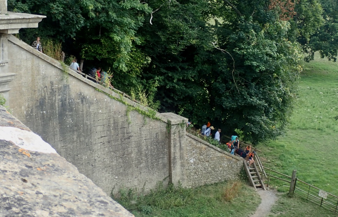
Once on the right bank it’s a 20-metre set of stairs up to the aqueduct. Wouldn’t fancy hauling a hardshell up there by myself.
The Avon from the aqueduct.
Tow path on the aqueduct. By way of a rest I submit to a questionnaire for the National Trust.
Video Andy warned the canal can get raucous with piss-up barges. But not on a balmy, late summer’s Tuesday afternoon.
I got stuck in to the flatwater paddle back to BoA, looking down onto the valley on the right. It gets a bit dull and samey, then becomes a flat-out slog. The hands get sore and the elbows creak. I even overtake a couple of rental barges chugging along in a trail diesel fumes like an Algerian truck. A smell from the 1980s. No Euro 5 here.

Paddling along in the perfectly still water I had the feeling the boat was pulling to the left as if some weed was caught in the skeg or I wasn’t holding my paddle evenly. This wasn’t evident on the more lively river, earlier. I suspected I knew what it was: the skeg was warped, leaning over to one side and with a longitudinal curl at the back that would steer the boat left. I’ve not had this before on rock solid polyethylene skegs which don’t deform no matter how abused or badly packed. The unused one above with no tape or scratches is straight. I gave the bent one 2 minutes in a microwave but it came out the same. It is 3 years old from my original green TXL.

The state of some of these boats, honestly! On the street they’d be towed away.
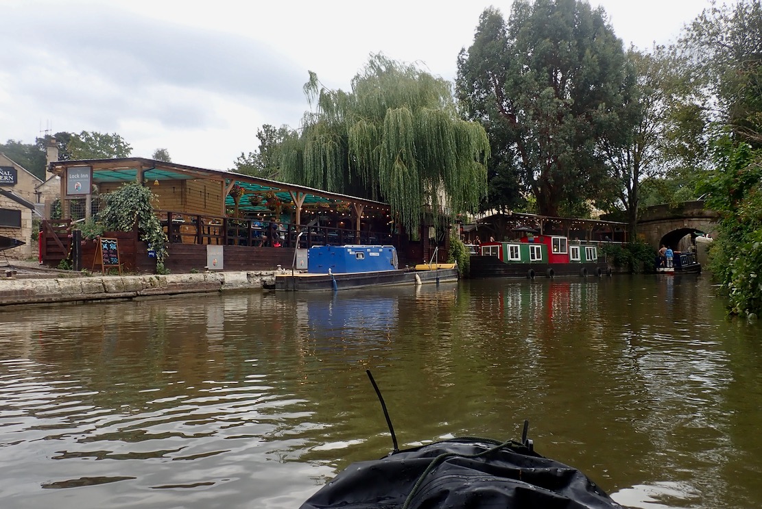
Take out by the Lock Inn back in town. There a lock right by that bridge leading into the C&RT basin. It was a bit further (4.3mls/6.9km) but surprisingly took just 80 long minutes (3.2mph) with no weir interruptions. Near the end I was flagging and considered hopping out and two-path walking, but that would ruin the story. By now I’m ready for an early dinner.

Unless you’re getting swept down Spain’s Canal de la Toba, as expected, the river stage was a lot more agreeable than the parallel canal, and the two weirs portaged were not awkward. At much higher (or normal?) flows that might be different but anyway, the whole point of packboats is you don’t need to do loops if there is transport at hand.

All the way to Bath? (Read this a year later)
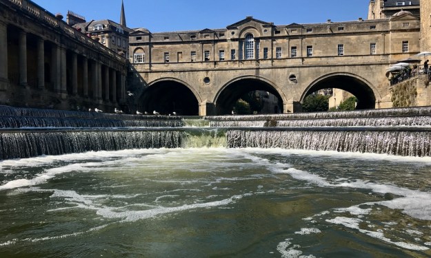
Had I thought it through a bit more, I’d have registered the railway also following the Avon valley, and which carried on 10km down river to Bath’s amazing Pulteney Weir (below). Bath Spa station is just 10 minutes away for the 16-minute train ride back to Bradford on Avon, looking down onto the river you just paddled. It’s a better way to do it.

Packraft preview: Anfibio Rebel 3KL, Sigma TXLB+

TXL+ main page

My 2.8-metre TXL+ (left) does it all for me these days, and I was just thinking that, for what I do (less hardcore, such as it was), I don’t miss my IKs at all.

What my TXL+ loses in sublime kayak glide, it gains right back in being able to be easily carried following a day paddle. Being wind-prone, venturing too far out to sea in any inflatable, IKs included, takes some nerve when alone.
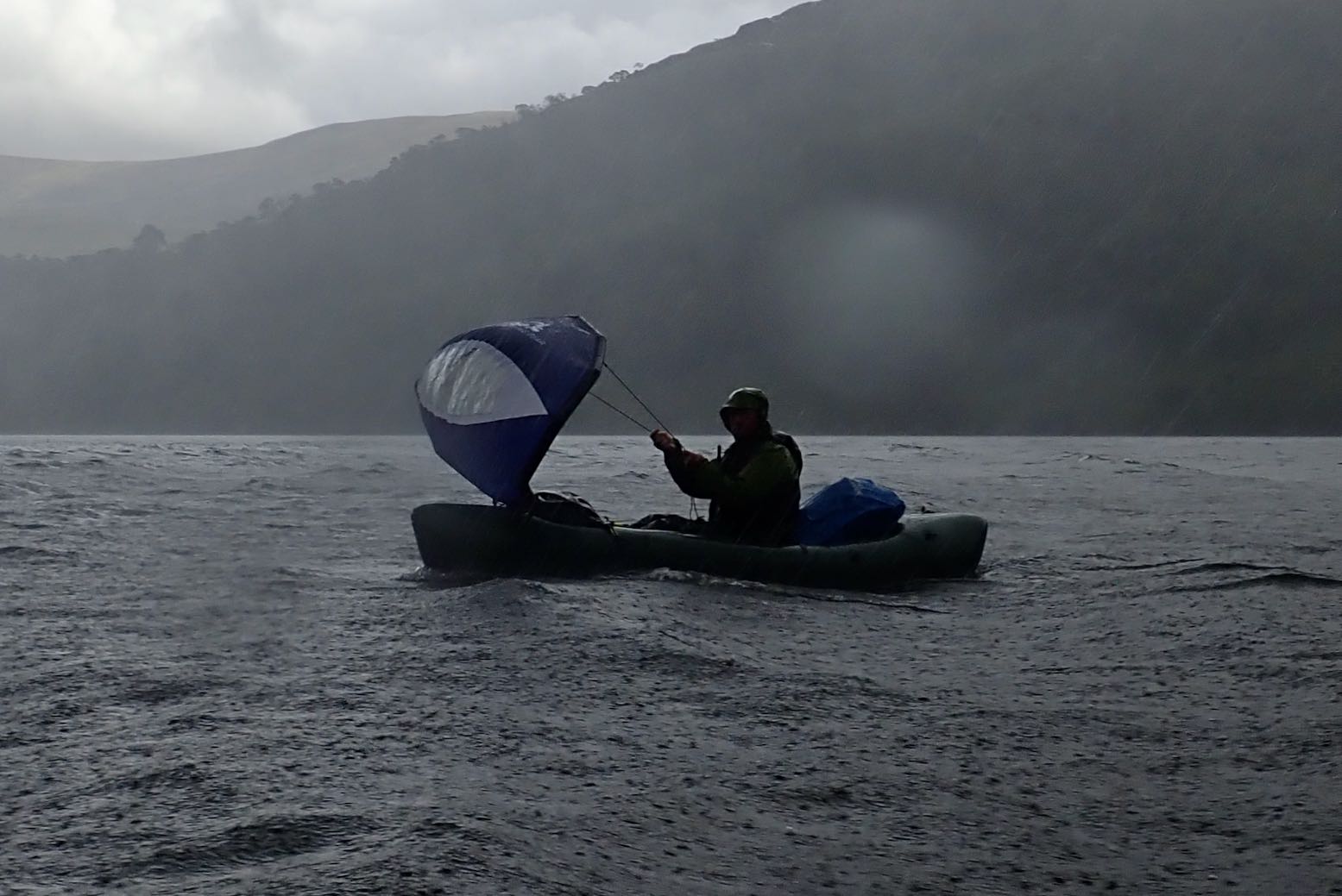
Of course overnight trips including tough terrain, like our Knoydart paddle, will require a stiffer back or porters for these heavier, bulkier boats – or you plan for a sustainable paddling/walking ratio, ideally including sailing where possible (see video below).
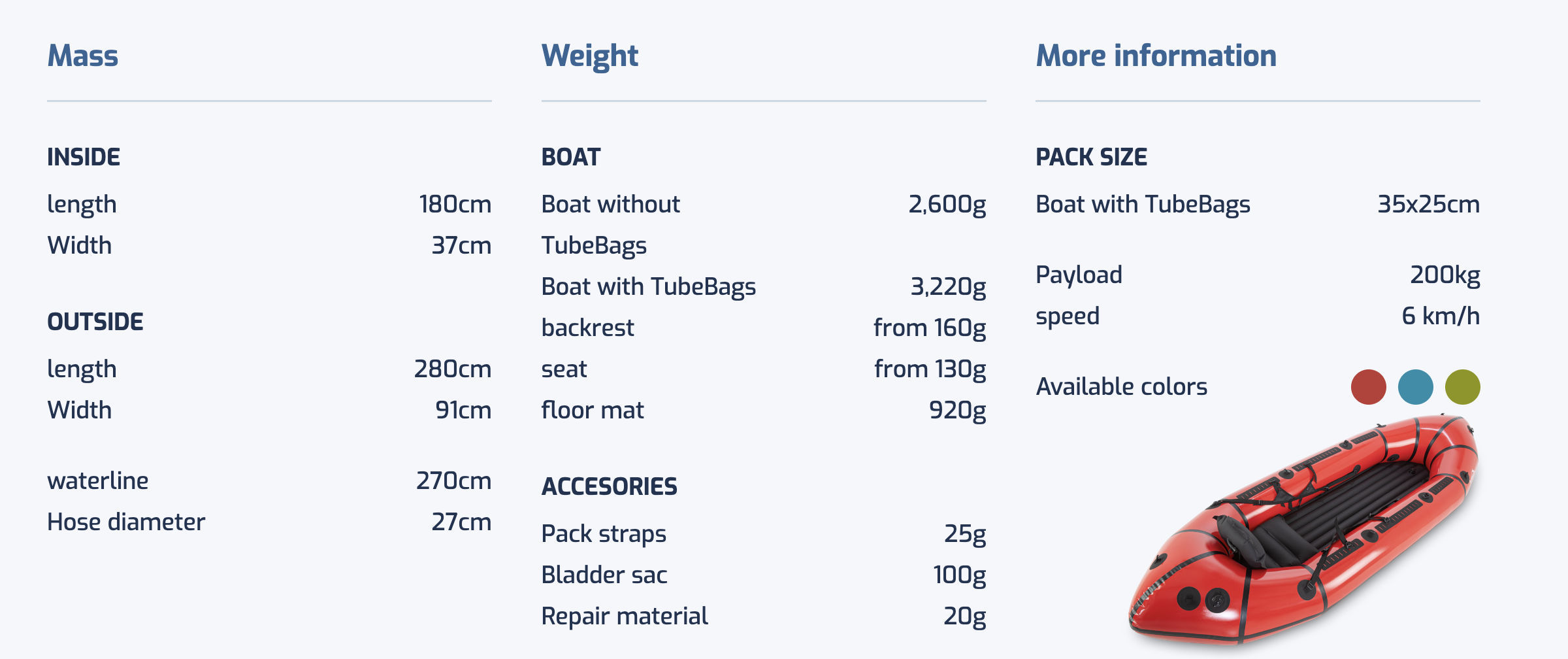
Long packrafts of around 2.8 metres offer more packing space and less annoying bow yawing, have a kayak-like, central solo paddling position with a level trim, but can fit a second paddler or a bike, as well as reach speeds up to 6kph. All for less than a kilo in mass. They are Pakayaks: the best of both worlds.
Two newish ‘packayaks’ from Anfibio caught my eye: the Sigma TXLB+ and the Rebel 3KL which has been out a few months. With masses of (optional) side storage, both are suited to multi-day, rough water expeditions. One bails, the other decks and both are ‘symmetrical’, ie: the bow and stern are identical, like a canoe and all current Anfibio boats apart from the Revos and Nano RTC. Some reviewers seem to think this symmetry contributes to faster speeds. A longer waterline certainly does, but identical bows and sterns merely simplify assembly and reduces costs – symmetry has nothing to do with speed (or Alpacka Raft have got it all terribly wrong!).
I’ve not tried either boat but as usual, that does not proscribe me from opinionating on pictures ransacked from the Anfibio website.

Sigma TXLB+ The Expeditionist
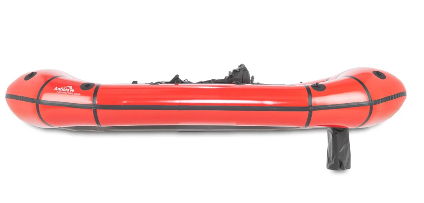
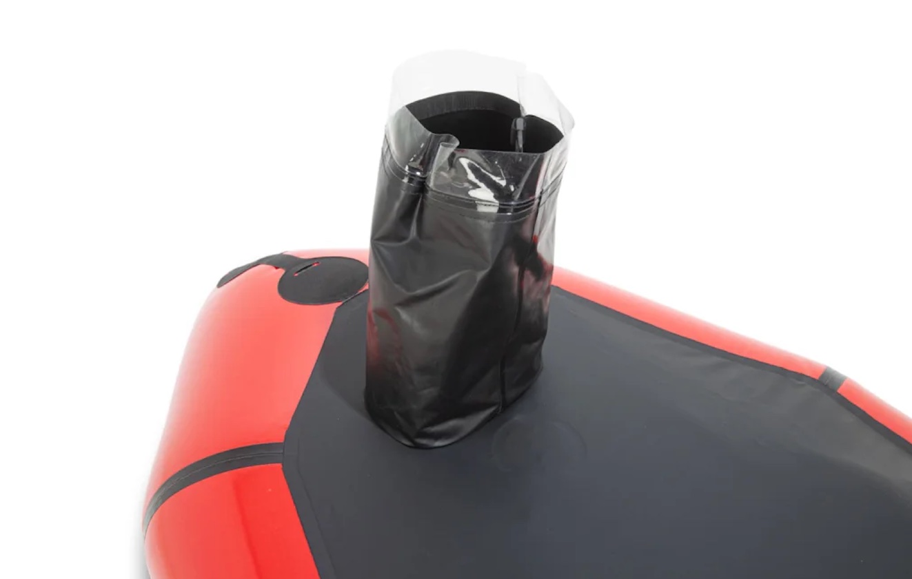
The single colour TXLB+ is just like my blue boat with optional thigh straps, floor matt, strap attachments and massive and secure TubeBag storage, but with the roll-up self-bailing drain hose we first saw on the 2022 Revo white water packraft. I never got to test that system properly, but the principle of flowing water sucking the swill out sounds plausible. As it is, you’ll be up dry on a floor and seat anyway, so it’ll take a lot of splashing to swamp the boat.

Is it needed? Not for what I do, but mileage famously varies from paddler to paddler. The hose can be rolled up and tucked out of the way (left) when not needed.
One thing that didn’t look right is the skeg back in the ‘old’ solo-packraft position (left) so as to be out of the way of the trailing hose. This placement works fine on normal, back-heavy packrafts with the paddler’s weight at the stern. But as I soon found with my first green TXL (see video below), it is less effective with centrally positioned padders because the boat floats level. And I imagine it might work even less well with the hose down.
I suppose you could say when using the self-bailing feature in white water, you won’t be using a skeg. And on flatwater you won’t be using the drain but could do with the skeg which will work OK. As for rough seas when you might want both – who would go out and do that?! One answer could be a bigger ‘sea skeg‘ option, like I’ve been saying for years. Or, on the TXLB+ simply remount the regular skeg in front of the drain.

Rebel 3KL ‘The Longliner’
I’m not sure about the 3KL’s blue and green (“… should never be seen”) colour scheme. Bring back the delicious lemon and olive, like my old 2K. But the 2.72-m ‘Longliner’ is just 8cm less than a TXL and a viable decked longboat comparable with the zippy MRS Nomad S1. The deck is permanently fitted which means it’s solo only, but that’s what most do most of the time.

I was never that keen on my fragile decked packrafts from MRS, Alpacka or Anfibio – just another thing to damage, though I never did. I barely used them but one time rushing down a windy loch in pelting squalls, it sure kept me drier than matey in an undecked Nomad (left). He got so drenched and waterlogged, we had to stop early for him to tip out and wring himself out like a flannel.
You don’t have to zip up every time: the deck with integrated skirt rolls off to the sides, and a vital grab loop ejects you fast if you tip over. (Never happened to me in all my pack years).

I like very much that Anfibio are now using the so-called Performance BackBand – aka: an SoT foam backrest which I’ve been retro fitting to my packboats – IK or raft – for years (years, I tell you!). The lighter but wobbly inflatable versions which came with my TXLs got fed to the goats before I ever used them. Yes, you need inflation for supporting your weight on a seat base, but a backrest wants to be stiff and supportive, snugging into your lumbar curve while ideally, you press against a footrest or the front of the boat. Doing so really enhances boat control and connection.

TXLB+ or 3KL. Which would I choose?
Neither, thanks for asking ;-) My deckless, drainless TXL+ with self-fitted thigh straps and an SoT backrest covers all my needs. Just like IKs, I like that it’s dead easy to get in and out. And that video above is about as ‘out there’ as I ever like to get. Water coming over the sides was not an issue that day. Going straight was.
If it’s cold or rainy I’ll wear my drysuit and onesie or surf Netflix. And if it’s coming over the sides then I either badly misread the forecast or am engaged in some lovely southern French white water in the balmy summertime when pulling over to a bank to flip the boat dry is all part of the fun. I suppose I’d take the decked 3KL for cosy winter paddles. They just need to sort those mixed colours out. Alpacka used to have some great combos.

Still, it sure is great to have all these choices!
Anfibio Rebel 3KL Longliner
Anfibio Sigma TXLB+ Expeditionist
– both with optional Tubebags, imo the best way to carry heavy loads securely and reliably without compromising hull integrity.

How does this work then?

Packrafting TXL: Kwikie around Hamworthy

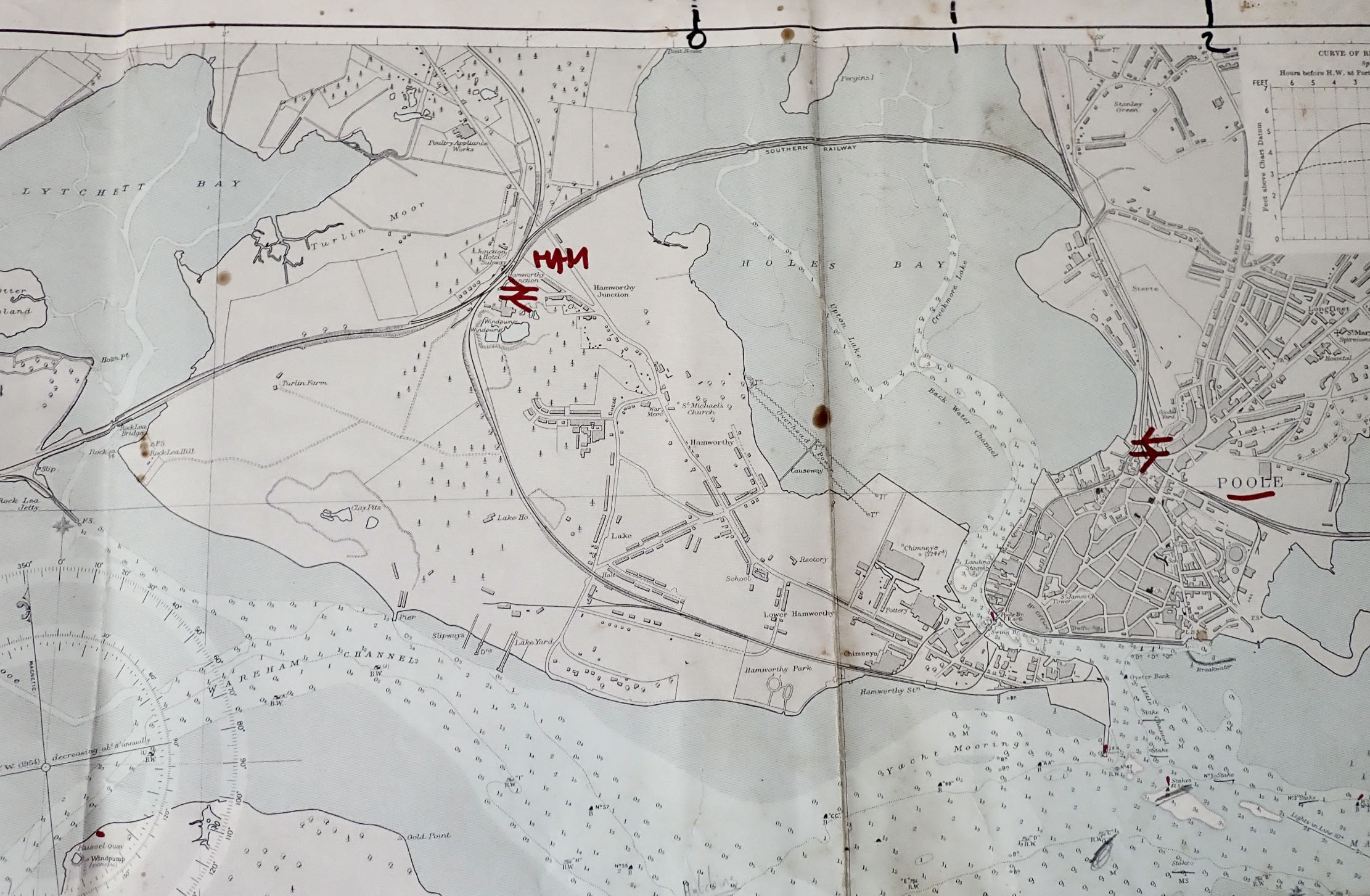
With the car in for an MoT at Kwik-Fit in Hamworthy, it made sense to do a Poole harbour paddle rather than go home or hang out. Kwik-Fit is close to Lytchett Bay, an intertidal embayment or tidal inland lake crossed by the London-Weymouth rail line spanning a narrow outlet. A 10km lap from there out into Wareham Channel and back into the adjacent Holes Bay (another embayment with a narrow pass under a rail bridge) might be possible in the time I had. If not, I could hop off anywhere and walk back to the garage. That is the appeal of pack boating!
This route – out one tidal channel and in via another – had similarities with our lap around Hayling Island a few years back in the Seawave. On that occasion we had to go full steam against the incoming tide to get out of Langstone Harbour back into the Solent to close the loop. This Poole loop would only require a 500-m walk from Holes Bay shore back to Kwik-Fit.

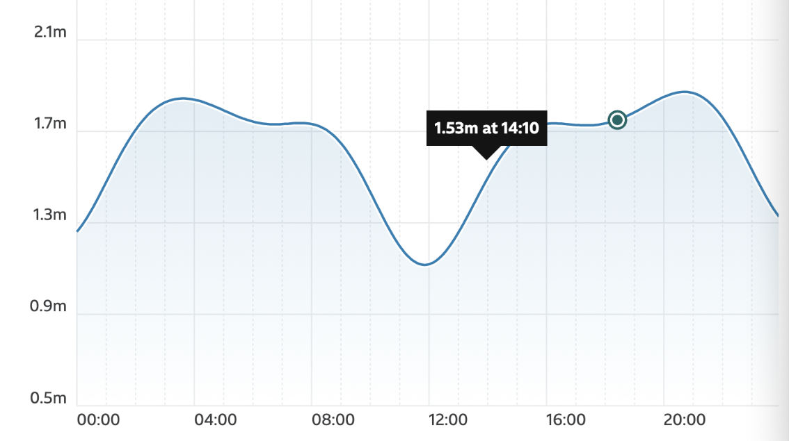
The winds were 10-13mph from the southwest which made sailing just about possible along my ESE route. The tide was coming in and levelling off about 3pm for 6 hours before dropping steeply again. In Poole Harbour – second only to Sydney Harbour but with an outlet just 300-m wide at Sandbanks chain ferry – the tides are far from simple sine waves. It may still be going in at Wareham at the back end, when it’s already going out at Sandbanks. There are four tide points listed by UKHO in Poole Harbour and I’m pretty sure ‘Poole Harbour’ refers to the RoRo ferry port on the north side. PHC is a great resource.

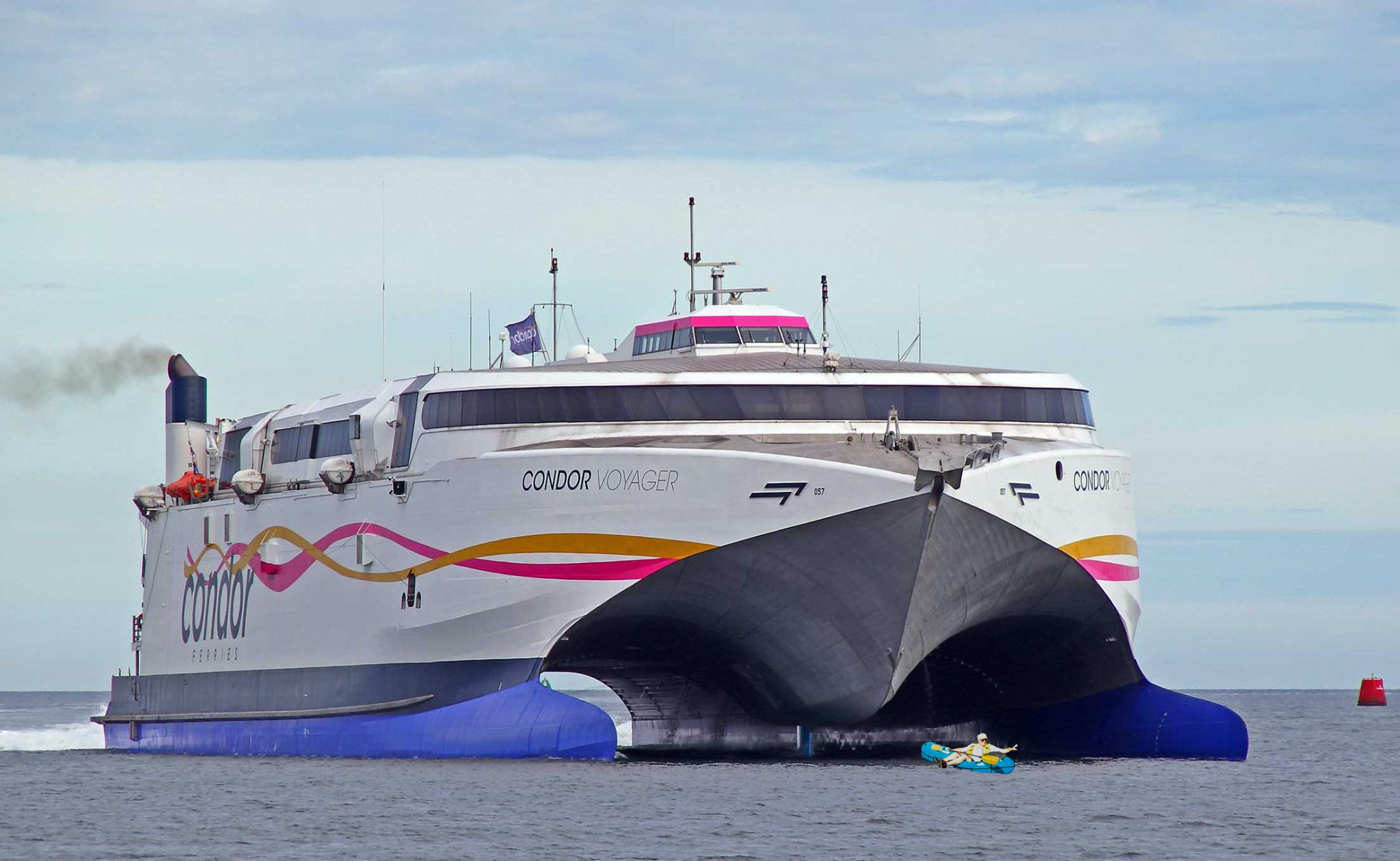
My route would take me right past the ferry berth where getting in the way of a gigantic ferry would probably raise a yellow card. Again, on PWC I was able to see today’s main ferry movements: the massive Condor Voyager cheesecutter class twin hull (above) would depart for St Malo at 14.15. I’d probably be an hour behind.

I set off from Kwik-Fit across Turlin Moor park aiming for the inlet, and once I saw some water, bundled through thick, 2-metre-high reeds on the off chance.

But once I emerged from the dense reed jungle I could see I was a bit early at this point, with 100m of knee-deep sludge ahead. It’s large acreages of tidal mudflats like this which give Poole Harbour its average depth of less than 50cm. That’s about the same depth I’d sink into the mud, trying to reach the water.

So I turned back and carried on along the shore until a path led behind some houses and through the trees to this grassy, reed-free bench by a sandy beach: 50.72448, -2.03601. If you want a mess-free, easy way to get on the water at Lytchett Bay east, aim for here.

A headwind was blowing quite hard, but it was only 500m to the rail bridge narrows, after which I’d turn southeast to pick up what wind I could get. Setting off, the TXL+ felt like it was zipping along as wind and waves rushed past. Up to 6kph, according to the GPS as I neared the narrows. That was probably an unseen back eddy sucking me into the gap, because as I got nearer I could see a current ripping through under the bridge at at least the same speed or more. I powered in hard along the edge, like we’d done at Hayling, but could only manage 0kph.

“Try on the other side” said the bloke lurking by the abutments, so I ferried across and, with a lot more effort managed to squeeze under the bridge and hook behind some rocks for a breather while not getting drawn back in.
I’d swum half a mile that morning which can be enough exercise for one day. Paddling under the bridge was like doing 50 pull-ups and I was a bit pooped. I looked later at the state of the tide at that precise time (left) and saw I’d been about an hour early.

I took a wide arc out to avoid the worst of the tide race and headed off towards Rockley Sands where I came ashore last year on my way to buy a moto. The wind from my right wasn’t ideal for sailing in my direction, so I paddled out into the channel to turn and get a better angle as it pushed me towards the shore.
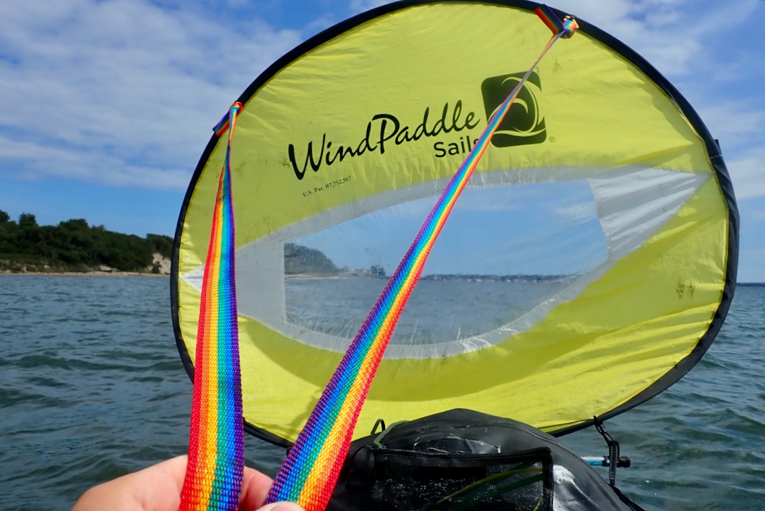
Though I was hardly bombing along, getting the sail up was the rest I needed. Out in the Channel, loads of sailing boats were fluttering to and fro past Brownsea island, and at one point a lightweight sailing cat passed close by with a hiss. I could do with some sails like that. As usual the WindPaddle was hit and miss. Holding 45° off the wind with some steering is not bad for what it is, but it never stays on it for long before getting in a flap.
However, as I got pushed towards the shore again, I really appreciated the way I could pull the WindPaddle down, give it a twist and tuck the lower fold under the Anfibio DeckPack in seconds. It was a handy trick I discovered while belting down a wind struck loch in Knoydart one time.

I passed a couple of piers and a series of long private jetties extending from people’s back gardens, some with a motorboat at the end perched on giant hydraulic hoists to stop them getting too wet. I assumed this was luxury overspill from affluent Sandbanks nearby, once home to the most expensive properties in the UK, but here “…overall, the historical sold prices in Branksea Avenue over the last year were 41% down on the previous year and 75% down on the 2011 peak of £2,262,500.” Unless rising sea levels are coming quicker than we think, or they’re putting in a new high-speed railway, it did seem an implausibly catastrophic collapse in house prices. Maybe the Rightmove AI needs to be burped.

Now heading more east, the wind was getting behind me. I made another effort to paddle out into the Channel to get a good run, and this time the TXL got picked up and rushed along. This was more like it, with an aerated bow wave frothing away by my feet. I squeezed every last minute out of a good run of nearly half a mile, not quite managing to steer around the breakwater of Poole Yacht Club where the accumulated fetch and rebound slapped me around a bit, but the TXL sat steady as a barge.
Round the corner I passed the entrance to Poole Yacht Club with a ‘Visitors Welcome’ sign and wondered if that included packrafts.
The phone rang.
Kwik-Fit here. Your Micra’s ready in 40 minutes.’
My word that was quick!’

A quick look at the map showed I was just less than halfway and would soon turn into Holes Bay with no more wind behind me, but with the high tide negligible. It would be tight to get back to the garage before it closed, so I turned into a dock entrance and rolled up the boat on the slipway.

I assumed this dock was part of the welcoming yacht club marina next door, but it was actually more like a deserted service yard for the ferry port right next door, surrounded on all sides by high security fences and an electric gate.
I dare say some security guard was observing me on his CCTV lair somewhere. After nosing around the portacabins and sheds looking for someone, a guy appeared in his car and swiped me out with his pass.
Things always work out, and as I passed the entrance to the Yacht Club, that too had electric security gates, though probably someone manning them. Looking at the map, a better take-out would have been Hamworthy Park by the club’s breakwater (50.71099, -2.00039), leading to a footbridge short cut over the rail line.

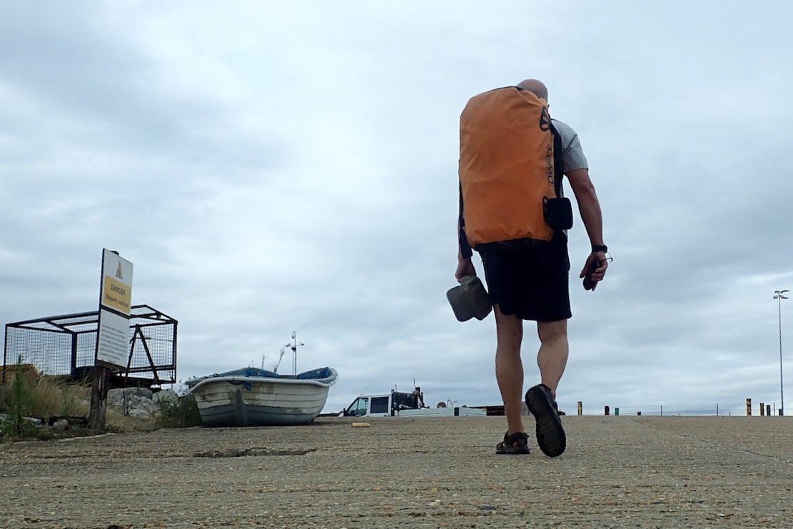
I walked right past the Customs and Immigration cabins (above left) of Poole ferry port, and a helpful map affirming je pagaie donc je suis ici with irreducible Cartesian logic. So – paddling mission not fully accomplished but the old Micra was on the road for another year.

Fat dotted red line shows unfinished stage. Arrows show wind direction

Looking back at the tide graphs for Poole Harbour, it seems that at the lowest neap tides (as it was two days later), there can be a 7 hour period when the high tide flattens off and rises then falls more than 20cm. That would be the best time to try and paddle around Hamworthy between Lytchett and Holes Bay. It could also be fun to leave Holes Bay on an ebbing spring tide to get a good blast under the rail bridge narrows, down the channel through downtown Poole and out into the harbour.

Wayback machine. Harbour chart from 1955. Hamworthy was just farmland and claypiys

There’s Wind in the Willow

The short run between Kimmeridge Bay and Chapman’s Pool was on my pack list, part of what remains to packraft between Weymouth and Poole. St Alban’s Head near Chapmans, and Durlston Head near Swanage will need ideal conditions as there’s virtually no getting off anywhere in between, so they will have to wait.

A quick look at next day’s wind and tide put Kimmeridge broadly in the ballpark. High water 10am at Chapmans receding east, helped by a 10-12mph easterly. Ten is my self imposed limit for packing at sea so it felt a bit sketchy, plus it would be a hot walk with the boat back to the car near Kingston. It feels more than the forecasted mid-20s around here right now.
I was also unsure what the Kimmeridge Ledges do in such conditions, other than force you away from the shore. It was all a bit hot for an otherwise sensible clifftop recce from Kimmeridge car park to Chapmans’ with the boat, to gauge the sea state below. I’d have to carry loads of water too, as the springs trickling into Chapman’s Pool are probably minging with farm run-off. But whatever happened, it would sure be a sporty ride to Kimmeridge clutching the sail like something out of Roadrunner.

There’s a wind in this willow

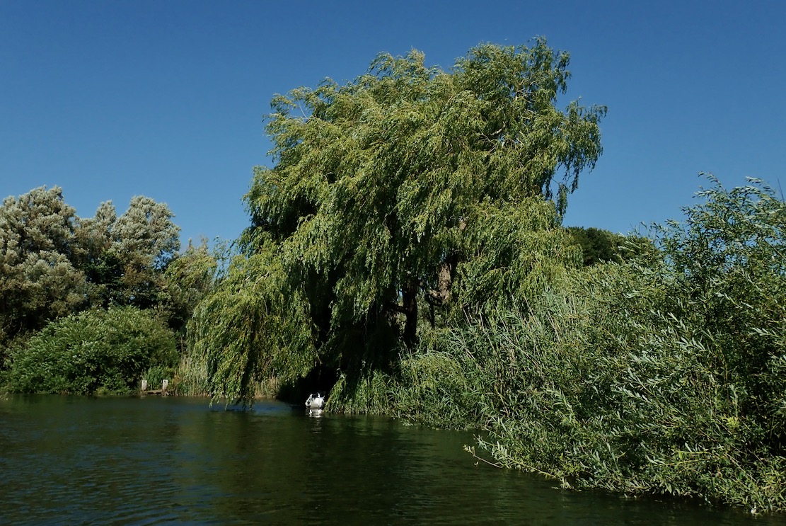
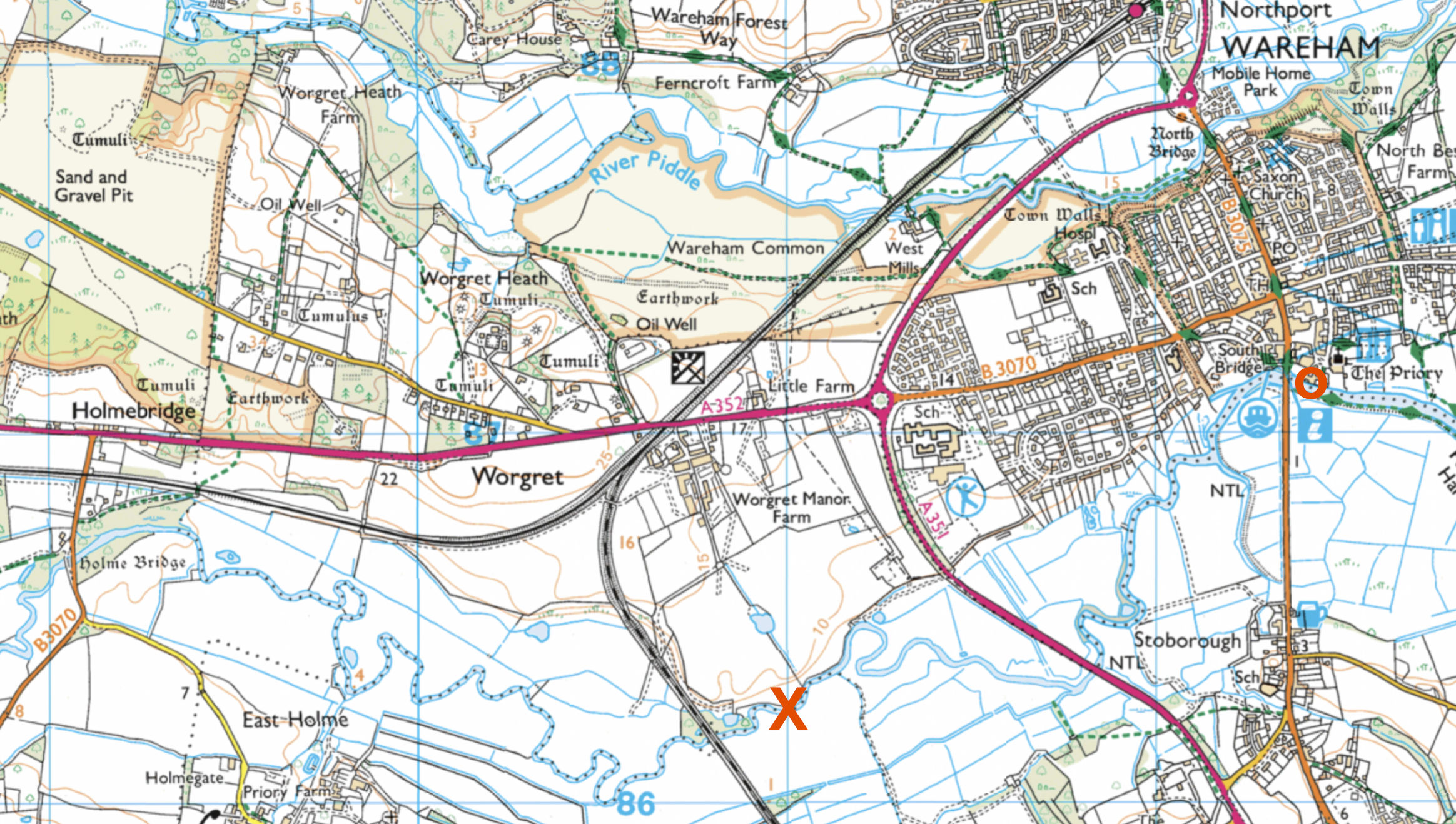
Came the early morning I let myself off and decided to paddle upriver from Wareham instead. I’ve not been up there either. I left the quayside ducks around 9am, and passing the already swaying riverside willows confirmed I’d made the right choice. Ten-12mph predictions are always more in my experience, and they say easterlies off the continent are more gusty. Six to 10 with a tide would be more like it, alone in a packboat.

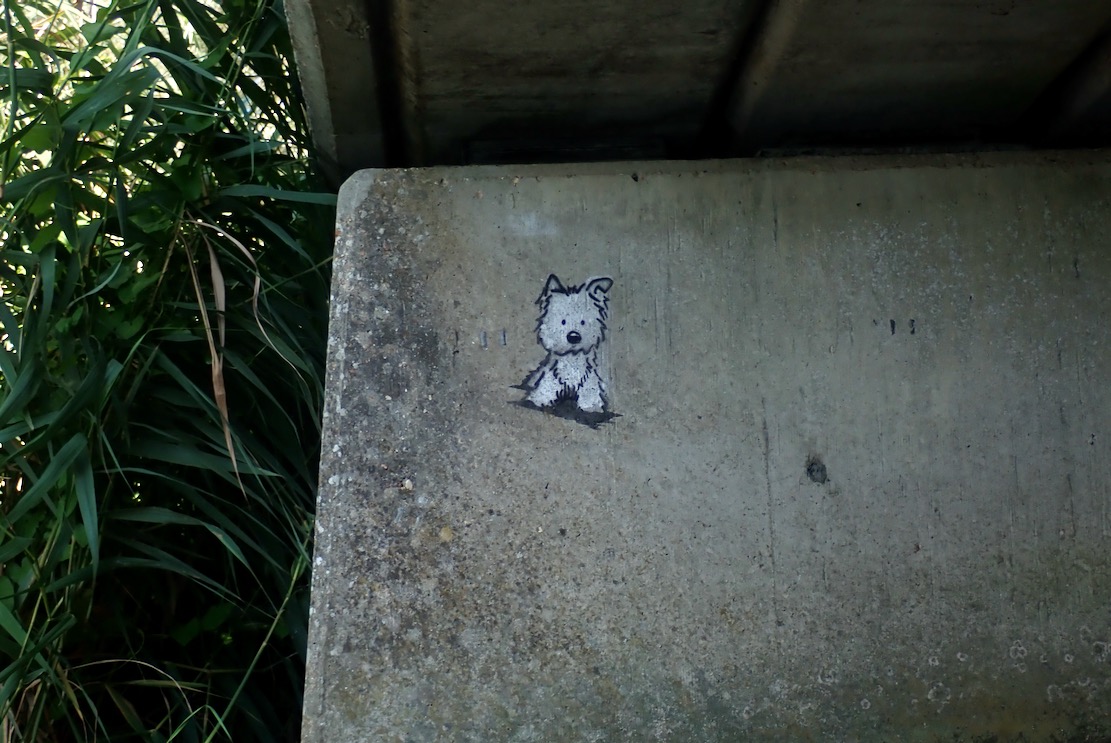
Tagged by the Wareham RiverBanksy

The Wareham tide and wind were with me and reaching the A35 bypass bridge (left) – the tidal line according to the OS map – I expected a big, ‘Paddlers Turn Back!’ sign, as rental SoTs and SuPs venture up this way.
No sign, so I had an excuse to carry on in ignorance until I got either shouted at or the Frome’s current got too strong. As it was, the riverbanks hereabouts were still thick with reeds, making angling without a periscope difficult. Further up nearer Holmebridge was angling country.

Frome meander from O to X and back to O

The river meanders like rivers do, covering double the distance as the gannet flies, so at some points I was into the wind which was now bending the trees. A good time not to be hanging onto the WindPaddle while launching from one Kimmeridge ledge to the next.
Up ahead I could the vanside banners fluttering briskly at the annual Volksfest campsite (below) whose music we can hear until nearly midnight.

Turns it down, volks

I wondered if I might make a run through the water meadows to Holmebridge, but by now the incoming tide had dissipated and I was against the Frome’s rising current.
That would better done as a stealthy dawn mission, but I felt I’d seen enough of the inland Frome, so I flipped round and enjoyed the cooling breeze in my face back to Wareham town.

Wareham Quay

It was a short, easy paddle so I’d not bothered checking the tides, but back home I was curious to know how Wareham – tucked right at the back of Poole Harbour – compared with Kimmeridge out in the Channel. Taking out at Wareham Quay around 10.15, the tide looked nearly full and had turned 30 minutes ago at Kimmeridge.

BBC tide

But the BBC (above right) which I usually look at first appeared to be hours out. According to their graphic (left), after I got out at 10.15 the river would rise another 800mm in the next 3 hours, flooding the quayside carpark a foot deep! tideschart.com, which I also refer to, showed identical times for anywhere in Dorset, so it (or my computer, or as likely, me) needed a cooling drink in the shade.
I deleted tideschart.com bookmark and found dorset-tides.com (above left) which gave a more plausible Wareham High Water about 90 minutes away (11.46). These are all BST, but this is the first time I’ve noticed such an anomaly. Both claim to use the UKHO. Only the BBC matches UKHO data, while seeming to be way out on the water. Today is the peak of the spring tides and maybe the east wind pushed Poole Harbour’s mass up the Frome a bit more than normal, but that’s not what a tide table can predict.
Meanwhile I wait for a fair wind at Chapman’s.

Packrafting the Swanage Pinnacles

See also
Sigma TXL Main Page
TXL • Packrafting Old Harry (Swanage)
TXL • Packrafting Swanage
Kayaking the Swanage Stacks

A recent picture on BBC News of David Attenborough plugging his new Ocean film (or lamenting the ravaged state of the seas) reminded me that the dramatic Swanage Pinnacles and arches are just down the road. Having paddled just once last year, this would be a good first paddle to break in the shoulders. Last summer got nixed by a big book job, which was tackled full-on and did in my back for months and months – all compounded by finally catching the Covid (or so it felt).

Ballard Point

As beach towels and brollies were getting unfurled, I unrolled my boat and left Swanage Bay (above) at the bottom of the tide. It would carry me north against a light breeze that would flip and get behind me around noon.
But setting off towards Ballard Point (left), the TXL was all over the place, handling like a 1psi vinyl bath toy. Had I forgotten how to paddle straight in the last year? I groped under the stern with the paddle to see if it clanked against the skeg. Either I missed it or it wasn’t there.

Back on the beach, sure enough – no skeg; probably dislodged while putting in. This happened once before, landing on a rocky ledge where the fore and aft of the shallow surf saw the skeg slip its mount. After that I wrapped it in hi-viz tape.
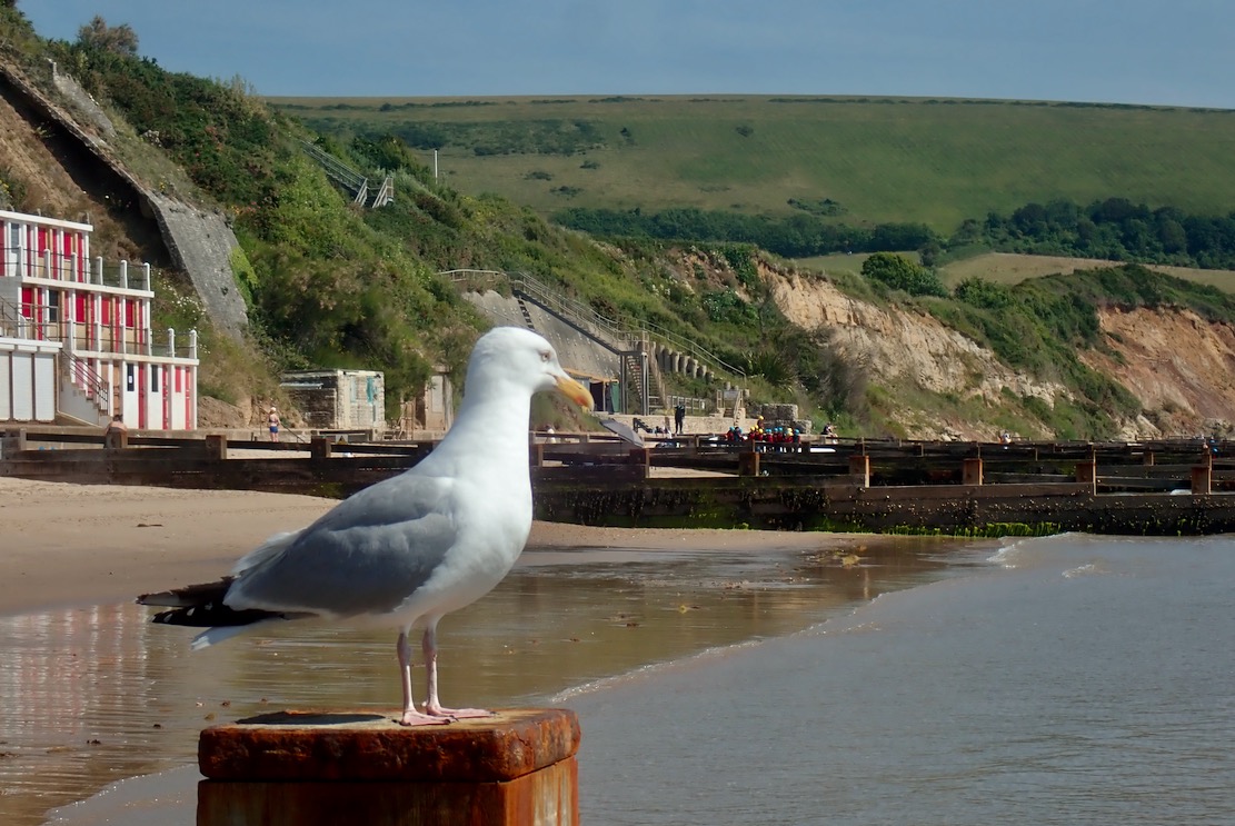
I couldn’t see how it had happened today on a smooth, sandy beach, but I spent the next 40 minutes wading up and down, juggling estimates of longshore drift with onshore breezes, but unsure exactly which of the 20 Swanage groynes I’d set off from. I finally accepted the skeg was MIA: some errant doggie must have snapped it up and rushed it back to its bemused owner. Drat – and I’d paid for 6 hours parking too! I went for a swim anyway, ate my sandwich, then packed up while a beaky seagull dryly observed the lambent folly of human endeavour.
Look for my Skeg, ye Mighty, and despair!

Heading back, I recognised a little sandcastle I’d passed on my way down to the shore, all of 2 hours ago. Was it here I put in? I wandered back to the nearby groyne on the off chance, but soon got distracted by the flash of some sunglasses. I waded round the end of the groyne to pick them up and there sat my skeg! Like a lost desert traveller expiring just one dune short of a palm-ringed oasis, my search had been one groyne short. Saved by a thoughtful beachcomber, I grabbed my skeg and left the shades: this show was back on the water ;-)

Don’t lose your skeg
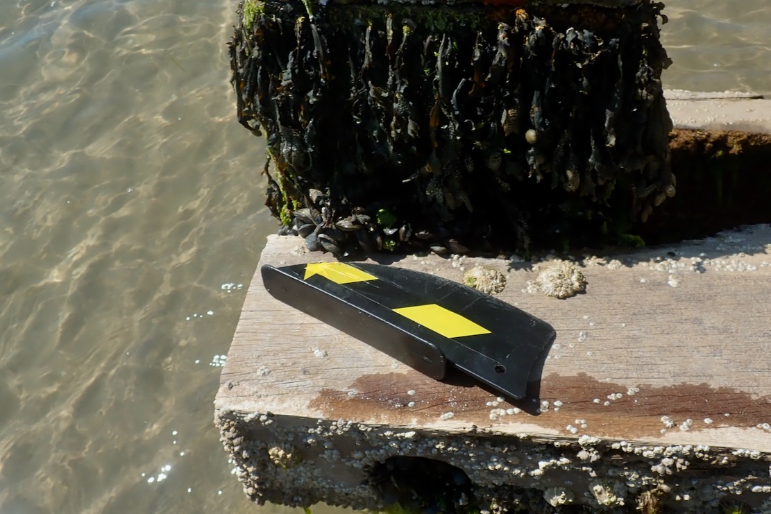
The lack of tension, even once inflated, can dislodge an Anfibio skeg following a small fore and aft movement of the hull pressing on the sea- or riverbed. On a flowing river, skeg-free is not so bad and you might need the clearance anyway, but at sea you definitely want a skeg for good tracking. Here’s one solution.
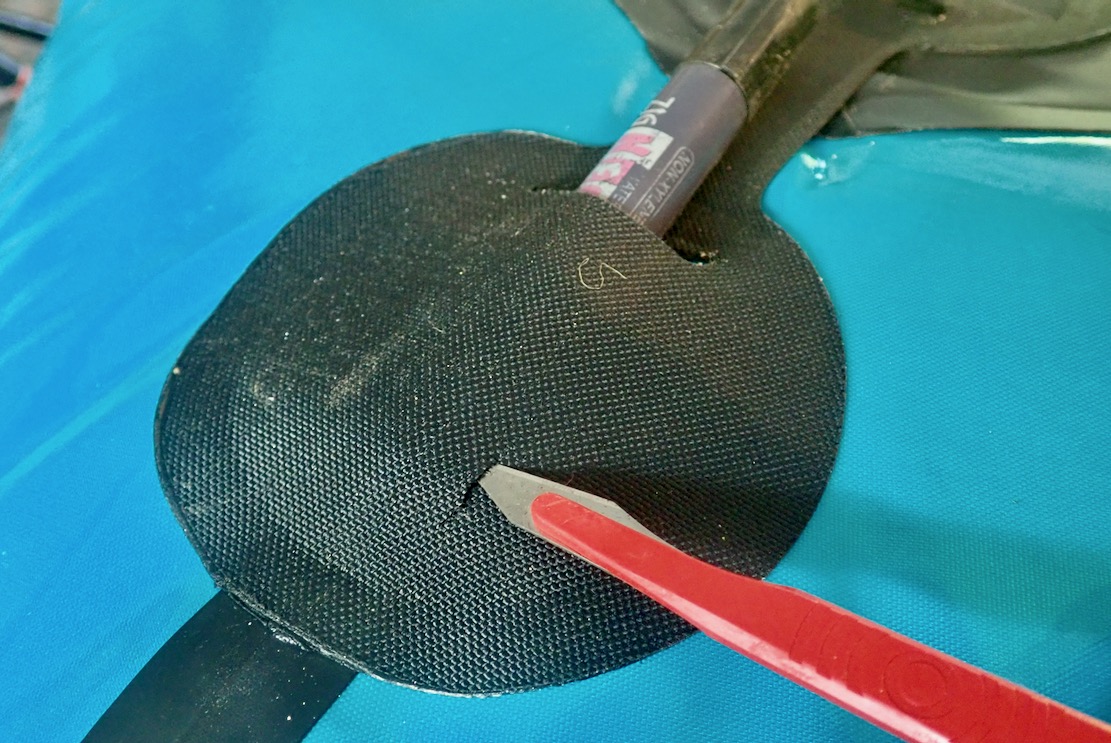
Stick something like a fat sharpie under the rear skeg patch to lift the fabric away from the hull; you don’t want to stab your packraft
Make two incisions which line up with the hole at the back of the skeg
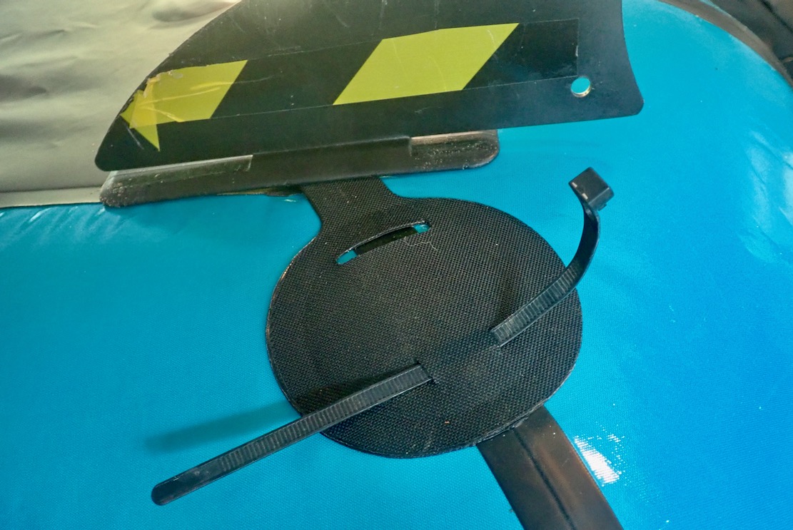
Feed a reusable cable tie through the slits and leave it in place. The skeg will now be secure

Skeged up, the TXL sliced NE towards Ballards Point like a troupe of dolphins late for the ball. I was sitting on the optional floor inflata-mat, which stiffens the long hull, reducing drag).
Edging towards the Point, I could feel the boat slowing down against the eddy hooking back southwest into the bay (left; LW+3). Passing over the corner some clapotis (below) was jingling about, pushed up by the eddying current.

Once round the corner, with the wind and tide now behind me, I was expecting record speeds. As usual though, with a backwind you lose the ‘wind-in-your-face’ impression of speed, which can be quite dissatisfying. To my right, jet-skiers were thrashing about, making me feel uneasy. Paddling quietly along, it’s hard not to feel intimidated, far less any aquatic fraternity towards these wave-jumping motocrossers. The sooner they all go electric the happier we’ll all be. But either way, I bet they’re a blast to ride!

Awesome!

Up ahead rose the oddly nameless Jurassic fang, seen behind Attenborough at the top of the page. All the other outlying pinnacles hereabouts are flat-topped. When you work out the thin rib of chalk where they got DA to stand to get the shot, you’d hope there was an unseen safety line securely attached to Britain’s most treasured national. As I passed between the fang and the cliff wall, a gust shoved me through, and I saw later the GPS had hit a dizzying 9kph.

Beyond lay the first of the chalk arches which make this paddle so special, and why it got featured on the title page of my IK beginner’s guidebook (below). At the first small arch the wind bounced me back off the high walls, then whooshed me through the calcified portal like a popped cork. On the far side some paddle-boarders out of nearby Studland were taking a break on a tidal ledge.

With the tide about halfway in, I threaded the passable arches around Old Harry’s (above), while other paddle sports enthusiasts milled about at the geological wonder of it all and from the cliffs above, walkers looked down with envy.
Once round the corner and in the lee of Ballard Downs, all that remained was to head west for Studland South Beach and pull the plug.

Convincing

With a bit of energy to spare and nothing to lose, at one point I put my head down and powered on to see ‘what she’ll do [mister]’. The GPS data log revealed a blip from a steady and sustainable 5kph to a limited-endurance 6kph, which would soon drain the batteries. Six kph must be the maximum hull speed of a TXL on near still and windless water. Better to save such efforts for unwanted offshore headwinds. Even then, looking at the data below, I’m again amazed what a portable raft which you can easily pack up and walk with anywhere will do on the open sea. ISuPs may be loads more popular, but to paraphrase former Met Police commissioner, Robert Mark, ‘I’m convinced packrafts are a major contribution to paddle sport adventures’.

Fast

On South Beach oiled-up heliophiles were laid out like seals. It reminded me of a radio doc about boredom I’d caught the previous evening. In an experiment, apparently 70% of males preferred to self-administer a light electric shock rather than sit still in an empty room for 15 minutes. They should give them a sun bed next time, but perhaps I’m missing the point.

I could have walked back the couple of miles over Ballard Downs to Swanage, but what with the time wasted on the skeg search-and-rescue mission, I didn’t want to risk getting back late to the parking before something terrible happened.

So I treated myself to the 20-minute open-top #50 bus ride back to town.

All together now:
We’re all goin on a
Summer holi-day…’

IK&P Competition. Win Free Books!

Congratulations to winners: Roger H and Dan S!

It was competition time here at IK&P. Answer a simple question to win three lavishly illustrated paddling books by Fernhurst Books, including their new Paddling Adventures; 100 Epic Experiences with a Paddle out in November for £20.
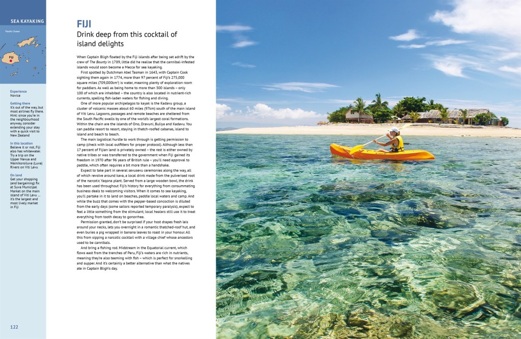
Inside, browse over 200 pages of gonzo whitewater, sublime sea kayaking, surfing, canoeing, paddleboarding and heck, even packrafting, with a couple of contributions by me, as well Rob from Mekong Packraft, including southern France’s lovely Allier.

I’ll also include a copy of my Inflatable Kayaking and Packrafting Beginners’ Guides, also by Fernhurst. Three books and enough paddle action and ideas to see you through the winter.

To enter the competition and a chance to win one of two sets of the three books worth £40 and post free anywhere, answer this simple question:

What is ‘IK&P’ short for?

Answer: Inflatable Kayaks & Packrafts