It was competition time here at IK&P. Answer a simple question to win three lavishly illustrated paddling books by Fernhurst Books, including their new Paddling Adventures; 100 Epic Experiences with a Paddle out in November for £20. Inside, browse over 200 pages of gonzo whitewater, sublime sea kayaking, surfing, canoeing, paddleboarding and heck, even packrafting, with a couple of contributions by me, as well Rob from Mekong Packraft, including southern France’s lovely Allier.
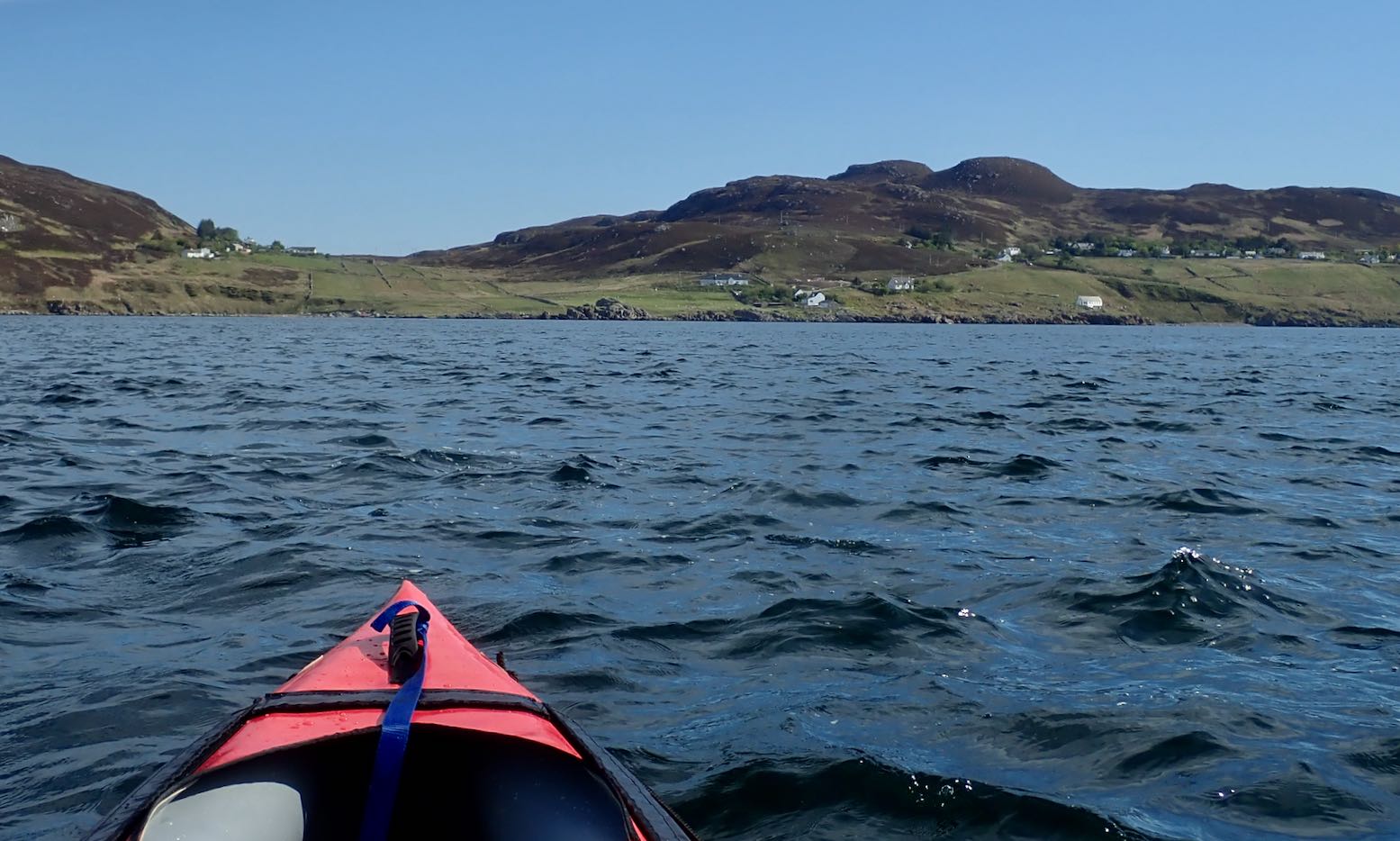
Another forecast of calm winds in the Summers. Or is it? The BBC and YR reports are contradictory: the former has too-strong-for-IK winds from the south; the latter shows light winds from the north. Others show light winds from the south. How can they all be so different? Maybe I should just look out across the water? All looks serene so let’s make paddle while the sun shines. I wheel back down to False Man’s Harbour and set off with two hours before high water.
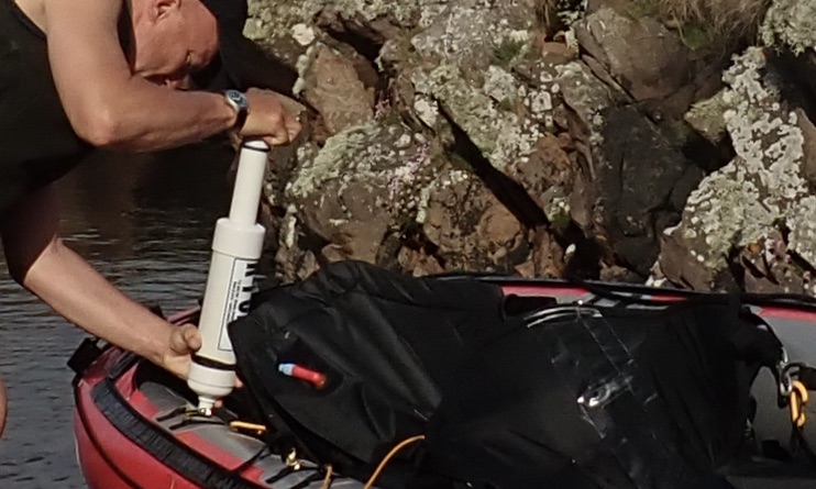
No side PRVs? Am I missing not having added pressure release valves in my side tubes, as I did to my original Seawave? Not really. I am running 0.3+ bar in the sides (official: 0.25) but temperatures up here in NW Scotland are hardly tropical. I try and leave the boat in the shade at the house and de-air the side tubes for a couple of seconds after a paddle, effectively manually depressurising the sides to about 0.2 bar, rather than having fitted PRVs do it for me automatically. The more vulnerable stock PRV in the floor purges automatically at 0.25. On my next paddle I have to top up all three chambers with the K-Pump as I would have to do with all-round PRVs anyway. About 30 kpumps brings the sides back up to over 0.3 bar. The difference now is I use a manometer to check the sides are about right. Before I would just pump until the side PRVs purged. It’s about a minute’s more faffing. As with a lot of things I do to my IKs: sails, rudders, decks and now, trolleys and headwind weight transfer – it’s fun to experiment. But in the end they’re all largely over-shadowed by the simple enjoyment of paddling. With sides pumped to >0.3 bar I find I can cruise easily in the near-still conditions at 6kph.
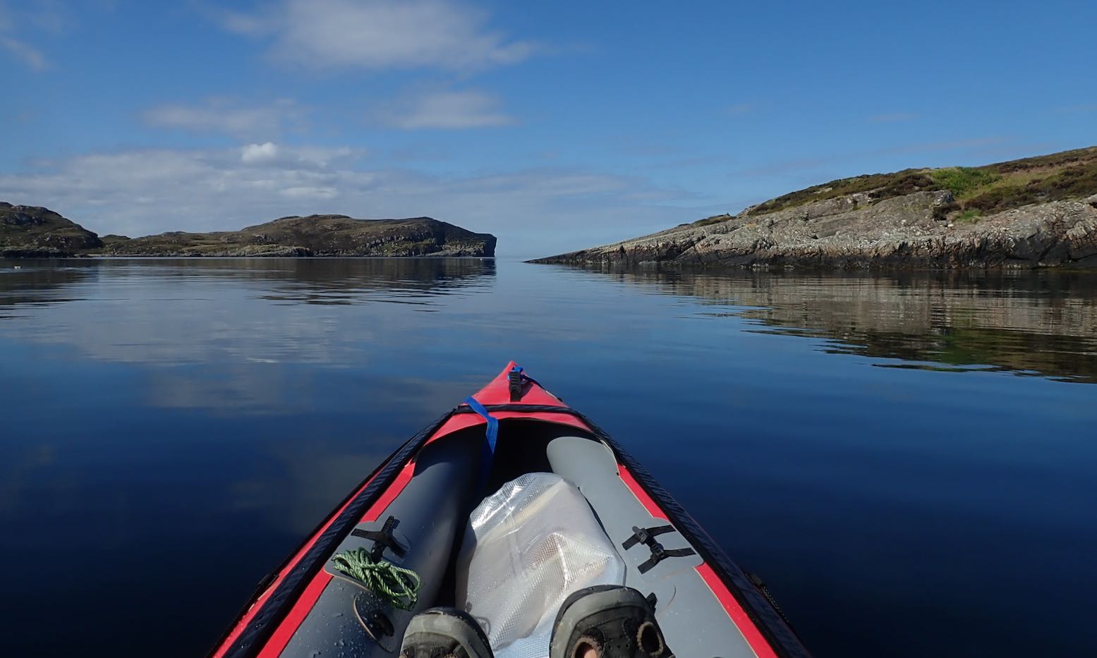
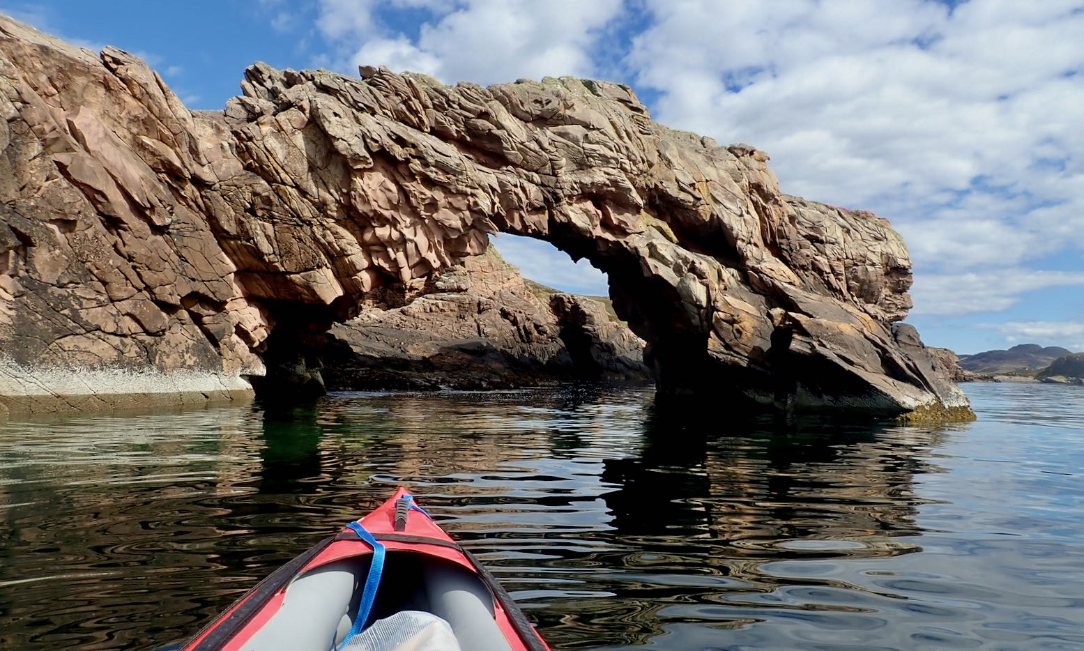
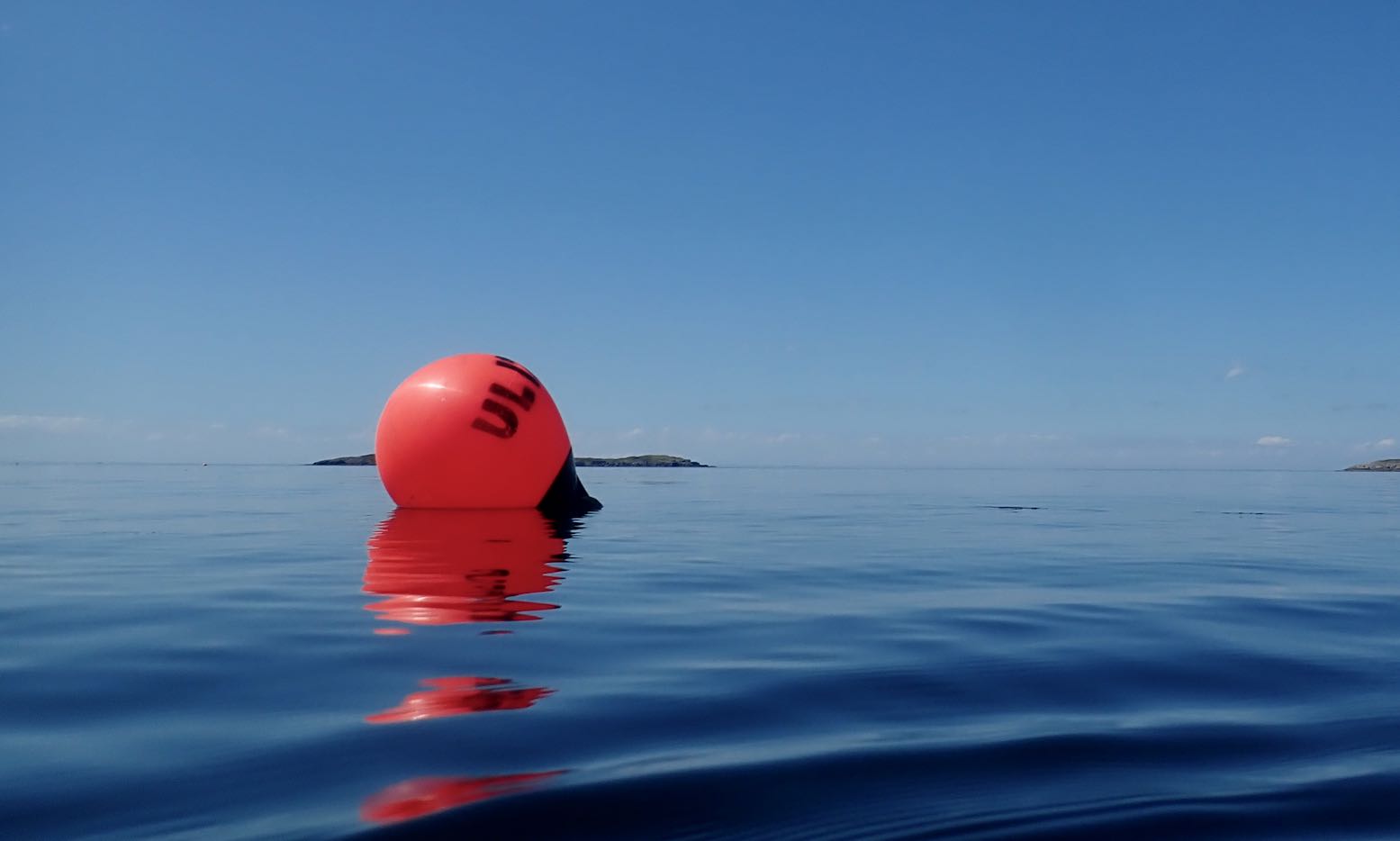
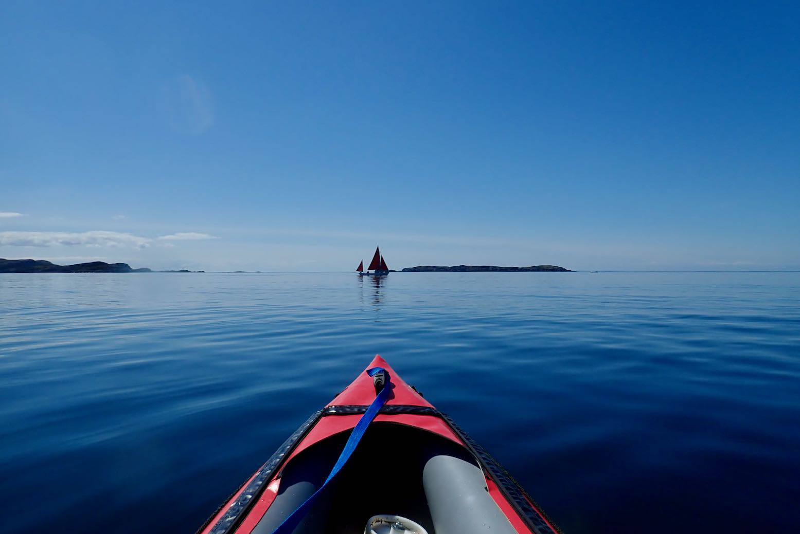
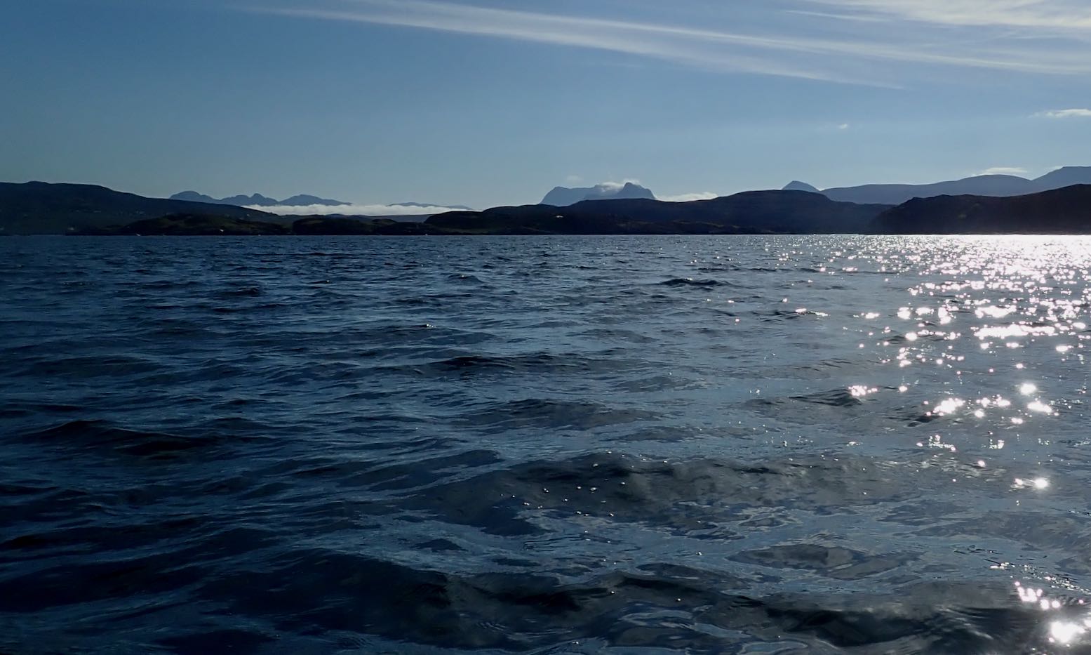
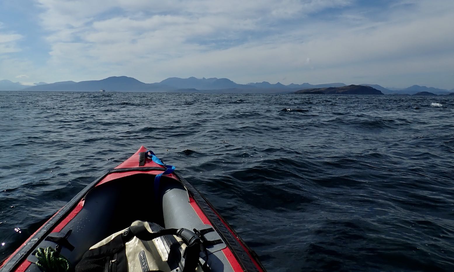
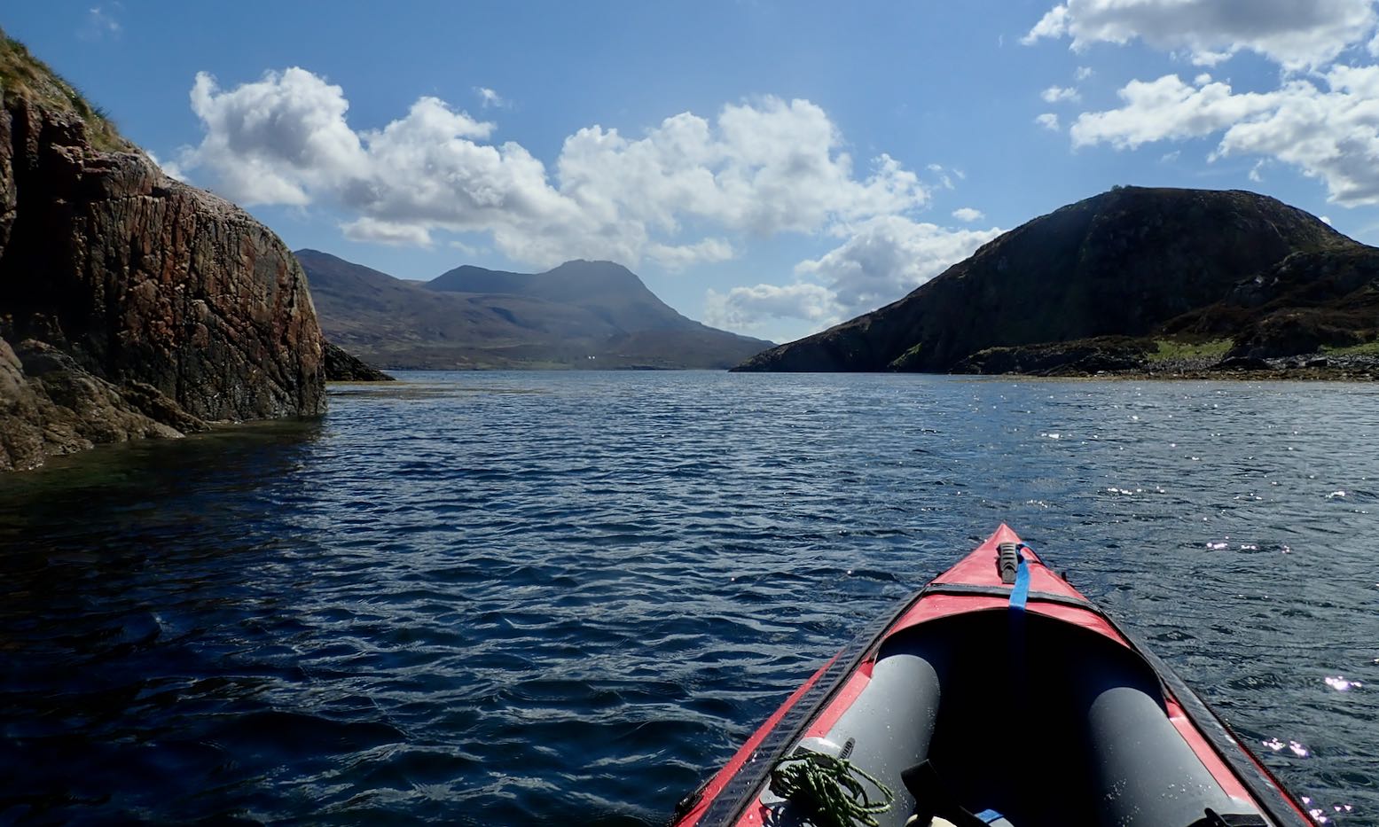
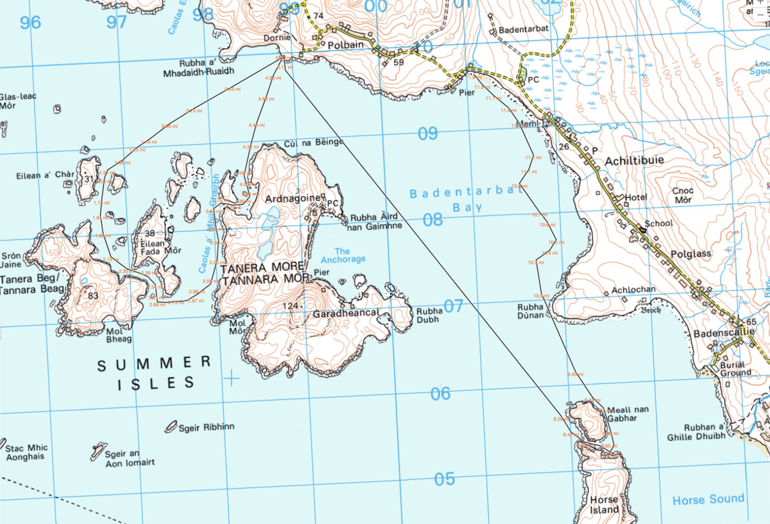
Let’s try and make the outside of Tanera Beg again. Two days ago I got blown off that idea.I fit a compass so I know which way the wind blowsAnd try out my deckbag GPS RAM mount so I can measure, not guess, distancesKayaking tour party mustering at the north cliff of T. Beg.But they seem to be dawdling, as if unsure whether to go ahead.I paddle past and on to the big cave on T. Beg’s south side. That crack at the back might be passable at max HW.The view out south towards the Wedge of Angus and Priest Island beyond.I slip through the popular arch at Tanera Beg’s southeast end.I notice a small second arch. The water is too high and gap too narrow to squeeze through with my Seawave, but it’s only a foot deep below, so the window of opportunity is as narrow as the arch. What would Freud have made of all this arch-threading.Being more exposed to the southwest, Tanera Beg has some deeply weathered sandstone cliffs.Midway through, I decide crossing over to Tanera Mor seems too easy. In the prevailing calm the three skerries to the south don’t look that far. It’s just over a kilometre to Sgeir Ribhinn (‘Stack C’) according to the GPS. That will take 11 minutes. Once there, I fail to notice the double-arched cave we found last time. But this is HW. A guard-bird observes.Over to the south side of Tanera Mor. The new owner is employing scores and spending millions here. New cottages here and there, plus tracks to isolated beaches (for building stones, I was told). They now ask you not to land in the more built-up Anchorage on the north side.There’s even a new house and other construction alongside the tidal lagoon of An Lochanach where I stop for a snack. Two kayakers pass by. Earlier, I could clearly hear them talking behind me across the flat water, long before I could see them.I cross the Bay and stop off on the mainland below our place to collect something.Looking west: a buoy with Glas Leac Mor behind. I recently read that a hazy horizon (Outer Hebrides not visible) means stability; warm, humid air. Good viz and crisp detail = cold air and wind. I head to Altandu, near the campervan-packed campsite.I drop-off and pick up a bucket. Coming back through Old Dornie harbour, a quarter headwind kicks up, pushing the bow left. I use the chance to load the bow with 10 litres of bucket-water. It does seem to make a difference: the bow bites better; no correctional paddling needed, unlike the other day. A good trick to know (I’d brought the drybag up front for that purpose).Another 13-mile day in the Summers, but I could have managed twice as far. How easy IK-ing is without wind. As is portaging with a trolley.
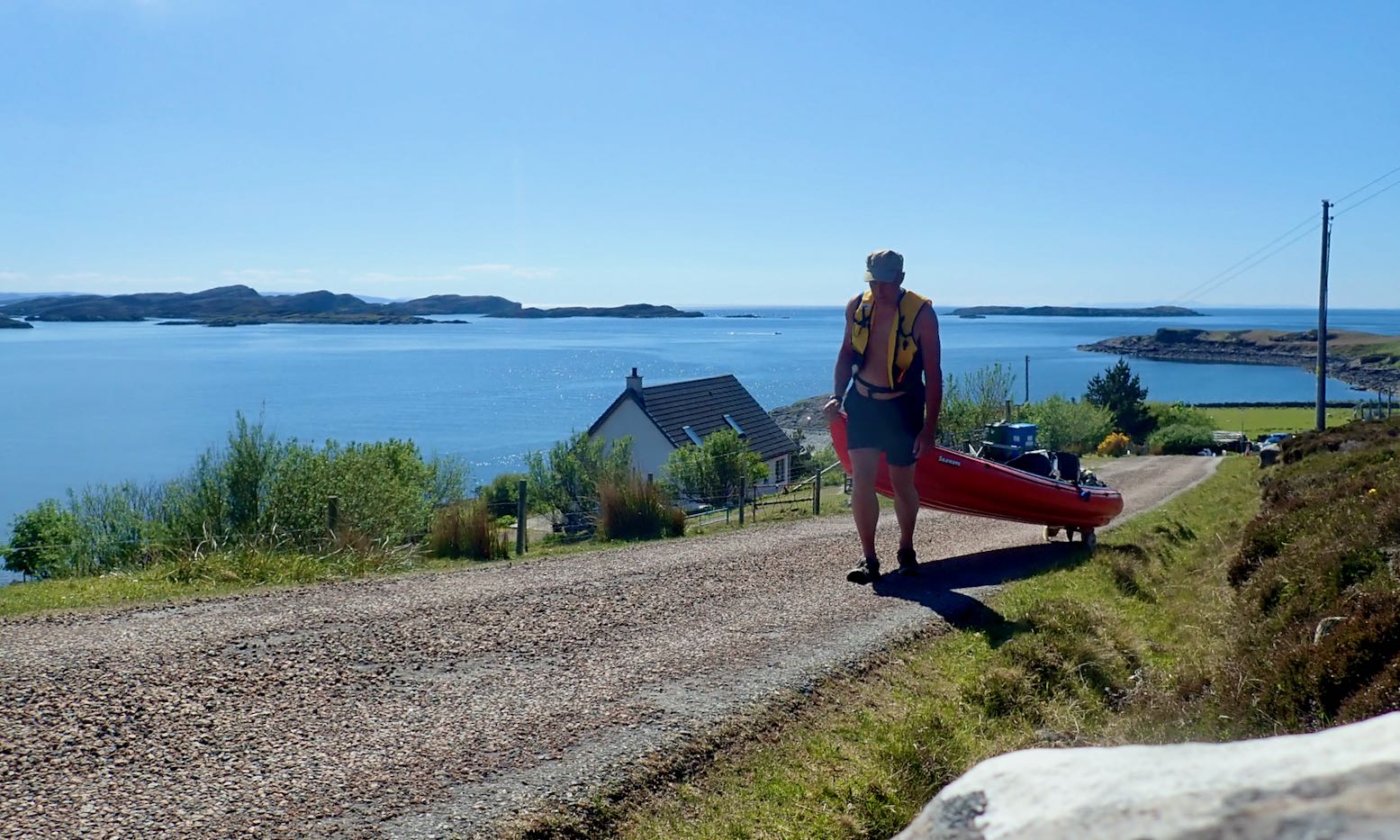
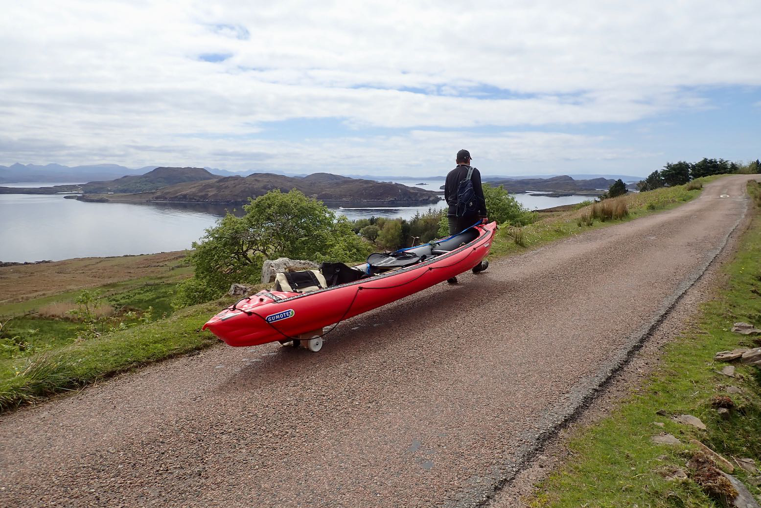
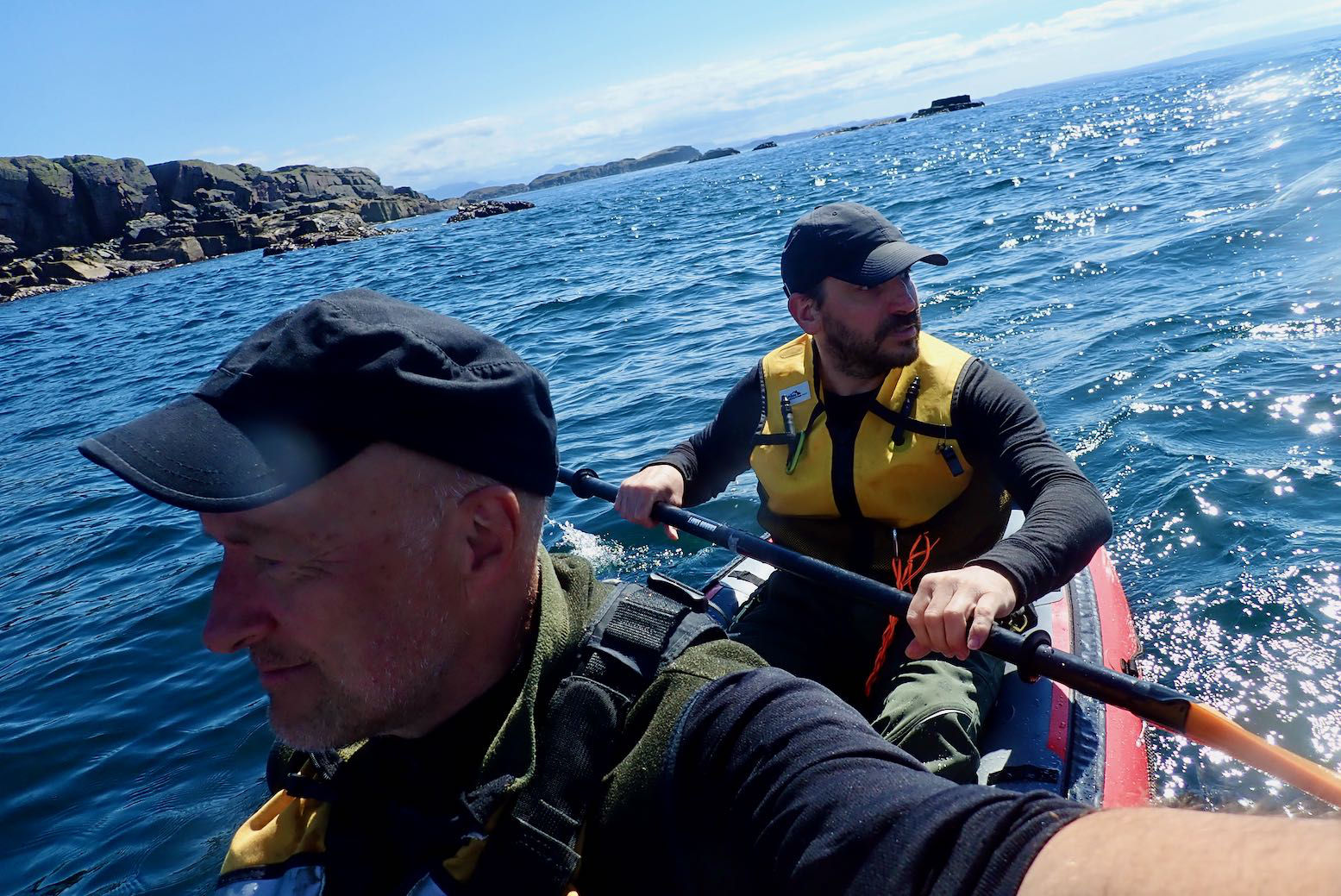
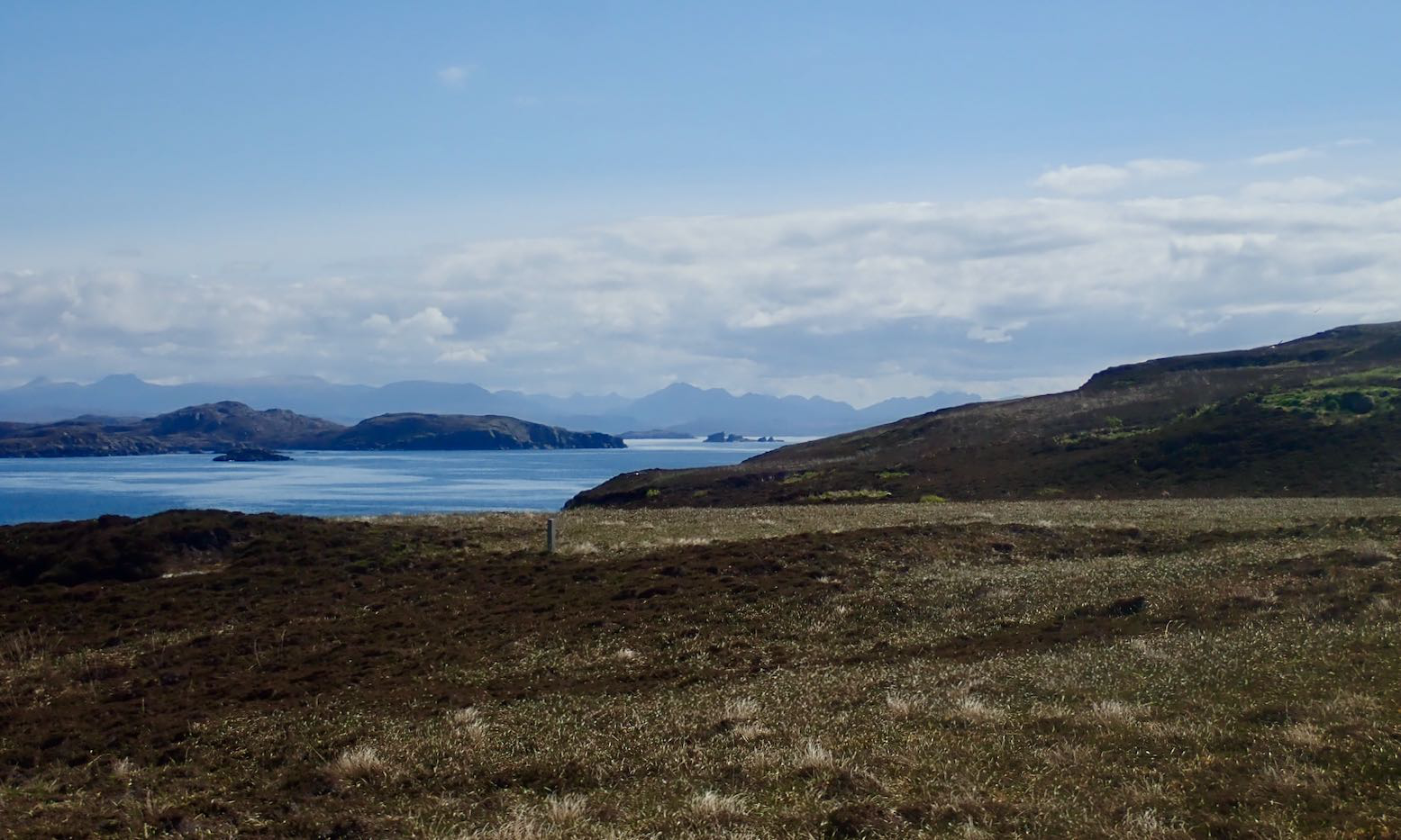
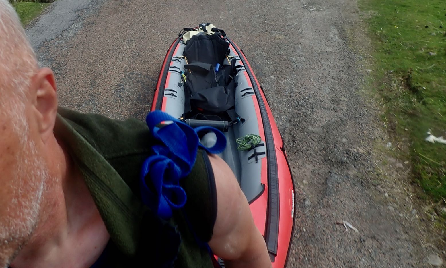
After a fortnight of chilly north winds and a diminishing woodpile, today was one of those rare days in the Summer Isles (far northwest Scotland) where you could paddle pretty much where you liked in an IK. It was also a chance for me to try out my new skeg-wheel trolley which Jon, who was staying down the road, had made for me. With no boat of his own this time, we set off in mine to see what we might see.
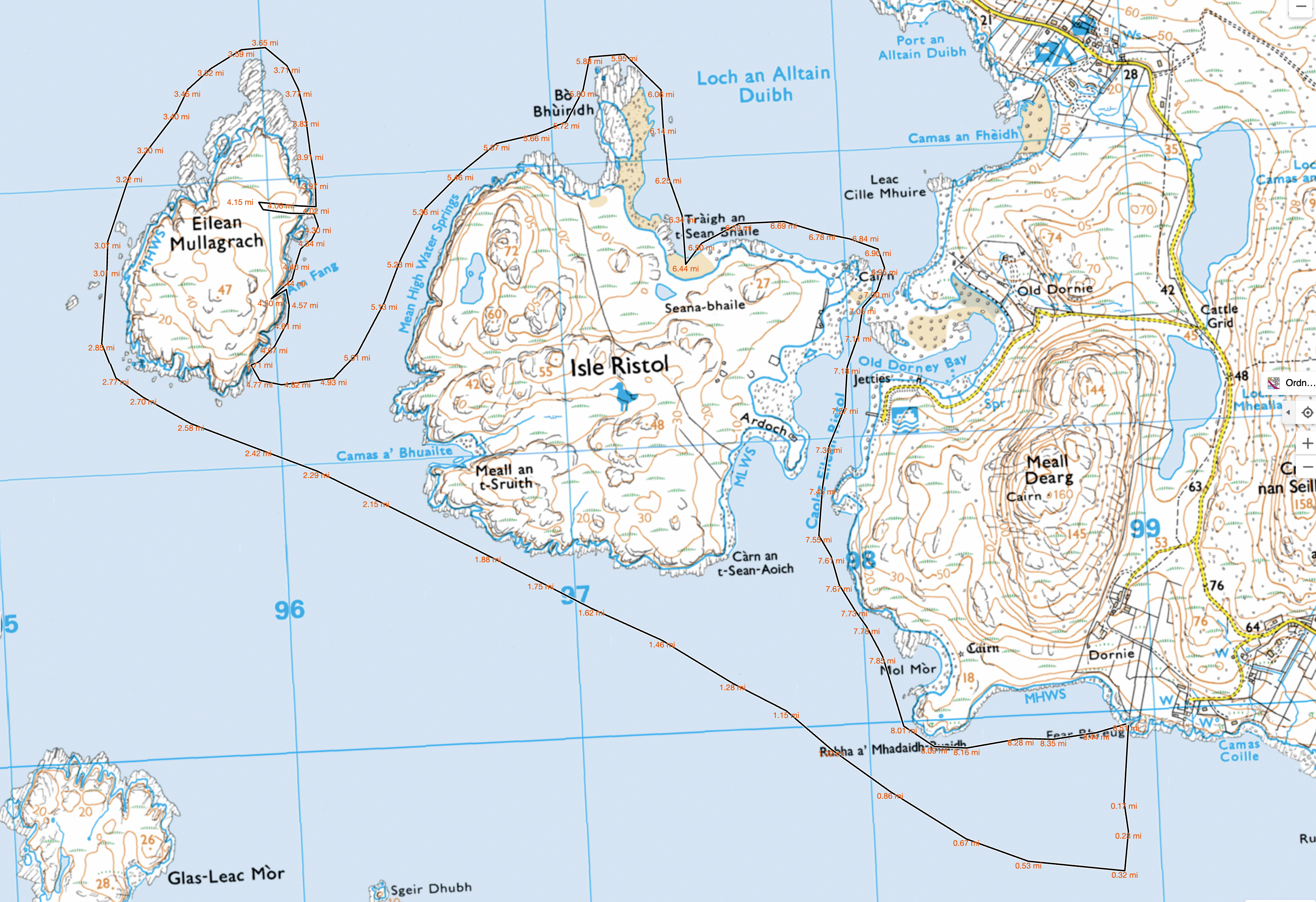
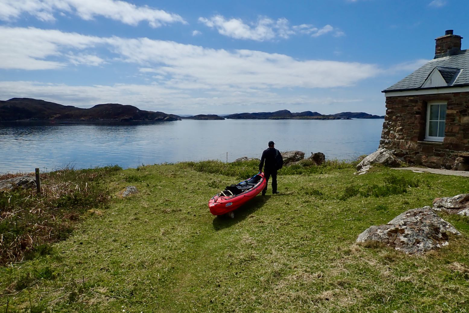
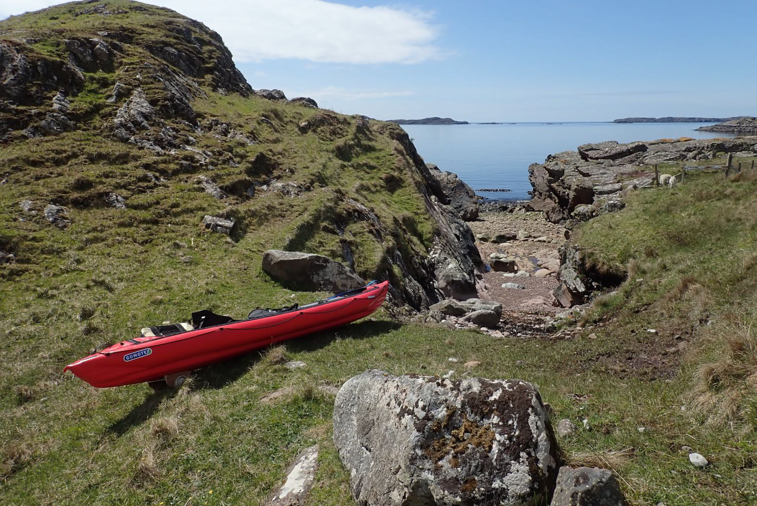
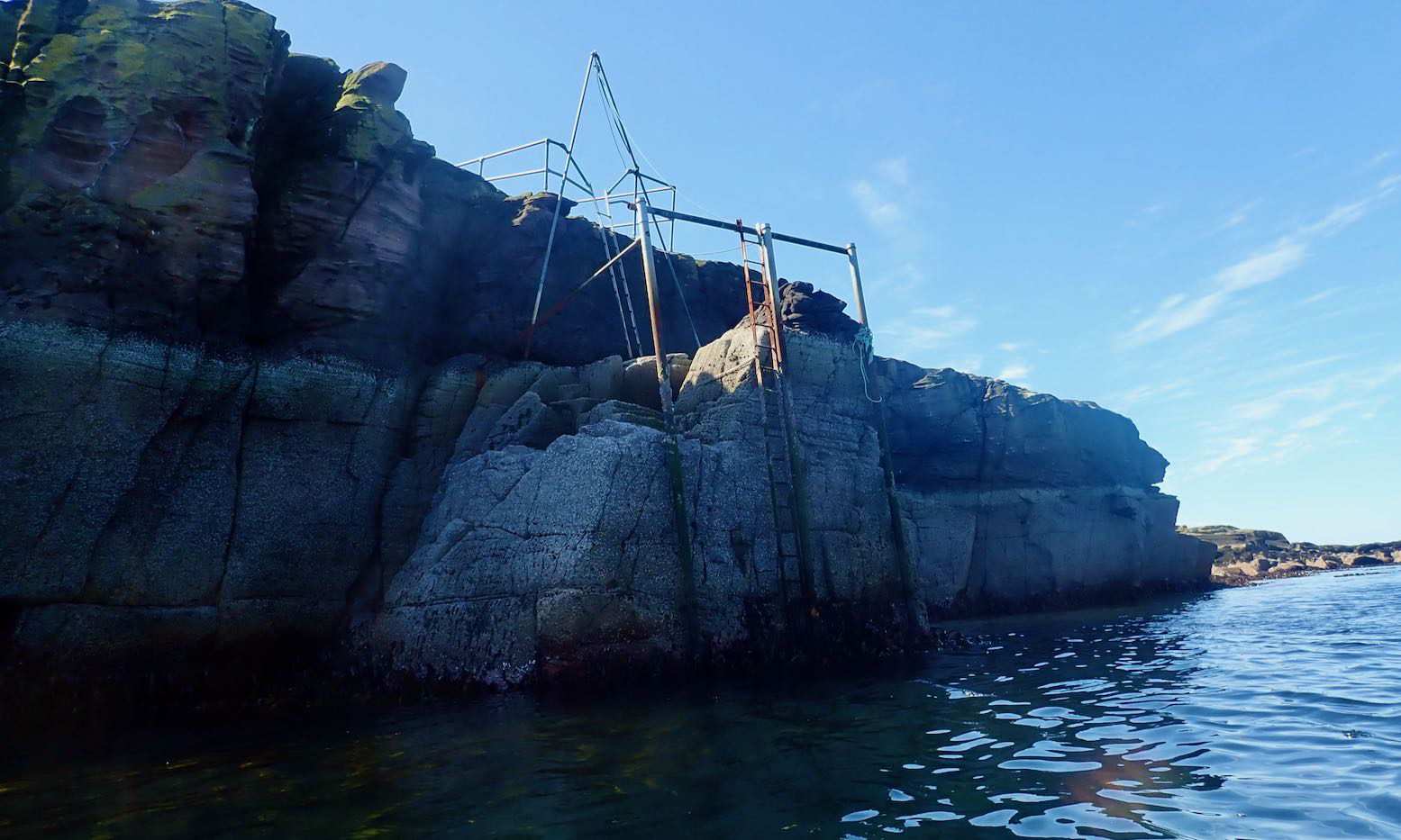
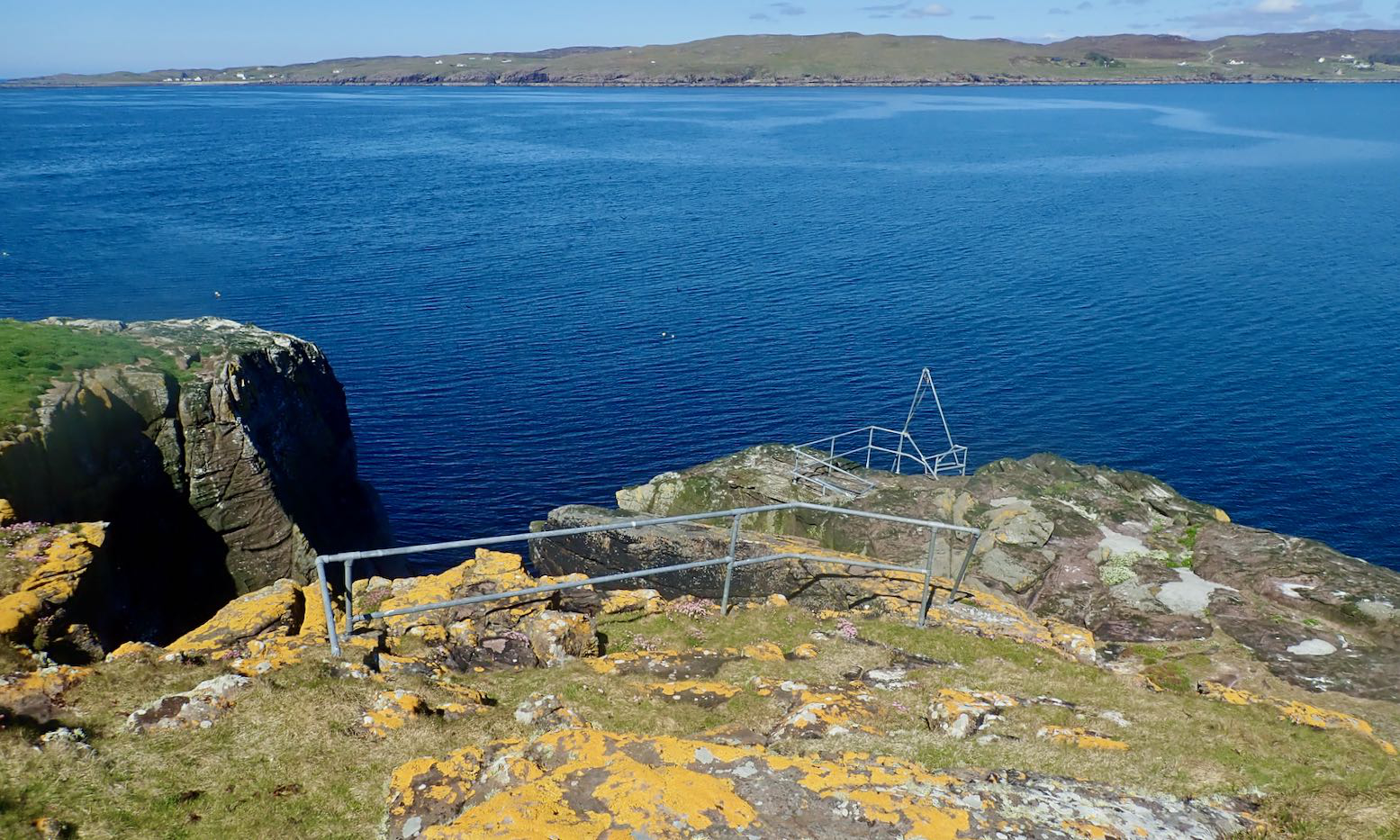
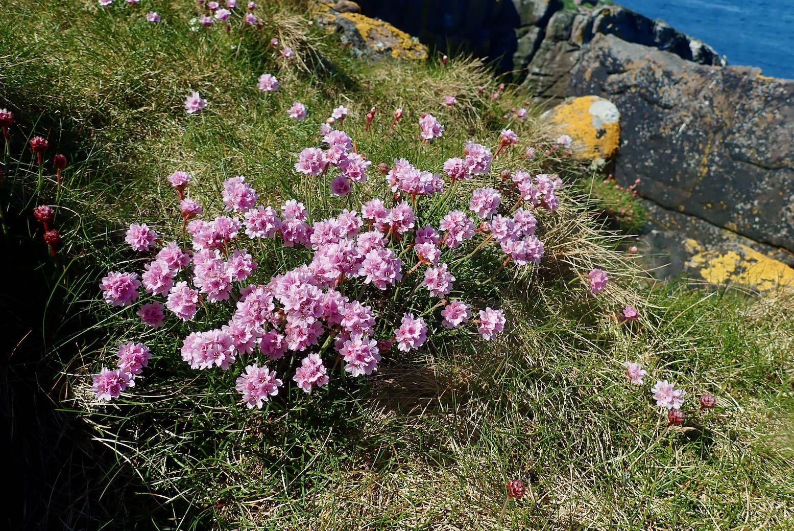
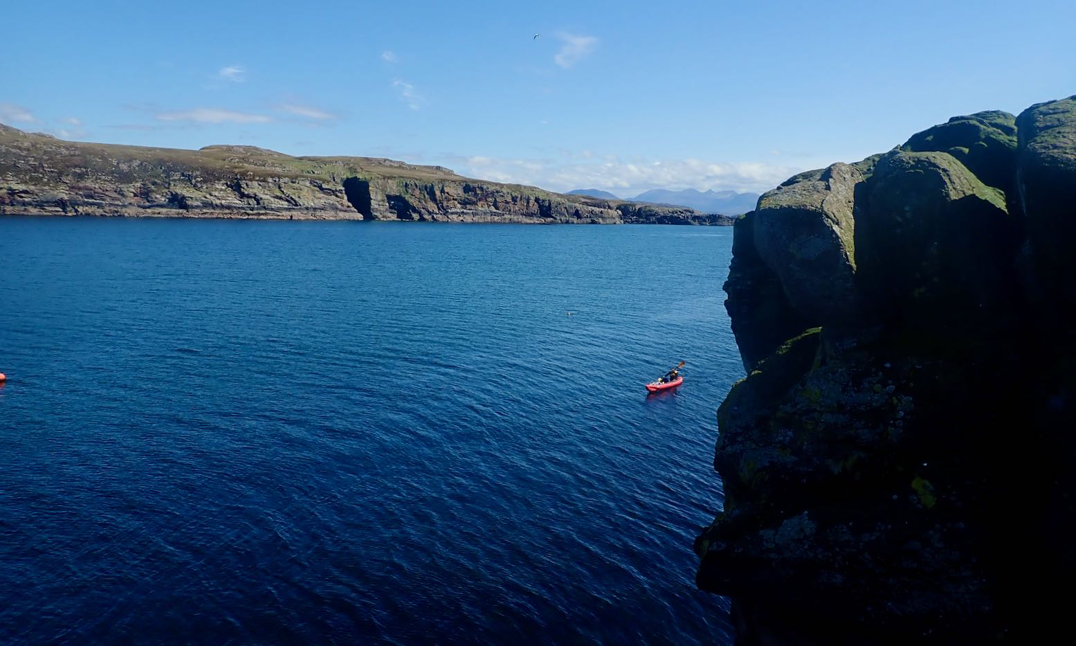
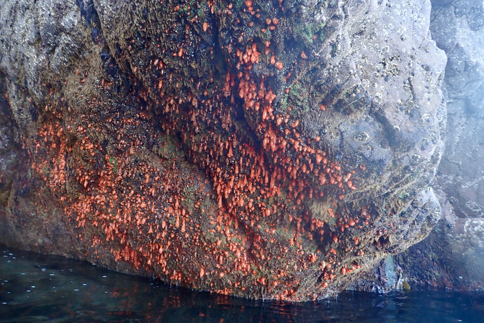
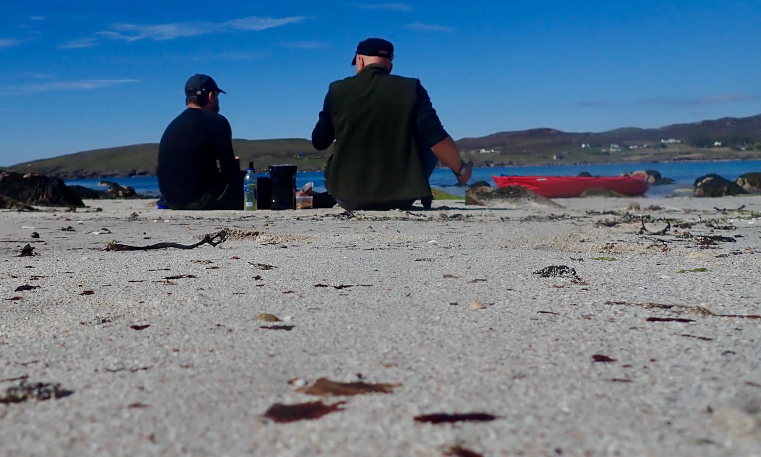
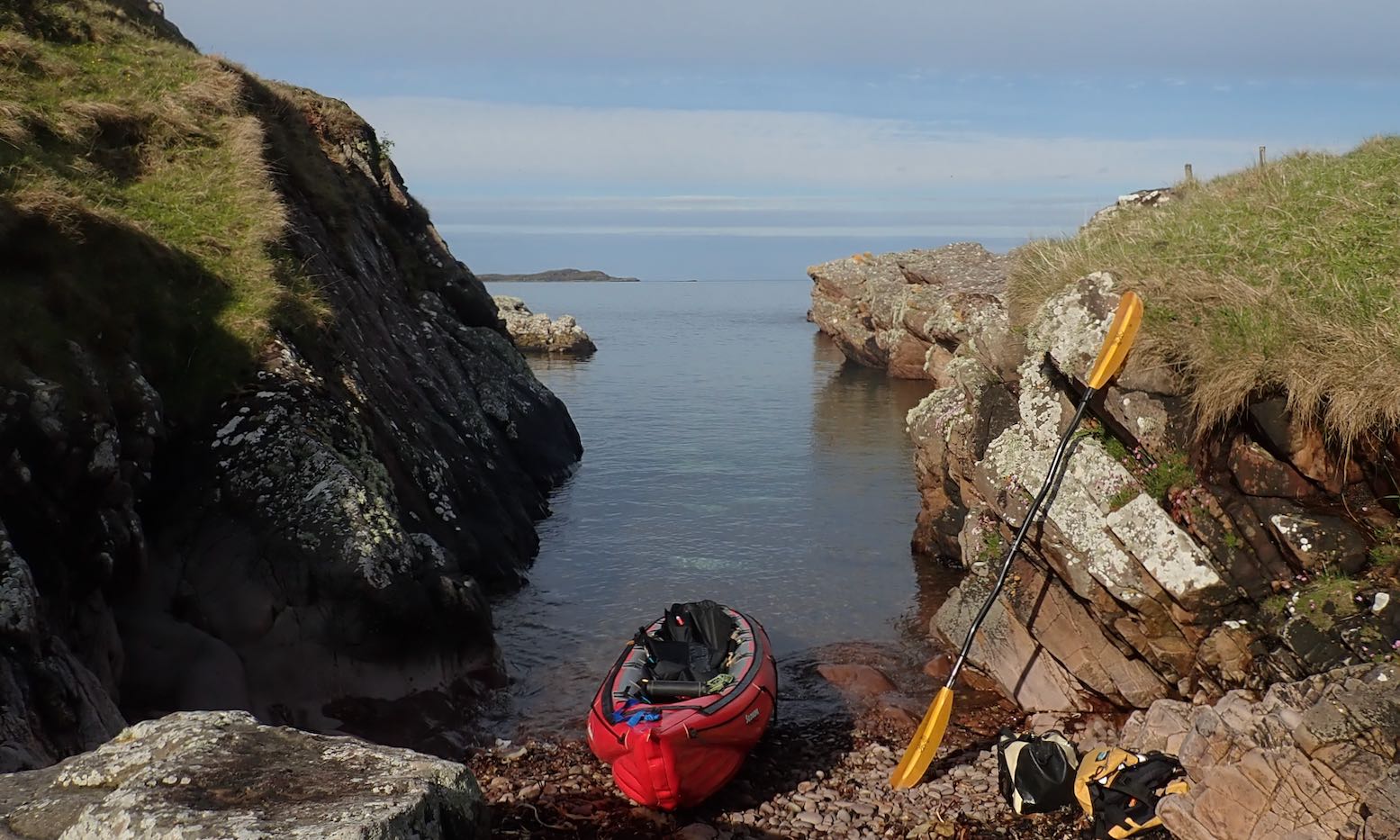
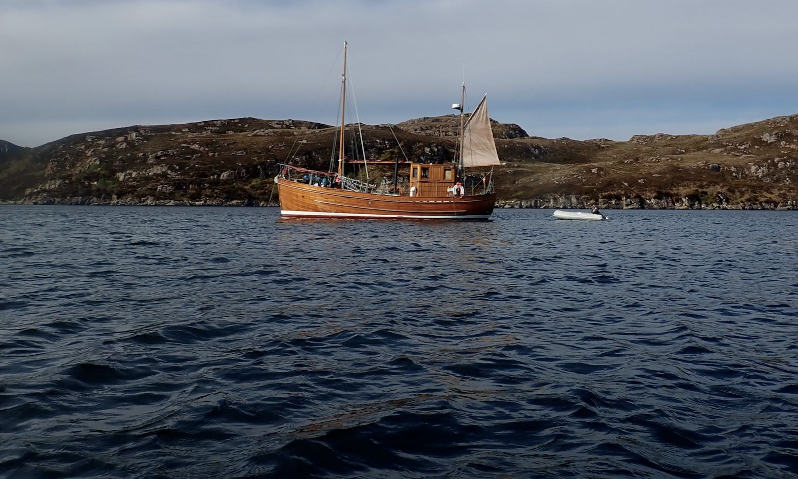
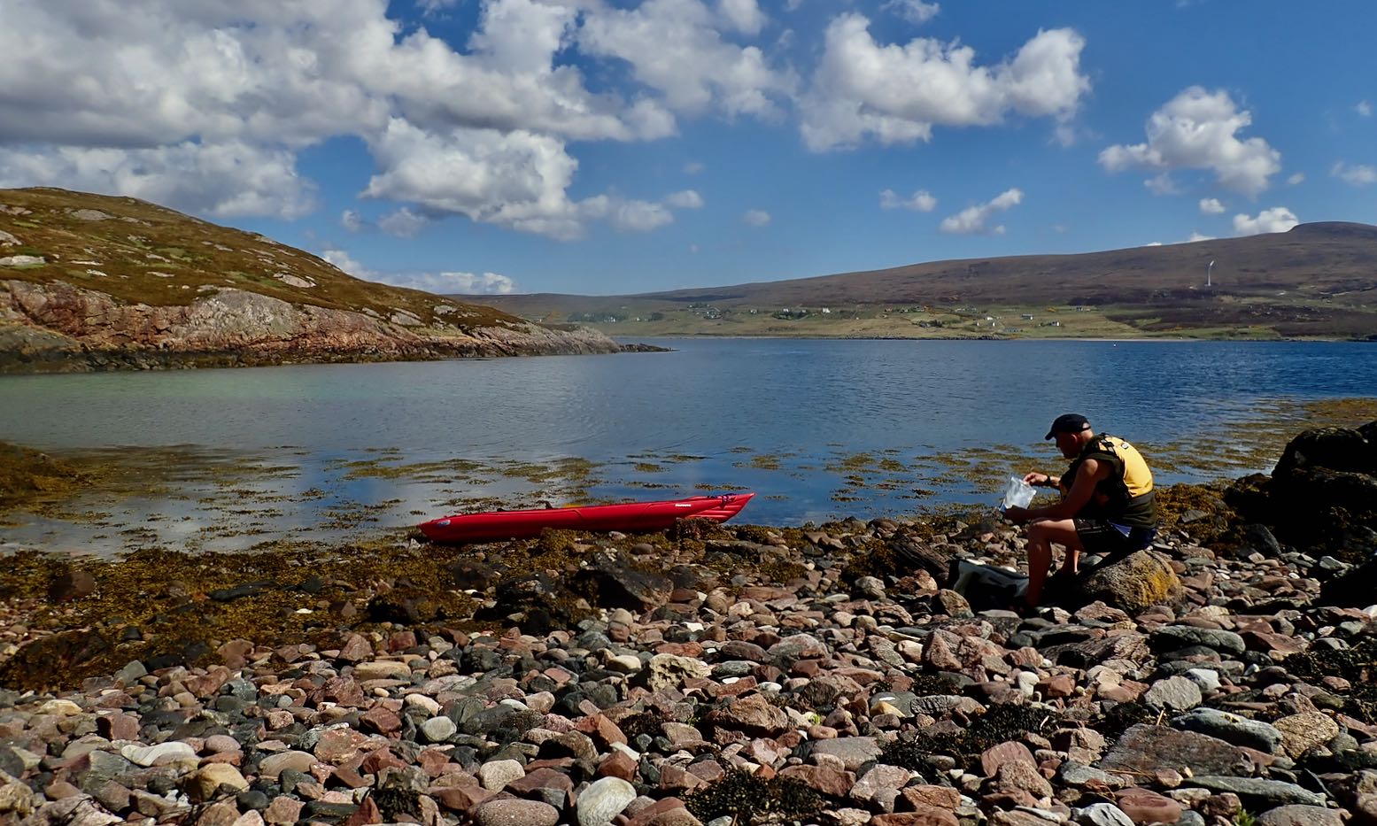
We rolled down the road to the Fox Point, the nearest and least effortful shore access from where I’m staying. Apart from the clatter of the solid wheels, the set up worked perfectly: stable and smooth.The spring tide had bottomed out so we looked for the least ankle-twisting put-in.Fear Bhreug (False Man) slot harbour looked just rightJust a few wet, slime-covered wet stones to negotiateWe have no plan so head towards the Ristol Islands across a glassy sea.With the calm, we take on the outside shore of Eilean Mullagrach; here the refracting northern after-swell makes it a bit choppier with some alarming waves breaking over reefs.Unless you’re a gannet, this is the only way to get onto Mullagrach, a gantry at the northeast tip. Usually alone, I’ve never done it, but with Jon to tend the boat, I climb up.With access so difficult, Eilean Mullagrach was never occupied or crofted. I think it’s now owned by a bird protection enterprise. Perhaps they built this guardrail and cut the steps. There’s what looks like a hut at the island’s south end, just past the (not very) high point.Nice to see sea pink and yellow lichen again. The former mostly found on the sheep-free islands and skerries.View south over the Summers to the Fisherfield mountains.The channel with Ristol behind. Better get back; the taxi’s meter is running.We visit the narrow twin-cave and nearby archPendulous sea growth emerges at very low tidesWe scoot back north out of the channel and take a break on Ristol beach before cutting through Old Dornie harbour back to False Man inlet. I leave my kayak overnight with a plan to come back for more tomorrow.Next morning I’m relieved to see my Seawave hasn’t floated off into the Minch. I top up and decide to head round the outside of Tanera Beg for starters.All is calmish as I cross Badentarbet Bay, but as I near T. Beg an unforecast southeasterly kicks up and keeps on kicking. The west side of Tanera Beg would be too exposed, so I divert into the Tanera Channel, using the lee of the smaller eileans.Nice looking wooden trawler.I’m hoping to at least visit the arch at the southeast end of T. Beg. It’s only 500m away but it’s quite lively and gusty now so I don’t risk it. Instead, I turn east to get into the lee of Tanera Mor, and take a diversion through the usually cut off pool of Acairseid Driseach (these Gaelic words just roll off the tongue).A bit disappointed, I head back to slot harbour but the wind seems less bad or may have passed. So I collect my trolley and strike out for Horse & Goat Island. I estimate it’s about 2 miles across Badentarbet Bay. The wind drops and even becomes a NW tail breeze.It’s actually more like 3.5 miles to the tidal channel between Horse & Goat. By now the spring tide is at full flow against me and I wonder if the two islands have joined up yet. I needn’t have worried; the NW breeze is stronger than any tidal current and there’s at least a foot of clearance.I pull over for a snack and a drink. Last time I was here was with my failed Semperit project. What a nice boat that could have been. I knew from here it would be a 2-mile into the wind hack to Badentarbet beach. Or even more annoyingly, a three-quarter headwind. It’s less than 10mph, but despite pushing hard with my left arm, the boat kept getting pushed right. Where is my rudder now?! I should have picked up some rocks to weight the bow at Horse Island to see if that trick works. Next time I’ll carry a waterbag to do the same; it’s something I’ve read of but never tried.From Badentarbet Beach it’s a stiff climb – 1st gear pushbike – back up the road to Polbain, but on the road the skeg-wheel trolley again makes for easy, hands free towing with the boat hanging from my shoulder via a knotted mooring line. I can walk at normal speed with loads less effort (and time) than carrying the deflated IK. Having a trolley like this makes the IK nearly as versatile as a packraft: a boat you can start here, end there and easily transport back across the difference.
So ends another great 12-mile day out in the Summer Isles whose configuration enables numerous ways to spin out a trip as pirates, winds and stamina allow, and all without getting too far out.
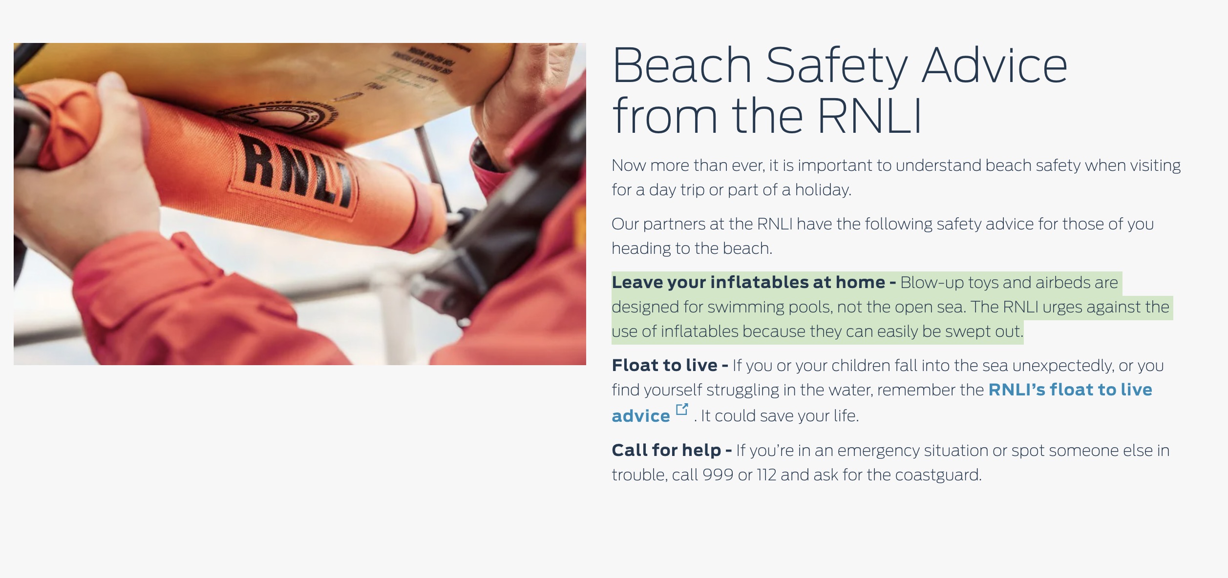
I just came across an RNLI campaign sponsored by Ford from August 2020, at which time paddling in the UK and elsewhere had gone ballistic. As some may recall, beaches in the UK were packed with a consequent rise in call outs Among the pithy safety advice they found room to print on a Ford Ranger’s specially moulded tyres – ‘RNLI Ford‘, ‘Emergency? Call 999‘ and ‘Float to Live‘ (a good case for inflatables, you’d think) – they also chose to include the rather blunt: ‘No Inflatables‘. As the Ford press release linked above says:
‘In 2019, RNLI lifeguards aided more than 29,000 people on UK beaches in more than 17,000 incidents, saving a total of 154 lives. They also helped to reunite nearly 1,800 lost children and teenagers with their families and aided 346 people in incidents involving inflatables.
In other words, 0.5% of incidents involved inflatables. Another statistic in the report may explain why inflatables got such prominence:
• 40% of people who say they would take an inflatable into the sea in the UK admit to previously getting into difficulty
How would you interpret this? Reckless stupidity or learning from your mistakes and being a bit more careful next time? Is the suggestion that ‘getting into difficulty’ required a rescue?
‘Stay together’
A fourth moulded-tyre message advising what looks like ‘Stay Together‘ (right) was given far less prominence in the press release and photos. It presumably referred to the >10% of incidents of children getting separated from their families at the seaside. That can be very unnerving for all concerned but is less perilous than being blown out to sea. It will be interesting to read the 2020 stats if they become available.
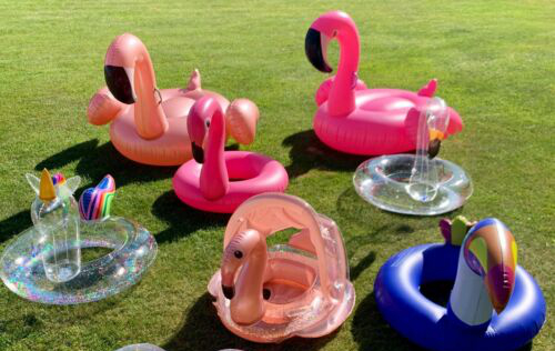
Inflatables…… some are better than others
It was a Ford publicity stunt, of course, capitalising on their support of the RNLI which is a voluntary organisation part-assisted by donations. A link makes it clear by ‘inflatables’ they mean pool toys as above left or the inflatable toucan ring the little girl is seen wearing at the start of the video (below), running across a deserted beach towards the surf. But you’d think there was a better way of saying it. After all, the RNLI use inflatables themselves.
Allow me to pull a publicity stunt of my own and refer to the Weather & Safety chapter in the new book. The advice is clear: compared to a relatively heavy hardshell sea kayak which sits low in the water, much lighter more buoyant and wind-catching IKs can become difficult to manage in windy sea conditions, even if you are young and fit. Unless you know better, never go sea kayaking with a strong offshore wind, and think twice about going alone, especially to explore an unfamiliar area. At sea always wear a buoyancy aid. The summer sun may be hot on your back but in the UK, the water is cold. It’s the initial involuntary gasping reflex caused by cold water shock which leads panic, flailing about and drowning. That’s what they mean by Float to Live: once you’re over the initial shook and the breathing has stabilised, spread your limbs out and relax (assuming you can’t get back to you boat). Obviously a buoyancy aid makes this all much easier.
Last time I looked, you won’t find anything on the RNLI specifically addressing IK and iSUP limitations, and yet it is inexpensive IKs which tend to be bought by holidaymakers with no knowledge of how they handle at sea in windy conditions. I suggested to the RNLI writing such a piece but was told they have their own safety experts.
The Ford RNLI video below was shot at Minnis Bay, near Margate. I’ve never been paddling there but it does look like a particularly exposed beach where a typical southwesterly wind would blow you straight out into the Channel.