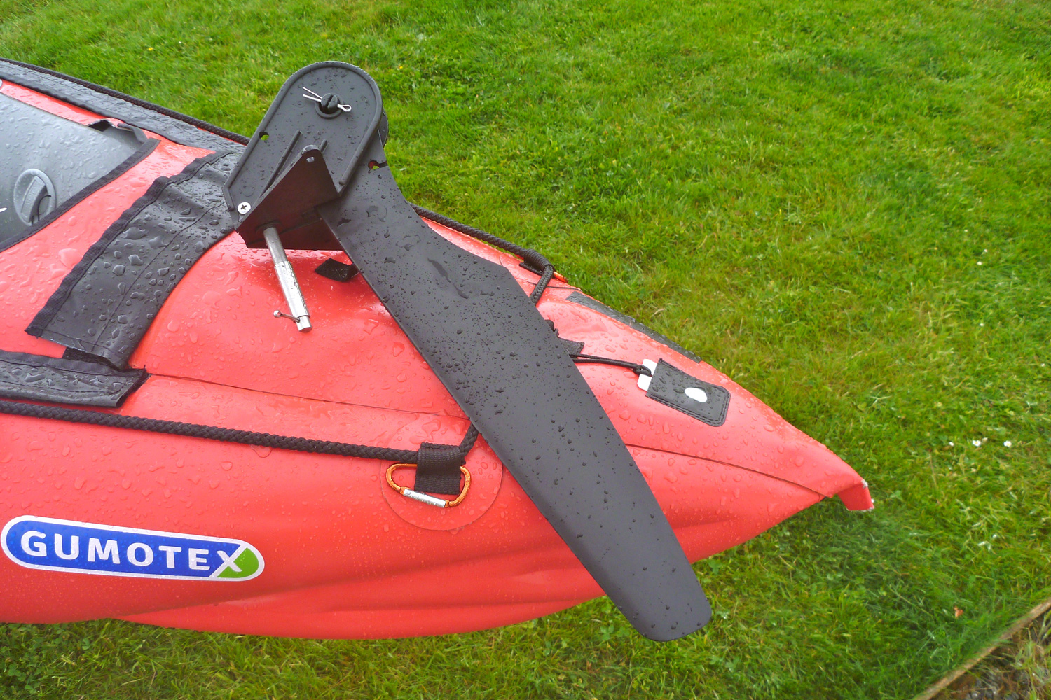
The 2016 Gumotex Seawave has had the stern slightly adapted to take an optional rudder kit. They’ve also improved the velcro bands for the optional deck by using Nitrilon, but it’s the rudder that’s the interesting development.
Coincidentally, I was halfway through adapting a cheap SoT rudder for my Seawave (left) and the factory version (going for £200) gave me some good ideas. The Gumotex rudder kit could be easily fitted to first-model Seawaves, and possibly to other Gumboats with similar triangular stern decks.
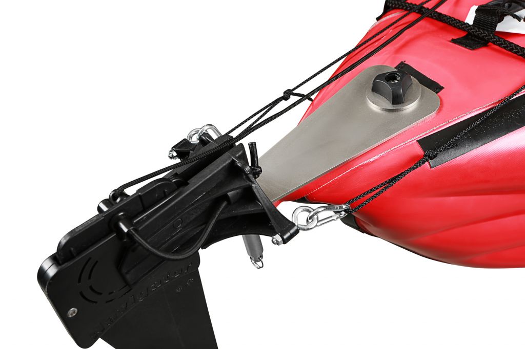
For the time it took to make mine I could have fitted a Gumotex kit ten times over but with only these pictures I was unsure exactly how it was secured. I suspect there’s an additional unseen plate underneath the stern decking to help jam the whole set up securely into the back triangle of the boat. I also believe they supply some stick-on velcro which goes behind (aft of) the black knob. Otherwise the plate would be prone to distortion under rudder forces, or give a mushy response like I got that on my prototype version.
The Gumo’s rudder’s retraction method is a pull-up-and-in, (left) whereas my was a more conventional swing-up-and-over which puts the rudder right out of the way over the back of the boat. IMO this is better for negotiating tight turns in narrow sea chasms where an unexpected swell could crunch your protruding rudder blade.
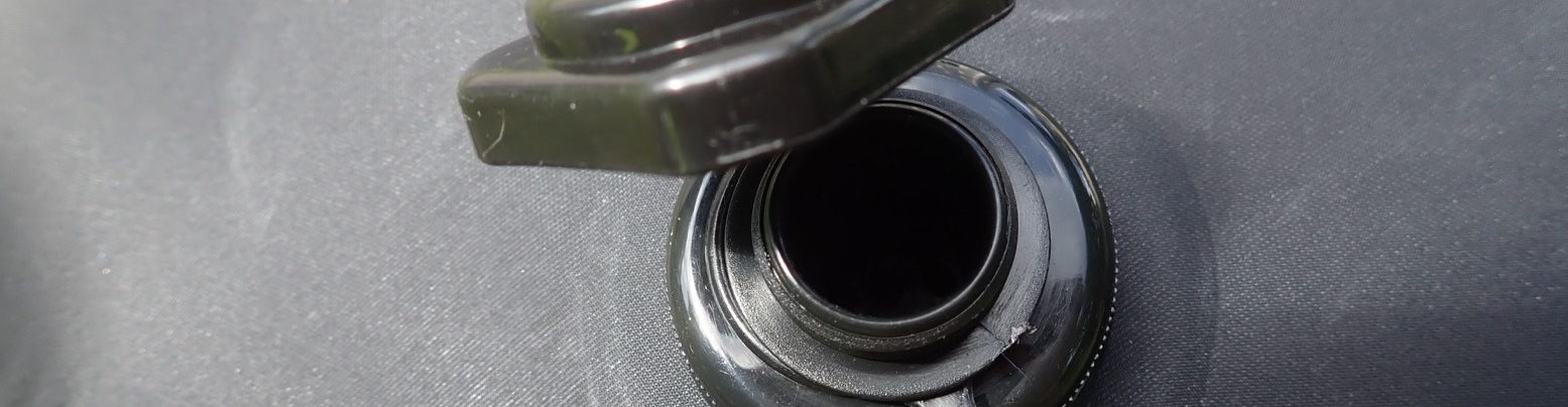
At the pointy end the pedal board looks reassuringly basic (and easy to copy) and the only obvious difference between an old Seawave are the two line guides on the stern deck (right) which I added to my boat to make a straighter, drag-free pull on the lines.
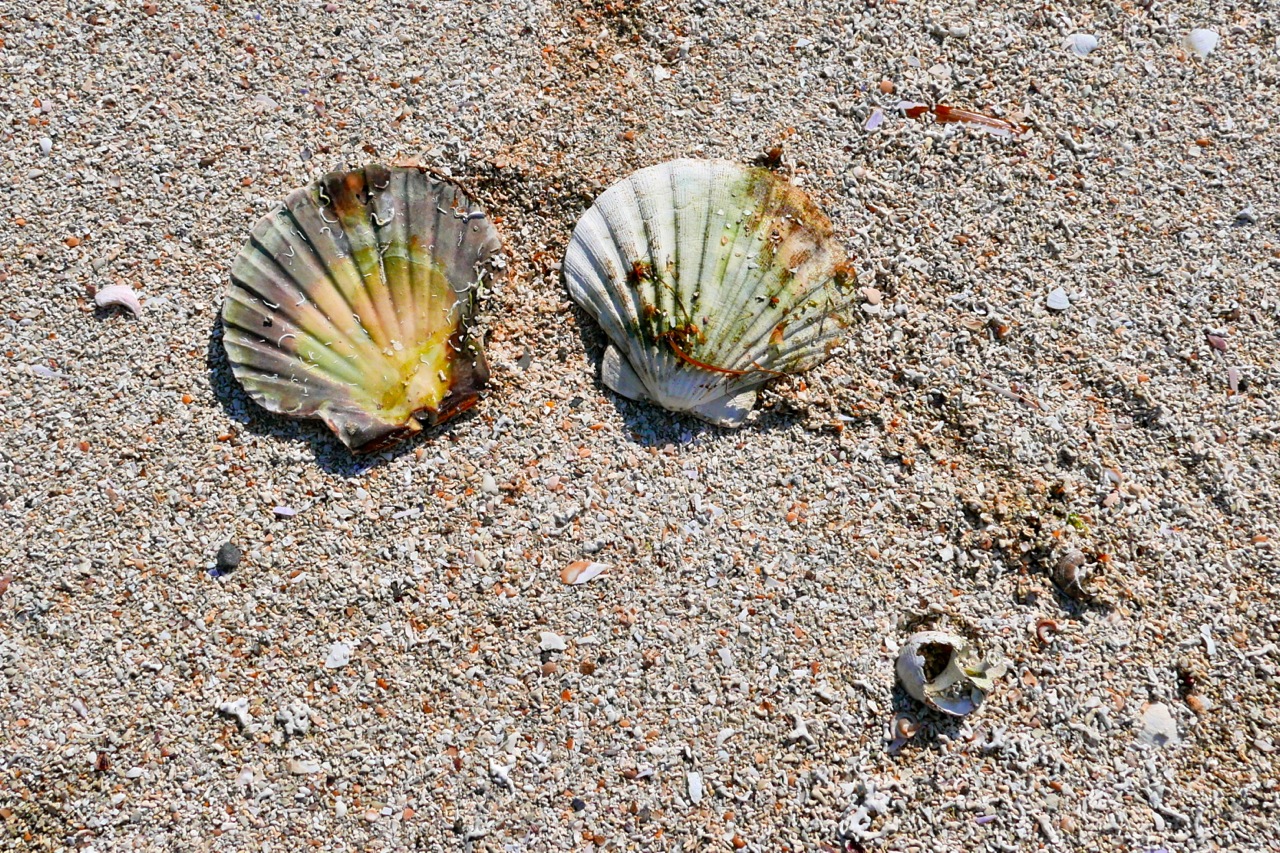
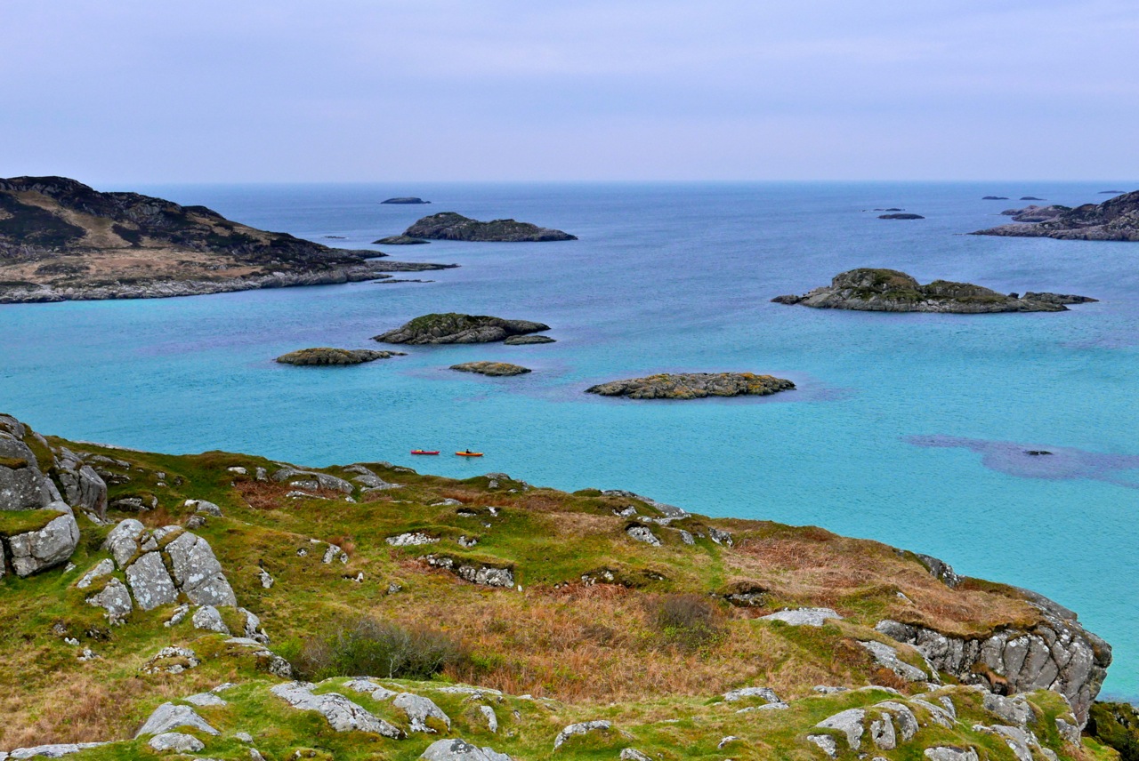
The shell-sand skerries of Arisaig are a well-known sea kayaking destination so, blown out by the wrong sort of wind to complete our mission on Mull, we scooted over towards Morar on the warmest May day since Michael Fish was knee-high to an isobar. Arriving late the night before at the sheltered glampsite at Camusdarach (5-star ablutions), I wasn’t quite sure where we were, but somewhere out there the easterlies were howling like banshees. Next morning at Arisaig all was calm as a small posse of schoolchildren trotted by in high-viz safety wear, a tribute perhaps to George Osbourne.
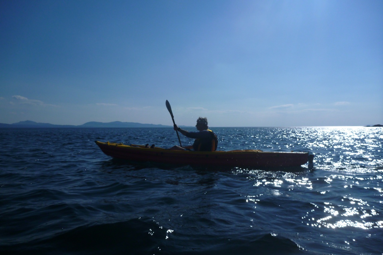
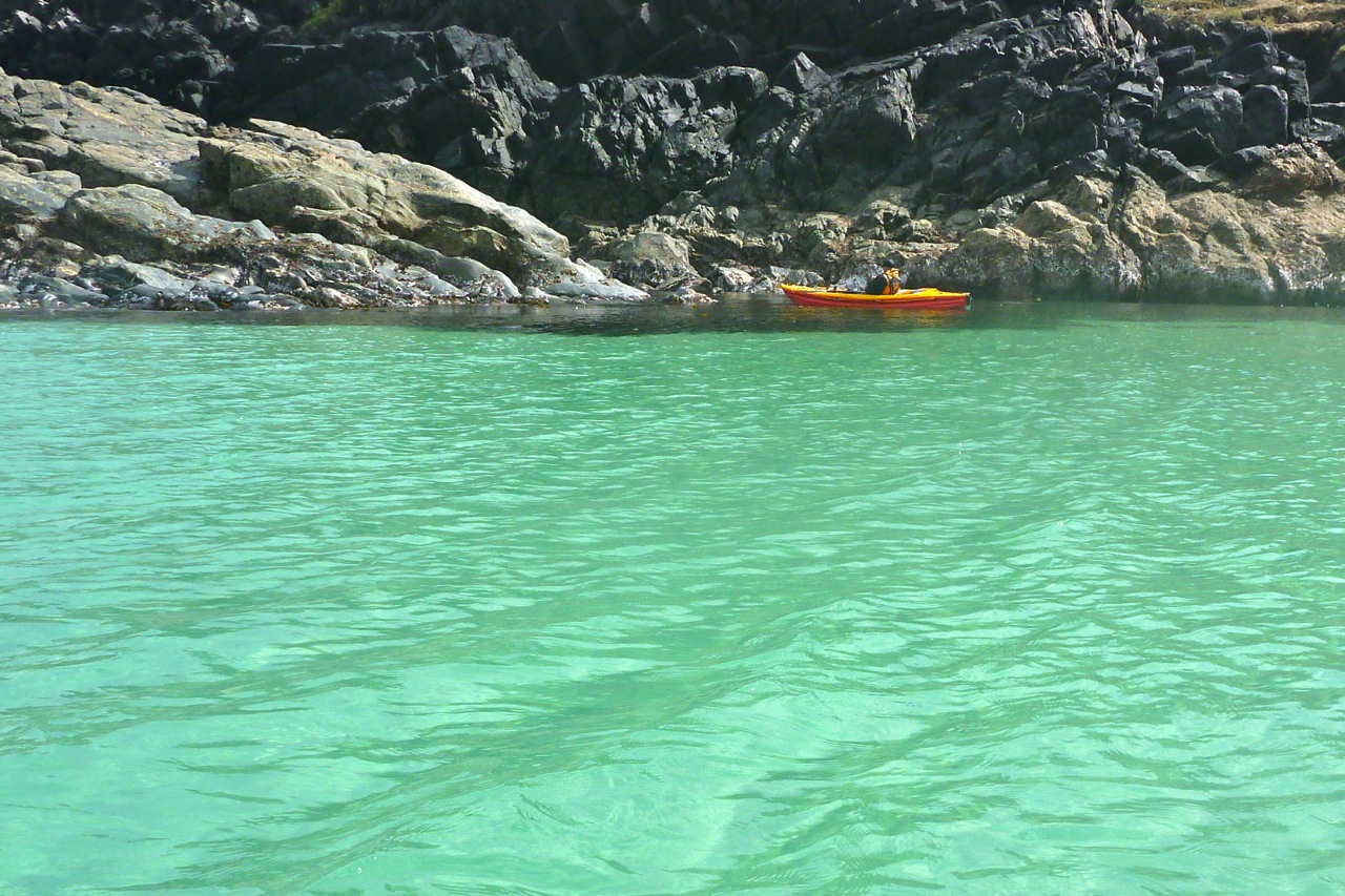
We were at the wrong end of the tide to enjoy Arisaig’s famed aquamarine lagoons, so headed round the corner to some beaches Gael knew from previous visits. We lunched at one, set up camp at another then headed back to the archipelago in unloaded boats for low tide. For me it had become just too darn windy to enjoy a relaxing sea cruise. Even hopping onto one of the skerries, I could barely stand while grabbing a few shots of Gael (left). Back at the camp, conditions were calmer for a quiet evening, but early next morning, as soon as I looked out the tent the northeasterly kicked off for the 90-minute headwind hack back to Arisaig. We arrived at the jetty just as the church bell tolled 9am. Nice touch – can’t say I’ve ever encountered church bells in Scotland.
All that remained was a lift to Mallaig, a ferry to Armadale, a two-hour wait sun-baking outside the Ardvasar pub for the stealth bus to Broadford, then another hour for the big bus to gusty Kyle. An hour later the train left for the scenic line to Garve where the Mrs turned up right on time. I’m staggered by Cal-Mac prices for walk-ons, even hauling a paddle and some packs. You couldn’t go two stops on a London bus for what it costs to cross over to Skye. Integrated local bus services? Less impressive but I got there in the end.
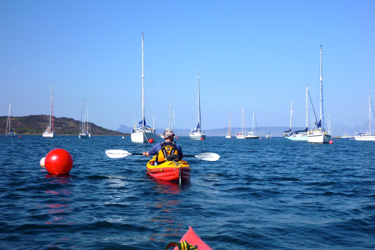
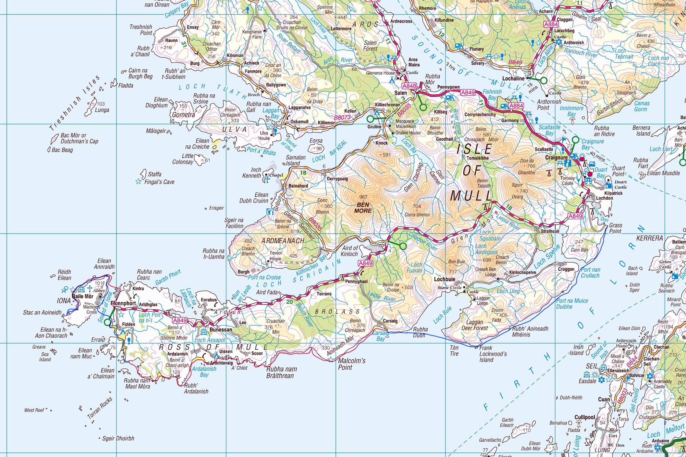
Intrepid Scottish sea kayakeur Gael of the Scottish Sea Kayak Trail was taking it to Mull this year. I invited myself along for part of the tour. His plan: Oban > Kerrera > Mull then along the Ross of Mull to Iona, back east then north for Ardmeanach, Inch K and Ulva. Then maybe Staffa, maybe the Treshnish, then handbrake turn and round the top to surf the tide back to Oban like the cats in Big Wednesday. He of course knew well that achieving half of that would be good going, but the forecast at least was for a sunny week with easterly winds. In the end, he ferried the car over the Firth of Lorn to Craignure on Mull (we had a full-blown gale up here on that day) then gonflated his K40 and set off clockwise round Mull from Grass Point.
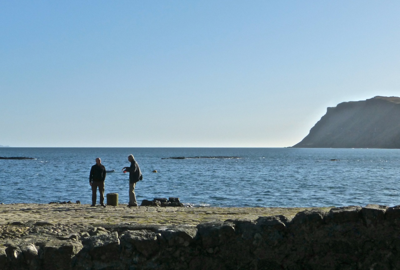
I Know Where We’re Going Hopefully he’d manage the 27km to Carsaig Bay, as that’s where we planned to meet up that evening, far beyond the reach of any mobile signal. As we drew into the rendezvous the steep, bumpy single track road passed the quaintly isolated Carsaig phone box. It looked so picturesque, right by a waterfall surrounded by dense forest – I wish I’d taken a photo. Seems I wasn’t the first to notice it’s photogenic qualities: it featured in the 1945 Powell/Pressburger Hebridean romance I Know Where I’m Going. It was down on the old jetty that Wendy Hiller (left) looked out towards a fictional ‘Kilkoan’ (Colonsay) where she thought her matrimonial destiny lay before the spirit of the isles got the better of her. A more recent film is also set in the Bay: The Silent Storm refers we’re told to repressed resentments in an island preacher’s mission and marriage, but by all accounts is a turkey.
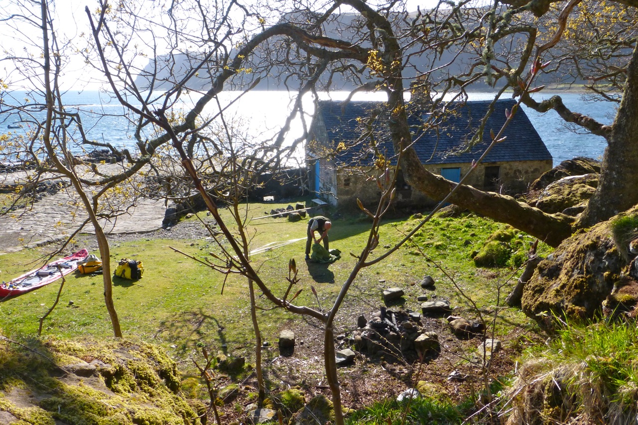
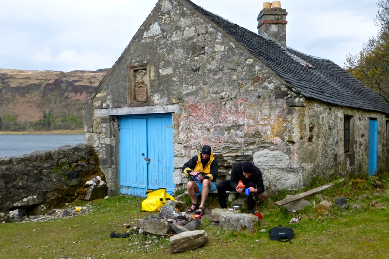
Carsaig is just a few scattered houses clinging to the wooded slopes, and some bothies by the jetty not built, we’re told, by French Napoleonic PoWs. Twenty odd clicks to the southeast lay the Slate islands where Gael and I pulled off a successful tour two years ago. This time round I’d be happy to tick off Iona, Inch Kenneth and Ulva before scarpering, while Gael set out for the Treshnish. For my liking they were a bit too close to Tiree, home of the Hebrides’ most persistent winds.
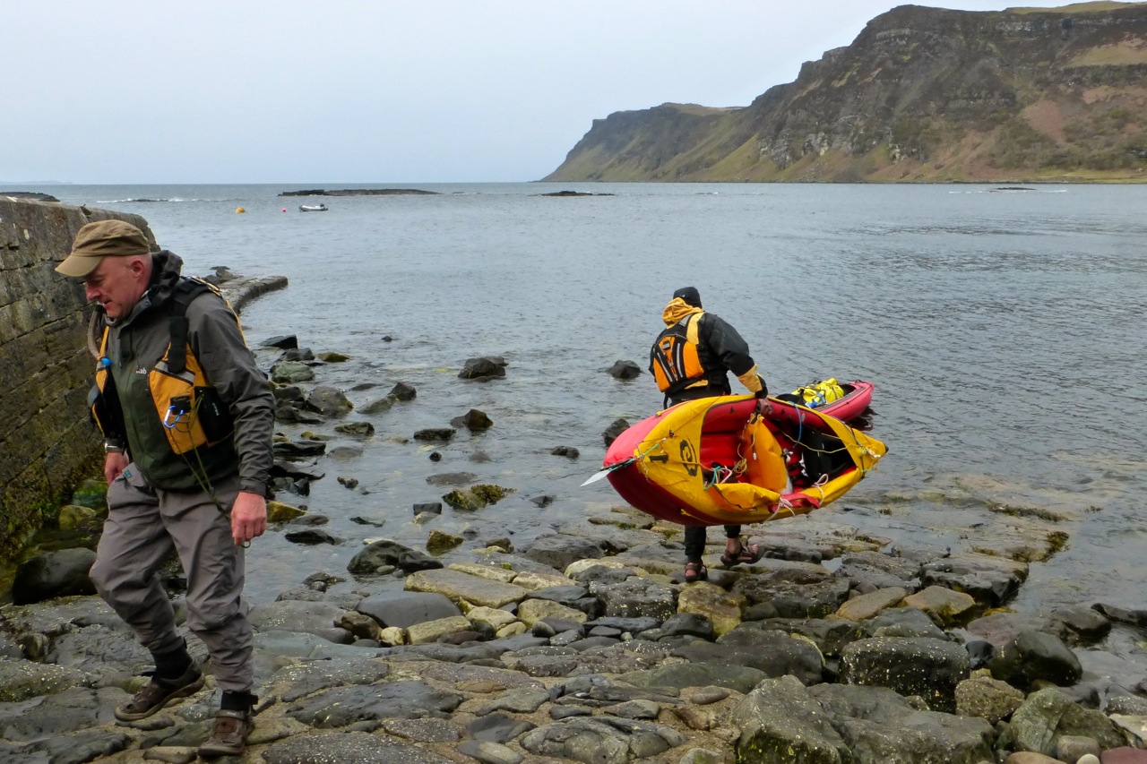
West with the Wind Came the day, all was overcast with a stiff easterly and rains in the air. Full cags and batten down the hat. It’s not often you get an easterly up here and they can be a mixed blessing. They are of course offshore winds but as Gael explained, because they don’t kick up much of a fetch, they blow over invitingly flat seas. Warm, sunny, dry weather from the continent is also a feature, but in passing over fast-warming landmasses they get gusty and variable, swinging between NE to SE several times over a day while stuck in this barometric rut for days. Your prevailing, rain-sodden southwesterly is generally much more consistent. A gusting offshore wind from an unexpected direction isn’t what you want when trying to get back to shore at the end of a tough day.
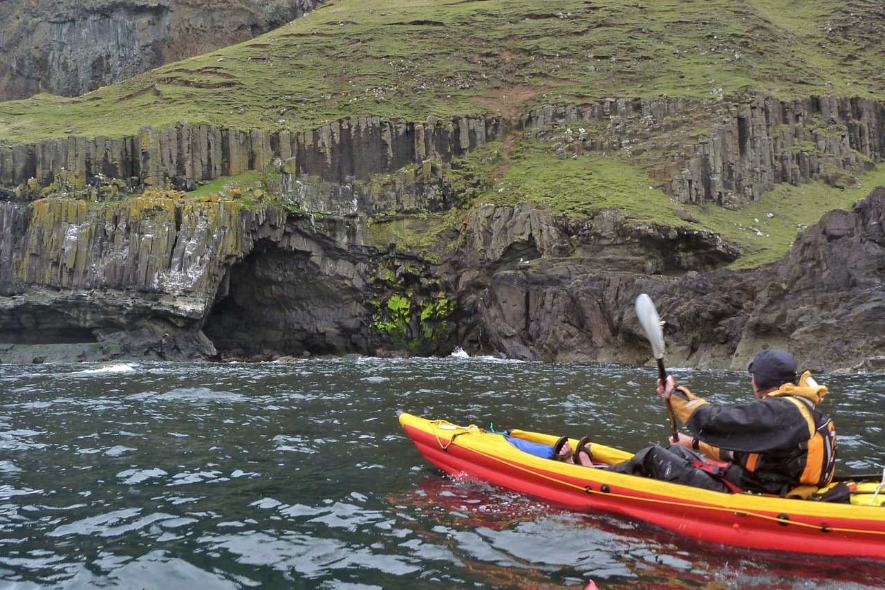
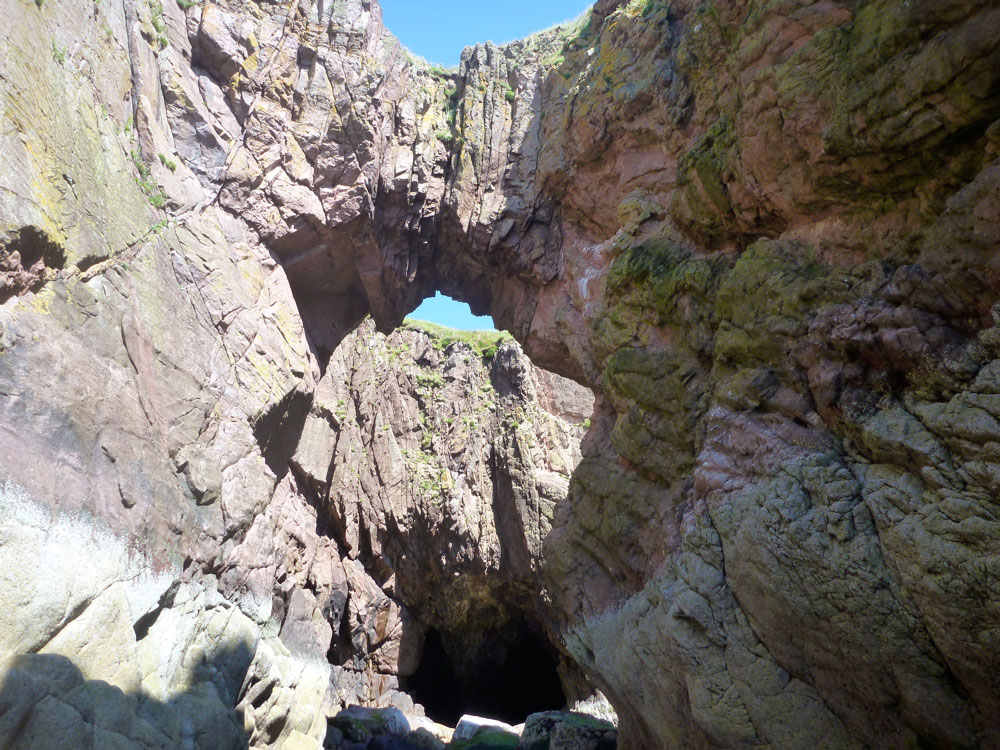
Out on the bay I was initially freaked out by the backwind, swell and exposure; it seems the 1000-foot mass of Beinn Chreagach was amplifying the rush. My loaded Seawave was far more composed, and together we bobbed and yawed towards the cave at Malcolm’s Point (actually an arch, left) with definite Staffaesque influences.
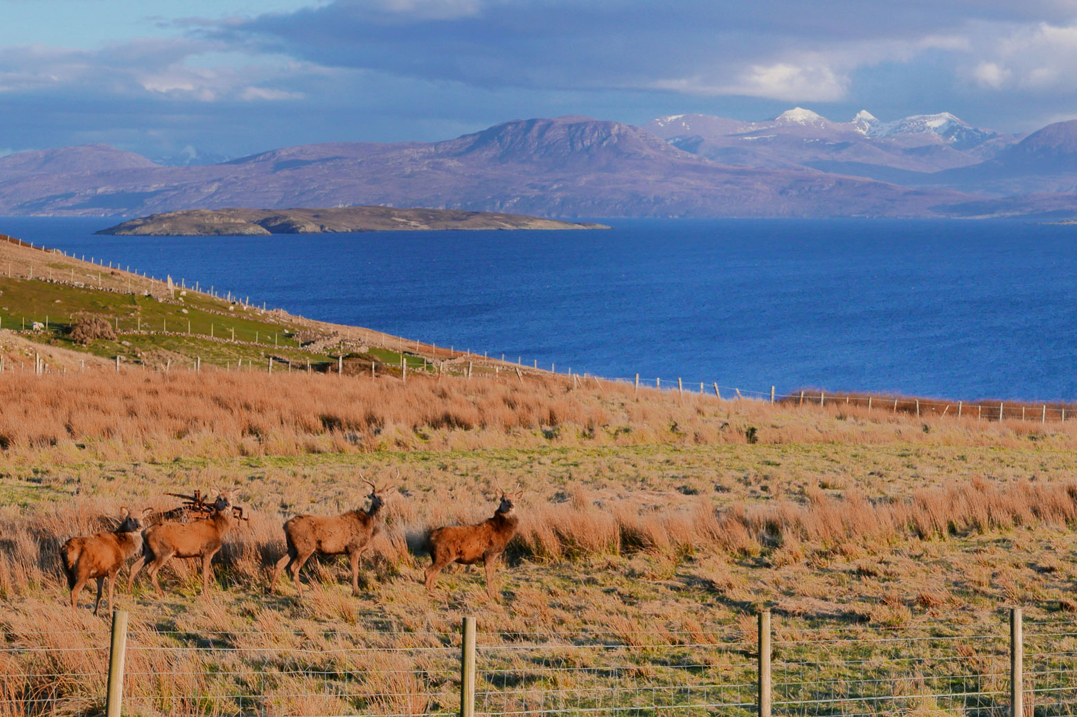
It’s almost certainly the same basaltic formation that makes up Staffa’s famous Fingals Cave. Alongside is a more obvious arch that from the sea looks like the front edifice of a bombed-out building (great shoreside pic of both here). Moving into the adjacent bay, high above a herd of deer swept across the steep slope – descended perhaps from the mythical doudou of French folklore, according to Gael a mountain beast with two shorter legs on one side. The deer ran towards a flock of wild goats tiptoeing for the shore. They’re pictured here in the nearby Nun’s Cave, a Medieval ‘Naughty Step’ accessible along a coastal path from Carsaig.
The huge waterfall at the back of Traigh Cadh an Easa (‘Waterfall at Ravine Beach’, or some such) reminded me I’d needed to fill up. On the stony beach the usual flotsam suspects lay strewn at the high water line: rope, plastic, wood and the occasional fisherman’s Croc.
Round the point the winds dropped, but murk prevailed; further falls tumbling from the cliffs, as well as basaltic intrusions, gave the scenery a distinctly Icelandic feel. We were now passing towards a flatter ragged shoreline of skerries and periodic beaches where I grabbed a snack on a cushy fishing net sofa. It would have been a good day to have a sail up – I should have packed my compact cheapo disc sail which I’ve not bothered trying on the Seawave. I have experimented with the whole business and, certainly without a rudder, managing the lines on the disc would have resulted in the usual unsatisfying spurts.
West towards Uisken and through the skerries leading to the few dwellings at Ardalanish, the only car-accessible take-out before Fionnphort. Occasional showers rinsed the salt from our cags and after one stop my Seawave seemed to be pulling right, even though it’d handled fine in stronger backwinds earlier. I made do offsetting the paddle until the sandy isthmus by Eilean Mor where I hopped out and pulled off the kelp caught in the skeg. That’s more like it.
How far had we come? Who knew, but this being my first full-day’s paddle this year, by now I was counting the miles to the turning point at Erraid on my newish Montana GPS with OS mapping. As I’d found using it in the States on a moto a few months back, you can’t beat the big picture of a paper map. But here, when it came to threading passages between the skerries, seeing your precise position on a proper OS map made it easier to find a way through and avoid dead ends.
As we crossed Port nan Ron bay the winds kicked up hard to the NNE. We were aiming to turn north up the narrow, tidal channel in the Sound of Erraid (also the title of one of Enya’s unreleased albums from her mordant ‘Scottish Widows’ phase), but the tide was only just turning back in and the wind would have been on us.
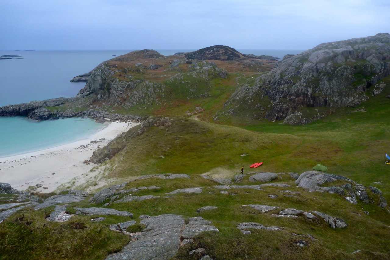
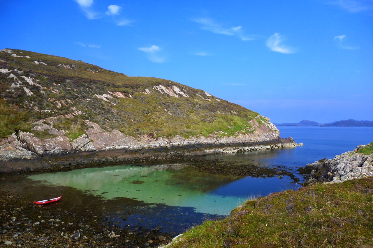
So we parked up for the night inside a lovely clamshell cove hemmed in by pink granite crags below a broad grassy amphitheatre. As the predicted evening rain fell, we cooked up some delicious seawater pasta then roamed to a high point overlooking the Sound where Gael picked up a detailed forecast from his mate: warming up, drying up but still blowing up from the east. Strong winds woke me in the night and I lay there wincing as the tent shook and flapped violently. This was its first stormy outing and it took me a while to just accept it, plug up the ears and fall back to sleep.
The Sound of Erraid The morning blew in from the northeast and after breakfast behind a knoll, Gael set out towing my yak while I fired off some shots from the headlands above and caught him up in the Sound. It was an hour or two after high tide so we only just managed to scrape over the Shallows of Erraid and out into a wind-blasted bay.
As we crept northwest, Erraid island seemed to be developed out of proportion to its size. Turns out it was a quarry for the nearby Torran Rocks lighthouse in the Stevenson era, and Stevenson fils set Kidnapped here. Now the former quarrymen’s cottages house a satellite community of the Findhorn Foundation, offering their alternative to the ecumenical retreats over the water on Iona.
Gael’s big Ortlieb water bag had gone rogue, exuding a pungent iodine tang, so we put in near Fidden campsite to fill everything else with lovely sweet water. (I noted a 1.5L plastic bottle slotted neatly into my footrest tube). Out in the Sound it was way too windy to aim for the southern end of Iona as planned, but we figured with our added ballast we could work our way north between the skerries for a shorter, less exposed crossing of the mile-wide Iona Sound. From there set off for an anticlockwise loop instead.
Crossing to Iona Somewhere just after Lalte Mor we made our dash for Iona, aiming for a beach just south of the ferry jetty, with two big buoys in between as markers. The wind had now veered to the southeast and mid-channel it was all getting a bit lumpy but manageable but the Seawave tracked true. The quicker I paddled the sooner it’d be over. Gael yelled to err north towards the ferry line where we were being blown anyway. He realised the spring tide was in full retreat down the sound and we needed to compensate. With the green and yellow buoys and the beach, I was sure my track was good, but on the far side Gael explained my trajectory resembled a washing line due to the strong southerly ebb. Sure, I was pointed at the beach and the buoys remained to my left, but the sea was moving southwards beneath me. His tip on such crossings was to line two points (a buoy and the beach for example) to better monitor and compensate for any deflection. A day or two later I tried this while hacking into Arisaig Bay, lining up a distant tree and a gully, and was surprised how the unseen current or wind deflected me within seconds, while still making good headway.
It was a good lesson from le seamasteur. Had we let the tide take us, our Iona Sound crossing might merely have ended up more westerly than northwesterly, but we’d still have reached the shore OK. But had we been aiming for Iona’s southern tip (as originally planned from Fidden), the stream may have pushed us out into the open sea, or at the very least extended the transit to reach the island. Add in the wind swinging back to the northeast and that’s how sea kayakers get in trouble.
Little did we know that my Mrs, who’d spent the night on Iona in solemn retreat after dropping me off at Carsaig, was recording our progress from the ferry chugging back to Fionnphort. And even as the odd wave broke alongside me, I too was able to grab a few shots: clearly a sign that conditions were less epic than they felt.
The Treasures of Iona We beached the boats and went for a wander through Baile Mor towards the abbey. While backtracking, up ahead it looked like the village idiot was bounding along towards us, waving enthusiastically. We reserved our judgments until it turned out to be the g-friend who’d hopped back onto the ferry to present me a chocolate doubloon (it was my birthday). What a nice surprise ;-) Soon we were swept away in a whirlwind of anniversarian revelry and all headed to the village cafe for a slap-up haddock, salad and chips (with a backup ice cream. And cake).
Back in the boats, it was a short sidewind struggle up to Iona’s northern beaches before a calmer paddle on the island’s lee. With the weather warming up, post-lunch lethargy plus the fatigue from the nervy crossing and the interrupted night, we lost our momentum a bit.
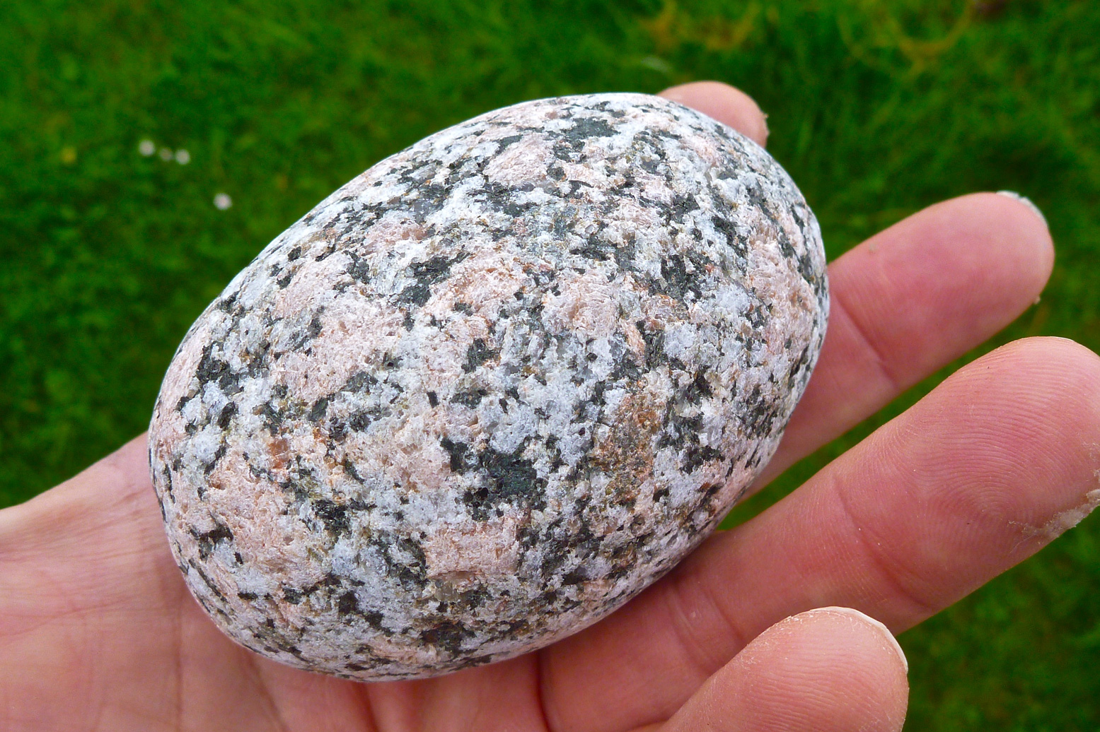
At the back of our minds, neither was keen on the idea of shortly rounding Iona’s southern tip into the wind and then edging back up the windward side. We crossed the big bay and nosed ambivalently past Sprouting Cave as far as Port Beul-Mhoe, a steep stony cove with an onerous portage before any tentable grass. I plucked a superb granite birthday egg from the shingle, then we backtracked to the big Camas ‘Bay at the Back of the Ocean’ and made an early camp to enjoy a warm, sunny evening. Next morning we’d see how we and the winds blew.
Outrun by the wind The plan had been to complete the Iona circuit, cross back to the Ross and head east into the mouth of Loch Scridain for the mountainous Ardmeanach peninsula where Gael has got windbound last year. A glance out of the tent at 6.30 revealed blue skies, but an offshore breeze was already ruffling the sea – and this was the lee side of Iona. It didn’t bode well for the south end, let alone the 13-km leg into Loch Scridain and the exposed crossing to Ardmeanach, with gusts tearing down off the 3000-foot slopes of Ben Mor. I was all set to roll up my boat, stagger across the island and meet Gael at the ferry, but he agreed the weather had outpaced our plans on Mull. We’d head back the way we’d come, cross to Fionnphort by paddle or ferry, then he’d retrieve his car from Craignure to deploy Plan B.
We set off at the top of the tide. With the newfound sunshine and warmth it was a relief to forgo the sweaty, salt-caked cagwear. Back through the skerries and into the wind round the top of Iona. Ten clicks to the north, Staffa and Dutchman’s Cap hovered on the horizon, but any trippers heading there today may well come back with faces the colour of warm guacamole.
The narrowest crossing back to Mull is near Eilean nam Ban, and when the time came it turned out to be a lot easier than yesterday, even contending with another southerly stream (left). Gael decided later we must have caught a fortuitous lull in the wind-bashing, and once in the sheltered Bull Hole channel, we let the strongly ebbing tide swish us down towards Fionnphort.
Unloading on the jetty, hoards of tourist-pilgrims from the world over were making their way to Iona. Having spent a day there, the Mrs had confessed she’d been a bit disappointed. The recently rebuilt abbey lacked a Medieval aura, and the achievements of Saint Columba and the significance of Iona’s post-Druidic heyday were rather embellished, compared to more objective sources.
For centuries the Lords of the Isles and Scottish kings (including Macbeth) had been buried here; the nearer the abbey the better, it was thought. I noticed the decorated headstone (above right) of former Labour party leader John Smith who’d managed to squeeze in, though it turns out he’d no connection with Iona other than being raised in Argyll. Maybe there’s more to it, but as even some Iona-born fail get a plot here, it seemed a post-mortal vanity inconsistent with what I recall of Smith’s public image.
Anyway – I stretched out with my Kindle on the old jetty and let the warming kayaks gently purge through their PRVs, while Gael strode boldly east up the A849. After a while I went up the road to make sure he wasn’t skiving behind some shed having a quick nap. The strong winds I met underlined the fact that we were doing the right thing. Kayaking anywhere east from here would have been hard, paddle-creaking yakka. Three hours later Gael returned to find me surrounded by empty crisp packets, ice cream wrappers and a succulent Curly Wurly embedded in my gob. We strapped the yaks to the roof and went to find somewhere else to play.
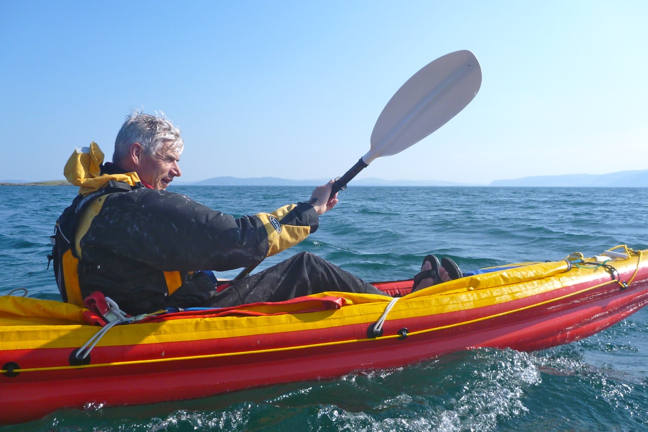
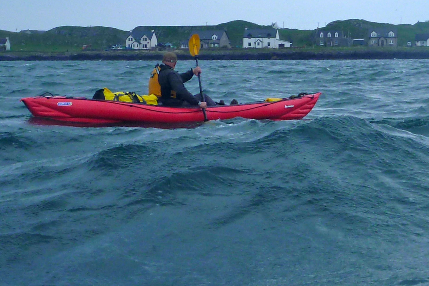
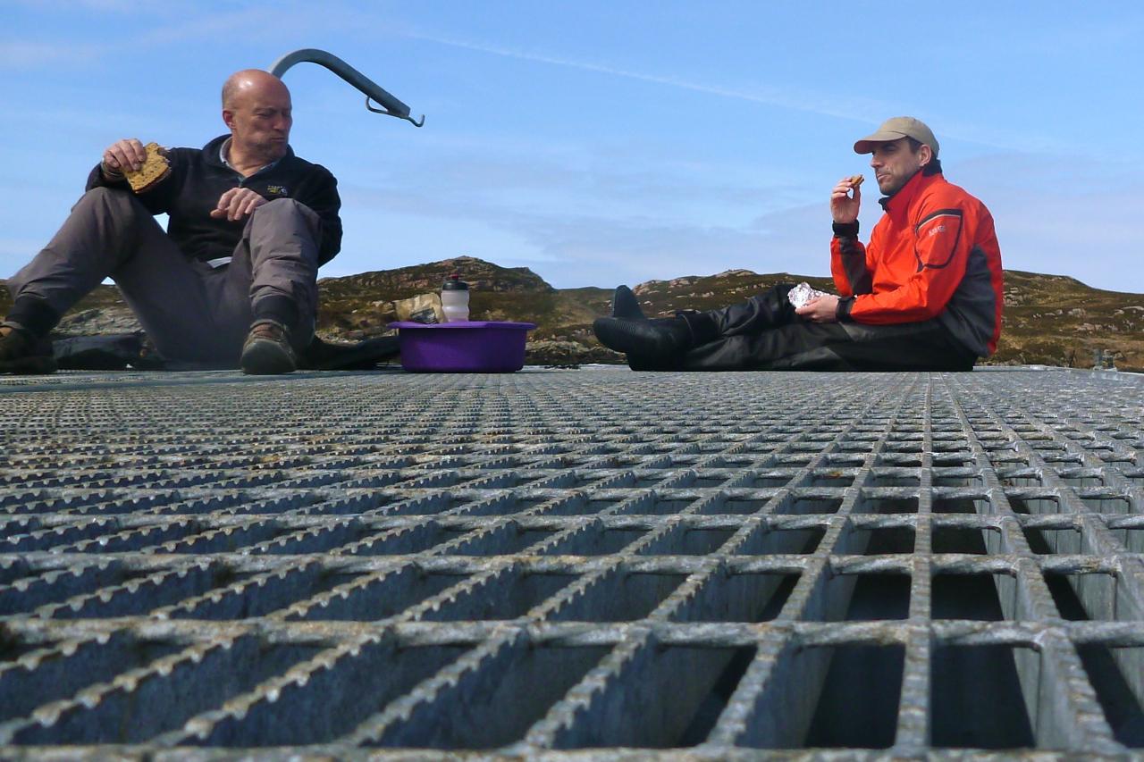
I am on Gumotex Seawave 2 and a while back had the InceptK40 for a year or more. IMO, these are still two of the best IKs around for sea kayaking and touring. Fast, stable and firm. Like my paddle with my former Grabner Amigo, a longer trip with a K40 also gave me a chance to reappraise the pros and cons of these two IKs. Gael’s red K40 is the same one I tested back in 2012.
As you can see in this table, the Nitrilon Seawave is a little longer, quite a lot wider but less spacious inside. It claims a much greater payload, has space for up to 2.5 paddlers as well as fitting an optional fully removable deck and a fixed skeg with a rudder kit available.The K40 is made from a stiffer ‘PVC-urethane alloy’ fabric, has a zip-up/roll-back deck, a rudder and a single seat. The twin side-beam hull explains its slimness as well as the greater internal width. Both these IKs weigh around 17kg. Paddling with the K40 for a couple of days, it was a little faster than my Seawave. Gael’s K40 was loaded a little more heavily, but my added weight easily exceeded that. Both boats run similar pressures but the slimmer, stiffer fabric’d K40 had the advantage, even though it’s a shorter. Gael may also have a more efficient paddling technique, but overall we agreed that in the windy conditions we were experiencing, it was his rudder which made the difference when it came to maintaining steady progress.
Simply put, with a bit of rudder correction to compensate for winds pushing the boat off course, Gael could carry on paddling normally. At the same time, I had to correct my steering by pushing hard on the upwind arm and trailing the other to maintain a course, so I was only powering with one and a bit arms. This gave the K40 about 5–10 minutes over an hour, while also reducing – or at least balancing – paddling effort.
Seawave left, K40 right.
Running a Grabner Holiday, Gael is a rudder fan and thinks adding one to a Seawave would make it a perfect IK. Me, I wasn’t so sure the added complexity and risk of breakage was worth it, but I I talked myself into it. As long as my system is not like the Incept’s horribly mushy rudder actuation. It was less effort to paddle Gael’s K40, but pushing hard on the inflatable pedals was a bit like using a cushion for a steering wheel.
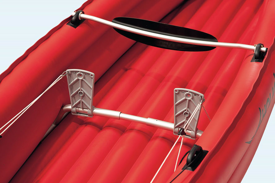
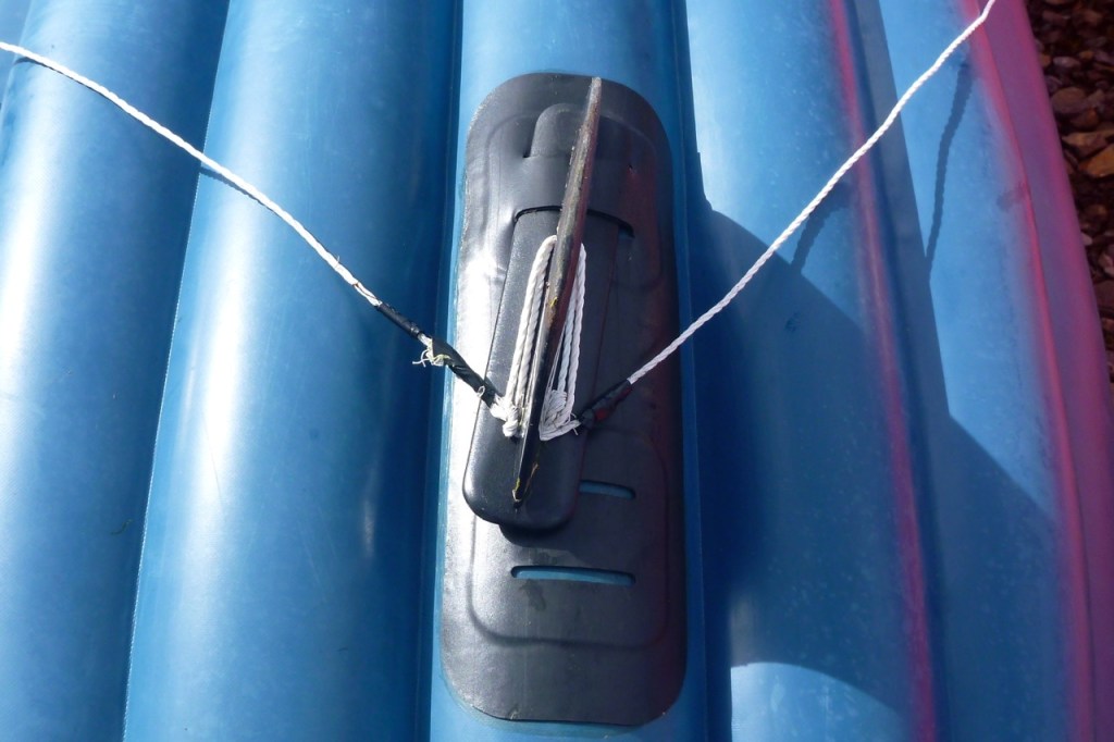
A great way to improve the K40 would be to fit something like Grabner plastic pedals pivoting on a rigid bar (below left). Or even a pivoting footrest tube (middle) as show here. The actual pivoting- and rudder-lifting mechanism at the back looks like a standard sea kayak arrangement with a rudder pin. We both agreed the K40’s generic hardshell rudder blade is too small or short for this boat when the seas get lumpy or the winds exceed F4. Maybe better to accept an IK’s limitations and not go out in those conditions, as I found once, though I’ve just remembered the hand-skeg-steering idea a visitor suggested to me: pivoting the half inserted Gumotex skeg using cords (right) to fix an angle against a steady wind.
Grabner rudder pedals
Pivoting footrest
Skeg hand trimming
Especially when loaded, my Seawave’s fixed skeg can be a bit of a pain at the shore. I don’t like the idea of the heavy IK pressing on the skeg so look for a rock, use my Pelicase or lean on the K40. But that’s all a small price to pay for the benefits the skeg brings at sea. I’ve thought of fitting a retracting/trailing skeg to get round this, but if I go that far I may as well install a rudder. Generic SoT rudders on eBay go for just 20 quid and could help review my dormant sailing experiments which I recalled fondly during the backwinds of Mull.
The other impression of the K40was the initial tippiness – yikes, it’s been a while since I’ve experienced that. In fact it soon went away and anyway, was helped by the thigh straps which again, I’m reminded, don’t snag the knees as securely as my set ups in the Amigo and Seawave – possibly because the front mount is too far forward (using the rudder pedal mounts). But then again, I should have adjusted the rudder-footrest towards me a good few inches. The Incept was also much more roomy thanks to the slim side tubes. That makes the thigh straps more important, and I actually missed the packraft-like jammed-in feeling between my Gumotex’s fat side tubes. The seat didn’t feel as comfy and secure as the packraft/SoT set up on my Seawave, and all-in-all I felt a bit out of sorts in the Incept which helped me realise how well my Seawave is suited to my sort of paddling. About time; it’s taken a few IKs to get there.
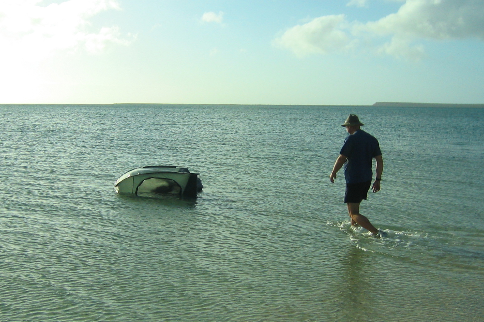
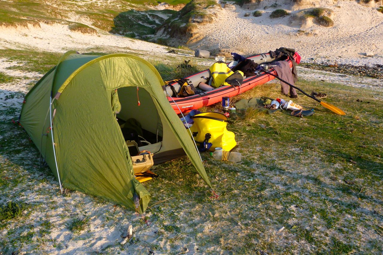
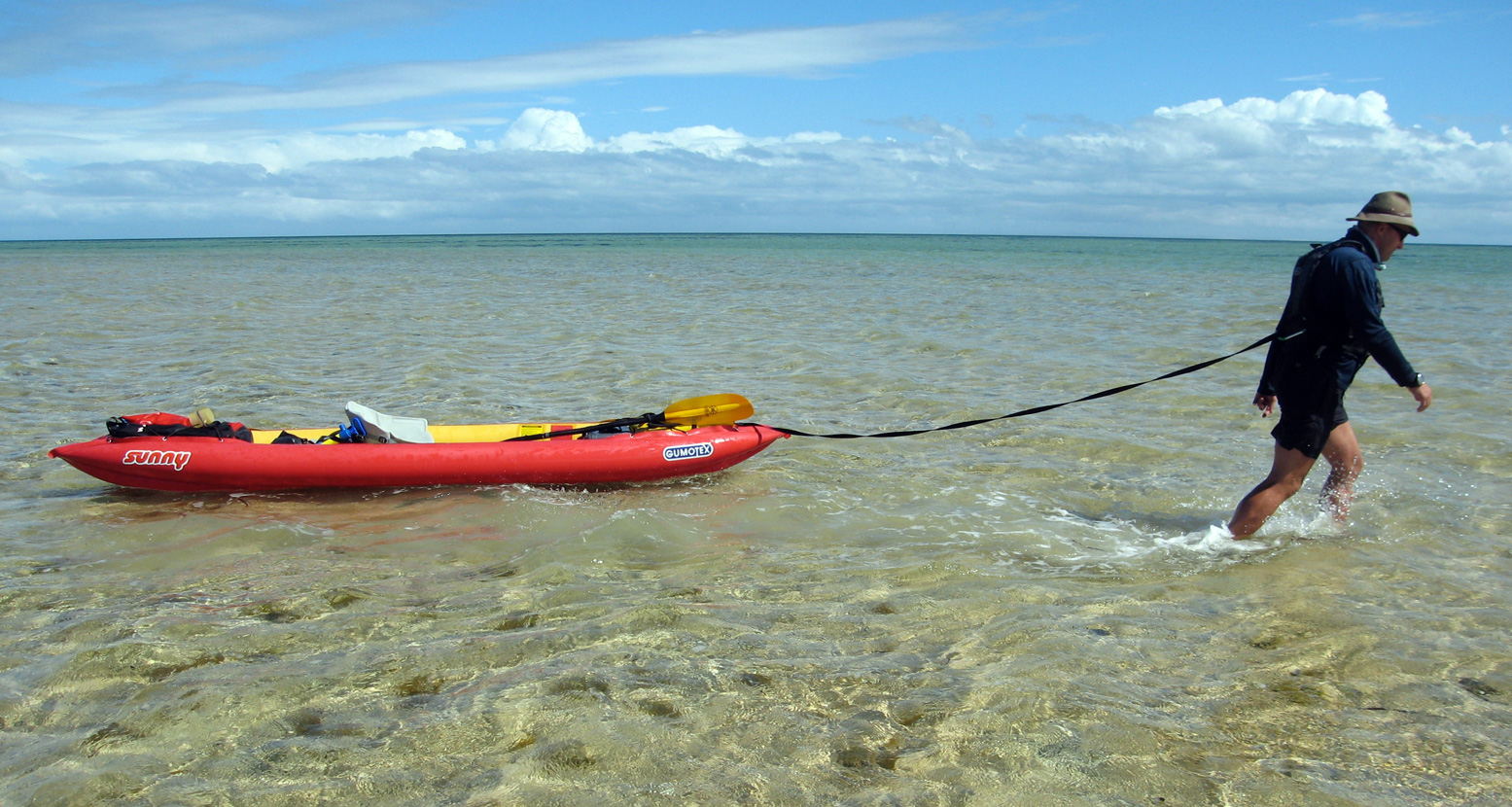
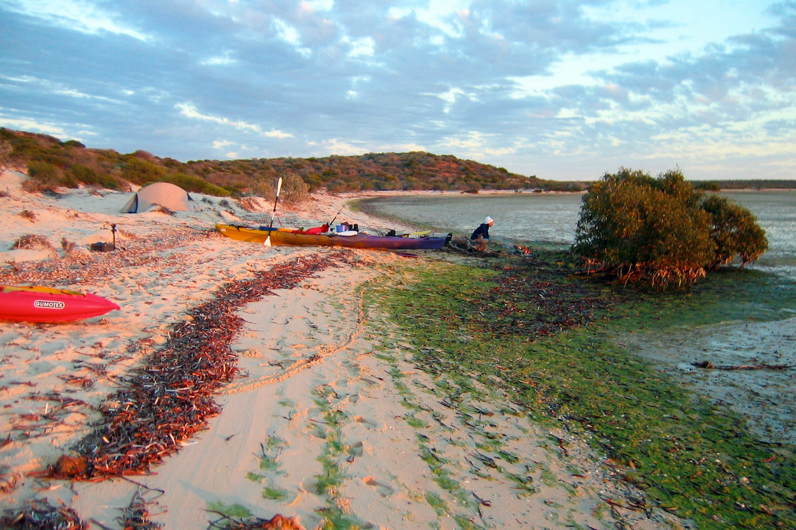
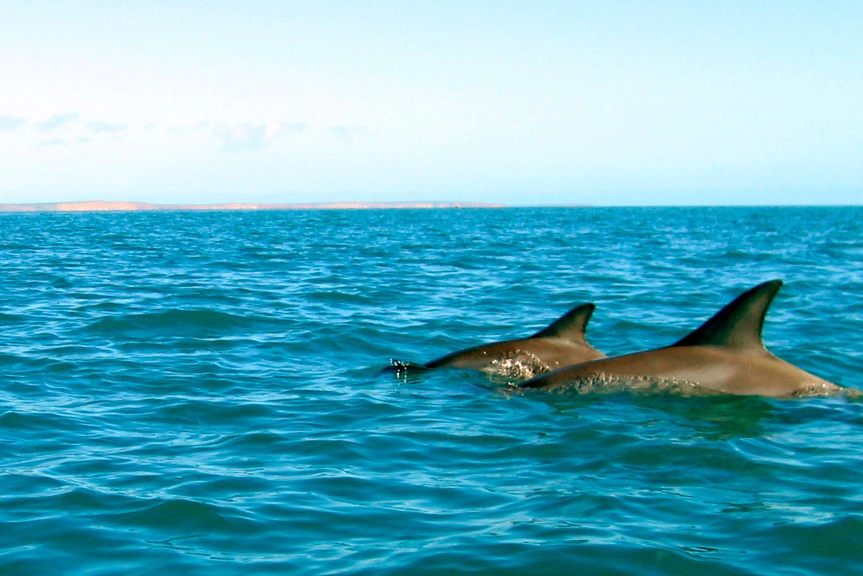
What makes a good packboating tent? For me doing a bit more Scottish sea kayaking than packrafting these days, super light weight is not that crucial. Better to have something that is easy pitching and spacious so you can sit out rough weather. And then when some packrafting does turn up, have the ability to use just the fly or inner to save weight and bulk. On occasions I’ve used a cheapie tent’s inner as a mozzie dome, just as long as I remember to keep it weighed down before frying up the brekkie on a windy morning in Shark Bay (left).
A couple of mates have used the legendary Hilleberg Nallo for years, so when I found one cheap in the US I gave it a try. Sure, for me the Nallo (left) may have been OTT in an ATGNI sense, but with its reputation and residuals, I knew I’d not lose on it. I liked the Hillie’s all-in-one pitching, the options to pitch outer (with footprint), inner only (or an optional inner mesh that was also included). This made it as potentially as light as my old Black Diamond Lighthouse, but much roomier. I also like the roomy front end and porch.
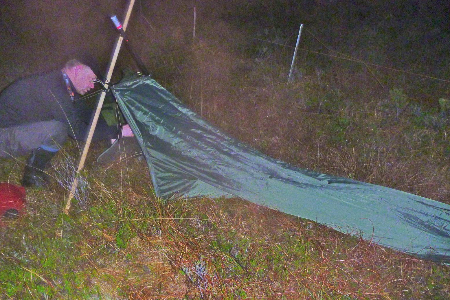
I thought it would fit the bill, but getting caught out one winter’s night on the Postman’s Path on the Coigach (below) proved that, while it may stand up to 60-mph blasts like they say, its unsupported flanks flapped like the flags outside the UN building during Hurricane Sandy. My hardcore mate crammed himself into his bivvy bag (left) and had a quieter night, even if he could barely move. On a windy nor’western night, for all that money the Nallo was no quieter than my old Black Diamond.
On top of that, the Nallo may claim to have a floor that’s 220cm long (a minimum requirement for me) and have a huge porch, but the way it slopes down at the back where the blowing wind presses (right, and in the video below) meant I still ended up with an annoyingly damp end to my sleeping bag. Just like the too short Lighthouse.
I’ve since read that Hilleberg recommends pitching a Nallo porchinto the wind, but as this discussion suggests, that seems rather counter-intuitive – unzip the door and the thing will fill like a sail while blasting you with horizontal rain every time you get in and out. They say the Nallo-style tunnel design gives the lightest weight for volume. I’m not sure that’s true anymore, and those unsupported flanks make a racket plus inside, my Nallo was always a saggy affair (right), however I pitched it (left). While paddling the Slate Islands I took the chance to get some good ebay pics and sure enough, flogged it for more a little more than it cost me.
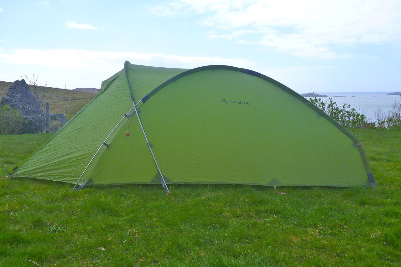
It was good to try the Nallo experience for free, but now I had a better idea what I wanted for my current camping prefs: the Nallo’s better attributes but not in tunnel form. I considered four-pole mountain tents like the famous Quasar or more obscure Crux X2 Storm, but the doors were small, they didn’t do inner or outer only, and prices were a bit high for my low level of usage. Crux’s foam spacers to separate the inner and fly to enable better airflow was an interesting idea – or an admission that condensation was a problem. More tent spotting uncovered Vaude’s Odyssee which used a similarly stable 3-pole set up while having many of the other features I sought.
Vaude Odyssee L 2P
The Odyssee ticked all the boxes for my sort of camping out of boats or riding a moto.
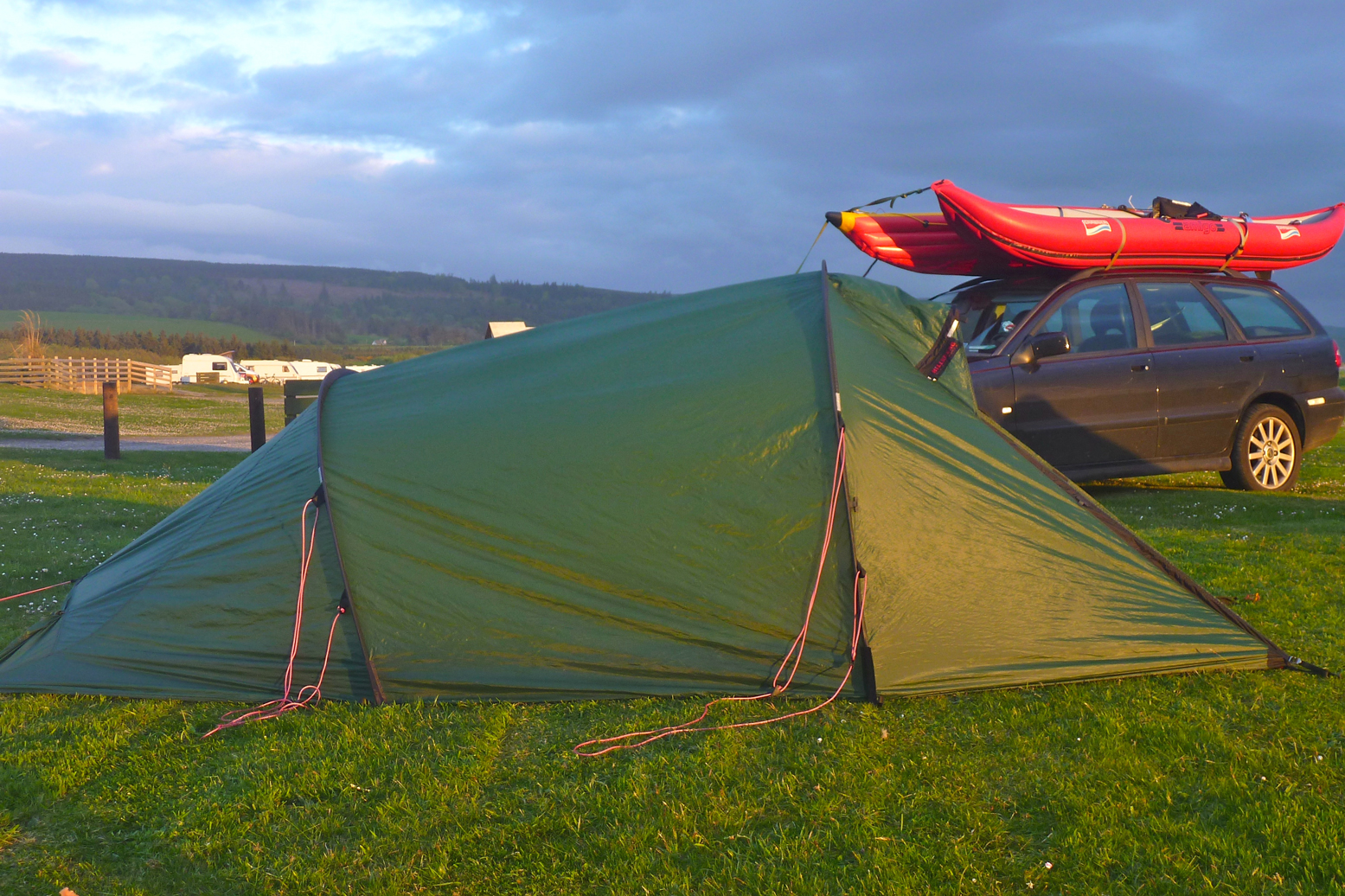
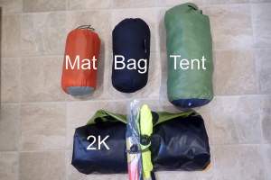
• Inner and outer attached helps speedy, all-in-one pitching • 3-pole system copes in strong winds and makes a taught, flapping-reducing pitch. • Almost self-supporting so can be easily repositioned or pitched on hard surfaces which can’t be pegged • The steep back end may catch more wind but means the full 220cm inner length can be used. This is a great feature for me – no more diagonal agonies or damp sleeping-bag foot from pressing against a sloping inner, as on the Nallo. • You can pitch just the outer, saving 700-odd g*, if insects, moles or temperatures aren’t an issue – and I’m pretty sure you can pitch just the inner (saving nearly a kilo) as a mozzie dome. • Scrunches into a football-sized bundle and the poles break down to 44cm for compact packing.
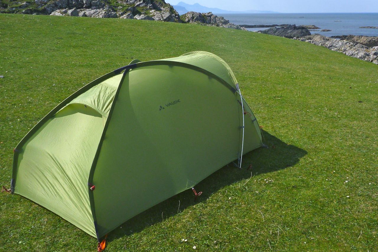
All these attributes along with the reasonably light weight – ready to go at 2.6kg made the Odyssee 2P a great-value and versatile 1 or 2 person tent. It’s only 280g heavier than my Nallo, and while I presume the fabrics are inferior (“30D ripstop Polyester Silicone/PU coated 3000mm head; floor: 70D Polyamide PU coated 7000mm head”) it was much less than what my Nallo would have cost new.
* My dimensions may not match other sources
The inner ‘washing line’ and loops to attach an optional roof net are handy, as are the pockets by the door. The 75-cm deep porch is smaller than the Nallo but roomy enough, and the zip arrangements make it easy to control ventilation and maintain privacy. I’ve not had much condensation, but that must be just luck and breezy nights. Even with a breeze, the Nallo was terrible for condensation, partly because the flysheet ran right to ground level. The other night, gusts over 20-25mph in the Odyssee woke me up and I lay there thinking ‘she cannae hold, Cap’n’ until I remembered my earplugs and soon fell asleep. I’m told most modern tents with < 4 poles will make a noise in strong winds. As long as you know it’s as well lashed down as can be and can take the hammering, just turn over, plug up and pass out.
First time out one peg bent when pressed in by foot. So I pulled out my bombproof MSR Groundhogs with nifty pull-out loops (right). The Odyssee takes about ten minutes to pitch without hurrying and some faffing with the footprint (from the old Exped), and will stand with a minimum of two pegs staking out the porch. Two more at the back help make good tension, and using every dang loop and all six guys needs 16 pegs – you’re now ready for a gale and I suppose a pole will snap before it rips (there a pole repair sleeve included).
Other small annoyances are the two long poles catch the fabric pocket seams at the back – make sure the pole ends sit fully in the end of the pockets or you’ll over-tension them when clipping in the front end. And the pole-end locating pegs sometimes come away on the elastic cord which can be fiddly to reposition with the cord knot. I’ve fixed that with a dab of rubber glue.
I’ve only had normal rain until 2018 when I used it on the Tarn without the inner. In really pelting rain verging on hail a light spray came through the fly and there was the odd drip from the seams. Had I used the inner would have settled on that and evaporated later, but it didn’t so all was a little damp. The flat roof doesn’t help. I wonder if even a 3000mm hydrostatic head (over twice normal) is not enough for really heavy and prolonged downpours. I see the Kerlon 1200 on the Nallo is rated at 5000mm. When I got home I sealed most of the roof seams and sprayed it all with Nikwax. We’ll see if it made any difference on the next big downpour.
Inner hangs from the fly; pitches all in one, like a Nallo Can pitch inner or outer only Nearly self-standing Roomy inner in all dimensions Long, flat roof gives good headroom Roomy porch; quite easy to get in and out Stable 3-pole set up
Boring old green Bendy stock pegs In pelting rain a light spray passes through the fly if no inner used. Since re-proofed and seam-sealed Collapsed poles are a bit long at 44cm
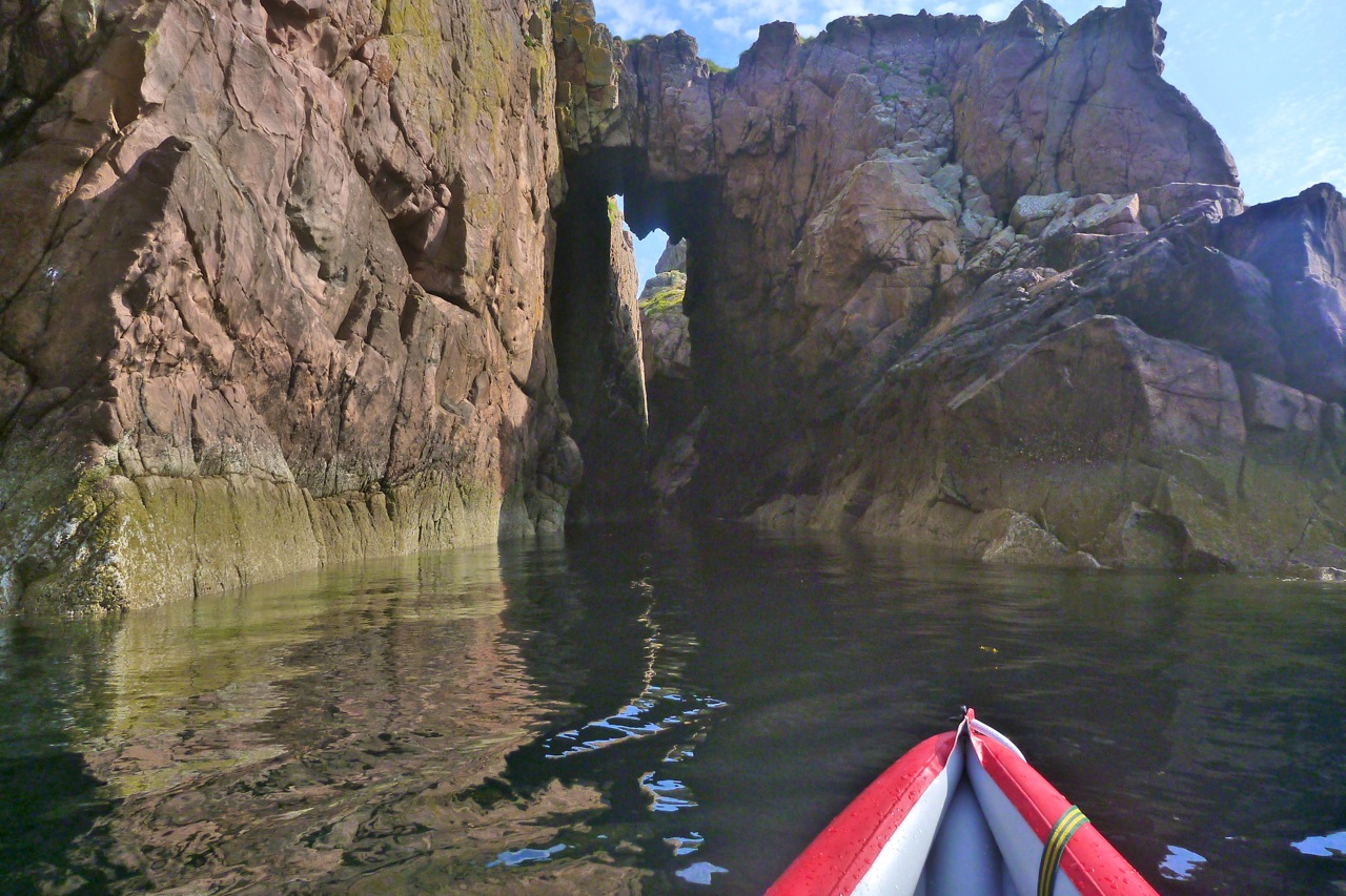
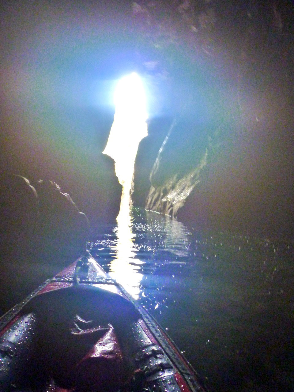
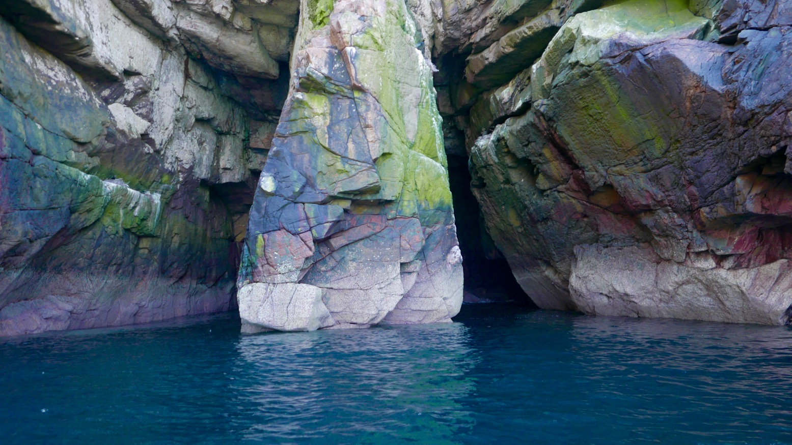
What paddler can resist the thrill of poking their bow into a cave or threading a natural rock arch? Paddling under a bridge or into a boathouse just doesn’t have the same transgressive buzz. Here are a few of my favourites, tracked down over many summers bobbing among the Isles. Most of the arches will need the top half of a tall tide, but add spring highs and a swell and some caves may require a hard hat too, or may just be too risky.
Double Arch • Bottle Island This was a great discovery – in under one arched slot with room enough below a collapsed roof cavern to turn for a paddle-stowed squeeze out of the other exit (above right) if the tide is high or the swell is right. Read more…
Arch • Tanera Beg The best known and best looking of kayaking arches in the Summer Isles (left). Not that easy to spot on the usual approach from the northeast I the Tanera channel, so start nosing around off the southeast side of Tanera Beg when the tide is high. Read more…
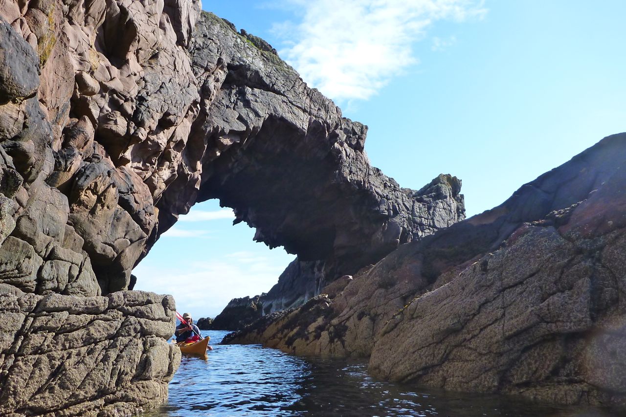
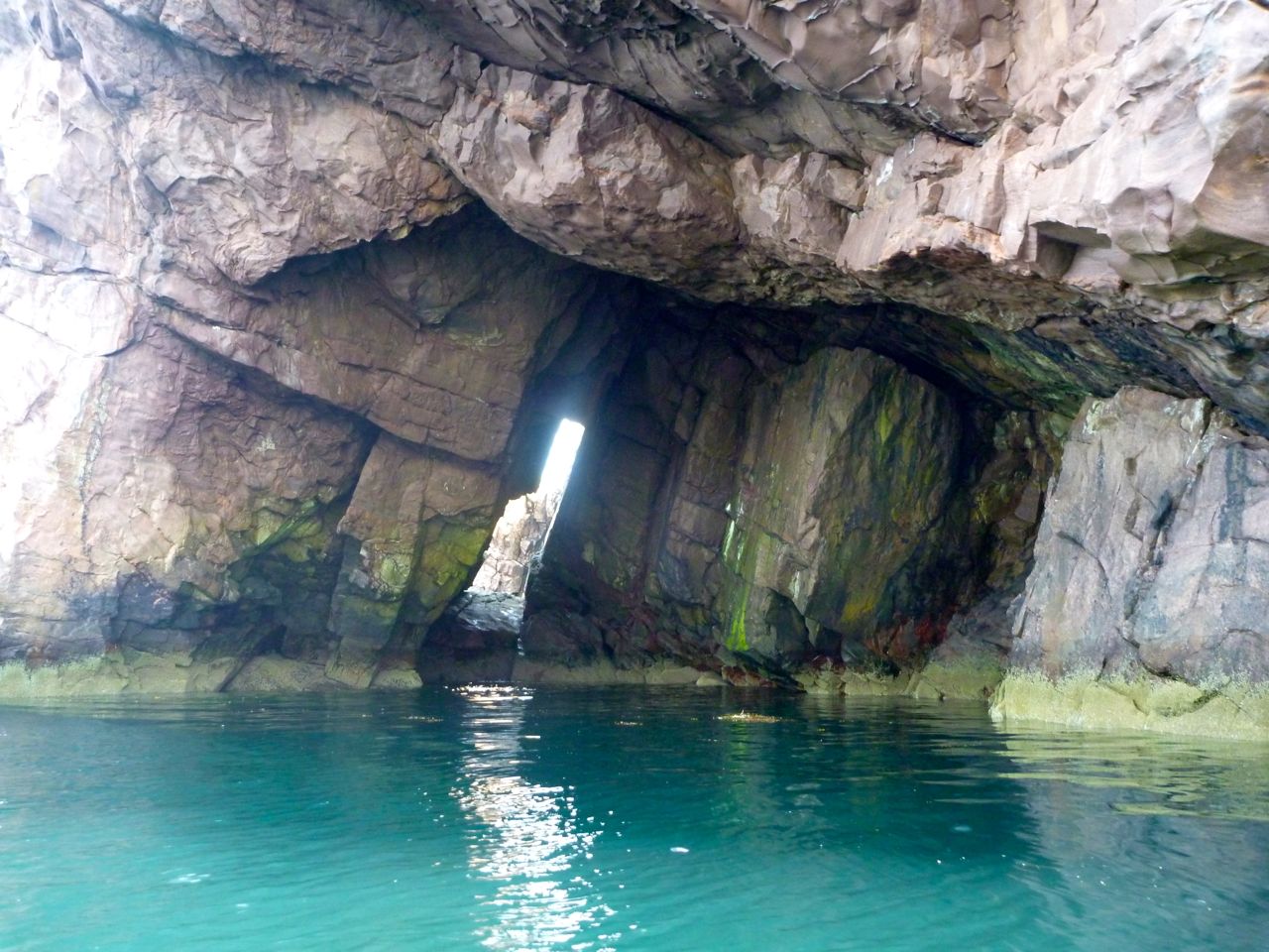
Arch • Eilean Mullagrach Another superb example of Torridian archmanship which elsewhere, in similar forms, may have given birth to the first architectural arch. Easy to find and get to as long as there’s a paddle in your hand and water under your boat. There’s a cave behind the arch (both left) which, who knows, may one day link up with the other Mullagrachcave described below. Read more…
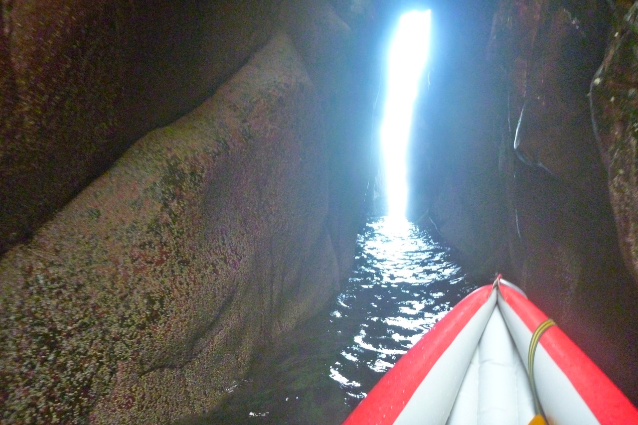
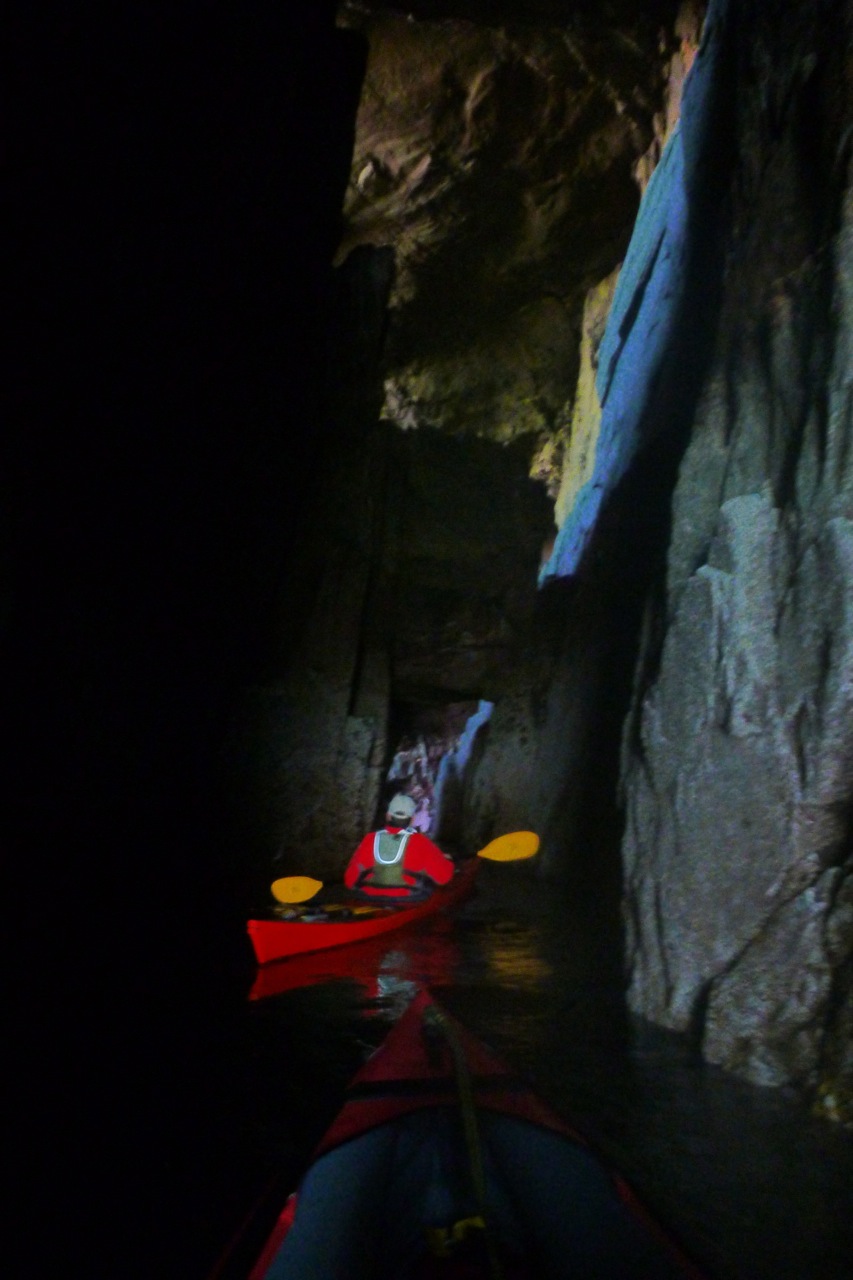
Deep Cave • Eilean Mullagrach Just up the coast from the above arch is a hidden cave tucked in the back of a little cove – Am Fang on some maps. Look on a map or sat image and it very much looks part of the same fault as the arch above which burrows right along the eastern shore of Mullagrach. We went back the other day for a closer look with a bit more tide but which did not please the birds nesting by the entrance (left) at all. We probably got within a boat’s length of the end, using the camera flash to navigate. Read more…
Arches and Caves • Priest Island We didn’t go right round the ‘Island of the Clerics’ but passed an arch approaching the Priest’s northern tip, and I read in Fraser-Darling’s Island Years that there are deep linking chasms – crawlable not kayakable – around the northern point and another on the western end too. On the east end of the ‘Acairseid’ or bay is a narrow cave as well as a tricky right-angled tidal slot alongside a stack (right; I may be conflating the two). There’s also a less a constricted passage through the skerries just round the corner. Read more…
Cave • Tanera Beg On the OS map this cave is near a point labelled Sron Ghlas on at the island’s south-southeast point. ‘Cathedral Cave’ is what the boat tours call it, as they can edge right in while the captain offers a rendition of ‘Danny Boy’. With the daylight coming through the crack at the back (right), give it 100,342 years and they’ll have to reprint their brochures with ‘Cathedral Arch’. Read more…
Double Arch • Sgeir Ribhinn In a rush to get to see the main islands before the weather breaks, most would paddle by Sgeir Ribhinn, the easternmost of the three skerries south of the Taneras. But if you do pass close by, the one-kayak-wide geo on the upper east side will bring you into the cathedral gloom of big and small (left) arches overhead. Read more…
There are more caveson the Coigach peninsula cliffs facing Enard Bay, northwest of Achnahaird plus some fun tidal passages in the Isles too. Here you can catch that serene Caribbean sensation of gliding on aquamarine glass over the sandy sea bed, if not always with tropical temps, balmy winds or reggae soundtrack. My favourite is the pass between Carn Iar and Carn Deas (left), just above Bottle Island, with a lovely sandy passage on the right of Deas. Carn nan Sgeir below Horse Island is another, though you’ve got to time both at high tides.
… I deliberately chose [these Kokatat Swift] dry trousers with no sewn-in socks as my drysuit has those. With the Swifts … I’ll just wear short Seal Skins and have no worries about the sewn-in socks getting holed by gravel. Time will tell how they wear and perform.
Well, I’ve changed my mind. I’ve never been convinced by the Goretex/membrane magic; at least not for hillwalking – I get too hot and sweaty. But making less heat paddling an open kayak on a cool Scottish day, the stuff seemed to work. It keeps out the splash and light rain, but because the leg muscles are inactive, sweatiness is barely apparent. Using a regular eVent hiking cag on top produced more mugginess, but nothing as bad as on the hill and easier to control with the front zip and adjustable cuff cinches. Unlike a hardshell, for an IK there’s no great benefit to buying a regular kayak cag with a waist seal as there’s no cockpit spray skirt to seal it against. If you really want to keep dry all over, just use a dry suit.
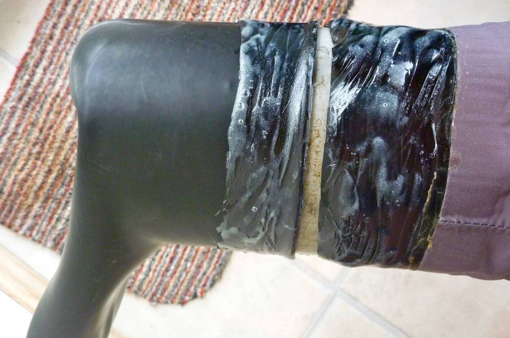
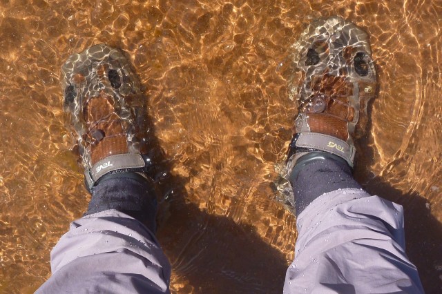
On one trip I found that the Swifts with knackered SealSkinz didn’t really work. ‘Waterproof’ SealSkinz only last until the clingfilm-like membrane goes. Then they become saggy sock-bags with insulation qualities no better than woollen socks. In fact, they may well chill damp feet. Wearing my slowly dilapidating Teva Omnium water shoes (left), I now think it’s better to seal feet properly with latex socks. IMO latex is easier to repair than socks laboriously made from off-cuts of membrane fabric which, like all that kind of stuff, has a limited life span, especially under the grinding weight of a foot. Bizarrely, I see most don’t make dry pants with integrated latex socks, only membrane, which must be a a cost or maybe a UV thing. Anfibio is an exception. But you can easily buy dry pants with latex ankle seals and glue on latex socks which are readily sold individually for around 20 quid.
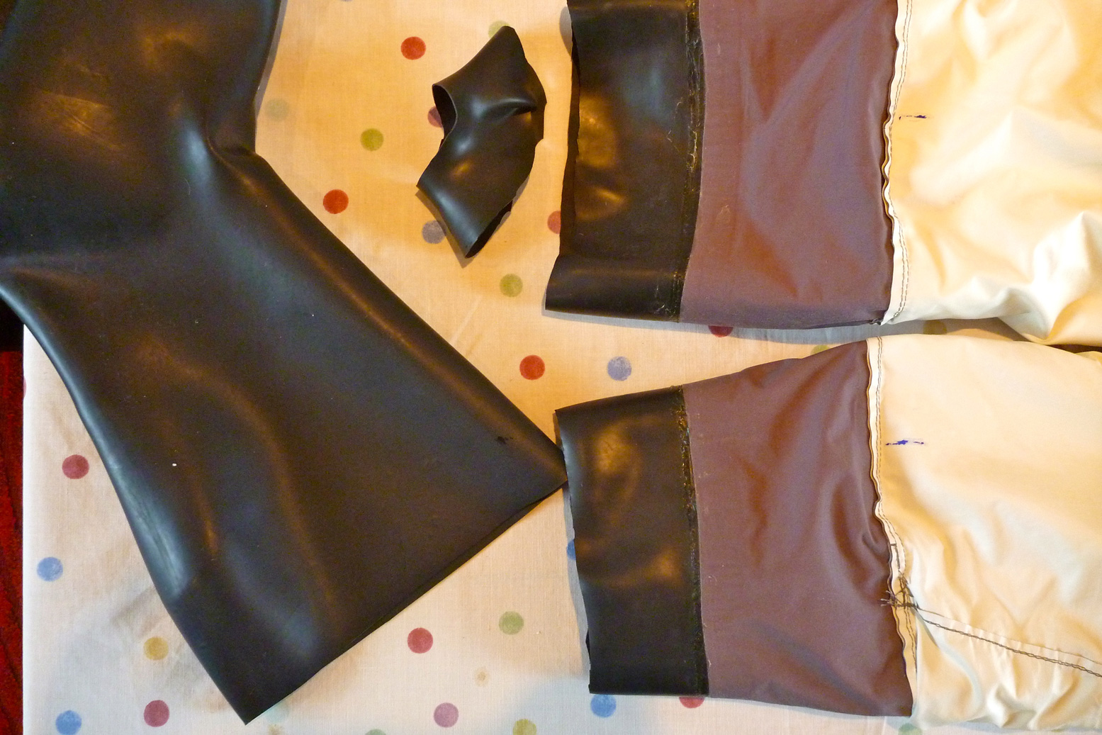
Gluing on latex socks First I trimmed the latex on the trousers and the socks to similar lengths. Getting a circumference match is important if there’s to be no leak-prone creasing once they’re joined. You’d think gluing latex socks to latex trouser cuffs would be simple. Not so it seems. My first go using regular rubber glue didn’t take to the shiny outer surface of the pants’ latex.
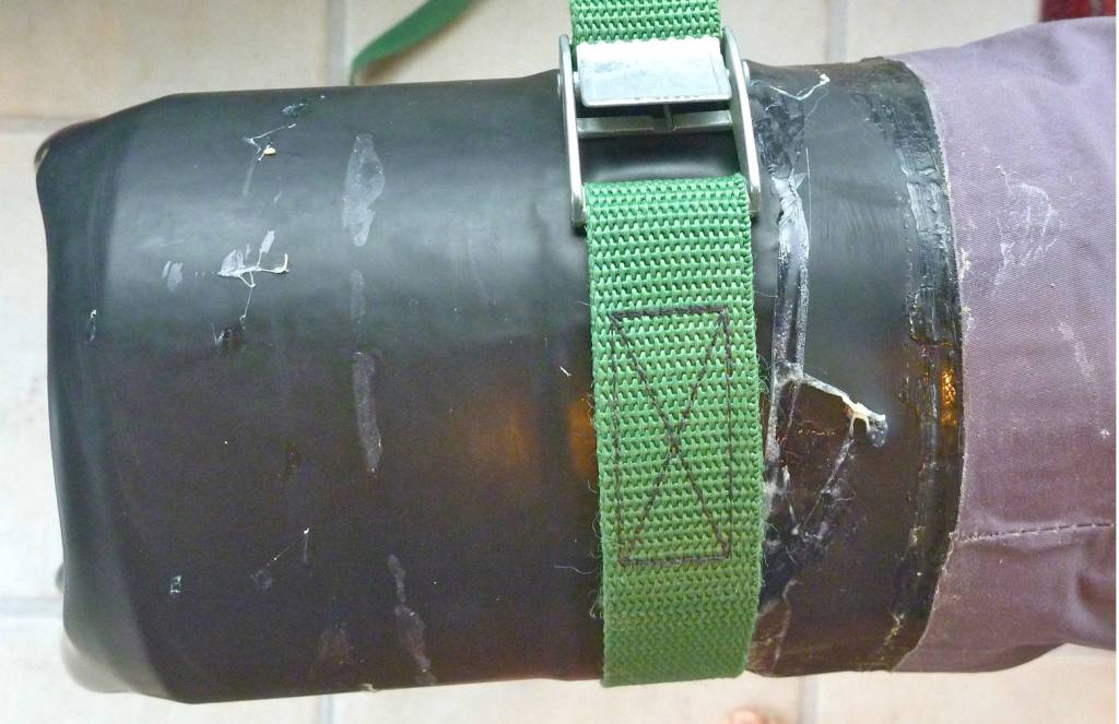
I read of using two-part adhesive, even though that refers to the tricky latex-to-dry suit fabric seal, not similar latex. So with the leg and the sock remounted on a piece of 5-inch plastic drain pipe (below), I tried again mixing up some PolyMarine Hypalon adhesive. This stuff sticks like a velcro electro-magnet, but curing times are lengthy and there’s the whole faff of getting the 25:1 mix correct.
Mount on a pipe
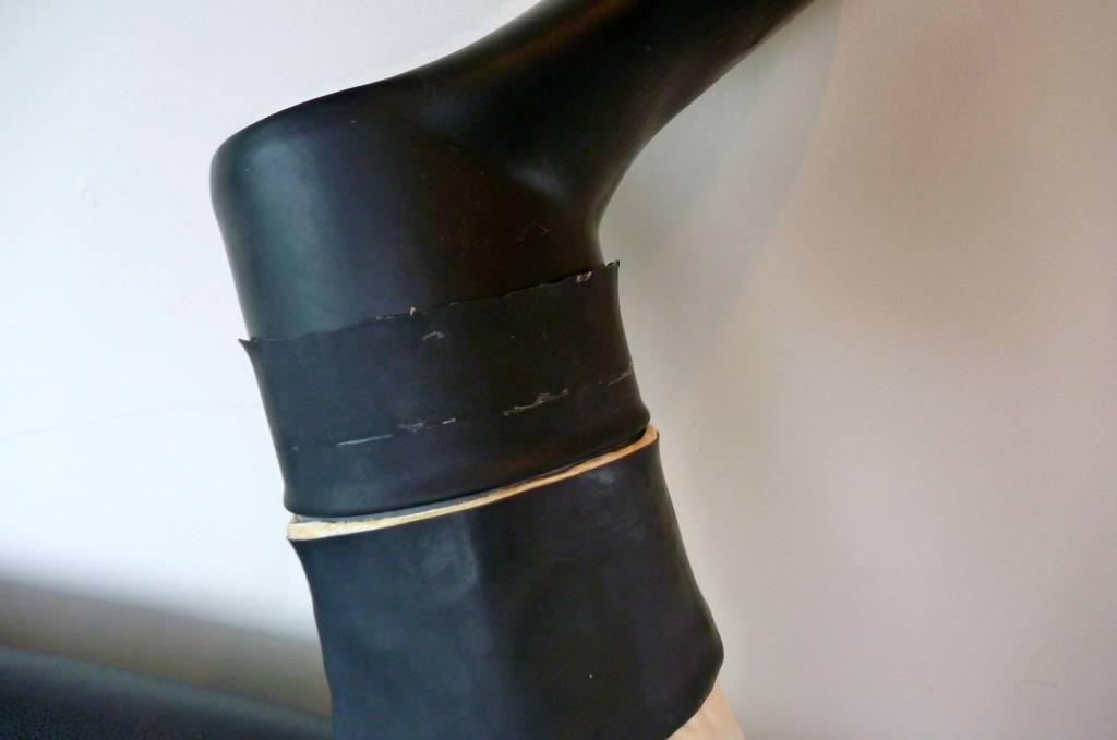
Fold sock back and glue
Fold over and press down
I folded back the sock about 3cm on the pipe end and nudged it against the exposed trouser leg cuff (left, above). When the adhesive had cured after 30 mins, it’s another coat (middle), wait 3 mins then just roll the sock over onto the leg and lay in with the roller then strap it up for a couple of hours. There was one small leak, easily fixed.
When cooler weather requires them but you don’t want a full-on drysuit, these fully sealed pants have been great. I can wade right in without getting wet feet, and wearing regular socks underneath the latex is are warm and comfy. A few years later one sock started leaking; a tiny hole, easily fixed with a dab of Aquaseal. They say latex is prone to UV so is best kept out of sunlight (which is why latex cuffs are often covered) and given the odd squirt of 303 UV protectorant or NikWax Solarproof.
Integrated socks – best thing you can do to your dry pants
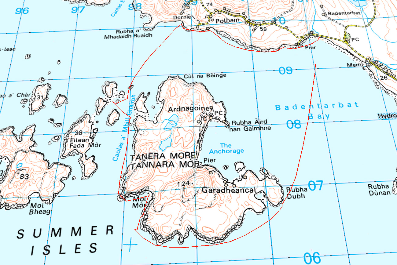
First paddle of the season, although it’s still far from spring-like. The last few days snow has been blanketing the Torridons (left), the Assynts and even BM Coigach (above). But after three days of howling, the winds abated and Jon and I went for a spin round Tanera Mor. I remember first time I did that in the new K40 it felt like an expedition. This time with two of us it was just a jaunt to get the old shoulders cranking again.
Jon bought my previous IK, a Grabner Amigo, but had yet to use it, so this was a chance to compare it with my current Seawave. I sold the Amigo after a run out to Bottle Island when it dawned on me it literally wasn’t cut out to be a swift sea kayak. Still, I managed a pretty good tour of the Slate Islands that year with the Amigo.
Off Badentarbet beach heading for Rubha Dubh-Dubh, Jon was notably slower in the Grabner. For a moment I felt a bit bad – Jeez, did I really sell him such a dud? I’m sure it wasn’t that bad. It was only later when we swapped boats and were more of less evenly matched, that it transpired years of paddling slick, hydro-dynamically efficient hardshells had had a catastrophic effect on Jon’s pulling power. Either that, or a winter’s pushbike training had similarly atrophied his arms, giving him the physique of a T Rex.
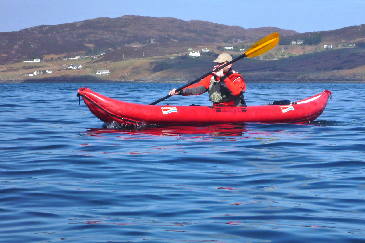
Still, it was good to break the arms in gently, and before we knew it we were turning back northwest for the Tabera channel. With the tide bottomed out, we had lunch on a fish farm platform to the sound of salmon skimming and thrashing up non-existent rapids to their blue remembered breeding grounds. With that sort of daily exercise, at least they won’t end up like T Rexes. From here I rowed the Amigo back. Sure, the flat nose was more snow plough than arrow-like bow, but you’ve got to admire the Grabner’s solid, no-nonsense build. PRVs? Kiss mein schkegg!
Proper seat and attachment points? Opzional, Freund. And compared to the slight flex I noticed in the Seawave – even at .25 bar all round – the 0.3 bar and 750-cm shorter Amigo was as stiff as a stretcher.
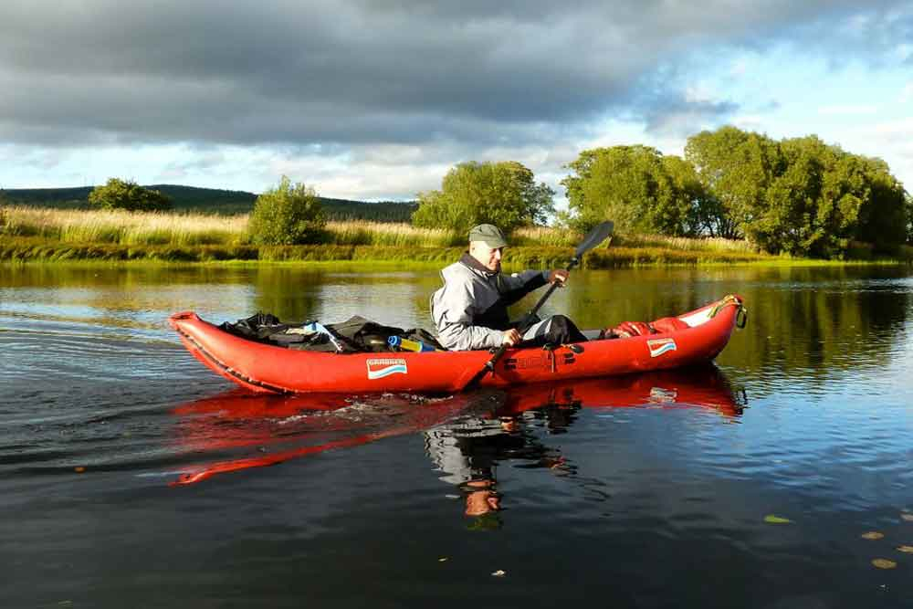
As before, the seat-bar mounts caught my fingers as I paddled, but Jon found similar protuberances on the Gumboat. The bomb-proof Amigo would make a great river touring boat: tough as nails, upswept ends to ride over whitewater and as stable as any IK – though the upswept stern might be a backwind catcher when running skeg-free, as I did on the shallow Spey one time (left).
All in all though, living as I occasionally do by better sea than big, boaty rivers, the Seawave works for me, even at just half an mph faster. The price new was about the same, but there were a lot more extras with the Gumotex, including a deck (I never use). I gave the OE seats away with the Amigo and made a lightweight and q/d seating arrangement which I’ve adopted on the Seawave: a packraft seat base, SoT backrest plus packraft thigh straps and my patented elasto-cantilevered drainpipe footrest (left). Read all about them here.
“Why doesn’t anyone paddle around Shark Bay, Jeff? It seems ideal for beginners like us.”
“Name puts them off I reckon. It’s famous for big tiger sharks. National Geographic did a doco there once.”
“Oh really?” I said. “I thought it was just a name…” and took a thoughtful sip from my coffee.
It was 2am in a roadhouse on the Coastal Highway north of Perth, Western Australia (WA). I’d flown in from London that evening with my boat-in-a-bag and together with Jeff’s girlfriend Sharon, we’d hit the road for the 1000-kilometre drive to Shark Bay.
Perth-based Jeff and Sharon were river paddlers and windsurfers and I’d done a couple of French rivers in my trusty Gumotex Sunny as well as some coastal days, but the three of us were new to sea kayak touring. All we wanted was a safe but inspiring introduction and despite the name, we were sure the shallow, sheltered waters of Shark Bay fitted the bill.
The Bay itself is really a stretch of the otherwise exposed WA coast on the Indian Ocean, and the Shark Bay area is protected by two thin peninsulas which protrude north for 200 kilometres, like elongated harbour walls. But at an average depth of only ten metres, Shark Bay is of little use to shipping and is best known for the daily dolphin visits at Monkey Mia beach. A regular tide of tourists flow in and out of the resort, but having made regular visits there myself as a guidebook writer, I’d long suspected there was more to this ‘Australian Baja’ than beachside photo opportunities with Flipper and the family.
Apart from anything else, Shark Bay is a UNESCO World Heritage site, at the time one of only a handful which fulfilled all four criteria, being an area of evolutionary significance; ongoing ecological processes; superlative natural phenomena and biological diversity. With such impressive credentials we were sure its less-visited corners would be ideal for a mid-winter’s exploration in kayaks.
Once I established with the local parks service that paddling in such an exalted environment was permitted (Australia is full of rules), I was surprised to find just one online account of a kayak tour of the Bay: a quick visit by Australian canoeing legend Terry Bolland. Compared to Bolland’s adventures in the croc-ridden inlets of WA’s northern coast where ten-metre tides run like rivers, his Shark Bay excursion read like Lance Armstrong pedalling down to the shops to buy some milk.
Jetlag meant I was conveniently wide awake for the overnight drive and as the sky coloured with the dawn, we crossed the 26th parallel and passed a sign welcoming us to the fabled ‘Nor’ West’. We rolled into Denham, halfway up the Peron Peninsula and Shark Bay’s only settlement, populated by a mixture of snowbirds living cheek-by-jowl in the caravan park, permanent retirees in pristine bungalows and some fishing and tourist operations. We parked outside the café and waited for it to open.
For once the plan was not too ambitious. Paddle north from Denham about 60 kilometres to the tip of the Peron Peninsula, round Cape Peron to the east side, then cover the same distance south to Monkey Mia Dolphin Resort, a trip that might take up to a week. We aimed to take advantage of the prevailing southwesterlies on the exposed west side of the Peron and deal with the same as headwinds on the more sheltered southbound leg.
There was no fresh water anywhere on our route, and even the townsfolk of Denham had to pay a premium for desalinated drinking water. So after breakfast we followed a network of 4×4 tracks to the tip of Cape Peron, our halfway point, and buried a cache of water and snacks. It saved carrying very heavy loads and should take us about two days to paddle here.
Setting Off With our cache stashed under the paprika-red cliffs of Cape Peron, we set off from Denham at dawn the following day. Jeff and Sharon had a Mission Eco Niitz tandem kayak the size and weight of a tanker.
The waters were soothingly calm and soon a reliable southwesterly saw Jeff hoist his Pacific Action sail on. “Bye,” I said forlornly “see you later.”
These propitious conditions didn’t last long. Soon the wind swung to the northwest, obliging us to dig in for what was to be two-and-a-half days of relentless battling. I actually enjoyed getting my teeth into a headwind, buoyed up by sightings of the extraordinarily rich marine life that give Shark Bay its special UNESCO status.
J and S took pity on my kayak-shaped lilo and hooked me up for a tow to the first of many mostly unnamed capes by which we’d measure our progress across a marine chart.
Sharon had chalked up a checklist of ‘must sees’: turtles, sharks, rays, dolphins and dugongs (sea cows). By our first beach break a green turtle had already passed beneath her bows and later, as we towed our boats through the knee-deep shallows up to half a mile off shore to rest the arms, startled manta rays submerged on the sandy seabed took flight as if shot from a bow.
Our destination that first day was the intriguing Big Lagoon which probed the peninsula’s flank like a tidal glove and promised a sheltered camp site. Twenty kilometres out to sea, Dirk Hartog Island broke the horizon: Australia’s westernmost point. The Dutch seafarer recorded the first European landing there in 1616, nailing an inscribed pewter plate to a pole. What he saw of the newfound Terra Australis was uninspiring: flat, arid and dense with scrub. It was another 150 years before Captain Cook mapped Australia’s less harsh east coast and brought about British colonisation.
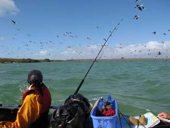
A less historic lone pole marked the mouth of Big Lagoon, and as we rounded the entrance a mass of cormorants took flight, the air filling with the whiff of their oily wings. Though we’d snacked on some oysters during our afternoon wade, the day’s hard paddling had given us all an appetite so we pulled over among some mangroves for an overdue feed and a reappraisal.
It was already 4pm, and with the tide and the wind now against us we decided to leave the exploration of Big Lagoon for another day and scooted across the channel to the nearest sandy beach to make camp. We hauled out boats the last few hundred metres to the tide line.
Walking with Sharks Though only ranging around a metre, the tides in Shark Bay seem to have a mind of their own. Some days there are two as normal, but the following day there might be only one-and-a-half, or even a single 13-hour high.
This had caused Jeff some consternation with the tables, but dawn brought the tide right to our feet and once loaded up, we glided out across the mirrored lagoon. It was to be only a momentary pleasure watching our boats speed silently over the seabed; out in the open the northwesterly was hunched up, fists drawn and waiting. Heads down, we worked our way up the coastline, stopping to investigate an old pearl divers’ camp. Western Australia’s famous pearl industry had begun in Shark Bay in the mid-1800s and the corrugated iron stumps of the shacks around us, now brittle with rust, dated from that period.
Tiny fishes skimming over the surface alerted us to the distinctive tail and dorsal fins chasing them. Soon metre-long sharks began darting between our boats, racing at us then veering off at the last second in a flurry of spray. We assumed the bulky silhouettes of our trailing kayaks kept the young sharks from attacking, a theory that gained credibility when Sharon ended up running towards the beach, screaming as the sharklets circled her menacingly.
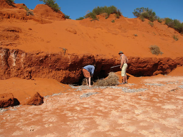
Presently the waters cleared and we hopped back into the boats, steering out into the wind around sandbanks as a long line of ochre-red cliffs long passed by. As they ended we hauled the boats ashore to set up another camp and, with daylight to spare, wandered off to explore the beach.
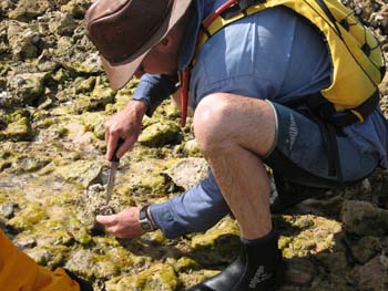
I found a washed-up conch the size of a watermelon while Sharon and Jeff came across a midden of oyster shells left either by 19th-century pearlers or maybe the Yamatji Aboriginal people who’d occupied the Bay prior to colonisation.
To Cape Peron Up with the sun again, but there was no calm put-in this morning. It would be another tough haul to reach Cape Peron and our mouth-watering cache. By 9am Jeff estimated it was blowing at 20 knots. “What’s that in English!?” I yelled, although the answer was immaterial. “About 30 clicks!”
Was it possible to paddle against 30kph winds? My gumboat flexed with the swell as the sea surged over the sides. Now, without the protection of Dirk Hartog Island, the unfettered Indian Ocean swells were crashing against the shore. Still, every vicious headwind had has a silver lining and as we hacked at the water, a pair of dolphins popped up to say hello. Less than 48 hours into our sea safari and only the elusive dugongs remained on Sharon’s checklist.
The seas were getting as big as I’d ever experienced, but I figured as long as the Eco did not disappear behind the swell it wasn’t that bad. I still find the idea of sea kayaking intimidating, but two days of hard paddling had toned me up and I felt confident I could face the day’s toil. Partly this was because my Sunny had the reassuring stability of a raft, even if that included comparable agility and speed! It was something I appreciated when, after breaching a gnarly reef to grab another snack on the south end of Broadhurst Bight, we set off to cross the bay to the northern edge.
That turned into a punishing marathon with the confused seas barging at us from all sides. Tying on to Jeff’s stern I’d worked the bilge pump regularly while the distant shore inched steadily by. All around the once-comforting seabed was now an unfathomable inky blue abyss.
Two hours later we staggered onto the sandy headland, having covered just five kilometres. Our morning’s efforts had put us just a couple of clicks from the tip of Cape Peron for a snack and after another forty minute burst, with my boat swilling again with seawater, we landed on the Cape’s sandy beach and retrieved our cache.
Stuffing our faces with jellies, sausage and now with plenty of water, we were keen to round the Cape because at last the wind would out of our face! We pushed out and once rafted up, Jeff hoisted his sail which filled instantly with a satisfying SLAP! Soon we were skimming along at two or three times our paddling speeds, water lapping over our bows, heading southeast into Herauld Bight.
Sailing with Dugongs We were sitting back, our paddles over our knees and enjoying chatting without yelling when Sharon exclaimed “Dugongs!!” Several huge, dun-coloured profiles emerged against the dark seagrass bank on which they’d been feeding, and before long we were right among a herd of twenty sea cows, caught unawares by our stealthy windborne raft. At times our bows nearly ran over them, the water ahead exploding as their powerful tail flukes blasted them out of range.
By dusk our unexpected run downwind had doubled our day’s mileage. Once ashore I foraged for firewood while Sharon and Jeff got cooking. As we wolfed down our food, wafts of a gorgeous aroma drifted over from the fire. Intrigued, I walked over and realised one especially large chunk or timber was precious sandalwood. A century ago WA had got rich quick supplying this raw material for incense to nearby Asia. Now the last reserves in WA were said to be in Shark Bay. We pulled the log off, finished off the meal and with the wind still blasting down the bight, retreated to our tents.
Across Hopeless Reach By the time I’d dried out my tent after it blew into the sea, the tide had come in to meet us again and under sail we windsurfed round into Hopeless Reach. Here, prophetically, the wind dropped and it was back to good old-fashioned paddling, albeit on much calmer seas. By mid-afternoon we could see Cape Rose a few kilometres from Monkey Mia resort. We didn’t want it to end yet and so strung out the day with fruitless fishing and exploring the scrubby cliff tops on foot.
As we approached Monkey Mia next morning, bottle-nosed dolphins cruised past, soon followed by a tourist catamaran and all the commotion of the resort. We beached the boats one last time and while Jeff hitched back to Denham to get the van another ranger-led dolphin visitation ensued before a line of excited tourists.
Sure it’s fun seeing a dolphin close up, but the three of us couldn’t help feeling rather smug about our thrilling encounters out in the Bay. The tourists were standing ankle deep with half-tame dolphins, but we’d worn the paint off our paddle shafts, sailed with sea cows and walked with sharks!