We decided to lap the tip (left) of the Coigach peninsula. Doing it clockwise put us in the lee of the afternoon’s southwesterly once in Enard Bay and better still, we’d catch high tide at Achnahaird, enabling us to paddle up the creek to complete a near full loop back to the car via the freshwater lochs of Ra and Vatachan.
I remember being quite nervous the first time I did this way back in 2013 in my Amigo – in the other direction from Achnahaird. Looks like I’m not the only one – I blame the Pesda guidebook. It felt like a long old slog west then north between the Ristol islands – the tidal Ristol channel was dry. But by the time we’d passed the reefs of Reiff and reached the sparkling beach at Camas Ghlais (below) we were already more than halfway round.
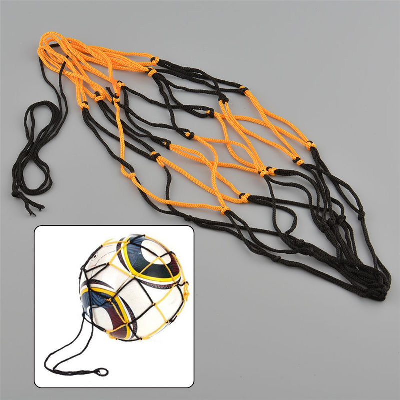
Sitting on the beach, on warm days like this and always looking to refine my set-up to a razorbill’s edge, I sometimes think a sturdy football-sized net bag to take a beach stone would be handy to anchor the boat out in the shallows. This way it won’t beach itself, get hot and purge air which can make the kayak soggy once back in the cool water. It’s one slight drawback of running PRVs on all 3 air chambers. I could probably find some washed up net up among the flotsam and make one. Or I could Buy [a ball bag] Now on ebay for a £1.62. Leaving the sandy bay, I give the Seawave a quick top-up with the K-Pump anyway.
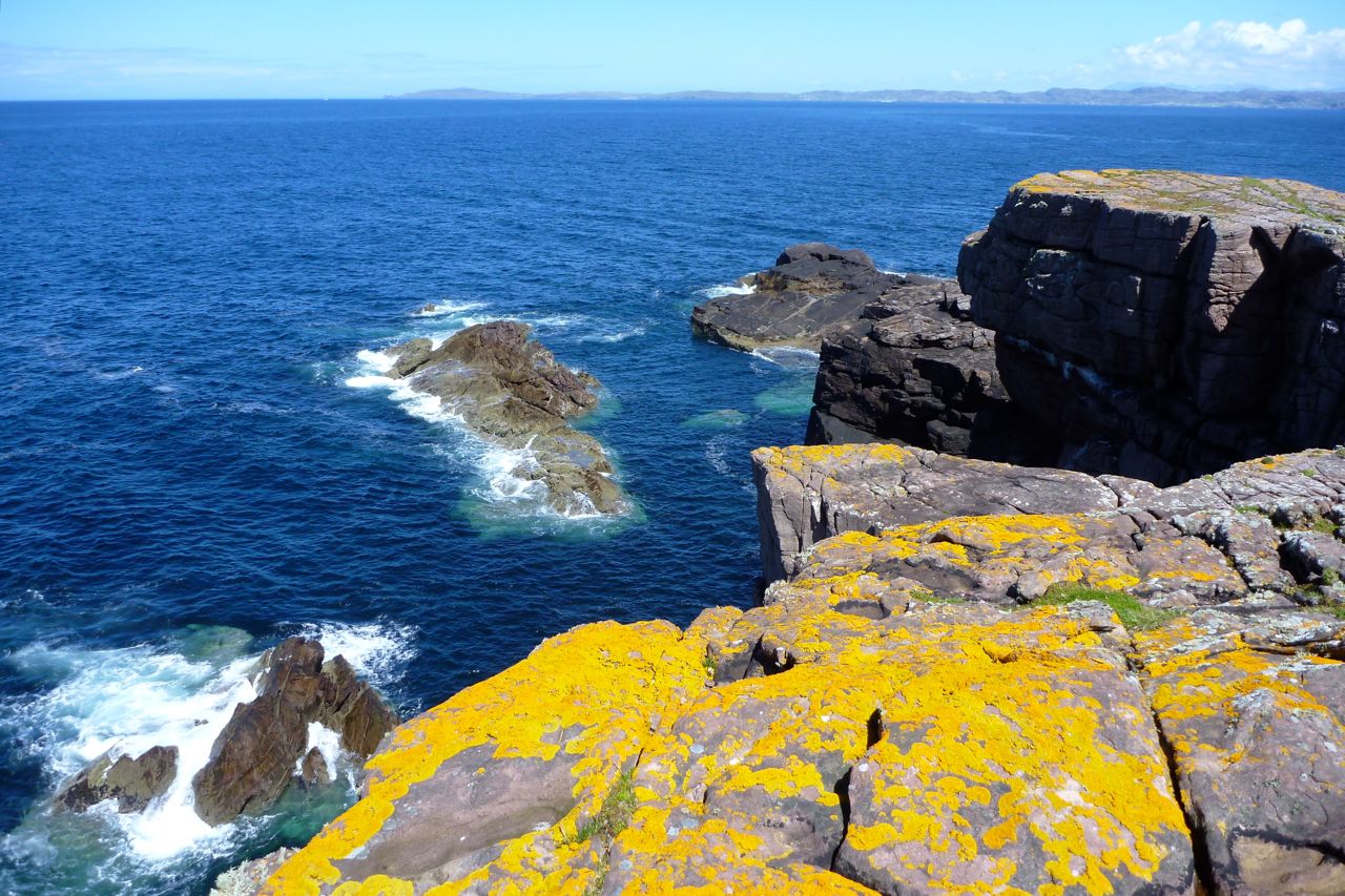
On the north side on the bay we nosed towards a slot cave, but white streaks running down from the ledges suggested nesting birds had hung out ‘Do Not Disturb’ signs. Either I’ve never noticed them before or there are lots more nesting birds around this year. It’s the end of May but there are still tiny snow patches on An Teallach and Beinn Dearg – maybe the season is late.
North of Camas the unrestrained swell was bouncing back off the low cliffs and small dazzling waves were breaking over semi-submerged rocks, making for a rough ride. But it’s all relative and showed what a sheltered life I lead, paddling mostly in and out of the protected Summer Isles.
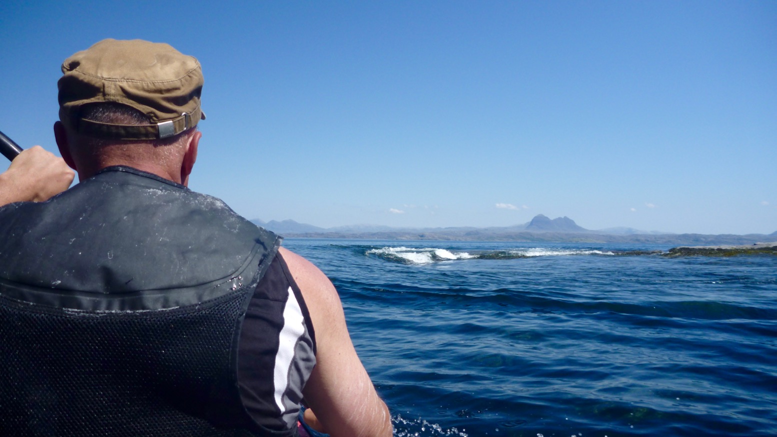
We passed on sandless Faochag Bay and on turning the point of Rubha Coigach all was calm as the grand panorama of the Assynt peaks came into view (above). From the right: Quinaig; Canisp behind Suilven, Cul Mor, Stac Polly in front of Cul Beag, and the group around Ben Mor Coigach. It’s one good reason to do the paddle in this direction. There’s a bigger version of the Assynt panorama here taken on the road above Achnahaird. I really must work out how to do that panorama photo-stitch thing.
Coming down the Enard Bay side, we tried to explore some other caves with green moss streaked with guano, but got dive-bombed by angry shags.
Back out in the bay an unpredicted northwesterly picked up – time to launch that WindPaddle which has been sitting in my kit bag unused for a year or more. Initially, the breeze barely reaches 6mph – we could have paddled faster – but it sure was fun to kick back, look around and let the boat waft quietly along, free from the splish-splosh, splish-splosh rhythm. I wonder if self-driving cars will be the same.
It’s been a while since I’ve done this but the WindPaddle definitely felt better than my homemade efforts from years ago, as well as the knock-off WP I bought a year or two back. I tried a V-sail too but have never really got the hang of kayak sailing. It seems the sweet spot is hard to find: either the wind comes and goes and the sail flops, or it blowing so hard the sail can’t handle it and you’re clinging on. Still, I look forward to giving the WP a spin in slightly windier conditions. For the compact size and light weight I get the feeling it may be worth keeping.
The breeze picked up and we chugged along at a brisk stroll. But even then the WindPaddle feels satisfying to use. I think the key is the sprung tension of the composite batten (rim); it retains the circular shape of the bowl which means it’ll stay up as the wind drops and keep shape as it rises, then can be confidently scrunched down to a packable size without breaking. Doing that during a bit of a blow may be tricky, but it can easily be pulled back and tucked down unfurled over the legs (right). It’s only a downwindish sail but as with previous disc sails, I like the way you can steer intuitively by pulling one line back; a skeg must help but there’s no need for paddle-rudder assistance.
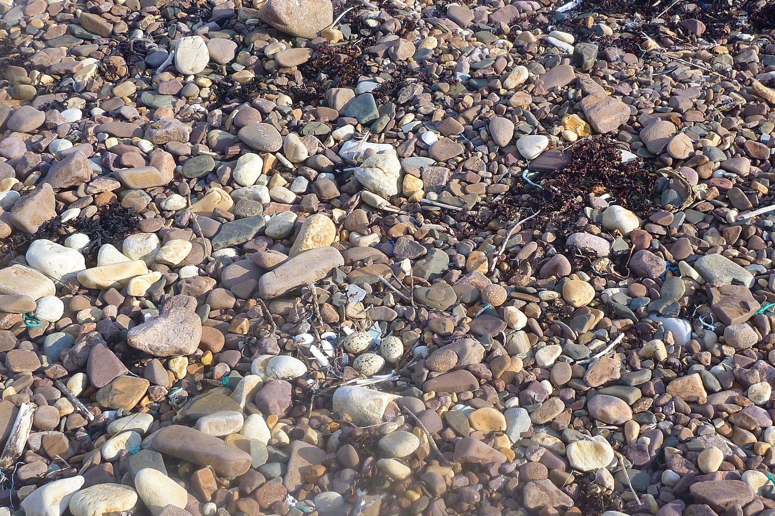
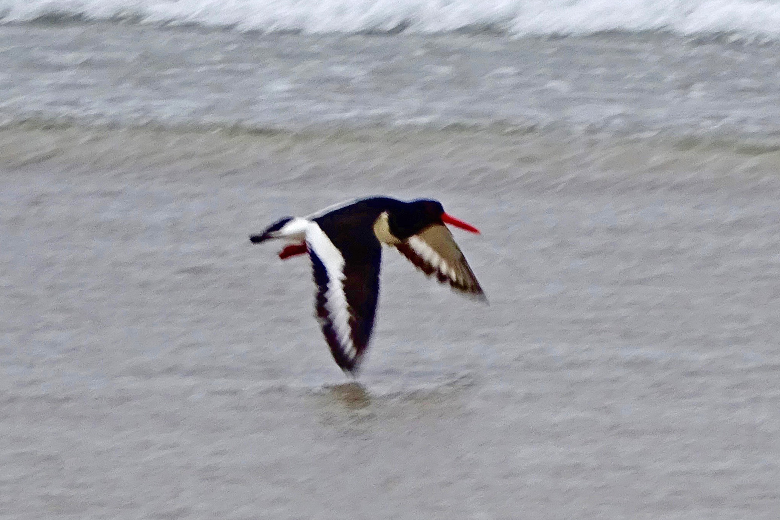
It was nice to look around in the quiet but I also missed that thrill of thrust when a sail catches and holds a good passing gust. Eventually we could stand the relaxed pace no more and the geef paddle-assisted us towards a stony beach at the mouth of the Allt Loch Ra creek. Squawking oystercatchers were guarding their nests. Left, by the bothy at Badentarbet last year; don’t stand on the eggs.
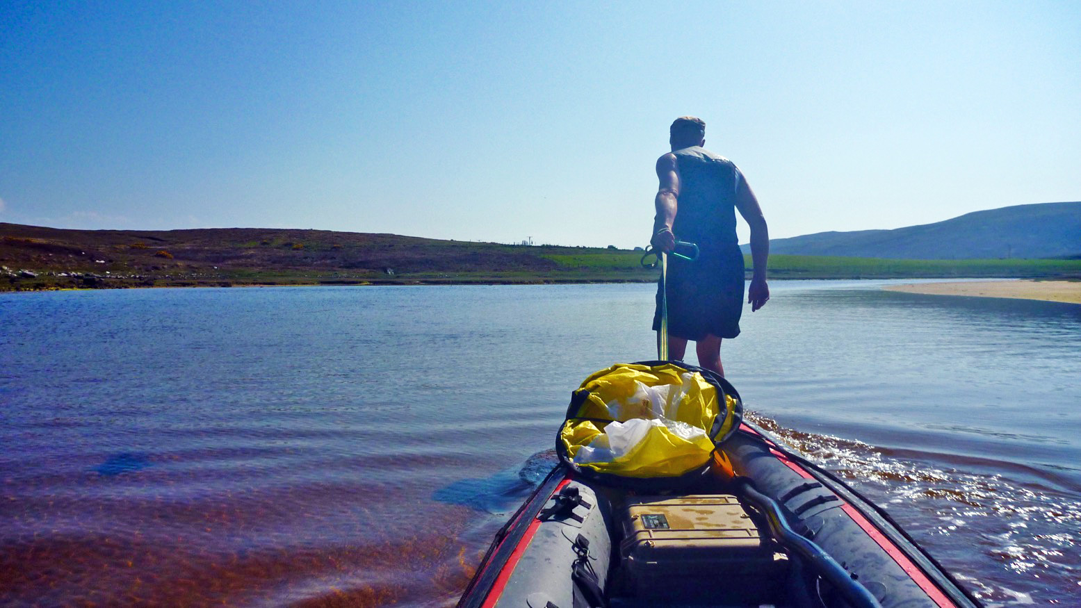
Refuelled, we paddled upstream for a bit then I tow-waded the boat, reminding me of the shallows of Shark Bay in 2006 – a good way to rest after what felt like days of headwinds. The short wade brought us to within a couple of minutes’ portage of Loch Ra just over the road. Now on fresh water, we dragged through the reeds before another short portage over into the adjacent Loch Vatachan. Picking a passing place close to the shore, the geef walked off to get the car while I rinsed off the seawater – another good reason to paddle this loop clockwise. It’s 15 miles and about 5 easy hours to loop the Coigach loop.
A photo I shot exactly a week ago as we walked over the Coigach peninsula having paddled Loch Lurgainn narrows. We’e heading towards Achiltibuie for a cup of tea (right). Notice how Robin’s hair melds magically with the mid-winter bracken. Must be a form of archaic Celtic camouflage carried through the genes. From the far back left coming forward and right, the amazing mountains of the Assynt: Quinaig (‘Kun-yak’); Suilven of course with Stac behind Robin and Cul Mor on the far right. All great climbs. It was the weather the day before (left) forced a change of plans. Full story with more pics evolving here.
Anyone who’s climbed up the fin-like ridge of Stac Polly will see a wild, lochan- and bog-speckled vista spreading north across the Assynt. Just a couple of miles away are the peaks of Cul Mor and Suilven (main hill, left), relics of a glacier that ground down the land between them as it inched towards what’s now the sea.
The OS map shows this area as a Nation Nature Reserve, but it actually lost this designation a few years ago. And although it looks wild – so wild there’s no grazing, nor inhabited dwellings – this 100 square-miles of barely-fenced bog, rock and water is unusually accessible, bordered by quiet roads to the south and west, the A835 to the east, but not much to the north apart from the path passing below the north slope of Suilven. So seeing as this region of Coigach/Assynt has so few packable rivers, these lochans are a great place for short-range packraft exploration following some of the routes suggested on the graphic, right. It’s not just me that thinks so, the local sea kayak outfitter as well as a couple of intrepid canoeists have been coming here over the years. For them the inter-lochan portages require some commitment. But not in a packraft!
You can make up a route to suit yourself here; climb every mountain, ford every stream, visit every island. I chose a pretty easy overnighter and got dropped off by the road at Linneraineach below Cul Beag. There’s nothing at Linner’ bar a footpath which leads north to Loch an Doire Dhuibh (right viewed from Cul Mor).
My packplan was to paddle across Doire into the small adjacent loch, follow the channel into the main Loch Sionascaig, pay a visit to Eilean Mor, the biggest island hereabouts (and one of hundreds of Eilean Mors – or ‘big island’ in Scotland). From there I’d paddle among smaller isles towards the northeast shore of Sionascaig and walk past the ruin of Shieling over the saddle to the short river that links Fionn Loch to Loch Veyatie. With a paddle over to the south side of Suilven mountain, I’d find a dry spot to camp and take it from there. Suilven is only 731m or 2398 feet high, but it does have a strong draw on the imaginations of hillwalkers in far northwest Scotland, as do many of the Assynt’s peaks.
I think much of it stems from its Ayers Rock- or Matterhorn-like separation from its surroundings; a distinctive mountain shape, like the much more accessible Stac to the south. Add the lochans below and the open sea just a mile or two away, and mountain summits around here add up to something special. The picture right is taken from Ben Mor Coigach (743m) looking north over to Stac, Suilven and the distant peak of Quinaig. That’s another thing – the mountains have nice names around here with, you’d like to think, a touch of the Norse about them. This is after all Sutherland, or ‘the South Land’ in the mind of a Danish bloke in a horned helmet, circa 900AD. If you like hills there’s a panorama of some Sutherland mountains below, taken from the tip of the Coigach peninsula looking northeast.
Back to the boating; this was my first proper run in my Yak and as I pulled smoothly away from the shore of Loch Doire (left) it struck me how cool it is to trek over the hills with a pack of only 10-12 kilos, inflate your mini boat and set out across a body of water with your kit slung over the bow. In fact I’m convinced a frontal load makes packrafts faster as, despite the wind drag, the weight reduces the left-to-right yawing.
Very soon I was surprised to see the GPS reading a steady and sustainable 3mph (4.8kph, 2.6 knots) on the calm, windless loch. “What’ll it do?” I wondered, as you do. About 4.1mph, as you ask, but only for a few seconds, unless there’s a Great White on your tail. I’m sure that was more than I ever registered in my old-shape Llama, and I dare say more than I could average walking along the surrounding terrain which was mostly pathless. When I got back a speed graph (right) extracted from the GPS spelled it out: tramping across the pathless hilly bogs – about 2.3mph; on the water, out of the wind – 3mph; on the water into the wind – 2.4mph but with some effort.
The channel that led west to Loch Sion (below Stac Polly, right) looked promising on the map, but even with the current high water levels following the deluge that was May, it soon got too shallow over the couple of metres drop to the next loch, and with a wince-inducing scrape the Yak hung up on a rock, requiring a short portage (left). That done, moving out onto Loch Sion a breeze was now in my face as I edged along the shore. Past Eilean Dubh I squeezed through another inter-island lead and out into the main loch, heading for Eilean Mor island. Even with the mild buffeting, it struck me how safe I felt alone in my raft; safer than I often feel initially in my Incept kayak at sea in similarly tame conditions. I think not being at sea had much to do with it, with no kind of wave or ill wind that could blow the Alpacka out to the wrong side of Greenland.
Eilean Mor is a natural focal point in Sion loch – what can it be like, an island set deep within in a wilderness? Many paddlers are fascinated by these tiny wooden islands on Scottish lochs, I assume like me, because they think it must be a UNESCO-like example of a hyper-pristine natural habitat beyond the reach of prolonged human intrusion.
On the southern tip I can tell you there’s certainly a spacious, grassy camping spot (and now, a finely-built cairn), but as I half fell out of my boat and staggered ashore (left), the latest shower passed by as I beat my way inland towards the Eilean’s summit, through a forest choked with ferns, birch, hazel and their fallen, decaying predecessors. As I bushwhacked upwards, an owl not 10 feet to my left flew off noiselessly, and in places the ferns hummed with a flouorescent green glow (above).
At the summit, about 100 feet above the loch I looked over to the entrance to Boat Bay, a mile or so to the west (above left). To the north Suilven was a dark, uninviting rampart while to the south I imagined the walkers who daily take the short trek up Stac Polly (right) looking down on the progress of the little yellow boat far below and thinking, heck that looks fun!
I set off northeast, passing other inviting but unnamed isles (left and right), around Rubha Sionascaig with its alluring isthmus and up to Creag Sionascaig. Arriving at the shore, new shoots of grass poked through the blackened peat, scorched by the bushfires of early May which have been well and truly doused by the series of lashing gales which followed. I rolled up and headed up a creek line towards a saddle, passing a ruined croft which, as in so many remote locales in northwest Scotland, makes you wonder what on earth the people lived off up here?
Squelching over a novel mixture of burned peat crust spongebog mush (left), at the pass I looked down and saw half a dozen tents and a couple of canoes (right, barely visible) pitched at a meander in the river at a point where it was quite probably fordable. I’m sure the water there was running eastwards from Fionn into Loch Veyatie [it doesn’t], but if that’s the case then Fionn Loch is unusual in that it drains both ways, east and also west via the River Kirkaig to Lochinver and the sea. A geographical oddity? who knows [I do now; it isn’t]. I walked directly to Fionn, deployed the Yak and paddled across the channel (left). A short walk out of sight of the campers found a flat shoreline where I pitched beneath the looming mass of Suilven.
At times I’d wondered whether there even was a path up the south side of Suilven mountain (left) – I’m sure I’d read it somewhere. Then, during a short spell of sunshine a steep path became briefly illuminated; straight up alongside a scree slope, then off at an angle to the saddle-ridge between the two peaks. But now it was raining steadily, I was pretty damp and not in the mood for a hefty slog across contours pressed together up like the teeth of a comb, but I feared once I got in the tent I’d probably slob out. So after a light feed, I set out, packstaff in hand, to locate the path up the hill and once on it, followed it till 8pm. If nothing else, it was a good way to warm up and dry off.
It would be nice to report a stirring vista some 400 metres below the summit of Suilven, but a leaden gloom pressed down on the sodden land. I’d called the Mrs – tomorrow would bring more rain, but the winds would return too first thing in the morning. Back in the tent and soon after sunset, the rain arrived early and lasted most of the night. It was all a bit much for my single-skin tent which, though amazingly light and compact, is not rated as waterproof. The drips soon came through the fabric of the flat roof as I dozed, soaking my legs and chilling me. Half-awake, I lay my cag over the drip zone, after which the night passed well enough and I woke reasonably dry. The next day was not one for shorts; today I was going to try out my new Kokatat Swift Dry Pants (see Suilven Gear). I’d half a mind to catch the twice-daily bus at 11.15 from the junction (see green graphic, top of the page) and estimated it would take 4 hours to get there, so breakfast at 6am was cereal in warmed up loch water. It wasn’t raining yet which meant it would be shortly, so I packed up quick and scooted back over Fionn Loch, taking a different route back southwest, past Na Tri Lochan to an inlet on Loch Sion (see satellite image bottom of the page). It was a longer land stage, but would put me into a better position to dodge the predicted southwesterlies while paddling back west towards Boat Bay. I’ve been reading a lot of sea kayaking literature lately and the lessons were paying off.
Let me tell you, walking over the pathless mire following a night of rain is merely a necessary means to get to the next bit of fun paddling. My knee-high Seal Skin ‘Wellington socks’ were working fine – last night my feet had been bone dry – but it’s a tiring, rhythmless slog over this crap; any sheep trails are merely conduits for more running water and mud. Again, the star of the Gear Show has to be my packstaff; it makes walking on uneven ground, descents and climbs so much more secure, especially with a load.
I reached the inlet bang on time which took me by surprise. Was this some un-noted lochan, no it was Sion – I’d not read the inlet’s shape on the map closely enough. Once back on the water, initially my leeward paddling ploy worked well. Then I turned a corner and suddenly the wind was onto me and the bow was bouncing on the waves (left) as I hacked past the shore at barely 1mph. For a while I thought I’d have to give up and take to the shore but again, as sea kayaking lore states, wind is often exacerbated round a point or headland, even on a lochan. Near normal speeds resumed, in fact just a fraction under the still-and-calm 3mph cruising of yesterday, but at a heavy cost to the arms and shoulders. I couldn’t have done this all day but luckily, I didn’t have to so I got stuck in. Again I was surprised how safe I felt out here, alone and ill-dressed and where stopping to fiddle with the cameras pushed me back nearly as fast as I paddled forward.
Finally I entered the mouth of Boat Bay, back onto known ground. The end was in sight. Last September I couldn’t even paddle the Sunny out of this bay in a stiff easterly. Now I dug my way onwards to the tiny beach inlet which was notably smaller than last year. I rolled it all up and hiked up to the nearby road. Within a couple of miles g-friend’s hatchback popped over the hill and I was home and dry for lunchtime – a 15-mile, 24-hour mini packboating adventure completed, with lots more ideas for future exploring of the lochans below Suilven mountain.
Below: almost the entire route seen from Cul Mor summit, looking southwest and west. Stac and Summer Isles in the distance.