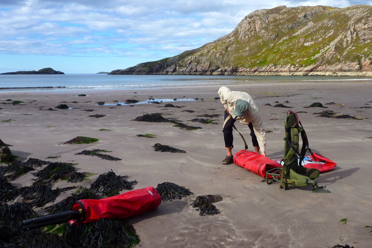
My grand plans to try out my new packframe on a trek from Loch Maree back to the Summers got radically downsized to a day out from Inverpolly. Down at Boat Bay we pumped up the IKs and set off along a route I’d packrafted a couple of years ago.
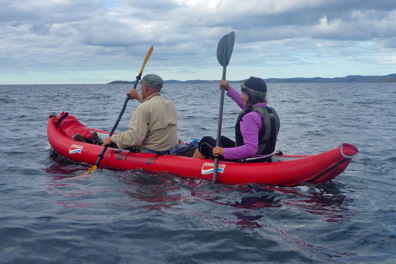
Surrounded by the singular Assynt peaks, Sionasgaig loch is an amazing place to splash about in a paddle boat, but at kayak speeds that stage was over rather too quickly. Just as well though, as I was trying the Amigo without a skeg, and two-up it wasn’t working. Into the wind was possible with one paddling, but out on Sion with a side wind, even with one in control the lighter back kept swinging off the wind. We put a bag in the back, but at the Sluice Portage (above) we had to commandeer the skeg off Craig in the Solar who up to that point was loving his day out on the lochs. I assured him the Solar was manageable without a skeg as long as he applied appropriate levels of paddling finesse. This low level, almost sub-conscious correction to the tracking is something that’s difficult to achieve when two people are paddling one boat. It’s a shame that a skeg is such a vital accoutrement.
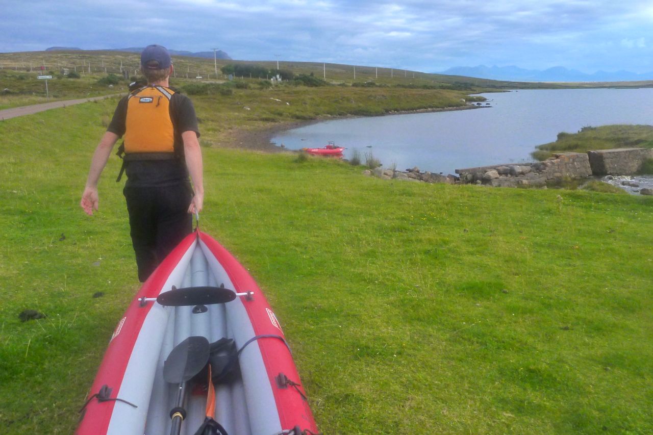
We’d all want them for the Enard Bay sea stage, so at the end of Loch Uidh Tarraigean, g-friend nipped back a couple of miles to the car where the forgotten skeg hopefully lay under a seat. By the time Craig and I had portaged over to little Loch na Dail, crossed it and walked up to the road, the car arrived with the errant skeg.
Past Inverpolly Lodge.
After lunch we rolled the boats up, coasted down to the fish hatchery on the River Polly and set off down the track towards Inverpolly Lodge and Polly Bay beyond. We’d crept up here on our bikes a few months back, to check out ‘Loch Sal’ bay north of the lodge. There’s boat ramp and fish pens there, which was good to know when I passed a while later on my Enard Bay paddle to Lochinver. First time there and Polly Bay glittered invitingly at low water. On with in the skegs, in with the air and out we go into the flat calm. While exploring a bay round the corner, Craig managed to spot an otter gnawing over its lunch at the back of a chasm.
Arriving at Polly Bay
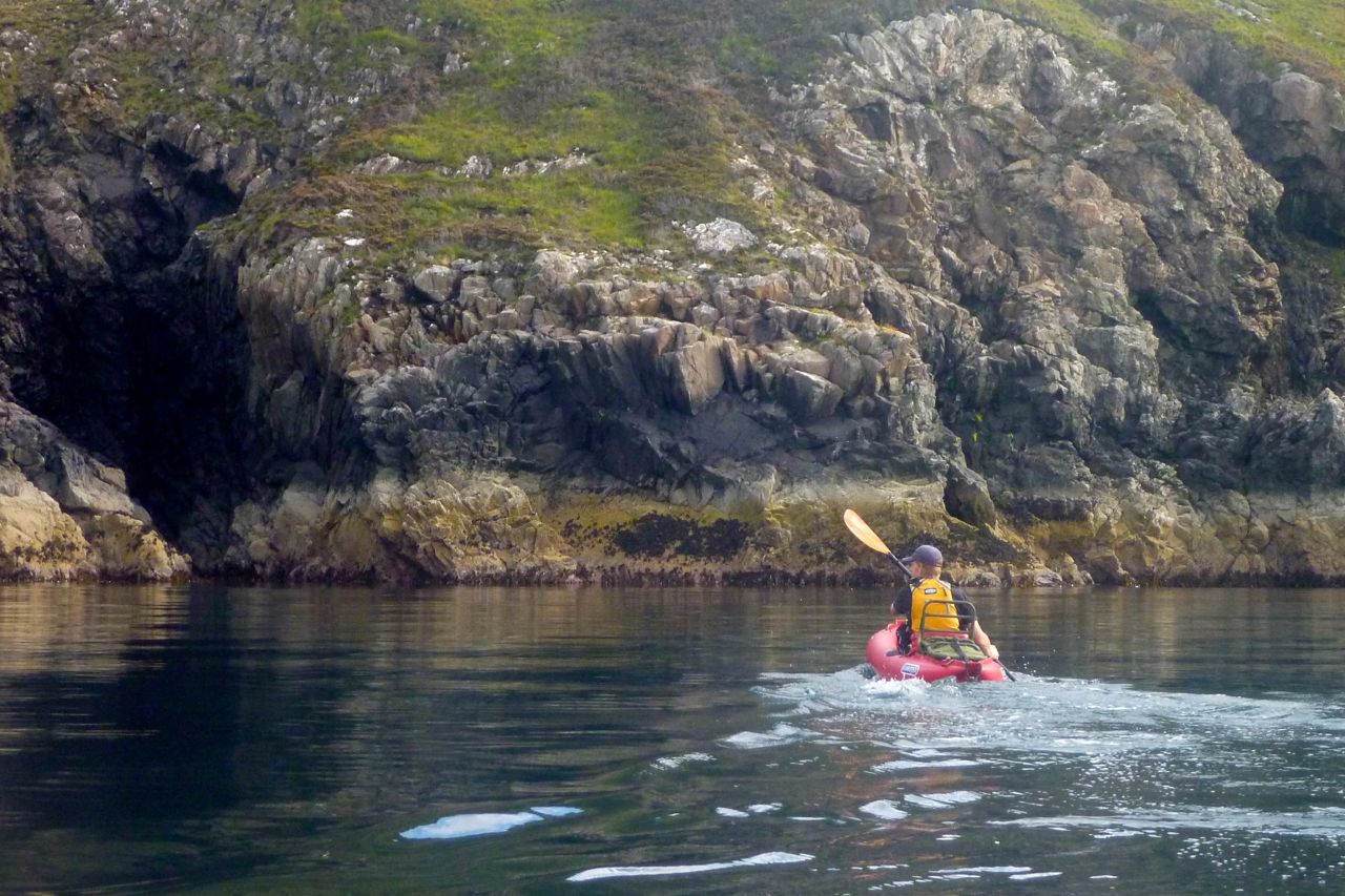
We worked our way around the coastline fringed with kelp exposed by the very low tide. Further along, winkle pickers were at work at Garvie Point, but then cloud rolled in on an annoying north wind; that is why you want skegs at sea. The little Solar bobbed about on the waves, but Craig seemed to be managing fine. We edged round Camas a Bhothain bay – no seals at play today – and slipped through the reef into Achnahaird Bay.
It was now quite chilly and my proposal to form a holding pattern for three hours until the spring tide filled the bay was roundly vetoed. When Achnahaird Bay fills right up on spring tides, you can paddle up the Loch Raa outlet stream almost to the road junction car park, for the short portage to Raa. As it was, there was enough flow to tow the boats all the way up. We’d left a bike here so the Mrs cycled back over the hill to get the car, while Craig and I paddled across Loch Raa and then to the north side of Loch Vatachen. I did this bit without the skeg and was reassured to find that one up the Amigo tracked at least as well as the Sunny did in the same state. Perhaps it’s all down to more centred weight and the aforementioned correcting finesse. I’ll be on the River Spey in a couple of weeks where it’s good to know a skeg won’t be needed (it was).
On the north side of Loch Vatachen we aired down for the short but arduous slog up the hillside to the peat track that leads back to Polbain, a more direct route than following the road. Maybe it’s down to late summer growth, but the grassy tussocks and toe-dragging shrubbery made for an exceedingly tiresome, one-mph haul. Each step required lifting to knee height, and crossing the boggy stream course midway ingested one of Craig’s cherished flip-flops. Struggling a bit with his kayak in a shoulder bag, I was amazed it had managed to stay with him that far. My well-used Teva Omniums clung better to my feet if not the ground, and the heavily loaded packframe sat securely on my back, but I wouldn’t want to spend all day doing this. By the time we reached the peat track where locals periodically excavate their allocations, the sun was setting over the Assynt peaks to the northeast. From here it was a short downhill walk to the village and, after some 12 miles, attending to all the food that was fit to eat.
A sunny and a warm day, so although I was still feeling a bit groggy following a cold, it was high time to enact a mini-packplan: head out to Inverpolly and string together some of the lochans on the west side.
I’d nipped out there a few days earlier to check the lie of the land and try out some used Jungle boots, and although the maps warned of sluices, it all looked doable from the hillsides above.
And judging from the terrain I crossed to get there, it would be a whole lot easier to paddle than to walk. At the end of this paddle my shins were all scrapped bloody by dry heather stalks and other brush. Some sort of plain canvas gaiters are needed to walk across this stuff, even in long trousers. More gear… sigh.
The Mrs had nipped off to Handa Island with the car, but it suited me fine to cycle out to the lochans by the fish farm on the WMR to Lochinver. I stashed the bike behind an old shed in the woods and walked on up the road.
Loch Call‘ where I’d chosen to put in isn’t visible from the WMR which explains why I overshot it a bit, but a splash in the loch to cool down followed by paddling to the north end lined me up for the path down to Boat Bay. It’s one of only two paths I know of to access the lochans. But why were my arms so weak? it was only a cold for goodness sake! I decided to scoff all my sandwiches in the hope it was food I was needing.
Paddling out of Boat Bay the wind was firmly at my back and I sped along at an effortless 3mph+, and noted no ‘weathercocking’ (back end swing-round) as you can get with a kayak without a rudder or skeg. A packraft is a whole different thing of course, with all the weight in the back. If anything, going into the wind sees the lighter front come round if you stop paddling briefly. That same 10-15mph wind that pushed me along would probably be in my face when I turned the corner into Loch Sionascaig (above) and headed southwest, and sure enough it was, but not enough to spoil my day. The sandwiches were kicking in by now and I shovelled my way towards the first sluice, surrounded by the three mountains of Stac Polly, Cul Mor and of course Suilven, which give this paddling location it’s unique character. How wonderful it is to be out here in the wilds, fanned by a warm breeze and for once not being chocked from all angles in faux-breathable, latex-trimmed wet wear. This could almost be France or Scandinavia in a heatwave.
First one, then a couple more fishermen cropped up, standing alone on the banks, dipping their rods and exuding the usual unfriendly vibes. How did they even get there, I wondered? Not looking intrepid enough to have tramped over the hills, they must have paid their dues and been dropped off by the Inverpolly Estate’s boat from Boat Bay. Then a bloke comes round the corner paddling a yellow inflatable bath and threatens to put the wind up their trout.
I neared the sluice (above: from above; left, from the south) at the southwest corner of Loch Sionascaig. On my Suilven overnighter a few weeks back, I’d noticed something white hereabouts while on the way back to Boat Bay from the north side of Sionascaig. Turns out they were just big white bags of rocks left over from shoring up the crumbling sluice wall. Most of the water pours though holes in the wall but even then, considering the size of Loch Sionascaig, there’s no danger here of getting sucked into anything nasty at normal levels. Should the wall fail, that could be another matter.
It’s about a 10-metre drop (above) into the steep-sided Loch Uidh which leads to a gap. Here as expected, the wind was funnelling but was counteracted by a slight current running my way. This soon ended at another crumbling sluice that might have been runnable (below). I came right up and had a good look but decided the raft was too wide to make it down the chute and one-foot drop without me making a mess of myself, and I had to get out soon after. So I walked round and down alongside a series of torrents to the last paddle, Loch Na Dall. This happens to be linked by a short car track to the WMR (not on the map); a good take out if you’re in a canoe.
Although I’ve read of canoeists paddling the slim lochs below Suilven, portaging over to Loch Sionascaig and hoping to follow the Polly all the way to the sea at Polly Bay, what follows from Loch Na Dall isn’t really worth the portage, even if you’ve had a great time up on the main loch. It’s an ankle-twisting haul on a bumpy paddle all the way down to the fish farm, and the one kilometre downstream section after the road bridge at the fish farm (sluices and strainers) to the sea may well raise frowns from the Estate. But perhaps in winter, with the higher water levels you’d need for a clean run, no one’s bothered. Anyway it pays to remember: this is enlightened Scotland where outdoor access is a legal right, though always best combined with common sense. I’ve spent the last couple of months enjoying this freedom up here so it’s worth spelling it out: The Land Reform (Scotland) Act 2003 “You can exercise these rights, provided you do so responsibly, over most land and inland water in Scotland, including mountains, moorland, woods and forests, grassland, margins of fields in which crops are growing, paths and tracks, rivers and lochs, the coast and most parks and open spaces. Access rights can be exercised at any time of the day or night.”
Back to the packrafting. The south end of Na Dall was asprout with grassy reeds which created a briefly exotic paddling sensation. At it’s end the river dropped down into the valley, but there was no tell-tale roaring and the contours on the map suggested it didn’t drop immediately. So after peering from the intake, I dived in with blades churning, only to get hung up on a rock at the first drop. Free from that and on the move, the underside of the plucky Yak whined periodically as it slid over successive obstructions; another high-centred hang up, another clumsy, butt-pivoting, paddle-bashing extraction, gaining nul points for style. That led to a breather in a pool and then another frothing drop, the camera by now sagged from the jolting. It had turned out to be a couple of minutes of unexpected action, but up ahead there was that ominous noise and I knew it was time to hop out ahead of a series of stony drops (below). I rolled up the Yak and tramped back down to the valley and the bike shed.
Riding back over the hill to Osgaig Loch at a quarter of the speed I came down it earlier that day, there’s a hoot from behind. ‘What!?’ I snapped, eyes stinging with sweat. Another hoot ‘WHAT!?’ Ah, pardon me, it’s the g-friend back from Puffin World while I’m puffing away in two-one, as red as a puffin’s beak and as sweaty as a sauna full of guillemots.
‘Want a lift, puffinboy? You look a bit hot‘.
I was actually anticipating the freewheeling rush down to Osgaig Loch where I’d had half a mind to try rafting the bike over to the other side. Never tried lashing my bike to the bow of my packraft before – it seems an awkward thing to strap down securely, but others have managed fine so it needs trying out once. Something for another day. We hooked the bike up and drove home.
Anyone who’s climbed up the fin-like ridge of Stac Polly will see a wild, lochan- and bog-speckled vista spreading north across the Assynt. Just a couple of miles away are the peaks of Cul Mor and Suilven (main hill, left), relics of a glacier that ground down the land between them as it inched towards what’s now the sea.
The OS map shows this area as a Nation Nature Reserve, but it actually lost this designation a few years ago. And although it looks wild – so wild there’s no grazing, nor inhabited dwellings – this 100 square-miles of barely-fenced bog, rock and water is unusually accessible, bordered by quiet roads to the south and west, the A835 to the east, but not much to the north apart from the path passing below the north slope of Suilven. So seeing as this region of Coigach/Assynt has so few packable rivers, these lochans are a great place for short-range packraft exploration following some of the routes suggested on the graphic, right. It’s not just me that thinks so, the local sea kayak outfitter as well as a couple of intrepid canoeists have been coming here over the years. For them the inter-lochan portages require some commitment. But not in a packraft!
You can make up a route to suit yourself here; climb every mountain, ford every stream, visit every island. I chose a pretty easy overnighter and got dropped off by the road at Linneraineach below Cul Beag. There’s nothing at Linner’ bar a footpath which leads north to Loch an Doire Dhuibh (right viewed from Cul Mor).
My packplan was to paddle across Doire into the small adjacent loch, follow the channel into the main Loch Sionascaig, pay a visit to Eilean Mor, the biggest island hereabouts (and one of hundreds of Eilean Mors – or ‘big island’ in Scotland). From there I’d paddle among smaller isles towards the northeast shore of Sionascaig and walk past the ruin of Shieling over the saddle to the short river that links Fionn Loch to Loch Veyatie. With a paddle over to the south side of Suilven mountain, I’d find a dry spot to camp and take it from there. Suilven is only 731m or 2398 feet high, but it does have a strong draw on the imaginations of hillwalkers in far northwest Scotland, as do many of the Assynt’s peaks.
I think much of it stems from its Ayers Rock- or Matterhorn-like separation from its surroundings; a distinctive mountain shape, like the much more accessible Stac to the south. Add the lochans below and the open sea just a mile or two away, and mountain summits around here add up to something special. The picture right is taken from Ben Mor Coigach (743m) looking north over to Stac, Suilven and the distant peak of Quinaig. That’s another thing – the mountains have nice names around here with, you’d like to think, a touch of the Norse about them. This is after all Sutherland, or ‘the South Land’ in the mind of a Danish bloke in a horned helmet, circa 900AD. If you like hills there’s a panorama of some Sutherland mountains below, taken from the tip of the Coigach peninsula looking northeast.
Back to the boating; this was my first proper run in my Yak and as I pulled smoothly away from the shore of Loch Doire (left) it struck me how cool it is to trek over the hills with a pack of only 10-12 kilos, inflate your mini boat and set out across a body of water with your kit slung over the bow. In fact I’m convinced a frontal load makes packrafts faster as, despite the wind drag, the weight reduces the left-to-right yawing.
Very soon I was surprised to see the GPS reading a steady and sustainable 3mph (4.8kph, 2.6 knots) on the calm, windless loch. “What’ll it do?” I wondered, as you do. About 4.1mph, as you ask, but only for a few seconds, unless there’s a Great White on your tail. I’m sure that was more than I ever registered in my old-shape Llama, and I dare say more than I could average walking along the surrounding terrain which was mostly pathless. When I got back a speed graph (right) extracted from the GPS spelled it out: tramping across the pathless hilly bogs – about 2.3mph; on the water, out of the wind – 3mph; on the water into the wind – 2.4mph but with some effort.
The channel that led west to Loch Sion (below Stac Polly, right) looked promising on the map, but even with the current high water levels following the deluge that was May, it soon got too shallow over the couple of metres drop to the next loch, and with a wince-inducing scrape the Yak hung up on a rock, requiring a short portage (left). That done, moving out onto Loch Sion a breeze was now in my face as I edged along the shore. Past Eilean Dubh I squeezed through another inter-island lead and out into the main loch, heading for Eilean Mor island. Even with the mild buffeting, it struck me how safe I felt alone in my raft; safer than I often feel initially in my Incept kayak at sea in similarly tame conditions. I think not being at sea had much to do with it, with no kind of wave or ill wind that could blow the Alpacka out to the wrong side of Greenland.
Eilean Mor is a natural focal point in Sion loch – what can it be like, an island set deep within in a wilderness? Many paddlers are fascinated by these tiny wooden islands on Scottish lochs, I assume like me, because they think it must be a UNESCO-like example of a hyper-pristine natural habitat beyond the reach of prolonged human intrusion.
On the southern tip I can tell you there’s certainly a spacious, grassy camping spot (and now, a finely-built cairn), but as I half fell out of my boat and staggered ashore (left), the latest shower passed by as I beat my way inland towards the Eilean’s summit, through a forest choked with ferns, birch, hazel and their fallen, decaying predecessors. As I bushwhacked upwards, an owl not 10 feet to my left flew off noiselessly, and in places the ferns hummed with a flouorescent green glow (above).
At the summit, about 100 feet above the loch I looked over to the entrance to Boat Bay, a mile or so to the west (above left). To the north Suilven was a dark, uninviting rampart while to the south I imagined the walkers who daily take the short trek up Stac Polly (right) looking down on the progress of the little yellow boat far below and thinking, heck that looks fun!
I set off northeast, passing other inviting but unnamed isles (left and right), around Rubha Sionascaig with its alluring isthmus and up to Creag Sionascaig. Arriving at the shore, new shoots of grass poked through the blackened peat, scorched by the bushfires of early May which have been well and truly doused by the series of lashing gales which followed. I rolled up and headed up a creek line towards a saddle, passing a ruined croft which, as in so many remote locales in northwest Scotland, makes you wonder what on earth the people lived off up here?
Squelching over a novel mixture of burned peat crust spongebog mush (left), at the pass I looked down and saw half a dozen tents and a couple of canoes (right, barely visible) pitched at a meander in the river at a point where it was quite probably fordable. I’m sure the water there was running eastwards from Fionn into Loch Veyatie [it doesn’t], but if that’s the case then Fionn Loch is unusual in that it drains both ways, east and also west via the River Kirkaig to Lochinver and the sea. A geographical oddity? who knows [I do now; it isn’t]. I walked directly to Fionn, deployed the Yak and paddled across the channel (left). A short walk out of sight of the campers found a flat shoreline where I pitched beneath the looming mass of Suilven.
At times I’d wondered whether there even was a path up the south side of Suilven mountain (left) – I’m sure I’d read it somewhere. Then, during a short spell of sunshine a steep path became briefly illuminated; straight up alongside a scree slope, then off at an angle to the saddle-ridge between the two peaks. But now it was raining steadily, I was pretty damp and not in the mood for a hefty slog across contours pressed together up like the teeth of a comb, but I feared once I got in the tent I’d probably slob out. So after a light feed, I set out, packstaff in hand, to locate the path up the hill and once on it, followed it till 8pm. If nothing else, it was a good way to warm up and dry off.
It would be nice to report a stirring vista some 400 metres below the summit of Suilven, but a leaden gloom pressed down on the sodden land. I’d called the Mrs – tomorrow would bring more rain, but the winds would return too first thing in the morning. Back in the tent and soon after sunset, the rain arrived early and lasted most of the night. It was all a bit much for my single-skin tent which, though amazingly light and compact, is not rated as waterproof. The drips soon came through the fabric of the flat roof as I dozed, soaking my legs and chilling me. Half-awake, I lay my cag over the drip zone, after which the night passed well enough and I woke reasonably dry. The next day was not one for shorts; today I was going to try out my new Kokatat Swift Dry Pants (see Suilven Gear). I’d half a mind to catch the twice-daily bus at 11.15 from the junction (see green graphic, top of the page) and estimated it would take 4 hours to get there, so breakfast at 6am was cereal in warmed up loch water. It wasn’t raining yet which meant it would be shortly, so I packed up quick and scooted back over Fionn Loch, taking a different route back southwest, past Na Tri Lochan to an inlet on Loch Sion (see satellite image bottom of the page). It was a longer land stage, but would put me into a better position to dodge the predicted southwesterlies while paddling back west towards Boat Bay. I’ve been reading a lot of sea kayaking literature lately and the lessons were paying off.
Let me tell you, walking over the pathless mire following a night of rain is merely a necessary means to get to the next bit of fun paddling. My knee-high Seal Skin ‘Wellington socks’ were working fine – last night my feet had been bone dry – but it’s a tiring, rhythmless slog over this crap; any sheep trails are merely conduits for more running water and mud. Again, the star of the Gear Show has to be my packstaff; it makes walking on uneven ground, descents and climbs so much more secure, especially with a load.
I reached the inlet bang on time which took me by surprise. Was this some un-noted lochan, no it was Sion – I’d not read the inlet’s shape on the map closely enough. Once back on the water, initially my leeward paddling ploy worked well. Then I turned a corner and suddenly the wind was onto me and the bow was bouncing on the waves (left) as I hacked past the shore at barely 1mph. For a while I thought I’d have to give up and take to the shore but again, as sea kayaking lore states, wind is often exacerbated round a point or headland, even on a lochan. Near normal speeds resumed, in fact just a fraction under the still-and-calm 3mph cruising of yesterday, but at a heavy cost to the arms and shoulders. I couldn’t have done this all day but luckily, I didn’t have to so I got stuck in. Again I was surprised how safe I felt out here, alone and ill-dressed and where stopping to fiddle with the cameras pushed me back nearly as fast as I paddled forward.
Finally I entered the mouth of Boat Bay, back onto known ground. The end was in sight. Last September I couldn’t even paddle the Sunny out of this bay in a stiff easterly. Now I dug my way onwards to the tiny beach inlet which was notably smaller than last year. I rolled it all up and hiked up to the nearby road. Within a couple of miles g-friend’s hatchback popped over the hill and I was home and dry for lunchtime – a 15-mile, 24-hour mini packboating adventure completed, with lots more ideas for future exploring of the lochans below Suilven mountain.
Below: almost the entire route seen from Cul Mor summit, looking southwest and west. Stac and Summer Isles in the distance.