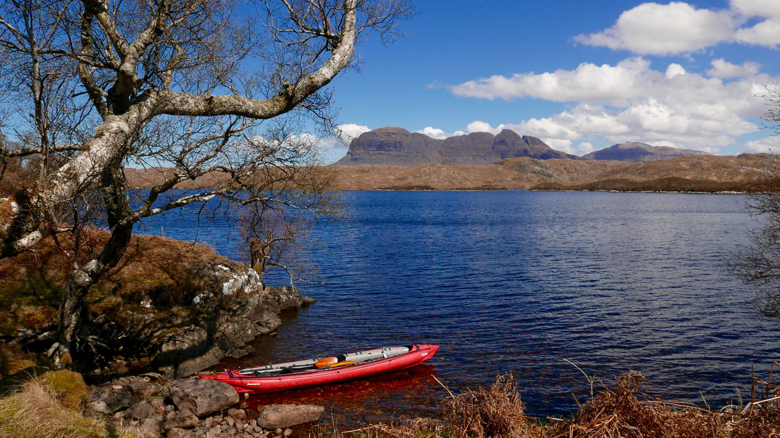
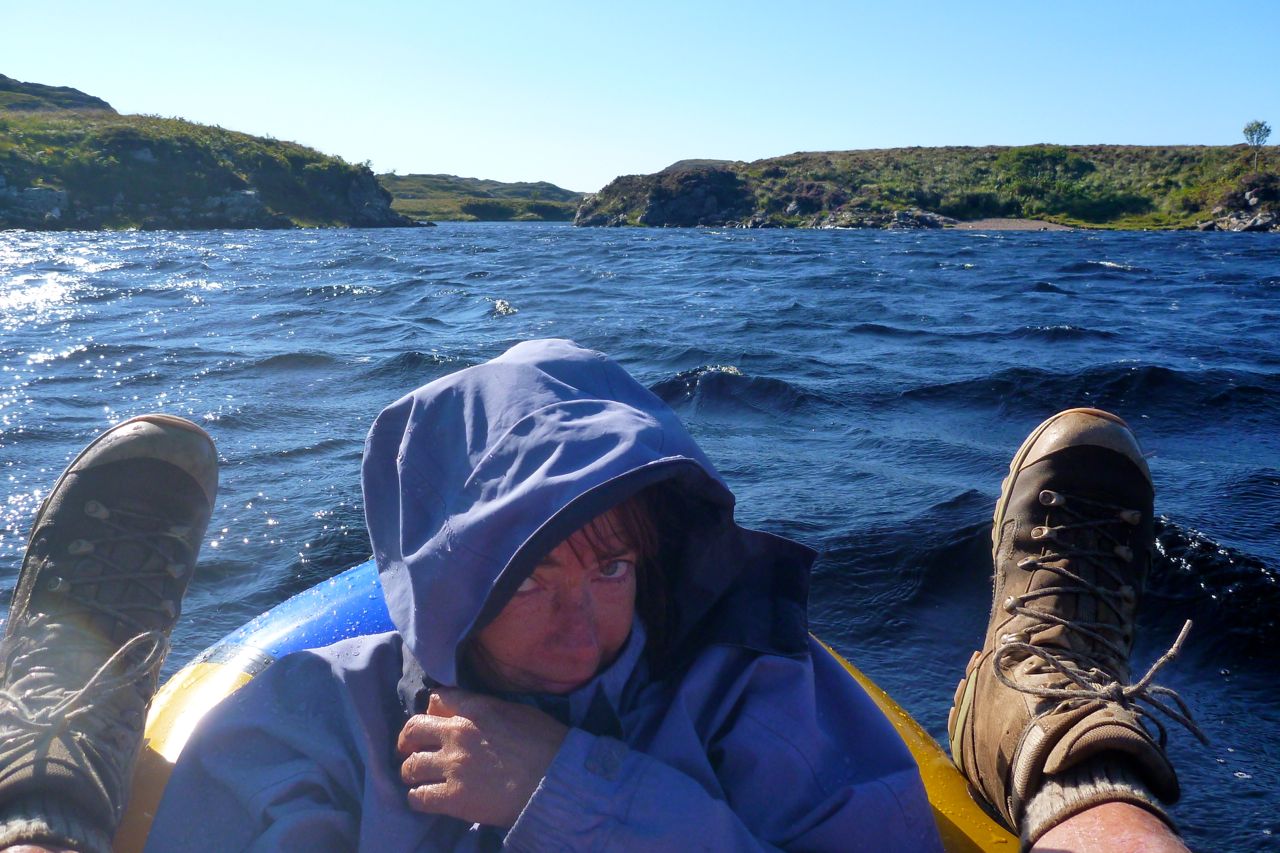
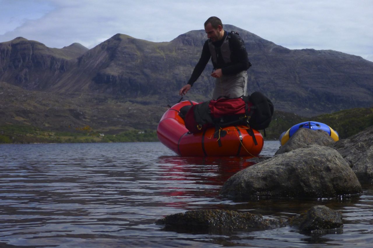
First paddle of the year and it’s nearly May! I need to get out more. It was a calm day but as we’d not been there for ages, we decided to go inland to the ever-reliable Loch ‘Sion’, spread below a cirque of dramatic Assynt peaks. From the lay-by on the WMR it’s a half-a-mile’s trudge down to the west shore at Boat Bay, dipping through the hazel woods then tip-toeing over rotting walkways spanning slimy quagmires.
Down at the bay – bother! The skeg, clipped to hull through a zip tie, was MIA. The zip tie had probably succumbed to the UV, as they do. Oh well, I claimed years ago these IKs are controllable without a skeg, let’s see if that’s still true.
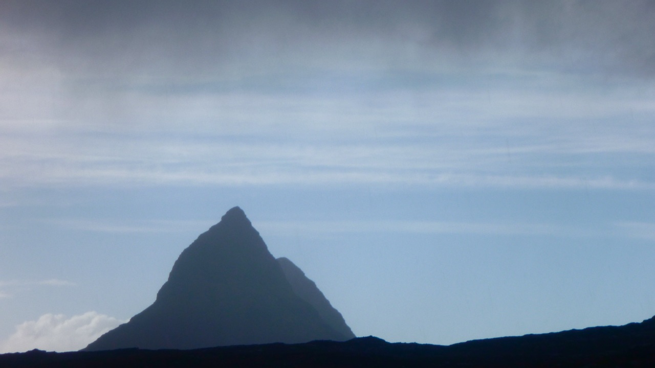
Below Suilven
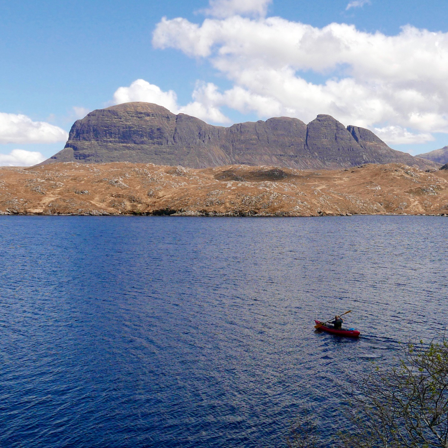
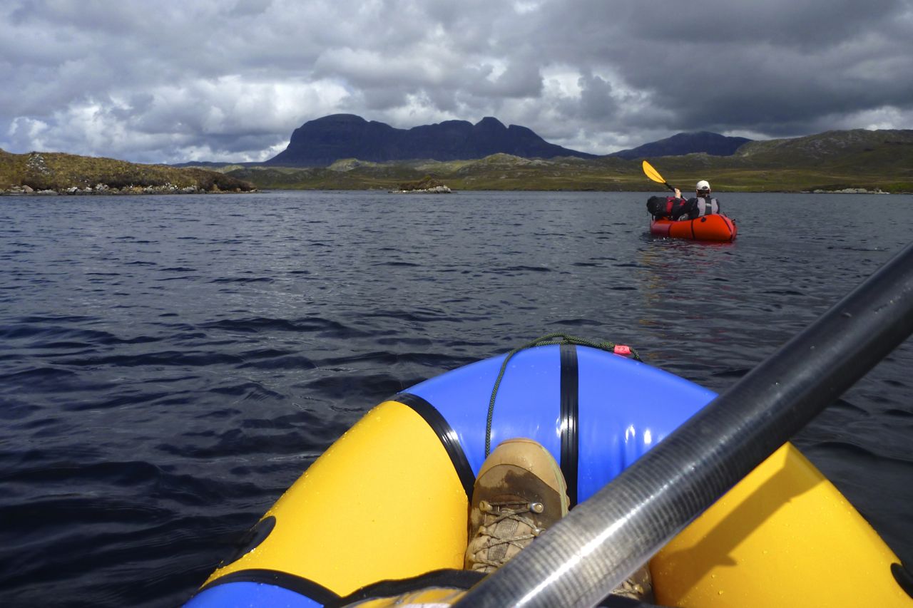
On a flowing river, finessing the paddle strokes while solo, it works well at the cost of some flat-out speed. But two-up and with a tail breeze – that aeolian nemesis of paddlecraft – we scratched a scruffy traverse out to the mouth of Boat Bay where it was quicker to let the funnelled wind push us out into the main loch. Suilven sat to the north, Cul Mor was straight ahead and the ever-popular Stac Poltroon was to the south where panting lines of day-trekkers were eyeing us right now, some with what I liked to think was mild envy. By and by we reach Eilean Dudh, the islet just north of Eilean Mòr, where I went for a solo spin to see if the boat was easier to track solo. It was a bit, especially once off a tailwind.
That done, we paddled over to Eilean Mòr, parked up on the east side out of the breeze and found a flatish, dryish patch where some woodsman had made a rudimentary camp. I went off for an explore through the mossy-barked woodlands, like something from a fairy tale, then up to the unusually bald summit which in a month or two will be waist-deep in thick, green ferns. or is it bracken? All around the heather-clad hills still clung to the tawny hues of late winter and the branches of gaunt, leafless trees, deformed by the prevailing winds, reached northeast like some toga-clad heroine in a Romantic painting. May’s reliably sunny spells will soon put an end to all this drabness.
When the time came to paddle back, set against the wind the skegless Seawave was much easier to handle and satisfying to paddle. In fact I got so engrossed in the effort that amid the perspectiveless blur of yellows and browns I missed the small entrance back into Boat Bay and was steering us west towards the Polly Lochs.
‘This doesn’t look right’. And I was right, it wasn’t. A quick glance at the map and a turn to the northwest delivered us back to the right shore. Back home, the skeg lay in the gravel by the wall alongside a broken zip tie. Have I mentioned tough, TPU RovaFlex reusuables yet?
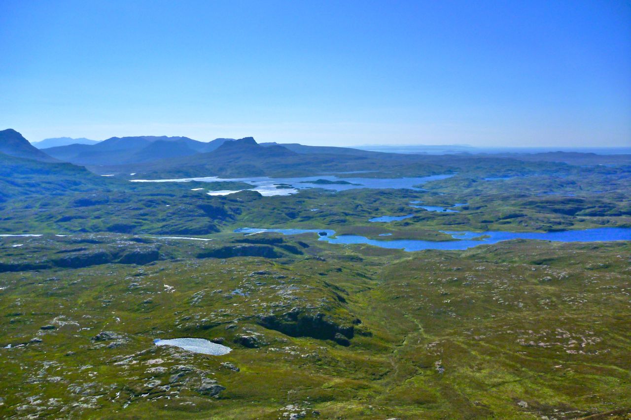
A fortnight later (that’s the frequency of sunny days up here) we looked down on a new perspective of Suilven and Eilean Mòr island from the windless 2800-foot summit of Canisp mountain, still clinging to the last of the winter snows.
Not much time for paddling at the moment, but with a staggering three days of cloud-free skies while the south had its traditional wet bank holiday, we had to down tools and go and do something. How about another walk over Suilven and paddle back – was last time three years ago already? The motorbike was left at Inverkirkaig, so this time it was just a paddle-and-boot ‘biathlon’.
With the car parked near Glencanisp Lodge, it’s about a 2-hour walk along the estate track to the turn-off leading up to Suilven saddle. On the way we pass Suileag bothy where Jon and I overnighted in May, tackling an Assynt variant on the Cape Wrath Trail.
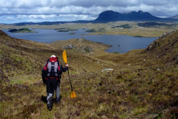
It’s only a mile and a quarter from the estate track to the saddle, but with the 430-metre rise, it takes up to an hour. The washed-out last few feet onto the 600-metre-high saddle are on all fours. Above at the back, Quinaig, one of the best of the Assynt mountain walks. No packraft required.
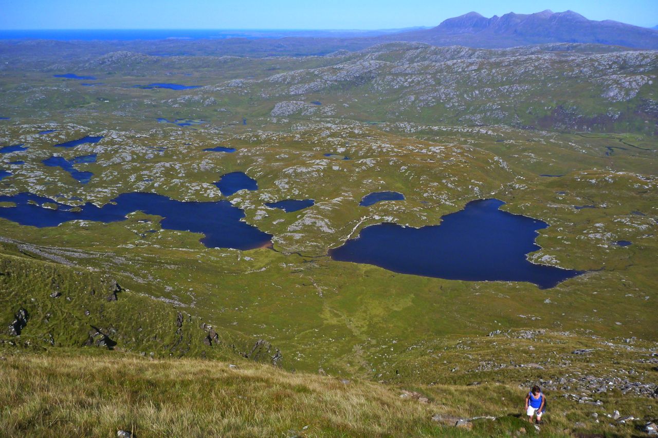
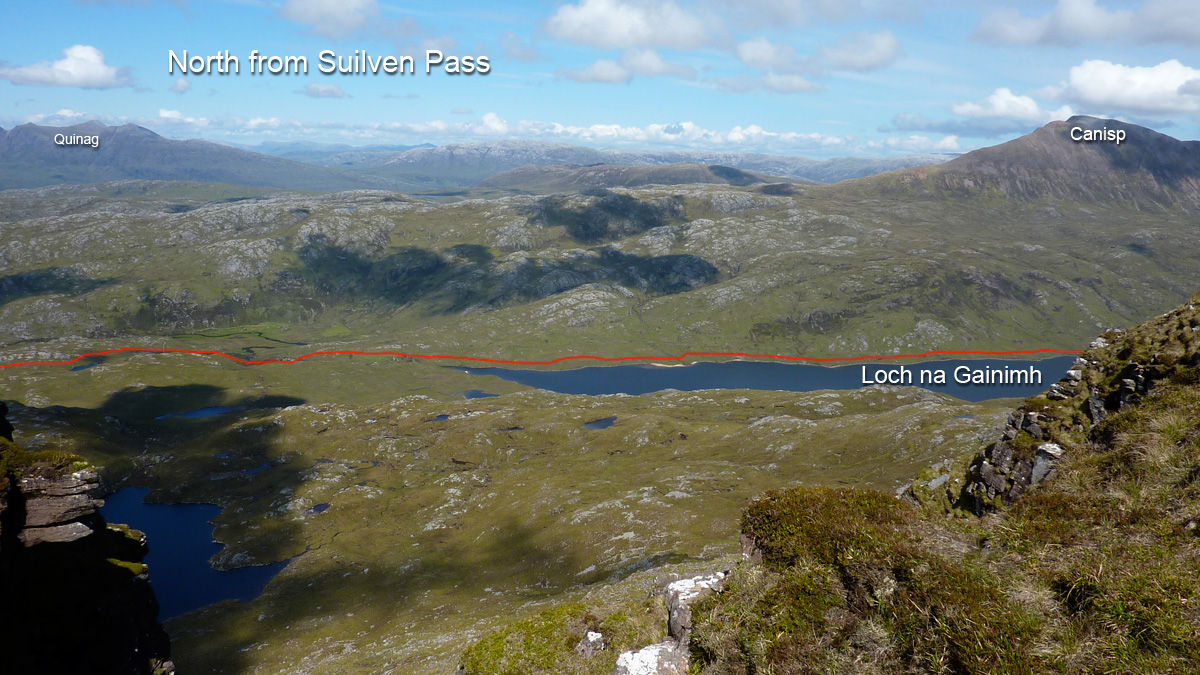
At the breezy saddle it’s quite busy – well, ten people or so – so we decide to lounge around and not visit the 731-m summit, nice grassy spot though it is. Far down below on Fionn Loch, we think we can see three canoes heading upstream towards the canoe camp alongside the rapids (more or less the middle of the picture, above). But they’re moving so slowly, for while I thought I was mistaken. Soon we’d realise why they were creeping along at about one foot a second.
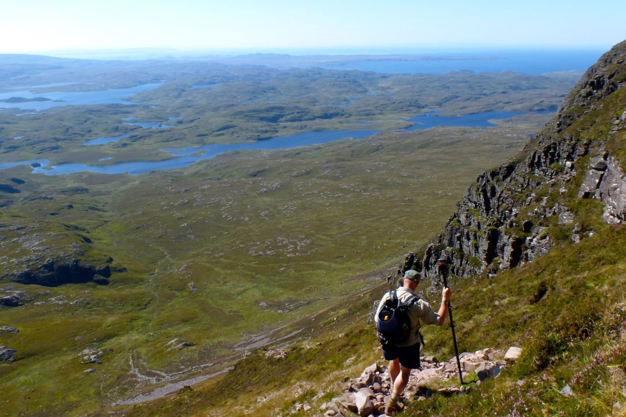
We set off down the exceedingly steep south side of the mountain.
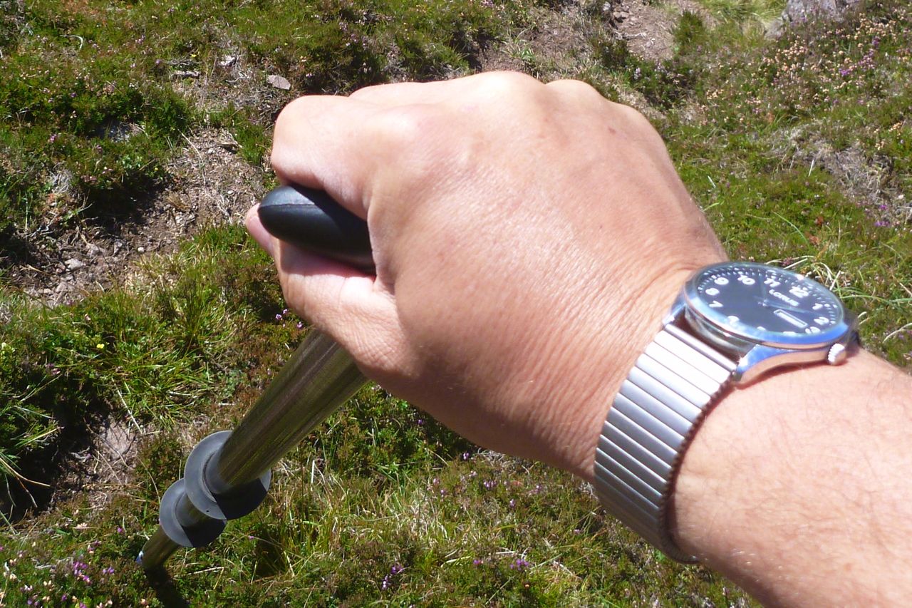
Here I get my first chance to appreciate the canoe-handle T-piece I’ve added to the end of my packstaff. It makes a much better support when inching down steep slopes, and the long packstaff can reach down a foot below your boots. Anyone would think I was going on about packstaffs again.
Coming off Suilven, the gradient begins to ease. By Fionn lochside a strong easterly is blowing and the packraft fills up almost by itself, even if the boat is on the verge of taking off. This looks a lot more than the 15-mph forecast. The wind will blow us downstream, but it looks rather gnarly out there, and we’re only at the ‘top’ of the fetch. It’s about a mile and a half along the loch to the river inlet and will get choppier downwind.
Visiting baboons might enjoy a view of my butt patch – glued on with Bostik 1782 and (appropriately) lined with gorilla-tape. Even though the 2014 Alpackas have a bit more back-end buoyancy (as we were about to find to our cost), for the weightier and lazier paddler, a butt patch offers useful protection in the shallows.
Did I say it’s very windy? And to make matters worse I’m rather careless about the weight distribution, forgetting how we did it last time in much calmer conditions. With the packs in the middle of the boat and the Mrs’ legs tucked in, instead of reaching back, the bow was noticeably low.
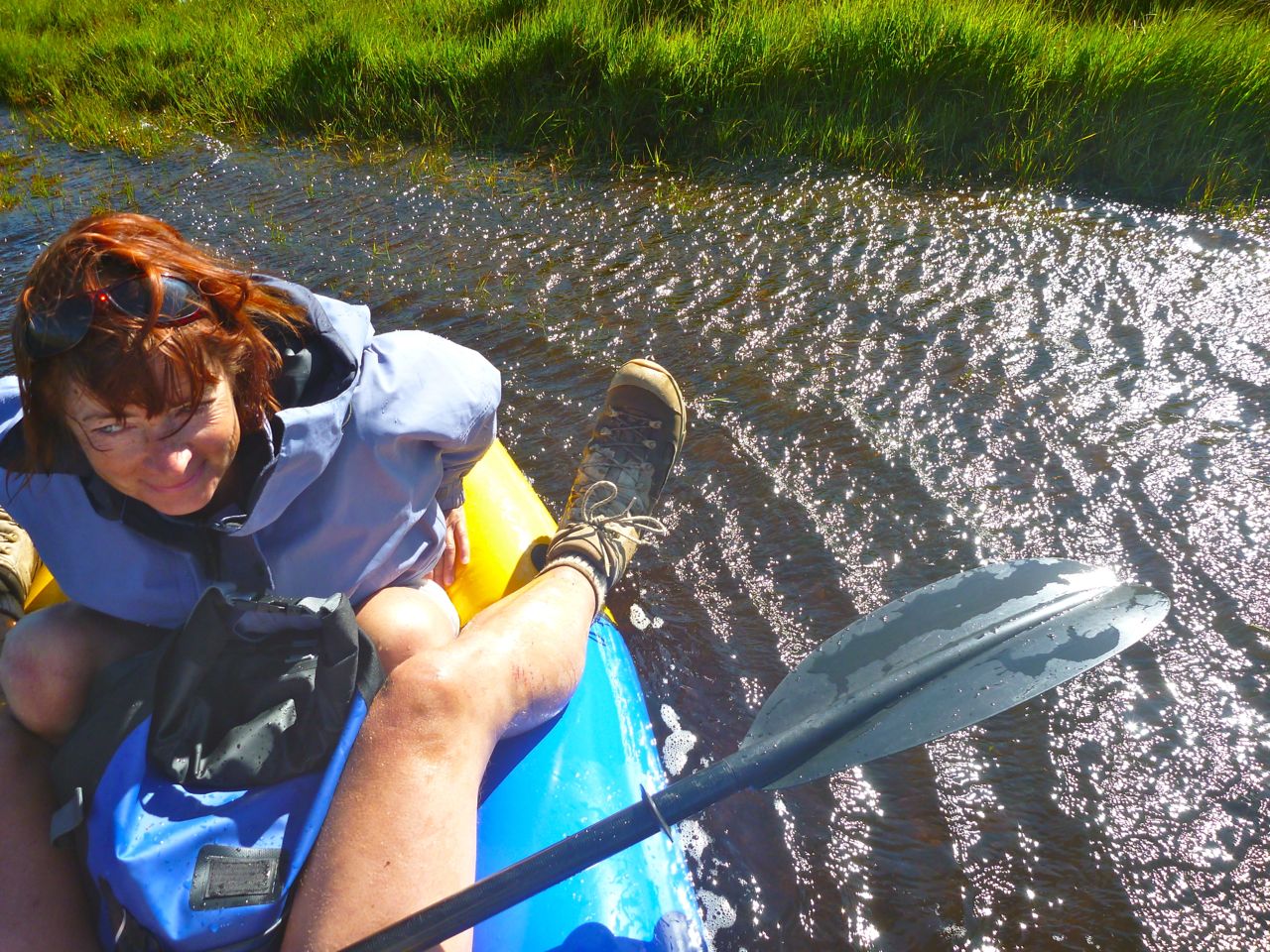
Once out midstream, the bow started swamping in the chop which was a little alarming. The restful 1.5-mile downwind paddle to the river inlet is abandoned. I tell the Mrs to lean towards me, and I paddle across-wind for the other bank. The odd wave splashes over the side.
We could have tried again with the packs on my back, but were a bit unnerved. As it is, two-up the boat was a little hard to handle in the wind, and we have no pfds. So the Mrs takes to the bank – a long detour around a lagoon – while I tip out the boat then allow the wind to whip me along the loch, pulling over to wait once every few minutes.
I’m not sure I want to engage with the wind funnel at the ‘narrows’ of Fionn Loch, as by now the whitecaps and chop are getting it on. Plus I’ve lost track of the Mrs. So I pull over and stagger over the bogs to see where she is.
Reunited, we’re effectively on the south side of the Kirkaig river, so are still going to have to paddle across to get to the north side for the regular path back to the car park. I recall the river entrance nearby is in another bay which will be out of the easterly fetch. With better thought out trim, that crossing should be less risky.
I know from previous experience that trying to carry an inflated packraft even five minutes to the bay in this sort of wind will be like trying to wrestling a pterodactyl. So out with the plug and under my arm it goes. That’s the great thing with packrafts: they’re as easy to paddle in as they are to walk with, though there’s probably a more elegant way of saying that.
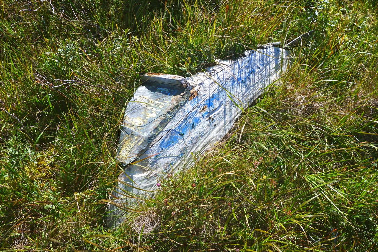
This rotting transom is all that remains of the last boat that came this way.
Another quick air up…
…and we set off across the small bay…
…for a small beach by the river entrance (above my right boot). Two up with the wind, I don’t want to get involved with the swift current flowing through the inlet towards bone-crunching waterfalls.
Back ashore I roll up the Yakpacka…
…and we set off for the 3.5-mile walk back to the bike at Inverkirkaig. And even here on the path the wind nearly knocks we over a couple of times. It was only an 11.5-mile day (10 for me on foot + 1.5 paddle), but by the time we get back to the bike we are pooped. Luckily, this year we have a lovely house to go back to.
I am slowly working my way through a western variant of the Cape Wrath Trail, a hardcore, unofficial Long-distance path that runs some 200 miles between Fort William and Cape Wrath. More about the CWT here.
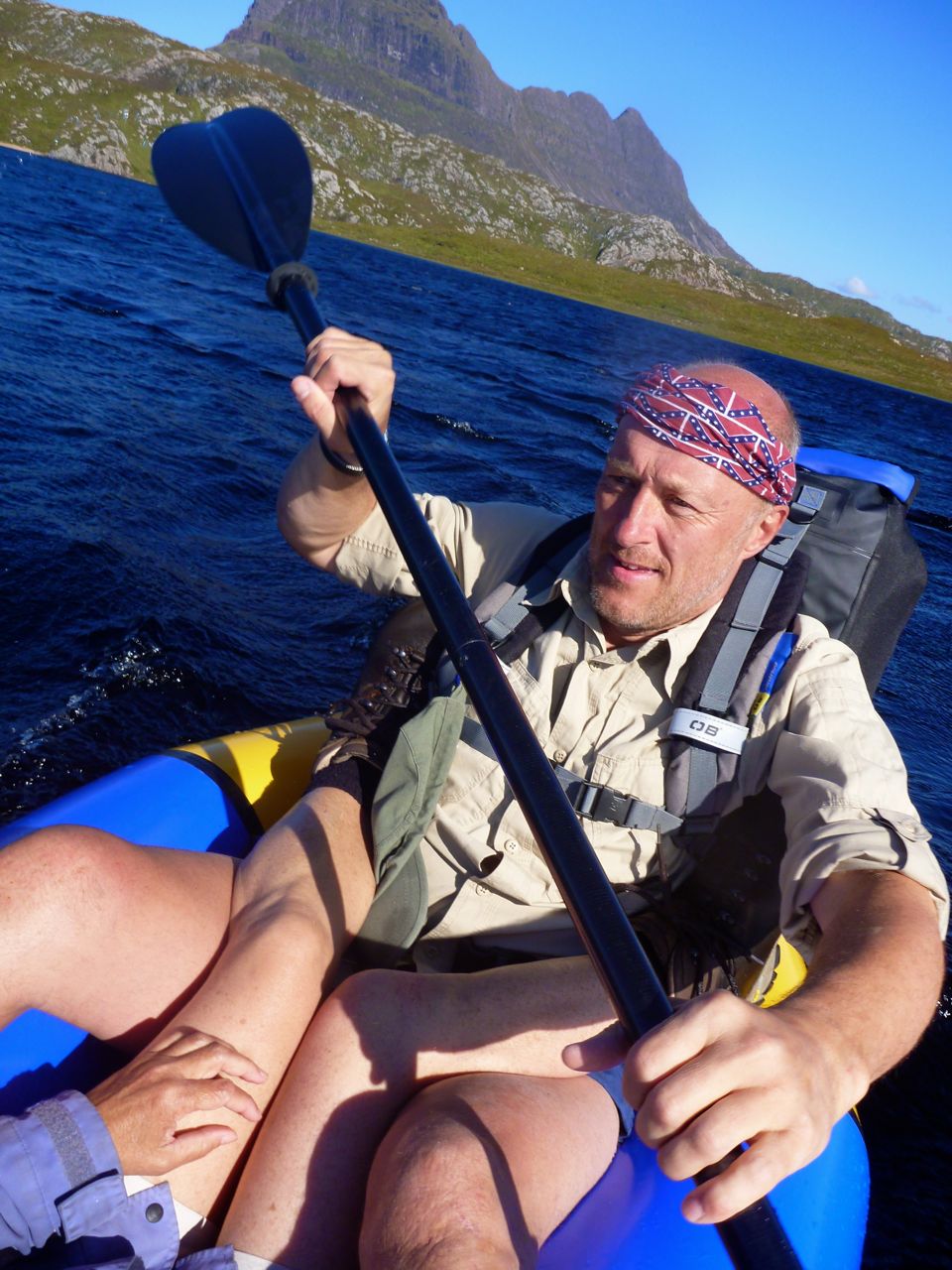
After scraping through the first part of the variant from Dundonnell in December 2013, I returned with paddlechum Jon to complete the remainder from Stac Polly mountain to Kylesku bridge where the regular route comes in from the east at Kylestrome. Following several humiliating episodes orchestrated by me in slackrafts, Jon finally saw the light and bought himself a red Alpacka Alpaca (the next size down from my Yak).
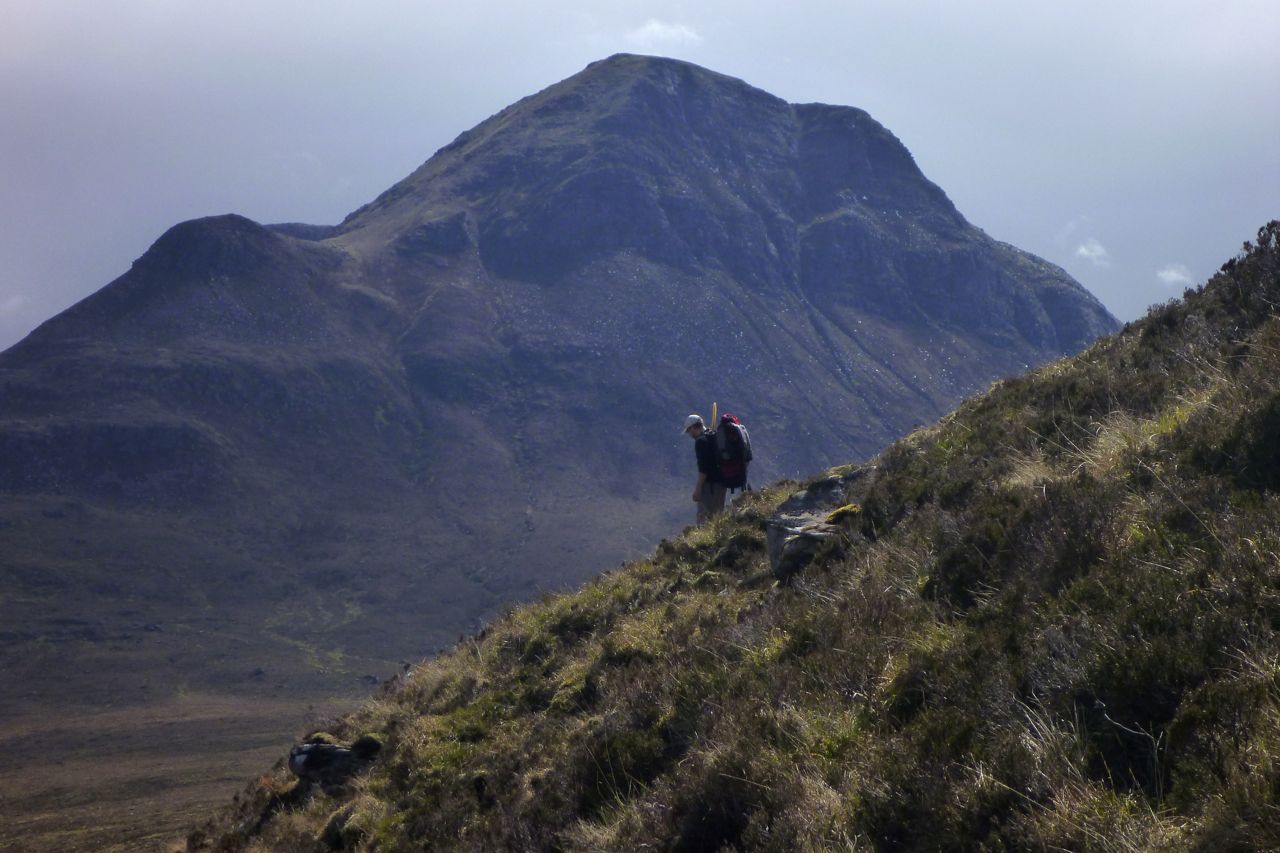
After kayaking around the Slate Islands near Oban I rode up to Achiltibuie on my very overloaded bike and met Jon at Di’s croft in Altandhu. We fixed up her electric bike, extended the goat shed then next day left a car at Stac car park (above) for our two-day paddle-walk to Kylesku. But things had already got off to a bad start: Jon had done his knee in on the previous day’s Etape Caledonia cycle race.
As a result progress was slow up the steep path onto Stac mountain and even slower once we left the path down the north side (above) for the trudge towards Sion’ loch. By this time Jon had recognised the value of using his hefty TNP paddle as a packstaff.
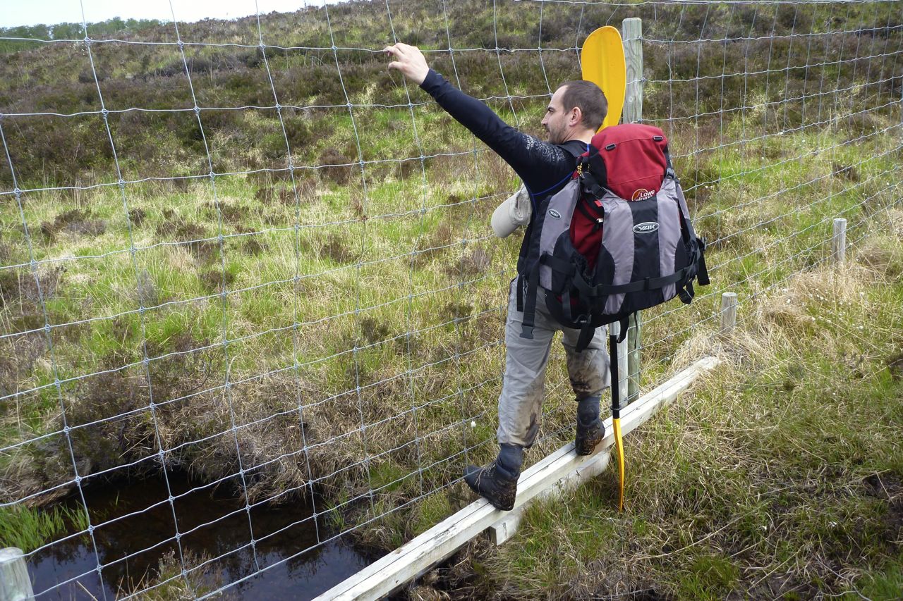
As the slope levelled off, ahead of us a deer fence cut through the scrub; we followed it until a stout corner post provided an easy hop to the other side. We were now heading directly for a bay with a small island to put in, but that was further than it looked, down small cliffs before dropping through an enchanting light birch woodland which the deer fence may have helped preserve.
While it was nice to come across the lost pocket of woodland, walking or boating, next time I think I’d take the Linneraineach path which starts a mile or so east of Stac. It leads all the way to the wadeable stream running into the loch (on the edge of the map, above) and is probably quicker and less effort. A walker would certainly be better off going that way instead of rising halfway up Stac and then down again, as we did. As it was, we were lucky that a recent dry spell had left a spongy crust on top of the saturated post-winter mire. On a few occasions that crust sheared away from the soggy underlay and sent me flying. Either way, this was packstaff terrain par excellence. Have I mentioned packstaffs yet?
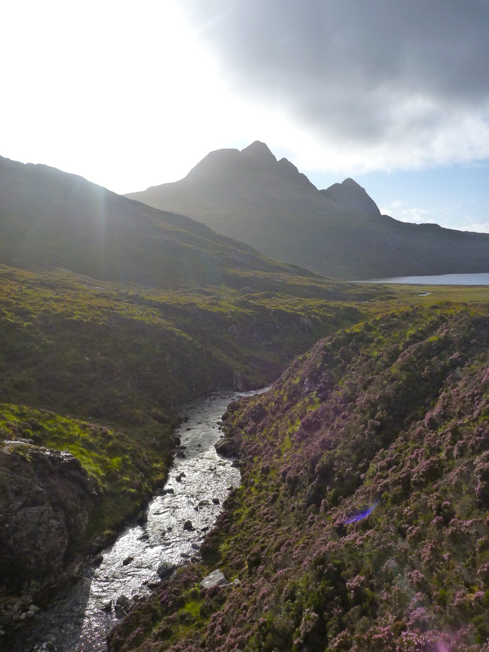
On the small beach at ‘Island Bay’ we pumped up our supple new Alpackas and paddled out north across the loch towards Suilven mountain, passing between small islets and landing an hour later for lunch near ‘Shielding’ on the map. Initially the northwest breeze put us at the fetchy end of the loch and we took on the odd splash. But even with a wet bum, from any vantage point you care to choose, with its ring of peaks, the primeval Inverpolly basin (below) has got to be one of northwest Scotland’s most dramatic landscapes.
Over lunch I measured up Jon’s red Alpaca against my Yak but could hardly see a difference (it’s 3 inches shorter inside and out). But Jon was having trouble getting a full draw of the paddle with his bag across the bow (mine was below my knees). It’s possible these newer Alpackas have more of a wave-riding upturn at the bow which makes any bow-mounted bag slide backwards. That, plus a need to adapt to a gentler but more frequent ‘packrafting cadence’ saw Jon’s red Alpaca lag behind my Yak. Later we swapped paddles which made a small difference – we should have swapped boats too to see if man or boat was the culprit. My 2014 Yak has the slightly longer stern, but paddles much like my old one.
From Shielding we walked over the pass to Fionn Loch directly below the south wall of Suilven. As before, some canoeists were camped by the Uidh Fhearna river crossing (a deep wade for a walker; right), practising their moves and barely noticed us slipping into the water from a reedy lagoon. Once on the north side we found an oddly deep channel which led inland for a hundred metres saving some tussock and bog walking.
Rolling the boats up, I tried to persuade Jon that the seemingly vertical clamber up Suilven’s south face would be excellent knee therapy, but he wasn’t buying it. He had ten weeks to get into shape for a four-day trans-Pyrenean ride and didn’t want to risk it. So we set off north below the western prow of what the Norsemen called ‘the Pillar’ (below).
The 50k map doesn’t show a series of gradually ascending ups and downs over ridges running parallel to the mountain. With Jon’s paddle-supported hobbling it took an hour and a half to get to the high point where a view of our next challenge – Quinag (below) – revealed itself across a string of lochans.
Soon we caught a view of Suileag bothy far below but the terrain got gnarlier still, winding around lochans, small passes and down steep slopes. Somewhere here Jon chose to follow an indirect low route to spare his knee and somehow managed to sneak past me while I scanned from a high point for half an hour, trying to track him down. He was behind me all the time, kettle on and yellow paddle resting by the bothy’s doorway as a marker. I needlessly paddled over Loch an Alltain Duibh, assuming the river gully just upstream would be too awkward to cross. In fact Jon had found it an easy ankle wade.
In hindsight I’d say the path climbing up and down the saddle of Suilven to pick up the jeep track west to the bothy wouldn’t have been much slower than our route around the mountain’s western prow, let alone the added appeal of taking a quick detour from the saddle to Suilven’s western summit. Since we did this, the path on the north side of the mountain has been improved.
Suileag bothy is one of the tidiest I’ve seen, clean and basic with a fireplace and water from a nearby burn. It’s so much more agreeable to barge into any bothy and spread out like a normal person, than crawl around a tent like an invertebrate.
Next morning we followed the path north over a pass for two or three miles to the footbridge over the River Inver to Little Assynt; all up much quicker going. At the footbridge we carried on west then north, over another deer fence and ankle twisting tussocks to a beach beyond the sluice where Loch Assynt drained into the river.
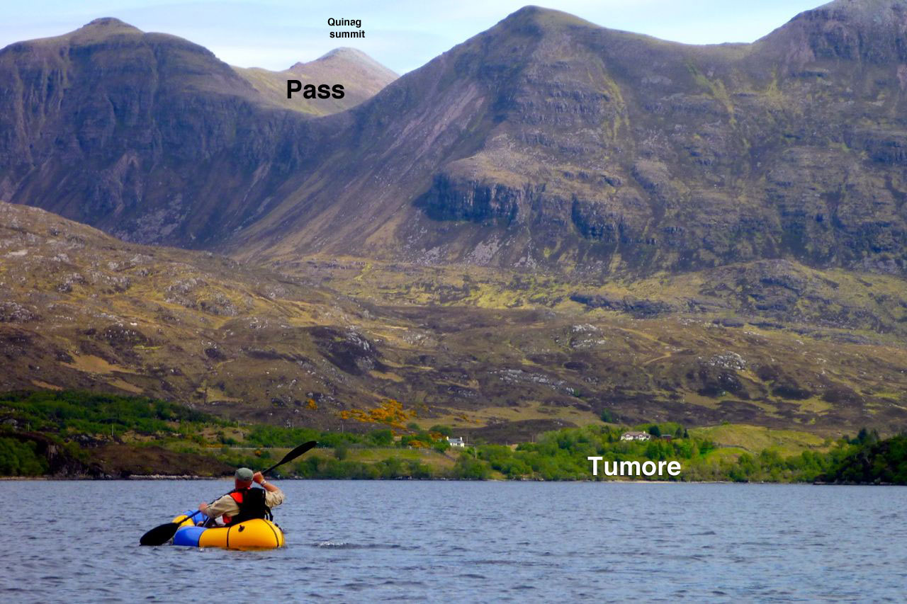
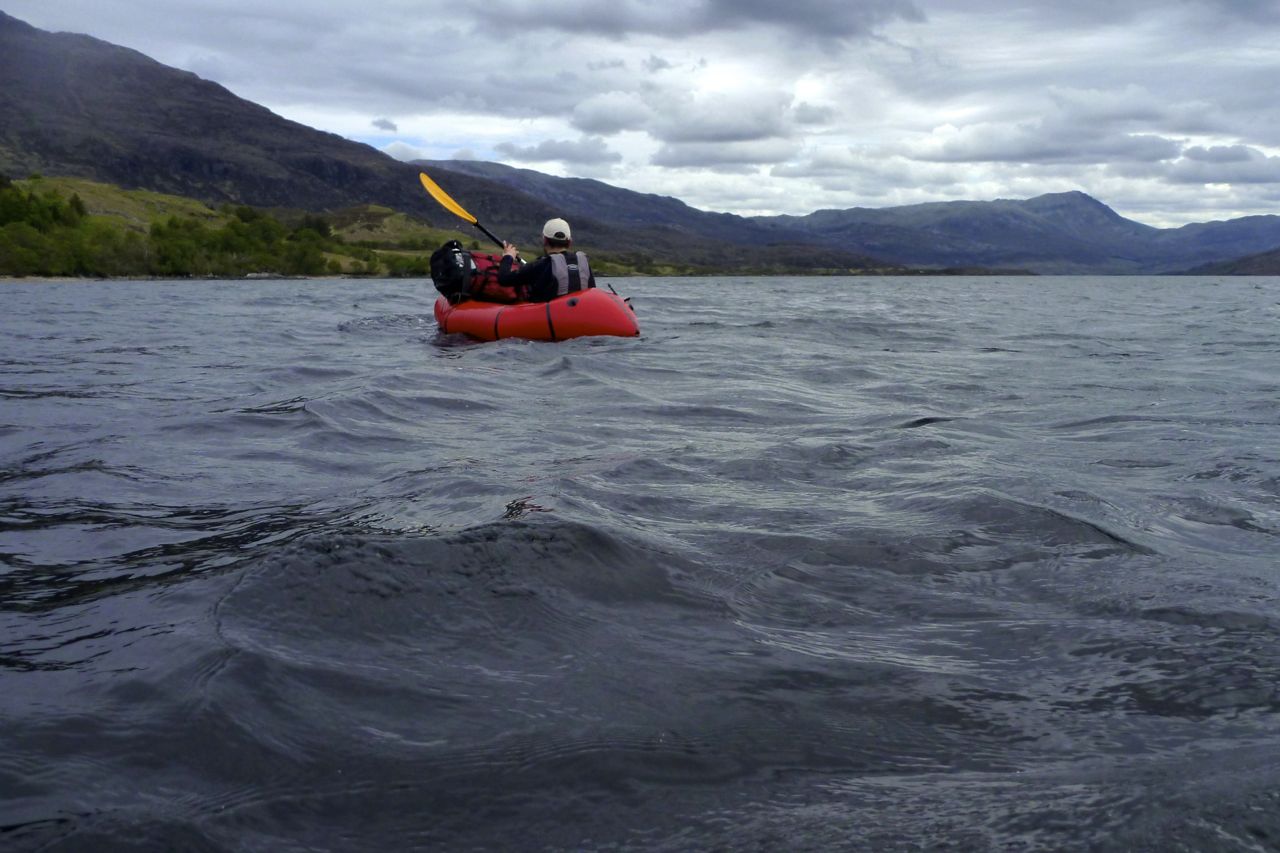
Up ahead loomed the mass of Quinag mountain (above) and Jon and I debated the feasibility of tackling the Bealach a Chornaidh from the pathless west side. Leaving the Drumbeg path, a slope leads a kilometre and some 400m up to either a harmless scree bank or a lethal cliff. It was probably the former but too much for Jon’s gammy knee. We finished off our food under a gale-bent birch below Tumore and, as the wind was with us, decided to paddle Loch Assynt east to the road junction instead. The back way up Quinag pass would have to wait for another time.
On the water the southwest breeze wafted us helpfully down the loch, though the Alpaca was still notably slower despite my helpful demonstrations on how to paddle. I really ought make one of those instructional dvds, like Jane Fonda. Once ashore all that remained was a seven-mile road walk to Kylesku by which time the forecast wind and rain had caught up with us.
On the road walk I eyed up the terrain northwest of Quinag massif. It looks like the planned orange path shown on the map above would have been another convoluted cross-country struggle, even if it was a more direct line. Leave that to the crows and follow the regular path down from the pass east to the road (unshown on the map but it’s there). And that was the lesson learned on the land stages of this CWT variant. While there may now be a right to roam across the glens and bens of bonnie Scotland, who in their right mind would want to do that for any longer than necessary? Even wild animals develop paths; it’s less effort and happens to be quicker, even if it’s not a direct route.
Lured by the promise of a free meal at the hotel, Di drove up right on time and took us the last mile to Kylesku where a TV crew happened to be recording the retirement of the postmistress following no less than 61 years on the job.
So, my summary for this nearly completed CWT Assynt variant? For a boatless walker, once over Loch Broom and in Ullapool, the Postie Path is a dramatic way of getting to Achiltibuie where there’s a hostel, pub and shop. Over the hill it’s a major wade across the Narrows of Loch Lurgainn after which I’d recommend the Linneraineach path between Stac and Cul Beag to the stream before the long cross-country trek to a shorter wade across the Uidh Fhearna river at Fionn Loch. From here take yourself up and down Suilven’s saddle, then from the bothy take the track to Little Assynt footbridge. From here it’s a two-mile road walk to Tumore where you take the Drumbeg path before breaking off up to the Chornaidh pass and down to the road using the path to get you there. With a boat the Narrows can be paddled, so can Loch Sionasgaig, cutting out a long cross-country yomp. Another quickie over Fionn Loch, up and over or around Suilven and paddle the west end of Loch Assynt to Tumore from anywhere north of the sluice. Job done.
As far as I can tell, there are few other places on the regular CWT path where a packraft is worth carrying (which is probably why the path goes that way and avoids the Assynt). Except of course to get across the Kyle of Durness sea loch after the walk’s finale at Cape Wrath, if the boatman is not around and you don’t fancy the detour to the head of the loch. The image left from a few years ago must be a very low tide, but as you can see it’s potentially just a swim of a few metres. Eight years later I finally got to paddle the Kyle (below).
Crossing the Kyle of Durness; Cape Wrath headland behind
A photo I shot exactly a week ago as we walked over the Coigach peninsula having paddled Loch Lurgainn narrows. We’e heading towards Achiltibuie for a cup of tea (right). Notice how Robin’s hair melds magically with the mid-winter bracken. Must be a form of archaic Celtic camouflage carried through the genes. From the far back left coming forward and right, the amazing mountains of the Assynt: Quinaig (‘Kun-yak’); Suilven of course with Stac behind Robin and Cul Mor on the far right. All great climbs. It was the weather the day before (left) forced a change of plans. Full story with more pics evolving here.
I’ve already done a couple of great packrafting excursions around the charismatic mass of Suilven mountain (left, viewed from the east). Last year we did a ‘triathlon’ loop up one side and down the other using bikes, feet and two-up in the Yak; and before that I did an overnighter from Loch Sion to have a look around. That second link has an intro to the region you may like to read.
So you’d think I’d know the local pack-potential well, but looking yet again at the map, I clocked an interesting if lengthy day out, packrafting around Suilven. I could walk east out of Inverkirkaig past the Falls to Fionn Loch, then paddle several miles of continuous water south of the mountain to cross a headland and then another short loch. From there I’d turn back passing a couple more lochs to Lochinver back on the coast. That was around 23 miles, plus another 3 or 4 back to the motorbike at Inverkirkaig. An eleven hour day for sure so unusually, I packed a torch.
The day of least bad weather arrived (today’s grim weather, right): overcast and 12°C with winds building up to 25mph bringing showers and afternoon sunshine. It would have to do; the rest of the week was forecast as much worse and at least I’d have backwinds paddling out.
Should they become hard to handle I knew I could hop ashore – that’s the great thing about packrating. But I also knew that cross country hereabouts is usually a gnarly combination of boot-sucking mires, moss-clad boulders and ankle-snapping tussocks of clump grass. Unless you’re a ground slug or sport a rack of antlers, when off piste in the trackless wilds of the far northwest, you’re often better off in a boat.
Nine 15 and I was out of Inverkirkaig with two fat sandwiches, two bananas and a cup. The thickly wooded valley with it’s not quite paddle-worthy river rose up to the 60-foot Falls of Kirkaig, but with filming and whatnot, it wasn’t till 11am that I paddled onto Fionn Loch (left) under a ceiling of thick cloud on the verge of incontinence. The rounded west prow of Suilven loomed above, trailing its cone-like tail like the giant goldfish in the Singing Ringing Tree.
I was reversing the section we paddled last year on the triathlon, and at a narrow point passed some small standing waves indicating a current flowing back to the river. Hmm, strange I thought. Approaching the mile-long narrows which maps call Uidh Fhearna, it was a stage which I’d somehow got into my head flowed eastinto Loch Veyatie, based partly on this picture I took last year. Turning south round a reedy bend and fighting what I thought was just the headwind, I took another turn and, like some astonished Victorian explorer, found the water flowing west, right at me. Of course it does. At the other end Loch Veyatie, Cam Loch drops through a series of waterfalls, and if Fionn here did the same, where did Veyatie drain – down some tectonic plug hole? There would be no Fellowship of the Royal Geographical Society for me this year.
Even with a backwind, there was no paddling up this Uidh (left), though I’ve read of hardcore canoeists poling it. So I unplugged the Yak and set off along the north bank to the far end where the Uidh opened out onto Loch Veyatie and lost its current. With no free ride to help outrun the afternoon’s predicted winds, my schedule slipped away. As the OS map shows initially, there’s a path as far as a stream a mile away. Who knows why, maybe that’s where folk fish, but of course the path itself becomes a mini river. I should have worn my long Seal Skin socks today, the short ones were already sodden but they still kept my feet warm. After fording the river I decided to continue cross country until it became too hard. That took less than 20 minutes by which time I’d already stumbled twice and, while negotiating one steep bank, actually feel a few feet into the loch! Luckily, no damage done so just up ahead I set my sites on a beach to deploy the raft. It was now 1pm and with that walk covered at around 1.5mph and getting slower; better to get on the water. But first, for amusement purposes I filmed myself from unrolling the Yak to paddling away. It took 8 minutes, something that you’ll see below is made a little less boring to watch by speeding up fifteen times.
An exposed hour’s paddle down Loch Veyatie ensued. I turned out of the cove into the wind, hurrying for the south shore to get into the southwesterly’s lee until the next narrow point where I’d cross back to the windier north side to line up for my take-out. As I passed across the mouth of the sand-spit inlet of Loch a Mhadail, gusts blasted out fetching up some whitecaps. It’s all in the mind of course, but I really don’t enjoy bobbing about alone, mid-loch and out of sight on a chilly September’s day without a drysuit or PFD. One good thing with the Animas backpack I was using for the first time was that like my UDB, it doubled as a reliable float bag. Although there was virtually nothing in it bar my lunch and a cag, that was the reason I sealed it full of air.
The overhead gloom and rising wind was eating up a lot of nervous energy, but that wind was also pushing me along at what turned out to be 3mph, more than double what I’d have managed staggering along the shore, and more direct too. Another reassuring surprise was spotting the buildings at Elphin on the A837 at the head of the Loch. I’d forgotten how close I’d be getting to the other end. Paddling with the wind past the south shore, cascades ran off Cul Mor and scraggy patches of original woodland clung to the foreshore. I counted them off on the map as markers to my take-out, and with a dash over to the north side, that came up just as it looked on Google Earth last night. What a great WYSIWYG navigation aid GE is. Let Google harvest all my dreary browsing data to throw back at me as targeted ads. It’s a price worth paying for their sat mapping services.
It was only when I crawled out of the boat and stood still that I realised how strong the wind really was, roaring over the hills and bating down the grass. Even though it was less than a mile’s walk to the other side of Creagan Mor headland, there was no chance of leaving the Yak inflated. Instinctively I headed for higher ground, scattering some deer far ahead, but my route soon led to a cliff so I dropped back into the bog and tussock valley that brought me to Cam Loch’s shore. Here I felt I could relax sufficiently to eat something. My cup was MIA, out on the loch somewhere, so I scooped up a drink by hand.
One more loch to cross; easily done no matter how windy it’s become. Somewhere on the north side the map promised a path that led 12 miles back to Lochinver. All I had to do was slot myself onto it and ride it out for as long as it took. Whitecaps rolled passed me as I neared the north shore of Loch Cam, but what had had an edge of dread on Veyatie just an hour or two ago was becoming familiar and a bit of a laugh as the promised sun stuck its nose out for a sniff at the day. After airing down I soon hooked up with the stony trail, but found I was wavering a little, probably through not eating or drinking enough. It was now 3pm; six hours on the go but I’d only actually walked some 4 miles up to that point, so the legs had plenty left in them and there was drinking water running down the paths.
On occasions I’ve harboured thoughts of cycling this path from Lochinver to the A road, but from the state of it at this end I’d not get 10 feet. It followed a hard, white rim of exposed stony rubble that’s visible on a sat image, but I suppose was better than the mush to either side. Light grey and crystalline, I’ve since read it’s Lewisian gneiss or quartzite which gives the appearance of snow to some of the Assynt’s mountains like Canisp or Foinaven (see long image below). This whole region is marked with monoliths, the most striking of course being the remnant sandstone outliers like Stac or Suilven which resisted their brush with the glacier’s claw as it passed through, exposing the ancient base of lighter coloured gneiss.
I’ve kept missing the interesting ranger-led talks at Knockan Crag, just south of Elphin, he site of the Moine Thrust which literally turned geology on its head a century ago.
A sunny and a warm day, so although I was still feeling a bit groggy following a cold, it was high time to enact a mini-packplan: head out to Inverpolly and string together some of the lochans on the west side.
I’d nipped out there a few days earlier to check the lie of the land and try out some used Jungle boots, and although the maps warned of sluices, it all looked doable from the hillsides above.
And judging from the terrain I crossed to get there, it would be a whole lot easier to paddle than to walk. At the end of this paddle my shins were all scrapped bloody by dry heather stalks and other brush. Some sort of plain canvas gaiters are needed to walk across this stuff, even in long trousers. More gear… sigh.
The Mrs had nipped off to Handa Island with the car, but it suited me fine to cycle out to the lochans by the fish farm on the WMR to Lochinver. I stashed the bike behind an old shed in the woods and walked on up the road.
Loch Call‘ where I’d chosen to put in isn’t visible from the WMR which explains why I overshot it a bit, but a splash in the loch to cool down followed by paddling to the north end lined me up for the path down to Boat Bay. It’s one of only two paths I know of to access the lochans. But why were my arms so weak? it was only a cold for goodness sake! I decided to scoff all my sandwiches in the hope it was food I was needing.
Paddling out of Boat Bay the wind was firmly at my back and I sped along at an effortless 3mph+, and noted no ‘weathercocking’ (back end swing-round) as you can get with a kayak without a rudder or skeg. A packraft is a whole different thing of course, with all the weight in the back. If anything, going into the wind sees the lighter front come round if you stop paddling briefly. That same 10-15mph wind that pushed me along would probably be in my face when I turned the corner into Loch Sionascaig (above) and headed southwest, and sure enough it was, but not enough to spoil my day. The sandwiches were kicking in by now and I shovelled my way towards the first sluice, surrounded by the three mountains of Stac Polly, Cul Mor and of course Suilven, which give this paddling location it’s unique character. How wonderful it is to be out here in the wilds, fanned by a warm breeze and for once not being chocked from all angles in faux-breathable, latex-trimmed wet wear. This could almost be France or Scandinavia in a heatwave.
First one, then a couple more fishermen cropped up, standing alone on the banks, dipping their rods and exuding the usual unfriendly vibes. How did they even get there, I wondered? Not looking intrepid enough to have tramped over the hills, they must have paid their dues and been dropped off by the Inverpolly Estate’s boat from Boat Bay. Then a bloke comes round the corner paddling a yellow inflatable bath and threatens to put the wind up their trout.
I neared the sluice (above: from above; left, from the south) at the southwest corner of Loch Sionascaig. On my Suilven overnighter a few weeks back, I’d noticed something white hereabouts while on the way back to Boat Bay from the north side of Sionascaig. Turns out they were just big white bags of rocks left over from shoring up the crumbling sluice wall. Most of the water pours though holes in the wall but even then, considering the size of Loch Sionascaig, there’s no danger here of getting sucked into anything nasty at normal levels. Should the wall fail, that could be another matter.
It’s about a 10-metre drop (above) into the steep-sided Loch Uidh which leads to a gap. Here as expected, the wind was funnelling but was counteracted by a slight current running my way. This soon ended at another crumbling sluice that might have been runnable (below). I came right up and had a good look but decided the raft was too wide to make it down the chute and one-foot drop without me making a mess of myself, and I had to get out soon after. So I walked round and down alongside a series of torrents to the last paddle, Loch Na Dall. This happens to be linked by a short car track to the WMR (not on the map); a good take out if you’re in a canoe.
Although I’ve read of canoeists paddling the slim lochs below Suilven, portaging over to Loch Sionascaig and hoping to follow the Polly all the way to the sea at Polly Bay, what follows from Loch Na Dall isn’t really worth the portage, even if you’ve had a great time up on the main loch. It’s an ankle-twisting haul on a bumpy paddle all the way down to the fish farm, and the one kilometre downstream section after the road bridge at the fish farm (sluices and strainers) to the sea may well raise frowns from the Estate. But perhaps in winter, with the higher water levels you’d need for a clean run, no one’s bothered. Anyway it pays to remember: this is enlightened Scotland where outdoor access is a legal right, though always best combined with common sense. I’ve spent the last couple of months enjoying this freedom up here so it’s worth spelling it out: The Land Reform (Scotland) Act 2003 “You can exercise these rights, provided you do so responsibly, over most land and inland water in Scotland, including mountains, moorland, woods and forests, grassland, margins of fields in which crops are growing, paths and tracks, rivers and lochs, the coast and most parks and open spaces. Access rights can be exercised at any time of the day or night.”
Back to the packrafting. The south end of Na Dall was asprout with grassy reeds which created a briefly exotic paddling sensation. At it’s end the river dropped down into the valley, but there was no tell-tale roaring and the contours on the map suggested it didn’t drop immediately. So after peering from the intake, I dived in with blades churning, only to get hung up on a rock at the first drop. Free from that and on the move, the underside of the plucky Yak whined periodically as it slid over successive obstructions; another high-centred hang up, another clumsy, butt-pivoting, paddle-bashing extraction, gaining nul points for style. That led to a breather in a pool and then another frothing drop, the camera by now sagged from the jolting. It had turned out to be a couple of minutes of unexpected action, but up ahead there was that ominous noise and I knew it was time to hop out ahead of a series of stony drops (below). I rolled up the Yak and tramped back down to the valley and the bike shed.
Riding back over the hill to Osgaig Loch at a quarter of the speed I came down it earlier that day, there’s a hoot from behind. ‘What!?’ I snapped, eyes stinging with sweat. Another hoot ‘WHAT!?’ Ah, pardon me, it’s the g-friend back from Puffin World while I’m puffing away in two-one, as red as a puffin’s beak and as sweaty as a sauna full of guillemots.
‘Want a lift, puffinboy? You look a bit hot‘.
I was actually anticipating the freewheeling rush down to Osgaig Loch where I’d had half a mind to try rafting the bike over to the other side. Never tried lashing my bike to the bow of my packraft before – it seems an awkward thing to strap down securely, but others have managed fine so it needs trying out once. Something for another day. We hooked the bike up and drove home.
The forecast was good and with time running out, such days cannot be ignored. ‘Let’s go and do Suilven‘ I said to the Mrs. ‘Better still, let’s take the bikes and the packraft, park the car at Inverkirkaig, cycle to the trail head, climb up the north side, down the south side, and paddle Fionn Loch into the River Kirkaig for the footpath back to the car to get the bikes.’
‘What was the last bit again?‘
It’s a hilly 6-mile ride from Inverkirkaigalong the WMR and up to Glencanisp Lodge where the road ends. From that angle Suilven rises like a sperm whale’s head over the gorse and lochans. Maybe it was the sunshine, but Glen Canisp that day looked like something out of a Scottish Tourist Board advert, and was made all the more appreciable by the easy quadbike track we followed east. One time that would be great walk to follow the 14 miles all the way through to Cam Loch and the A835 near Ledmore.
Of course, as ever these days, I was eyeing up the pack-potential of the Abhainn na Clach Airigh river too; actually string of easy lochans and gorges (left), linked with flat or frothy river stages. That too would be a great run, more probably from the Ledmore end, and with a handy bothy at Suileag. Or cook up any combination you like; with boots and a paddle the possibilities here or anywhere in northwest Scotland are infinite.
There comes a point directly north of Suilven’s twin-peak saddle (right) where you have to leave the easy track and head south into the bogs and up. You can’t see a path up the side of Suilven, but it pretty much follows the creek running down from the saddle; an hour and a half’s slog from the quad track that’s as steep as any track can be, without using your arms. And yet, as long as you keep chipping away (left), it’s always quicker and easier than it looks. And it’s quite a thrill to approach the saddle and have the Loch Sionascaig vista erupt before you (below right) as you catch your breath.
G/f decided to rest here while I took on the last 130 metres up to the summit, about 20 minutes away. For some reason a ‘magnificently pointless’ dry stone wall straddles the summit ridge near here. A quick look on the web came up with no convincing reason to its origin, though it does extend downwards enough on each side to stop agile stock either leaving or getting to the summit. And on the actual top there’s certainly enough room to graze a few sheep as well as curiously closely cropped grass. We’d not seen a sheep all day so unless deer make the climb you do wonder what grazed the grass up here? More Suilven summit mysteries.
From anywhere up here we could see the way back; the put-in near last week’s camp and the 2-odd miles along Fionn Loch to the entrance of the River Kirkaig (left). These waters define the border between the counties of Ross & Cromarty and Sutherland. While I was planting the flag, G had been scanning the scene below with binoculars and had spotted the waterfalls on the River Kirkaig we very much did not want to get sucked into.
We set off back down the looser south side slope, don’t want to go on but it was another validation of the knee-sparing Packstaffing Way. Without it it’s hard to see how anyone would not stumble or slip a couple of times. Passing the spot I reached last week, strange barking sounds emerged from the heather. A grouse in distress? Turns out G with better eyesight had seen a couple of dashing deer right in front of me.
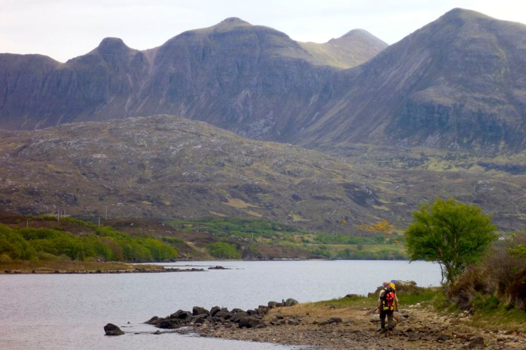
Down by Fionn Loch I wasn’t convinced two-up in the Yak was going to work or be safe. But we tried fitting in on the bank and in fact it was roomy enough with my legs out over the sides. So we put in and pushed off west across the loch (left) for the river, initially following the shore. Then as it became clear the 3-kilo boat-in-a-bag managed its 160kg (350lb) load fine, I set the engine for full ahead against what I perceived [incorrectly] was a slight current as well as a breeze. Amazingly (or perhaps not) I’ve never seen my packraft track so well with the near-perfect trim.
About 40 minutes later the entry point to the river loomed, with a mild rushing sound caused by the race of water flowing off the loch. We were a little edgy, knowing a deadly waterfall lay not far ahead. We let ourselves get swept in and as soon as I entered the river the boat handled differently, like a kayak in a backwind. It was the current of course wafting us onward. I went as far as I dared and stopped paddling for a moment – a louder rumbling of white water became evident. Two up, sluggish and with no BAs, we didn’t risk it and headed for the bankside footpath.
Rolling up and looking back, it seemed hard to believe we come up and over ‘Pillar Mountain’ as the Vikings had named the prominent maritime landmark of Suilven. By taking to the water we’d saved a bit of time over the path and rested the legs for the last hour’s trek back to the car and a short drive back to Glen Canisp Lodge to collect the bikes. All up, a great day out; 7 miles cycling, 2 paddling and a dozen on foot. And the Yak had proved itself as able handle the two of us for similar flat water transits.
Packrafting the River Kirkaig The minor waterfall (left) we took out before might be rideable by the likes of Roman Dial and his intrepid chums, but the thundering 100-foot Falls of Kirkaig (see map, above left) would only appeal to gonzo hairboaters high on Red Bull and Go Pros. From there though, the river far below the track seemed packable to the brave, certainly at a point where the path drops down right alongside and the river where it broadens out, just under a mile or so from the road bridge. All grade II or less; even I could manage much of it. Beyond the bridge, it’s just half a mile to the sea at Loch Kirkaig, which would be satisfying to pull off, but even at the relatively high levels (now dropping), it gets pretty shallow in places and would not be a clean run. But don’t take my word for it. I read the river is listed in the SCA whitewater guide.
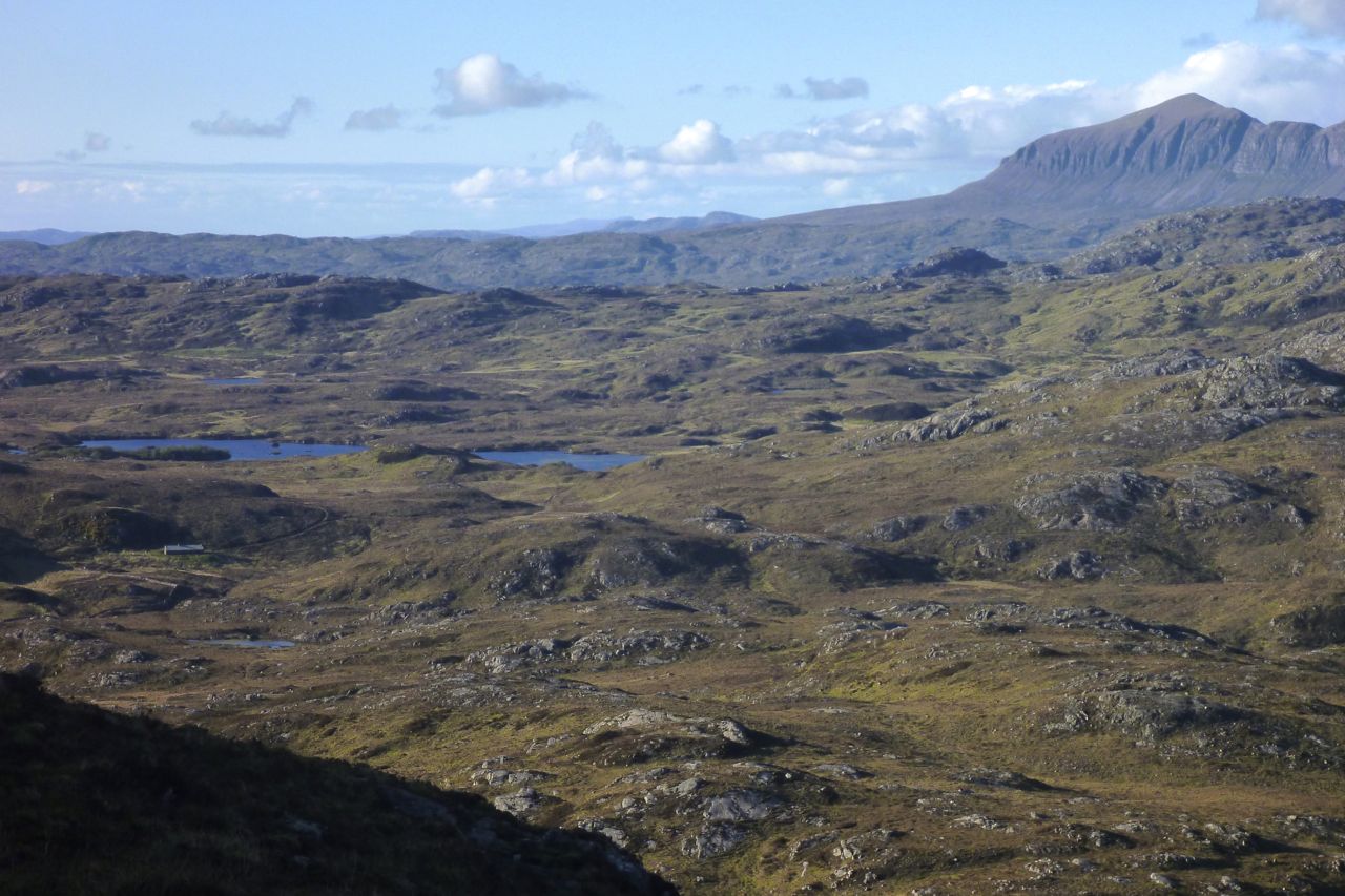
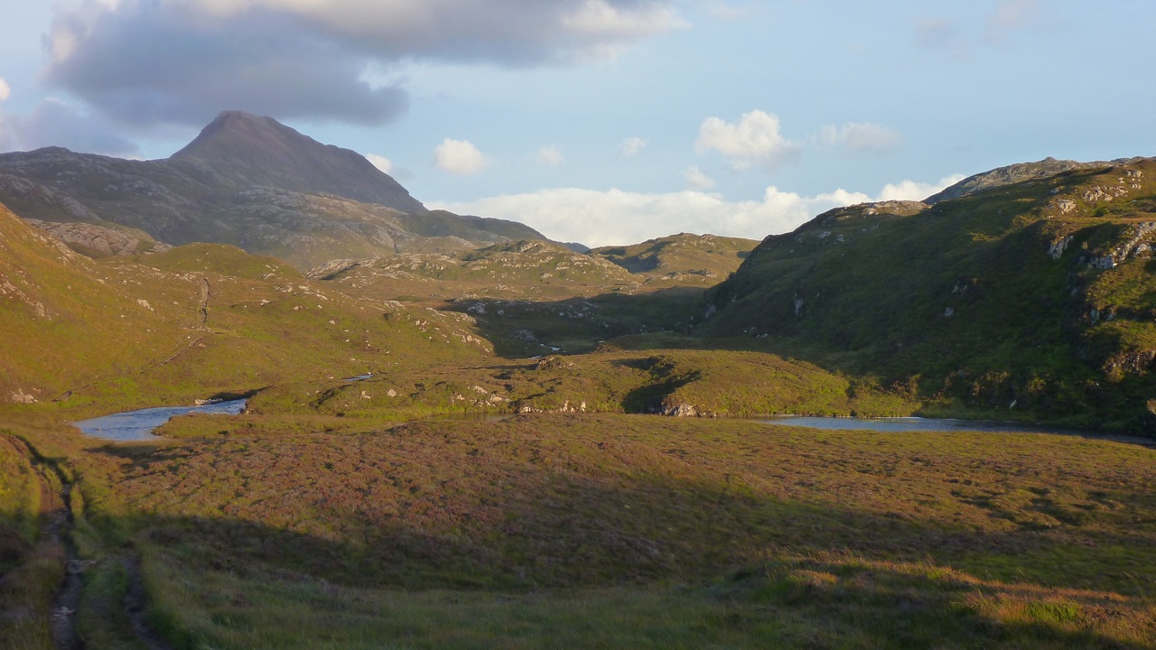
Anyone who’s climbed up the fin-like ridge of Stac Polly will see a wild, lochan- and bog-speckled vista spreading north across the Assynt. Just a couple of miles away are the peaks of Cul Mor and Suilven (main hill, left), relics of a glacier that ground down the land between them as it inched towards what’s now the sea.
The OS map shows this area as a Nation Nature Reserve, but it actually lost this designation a few years ago. And although it looks wild – so wild there’s no grazing, nor inhabited dwellings – this 100 square-miles of barely-fenced bog, rock and water is unusually accessible, bordered by quiet roads to the south and west, the A835 to the east, but not much to the north apart from the path passing below the north slope of Suilven. So seeing as this region of Coigach/Assynt has so few packable rivers, these lochans are a great place for short-range packraft exploration following some of the routes suggested on the graphic, right. It’s not just me that thinks so, the local sea kayak outfitter as well as a couple of intrepid canoeists have been coming here over the years. For them the inter-lochan portages require some commitment. But not in a packraft!
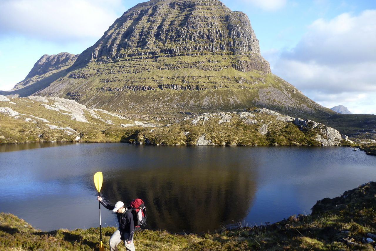
You can make up a route to suit yourself here; climb every mountain, ford every stream, visit every island. I chose a pretty easy overnighter and got dropped off by the road at Linneraineach below Cul Beag. There’s nothing at Linner’ bar a footpath which leads north to Loch an Doire Dhuibh (right viewed from Cul Mor).
My packplan was to paddle across Doire into the small adjacent loch, follow the channel into the main Loch Sionascaig, pay a visit to Eilean Mor, the biggest island hereabouts (and one of hundreds of Eilean Mors – or ‘big island’ in Scotland). From there I’d paddle among smaller isles towards the northeast shore of Sionascaig and walk past the ruin of Shieling over the saddle to the short river that links Fionn Loch to Loch Veyatie. With a paddle over to the south side of Suilven mountain, I’d find a dry spot to camp and take it from there. Suilven is only 731m or 2398 feet high, but it does have a strong draw on the imaginations of hillwalkers in far northwest Scotland, as do many of the Assynt’s peaks.
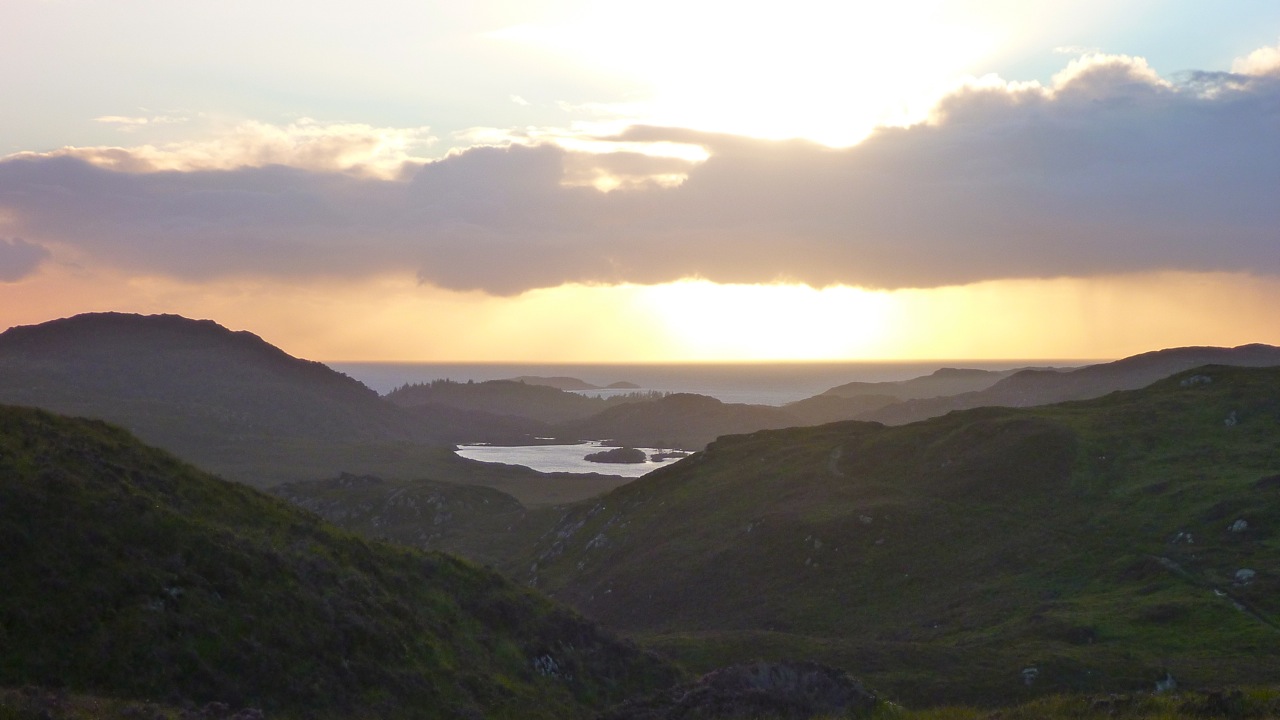
I think much of it stems from its Ayers Rock- or Matterhorn-like separation from its surroundings; a distinctive mountain shape, like the much more accessible Stac to the south. Add the lochans below and the open sea just a mile or two away, and mountain summits around here add up to something special. The picture right is taken from Ben Mor Coigach (743m) looking north over to Stac, Suilven and the distant peak of Quinaig. That’s another thing – the mountains have nice names around here with, you’d like to think, a touch of the Norse about them. This is after all Sutherland, or ‘the South Land’ in the mind of a Danish bloke in a horned helmet, circa 900AD. If you like hills there’s a panorama of some Sutherland mountains below, taken from the tip of the Coigach peninsula looking northeast.
Back to the boating; this was my first proper run in my Yak and as I pulled smoothly away from the shore of Loch Doire (left) it struck me how cool it is to trek over the hills with a pack of only 10-12 kilos, inflate your mini boat and set out across a body of water with your kit slung over the bow. In fact I’m convinced a frontal load makes packrafts faster as, despite the wind drag, the weight reduces the left-to-right yawing.
Very soon I was surprised to see the GPS reading a steady and sustainable 3mph (4.8kph, 2.6 knots) on the calm, windless loch. “What’ll it do?” I wondered, as you do. About 4.1mph, as you ask, but only for a few seconds, unless there’s a Great White on your tail. I’m sure that was more than I ever registered in my old-shape Llama, and I dare say more than I could average walking along the surrounding terrain which was mostly pathless. When I got back a speed graph (right) extracted from the GPS spelled it out: tramping across the pathless hilly bogs – about 2.3mph; on the water, out of the wind – 3mph; on the water into the wind – 2.4mph but with some effort.
The channel that led west to Loch Sion (below Stac Polly, right) looked promising on the map, but even with the current high water levels following the deluge that was May, it soon got too shallow over the couple of metres drop to the next loch, and with a wince-inducing scrape the Yak hung up on a rock, requiring a short portage (left). That done, moving out onto Loch Sion a breeze was now in my face as I edged along the shore. Past Eilean Dubh I squeezed through another inter-island lead and out into the main loch, heading for Eilean Mor island. Even with the mild buffeting, it struck me how safe I felt alone in my raft; safer than I often feel initially in my Incept kayak at sea in similarly tame conditions. I think not being at sea had much to do with it, with no kind of wave or ill wind that could blow the Alpacka out to the wrong side of Greenland.
Eilean Mor is a natural focal point in Sion loch – what can it be like, an island set deep within in a wilderness? Many paddlers are fascinated by these tiny wooden islands on Scottish lochs, I assume like me, because they think it must be a UNESCO-like example of a hyper-pristine natural habitat beyond the reach of prolonged human intrusion.
On the southern tip I can tell you there’s certainly a spacious, grassy camping spot (and now, a finely-built cairn), but as I half fell out of my boat and staggered ashore (left), the latest shower passed by as I beat my way inland towards the Eilean’s summit, through a forest choked with ferns, birch, hazel and their fallen, decaying predecessors. As I bushwhacked upwards, an owl not 10 feet to my left flew off noiselessly, and in places the ferns hummed with a flouorescent green glow (above).
At the summit, about 100 feet above the loch I looked over to the entrance to Boat Bay, a mile or so to the west (above left). To the north Suilven was a dark, uninviting rampart while to the south I imagined the walkers who daily take the short trek up Stac Polly (right) looking down on the progress of the little yellow boat far below and thinking, heck that looks fun!
I set off northeast, passing other inviting but unnamed isles (left and right), around Rubha Sionascaig with its alluring isthmus and up to Creag Sionascaig. Arriving at the shore, new shoots of grass poked through the blackened peat, scorched by the bushfires of early May which have been well and truly doused by the series of lashing gales which followed. I rolled up and headed up a creek line towards a saddle, passing a ruined croft which, as in so many remote locales in northwest Scotland, makes you wonder what on earth the people lived off up here?
Squelching over a novel mixture of burned peat crust spongebog mush (left), at the pass I looked down and saw half a dozen tents and a couple of canoes (right, barely visible) pitched at a meander in the river at a point where it was quite probably fordable. I’m sure the water there was running eastwards from Fionn into Loch Veyatie [it doesn’t], but if that’s the case then Fionn Loch is unusual in that it drains both ways, east and also west via the River Kirkaig to Lochinver and the sea. A geographical oddity? who knows [I do now; it isn’t]. I walked directly to Fionn, deployed the Yak and paddled across the channel (left). A short walk out of sight of the campers found a flat shoreline where I pitched beneath the looming mass of Suilven.
At times I’d wondered whether there even was a path up the south side of Suilven mountain (left) – I’m sure I’d read it somewhere. Then, during a short spell of sunshine a steep path became briefly illuminated; straight up alongside a scree slope, then off at an angle to the saddle-ridge between the two peaks. But now it was raining steadily, I was pretty damp and not in the mood for a hefty slog across contours pressed together up like the teeth of a comb, but I feared once I got in the tent I’d probably slob out. So after a light feed, I set out, packstaff in hand, to locate the path up the hill and once on it, followed it till 8pm. If nothing else, it was a good way to warm up and dry off.
It would be nice to report a stirring vista some 400 metres below the summit of Suilven, but a leaden gloom pressed down on the sodden land. I’d called the Mrs – tomorrow would bring more rain, but the winds would return too first thing in the morning. Back in the tent and soon after sunset, the rain arrived early and lasted most of the night. It was all a bit much for my single-skin tent which, though amazingly light and compact, is not rated as waterproof. The drips soon came through the fabric of the flat roof as I dozed, soaking my legs and chilling me. Half-awake, I lay my cag over the drip zone, after which the night passed well enough and I woke reasonably dry. The next day was not one for shorts; today I was going to try out my new Kokatat Swift Dry Pants (see Suilven Gear). I’d half a mind to catch the twice-daily bus at 11.15 from the junction (see green graphic, top of the page) and estimated it would take 4 hours to get there, so breakfast at 6am was cereal in warmed up loch water. It wasn’t raining yet which meant it would be shortly, so I packed up quick and scooted back over Fionn Loch, taking a different route back southwest, past Na Tri Lochan to an inlet on Loch Sion (see satellite image bottom of the page). It was a longer land stage, but would put me into a better position to dodge the predicted southwesterlies while paddling back west towards Boat Bay. I’ve been reading a lot of sea kayaking literature lately and the lessons were paying off.
Let me tell you, walking over the pathless mire following a night of rain is merely a necessary means to get to the next bit of fun paddling. My knee-high Seal Skin ‘Wellington socks’ were working fine – last night my feet had been bone dry – but it’s a tiring, rhythmless slog over this crap; any sheep trails are merely conduits for more running water and mud. Again, the star of the Gear Show has to be my packstaff; it makes walking on uneven ground, descents and climbs so much more secure, especially with a load.
I reached the inlet bang on time which took me by surprise. Was this some un-noted lochan, no it was Sion – I’d not read the inlet’s shape on the map closely enough. Once back on the water, initially my leeward paddling ploy worked well. Then I turned a corner and suddenly the wind was onto me and the bow was bouncing on the waves (left) as I hacked past the shore at barely 1mph. For a while I thought I’d have to give up and take to the shore but again, as sea kayaking lore states, wind is often exacerbated round a point or headland, even on a lochan. Near normal speeds resumed, in fact just a fraction under the still-and-calm 3mph cruising of yesterday, but at a heavy cost to the arms and shoulders. I couldn’t have done this all day but luckily, I didn’t have to so I got stuck in. Again I was surprised how safe I felt out here, alone and ill-dressed and where stopping to fiddle with the cameras pushed me back nearly as fast as I paddled forward.
Finally I entered the mouth of Boat Bay, back onto known ground. The end was in sight. Last September I couldn’t even paddle the Sunny out of this bay in a stiff easterly. Now I dug my way onwards to the tiny beach inlet which was notably smaller than last year. I rolled it all up and hiked up to the nearby road. Within a couple of miles g-friend’s hatchback popped over the hill and I was home and dry for lunchtime – a 15-mile, 24-hour mini packboating adventure completed, with lots more ideas for future exploring of the lochans below Suilven mountain.
Below: almost the entire route seen from Cul Mor summit, looking southwest and west. Stac and Summer Isles in the distance.