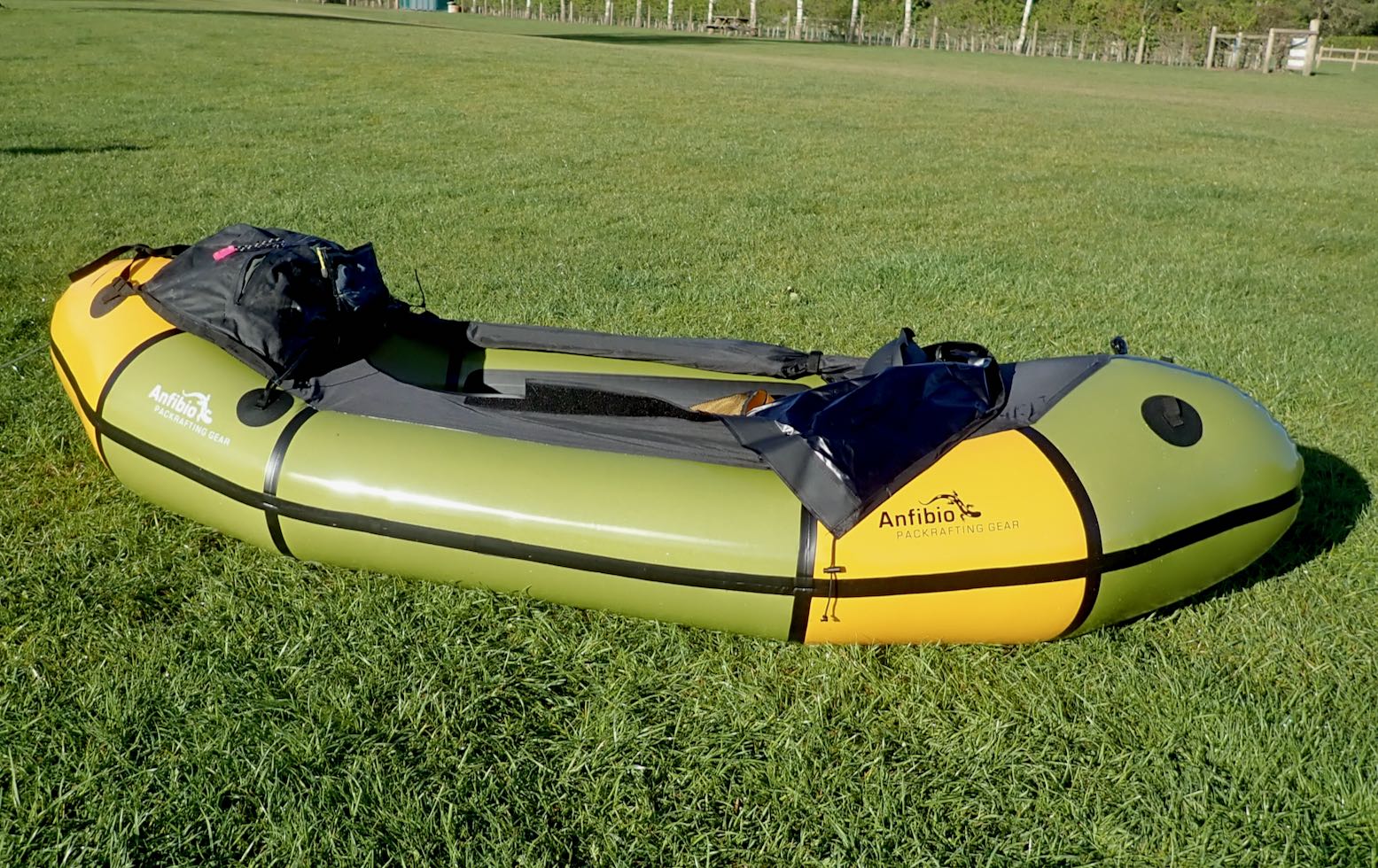
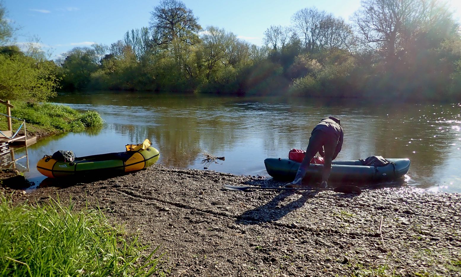
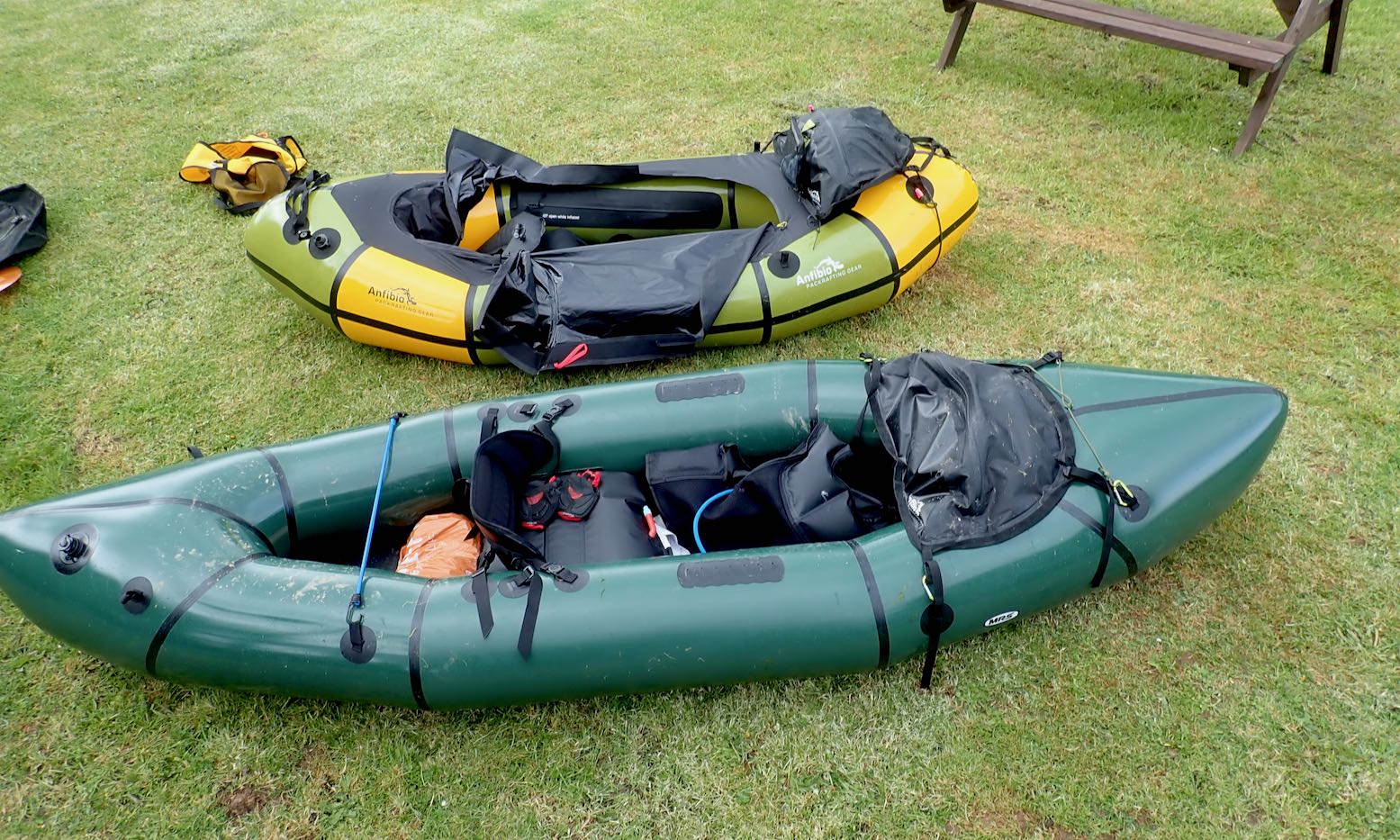
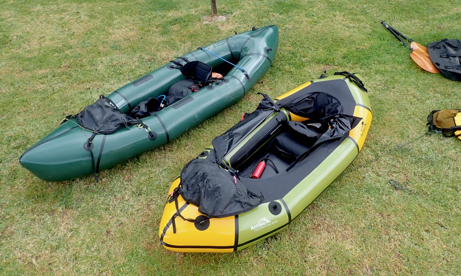
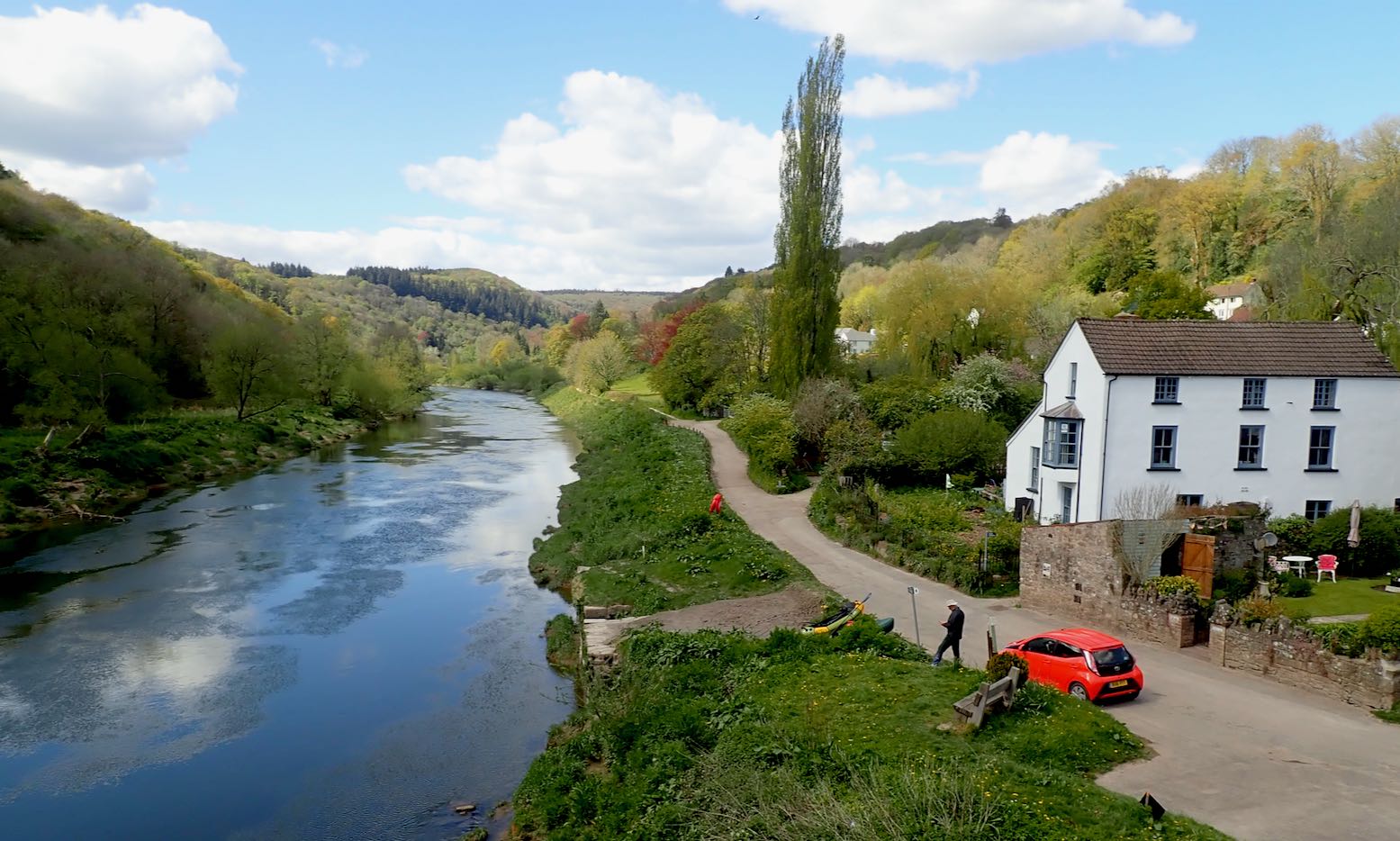
For a couple of years Longshore International sold self-branded packrafts from China, as did a few other ‘side-hustlers’ at that time.
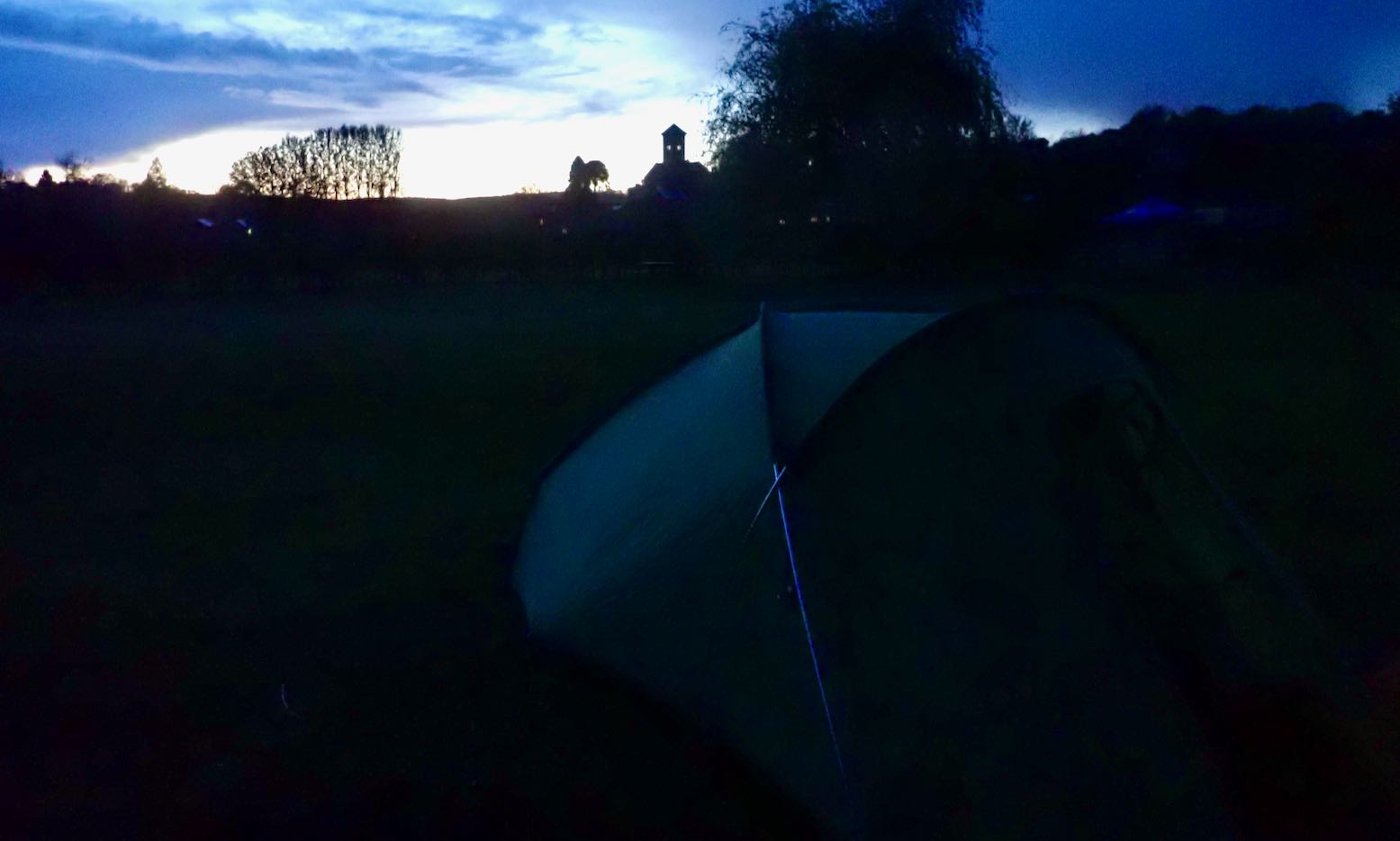
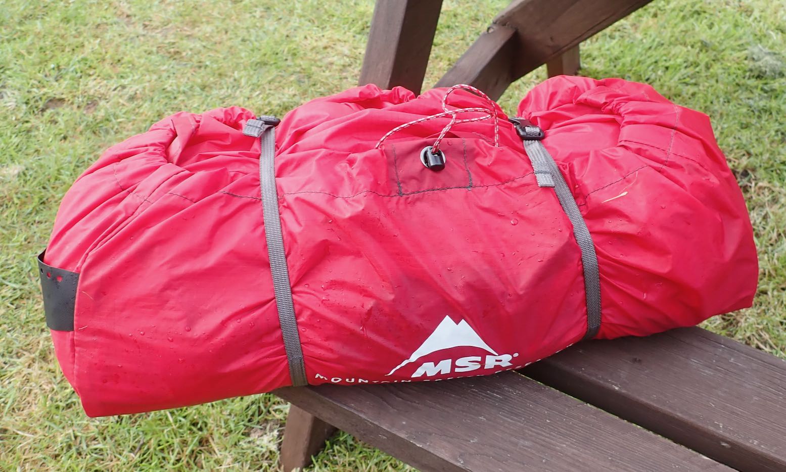
Tim (left) actually undertook mini adventures with his products and in 2018 we reviewed their EX280 tandem in Scotland (right). But Longshore and most others shut down, possibly due to supply issues during Covid, even if demand went off the charts at that time. The website expired and their YouTube vids were deleted, but a couple of Tim’s yarns remain online at Medium (an early SubStack?), including this two day hike and paddle along the Devons’ south coast. Interestingly, he advises that some of South Devon’s many estuaries are privately owned, something I found out myself the other day while recce’ing the Fleet lagoon near Portland. No all UK tidal waters are freely accessed it seems, but at least they are extensive. Most pics by Longshore.
Over two days we hiked and paddled about 40km. Whilst we were carrying a little more gear than other hikers we met along the South West Coastal Path, our packrafts enabled us to cut across rivers whilst they had to traipse inland looking for a crossing. We also had the option to vary our route away from the official path, exploring otherwise inaccessible creeks, coves and estuaries. I suspect the sea kayakers we launched with, arrived far quicker than us but travelling only at sea level they missed some stunning views from the jagged pinnacles and tors above the coastal cliffs. Read the rest.
I’ve done a few IK paddles in Southeast England between Rye and Portsmouth, but the Sussex and Hampshire coasts aren’t that inspiring. So it’s about time I started exploring the far more interesting and much more extensive Southwest Coast. From the Isle of Wight to Cornwall and back up to the Severn there are scores of inshore excursions possible in an inflatable. Just as in the far northwest where I mostly sea paddle, all you need is a fair tide and paddle-friendly winds, the latter a bit less rare down south.
In a blobby packraft? You cannot be serious!
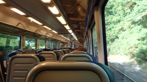
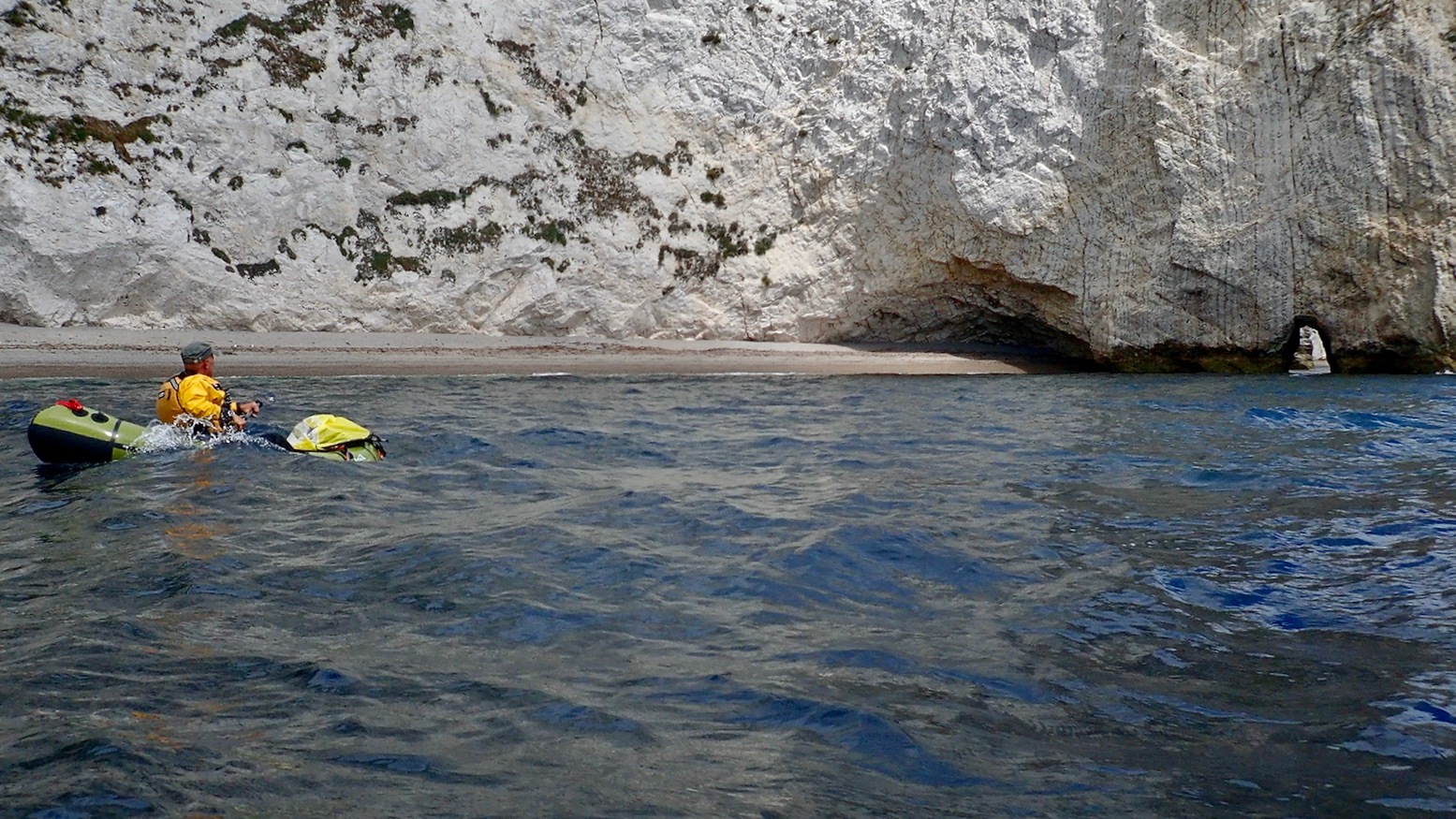
So in the face of predicted moderate winds I cooked up a 50-km Jurassic overnighter from Weymouth to Swanage in Dorset. I’m pretty sure they opportunistically rebranded the plain old Purbeck or just ‘Dorset’ coast as the ‘Jurassic Coast‘ soon after that 1993 movie and haven’t looked back since. Like much of the Southwest coast, the beaches and country lanes become a logjam of holidaymakers on a warm summer’s day. On the water, our paddle would pass below sections of cliffs a couple of miles long and take us to the famed landmarks of Lulworth Cove, Durdle Door arch (top of the page) and Dancing Ledge. We could even carry on back north past Old Harry’s Rocks and across Studland Bay right into Poole Harbour to catch out trains home.
TXL at sea
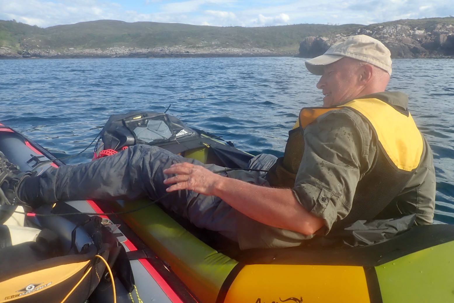
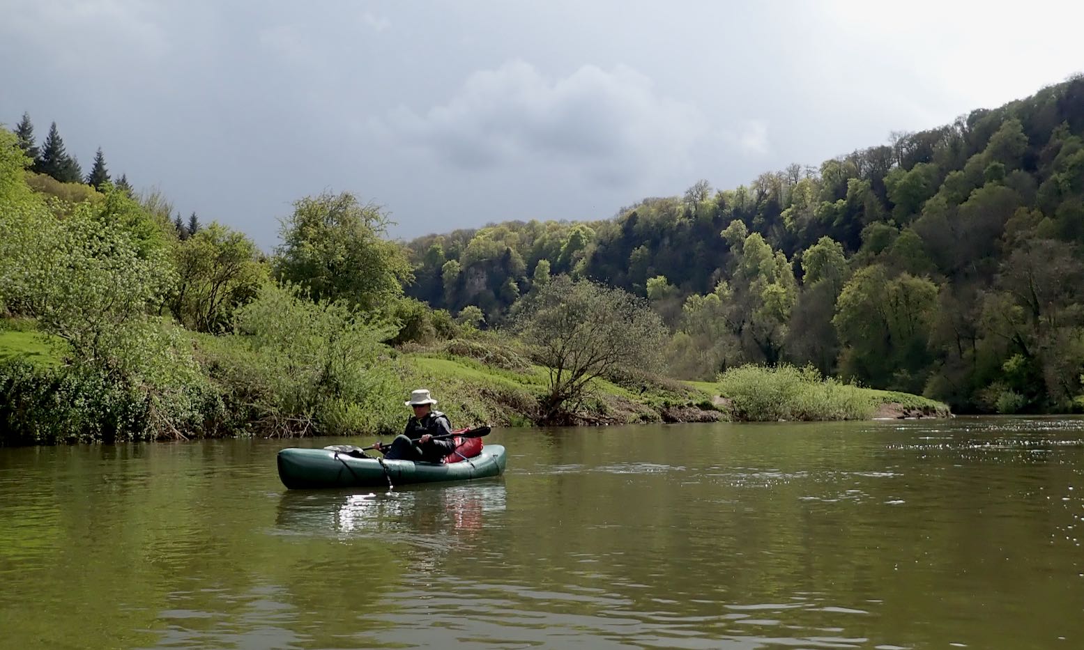
Compared to using regular (solo) packrafts, my confidence in my TXL for sea paddling is a revelation. After all, it’s still just another blobby, single-chamber packraft. It must be a combination of the added size giving a kayak-like perception of security (as I found in my MRS Nomad), as well as the responsiveness and speed from a longer waterline and, I now recognise, the sometimes noticeable added glide from the Multimat floor. There’s also the fact that paddlechum Barry was up for the Dorset run in his similar MRS Nomad, making this untypical packraft outing less daunting.
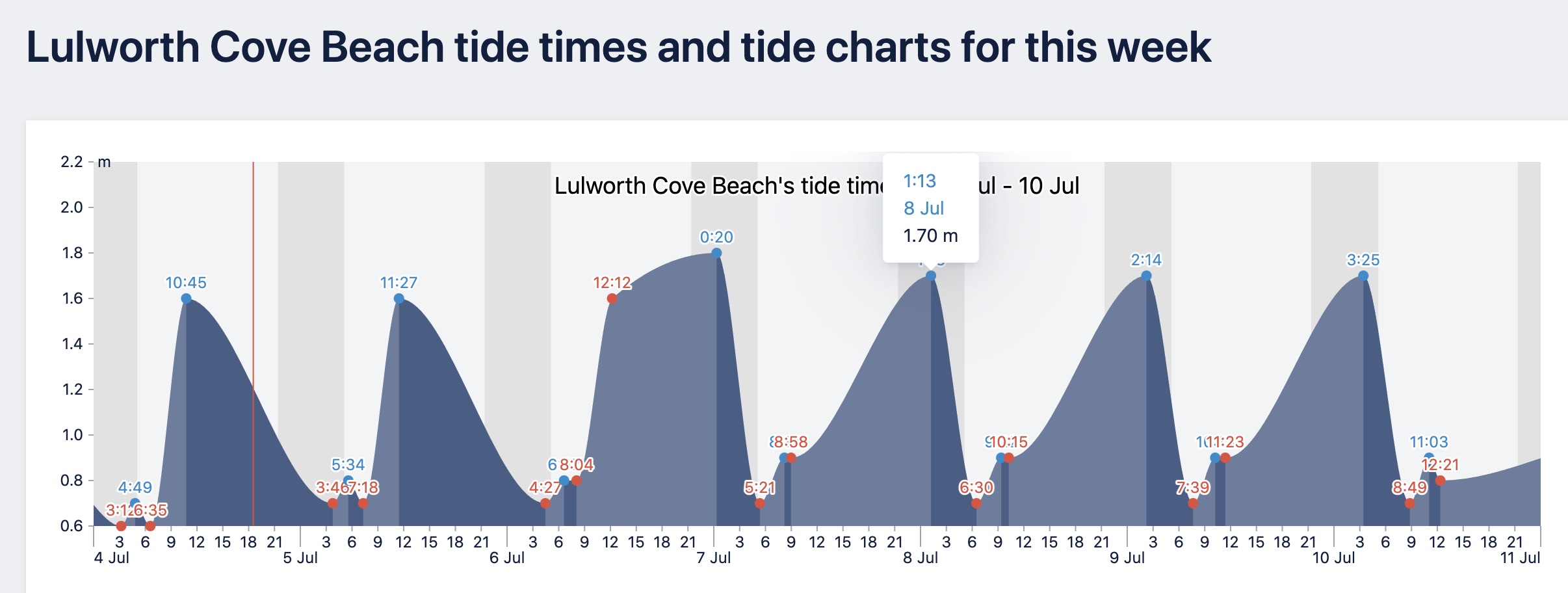
Lulworth tides – all or nothing (of not much).
Modest, two-metre tides off Purbeck
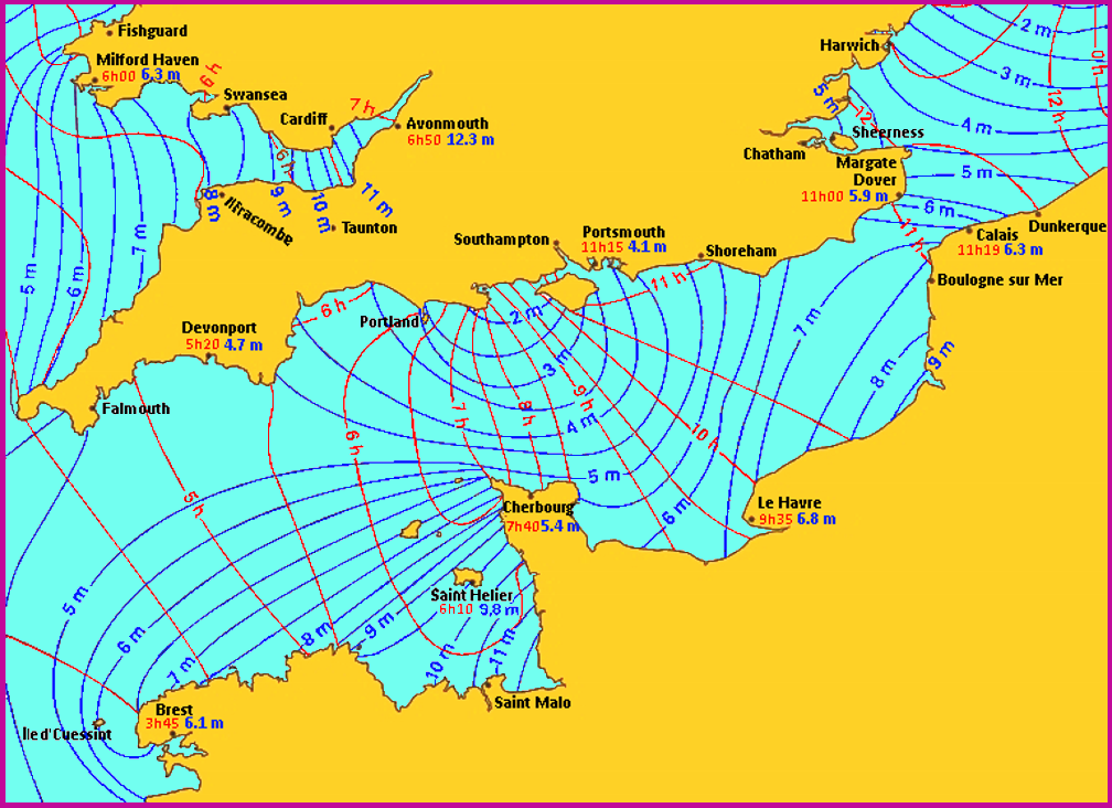
For some bathymetric reason – possibly the Atlantic tidal surge backing up in the Straits of Dover, plus hidden offshore shelves – the tides off the east Dorset coast are very odd: they can rise or drop all day, but have a range of just two metres, about as low as it gets in the UK. That ought to mean moderate ebb flows pushing up against prevailing westerlies, plus we were heading into neaps. And while often cliff-bound, if we stayed alert to escape routes we could easily bail and walk or climb out with our packrafts.
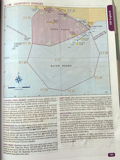
East of Lulworth Cove the Jurassic Coast‘s bucket & spade Babylon is interrupted by a 5-mile wide Danger Area – an army firing range. This was probably not one of UNESCO’s criteria for World Heritage status, but the SW coastal path also gets closed for a similar distance. Barry’s Reeds Almanac had a page or two on this (left), as well as useful tidal flow charts (drops to the west; rises east). I left it to Barry to call the ‘0800 DUCK!’ number, but imagined surely they’d leave the target practice to the off season. In fact they’re all it most of the time Mon–Fri, including an evening session 9pm to midnight: all we had to do was click this.
fishing.app – handy and similar toa Reeds Almanac but free
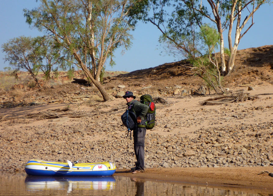
Early train to Weymouth
With a plan taking shape, I in turn bought a copy of Pesda’s South West Sea Kayaking in the hope of being alerted to local anomalies. I’m glad I did. It turned up with just hours to spare and identified that the run from Kimmeridge Bay round the Purbeck corner to Swanage was a grade up from the easy section from Weymouth. With headlands, submarine ledges and long lines of cliffs, without a foot recce I decided we may be better off skipping this bit.
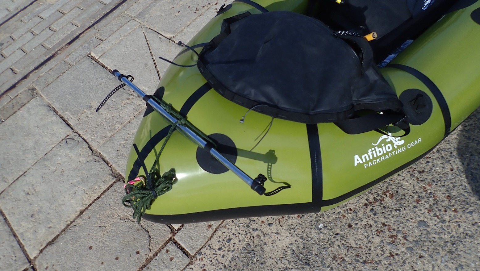
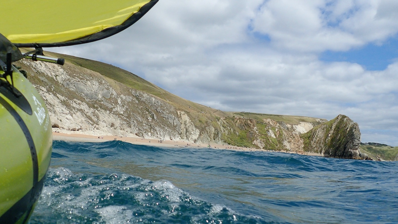
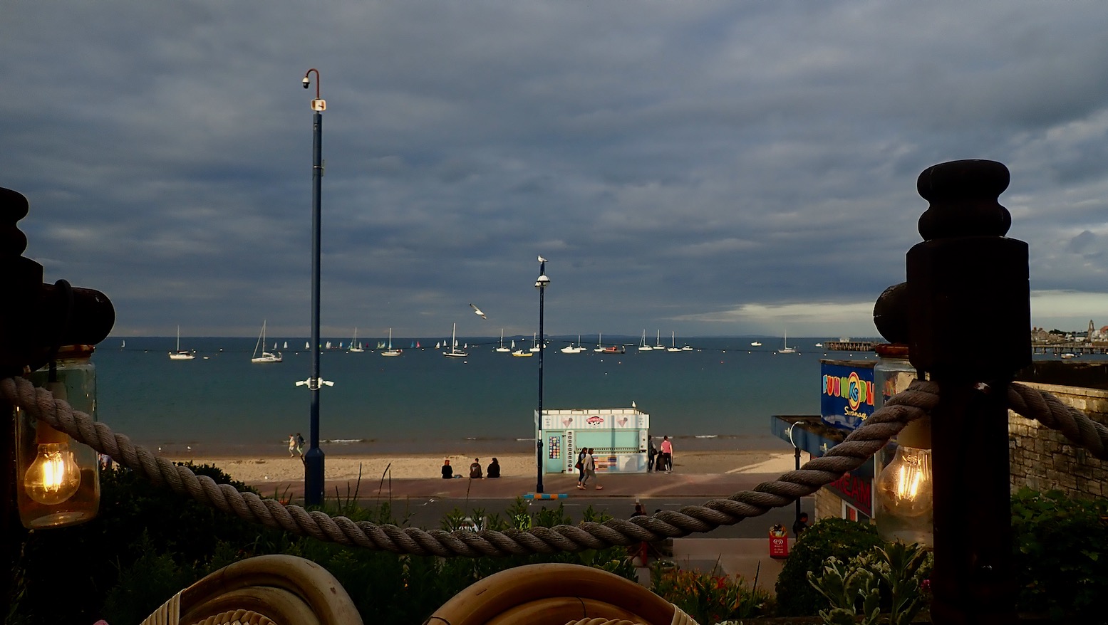
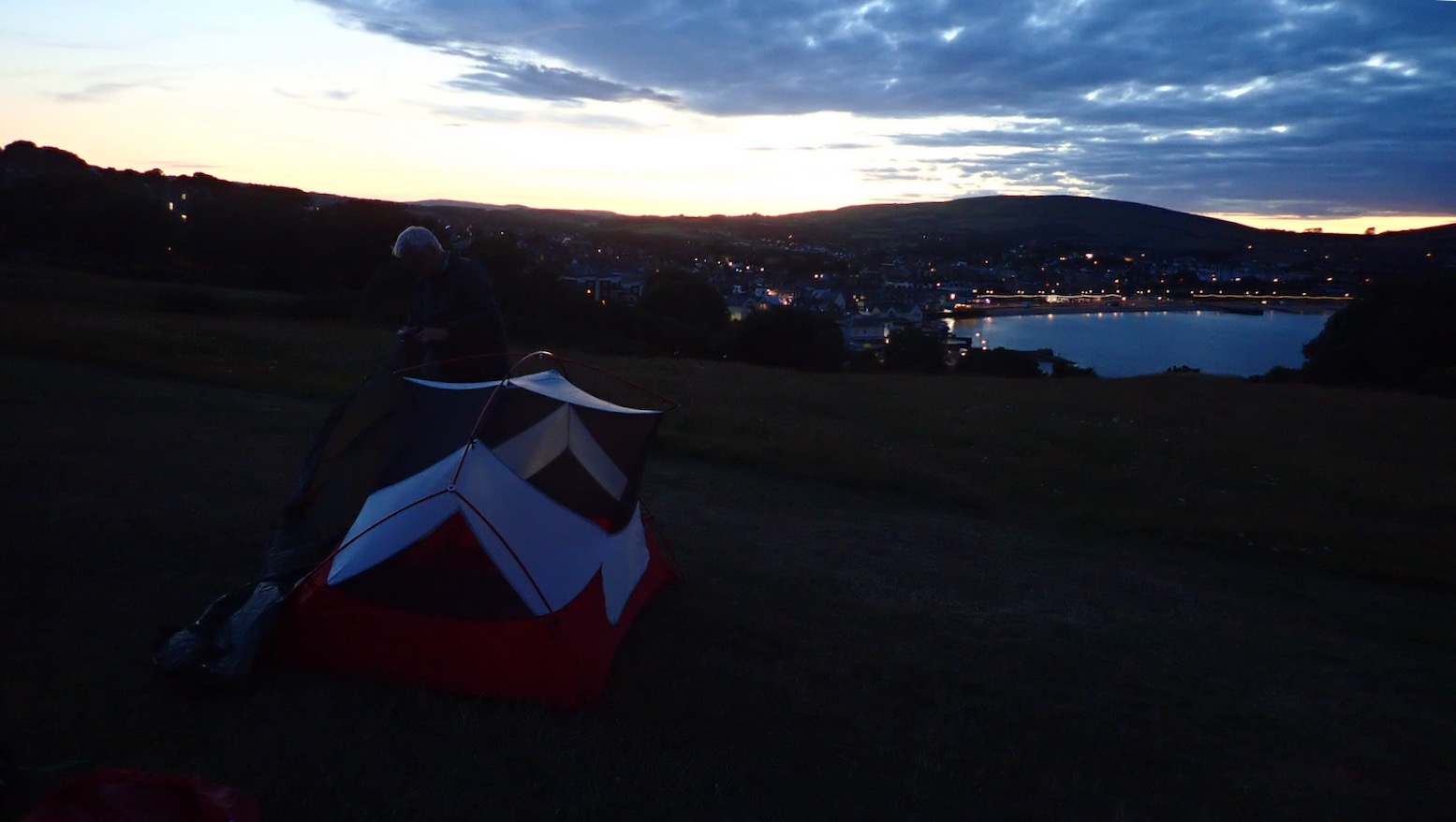
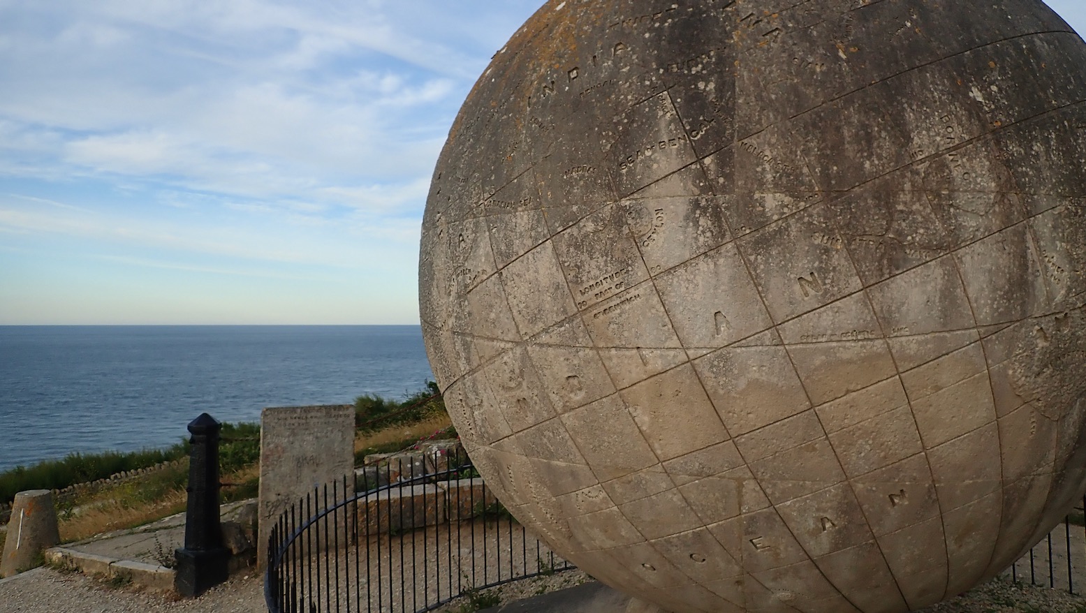
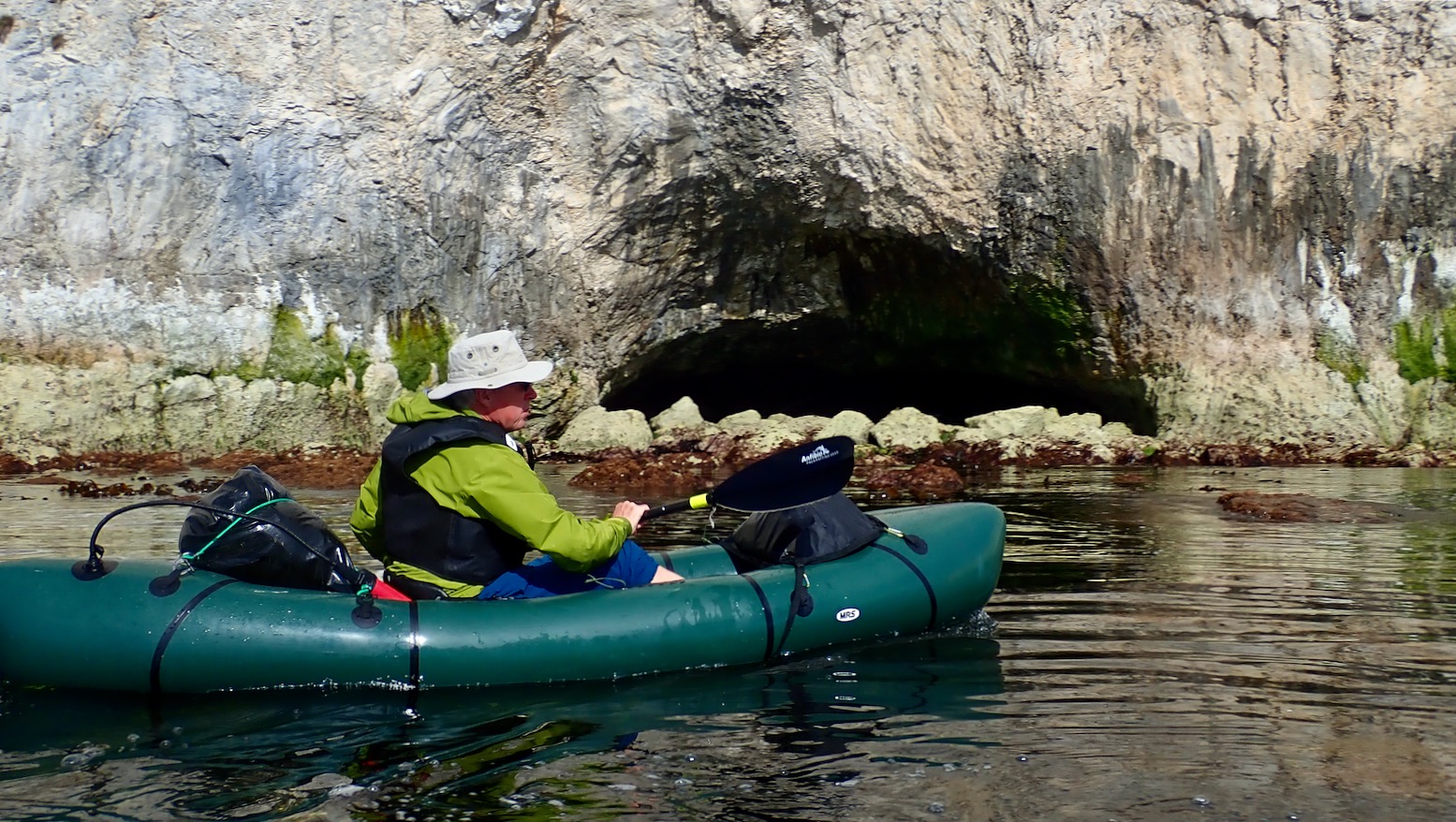
It’s noon in Weymouth, but with offshores now predicted by late afternoon, we fast forward by taxi to Ringstead Bay, 5 miles in. That first section from Weymouth looks nothing special.Put in at Ringstead. Ten mph westerlies blowing against an ebbing neap tide.My Mk2 transverse bowsprit for a wide WindPaddle sail mount to limit swaying in stronger winds. I’m giving the Multimat floor yet another go too, all the better to skim over the water. We’re on the water at 1pm, hoping to reach Chapman’s Pool, about 21km away. But around 5pm winds are said to veer offshore and strengthen, so we’ll see. We sail at about 5-6kph – not much faster than paddling – but I note my TXL creeps forward about half a click faster than the MRS – must be the stiffening Multimat.Propelled at paddling speed by his inflatable AirSail, Barry casually checks his investment portfolio.The cliffs below Chaldon Downs. At times we paddled as we sailed to make less work for the wind.Forty five minutes in, I pull in the sail and line the TXL up to thread Bat’s Head arch. Note how the layers of chalk beds here have been pushed up to nearly vertical. Give it half a million years and Bat’s Head will be as big as nearby Durdle Door.Approaching the famous Durdle Door arch alongside a crowded beach. The TXL still weathercocks a bit under sail; I keep having to steer hard inland, but the bowsprit ‘stick’ limits the sail’s ability to twist. Or maybe the wind’s bouncing off the cliffs and blowing us offshore a little. Sitting further back to weight the back end over the waves may help.Sunbathers watch spellbound as Barry smoothly ‘Durdles the Door’ – a Southwest kayaker’s rite of passage.The Door has been durdled. Some claim ‘Dorset’ (formerly Wessex) was named after this famous arch. In high summer young bloods jump off the 60-metre arch. Appropriately, it’s called ‘tombstoning’.Near the entrance into Lulworth Cove things get choppy. Sat high on the airmat floor, if I feel unstable I can easily let it down. As we head through the Cove’s narrow neck a patrol boat circles back and instructs Barry we can’t carry on east; the army ranges are firing. ‘I thought you said you were going call them, Barry? You had one job to do…’ ‘But you said they hardly ever do this on a balmy, July’s day!’ And so it went on…360° selfing in sheltered Lulworth Cove.I spot some IK compadres lugging an AE Elite.A salty-eared boatman tells us the army pack up about 5pm, about 2.5 hours from now by which time the offshores may be on us as we cross the Kimmeridge Ledges mentioned in the Pesda book. As we slurp a 99 with sprinkles the odd gust blows offshore. We can’t even pack up and walk the cliff path; it’s closed too, and so is the B3070 road. Barry wants to paddle on a 5pm, but I propose we bus to Swanage rather than risk being be left high and dry. Tomorrow we’ll paddle north towards Poole – or as far as the predicted headwinds allow.So a paltry 5 miles – but the classic stretch of the Jurassic Coast.A couple of hours later we enjoy a pint and…a lavish seafood medley overlooking Swanage Bay.But there’s no campsite till August, so we pitch for free up in Durlston Country Park to the sound of beery revellers and Tuesday-night hoons doing burn-outs along the seafront. What can it be like on a Saturday night?Six am next morning, a light breeze blowing from the northwest means no condensation ;-)) The Anfibio Multimat passed the sleeping test, too.I walk a mile south to Purbeck’s corner at Durlston Head to inspect the tidal stream. Two hours before LW, it’s negligible, but further west, St Albans Head just out of Chapman’s Pool is said to be stronger. I must do that walk sometime. Above, a ferry heads from Poole to the Channel Islands.Durlston’s famous 1890 Great Globe.‘The Earth is a planet and one of God’s glorious creations.’Looking back north you just see our tents on Peveril Point, Ballard Down chalk cliffs and pinnacles stretch out beyond, and Bournemouth’s at the back.I’m amazed how Barry always manages to roll his MRS up so compactly.A modest breakfast in the Swanage sunshine.At the cafe we meet Rach and Mark setting off on the final day of a staggering 630-mile walk along the Southwest coast from Minehead in north Devon. Their picture above taken a few hours later.Meanwhile we prime our boats for the 6.3 miles past Old Harry to Poole Harbour Entrance. We may carry on to Poole itself, but a strengthening wind may nix that idea.No sailing today, Barry inches into the light morning breeze across Swanage Bay. We reversed this trip a couple of months back.Ballard cliffs in the wind’s lee at glassy low water.Ideal paddling conditions – a chance to explore tidal caves I’ve never noticed before.Ballard’s spike, thought by some to be a fossilised Dendrosauraus tooth.We approach the Pinnacles to the squawk of agitated seabirds.Arches ripe for threading as far as the eye can see.But this morning the tide is too low.And it means there’s a lot of this string-weed floating about. It catches in our skegs but I have a solution.Leaving Harry’s, Barry’s is a bit of a Lethargic Larry cutting across Studland Bay. Halfway across, I remove a metre-long, kilo of Swanage string-weed caught in his skeg.It’s all going nicely until 10.30am when the wind kicks up, then picks up some more. But the GPS revealed we kept plugging on at 5kph, just with a lot more effort. As Barry observed, it was a slog but good to know our packrafts can progress against this sort of wind.With brain-out jet-skiers, sailboats, motorboats, working boats and the rattling Sandbanks chain ferry, we have to time our crossing across the busy vortex of Poole Harbour Entrance. Hitting 8kph, we cross a sharp eddyline where the incoming tide clashed with still-draining Poole Harbour. Barry hops out quick before the chain ferry trundles back. (Turns out it’s actually free for northbound pedestrians).From Swanage to Sandbanks, followed by a 90-minute walk to Poole station for the train home.
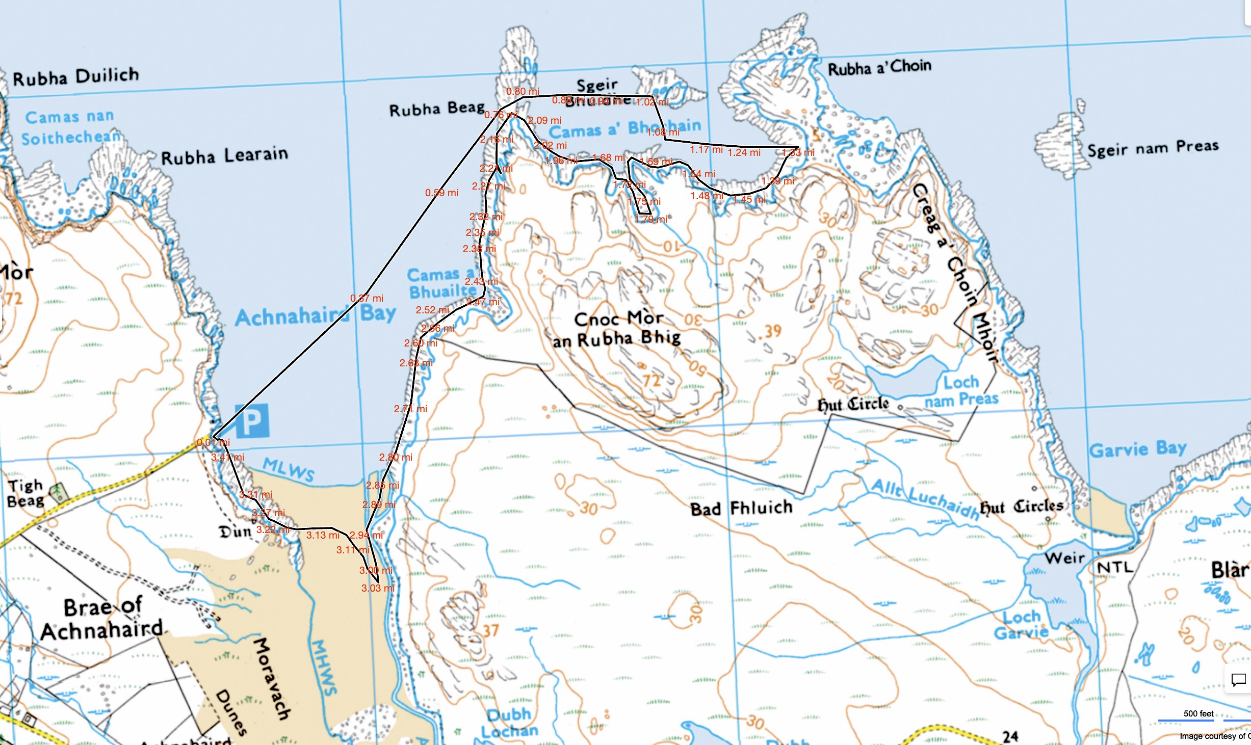
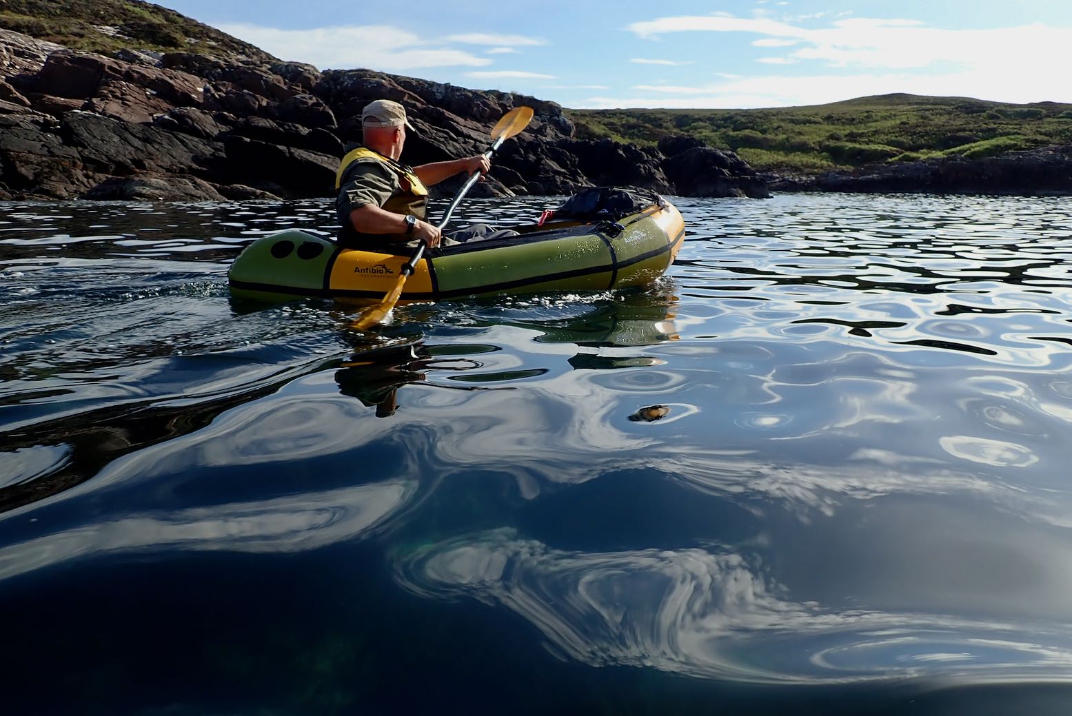
Around here the inshore sea paddling is exceptional, even if packrafting the inland lochs is also pretty good. Having done most of the latter routes, I thought I might try some coastal packrafting. Garvie Bay arcing west to Achnahaird Bay looked like a good one and happens to parallel probably the best walk on the peninsula which we’ve done many times. That route could be a 20-km combination of cycling, walking and paddling, but as it was the last calm evening for a while, we thought we’d go out together in the kayak and I’d try the packraft on the way back. That way everyone got to play.
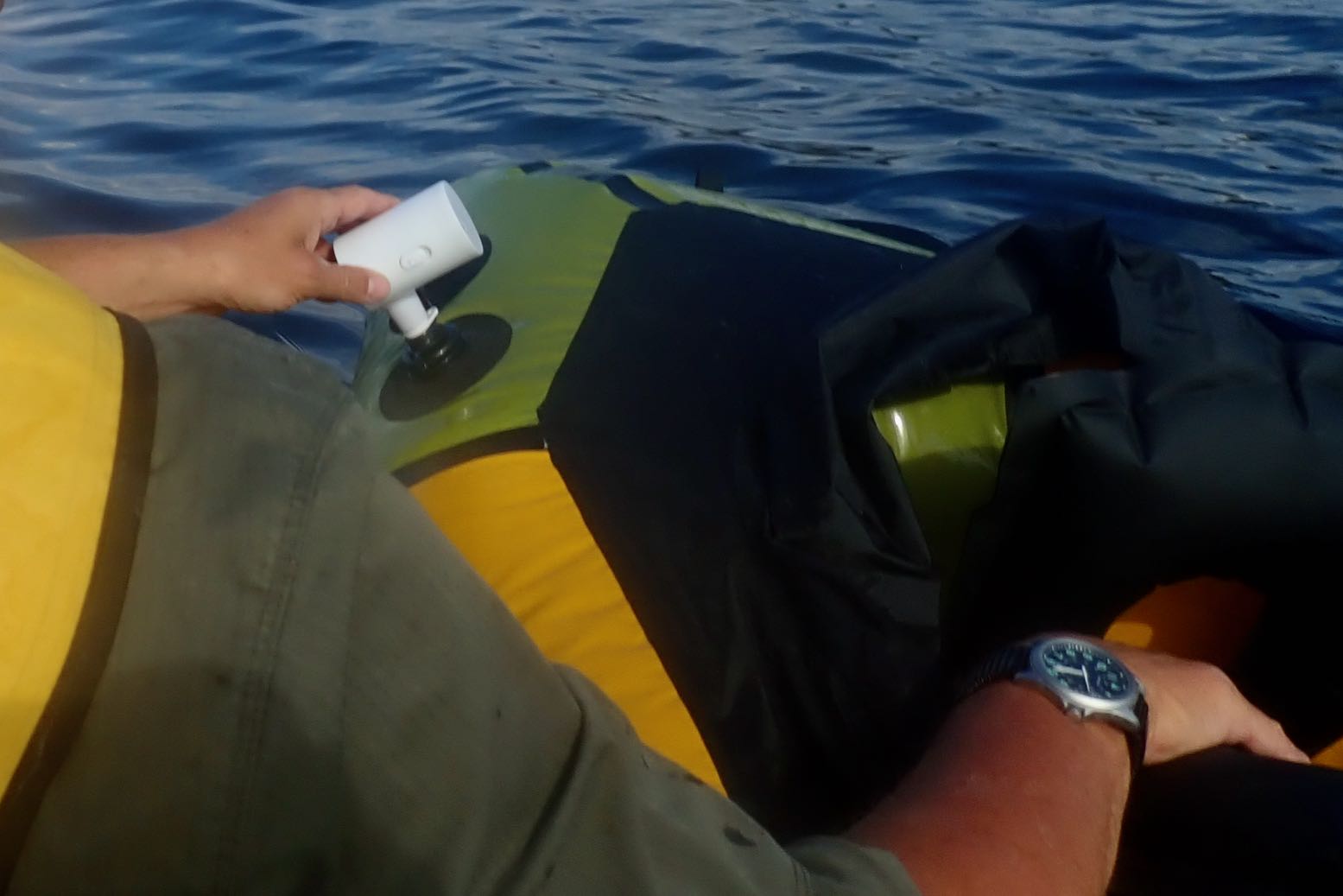
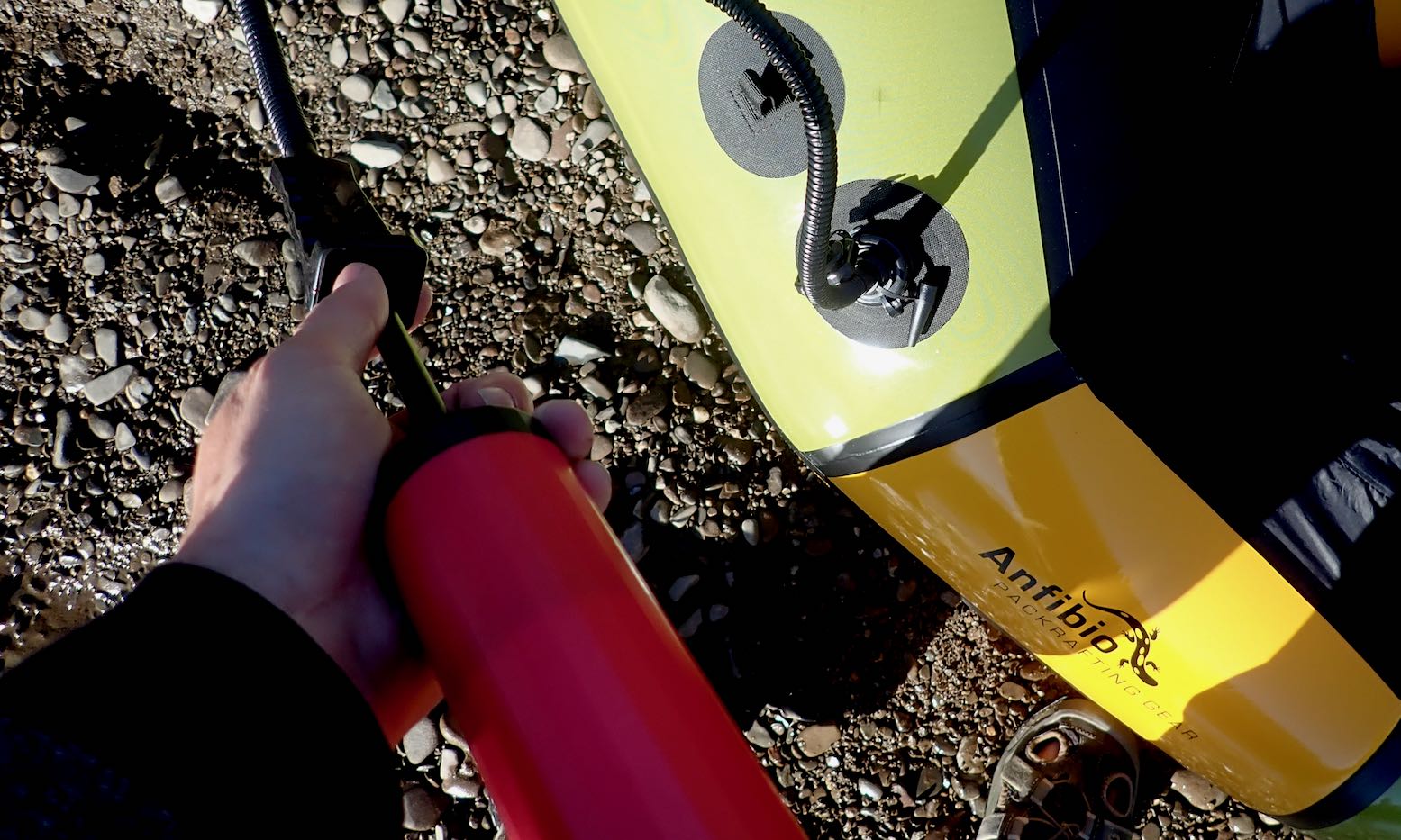
A light NW breeze blew onshore as we cut across Achnahaird Bay like a blue fin tuna. The approach of HW meant we slipped through the submerged skerries of Rubha Beag and into the crab’s claw inlet of Camas a Bhothain (Bothy Bay). This seemed a good spot to deploy the packraft with the aid of my exciting new gadget, a mini electric pump. I unrolled the boat over the water and let the pump buzz away for a couple of minutes, topped off with the hand pump, then clambered aboard.
Buzzing noise
Man the lifeboats!
Paddling away, I realised this was the first time I’ve paddled my Rebel 2K unloaded and I was a bit shocked by the bow yawing. Now fully back-heavy, one good swipe of the paddle and it could flip a 180°, just like my old 2010 Alpacka Llama.
Ah, but in my haste to launch the lifeboat I’d forgotten to fit the also-untried skeg which comes standard on the 2K. I waddled over towards Rubha a Choin beach and slipped it on easily, while the Mrs transferred to the Seawave’s front seat.
I’ve been ambivalent about the value of a skeg on a packraft, but now back on the water the yawing was notably reduced. If you think about it, a packraft actually pivots from a point around the middle of your swinging paddle, not from the stern, as it feels from the seat. The centre of mass behind the pivot point does make an unladen bow yaw more, but the stern will yaw too; just less and unnoticed.
Skegging ‘eck!
On the Wye my 2K was fully loaded with the centre of mass moved forward and which minimised any yawing, even without a skeg. (With a heavy load over the bow a reduction in yawing is well known with packrafts). Now unloaded and with the bow riding high, swish-swosh yawing was exacerbated, but is actually happening at both ends of the boat. So any type of fin or extension of the stern (like the post-2011 Alpackas – right – and all subsequent copies) will constrain this, while not affecting steering. So, bottom line: skegs work on a packraft and are easy to retro-fit.
A short-but-wide packraft actually pivots from near the centre, not from the back as the impression suggests
All the remains is a packraft’s agonisingly slow speed. These are not boats made to enjoy the sensation of flatwater paddling; they are boats to enjoy getting to out-of-the-way places easily. Any type of disturbance to progress, be it wind or current, may slow you to a stop, or worse. Something like the longer Nomad S1 I had would be better for this while still being packable. Still, in these ideal conditions it’s nice to float along observing the coastal features.
Paddling back down the east side of Achnahaird Bay, a back-breeze made progress feel achingly slow. Lately, I’ve come to value metres per second (m/s) as a metric of wind or paddling speeds. Something moving past you (or vice versa) at three metres per second is easy to visualise, though I suppose we can all visualise a 3mph walking pace, too. It’s what YR uses and is easily converted to ‘double + 10%’ for miles per hour (so 5 m/s = 11.18 mph). Or just double it and you nearly have knots (5 m/s = 9.8 kn), for what that’s worth. Crawling past the rocky coast it looked like I was doing 1 m/s at times. We had a race: diminutive Mrs in a big, long kayak; me in the packraft. Within ten seconds the Seawave streamed away while Bunter frothed up the water like a cappuccino machine.
Oh well, you’re as fast as you are. Like cycling in Tajikistan rather than Kazakhstan, for the best experience match your routes with your mobility and conditions. Next calm day I’ll do the full Garvie loop.
With the exception of a few rivers … (Lugg … Severn … and the Wye), there is no confirmed Public Right of Navigation on other physically navigable, non-tidal rivers in Wales. Canoe Wales
Free canoe camp below Symonds Yat marked
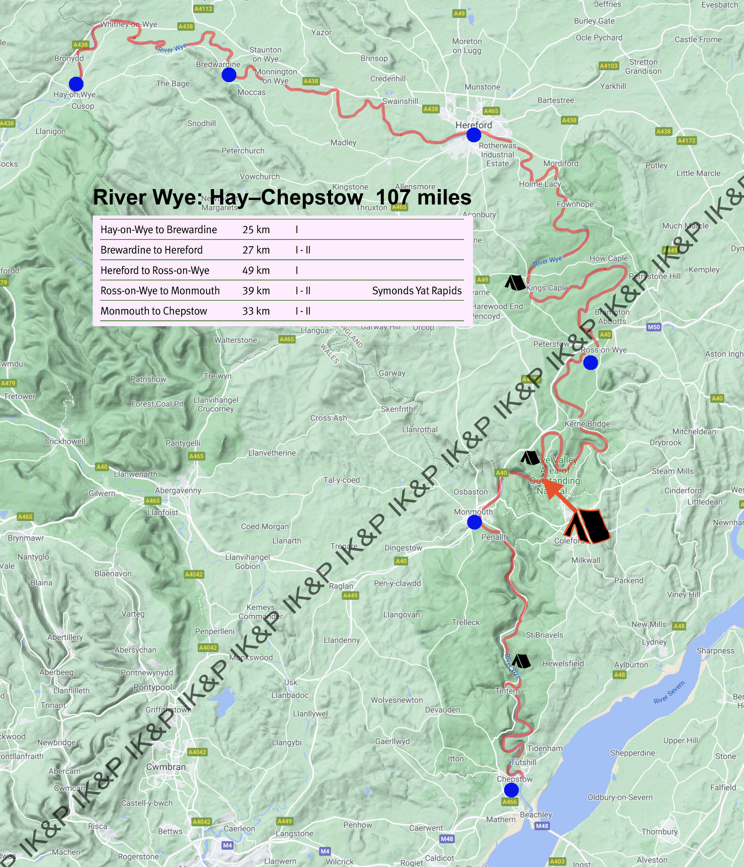
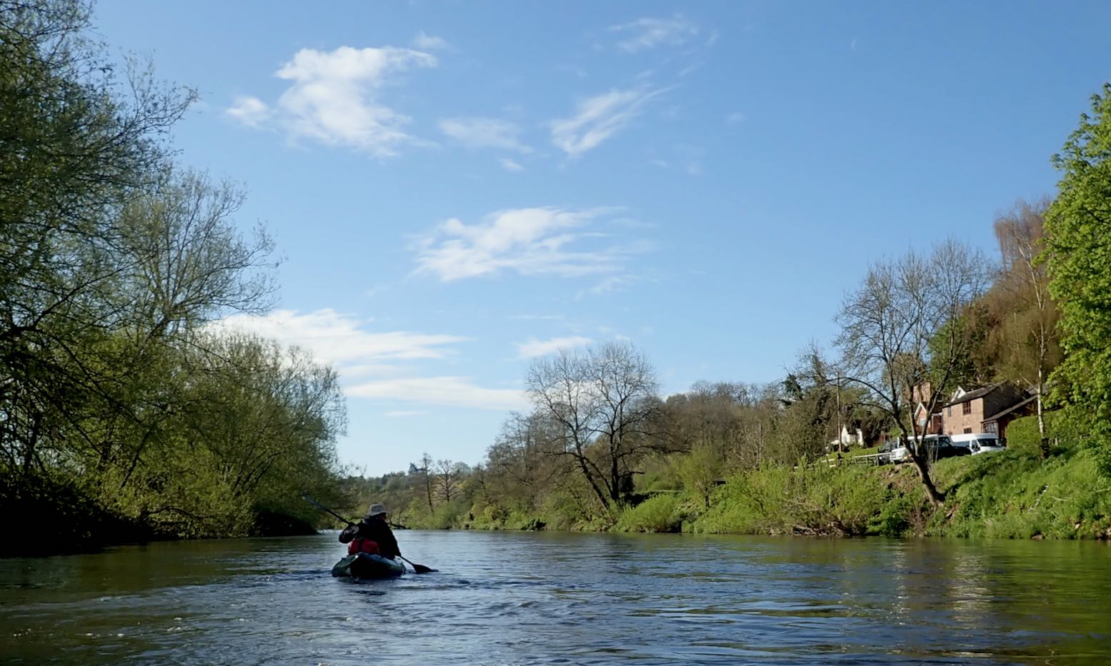
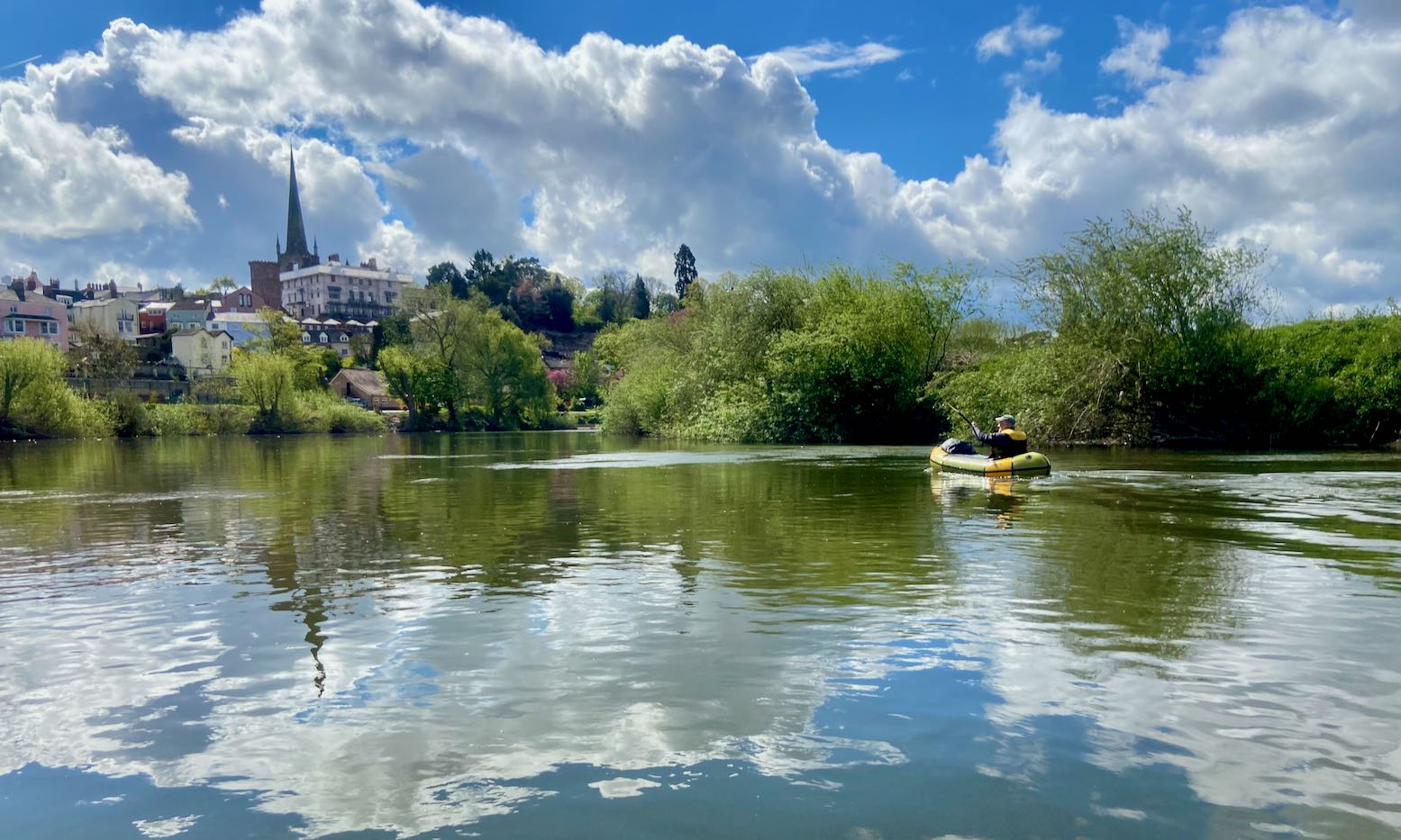
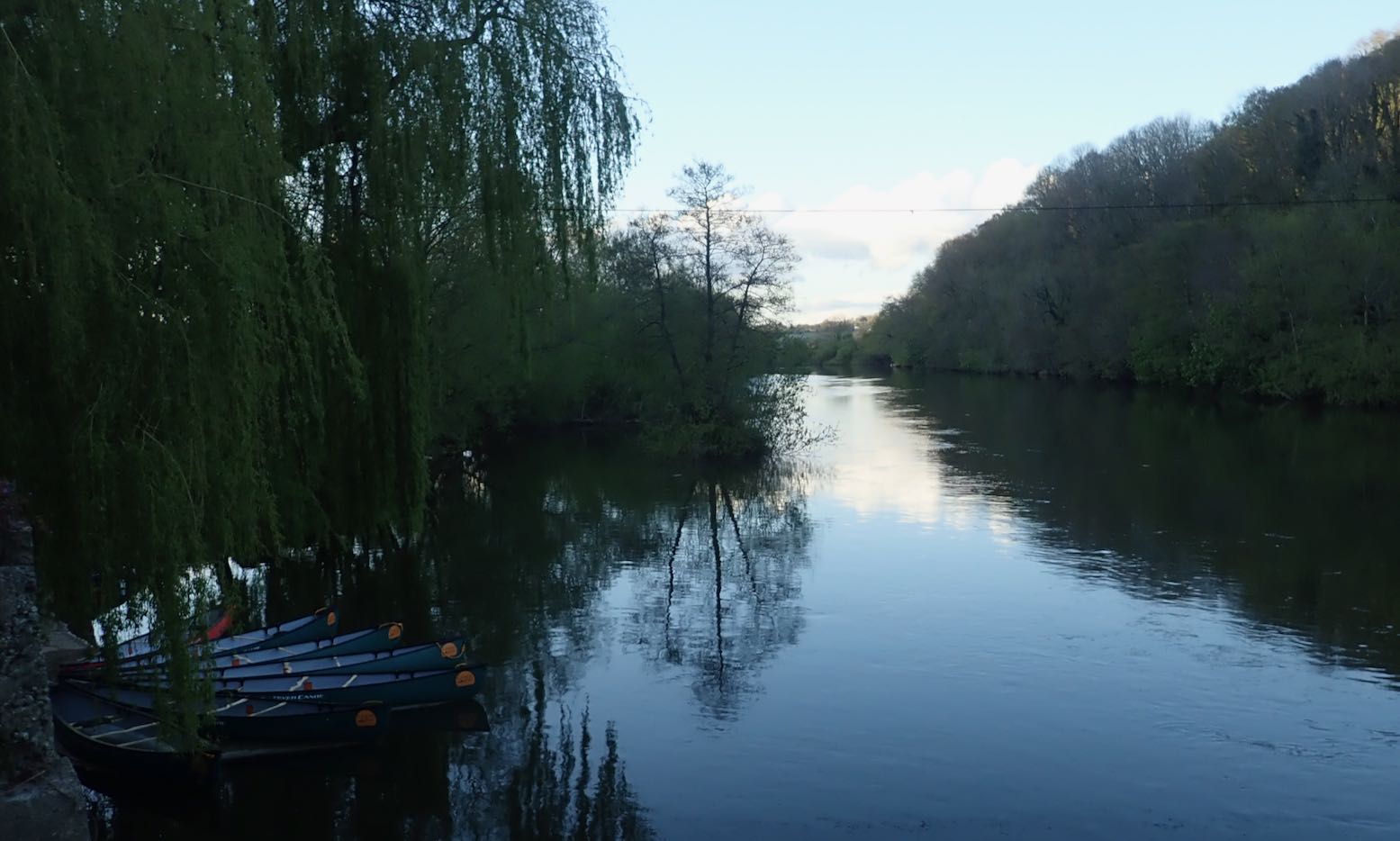
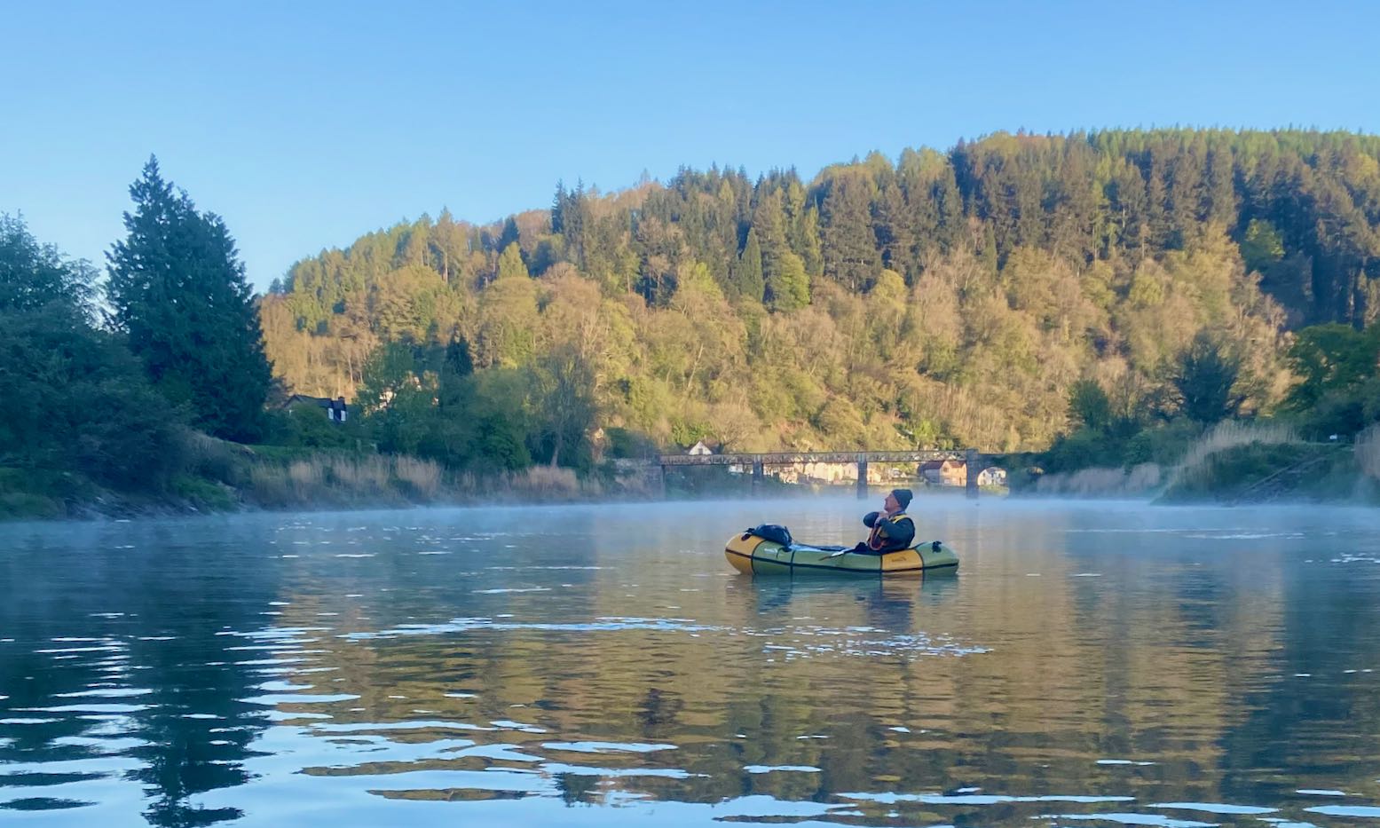
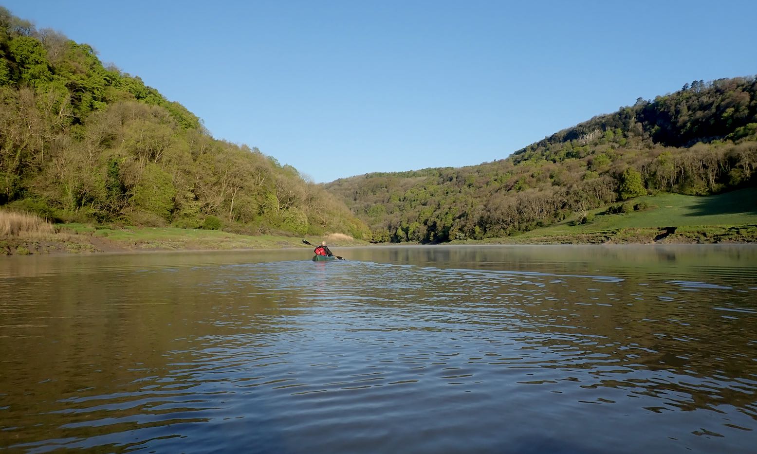
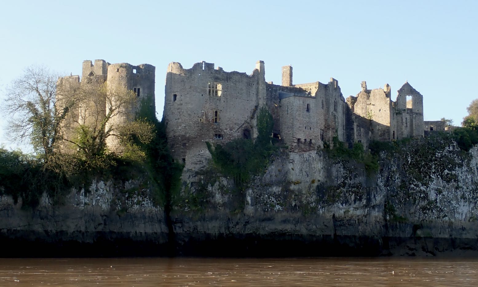
The Wye is the only river in (mostly) England where you can paddle for days and over a hundred miles, and not need to dodge a weir, portage a lock or confront a scowling angler. Even the few towns are historically intriguing. The whole valley is an Area of Outstanding Natural Beauty (‘AONB’), or ‘countryside’ as some call it. You don’t even need a BC licence: from Hay-on-Wye the river uniquely has PRN (‘public right of navigation’; like a footpath’s ‘right of way’). There is no other river like it in England so I don’t know what’s taken me so long, other than the prospect of another staycated summer makes you reappraise your own backyard.
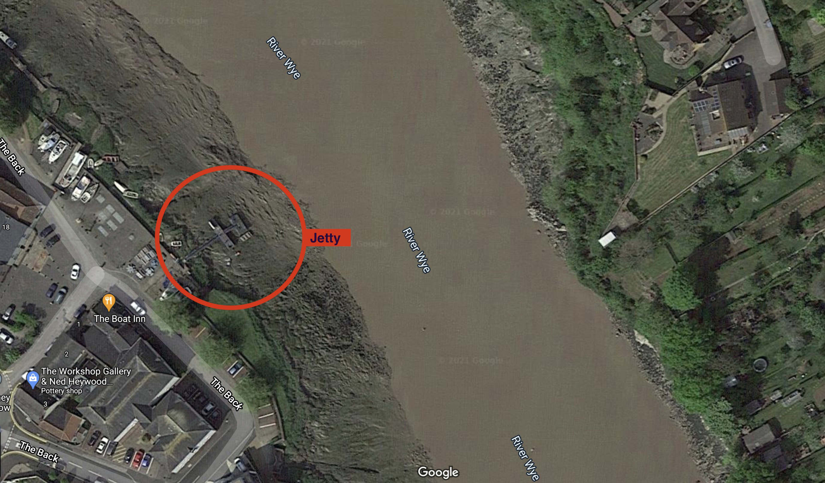
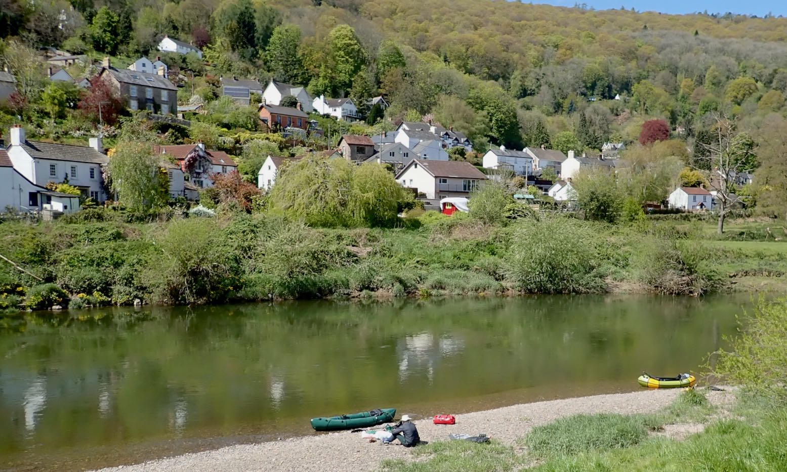
I invited myself to join Barry who lives near the river and who’d just bought himself an MRS Nomad. He’d done Hay to Hereford once and pronounced it a bit tame, so proposed Hoarwithy (Mile 51 from Hay) to the tidal finale at Chepstow (Mile 107 according to the table, left, or Mile 100 in the same sourced EA pdf guide.
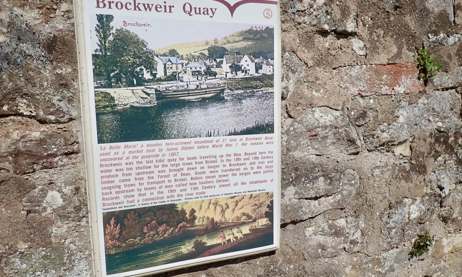
Fifty-odd miles: two long days and a bit, we estimated (wrongly). Our riverine transit had to be timed to meet HW at Brockweir, 7 miles from Chepstow’s sole jetty, otherwise we’d be stranded by tidal sludge or swept out into the Severn and end up in Tristan da Cunha.
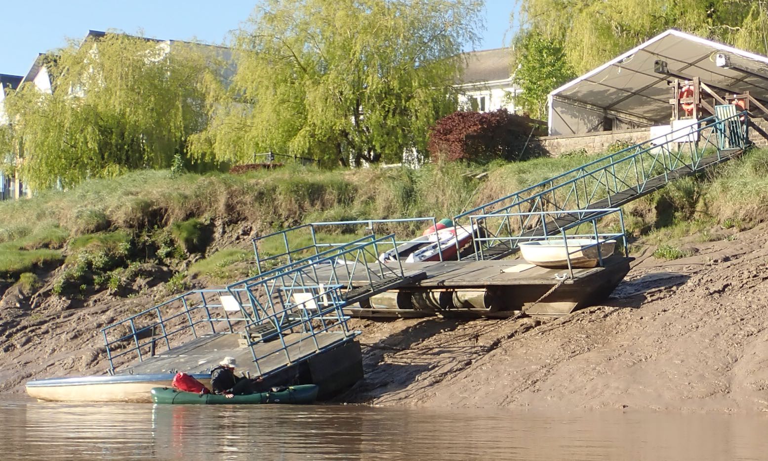
Chepstow jetty at LW; messy.
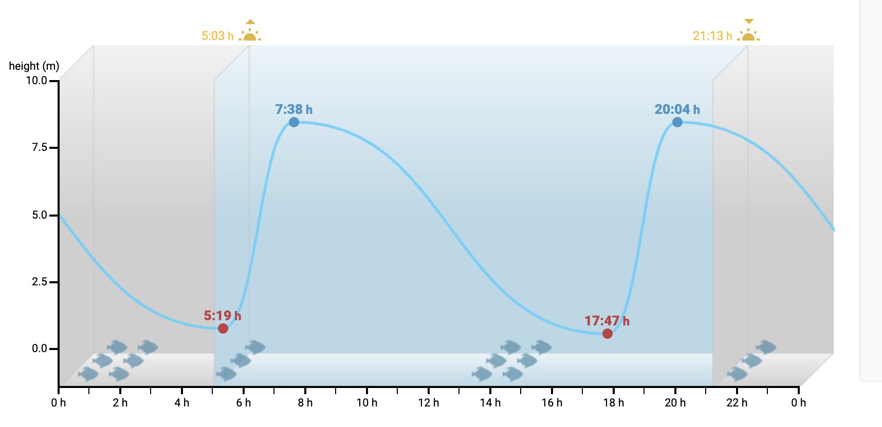
I don’t think I’ve ever seen a tidal profile like Chepstow: on a Spring tide the water can rise nearly 9 metres is less than two and a half hours, then take over ten hours to drop. This is because your Atlantic Ocean is piling into the western edge of the European land mass, including the funnel of the Severn (with Wye) estuary, creating among the highest tides on the whole darn planet. The game of ‘grab the jetty’ would make an exciting conclusion to our trip, especially as we’d have to be on the water before dawn to time it right. The guidebook warns: continue beyond Chepstow at your peril. Most canoeists dodge the tide timing game and take out at Brockweir.
Chepstow tides: holy moly!
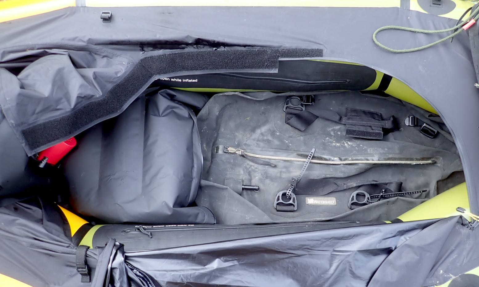
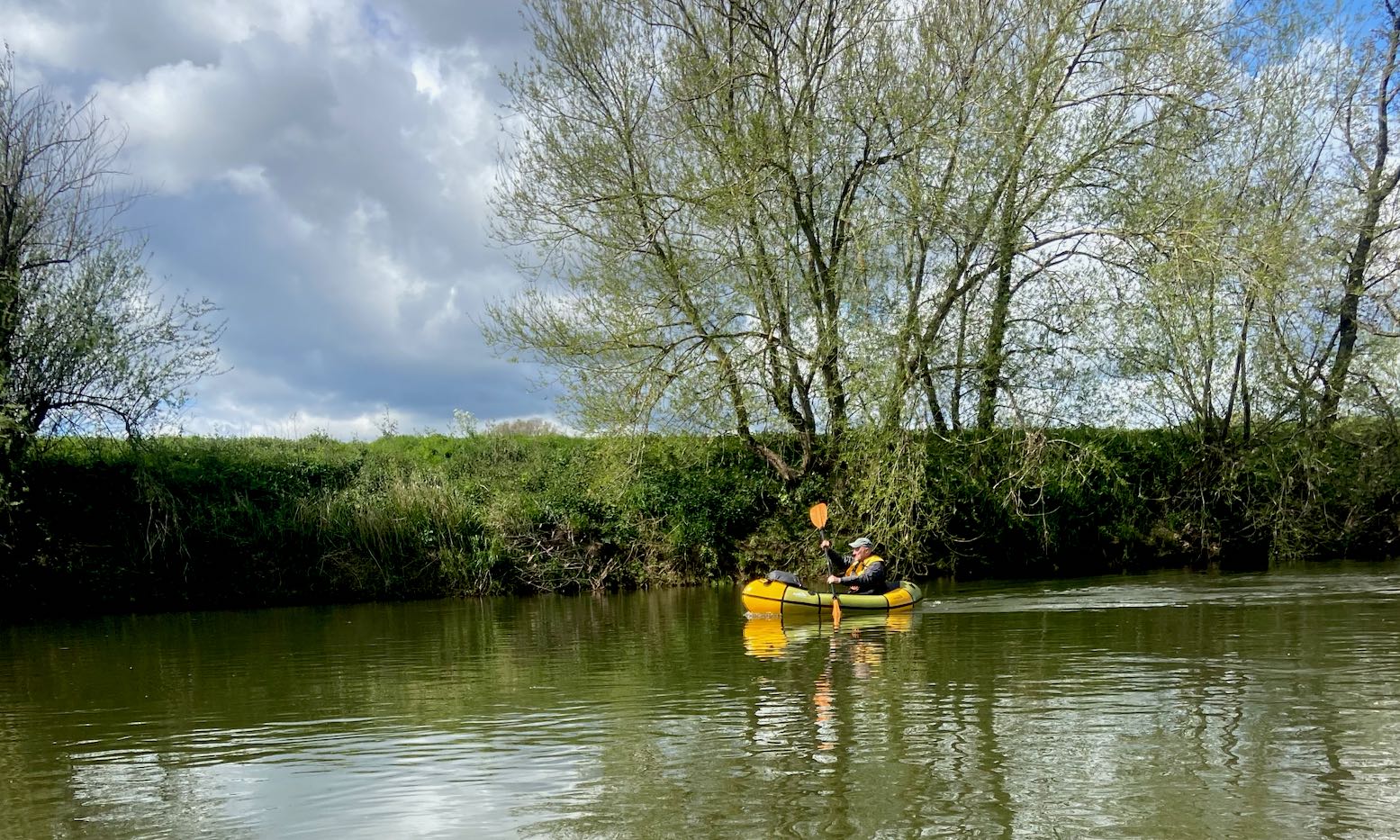
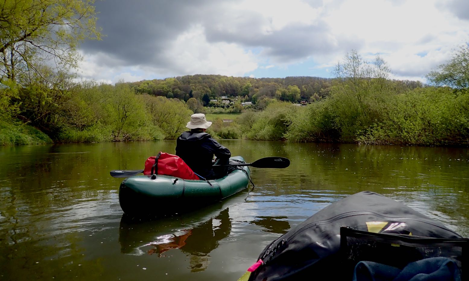
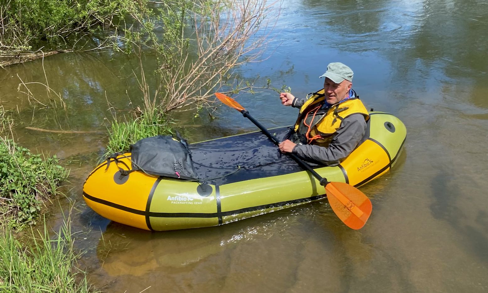
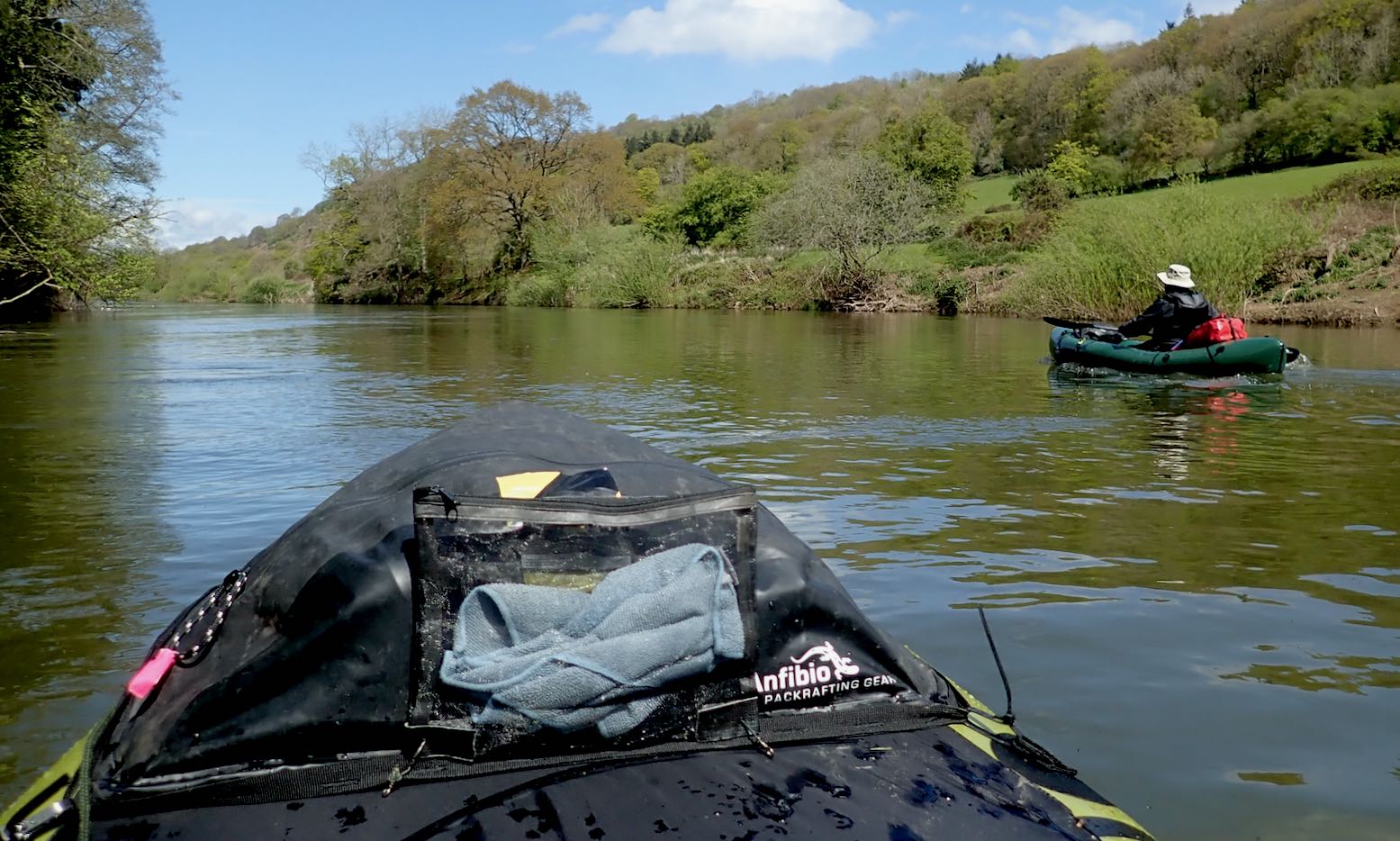
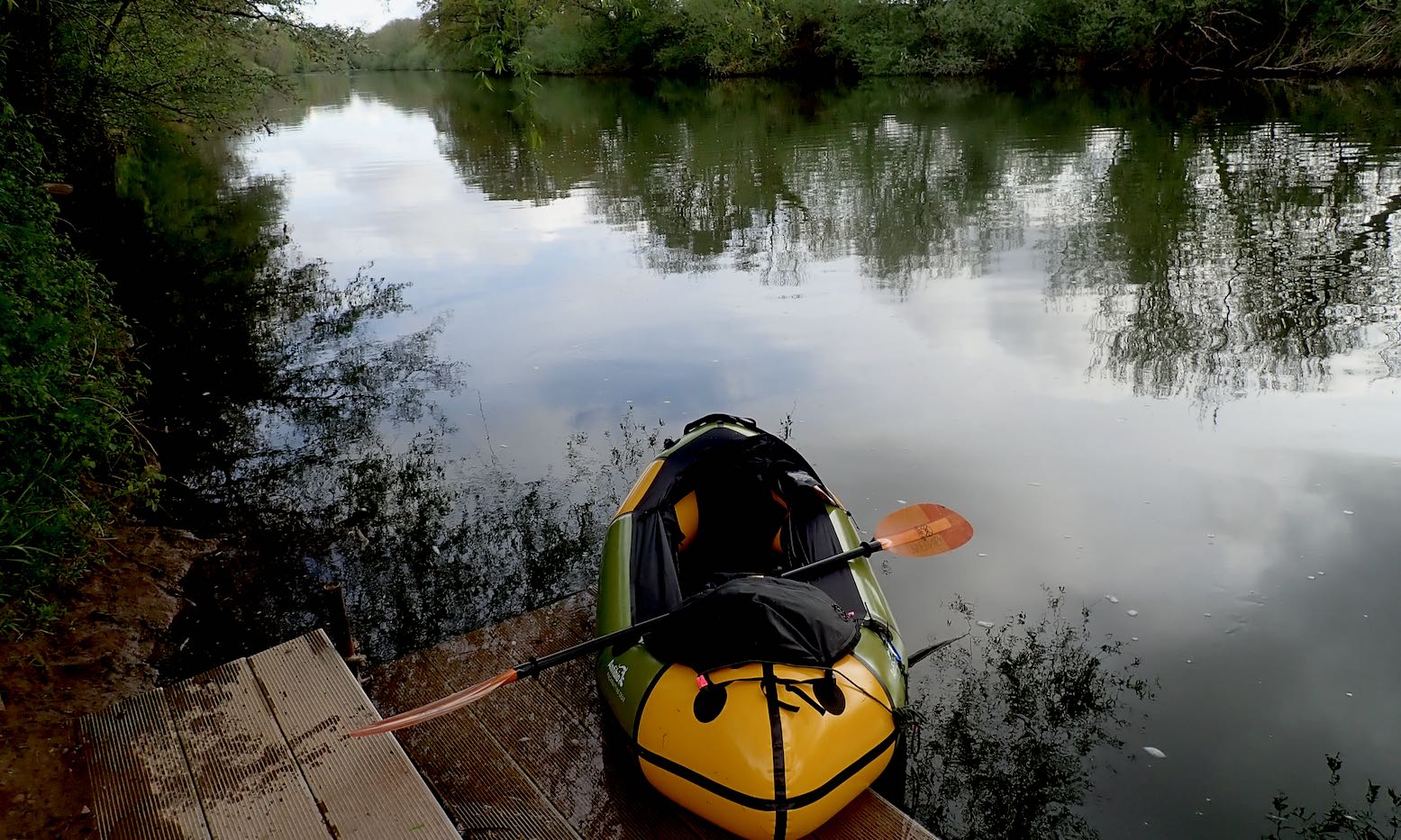
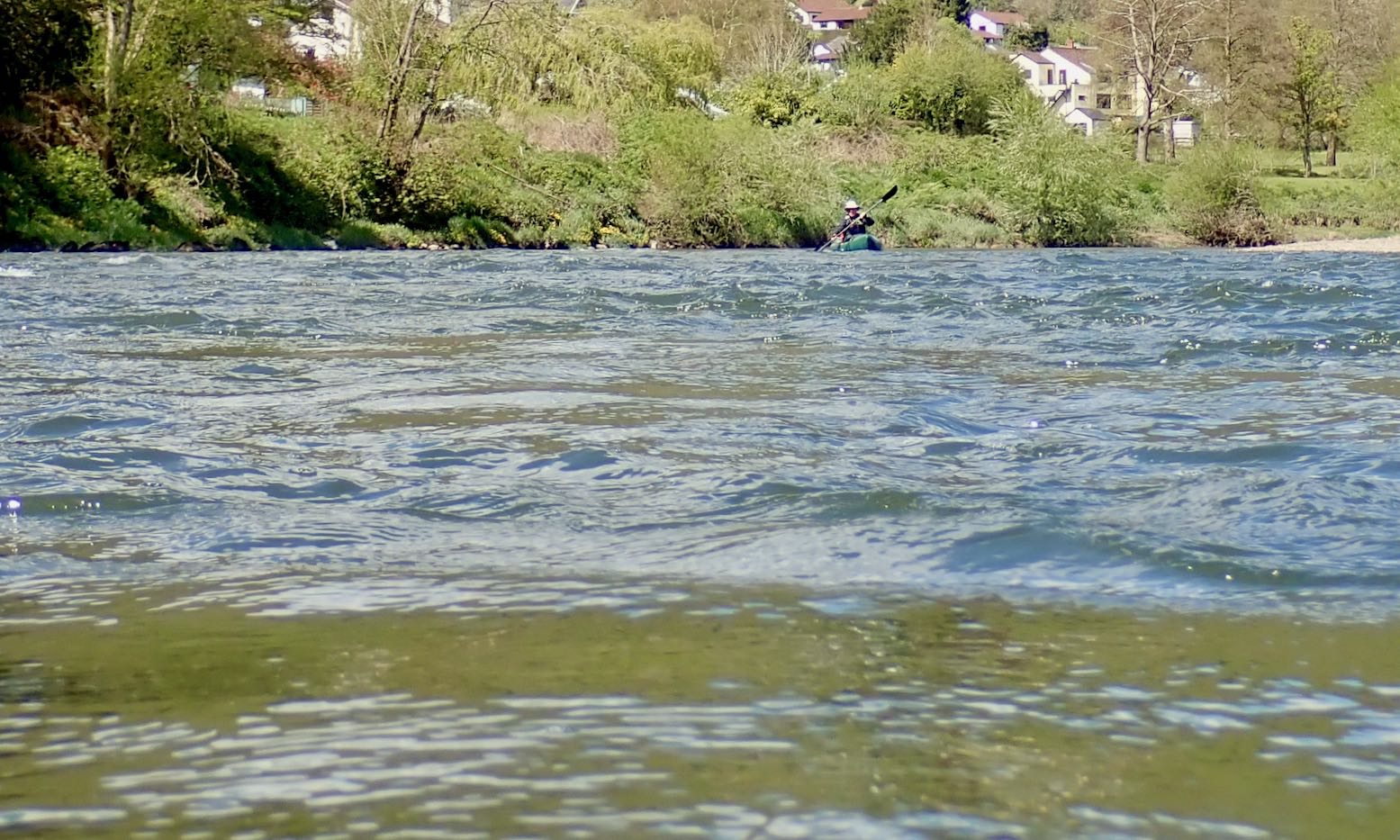
I thought I’d do the Wye in my Seawave, but then decided all that space and speed and glide would be too easy. Anfibio did me a deal on the Rebel 2K I tested last autumn (they’ll readily drop the tax to the UK so you don’t pay it twice). The three-night paddle would be a good test of their internal storage system for packraft touring. And the wet bits in between, a good test of the boat. My review of the 2K here. Short version: with a good, rain-fed current, the Wye is a fabulous, easy and scenic paddle. We saw just a couple of Gumo Safaris on a bank, and some club rowers out of Ross. Plus loads of parked up canoes waiting for the rental season. I hope to do it again in the summer. With no lifts, I’d try to leave Hereford early for Symmonds Yat free camp (see below). It’s 43 miles but in the conditions we had could be an easy ten hours. And if you don’t make it, no bother. Then it’s five hours paddling to Brockweir where an early afternoon HW could bring you two hours into Chepstow for a train home.
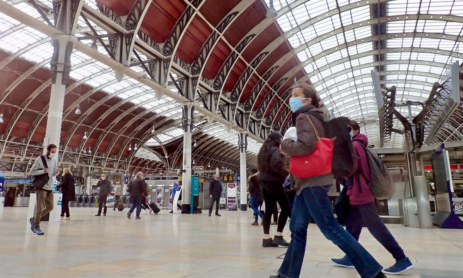
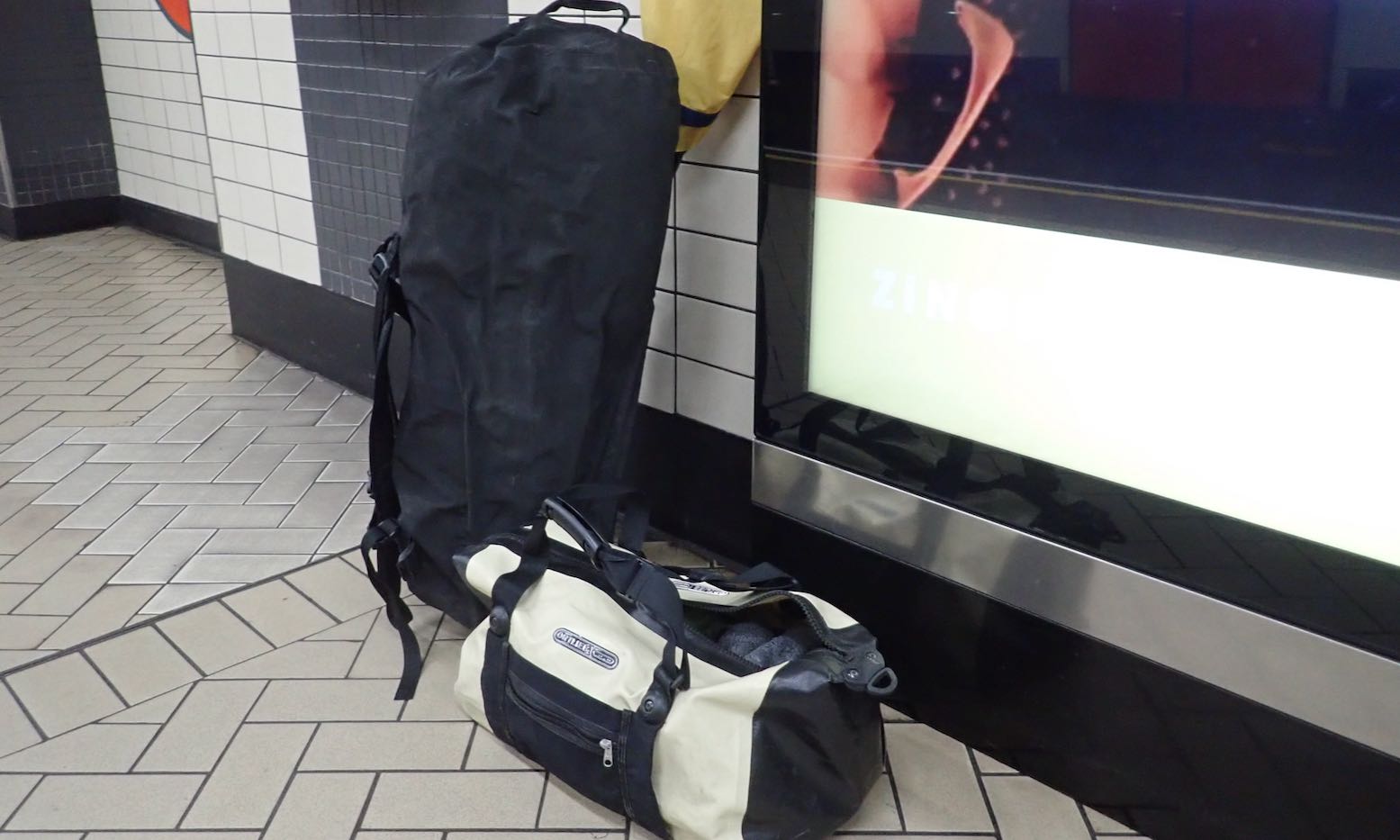
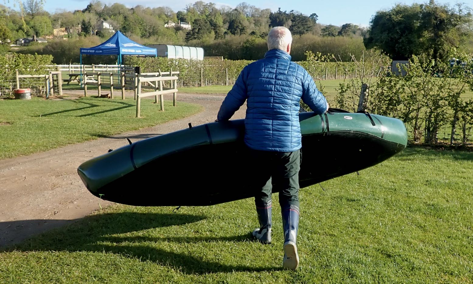
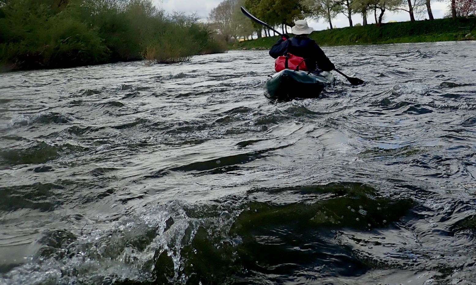
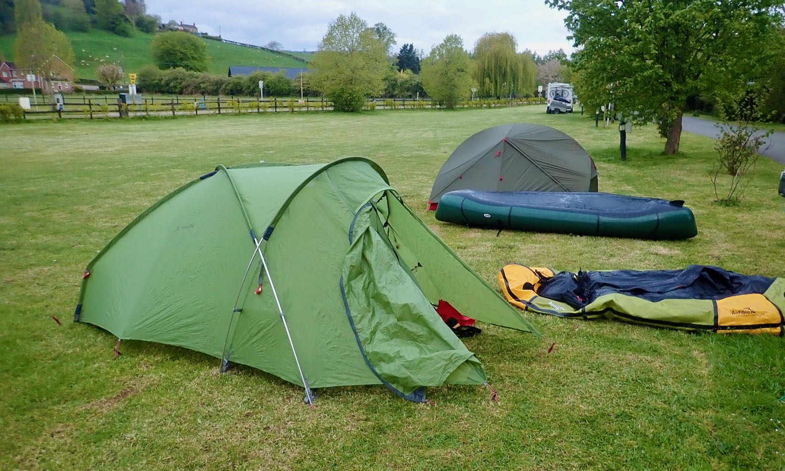
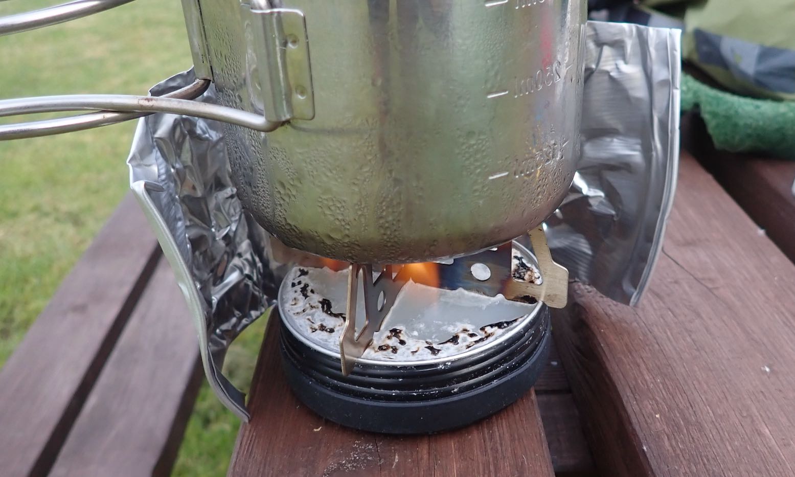
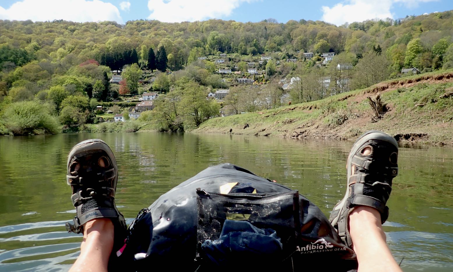
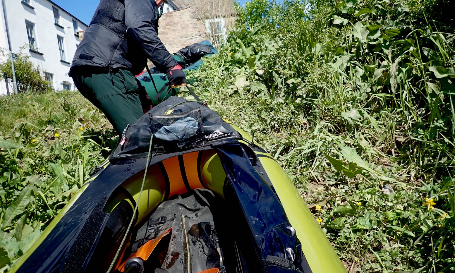
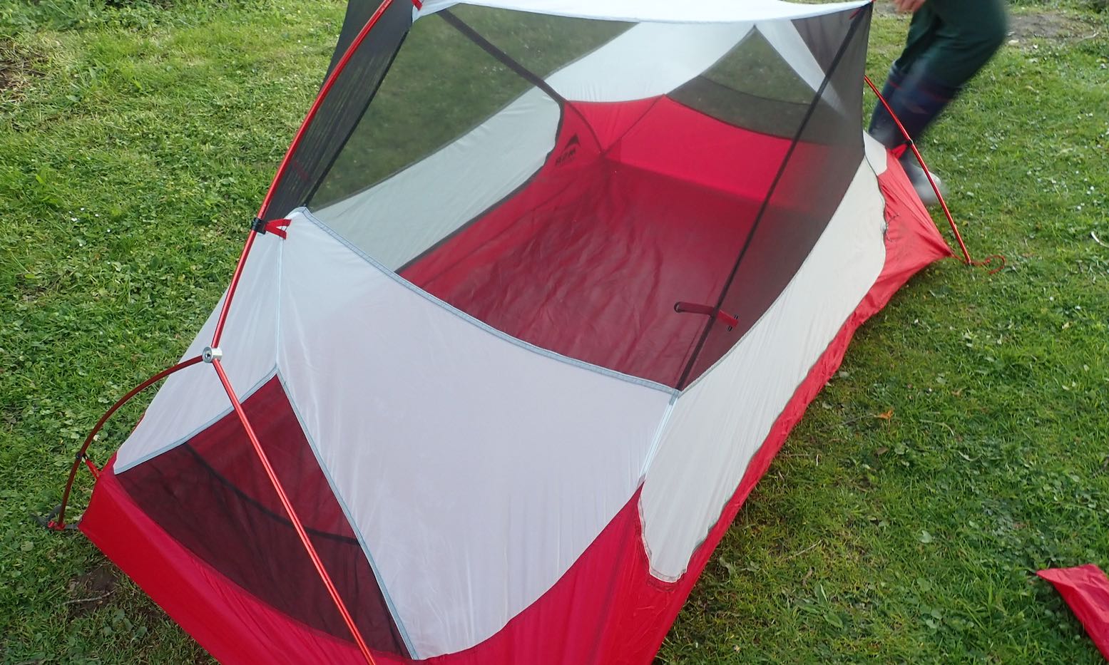
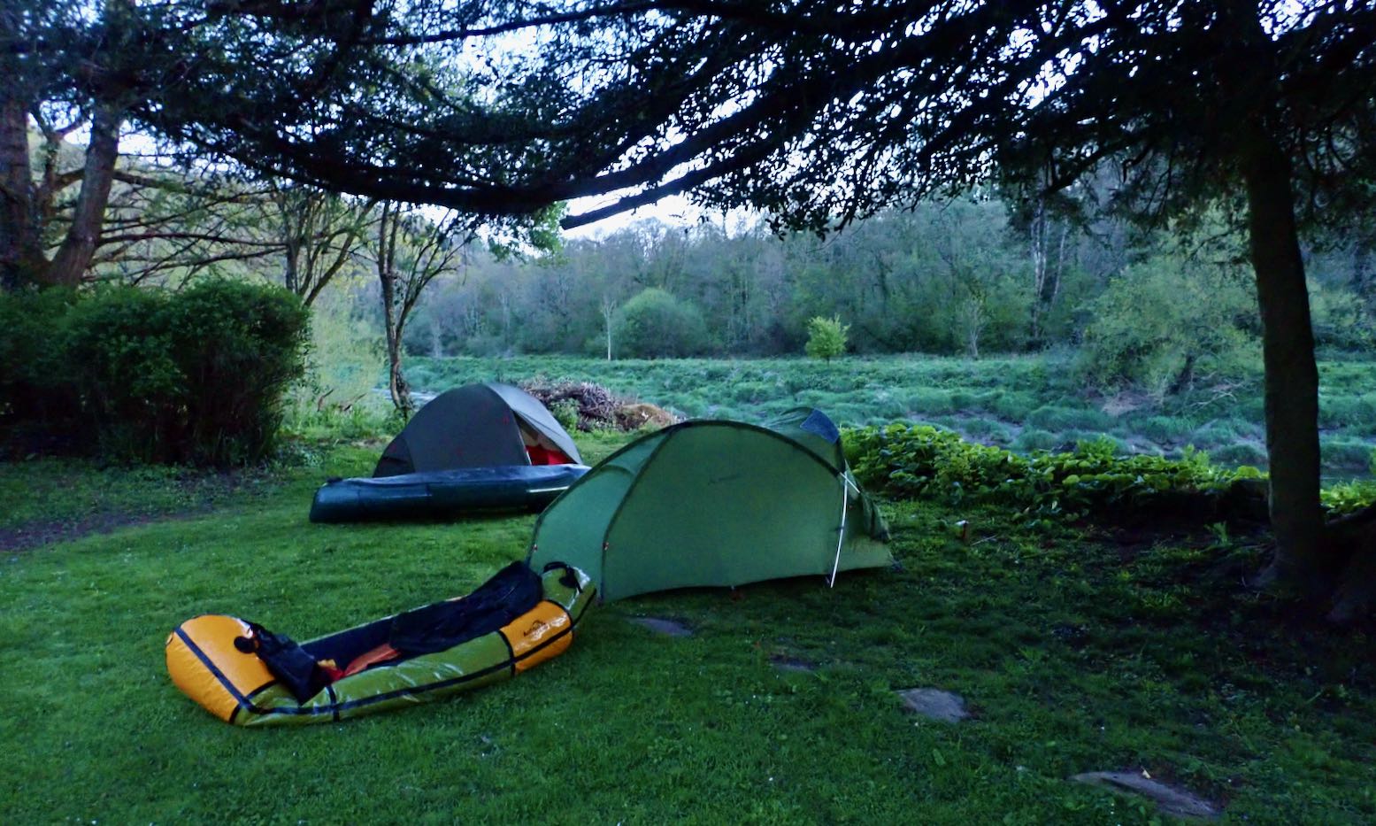
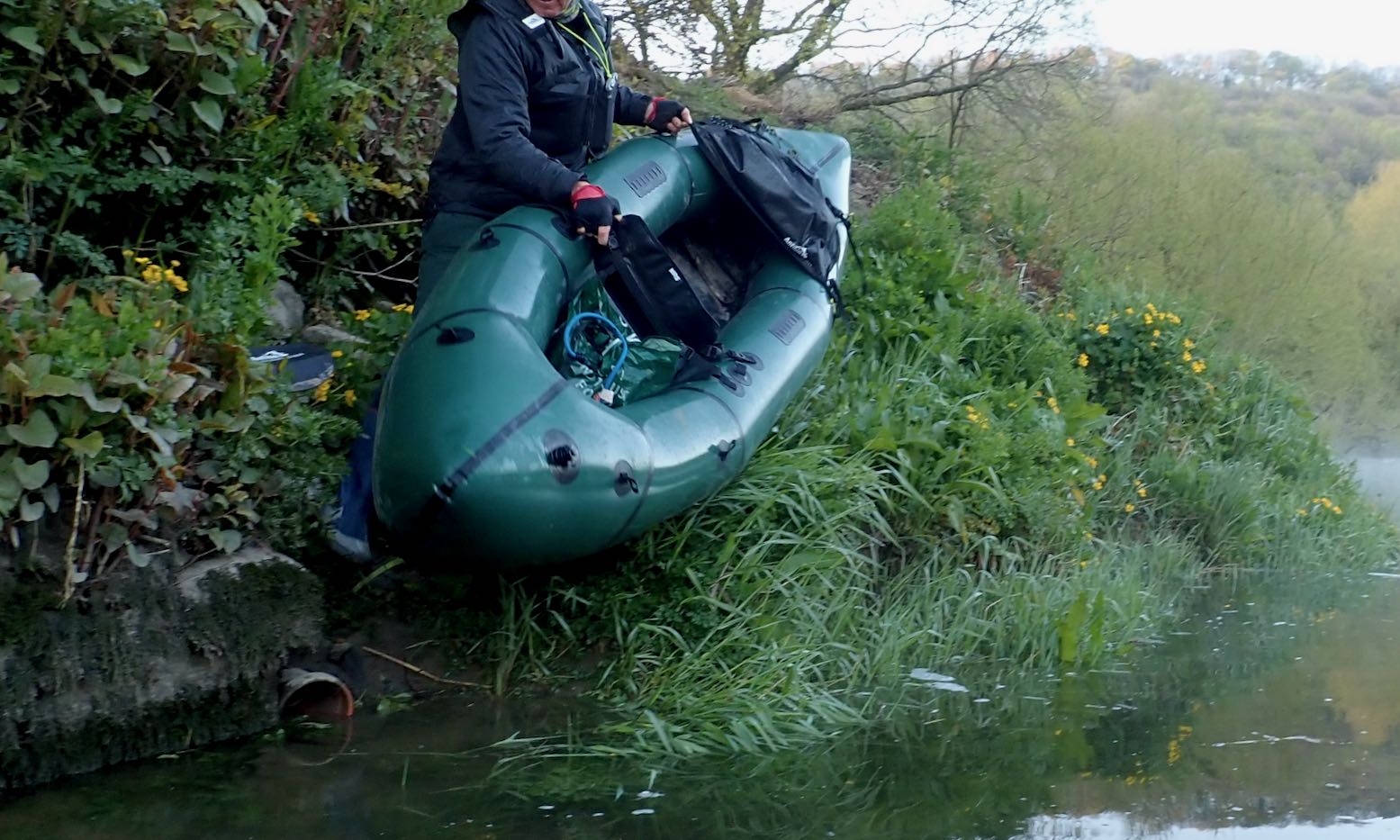
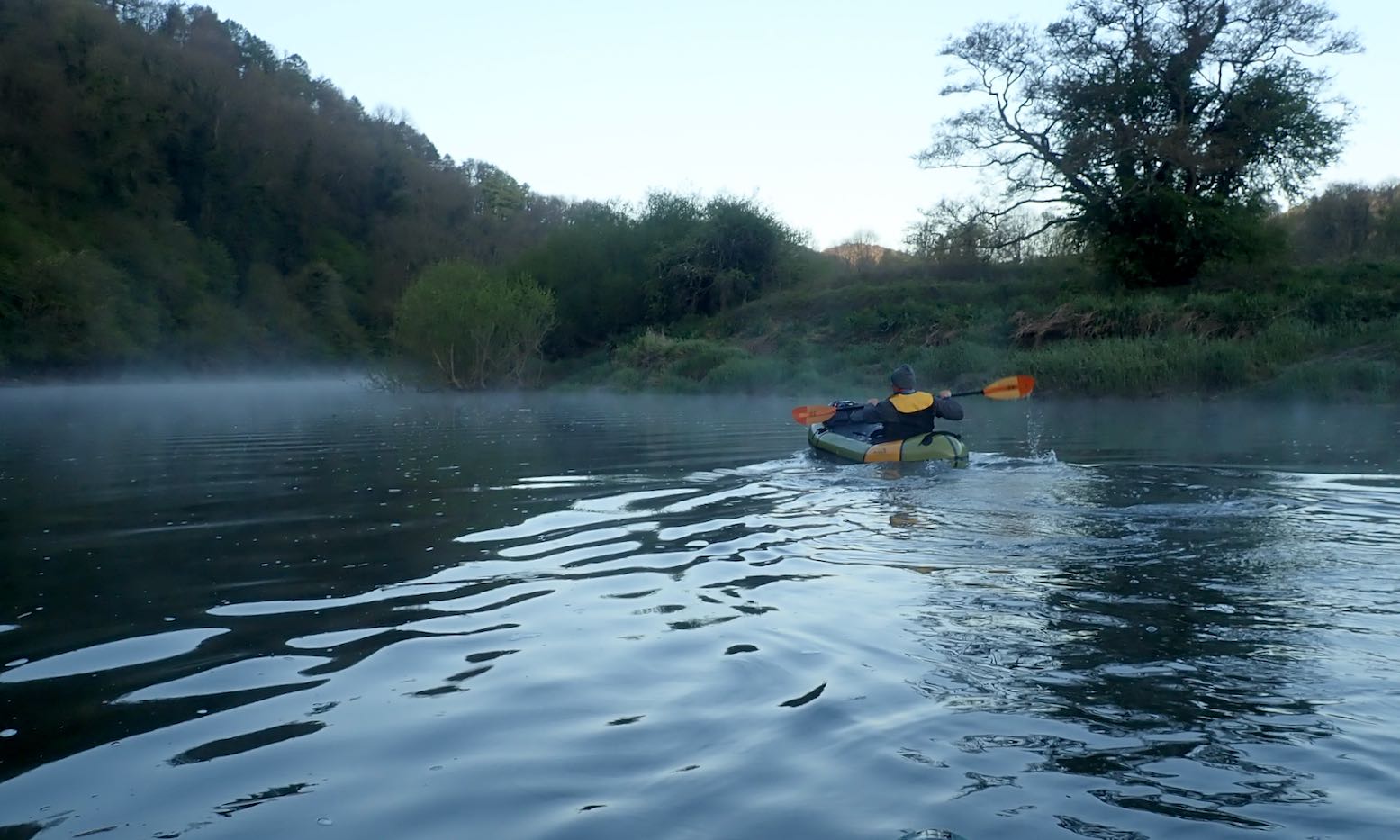
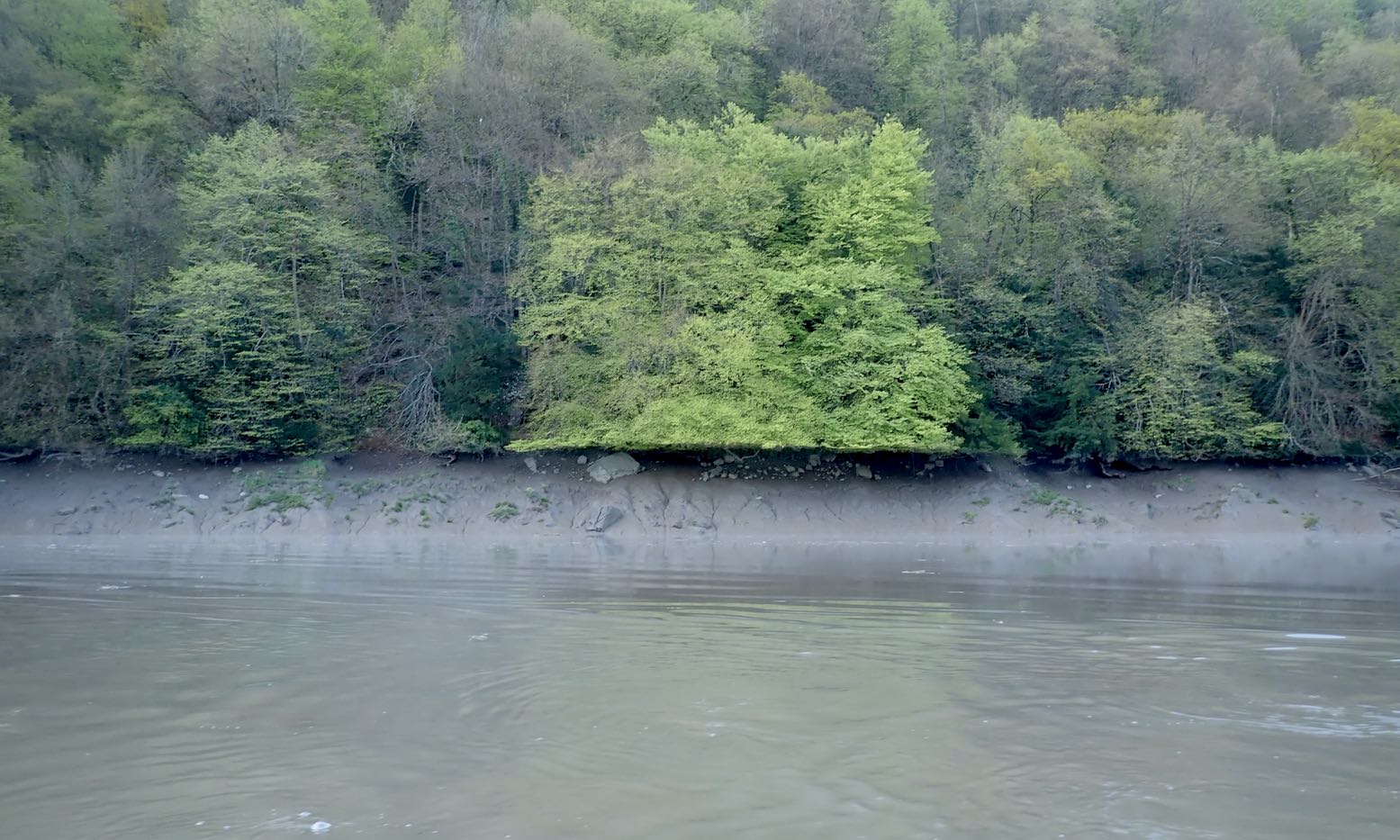
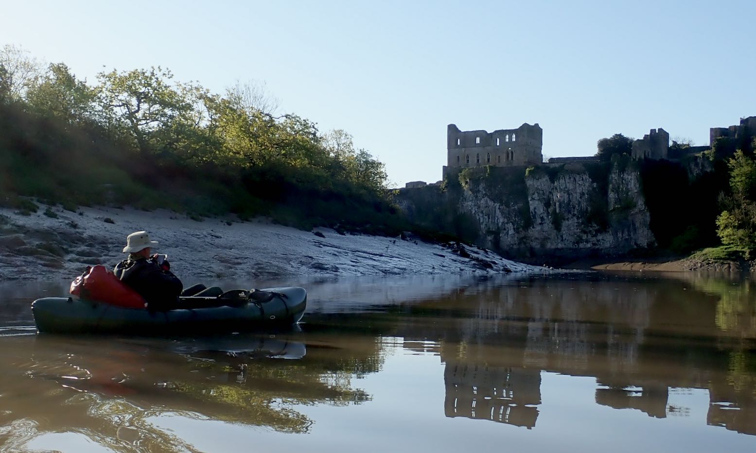
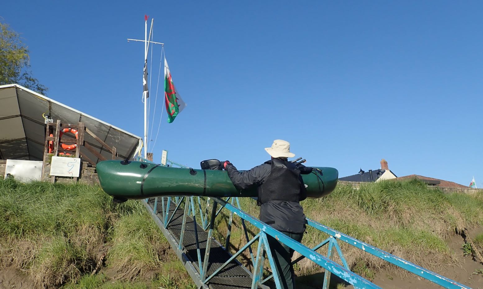
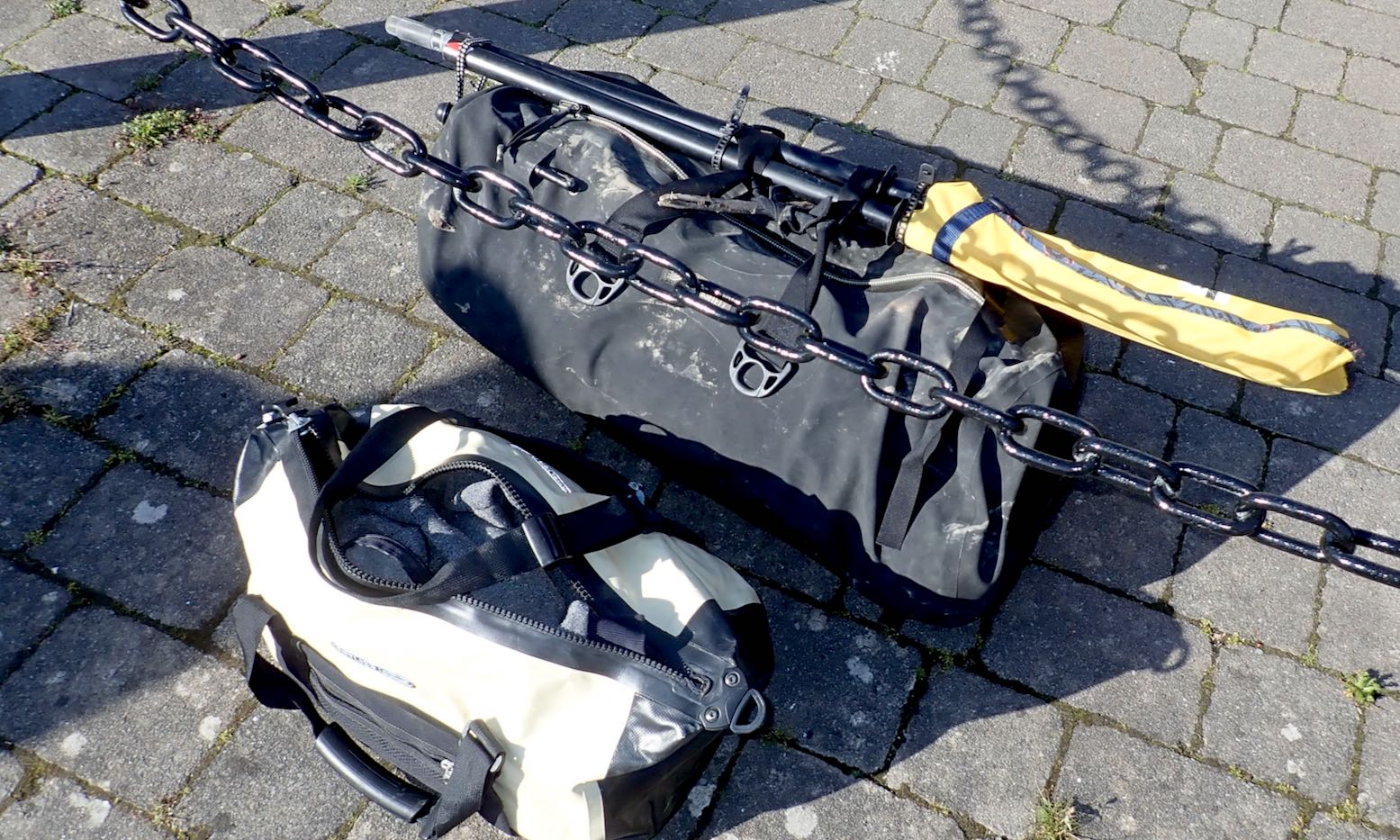
Apart from paddling through, not been up London for over a year. Slowly getting back to normal.A viable boat (and all the rest) in a pack – amazing still.We got fed then dropped at Hoarwithy campsite by Barry’s Mrs who’d meet us at Chepstow in 2.5 day’s time. Bloody freezing. Couldn’t wait to get in my bag.Checking the guy lines at 3am, I saw something like this heading west, fast: it’s Elon Musk’s Starlink. Look it up.Darn chilly… … at 6am. My gas stove couldn’t get it up. Warm tea.Tube bags: 2 x 70L pockets in the side tubes.Boat looks normal but is full of camping gear. Very clever.But with no Tube Bags = easy portage.More early morning rumpy pumpy to get the 2K skimming like a stone.My vacuum’d, super-duper UDB disappears out of the way as a floor protector.River’s higher and faster than when Barry recce’d a week earlier. Rain in Wales? Is that possible?We’re soon swept into the swift current.… and even a little ruffled water now and then. But all perfectly doable by a beginner.I brought my bigger-bladed Corry to keep up with the faster Nomad. I don’t think it works like that: it’s a pack raft.Ross-on-Wye – charming riverside town. Who knew?As southern English rivers go, the Wye was a whole lot nicer than I expected. This could be France!I clutch a twig for reassurance. Trim is backheavy compared to the Nomad, but that’s packrafts for you. I did load the side tubes weight-forward.I’m a convert to roomy Deck Bags, especially with a spray deck and when all the rest is locked in the side tubes.We’ve done our 25 miles by 2.30pm. We’re going much faster than expected.Sterretts Caravan Park. Ablutions closed but they took our money anyway. Next time I’ll use free canoe camping 1.7 miles on, past the Ferry Inn and famous Symmonds Yat rapids: 51.830177, -2.646146, complete with jetty!A bit less chilly this eveing at the 600-year-old Ferry Inn. A very yummy mac cheese for just £12.55!Next morning I get my gimp on.MRS NomadAnfibio Rebel 2KOnce loaded daily re-inflation is a bit of a faff. But it soon pays off. Symmonds Yat rapids just downriver running WW1.5North winds with very occasional warm spells. Llandogo, Wales river right, England river left.Lunchtime and more gimping. In the early 1970s I was on this very beach on a scout camp.No dogwater on this river.About 18 miles later we arrive mid-afternoon at Brockwier, the tidal extent of the Wye. We must wait for HW.In the old days sea vessels reached here. Smaller boats then went upriver as far as Hereford.In a wet spell that house will flood. We leave the boats …… and walk two miles to Tintern for some nosebag.We then camp discreetly back in the village’s churchyard, built in the 19th C to contain the rampaging riverfolk.I suffer a spot of Hubba tent envy.Compacter, lighter, roomier – but 450 quider.Five am: quiet as a Moravian graveyard. HW in an hour. No time for breakfast!Awkward put in; it’s only a neap tide.We set off into the pre-dawn mists. Two hours to Chepstow.By Tintern the sun is up, but still too early for a nice shot of the ruined abbey.Tree does not like saltwater.We expected to surf a barely ridable riptide, but it was no faster than upstream because the tide goes out very slowly.7.45amChateau ChepsteauEgress was made more awkward by that annoying dinghy.Croeso i Gymru, boyo.All packed up. A train back to London at midday.Which leaves loads of time for aFull Welsh Breakfast!
In an occasional series here on IK&P, we trawl through the tangled archives of celluloid to seek out often over-looked packrafting action from the silver screen. Our first candidate: Stanley Kramer’s 1959 rendition of Nevil Shute’s post-apocalyptic drama On The Beach (1957), starring Gregory Peck and Ava Gardner (left and right) plus a miscast and already twitchy Anthony Perkins warming up for Psycho in a year’s time.
Synopsis Someone in a Cold War bunker over-reacted and the world has turned dayglo (this actually nearly happened in 1983). But only the northern hemisphere has been obliterated. Australia remains uncontaminated but commodities are in short supply and the country is irrevocably turning toxic as wind currents spread fall-out right across the planet. Although the film and the book shared an implausible ‘Keep Calm and Carry On [till the End]’ mood, for it’s time On The Beach was unusual in that the dangers of misused nuclear power were for once not ‘Attack-Of-The-Giant-Ants’ allegorical, but chillingly in-your-face realistic.
Packrafting Scene American Navy sub commander Peck has taken refuge in Melbourne, but is asked to cross the Pacific in his nuclear-powered vessel to see if Arctic radiation levels might be dropping, and also to look into grabled morse signals emanating from San Diego. On the left a volunteer in a radiation suit and scuba tanks paddles ashore to investigate the radio transmissions.
Our man’s heavy get-up sees his navy issue packraft close to swamping. Continuity spotters will further observe that as he climbs the mooring ladder (left) he carelessly fails to tether his packraft, jeopardising his return to the sub even before the deadly fall-out permeates through his PVC suit.
Denouement Northern hemisphere radiation remains deadly – no one is alive. The San Diego signals turn out to be a tangled sun shade flapping over a morse keying board. Gregor returns to Melbourne and accedes to Ava Gardner’s charms (left – unlike in the book but we’ll let him off). Doing so cures her alcoholism and ‘wicked ways’ but with his loyal crew he heads back ‘home’ to the toxic US anyway. The antipodean remnant of humankind succumbs and the film ends with a Salvation Army banner flapping in now-deserted uptown Melbourne: ‘It’s Not Too Late… Brother’.
I do like a good storm. On the left today’s coastal forecast for the Minch. You might call it the first big storm of the autumn. Some 250 miles to the north, out on the Faeroes and towards Norway it’s blowing at Force 10 with 40-foot waves, like something out of the Perfect Storm movie before it gets really scary.
What can it be like to paddle a packraft against a wind gusting up to 50mph, I wonder? Is it even possible? Many times I’ve surprised myself how fast an IK can move – 2-3mph – into a headwind of around 25mph. You can’t sustain that all day, but last year I managed to plough along like that for an hour or two when I gave up on the Ningaloo Reef and turned back into the wind. Seeing as gale-force is the only paddling available for the next few days, I rolled up the Alpacka and went to find out. Sorry to disappoint you but heading out to sea alone, even on the beach with the onshore wind felt too risky. I figured there was a good chance of a gust flipping the back-heavy Yak in a kind of ‘frontal bandersnatch’ as it crested a wave. Better to stick to my ‘play-loch’, site of many paddling experiments and where there’s just wind and not much wave to deal with. In the given conditions inflating the Alpacka in the back of the car was effortless; it took just six bagfuls to fill up the boat, instead of the usual ten. Getting my yellow windsock onto the water was less easy, so once I slapped it down I jumped in quick, clipped the raft to myself via the paddle and tried to leave the shore at the downwind end of Loch Raa.
There was no fetch to speak of and using my large-bladed but light Werner Corrywrecken paddle, I jabbed at the water head down, trying to make headway. The waves rushing by gave the impression I was flying but a sideways glance to the shore showed the raft was barely creeping along. And when a gust hit, it didn’t actually move at all despite my huffing and puffing. Even though I’d probably missed the peak of the day’s winds, not surprisingly I’ve never experienced a paddling effort like it. It felt like some sort of horizontal pull-up machine in a gym set on ’10’ and my hands gripped way out on the ends of the shaft to increase the leverage. Soon any ideas about paddling to the far shore, only 700 metres away, were surrendered. From a video’s timeline it seems it took me 8 minutes of flat-out effort to cover 250 metres – just over 1mph with brief rests every couple of minutes.
I felt safe in the Yak; the gust-borne waves weren’t even a foot high and it was actually a good little workout. Once I’d had enough, I swung round and shot back to shore at what turned out to be 4mph, but felt like sitting still while the wind blew past from behind. Interestingly the raft was easy to handle; no weathercocking. Walking the empty Yak to shore, it took off like a kite. Had I not been strung onto that thing it would have been on it’s way to Inverness quicker than the RAF Tornadoes which tear across the skies hereabouts on a fine day.
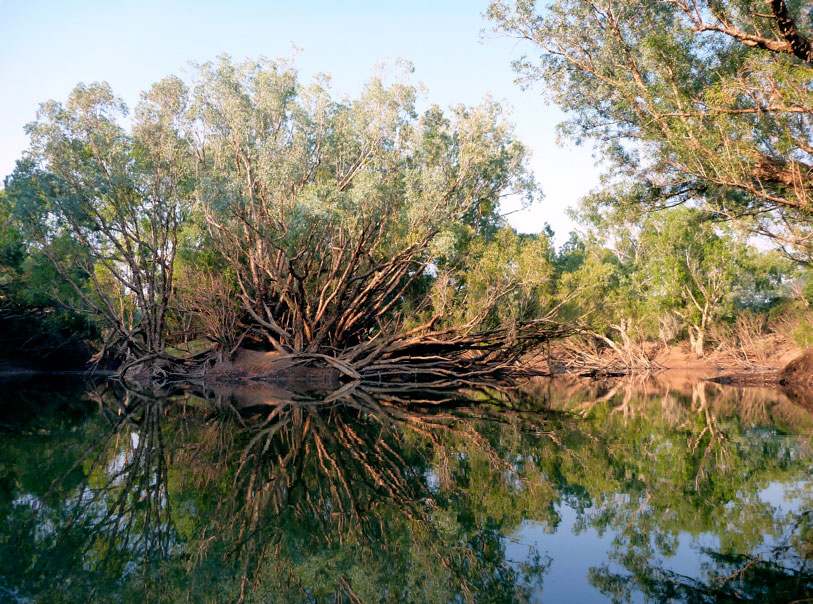
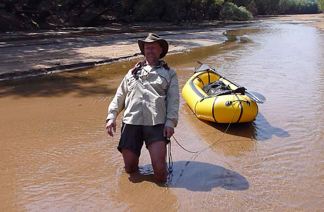
Soon after dawn we stood on a small hill overlooking our camp down on the sandbank (middle point map left or picture right). For the last couple of days we’d spent most of our time in the tree-lined river channels, seemingly separated from the outside world. Here was a chance to see what lay on the outside, beyond the river.
It was the same old gum-tree spotted Australia bush which covered most of the country, but up ahead a particularly thick mass of gums obscured the course of the Fitzroy. It did not bode well for an easy day.
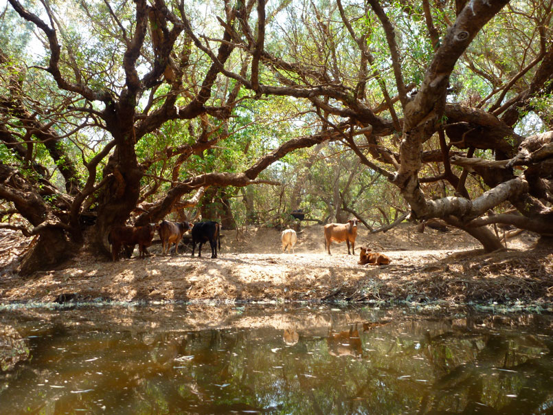
We set off a little later than usual, wading and paddling the shallows, but mostly walking with our boats. We passed Munsters Pool as marked on many maps, but it’s just another part of the river with a few cattle milling around. The flow braided and at one point I idly took a left stream while Jeff just ahead went right. I assumed they’d join up which they did, but not for 20 minutes or so by which time we’d lost touch with each other. I’ll let the video above show how events unfolded, but I knew soon enough was my mistake for not following the one in the lead, even if that path might end up a dead-end. I’ve experienced this kind of unintentional separation several times in the desert on motorbikes: everyone knows best so you diverge round an obstacle as you think your way is better/easier and will soon join up anyway. Your path goes astray and round the other side you don’t meet up. The one ahead goes back looking for the one missing, the one behind thinks he’s way behind and rushes on ahead. Cue wasted time and frayed nerves. On this occasion, once I stopped I was pretty sure Jeff was behind me, and sure enough, 40 minutes later he walked in from upriver after backtracking all the way looking for me, giving up and carrying on. Although we were both self-sufficient, from then we vowed to stick together – it was better for the film!
Soon after that we has smoko and tensions eased over a cup of tea. As we gathered wood I found a plastic bin lid which made a great over-sized frisbee and which Jeff later adapted into a seat to keep his butt out of the swill. Very soon that bin lid became handy as I came across a rich deposit of alluvial gold, sparkling in the shallows. Jeff swilled the sediment around while I filmed, and very soon we had some colour. There certainly is gold in the Kimberley; WA’s wealth was founded on it in 1885 with the original gold rush at Halls Creek, the next town down the road from Fitzroy Crossing. And since pre-industrial times the low-energy method of surface mining has been to divert rivers into torrential ‘hushes’ which scoured away the topsoil to reveal precious mineral veins or ore. The 2011 flood on the Fitzroy had clearly exposed riches beyond our wildest dreams and I’d have to beat Jeff to death with the bin lid to get my hands on the treasure. In the end we came to our senses and recalled that the lady’s assertion in opening line of Stairway to Heaven was most probably deluded.
The day proceeded to warm up with a series of short pools, very often preceded by tiring quicksands where the shallows became waterlogged. Elsewhere progress was slowed by log jams where the flow was forced into the trees lining the main channel which has become choked with sandy sediment dropped by the river after the flood. But along the entire route the Kimberley soundtrack of birdsong kept us company with its squawks, whistles, warbles and chirps. Today we saw a few blue-winged kookaburras and a couple of rainbow bee eaters along with the usual procession of egrets and cockatoos. In my guidebook-researching days I knew them all by heart and it was fun to jog my memory or be able to name what I saw.
Up ahead a welcome pool promised some steady progress – even Jeff was getting to like to the effortless paddling now. But very soon a strong reek of guano or urea choked the air, with the below water covered in a skanky film. A huge colony of bats where clinging to the river gums along the left bank, and with a shriek took to the wing as we slowly paddled by. Jeff explained the reason for the stench was that bats pee on themselves in an effort to keep cool.
At lunch I called Fossil Downs station to notify them a little late that we were on their land, (as they’d asked us to do). The old lady there seemed quite inspired by our mini adventure along the river which she’d never really seen but which watered most of their land. Still in the hands of the same family, Fossil Downs was established in 1885, making it the oldest cattle station in the west Kimberley. Although I’d never been there I’d always been in intrigued by tales of the comparatively palatial homestead and its marble flooring (or some such). In the Kimberley most station homesteads were functional affairs.
Just as yesterday, within a few steps of lunch Jeff got another flat, but fixed it in a jiffy by rolling the hole up with superglue and applying a duct tape bandage for good measure. We pressed into the afternoon, squeezing under trees or lifting the boats over or around fallen logs. At one point a rather mangy bull stood in our channel, sick and clearly agitated. Normally the cattle ran away; this one tried but got stuck in quicksand and didn’t have the strength to gallop up the steep bank. It turned round and came back to stand its ground. Filming all the way, Jeff got a little too close and the thing lowered its horns and ran at him. Eventually I crawled up the steep bank, and from point downstream but safely out of reach, coaxed the ailing steer upstream past Jeff and our boats by throwing sticks.
Since the bat colony the surface of the river had been pretty rank which didn’t add to the ambience. More bat colonies followed, and about 4.30 we came across another piled-up sandbank which filled the whole channel while the flow took off left into the side trees. A knot of fallen trees required lifting round to continue so we called it a day just as a helicopter flew overhead. With cow crap and bat shit all around, it wasn’t a great spot, but would have to do as we were just about finished for the day. In fact we’d done better than we thought: 10 hours to cover 26 clicks according to the map, and not far from the second Big Bend which led down to Geikie, possible ranger issues and the final big run on wide open channels.
That night Jeff prepared a brilliant garlic damper which we cooked on the coals. Real food – you just can’t beat it! It had been a hard day to end at a grubby camp, but we felt we’d finally broken the back of the Fitzroy.
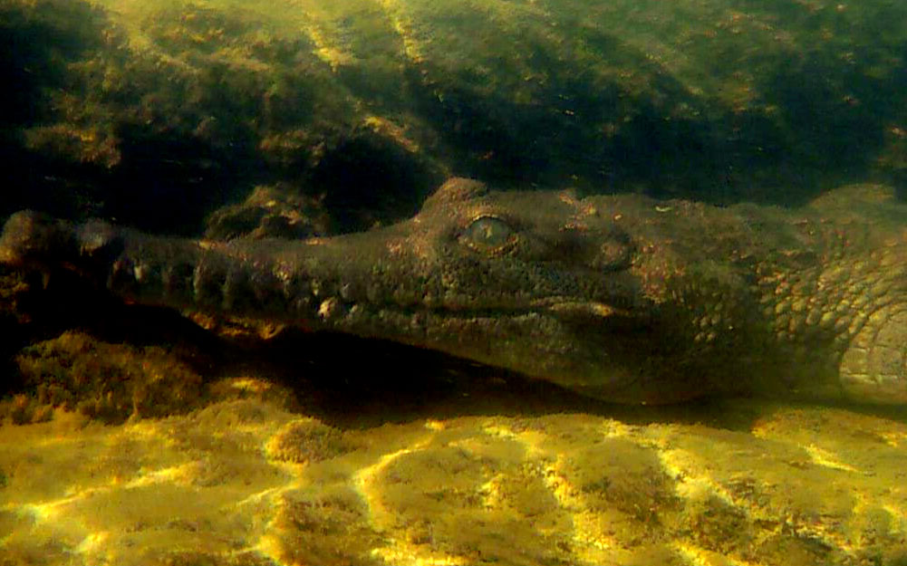
We were up again with the light, ready for more ankle-twisting boulder portages like those which had slowed us down yesterday afternoon. Little did we know that the day would turn out to be one of our best on the Fitzroy. Back in our boats, within minutes of leaving the camp, we emerged in an open area of rocky outcrops and knotted rapids, like the lower reaches of a mountain stream. Little crocs basked either side on the sandy banks. As the day developed we ended up towing our loads along shady shallows, as effortless as walking a dog. The occasional quicksands, log jams, jumpy cattle and the Bestway’s first puncture only added to the day’s adventure. We ended up camped on a broad sandbank below granite hills after a great day on the Fitzroy. Let the day’s filming and gallery below tell the full story.