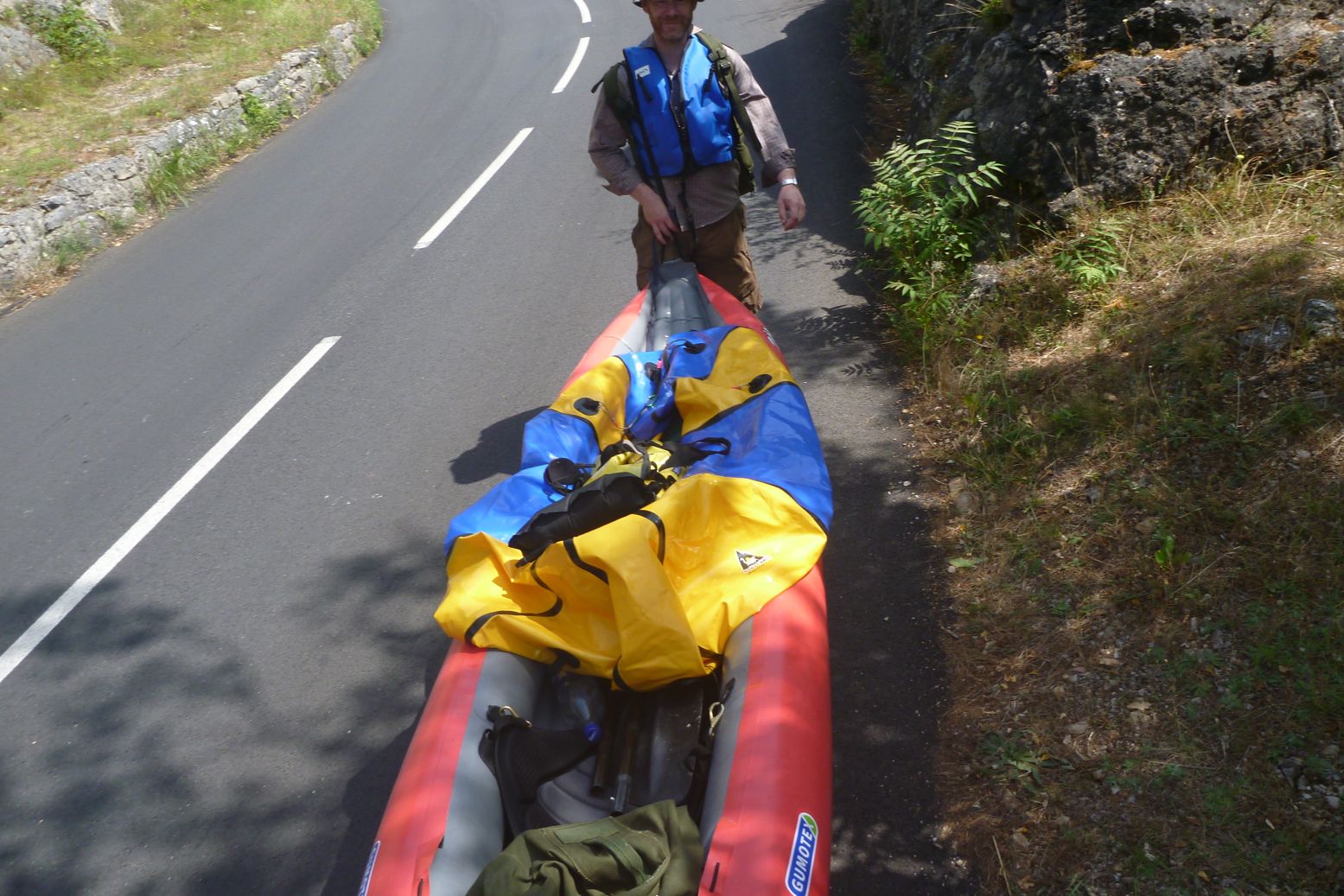
Packboat is my made-up word for easily portable boats that roll into a bag but deploy in minutes, in contrast with hardshell kayaks or canoes in aluminum, plastic, or composite. I’m here to suggest that if lugging a cumbersome hardshell on your overland rig isn’t for you, then a packboat weighing from 2 to 40 pounds and never bigger than a backpack might well be, while adding another great way to explore the outdoors…
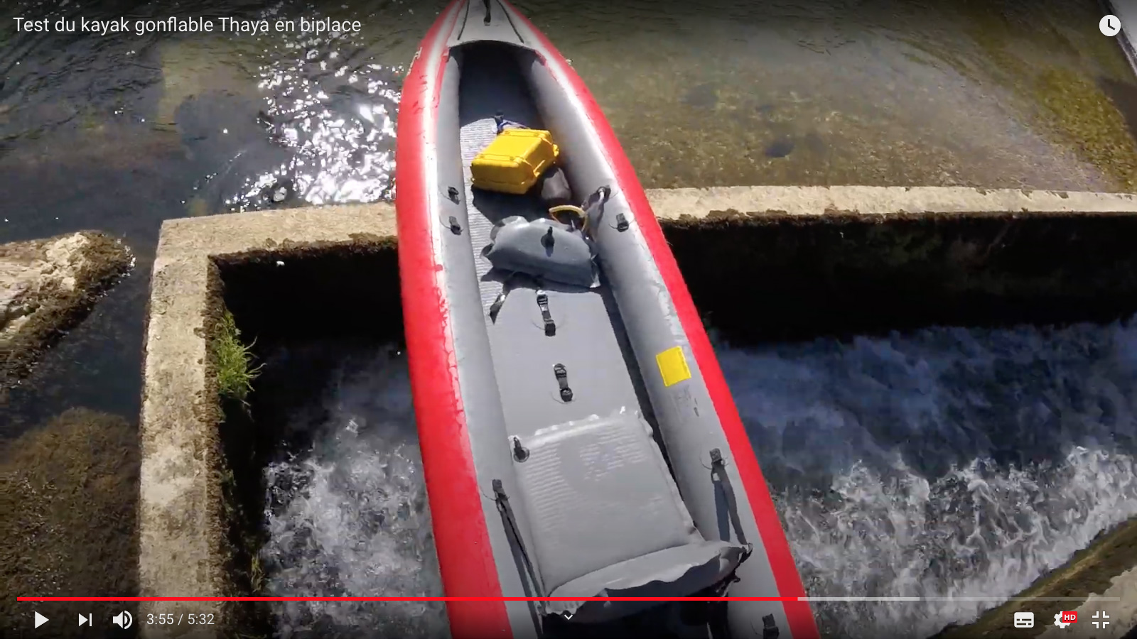
Since 2019 the Gumotex Thaya sits alongside the near-identical and 25% cheaper 4.1-m Solar on which it’s based, but with a drop-stitch (DS) floor to greatly improve rigidity. The Solar was not unlike my old Sunny, running just 3psi (0.2 bar) all round. That can get a bit saggy with a well-fed solo paddler. This was the first of Gumotex’s DS-floor boats, but a basic exercise in simply replacing a floor rather than trying anything more fancy like the Rushs of 2020.
Drop-stitch fabric now makes the complicated hand assembly of pressure-vulnerable I-beam floors (left) redundant. A DS floor is a flat panel with effectively 3-4 zillion ‘I-beams’ (see top of the page) all spreading the pressure load evenly to constrain the form into a plank shape, but at a much higher pressure than an I-beam floor can safely handle. In an IK, high pressure = a more rigid hull = better glide/less effort for barely any additional weight. The only drawback is that you need a more powerful high pressure barrel pump (above right). Your old Bravo foot bellows won’t do anymore.
DS is normally PVC and made in China, but Gumotex have found a way to manufacture threading and bonding a D/S floor with their durable, flexible and environmentally right-on Nitrilon rubber fabric. It can’t be that hard. The regular, normal-pressure 3psi sidetubes ought not need the higher pressures I ran on my adapted Seawave because the 7psi (0.5 bar) DS floor greatly aids rigidity (see action video below). Gumotex’s new tag line rubs it all in: ‘Made in EU[read: ‘not China’], made from rubber[read: ‘not PV … spit … C’].
The promo video below suggests something revolutionary, but combining DS with Nitrilon can’t be that much different from doing the same with PVC. It will certainly simplify or speed up assembly. One assumes drop-stitch floors supposedly don’t need a PRV necessary to protect I-beam floors from internal ruptures when they overheat in the hot sun. Some UK outlets where claiming the Thaya has a “Safety relief valve [PRV] in the bottom of the boat” but it’s probably just a copy and pasting error from the Solar. I can’t see one in any pictures and have yet to see a DS panel with a PRV until the AE AirVolution came out in 2020. The assumption is they don’t need it if it runs a modest 7psi, but some claim high-pressure DS floors won’t last as long as I-beams. Without a PRV, that may be true and much will depend on running the correct recommended pressure, the quality of manufacture/assembly and where possible, leaving the boat in the water on hot days so the large water-contact area keeps things cool.
One positive thing about old-style I-beam floors is the parallel I-tubes (left) probably don’t hurt tracking (even without a skeg). They also enable the desirable curved hull profile of a boat rather than the flat floor of a barge (for the moment DS panels can only be flat or maybe with a slight curve).
Payload ratings seem to have settled at 230kg and the movable seats are also made from DS panels. Initially I thought why? For the backrest and footrest that makes sense but who wants to sit on DS seat base on a DS floor? Of course you don’t have to pump DS up to the max to get its flat form constraining benefits and it looks like valves are regular twist-locks so you’d couldn’t get more than a couple of psi in there. Footrests are the usual inflatable pillow rubbish, but possibly also DS? I’d replace them with a section of sawn-down plastic drainpipe so you get a solid block to brace against. It makes efficient paddling much easier.
I’ve never tried one, but I do wonder how a flat-floored DS IK might handle in windier, choppier conditions where an IK isn’t exactly a hydrofoil at the best of times. A flat, raft-like floor will be stable, sure, but it will roll and pitch about more. Also, according to the specs (left) at 89cm the Thaya is a disappointing 6 or 9cm (3.5″) wider than the all-tube Solar 3 (Actual verified width seems to be 34″ or 86cm). Great for family-friendly stability; not so good for solo paddling speed and efficiency. My Seawave was 2cm narrower than a Solar 3 and with the usual care getting in, stability is not an issue. Out at sea my Seawave would swamp long before I’m tipped out. But then again, the near-rigid floor may cancel out the drawbacks of the greater width. At 18kg the Thaya is heavier than a Solar 3.
For most recreational, flatwater users the Thaya ought to be a nice family boat, but then so is a Solar 3. The Thaya costs 30% more than the Solar 3 whose days may be numbered, but it’s 2022 so maybe not.
In 2005 the Dordogne and nearby Vezere were my first multi-day rivers in my Sunny IK, all helped by the discovery of the inspiring White Water Massif Central guidebook. The Dordogne was a good choice but to be honest, a bit easy. Ready for something un peu plussportif, I’d got it into my head from that book that the Ardeche was too hardcore, so I’d be better off on the less famous Allier between Chapeauroux and Brioude (big map, above).
Gumotex IC and IKs paddling pros on the Allier, 2025. And they al trained back from Brioude – respect!
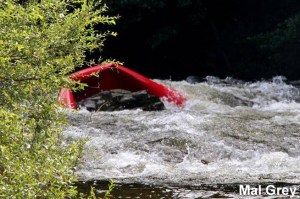
In fact, as you can read here (admittedly at twice the normal summer flow; video too, as well as the video above), parts of Allier can get tricky (left; a plastic canoe folded against a rock). Even though a railway carves and tunnels right along the gorge, on the first two days from Chapeauroux there are places where the rapids come at you fast and with no easy way out of the gorge if you get in trouble. Over the years stranded paddlers have been rescued by helicopter.
Not fully comprehending all this, in June 2006 I set off from Chapeauroux in my Sunny, and at the very first bend was flapping about like a salmon with a seizure, trying to stay on track. It went on like that for a while, then eased up and actually got quite pleasant by the time I reached Alleyras for the night. This was more like it; a wild river rather than the broad Dordogne lined with droning pumps irrigating the adjacent farmland.
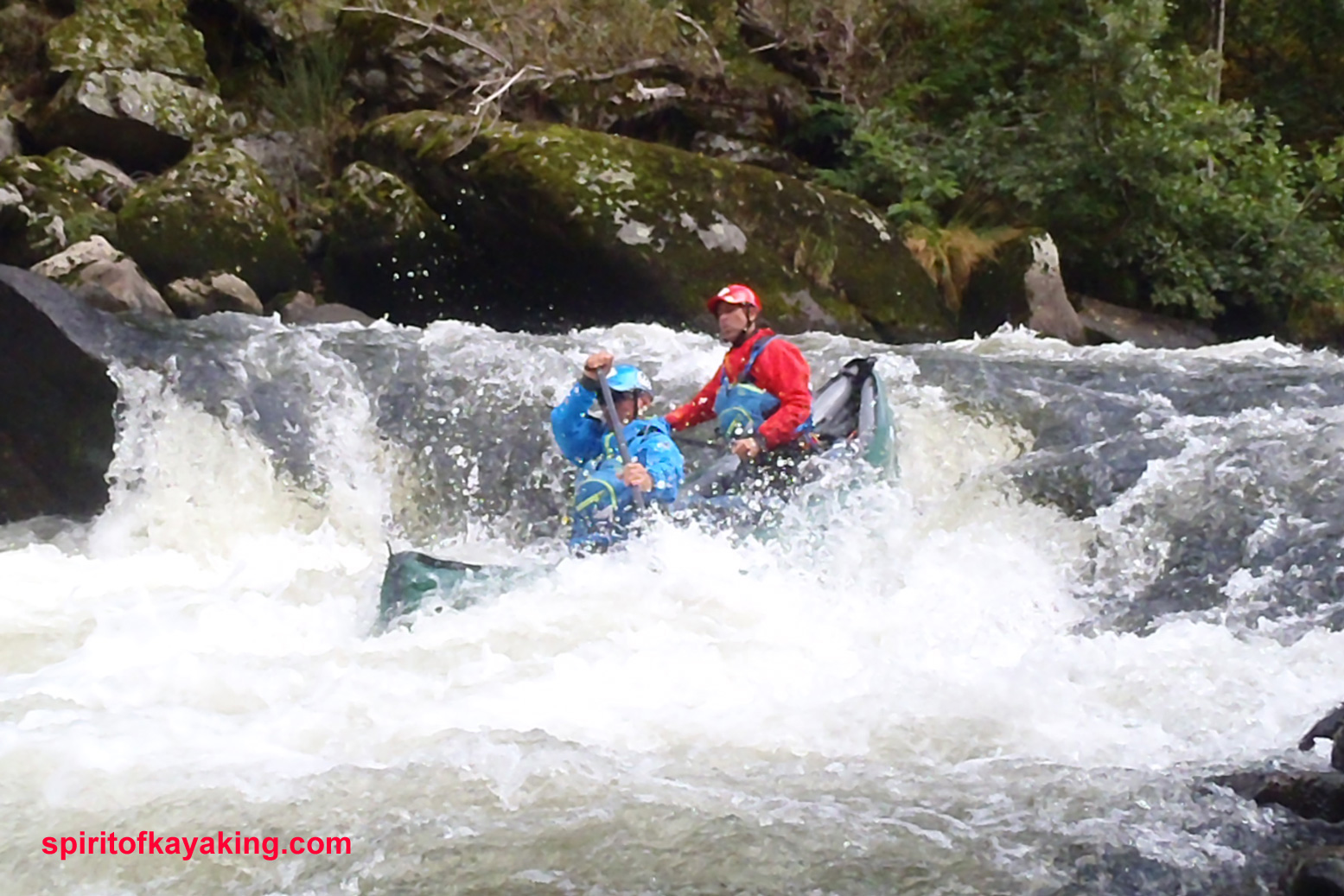
Next morning a taxi transported me past the then-closed section dodging the Poutes dam below Alleyras (more below) and dropped me at Monistrol. Here again I failed to fully appreciate the greater challenges immediately ahead, even if the guidebook was clear: great fun in a creekboat, but an open canoe will fill up on the longer rapids. And if I didn’t know it then, I sure do now: the white water abilities of open canoes and IKs are closely matched, while IKs might easier to control for beginners (like me).
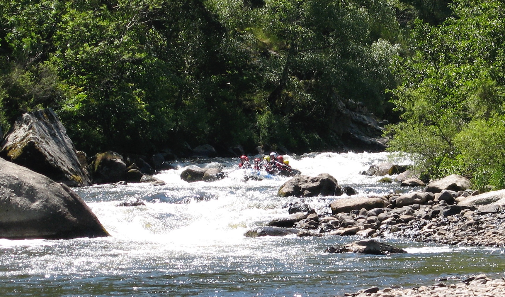
This Monistrol stage is run by commercial rafting trips (above), also a telling sign about the nature of this part of the river. I scraped through that day, exiting a few rapids with a boat full of water, and on one ending up swimming alongside it. Looking back, I’m pretty sure this was the exit of ‘La Barraque au Ponnet‘ (KM3.5; more below) with that raft above coming through soon after I stopped. It was all a bit of a shock.
Unless you’re confident, I’d suggest not following my example in doing this section alone. Consider a recce in the commercial raft if there’s one going that day, or ask if you can tag along for safety.Or find some paddle pals.
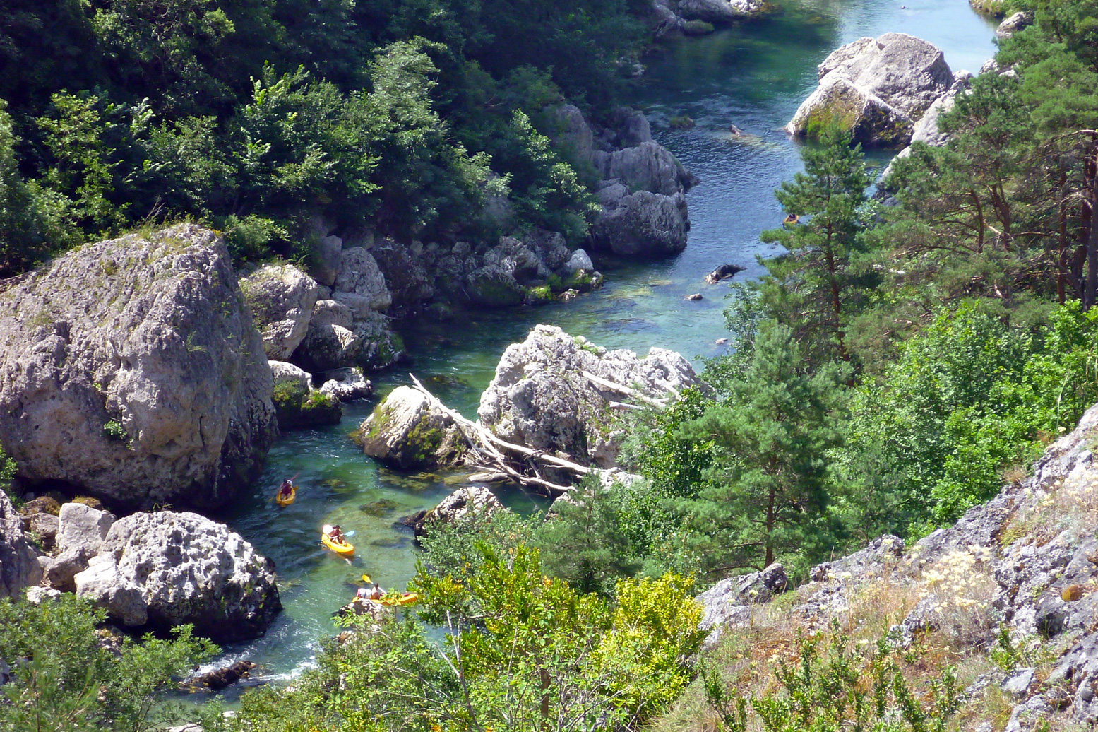
A few kilometres before Prades (KM12 from Monistrol) it all becomes less of a white-knuckle ride, and what followed all the way to the Brioude take-out were fun, Grade 2 rapids and a couple of thought-provoking chutes or easy portages. All manageable in open packboats. As you approach Brioude on the last day, the paddling eases right up so that you start harking back for a bit of eaux vivants.
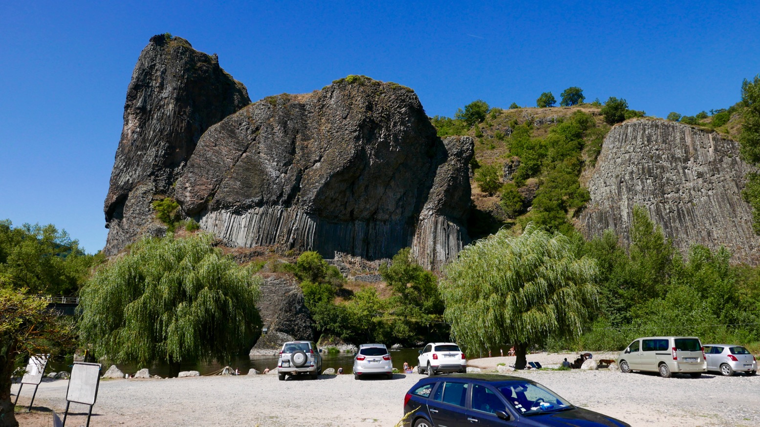
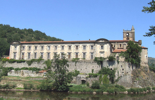
All along what they now call ‘one of Europe’s last wild rivers’ you’ll pass many striking outcrops of columnar basalt as well as pretty villages (like Chilhac, below) with adjacent campsites, boulangeries, quaint hotels – and not a chain store to be seen. Like the better known Ardeche and Tarn, the Allier is another Massif classic, still distinctively scenic but with non of the nose-to-tail traffic during busy holiday periods.
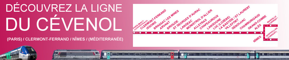
Getting there Although the daily trains aren’t frequent, with riverside stations at Brioude, Langeac, Monistrol, Alleyras and Chapeauroux, the Allier (left) is easy to get to with packboats. First, Easyjet yourself to Lyon, or Ryanair-it to Nimes or Clermont, two cities which are also linked by the scenic Ligne des Cévennes rail line (below). Brioude is an hour south of Clermont, and Chapeauroux is two hours over the hills from Nimes. Between them, Brioude and Chapeauroux span the scenic and paddleable 88-km section of the Allier.
One thing worth considering if you’re unsure about the half-day Grade 3+ Monistrol–Prades section, is coming up on the train from Brioude or Langeac. It passes right above the gorge where you get a good view of the Barraque au Ponnet and a few seconds later the ‘Roche qui Pleure’ drop a few hundred metres upstream (left; Gumotex Scout canoe). I’m sure glad I looked when I came back years later.
In 2018 I returned to the Allier, this time with a packraft. I flew to Lyon (cheaper and more frequent than last-minute Ryanair), caught the train via Clermont to Brioude (5hrs), and next day caught the first train to Monistrol (left). I planned to miss out the Chapearoux–Alleyras stage to save time and the taxi faff around the dam**. It left me three days to cover about 70 paddling kilometres back to Brioude.
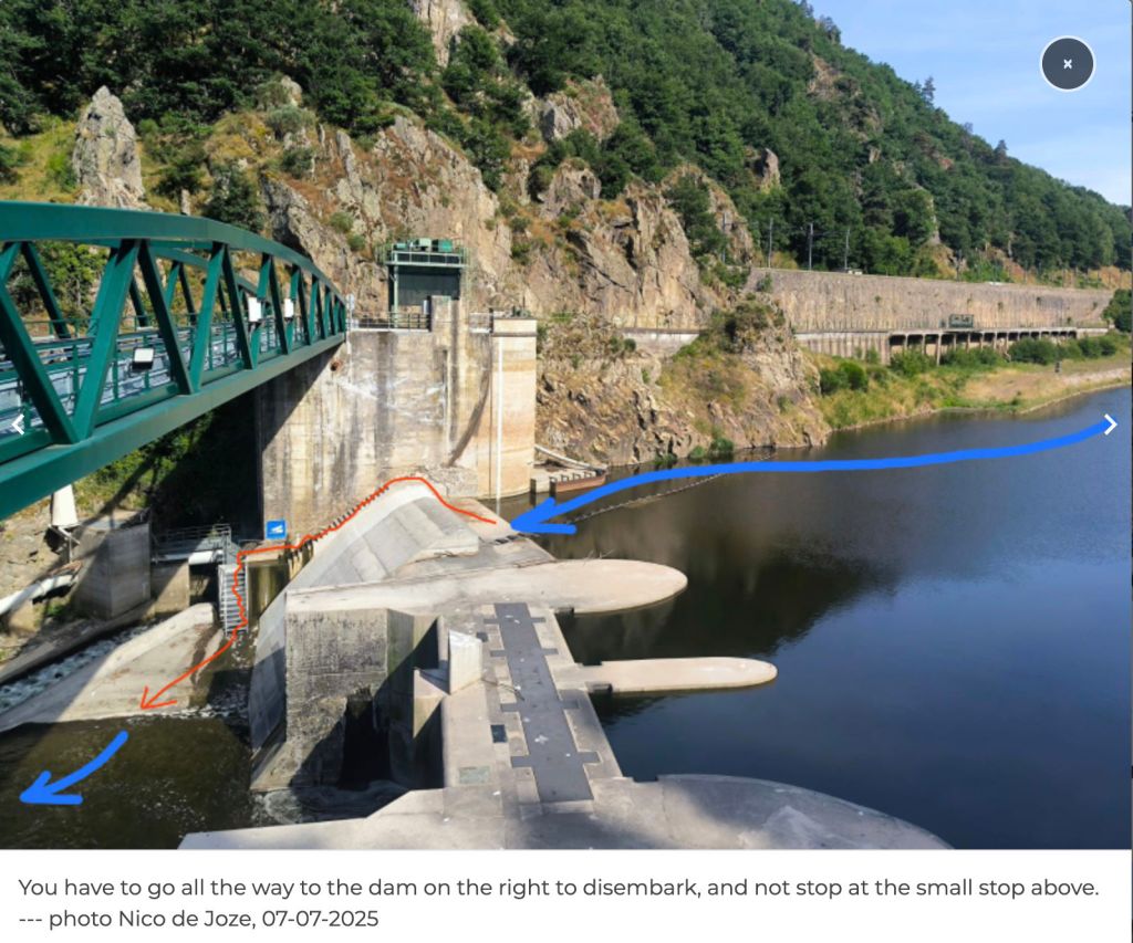
Poutes Dam **Since around 2021 (click ‘P5’) the long-closed section between Alleyras and Monistrol reopened to paddlers, with a portage around the new Poutes dam (below), 3.5km from Alleyras station (the train line crosses the river right in front of it). See the video link above. As part of the Allier resalmonification programme, the dam was lowered by 10 metres d and fitted with a ‘ladder’ to help the fish get upstream and propagate – plus give anglers something to do. Local environmentalists fought a long battle to get this done.
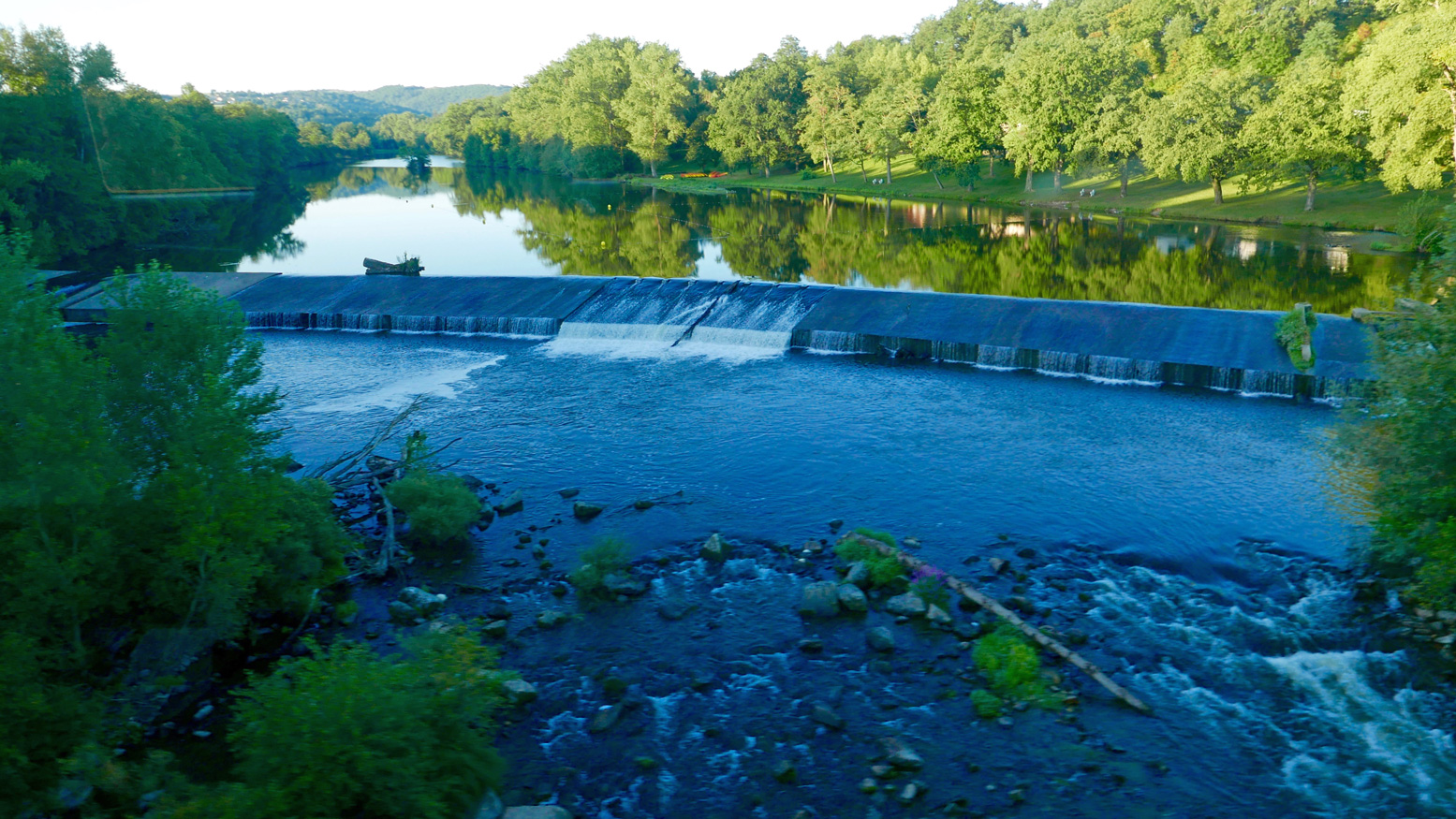
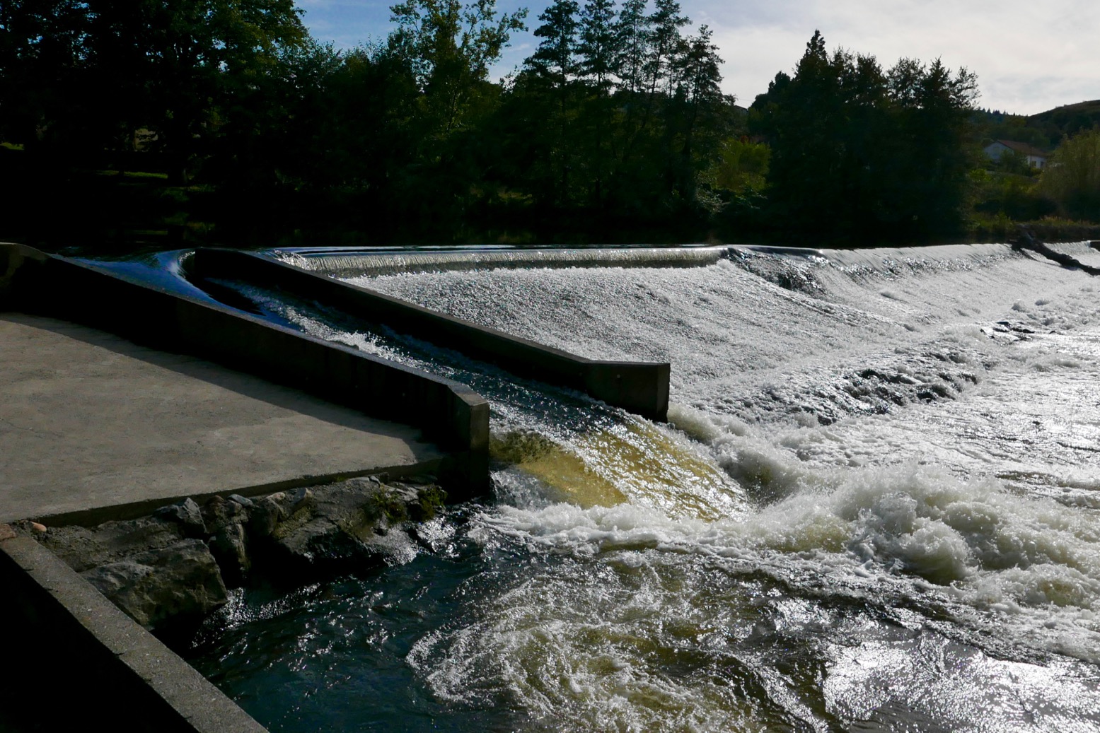
The train heading upstream passed right in front of the Brioude weir (left) where I’d be taking out in a couple of days. The line then rejoins the Allier at Langeac before heading for Monistrol. Soon it enters the wild gorge and looking down at the rapids below I thought… ‘Hang on a minute!’ which, a rapid or two later escalated to ‘WTjoF!?’.
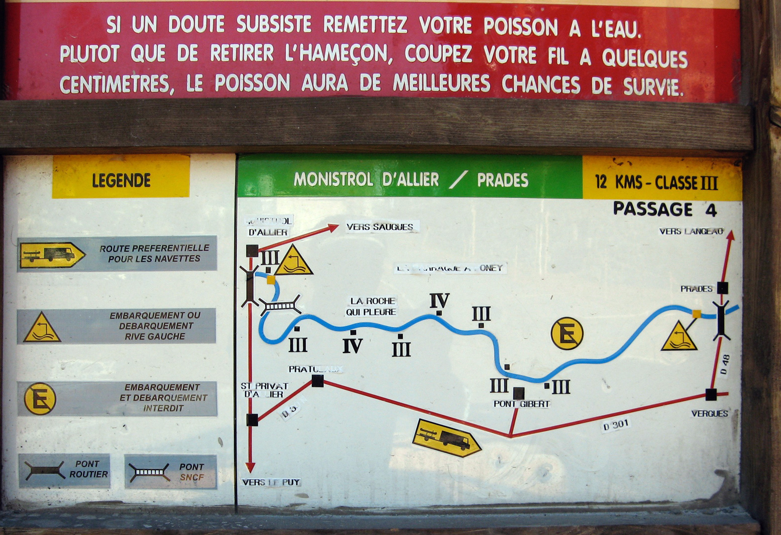
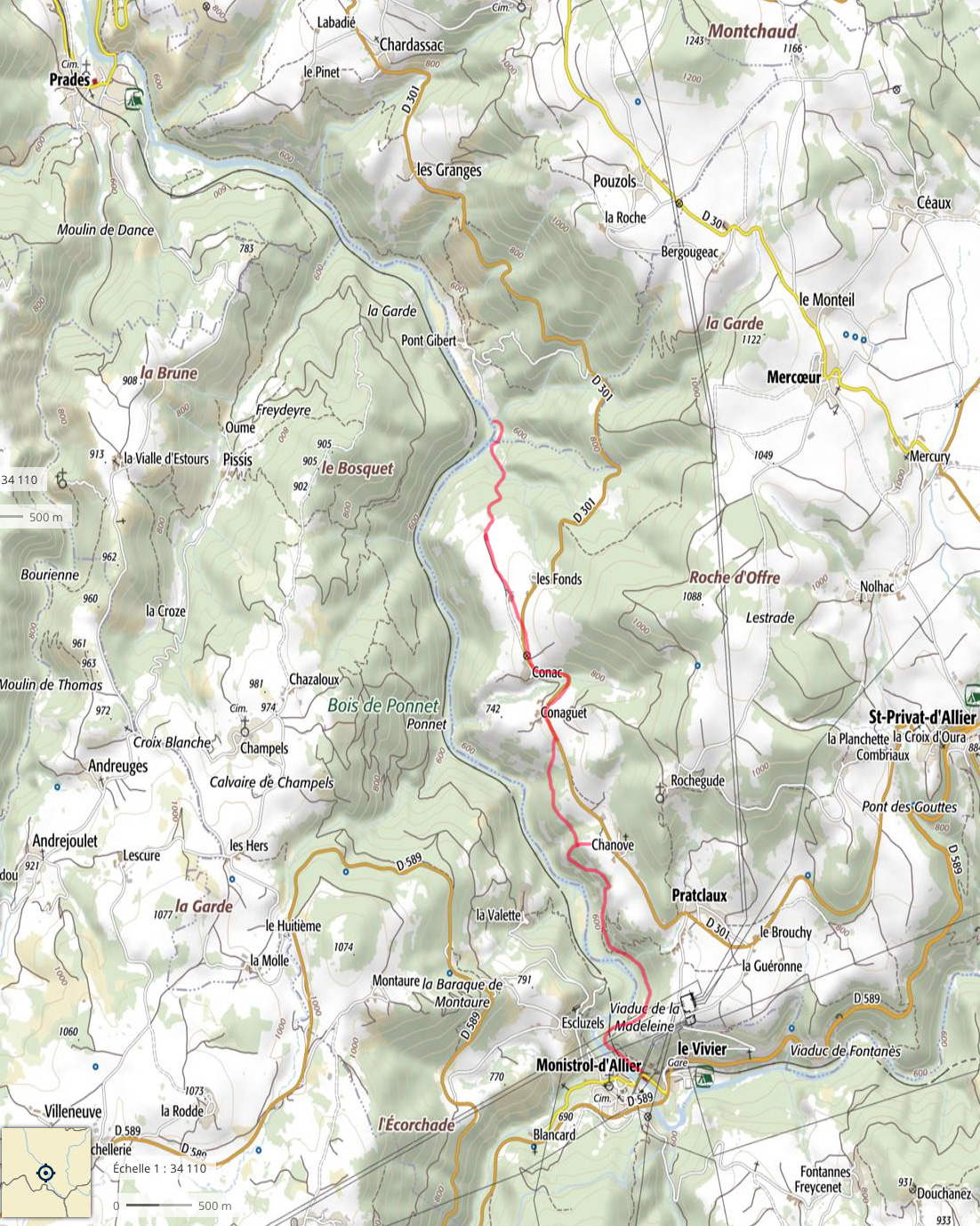
I recall being unnerved in 2006, but I’m sure they didn’t look this gnarly. I realised later that the first 100-m white plume was ‘Le Barraque au Ponnet’, easily recognisable on aerial maps. The other was ‘La Roche Qui Pleure’ – two of the plus fruitif chutes on this stage (map below left).
I got off at Monistrol, scoffed a petit dej at a deserted hotel and wandered around town wondering what to do. The river didn’t seem higher than normal; perhaps it was low back in June 2006 when I came through in the Gumboat? Either way, thanks to my train preview this stage seemed a bit too ripe for me; the Yak would be spilling over long before I was halfway through ‘Le Ponnet’.
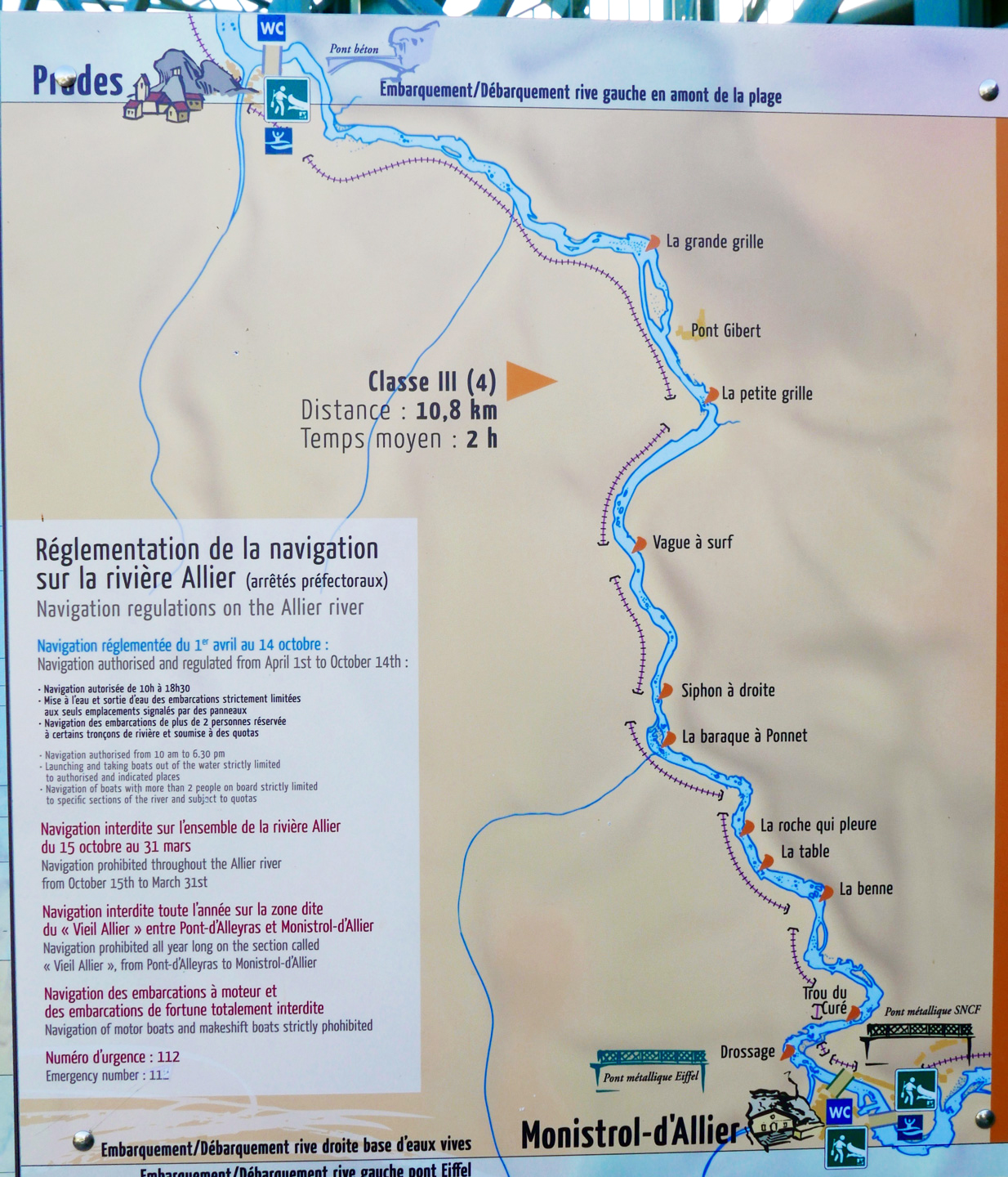
For a while I actually wondered if I was suffering from false memory syndrome from 2006 and might have cause to claim compensation if I could find the right lawyer. But I definitely recall the old Monistrol hydro plant (right) and my photo record shows I took the picture of the board below at 9.03 and arrived at Prades beach by 1pm, invigorated but not inordinately traumatised. River pictures were few back then in that pre-wet camera era.
Later, trying to work out what was different (other than my aged nerves), I wondered if I’d just glanced down on Le Ponnet during a particularly hearty pulse of dam-released water? Looking at the vigicrues website later, the flow graph for that day (at Prades) does show it was high as I passed by around 8am – before dropping six inches around midday. I knew from the Tarn earlier this summer that following a stormy night, a six-inch rise makes a difference – it speeds up the flow but can also smother stony rapids and make them easier. The pulsed releases every 8 hours are the lumpy pattern you can see along the bottom of the graph below for the days before and after I came through. As you can tell, I am bending over backwards trying to find ways to rationalise my new-found timidity! Above left: from the Eiffel bridge in town, you can see the first rapid (looking back upstream). Like the book says: if you don’t like how this or the next couple of runs look, turn back. Otherwise – strap in for the ride!
Annoyingly, my GPS with good maps was at the menders. I took a look off a passing trekker’s map (Monistrol is on the GR65 Santiago trail) but at 1:100k, I was none the wiser. I’d have needed a 1:25k map to find any viable paths along the gorge.
La Benne?
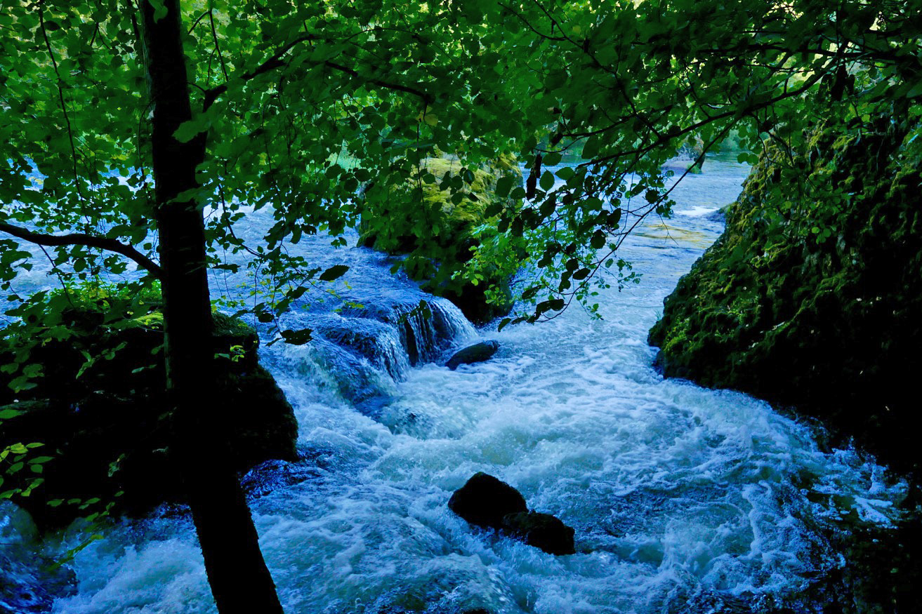
In the end I decided to follow a path by the bridge on the right side of the river, signed: ‘Viaduct, 1 hr’. It might continue along or above the gorge to a point where I could put in with the worst behind me. If it didn’t I could turn back and hitch or bus – or if desperate, clamber uphill to the D301 backroad to Prades. And that is what I did, but not without a huge amount of effort. Initially, the path followed the riverbank, passing a few Grade 3s (above, probably ‘La Benne’; KM1.8) which would have swamped my Yak like hot ‘creme anglais’ over a freshly baked rhubarb crumble.
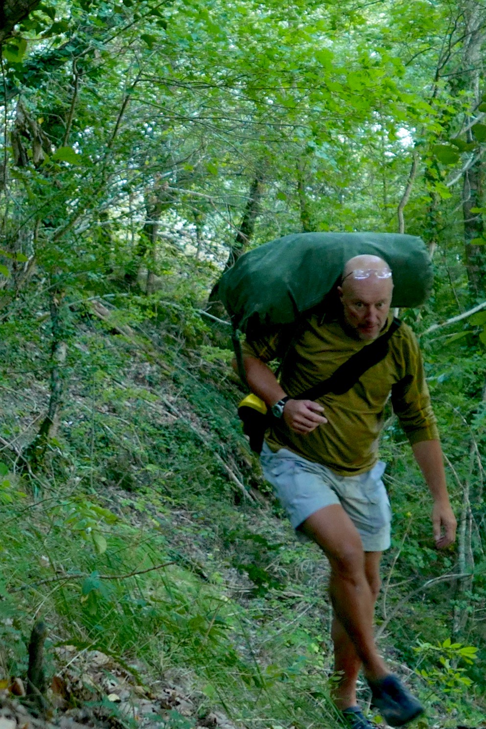
Some three hours later, high above the valley and heading for dehydration (33°C in Brioude that day), I gave up trying to follow a path. Fallen trees, brambles, scree slopes, an intermittent path and the 1:1 slope all took their toll. After an aborted attempt climbing a loose cliff, I managed to hack my way uphill and emerged a sweaty mess on the D310 backroad, looking like I’d just escaped from a teenage slasher movie. Scratched, bitten, stung and grazed to buggery, I’d covered 3km in three hours.
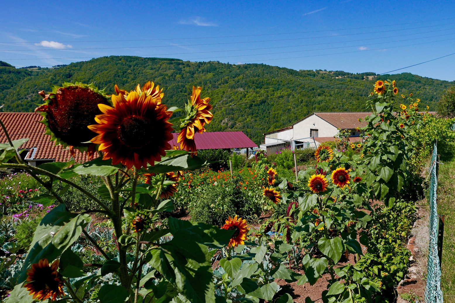
I washed in a cattle trough and passed through the sunflower hamlets of Conaquet and Conac, before splitting left down a side track and path leading back downhill, hopefully to rejoin the river below any enraged torrents.
This it did, just before Pont Gilbert and just below ‘La Petite Grille’, by chance nearly the last (and easy-looking) rapid, 8 river-kms from Monistrol. Although it didn’t feel like it at the time, this turned out to be pretty darn good route-finding without a map (left).
At one point earlier, while thrashing through the bush or teetering across scree slopes, I heard the telltale whoops of hyper-excited rafters far below. I realised that’s what I should have done: taken the fun option in a big-arsed raft as far as Pont Gilbert (if they’d take me, with baggage). I’d seen signs for a rafting centre near Monistrol station, but the town was so quiet I assumed they’d closed for the season. It would have been a great way to punch through the big rapids without a care in the world. Picture above: the ‘Le Ponnet’ viaduct down below with the long ‘Barraque’ rapid starting just around the corner and ‘Roche qui Pleure’ laughing menacingly from behind the trees on the left.
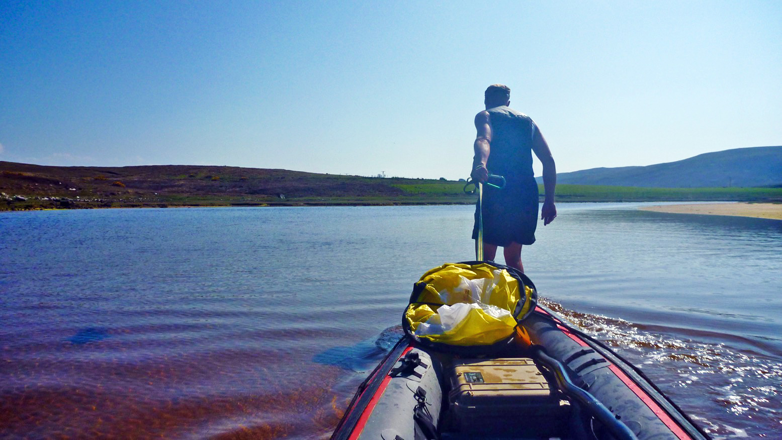
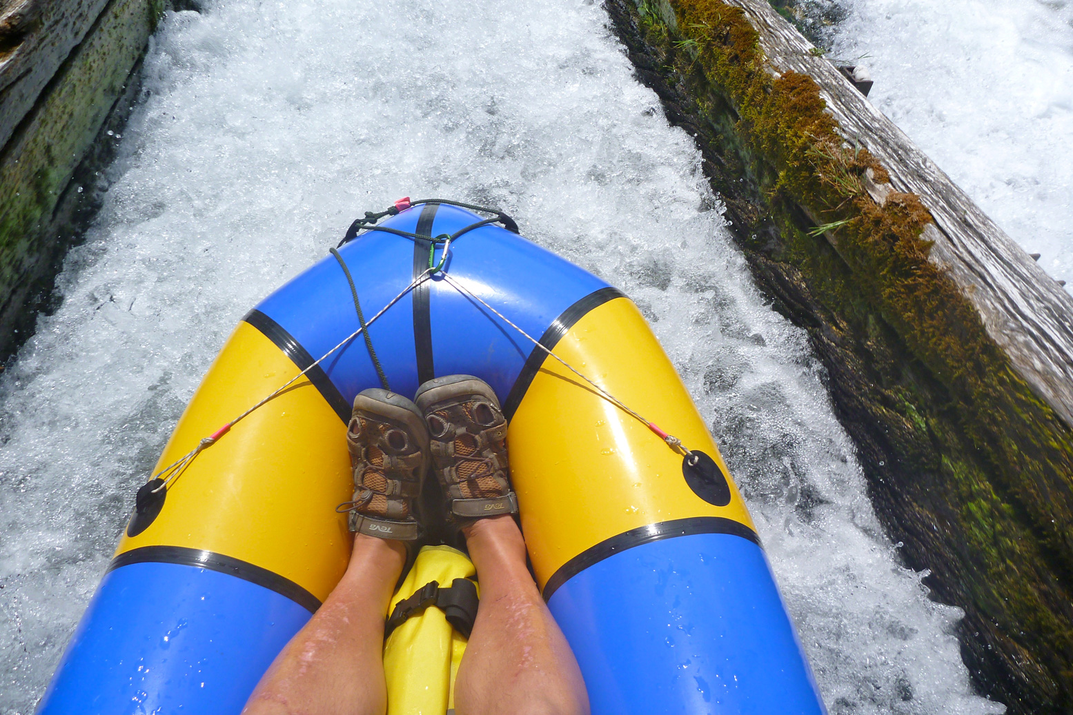
Dropping the kit bag and setting up by the riverside below ‘La Petite Grille’, it had indeed become hot enough to grill a salmon, but once on the water it sure felt good to flop down and float away like a stray log. Just like in the wilds of northwest Scotland, if you have the choice: float, don’t walk. Obviously part of me wondered if I could have managed the gnarly rapids upstream in the Yak. After all, I’d clearly scraped through years ago in the Sunny (still hard to believe). With someone alongside I’d have been braver but I’d followed my gut and felt happy with that.
Watch Belgian packrafter Dzjow’s video below from 2014. He enjoyed the Monistrol stage so much he went back up on the train and did it again with GoPros rolling. Watching it, I’m glad I didn’t. From Monistrol starts at 1:57 and he shoots down ‘La ‘Roche qui Pleure’ (the image below) at 2:28, soon followed by ‘Barraque au Ponnet’ which starts at 2:34 (note the railway viaduct) and goes on for a while to the big rock (3:19) you’ll recognise on the left in the rafting pic, above. Dzjow was a hardcore adventuriste I’ve come across before. The following year he went on to do a self-admittedly tough and not so enjoyable trip in wild Patagonia. He hasn’t written about packrafting since.
After about 4km I pulled into Prades beach (below left). I needed salt and I needed drink. And while I was at it, what harm would a handmade mini quiche, some bacon crisps and a tartes aux framboises do? None at all, mon brave.
Now dizzyingly revived but still worn out by the morning’s commando course, I knew there was a bit of a drossage (great word) just around the corner, but it was all fun knowing a few others were playing around too, including SUPs. What is it with these SUPs? I’ve never seen them doing anything more than goof about in the shallows but rarely actually go anywhere, yet they’re clearly ten times more popular than IKs and Ps combined. What does that say about the state of post-industrial recreation in the developed world?
Unusually, I had a hotel booked at Reilhac, about 18km downriver, past Langeac. With just a couple of canoes on the water, the afternoon passed without drama, bar the odd wetting. But approaching Langeac, the din from the weir just before town was unusually intimidating. The canoe chute here (left) is well-known as being a bit of a drossage because it’s about 3 feet too short and so pumps a plume of water into a nasty backwave which not all boats can easily escape.
Spot the chute
And I do wish these Frenchies would mark the tops of their glissieres with two poles, indicating: ‘aimhere’. Above, show me the chute entry point while wearing a pair of sweat-smudged specs! Maybe the idea is by not having clear markers, paddlers slow down and look carefully. I did just that above and portaged round off a little beach on the right. I could not be arsed with hitting the churning pile to get catapulted over the bow like a 40-kilo sack of dried beetroots. I felt that no matter how far back I leaned, my short, light boat would plough ‘n’ flip, unlike a longer IK. Back in the water, I paddled on through early evening Langeac and an hour or so later was slumped on my Reilhac hotel bed.
The next day was just what I wanted; a short, easy run of just 13km, ending at the UNESCO-overlooked village of Lavoute Chilac where the charming Hotel des Pecheurs tottered on the slender gooseneck bluff above the Allier.
Three clicks downriver (6km from Langeac) was a double-drop weir-chute (below left). Easy enough providing you steer straight for the lower drop, but I walked it as I knew it would be a bailing job, and today was some 10 degrees cooler. Splish followed splosh followed splish down to Chillac (below, 11.5km from Langeac), another picture-perfect village sat atop a striking basalt plug with dreamy views over the Auvergnois countryside from the terrace by the church.
Half a click downstream from Chilac is an easy, short chute (left) on the far left. But once down it I realised the old weir passing below the mill on the right had pretty much been washed away, making the chute redundant and a fun ride down a long, shallow rapid. Clearly I was recovering my mojo if I was looking for some white water action again. Later, I read this weir has been flushed away for some years, but is another thing the new Canoe Trips,South of France guide had not updated.
Soon, the bluff of Lavoute Chilac rose into view. I pulled over left at the riverside park, let my gear dry, then walked into the village over the tall bridge (left). Les Pecheurs (white building on the right, below) was still on siesta, so I left the Yak by the steps and walked over to Le Prieure, the other creaky-stair hotel in the village, for a mouth-watering ‘Salade Auvergnate‘.
Wandering around the old church and the imposing, 18th-century facade of the abandoned priory (right, due for luxury flat conversion), I was staggered to see a July 1866 flood marker at the church’s back door. In the photo left my hotel room would have been submerged by a few metres. Perhaps the river’s acute 180-degree turn causes floodwaters to back up.
It’s the last day of my packrafting mini-break and by my estimates, I had about 22km of paddling, plus a 4km walk to Brioude station to catch the 4:10 to Lyon. I didn’t want to miss that so set off briskly, passing a canoeing couple (the only other boat I saw all day) until I could estimate my pace against a landmark. Before 11am I’d reached the bridge at Villeneuve meaning I’d covered 9.5 clicks in 80 minutes which gave me plenty of time. This Allier flows quicker than it looks.
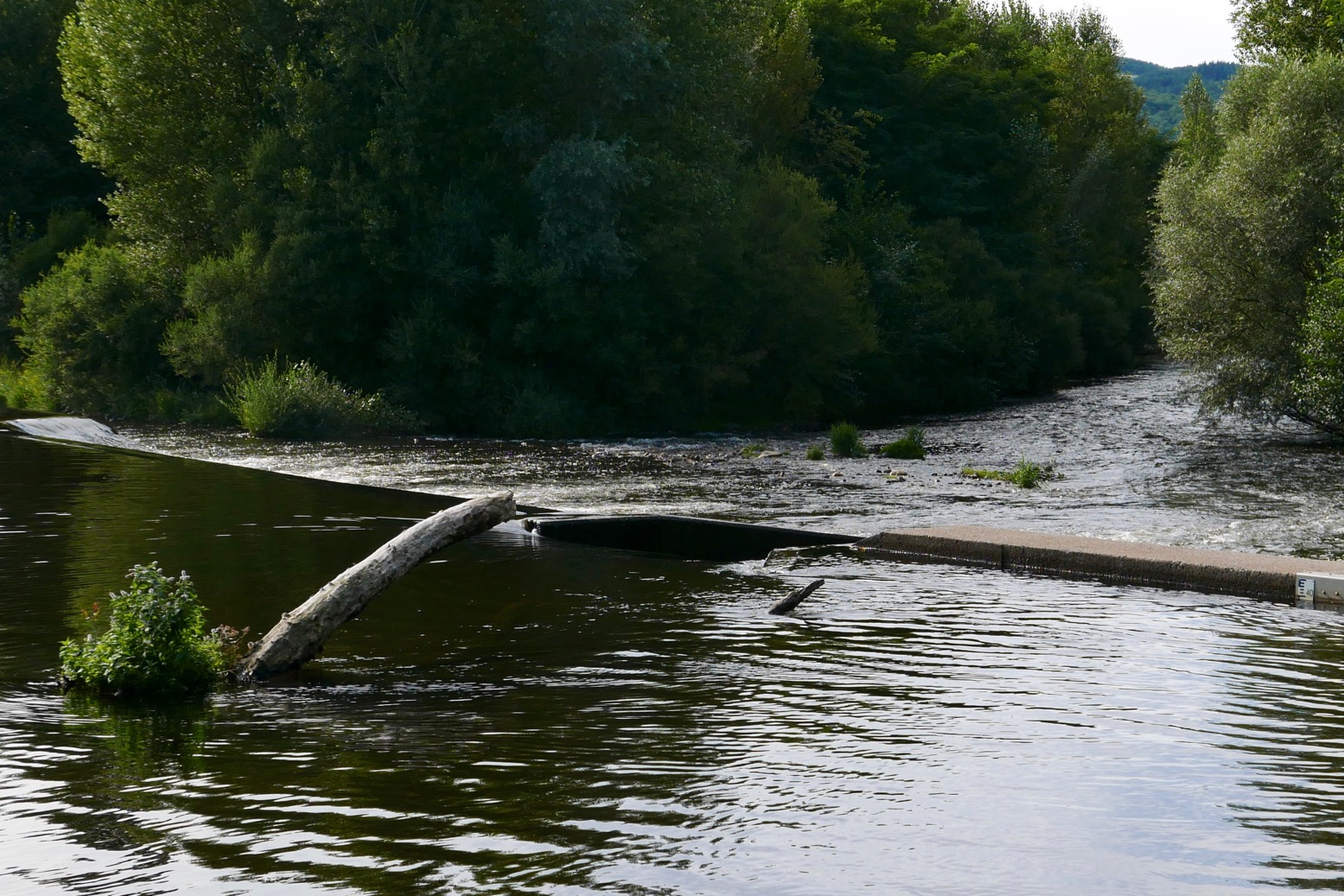
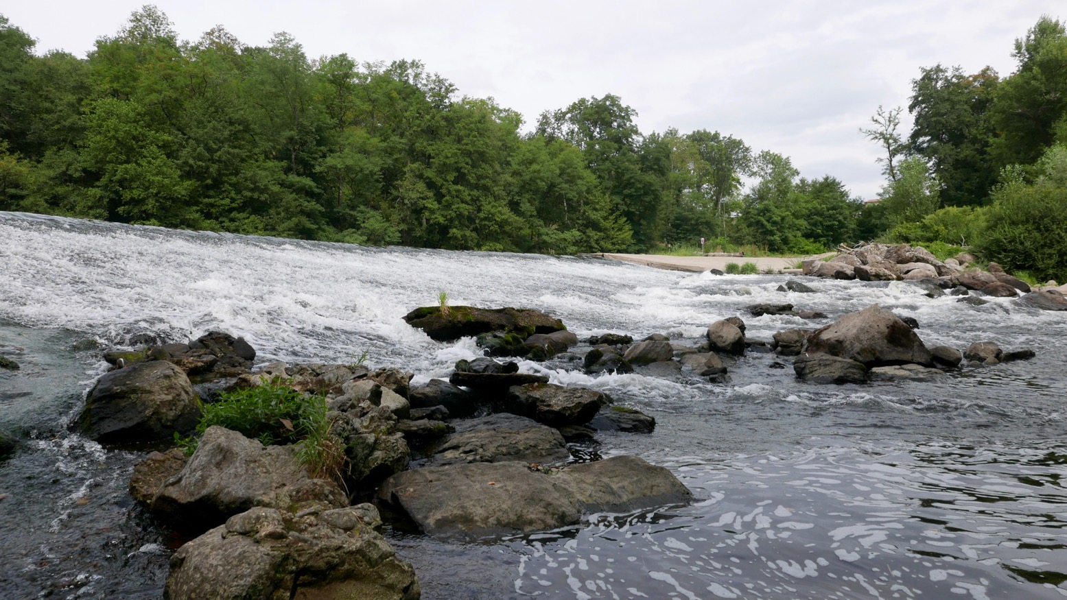
The book talks of another old weir to ‘shoot’ at Villeneuve campsite, but there’s nothing here except a ford with poles marking the car crossing. Many of the book’s ‘shoot an old weir’ descriptions are out of date. There’s rarely anything more than a line of rounded boulders and a drop of a few inches, making you wonder: ‘was that it?’ But at Ville Brioude, just before the tall bridge, the book suggests you can shoot a modern concrete weir (left). Good luck with that and those boulders lined along the base.
Finally I was back at the public beach below La Bargesse campsite (45.279097, 3.406962). Ahead was the big weir before the red brick rail bridge I’d crossed on the train a few days earlier (left). Here again the book now suggests ‘portage right’ and other convoluted options – perhaps a simple left/right mistake? Instead you simply take out at the grassy park, river left, walk over a little footbridge and put back in below the weir under the railway bridge and above a shallow rapid.
Once again, I’m amazed at the true amphibiousness of these packrafts, especially if not hauling camping gear on the trail. A long walk to dodge gnarly or closed stages is (potentially) easily done, even carrying an inappropriate kitbag. With plenty of time to catch my train, I dried off, got changed and walked over to Brioude for a coffee and cake in the town square below the basilica’s decorated tower. In the hills all around, the petrified volcanos and lush grassy valleys of the Auvergne countryside could easily sustain more exploring on foot, by pedal or with paddle.
Time to knock out a long-planned circumnavigation of Hayling Island near Portsmouth while this amazing summer lasts! P-Day came along and by chance, the weather and tides lined up: high 20s °C with a 3-m neap and a calm morning before a 10mph onshore afternoon breeze.
I’d ridden down and recce’d the harbour entrances a couple of years back and last year we’d tried to reach the harbour along the canal from Chichester, but that plan didn’t work out. You’ll find lots of useful descriptions online, but it pays to recall (as I learned on a run to Brighton) that on the English southeast coast the tide (which floods eastwards and ebbs to the west) turns eastwards from two hours before high water to four hours after. So while the water is still dropping the current reverses. The Brighton post explains it (and I’ve since found an interesting animatable graphic here) and it may also explain why we passed deserted beaches and got to turn north into Chichester harbour entrance surprisingly quickly, even if it was near calm. Occasionally a rogue wake rippled in from a distant freighter out in the English Channel.
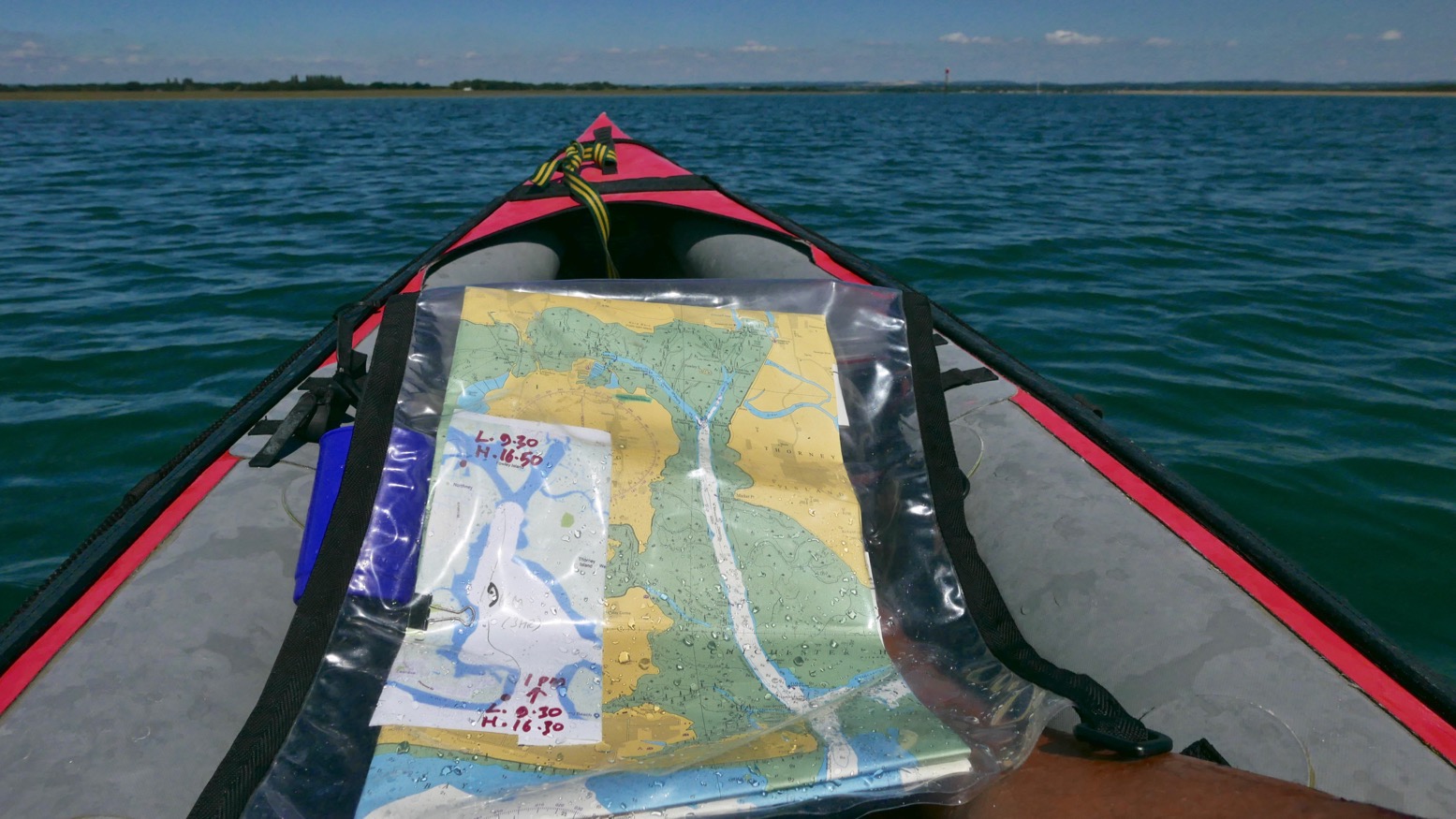
It was soon clear that my estimation to cover this 22km lap was way too long. Shooting along the channels visible on the map above, mudbanks to left and right limited side exploration and we ended up under Hayling bridge (KM13.5) in just 2½ hours including lunch and a few drifts.
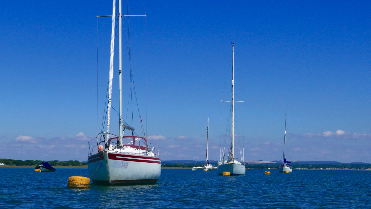
On the way we passed a lot of moss-covered sailing boats, lots of birds including oyster catchers (didn’t know you get them down south) and up nearer Northney marina, a brace of SoTs and a young couple struggling to control an under-inflated (or leaking) Sevy K2. Our high-pressure Seawave glided smugly by.
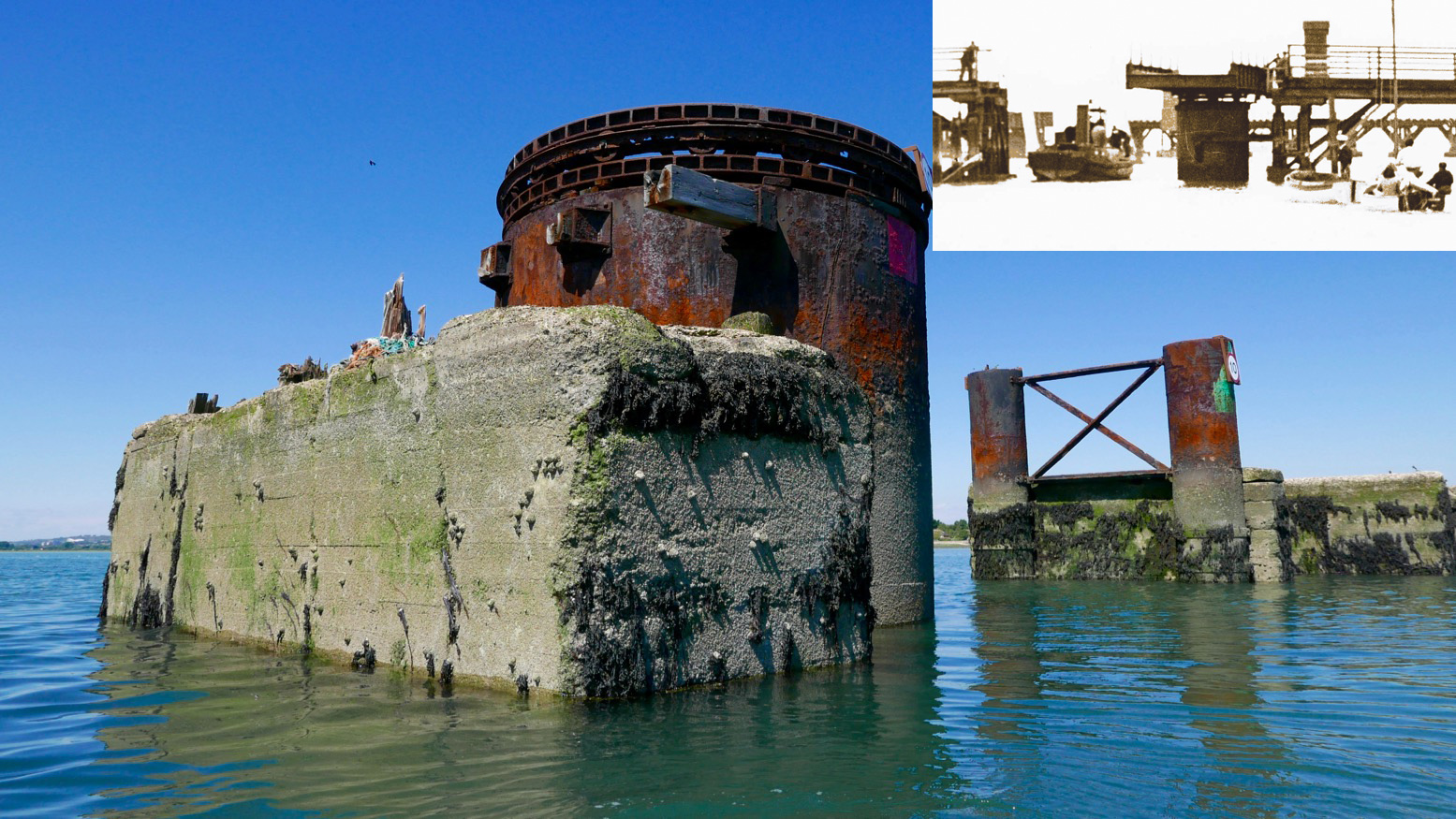
With less than half the tide in, there was already plenty of water to pass under the road bridge and between the stumps of the old railway span alongside. A huge rusting drum suggested a swing bridge to allow boats to pass; online later, sure enough, that’s what it was (left, see inset); a railway running from 1865 for just short of a century. When we drove off the island at about HW, it was the drum was only thing above water. Chichester harbour is packed with parked-up sailboats (‘moored’ some might say), but Langstone is virtually empty, possibly because i’s shallower and with a much narrower entrance. These natural harbours formed after the last Ice Age and take about seven hours to fill, but drain in only five. And because they drain right down to unfathomable mudflats on which even a gannet in snowshoes can barely walk, exploring side creeks can only be done with the high water clock ticking.
To aim for Langstone exit channel from the bridge, head for two tall poles visible to the SSW. By now the wind was in our faces giving a greater impression of speed, but the tide was coming in for another two hours (or do I add/subtract two hours? My brain hurts). We were way too early to catch a roiling ride out the 250-metre wide Langstone channel back into the Solent. We’d have to hack our way out along the side, like a Maori war party.
Long before we got there we could hear the intimidating wail of jet-skis haring up and down the channel. They have such a bad rep and the two-stroke din doesn’t help endear them. If they sounded like Ducatis or Bonnevilles we’d be queuing up for a go! We passed the famous Langstone Pumpkin (above; a lost novel by Wilkie Collins), and soon after, hopping out to wade against the tide over the shallow Sinah Bank saw me sink into the vile black quicksludge which Collins used for the demise of his fickle heroine.
Nearing the channel I sought to dodge the in-pouring current by passing under the gantry of the Hayling Island ferry. Then I announced ‘All hands on deck! Prepare for ten minutes of full steam ahead’. That ended up more like twenty, because keeping close to shore was made trickier by frolicking bathers, parked-up jet skis and inflatable goofballs. To the right the tide streamed past way faster than we could’ve paddled, but along the sides we managed to inch forward at a stroll’s pace; a yacht motoring out mid-channel was no faster. I kept eyeing up points where the current might splay out, but it was getting on for a mile out over the East Winner sandbank before the effort eased, the seas slapped us about a bit and we were out in the Solent for a choppy paddle back to the beach (above), now packed with frolicking sunbathers, paddleboarders and inflatable goofballs. Quite worn out, we beached the kayak and jumped back into the warm sea to wash off the salt and sweat.
It’s fun to try new stuff and paddle on a sunny day, but overall I’d say around Hayling was a bit boring compared to a sunny day in the Northwest Highlands. Who wants to pass Funland and beach houses, mudflats, marinas and more mudflats? Reminds me of Darwin harbour but without the crocs and mangroves. I suspect west of here, the Southwest coast has more promise. I still think the morning start anticlockwise from West Town is a good idea: knock out that exposed seafront stage before an afternoon breeze (and the concomitant rise in bathers, borders and hydrofoil kiteboarders hitting the sound barrier). But I’d aim to leave West Town 3–4 hours after LW. The unintuitive tide may be turning but once in the Chichester Harbour it gets you up and around to the Langstone exit channel around HW for a short paddle along the seafront back to West Town. There’s probably a formula for doing it clockwise from Eastoke and running the flood tide through the Langstone channel, but I’ll let you work that out.
We decided to lap the tip (left) of the Coigach peninsula. Doing it clockwise put us in the lee of the afternoon’s southwesterly once in Enard Bay and better still, we’d catch high tide at Achnahaird, enabling us to paddle up the creek to complete a near full loop back to the car via the freshwater lochs of Ra and Vatachan.
I remember being quite nervous the first time I did this way back in 2013 in my Amigo – in the other direction from Achnahaird. Looks like I’m not the only one – I blame the Pesda guidebook. It felt like a long old slog west then north between the Ristol islands – the tidal Ristol channel was dry. But by the time we’d passed the reefs of Reiff and reached the sparkling beach at Camas Ghlais (below) we were already more than halfway round.
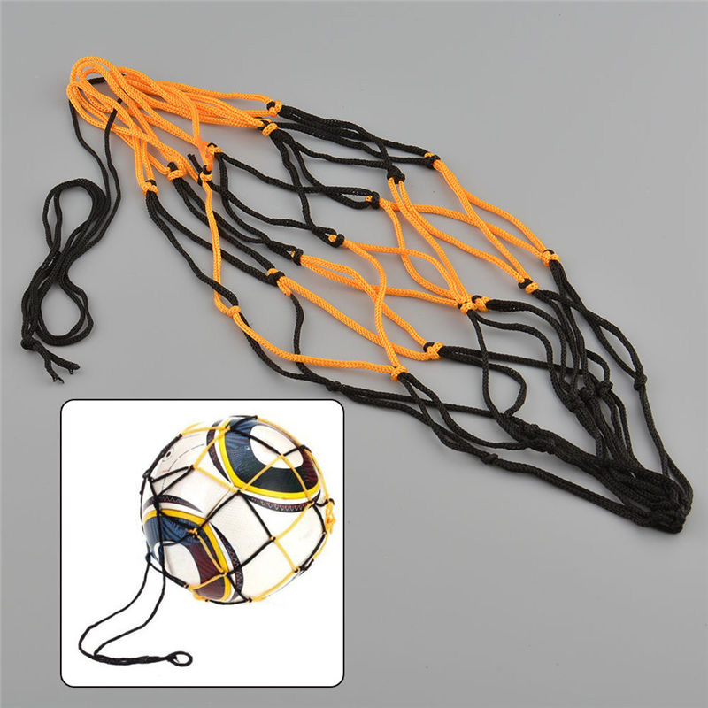
Sitting on the beach, on warm days like this and always looking to refine my set-up to a razorbill’s edge, I sometimes think a sturdy football-sized net bag to take a beach stone would be handy to anchor the boat out in the shallows. This way it won’t beach itself, get hot and purge air which can make the kayak soggy once back in the cool water. It’s one slight drawback of running PRVs on all 3 air chambers. I could probably find some washed up net up among the flotsam and make one. Or I could Buy [a ball bag] Now on ebay for a £1.62. Leaving the sandy bay, I give the Seawave a quick top-up with the K-Pump anyway.
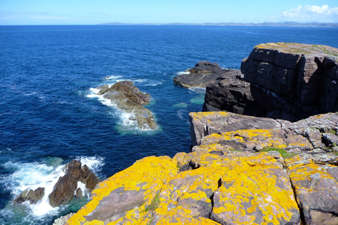
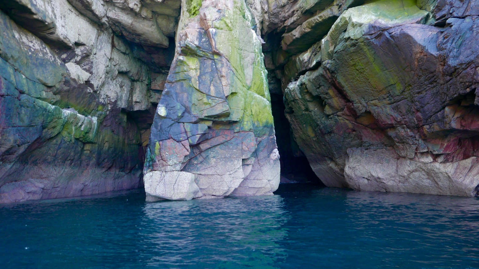
On the north side on the bay we nosed towards a slot cave, but white streaks running down from the ledges suggested nesting birds had hung out ‘Do Not Disturb’ signs. Either I’ve never noticed them before or there are lots more nesting birds around this year. It’s the end of May but there are still tiny snow patches on An Teallach and Beinn Dearg – maybe the season is late.
North of Camas the unrestrained swell was bouncing back off the low cliffs and small dazzling waves were breaking over semi-submerged rocks, making for a rough ride. But it’s all relative and showed what a sheltered life I lead, paddling mostly in and out of the protected Summer Isles.
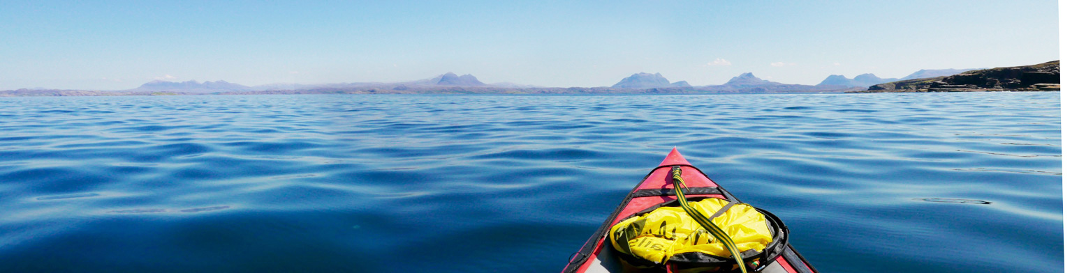
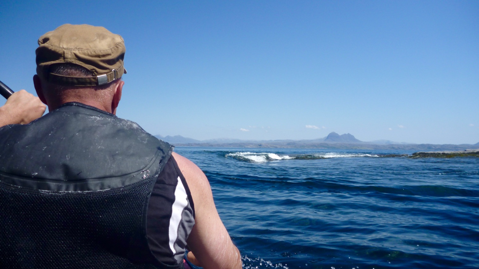
We passed on sandless Faochag Bay and on turning the point of Rubha Coigach all was calm as the grand panorama of the Assynt peaks came into view (above). From the right: Quinaig; Canisp behind Suilven, Cul Mor, Stac Polly in front of Cul Beag, and the group around Ben Mor Coigach. It’s one good reason to do the paddle in this direction. There’s a bigger version of the Assynt panorama here taken on the road above Achnahaird. I really must work out how to do that panorama photo-stitch thing.
Coming down the Enard Bay side, we tried to explore some other caves with green moss streaked with guano, but got dive-bombed by angry shags.
Back out in the bay an unpredicted northwesterly picked up – time to launch that WindPaddle which has been sitting in my kit bag unused for a year or more. Initially, the breeze barely reaches 6mph – we could have paddled faster – but it sure was fun to kick back, look around and let the boat waft quietly along, free from the splish-splosh, splish-splosh rhythm. I wonder if self-driving cars will be the same.
It’s been a while since I’ve done this but the WindPaddle definitely felt better than my homemade efforts from years ago, as well as the knock-off WP I bought a year or two back. I tried a V-sail too but have never really got the hang of kayak sailing. It seems the sweet spot is hard to find: either the wind comes and goes and the sail flops, or it blowing so hard the sail can’t handle it and you’re clinging on. Still, I look forward to giving the WP a spin in slightly windier conditions. For the compact size and light weight I get the feeling it may be worth keeping.
The breeze picked up and we chugged along at a brisk stroll. But even then the WindPaddle feels satisfying to use. I think the key is the sprung tension of the composite batten (rim); it retains the circular shape of the bowl which means it’ll stay up as the wind drops and keep shape as it rises, then can be confidently scrunched down to a packable size without breaking. Doing that during a bit of a blow may be tricky, but it can easily be pulled back and tucked down unfurled over the legs (right). It’s only a downwindish sail but as with previous disc sails, I like the way you can steer intuitively by pulling one line back; a skeg must help but there’s no need for paddle-rudder assistance.
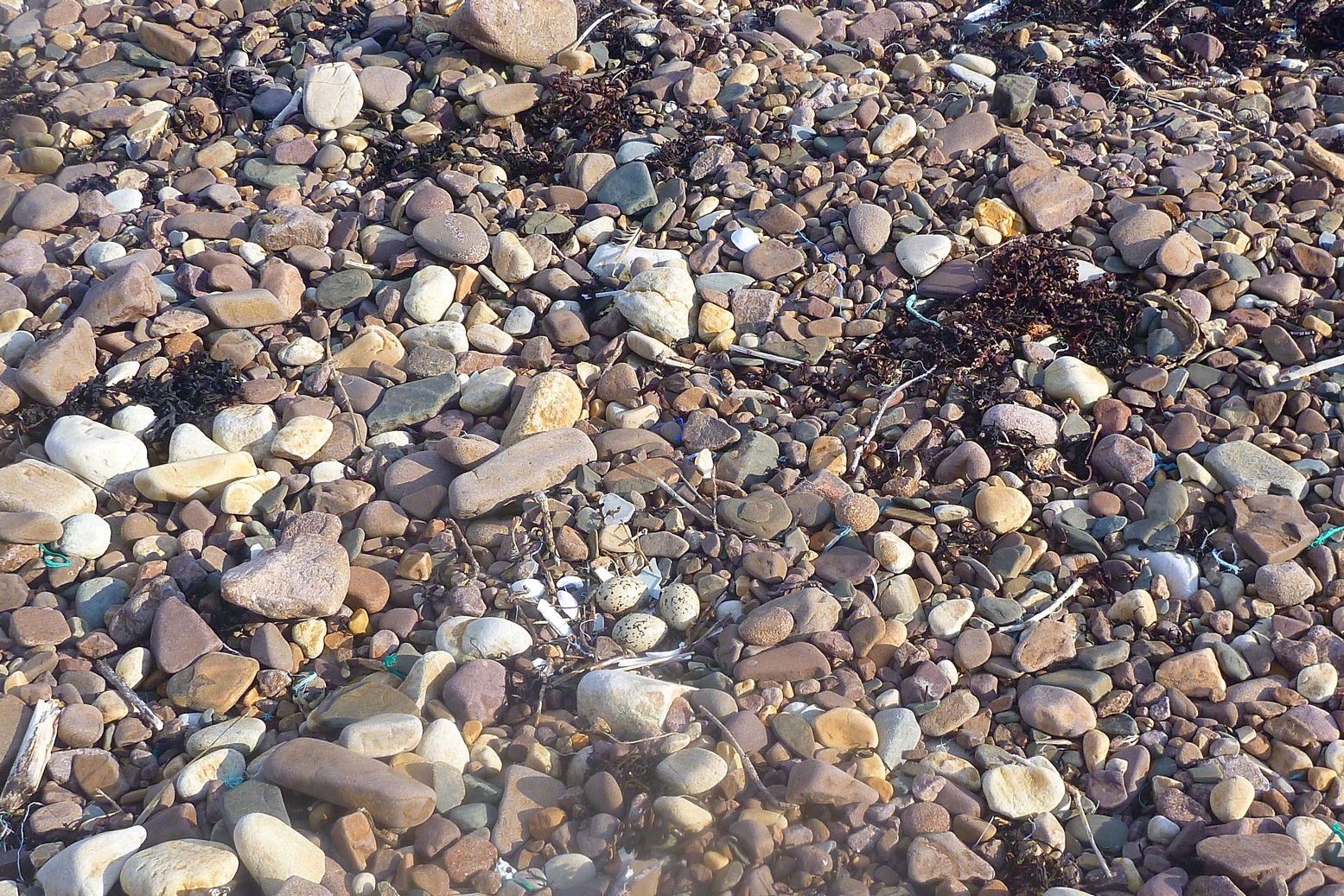
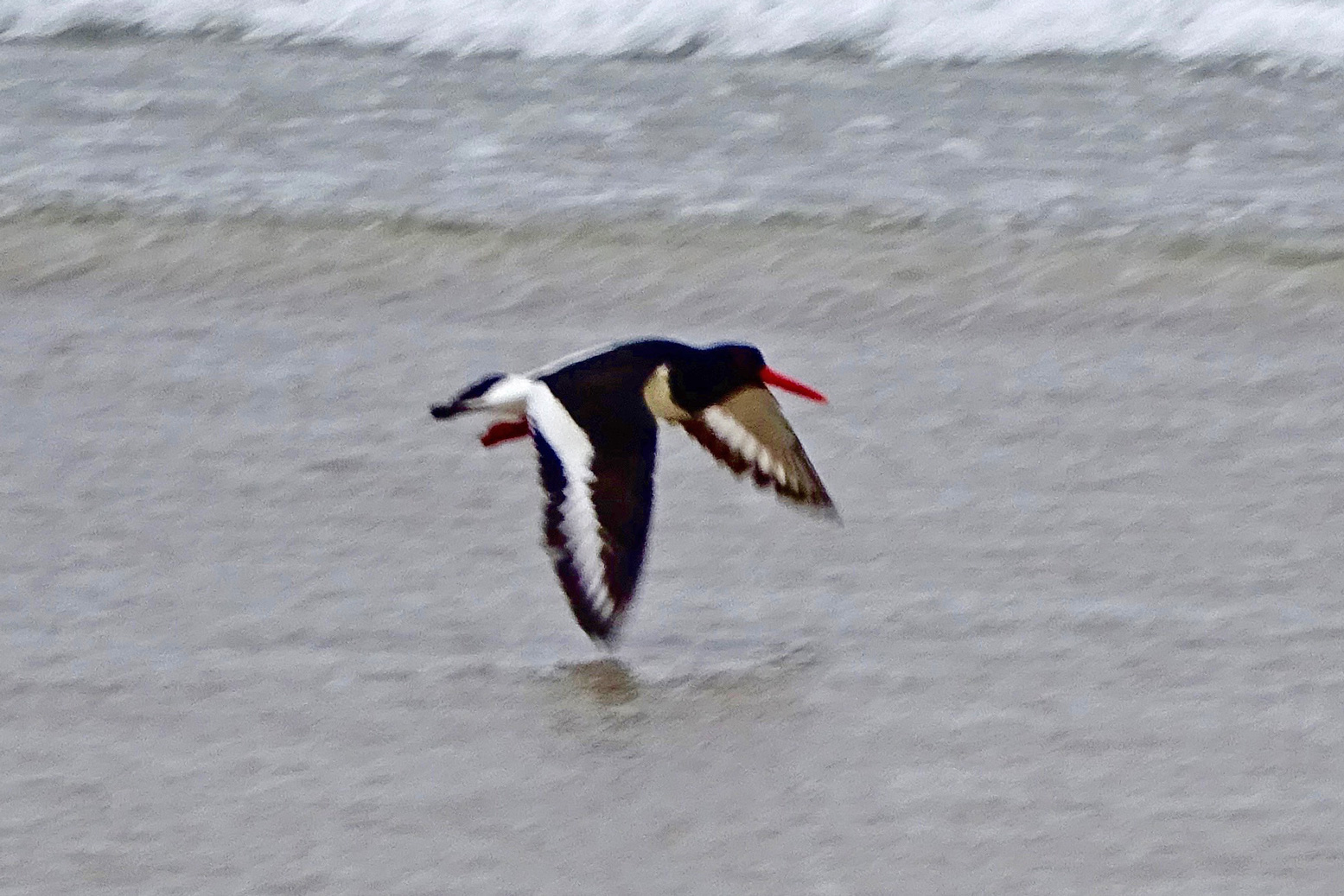
It was nice to look around in the quiet but I also missed that thrill of thrust when a sail catches and holds a good passing gust. Eventually we could stand the relaxed pace no more and the geef paddle-assisted us towards a stony beach at the mouth of the Allt Loch Ra creek. Squawking oystercatchers were guarding their nests. Left, by the bothy at Badentarbet last year; don’t stand on the eggs.
Refuelled, we paddled upstream for a bit then I tow-waded the boat, reminding me of the shallows of Shark Bay in 2006 – a good way to rest after what felt like days of headwinds. The short wade brought us to within a couple of minutes’ portage of Loch Ra just over the road. Now on fresh water, we dragged through the reeds before another short portage over into the adjacent Loch Vatachan. Picking a passing place close to the shore, the geef walked off to get the car while I rinsed off the seawater – another good reason to paddle this loop clockwise. It’s 15 miles and about 5 easy hours to loop the Coigach loop.
A few shots from our first visit to the Summer Isles in 2006 with my original Gumotex Sunny and Mk1 Safari and when it seems the weather was unusually good for August. One day we paddled out as far as Tanera Mor and Tanera Beg, as well as Achnahaird and Loch Sionascaig and Osgaig and thought it was all a huge adventure.
See also: the similar but wider and DS-floored Thaya
Gumotex have rebranded 2013’s Solar 410C as a Solar 3 (some call it ‘Solar 019’). Everything about the two boats appears to be the same.
Actual differences only add up to a longer front splash deck (left) with a metal support to stop sag – and a drain slot at the back (right; an idea copied off my old Sunny, just so you know!).
The 410C evolved from the slightly shorter Gumotex Sunny (left), in its day a brilliant IK which I used for years and years, until the flexing and size outgrew my needs.
Pressure in the Solar 3 remains the standard 0.2 bar, but this only becomes an issue when used solo at sea (the boat sags in the middle and can swamp more easily). Two or three up on flat water, it won’t be so noticeable or will be part of the fun. The Solar 3 is pitched as an easy river-touring or family recreational boat where price and space matters more than pressure and performance; for that you have the 0.25 bar Seawave which costs 40% more. For now the Solar remains the an all-tube and inexpensive option to a wider, dropstitch Thaya and is the last of the classic Gumotex longboats.
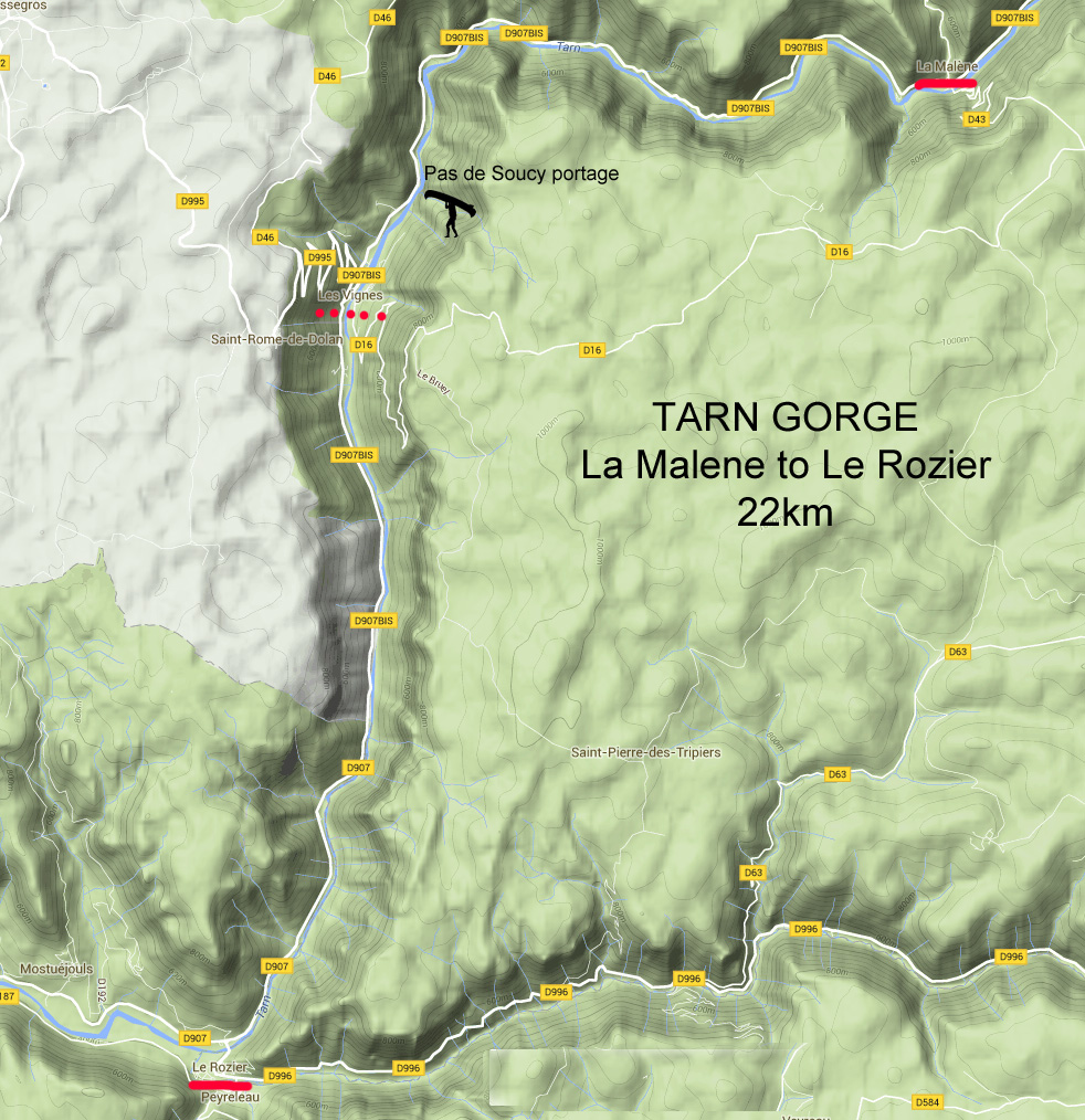
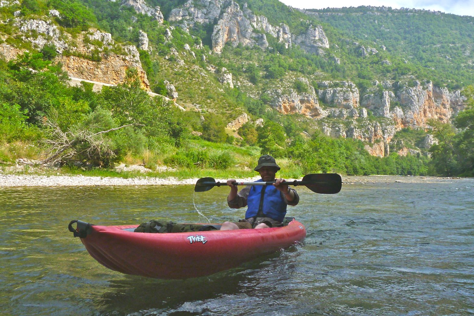
On the way back from some riding in the Pyrenees I persuaded my lift that a day’s paddling along southern France’s famous Tarn Gorge would be a good use of our time. The 22 kms between La Malene and Le Rozier via Les Vignes (see map, left) is about as good a day in the gorge as you’ll get. We last did the full 75km from Florac to Le Cresse in 2007 with a Solar and the Sunny and had a great time as near total newbs. Since this trip I re-did it the full 86km from Florac to Millau in my Alpacka.
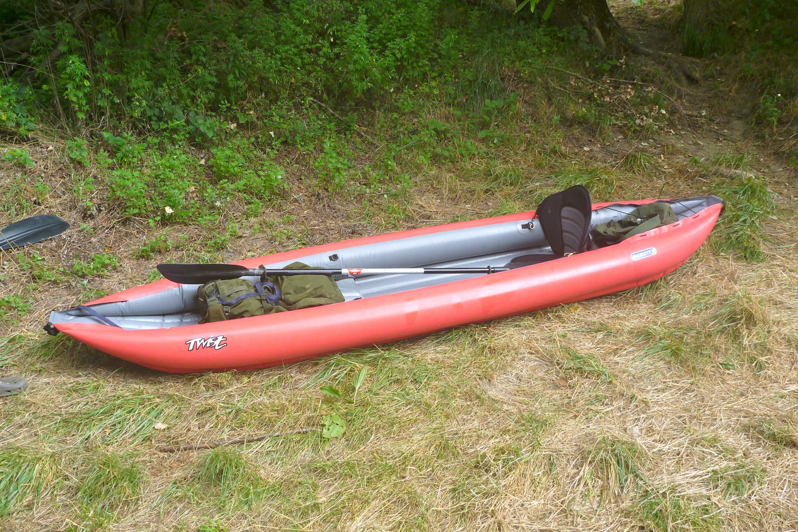
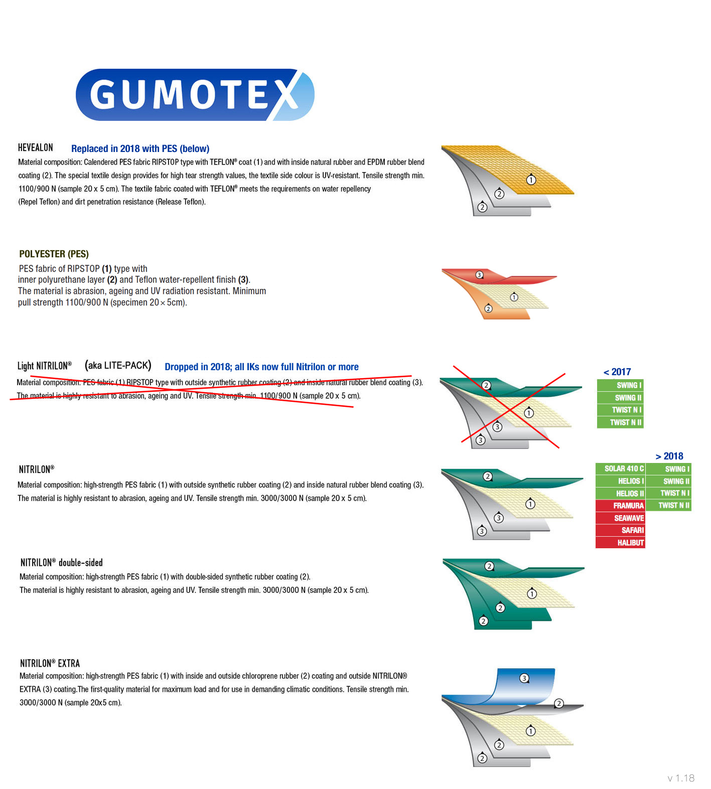
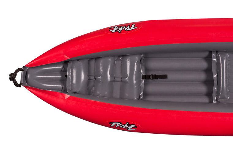
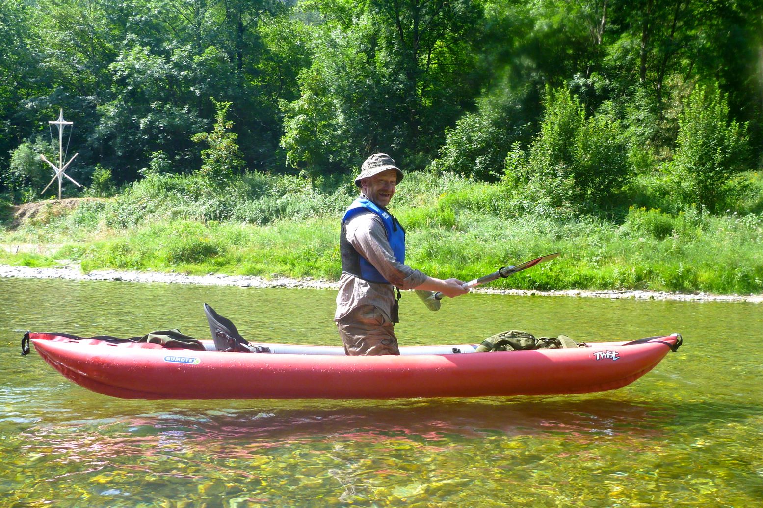
On this occasion IKing chum Robin was baptising his new Gumotex Twist 2, an entry-level IK which in the MkII version has gone back to shiny Nitrilon Light inside and out. I do read here that one unhappy customer found out it was ‘70% less strong and only 30% lighter’ than the regular Nitrilon as used on Seawaves, 410C, Helios and so on. His boat flipped in the wind and punctured on a stick which does sound like a gale combined with an exceedingly sharp stick. But then again, one time Robin lent his Twist to a pal who managed to catch some spike under a jetty and blow a half-metre rip in the side.
According to the Gumotex graphic (left) it appears like Nitrilon Light uses the same layering as the Nitrilon in the higher spec Gumboats, but due to a lower-strength fabric core, Nitrilon Lighthas about a third of the tensile strength. As a reminder the T2 is 3.6m long, a generous and stable 83cm wide and weighs 11kg (2kg more than the old model). Payload is said to be 180kg. Robin has the original Lite Pack Twists but found they weren’t so practical or robust, at least not on the submerged light industrial detritus found in his neighbourhood. However, Nitrilon Lite was dropped from the Gumotex lineup in 2018 and since then all Twists are made from the same Nitrilon you’ll get in the bigger and pricier Gumoboats. That also means a post-2018 Twist weighs 13kg.
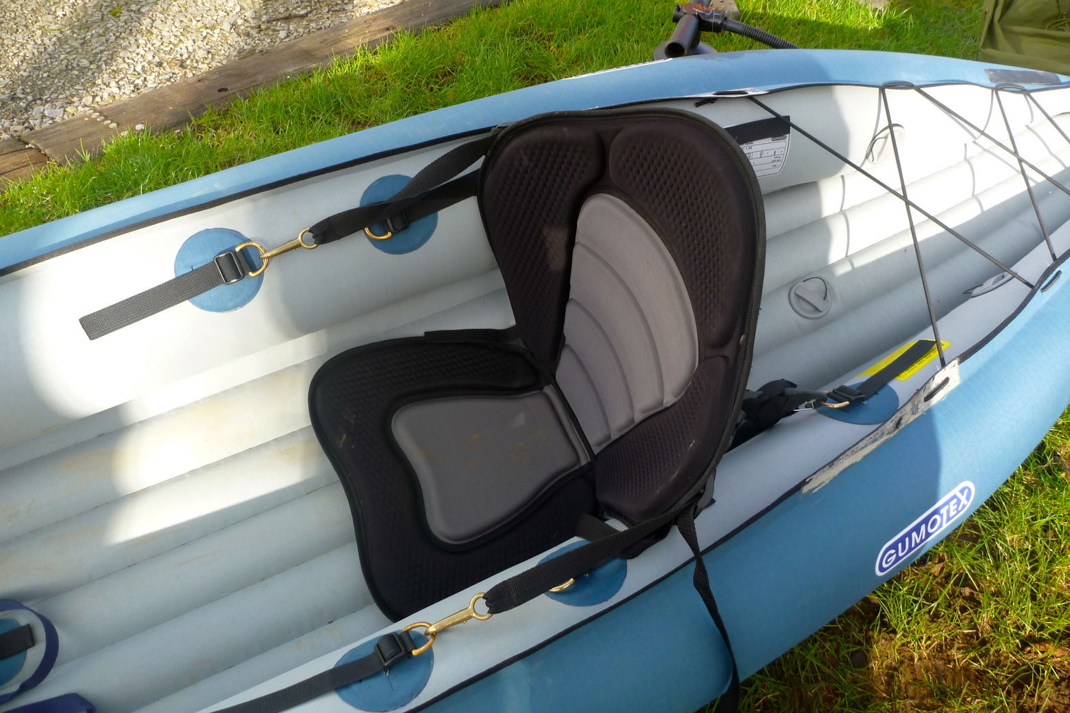
These MkII Twists also have detachable and adjustable seats – a big improvement (or return to former practices) because it means they can be easily replaced with something a lot better. There’s nothing wrong with the blow-up seat base but the inflatable back section lacks support. Robin’s fitted some sort of SoT seat pad (above, in his T1). Another improvement on the MkIIs is making the top seam on the side tubes overlapping flat, not just pressed together which maybe simplifies assembly in the factory but looks cheap. There’s a mushy inflatable footrest for the front paddler; the back paddler adjusts their seat to use the back of the front seat as a footrest. And there’s now also a PRV in the floor chamber which the Lite Pack Twists didn’t have. We like PRVs here at IK&P. We even like PRVs all round.
The £350 T2 could actually be a good lightweight alternative to the 60cm longer 410C (later the Solar 2) which at the time costs £200 more (in the UK), as it still has a useful length for a solo touring paddler. Problem is, using just the back seat tips the weight back and the bow up unless there’s a hefty counterbalancing load on the front. The boat paddles OK like this and probably turns quicker, but yawed more than my packraft so seemed slower and just looked wrong. For a while Robin knelt canoe-style which looked more balanced but isn’t a really a sustainable way of paddling without a bench. The post 2018 models have a third pair of D-rings in the middle to position a solo seat in the right place.
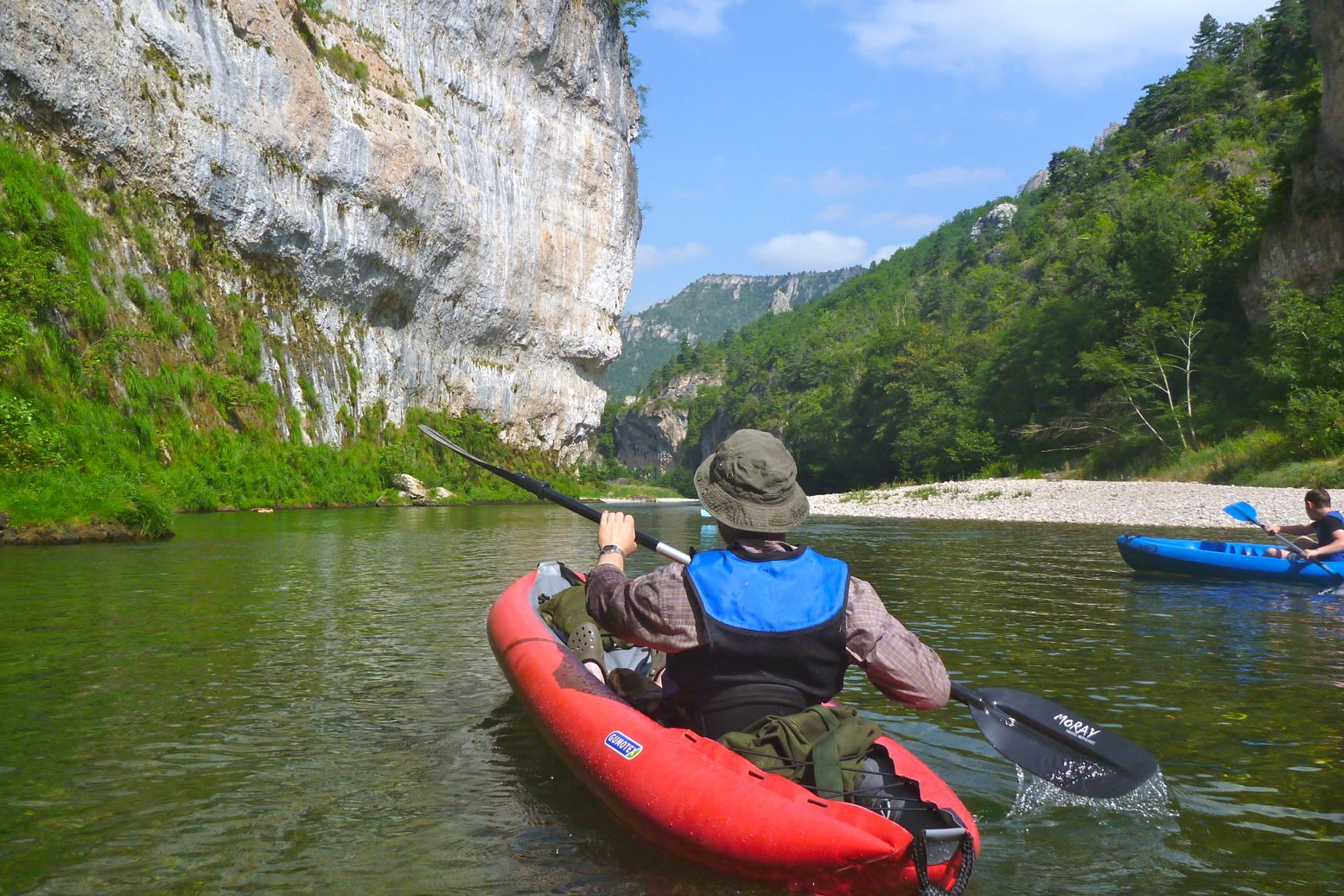
We set off from La Malene, me assuming my Alpacka would be a lot slower, but Robin likes to bimble along, waving his bow around. The Tarn was shallow and so his skeg took quite a beating, made worse by his rearward seating prefs. They’re pretty much unbreakable but I’d have removed it, even if the tracking may have suffered.
With careful scanning the Alpacka just about scraped through the shallows, with me occasionally resorting to ‘back planking’ where you lift your butt by leaning back on the stern to improve clearance. As you can see right, the backside is the lowest point which is why I glued on a butt patch. On the Twist, Robin could only shove forward or get out and pull. By the end the Twist’s skeg patch was a little torn which takes some doing.
It took 90 minutes to cover the 9km of Grade 1 riffles to the Pas de Soucy where a rockfall blocks the river (left) and makes some very nasty strainers. Midway en portage we nipped up to the lookout for the view then had lunch and put back in for the 12km stage to Le Rozier and the van.
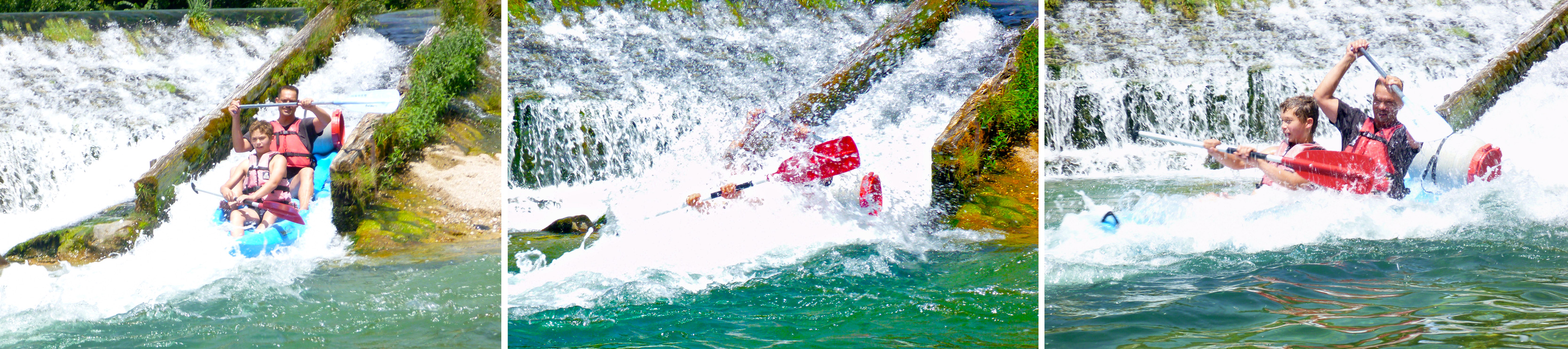
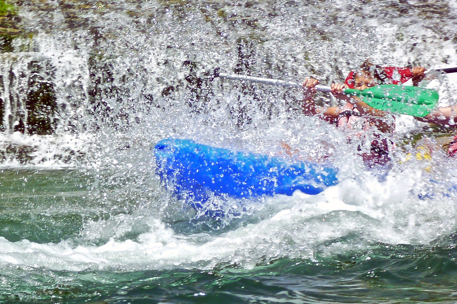
Soon after Pas de Soucy is the chute or glissade at Les Vignes where a typical indestructible plastic rental brick tends to plough in at the bottom, while an airy inflatable surfs over the pile. The missing fourth frame in the pictures below is the blue SoT flipping over. ‘Prends pas le photo!’ No harm done on a 30°C day in sunny France.
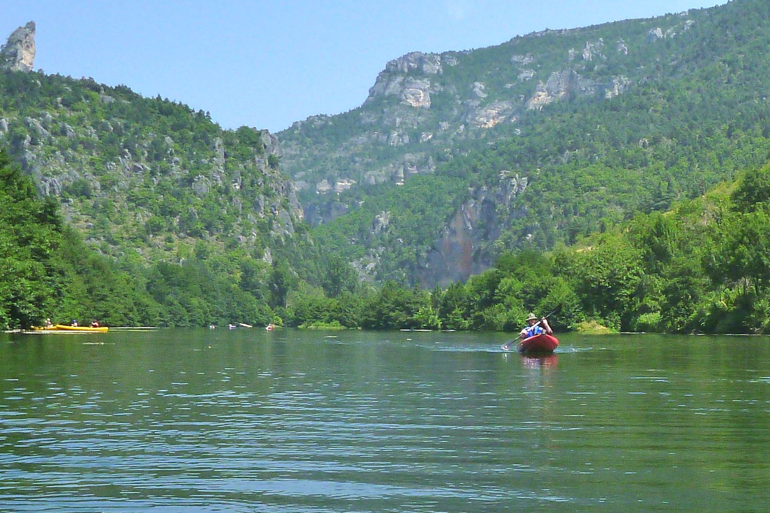
This section of the gorge has some juicier rapids, but it’s still nothing that would freak out a first timer; that’s what makes the Tarn such a classic paddle: great scenery, some white water action, easy camping and the fun of splashing about among the flotillas of SoT rentals. There are several campings below the road right by the river, though this time of year they’re all packed out. On arrival we got the last pitch between two noisy young groups at Le Rozier and a free lift next morning up to La Malene from the kayak rental agency next door. There’s also a shuttle bus running up and down the gorge. Read more about southern France paddling here then hop on the TGV with your packboat.
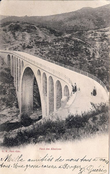
An old Gumotex Solar 1 passes under Le Pont des Abarines on the Gardon de Mialet near St Jean du Gard in the southern Cevennes. The bridge is 116 years old this week.