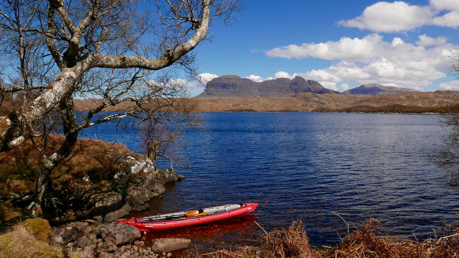
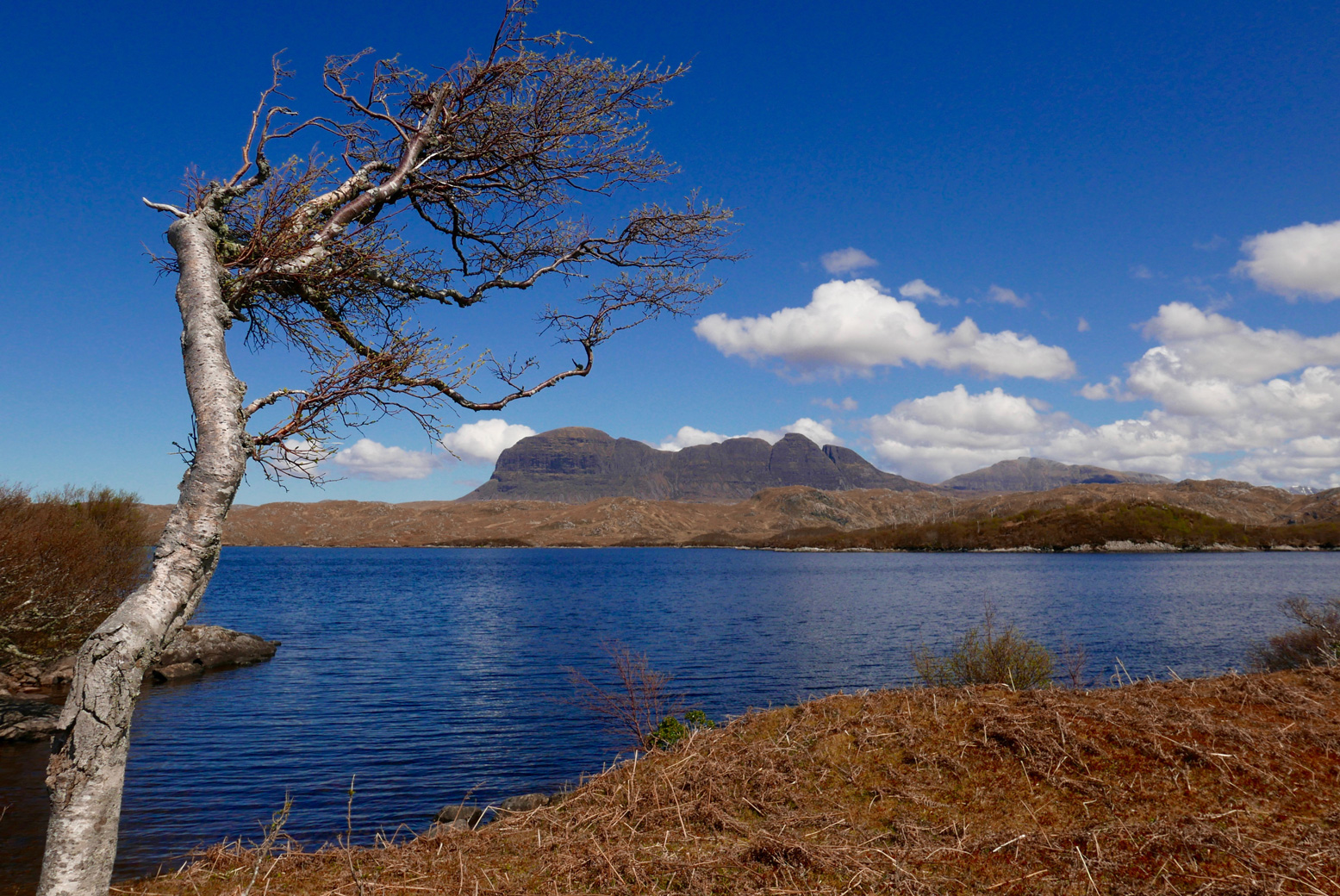
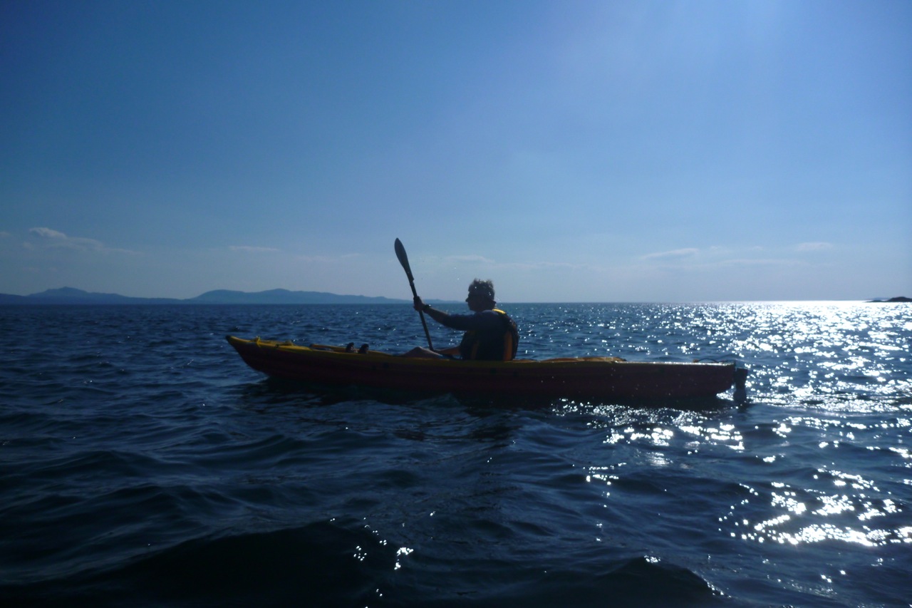
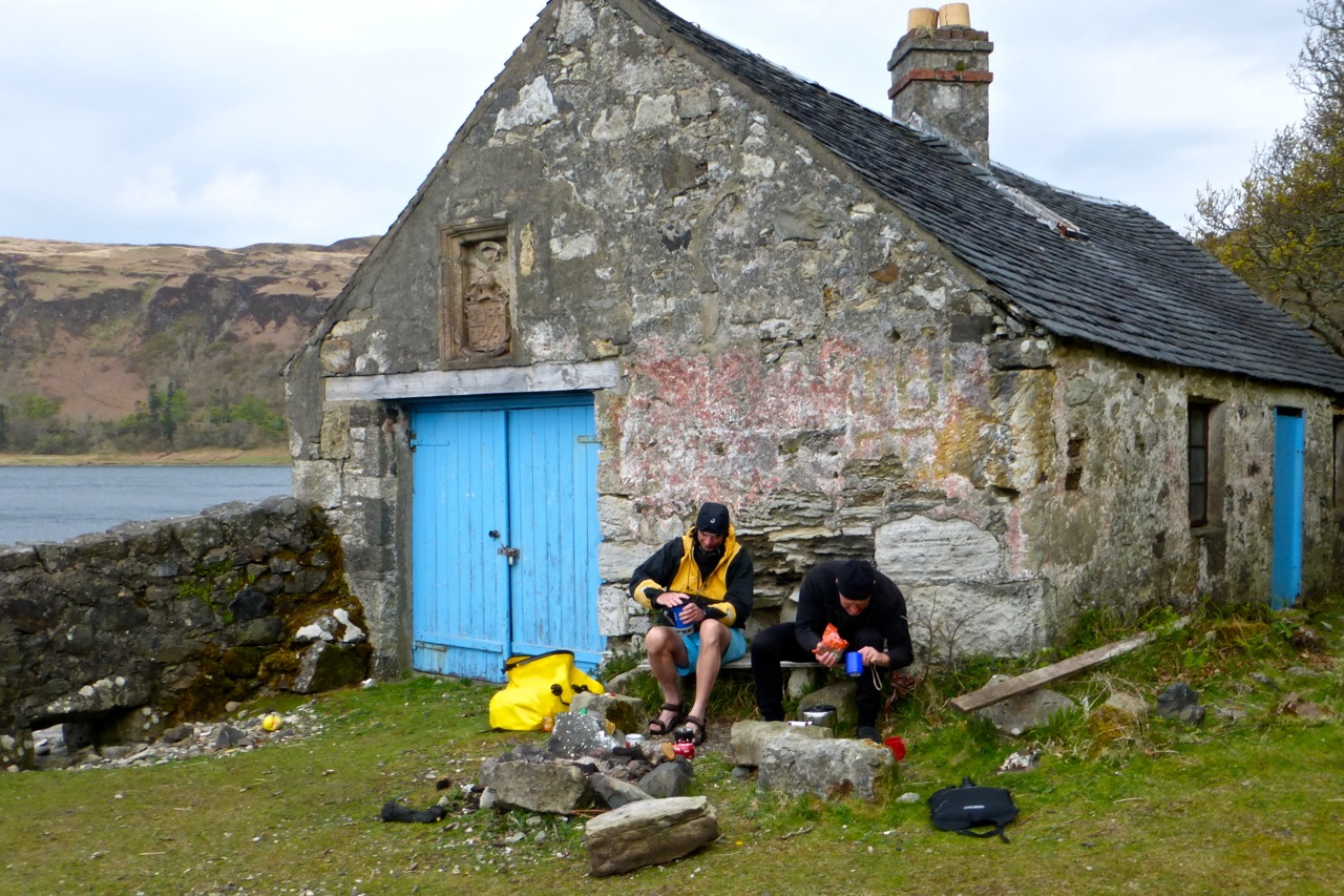
First paddle of the year and it’s nearly May! I need to get out more. It was a calm day but as we’d not been there for ages, we decided to go inland to the ever-reliable Loch ‘Sion’, spread below a cirque of dramatic Assynt peaks. From the lay-by on the WMR it’s a half-a-mile’s trudge down to the west shore at Boat Bay, dipping through the hazel woods then tip-toeing over rotting walkways spanning slimy quagmires.
Down at the bay – bother! The skeg, clipped to hull through a zip tie, was MIA. The zip tie had probably succumbed to the UV, as they do. Oh well, I claimed years ago these IKs are controllable without a skeg, let’s see if that’s still true.
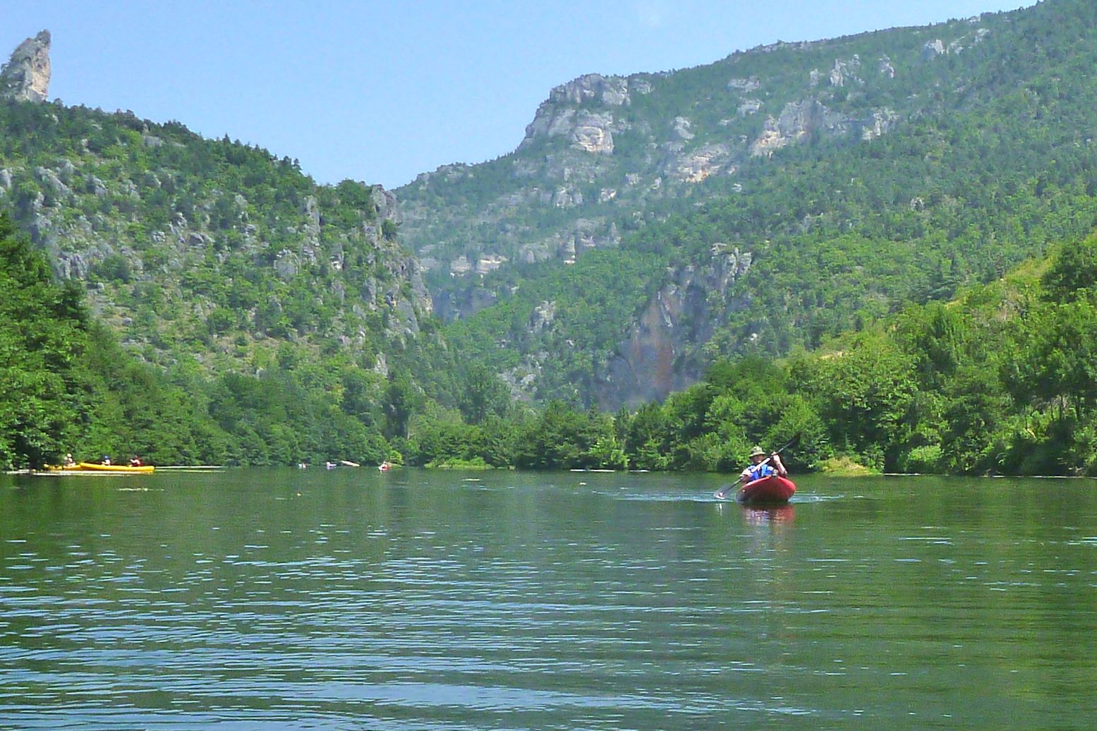
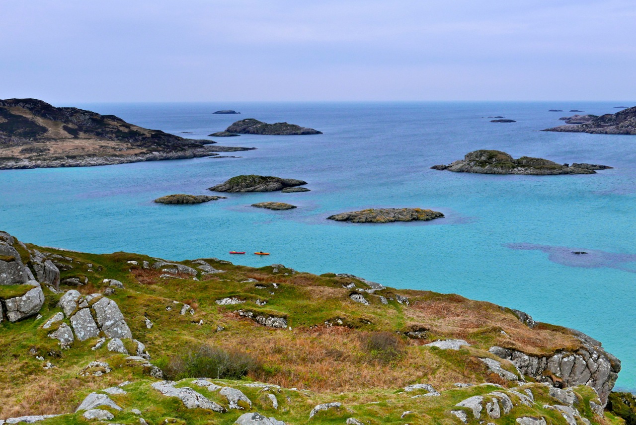
Below Suilven
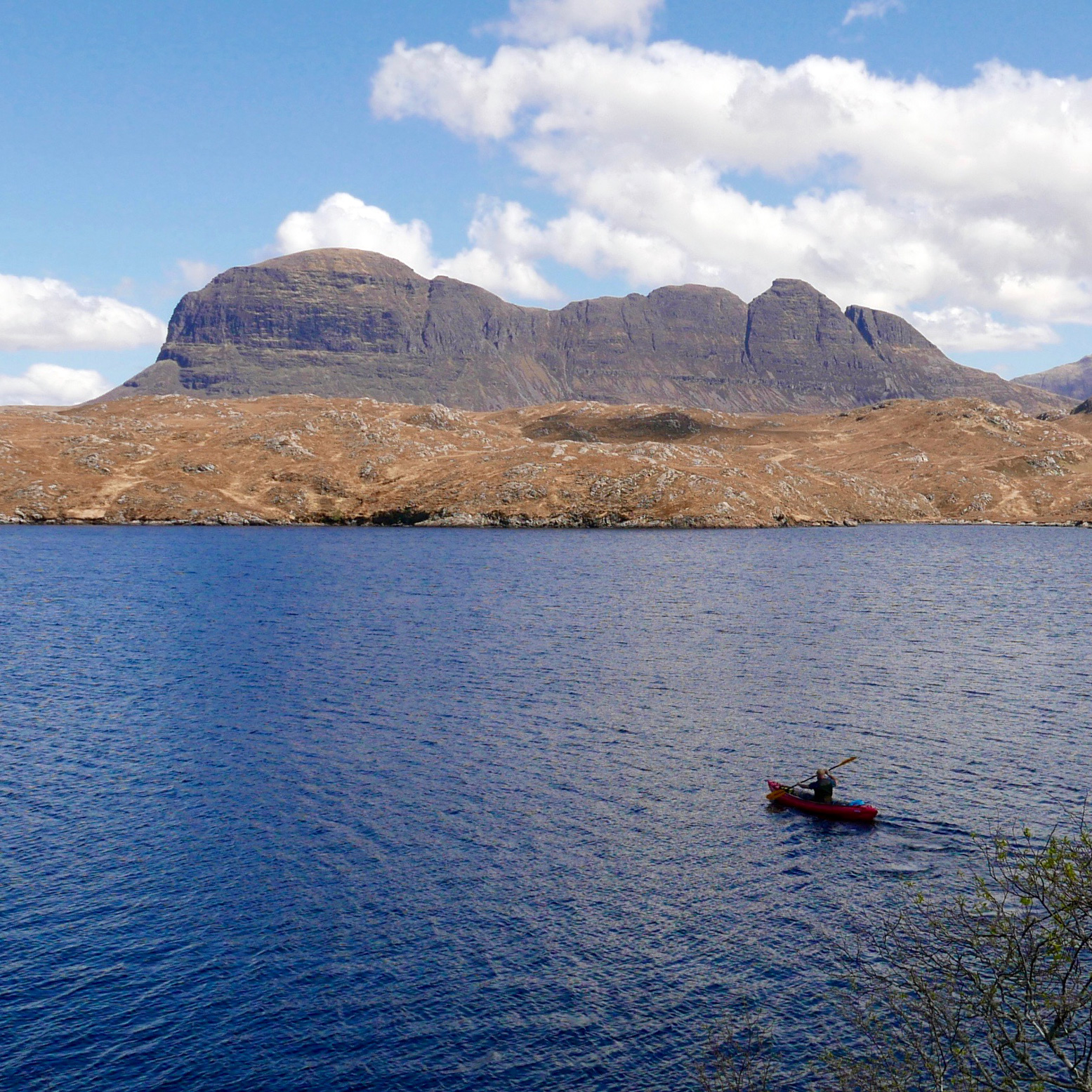
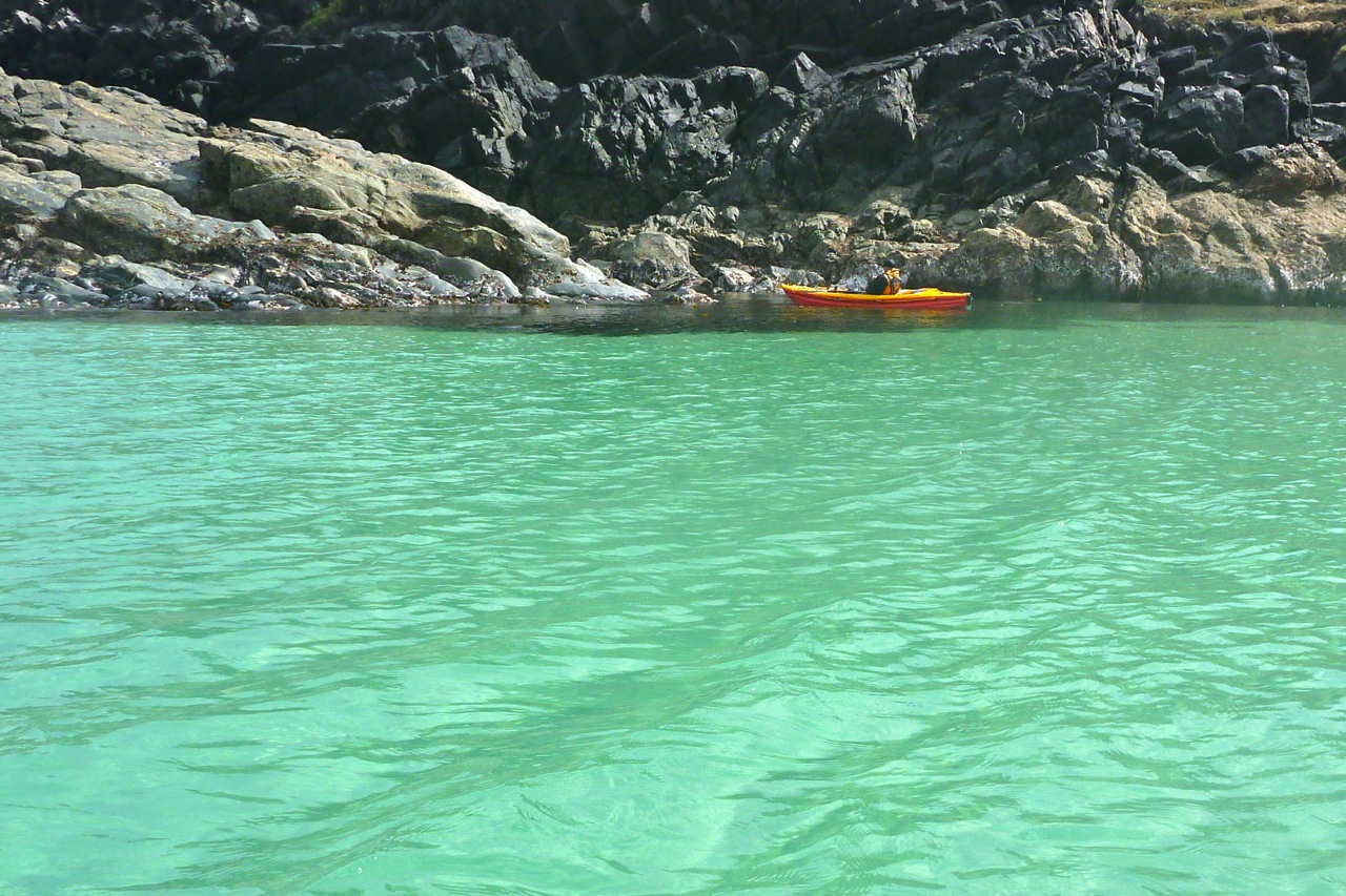
On a flowing river, finessing the paddle strokes while solo, it works well at the cost of some flat-out speed. But two-up and with a tail breeze – that aeolian nemesis of paddlecraft – we scratched a scruffy traverse out to the mouth of Boat Bay where it was quicker to let the funnelled wind push us out into the main loch. Suilven sat to the north, Cul Mor was straight ahead and the ever-popular Stac Poltroon was to the south where panting lines of day-trekkers were eyeing us right now, some with what I liked to think was mild envy. By and by we reach Eilean Dudh, the islet just north of Eilean Mòr, where I went for a solo spin to see if the boat was easier to track solo. It was a bit, especially once off a tailwind.
That done, we paddled over to Eilean Mòr, parked up on the east side out of the breeze and found a flatish, dryish patch where some woodsman had made a rudimentary camp. I went off for an explore through the mossy-barked woodlands, like something from a fairy tale, then up to the unusually bald summit which in a month or two will be waist-deep in thick, green ferns. or is it bracken? All around the heather-clad hills still clung to the tawny hues of late winter and the branches of gaunt, leafless trees, deformed by the prevailing winds, reached northeast like some toga-clad heroine in a Romantic painting. May’s reliably sunny spells will soon put an end to all this drabness.
When the time came to paddle back, set against the wind the skegless Seawave was much easier to handle and satisfying to paddle. In fact I got so engrossed in the effort that amid the perspectiveless blur of yellows and browns I missed the small entrance back into Boat Bay and was steering us west towards the Polly Lochs.
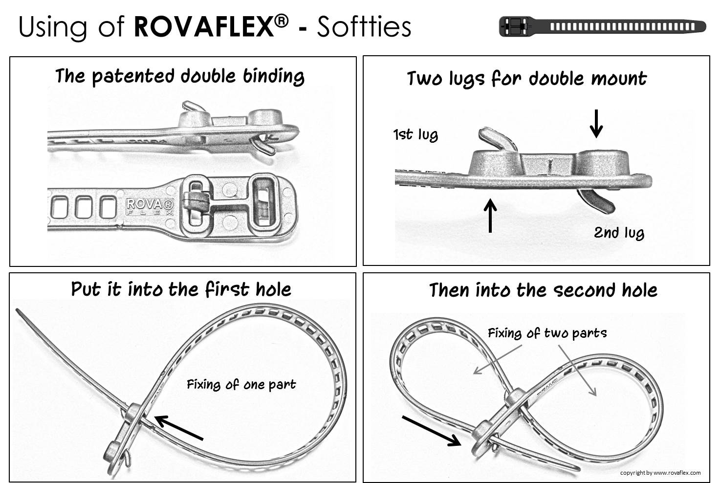
‘This doesn’t look right’. And I was right, it wasn’t. A quick glance at the map and a turn to the northwest delivered us back to the right shore. Back home, the skeg lay in the gravel by the wall alongside a broken zip tie. Have I mentioned tough, TPU RovaFlex reusuables yet?
A fortnight later (that’s the frequency of sunny days up here) we looked down on a new perspective of Suilven and Eilean Mòr island from the windless 2800-foot summit of Canisp mountain, still clinging to the last of the winter snows.
We set out to paddle from Chichester Town Basin, down the old ship canal into the tidal Chichester Harbour at Birdham Lock. Lois and Austin in two do-it-all, drop-skeg Venture Flex 11s (left) Robin and Elliot in an old Gumo Twist 2 and a newer Nitrilon one, both of which fitted into carrier bags. Plus my Seawave lashed to a trolley.
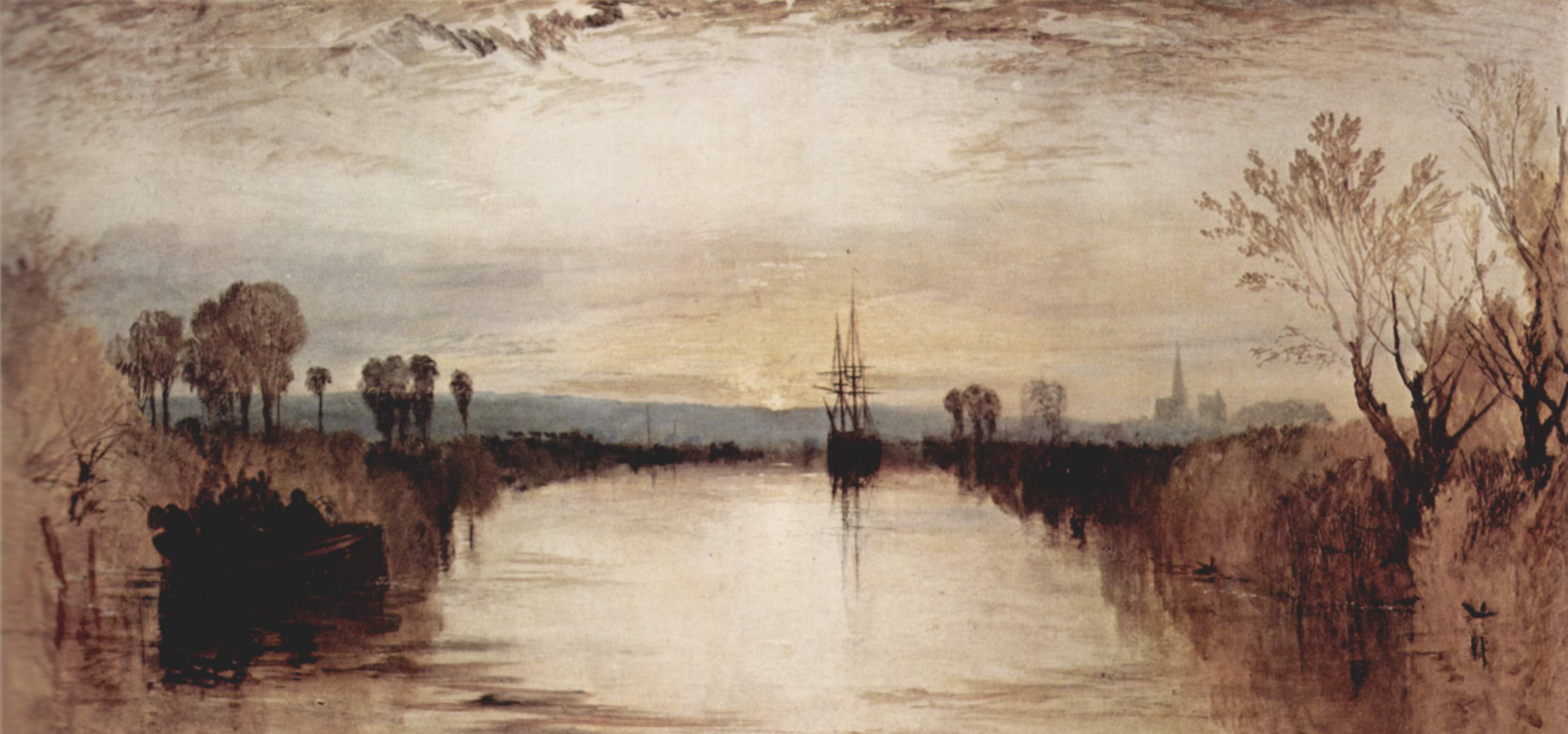
Nearly two hundred years ago Turner depicted tall ships gliding serenely along the then new 4.5-mile canal (above). During the canal boom preceding the railways, it linked Roman-era Chichester with the huge natural inlet of Chichester Harbour and the adjacent naval fleet at Portsmouth. To the east was a canal to the Arun & Wey navigation (left) which was a short-lived inland link between London and Portsmouth commissioned at a time when Napoleonic fleets threatened the English Channel.
Our original plan had been no less Napoleonic in its grandeur: a 15-mile lap of Hayling Island, but today the tides and winds were all wrong for that, and even with Plan B we’d arrive at Birdham at low tide to face an undignified, sludgey put in.
On Google maps the canal looked clear, with maybe a quick carry around a lock or two. But just two miles from the basin, a thick mat of Sargasso frogweed clogged the channel at the B2201 Selsey Road bridge (below), reducing speeds to a crawl. Worse still, over the bridge this unallied carpet of errant biomass ran on like forever, and probably all the way to Birdham Lock.
Was it a high-summer frogweed bloom? The initial two miles are kept clear by rowers, paddlers and the 32-seater cruise boat which hooted past us with a lone passenger tapping at his phone. But nothing bar the Solent breeze stirred the canal west of the B2201, allowing the thick Sargassian spinach to fester and choke navigation for even the pluckiest of mallards. A picture from 2008 (above) shows less weed at the bridge and a rather squeezy thrutch through a spider-clogged culvert under the road.
Abandon Plan B all ye who Venture Flex here. Austin called in an Uber: ETA 4 mins; ET back to his Volvo: 6 mins. Total elapsed recovery time: 16 mins, give or take. The internet of things – how modern! Soon the hardshells were lashed to the roof and the rolled-up IKs heaved into the spacious boot of the Swedish landraft with class-leading crumple zones.
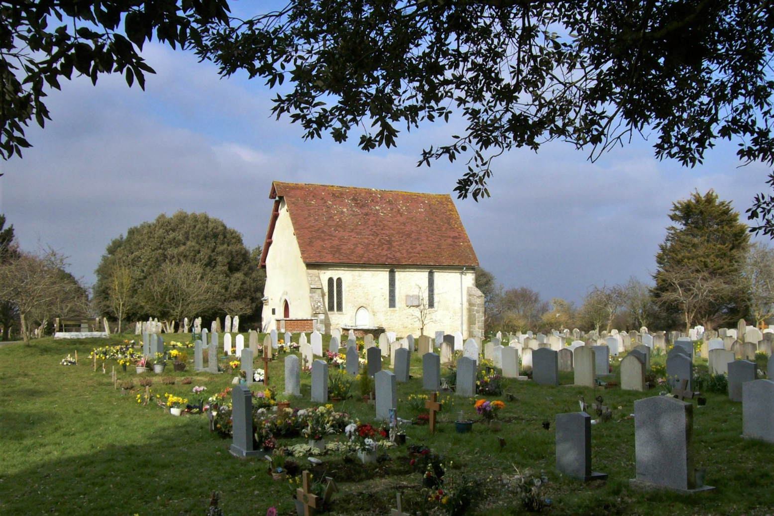
A quick map check and I proposed Plan C: Pagham Harbour just down the road and out of the rising southwesterlies. I’d never heard of this medieval-era port which was now a bird sanctuary-cum-sludge repository, but Elliot had been spotting here so knew the way to the chapel at Church Norton, thought to be the mythical 7th-C source of the overdue Christianisation of pagan Sussex.
A 5-minute haul led to the shore, except the tide – which should have turned over an hour ago – was still way out, leaving only snaking channels accessible down muddy banks. We ate lunch, waiting, like Al Gore, for sea levels to rise. But when the time came nothing but irksome clouds of marsh gnats stirred as we padded over the springy salt-scrub to the nearest channel (above).
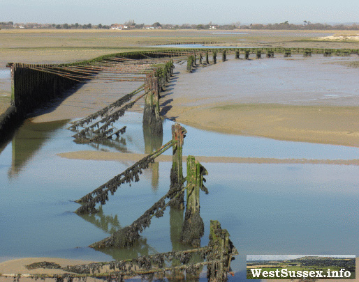
All around, collapsed jetties, concrete groynes and other arcane structures recalled Pagham’s 19th-century heyday. Back then the sea had been successfully sealed off and the land reclaimed for farming until a storm in 1910 broke through the embankment, reflooding the harbour for fair and fowl.
Another portage over a shingle bank got us to the main outlet leading to the sea and where the water was rushing out when it should have been filling. I realised that narrow-necked inlets like Pagham Harbour act like reservoirs, releasing their tidal fill gradually for hours after the sea tide has turned. In the tropical fjords of northwestern Australia’s Kimberley it can produce bizarre spectacles like the Horizontal Waterfall (left).
We drifted and boat-hauled through a strange, desert-like landscape of barren shingle banks speckled with forlorn fishermen and demure nudists until the spit spat us out into the English Channel like five bits of unwanted, flavourless chewing gum.
According to images and video on Save Pagham Beach (left), it’s staggering how fast the spit has grown once shingle management ceased around 2004; part of a new ‘natural coastline’ [money saving] policy. The spit has repositioned tidal erosion eastwards and along the shore, accelerating the scouring of Pagham’s foreshore and endangering the homes immediately behind. Recutting the Harbour’s outlet to the west (bottom picture, left) is thought to be a solution, but may transfer the flooding risk inside the harbour. Add in the protected SSSI status of the Harbour and the ‘homes vs terns’ debate becomes complex. Who’d have thought we just went out for a simple paddle.
Eastward along the coast, the assembled infrastructure of Bognor Regis rose from the horizon, while behind us the promontory of Selsey Bill kept the worst of the wind off the waves. With a helping tide and backwind we bobbed with little effort in the swell which gradually grew and started white-capping once clear of the bill. But as I often find, a sunny day and not paddling alone reduced the feeling of exposure and imminent watery doom. Only when a stray cloud blocked the sun for a minute did the tumbling swell take on a more malevolent tone. The buoyant Twists – hardly sea kayaks – managed the conditions fine and the lower, unskirted Ventures only took the odd interior rinse.
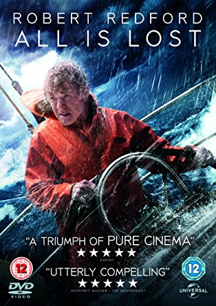
Talking of which, All Is Lost (right) was on telly the other night. Lone yachtsman Robert Redford battles against compounding reversals in the Indian Ocean after a collision with floating cargo container wrecks his boat. A great movie with almost zero dialogue.
Just near Bognor all was lost for real (above and left). Only a fortnight earlier, a similar, lone-helmed sailing boat had lost its engine and unable to sail, drifted onto Bognor’s serried timber groynes. Less than two weeks had passed and already the hull was now cracked like an eggshell and the masts were gone (maybe removed). But unlike the doomed Redford character, on the day the Norway-bound sailsman had been able to scramble ashore.
These groyne stumps – designed to limit longshore shingle drift – could also be a bit tricky in a hardshell if the swell dropped as you passed over one. And just along the shore was another wreck (above) protruding gnarly, rusted studs which may well have sliced up an IK. Mostly submerged when we passed, some post-facto internetery revealed it to be the remains of a Mulberry Harbour pontoon, one of many built in secret during WWII as far as northwest Scotland, then floated out on D-Day in 1944 to enable the sea assault on Normandy.
Our own beach assault ended at the truncated remains of Bognor pier, proving the sea eats away at this whole coast. Bognor is a step back to Hi-de-Hi! Sixties Britain when we did like to be beside the seaside. All together now! So ended a great day of paddle exploring. Uber!
Tuesday was set to be a scorcher – no less than 30°C predicted in mid-September (in the end over 34°C, the hottest Septemberday for over a century; the new normal). No excuses then to try my first south coast paddle if the winds and tides lined up. It could be my last paddle this year. With bands of chalk cliffs and the Atlantic getting funnelled in, the Sussex coast feels a bit exposed compared to northwest Scotland where I usually sea kayak. With little of interest, it’s not exactly a sea kayaking mecca, even though it’s highly populated. At least if you have a shipwreck, it won’t be far to a road or even a bus and I bet a mobile works everywhere. Wind direction for Tuesday was ESE – an ideal onshore-ish backwind, if a bit breezy (for a lone IK) at 13mph. And by chance the tide was just right too: high at a handy 9am with a moderate 3.5m drop. (good tide times website). In five days time the spring tide would be nearly twice that. Clearly this was shaping into a westbound day. Anyway, that was academic as wind and tide made Newhaven west to Brighton and beyond the way to go. With lots of rail stations, I could go as far as the arms lasted.
I learned an interesting thing about Sussex and Kent tides while planning this run earlier in the summer. For the last two hours of the incoming (eastbound) flow, the tide keeps rising but reverses westbound along the English coast as it backs up at the Straits of Dover and spills back down the sides. This makes a more usual easterly run with the prevailing SW winds a bit tricky (or short) on an incoming tide. The nearer the Straits the more skewed the tides. At Dover it falls for nearly 8 hours, but fills in less than five. At Brighton, where the Channel is four times wider, ebb and flow are equal but you still get that 2-3 hour backwash at the end of a high.
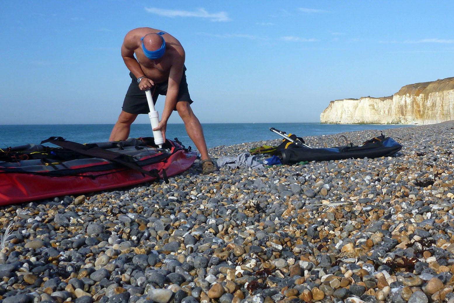
The Newhaven train took me over and along the South Downs where sheep nibbled in the early morning sunshine. It sure was nice to get out, even in southeast England which isn’t exactly terra incognita to me. On the steep shingle beach below Newhaven fort, the tide was topping out as I topped off the Seawave and the Dieppe ferry backed out of the harbour. These shingle beaches have steep ramps bashed out by stormy seas. At high tides this terracing kicks up the surf and means wading in can quickly put you out of your depth, as I recall well from childhood holidays on the Southeast’s shingle beaches. But probably more by chance, I timed my put-in on a lull, hopped in and PLF’d out of the surf zone. As usual, alone on a new shore after a couple of months off, the first few minutes or more required managing an agoraphobic anxiety. I reassured myself the wind was blowing me along- and towards the shore, and the dropping tide would gradually expose beaches below the cliffs if I needed a break. On the beach I’d inadvertently pumped the seat right up, and in trying to deflate it on the water, the annoying sticky twist valve stuck and I was soon sat flat on the floor. Oh well, it will make me more stable if it all gets rough. I’d forgotten my rudder too, but wasn’t too bothered about that. One less thing to concentrate on.
The trouble with backwinds is they give no impression of movement and soon I was dripping like a dewy fern at dawn. As you’d expect out here, the seas were jaunty, with occasional swells rolling by that looked higher than me. But there were no tell-tale whitecaps, the stern wasn’t pushed about, and half an hour in, a long concrete ledge/seawall below Peacehaven cliffs offered a way out if needed. That would have to be in extremis though, as at times the swell slapped hard against the walls and there were only steps to get out.
No need for that yet. We were moving along probably faster than I felt. I tried to keep away from the shore so as not to get caught by a rogue swell – I saw one break up ahead way off the shore and steered well behind that point. There seemed to be no pattern to these choppier episodes. Was it a set coming through or just seabed related? Later, looking at an OS map and what the sat map below shows too, a wave-cut sub-sea platform of the soft chalky cliffs extends quite far out. Where the jade green sea turns blue is where it drops off? Who knows, perhaps it’s just the sea, but it created an uneven rhythm considering the linear nature of the paddle. Another thing I noticed was that I drifted out to sea if I didn’t concentrate. It was probably the tide which not only ebbs westwards but goes out too. Hence the well-known expression and phenomenon: ‘the tide is going out’. Every once in a while a quick spurt inshore (but not too far inshore) put me right.
A few miles ahead I could see the whitewashed conurbation of Brighton, but without a seatbase the old backside was now beginning to feel the strain. I passed by a couple of serious-looking sea swimmers heading upwind, then put in between some groynes at Saltdean, where another cliff-protecting concrete walkway ran all the way to Brighton; a fun cycle or hoverboard, I dare say. I timed my landing well enough, but after pumping the seat and a rest, re-entry required flipping the swamped boat a couple of times. Probably because getting back out between the surf can’t be done as briskly as coming in.
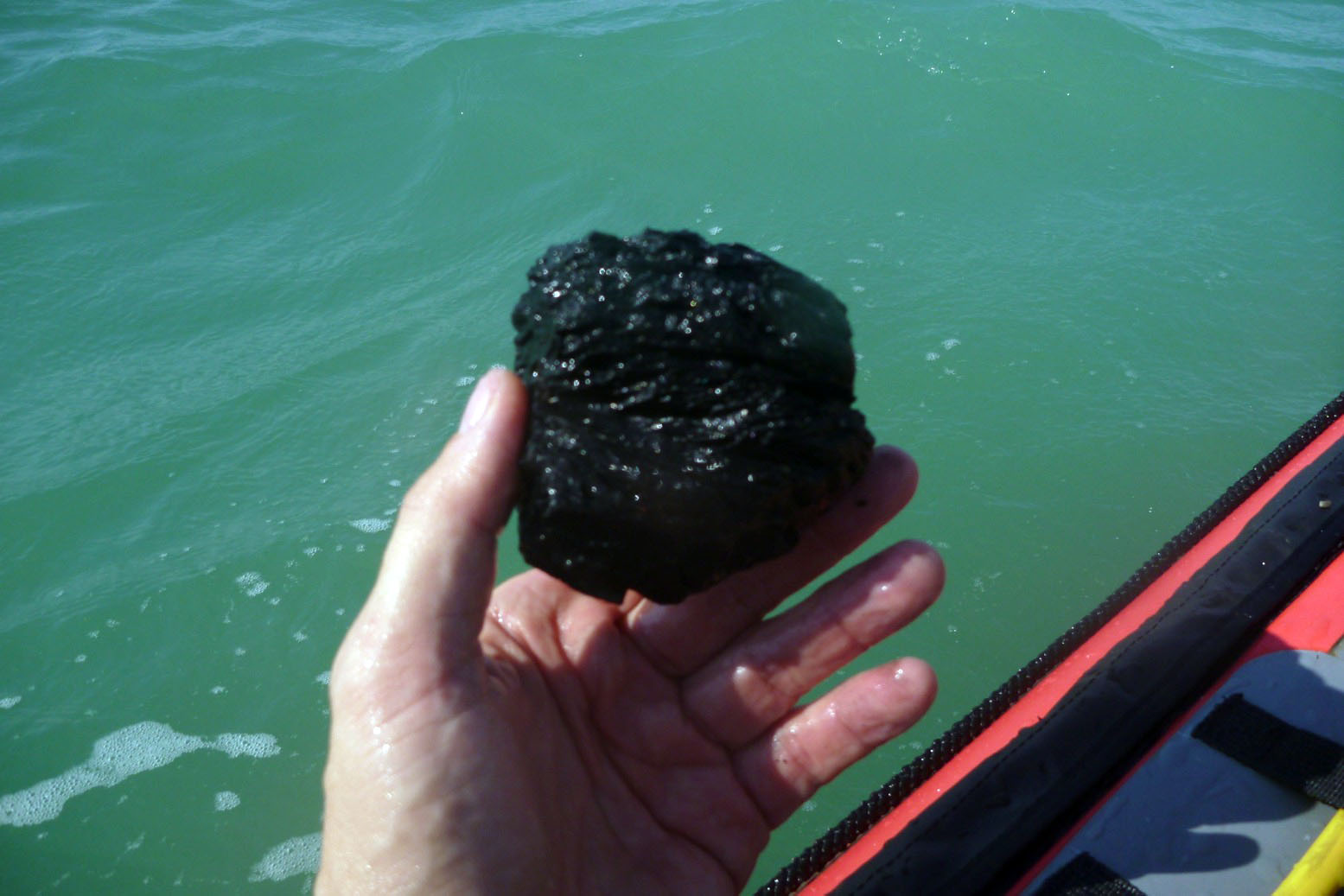
Next obstacle: getting round Brighton marina where the seas really felt quite lively. The southeasterly swell was bouncing off the marina walls like Brighton revellers on legal highs. Nothing for it but to PLF; at least the wind was helping. Round the back of the breakwater all was calm, bar the odd oversized swell. I found a piece of coal and a child’s wet shoe. It was a good omen: follow the shoe!
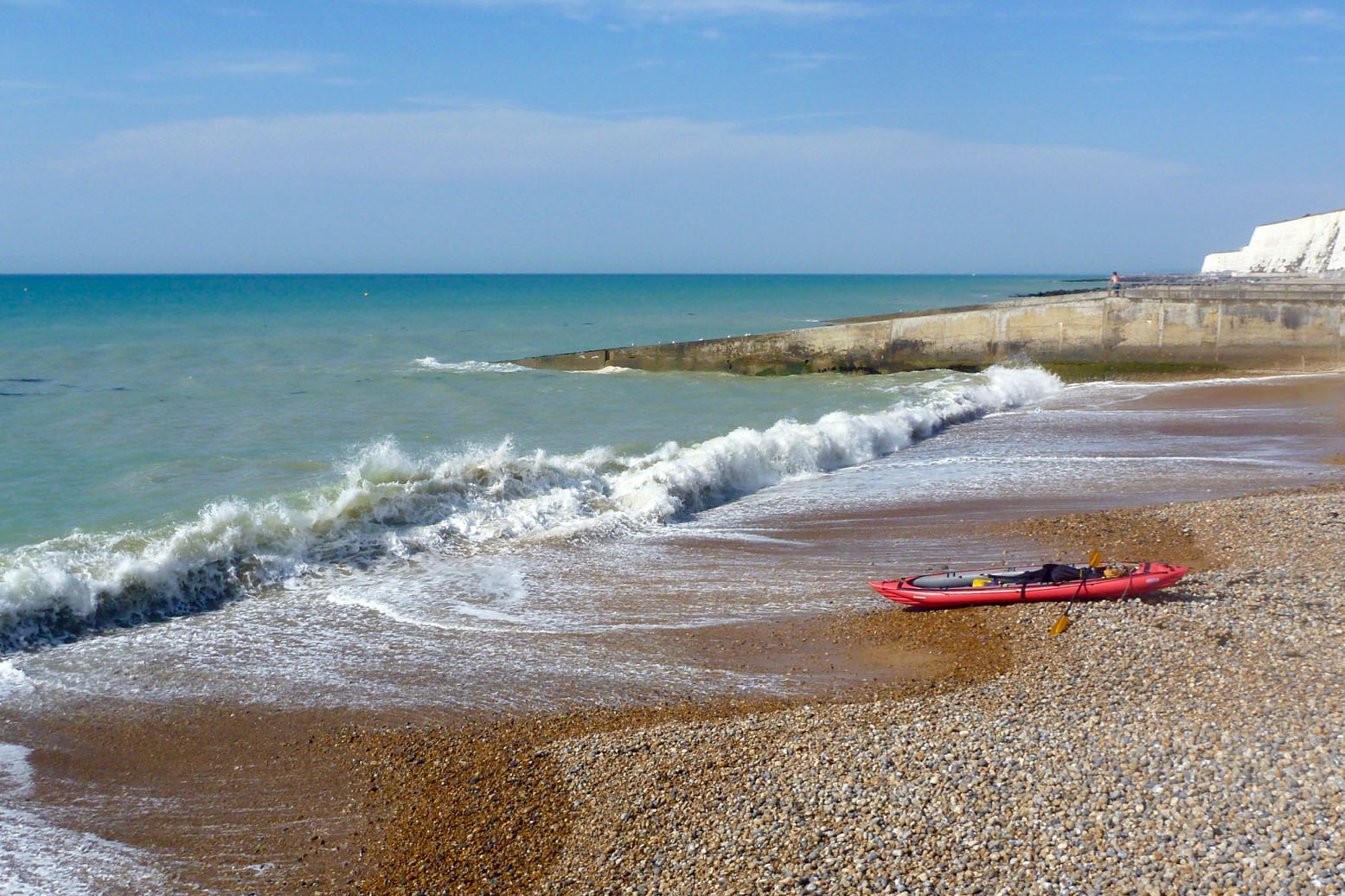
Up ahead lay Brighton pier and the effort and early tension of only a couple of hours was starting to show. I hacked away towards the pier, then decided I must pass underneath it with my new shoe if I was to reach salvation. SUPers were gliding by and wetbikers were gunning about, making a grating, aggressive din. A surfy beach landing was performed ‘with aplomb‘ in front of the basking crowds. I recall an apocryphal American’s view of Brighton Beach ‘Beach? Where’s the saynd? It’s all stones!’. GPS check: ten miles at 4mph average, peak 6.5mph. Quite fast really. Time to pull the plugs.
In case you don’t know, Brighton is an unusually groovy and arsty enclave by English south coast standards; ‘London by Sea’ some call it. I met up with a young entrepreneur who was hoping to start-up an innovative coffee-by-drone delivery service. So far the response had been excellent and the odd sunbather who’d got a scalding espresso shower merely thought it was an amusing prank. If coffee-by-drone could work anywhere in the UK, Brighton would be the place. Apparently he’s idea is on an upcoming Dragon’s Den.
As for the paddle. It’s good to get a salty tan while exercising, but the run was as ordinary as I expected, not like the wilds of the northwest or even the rural southwest, and without much intriguing geographic detail to explore. I bet looking down on the passing Seawave from the clifftops was a lot more alluring.
West beyond Brighton it’s built up pretty much all the way to Selsey Bill before the Solent. In the other direction Cuckmere Haven around the much bigger cliffs of Seven Sisters and Beachy Head to Eastbourne pier (8 miles) would be a good one on a calm day. You can’t get lost – just follow the shoe.
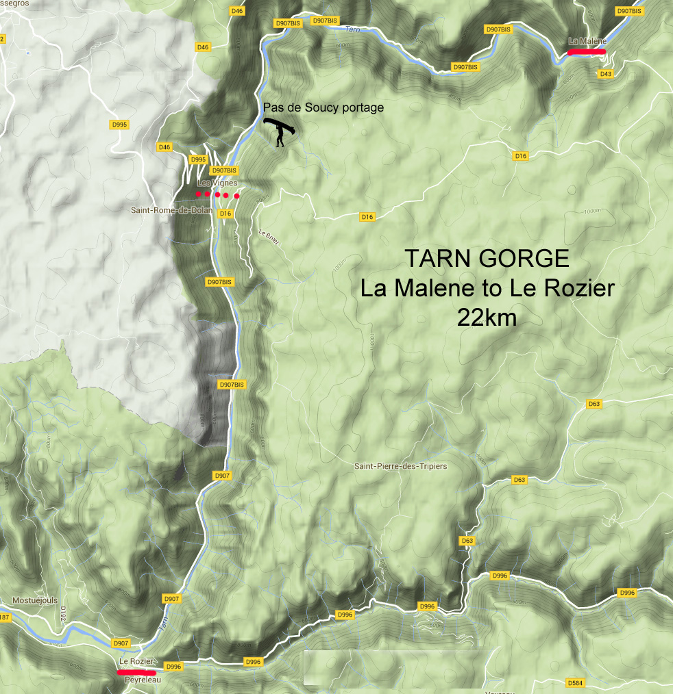
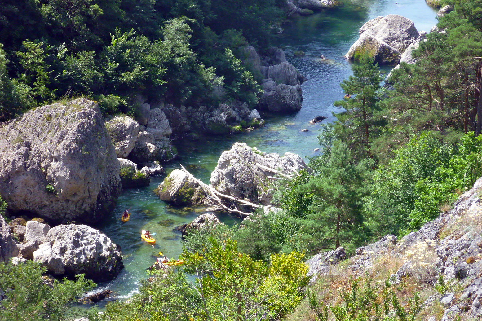
On the way back from some riding in the Pyrenees I persuaded my lift that a day’s paddling along southern France’s famous Tarn Gorge would be a good use of our time. The 22 kms between La Malene and Le Rozier via Les Vignes (see map, left) is about as good a day in the gorge as you’ll get. We last did the full 75km from Florac to Le Cresse in 2007 with a Solar and the Sunny and had a great time as near total newbs. Since this trip I re-did it the full 86km from Florac to Millau in my Alpacka.
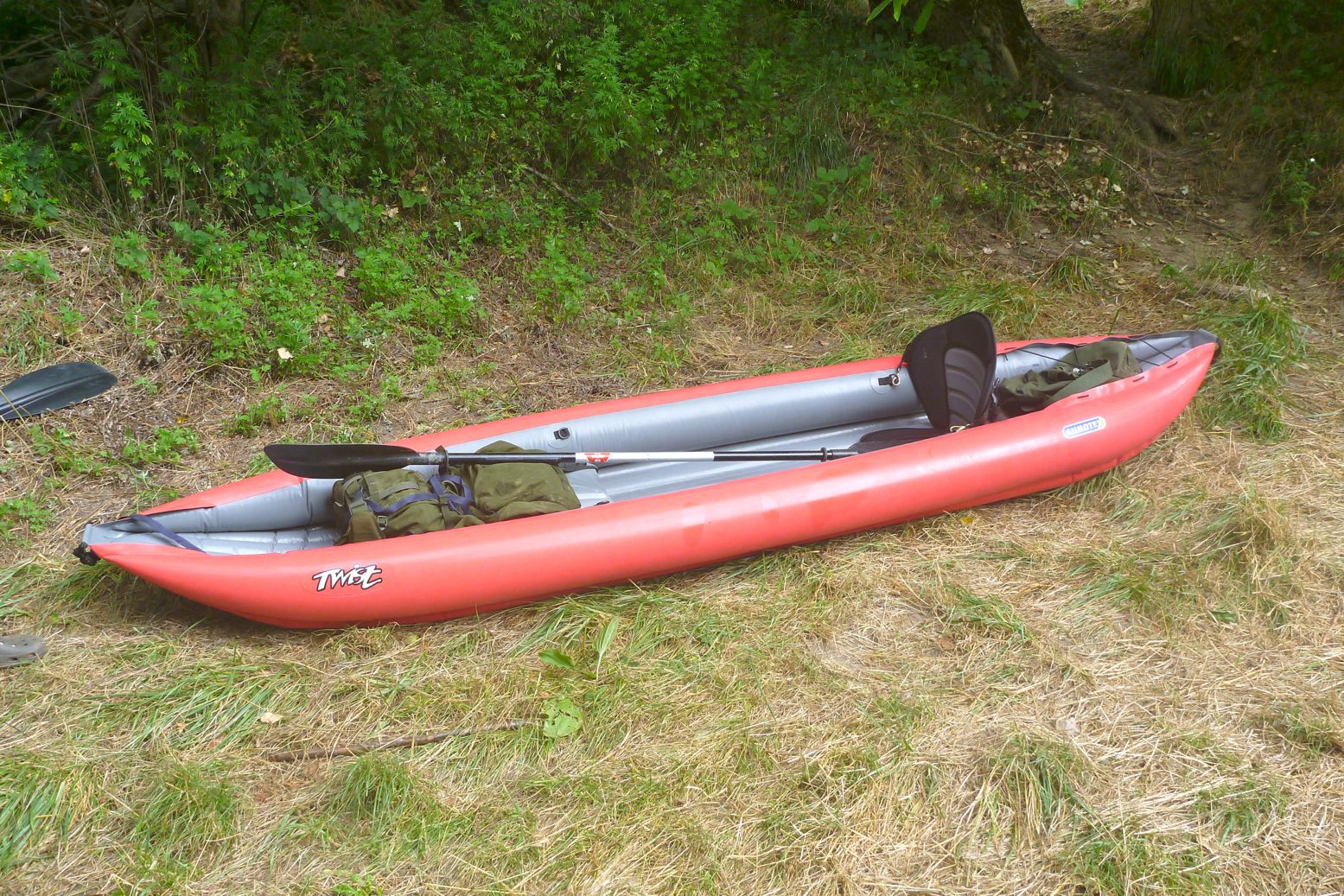
On this occasion IKing chum Robin was baptising his new Gumotex Twist 2, an entry-level IK which in the MkII version has gone back to shiny Nitrilon Light inside and out. I do read here that one unhappy customer found out it was ‘70% less strong and only 30% lighter’ than the regular Nitrilon as used on Seawaves, 410C, Helios and so on. His boat flipped in the wind and punctured on a stick which does sound like a gale combined with an exceedingly sharp stick. But then again, one time Robin lent his Twist to a pal who managed to catch some spike under a jetty and blow a half-metre rip in the side.
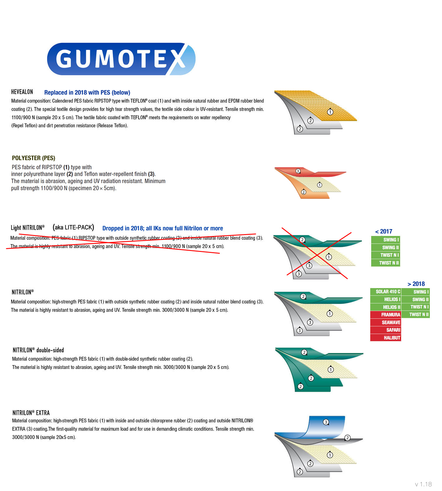
According to the Gumotex graphic (left) it appears like Nitrilon Light uses the same layering as the Nitrilon in the higher spec Gumboats, but due to a lower-strength fabric core, Nitrilon Lighthas about a third of the tensile strength. As a reminder the T2 is 3.6m long, a generous and stable 83cm wide and weighs 11kg (2kg more than the old model). Payload is said to be 180kg. Robin has the original Lite Pack Twists but found they weren’t so practical or robust, at least not on the submerged light industrial detritus found in his neighbourhood. However, Nitrilon Lite was dropped from the Gumotex lineup in 2018 and since then all Twists are made from the same Nitrilon you’ll get in the bigger and pricier Gumoboats. That also means a post-2018 Twist weighs 13kg.
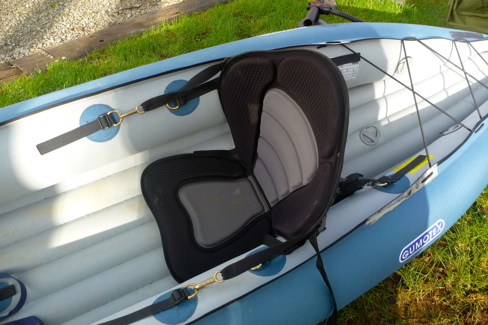
These MkII Twists also have detachable and adjustable seats – a big improvement (or return to former practices) because it means they can be easily replaced with something a lot better. There’s nothing wrong with the blow-up seat base but the inflatable back section lacks support. Robin’s fitted some sort of SoT seat pad (above, in his T1). Another improvement on the MkIIs is making the top seam on the side tubes overlapping flat, not just pressed together which maybe simplifies assembly in the factory but looks cheap. There’s a mushy inflatable footrest for the front paddler; the back paddler adjusts their seat to use the back of the front seat as a footrest. And there’s now also a PRV in the floor chamber which the Lite Pack Twists didn’t have. We like PRVs here at IK&P. We even like PRVs all round.
The £350 T2 could actually be a good lightweight alternative to the 60cm longer 410C (later the Solar 2) which at the time costs £200 more (in the UK), as it still has a useful length for a solo touring paddler. Problem is, using just the back seat tips the weight back and the bow up unless there’s a hefty counterbalancing load on the front. The boat paddles OK like this and probably turns quicker, but yawed more than my packraft so seemed slower and just looked wrong. For a while Robin knelt canoe-style which looked more balanced but isn’t a really a sustainable way of paddling without a bench. The post 2018 models have a third pair of D-rings in the middle to position a solo seat in the right place.
We set off from La Malene, me assuming my Alpacka would be a lot slower, but Robin likes to bimble along, waving his bow around. The Tarn was shallow and so his skeg took quite a beating, made worse by his rearward seating prefs. They’re pretty much unbreakable but I’d have removed it, even if the tracking may have suffered.
With careful scanning the Alpacka just about scraped through the shallows, with me occasionally resorting to ‘back planking’ where you lift your butt by leaning back on the stern to improve clearance. As you can see right, the backside is the lowest point which is why I glued on a butt patch. On the Twist, Robin could only shove forward or get out and pull. By the end the Twist’s skeg patch was a little torn which takes some doing.
It took 90 minutes to cover the 9km of Grade 1 riffles to the Pas de Soucy where a rockfall blocks the river (left) and makes some very nasty strainers. Midway en portage we nipped up to the lookout for the view then had lunch and put back in for the 12km stage to Le Rozier and the van.
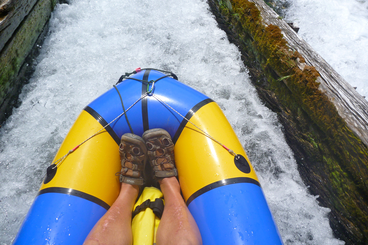
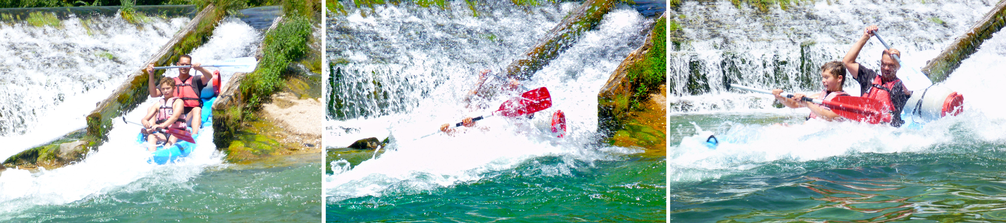
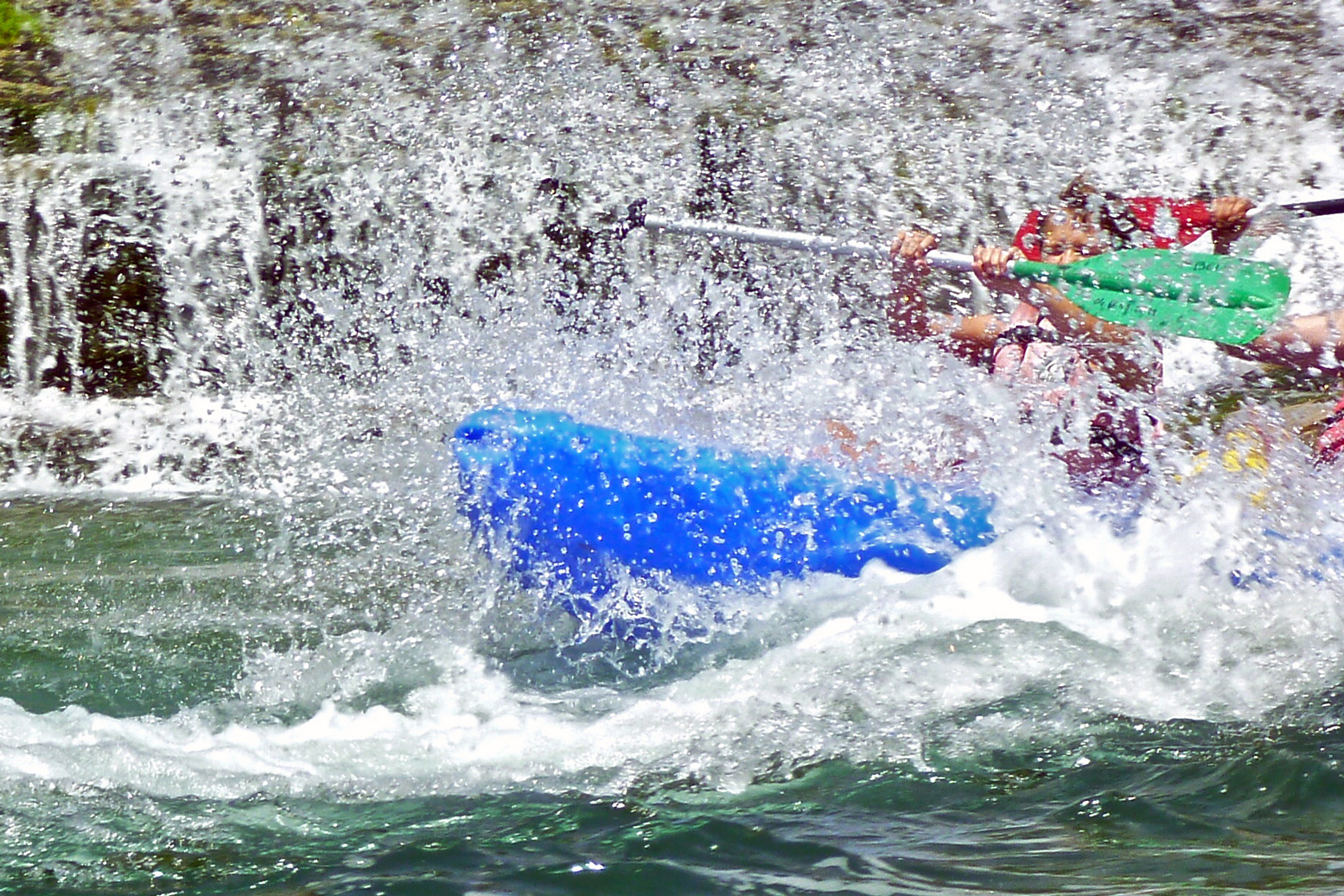
Soon after Pas de Soucy is the chute or glissade at Les Vignes where a typical indestructible plastic rental brick tends to plough in at the bottom, while an airy inflatable surfs over the pile. The missing fourth frame in the pictures below is the blue SoT flipping over. ‘Prends pas le photo!’ No harm done on a 30°C day in sunny France.
This section of the gorge has some juicier rapids, but it’s still nothing that would freak out a first timer; that’s what makes the Tarn such a classic paddle: great scenery, some white water action, easy camping and the fun of splashing about among the flotillas of SoT rentals. There are several campings below the road right by the river, though this time of year they’re all packed out. On arrival we got the last pitch between two noisy young groups at Le Rozier and a free lift next morning up to La Malene from the kayak rental agency next door. There’s also a shuttle bus running up and down the gorge. Read more about southern France paddling here then hop on the TGV with your packboat.
Update 2019: I’ve not used my MYO rudder since I made it in 2016 and sold it with the boat in 2020. Partly because I’ve only done day trips predicated on nice weather, but also it’s all just more faff and clutter, not least the lines and footboard. As explained earlier, for multi-day trips you must deal with the winds you’re given so a rudder is a good idea. But even then, you only notice your relative lack of speed (due to sidewind paddling correction) alongside others. Alone, you’re as fast as you are [grasshopper]. Rudders are not about steering as they are on powered boats; in a kayak they’re about enabling efficient, balanced paddling on both arms by compensating for the boat’s deflection by side winds.
While waiting for rudder bits to turn up, we went out for an evening paddle round Eilean Mullagrach. It was pretty calm but at no point did I think, ‘Darn, I wish I had a rudder’. When it came to turning corners we just paddled hard or dragged a blade and round we came. But the Seawave rudder project carries on like a supertanker with a jammed… rudder, if for no other reason than it’s fun to experiment and a rudder can also work as an articulated skeg when locked out – something I may look into when it’s all done.
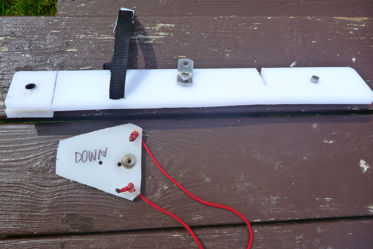
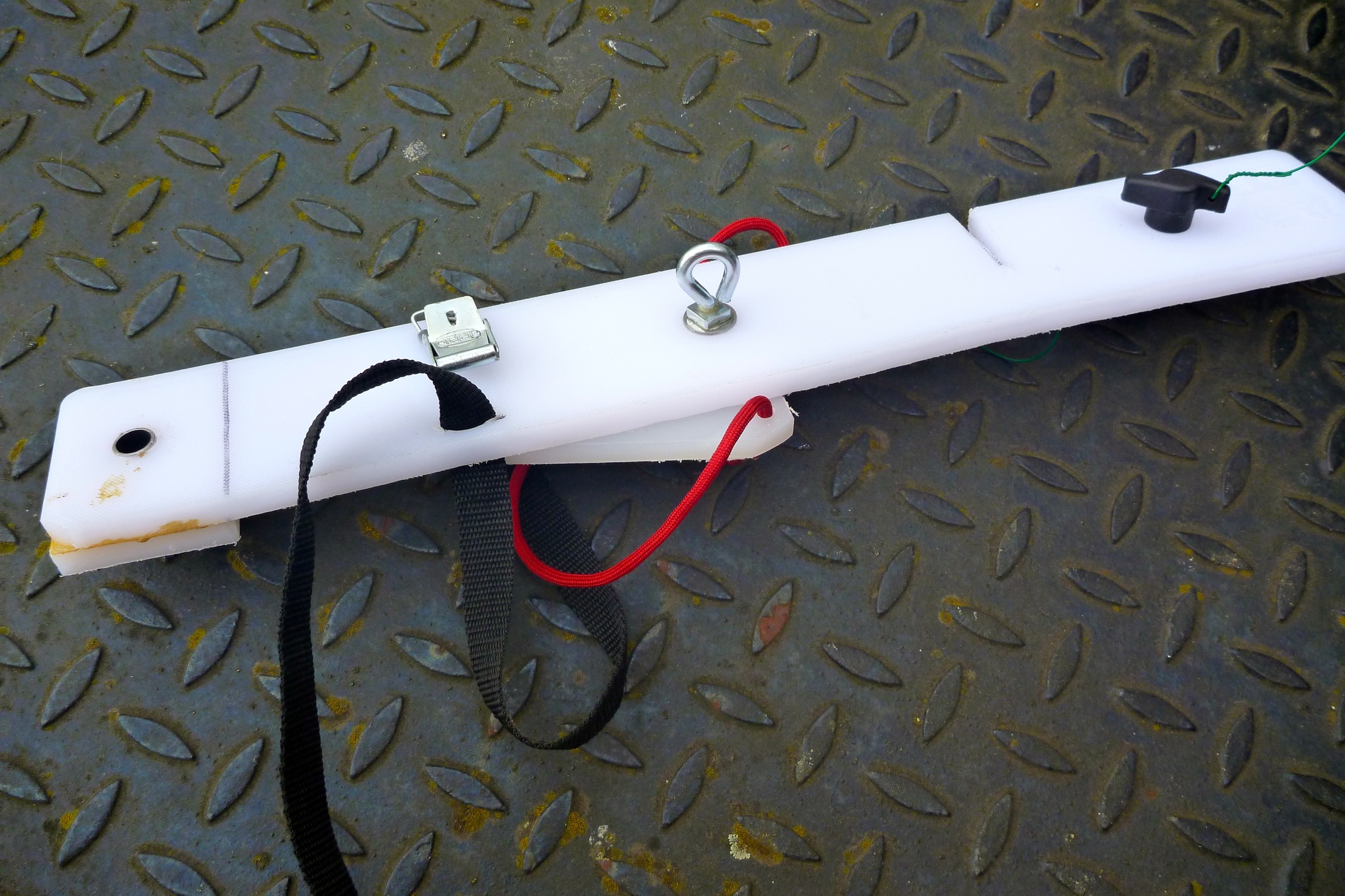
Ironing out the flaws with the prototype added up to attaching it more securely at the back and making the pedal board out of something more responsive and durable. By coincidence, all these components can be sawn from a single piece of 450 x 300 x 12mm LDPE chopping board (above) which costs from £8 on eBay in a range of colours. This is 50% thicker than the smaller board I used on the prototype plate so doesn’t need doubling up and gluing to make it rigid.
At the back I slimmed the rudder plate right down to a simple strip of 65mm x 450mm, glued a block on the end to better support the gudgeon swivel pivot sleeve and added the crucial second fixing under the portaging handle (above left). I also added a triangularish screw plate underneath (left, with red cord) so it all sits snug in the stern. With the hardware and saddle strap that now adds up to 306g (the rudder unit weighs 450g with its running lines). Even though it’s slimmer than the proto plate, it weighs about the same because it’s now 12 mil. But looks a whole lot neater.
The pedal board is from the same slab but uses stainless hinges, not zip ties. I’m reminded, you’re constantly making small adjustments as you paddle so pedals need to be as taut and responsive as possible. Once I’d trimmed the board and pedals a bit (left), with hinges it came in at 660g. The board and maybe the pedals could have been made from 8mm if there was some to spare – but an 8mm board wants to be ~450mm wide to sit snugly in the boat’s side channels. Like the rudder, the pedal board will be subject to strong forces in heavy seas so also needs to be solidly jammed in. Meanwhile, I noticed the floor-laminate prototype board (right) gained nearly 15% in weight after getting wet – a sign it won’t last long. Still, it made a good template.
I do wonder if something like the Grabner rudder pedal bar (left, similar to Gael’s old H2) would be much lighter, as solid and as effective as my board. It costs €70 plus €30 for a pair of Zoelzer pedals. I can’t really see how I could replicate that alloy footrest bar – out of copper tube filled with resin perhaps (like this motorbike rack)? It’s held securely in place without fittings by being jammed in the channel cavity between the floor and the sides (like my board), but a check with Gael advised me against it. As it happened, I’d pretty much decided the same mid-test run (below). A sliding ally bar plus seawater isn’t a great combination and might bend or break, or the pedals snap. I know the ally backrest bar on my Amigo wasn’t up to it and Gael’s backrest broke (though it was ancient). My plastic version may weigh double but should be solid. Interestingly, just as a bag of clam cleats turned up to make a quicker way of fine-tuning the rudder pedal lines from the cockpit, I see left that Grabner use them – a good sign.
The weather here’s about to crack and then we’re moving south, so in a rush I took the revised rudder plate out for a test with the creaky waterlogged pedal board. Heading towards Horse Island tidal passage, I didn’t need a weatherman to know which way the wind blew: from the WNW at about 12mph.
Initially, the boat needed constant small corrections to maintain a course, and there was some stiction, hopefully down to the zip ties on the soggy pedal board. I tried a few tight turns and marvelled at the control and how sharply the boat swung round like a pedalo. The rudder plate is now as rock solid as anything fitted to an IK can be. Again, I consciously tried not to correct with my arms, just my feet, which were twitching regularly.
At Horse Island I was way too early to pass through the passage, but as it was probably my last paddle here till next year, I decided to head for Badentarbet. Turning north, closer into the wind the micro corrections were no longer needed and the boat ran as if on a skeg, but without arm corrections. I’m pretty sure paddling 20–30° off the wind would have required arm steering, but I just hacked away towards Rubha Dunan on the mainland as the wind increased. When I tried a bit of downwinding, protracted rudder juggling was needed to keep the back-end in line.
I passed through a channel on the headland and the NW wind got steadily stronger so crossing the bay to the beach seemed to take ages of effort. By now the small corrections I’d been making were no longer necessary, perhaps something had bedded in, the knots had tightened up or, like riding a bike, I’d just got the knack of minimal rudder movement to keep the boat on track. But upwind paddling is comparatively easy so I tried across the wind, now running over 15mph, and a bit more downwinding which gave me that unsettling Ningaloo feeling. This must be the weak point of a buoyant, windprone IK (especially when unloaded), and maybe all kayaks and canoes too. The chop was only a foot high but were there a swell of a metre or more, the rudder would be briefly lifting and the stern sliding. I wonder if in such conditions a combination of rudder and skeg (which is always submerged) might be a way of limiting weathercocking? Or perhaps just more practice is required. There’s also another solution that might arrive here in time to try out.
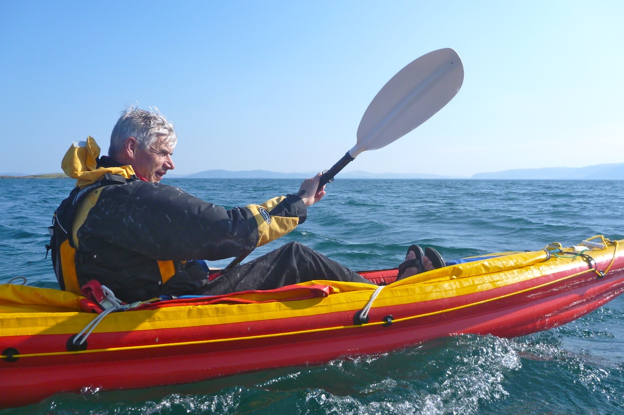
As I neared the beach the wind was hard in my face but I realised I was actually on good form, unlike on the Tanera run with the prototype. So I hammered away with all I had until my strake hissed onto the sands. Paddling hard is all helped by my brilliant, bent-shaft Werner Camano paddle, no less than ten years old this summer. It still clips together with a satisfyingly ‘clunk’ and has very little play. If it ever got lost or abducted by aliens I’d buy another without hesitation.I was glad I’d got stuck into a longer test run than planned, and am now confident my MYO Seawave rudder is in the ballpark. Hopefully, the new pedal board will complete the job.
Total weight: 300g rudder plate + 450g rudder + 660g pedal board + ~100g rigging = 1.51kg (3.3lbs), or < 10% of the boat’s weight
For about £200 posted I could have installed a 2016 Seawave rudder kit, but from all the images I could find at the time it was unclear exactly how it secured at the back – there must be their version of an unseen triangular underplate, but even then it’s still a stressed-out single point attachment. My additional under-handle fixture eliminates any chance of pivoting.
And the plywood Gumotex footboard (right) appears to sit loose and seemingly will also pivot on that single strap. Production versions may differ and let’s not forget that adding all this complexity also adds a risk of breakage or damage. The simplest solution is usually the best, but the 160-g skeg will always be clipped in the boat as a back-up and a Seawave is controllable (if much slower) with no tracking aids at all. It’s worth remembering: a rudder isn’t about day-to-day tracking, it’s about maintaining a course when the boat gets pushed about in stronger winds. In such conditions a skeg is essential and a rudder is an improvement, as explained here.
On the beach, prior to lugging the boat over seaweed-clad boulders, it took only 30 seconds to unclip the rudder mechanism from the plate to pre-empt stumbling and damaging it. Since then I changed the rudder plate mounts with tool-free knobs and an eyelet (above). When rolling the boat up it was best to pivot the rudder plate around the drain hole 90° to pack better.
The shell-sand skerries of Arisaig are a well-known sea kayaking destination so, blown out by the wrong sort of wind to complete our mission on Mull, we scooted over towards Morar on the warmest May day since Michael Fish was knee-high to an isobar. Arriving late the night before at the sheltered glampsite at Camusdarach (5-star ablutions), I wasn’t quite sure where we were, but somewhere out there the easterlies were howling like banshees. Next morning at Arisaig all was calm as a small posse of schoolchildren trotted by in high-viz safety wear, a tribute perhaps to George Osbourne.
We were at the wrong end of the tide to enjoy Arisaig’s famed aquamarine lagoons, so headed round the corner to some beaches Gael knew from previous visits. We lunched at one, set up camp at another then headed back to the archipelago in unloaded boats for low tide. For me it had become just too darn windy to enjoy a relaxing sea cruise. Even hopping onto one of the skerries, I could barely stand while grabbing a few shots of Gael (left). Back at the camp, conditions were calmer for a quiet evening, but early next morning, as soon as I looked out the tent the northeasterly kicked off for the 90-minute headwind hack back to Arisaig. We arrived at the jetty just as the church bell tolled 9am. Nice touch – can’t say I’ve ever encountered church bells in Scotland.
All that remained was a lift to Mallaig, a ferry to Armadale, a two-hour wait sun-baking outside the Ardvasar pub for the stealth bus to Broadford, then another hour for the big bus to gusty Kyle. An hour later the train left for the scenic line to Garve where the Mrs turned up right on time. I’m staggered by Cal-Mac prices for walk-ons, even hauling a paddle and some packs. You couldn’t go two stops on a London bus for what it costs to cross over to Skye. Integrated local bus services? Less impressive but I got there in the end.
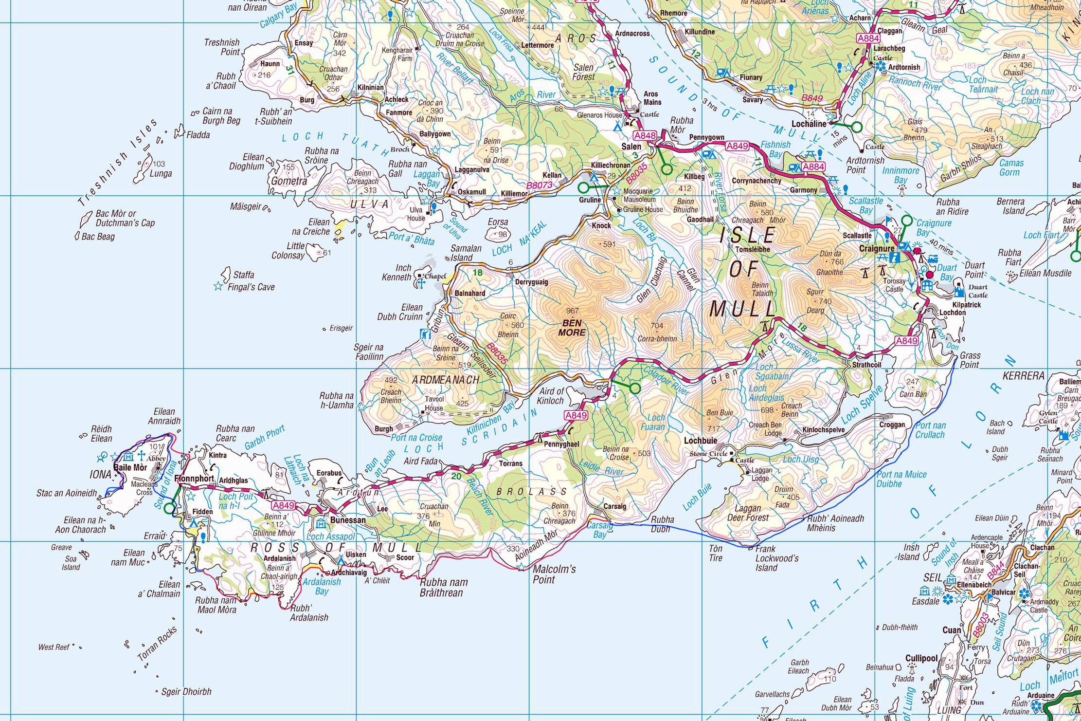
Intrepid Scottish sea kayakeur Gael of the Scottish Sea Kayak Trail was taking it to Mull this year. I invited myself along for part of the tour. His plan: Oban > Kerrera > Mull then along the Ross of Mull to Iona, back east then north for Ardmeanach, Inch K and Ulva. Then maybe Staffa, maybe the Treshnish, then handbrake turn and round the top to surf the tide back to Oban like the cats in Big Wednesday. He of course knew well that achieving half of that would be good going, but the forecast at least was for a sunny week with easterly winds. In the end, he ferried the car over the Firth of Lorn to Craignure on Mull (we had a full-blown gale up here on that day) then gonflated his K40 and set off clockwise round Mull from Grass Point.
I Know Where We’re Going Hopefully he’d manage the 27km to Carsaig Bay, as that’s where we planned to meet up that evening, far beyond the reach of any mobile signal. As we drew into the rendezvous the steep, bumpy single track road passed the quaintly isolated Carsaig phone box. It looked so picturesque, right by a waterfall surrounded by dense forest – I wish I’d taken a photo. Seems I wasn’t the first to notice it’s photogenic qualities: it featured in the 1945 Powell/Pressburger Hebridean romance I Know Where I’m Going. It was down on the old jetty that Wendy Hiller (left) looked out towards a fictional ‘Kilkoan’ (Colonsay) where she thought her matrimonial destiny lay before the spirit of the isles got the better of her. A more recent film is also set in the Bay: The Silent Storm refers we’re told to repressed resentments in an island preacher’s mission and marriage, but by all accounts is a turkey.
Carsaig is just a few scattered houses clinging to the wooded slopes, and some bothies by the jetty not built, we’re told, by French Napoleonic PoWs. Twenty odd clicks to the southeast lay the Slate islands where Gael and I pulled off a successful tour two years ago. This time round I’d be happy to tick off Iona, Inch Kenneth and Ulva before scarpering, while Gael set out for the Treshnish. For my liking they were a bit too close to Tiree, home of the Hebrides’ most persistent winds.
West with the Wind Came the day, all was overcast with a stiff easterly and rains in the air. Full cags and batten down the hat. It’s not often you get an easterly up here and they can be a mixed blessing. They are of course offshore winds but as Gael explained, because they don’t kick up much of a fetch, they blow over invitingly flat seas. Warm, sunny, dry weather from the continent is also a feature, but in passing over fast-warming landmasses they get gusty and variable, swinging between NE to SE several times over a day while stuck in this barometric rut for days. Your prevailing, rain-sodden southwesterly is generally much more consistent. A gusting offshore wind from an unexpected direction isn’t what you want when trying to get back to shore at the end of a tough day.
Out on the bay I was initially freaked out by the backwind, swell and exposure; it seems the 1000-foot mass of Beinn Chreagach was amplifying the rush. My loaded Seawave was far more composed, and together we bobbed and yawed towards the cave at Malcolm’s Point (actually an arch, left) with definite Staffaesque influences.
It’s almost certainly the same basaltic formation that makes up Staffa’s famous Fingals Cave. Alongside is a more obvious arch that from the sea looks like the front edifice of a bombed-out building (great shoreside pic of both here). Moving into the adjacent bay, high above a herd of deer swept across the steep slope – descended perhaps from the mythical doudou of French folklore, according to Gael a mountain beast with two shorter legs on one side. The deer ran towards a flock of wild goats tiptoeing for the shore. They’re pictured here in the nearby Nun’s Cave, a Medieval ‘Naughty Step’ accessible along a coastal path from Carsaig.
The huge waterfall at the back of Traigh Cadh an Easa (‘Waterfall at Ravine Beach’, or some such) reminded me I’d needed to fill up. On the stony beach the usual flotsam suspects lay strewn at the high water line: rope, plastic, wood and the occasional fisherman’s Croc.
Round the point the winds dropped, but murk prevailed; further falls tumbling from the cliffs, as well as basaltic intrusions, gave the scenery a distinctly Icelandic feel. We were now passing towards a flatter ragged shoreline of skerries and periodic beaches where I grabbed a snack on a cushy fishing net sofa. It would have been a good day to have a sail up – I should have packed my compact cheapo disc sail which I’ve not bothered trying on the Seawave. I have experimented with the whole business and, certainly without a rudder, managing the lines on the disc would have resulted in the usual unsatisfying spurts.
West towards Uisken and through the skerries leading to the few dwellings at Ardalanish, the only car-accessible take-out before Fionnphort. Occasional showers rinsed the salt from our cags and after one stop my Seawave seemed to be pulling right, even though it’d handled fine in stronger backwinds earlier. I made do offsetting the paddle until the sandy isthmus by Eilean Mor where I hopped out and pulled off the kelp caught in the skeg. That’s more like it.
How far had we come? Who knew, but this being my first full-day’s paddle this year, by now I was counting the miles to the turning point at Erraid on my newish Montana GPS with OS mapping. As I’d found using it in the States on a moto a few months back, you can’t beat the big picture of a paper map. But here, when it came to threading passages between the skerries, seeing your precise position on a proper OS map made it easier to find a way through and avoid dead ends.
As we crossed Port nan Ron bay the winds kicked up hard to the NNE. We were aiming to turn north up the narrow, tidal channel in the Sound of Erraid (also the title of one of Enya’s unreleased albums from her mordant ‘Scottish Widows’ phase), but the tide was only just turning back in and the wind would have been on us.
So we parked up for the night inside a lovely clamshell cove hemmed in by pink granite crags below a broad grassy amphitheatre. As the predicted evening rain fell, we cooked up some delicious seawater pasta then roamed to a high point overlooking the Sound where Gael picked up a detailed forecast from his mate: warming up, drying up but still blowing up from the east. Strong winds woke me in the night and I lay there wincing as the tent shook and flapped violently. This was its first stormy outing and it took me a while to just accept it, plug up the ears and fall back to sleep.
The Sound of Erraid The morning blew in from the northeast and after breakfast behind a knoll, Gael set out towing my yak while I fired off some shots from the headlands above and caught him up in the Sound. It was an hour or two after high tide so we only just managed to scrape over the Shallows of Erraid and out into a wind-blasted bay.
As we crept northwest, Erraid island seemed to be developed out of proportion to its size. Turns out it was a quarry for the nearby Torran Rocks lighthouse in the Stevenson era, and Stevenson fils set Kidnapped here. Now the former quarrymen’s cottages house a satellite community of the Findhorn Foundation, offering their alternative to the ecumenical retreats over the water on Iona.
Gael’s big Ortlieb water bag had gone rogue, exuding a pungent iodine tang, so we put in near Fidden campsite to fill everything else with lovely sweet water. (I noted a 1.5L plastic bottle slotted neatly into my footrest tube). Out in the Sound it was way too windy to aim for the southern end of Iona as planned, but we figured with our added ballast we could work our way north between the skerries for a shorter, less exposed crossing of the mile-wide Iona Sound. From there set off for an anticlockwise loop instead.
Crossing to Iona Somewhere just after Lalte Mor we made our dash for Iona, aiming for a beach just south of the ferry jetty, with two big buoys in between as markers. The wind had now veered to the southeast and mid-channel it was all getting a bit lumpy but manageable but the Seawave tracked true. The quicker I paddled the sooner it’d be over. Gael yelled to err north towards the ferry line where we were being blown anyway. He realised the spring tide was in full retreat down the sound and we needed to compensate. With the green and yellow buoys and the beach, I was sure my track was good, but on the far side Gael explained my trajectory resembled a washing line due to the strong southerly ebb. Sure, I was pointed at the beach and the buoys remained to my left, but the sea was moving southwards beneath me. His tip on such crossings was to line two points (a buoy and the beach for example) to better monitor and compensate for any deflection. A day or two later I tried this while hacking into Arisaig Bay, lining up a distant tree and a gully, and was surprised how the unseen current or wind deflected me within seconds, while still making good headway.
It was a good lesson from le seamasteur. Had we let the tide take us, our Iona Sound crossing might merely have ended up more westerly than northwesterly, but we’d still have reached the shore OK. But had we been aiming for Iona’s southern tip (as originally planned from Fidden), the stream may have pushed us out into the open sea, or at the very least extended the transit to reach the island. Add in the wind swinging back to the northeast and that’s how sea kayakers get in trouble.
Little did we know that my Mrs, who’d spent the night on Iona in solemn retreat after dropping me off at Carsaig, was recording our progress from the ferry chugging back to Fionnphort. And even as the odd wave broke alongside me, I too was able to grab a few shots: clearly a sign that conditions were less epic than they felt.
The Treasures of Iona We beached the boats and went for a wander through Baile Mor towards the abbey. While backtracking, up ahead it looked like the village idiot was bounding along towards us, waving enthusiastically. We reserved our judgments until it turned out to be the g-friend who’d hopped back onto the ferry to present me a chocolate doubloon (it was my birthday). What a nice surprise ;-) Soon we were swept away in a whirlwind of anniversarian revelry and all headed to the village cafe for a slap-up haddock, salad and chips (with a backup ice cream. And cake).
Back in the boats, it was a short sidewind struggle up to Iona’s northern beaches before a calmer paddle on the island’s lee. With the weather warming up, post-lunch lethargy plus the fatigue from the nervy crossing and the interrupted night, we lost our momentum a bit.
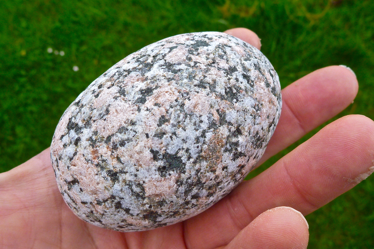
At the back of our minds, neither was keen on the idea of shortly rounding Iona’s southern tip into the wind and then edging back up the windward side. We crossed the big bay and nosed ambivalently past Sprouting Cave as far as Port Beul-Mhoe, a steep stony cove with an onerous portage before any tentable grass. I plucked a superb granite birthday egg from the shingle, then we backtracked to the big Camas ‘Bay at the Back of the Ocean’ and made an early camp to enjoy a warm, sunny evening. Next morning we’d see how we and the winds blew.
Outrun by the wind The plan had been to complete the Iona circuit, cross back to the Ross and head east into the mouth of Loch Scridain for the mountainous Ardmeanach peninsula where Gael has got windbound last year. A glance out of the tent at 6.30 revealed blue skies, but an offshore breeze was already ruffling the sea – and this was the lee side of Iona. It didn’t bode well for the south end, let alone the 13-km leg into Loch Scridain and the exposed crossing to Ardmeanach, with gusts tearing down off the 3000-foot slopes of Ben Mor. I was all set to roll up my boat, stagger across the island and meet Gael at the ferry, but he agreed the weather had outpaced our plans on Mull. We’d head back the way we’d come, cross to Fionnphort by paddle or ferry, then he’d retrieve his car from Craignure to deploy Plan B.
We set off at the top of the tide. With the newfound sunshine and warmth it was a relief to forgo the sweaty, salt-caked cagwear. Back through the skerries and into the wind round the top of Iona. Ten clicks to the north, Staffa and Dutchman’s Cap hovered on the horizon, but any trippers heading there today may well come back with faces the colour of warm guacamole.
The narrowest crossing back to Mull is near Eilean nam Ban, and when the time came it turned out to be a lot easier than yesterday, even contending with another southerly stream (left). Gael decided later we must have caught a fortuitous lull in the wind-bashing, and once in the sheltered Bull Hole channel, we let the strongly ebbing tide swish us down towards Fionnphort.
Unloading on the jetty, hoards of tourist-pilgrims from the world over were making their way to Iona. Having spent a day there, the Mrs had confessed she’d been a bit disappointed. The recently rebuilt abbey lacked a Medieval aura, and the achievements of Saint Columba and the significance of Iona’s post-Druidic heyday were rather embellished, compared to more objective sources.
For centuries the Lords of the Isles and Scottish kings (including Macbeth) had been buried here; the nearer the abbey the better, it was thought. I noticed the decorated headstone (above right) of former Labour party leader John Smith who’d managed to squeeze in, though it turns out he’d no connection with Iona other than being raised in Argyll. Maybe there’s more to it, but as even some Iona-born fail get a plot here, it seemed a post-mortal vanity inconsistent with what I recall of Smith’s public image.
Anyway – I stretched out with my Kindle on the old jetty and let the warming kayaks gently purge through their PRVs, while Gael strode boldly east up the A849. After a while I went up the road to make sure he wasn’t skiving behind some shed having a quick nap. The strong winds I met underlined the fact that we were doing the right thing. Kayaking anywhere east from here would have been hard, paddle-creaking yakka. Three hours later Gael returned to find me surrounded by empty crisp packets, ice cream wrappers and a succulent Curly Wurly embedded in my gob. We strapped the yaks to the roof and went to find somewhere else to play.
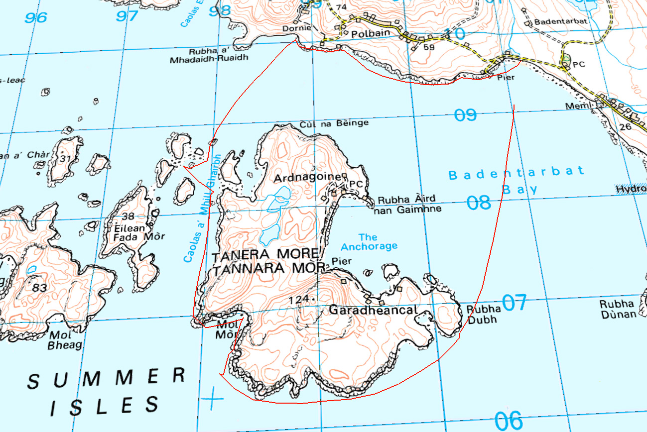
First paddle of the season, although it’s still far from spring-like. The last few days snow has been blanketing the Torridons (left), the Assynts and even BM Coigach (above). But after three days of howling, the winds abated and Jon and I went for a spin round Tanera Mor. I remember first time I did that in the new K40 it felt like an expedition. This time with two of us it was just a jaunt to get the old shoulders cranking again.
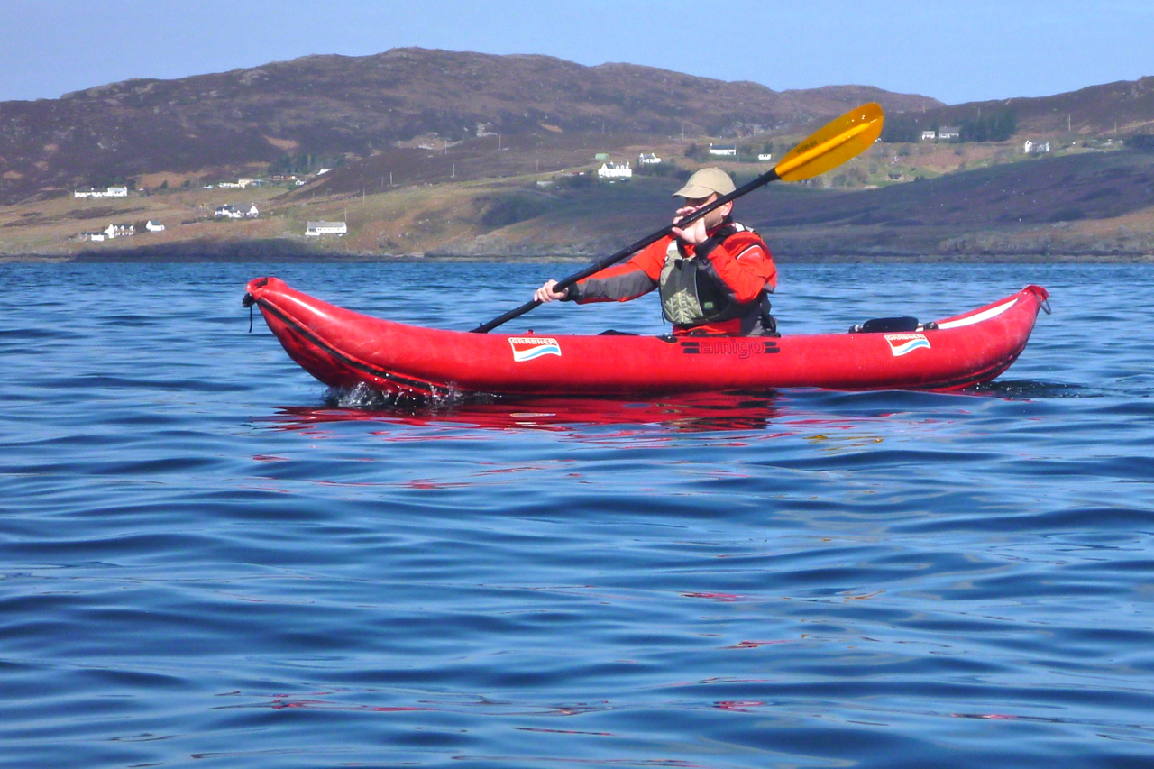
Jon bought my previous IK, a Grabner Amigo, but had yet to use it, so this was a chance to compare it with my current Seawave. I sold the Amigo after a run out to Bottle Island when it dawned on me it literally wasn’t cut out to be a swift sea kayak. Still, I managed a pretty good tour of the Slate Islands that year with the Amigo.
Off Badentarbet beach heading for Rubha Dubh-Dubh, Jon was notably slower in the Grabner. For a moment I felt a bit bad – Jeez, did I really sell him such a dud? I’m sure it wasn’t that bad. It was only later when we swapped boats and were more of less evenly matched, that it transpired years of paddling slick, hydro-dynamically efficient hardshells had had a catastrophic effect on Jon’s pulling power. Either that, or a winter’s pushbike training had similarly atrophied his arms, giving him the physique of a T Rex.
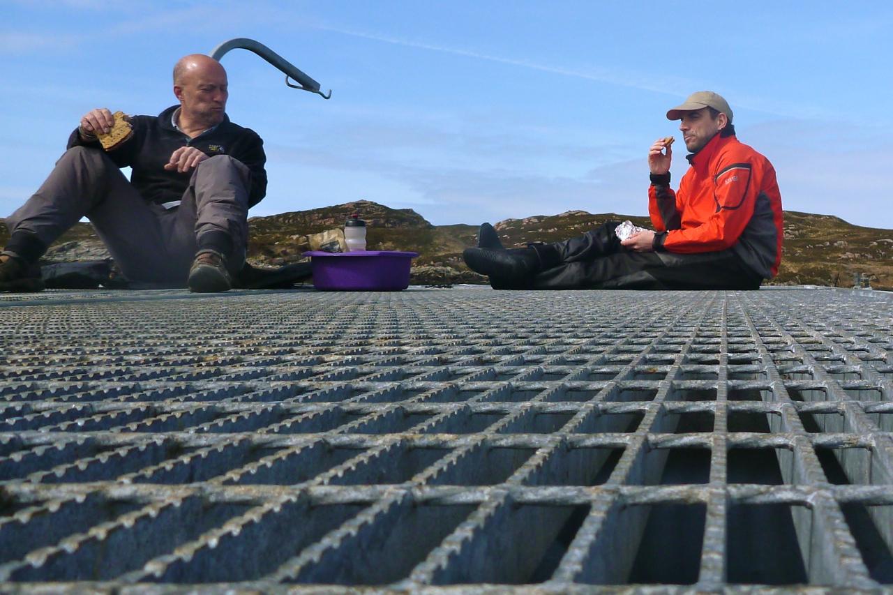
Still, it was good to break the arms in gently, and before we knew it we were turning back northwest for the Tabera channel. With the tide bottomed out, we had lunch on a fish farm platform to the sound of salmon skimming and thrashing up non-existent rapids to their blue remembered breeding grounds. With that sort of daily exercise, at least they won’t end up like T Rexes. From here I rowed the Amigo back. Sure, the flat nose was more snow plough than arrow-like bow, but you’ve got to admire the Grabner’s solid, no-nonsense build. PRVs? Kiss mein schkegg!
Proper seat and attachment points? Opzional, Freund. And compared to the slight flex I noticed in the Seawave – even at .25 bar all round – the 0.3 bar and 750-cm shorter Amigo was as stiff as a stretcher.
As before, the seat-bar mounts caught my fingers as I paddled, but Jon found similar protuberances on the Gumboat. The bomb-proof Amigo would make a great river touring boat: tough as nails, upswept ends to ride over whitewater and as stable as any IK – though the upswept stern might be a backwind catcher when running skeg-free, as I did on the shallow Spey one time (left).
All in all though, living as I occasionally do by better sea than big, boaty rivers, the Seawave works for me, even at just half an mph faster. The price new was about the same, but there were a lot more extras with the Gumotex, including a deck (I never use). I gave the OE seats away with the Amigo and made a lightweight and q/d seating arrangement which I’ve adopted on the Seawave: a packraft seat base, SoT backrest plus packraft thigh straps and my patented elasto-cantilevered drainpipe footrest (left). Read all about them here.
“Why doesn’t anyone paddle around Shark Bay, Jeff? It seems ideal for beginners like us.”
“Name puts them off I reckon. It’s famous for big tiger sharks. National Geographic did a doco there once.”
“Oh really?” I said. “I thought it was just a name…” and took a thoughtful sip from my coffee.
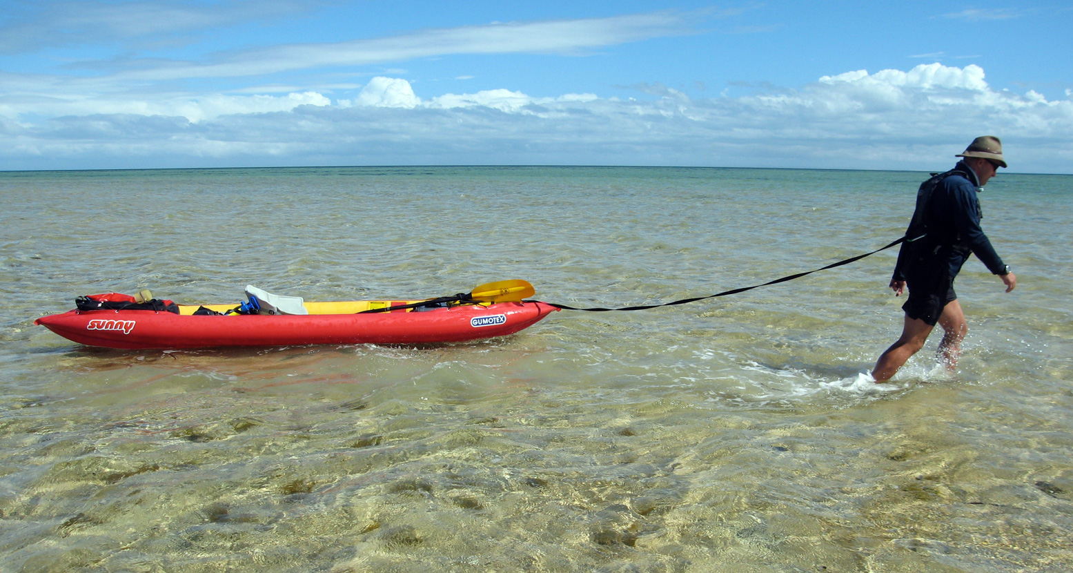
It was 2am in a roadhouse on the Coastal Highway north of Perth, Western Australia (WA). I’d flown in from London that evening with my boat-in-a-bag and together with Jeff’s girlfriend Sharon, we’d hit the road for the 1000-kilometre drive to Shark Bay.
Perth-based Jeff and Sharon were river paddlers and windsurfers and I’d done a couple of French rivers in my trusty Gumotex Sunny as well as some coastal days, but the three of us were new to sea kayak touring. All we wanted was a safe but inspiring introduction and despite the name, we were sure the shallow, sheltered waters of Shark Bay fitted the bill.
The Bay itself is really a stretch of the otherwise exposed WA coast on the Indian Ocean, and the Shark Bay area is protected by two thin peninsulas which protrude north for 200 kilometres, like elongated harbour walls. But at an average depth of only ten metres, Shark Bay is of little use to shipping and is best known for the daily dolphin visits at Monkey Mia beach. A regular tide of tourists flow in and out of the resort, but having made regular visits there myself as a guidebook writer, I’d long suspected there was more to this ‘Australian Baja’ than beachside photo opportunities with Flipper and the family.
Apart from anything else, Shark Bay is a UNESCO World Heritage site, at the time one of only a handful which fulfilled all four criteria, being an area of evolutionary significance; ongoing ecological processes; superlative natural phenomena and biological diversity. With such impressive credentials we were sure its less-visited corners would be ideal for a mid-winter’s exploration in kayaks.
Once I established with the local parks service that paddling in such an exalted environment was permitted (Australia is full of rules), I was surprised to find just one online account of a kayak tour of the Bay: a quick visit by Australian canoeing legend Terry Bolland. Compared to Bolland’s adventures in the croc-ridden inlets of WA’s northern coast where ten-metre tides run like rivers, his Shark Bay excursion read like Lance Armstrong pedalling down to the shops to buy some milk.
Jetlag meant I was conveniently wide awake for the overnight drive and as the sky coloured with the dawn, we crossed the 26th parallel and passed a sign welcoming us to the fabled ‘Nor’ West’. We rolled into Denham, halfway up the Peron Peninsula and Shark Bay’s only settlement, populated by a mixture of snowbirds living cheek-by-jowl in the caravan park, permanent retirees in pristine bungalows and some fishing and tourist operations. We parked outside the café and waited for it to open.
For once the plan was not too ambitious. Paddle north from Denham about 60 kilometres to the tip of the Peron Peninsula, round Cape Peron to the east side, then cover the same distance south to Monkey Mia Dolphin Resort, a trip that might take up to a week. We aimed to take advantage of the prevailing southwesterlies on the exposed west side of the Peron and deal with the same as headwinds on the more sheltered southbound leg.
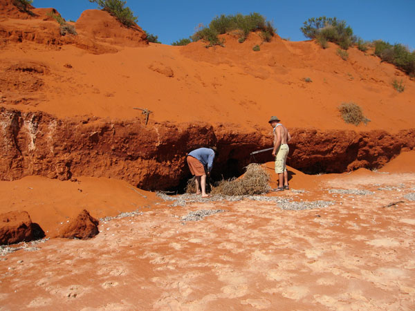
There was no fresh water anywhere on our route, and even the townsfolk of Denham had to pay a premium for desalinated drinking water. So after breakfast we followed a network of 4×4 tracks to the tip of Cape Peron, our halfway point, and buried a cache of water and snacks. It saved carrying very heavy loads and should take us about two days to paddle here.
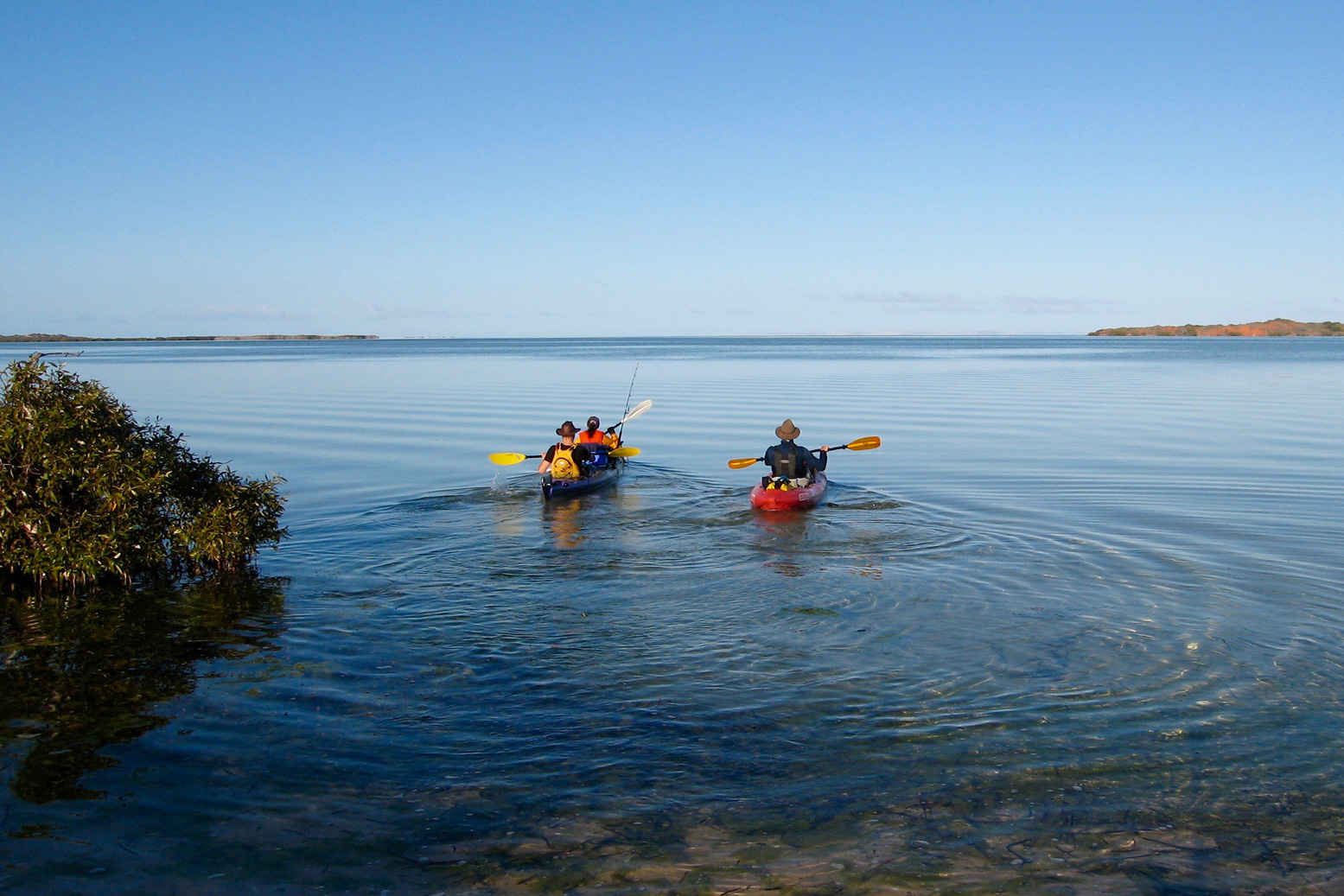
Setting Off With our cache stashed under the paprika-red cliffs of Cape Peron, we set off from Denham at dawn the following day. Jeff and Sharon had a Mission Eco Niitz tandem kayak the size and weight of a tanker.
The waters were soothingly calm and soon a reliable southwesterly saw Jeff hoist his Pacific Action sail on. “Bye,” I said forlornly “see you later.”
These propitious conditions didn’t last long. Soon the wind swung to the northwest, obliging us to dig in for what was to be two-and-a-half days of relentless battling. I actually enjoyed getting my teeth into a headwind, buoyed up by sightings of the extraordinarily rich marine life that give Shark Bay its special UNESCO status.
J and S took pity on my kayak-shaped lilo and hooked me up for a tow to the first of many mostly unnamed capes by which we’d measure our progress across a marine chart.
Sharon had chalked up a checklist of ‘must sees’: turtles, sharks, rays, dolphins and dugongs (sea cows). By our first beach break a green turtle had already passed beneath her bows and later, as we towed our boats through the knee-deep shallows up to half a mile off shore to rest the arms, startled manta rays submerged on the sandy seabed took flight as if shot from a bow.
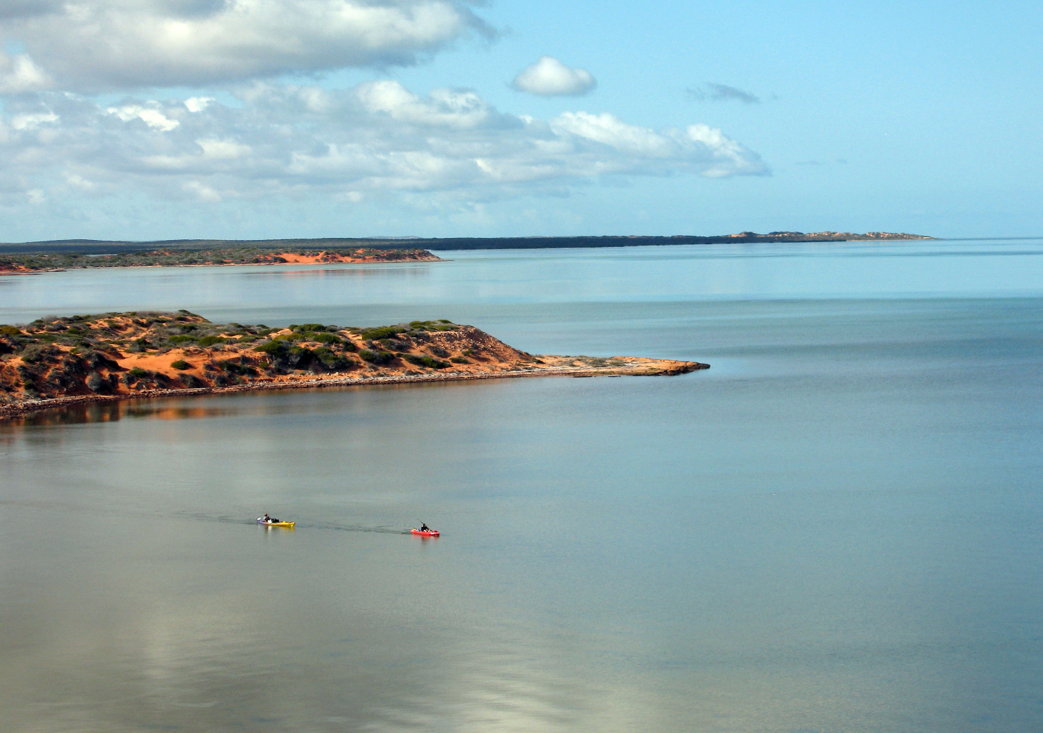
Our destination that first day was the intriguing Big Lagoon which probed the peninsula’s flank like a tidal glove and promised a sheltered camp site. Twenty kilometres out to sea, Dirk Hartog Island broke the horizon: Australia’s westernmost point. The Dutch seafarer recorded the first European landing there in 1616, nailing an inscribed pewter plate to a pole. What he saw of the newfound Terra Australis was uninspiring: flat, arid and dense with scrub. It was another 150 years before Captain Cook mapped Australia’s less harsh east coast and brought about British colonisation.
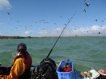
A less historic lone pole marked the mouth of Big Lagoon, and as we rounded the entrance a mass of cormorants took flight, the air filling with the whiff of their oily wings. Though we’d snacked on some oysters during our afternoon wade, the day’s hard paddling had given us all an appetite so we pulled over among some mangroves for an overdue feed and a reappraisal.
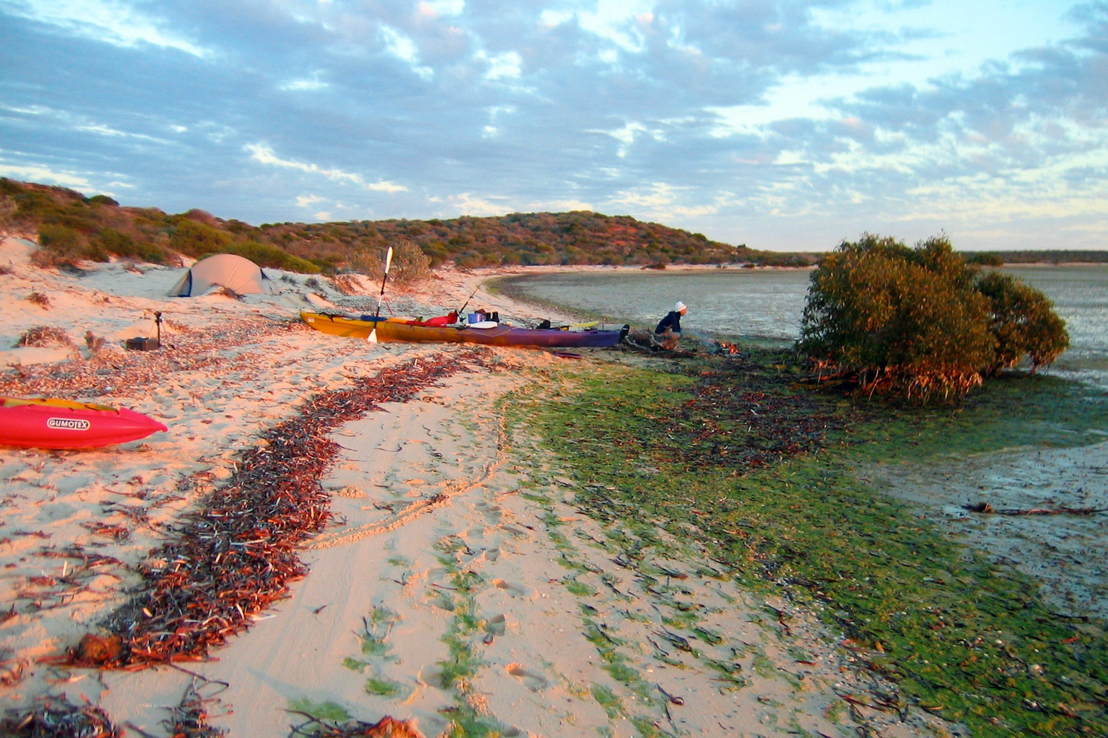
It was already 4pm, and with the tide and the wind now against us we decided to leave the exploration of Big Lagoon for another day and scooted across the channel to the nearest sandy beach to make camp. We hauled out boats the last few hundred metres to the tide line.
Walking with Sharks Though only ranging around a metre, the tides in Shark Bay seem to have a mind of their own. Some days there are two as normal, but the following day there might be only one-and-a-half, or even a single 13-hour high.
This had caused Jeff some consternation with the tables, but dawn brought the tide right to our feet and once loaded up, we glided out across the mirrored lagoon. It was to be only a momentary pleasure watching our boats speed silently over the seabed; out in the open the northwesterly was hunched up, fists drawn and waiting. Heads down, we worked our way up the coastline, stopping to investigate an old pearl divers’ camp. Western Australia’s famous pearl industry had begun in Shark Bay in the mid-1800s and the corrugated iron stumps of the shacks around us, now brittle with rust, dated from that period.
Tiny fishes skimming over the surface alerted us to the distinctive tail and dorsal fins chasing them. Soon metre-long sharks began darting between our boats, racing at us then veering off at the last second in a flurry of spray. We assumed the bulky silhouettes of our trailing kayaks kept the young sharks from attacking, a theory that gained credibility when Sharon ended up running towards the beach, screaming as the sharklets circled her menacingly.
Presently the waters cleared and we hopped back into the boats, steering out into the wind around sandbanks as a long line of ochre-red cliffs long passed by. As they ended we hauled the boats ashore to set up another camp and, with daylight to spare, wandered off to explore the beach.
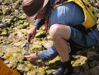
I found a washed-up conch the size of a watermelon while Sharon and Jeff came across a midden of oyster shells left either by 19th-century pearlers or maybe the Yamatji Aboriginal people who’d occupied the Bay prior to colonisation.
To Cape Peron Up with the sun again, but there was no calm put-in this morning. It would be another tough haul to reach Cape Peron and our mouth-watering cache. By 9am Jeff estimated it was blowing at 20 knots. “What’s that in English!?” I yelled, although the answer was immaterial. “About 30 clicks!”
Was it possible to paddle against 30kph winds? My gumboat flexed with the swell as the sea surged over the sides. Now, without the protection of Dirk Hartog Island, the unfettered Indian Ocean swells were crashing against the shore. Still, every vicious headwind had has a silver lining and as we hacked at the water, a pair of dolphins popped up to say hello. Less than 48 hours into our sea safari and only the elusive dugongs remained on Sharon’s checklist.
The seas were getting as big as I’d ever experienced, but I figured as long as the Eco did not disappear behind the swell it wasn’t that bad. I still find the idea of sea kayaking intimidating, but two days of hard paddling had toned me up and I felt confident I could face the day’s toil. Partly this was because my Sunny had the reassuring stability of a raft, even if that included comparable agility and speed! It was something I appreciated when, after breaching a gnarly reef to grab another snack on the south end of Broadhurst Bight, we set off to cross the bay to the northern edge.
That turned into a punishing marathon with the confused seas barging at us from all sides. Tying on to Jeff’s stern I’d worked the bilge pump regularly while the distant shore inched steadily by. All around the once-comforting seabed was now an unfathomable inky blue abyss.
Two hours later we staggered onto the sandy headland, having covered just five kilometres. Our morning’s efforts had put us just a couple of clicks from the tip of Cape Peron for a snack and after another forty minute burst, with my boat swilling again with seawater, we landed on the Cape’s sandy beach and retrieved our cache.
Stuffing our faces with jellies, sausage and now with plenty of water, we were keen to round the Cape because at last the wind would out of our face! We pushed out and once rafted up, Jeff hoisted his sail which filled instantly with a satisfying SLAP! Soon we were skimming along at two or three times our paddling speeds, water lapping over our bows, heading southeast into Herauld Bight.
Sailing with Dugongs We were sitting back, our paddles over our knees and enjoying chatting without yelling when Sharon exclaimed “Dugongs!!” Several huge, dun-coloured profiles emerged against the dark seagrass bank on which they’d been feeding, and before long we were right among a herd of twenty sea cows, caught unawares by our stealthy windborne raft. At times our bows nearly ran over them, the water ahead exploding as their powerful tail flukes blasted them out of range.
By dusk our unexpected run downwind had doubled our day’s mileage. Once ashore I foraged for firewood while Sharon and Jeff got cooking. As we wolfed down our food, wafts of a gorgeous aroma drifted over from the fire. Intrigued, I walked over and realised one especially large chunk or timber was precious sandalwood. A century ago WA had got rich quick supplying this raw material for incense to nearby Asia. Now the last reserves in WA were said to be in Shark Bay. We pulled the log off, finished off the meal and with the wind still blasting down the bight, retreated to our tents.
Across Hopeless Reach By the time I’d dried out my tent after it blew into the sea, the tide had come in to meet us again and under sail we windsurfed round into Hopeless Reach. Here, prophetically, the wind dropped and it was back to good old-fashioned paddling, albeit on much calmer seas. By mid-afternoon we could see Cape Rose a few kilometres from Monkey Mia resort. We didn’t want it to end yet and so strung out the day with fruitless fishing and exploring the scrubby cliff tops on foot.
As we approached Monkey Mia next morning, bottle-nosed dolphins cruised past, soon followed by a tourist catamaran and all the commotion of the resort. We beached the boats one last time and while Jeff hitched back to Denham to get the van another ranger-led dolphin visitation ensued before a line of excited tourists.
Sure it’s fun seeing a dolphin close up, but the three of us couldn’t help feeling rather smug about our thrilling encounters out in the Bay. The tourists were standing ankle deep with half-tame dolphins, but we’d worn the paint off our paddle shafts, sailed with sea cows and walked with sharks!