Seawave main page
Other Summer Isles paddles


High pressure alert! No, my range of recreational leisurecraft weren’t about to blow, it’s the weather – and that’s not about to blow. Far from it. A high was about to lasso the north of Scotland with its concentric isobars. It may be mid-October but it’s been the sunniest and calmest spell up here for two months. Never mind Indian summer, this was turning into an Arapaho autumn. It all added up to good chance to make a break for that most troublesome and distant of the Summer Isles: Priest Island – or Eilean a’ Chleirich; ‘Island of Clerics’.
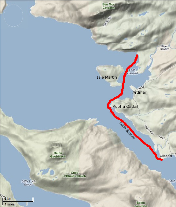
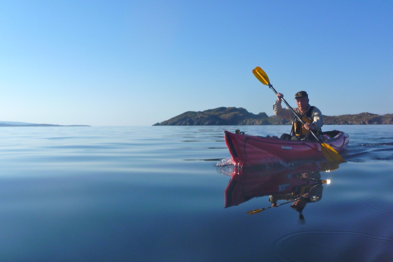
Whichever way you look at, it Priest looks way out there for someone used to staying within a mile of the shore. Mainlandwise, it’s over six miles out of Old Dornie, nearly four miles off Mellon Udrigle on the other side, and a bit more from the end of the Scoraig peninsula. Far enough out to need the full length of a good day and someone for backup. Luckily Jon thought so too and rode up late Thursday night with his Peckett & McNabb Scorchio LV.

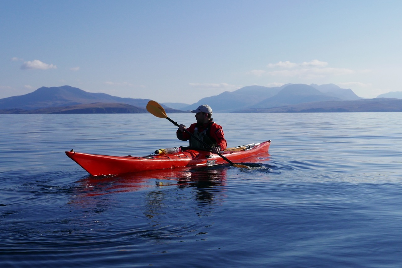
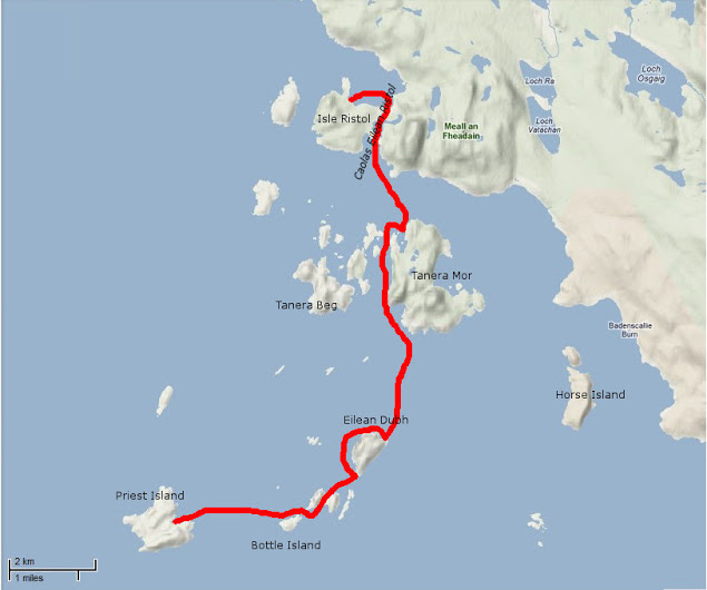
Friday, soon after dawn we were putting in at the top of the tide at Old Dornie. ETA Priest north shore: 2.5 hours. The forecast was a 6mph SE till late morning after which time it was set to drop right off to the southwest.
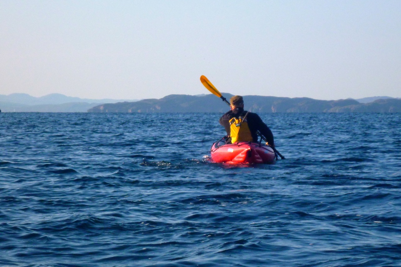
Once clear of the back of Tanera Beg’s lee, I expected things to kick up a bit. But what a difference it is having someone else along for the ride to quell the usual neuroses. Jon agreed that he too would be nervous of taking a run out to Priest alone, and he was sea kayaking by the book: UHF, spare paddle, bluetooth bilge pump and the Semaphore Handbook in six languages, including Gaelic.
Of course, this was all in a day’s work for someone like Gael A who was up here a couple of years ago in an Incept K40 at the end of his Scottish Sea Kayak Trail when he wrote.

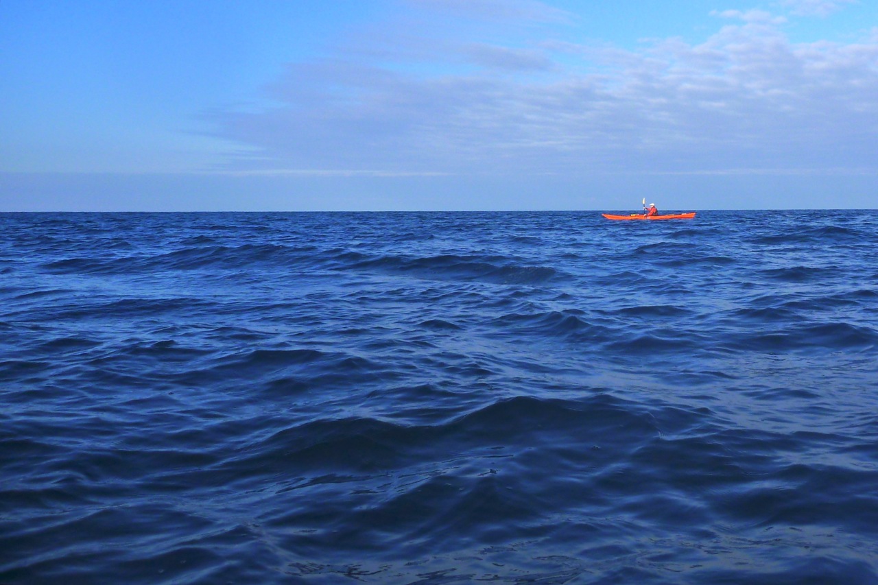
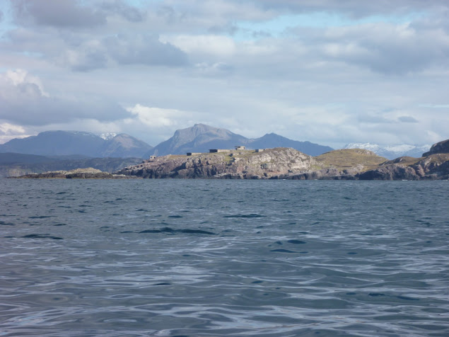
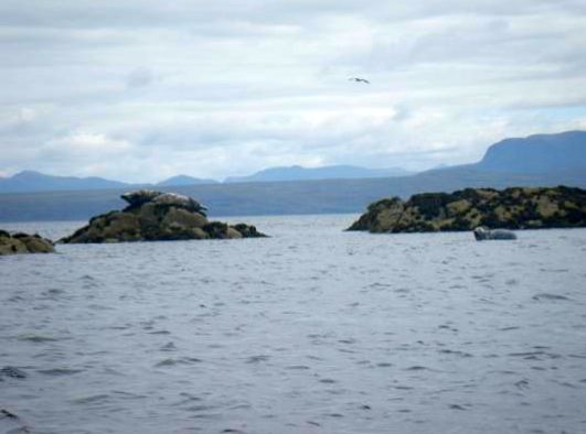
I headed towards the closest, Priest Island some 5km away. Halfway through the passage, the wind died off and the sea glassed over. The uncanny cries of the guillemots emphasised the eerie atmosphere; I felt like I was entering an unearthly space. From the SE tip of the Priest Island I carried on around the west side. It was another paddling paradise with endless features to explore in the good company of seabirds and seals.

Back to now, and I was typically under-dressed, making a concession to the season with some Ron Hill leggings and my warmer pfd. It may have been mid-October but I knew I’d cook in my drysuit and, as I guessed correctly, my high-waisted Kokotat overtrousers would complicate the inevitable pee breaks long before I got to set foot on Priest.
Good thing a calm was setting in then. As we left Old Dornie Jon asked me to pull down his jammy skeg, and in the ten seconds it took me to locate it, my arm went numb with cold. Falling in out there would really not bear thinking about. The cold shock would lock your lungs like a slamming safe door. As it was, once past the back of Tanera Beg the sideslap never got that unnerving, and as we sploshed along I knew not to be concerned if the distant dark crags of Priest appeared not to grow any nearer.
Only 90 minutes in the marker of Glas Leac Beag (small green rock – above) came up on the right. I visited the bigger counterpart, Glas Leac Mor the other week, but Glas Leac Beag’s consolation in an emergency was purely hypothetical as the only way to get on it would be to leap from a boat like a frog.
Still, we were going quicker than I expected despite the chop and corrections against the sidewind. The skeg-rudder idea of fellow Gumotard, Jim, would have been handy here. Every once in a while I had to give a double haul on the right. Jon’s hardshell worked by balancing the variable drop of the skeg against the force of a sidewind which would otherwise push his stern round: more sidewind, more skeg, or something like that. In that sense skegs are more like optional rudders on hardshell cheesecutters which have no need of directional aids, unlike windprone IK bloats.

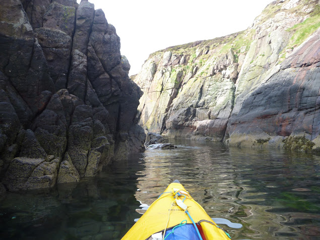
Looking at Priest with the low sun in my face, it was impossible to discern any perspective to the foreshore – it was all one long dark line of crags. The map lay right in my lap but who looks at maps once they’re on the move? I failed to recognise that the bouldered landing beach we were aiming for was further to the east, while we were heading down to the western end. Once I realised that, we changed course and passed the tip of Priest and an arch (not the needle-eye arch on the west end) which only Jon noticed. And as predicted, the wind dropped off to nothing.
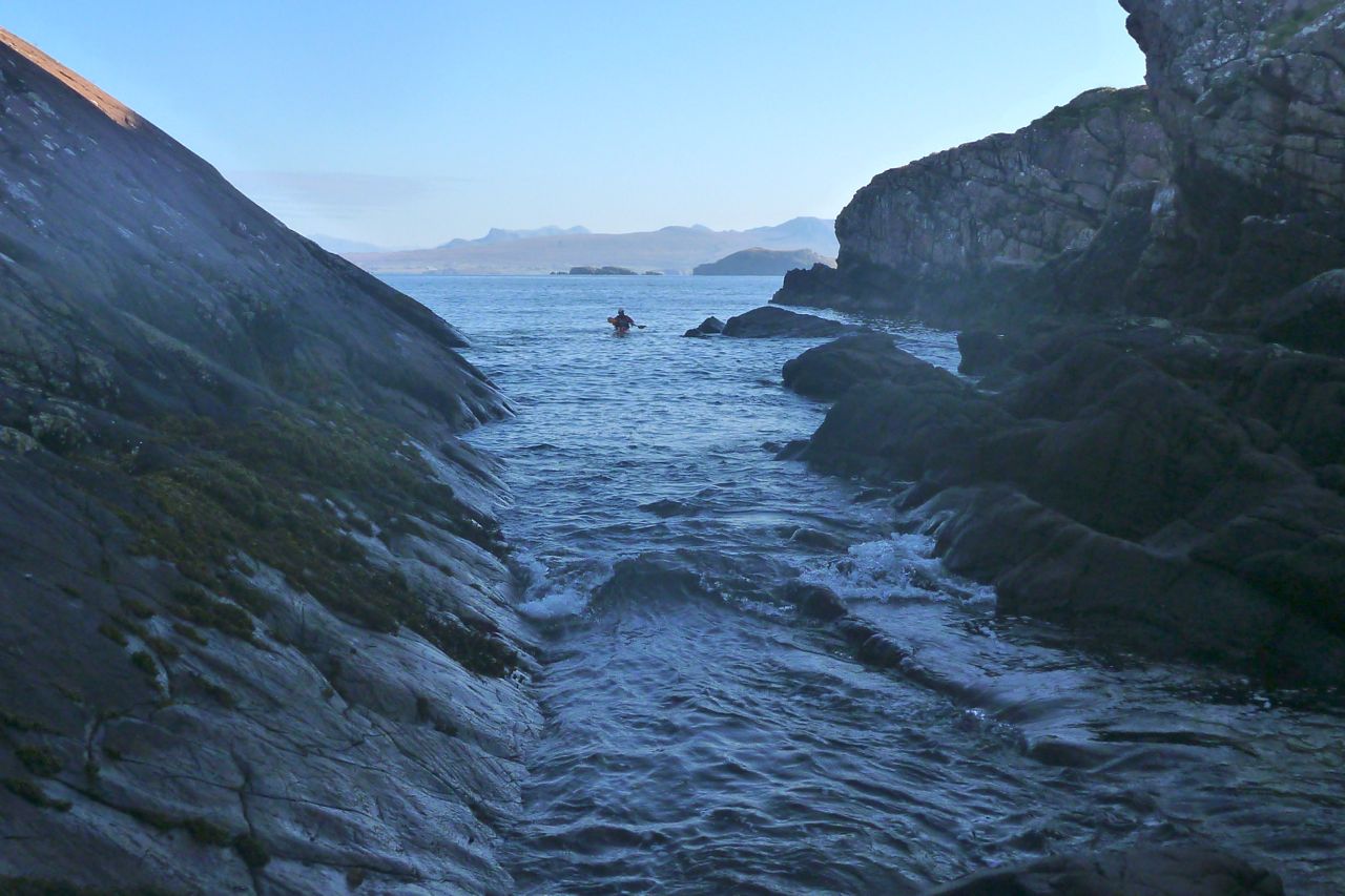
We were searching for the cobble stoned beach created by the island’s NE/SW glacial gouging. We put in up a cleft (left) and staggered ashore, but it was all wrong – we had made the deadly mistake of pre-emption: scourge of the hasty navigator! If we wanted to spend any time on land, the dropping 12-foot tide would make getting back out of the cleft tricky.

Back into the boats on the slippery seaweed boulders – surely the most awkward and risky part of sea yaking, short of tackling a typhoon. Soon we got to the correct stony beach I’d clocked on Google. A stumbly 5-minute portage from here would have led to the glassy half-km-long Lochan Fada which cuts right to the heart of the island, one of nine freshwater sources on the Priest. But, great picture though it may have made, I was a bit pooped and more interested in ham butties.
We sat on a hill overlooking the still lochan when Jon noticed the back of a signboard at the other landing beach. It was a plea by the island’s RSPB owners for visitors to be careful not to crush the burrows and eggs of the 2000-strong colony of storm petrels that inhabit Priest Island.


As it happens that was made easier by a few paths leading from the two landing beaches. One led past the RSPB shed from where I carried on to the south side to check out the ‘prehistoric’ stone circles. The ones I saw (picture far below) looked more like rude shepherd shelters than mysterious Neolithic monuments (there’s more on Wiki), but to be fair, I didn’t see the others just to the north. That was because it took a bit of reorienting to locate the island’s sole ruin, a substantial but roofless four-room bothy supposedly on the site of a sixth-century Christian chapel, suggesting an origin to the island’s name. I was curious to see this place as it’s said in 1975 a pair of unlikely criminals hid out here for a few months, on the run from a collapsing series of scams.


Google ‘Jim Miller and John Bellord, Southern Organs Scandal’ and you’ll soon find Geoff Green’s recent book: Paying for the Past. In it, the author admits to falling under Miller’s mesmeric spell in the early sixties and eventually becoming one of the entrepreneurs’ close business associates. Along with many others, he was invited to make a quick buck by investing in loans to supposedly supply churches with expensive electric organs, and was later drawn into a racy, high-profile lifestyle as the manager of Southern Organs’ GP sponsorship endeavour. Alvin Stardust (right) and other celebs were part of the gang, but then around 1975 the whole cosy investment scam which supported the racing sponsorship began to crumble.

Although he knew nothing of the area, it was Green who came up with the idea for the pair to hide out on Priest Island. They jetted off on a long-overdue holiday to Calais, sent postcards back home saying they’d killed themselves, ferried back to Dover the same day where Green met them and drove up to Ullapool. He then RIB’ed over from Dundonnell to Priest, leaving them with provisions and an inadequate two-metre dinghy with an outboard.

I read the book curious to discover if this claim – that these urbane middle-aged gents (Miller lightly crippled with polio) could really have lived for ‘262 days’ on Priest Island, frying up storm petrel omelettes and brewing peat tea. Over eight months sounded far-fetched for two conmen fleeing a Rolls Royce-champagne-and-helicopter lifestyle before clumsily faking their suicides from Calais, like Reggie Perrin on telly, John Stonehouse the MP, Lucan and more recently, our hardshelled friend, Canoe Man. A desperate, ex-para axe-murdering survivalist might have been able to hack Priest for that long. But with these two, insisting as they did on a chemical toilet, it all seemed improbable. Crofting on Coigach mainland is hard enough. What chance on a 120-hectare island, even with half-a-dozen lochans? On their release they went on to explain in a BBC documentary:
… the island had reaffirmed our belief in the simple things and helped us to clear away a mass of valueless and extraneous paraphernalia with which we, like so many, has cluttered our lives.

Paying for the Past is a bit light on clerical details and dates as, after dropping them off on Priest one stormy September day (a slightly over-written episode with some implausible embellishments, IMO), the author (left) was never to see his friends again. It’s only towards the end of the book that Green suggests they may not have been on the island anywhere near as long as he claims, and once recovered to the mainland, probably used their well-polished charm and remaining cash to secure local support in Ullapool, as explained in the book.
This video is part of a documentary that portrays the events from the point of view of a psychic detective who was hired by the Express, though it wasn’t shot on Priest Island. And for all our man’s alleged clairvoyance, it was simply the police tip-off from Geoff Green (under pressure from legions of debtors and with leniency guaranteed) that got the two arrested in Ullapool. Ironically though, it was Miller’s similar esoteric beliefs in radionics, among other ‘faith healing’ therapies, that founded and then funded what became the duo’s glamourous empire.


When I found the ruin in which they say they hid, it was clearly not your average Coigach crofter’s bothy, but a more substantial dwelling supposedly built on the site of an old chapel, either by a sixth-century monk on retreat, or a banished sheep rustler with a talent for masonry. As a sign (right) we saw on the Dundonnell Estate near Scoraig last week proves, ovine rustling is still an issue here in the wild nor’ west.

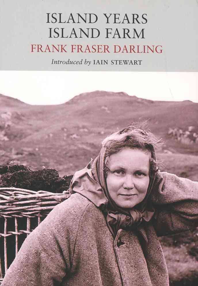
The way Green tells it, it was his auspicious discovery and reading of Frank Fraser Darling’s book Island Years, Island Farm (1943, left) which gave him the bright idea for the pair to hide out on Priest Island until it all blew over. Apparently, Miller and Bellord had holidayed in Ullapool and were fond of the area – that was all it took. Any bushcraft savvy they could pick up along the way. Darling’s Island Years mostly deals with experimenting with sustainable crofting agriculture on Tanera Mor (left) in the early 1940s (Island Farm), but he and his resilient family first tried to give a go for a few months on Priest Island a few years earlier. Having now read that book I wouldn’t say the account of Arctic-grade tents being torn to shreds would evoke a great place for a hideaway holiday, but as we know with northwest Scotland, when the weather is calm it’s brilliant, and when it’s not you just knuckle down.

The Fraser Darling family went on to camp on the Treshnish Islands and even endured a spell on North Rona where the author had been funded to study grey seals and their effect on commercial fishing.

Miller and Bellord come across as an intriguing pair, and you can see why their background, interests and activities captured the attention of the media, and why Geoff Green’s 2014 book has gone down well with readers.
In this video published by Green a couple of weeks ago, he returns to Priest Island, but in it he mistakes the hut circles I saw (left) for the bothy which appears on the 25k OS map shown on this page, and even more clearly on Google aerial imagery. It remains as intact as it was in the first, 1979 BBC Everyman documentary featured at the end of the video above, with a bit of unsightly plastic rubbish in the adjacent burn – a job for the next RSPB volunteer visit, or anyone with a bin bag and space.
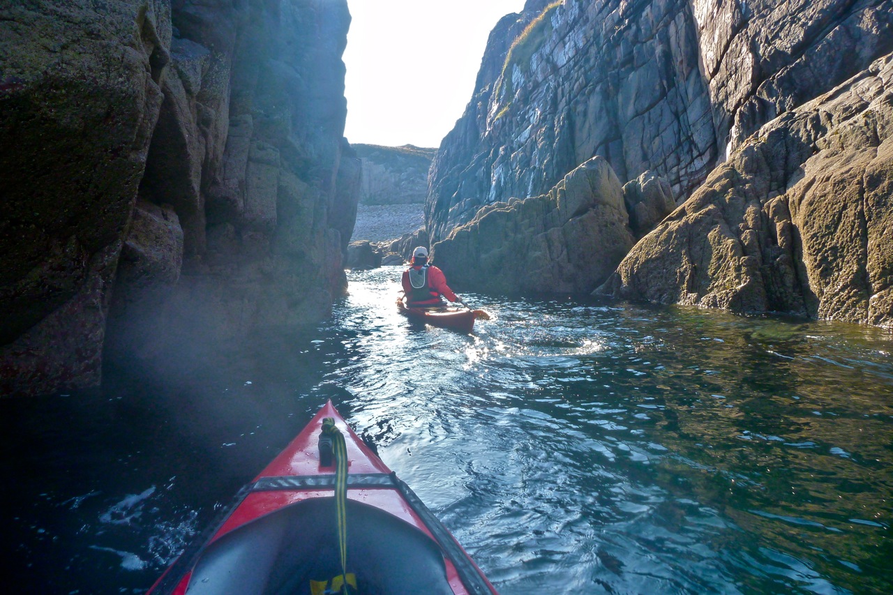
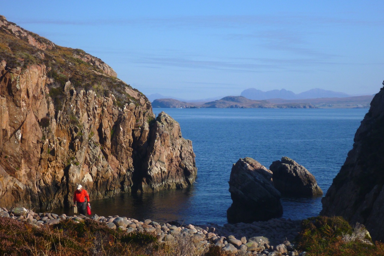
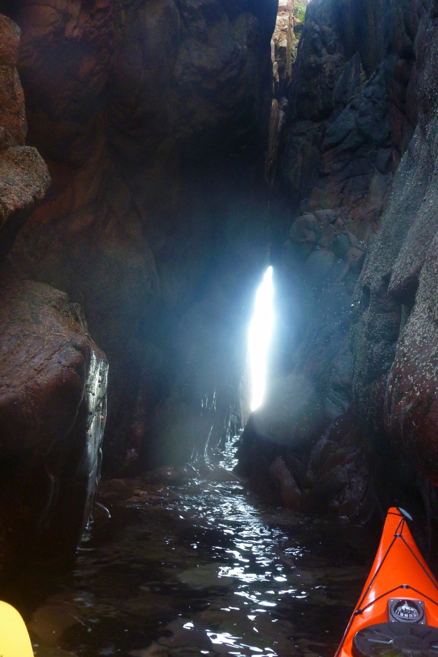
Anyway. Enough true crime confessionals. We returned to the boats and headed southeast across the big bay towards some interesting looking cliffs and clefts. One chasm led deep into the crag with promising daylight peaking out the far end. We edged in deeper, pushing off the sides, and between the swells got far enough through to see there was no way out at this point, halfway down the tide. We tried from the other end, slipping behind the outer stack visible on aerial images, but that too needed at least another foot of water to paddle through. Finally at Aird Glas, Priest’s eastern extremity, we managed to paddle behind a stack and commence our glide across the now mirrored water to Bottle Island.
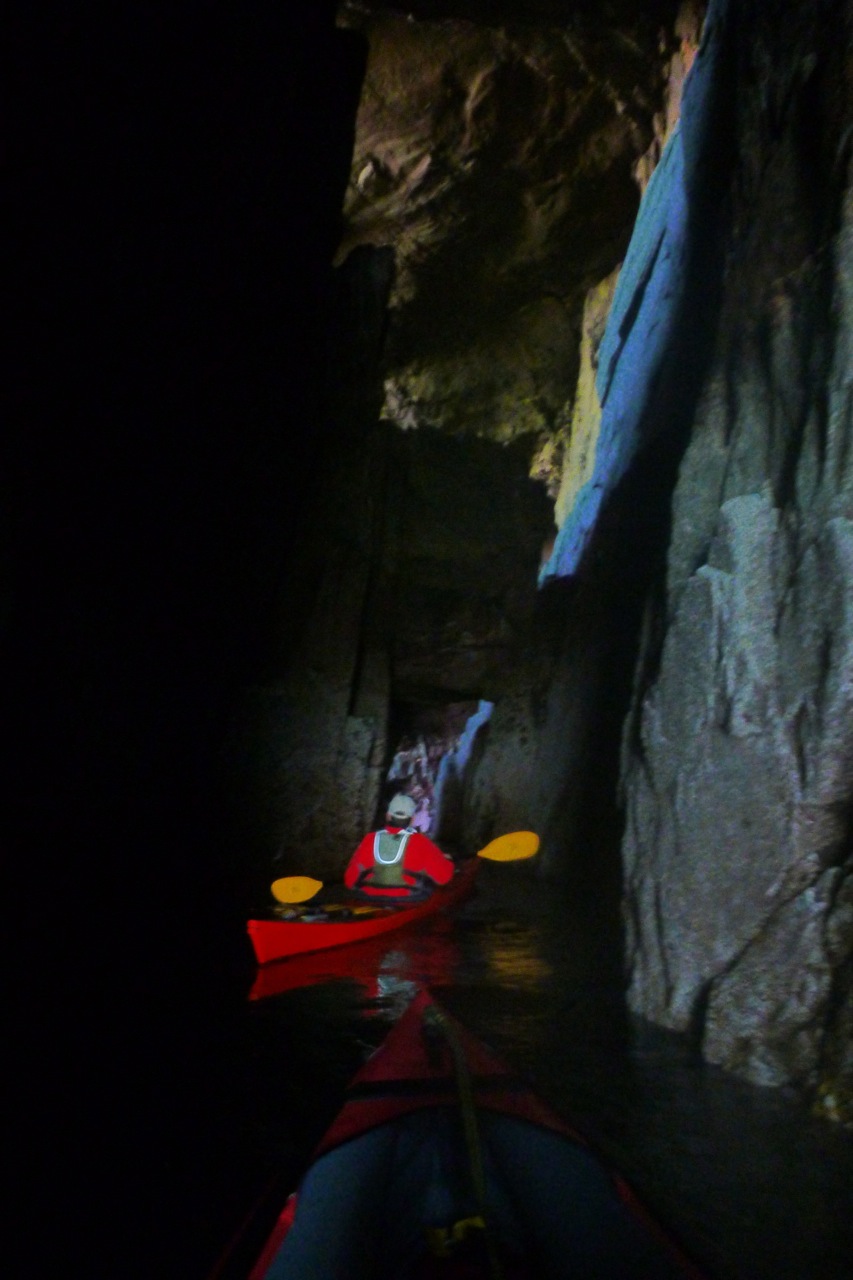
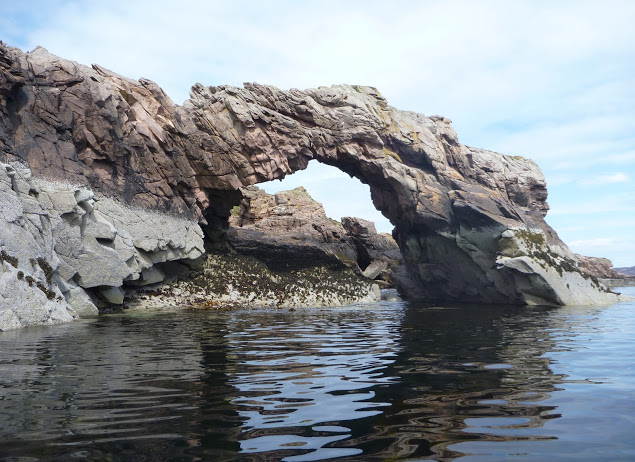
It all seemed so effortless. We could have aimed at any Summer Isle we chose – over to Carn nan Sgeir even – and paddled straight there with ease. What was all the fuss about? On Bottle I was hoping to lead Jon through the southern passage I found last year, but as on Priest, the water was too low to pass through the narrower exit tunnel (right).

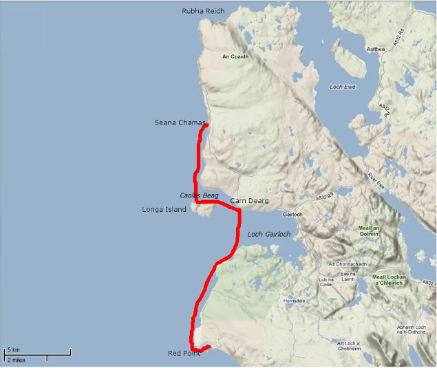
All that remained now was to follow the island chain over to nearby Carn Iar/Deas and from there pass over the sandy green channel of Caolas nan Sgeirean Glasa (I throw all these Gaelic names about like I didn’t just type them carefully off an OS map :–).
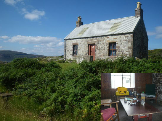
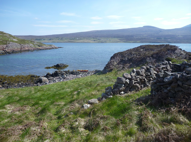
We pulled in for tea break on the jetty of Eilean Dubh, ahead of the final, six-mile surge back to Old Dornie. I found this handy refuge last year and we agreed that a: the jetty was a bit short for the tidal span and b: even if it’s nice to have a secluded island cabin (right) well sheltered from the prevailing winds, it had a comparatively ordinary view back towards Achiltibuie and a chilly, sunless aspect this time of year.


The tide was on the turn now as we passed Tanera’s tidal lagoon and crossed Badetarbet Bay on home ground. I’d been asked to pick up some heavy bags of winkles somewhere on the north side of the bay on Rubhan na Buaile and drop them off at Old Dornie. But clambering along the grubby shore while Jon towed my boat, neither of us could find any trace of them. There was clearly a need for some CCTV surveillance around here, too.

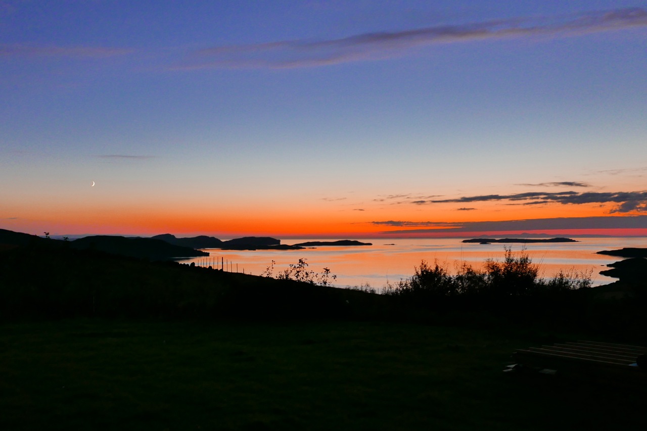
We got back to Old Dornie just as everything was getting bathed in the same rosy-orange glow it had been when we set out, nine hours earlier. And after 30 clicks of sea paddling and very little similar exercise, I wasn’t as shagged as I’d expected to be, something that I’d partly put down to a lack of tension of not doing it alone.
The Bottle Island run last year was 22km but pushing the bow of the Amigo had been enough of a slog to make me buy the Seawave. I think there’s barely one kph in it, but that’s nearly 20%, and with the Seawave’s many other benefits, not least its sharper bow, I can conclude that, like the name suggests, it’s a better all-round sea boat, and also that Priest Island would be a great place to revisit.