In early 2016, Feathecraft dropped the Java/Gemini and Aironaut to stick with folding kayaks. In 2017 Feathecraft closed for good.
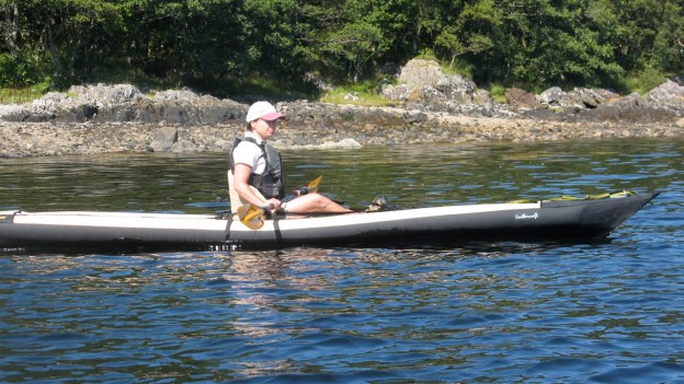
In 2007 I was already looking to move on from my Sunny to something a bit longer and self-bailing (I thought this was a good idea at the time). The two boats that appealed to me were Aire’s hefty and wide Super Lynx and a Feathercraft Java (since then many new contenders have come on the scene). I decided to treat myself to the more expensive but lighter Java and picked one up from the clued-up FC dealer in Durango.
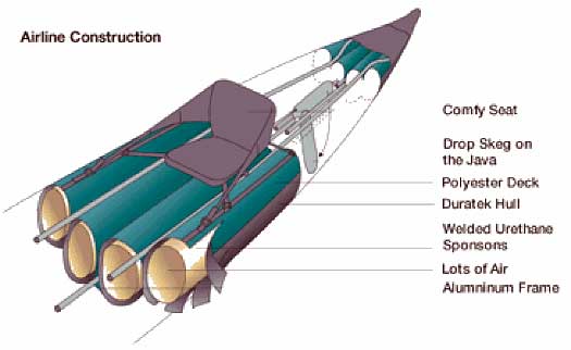
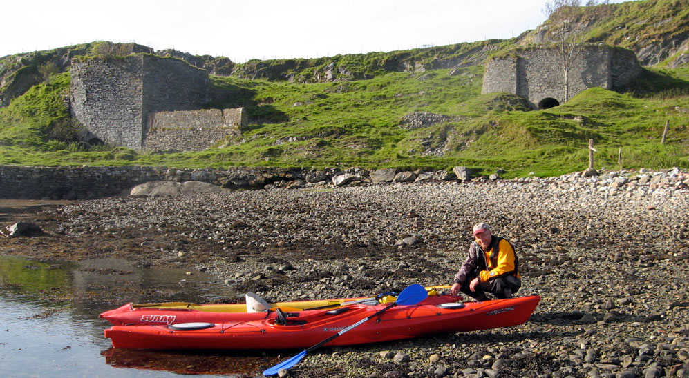
Set up is pretty straightforward: you slot in the alloy keel- and skeg pole and then the side poles, velcro them all in place, attach the seat by too many straps, pump up the four sponsons and off you go. Realistically, 20 minutes is a good assembly time. It’s a sleek-looking boat for an IK; still today nothing else comes close, but one of the biggest hassles are the cheapinflation valves: basic turn-and-lock elbow valves seemingly off the end of a Thermarest (or indeed an Alpacka packraft where they work fine to top up, not inflate). The thin plastic hose on the hand pump supplied pushes on, but when it’s hot or wet it twists off, or if you pump too hard it blows off and the air leaks out. As it’s an open (not one-way) valve, you have to screw it shut quick. Maddening! I thought for a while there was some component missing from the pump but no, this was it. I found holding the hose onto the valve with one hand while pumping the two-way pump with the other was an awkward but more effective way of inflating. Even if it’s bigger, give me a foot pump any day. Or regular one-way Halkey valves and a K-Pump. At 28 inches (71cm) wide, it’s just two inches narrower than the Sunny but feels much morem chiefly because you sit high ON it, rather than in it. FC are right in describing the Java as an inflatable sit-on-top. As you can see in the pics, under my 95kg weight, the poles are more there to aid the hull profile than enable longitudinal rigidity. It’s 15 feet 4 inches (4.65m) long but you can’t get much into the last foot-and-a-half at each end; the usual problem with IKs. The thigh straps are a nice touch or an admission that you may need them to keep upright. I took it out for a scoot across the Vallecito reservoir in Colorado one evening with the two inner (floor) bladders not too firm and was relieved to find it not too tippy. On the way back I struggled with the pump some more to firm up the inner sponsons and found it less stable but still OK, and probably faster. And before I got caught out, I practiced getting back in off the water; as long as I crawled aboard without any sudden movements it could be done in calm flat water. But who ever falls out in calm water?
The retractable skeg is a great idea that’s only really possible on a self-bailer, but with the middle sponsons firmly pumped up the actuating string which comes up between them gets jammed. It’s best to manually make sure the skeg is fully down before setting off – but this negates the retractable feature. At least you know that if it snags on the river bed it will just pivot up (but then won’t come down again). A good fix to help the skeg pivot with the string lever would be to have the string passing through a short section of thick garden hose or plastic tube jammed between the sponsons so enabling it to slide freely. The slot through which the skeg passes is also the bailing hole, designed I am told, to suck water out of the boat with a venturi effect as it moves over still water (less effective in a current going with the boat). Can’t say I noticed water rising as I stopped, but it sounds plausible.
Paddling without the skeg was OK on flat water but with it deployed you can power on. The solid footrests, thigh straps and comfy seat (also inflatable) all help here. One problem with the footrests is the angle they sit on: the poles force your knees outwards into the paddle arc. I also wondered how secure they were, screwed down to merely butt against a protruding rivet in the pole. A flat rather than pointy end to the securing screw pin sitting against the 2mm-high rivet might be better and could easily be done. Anyway they never shifted during the easy paddling I did.
The Java has neat cargo nets: easy to use and secure. I’ve since bought a pair for my Sunny. Inflation valve design apart, workmanship is what you’d expect for over $2000 with good attention to detail. The ‘envelope’ or hull doesn’t really need to be sealed in any way as the four sponsons or bladders slot into their respective cases and, with the poles, make this pile of nylon and rubber into the only IK I know that looks close to a proper sea kayak.
Next day in Colorado disaster struck. I left the boat drying on the roof of the car in the forest camp – black hull side up… and went out very early to Silverton on the steam train. It had been a week of huge storms in the Rockies and camped in the forest I figured it would be OK in the shade and probable afternoon storm. But on the way back, when the bus driver mentioned it was a hot afternoon in Durango I thought “oh dear, I hope it hasn’t…”
It had. The thick black hull rubber had caught the sun nicely as it passed over the clearing and ruptured three of the bladders or sponsons. My lovely new boat, not one day out of the bag was a floppy mess. I yanked out a limp bladders (easily done) and found the rather light, flysheet-like ripstop nylon split, and pinprick holes in the airtight PU coating. That was the end of my Java paddling in CO. (A happy ending. I ordered a full set of sponsons from FC in Vancouver and when they discovered the boat was nearly new they generously offered to supply them free of charge. Good on you FC.)
Back home with new bladders, we went to Scotland and I tried out the re-bladdered Java alongside my old Gumotex Sunny. G-friend’s first impression was that I was too big for it probably due to its SoT stance. She had a point. And also it was too fiddly to set-up for my keep-it-simple prefs. She had a point again, and although it’s amazingly light for what it was, it’s still pretty bulky. In Denver I’d spend hours packing it carefully for the flight back for fear of having the near yard-long hull poles damaged in transit. On my bathroom scales in the blue holdall ready to paddle it weighs 17kg (37.5lbs). The boat’s envelope alone (no seat or tubes) weighs 9kg (19.8lbs). In other words, about the same as my Sunny but two and a half feet longer.
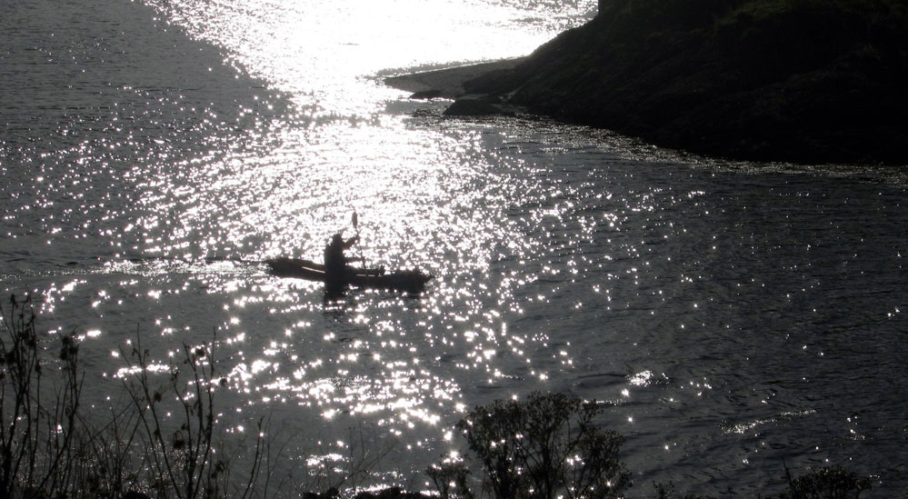
On the lochs the long, thin Java slipped along, with a speedof 10kph (6.2 mph) flashing on the GPS for a second, though 4mph was a more sustainable speed (video above). Let me tell you that is a very good speed for an IK, comparable with the Incept K40 I bought a few years later. (There are more useful speed stats on inlotusland’s blog about a lake near Vancouver in a blue Java.).
The Java kayak didn’t really feel right to me: the old problem of too narrow and me sitting too high for my weight. An experienced hardsheller would probably not have any issues. We went on to a freshwater loch, a little windier by now. I tried to visualise myself in a fairly normal one-metre swell out at sea. The rocks I added for ballast hadn’t really added an impression of stability (as they can do on other tippy IKs) and overall, with the height/width relationship I didn’t feel confident anticipating the less than flat calm conditions I wanted to be able to face.
Back at the chalet the biggest hassle of all: the Java takes hours to dry, maybe even days. But dry well it surely must, especially when rinsed after a sea paddle. Sure, I’d read about this in some reviews, but it now dawned on me that the problem was common to all bladder IKs (like all Aires). Water will always get in the hull sleeves/envelopes holding the bladders as well as other crannies, and once there will always take a while to evaporate. A spin in my basic Gumotex Sunny reminded me what a great boat it was: quick to set up, fast drying and good enough performance. If only it bailed. [2020: I now think self-baling is not essential for a tour boat; i just used my Sunny beyond its abilities].
The Java got itself sold on ebay. Lesson: try before you buy and if it’s not possible (as it wasn’t for me in the UK), be prepared to eat your mistake.
In 2011 I gave my sun-faded Sunny away and got myself an Incept K40 Tasman. The K40 was less fiddly than the Java to set up, though the time taken is about the same, but I still miss the ‘pump and go’ simplicity of the Sunny. That is why I then got myself a Grabner Amigo. But I sold that and got a Seawave, my best IK yet.
There’s some Java chat on FoldingKayak.org. This guy in BC also had a Java then got a Gumo 410C. Looking at his pictures, I’m struck how ‘perched’ he looks while still being high in the water.
A sunny and a warm day, so although I was still feeling a bit groggy following a cold, it was high time to enact a mini-packplan: head out to Inverpolly and string together some of the lochans on the west side.
I’d nipped out there a few days earlier to check the lie of the land and try out some used Jungle boots, and although the maps warned of sluices, it all looked doable from the hillsides above.
And judging from the terrain I crossed to get there, it would be a whole lot easier to paddle than to walk. At the end of this paddle my shins were all scrapped bloody by dry heather stalks and other brush. Some sort of plain canvas gaiters are needed to walk across this stuff, even in long trousers. More gear… sigh.
The Mrs had nipped off to Handa Island with the car, but it suited me fine to cycle out to the lochans by the fish farm on the WMR to Lochinver. I stashed the bike behind an old shed in the woods and walked on up the road.
Loch Call‘ where I’d chosen to put in isn’t visible from the WMR which explains why I overshot it a bit, but a splash in the loch to cool down followed by paddling to the north end lined me up for the path down to Boat Bay. It’s one of only two paths I know of to access the lochans. But why were my arms so weak? it was only a cold for goodness sake! I decided to scoff all my sandwiches in the hope it was food I was needing.
Paddling out of Boat Bay the wind was firmly at my back and I sped along at an effortless 3mph+, and noted no ‘weathercocking’ (back end swing-round) as you can get with a kayak without a rudder or skeg. A packraft is a whole different thing of course, with all the weight in the back. If anything, going into the wind sees the lighter front come round if you stop paddling briefly. That same 10-15mph wind that pushed me along would probably be in my face when I turned the corner into Loch Sionascaig (above) and headed southwest, and sure enough it was, but not enough to spoil my day. The sandwiches were kicking in by now and I shovelled my way towards the first sluice, surrounded by the three mountains of Stac Polly, Cul Mor and of course Suilven, which give this paddling location it’s unique character. How wonderful it is to be out here in the wilds, fanned by a warm breeze and for once not being chocked from all angles in faux-breathable, latex-trimmed wet wear. This could almost be France or Scandinavia in a heatwave.
First one, then a couple more fishermen cropped up, standing alone on the banks, dipping their rods and exuding the usual unfriendly vibes. How did they even get there, I wondered? Not looking intrepid enough to have tramped over the hills, they must have paid their dues and been dropped off by the Inverpolly Estate’s boat from Boat Bay. Then a bloke comes round the corner paddling a yellow inflatable bath and threatens to put the wind up their trout.
I neared the sluice (above: from above; left, from the south) at the southwest corner of Loch Sionascaig. On my Suilven overnighter a few weeks back, I’d noticed something white hereabouts while on the way back to Boat Bay from the north side of Sionascaig. Turns out they were just big white bags of rocks left over from shoring up the crumbling sluice wall. Most of the water pours though holes in the wall but even then, considering the size of Loch Sionascaig, there’s no danger here of getting sucked into anything nasty at normal levels. Should the wall fail, that could be another matter.
It’s about a 10-metre drop (above) into the steep-sided Loch Uidh which leads to a gap. Here as expected, the wind was funnelling but was counteracted by a slight current running my way. This soon ended at another crumbling sluice that might have been runnable (below). I came right up and had a good look but decided the raft was too wide to make it down the chute and one-foot drop without me making a mess of myself, and I had to get out soon after. So I walked round and down alongside a series of torrents to the last paddle, Loch Na Dall. This happens to be linked by a short car track to the WMR (not on the map); a good take out if you’re in a canoe.
Although I’ve read of canoeists paddling the slim lochs below Suilven, portaging over to Loch Sionascaig and hoping to follow the Polly all the way to the sea at Polly Bay, what follows from Loch Na Dall isn’t really worth the portage, even if you’ve had a great time up on the main loch. It’s an ankle-twisting haul on a bumpy paddle all the way down to the fish farm, and the one kilometre downstream section after the road bridge at the fish farm (sluices and strainers) to the sea may well raise frowns from the Estate. But perhaps in winter, with the higher water levels you’d need for a clean run, no one’s bothered. Anyway it pays to remember: this is enlightened Scotland where outdoor access is a legal right, though always best combined with common sense. I’ve spent the last couple of months enjoying this freedom up here so it’s worth spelling it out: The Land Reform (Scotland) Act 2003 “You can exercise these rights, provided you do so responsibly, over most land and inland water in Scotland, including mountains, moorland, woods and forests, grassland, margins of fields in which crops are growing, paths and tracks, rivers and lochs, the coast and most parks and open spaces. Access rights can be exercised at any time of the day or night.”
Back to the packrafting. The south end of Na Dall was asprout with grassy reeds which created a briefly exotic paddling sensation. At it’s end the river dropped down into the valley, but there was no tell-tale roaring and the contours on the map suggested it didn’t drop immediately. So after peering from the intake, I dived in with blades churning, only to get hung up on a rock at the first drop. Free from that and on the move, the underside of the plucky Yak whined periodically as it slid over successive obstructions; another high-centred hang up, another clumsy, butt-pivoting, paddle-bashing extraction, gaining nul points for style. That led to a breather in a pool and then another frothing drop, the camera by now sagged from the jolting. It had turned out to be a couple of minutes of unexpected action, but up ahead there was that ominous noise and I knew it was time to hop out ahead of a series of stony drops (below). I rolled up the Yak and tramped back down to the valley and the bike shed.
Riding back over the hill to Osgaig Loch at a quarter of the speed I came down it earlier that day, there’s a hoot from behind. ‘What!?’ I snapped, eyes stinging with sweat. Another hoot ‘WHAT!?’ Ah, pardon me, it’s the g-friend back from Puffin World while I’m puffing away in two-one, as red as a puffin’s beak and as sweaty as a sauna full of guillemots.
‘Want a lift, puffinboy? You look a bit hot‘.
I was actually anticipating the freewheeling rush down to Osgaig Loch where I’d had half a mind to try rafting the bike over to the other side. Never tried lashing my bike to the bow of my packraft before – it seems an awkward thing to strap down securely, but others have managed fine so it needs trying out once. Something for another day. We hooked the bike up and drove home.
I was not actually used to camping in the rain. My personal survival mode turns on with the first rain drops. I started worrying about staying dry when I heard the rain drumming on my tent that first morning in real Scotland. When I had decided to do a paddling trip along the Scottish west coast I knew what to expect. I was prepared and had enough room in my tent to dress and pack critical items such as my sleeping bag in drybags. Removing the inner tent gave me even more space to have a comfortable breakfast. When I broke camp the only wet thing was the tent flysheet. Yet I still wondered how long I could cope with these conditions. I had spent this first rainy night in a campground near Luss, on Loch Lomond west shore. I had arrived there at dusk the day before, after a long drive from Paris. The beauty of the landscape made me forget the weather as I drove along Loch Fyne. Inveraray was packed with tourists despite the showers. The rain didn’t stop until I reached Tayinloan on the west coast of Kintyre. I thought I’d find the Oban tide table in the tiny shop but I was wrong. I had to return to Tarbert where I should have stopped earlier. There I found the Oban tide tables at the tourist office. I bought some midge repellent, bread and peanut butter.
It was still early afternoon and I had enough time to cross to Gigha and set camp at the Ardminish boathouse, but I had to solve the problem of where to leave my car. According to the SSKT guide book I could leave it on the ferry car park but I didn’t want to worry about it during the next 2 or 3 weeks. So I decided to go to the Point Sands campground and get permission to leave my car there. I pitched my tent on the grass just behind the beach and spent the rest of the day preparing next day’s navigation on maps.
First paddle strokes in Scottish waters No rain this Sunday morning. I inflated my Grabner IK (inflatable kayak), sorted out my gear, packed it in the appropriate drybags and carried it all down the beach. It was low tide. The sea was calm but the low and dark clouds looked ominous. I was ready to push off at noon. Soon I was riding the small chop of Gigha sound, and I relished this moment that I had longed for many years. The 5km crossing to Gigha was the first leg of the trip. It was neap tide so the current in the sound was negligible. The paddling conditions were good so I could skip stopping at Ardminish Bay and paddle on towards the northern tip of Gigha. Thanks to the excellent visibility I could see the Gamnha Gigha rocks and light, and identify Rochanan Point in the distance. I took aim and paddled across the sound again and had a first encounter with seals on Gamnha Gigha. They are the same color as the rocks so I noticed them only when they started moving. I landed on Rochanan Point after 4 hours at sea. I was hungry. A NW breeze took up while I was having lunch. The wind and the chop were manageable and I crossed Loch West Tarbert with reasonable effort. I went around Ardpatrick Point then to Rubha Cruitiridh across Loch Stornoway. This bay was a possible landing if the conditions worsened and prevented me getting round Kilberry Head. I stopped on a small beach to relax, have a snack and empty the boat of the water that had splashed in during the crossing. The wind kicked up again around Kilberry Head and the clapotis rocked my boat in all directions. The rodeo-like ride went on until I passed Port Ban. Soon I landed in Miller’s Bay on a postcard-perfect sandy beach. Behind it I found a grassy spot occupied only by two sheep, half a dozen cows and many rabbits. I pitched my tent, gathered wood, cooked some noodles and watched the sunset. My first paddling day in Scotland was almost over. I had paddled 32 km (20 miles), overcome the head wind and ridden the clapotis. I had faced the same conditions many times before, but for some reason I had thought it would be more difficult in Scotland. Of course I was wrong.
Through the Dorus Mor I expected to meet the same conditions along the following sections of the route. But Kilberry Head was the last exposed stretch of coast before a safer area of inshore waters. I was now protected from offshore weather by the high paps of Jura. The conditions that usually make this place tricky are strong currents during spring tides and south-westerly wind. Tides were neap so the current was negligible, and the wind was just a light northerly breeze. Fortunately for me the danger that the SSKT book warns against were non-existent and the crossing to Point Knap was like paddling on a pond.
Rubha na Cille I stopped for a quick lunch near Rubha na Cille and indulged into a short nap before taking to water. The sea was flat now. The breeze died as I was ploughing my way towards Carsaig Bay. Paddling on this mirror-like water would have been boring save for the fantastic landscape I had around me. I had never met such incredible skies, nor such mountains towering above such a glistening sea. I didn’t find a camping spot around Carsaig Bay but had enough time to pass the Dorus Mor with the end of the flow. The, dead calm conditions were ideal for this passage. From Ardnoe I took a course to Garbh Reisa, the island marking the entrance of the Dorus Mor. This passage is a dangerous race in spring tides. The instructions given by the SSKT book were to reach the entrance at slack water and go with a beginning tide. They were valid for spring tides, but it was neaps and my plan was to cross at mid-tide to take advantage of the fastest current and add more distance to today’s mileage. I was late and I started feeling some current only when I reached the north tip of Garbh Reisa. To the west appeared the gap between Jura and Scarba, the infamous Gulf Of Corryvreckan, where a deadly whirlpool forms in spring tides. I gently glided around Craignish Point then turned north, expecting some push from the remainder of the flow. I looked to the shore to assess my speed: I was stuck, even being pulled slightly backwards to Craignish by some invisible eddy. I was not sure of the right move to make, get closer to the shore or away from it and closer to Reisa Mhic Phaidean. I had read that currents might be surprising in this area so I took the first option. I followed the shore until I found a suitable landing and camping spot in Bagh Dail nan Ceann, where I arrived just as I began feeling sore arms. After pitching my tent in the tall grass, I picked some wood for the stove. I found a rather big piece on the pebble beach and used my folding saw and Finnish knife to split it into kindling. I kept my Yak paddling suit on as a camp suit and it worked well, keeping me warm and dry without overheating while paddling or shivering while on the shore.
Inshore waters I woke up to the song of rain and wind. No surprise; the forecast had announced moderate wind save for squalls from the West. I had company under the tent flysheet: slugs and frogs were having a morning meeting on my face. The first effort of the day was to get out of my sleeping bag, the second was to put on my Yak trousers inside the tent. They were cold and clammy and making my feet break through the latex ankle seals was a chore. The rain stopped and as the sky cleared I enjoyed the view on distant islands to the west while sipping some hot coffee. After an easy crossing to Luing via Shuna south tip, I paddled northwards hugging the shore of Luing to dodge the ebbing current in the sound. I stopped in Toberonochy where I could get some water from a gentleman who stopped some masonry work to fill my water bag. I went around Torsa in the company of seals and rode a convenient eddy created by the current ebbing from Cuan sound that brought me to Seil. There I stopped to wait for the flow at the entrance of the sound of Seil. I entered Clachan sound not long after low tide but there was enough water for my kayak to glide over the kelp. Soon I passed under the famous bridge over the Atlantic, then through a narrow and shallow canal, and eventually emerged among some islets just north of Puilladobhrain. There I met a group of kayakers from Oban. Their leader came over to say hello. She even added that my kayak was nice. I was surprised as most hardshell sea kayakers usually find any IK ugly. We parted company and I headed to Kerrera taking a direct course to Rubha Seanach, Kerrera’s southeast tip. It was an open passage, out of the protection of any island. Mull was too far away to offer any significant shelter from the westerly breeze but it was manageable and I liked to feel the moves of the swell again after two days of lake-like conditions. The impressive Gyllen castle came into view and soon I entered Port a’Chaisteil. There a confused clapotis was stirring the water, making shooting pictures difficult. It was no better in Port a’Chroinn, the beach on the southeastside of the Castle. I went out of the bay, turned left around Rubha Seanach and entered the relatively flat waters of Kerrera sound where I paddled downwind up to Little Horse Shoe Bay, looking for a suitable campsite.
Crossings – Kerrera to Kilchoan I was thinking about today’s route while spreading a thick layer of peanut butter on a Breton pancake. I had water for at least another 2 days, food for another 2 weeks. I had OS maps covering the coast up to Lochalsh and the Skye bridge. I needed no additional equipment. In short needed nothing in Oban. So why bother? I decided to go around Kerrera clockwise instead. The west coast of Kerrera was rugged and beautiful. The view over the Firth of Lorn to Mull and the distant Morvern hills was promising. There was no shipping traffic except some fisherman and a barge or two. The ferry traffic was concentrated in Mull sound, going to and from Oban on a route that passes between Lady’s Rock and Lismore. I stopped on a shingle beach in Slatrach bay. This place offered superb camping and I promised myself to return and spend some time here. During spring tides the crossing to Mull has to be accurately timed in order to avoid being dragged in the race that forms between Lady’s Rock and Duart Point. It was still neaps, the tide was ebbing and I would just need to compensate a slight southbound current. I took a course to Grass Point against a moderate headwind. The visibility was excellent until I reached the middle of the 6.5 km (4 mile) passage where I saw thick cloud rolling down the slopes of Mull to the head of the sound, progressively concealing the landscape. I watched Lady’s Rock lighthouse as it started fading in the haze, while Eilan Musdile lighthouse was already invisible. I was now facing the situation I feared so much, being caught far from the shore in the way of large ships with little or no visibility. I knew it was strongly advised to have a VHF radio ready in busy waters, but I didn’t think it could prevent a collision. I ought to be wearing a fluo jacket but I had forgotten it in my car. I had the one solution every sea kayaker has left to escape the danger zone: paddle faster. So I did until I reached some fishnet buoys which were a sure sign that I was out of the shipping lane. I reached Mull and hugged the rocky shore. The wind picked up and showers became stronger and more frequent. I paddled under the conspicuous crenellated tower which ornates Duart Point; a heavy shower prevented me to take a picture of this famous landmark. As I came closer to the tip of Duart and entered the Sound of Mull, I was hit by a strong northwest breeze which was funneled between Mull and Morvern. I struggled harder to make headway and reached the foot of Duart Castle. I managed to take a picture of it although I was tossed by the waves and carried away by the wind. I turned into Duart Bay and landed on the beach. I had lunch in the shelter of some bush. Then I huddled under my poncho and fell asleep, impervious to the showers lashing down around me. Returning to the beach after a walk to the castle, I found that the wind had dropped and although it was already late in the afternoon I had time to paddle further to the west. The receding tide had left my kayak high on the sand and I had to perform the whole unload-carry-reload process before launching. I went against the now reasonable headwind and after crossing Craignure Bay I found a suitable campsite in a meadow close to Scallastle golf course. Two eagles hovering over the shingle beach and a group of deer strolling nearby were my only companions. I cooked my dinner behind a bush that protected me from the cold wind before showers pushed me in my tent to eat my noodles. Next morning brought more showers and gusts. I crossed to the Morvern shore as a cargo ship was coming from the west. I thought I had plenty of time to hop from Glas Eileanan lighthouse to Eilean Rubha and Ridire skerry, but once in the middle of Sound I saw the ship features alarmingly growing fast so I sprinted out of the way. I followed the beautiful Morvern shore and had my first encounter with otters. At first I was surprised by the sight of two long-tailed furry animals running on the kelp then jumping in the water. I stopped nearby hoping to spot more otters while having lunch, but none showed up. Despite the intermittent drizzle the place was lovely. Further up the Sound I landed in Lochaline near the ferry pier. For morale building I had a coffee and a scone at the small coffee shop. Another 14 km further west I crossed again the Sound from Dun Ban to Rubh’an-t-Sean Chaisteil. I landed on a shingle beach next to a stream to check for a possible campsite. Up above the beach I found a flat grassy shelf at the bottom of the hills, a perfect spot obviously often used by other kayakers. Several cairns had been erected by previous visitors and pipes were arranged as benches around a fireplace and there was dry wood stored inside, of which I used only a few twigs. The wind had backed to southeast during the night, bringing lukewarm but wet weather. Paddling through the Doirlion a’ Chailbhe narrow channel, I entered Tobermory under a low grey sky. Fading in the hazy drizzle the famous brightly painted houses lining its main-street appeared paler than usually seen on postcards. I landed near the harbour office. My paddling suit was dripping on the floor as I asked the weather forecast from the woman behind the counter, drawing disapproving gazes from the tourists. She produced a printout of the met office web page. I had no glasses and she lent me hers. She called me back as I started walking away still wearing them. The forecast confirmed light south to southeast winds all day, perfect for crossing the Sound then Loch Sunart mouth to Kilchoan, then skirting Ardnamurchan. The wind would carry me directly to Kilchoan but I had first to cross the shipping lane. Although there was less traffic than the day before, I thought the direct route was not safe, so I decided to cross the Sound from Calve Island to Auliston Point. On the way I checked the waves were not breaking on Big and Little Stirk, a clue that the sea would not be rough around Ardnamurchan. Three otters welcomed me at Auliston point. I went on across Loch Sunart to Maclean’s Nose, the wind and the waves pushing me gently to my destination and I landed on a skerry just outside Kilchoan.
Around the Ardnamurchan peninsula There was a small celebration in Kilchoan. I could see it from the skerry where I was having a quick lunch. The forecast I had looked at in Tobermory’s harbour office announced a north wind tomorrow while confirming a southerly light breeze for today. Therefore the best time to go around Ardnamurchan was Right Now! From the map and the guide I knew that between Sron Bheag and Ardnamurchan lighthouse there would be no escape route for about 10km. That was at least two hours strung out below bleak cliffs from which waves bounced back creating an uncomfortable clapotis of mixed-up water. I hoped to encounter dolphins or even Minke whales as promised in the guide book, but the sea around Ardnamurchan was empty save for the usual birds although I did see the fin of a basking shark. Even though I had ideal conditions for this section, I was relieved when the tall figure of the lighthouse came into view. Sandy Sanna Bay lived up to its description and I relished paddling among the scattered skerries and along its perfect beaches. I carried on past Sanna Point because I believed it would be more difficult tomorrow when it would be exposed to the forecasted northerly wind. However, I could not find a safe landing spot in the bay east of Sanna Point so I came to the Bay and landed on the smooth sand of a west-facing beach protected by a barrier of skerries. It had been a long day on the water. I was tired but happy to have overcome this major headland so easily. The hard part was still to come. Next morning the expected northerly was on and the sea was scattered with whitecaps. I launched in incredibly transparent water, glistening under the sun already high in the blue sky. The Small Isles were clearly visible to the north. Leaving the shelter of the last skerry I ploughed into the steep waves around Sanna Point then paddled a long 8-km stretch of beautiful though threatening jagged cliffs. I could tackle the beam sea but the ride was pretty wet as some waves crashed over the port side of my kayak and took enough water to feel the cold around my ass. I landed on the tiny beach in Fascadale Bay, timing the wave pattern to avoid being dumped in the sand. I needed a short rest before resuming my struggle to prevent the wind and the waves hurling me onto the rocks. I bailed the water from the Grabner, launched and went out punching through the chop, taking on as much or more water in the process. Some day I should rig a deck cover to this boat! As I paddled to Rubha Aird Druimnich headland a sudden and stinging hunger hit me. My paddling pace and my speed dropped alarmingly as the power in my arms and upper body vanished. I devoured a handfull of nuts and sultanas and all my sesame bars, sucked most of my water bottle and resumed paddling at a slower pace until I felt my strength back. Rubha Aird Druimnich seemed discouragingly far and I felt like I’d never reach it. But stroke after stroke it slowly loomed larger until I could see the cormorants drying their wings on its top. I rounded the point and enjoyed the wind and waves pushing me towards the conspicuous beach of Camas an Lighe where I noticed a narrow opening cutting into the rocky shore. I paddled through it and entered a pool which formed a perfect natural harbour, sheltered from all sides. Above the beach among the trees were an abandoned cottage and a decayed boathouse. It was the beginning of the rising tide so I moored the kayak, took my day bag, found a convenient rock to sit on and had the lunch I’d been longing for hours. Castle Tioram in Loch Moidart is an impressive building. Except at high tide it is accessible from the mainland, so tourists were coming and going. Although there was a flat patch of grass providing an adequate campsite just near the little beach I decided to find another place to pitch my tent. I eventually landed on Riska island. There was a great camping spot but the ground was soaked. At least I could verify that the floor of my inner tent was watertight. Next morning I was invited to have a coffee on board of a Polish sailboat. I had met Jeff, her skipper, on Tioram the day before. He had sailed single-handed from Gdansk. We had both been alone for a long time so we were both happy to have a civilized conversation with another person (after 2 days alone I start speaking aloud to myself). Time passed without my noticing until when looking over the rail I saw that the tide had reversed. I jumped in my kayak and pushed off. I paddled out of Loch Moidart through the south channel, for the eastern section of the north channel was dry. As I was rounding Shona’s southeast corner I went across two cruising Wayfarers heading into the Loch with the flow. I stopped for lunch on a lovely beach facing south on Samalaman island, then carried on to Glenuig where I refilled my water bag at the inn. Instead of heading to the northeast I paddled east up to Eilean nan Gobhar at the mouth of Loch Ailort. My goal was the Iron Age fort supposedly crowning this rock but I did not see any. Then I set a course to Eilean a t-Snidhe and paddled towards the declining sun setting behind the Small Isles. The conspicuous Sgurr of Eigg provided a perfect landmark to aim for. Soon after rounding the southwest corner of Rubh’Arisaig, I started looking for a campsite. I noticed two dinghies which had been hauled up the beach. I went closer and recognized the unmistakable features of the two Wayfarers I had met earlier near Loch Moidart. Four tents were pitched on the grass shelf above the beach. I assumed there would be room for a fifth one so I went ashore. I walked up to one of the larger tents where a group of eight people were having dinner. I said good evening and asked permission to share the place, which was joyously granted. Meanwhile, a herd of cows came to inspect my boat. They soon invaded our camp until we drove them away by yelling and waving arms frantically. The Scots invited me to join them around the bonfire they had lit on the beach. We swapped boating stories while sipping cider. They had caught only one mackerel which was being cooked on a flat stone put close to the fire. The kids were grilling marshmallows on sticks. As one boy was trimming his stick with the tiny saw blade of his little SAK, I handed him my Fiskars folding saw saying “you’d rather use a real saw”. Then his father produced a beautiful folding bucksaw out of a bag and said “THIS is a real saw!” Never underestimate the amount of gear a Wayfarer crew can carry. Those two families had sailed their Wayfarers from Glenuig to Eigg and Muck. They were just returning from these isles when I met them this morning. They used to stop on this beach every year. I heard that Dougal, one of the boys, was a piper. I told him I’d like to hear him. A moment later he was back with his bagpipe and played standing in this darkness so particular to places where the sun set in the sea. Huge and low black clouds invaded the sky to the west and we felt the raindrops and the wind started a song that meant it was time to go to bed. I pushed off late in the morning after waiting for a southwest squall to calm down. The sea flattened and the sun broke through the clouds. I entered the Arisaig skerries at low tide and there was not enough water left to get to Luinga Mhor. I landed on the sand and had lunch under a sunny blue sky. My Wayfarers companions had told me there would be many kayakers in this area, but I only met one group of half a dozen French paddlers who was picnicking not far from me. I paddled up Loch nan Ceall with the rising tide. My timing was right so I could land just in front of the Spar store in Arisaig. I pulled the boat onto the seaweed and moored her to a rock. At the grocery I indulged in some candy bars and a pack of beer as a treat for my birthday, packed the supplies in my daybag and put to sea. I paddled two miles against the southwest wind and the tide before turning north. There was enough water to take the short cut passage between Eilan Ighe and the mainland. I hopped downwind from skerry to skerry along miles of white sand beaches until I reached the bay of Morar. The map didn’t show any convenient landing till Mallaig, so I turned back and went ashore at the tip of a headland located near the famous Camas an Daraich, landing on a tiny beach tucked between rocks and grassy dunes providing shelter from the southwest breeze. The wind had veered to northwest again during the night and the temperature dropped significantly so I was shivering when I stopped in Mallaig. I expected this place to be bustling with tourists but I was alone on the slippery slipway in the southeast corner of the harbour. My initial plan was to leave the boat there and to walk to the Fishermen’s Mission for coffee and scones. Forget the coffee, I pushed off and vigorously resumed paddling in order to warm up, motivated by the beauty of the landscape offered by the Cuillin hills rising in the northwest and the Knoydart mountains across the mouth of Loch Nevis. There were no boats on the water, just a fisherman raising his lobster pots off the Knoydart shore. He kept me company to Doune, where I landed on the pebble beach one hour before low tide. The sun came back out and I spread my tent to dry on the boulders. Above the beach was an array of wooden bungalows so I went exploring. A chambermaid explained the place was a kind of hotel where the guests come by boat since there are no roads. She showed me to the kitchen where the cooks refilled my water bag. They were preparing scones, cakes and other good stuff. It was smelling so good but I was not offered anything except a shower. I felt slightly ashamed of my stinking, but only for a split second. As I paddled past Airor I enjoyed a short spell of dead calm. To avoid overheating I took off my PFD and cag. It lasted all of 15 minutes before the wind picked up again from the north and I had to put it all back on. From Rubh’Ard Slisneach I took a course to Rubha’ a’Chaisteil on the north shore of Loch Hourne. The north headwind slowed me down so I had plenty of time to gaze at the beautiful Loch Hourne mountainous backdrop. I reached the opposite shore, paddled on to Sandaig and landed on the beach to take a picture of Gavin Maxwell’s cottage. I was mesmerized by this place. After a nautical exploration of the islands in company of ubiquitous seals, I landed and made camp on one of them.
Stuck in Sandaig I was in the last phase of my breaking camp routine. All gear was packed and I just had to pull off some pegs and take down the flysheet of my tent. But suddenly the wind picked up in a series of gusts and showers. The sea to the northeast was all whitecaps and the temperature plummeted. I was expecting a spell of fine weather from the building of a high-pressure shoulder on the area but this was evidence that a front had found his way around the high pressures. The resulting gradient just meant stronger wind blowing from where I wanted to go. So much for a triumphant arrival in Lochalsh today. I was stuck in Sandaig.Bound to stay in my tent by the rain, I spent this forced day off reading, planning future navigation, making a list of supplies, but mostly dozing, stunned by the hammering of frequent downpours. I could not use any stove inside tent, so I ate cold meals of Mediterranean cereals, a kind of couscous that only requires some water on it. It’s ready after half an hour once the cereals have absorbed the water. I had also cheese, saucisson, bread, butter, dry fruits, neither requiring any heating nor cooking. Nevertheless I indulged in a big chocolate bar for morale building. Water was leaking in the tent because of two toggle straps sewn through the flysheet. I attached plastic bags with small rubber bands to the toggles so the water wicked inside the bags instead of splashing inside the tent. Next day I woke up to the sound of the waves crashing on the beach at high tide. It was not as loud as the day before though. Staying in bed and enjoying some oatmeal in the warmth of my sleeping bag, I listened to the sounds of nature outside. There was other evidence of weather improvement: no rattling of the rain, and ess flexing of the tent under the pressure of the wind. I looked out and watched the sea and the sky for clues which would help to make a right go/no go decision. The wind was blowing from northwest, so it would be at least a one-hour struggle to Skye across the two-kilometre wide Sound of Sleat. I put to sea from the lee side of the islet, paddled to the last bit of protected water, took a breath, sucked a large gulp of water and rushed forward. I battered into a short and steep chop, the prow rising on the crest of the oncoming wave then falling heavily in the successive trough. After I’d crossed two-thirds of the distance I reached the point where the mountains of Skye started providing shelter. The wind decreased and the sea gradually flattened as I came into the island’s lee. Close to the shore the water became like a pond barely rippled by gusts of air falling from the hills. I landed on a pebble beach, bailed my kayak and relaxed. Looking back to Sandaig islands in the distance, they seemed incredibly far.
Through Kyle Rhea I landed near the village of Kylerhea and the tide was ebbing at full speed now. Ten minutes earlier it had stopped me near the Glenelg ferry landing. I had met the southerly current when rounding Dunan Ruadh but I had been able to paddle on thanks to eddies running northward near the shore. From my vantage point I watched the seething water rush along the opposite shore into Glenelg Bay. I pushed off at slack water. I expected the flow to help me through the narrows but I reached Sgeir na Caillich before the current had built significantly. There I was greeted by a strong northwesterly breeze rocketing down Loch Alsh. After skirting Rubha Duibhe I gave up heading directly to Castle Moil and paddled close to the shore hoping there would be shelter in the lee of Loch na Beiste. The wind proved to be the same but the chop was much smaller, making the ride much more comfortable. I came along the rusty wreck of HMS Port Napier. There I met a tourist glass-bottom boat, the Atlantis, the only other boat I could see on the water. I passed Castle Moil and crossed the mouth of Kyleakin harbour to the slipway. I paddled into the harbor and docked my kayak along a pontoon. The hostels along the pier were full so I found a berth in a backpackers. I returned to my kayak, paddled out of the harbour into Otter Pond and landed on the shingle beach in front of the hostel. I stored my boat in the hostel’s backyard, got out of my clammy kayak outfit, and went to the bathroom for a well-deserved shower. Once neat and clean I went to Saucy Mary’s, the pub and lodge next door, with a fellow French traveller. We enjoyed a hearty dinner, some pints of local ale, good music and good company. Early next morning I took a bus to Lochalsh. I had to wait till 10 o’clock in the supermarket because they can’t sell beer before that time. I left my bag of supplies to the cashier and went to the tourist store to buy some maps. I had reached Skye much sooner than planned despite headwinds. The forecast was promising a spell of fine weather thanks to the high-pressure shoulder. Should it last a week I might be able to make it to Ullapool. My initial plan was a finish in Skye, so I’d not taken OS maps to cover the area farther north than Lochalsh. Unfortunately, I could only find one map, the one going up to Applecross. I returned to Tescos, paid my supplies including a six-pack of McEwans and walked over the famous Skye bridge back to Kyleakin. The wind was still blowing from northwest and got even stronger in the afternoon. I didn’t want to stay there any longer, but I couldn’t head north in such conditions. So be it, I launched in Otter Pond and paddled downwind through Loch Alsh then Kyle Rhea. At the ferry landing I met a group of kayakers led by the other famous Gordon Brown. They clearly looked down on me, as all so called real sea kayakers do when they meet an IK-er. Nevertheless, I engaged conversation with GB and he warmed up a bit when I told him I was from Brittany. I carried on along the rugged and beautiful Skye shore. The sky was blue, the whitecaps glistened in the sun on the choppy waters of the Sound of Sleat. I glided to the mouth of Loch na Dal. The view to Loch Hourne was extraordinary. The water was whipped by the gusts. I turned towards the head of the Loch instead of crossing to Duisdalemore. I found a lovely campsite by a stream and under the trees, well sheltered from the wind.
Last days Twenty-four hours later I was passing between the pillars of the elevated road leading to the Skye bridge. I scoured the Black Islands looking for a suitable campsite to no avail, as all islets were covered with impenetrable scrub. It was a tad too late to cross to the opposite shore so I carried on toward Plockton until I eventually noticed some inviting meadows above Port Cam near Drumbuie. I entered this tiny inlet and soon I saw a red sea kayak apparently suspended in the long grass of the meadow which sloped down to the beach. I took this as a positive sign and landed on the shingle beach. I checked the spot expecting to meet a party of fellow paddlers but only found a kayak trailer, which was still attached to a car casually parked by the farm track. Later I saw some people coming down the footpath in the dark. It turned out to be a girl and two guys. The girl said she had noticed some movement near her car from her house up on the hill, hence this visit. I explained what I was doing and asked if I could try one of the kayaks next morning. This request was not received with a great enthusiasm so we said good night and I was happy to be alone again under a fabulous starlit sky. It had been a very cold night, the coldest so far, but I quickly warmed up in the sunshine, happy to have a great summer day ahead. I was about to push off when I saw the small troop of kayakers who visited me the night before coming along the beach, already dressed for paddling including spray skirts. I waited for them. I engaged in conversation and was curious about their gear. The girl was obviously the leader of the group. She did not propose I paddle one of their kayaks as I had requested. She asked me about my plans for today. To her visible relief, I told her I would go to Plockton. Her group would go to Crowlin Islands, in the opposite direction. In fact, my plan was to cross to Applecross peninsula from An Dubh-aird, a headland not far to the east. So I did. While in the middle of the passage I briefly saw the back and the fin of a minke whale, too far to take a picture. I landed on the shingle beach at Uags and walked to the bothy to reconnoitre. I loved the place and decided to arrange for a night here on my way back. Then I crossed to Crowlin Islands and landed on Camas na h-Annait for lunch. What a perfect lunch spot it was! I carried on to the north until I reached Applecross. It was low tide and a large expanse of the famously red sand was emerging from the receding water. The sun was projecting my shadow on the shallow bottom. I paddled out of the shallow bay and turned back to the south. A gentle breeze picked up forum the southwest, so I could expect a midgeless evening at camp. I landed on the white coral beach at Ard Ban. The man who was renting the cottage nearby gave me permission to camp in the meadow and showed me a kind of well where I could draw some water. The opening to access the well was obstructed by a large flat stone to prevent sheep from soiling the water. Nevertheless, it was strongly recommended to boil this water for drinking. The sunset on Raasay was awesome. The weather changed overnight. It was a dreary morning with ominous clouds hovering low and dark over the grey sea. I left Ard Ban and paddled first to Sgeir Bhuidhe, then to Eilean Beag, the smallest of the Crowlin islands. I made a counterclockwise circumnavigation of Eilean Meadhonach, thanks to the tide that had risen enough to let me pass through the narrow channel between the two main islands. I stopped on the big island and walked up to the old settlement. There is little left of it, crumbling cottages scattered throughout the fern, some of them already turned into stone heaps. I crossed again Caolas Mor to Sgeir Shalash and went up to the pier at the head of Loch Toscaig. It was not an inviting place and I stopped on a small shingle beach nearby. There was no wind and the midges attacked me while I had lunch. It started raining. I tried to find shelter under the canopy of the trees behind the beach, but the midges proved to be more a nuisance than the drizzle. My poncho solved the problem of staying dry while having lunch in the rain. I paddled the last 4 km to Uags. The bothy was visited by walkers hiking the trails running across the Applecross peninsula. It offered them a convenient shelter for a rest and a hot beverage before turning back. Just two of them stayed overnight with me. Torrential rains fell during the night and I was happy to sleep under a solid roof. I woke up to at the loud sound of what I believed to be a howling wind but surprisingly there was none of the usual other noises like the cracks of the roof structure under the pressure of the wind. I looked through the window and saw that the trees were not moving. I went outside and found out that the din was caused by the rain-inflated stream that ran in front of the bothy steps. I left Uags and paddled east along the coast. Many streams were running down the hills and pouring over the shingle beaches. The wind had veered to northwest and pushed me across towards Plockton. I stopped on the Eilean a’Chait skerry which supports a lighthouse no longer in use. The owner was there with a contractor assessing work to be done to repair the tiny lighthouse building. I had lunch on the beach running along Plockton’s main street, busy with tourists. The wind cleaned the sky, and I could have lunch in shorts under a dazzling sun. I left Plockton with the ebbing tide. Some WNW breeze picked up and I stopped on the lee of An Dubh-aird to put on my cag. The wind died an hour later and it was dead calm when I passed through the Black Islands, disturbing the seals basking lazily on the rocks. I came around the north of Eilan Ban and let the current take me under the bridge into Otter’s Pond. I landed in front of the backpackers hostel. This was the end of my paddling along the SSKT for this year. All I had to do now was to return to my car in Tayinloan.
Back to Tayinloan I had to arrange my stuff in a strict packing set up to be compatible with bus traveling. I had a very large dry-bag for the kayak, PFD, paddling suit, pump, bailer, sponge, leashes, painter, compass. The paddles were secured to the bag with a pair of bungees and the blades wrapped into the folded seat pad for protection. The Ortlieb Rackpack bag contained the remaining food for about one week and small items like stove, pots, first aid kit, etc. Those two bulkier and heavier bags would go in the hold of the bus, while I would keep in the cabin the lighter and smaller Ortlieb Explorer which contained tent, sleeping pad, sleeping bag, some spare clothes and some snacks for the day. I could only walk a short distance with the large pack on my back and one of the other bags in each hand. It would have been easier with a cart. The bus left reasonably early from Kyleakin. The road run alongside Loch Alsh then Loch Duich past the famous Eilean Donan castle. I had forgotten I wanted to go there by kayak.
The road to Fort William run through the dramatic Glen Shiel, then along Loch Lochy’s stupendous countryside. From my elevated seat I had perfect sights on both sides of the road and I enjoyed every minute of the trip, although it was raining and the mountains were hidden in low clouds. Unexpectedly the bus to Oban was due to leave Fort William much earlier than I thought and I had no time to visit the outdoor gear shop nearby. In Oban the sun came out while I was waiting for the coach to Lochgilphead. Late in the afternoon the third bus dropped me at the entrance of the road to Point Sand, just in front of the deserted village school. A young couple got off the bus with their baby girl. They had no more luggage than a wheeled suitcase, a duffel bag and a stroller. They said they were going to the Point Sand campground too, so I proposed to go get my car alone while they would wait for me to pick them up. But they declined and declared they could walk with me. So be it. I hid my heaviest bag behind the low wall enclosing the schoolyard and set off to Point Sand with my three companions. Rebecca, the camp owner, was glad to see me back alive and handed me my car keys. I went to my car, started up and headed home.
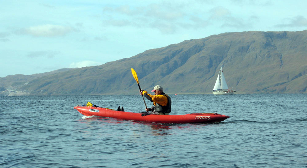
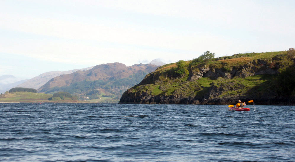
A short slide show of an afternoon’s paddling we did a couple of years ago after the Spey. Jon in the Carolina found this route description in this book, winding in and out of a few islands and so never far from a shore which was fine by us. It’s hardly ‘out there’ but for us it was quite a step up, calculating the tides, wind, currents, UV refraction index and negotiating the swell that might have exceeded two feet at times – plus dealing with some dodgy rip on the way back that was there just where the route description said it would be. After the castle, coming back in between Shuna island and the shore, the wind or tide or something was against me while Jon glided effortlessly forth in his hard plastic boat. That’s the good thing with an IK, you get a free work out! All in all, a lovely October’s day on the Scottish west coast.
I should have been off to France in early November to packboat down the Allier River, but the current job drags on. So despite the very short days, it struck me I ought to finish off my summer’s packrafting plan. On that occasion, I ran out of time at Fort William while realising my idea of traipsing merrily across the bogs of Rannoch Moor from loch to river was – as usual – over-ambitious. Being my first packing trip, I also learned a bit about what gear works for this sort of travel. End of November I’ll walk southeast for two days down from Fort William to west Rannoch along the West Highland Way, like any normal person. Then I’ll put-in near the road bridge at Loch Ba and paddle northeast for two slow days onto Loch Laidon for Rannoch station to train back home. Another perfect mini adventure!
Looks like the forecast is freezing and snowy, so I’m a little concerned that a weekend of sub-zero temperatures may be enough to thinly freeze the lochs by Monday when I reach Loch Ba, making it too thin to walk on but too hard to paddle across. (a couple of weeks later we indeed experienced a paddling-through-ice scenario on a local river. Wind is forecast at 18mph headwind, but not till Tuesday which on top of -2 ought to chill things down. But that’s the final day’s paddle to the station so it can be endured or walked.
On the way I’ll be trying out some new gear:
Full-length Seal Skin socks for bog-wading immunity.
Self-draining trail shoes (normal hiking shoes with a hole melted through the sides). My Keen Arroyo drainers were not up to loaded walking.
Watershed UDB drybag/backpack and W’shed Chattooga day bag.
A waterproof Panasonic FT2 camera that can just hang off the neck come rain or splash. No more scrabbling with a Peli box while watching out for camera-killing drips and the rocks ahead.
December 5 ~ All Pack and no Paddle
I ended up only packwalking for three days, reversing the West Highland Way (WHW) from Fort William to Bridge of Orchy. It was nice enough, especially the last day after a bit of snow to improve grip. The only other person I met was this guy who’d cycled the WHW from Glasgow (95 miles) in 2 and a bit days. Pretty good going as I soon found out it’s not all rideable or even easily walkable in icy conditions.
On the first day I misjudged what I needed to wear a couple of degrees below freezing and ended up overheated and worn out after a long climb out of Fort William. After 13 miles I descended to Kinlochleven, a former ally-smelting company town for which the Blackwater reservoir had been built a century ago. From above it looked like some sinister gulag hidden in a valley. With snow on the hills I thought the hostel here would have been packed out with climbers, but there were only 4 others in and close up Kinloch doesn’t look so bad. The smelting works have now been converted into an ice climbing centre, while I imagine plenty of excess hydropower still pours down the pipes to get fed off to Fort William.
Day 2 was a slog up along the pipeline towards the reservoir and then breaking off on the WHW path towards the walk’s 560-metre high point at the Giant’s Staircase before dropping to Glencoe. From the top the Blackwater reservoir looked grim but was clearly unfrozen which boded well for tomorrow when I hoped to paddle the nearby lochs to Rannoch station.
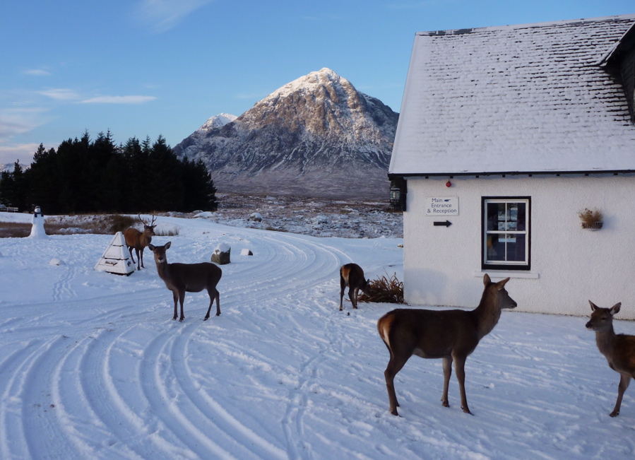
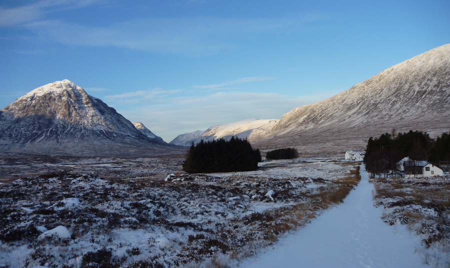
For the second time that day, I went flying on ice, ripping off my metal watch strap, tearing my trousers, and bashing my knee. The heavy pack amplified the impacts. Then later, walking on the flat towards the isolated Kingshouse Hotel at the head of Glencoe, I slipped again on and landed hard with the heel of my hand on a sharp rock which hurt a lot. With three similar falls on the previous day, after 9 miles I staggered into the hotel feeling pretty beaten up, but what a lovely cosy old place to spend the night! There was a fantastic view out of my room across to the pyramid peak of Buachaille Etive Mòr, while deer gathered below my window in the dusk.
It snowed overnight and leaving Kingshouse Hotel, after a few miles I was expecting to get a view east over to Loch Ba from a high point cairn on the WHW, to establish whether it was worth schleping cross country to get to the water. The previous night had been forecast at -10°C and at the viewpoint all to the east was just a snowy tundra, with a small, snow-covered frozen loch south of Loch Ba for sure. Was Loch Ba frozen too? I couldn’t see from there nor from any other point further on the WHW, despite scooting without a pack up a hill for a better recce. Only back home when I zoomed in on the photos could I see a thin blue line of the bigger Loch Laidon which was clearly unfrozen. So I probably could have managed it after all.
It has to be said it was a lovely sunny day on the trail with only me, the stags, and some scurrying tracks, so with days short, I was happy to stick with what I knew and plod on to Bridge of Orchy station, rather than paddle to Rannoch station (the next one up) as planned.
So, a 40-mile walk in the snow with a heavy load. Nothing new there. What I should have done is taken the path from Kingshouse east to Rannoch, passing north of the lochs, but that would have missed out Loch Ba and the easy and shallow chute between the two lochs (though that may well have been frozen).
If nothing else it proved that you can set off for a walk with a camping load including a packraft as an option. If the walking is more pleasant or the packrafting not worthwhile, the modest extra weight is no drama. It would have been nice to go for a paddle but it’ll all be there next time and on the way to the station at Bridge of Orchy I was sizing up the Orchy River which drains from the moor to enter Loch Awe which I’d never heard of but whose north end is right on the Oban rail branch line. Sounds like a couple of nasty waterfalls need the be walked around on the Orchy soon after the bridge, but in tame water that’s too low for any hardshell it could be another little adventure with packboat and paddle. With roads, rails, and trails, the more you look at a map of Scotland, the more packable stuff is out there.
A week back home and the temperatures have jumped, even in Scotland, so the papers have to write about something else. Today, December 10th, the webcam at Kingshouse is the standard miserable Scottish highland vista. We’re going back in a month to walk back from Orchy to the hotel and from there to Rannoch station. Bring on some more Siberian winds.
I was back in the area a month or so later in mid-January 2011 – still snowy but less thick cover. This time I could clearly see the path off the WHW leading down to the road bridge being repaired, the rushing torrent of the river Ba leading to the loch, and even the isles on the loch, not totally icebound. Maybe my eyesight improved over Xmas.
Gear
Seal Skin socks – very good while they last. Warm but not sweaty considering they’re initially waterproof. The knee-length ones ought to make great waders.
Self-draining Karrimor trail shoes. No real wading to test them, but certainly better to walk in with a heavy load than the thin-soled Arroyos, even if proper tight lacing (which could be adapted onto the Arroyos) had a lot to do with it. I may adapt a decent pair of decent trail shoes from Meindl or whatever with a better sole, if some turn up half price. It would be nice to get some plain, non Gore-tex trail shoes for packboating but I don’t think they exist these days.
Watershed UDB drybag backpack was surprisingly good when you consider the 16kg load I carried just on shoulder straps with another smaller yellow Watershed over the front. Part of the tolerable comfort I feel was that the UBD’s relatively rough fabric grips across the back like weak velcro and so spreads the load. The packstaff paddle shaft saved a few tumbles and so means the 4-part Aquabound paddle is well suited when trail walking and paddling.
The Panasonic FT2 never got to be splash tested either but was otherwise easy to use (once you know Pana interface) and took some great shots and video. It does lack the full 25mm width of my normal Lumix TZ6 and I wonder if on full zoom the relatively tiny lens is on the limit. A great back up camera for watery places. I’m still using one in 2016.


