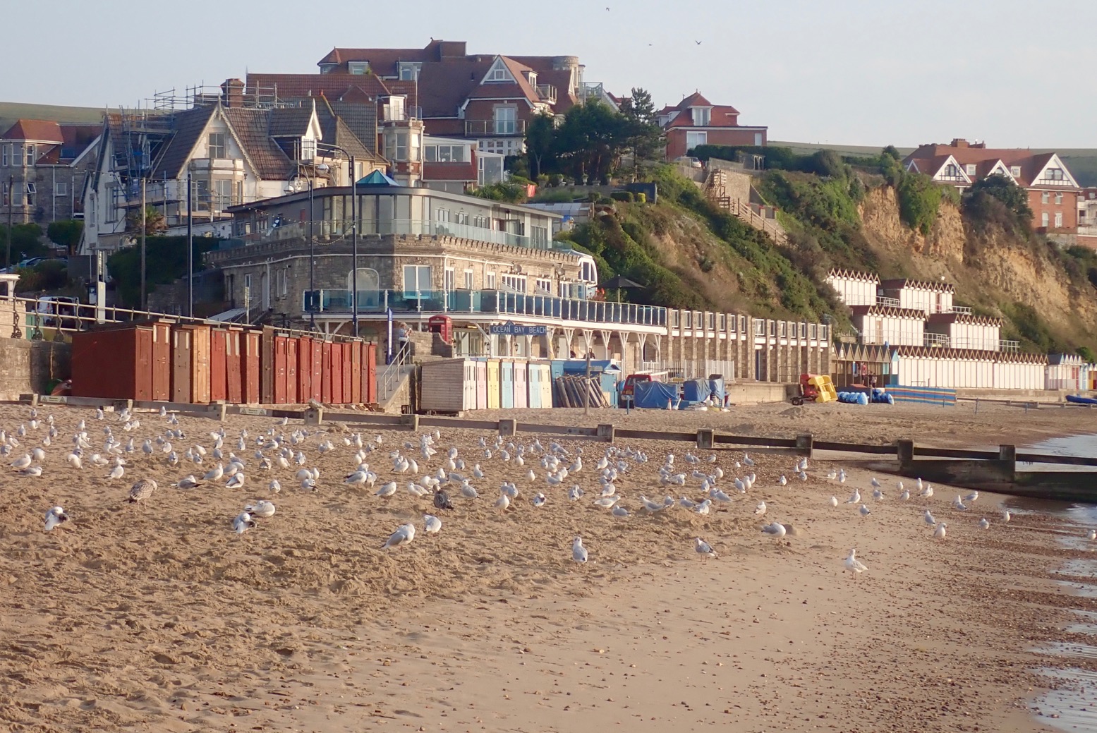
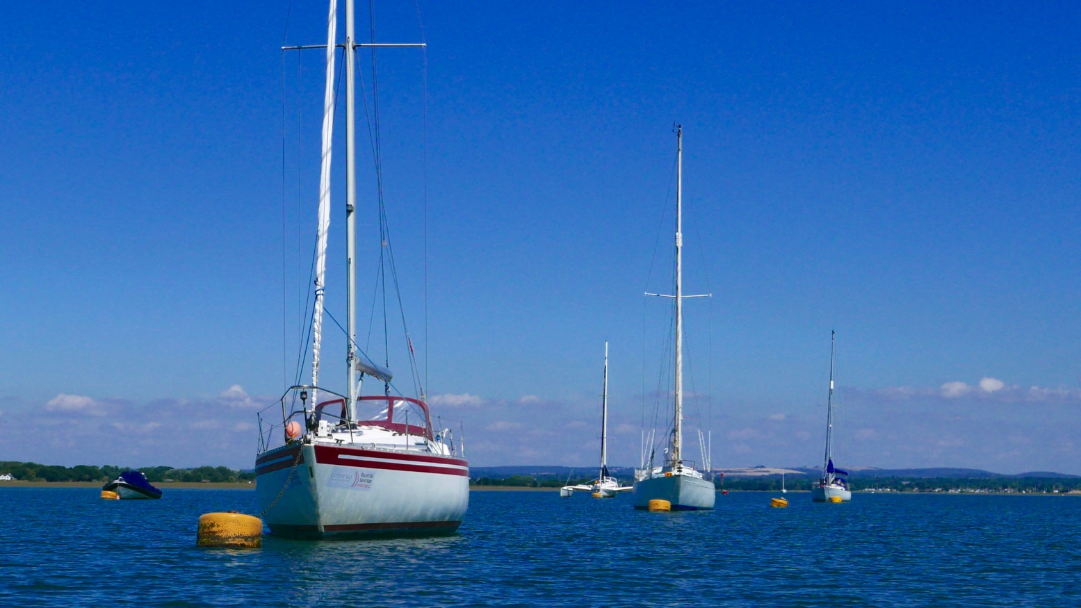
Ten minutes after a paddling away from a tranquil Swanage seafront bathed in a Turneresque light (above), we found ourselves battling a stiff breeze rolling off the Ballard Downs on the north edge of Swanage Bay. The odd whitecap scurried by, a sign that the IK Limit was not far away. This felt like more than the predicted 10mph northerly. We dug onward, and once tucked below the cliffs the pounding eased. The northerly was probably amplified as it rushed down the south slope of the Downs and hit the sea. We’d paddled through that turbid patch – a bit of a shock before breakfast. What would it be like once out in the open round Ballard Point? Mutiny was afoot.
“Let’s see how it is round the corner, then decide,” I informed the crew. “Aye aye, cap’n sir.”
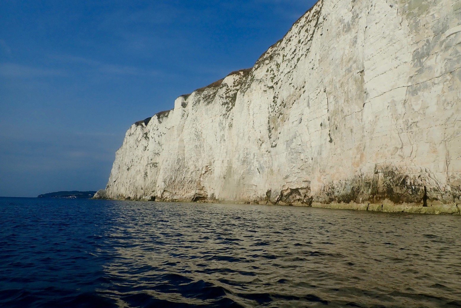
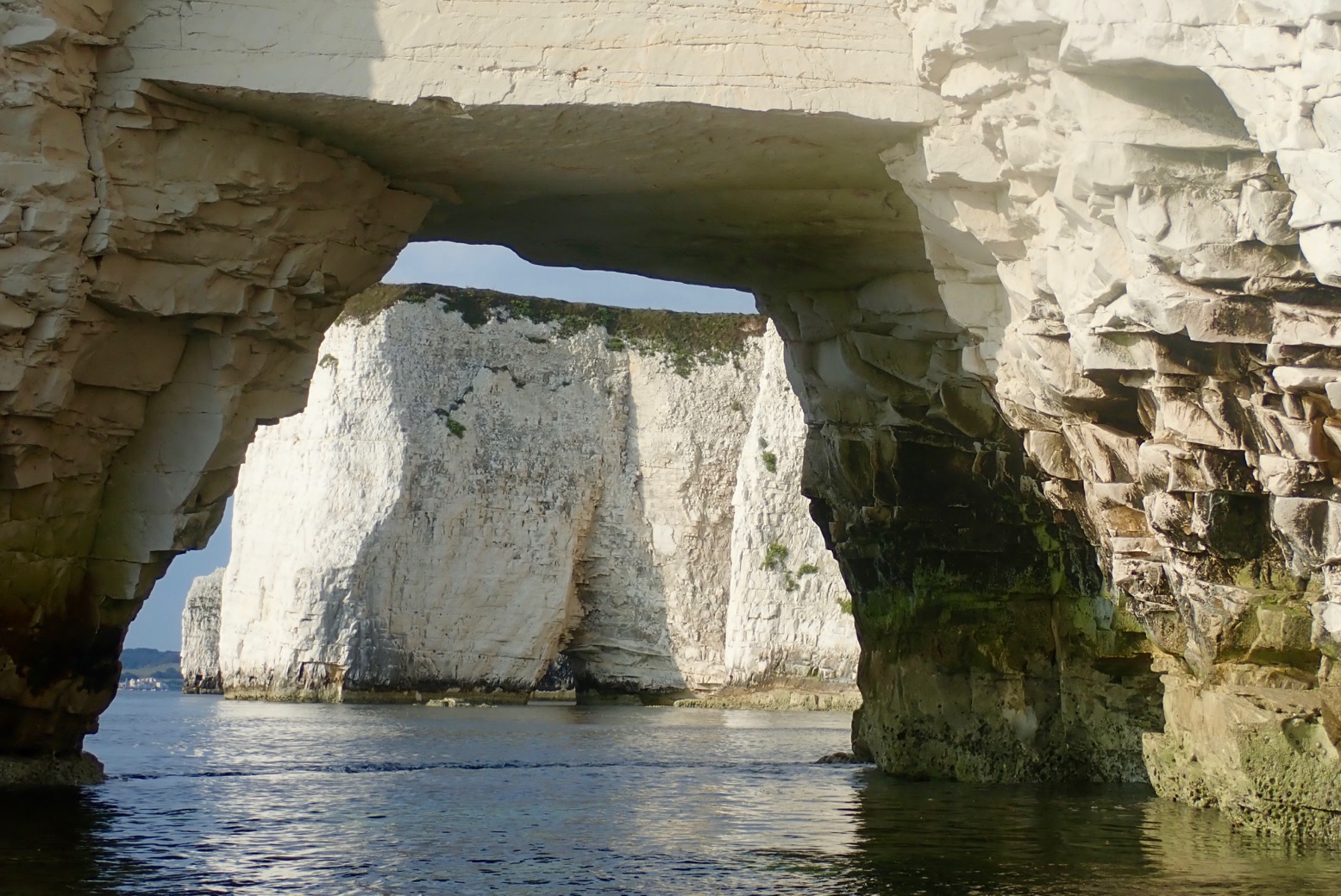
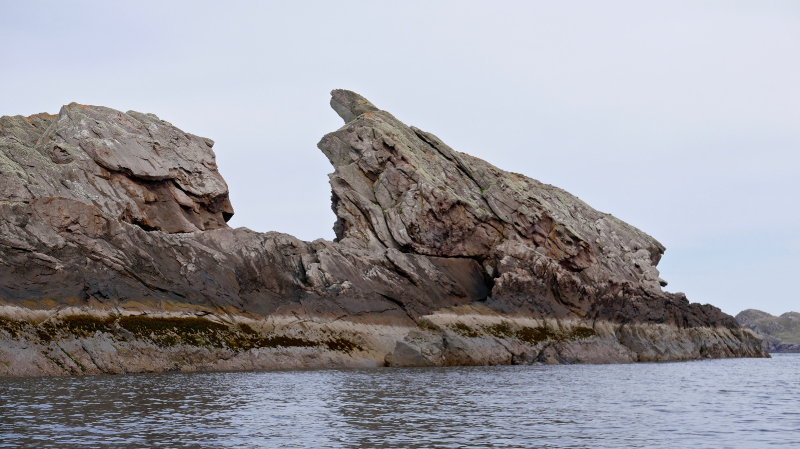
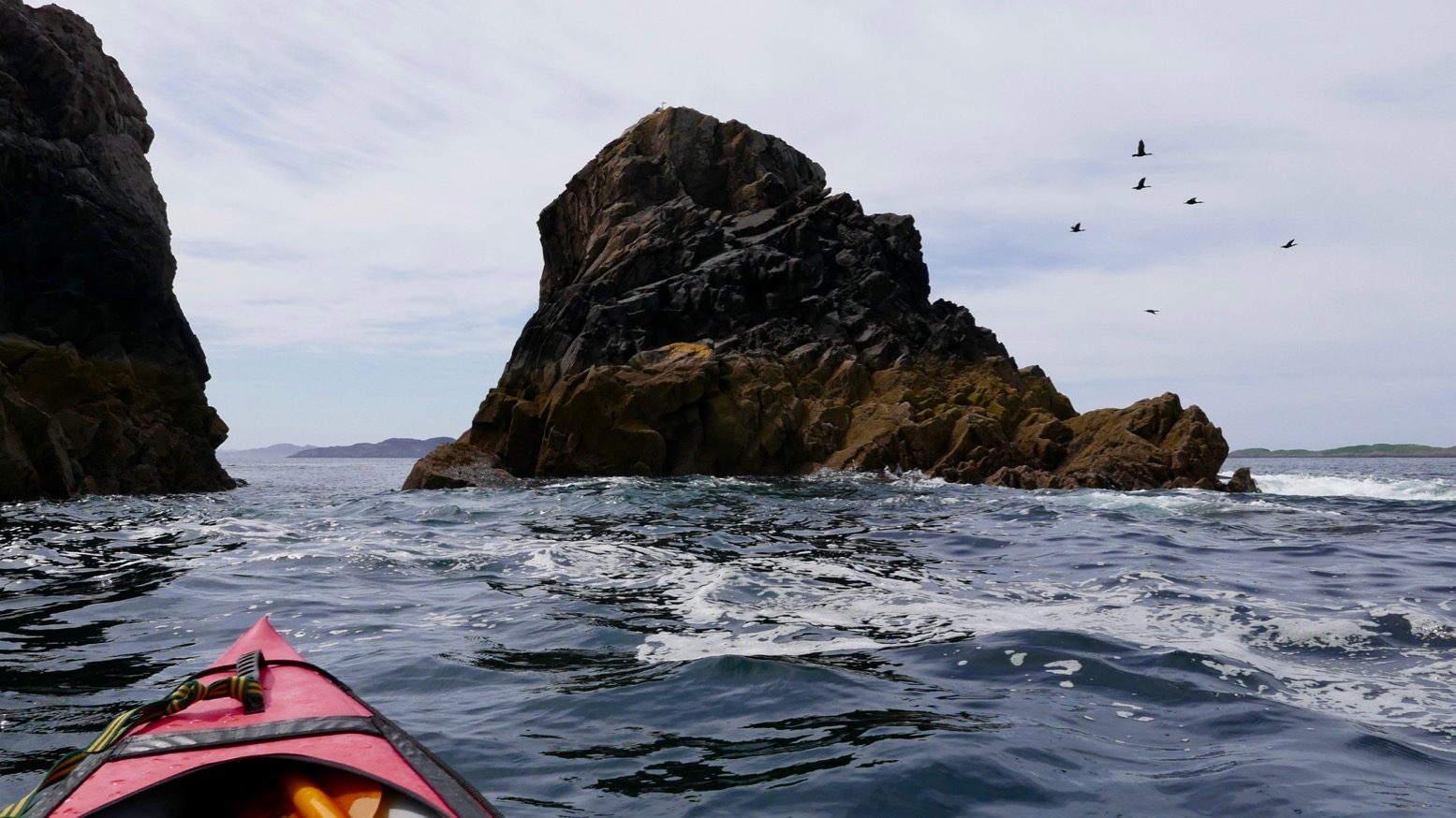
We eased around the corner expecting the worst, but were greeted by a magical sight: a line of 200-foot high chalk cliffs receding to a distant group of stacks and pinnacles glowing in the soft morning light and all soothed by a gentle breeze.
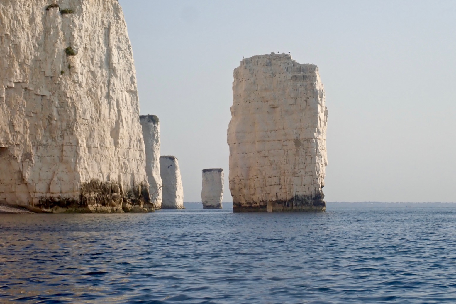
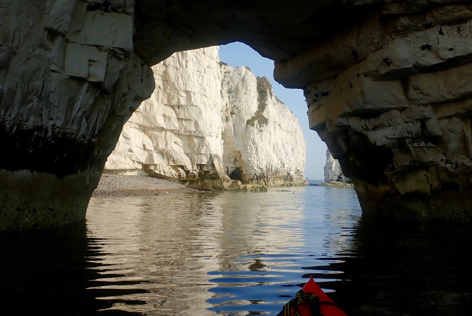
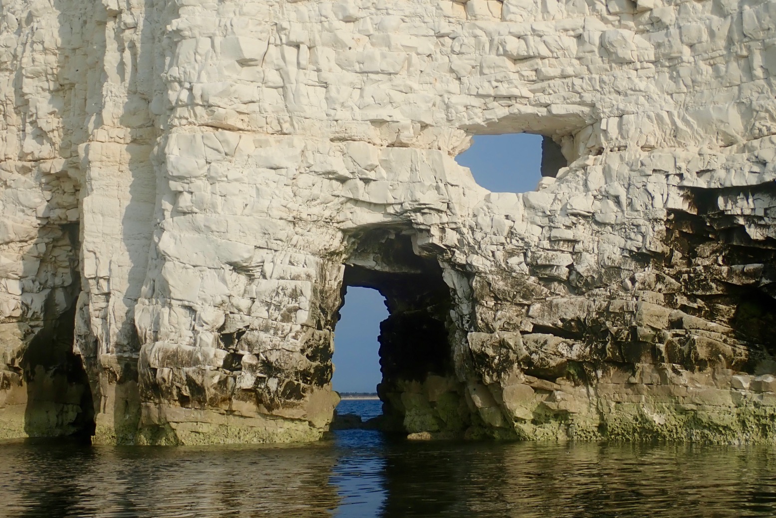
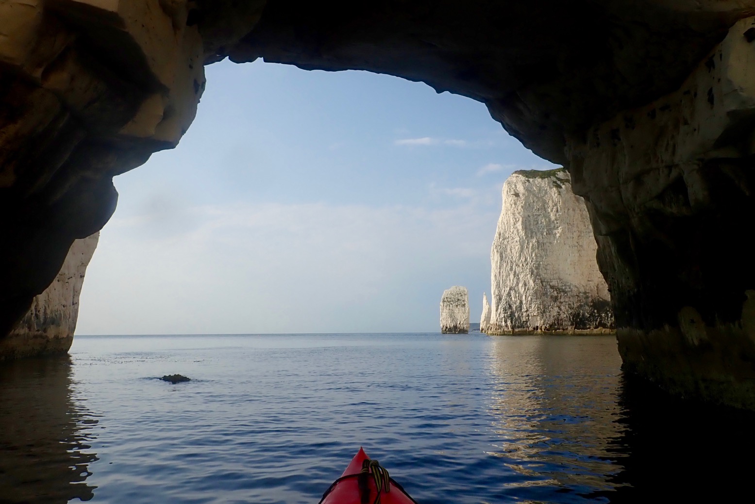
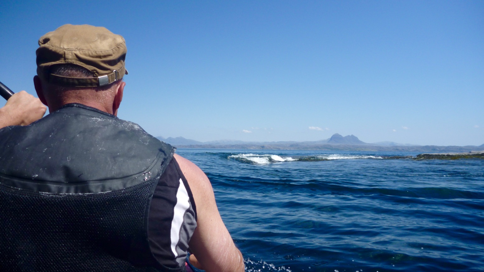
It was only a mile from here to Handfast Point aka: Old Harry, passing several stacks, arches, caves and slots. Ever the goldfish in its bowl, I’d got distracted before looking up tide times, but judging by yesterday evening’s paddle around Brownsea Island in nearby Poole Harbour, it was a couple of hours into its southerly ebb. We arrived at Harry’s about mid-tide but with still just enough water to paddle through most of the arches as well as some narrow slots which were already running too fast to tackle against the flow (below). A bit of a tidal race swirled past the Point, but nothing dramatic.
I’ve been planning to do Swanage for years and it was even better than expected. It must have been packed out yesterday on the bank holiday, but today, before 9am we had the place to ourselves. It’s a fascinating geological formation and all the better explored from a paddleboat.
Lit by a rising sun and on the top half of the tide must be ideal timing for a visit here. All up, it was only a two-hour roundtrip from Swanage seafront and in similarly good conditions would be easily packraftable from the north off nearby Studland beach.
Hope to paddle this again, one time.PS: Little did I know that this summer 2019 paddle would be out last sea paddle in the Seawave. Not since my original Gumo Sunny on which I learned and did so much, have I owned an IK for so long and had such fun times. What a great boat that was.
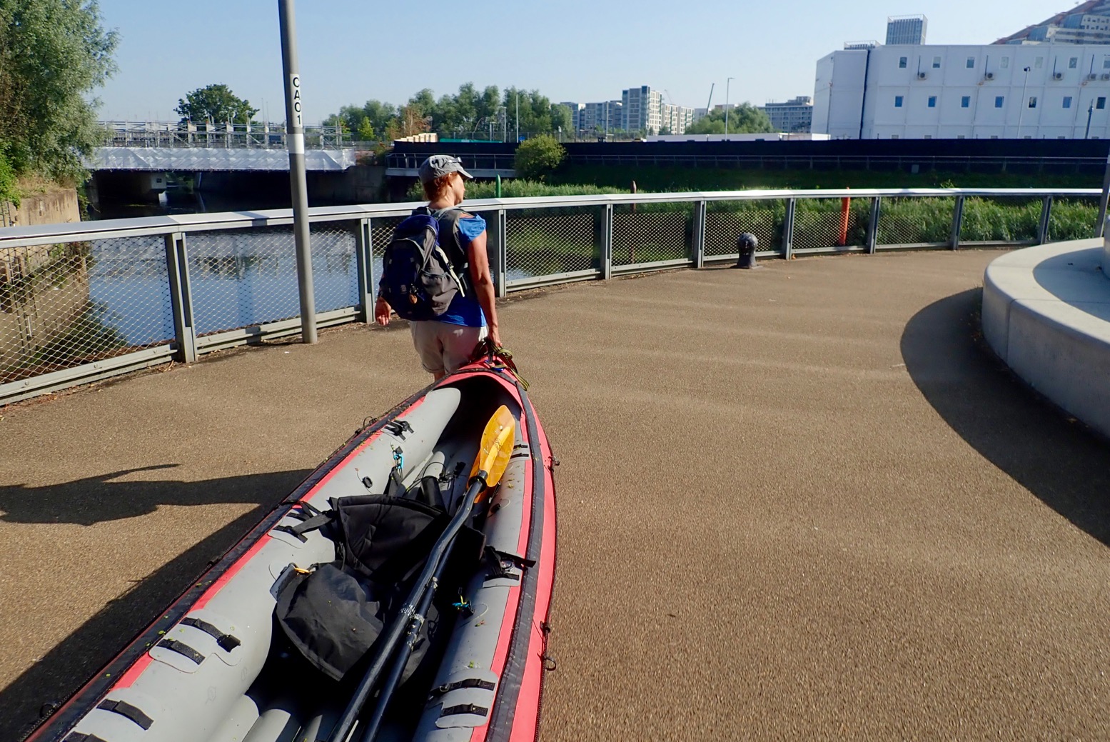
The plan was simple. Put the IK in at Limehouse Basin where I finished up last week, and take an easy canal-paddle up around what are collectively known as the Bow Back Rivers threading through the Olympic Park, then portage over Three Mills Lock onto what becomes Bow Creek. Here, we’d ride its tight meanders on an ebbing tide down to the Thames at Trinity Wharf. Hard left and, keeping on the north bank (naughty), for what looks like an easy beach take-out at Lyle Park, a mile downstream.
Another possible east London paddle route.
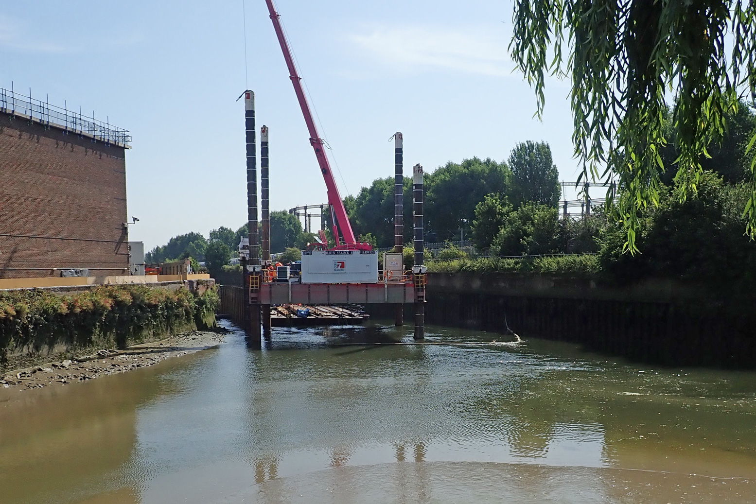
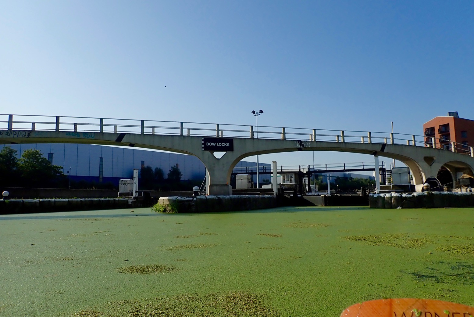
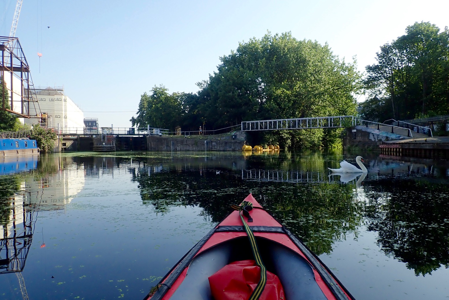
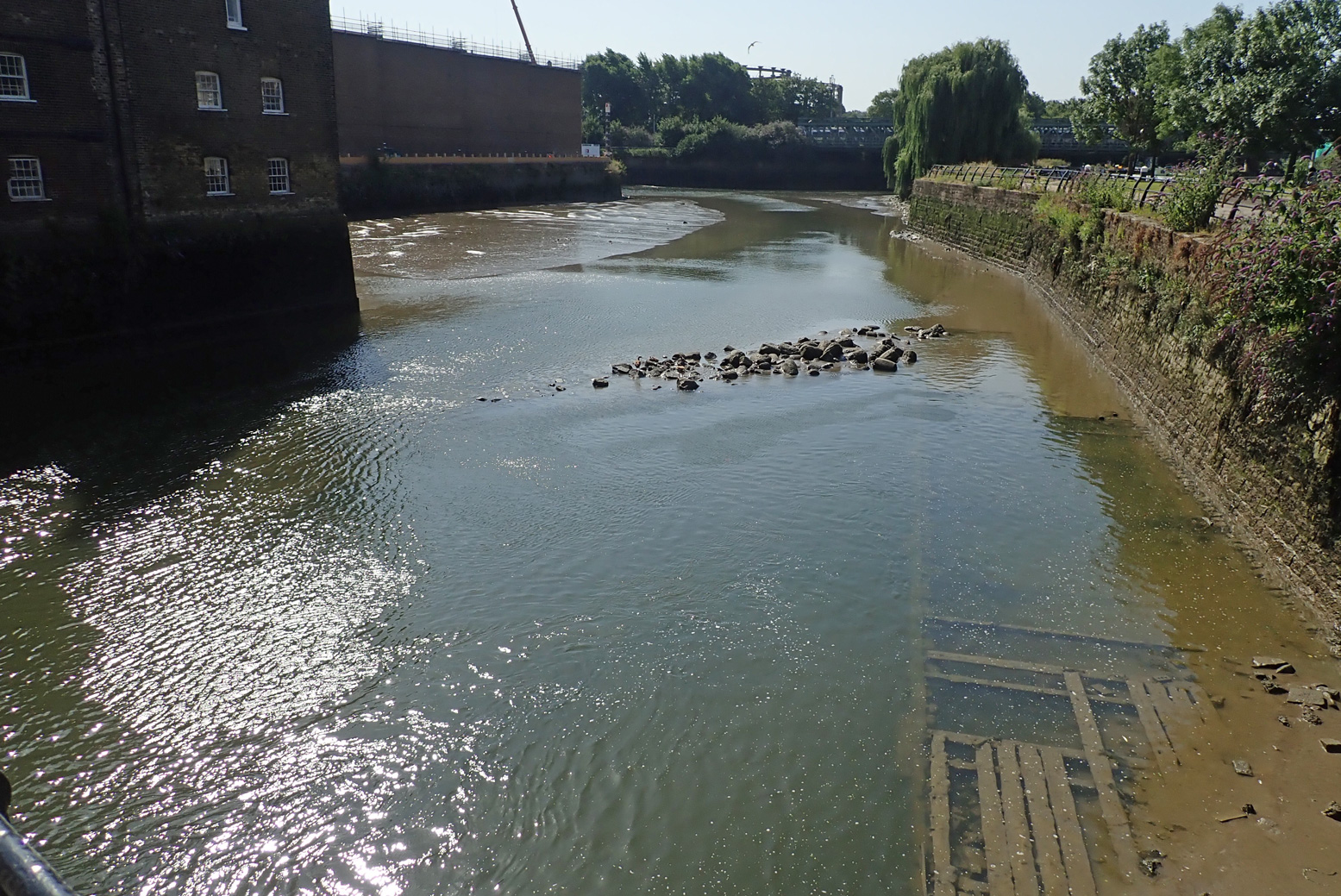
The whole 8-mile run included just two locks to portage. Compare that to 13 locks and two closed tunnels for the similarly long Regents Canal I pack’ed last week. Things didn’t get off to a great start, but next day we were back and on the water before 8am. We set off up arrow-straight Limehouse Cut. Dating from 1770, it’s London’s oldest canal, built to evade the Lee River’s final twisting meanders on Bow Creek which we hoped to paddle on the wat back. (Very detailed history of this river). Two miles on, a thick mat of spongey duckweed backed up around Bow Creek Tidal Locks. Tendrils of weed caught on the paddles and flicked all over the boat. Bow Creek ebbs and flows right alongside the near-stagnant Limehouse Cut/Lee Navigation, but this was surely once a single river system. The River Lee’s (or Lea) source is in the hazy Chilterns of north Luton, and reaches the Thames via Bow Creek, 42 miles later. The Lee River Navigation is paddlable from at least Hereford (Mile 27.5). In England, a ‘navigation’ in fluvial terms means a public right of way for all craft, with a precedent going back centuries. Not all rivers in England are a navigation. This whole underused wasteland between Strafford and Hackney was massively redeveloped for the 2012 Olympics, including the two new tidal locks mentioned. Before that, on the spring tide you could paddle up Bow Creek all the way to Hackney Marshes for some fish and chips. But while great for towpath activities, it seems the developers behind the refurbished network of waterways and new bridges didn’t consider paddleboat access either side of the locks. Odd, seeing as it was the Oh Lympics and all.
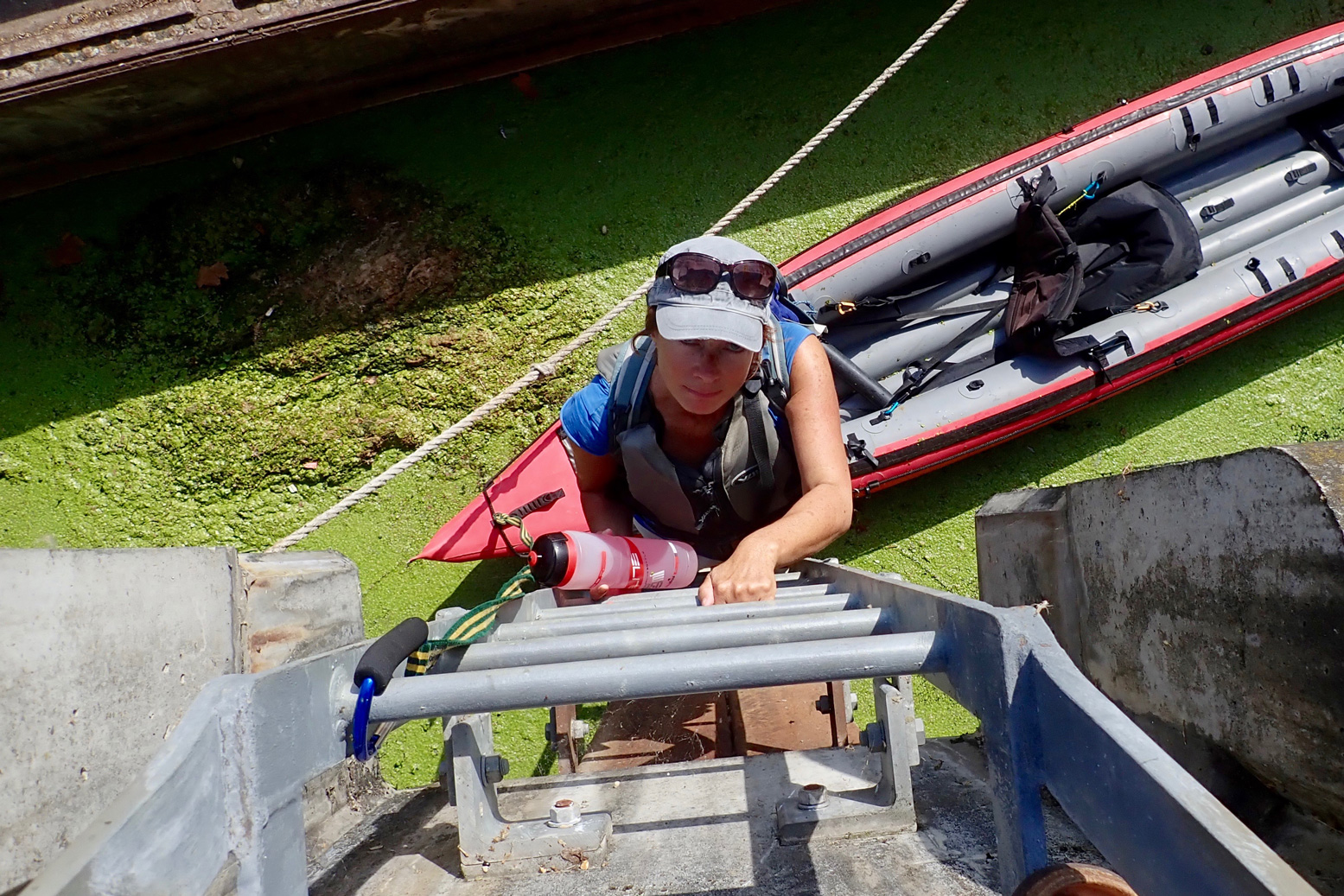
Our first trial came at Carpenters Road Lock (booking required a week in advance). It has a unique radial design with gates lifting a bit like a bulldozer blade. The CRT is very proud of it. Even though it’s permitted, as a single kayak I wouldn’t expect to use this or any lock; portaging is always quicker. But I would expect it to be fairly easy to get out and portage around a lock, just as I did 13 times or more last week on the Regents Canal. Maybe I’m going soft, but clambering up a 12 feet of rungs set in the canal wall, hauling the boat up, and then carrying it half a kilometre to the next accessible put-in doesn’t encourage paddling. What next; the cliff climbing finale from Deliverance (right)?
Two miles downriver at Three Mills Lock, (which I read was closed for repairs) we had to get up an even-higher ladder jammed behind a derelict? barge. To access the tidal stretch downstream of the lock, the only way was another long wall ladder, but it was behind temporary barriers. I could have wandered on to the Channelsea River to look for an easier put in, but where it joined Bow Creek (right), a cable or pipe to the crane floated across the surface, blocking the way. On a wild river you portage as long as necessary, sometimes miles. But either side of a lock on an urban waterway, how far do you go?
To be fair I’d timed the tide all wrong. I thought (correctly) that mid-ebb could be a fast run on the Bow, but in my greed for speed I’d failed to appreciate that at the tidal extent (the lock and adjacent Three Mills Island, left, 3 hours before LW at Bow Creek mouth), mid-ebb has already gone shallow. You’d need ropes to get down to a boat. I suppose the easiest way to do Bow Creek is to paddle up with the tide and then let it take you back – this must be what local hardshellers do. With a packboat you can dodge such backtracking. But not here it seems. And whichever direction you do it, once you’re in Bow Creek, I don’t think it’s easy to get out of the high-walled channel. Our East London paddle occurred during a mini-heatwave with temperatures up in the mid-30s. What better place to be than on the water. But not in it: that morning the news reported a staggering three drownings yesterday, all on the Thames and all separate incidents. Lacking the hoped-for thrill of the Bow Creek finale, the route we took wasn’t so interesting from the water, though would be a nice walk or cycle if you’ve never seen the Olympic Park in real life. From the water, you see a lot of high rises or backs of factories or construction to make more of the former. Even with its dozen or more portages, I found the Regents Canal much more diverse and interesting.
Below, some pictures from our day out.
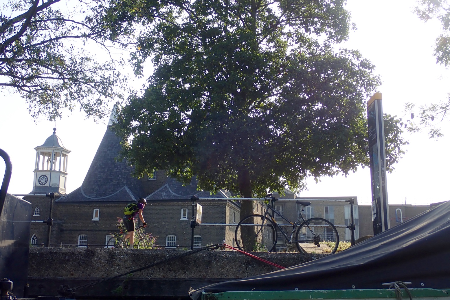
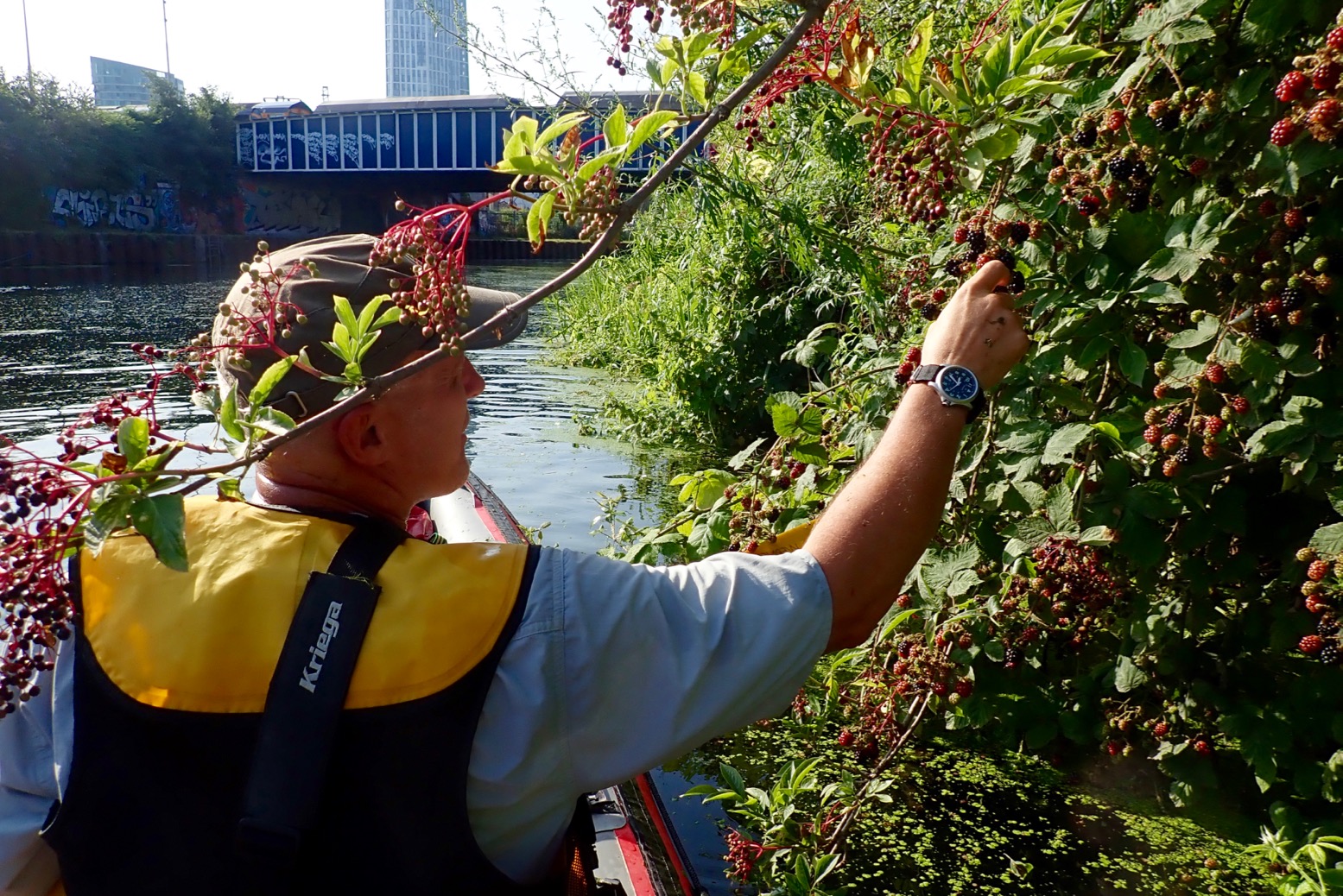
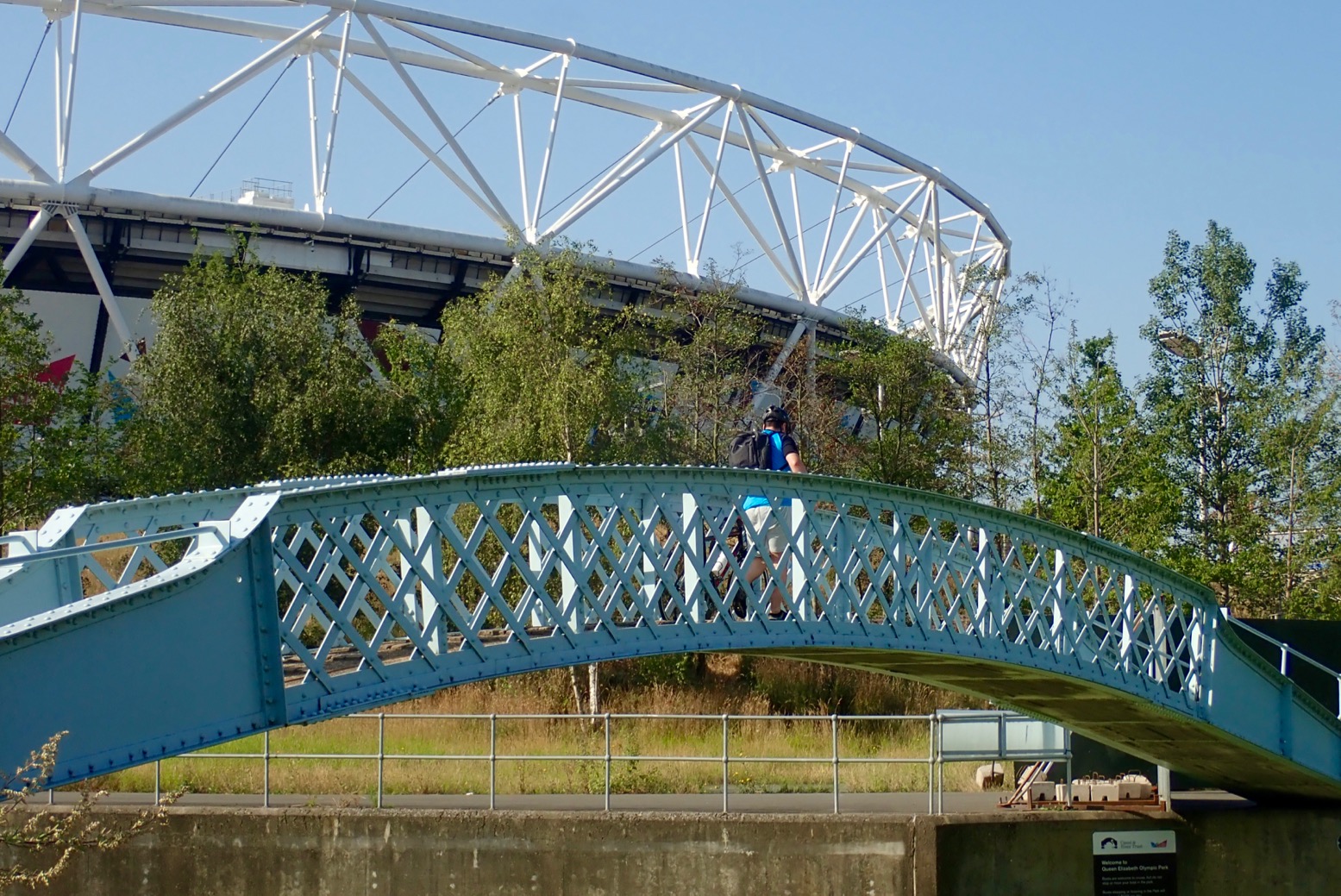
Limehouse Basin 7am.A week earlier, covered in duckweed.A normal-height floating jetty on the east side of the Basin. More of these needed upriver.Thick weed clogs Bow Docks which drop to tidal Bow Creek for the Thames. But there is no easy way to access Bow Creek from the bank. You must book the lock in advance.Three Mills Island complex – there’s been a tidal mill here since Saxon times they say. There’s a cafe.Under the Bow Flyover. The Lee is the notional boundary between the East End and East London. In some pubs it pays to know the difference. Aabout 1200 years ago in Alfred the Great’s time, it was the frontier between Danelaw (Vikings) and Wessex (Anglo Saxon England).Loads of building all around. London will be utterly brilliant when it’s finished.How deep is a canal, you ask? This deep, but often less on the sides.Belladonna and blackberries.Old Ford Lock (Lee River Nav) to the left. Just after, Hereford Union canal leads back west to the Regents Canal near Victoria Park. We follow the Swan right under the footbridge along the Old River Lea, passing below the stadium. Note the two different spellings of Lee/Lea, Ley being the original Medieval spelling. I realise that nearby Leyton + Leytonstone have the same derivation.Nesting heron.Carpenters Road Lock. How do you get up there? How indeed.Actually quite easy out of an open IK. Don’t drop the lead!We could have turned south here under this bridge and taken City Mills River back to the Lee River Nav just north of Three Mills Island and so back down to Limehouse (see map below). A closed loop with no locks which would be an OK canoe or even a SUP. You can rent Moo Canoes at Limehouse.Instead, we portage for 500 metres to the Waterworks River. A superb trolley surface.
9am – time for brekkie in a park before crossing the bridge. There are a couple of snack huts here.
Round the corner from the lock, yard-high put in on the west side of Waterworks River. Gate by the steps locked for no reason so down the ramp past a site entrance. Below the bridge is a short ladder and the gravel riverbed is only a few inches deep.
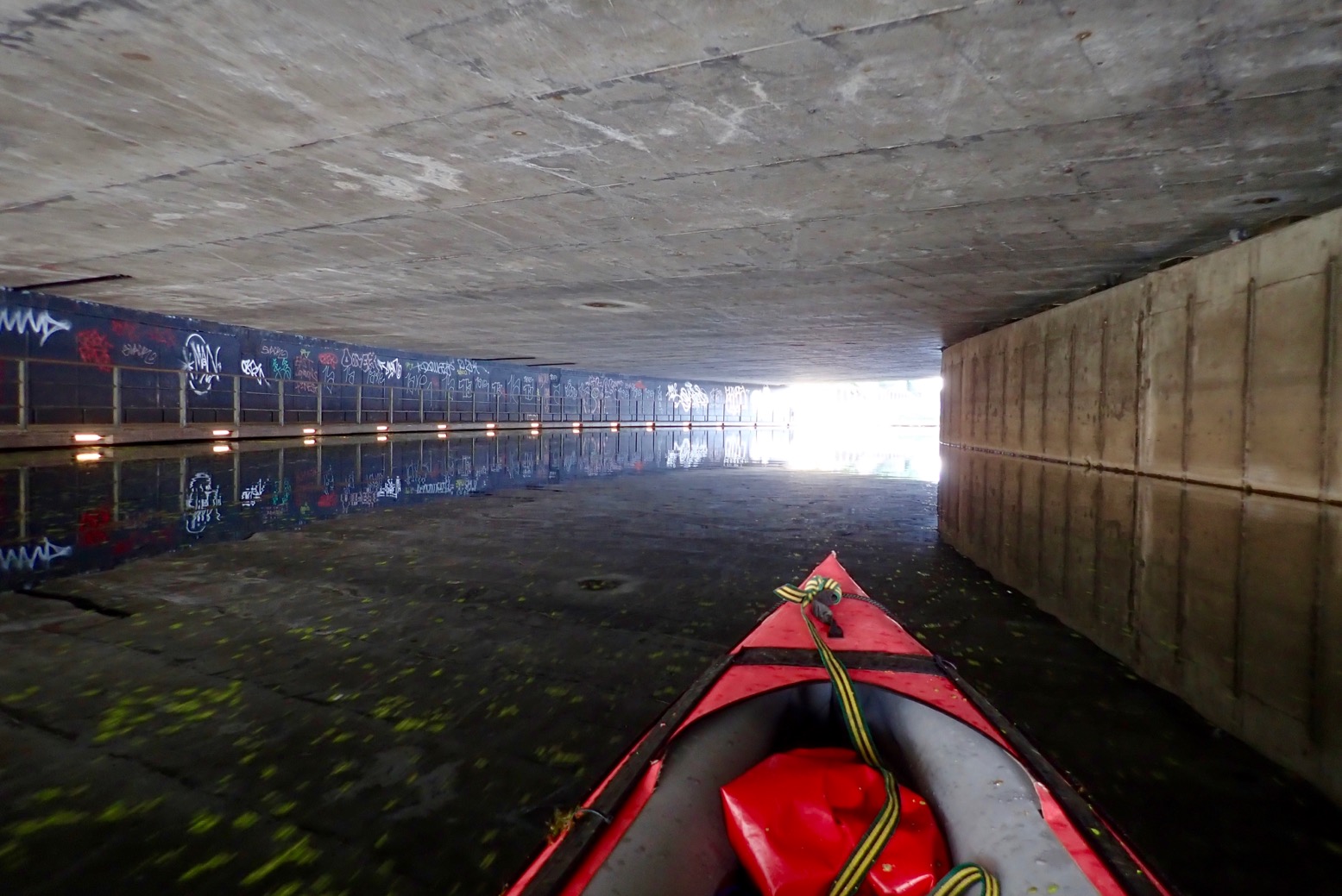
The Swan Highway Patrol.The famously elegant Mittal sculpture – and some twisted red thing on the right.Once a quick way to tart up old flats, cladding removal now in progress.You want your water bottle or what?Awkward and mucky take-out at Three Mills Lock. This is where your 3-metre lead comes in handy.Good thing with IKs: light and bouncy.I walked off for a recce all the way down to Bow Locks but found nowhere to put in – not even ladders. This spot above was about the easiest place, but still required clambering over fences to get to a walkway 9 feet above the bank scrub. With all the attendant construction and secretive film studios, you’d need to be quick to dodge the hi-viz jobsworths. This point is just north of the Three Mills complex where……you’d pass almost immediately under the Mill building. There’s a very shallow weir at low tides; maybe nothing at higher water.
View downstream on the bridge above that mill race. This is 3 hours before LW at Bow Creek mouth, but even at HW access is still awkward.
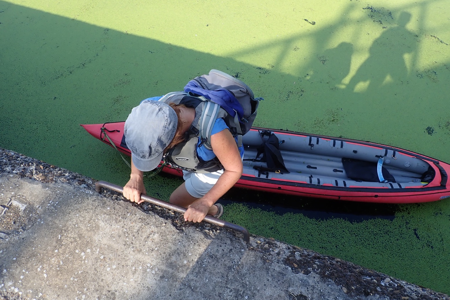
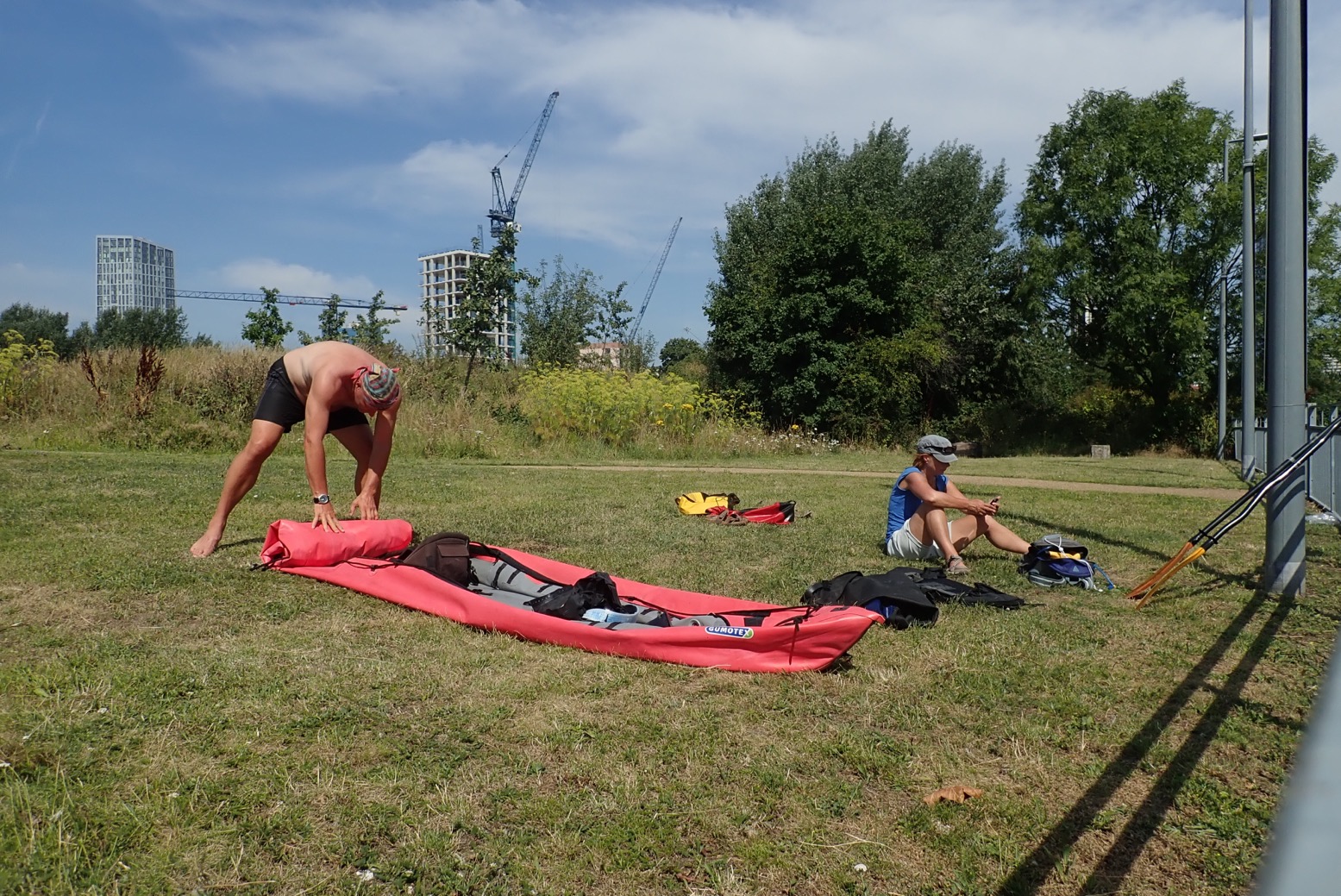
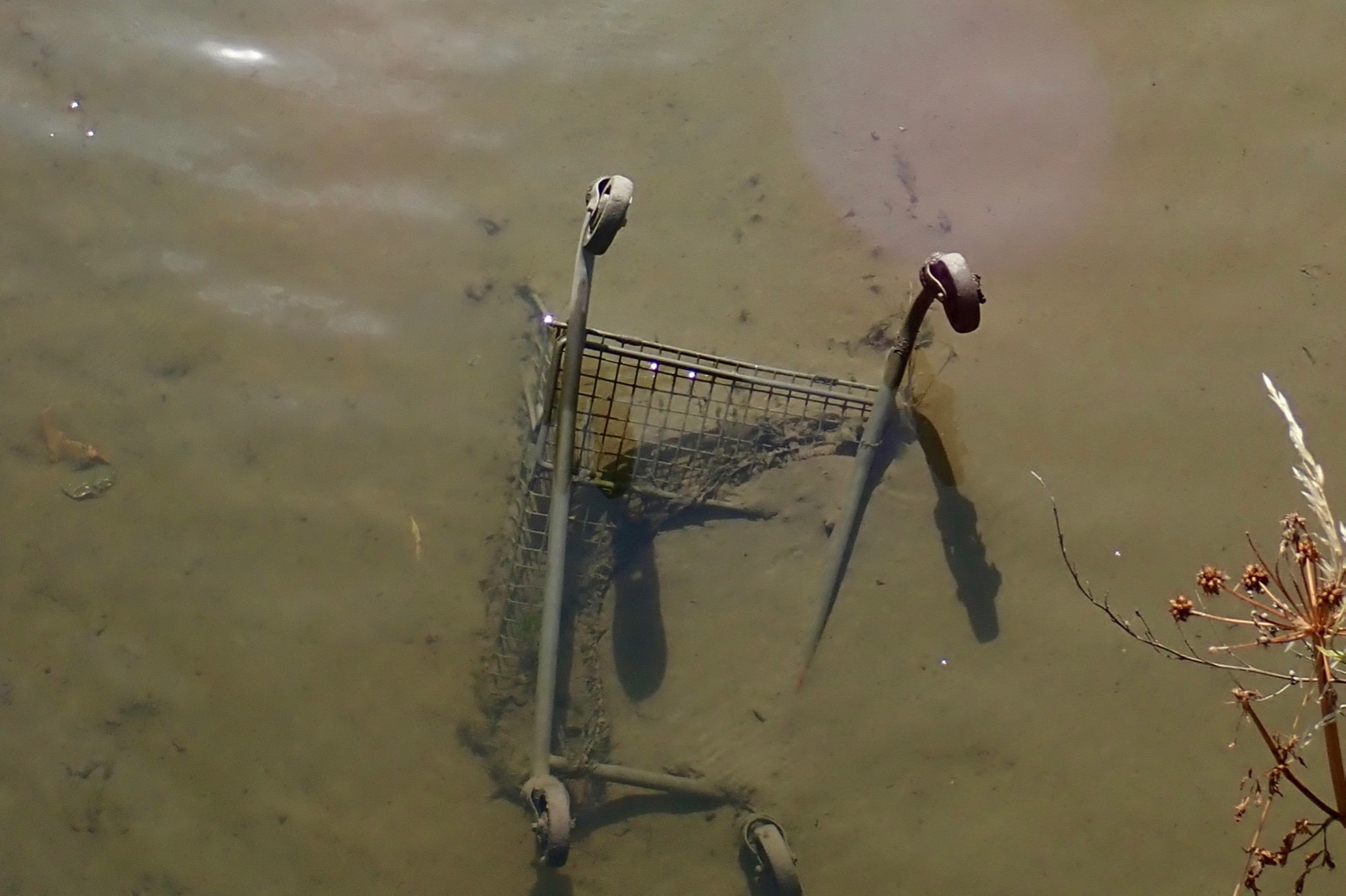
Reluctant to retrace the nearby Lee Nav back through the weed morass and down the Cut to Limehouse, I wipe off the duckweed and roll up.We set off for the hot two-mile walk back to Limehouse.Wouldn’t be an urban paddle without one of these!
Hypalon is a cool-sounding word and although not made anymore, has become a generic term for the similarly durable syntheticrubber-coated fabrics still in production, like Nordel and Nitrilon. Once upon a time all rafts and were made of hypalon, then less expensive Asian PVC came on the scene. More about IK fabrics.
The other day, while lashing the Seawave to a chopped-down trolley, the bag sagged under its own weight and rubbed on the sharp edge of the hard plastic wheels which wore through the pack and then the boat’s hull (left) ;-((
The trolley had worked fine with my UDB drybag in New Zealand (below left), but that was partly because you can fully inflate a UDB via its one-way oral valve, transforming it from saggy sack to firm travel sausage.
Ironically, just two days before I damaged my Seawave I’d snagged a BNWT Orlieb RS140 (right) on ebay. I’d been eyeing up this non-rigid wheeler duffle for a while as a versatile Seawave transporter plus a reliable on-water drybag/buoyancy aid. With a bag like this, an IK or whatever you got can be transported easily across any wheelable terrain, or carried as a holdall or on its backpack straps if you’re strong enough.
With enough practice applying D-rings, let along bike and moto punctures over the decades, I was confident I could do a bomb-proof repair on my Nitrilon Seawave. In a way, I was even a little chuffed that my 5-year old IK was earning its first battle scars. Plus, in my experience rubber-based IKs like Gumotex, NRS and Grabner glue more reliably than PVC boats. Shiny packraft TPU is even easier: you can just tape it, but packrafts are low-psi boats not normally inflated with mechanical pumps. My adapted Seawave side tubes run 4 or 5 psi.
Things you will need
Patch The right two-part glue (below left) Solvent (MEK, Toluene) and rag Sandpaper or abrasive foam sanding block (note: Toluene eats foam plastic sanding blocks) Masking tape Small brush or wipe-stick Tyre repair roller (right) Well ventilated space to do a good job
Two-part glue. It’s a faff, but worth it
Tyre roller – a great tool for secure bonding
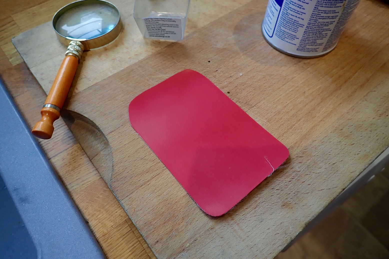
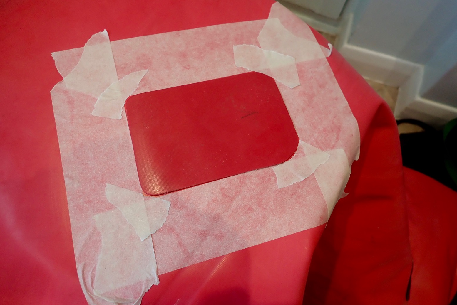
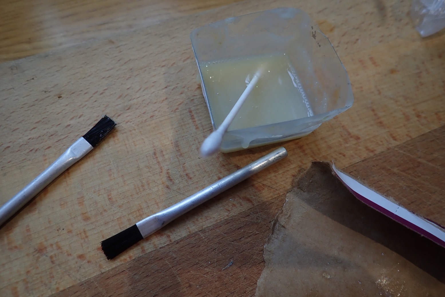
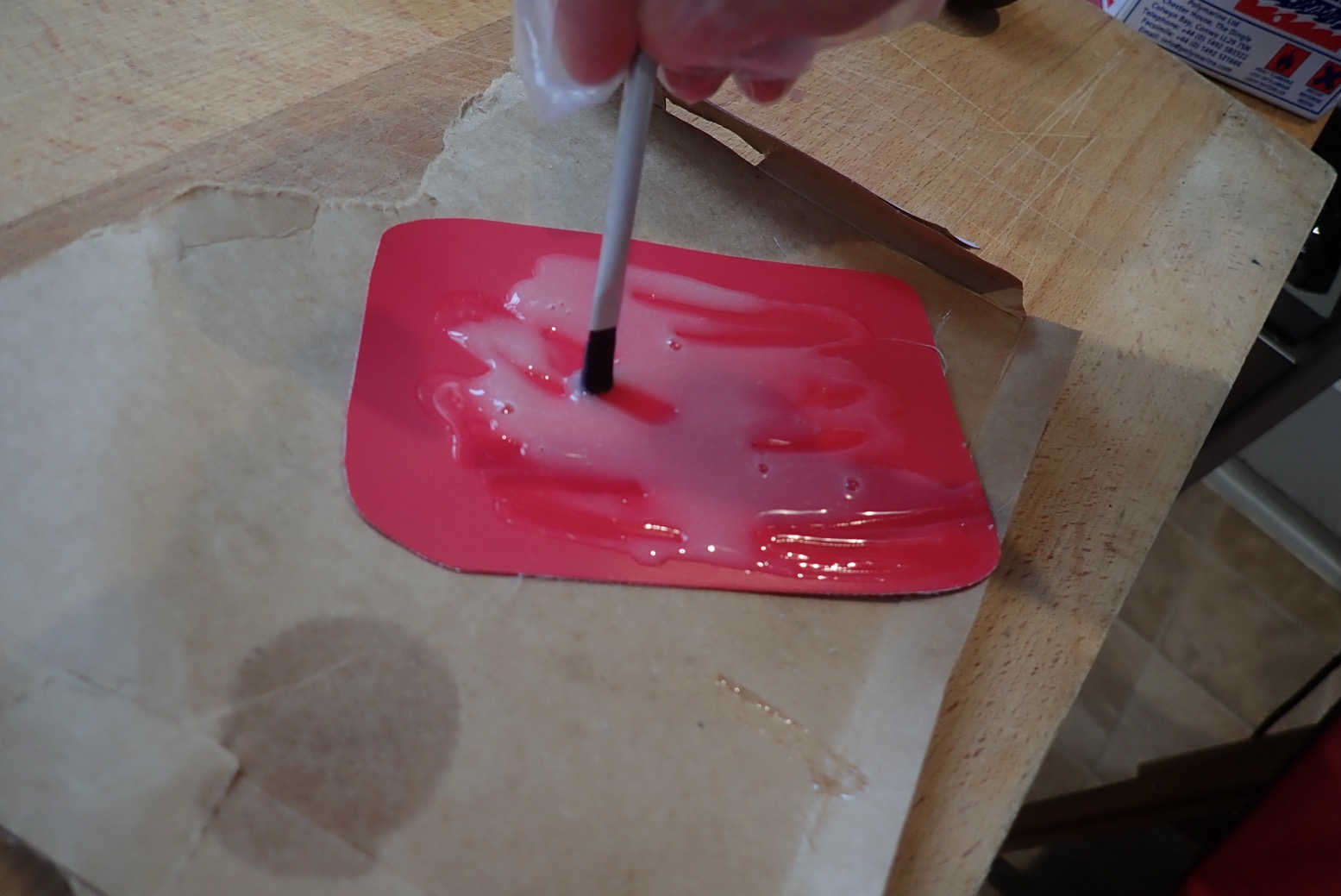
STEP 1 • Match up a patch from your collection, ideally identical fabric. For a small hole extend the patch at least an inch.STEP 2 • Clean the punctured area and patch surface with solvent and wipe dry. This time all I had was brake cleaner spray, but ordered some toluene for next time.STEP 3 • Sand down the two surfaces and then clean and wipe again with solvent. Avoid touching these cleaned surfaces with your fingers.Some colour coming off is a good sign you’ve removed any sheen or patina.STEP 4 • Position the unglued patch and mask the perimeter with tape to avoid excess residue and to help with positioning. If the patch is not perfectly symmetrical (like above) mark it – but make it bold – I still got it wrong!STEP 5 • Mix up some two-part Hypalon (Nitrilon; EDPM) glue. It’s rare than one-part glue works as well, but Aquaseal has worked for me, gluing a skeg-patch to a Grabner.I found some mini brushlettes in my repair kit box – they must have come free with some glue.STEP 6 • Brush on the glue thinly to the two surfaces. With Polymarine you then to wait 30 mins for it to cure/dry, then apply another coat and wait till touch dry (5-10 mins). Here’s their full guide: http://www.polymarine.com/advice/hypalon-adhesive-how-to-repair-inflatable-boat-tubesYou can see I made typical errors: mixed up too much glue (but better too much than not enough)…… and applied too much glue on the patch…… but a just-right thin later on the hull.STEP 7 • With the deflated boat repair positioned on a firm surface like a hard floor or better still, draped over a wooden stool, carefully lay the glued patch over the damaged area…… then – STEP 8 • peel off the masking tape and ROLL DOWN HARD moving from one edge to the other and again at 90° and again diagonally with your Baltic pine-handled roller, making sure the edges have stuck down. It won’t hurt to roll again in 20 minutes and again after an hour to make sure the two parts have well and truly bonded till death do them part. And actually, only about 25% of the glue was wasted.In 12 hours the repair is cured and ought to last the life of the boat. Never do that trolley thing again!
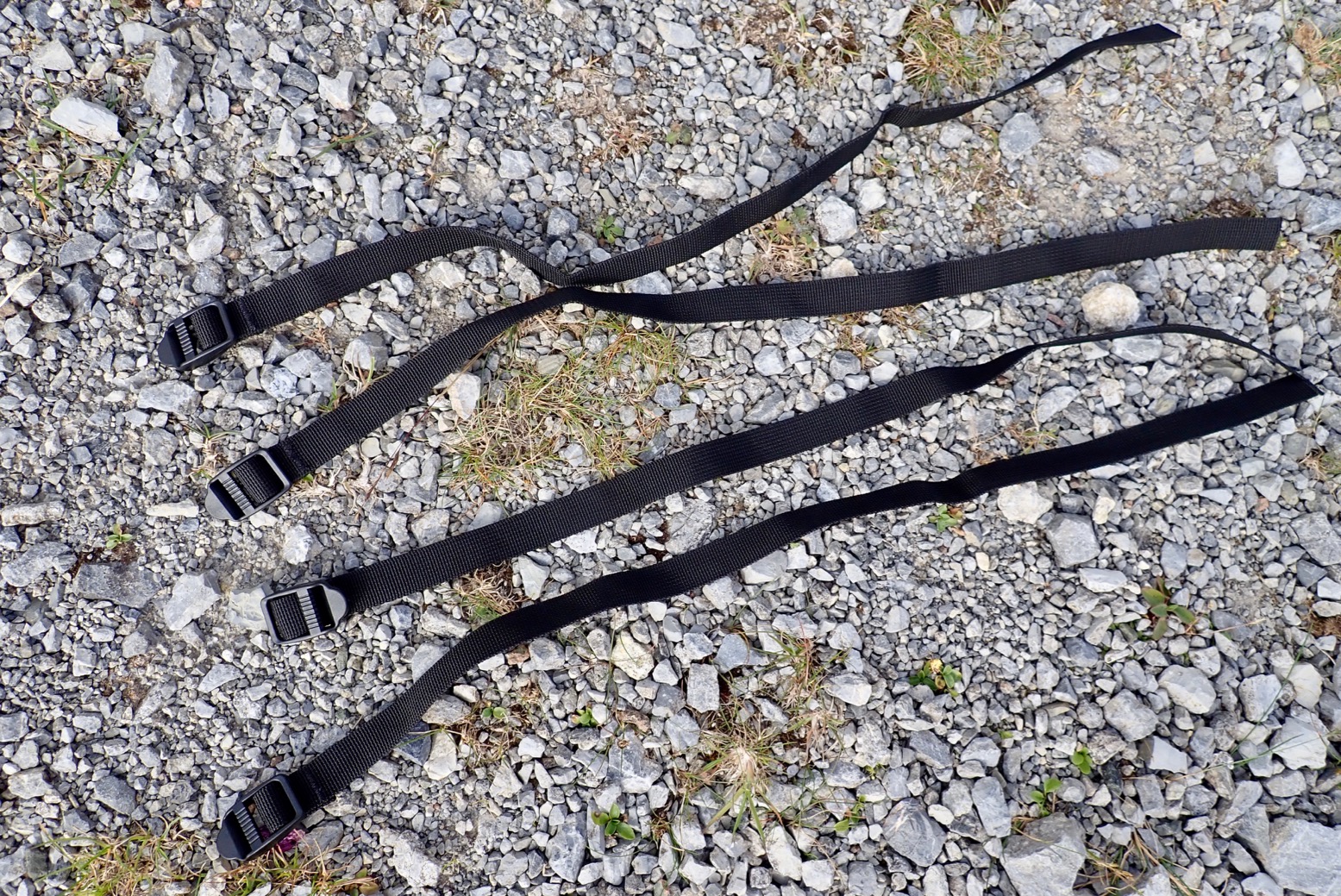
Weight, Size & Volume Bag: 224g; straps 11g each (verified) 59cm wide, 43 cm long and ~15 high when full. Volume: 22 litres.
Where tested Northwest Scotland, Medway, Knoydart, Jurassic Coast
• Waterproof construction including IPX7 zip • Light • Variety of attachment options, providing you have the mounts • Four 58-cm straps included • Works great on the trail as a shoulder bag too • Handy Molle rim tapes • You can easily tuck a once-folded WindPaddle underneath or even inside
• On the bow of my Nomad was a bit of to reach; better on the Rebel 2K and TXL • Not convinced it works well as a floor bag • Won’t stay up to be a pillow • A white interior and external mesh pocket would be really good • Drop the straps and use reusable zip ties – quicker and easier
What they say Waterproof zippered packraft bow or stern bag for easily accessible essentials on the water. Fits any Packrafts (and a lot of other boats) by full perimeter daisy chain (for variable fastening). With the Anfibio DeckPack you can transport your essentials safely and securely in all conditions. Splash-sensitive valuables like a camera, keys or documents as well as emergency equipment and spare clothing are always at hand on the bow, the stern or on the floor beneath your knees. The DeckPack can also be quickly converted into a daypack for excursions on land or the use as hand luggage on your journey.
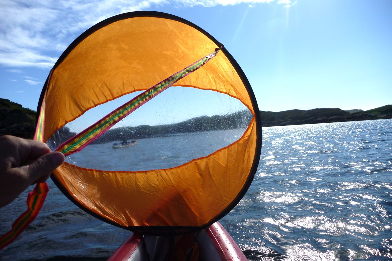
One great side benefit of a DeckPack is that a WindPaddle sail easily folds down and half tucks under the bag securely in seconds. A paddle can also tuck in under the bag securely while sailing.
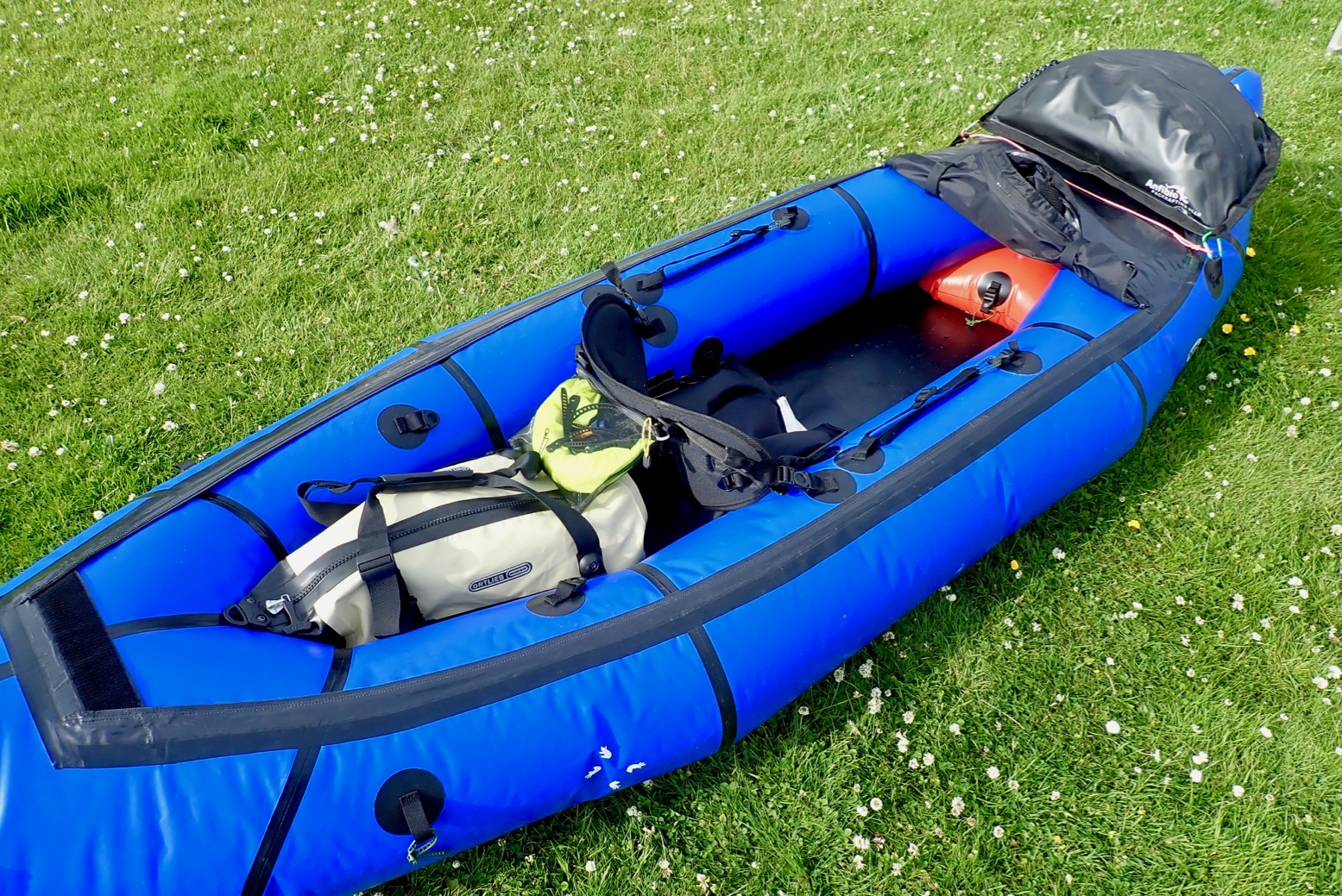
Review The problem with packrafts is there’s nowhere to put your stuff other than the bag it comes in, usually a backpack. I wrote more about it here, before making my own small Pakbag.
Otherwise, I like a 20-30L holdall, like my old Watershed Chattooga, or my current Ortlieb Travel Zip (right) with a handier TiZip and mesh-zip external pockets. These bags sit accessibly, but out of the way, under my knees, and on previous packrafts attached to a tab mount glued to the floor for when you flip.
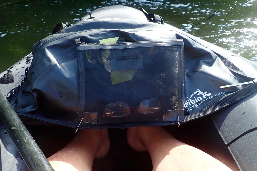
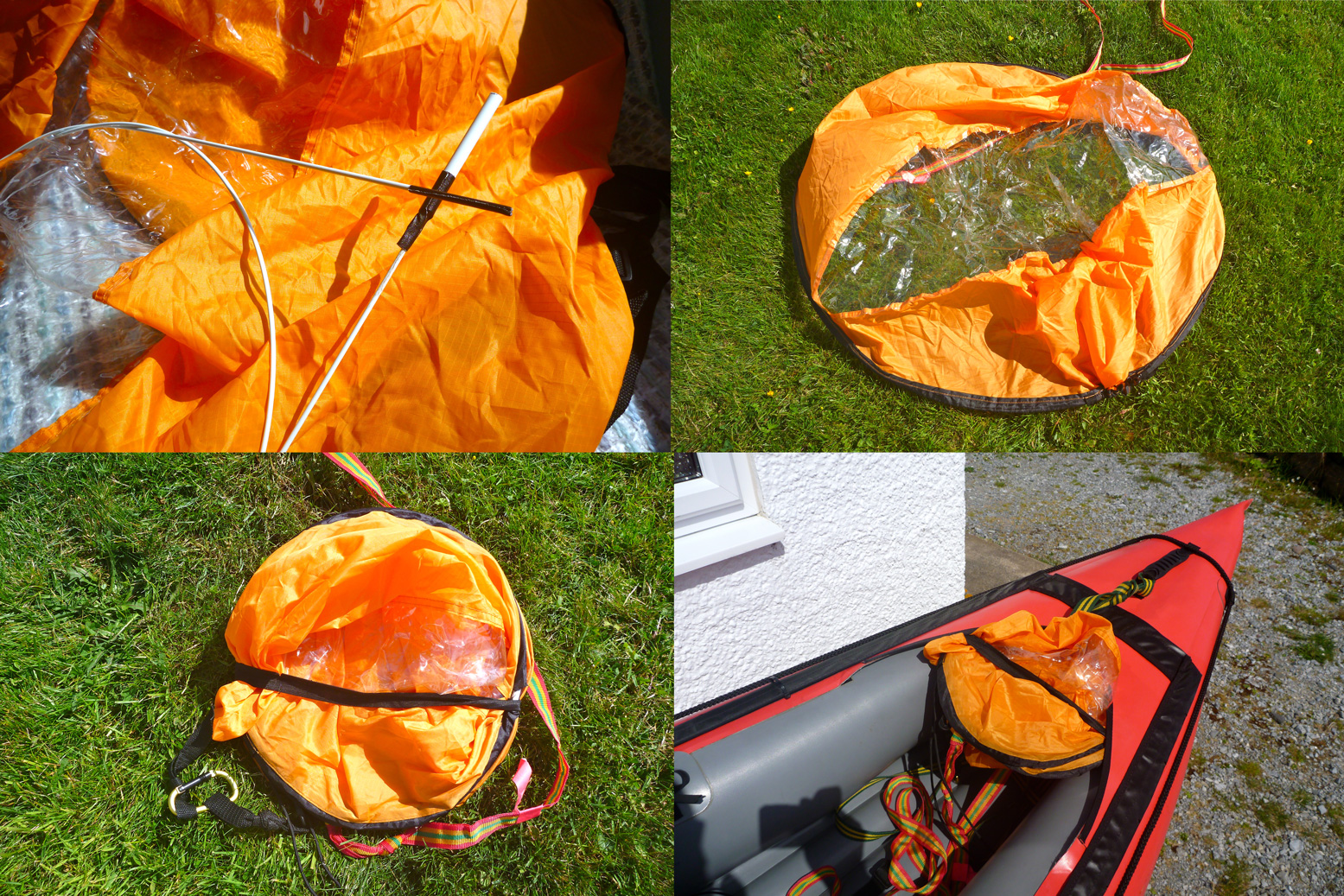
Anfibio DeckPack with added mesh outer pocket
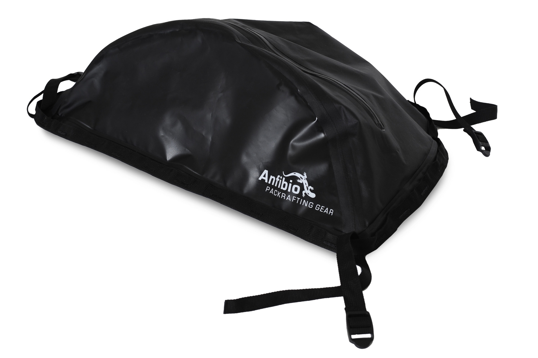
Anfibio’s DeckPack is another way of doing it. It resembles Alpacka’s larger, 24-litre Bow Bag but costs 25% less at current $/€ rates. It’s a vaguely semi-circular, PU-coated bag of around 22 litres which, unlike the Bow Bag, has a perimeter of daisy-chains (continuous attachment loops, a bit like Molle). It fits most obviously on a packraft’s bow, as this is where most packrafts have four tabs and where the weight trims the boat best. But you could as easily mount it on flatter sterns (as on my Nomad) if you already have a big backpack up front. Anfibio also suggest it can go inside on the floor too. Using the supplied straps, I’ve also used the pack as a shoulder bag while on the trail.
On my Nomad it just so happened the bow mounting tabs where just right to fit the bag without using the supplied straps. Reusable zip ties (below) are best. But mounted on the bow it was a bit of a reach on my Nomad unless I shuffled off the seat.
Too far forwardMore better
In fact there were enough hull mounts on my Nomad to position it further back (above right) using two front straps. Here it acts as a splash guard extension and was much more accessible on the water without making getting in and out too awkward.
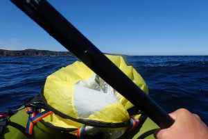
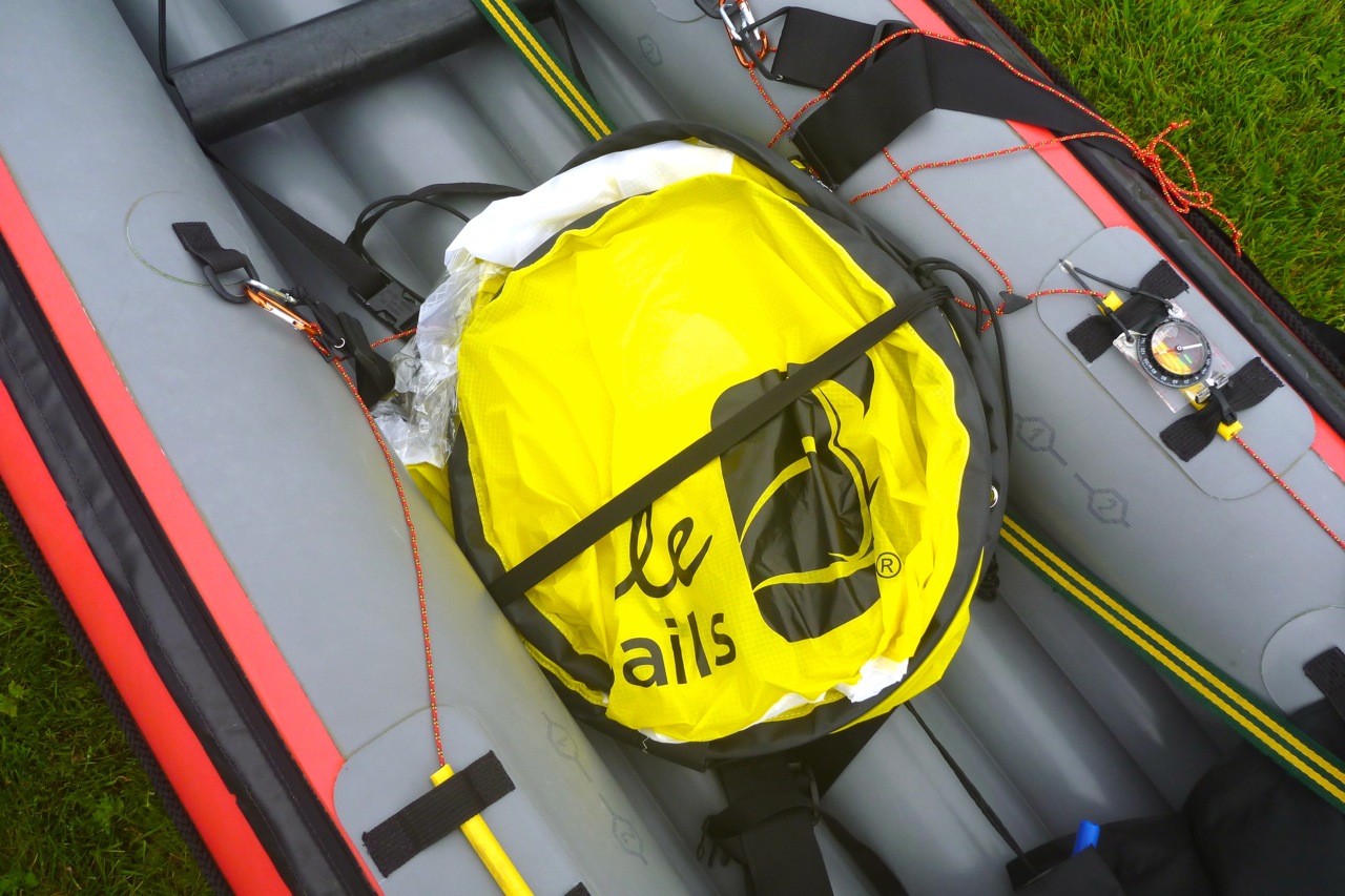
Another very handy aspect of a DeckPack is that a mounted WindPaddle (left) or similar can be quickly folded in half and tucked under the bag out of the way when you’re setting off or need to change direction and start paddling. In strong winds this stashing of the sail is an important thing to be able to do easily and quickly; without a deck you can jam it under your knees, but with a deck the DeckPack or similar enables reliable stashing. Then, when you’re ready to sail again, you just pull out the sail and it’s up in a jiffy.
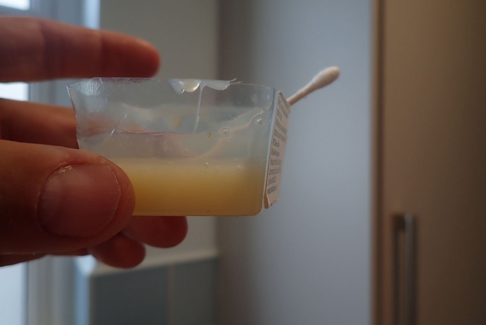
I submerged the DeckPack in the bath and, pushed underwater (ie: under some pressure) air bubbles slowly leaked out via the zip head. But Anfibio tell me:
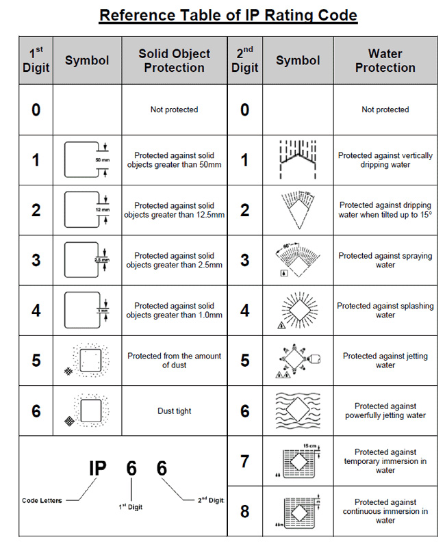
Please note, the zipper is one-way air penetrable, that means it will release air to the outside under some pressure along the zip, not only the head, but it remains watertight. It is actually rated IPX7. Under any circumstances, it can withstand submersion.
Without pressure, there may be no leakage and so the DeckPack doubles as a secondary buoyancy aid – always reassuring on single-chamber packrafts.
Once I realised it would work well on the IK, I ended up liking the Anfibio DeckPack a bit more than I expected, but here are a couple of suggestions: • Drop the price and make the straps (right) optional. Most paddlers will have their own mounting means or ideas. I use four reusable zip ties.
• A curved, meshed exterior zip pocket would be really handy for knick-knacks or having a GPS in a readable position. Or, run a line of daily-chains alongside the main zip, so you can DIY a mesh pocket to the outside without interfering with the main zip or bodging as I have done (left). It would make the DeckPack even more versatile and save over-working the waterproof zip to access stuff while on the water.
MYO Seatback Mesh Pouch As mentioned above, zipped mesh pouches on exterior surfaces are dead handy. You can put stuff in them, they drain or dry fast and they enable handy access without digging into a main bag. It’s one of the things I like on my Ortlieb Travel Zip.
On eBay I found 9″ x 7″ zip mesh pouches for makeup at about 3 quid each and quite well made. I zip-tied one around the side hem to the buckles on the back of my packraft’s foam backrest (above and below). It’s a handy place to stash the inflation bag, some cord, snaplinks, zip ties and the top-up adapter for my K-Pump. I even fitted one to my Anfibio DeckPack.
Packboat is my made-up word for easily portable boats that roll into a bag but deploy in minutes, in contrast with hardshell kayaks or canoes in aluminum, plastic, or composite. I’m here to suggest that if lugging a cumbersome hardshell on your overland rig isn’t for you, then a packboat weighing from 2 to 40 pounds and never bigger than a backpack might well be, while adding another great way to explore the outdoors…
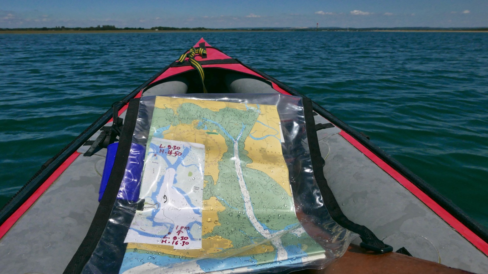
Time to knock out a long-planned circumnavigation of Hayling Island near Portsmouth while this amazing summer lasts! P-Day came along and by chance, the weather and tides lined up: high 20s °C with a 3-m neap and a calm morning before a 10mph onshore afternoon breeze.
I’d ridden down and recce’d the harbour entrances a couple of years back and last year we’d tried to reach the harbour along the canal from Chichester, but that plan didn’t work out. You’ll find lots of useful descriptions online, but it pays to recall (as I learned on a run to Brighton) that on the English southeast coast the tide (which floods eastwards and ebbs to the west) turns eastwards from two hours before high water to four hours after. So while the water is still dropping the current reverses. The Brighton post explains it (and I’ve since found an interesting animatable graphic here) and it may also explain why we passed deserted beaches and got to turn north into Chichester harbour entrance surprisingly quickly, even if it was near calm. Occasionally a rogue wake rippled in from a distant freighter out in the English Channel.
It was soon clear that my estimation to cover this 22km lap was way too long. Shooting along the channels visible on the map above, mudbanks to left and right limited side exploration and we ended up under Hayling bridge (KM13.5) in just 2½ hours including lunch and a few drifts.
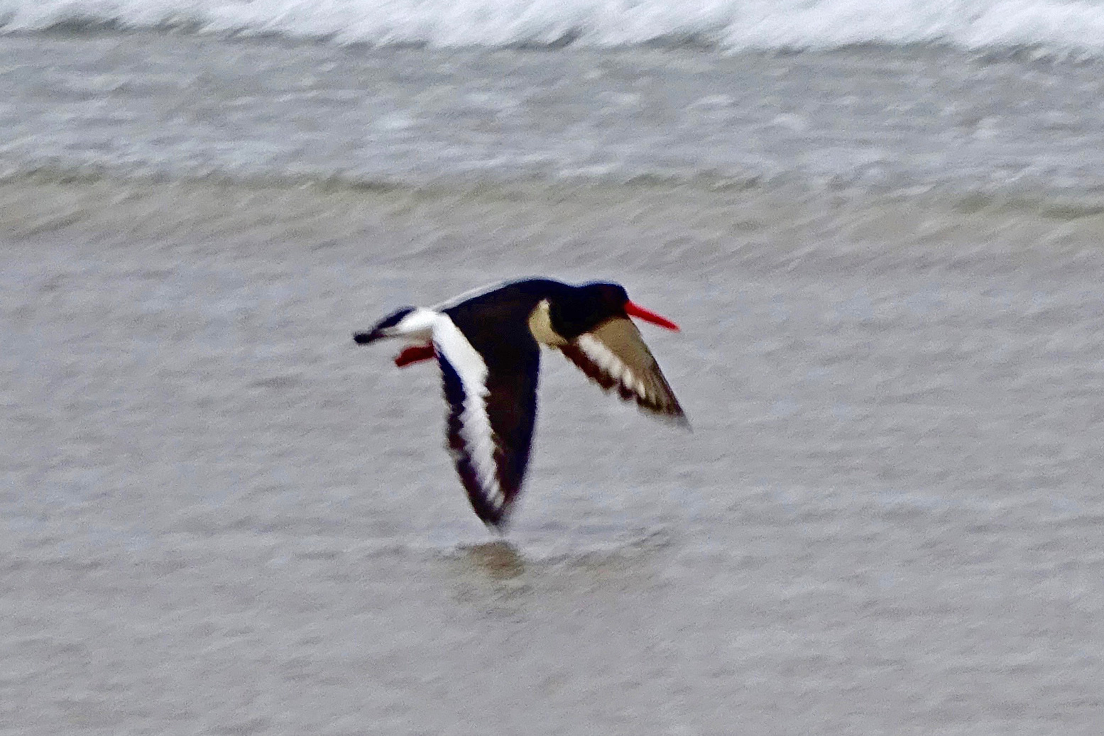
On the way we passed a lot of moss-covered sailing boats, lots of birds including oyster catchers (didn’t know you get them down south) and up nearer Northney marina, a brace of SoTs and a young couple struggling to control an under-inflated (or leaking) Sevy K2. Our high-pressure Seawave glided smugly by.
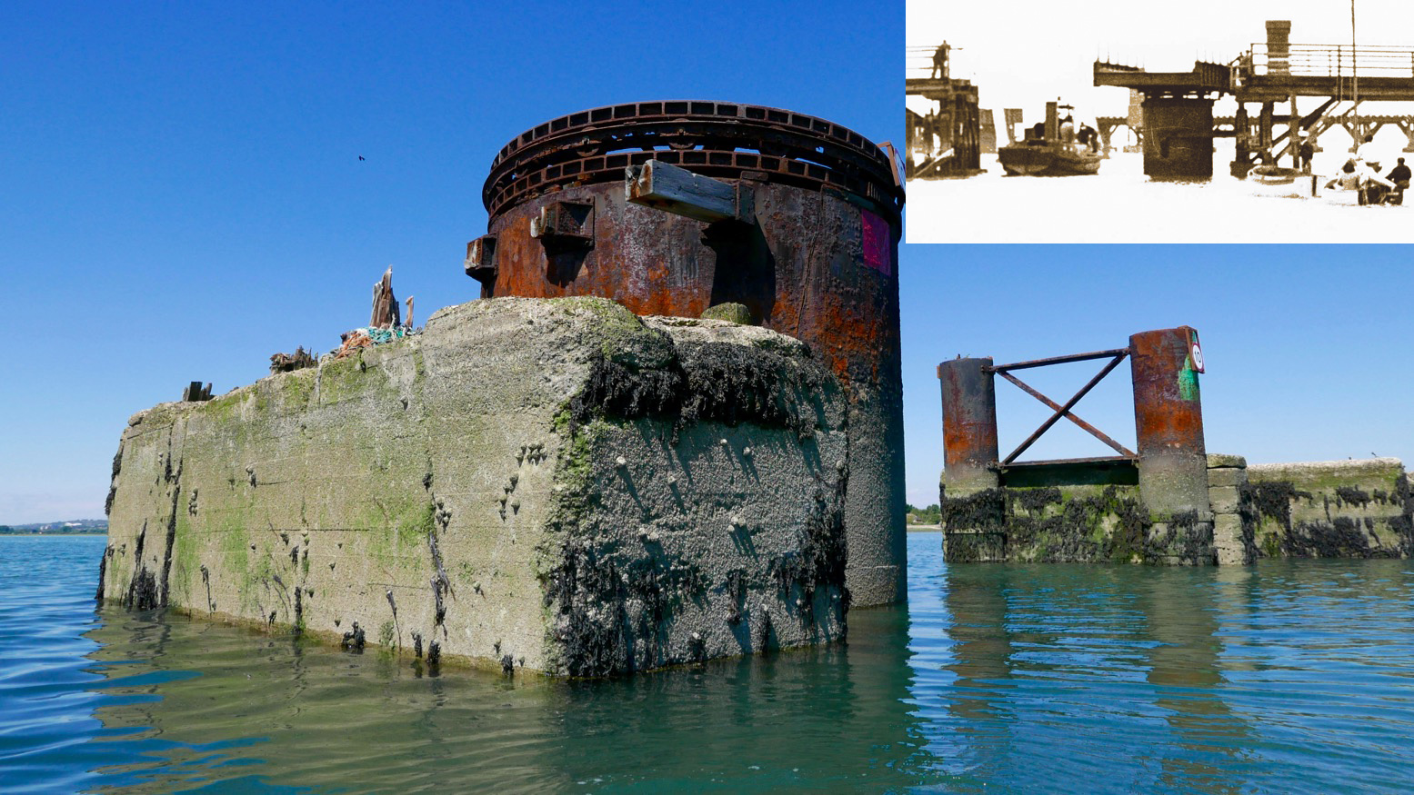
With less than half the tide in, there was already plenty of water to pass under the road bridge and between the stumps of the old railway span alongside. A huge rusting drum suggested a swing bridge to allow boats to pass; online later, sure enough, that’s what it was (left, see inset); a railway running from 1865 for just short of a century. When we drove off the island at about HW, it was the drum was only thing above water. Chichester harbour is packed with parked-up sailboats (‘moored’ some might say), but Langstone is virtually empty, possibly because i’s shallower and with a much narrower entrance. These natural harbours formed after the last Ice Age and take about seven hours to fill, but drain in only five. And because they drain right down to unfathomable mudflats on which even a gannet in snowshoes can barely walk, exploring side creeks can only be done with the high water clock ticking.
To aim for Langstone exit channel from the bridge, head for two tall poles visible to the SSW. By now the wind was in our faces giving a greater impression of speed, but the tide was coming in for another two hours (or do I add/subtract two hours? My brain hurts). We were way too early to catch a roiling ride out the 250-metre wide Langstone channel back into the Solent. We’d have to hack our way out along the side, like a Maori war party.
Long before we got there we could hear the intimidating wail of jet-skis haring up and down the channel. They have such a bad rep and the two-stroke din doesn’t help endear them. If they sounded like Ducatis or Bonnevilles we’d be queuing up for a go! We passed the famous Langstone Pumpkin (above; a lost novel by Wilkie Collins), and soon after, hopping out to wade against the tide over the shallow Sinah Bank saw me sink into the vile black quicksludge which Collins used for the demise of his fickle heroine.
Nearing the channel I sought to dodge the in-pouring current by passing under the gantry of the Hayling Island ferry. Then I announced ‘All hands on deck! Prepare for ten minutes of full steam ahead’. That ended up more like twenty, because keeping close to shore was made trickier by frolicking bathers, parked-up jet skis and inflatable goofballs. To the right the tide streamed past way faster than we could’ve paddled, but along the sides we managed to inch forward at a stroll’s pace; a yacht motoring out mid-channel was no faster. I kept eyeing up points where the current might splay out, but it was getting on for a mile out over the East Winner sandbank before the effort eased, the seas slapped us about a bit and we were out in the Solent for a choppy paddle back to the beach (above), now packed with frolicking sunbathers, paddleboarders and inflatable goofballs. Quite worn out, we beached the kayak and jumped back into the warm sea to wash off the salt and sweat.
It’s fun to try new stuff and paddle on a sunny day, but overall I’d say around Hayling was a bit boring compared to a sunny day in the Northwest Highlands. Who wants to pass Funland and beach houses, mudflats, marinas and more mudflats? Reminds me of Darwin harbour but without the crocs and mangroves. I suspect west of here, the Southwest coast has more promise. I still think the morning start anticlockwise from West Town is a good idea: knock out that exposed seafront stage before an afternoon breeze (and the concomitant rise in bathers, borders and hydrofoil kiteboarders hitting the sound barrier). But I’d aim to leave West Town 3–4 hours after LW. The unintuitive tide may be turning but once in the Chichester Harbour it gets you up and around to the Langstone exit channel around HW for a short paddle along the seafront back to West Town. There’s probably a formula for doing it clockwise from Eastoke and running the flood tide through the Langstone channel, but I’ll let you work that out.
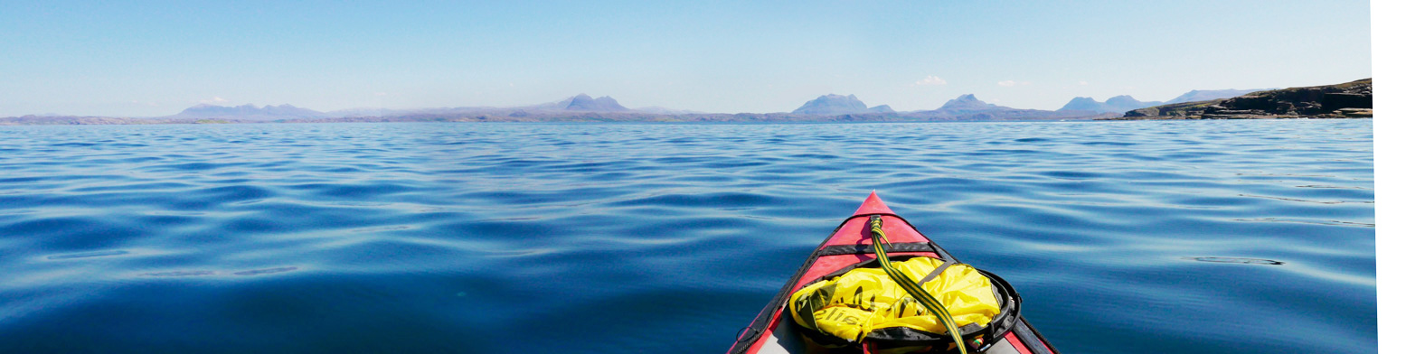
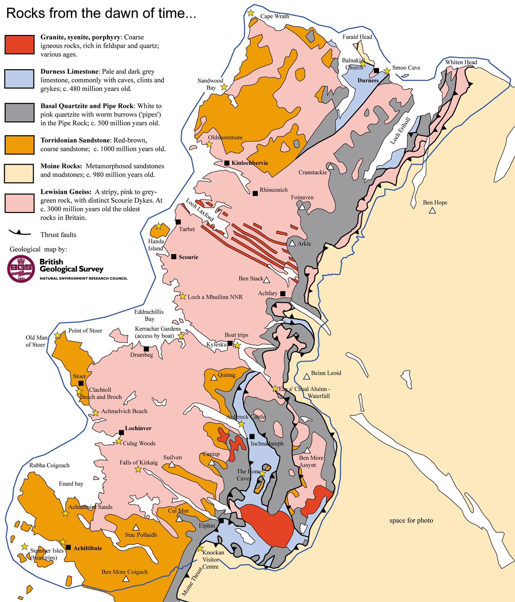
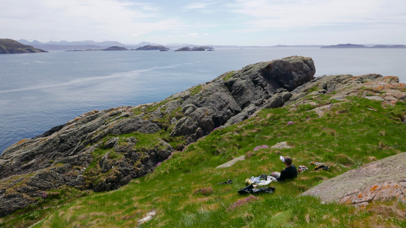
We decided to lap the tip (left) of the Coigach peninsula. Doing it clockwise put us in the lee of the afternoon’s southwesterly once in Enard Bay and better still, we’d catch high tide at Achnahaird, enabling us to paddle up the creek to complete a near full loop back to the car via the freshwater lochs of Ra and Vatachan.
I remember being quite nervous the first time I did this way back in 2013 in my Amigo – in the other direction from Achnahaird. Looks like I’m not the only one – I blame the Pesda guidebook. It felt like a long old slog west then north between the Ristol islands – the tidal Ristol channel was dry. But by the time we’d passed the reefs of Reiff and reached the sparkling beach at Camas Ghlais (below) we were already more than halfway round.
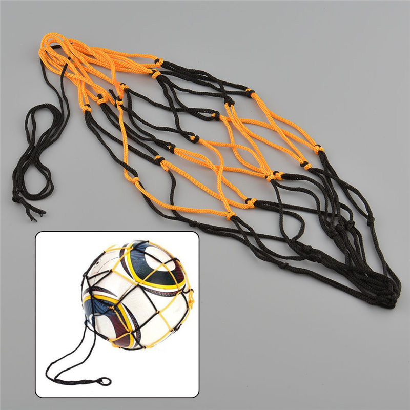
Sitting on the beach, on warm days like this and always looking to refine my set-up to a razorbill’s edge, I sometimes think a sturdy football-sized net bag to take a beach stone would be handy to anchor the boat out in the shallows. This way it won’t beach itself, get hot and purge air which can make the kayak soggy once back in the cool water. It’s one slight drawback of running PRVs on all 3 air chambers. I could probably find some washed up net up among the flotsam and make one. Or I could Buy [a ball bag] Now on ebay for a £1.62. Leaving the sandy bay, I give the Seawave a quick top-up with the K-Pump anyway.
On the north side on the bay we nosed towards a slot cave, but white streaks running down from the ledges suggested nesting birds had hung out ‘Do Not Disturb’ signs. Either I’ve never noticed them before or there are lots more nesting birds around this year. It’s the end of May but there are still tiny snow patches on An Teallach and Beinn Dearg – maybe the season is late.
North of Camas the unrestrained swell was bouncing back off the low cliffs and small dazzling waves were breaking over semi-submerged rocks, making for a rough ride. But it’s all relative and showed what a sheltered life I lead, paddling mostly in and out of the protected Summer Isles.
We passed on sandless Faochag Bay and on turning the point of Rubha Coigach all was calm as the grand panorama of the Assynt peaks came into view (above). From the right: Quinaig; Canisp behind Suilven, Cul Mor, Stac Polly in front of Cul Beag, and the group around Ben Mor Coigach. It’s one good reason to do the paddle in this direction. There’s a bigger version of the Assynt panorama here taken on the road above Achnahaird. I really must work out how to do that panorama photo-stitch thing.
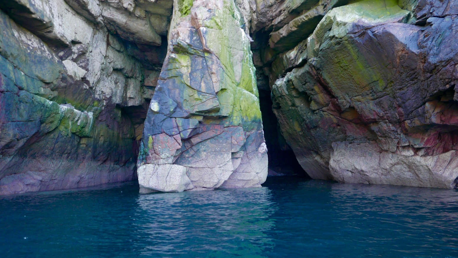
Coming down the Enard Bay side, we tried to explore some other caves with green moss streaked with guano, but got dive-bombed by angry shags.
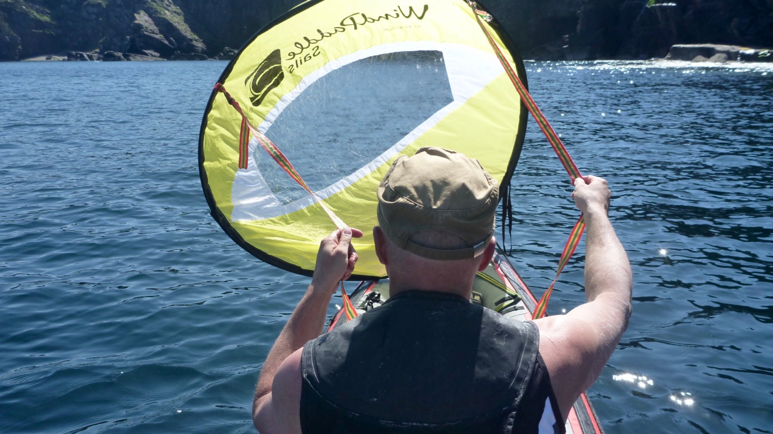
Back out in the bay an unpredicted northwesterly picked up – time to launch that WindPaddle which has been sitting in my kit bag unused for a year or more. Initially, the breeze barely reaches 6mph – we could have paddled faster – but it sure was fun to kick back, look around and let the boat waft quietly along, free from the splish-splosh, splish-splosh rhythm. I wonder if self-driving cars will be the same.
It’s been a while since I’ve done this but the WindPaddle definitely felt better than my homemade efforts from years ago, as well as the knock-off WP I bought a year or two back. I tried a V-sail too but have never really got the hang of kayak sailing. It seems the sweet spot is hard to find: either the wind comes and goes and the sail flops, or it blowing so hard the sail can’t handle it and you’re clinging on. Still, I look forward to giving the WP a spin in slightly windier conditions. For the compact size and light weight I get the feeling it may be worth keeping.
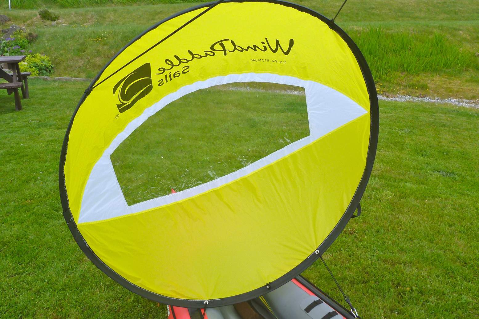
The breeze picked up and we chugged along at a brisk stroll. But even then the WindPaddle feels satisfying to use. I think the key is the sprung tension of the composite batten (rim); it retains the circular shape of the bowl which means it’ll stay up as the wind drops and keep shape as it rises, then can be confidently scrunched down to a packable size without breaking. Doing that during a bit of a blow may be tricky, but it can easily be pulled back and tucked down unfurled over the legs (right). It’s only a downwindish sail but as with previous disc sails, I like the way you can steer intuitively by pulling one line back; a skeg must help but there’s no need for paddle-rudder assistance.
It was nice to look around in the quiet but I also missed that thrill of thrust when a sail catches and holds a good passing gust. Eventually we could stand the relaxed pace no more and the geef paddle-assisted us towards a stony beach at the mouth of the Allt Loch Ra creek. Squawking oystercatchers were guarding their nests. Left, by the bothy at Badentarbet last year; don’t stand on the eggs.
Refuelled, we paddled upstream for a bit then I tow-waded the boat, reminding me of the shallows of Shark Bay in 2006 – a good way to rest after what felt like days of headwinds. The short wade brought us to within a couple of minutes’ portage of Loch Ra just over the road. Now on fresh water, we dragged through the reeds before another short portage over into the adjacent Loch Vatachan. Picking a passing place close to the shore, the geef walked off to get the car while I rinsed off the seawater – another good reason to paddle this loop clockwise. It’s 15 miles and about 5 easy hours to loop the Coigach loop.
Adding a rudder to the Seawave inspired me to drag out my cheapo disc sail. I last tried it three years ago on the Amigo (below) when it worked OK, even without a rudder. But of course, a rudder is much better for keeping the boat on the wind while sitting back with the paddle on your lap and your hands on the sail lines.
Pulling the sail out the 3mm fibreglass rod or ‘batten’ broke. I bought some more which, if anything, felt more pliable than the original but before I took it out it was broken in two places. Long sections of fibreglass rod in greater diameters can’t be sent bent so incur much higher postage charges which made reviving my KnockOffPaddle uneconomical. Worse still, removing the splintered rod from the sail (before I decided to ditch it) filled my hands with glass splinters for days. Nasty stuff.
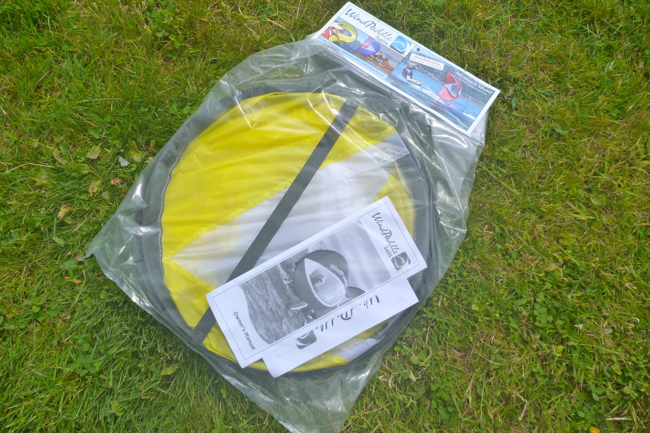
I looked again at the original WindPaddle whose prices have dropped in the UK. Their Adventure II model is up by 13cm to 119cm or 47″ in diameter, making a claimed area of 1.42m (as usual, π x r2. doesn’t add up to ‘1.42’ but never mind). It folds down to 42cm or 16 inches diameter but with squidge some more (ovalise) to tuck securely into the floor of your boat, and weighs just 400g (+30g for a control line). I asked about the cheaper Scout sail and why it’s rated at 4–15 knots when the new Adventure II is rated at 6–30kn. It’s not just the bigger area; the Adv II has a significantly stiffer composite batten to help hold its shape. That’s important and why ships don’t have rubber masts.
A problem with all sails is that they can start swinging from side to side in a recirculating frenzy before either settling down, collapsing or diving for the drink, possibly when the wind is more than they can handle. I recall with previous V and disc sails that lot of your time is spent managing that motion, rather than galloping across the waves like a flying fish, but the promise of achieving that is why I persevere. Update 2021: After having much better results with a AirSail on a packraft, I think some of this swinging could be down to clipping the sail to slack decklines, and not directly to mounts on the boat’s hull. I will try that next time.
When the £116 sail arrived, it certainly had a better quality feel than my smaller knock-off which went for under £20 on eBay and are now under a tenner. The sail fabric feels thicker and the crucual perimeter batten isn’t a regular GRP rod-like in a tent, but a flat flexible composite band about 8mm by 1mm. It takes significantly more effort to fold the Adventure II three times into its 16-inch hoop, but that should result in a more stable sail in action. Sea trials here.
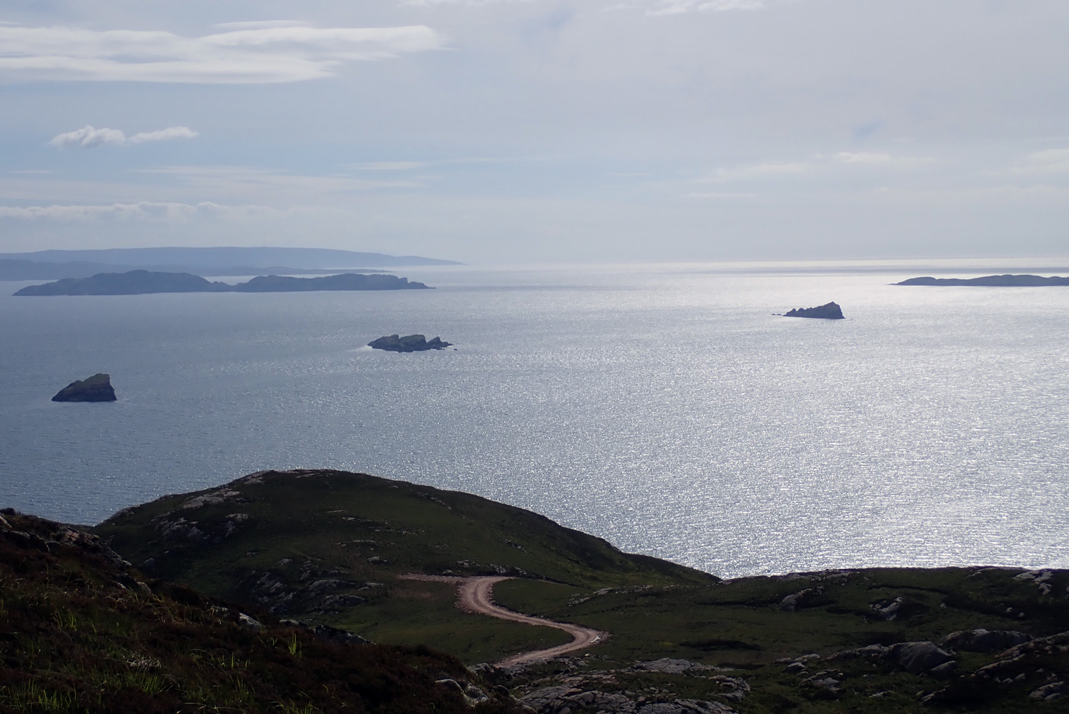
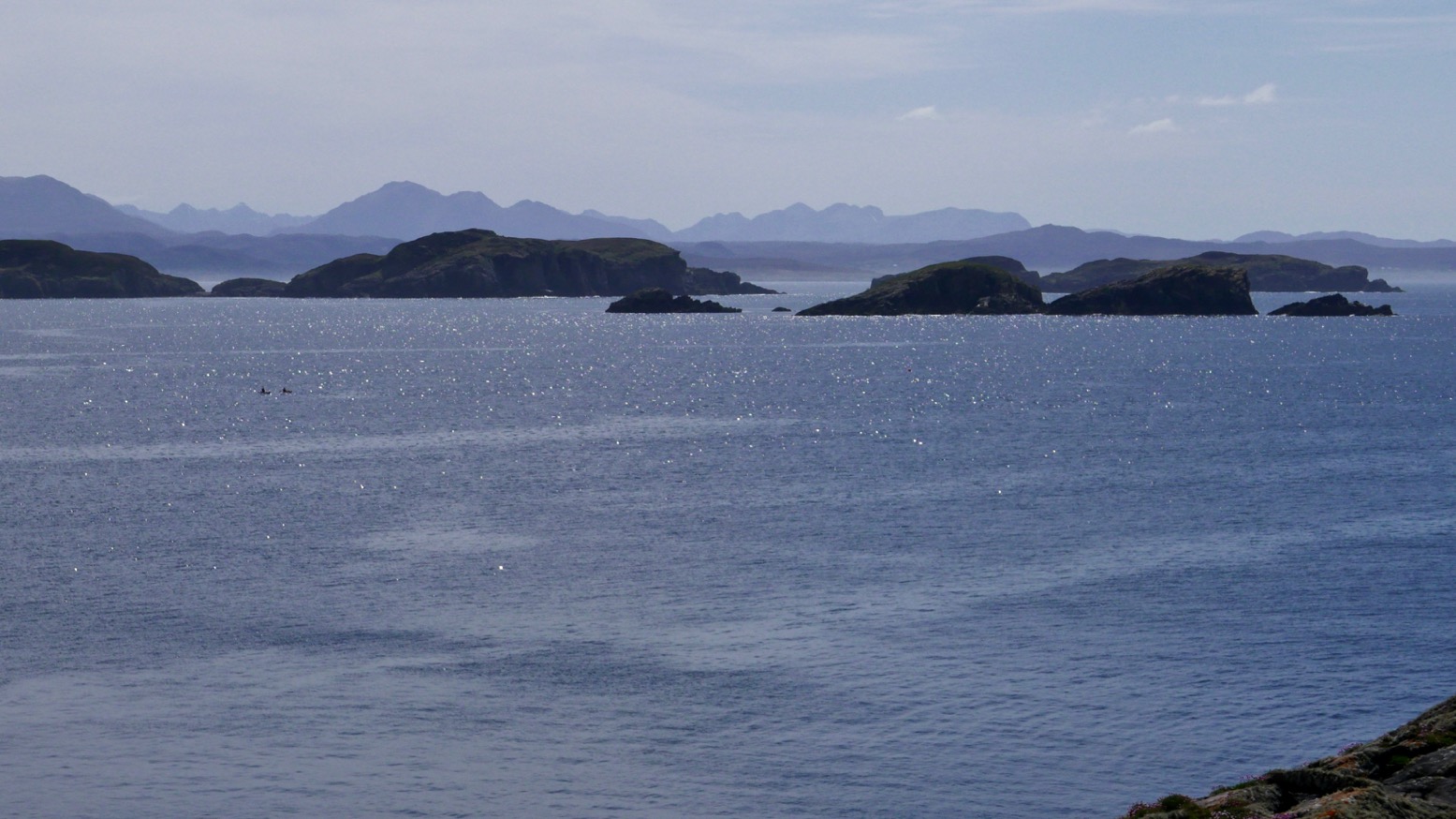
But I knew before I got on the water the tide was not with me and nor was the wind. Hauling myself through the Tanera channel, by the time the cheese-wedge profile of Angus came into view to the southwest it looked a long way away, with only Glas-leac Beag (on the right, below) between it and the inky depths of the Minch.
I paddled out into the Summers the other afternoon to see how far I’d get. What I was really eyeing up was Stac Mhic Aonghais or ‘Precipitous rocky feature of Angus’, one of three skerries bobbing just south of the Tanera islands. I only really clocked it on last year’s crossing from Carn nan Sgeir to Tanera Beg. I suppose now I’ve visited just about all the Summer Islands I’m looking more closely at the bits in between.
So I swung east around the south side of Tanera Mor and, now with the wind and tide behind me, at the last minute decided to make a ‘training dash’ towards ‘Goat Sound’ (left) – the tidal passage between Horse and ‘Goat’ island which I guessed was flooded by now. From there it was a weary hack back against the squalls to the beach and an XL dinner.
A few days later I persuaded visiting paddlechum Jon that a tour of the Summer Isles Skerries was good use of his holiday up here. He’d just returned from a gruelling, two-day bike ride through the Assynt – part of the HT550 – so his arms were in need of some exercise.
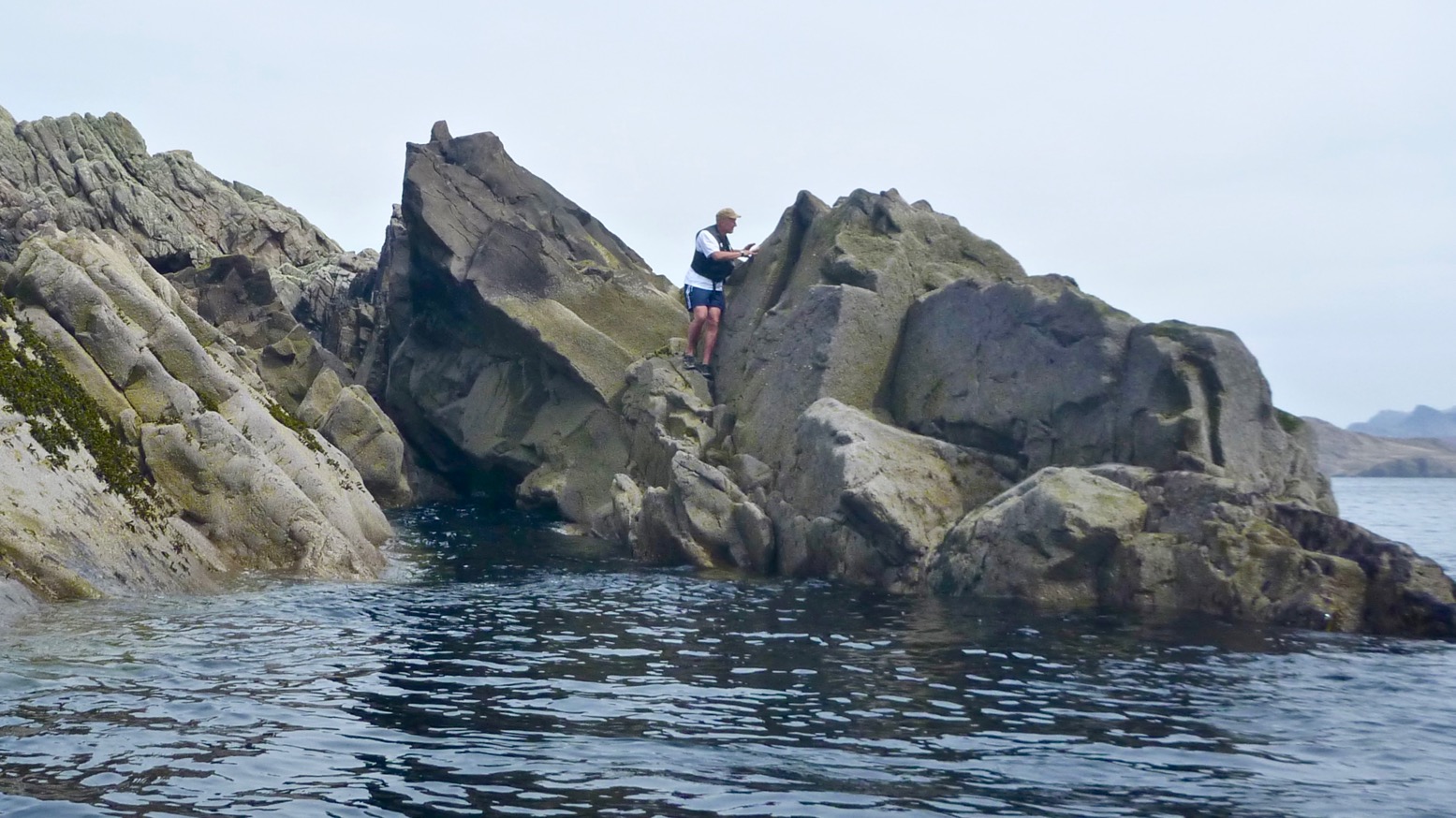
As skerries go, the supposedly 78-foot-high (26-m) Stac of Angus (see below) has a dramatic profile. From some angles a homesick Norseman pining for his mead might even call it a dragon’s tooth. It also looked fairly easy to climb to the top to get a nice shot of a kayak below.
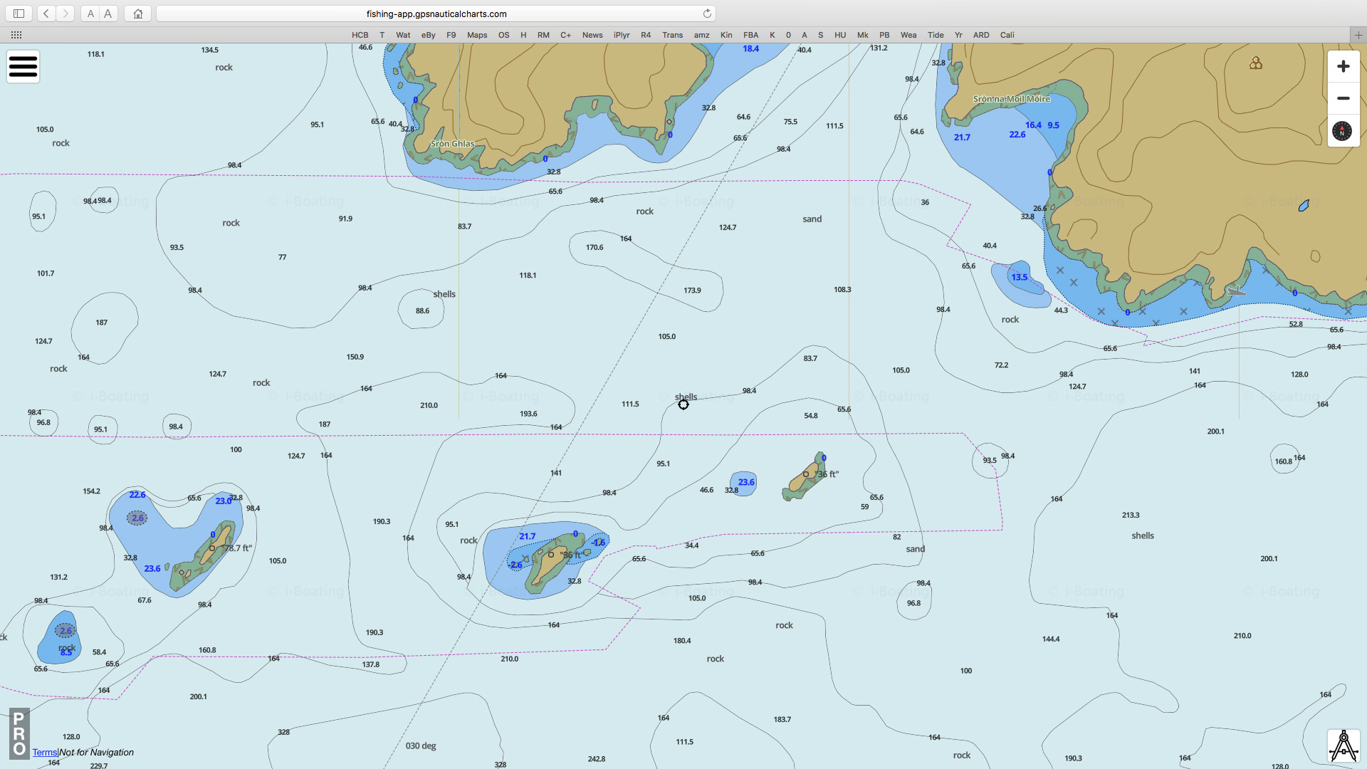
Stac Mhic Aonghais, Sgeir an Aon Iomairt and Sgeir Ribhinn or Revan. All three line up with about a kilometre between each; long thin skerries aligned on a SW/NE axis, as is much of the lower elevation topography up here; valleys and trenches carved I assume, by glaciers advancing from Scandinavia. This report suggests that 12,000 years ago during an anomalous cold spike following the end of the last Ice Age ‘…climatic factors, combined with the availability of large quantities of subglacial debris, led to the development of distinctive glacial landsystems, which may have no direct modern analogue.’ As we know, the dramatic Assynt has no topographic analogue elsewhere in Scotland and the angular claw of Stac of Angus is one of its many remnants. (Btw, that marine chart screenshot above left is from a very handy and editable online nautical ‘mapp’).
Planning paddles up here is of course a lottery but came the day, by some miracle a High had parked itself over the northern British Isles, put on the handbrake and tipped the seat back. The 4.5-m tide may have been at the peak of its fortnightly cycle, bottoming out at 2.30pm, but that could be handy if we used it right. If we left Stac around low tide, it should be an easy ride back up to Old Dornie, assisted by the rising afternoon breeze. We paddled down between the Taneras with the tide, passing some other kayakers on the way. I mentioned the Tanera Beg arch just round the corner to them, but after a quick check the tide was too far gone to thread the arch.
In little more than an hour we were approaching the gnarly, storm-wracked northern prow of Angus. It’s hard to think how the 1:25,000 OS map arrives at the oft-repeated height of 26m. The picture below of Angus’ high point is about 90 minutes before a low spring tide at around 0.5m above Ordnance Datum – which is the lowest astronomical tide – ‘LAT’ – at Newlyn. So even if you add about 2m or 6 feet to measure the skerry at LAT, or just use the more likely MSL, there’s no way that adds up nearly 80 feet; it’s more like half that. It’s odd because the two other skerries we were heading for had entirely plausible heights.
Anyway, we paddled along the exposed west side looking for a landing spot but found nothing but 45-degree slopes. I was sort of hoping that low tide might reveal a platform or at least give us more rock surface to choose from, but very low tide also exposes seaweed, kelp and other crap; there’s probably as much chance of getting alongside a handy ledge at higher tides.
As we passed between the two outcrops on the south end, Jon smacked me in the head with his paddle (left). Lifted through by a 1-m swell, on the inshore side we found the least unlikely looking parking slot, where between bigger swells I could crawl out (right). If you think about it, sitting as you are on the floor of a bobbling narrow boat at sea level, there’s nothing harder to get out of than a kayak, especially once you’ve attained a certain age. IKs are easier than a proper sea kayak of course, but even a canoe’s bench seat might be easier to spring or step off.
Stac Angus is nearly bisected by a punched-out breach (left) through which storm waves tumble; the higher part is in the north. Problem was getting there from the lower half of the skerry where I’d landed. Even if it wasn’t 26m above MLWS or LAT or even M&S, accessing that northern spike was a lot more of a rock-climbing challenge than I was prepared to take on. So I left it to the squawking guillemots and settled with just enough elevation to get an OK shot of Jon gliding by (below), then scrambled back down to the slot and hailed down my water taxi.
With Stac of Angus ticked off, we scooted over towards Sgeir an Aon Iomairt (in the picture above, on the right), hoping it would provide an easier landing for a civilised terrestrial lunch.
Iomairt has a similar NW-facing cliff and on its NE corner has a parking slot of sorts (right) where a kayak can wedge itself as the tide drops away below it.
The surprise here was the thick cushy duvet of soft grass and thrift flowers which capped the island. Picture left: looking south from, near the summit towards the Carns, Bottle and Priest Island. Whatever it is that makes Iomairt agreeable to lush vegetation and sea pink thrifts, while Angus makes do with lichen and bird shite, it’s found here. Perhaps because it’s less of a jutting flake and flatter, with many crevices where rainwater and sludge can gather and foment.
Who knows, but it was nice to be able to walk around, rather than teether on acute, barnacle-covered slabs, as I’d just done on Angus. We settled down out of the breeze – May temperatures are still barely in double figures up here – and unpacked our munchies. We had with less than an hour before the tide turned and lifted the Gumotex away. As we ate we spotted another couple of paddlers enjoying the calm conditions out to the southeast, near the two Carns which join up at low tides, like today. Though you’re not spoilt for choice out here in the Summer Isles, you could easily camp on Sgeir an Aon Iomairt. There’s brackish water in some pools, good enough for a wash, and enough flat patches to sleep in comfort. Hardshell or IK, for peace of mind you’d still want to lug you’re boat above the high water line unless you can find a bombproof anchorage. And the elevation of around 16m is, you’ll be pleased to know, about right. When our time came the tide had dropped a metre but was on the turn. Getting back in was as always an awkward shunt, slipping around on kelp and slimey molluscs to get the Seawave back on the water, but once in the pool it did manage to paddle itself out over the slimy kelp towards Sgeir Ribhinn (‘Maiden’s Skerry’), the last of our Summer Island skerries.
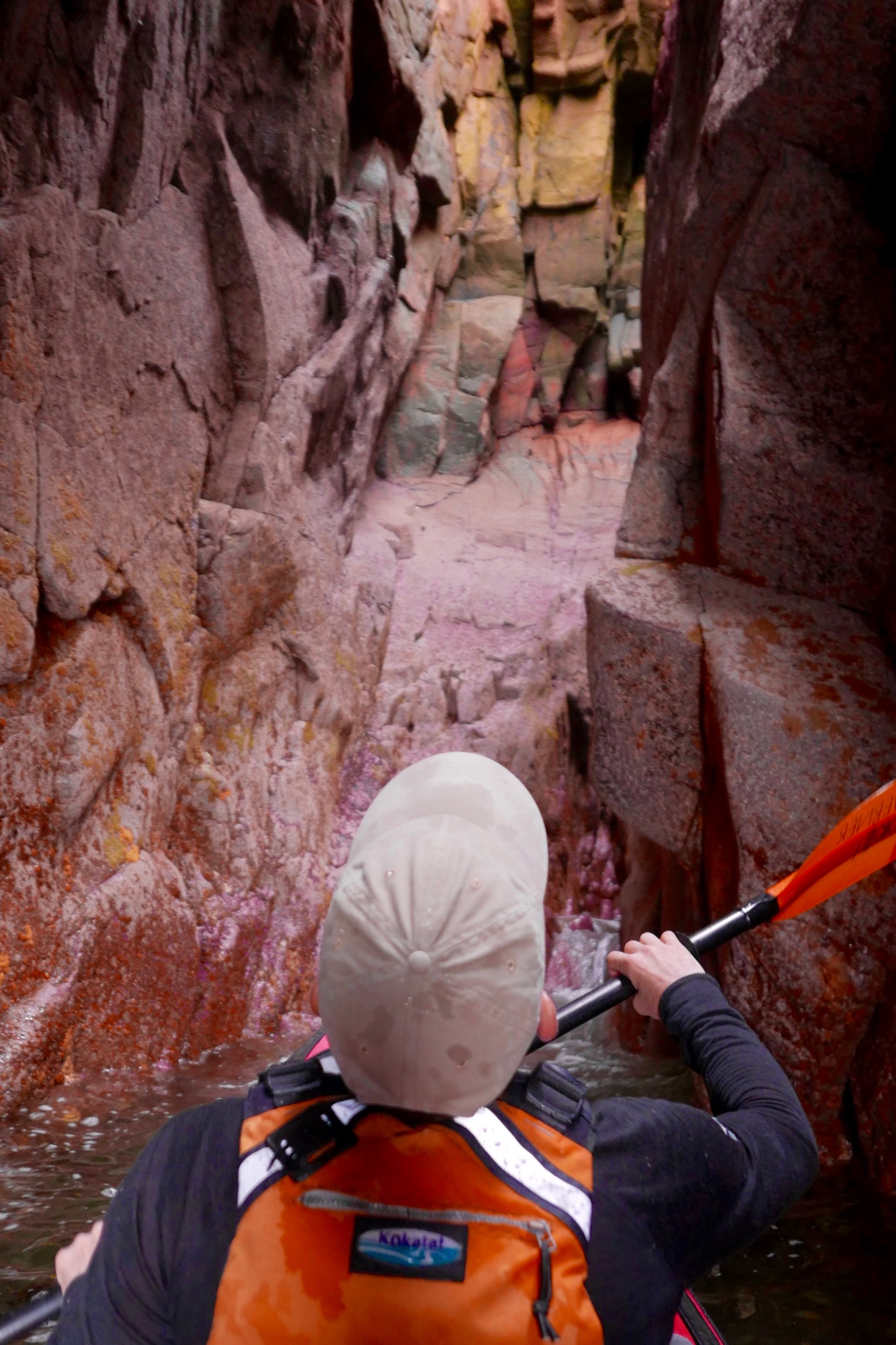
Coming round the eastern side of Ribhinn, even this skerry managed to sustain a small capping of grass. We nosed into a kayak-wide geo and found ourselves in a twin-arched cave, another paddleable arch (above) to add to my list.
All that remained was to paddle back the way we came through the western passage of ‘Tanera Sound’, between Tanera Beg and Eilean Fada Mor. With the spring tide still low, all the shell beaches were out sunning themselves. After looking for it for years, I finally recognised a cove and beach on Tanera Beg (left) where we’d spent a lovely afternoon 12 years ago with my Gumotex Sunny and ancient Safari when we first started coming to the Summers.
Back to now, I hopped off at Eilean Fada to top up the air that had purged while out of the water over lunch, and to get a shot of Jon floating over the azure Bahaman sands (below). My kayaks have got a lot better since 2006, but the Summer Islands remain the same great place they always were for a quiet paddle.


 It was only a mile from here to Handfast Point aka: Old Harry, passing several stacks, arches, caves and slots. Ever the goldfish in its bowl, I’d got distracted before looking up tide times, but judging by yesterday evening’s paddle around Brownsea Island in nearby Poole Harbour, it was a couple of hours into its southerly ebb. We arrived at Harry’s about mid-tide but with still just enough water to paddle through most of the arches as well as some narrow slots which were already running too fast to tackle against the flow (below). A bit of a tidal race swirled past the Point, but nothing dramatic.