With the exception of a few rivers … (Lugg … Severn … and the Wye), there is no confirmed Public Right of Navigation on other physically navigable, non-tidal rivers in Wales. Canoe Wales
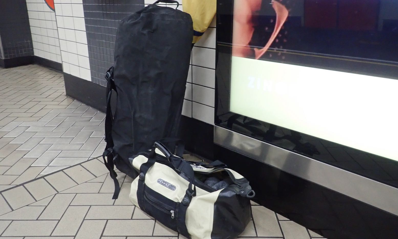
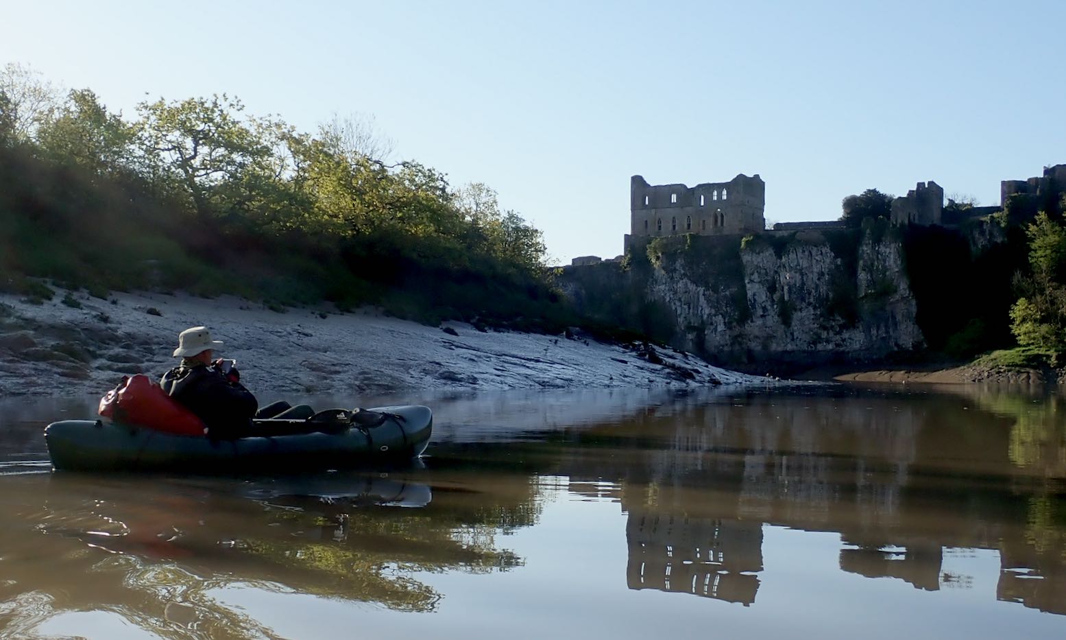
Free canoe camp below Symonds Yat marked
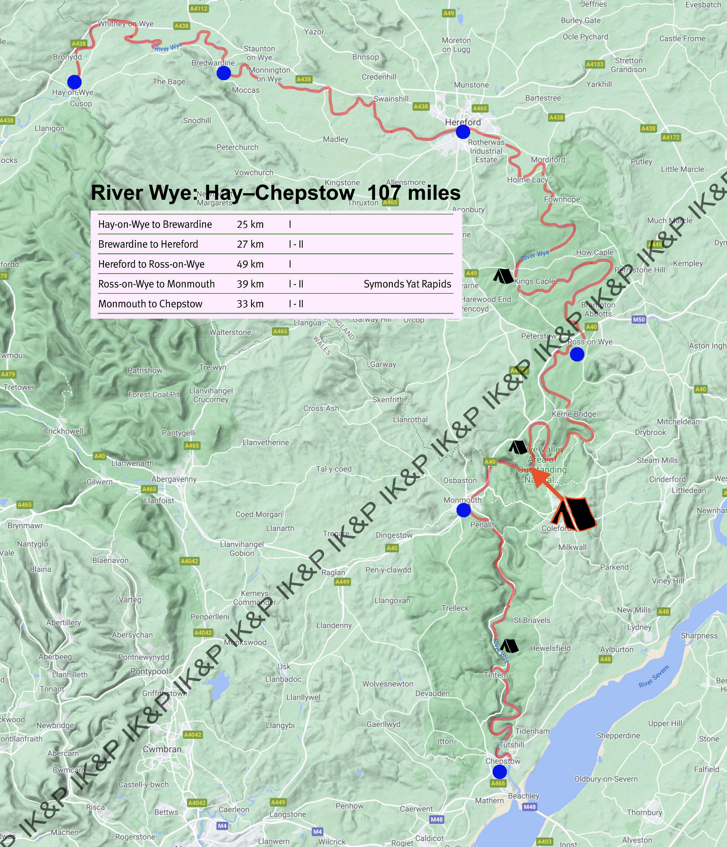
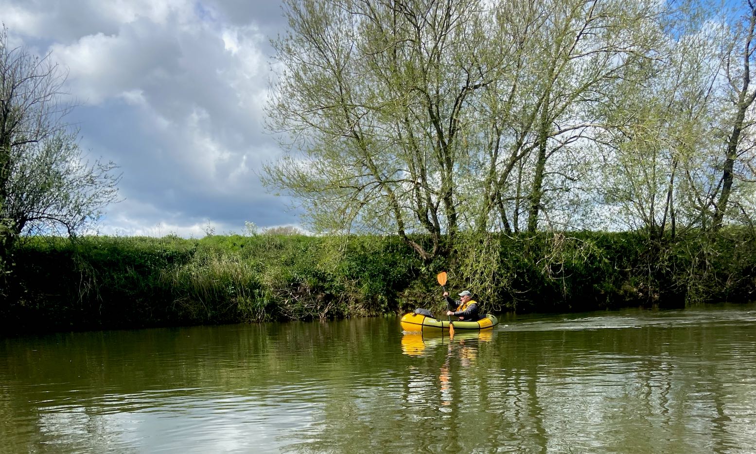
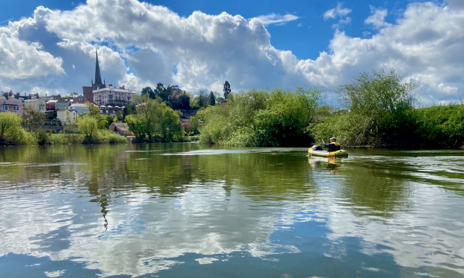
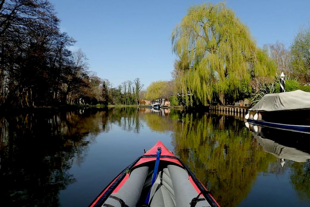
The Wye is the only river in (mostly) England where you can paddle for days and over a hundred miles, and not need to dodge a weir, portage a lock or confront a scowling angler. Even the few towns are historically intriguing. The whole valley is an Area of Outstanding Natural Beauty (‘AONB’), or ‘countryside’ as some call it. You don’t even need a BC licence: from Hay-on-Wye the river uniquely has PRN (‘public right of navigation’; like a footpath’s ‘right of way’). There is no other river like it in England so I don’t know what’s taken me so long, other than the prospect of another staycated summer makes you reappraise your own backyard.
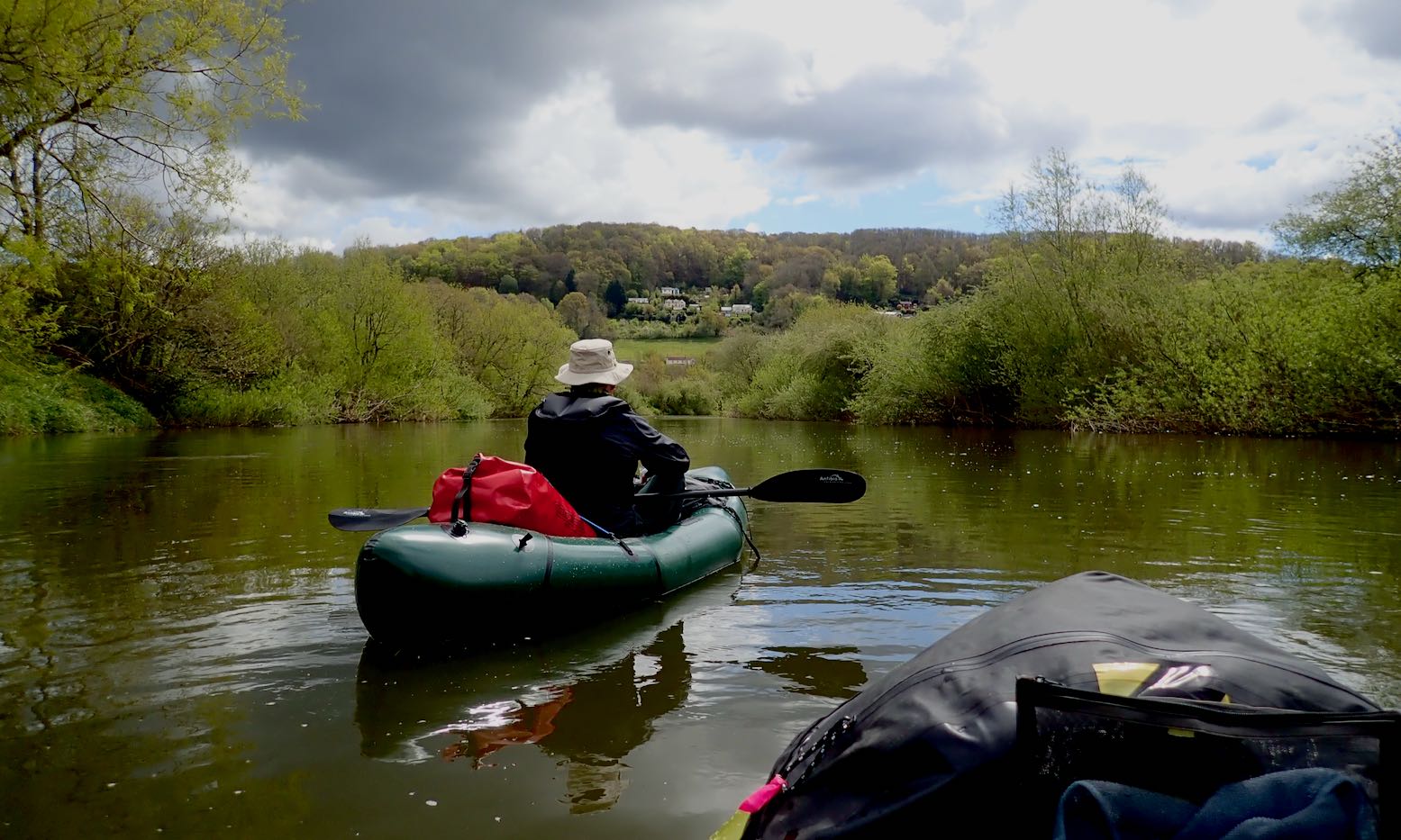
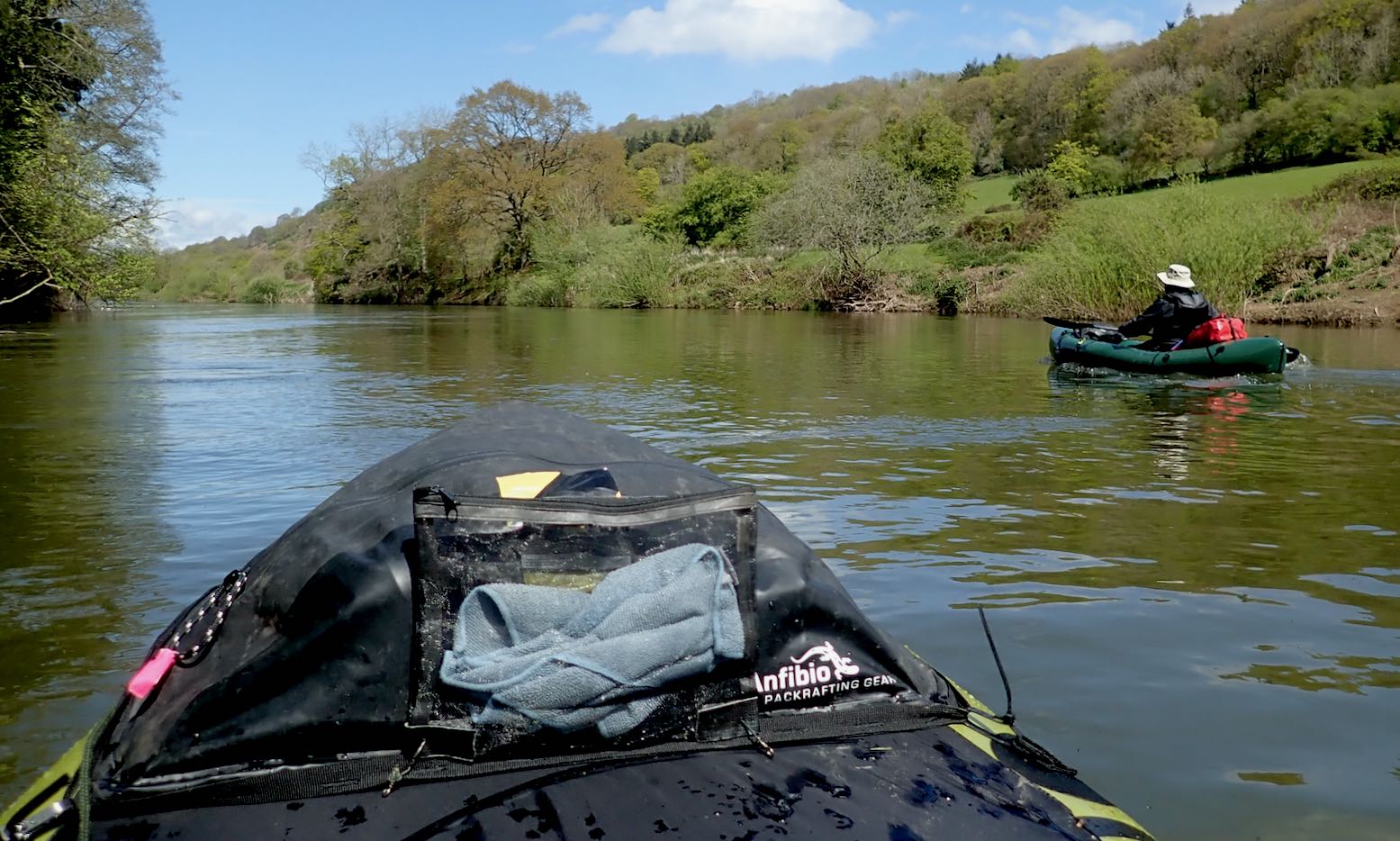
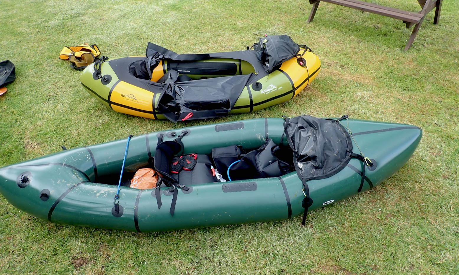
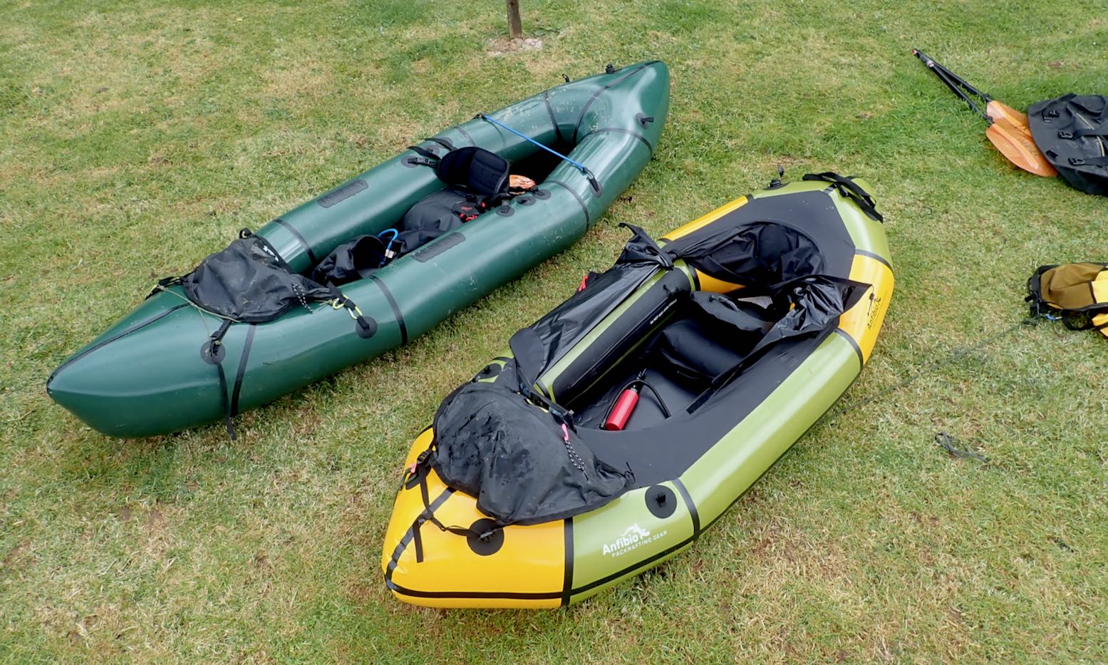
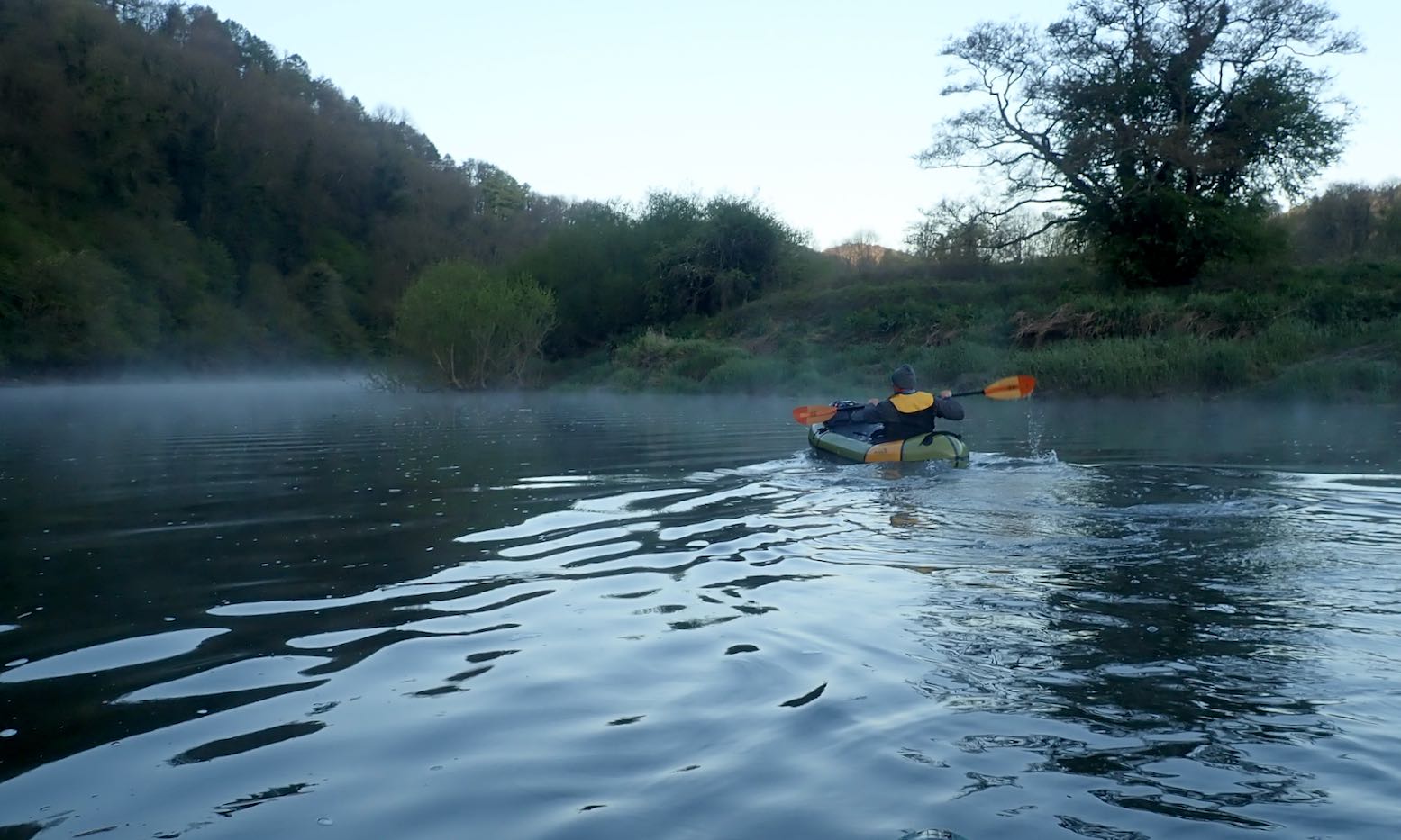
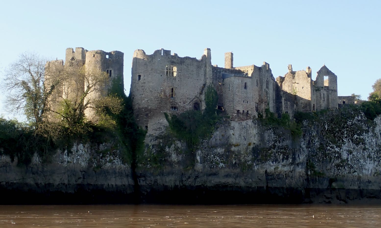
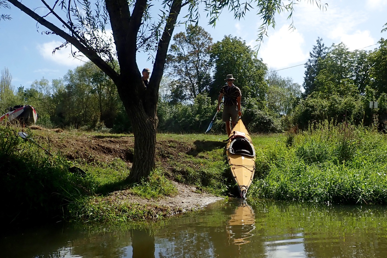
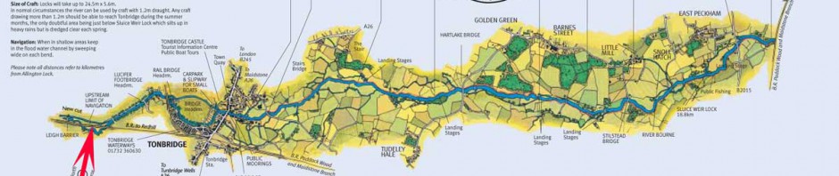
I invited myself to join Barry who lives near the river and who’d just bought himself an MRS Nomad. He’d done Hay to Hereford once and pronounced it a bit tame, so proposed Hoarwithy (Mile 51 from Hay) to the tidal finale at Chepstow (Mile 107 according to the table, left, or Mile 100 in the same sourced EA pdf guide.
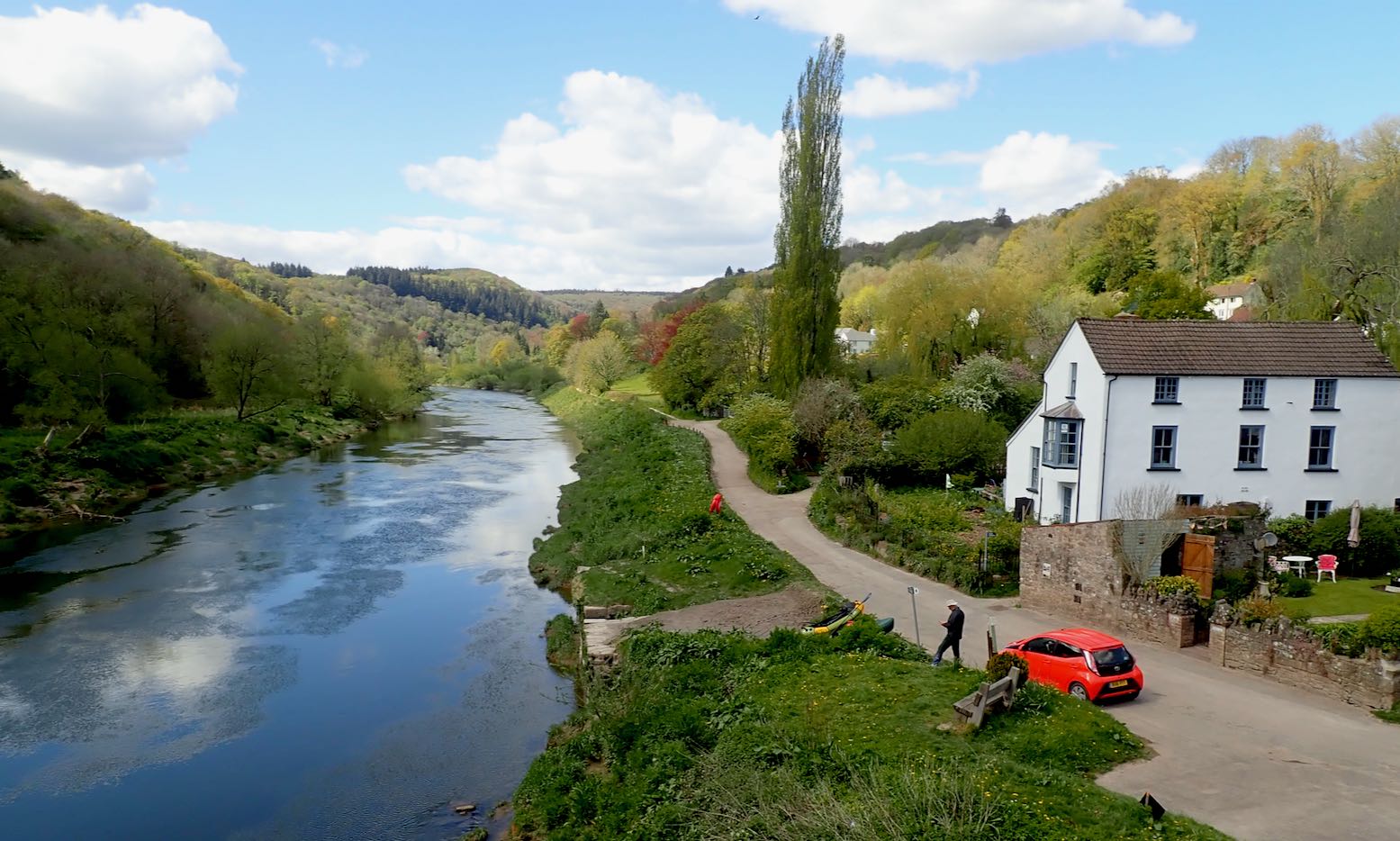
Fifty-odd miles: two long days and a bit, we estimated (wrongly). Our riverine transit had to be timed to meet HW at Brockweir, 7 miles from Chepstow’s sole jetty, otherwise we’d be stranded by tidal sludge or swept out into the Severn and end up in Tristan da Cunha.
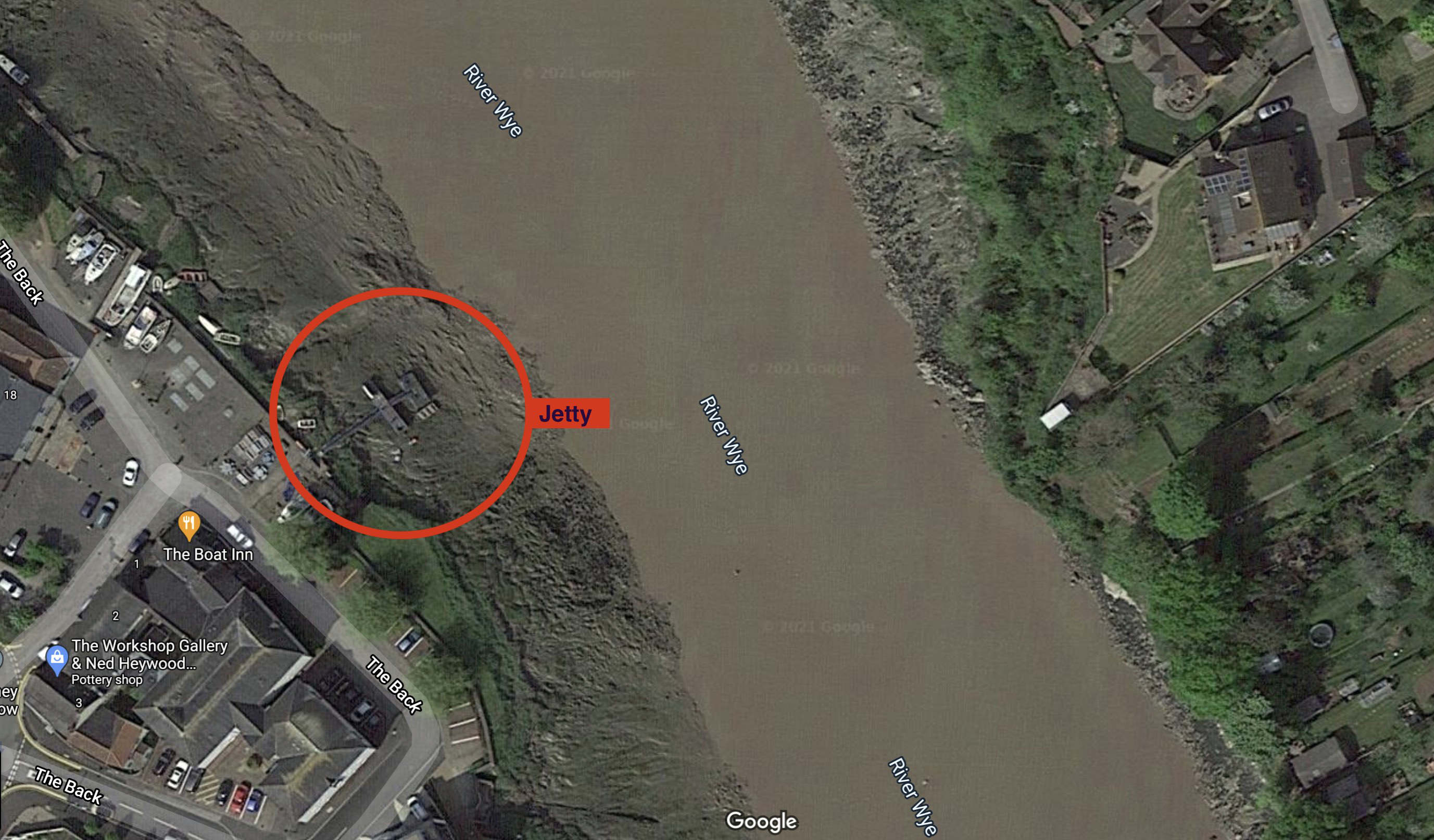
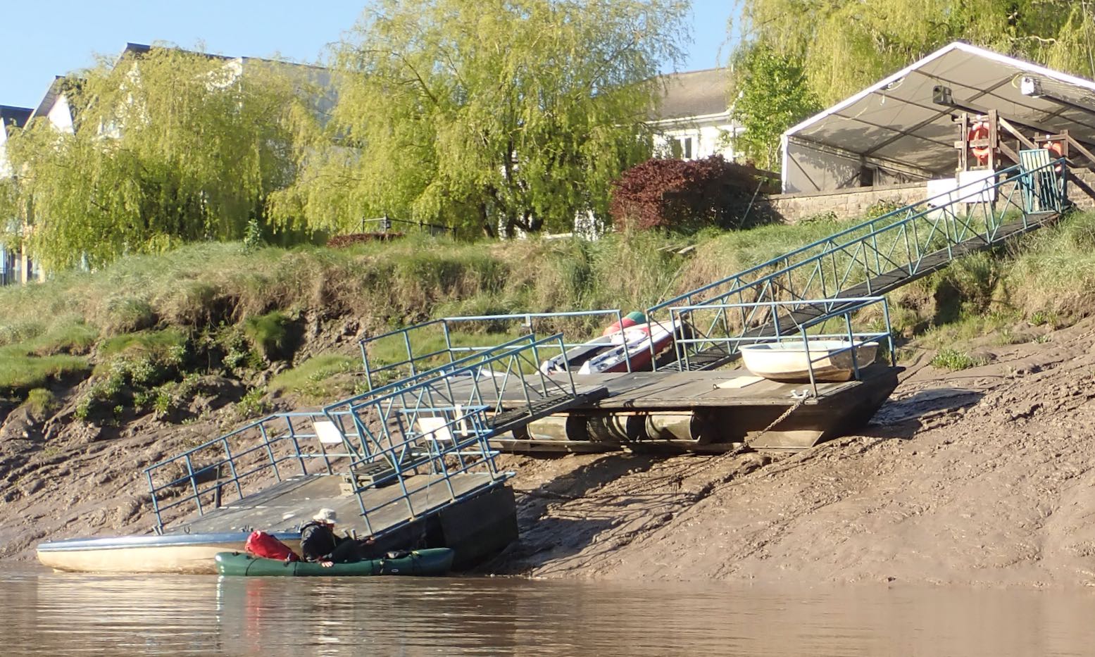
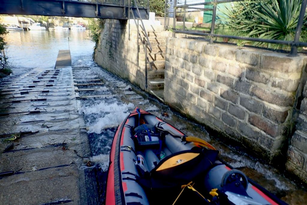
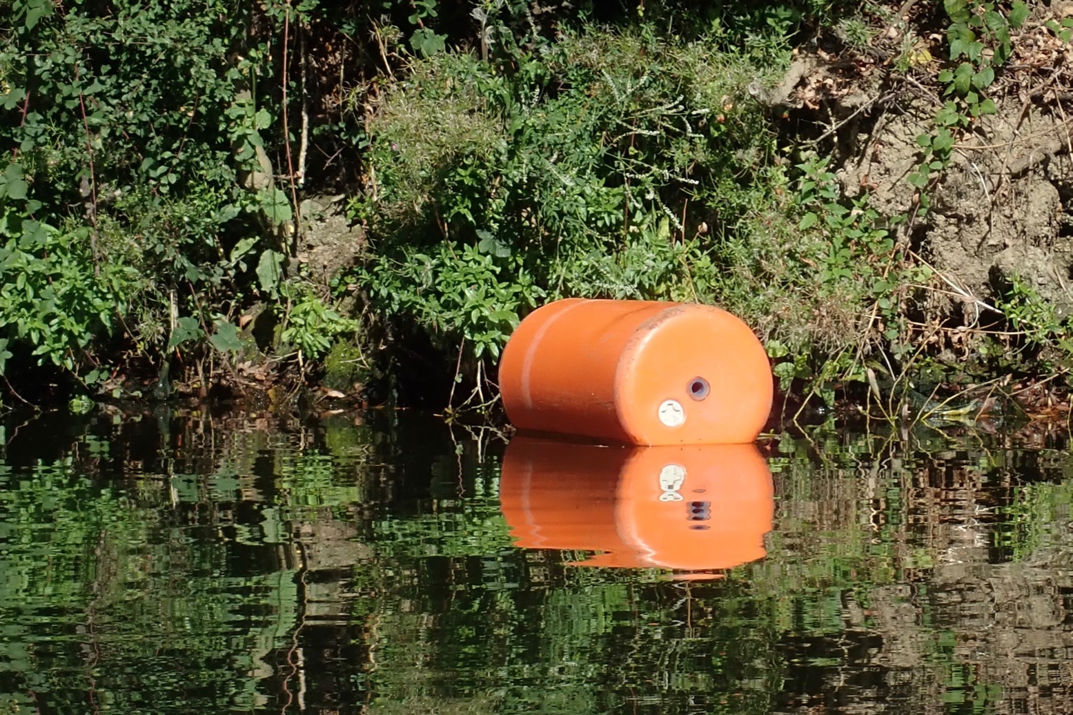
Chepstow jetty at LW; messy.
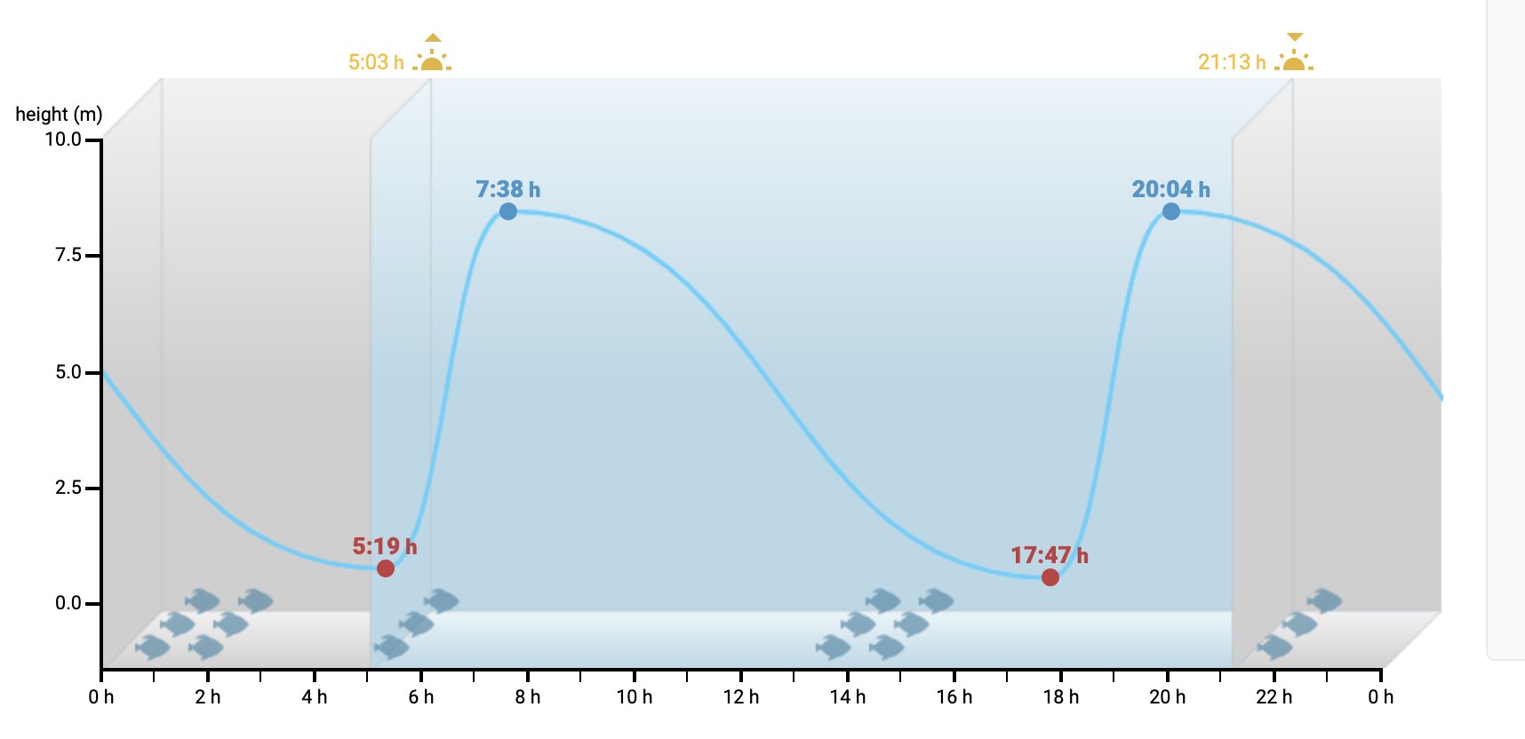
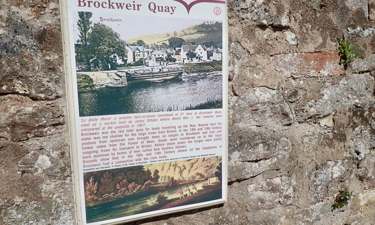
I don’t think I’ve ever seen a tidal profile like Chepstow: on a Spring tide the water can rise nearly 9 metres is less than two and a half hours, then take over ten hours to drop. This is because your Atlantic Ocean is piling into the western edge of the European land mass, including the funnel of the Severn (with Wye) estuary, creating among the highest tides on the whole darn planet. The game of ‘grab the jetty’ would make an exciting conclusion to our trip, especially as we’d have to be on the water before dawn to time it right. The guidebook warns: continue beyond Chepstow at your peril. Most canoeists dodge the tide timing game and take out at Brockweir.
Chepstow tides: holy moly!
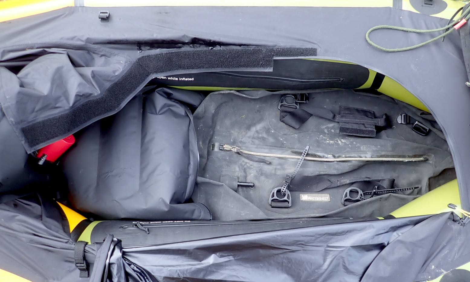
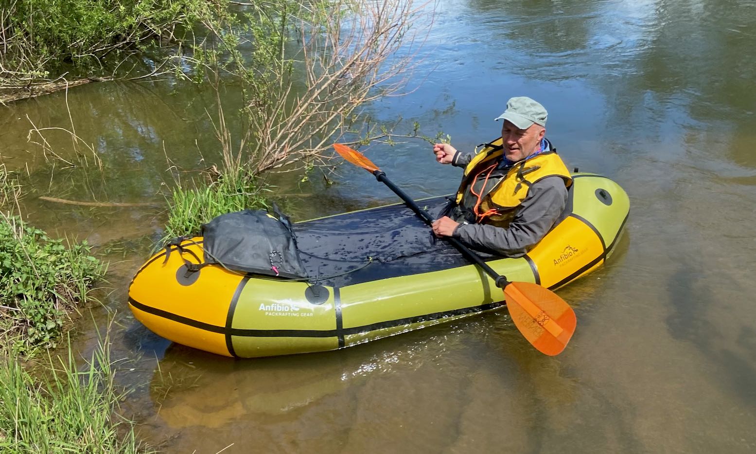
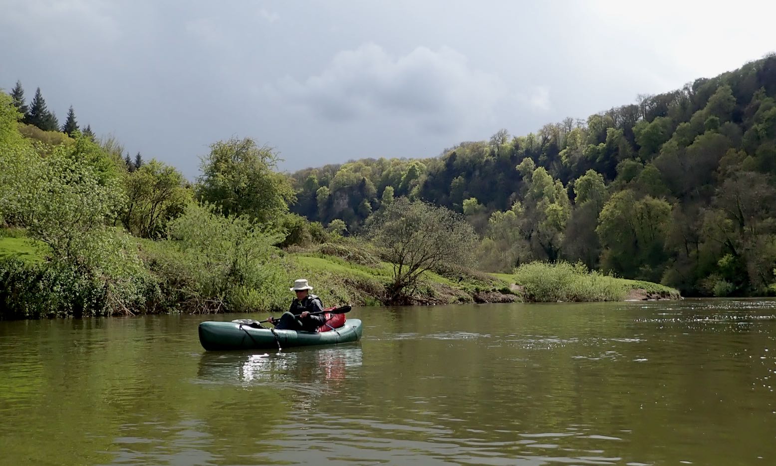
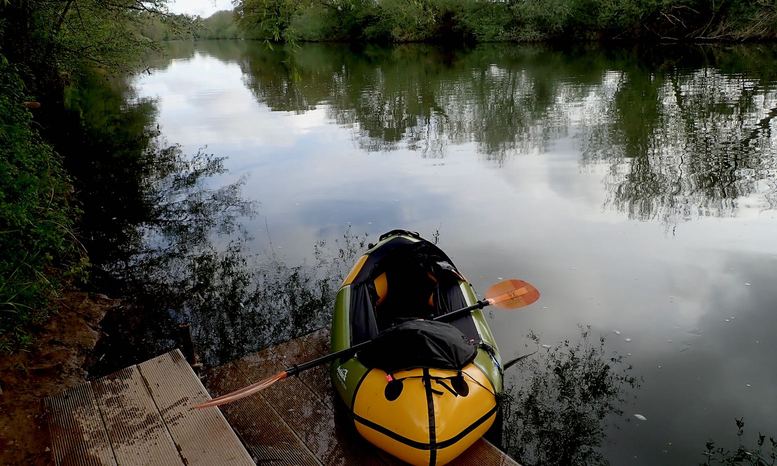
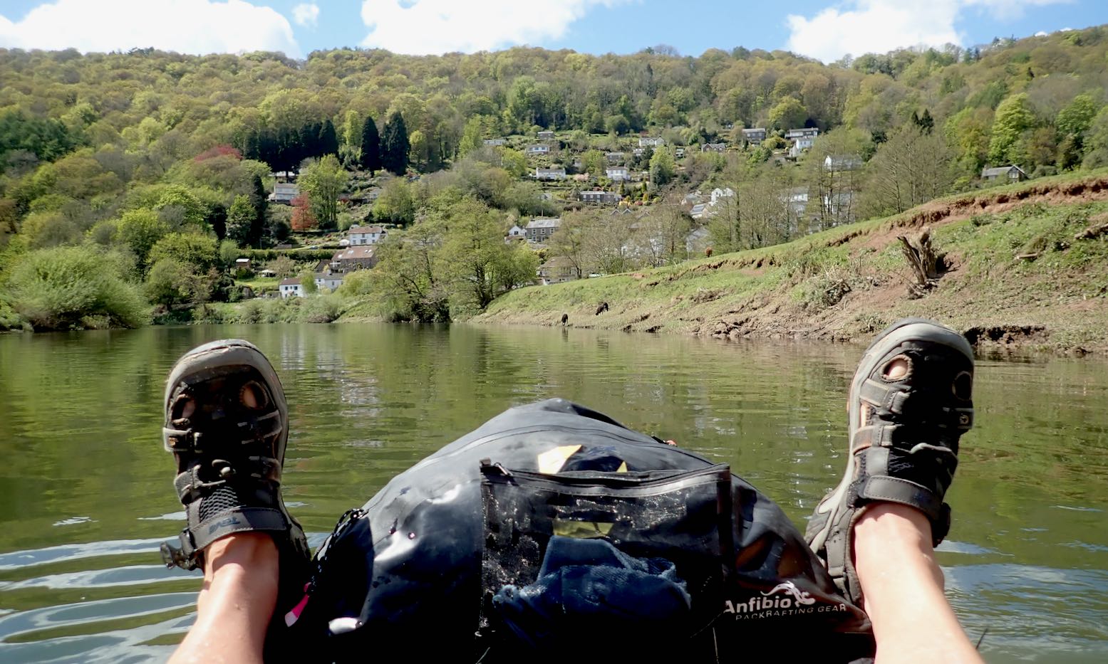
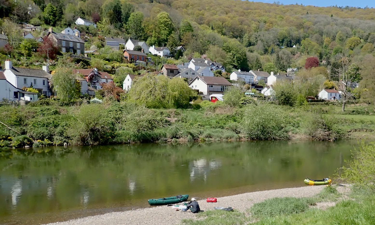
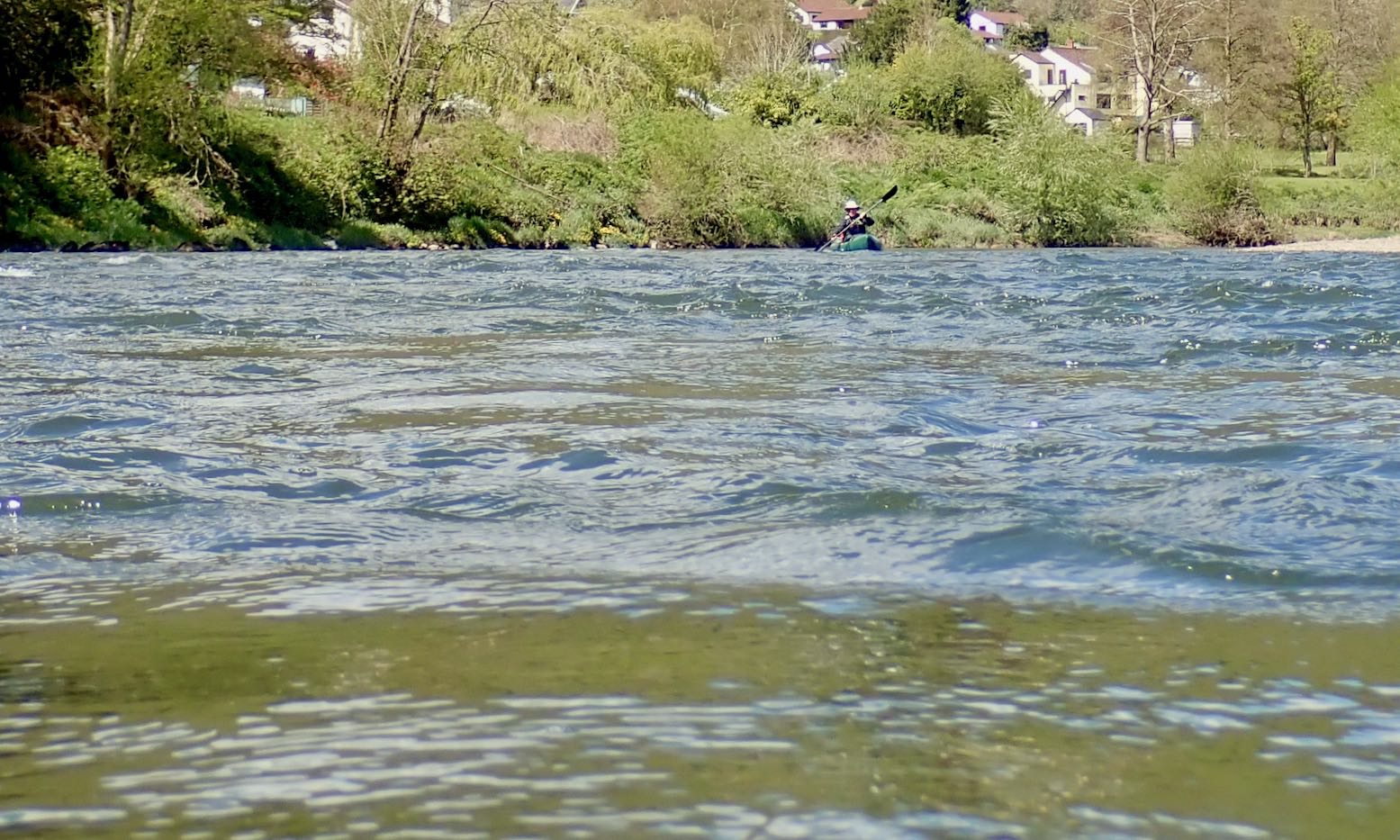
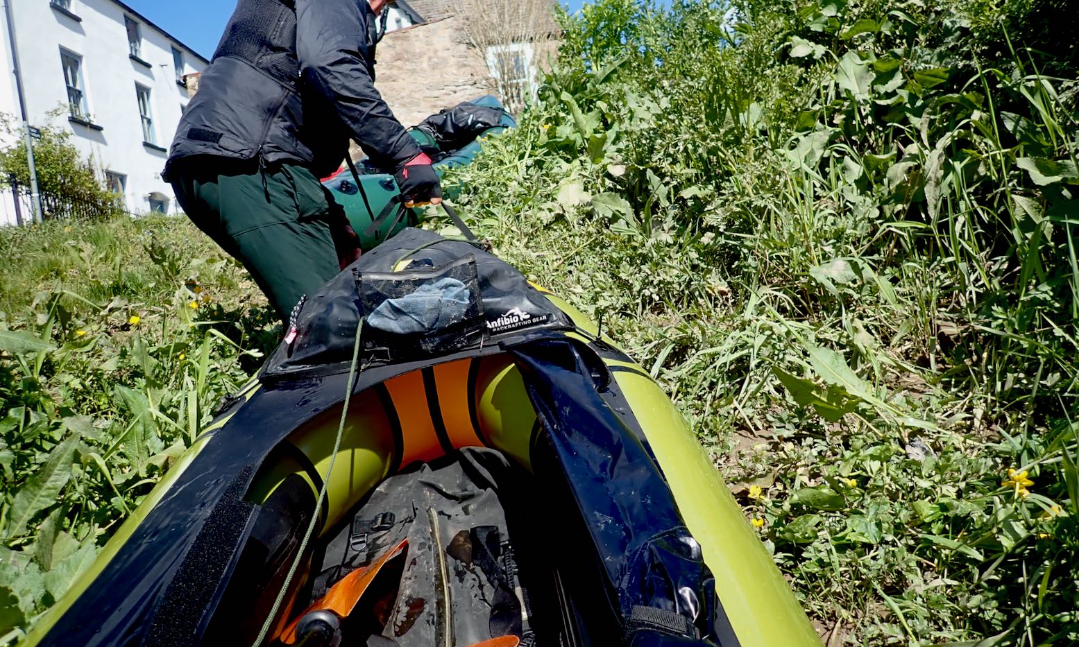
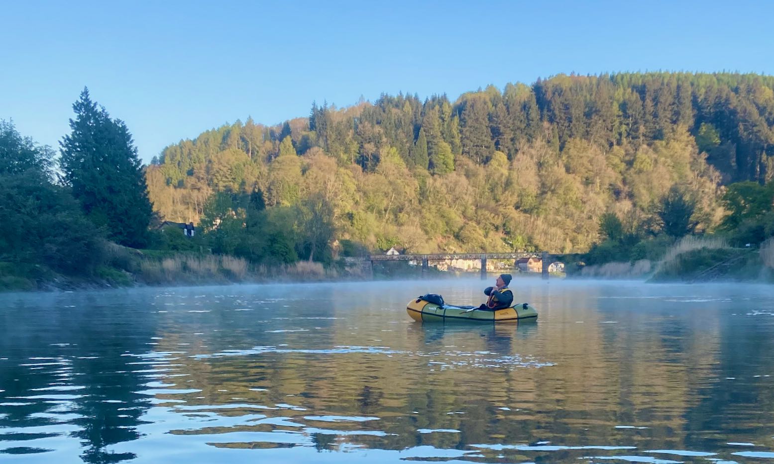
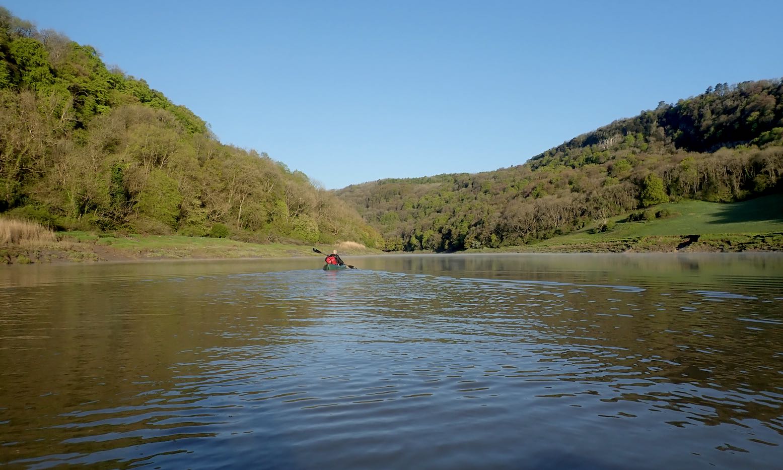
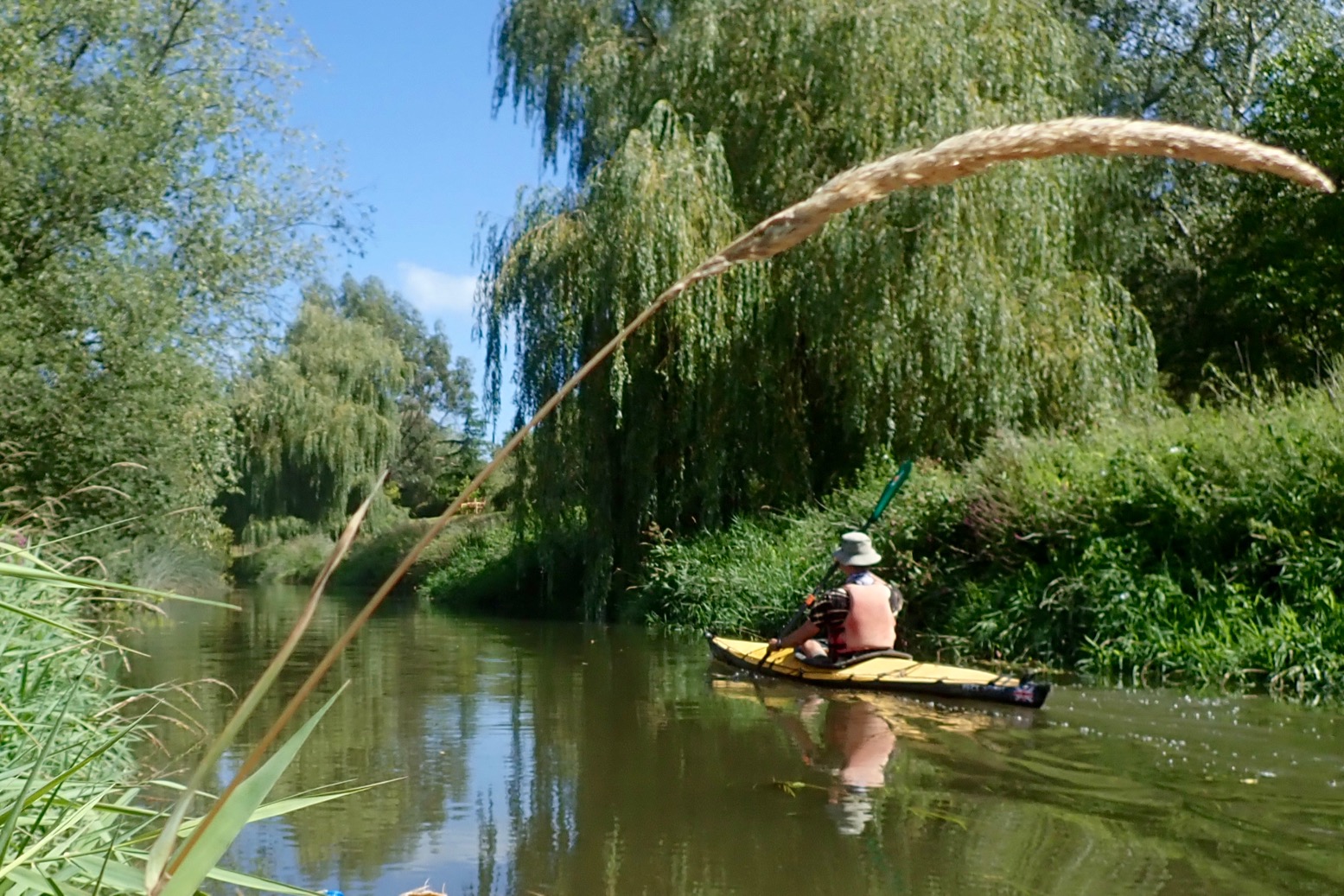
I thought I’d do the Wye in my Seawave, but then decided all that space and speed and glide would be too easy. Anfibio did me a deal on the Rebel 2K I tested last autumn (they’ll readily drop the tax to the UK so you don’t pay it twice). The three-night paddle would be a good test of their internal storage system for packraft touring. And the wet bits in between, a good test of the boat. My review of the 2K here. Short version: with a good, rain-fed current, the Wye is a fabulous, easy and scenic paddle. We saw just a couple of Gumo Safaris on a bank, and some club rowers out of Ross. Plus loads of parked up canoes waiting for the rental season. I hope to do it again in the summer. With no lifts, I’d try to leave Hereford early for Symmonds Yat free camp (see below). It’s 43 miles but in the conditions we had could be an easy ten hours. And if you don’t make it, no bother. Then it’s five hours paddling to Brockweir where an early afternoon HW could bring you two hours into Chepstow for a train home.
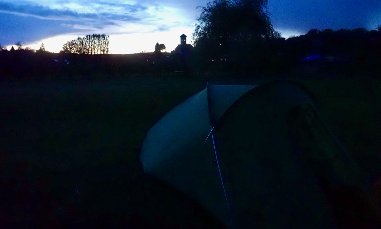
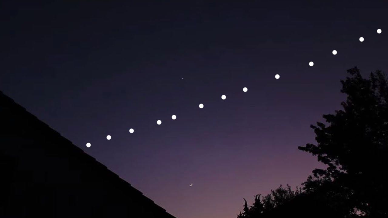
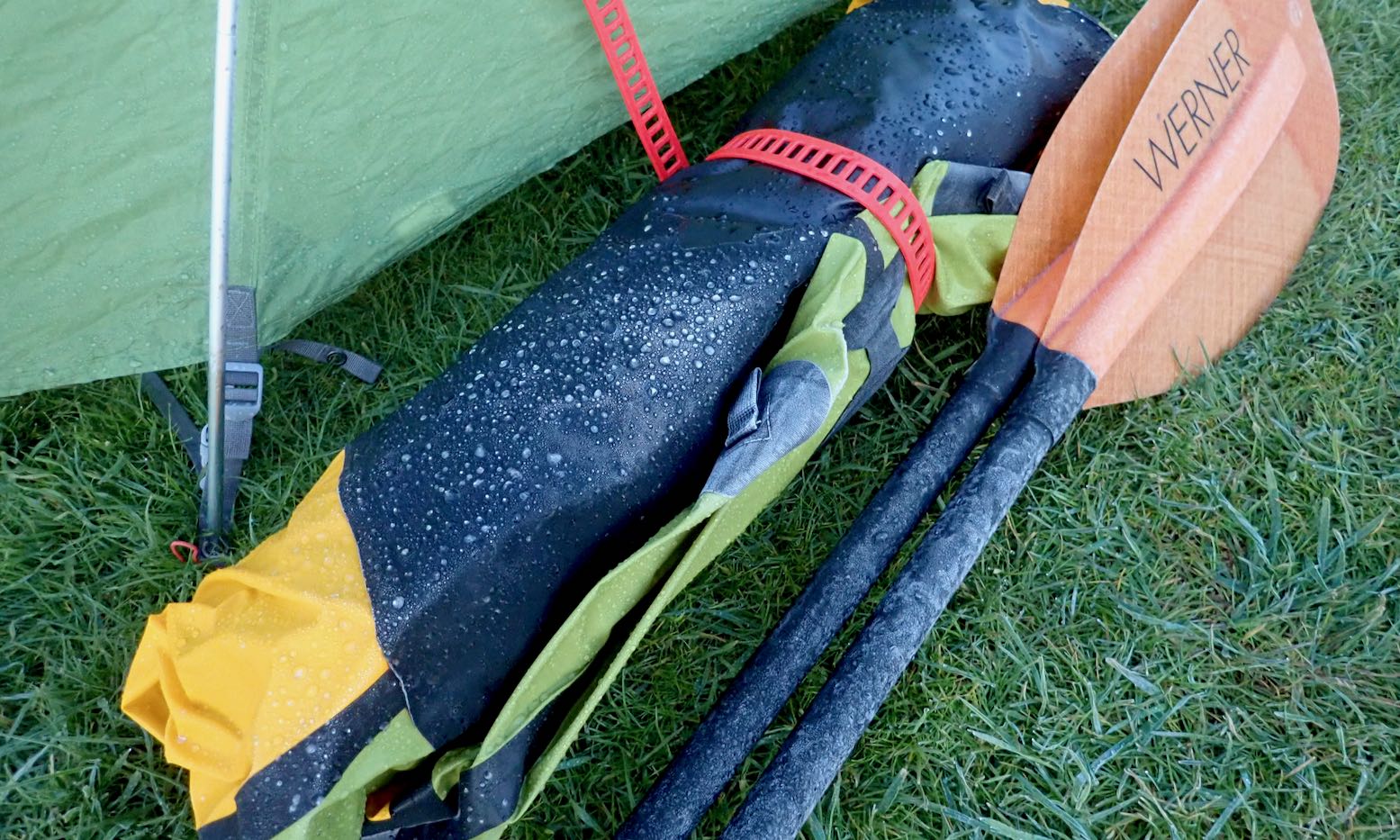
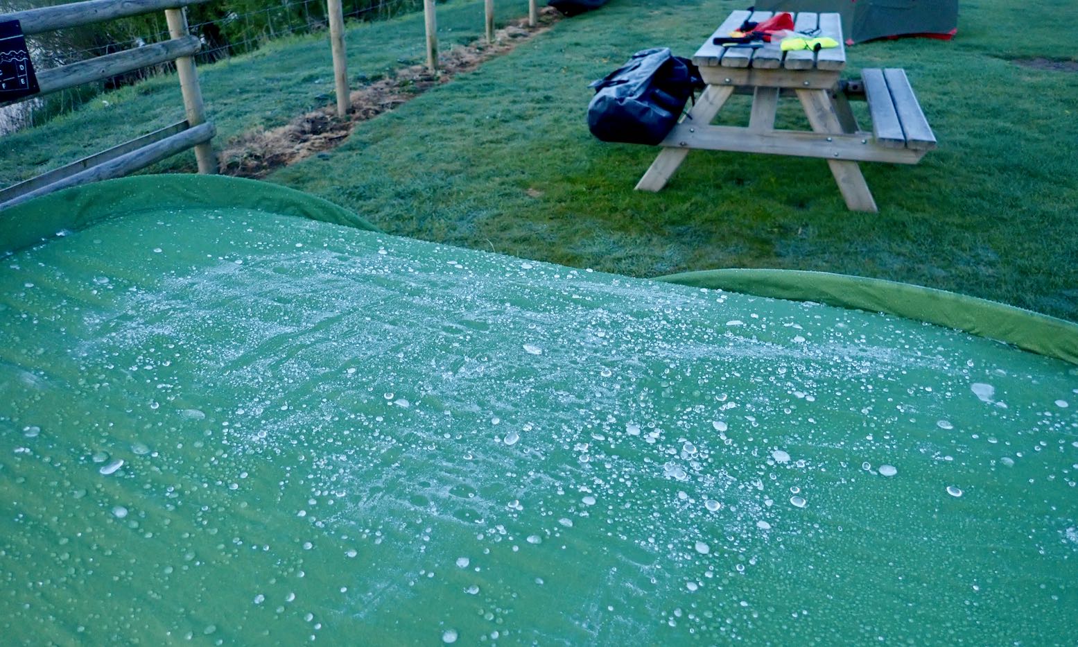
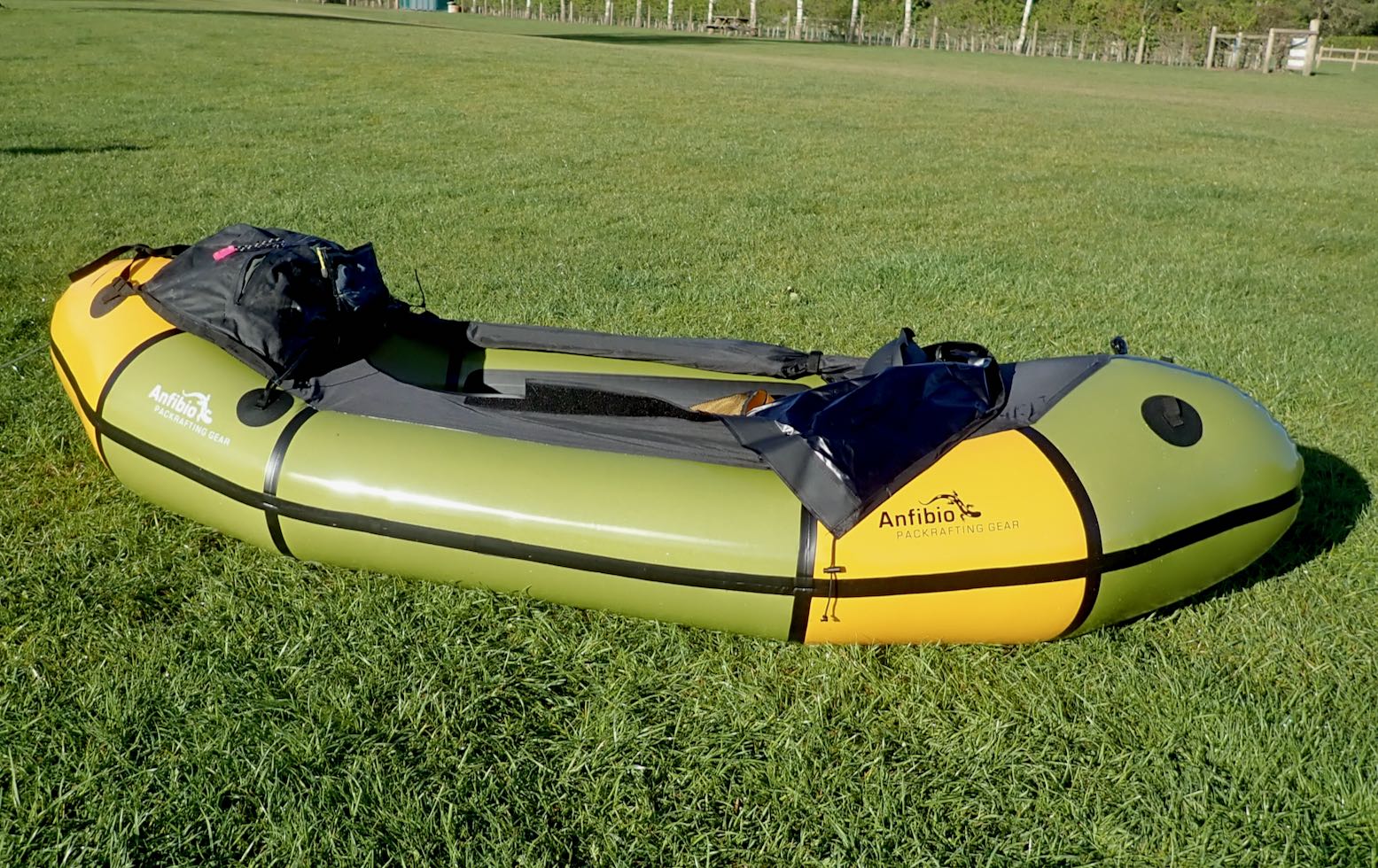
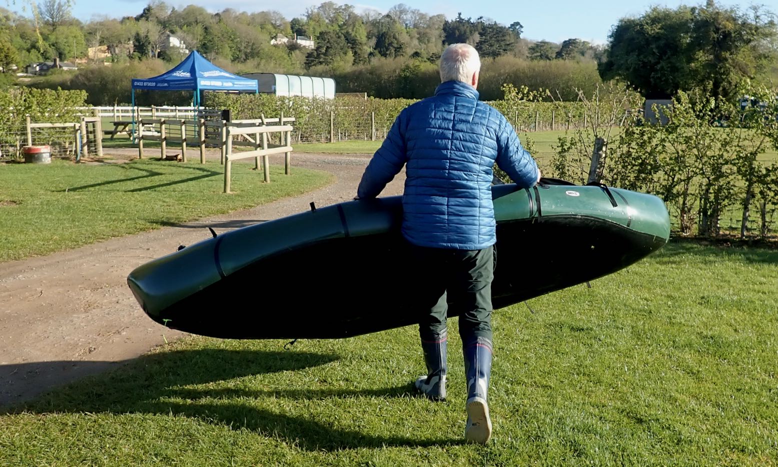
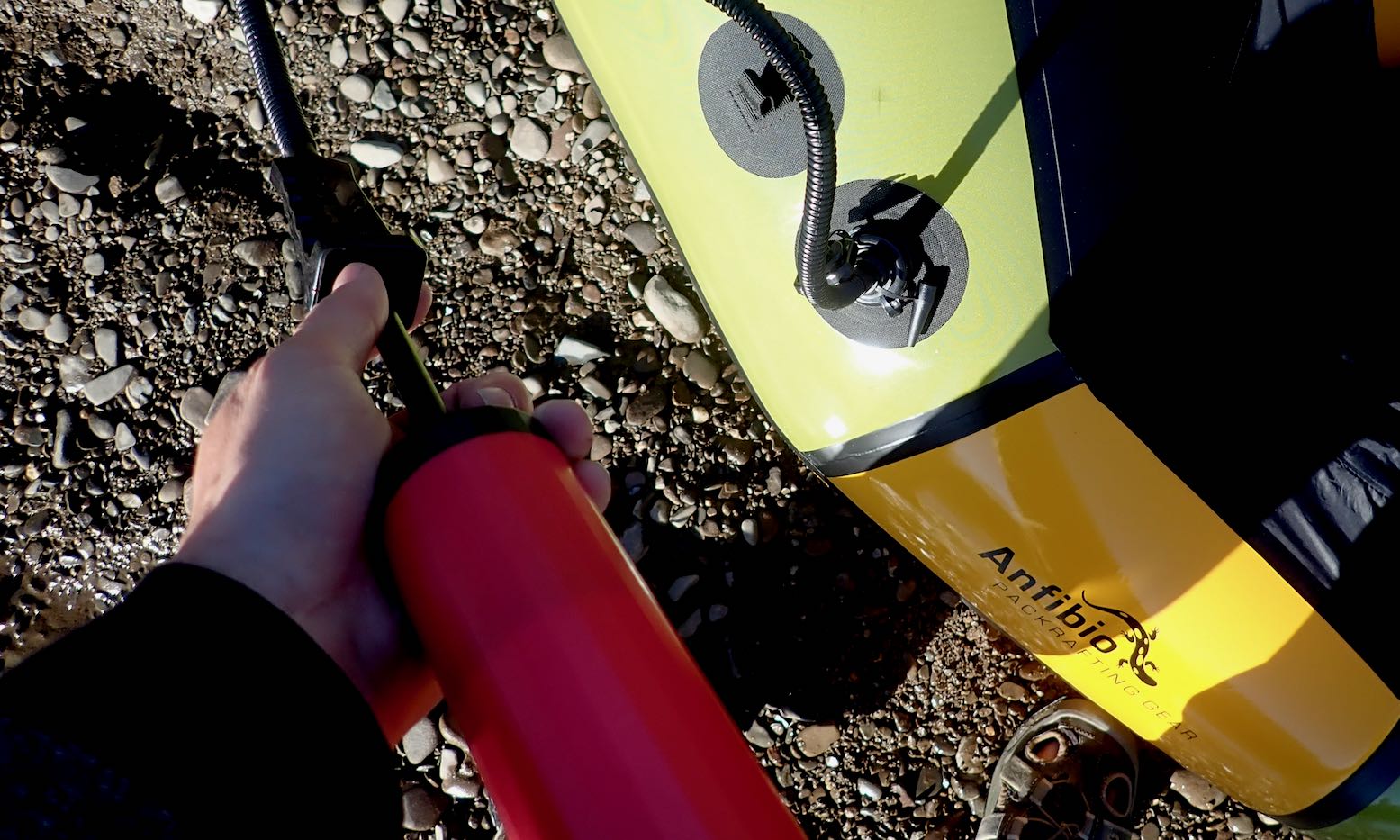
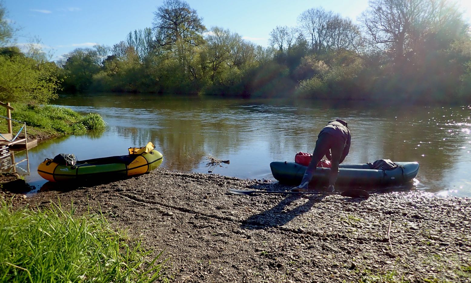
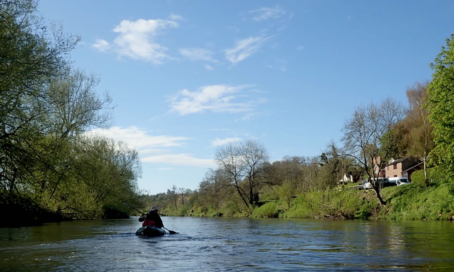
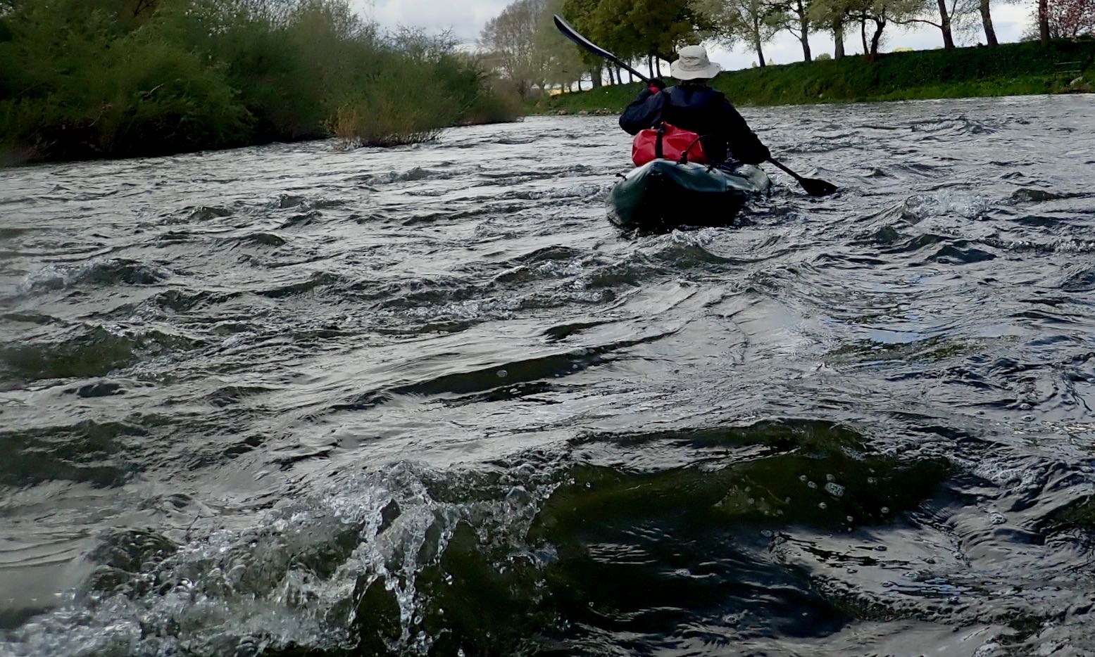
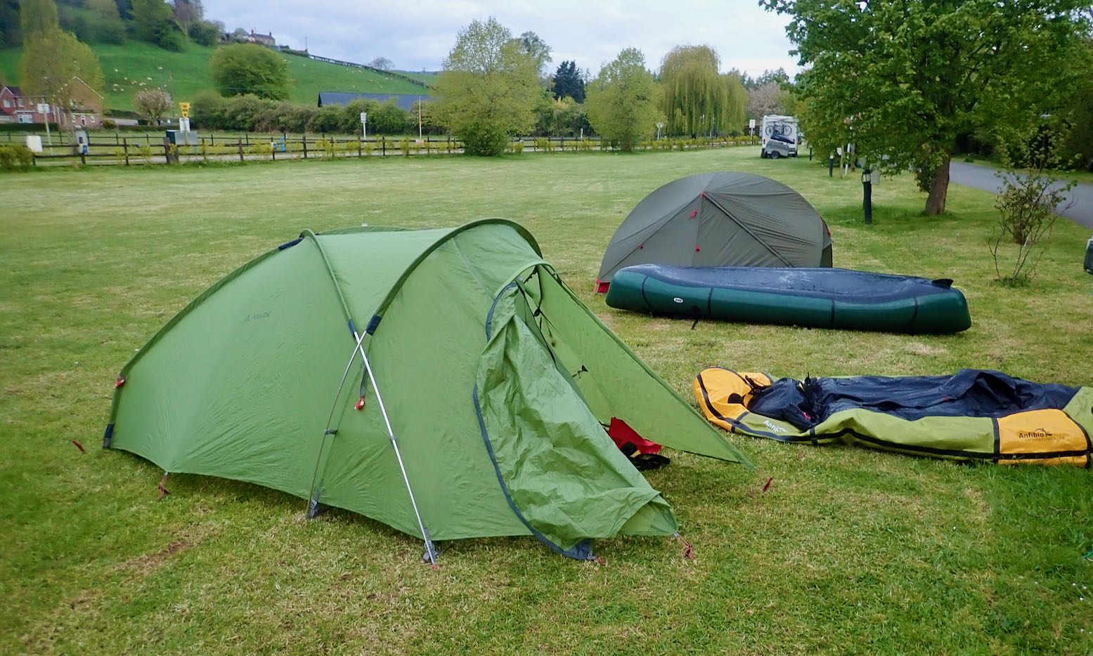
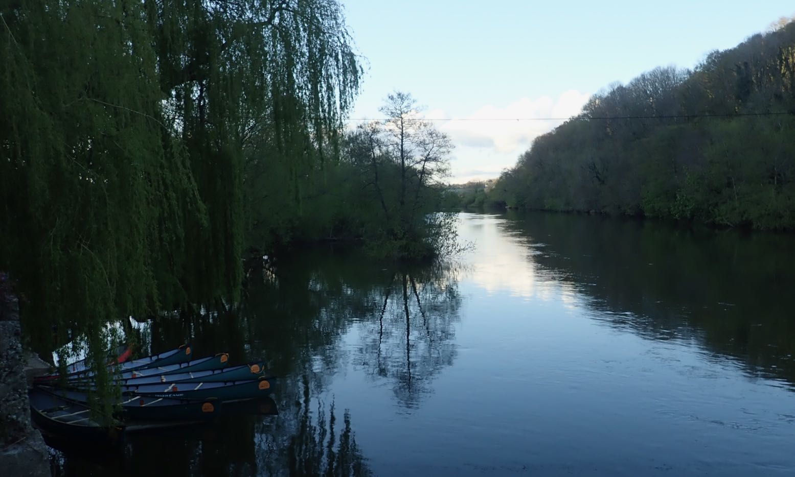
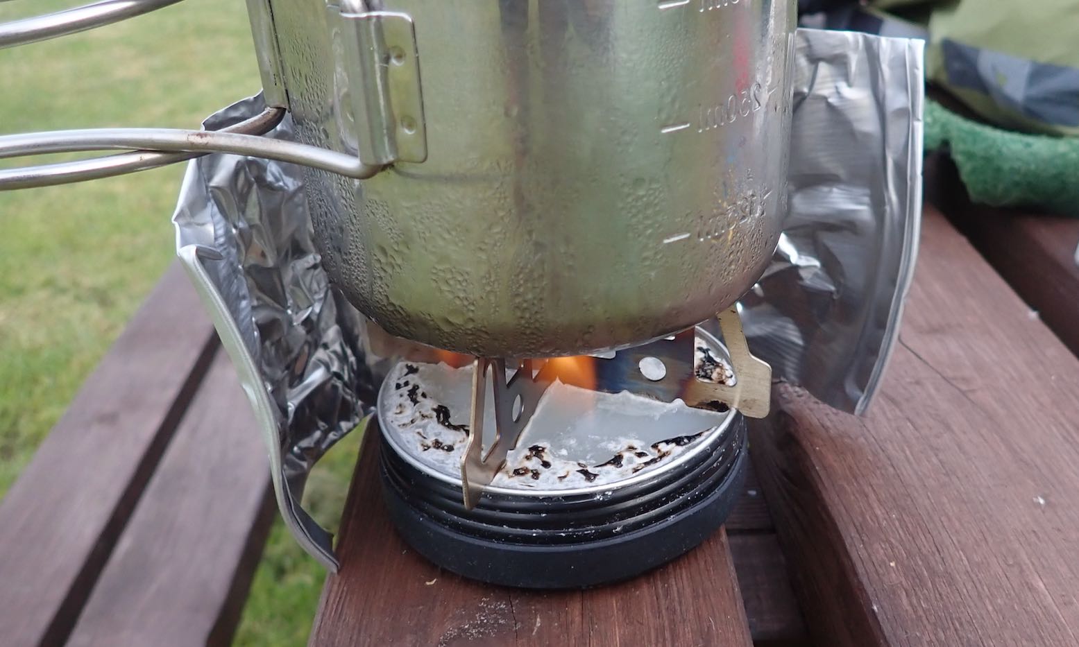
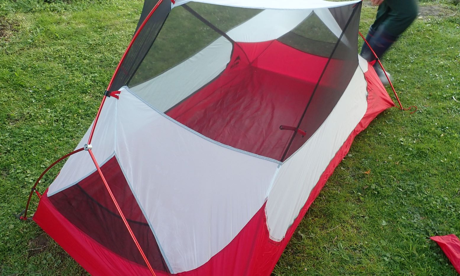
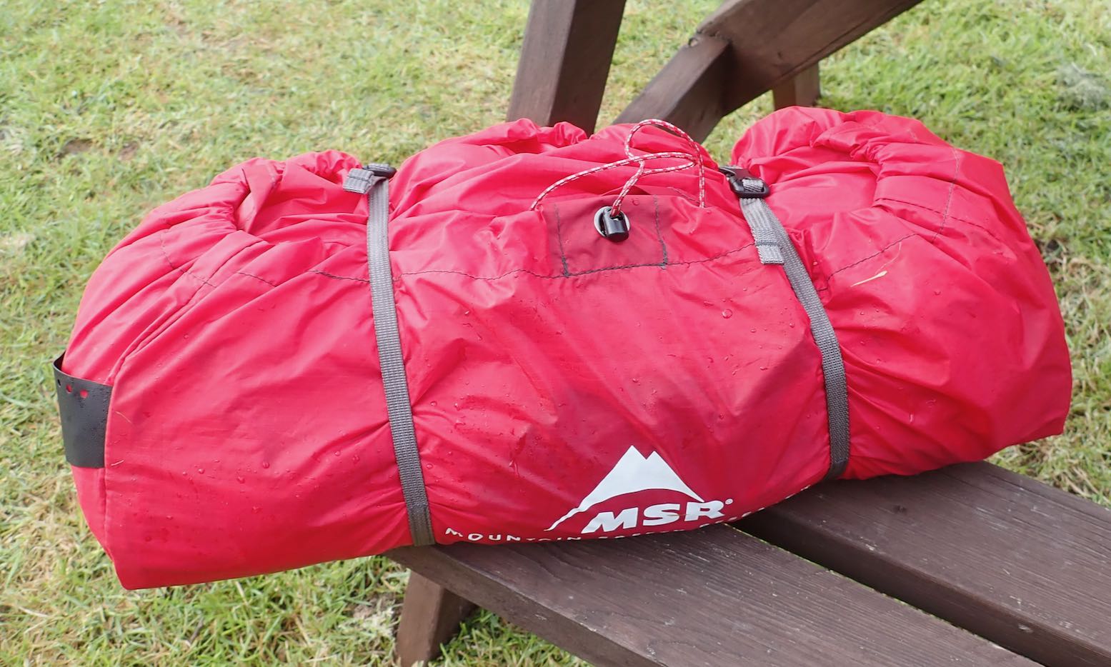
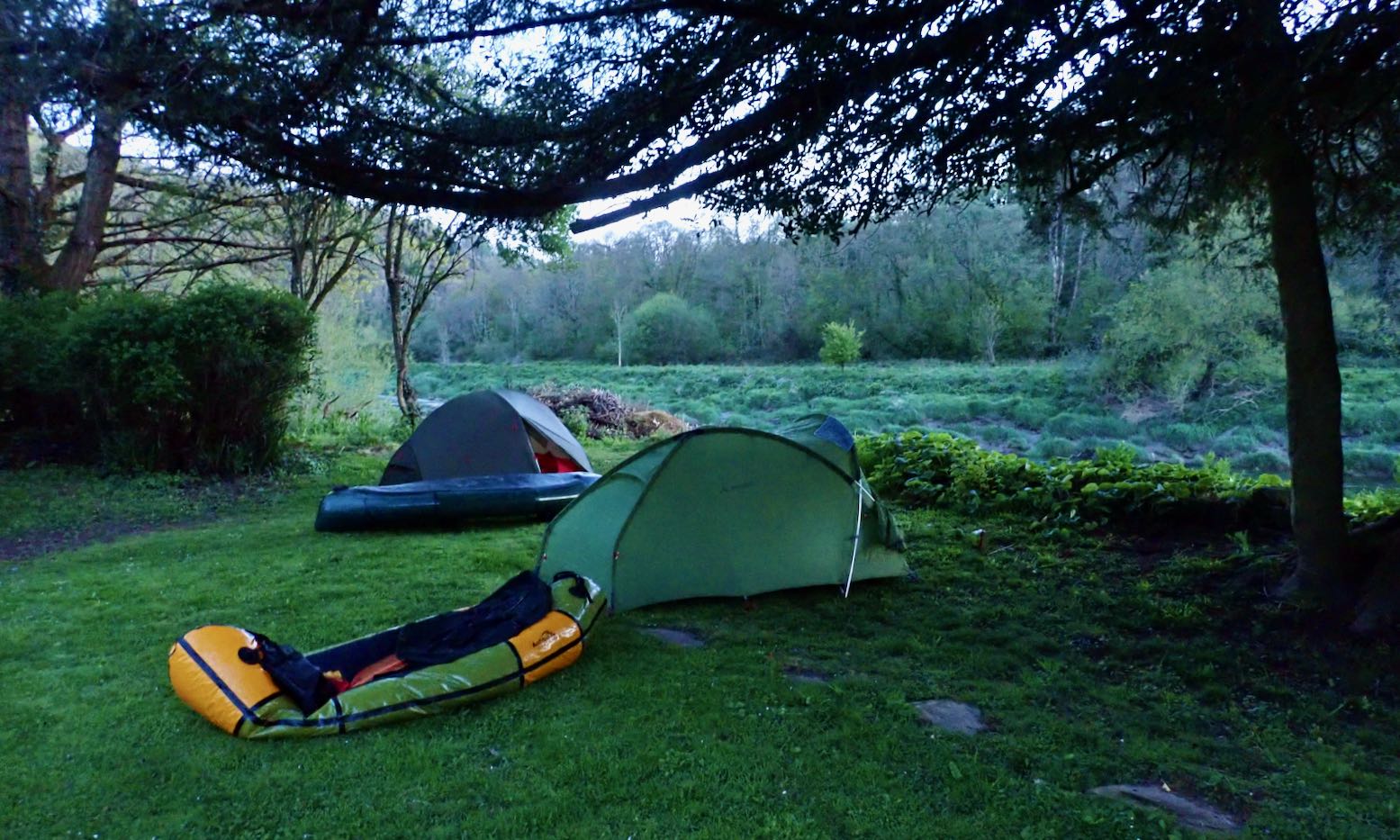
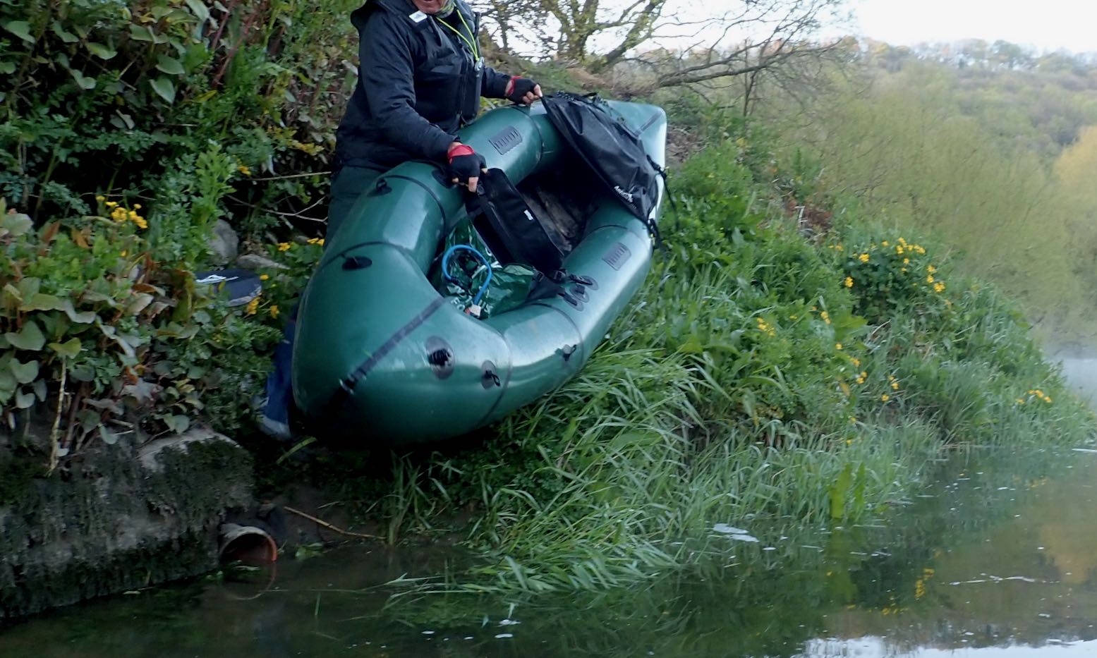
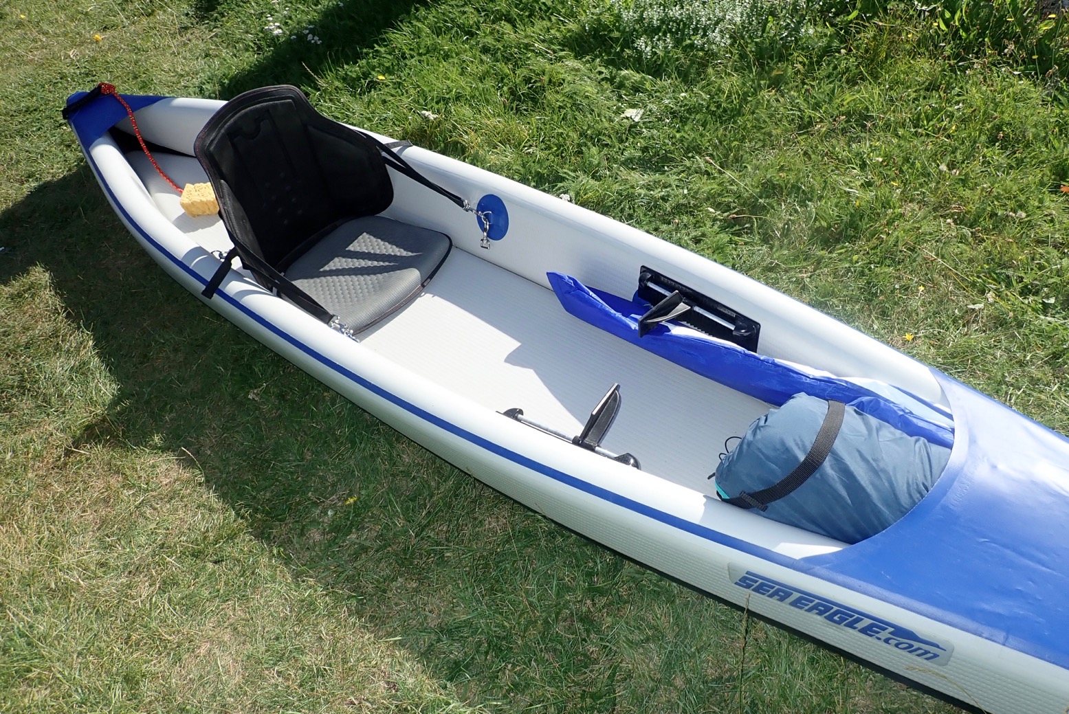
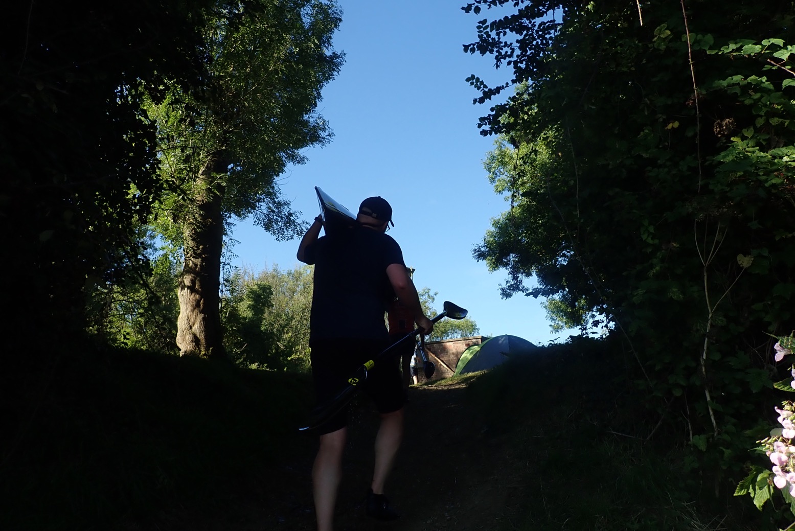
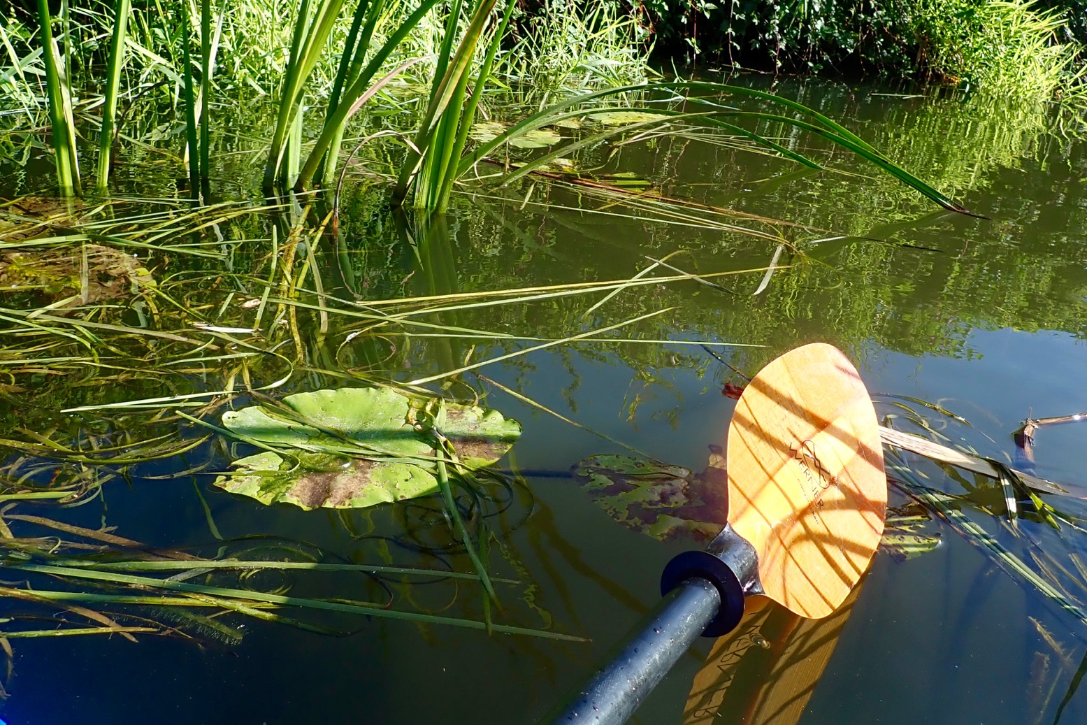
Apart from paddling through, not been up London for over a year. Slowly getting back to normal.A viable boat (and all the rest) in a pack – amazing still.We got fed then dropped at Hoarwithy campsite by Barry’s Mrs who’d meet us at Chepstow in 2.5 day’s time. Bloody freezing. Couldn’t wait to get in my bag.Checking the guy lines at 3am, I saw something like this heading west, fast: it’s Elon Musk’s Starlink. Look it up.Darn chilly… … at 6am. My gas stove couldn’t get it up. Warm tea.Tube bags: 2 x 70L pockets in the side tubes.Boat looks normal but is full of camping gear. Very clever.But with no Tube Bags = easy portage.More early morning rumpy pumpy to get the 2K skimming like a stone.My vacuum’d, super-duper UDB disappears out of the way as a floor protector.River’s higher and faster than when Barry recce’d a week earlier. Rain in Wales? Is that possible?We’re soon swept into the swift current.… and even a little ruffled water now and then. But all perfectly doable by a beginner.I brought my bigger-bladed Corry to keep up with the faster Nomad. I don’t think it works like that: it’s a pack raft.Ross-on-Wye – charming riverside town. Who knew?As southern English rivers go, the Wye was a whole lot nicer than I expected. This could be France!I clutch a twig for reassurance. Trim is backheavy compared to the Nomad, but that’s packrafts for you. I did load the side tubes weight-forward.I’m a convert to roomy Deck Bags, especially with a spray deck and when all the rest is locked in the side tubes.We’ve done our 25 miles by 2.30pm. We’re going much faster than expected.Sterretts Caravan Park. Ablutions closed but they took our money anyway. Next time I’ll use free canoe camping 1.7 miles on, past the Ferry Inn and famous Symmonds Yat rapids: 51.830177, -2.646146, complete with jetty!A bit less chilly this eveing at the 600-year-old Ferry Inn. A very yummy mac cheese for just £12.55!Next morning I get my gimp on.MRS NomadAnfibio Rebel 2KOnce loaded daily re-inflation is a bit of a faff. But it soon pays off. Symmonds Yat rapids just downriver running WW1.5North winds with very occasional warm spells. Llandogo, Wales river right, England river left.Lunchtime and more gimping. In the early 1970s I was on this very beach on a scout camp.No dogwater on this river.About 18 miles later we arrive mid-afternoon at Brockwier, the tidal extent of the Wye. We must wait for HW.In the old days sea vessels reached here. Smaller boats then went upriver as far as Hereford.In a wet spell that house will flood. We leave the boats …… and walk two miles to Tintern for some nosebag.We then camp discreetly back in the village’s churchyard, built in the 19th C to contain the rampaging riverfolk.I suffer a spot of Hubba tent envy.Compacter, lighter, roomier – but 450 quider.Five am: quiet as a Moravian graveyard. HW in an hour. No time for breakfast!Awkward put in; it’s only a neap tide.We set off into the pre-dawn mists. Two hours to Chepstow.By Tintern the sun is up, but still too early for a nice shot of the ruined abbey.Tree does not like saltwater.We expected to surf a barely ridable riptide, but it was no faster than upstream because the tide goes out very slowly.7.45amChateau ChepsteauEgress was made more awkward by that annoying dinghy.Croeso i Gymru, boyo.All packed up. A train back to London at midday.Which leaves loads of time for aFull Welsh Breakfast!
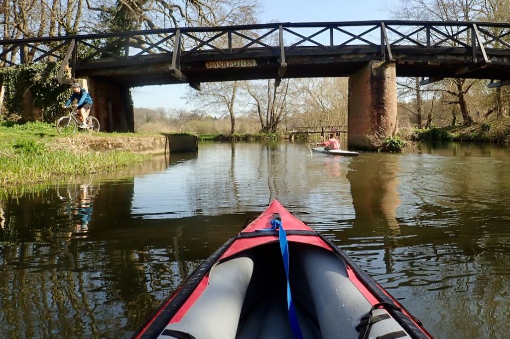
One of England’s first navigations, dating back to 1653. That’s probably why this historic canal feels quite natural and river-like, apart from the virtual lack of current.
All hands to the barrel pump! The day will be long, sunny and warm. High time to tick off ideas matured over the winter months of Lockdown. First on the list: the River Wey from Godalming to Weybridge in Surrey. Or should I say, the historic canal called the Wey Navigation which is paralleled in places by the old river. It’s one of England’s oldest navigations (commercial inland waterways) which once connected the Thames with the Navy base in Portsmouth. At the time a safe way of transporting stuff, including munitions produced near Godalming, without risking encounters with Napoleonic marauders in the Channel. For years I’ve been unsure whether the Wey was a dreary canal with more locks than the Tower of London, or a grubby, semi-urban river with weirs and other obstructions. Turns out it’s a bit of both but better than expected. All I had to do was RTFM!
Compared to the similarly popular Medway, which I’ve done loads of times in IKs and packrafts, summer and winter, the Wey Nav feels less agricultural, more scenic and has an interesting history if you slow down enough to look. But it lacks the Medway’s unique canoe passes which scoot you down the side of each lock (right), avoiding up to three laborious carry-rounds per mile. Parts of the original river survive in places to either side of the canal, which is what caused me confusion. I now realise the Navigation (managed by the National Trust) gets priority in terms of water levels and maintenance. As a result the occasionally nearby River Wey might be shallow or chocked up with fallen trees or rubbish. But you can combine both to make loops like this.
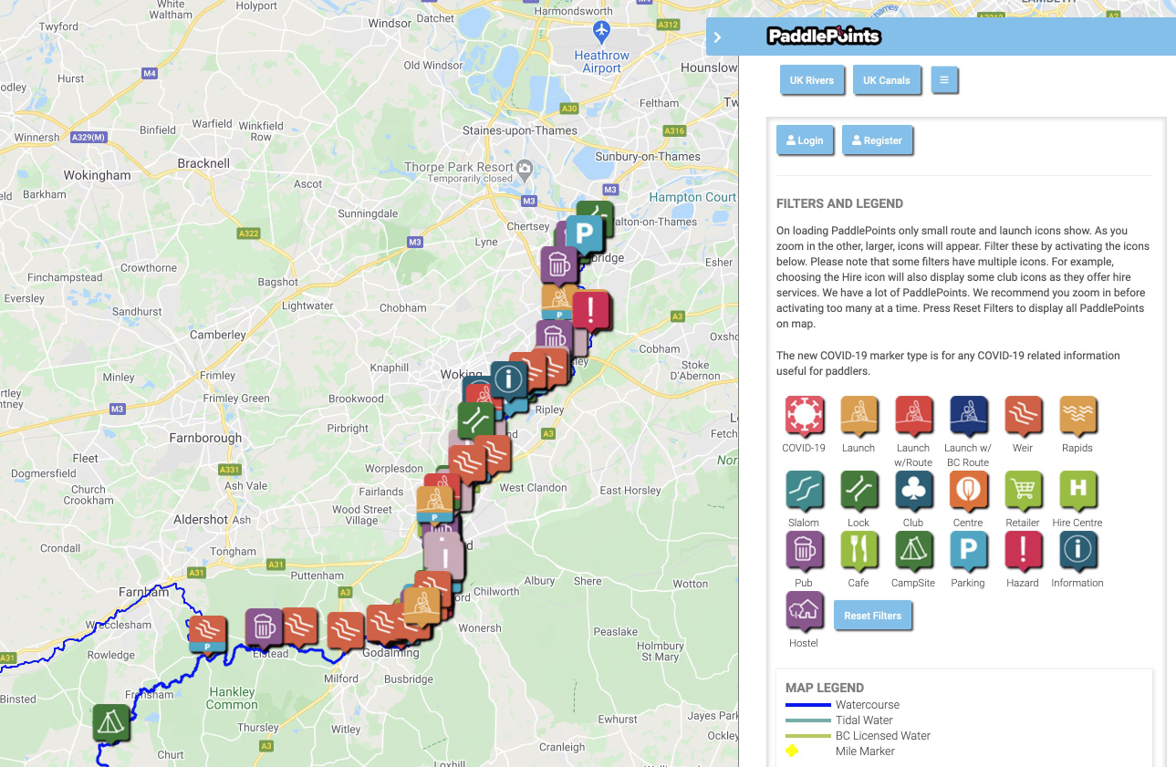
Because of the Wey’s multiple channels and numerous weirs and locks, I tried British Canoeing’s PaddlePoints website, a comprehensive database of paddleable river map routes with handy icons (above) for put-ins, parking, hazards like fallen trees, feral teenagers (I’m not joking) and so on. You can reset to delete extraneous icons (‘Covid-19’ ?); I just wanted to clearly locate the locks and weirs and river’s branches, though on the day ‘Navigation [this way]’ signs at junctions were clear. Closer scrutiny of the map shows that in places the blue line guides you along the old, choked-up river, not the Nav, and not all weirs (an important feature to know about) are shown as icons, even when they’re clearly evident on the Sat view underlay. And so the Map view (as above) can give a misleading impression of which way to go. As you’ll see below, at one point the blue line even guides you over a weir. Common sense prevails of course, but you can imagine some beginner clutching their PaddlePoints app on Map view getting sucked into a weir. I realise now this content is user-generated like OSM or Google Maps, and so errors, inconsistencies and lack of moderation are inevitable. As such, you can report icon-points, but it’s unclear if the route (blue/green line) can be corrected by users. If nothing else, PaddlePoints helps identify which rivers you’re allowed to paddle in England and Wales, and what the rules there might be.
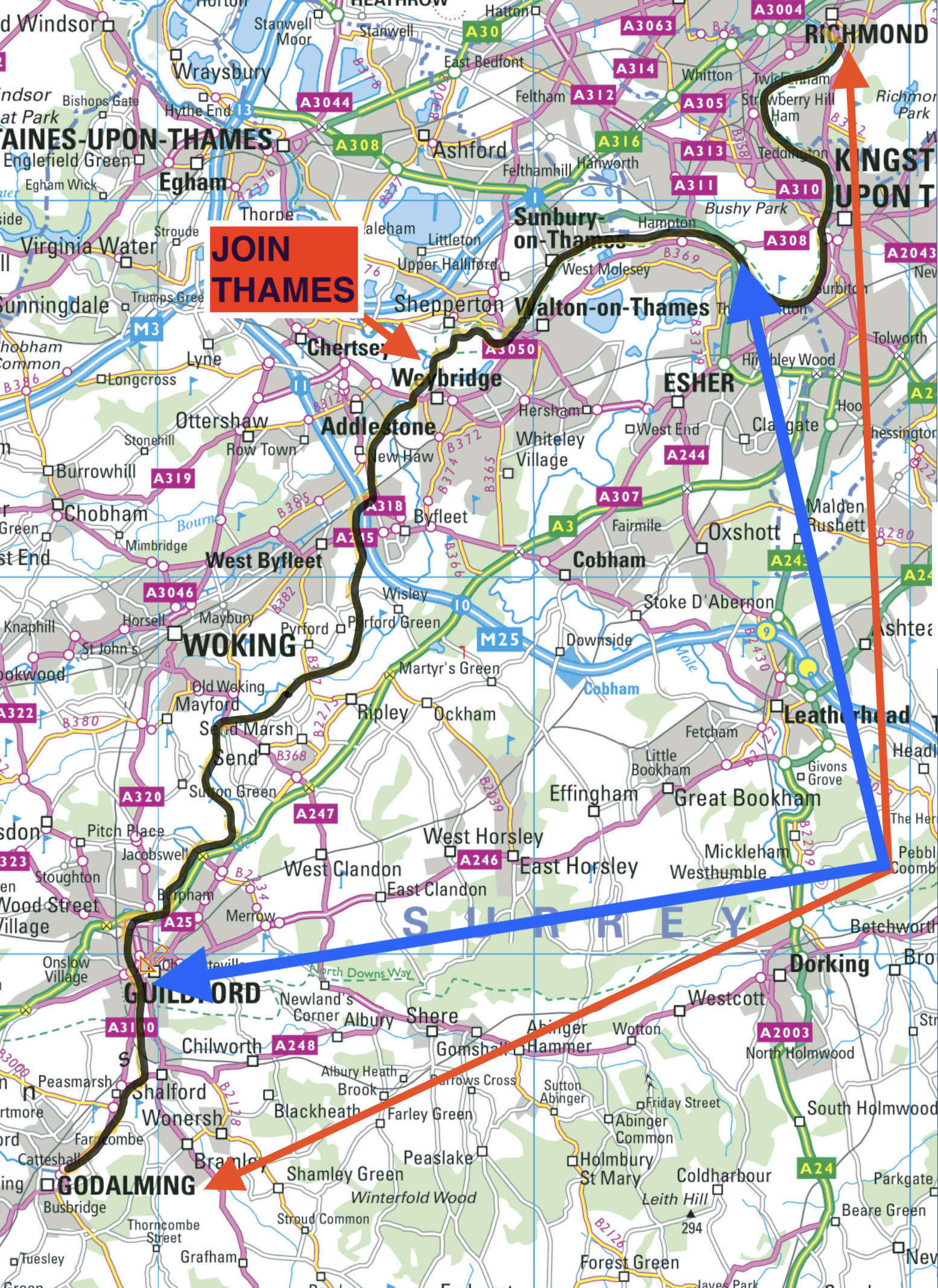
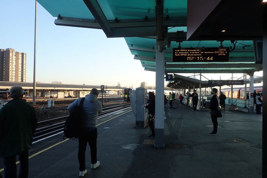
I fancied a full dawn-to-dusk recce: as much as I could fit in from Godalming (where most paddlers start) before my tank ran dry. I might even reach Richmond on the Thames, a section I enjoyed last December in the Arrowstream. That is actually quite a haul: 20 Weymiles plus another 15 on the Thames, including no less than 17 lock portages on the two rivers. But the great thing about ending a paddle in an urban area is I could air down when I got worn out and rail home. Thirty-five miles? Dream on, bro! I’ve only paddled two days since September so was far from paddle fit. Then again, the pre-dawn brain wasn’t on top form either: I set off in the right general direction, but on the wrong train.
Oh! Mister Porter, what shall I do? I want to go to Godalming And they’re taking me on to Hoo [k], Send me back to Woking as quickly as you can, Oh! Mister Porter, what a silly boy I am!
After backtracking, I decided to catch up with myself at Guildford, 5 miles downstream of Godalming and missing out 4 of the Wey’s 14 locks. I dare say I’d appreciate that later.
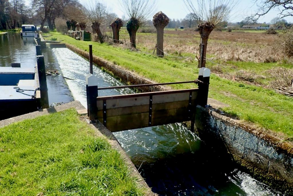
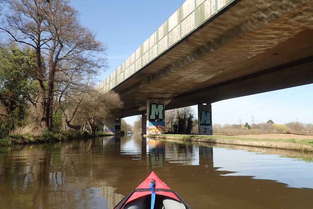
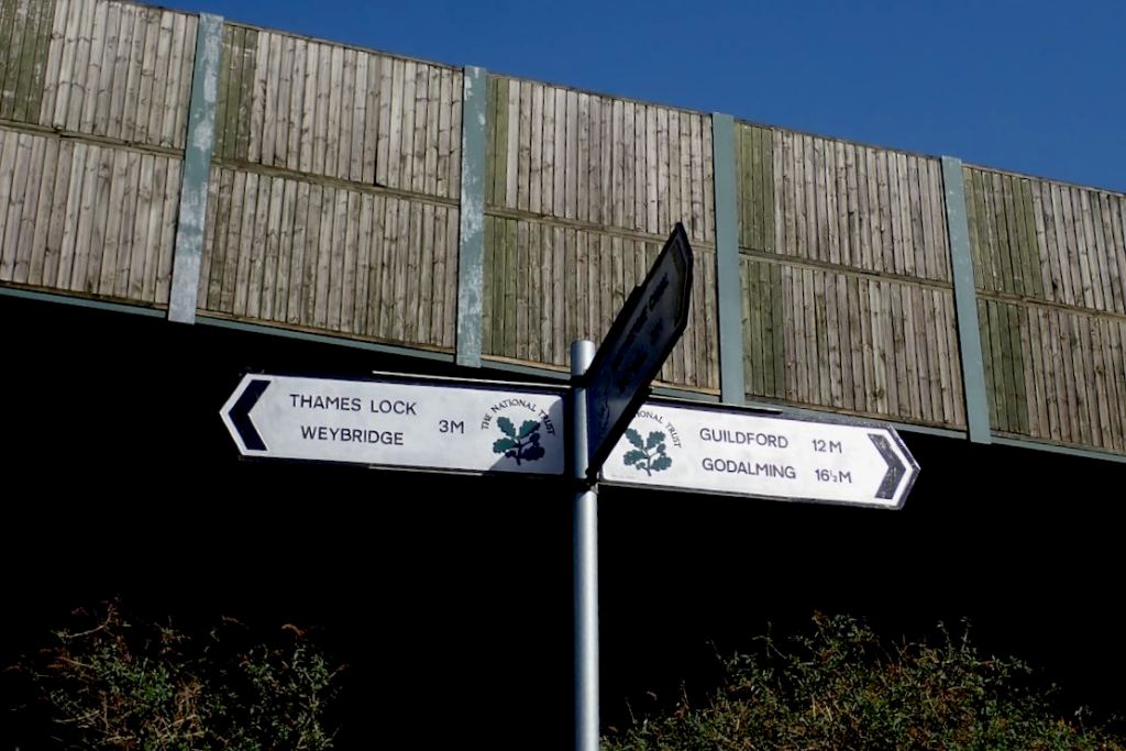
Clapham at 7am. It’s all a bit of a blur.I practise luggage distancing.In Guildford I slip onto a closed towpath and enjoy a quiet set-up without the usual ‘Oh Mr Porter, is that one of those inflatable canoes? I’m thinking of getting one…’Just around here I realised I’d left my Garmin out in the sun to catch a signal… Should have gone to Starbucks. I’m trying out some old runners as water shoes instead of my usual Teva Omniums. Do they really believe this or is it just juvenile baiting?A readable GPS in the net pocket of my Anfibio packraft deck bag didn’t really work on the Seawave. As usual I have a better idea.Alternative use for a big slackraft.At Bowers Lock I spot my first Intex of the day, a 100-quid of K2 Explorer on its maiden voyage with daughter and dad.Under an old bridge a real K1 belts past with barely any wake. Looks like fun but what happens when she stops? Same as the bike on the left, I suspect.As canals go, not so bad.Triggs Lock. With a little work this side sluice could be a fun canoe chute (lens finger shows scale).All they need to do is get rid of the guillotine and add a galvanised chute at the end. How about it, National Trust? It would be like turning Downton Abbey into a Discount Carpet Warehouse!Soon after lunch at Papercourt Lock I pass two chappies also heading for Weybridge in something called a Sea-Doo. Flip yer paddle round, mate, you look like an amateur!Not another lock, TFFT! Just some general-purpose gates to hold back Viking raiding parties.At this scenic and willowy point the canal runs right alongside the M25 London orbital motorway. The tyre noise is like Niagara Falls.Mile 12 at Basingstoke canal junction. By some civil engineering synchronicity the M25, Wey Nav, Basingstoke Canal and a railway mainline all cross or meet at this point. In its way it demonstrates the history of post-medieval commercial transport: rivers > canals > railways > highways and airplanes. That’s my MA thesis, right there!At New Haw Lock I need water but the lawn-mowing lock keeper says there’s no tap for a couple of miles. It’s an awkward portage over a narrow road bridge too. Luckily, this chap helps me out. Thanks, chum!Coxes Lock with a doable weir to the side. I may try it next time and risk censure from the NT.Well, according to BC’s PaddlePoints website, that’s the way to go!Weybridge Town Lock. Another awkward portage over a road bridge on the left.In places the Weybridge backwaters look like an Everglades retirement village.As I approach the Thames Lock at Weybridge things get wobbly and I have an out-of-boat experience.Amusingly lock-themed gates close the footpath so us portageurs can pass.Finally at Thames level, hallelujah. And there’s a tap set into the jetty too. I drink like a camel then me and the boat have ourselves a wash.Over six hours from Guildford, but even with a drink and food to spare, I don’t have another three hours in me to reach Richmond. Maybe I can do two hours to Kinsgton. Now on the Thames, I become a great admirer of roller portages.The game’s up at Hampton Court Bridge if I’m to have enough energy to roll up the boat. The station is right there. It’s a warm evening on the Thames and they’re all out in boats and the riverside parks. The [Covid] Rule of Six? Do me a favour! The skiffs collect bird poo while two lads fire up their Intex Challengers. I’ve seen more Intex IKs today than anything else. Why? Because they cost from under 100 quid, float just like a Seawave but track like a barrel.And he may be saying to himself: ‘My god, what have I done?’Dusk back at Clapham Jct. All up, only 21 miles. I blame ten portages, no resting and my nifty but 3-kilo Ortlieb roller duffle. With too much food, it all made the boat just a bit too heavy to carry easily. Where the lock-side grass was lush I dragged the boat, but I have a better idea.
Just before the GPS packed up at Basingstoke canal junction, I was averaging 5.5kph on the move. Pretty good with no current to speak of. On the livelier Thames I estimate I was moving at up to 10kph before I withered. Same as in the FDS Shipwreck in December. My tall BIC backrest (below left) initially felt great then collapsed on itself. Usual story: needs a stiffer insert. I was trying out my new footrest tube attachment points which worked great. Only when one heat-welded strap broke near Addlestone was I reminded how essential footrests are to comfort, efficiency and stamina. I jury-rigged something up between two D-rings which have been staring in the face all this time.
My 2021 Wey Survey of UK Paddling Trends
Hardshell canoes: 1
Hardshell kayaks: 1 (+ 2 K1 racers)
Hardshell SoT: 1
Vinyl IKs (cheapies): 5
PVC (bladder) IKs 3
iSUPs: 10+ (mostly women on iSuPs, too)
PFDs worn, almost none then again, mine’s more of a handy waistcoat)
FDS spotted: none (interesting as readers here are mad for that page)
Many packboaters have heard of Alone at Sea (right, and discussed below), Hannes Lindemann’s famous account of his sail-assisted, mid-Fifties Atlantic crossings, first in a dug-out canoe and then in a production Klepper folding kayak. As a doctor, Lindemann used his expedition to examine the physiology and psychology of enduring long weeks at sea alone.
Although he was already an experienced sailor and ocean kayaker by this time, Lindemann’s Atlantic goals may well have been spurred on by a meeting withFrenchman Alain Bombard (right) in Morocco in 1952. Also a doctor, Bombard was at the time engaged in exploring unorthodox ways of extending the survival chances for those adrift at sea. When they met, Bombard was about to set off across the Atlantic in a 14-foot RIB (rigid inflatable boat or dinghy) equipped with a sail – but with no food or water.
His book starts in 1951 when he estimated 200,000 people died at sea each year. Half perished when a disabled vessel struck the shore – ‘Fear the land, not the sea’ as a sailor’s adage goes – but about a quarter died while adrift in life rafts, surrounded by water and potential food.
Bombard was convinced that as long as sharks, madness and weather didn’t finish you off, indefinite survival at sea waspossible by drinking moderate amounts of seawater, as well as the less saline juice pressed from fish, and all supplemented by windfalls of rainwater. Fish could also be eaten raw or dried, while teaspoonfuls of plankton gathered in a stocking-like mesh could address vitamin needs. ‘Lobster puree’ was how he initially described the taste of the seaborne slime which he later grew to loath. All that was missing from a balanced diet were carbohydrates, to which Bombard believed the human body could adapt.
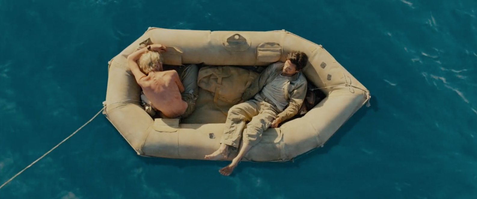
Throwing up. Still from ‘Unbroken’ (2014)
The key was to start drinking seawater as soon as fresh water became unavailable and before becoming seriously dehydrated. This sea-water-only practice was something about which Lindemann professed some scepticism. On his first dug-out trip his legs swelled up as a result, he thought, of drinking small amounts of seawater. Later, when he didn’t drink it they were mostly fine. But Bombard found no such ill effects early on, while adrift with a friend for a few days in the English Channel. Of course Lindemann was suffering in the torrid, tropical climate of the Gulf of Guinea while Bombard spent just a few days in the Channel during his first experiment. Although Bombard recorded many ailments, he reported little such swelling in the Atlantic; you do wonder if being able to move around his Zodiac more freely may have helped circulation, although Lindemann was never completely cockpit-bound on either of his crossings.
What does for many castaways is that once adrift and with all fresh water exhausted, it’s only in a state of acute desperation that they turn to seawater (or urine). By now severely dehydrated, the kidneys can’t handle the sudden accumulation of toxins and an agonising death soon follows, supporting the mariner’s lore that drinking seawater was fatal. According to Bombard the key was to drink early but drink little.
Still from ‘Unbroken’ (2014)
With the aid of sponsors, benefactors as well as supporters in the field of oceanography, he used an early incarnation of what was to become the well-known and widely licensedZodiacinflatable dinghy. (The Bombard brand of RIBs still survives today). He christened his own craft L’Heretique (the Heretic) which demonstrates how he thought he was perceived.
With much less experience at sea than Lindemann, in 1952 he set off from Monaco for the Balearics with an English companion and experienced sailor, a journey not without privations at sea and which on land included a hostile press eager to exploit his drama while keen to catch him out (plus ça change..). A small store of emergency food and water was officially sealedand placed in his boatand though he was at times desperate, it was never used by Bombard – partly because certainly in the mid-Atlantic he was at timesthrowing excess rainwater overboard and was never short of fish, despite what many had predicted. Shipping on from Ibiza to Tangiers (where he met Lindemann) for the Atlantic stage to the West Indies, he correctly interpreted his English companion’s dithering as a change of heart forwhat lay ahead and so set off alone, while later praising his companion’svaluable contribution. (Lindemann interprets this episode less generously).
You can imagine the ordeal that followed. A fortnight or so to the Canaries – a dangerous stage for any small sail boat and one which Lindemann chose to skip in the kayak. And then over two months across the Atlantic to Barbados where he arrived just before Christmas 1952, desperate to let his wife and new-born child know he was alive. Pushed along by irregular trade winds but travelling off the shipping lanes, he only encountered two vessels on the way. On one ship, the Arakaka, met less than a fortnight from completion, he succumbed to a regular meal that was offered, but following weeks of raw fish, his starvation-hardened willpower went into a spin which he claimed very nearly finished him off.
Still, Life of Pi (2012)
At times it reads like a voyage into the outer space of The Life of Pi, full of wonder as well as terrifying episodes: strange creatures, sound and lights, phosphorescence and a loyal escort of birds and dolphinfish or dorado (which also helped replenish his larder).
As well as his physical health, his mental state and morale were also closely scrutinised and well recorded, including his prolonged despair as land failed to materialise for weeks (most of the time his longitude was out by 10° or 600 miles). He demonstrated dogged defiance as storms swamped L’Heretique for hours on end, as well as the irrational conviction of being persecuted by inanimate objects – all exacerbated by the monotonous fare, incessant damp and interrupted sleep.
Loyal ‘Kleppards’ rightly hold Alone at Sea in high acclaim and ensure that it’s still in print, but whatever Lindemann achieved, you have to salute Bombard’s bravery, resolveand not least the commitment to his unconventional experiment in surviving for weeks by living off the fruits of the sea.
Reading the book I had a thought that perhaps Bombard had rediscovered a long-lost human ability or knowledge for surviving at sea. How else does one suppose people like the Polynesians colonised the Pacific, or humans got to Australia tens of thousands of years earlier and long after any land bridge? In fact his ideas had already been raised in the film of the Kon-Tiki voyage which had been released in 1950. Heyerdahl’s Wiki page says this of his 1947 expedition:
“Kon-Tiki demonstrated that it was possible for a primitive raft to sail the Pacific with relative ease and safety… The raft proved to be highly maneuverable, and fish congregated between the nine balsa logs in such numbers that ancient sailors could have possibly relied on fish for hydration in the absence of other sources of fresh water.”
The Kon-Tiki film (above) mentions extracting fish juice, eating plankton as well as mixing 40% seawater with fresh, but on reading Bombard’s book you still get the feeling he took it all a big step further, critically examining the full nutritional potential of living solely off the sea, and then having the guts to put his theory brutally to the test while learning a few hard lessons on the way.
Bombard’s extraordinary adventure brings to mind another incredible voyage that took place at the same time, that of Australian Ben Carlin who sailed and drove an ex-army amphibious jeep called Half-Safe around the world (right). It took him ten years and cost him a wife or two, but in overlanding terms nothing else comes close. As with Bombard, many couldn’t believe the jeep had motored across the Atlantic and then been driven up to London.
Although long out of print, I found an original 1953 Andre Deutsch edition of The Bombard Story for a couple of quid on the web, impeccably translated it has to be said, by a chap called Brian Connell.
Alone at Sea A couple of years after meeting Bombard in Tangiers, Lindemannalso put himself to the test by crossing the Atlantic alone in, of all things, a heavily-keeled West African dug-out canoe he had made in Liberia where he was stationed at the time. Here’s a little newsreel of the boat.
He took off again a year later, this time in a smaller and less robust Klepper Aerius folding kayak (right), fitted with two masts and an all-important outrigger to partially compensate for the lack of a keel. Little changed, the legendary Aerius is still made by Klepper today. The Pouch we used on the Speyis a close copy.
I recall being disappointed when I realised Lindemann hadsailed his Klepper across rather than paddled it, which shows how little I know about ocean paddling! Indeed, I believe it wasn’t until 2011 that a 64-year-old old Polish guyAlexander Doba, managed to actually kayak paddle alone – not sail or row – between the African and South American mainland, although his specialised craft was noslim sea kayak, buta specially designed 23-foot, half-ton, self-righting contraption with a watertight sleeping compartment, similar to those trans-Atlantic rowing boats. Such features enabled Doba to keep at it for over three months, sitting out contrary wind and currents until he finally reached Brazil. Doba completed a much longer 4500-mile in April 2014 in a similar boat (left), crossing between Lisbon and Florida. As this article says:
My kayak was equipped with an electric desalinator that produced around 4.5 litters … of fresh water per hour. It needed electricity, which came from a big solar panel that charged the battery… I had two spare manual desalinators, which I had to use. It took me about four hours daily to get six liters for all my needs. So instead of resting or paddling more I had to pump the water. I wanted to use my legs, so I fixed the manual desalinators in a way so I could use them with my feet.
Back to the story. Overall I found Alone at Sea the less engaging of the two books, partly because there are no less than four trips covered which adds up to a lot of horrendous days and nights at sea with waves washing over his decks and smashing off rudders. The end of the Klepper trip does pick up though, as utterly exhausted through lack of sleep, Lindemanndrifts through hallucinations and altered states following two weeks of terrible storms.
Hisgreat achievement was preparing himself as well as he could mentally, using prayer, meditation, what we now call ‘visualisation’ as well as affirmation (‘I will make it’; ‘Keep going west’), and what was then known as autogenic training, a relaxation technique on which he was later to write manuals. All this must have helped Lindemannkeep going, when other individuals would have allowed a capsized boat to slip away. Towards the end of the book there’s a telling photo on a Caribbean quayof a hunched, emaciated but still smiling figure; Lindemann had lost over 25% of his body weight and on arrival his pulse was down in the 30s.
At one point Lindemann says an odd thing though: ‘Surely I took with me the least amount of food of any boat that has ever made the Atlantic crossing, at least much less than Alain Bombard’. It’s unclear if this is an outright accusation of cheating, or an out-of-context dig at the sealed reserves which Bombard carried but, as far as we know, did not use. Sure Bombardcarried reserves; if his ‘heresy’ was flawed he didn’t want to die. He carried a radio too (it broke).
Such spats over a rival’s authenticity and integrity are common among adventurers competing for the same goal, and in his summary Lindemanngoes on tomention photos published of Bombard taking on supplies of food from the Arakaka. It’s much more than the ‘shower and meal’ Bombarddescribes in his book but still, 50 days of fish juice and plankton was surely enough to prove a point.
It has to be said though, I did feel the supposed agonies of the ‘psychologicalhunger‘ which befell Bombard following the Arakaka meal (and which proved ‘very nearly fatal’) was not so convincingly portrayed. Could he have been scoffing away merrily away all the way to the finalé? Bombard also records losing around 50 pounds of weight as a result of the ordeal.
It is true that Lindemann succeeded in making the crossing from the Canaries with his own provisions plus what nature provided with no human assistance whatsoever. He makes another dig at Bombard’s patronage and sponsorship from Zodiac, but I read Bombard’s book as the story of a guy who primarily set off to experiment in living off the sea, but like any castaway, took what was given in moderation. His preparations and qualifications seemed skimpy because he had the sealed reserves to fall back on. His goal was not to complete the crossing in complete self-sufficiency; while at sea he also sought to evaluate the viability of inflatables as life rafts, something he continued to champion and (one reads) take on commercially long after it was all over. Lindemann acknowledges this latter fact.
So though less rigorous in his execution, whether genuine or contrived, Bombard does succeed in painting himself as a more sympathetic character, missing his family and his Bach, as well as his food. He even had a little doll as a mascot which got pictured in the book. Lindemann had a speargun. And to my mind Bombard recorded his self-diagnoses more compellingly too, though reading both books back to back I could have been desensitised to registering the finer points of Lindemann’sprotracted trans-Atlantic suffering.
Lindeman was clearly much more experienced, and better prepared, particularly mentally. But I interpreted certain anti-social and even cruel elements, presumably a consequence of the pressure to succeed in the huge task he’d set himself. This included a resolve to outdo Bombard – a guy who had no shoulders of recent predecessors to stand on and so perhaps, like Ben Carlin, has paid the price in the history books.
Lindemann’s book was originally published in 1957 and, as far as I can tell, was released in English about 35 years later and remains in print; a nicely produced small hardback with colour illustrations and a map.
A less illuminating article (in German) about drinking seawater and which cites the controversy between the two authors.
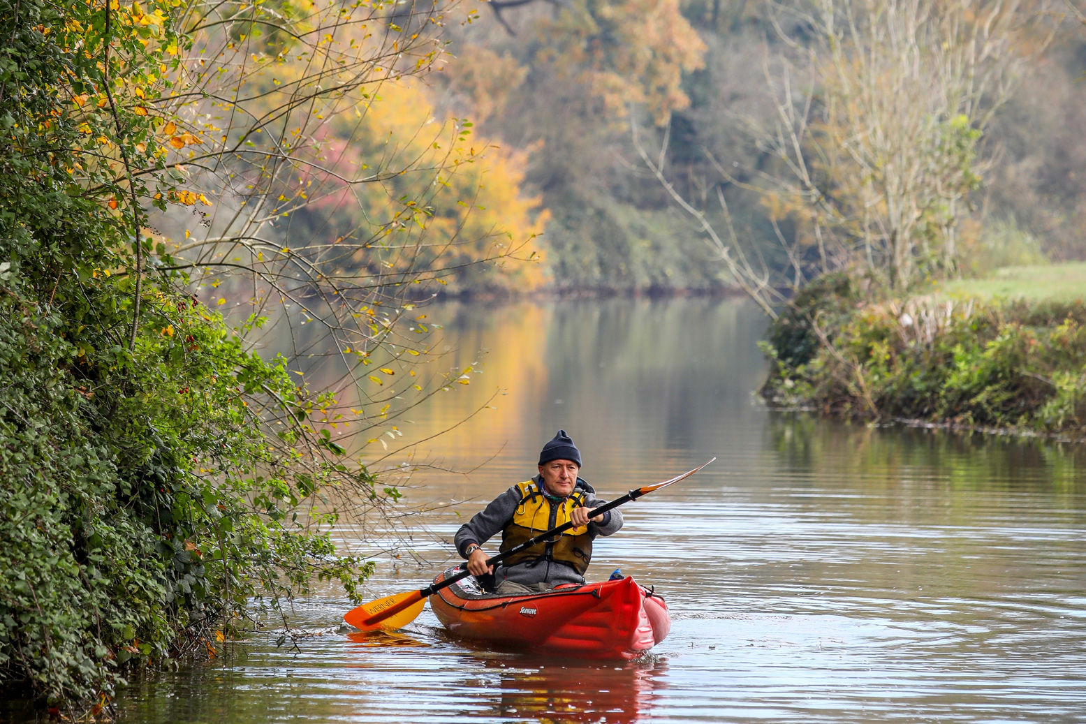
I’ve often thought of doing a really long river in France, but once you get out of the hills I get the feeling they can drag on a bit, even if it is France. It didn’t stop these two guys; 5 weeks from Goudet near Le Puy (near the Allier) to St Nazaire bridge just under Brittany. First couple of days they had to wrestle some pretty gnarly rapids in their 4.1-metre IKs. Never mind ‘dress for the swim’ – ‘pack for the capsize’ too! Interestingly, one suffered a flat on the Framura’s relatively pointed back corner, presumably from all that rock scraping. I’m amazed those rudders survived, too. Even with its fixed deck, sometimes I fancy a Framura. At just 75cm wide, it was the new Seaker but half the weight. But then I see how they flex, being long but only regular 2.9psi Gumboats, not 3.6psi like the Seawave. It’s quite a difference. And those are twin-tube sides, so jacking up the psi there, then fitting PRVs, as I did to my Seawave, would not be such a good idea (the I-beam in the side tube could rupture).
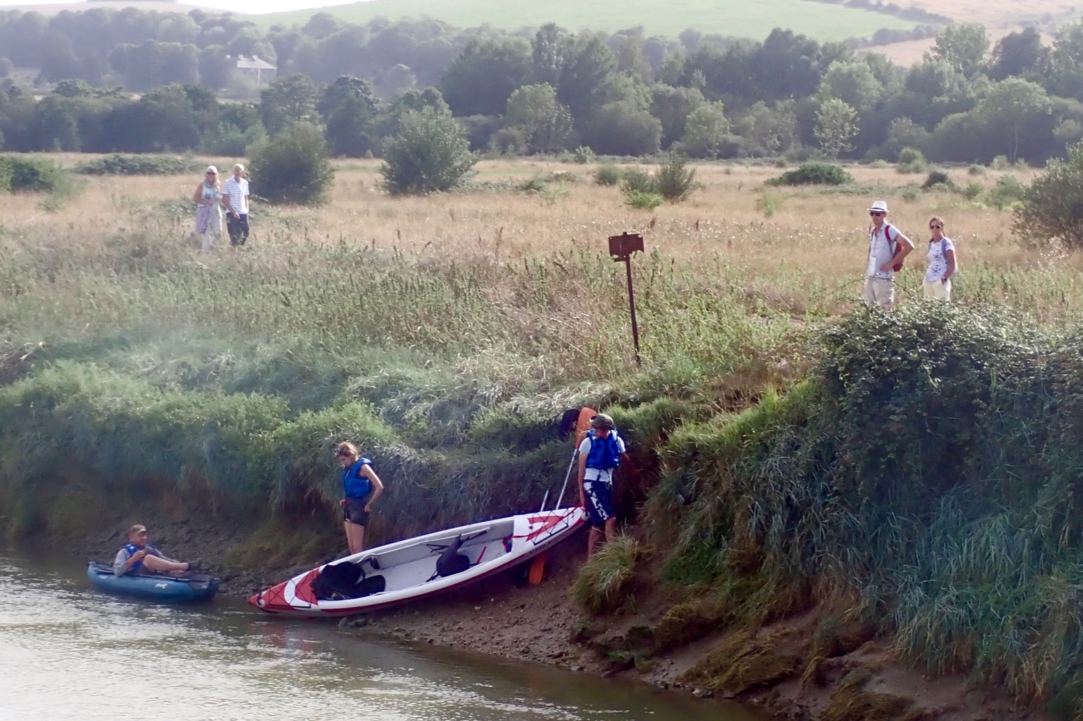
In the beginning when I was keen to try anything, I paddled Sussex’s River Arun and the upper Rother too. Neither made me want to rush back to tick off the other tidal rivers of southeast England. You feel you’re in a sunken, silty, reed-chocked ditch passing below treeless agricultural land and with limited, muddy take-outs. But Robbo was taking his Full DS Yakkair for a burn up; a good chance for me to check the boat out as well as try something new. He’d worked out the tides: putting in on a 6.5-m spring tide at 11am in Upper Bedding (the former medieval port of Steyning) would scoot us up 10km to the tidal limit under the A281 bridge near Shermanbury.
Put in at Upper Beeding.
In Beeding there’s a free car park at the east end of the village by the playing fields (maybe toilets), plus a garage and a Subway nearby. Arriving with Kahuna Steve at the steep east bank just south of the bridge at 10.30 (above), the river was flowing downstream like rivers do and faster than we could paddle against it. Had we timed it all wrong? But by the time Rob and his two young chums were on the water with us an hour later, the moon was doing its work and the river was flowing as fast in the opposite direction, backed by the southerly breeze pushing through the Steyning Gap in the South Downs.
The gang leaves Upper Beeding on the rising tide
Yes it’s another tidal Sussex ditch with lots of day-amblers either side, but who can complain being on the water on a sunny day in a boat you brought in on your back and gangs of menacing swans to dodge? Robbo was spinning like a break-dancing turtle in his tiny Twist, Steve was piloting his old Feathercraft Kahuna, the folder nursing a broken plastic rib from last year’s Danube run. And E&L were in Rob’s dropstitch Yakkair which you can read about here.
Twist, Kahuna and…… FDS Yakkair. Packboats one and all.
As we cruised effortlessly northward, the chat subsided and the river got narrower. Reeds and fallen trees closed in to just a boat’s width at times. Upstream I noticed a couple of access steps on the west bank – maybe private but the only way of getting off the river with some elegance, if needed.
Tight spots in late summer.
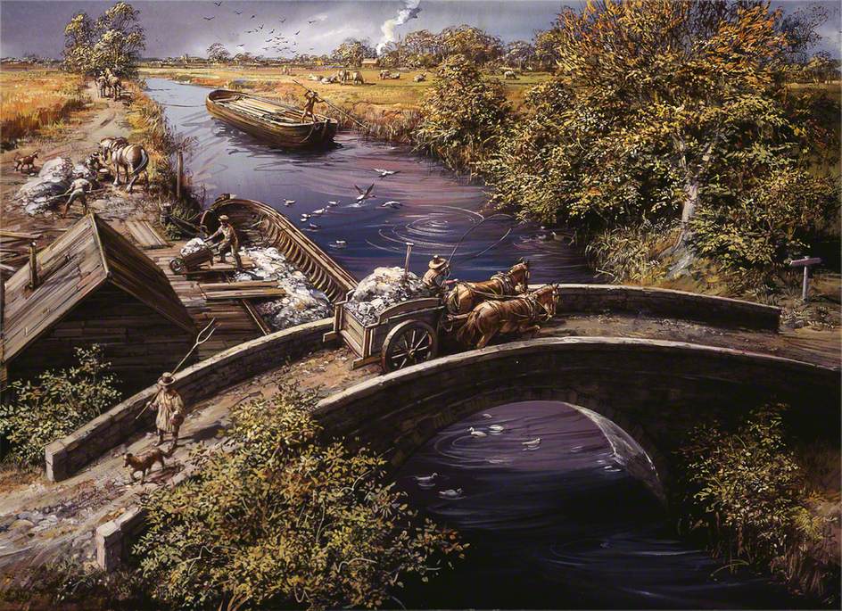
We reached the fork in about an hour 20. Northwest leads to Bines Bridge, romantically depicted by renowned 1960s illustrator, Michael Codd. Look him up: he’s rendered loads of idealised Sussex illustrations from the late-medieval iron ore industry right back to Neolithic hunting scenes.
Michael Codd; Bines Bridge, River Adur; West Sussex.
Taking off up the east arm, very soon a submerged weir slowed down the three skeged IKs. The Yakkair needed a lift over. Then a fallen tree appeared to block the way but the boats squeezed through. Here we met a local couple in their new Itiwit 3-seater. These must be the most popular IKs around right now, maybe because Decathlon were able to meet the huge demand after the first lockdown this summer.
Lifting over the weir bar.Itiwit encounter.Nearing Shermanbury bridge.
From here the scenery picked up briefly. The fields didn’t run to the water’s edge and riverside willows dangled over the stream. We reached the four-arched bridge near Shermanbury about 2pm for a snack (easy take out on the right), but had it in our heads we should turn round pronto. It soon became clear the spring tide here kept rising up to 3pm, a full 2 hours after Shoreham, maybe pushed up by the day’s wind.
Take-out at high water by Shermanbury Bridge
The weir bar that has been six inches below the surface on the way up was now two feet under. Good to know The wind had strengthened and was now in out face so there was nothing left but to have a work-out. Steve and I pulled ahead as gradually the flow turned our way; the Downs making a good marker for where we were headed. We got back in about an hour 30 and managed to crawl out without covering ourselves and the boats in mud. As Steve sagely observed, anywhere else in the world there’d be a civilised jetty to encourage paddling.
Leave it too late on a dropping tide and a take out is messy at Upper Beeding.
About the Adur tides: High tide in Upper Beeding (Steyning) is about 45 minutes after Shoreham and about 2 hours at Shermanbury. That brings up the brain-twisting notion that water levels are rising upriver while falling at the estuary. Somewhere a spooky patch of slack water is migrating silently upstream. With a skeg the weir bar is submerged enough about an hour before a high spring tide at Shermanbury bridge. Neap tides may not submerge it so just take the left fork towards Bines Bridge and see how far you get.
Next time it would be fun to start in Shoreham, at least 7km downstream from Upper Beedimng, and take more time at the top end – maybe at the Bull Inn near Shermanbury bridge – before riding the current and tide all the way back. You’d hope there’s a mud-free take out or slipway somewhere in Shoreham harbour.
Darn. I put my Seawave on eBay to ‘test the water’ and it went within hours.
Still, it’s an excuse to show some of my favourite Seawave shots in five seasons of fantastic paddling. What a great boat that was. So great that, with nothing better available at the time, in October 2020 I bought another Seawave (left).
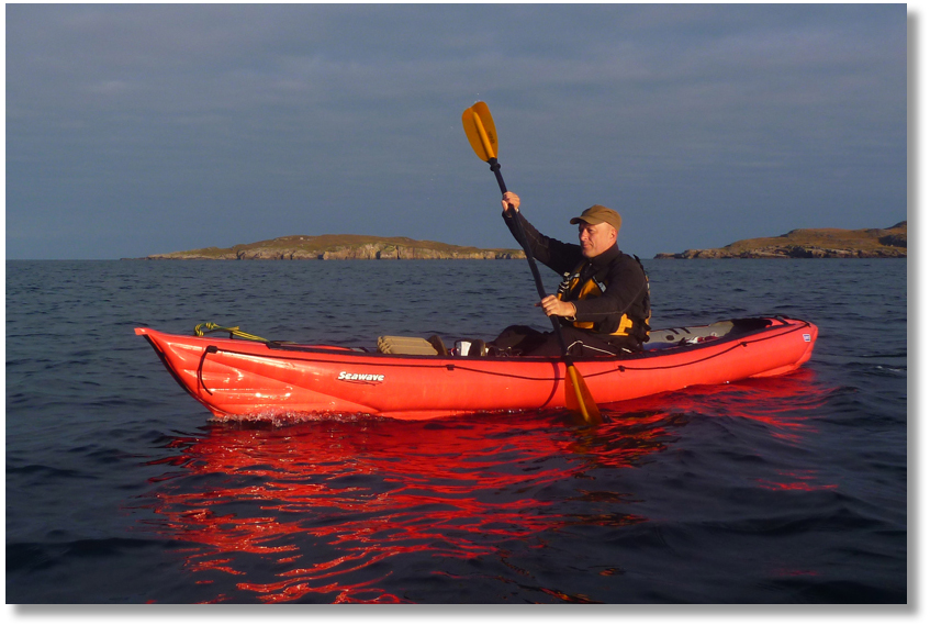
Venice lagoon; the only other Seawave I’ve ever seen. [Story]Early morning Swanage stacks. [Story]Lap of Hayling Island. Not as interesting as it looks. [Story]The far-flung wedge-skerry of Angus, outer Summer Isles. [Story]Tanera Beg, Summer Isles. [Story]Autumn sunrise on the way to Priest island. [Story]Limehouse Cut, London’s oldest canal (1769). [Story]Overgrown track to a lake in Sardinia.Grotto at Cala Luna, Sardinia. Our only wind-free day in a fortnight.WindPaddling around Coigach Peninsula [Story]Spring on the Medway, Kent. [Story]Short-lived MYO rudder experiment. [Story]
I really want to go with you Really want to show you, Lord That it won’t take long, my Lord Hallelujah, Hare Rama….
Picked up while scanning the radio on the drive to Tonbridge, there were much worst earworms to be stuck with than George Harrison’s 1970 pop hymn.
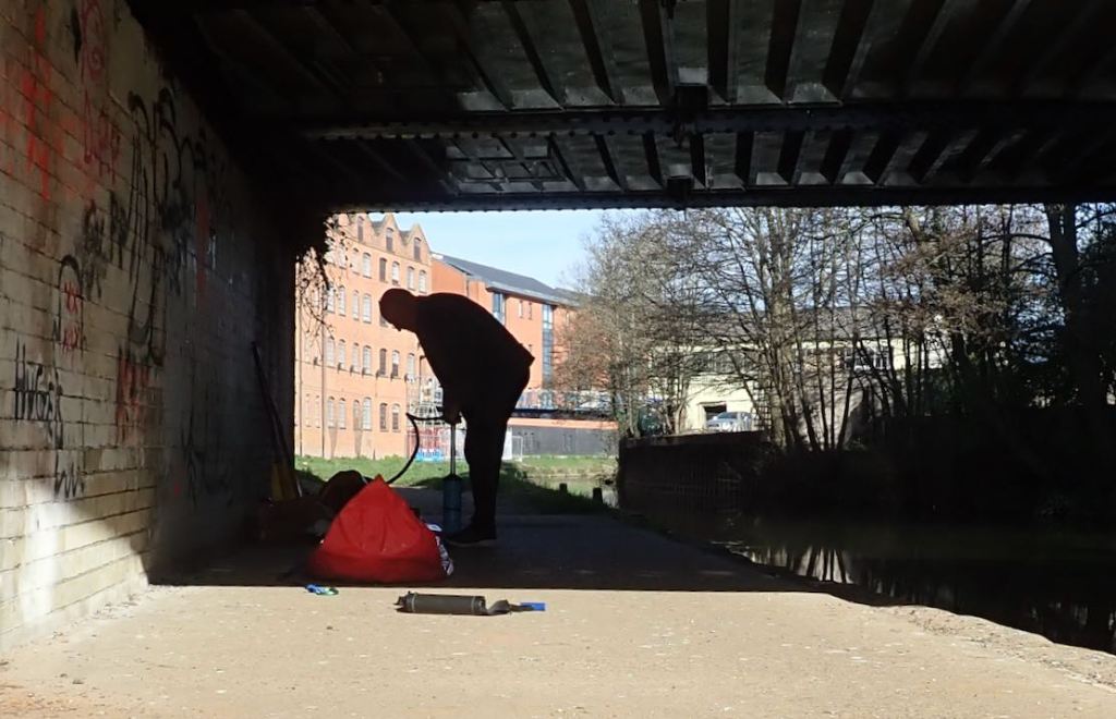
I was on the water at Town Lock before 9am on a mid-September day set to hit 25. This was surely, absolutely, positively the very last day of summer. End of! But just after 9am something was wrong. The MRS was saggy and I knew why. Annoyingly, it tends to need a top-up a full 5 minutes in, not just by resting empty on the cold water as I get ready to hop in. I put it down to being a high-volume and thin-skinned boat which takes a while to cool down and lose a little pressure once on the water. Plus, because you sit in the middle – not the back like a normal packraft – you notice the hull sag-crease to either side and feel the flex-bobbing as you paddle. That is why the K-Pump I’d dismissed today is a good idea with the Nomad: it gives the MRS a darn good over-pump before putting in and avoids the need to do it again in a few minutes. I suppose another way would be liberally splashing the boat all over for a few minutes before final top off. Now as taut as a harp string, I set off into the low morning sun, passing trees still in full leaf but slowly losing their sheen. I know that feeling.
The Medway would ordinarily be a fun-to-do-once southern English river if it wasn’t for the half-dozen jaunty canoe chutes installed to bypass the locks and weirs without portaging. Another way of spicing it up is to race it in a K1 kayak little wider than your hips. The first such bloke shot past me annoying close, paddling so fast he was bobbing up and down like a dashboard doggie. Soon a few others followed, including a double which must have been 22 feet long, and a guy in a plywood Wenonah with a lightning-fast single-paddle switch.
On the walk to Town Lock I’d passed several bands of early-morning Mamils browsing and clacking outside Tonbridge High Street’s 525 coffee shops – a common Sunday-morning sighting these days. But it seems a sub-species has evolved out of the recreational lifestyle gene pool – Mamiks – steely-eyed K1 kayakers, competitive City types going hell-for-leather, a club burn-up belting past at what looked like double my speed. But it seems one thing these slender 18-foot training razors couldn’t do was shoot the lock chutes, even if it saved them minutes of cumbersome portaging taken at a trot. Presumably skimpy and unhinged rudders would snap off, or the pencil-thin boat would get crossed-up on exit and flip like a fish-farm salmon.
By mid-morning there were plenty of other regular paddlers on the Medway: SoTs, canoes (but no SUPs), all enjoying a sunny Sunday on the water. I even spotted two Medway firsts: a wild swimmer bobbing along, followed by a naturist wild swimmer tiptoeing down a bank and finally, another old couple in their brand-new retirement Sevy Riviera which looked uncharacteristically pert. My sweet lord, they’re all out today.
Sweat was dripping from my nose and the back-breeze helped, but I did seem to be going at a good old lick for a packraft. I also noticed that I was paddling like you’re supposed to. I spotted this bizarre development on my last outing: I was pushing forward with my high arm (‘press-ups’), less pulling the lower arm through the water (‘pull-ups’). I was informed of this technique (along with ‘lighthouse’ torso pivoting) years ago by a mate who did a 1:1 paddle-stroke course, but don’t know what’s suddenly brought it on. Maybe I’ve had a knock to the head. Up ahead it was time to line it up and sluice on down the side of Sluice Weir – the longest, steepest and sadly the last chute on this part of the Medway. I imagine it’s given many newbies a bit of a fright, but the light and buoyant Nomad sashayed off the end with a shrug. From here it was dogwater all the way to Yalding Tea Rooms where I caught up with a young SoT woman who’d left Town Lock just before me. Following her for a while, she was definitely flagging. I knew that feeling at around this distance too, but not today.
I never know how far this paddle is, or I forget as I circle, gape-mouthed round my gilded bowl. 12 miles? At least 3 hours then, so I thought I might catch the hourly 1.12 train from Yalding back to Tonbridge. But by half-eleven I was already upon Hampstead Lock (above), 11 miles according to the official map (below). Take out the breaks and that was a moving average of 5.5mph. Five years ago I thought 3.4 was good. I need to update my avatar. Not bad for a packing MAMIK then, and a great way to end the season.
Hare Rama, Hare Krishna, Krishna Krishna…
Afternote
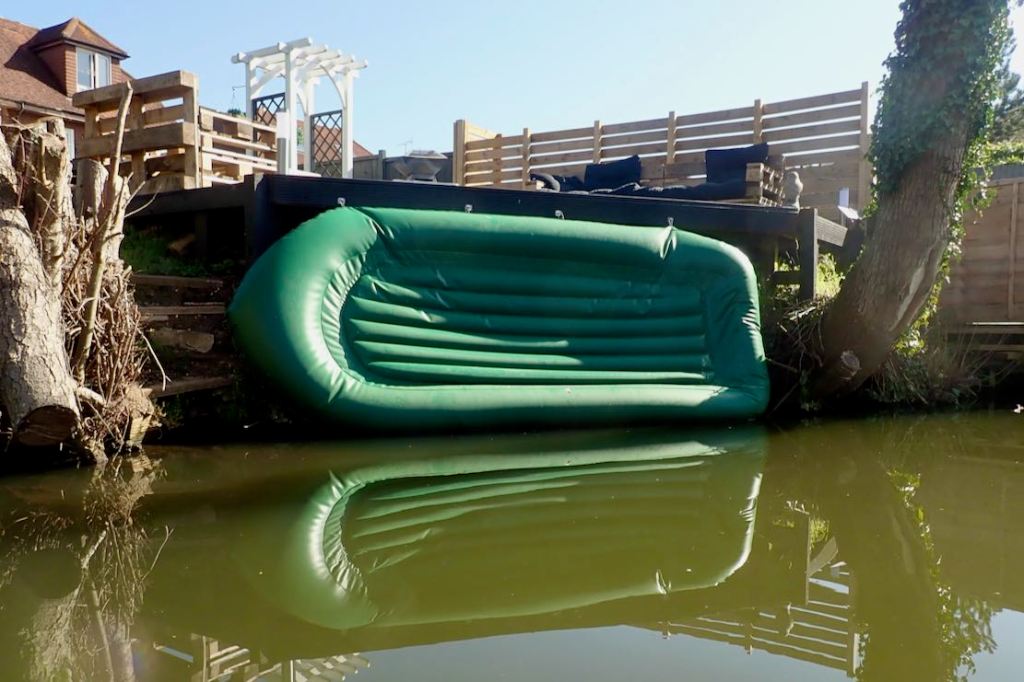
Like many paddlers, when I get out of the boat I’m always careful to hold the lead and move slowly, in case I kick the very light boat away from the bank – an awkward situation if alone, especially on a Pacific island with a typhoon on the horizon. While the Nomad was dripping dry at Hampstead Lock, resting on the beam of the lock gate, a gust blew it into the lock. Bugger! Luckily, it landed right way up, but ten feet down, there was no way I could reach it. Luckily too, it was caught in an eddy caused by the sluicing and right by the wall, not drifting off towards Maidstone. This gave me time to think. I reassembled the paddle and, hanging right off the lock side and holding the blade by the tips of my fingers, was j u s t able to nudge the boat towards some slimy steps, just as a motor boat drew up to the lock, probably wondering ‘What the heck is this chap playing at?’ I’ve learned similar lessons with pitched but unweighted tents: beware the unseen gust; it blows for you.
After-afternote
During this gust-driven mini-drama, out of the corner of my eye I’d spotted some IK activity nearby; something grey and thin; something green and fat. Turned out it was man and boy heading out for a paddle in a Razorlite 393 and a Gumo Swingbot. I’ve not seen the drop-stitch Sea Eagle before (nor a Swing, tbh) and have to say I was impressed by the look of the SE – and not just because it was next to a dumpy Swing (not one of Gumotex’s finest IKs). Those wide footrests on the RL might well help brace it, as long as knees don’t get in the way. And it had what they call a good fit and finish, but then so it should for a grand. The bloke knew his Gumboats and that a few other brands produced DS IKs near-identical to the RL. He was very pleased with the fast Sea Eagle. I’m still not convinced by the flat floor but one day I’ll getI got to try one.
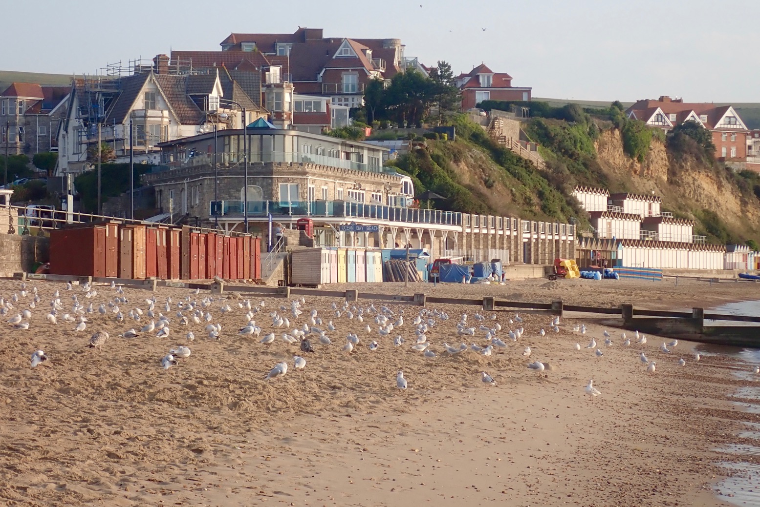
Ten minutes after a paddling away from a tranquil Swanage seafront bathed in a Turneresque light (above), we found ourselves battling a stiff breeze rolling off the Ballard Downs on the north edge of Swanage Bay. The odd whitecap scurried by, a sign that the IK Limit was not far away. This felt like more than the predicted 10mph northerly. We dug onward, and once tucked below the cliffs the pounding eased. The northerly was probably amplified as it rushed down the south slope of the Downs and hit the sea. We’d paddled through that turbid patch – a bit of a shock before breakfast. What would it be like once out in the open round Ballard Point? Mutiny was afoot.
“Let’s see how it is round the corner, then decide,” I informed the crew. “Aye aye, cap’n sir.”
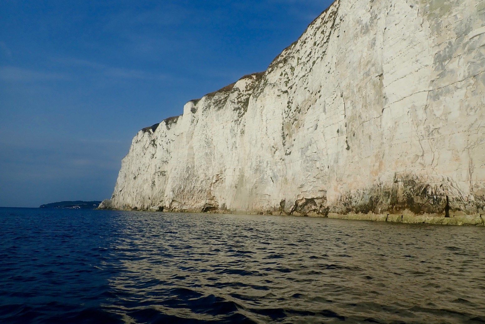
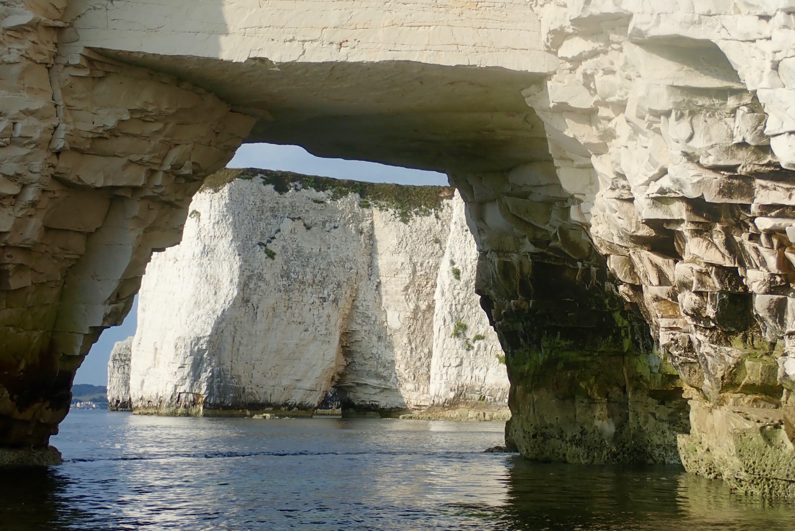
We eased around the corner expecting the worst, but were greeted by a magical sight: a line of 200-foot high chalk cliffs receding to a distant group of stacks and pinnacles glowing in the soft morning light and all soothed by a gentle breeze.
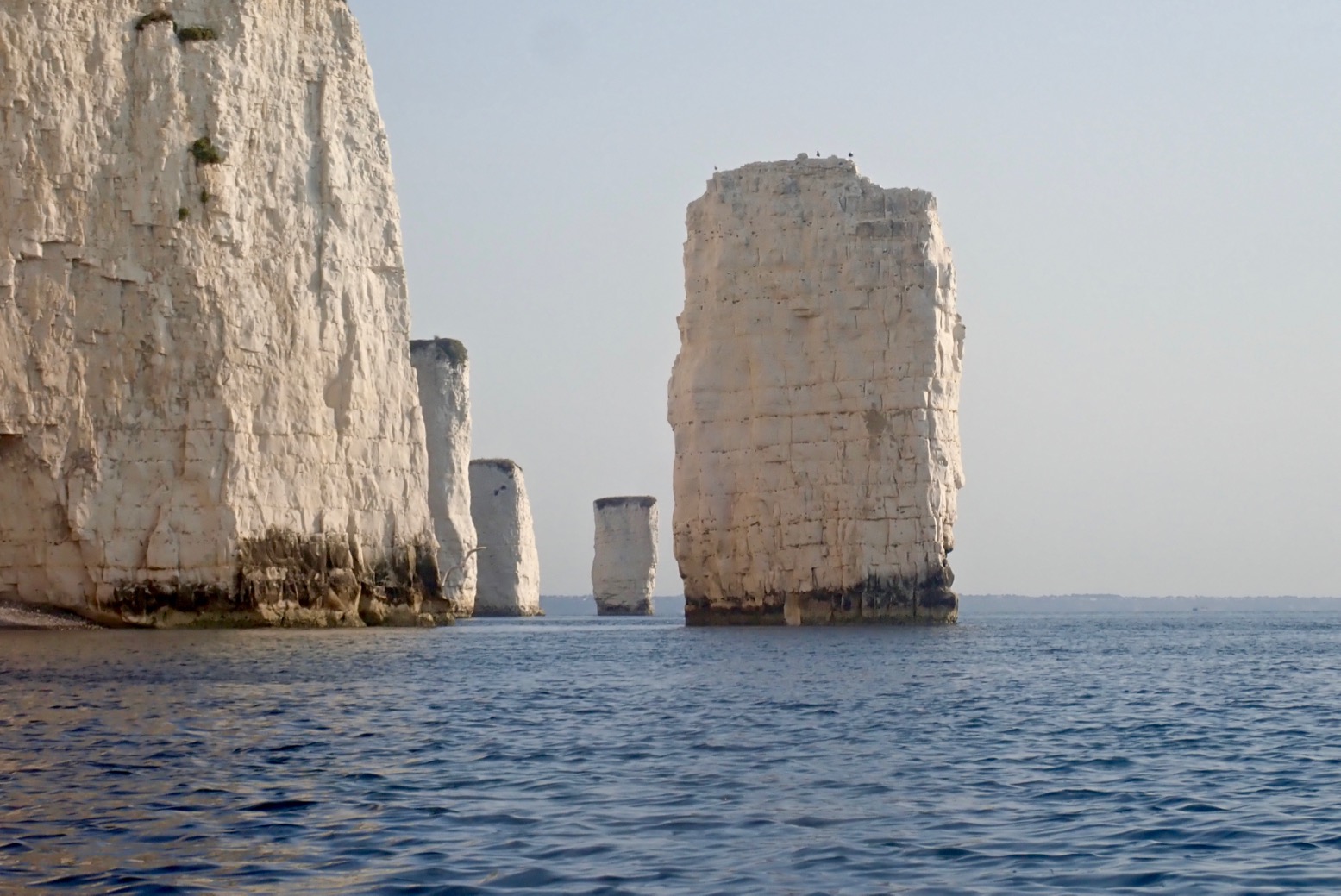
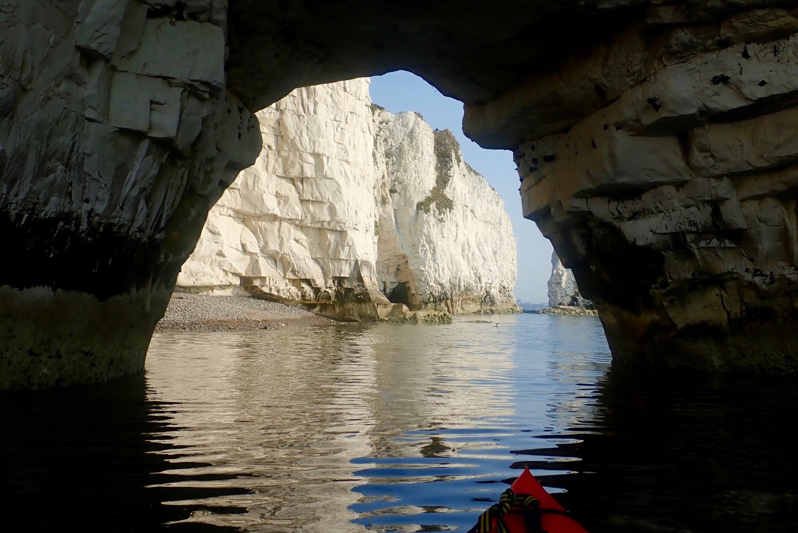
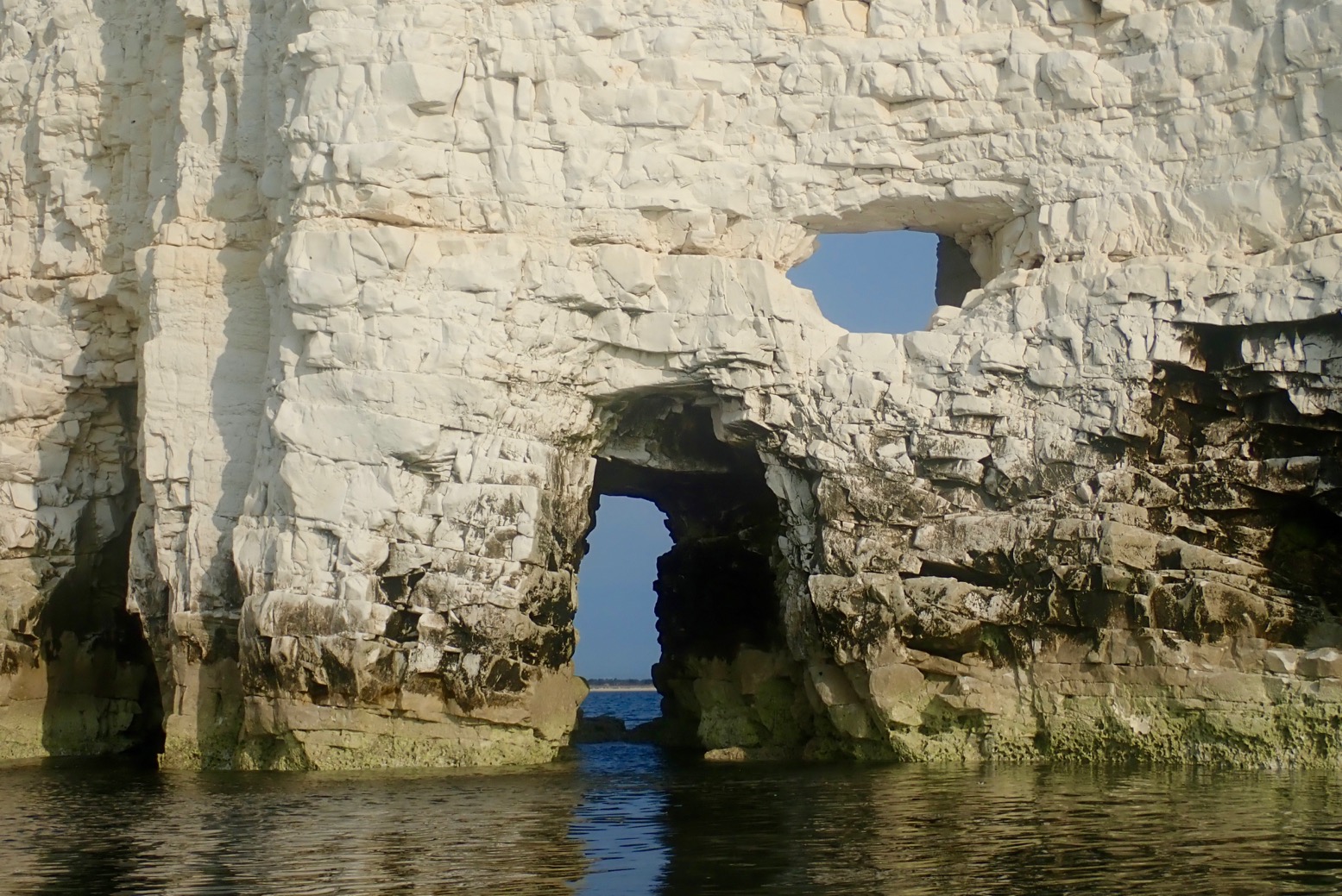
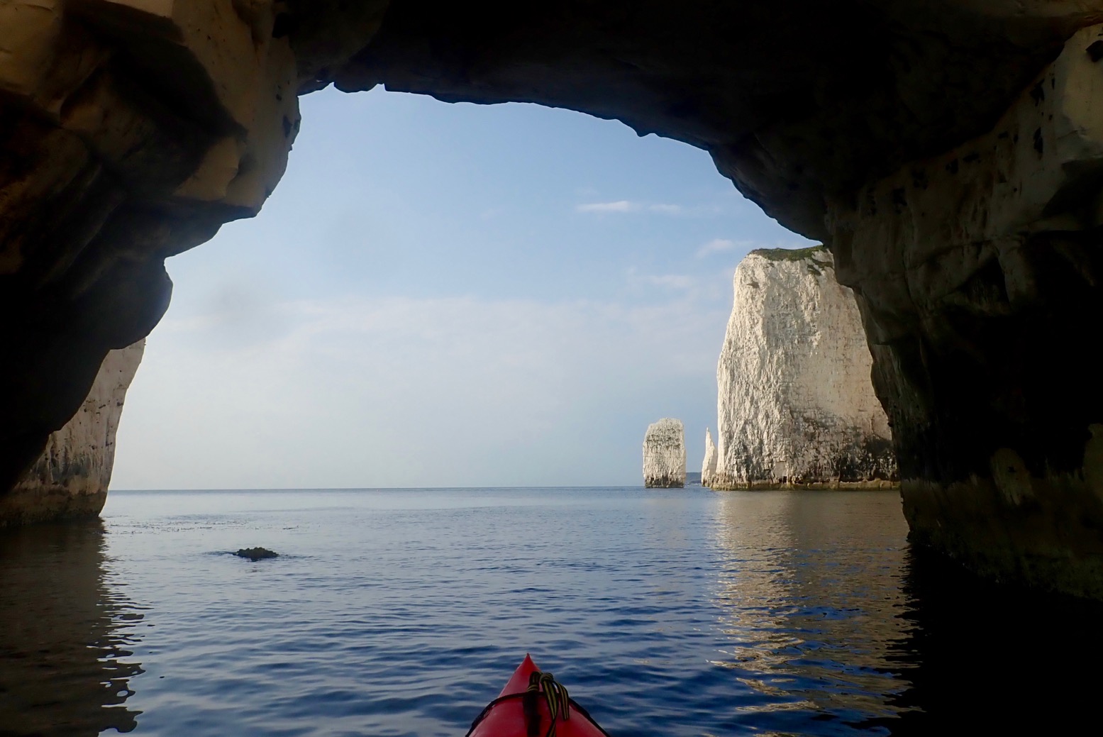
It was only a mile from here to Handfast Point aka: Old Harry, passing several stacks, arches, caves and slots. Ever the goldfish in its bowl, I’d got distracted before looking up tide times, but judging by yesterday evening’s paddle around Brownsea Island in nearby Poole Harbour, it was a couple of hours into its southerly ebb. We arrived at Harry’s about mid-tide but with still just enough water to paddle through most of the arches as well as some narrow slots which were already running too fast to tackle against the flow (below). A bit of a tidal race swirled past the Point, but nothing dramatic.
I’ve been planning to do Swanage for years and it was even better than expected. It must have been packed out yesterday on the bank holiday, but today, before 9am we had the place to ourselves. It’s a fascinating geological formation and all the better explored from a paddleboat.
Lit by a rising sun and on the top half of the tide must be ideal timing for a visit here. All up, it was only a two-hour roundtrip from Swanage seafront and in similarly good conditions would be easily packraftable from the north off nearby Studland beach.
Hope to paddle this again, one time.PS: Little did I know that this summer 2019 paddle would be out last sea paddle in the Seawave. Not since my original Gumo Sunny on which I learned and did so much, have I owned an IK for so long and had such fun times. What a great boat that was.
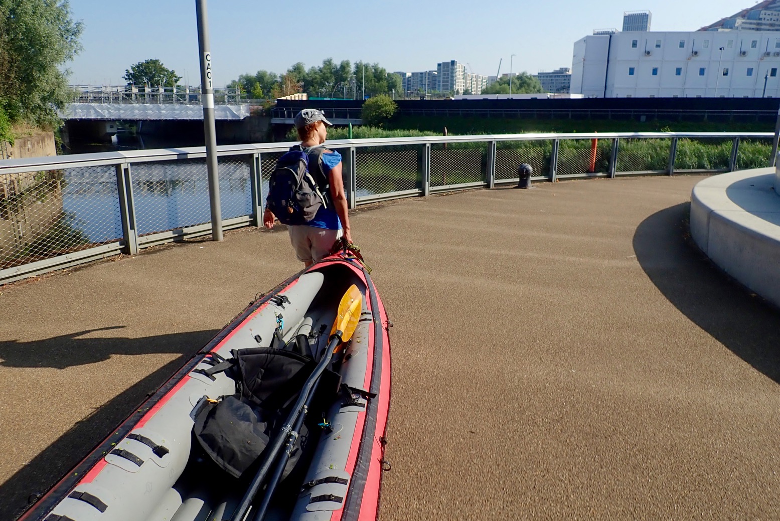
The plan was simple. Put the IK in at Limehouse Basin where I finished up last week, and take an easy canal-paddle up around what are collectively known as the Bow Back Rivers threading through the Olympic Park, then portage over Three Mills Lock onto what becomes Bow Creek. Here, we’d ride its tight meanders on an ebbing tide down to the Thames at Trinity Wharf. Hard left and, keeping on the north bank (naughty), for what looks like an easy beach take-out at Lyle Park, a mile downstream.
Another possible east London paddle route.
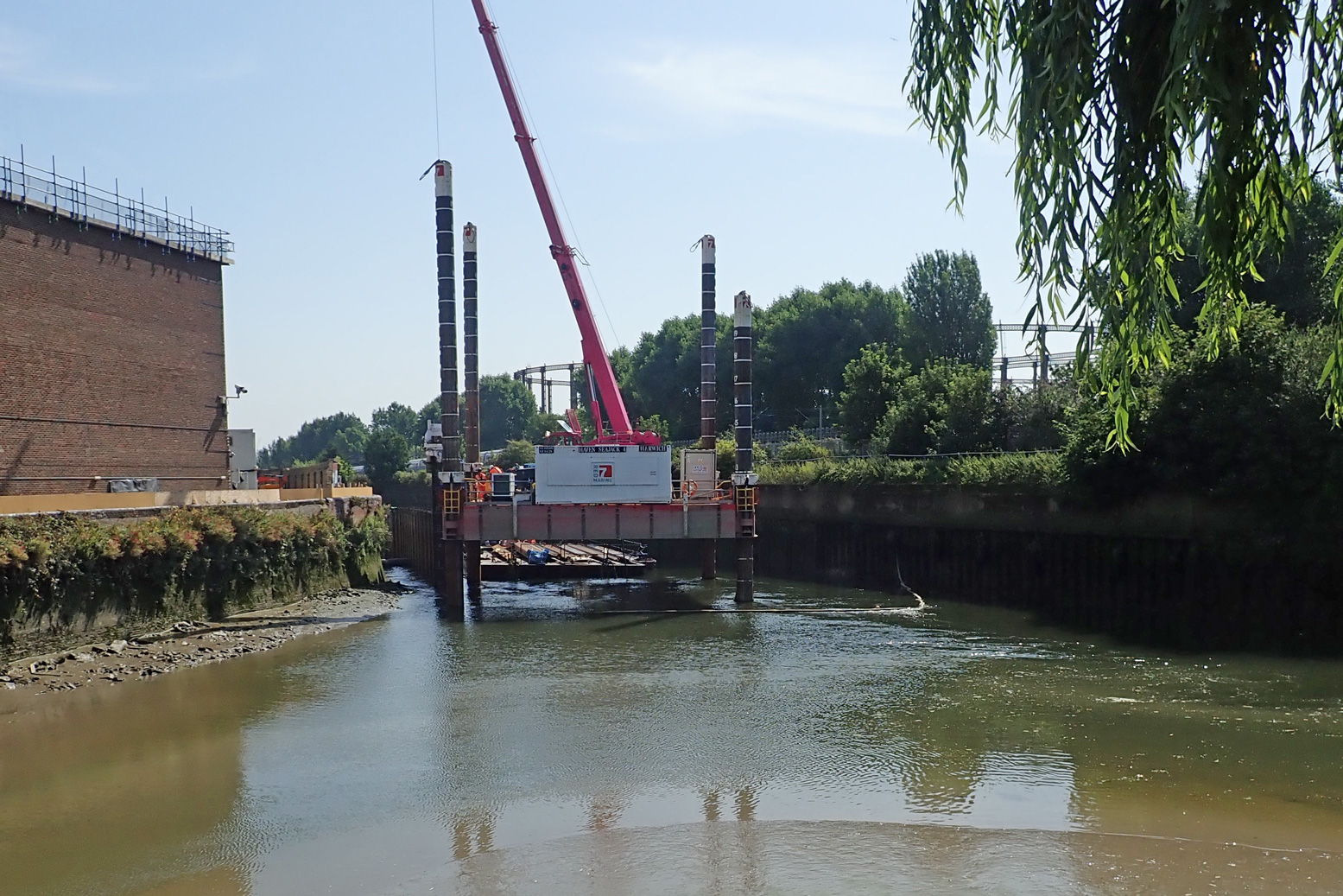
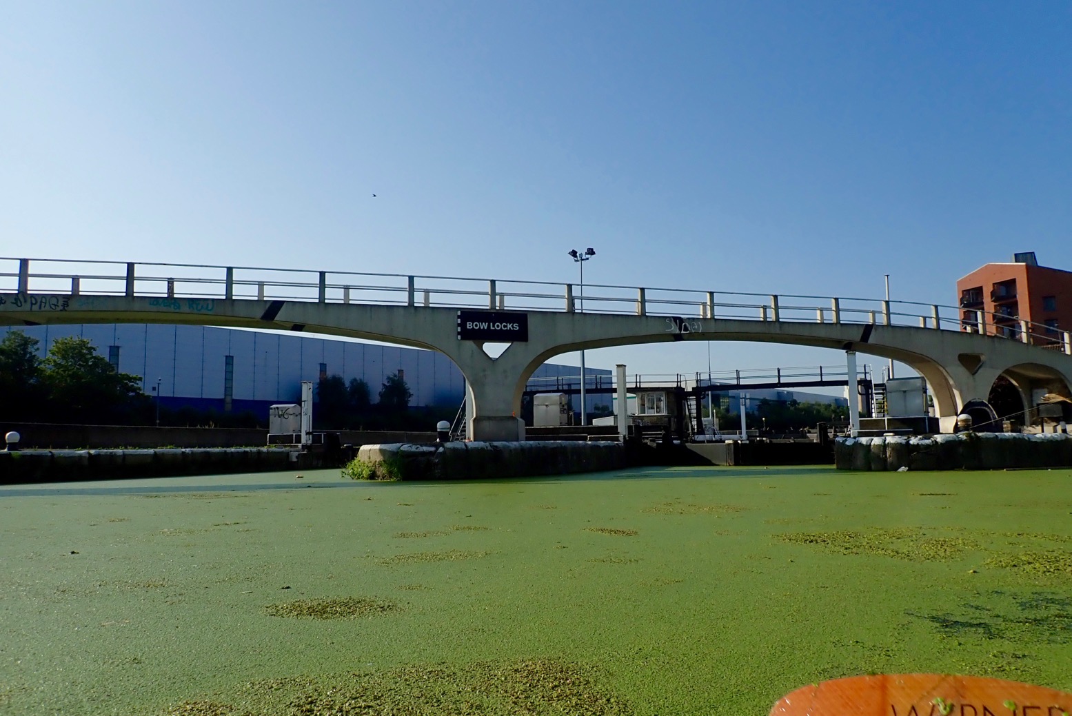
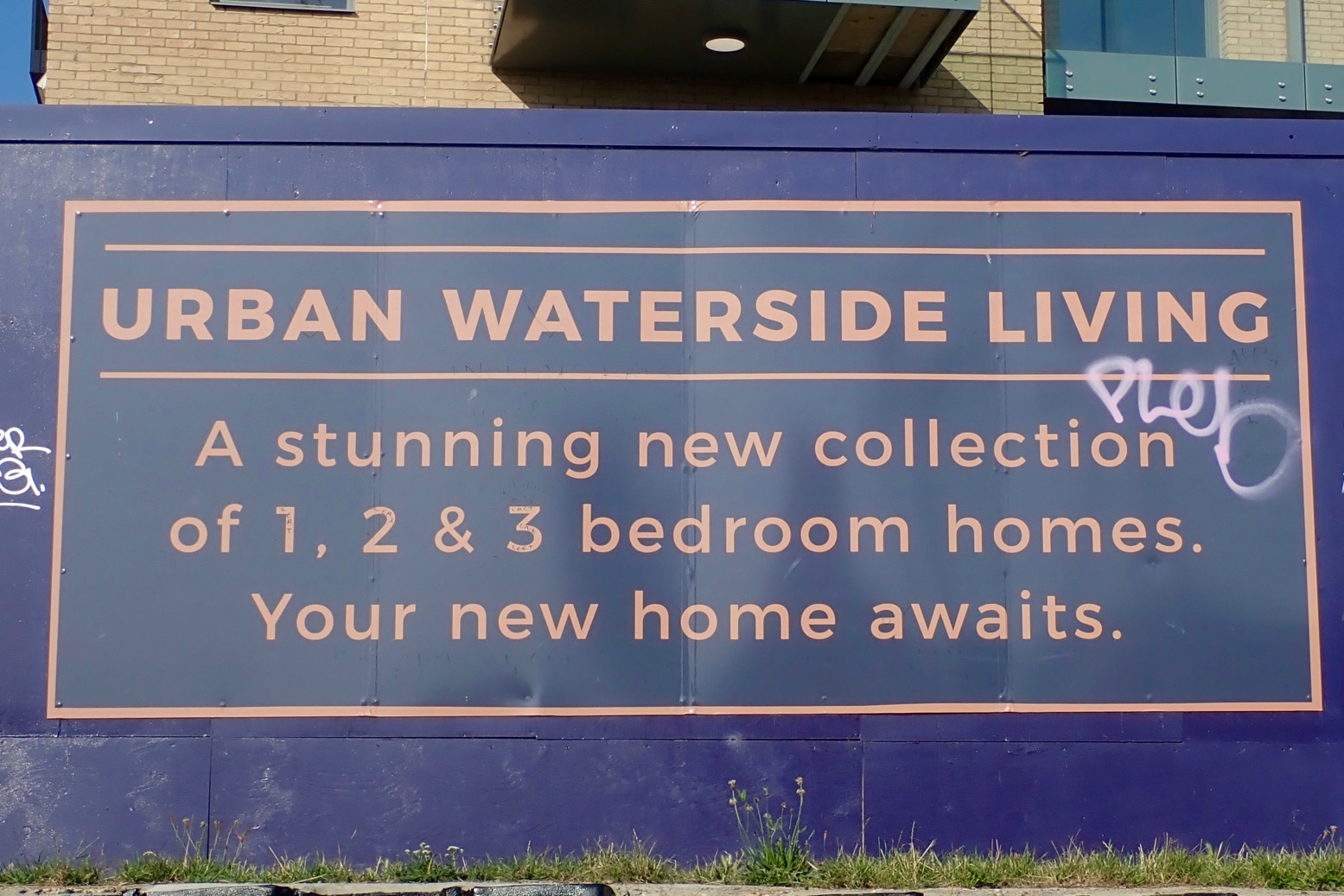
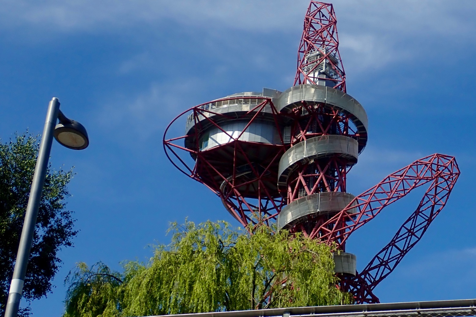
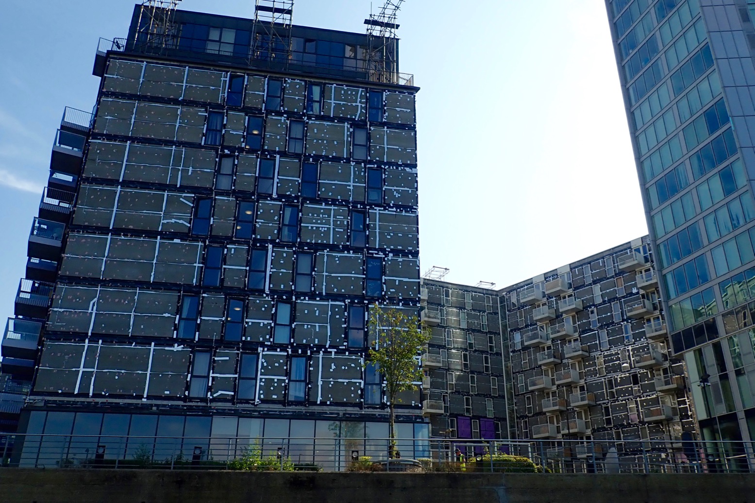
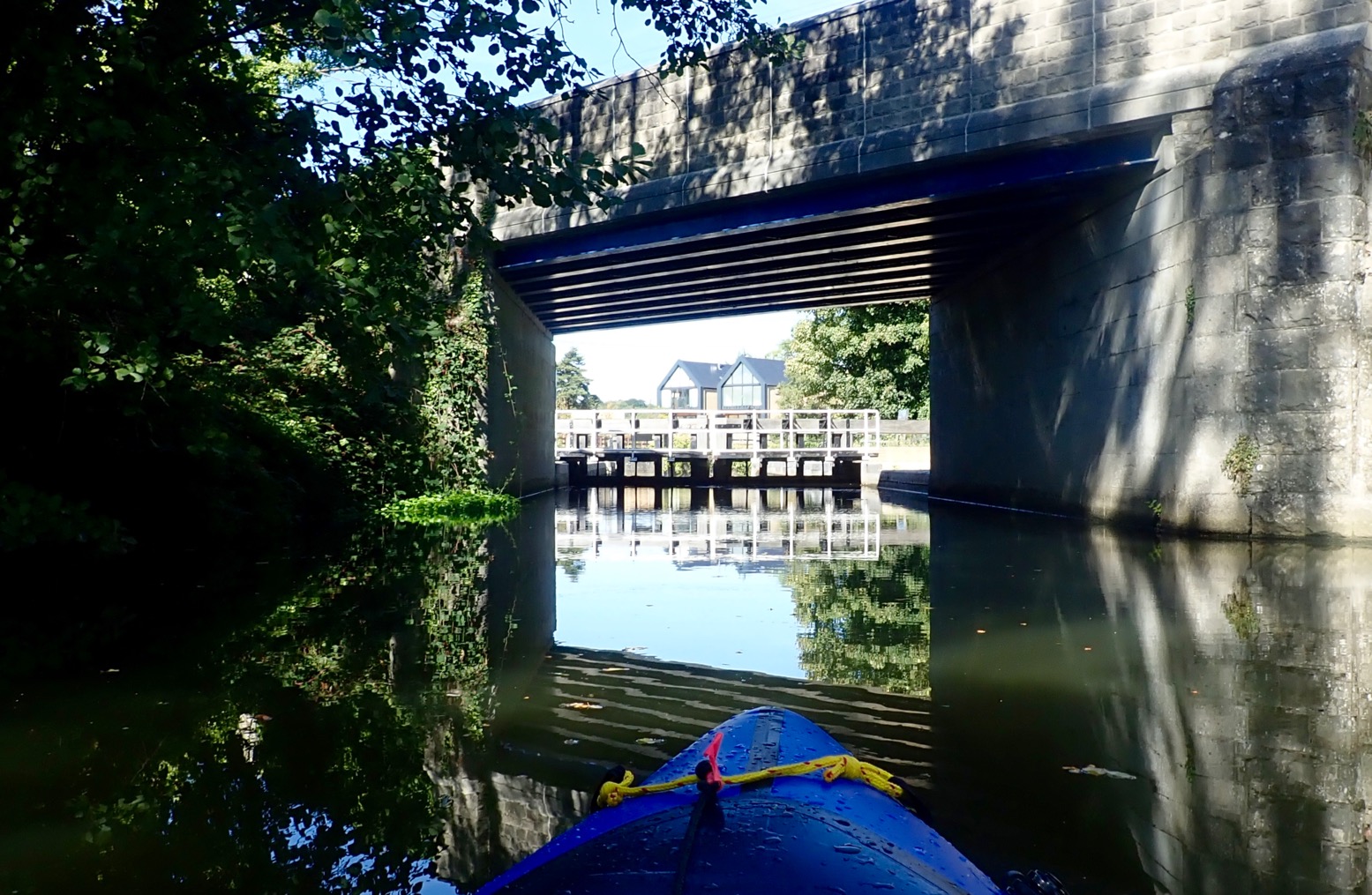
The whole 8-mile run included just two locks to portage. Compare that to 13 locks and two closed tunnels for the similarly long Regents Canal I pack’ed last week. Things didn’t get off to a great start, but next day we were back and on the water before 8am. We set off up arrow-straight Limehouse Cut. Dating from 1770, it’s London’s oldest canal, built to evade the Lee River’s final twisting meanders on Bow Creek which we hoped to paddle on the wat back. (Very detailed history of this river). Two miles on, a thick mat of spongey duckweed backed up around Bow Creek Tidal Locks. Tendrils of weed caught on the paddles and flicked all over the boat. Bow Creek ebbs and flows right alongside the near-stagnant Limehouse Cut/Lee Navigation, but this was surely once a single river system. The River Lee’s (or Lea) source is in the hazy Chilterns of north Luton, and reaches the Thames via Bow Creek, 42 miles later. The Lee River Navigation is paddlable from at least Hereford (Mile 27.5). In England, a ‘navigation’ in fluvial terms means a public right of way for all craft, with a precedent going back centuries. Not all rivers in England are a navigation. This whole underused wasteland between Strafford and Hackney was massively redeveloped for the 2012 Olympics, including the two new tidal locks mentioned. Before that, on the spring tide you could paddle up Bow Creek all the way to Hackney Marshes for some fish and chips. But while great for towpath activities, it seems the developers behind the refurbished network of waterways and new bridges didn’t consider paddleboat access either side of the locks. Odd, seeing as it was the Oh Lympics and all.
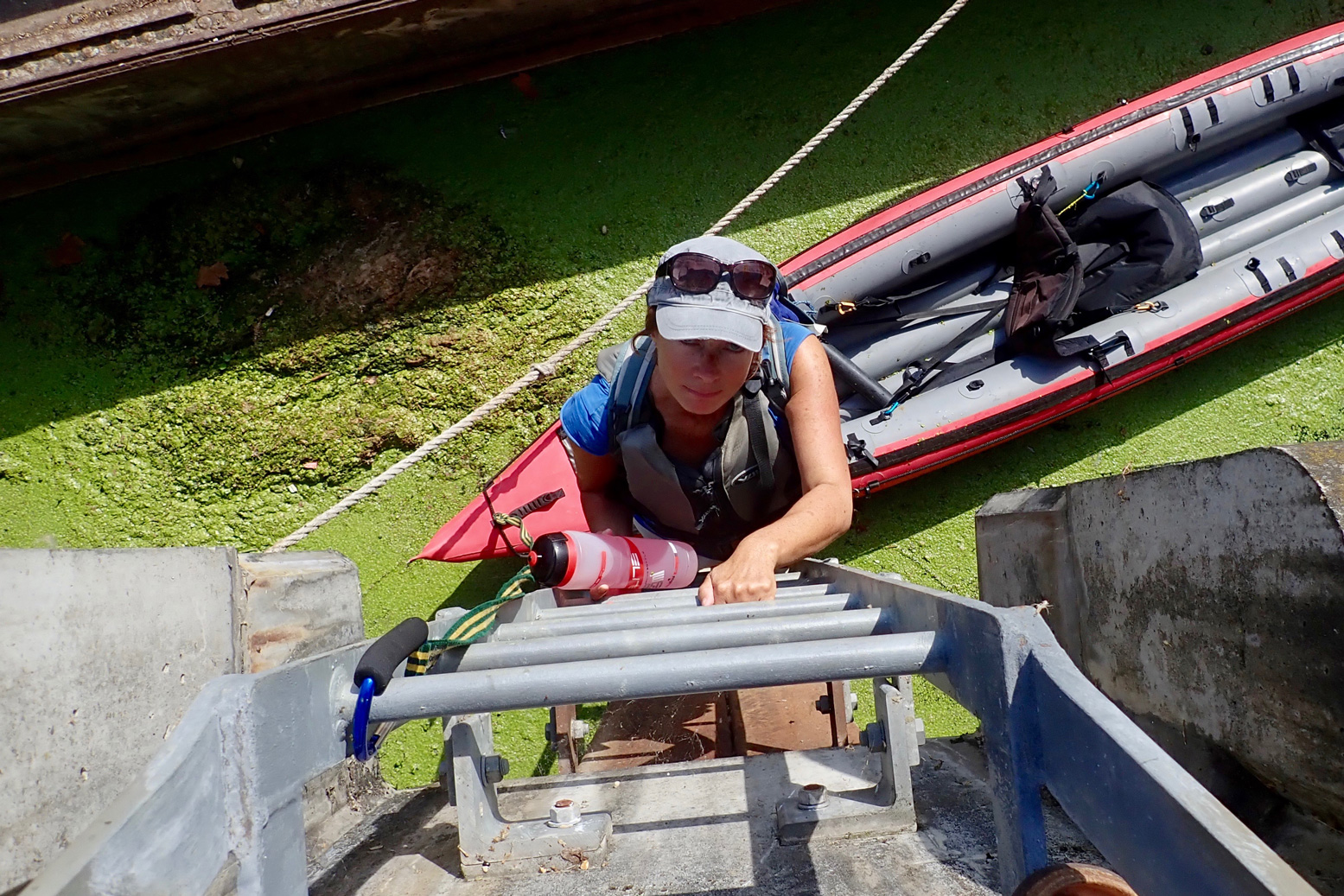
Our first trial came at Carpenters Road Lock (booking required a week in advance). It has a unique radial design with gates lifting a bit like a bulldozer blade. The CRT is very proud of it. Even though it’s permitted, as a single kayak I wouldn’t expect to use this or any lock; portaging is always quicker. But I would expect it to be fairly easy to get out and portage around a lock, just as I did 13 times or more last week on the Regents Canal. Maybe I’m going soft, but clambering up a 12 feet of rungs set in the canal wall, hauling the boat up, and then carrying it half a kilometre to the next accessible put-in doesn’t encourage paddling. What next; the cliff climbing finale from Deliverance (right)?
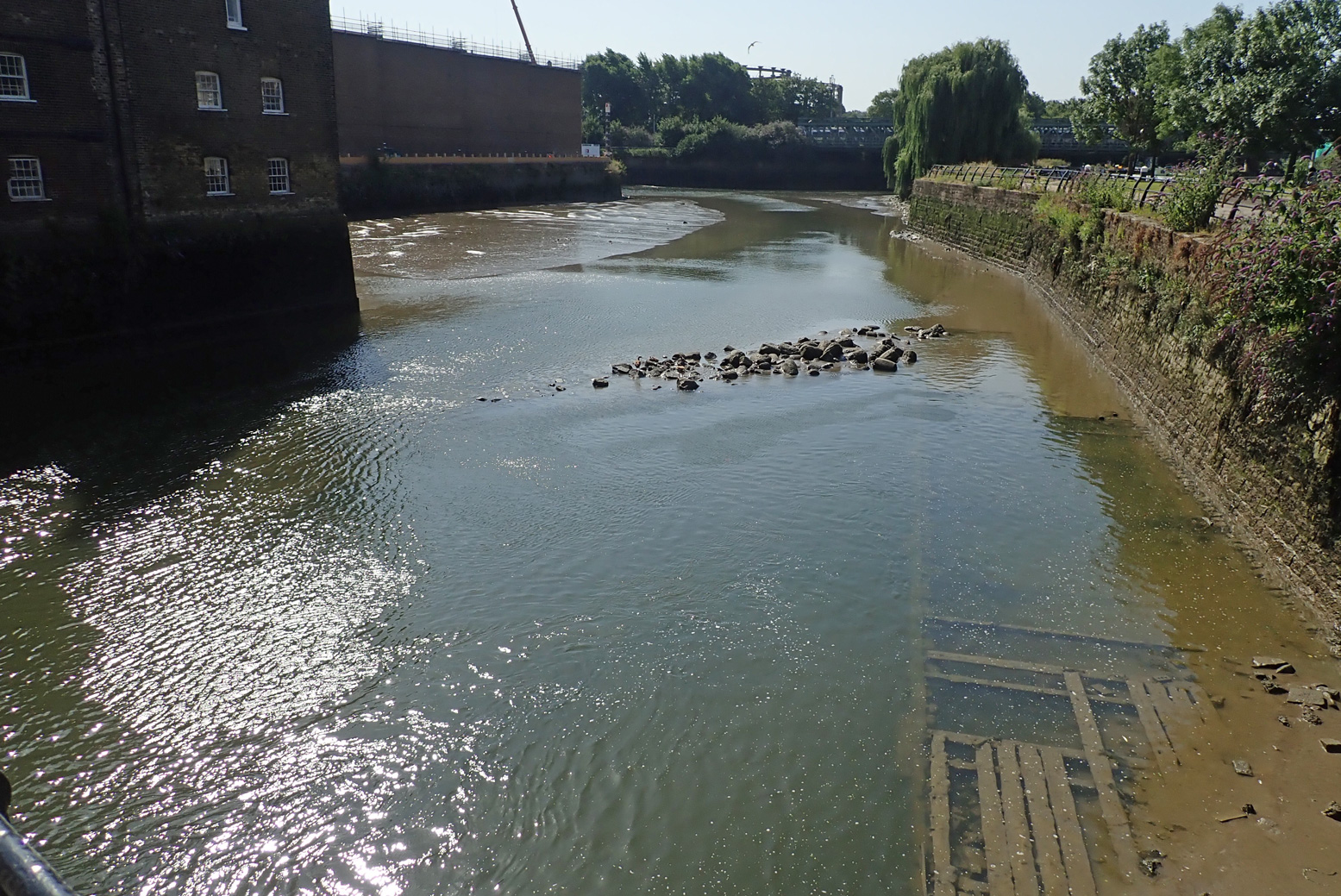
Two miles downriver at Three Mills Lock, (which I read was closed for repairs) we had to get up an even-higher ladder jammed behind a derelict? barge. To access the tidal stretch downstream of the lock, the only way was another long wall ladder, but it was behind temporary barriers. I could have wandered on to the Channelsea River to look for an easier put in, but where it joined Bow Creek (right), a cable or pipe to the crane floated across the surface, blocking the way. On a wild river you portage as long as necessary, sometimes miles. But either side of a lock on an urban waterway, how far do you go?
To be fair I’d timed the tide all wrong. I thought (correctly) that mid-ebb could be a fast run on the Bow, but in my greed for speed I’d failed to appreciate that at the tidal extent (the lock and adjacent Three Mills Island, left, 3 hours before LW at Bow Creek mouth), mid-ebb has already gone shallow. You’d need ropes to get down to a boat. I suppose the easiest way to do Bow Creek is to paddle up with the tide and then let it take you back – this must be what local hardshellers do. With a packboat you can dodge such backtracking. But not here it seems. And whichever direction you do it, once you’re in Bow Creek, I don’t think it’s easy to get out of the high-walled channel. Our East London paddle occurred during a mini-heatwave with temperatures up in the mid-30s. What better place to be than on the water. But not in it: that morning the news reported a staggering three drownings yesterday, all on the Thames and all separate incidents. Lacking the hoped-for thrill of the Bow Creek finale, the route we took wasn’t so interesting from the water, though would be a nice walk or cycle if you’ve never seen the Olympic Park in real life. From the water, you see a lot of high rises or backs of factories or construction to make more of the former. Even with its dozen or more portages, I found the Regents Canal much more diverse and interesting.
Below, some pictures from our day out.
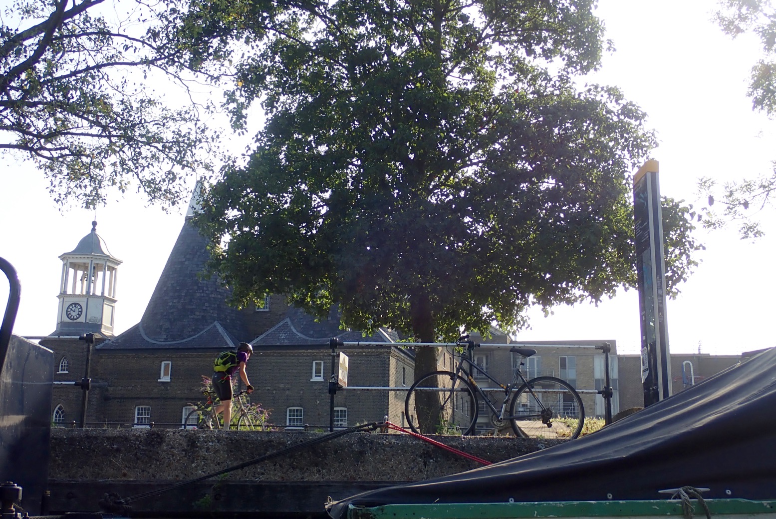
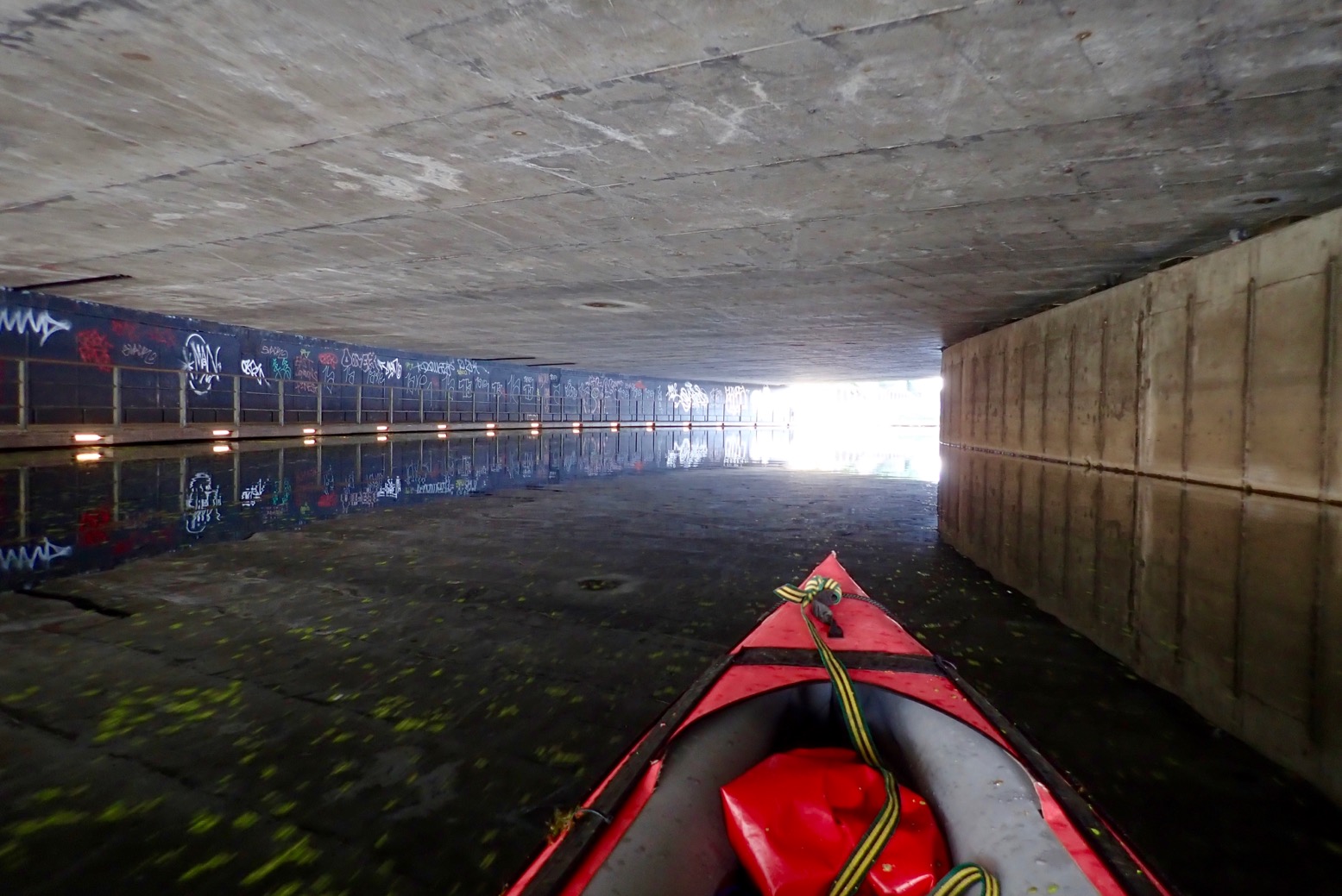
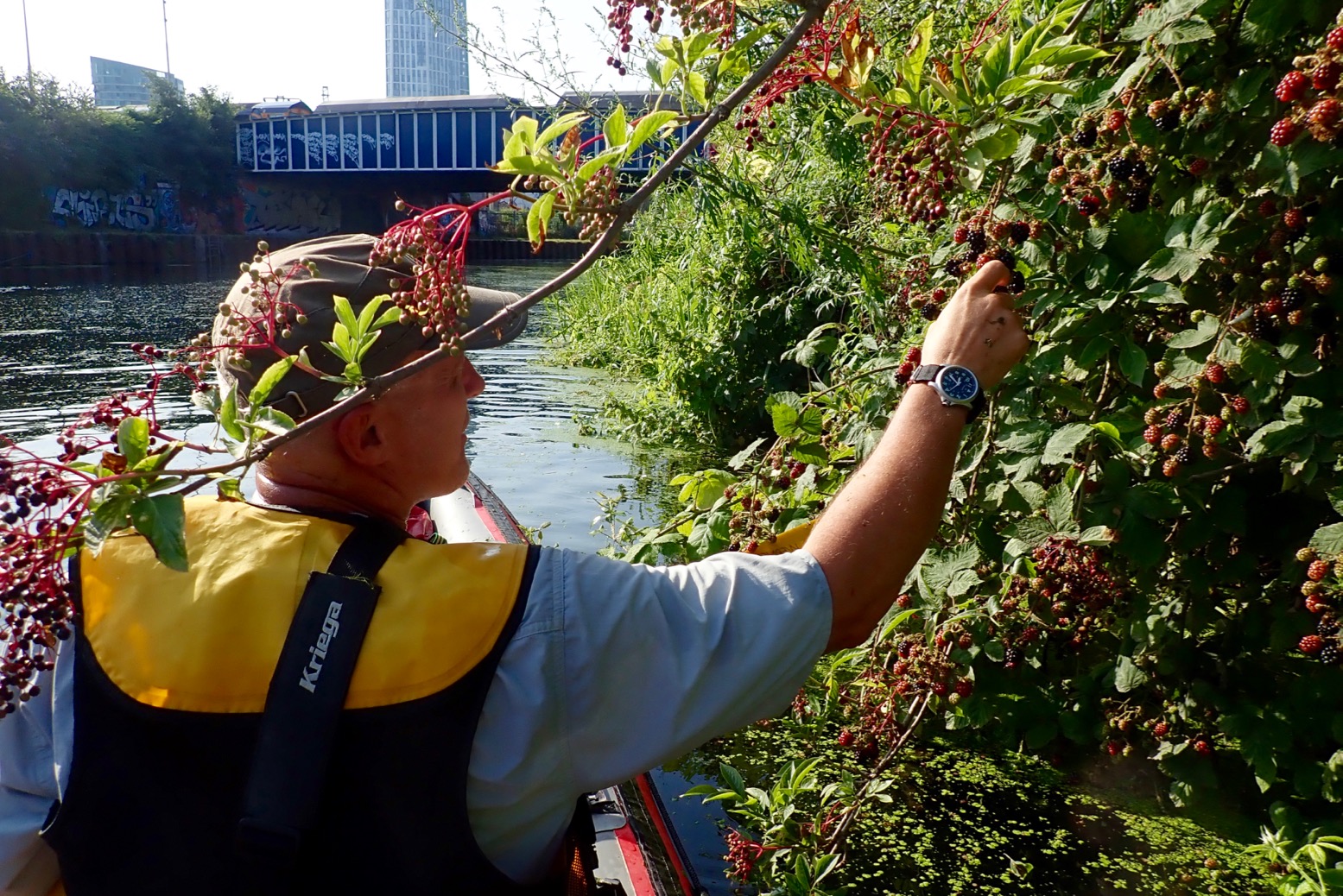
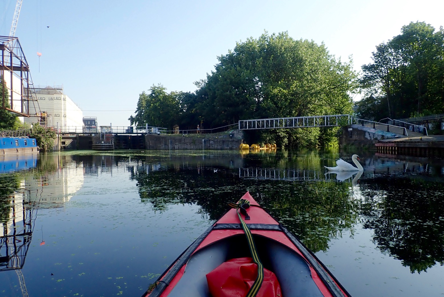
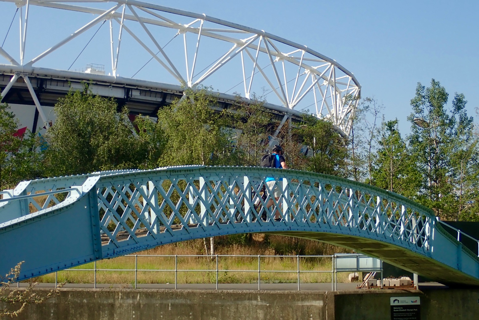
Limehouse Basin 7am.A week earlier, covered in duckweed.A normal-height floating jetty on the east side of the Basin. More of these needed upriver.Thick weed clogs Bow Docks which drop to tidal Bow Creek for the Thames. But there is no easy way to access Bow Creek from the bank. You must book the lock in advance.Three Mills Island complex – there’s been a tidal mill here since Saxon times they say. There’s a cafe.Under the Bow Flyover. The Lee is the notional boundary between the East End and East London. In some pubs it pays to know the difference. Aabout 1200 years ago in Alfred the Great’s time, it was the frontier between Danelaw (Vikings) and Wessex (Anglo Saxon England).Loads of building all around. London will be utterly brilliant when it’s finished.How deep is a canal, you ask? This deep, but often less on the sides.Belladonna and blackberries.Old Ford Lock (Lee River Nav) to the left. Just after, Hereford Union canal leads back west to the Regents Canal near Victoria Park. We follow the Swan right under the footbridge along the Old River Lea, passing below the stadium. Note the two different spellings of Lee/Lea, Ley being the original Medieval spelling. I realise that nearby Leyton + Leytonstone have the same derivation.Nesting heron.Carpenters Road Lock. How do you get up there? How indeed.Actually quite easy out of an open IK. Don’t drop the lead!We could have turned south here under this bridge and taken City Mills River back to the Lee River Nav just north of Three Mills Island and so back down to Limehouse (see map below). A closed loop with no locks which would be an OK canoe or even a SUP. You can rent Moo Canoes at Limehouse.Instead, we portage for 500 metres to the Waterworks River. A superb trolley surface.
9am – time for brekkie in a park before crossing the bridge. There are a couple of snack huts here.
Round the corner from the lock, yard-high put in on the west side of Waterworks River. Gate by the steps locked for no reason so down the ramp past a site entrance. Below the bridge is a short ladder and the gravel riverbed is only a few inches deep.
The Swan Highway Patrol.The famously elegant Mittal sculpture – and some twisted red thing on the right.Once a quick way to tart up old flats, cladding removal now in progress.You want your water bottle or what?Awkward and mucky take-out at Three Mills Lock. This is where your 3-metre lead comes in handy.Good thing with IKs: light and bouncy.I walked off for a recce all the way down to Bow Locks but found nowhere to put in – not even ladders. This spot above was about the easiest place, but still required clambering over fences to get to a walkway 9 feet above the bank scrub. With all the attendant construction and secretive film studios, you’d need to be quick to dodge the hi-viz jobsworths. This point is just north of the Three Mills complex where……you’d pass almost immediately under the Mill building. There’s a very shallow weir at low tides; maybe nothing at higher water.
View downstream on the bridge above that mill race. This is 3 hours before LW at Bow Creek mouth, but even at HW access is still awkward.
Reluctant to retrace the nearby Lee Nav back through the weed morass and down the Cut to Limehouse, I wipe off the duckweed and roll up.We set off for the hot two-mile walk back to Limehouse.Wouldn’t be an urban paddle without one of these!


 It was only a mile from here to Handfast Point aka: Old Harry, passing several stacks, arches, caves and slots. Ever the goldfish in its bowl, I’d got distracted before looking up tide times, but judging by yesterday evening’s paddle around Brownsea Island in nearby Poole Harbour, it was a couple of hours into its southerly ebb. We arrived at Harry’s about mid-tide but with still just enough water to paddle through most of the arches as well as some