FYI 2023: Not sure what or how but TiZip tell me the MasterSeal design has updated
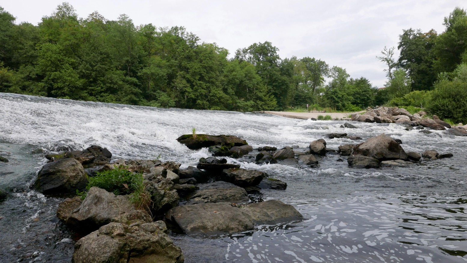
As mentioned here, wafting down the Tarn Gorge one summer with a Watershed Chattooga drybag jammed under my knees gave me plenty of time to configure a ‘deckbag’ to better fit my needs.
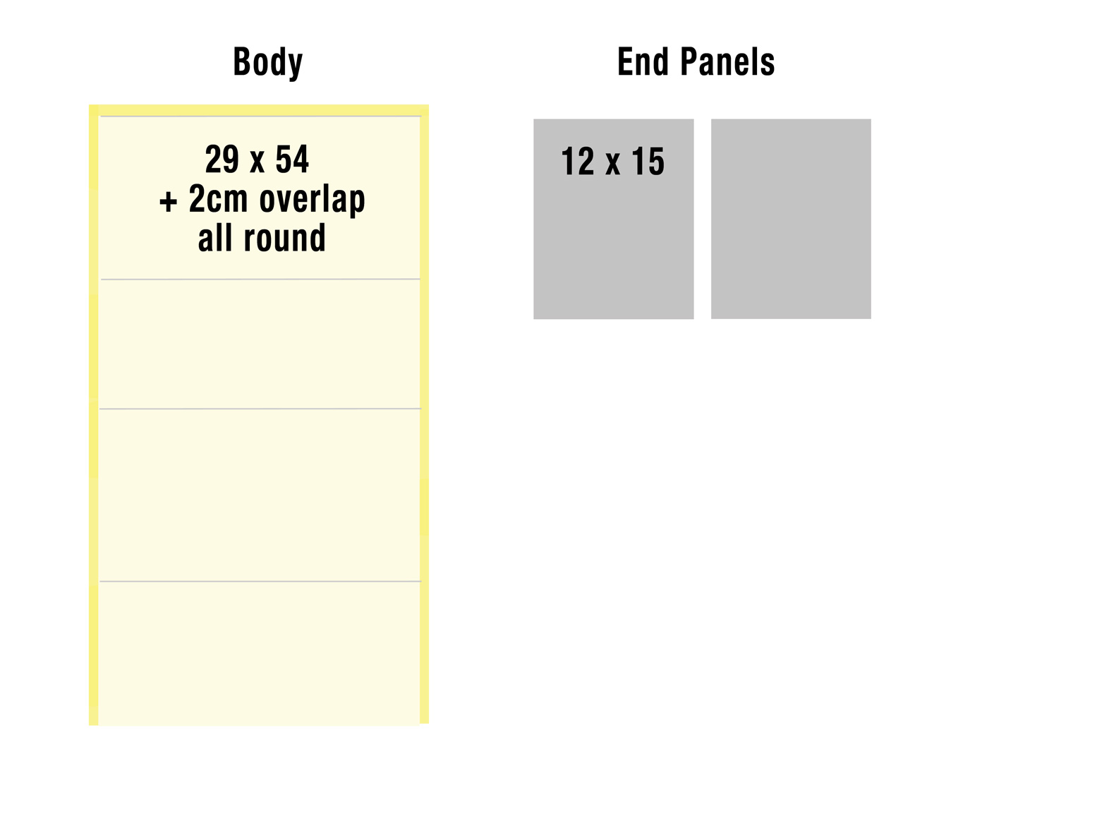
Peli cases are too heavy and cumbersome for these sorts of trips, while dependably dunk-proof – or even submersible bags like the Chattooga are too big and too fiddly to seal easily (since replaced with an Ortlieb Travel Zip). All I needed a 5-litre bag to sit on the floor below my knees for my must-stay-dries. Using state-of-the-art Adobe Crayon™ CAD software I came up with a design (above) and optimal dims of about 29cm x 15cm wide by 12cm deep giving about 5 litres volume. Part of the attraction of this project was learning to heat-weld TPU fabric with a small iron. It looks so much easier and less messy than glue. Or so I thought.
Before I got – quite literally – stuck in, I considered adapting some of the many heavy-duty SealLine PVC roll-top dry bags I have knocking about. All I needed to do was stick a zip in, then somehow cap one end with a round piece of something. I may well try that later but what I was actually aiming for was a stable box not a cylinder to sit securely on the floor of a boat.
Heat welding: important to understand PVC plastic can’t be heat sealed with an iron because it’s double coated. With double-coated anything (TPU, PVC, etc) the hot iron will easily melt the coating and make a right mess. Done this way you need to use a heat gun and a roller (left) which requires three hands. Or use single-sided PVC seam tape. Or of course, use glue.
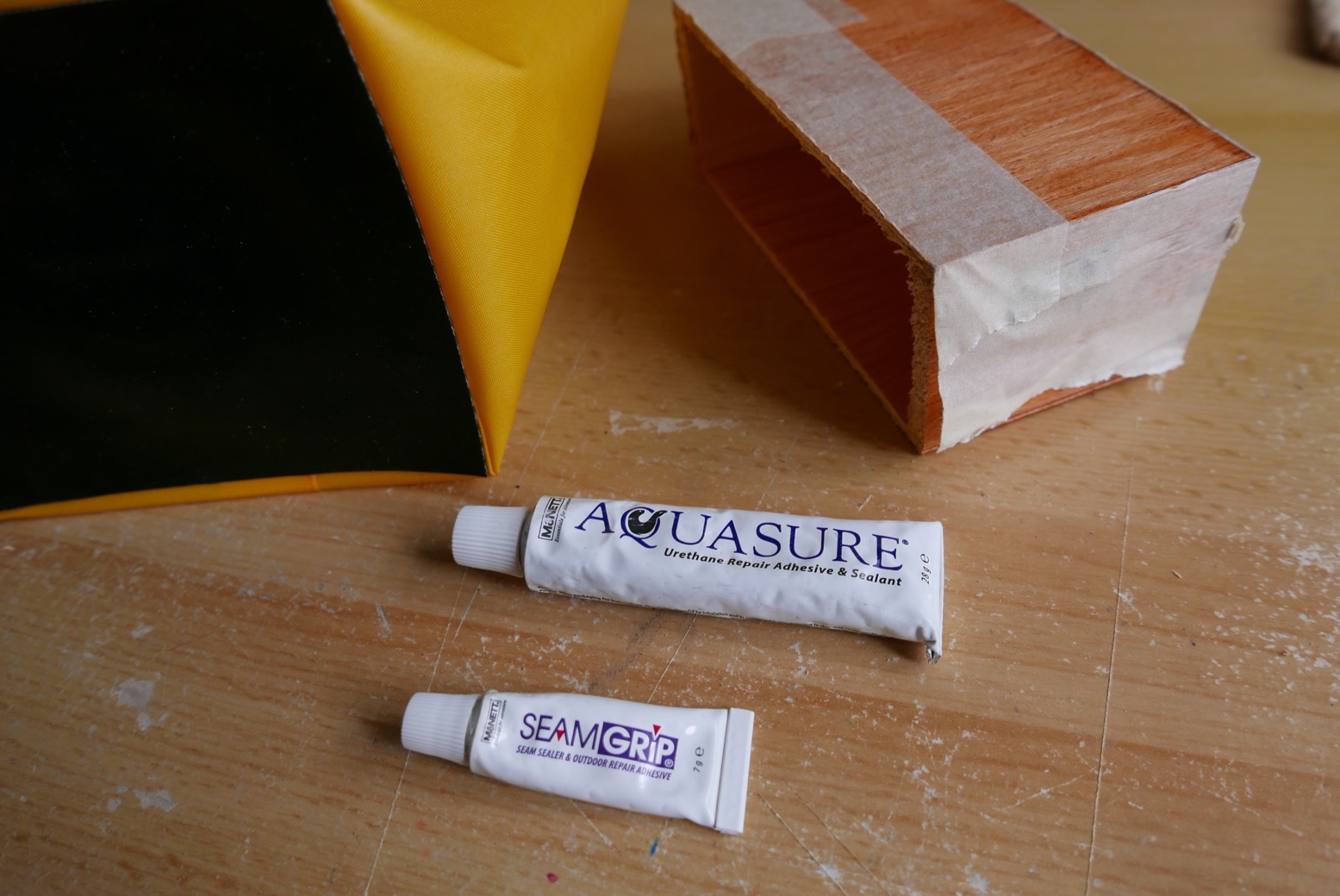
The body of my Pakbag could be made from single-coated yellow 210D packraft hull fabric, with the near-square end panels in ‘both-sides-coated’ 420D black packraft floor material. At 650g/sqm (27oz/sq yard) this stuff is good and thick. The thin yellow is 275g/sqm.
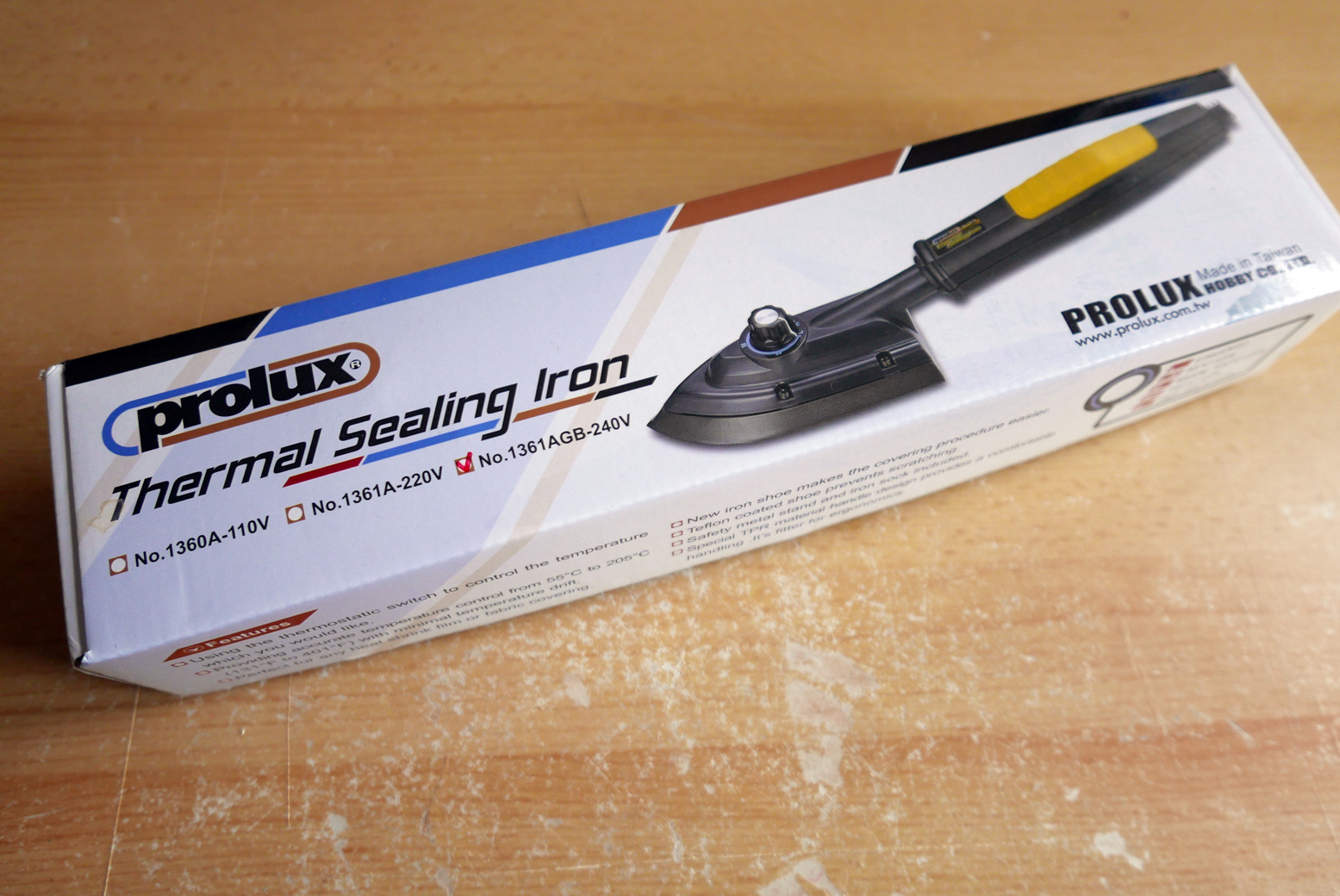
Half a metre minimum order of each cost €10 and €20 respectively from extremtextil in Germany; a very handy resource for the home fabrician. What you see left is what’s left over. Extrem were also one of the only places I found who’d sell a couple of 23-cm TiZip MasterSeal 10s for €23 each. Rolled delivery cost a bit more but avoided folds and was very fast. In the meantime I bought a used Prolux iron off ebay for 20 quid and already had some scissors, a table, a ruler and a knife.
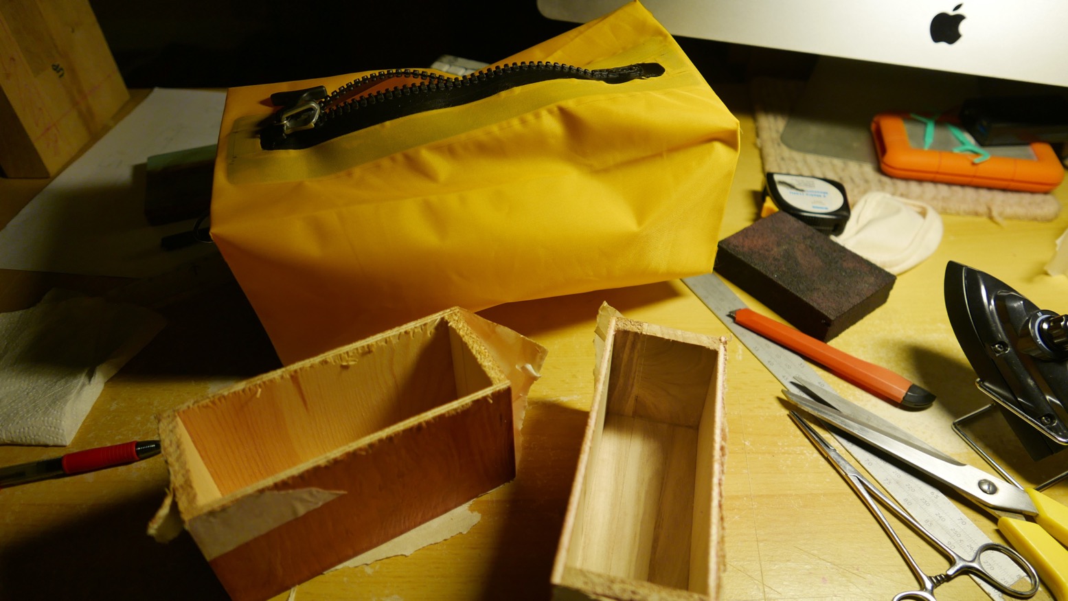
I’m not so skilled at home handicrafts so expected to make a right mess of things first time round, and was prepared to make a second bag. The next best thing I could do was think carefully before diving in like Edward Scissorhands at a confetti convention. One smart decision I made was to use a wooden mould to form the bag around. I could have laboriously hand-sawn some kitchen-shelf leftovers down to size, but after more ebaying found a pair of hobbyist’s knick-knack balsa boxes which added up to 15 x 12 x 30 stacked. As mentioned, you can’t iron on the coated side of TPU fabric; the coating will melt all over your iron before it bonds to whatever’s underneath. You can only directly heat an uncoated surface while pressing down the coated side which melts to the corresponding panel – coated or uncoated.
You can learn a lot from the DIY Packraft website. Lord knows how these guys manage to make packrafts from a roll of raw TPU. There can be no doubt that my attempt would end up looking like Picasso in an abattoir, but a dinky, curve-free pakbag ought to be within my abilities.
They mention the need for an iron with an adequate and consistent spread of heat up to around 220°C. Rated at 205°C, my cheapo Prolux was not in this category. I understand model makers find them ideal for applying thin transfers. For TPU work you need an iron with more poke, costing at least three times as much. I practised joining 210D to 210D, but sealing was far from instantaneously miraculous. It took repeated ironing and pressing, as well as spot heating to get a full seal with virtually no air gaps or lifted edges. You could then peel it apart if you got an edge up, but you certainly couldn’t pull it apart. I thought maybe the coating may be too thin or once melted was gone for good, but it’s probably just my crap iron.
For the end panels you need to seal 210D on to the thick black 420D. The box mould really helped to make a neat-enough job. One interesting observation about joining fabrics by sewing or heat-welding is that millimetre-precise measurements aren’t critical as they are with wood or metal. I took more time than I needed cutting the exact forms and trying to get precisely perpendicular edges. A big metal set square may help, or you can find stuff round the house – in my case, some square glass bathroom scales. Another tip is arrange something sticky under your cutting edge ruler so it doesn’t slip as you slice hard to get a full, straight cut.
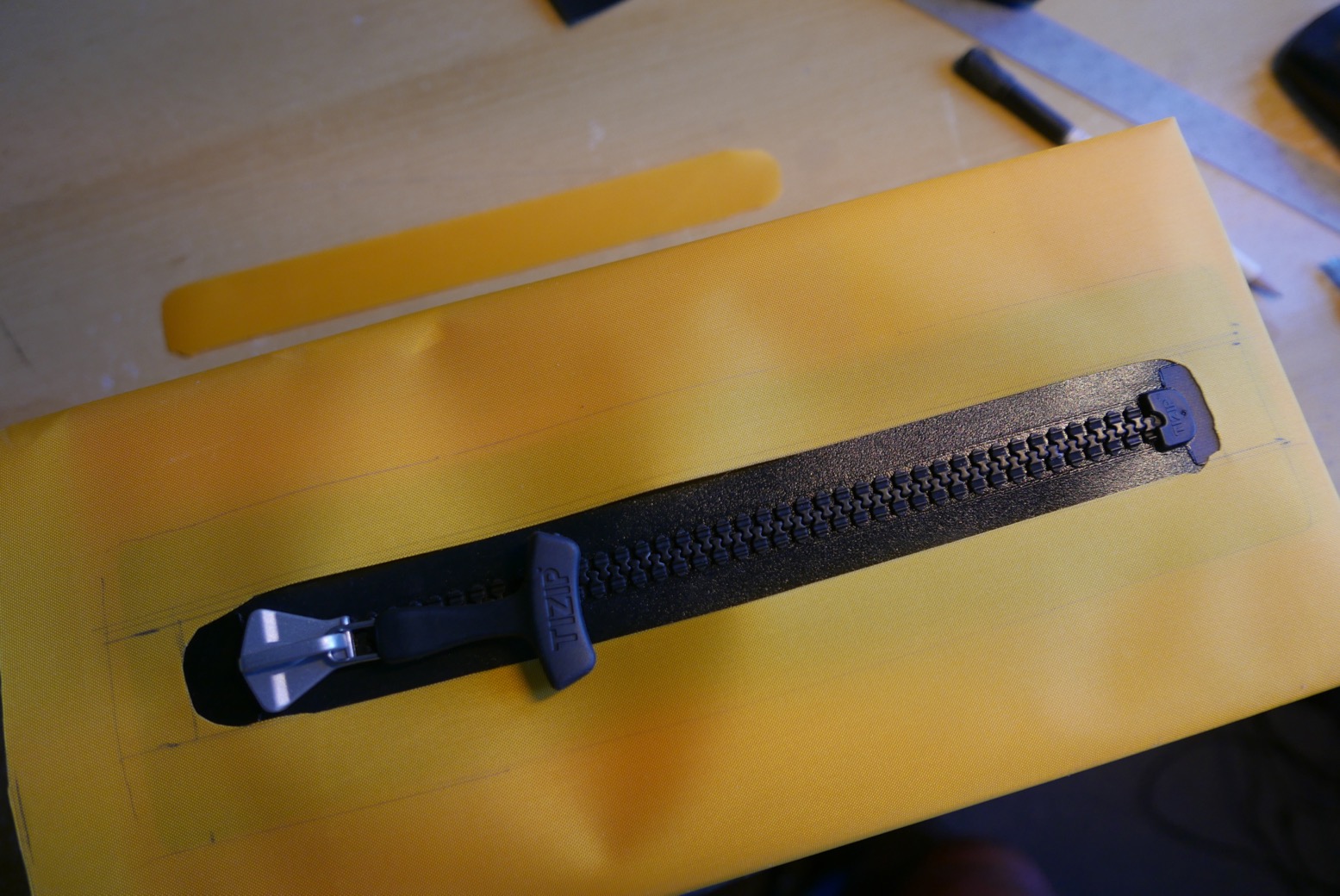
The length of the bag is partly governed by the available zip size. The 23cm MS10 Tizip which extrem sell is presumably used as a relief zip on men’s drysuits, but for a bag has a minimally useful aperture of just 19cm. The next size they sell is a massive 71cm. They must make TiZip sizes in between (for example for packraft cargo hulls), but good luck tracking them down online.
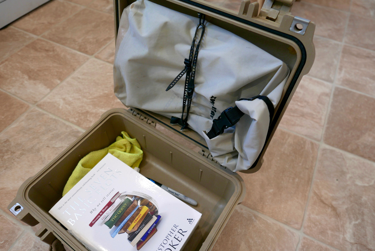
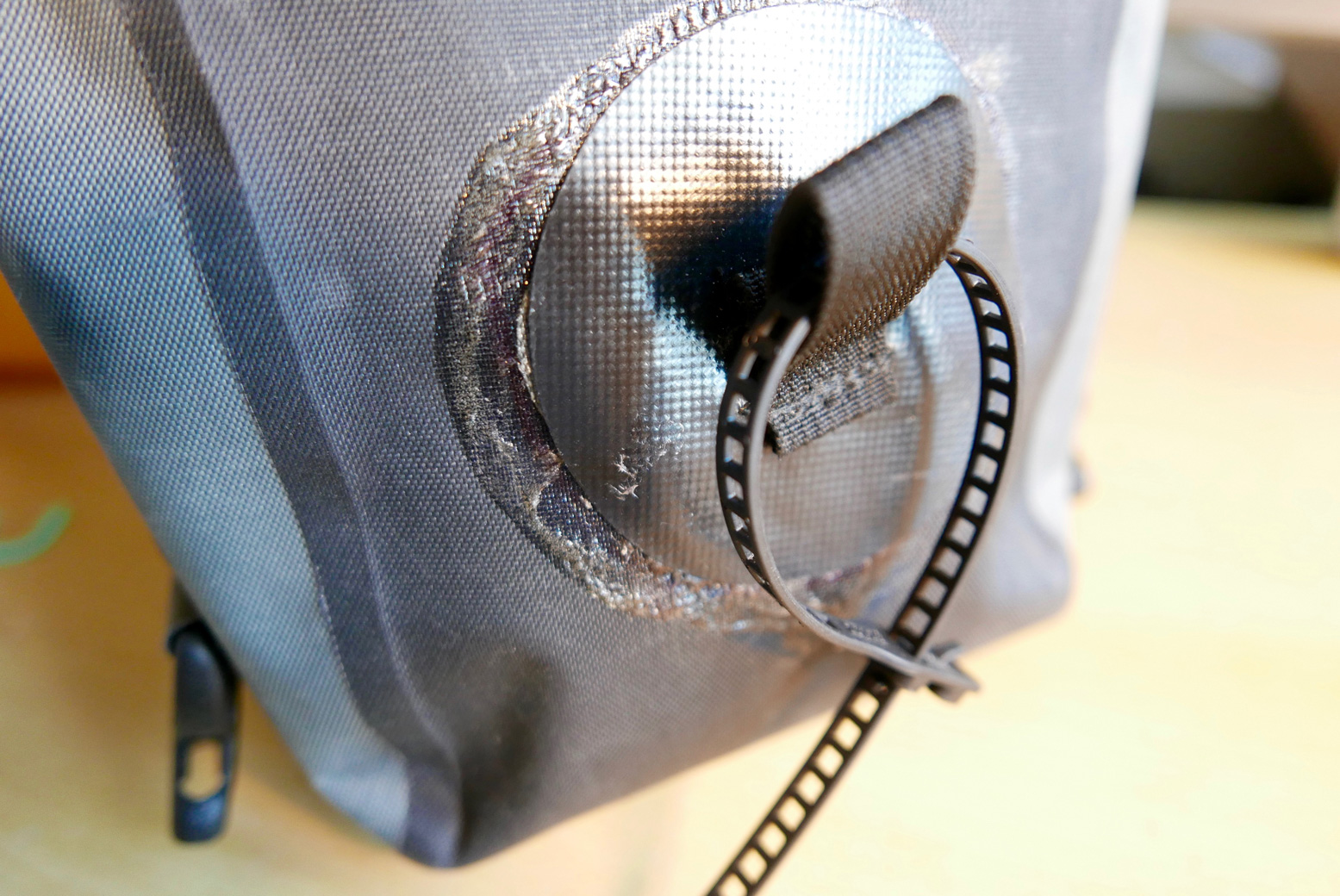
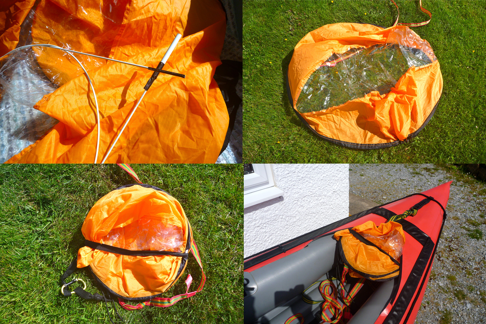
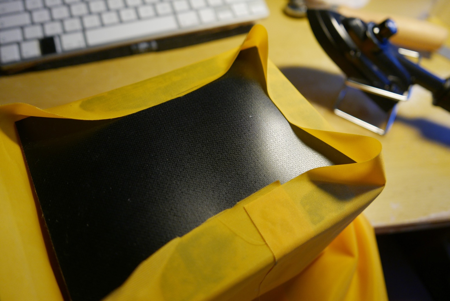
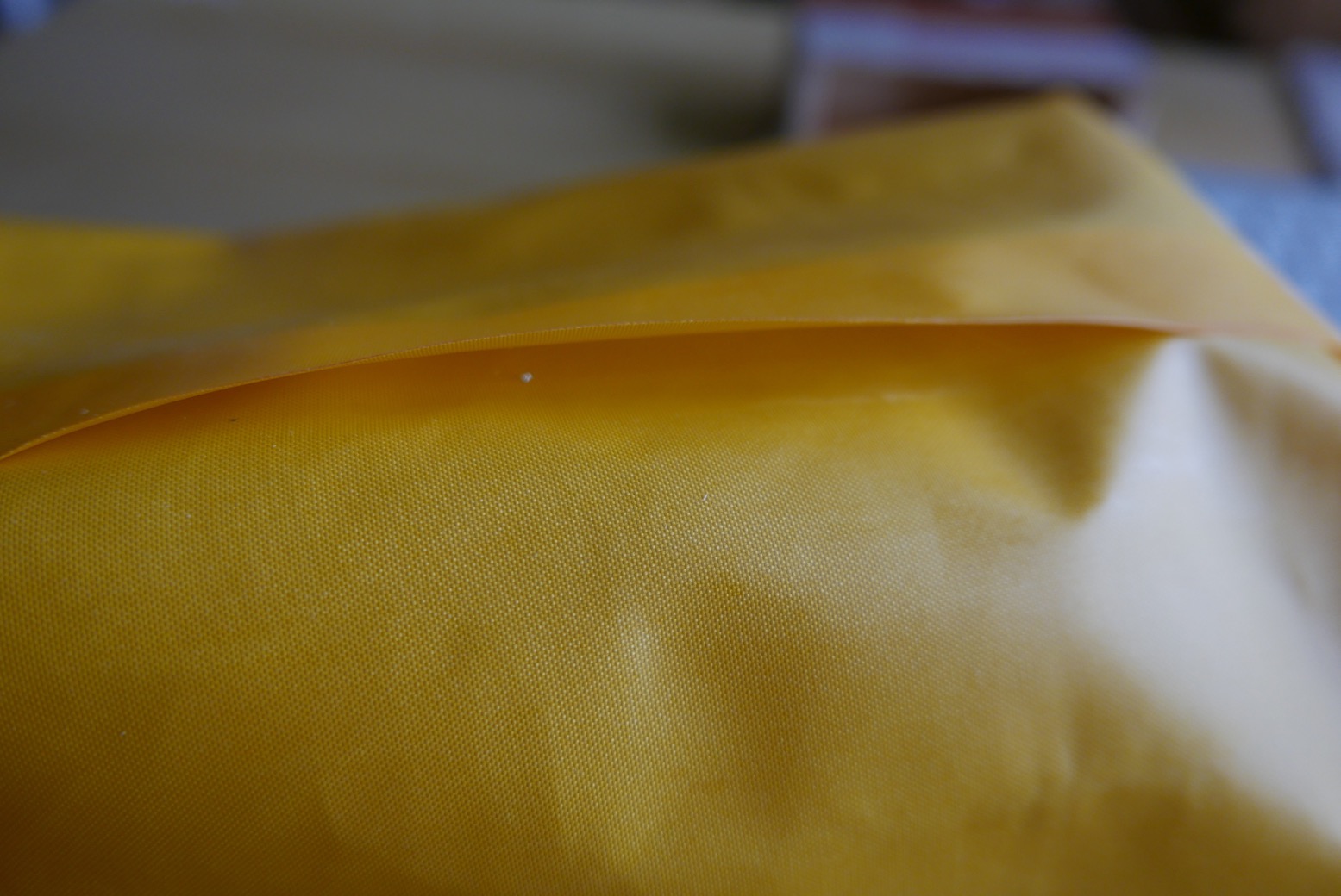
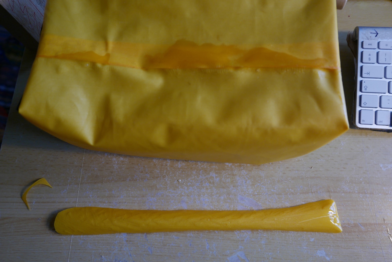
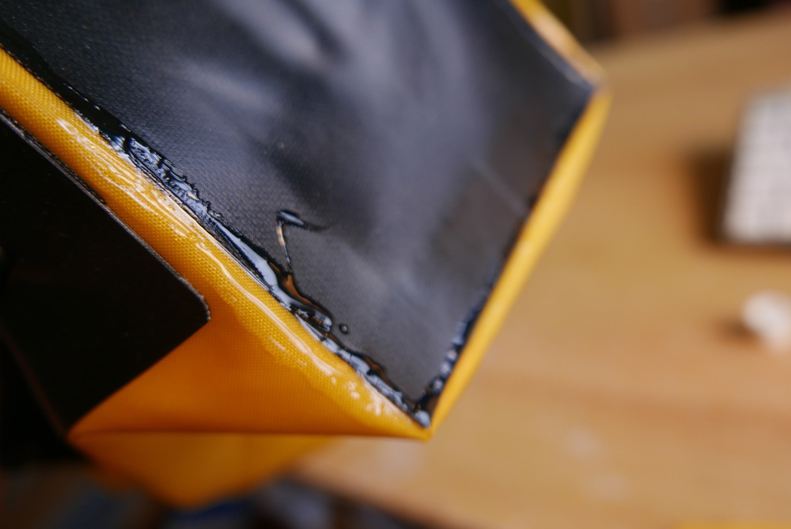
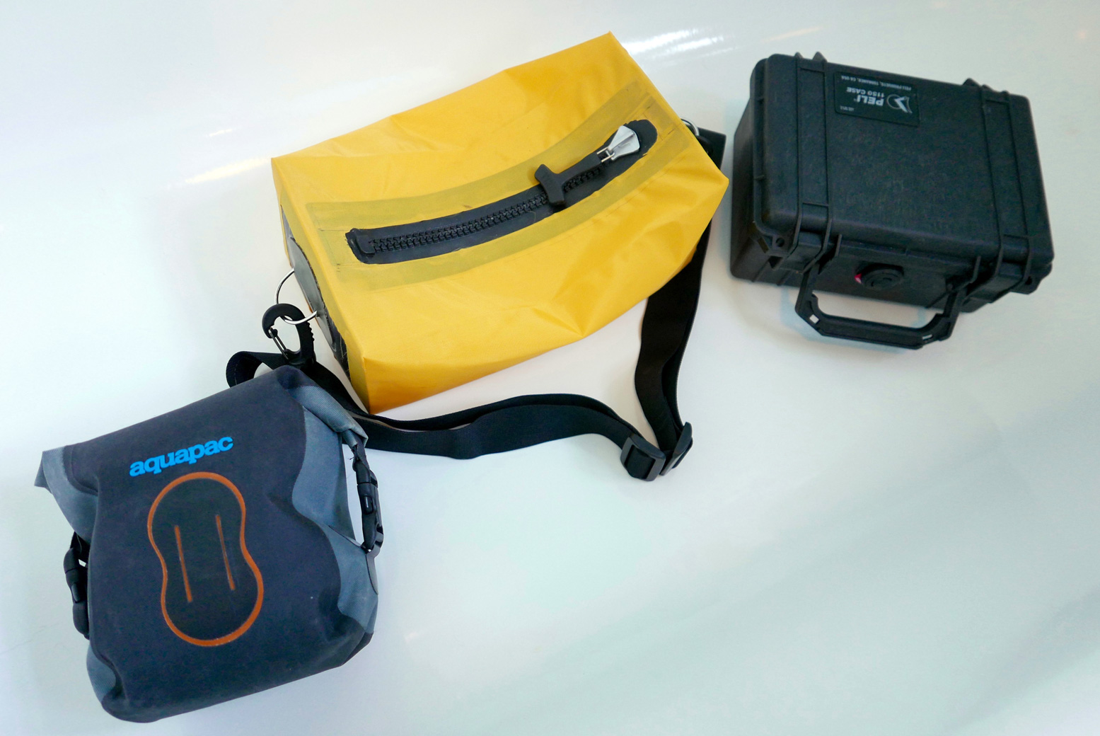
First job was wrapping the bag body panel round the box mould and sealing it. Cue endless to and fro with the iron to try and get a complete seal before I gave up and accepted I’d glue up the gaps later. Looking back, I should have made this join on the top of the bag, either side of the zip. Barely two inches of yellow to yellow sealing required here. Now I know.I dropped a black end panel on to the end of the box mould.and welded down the bits between the corners.Then I made an incision at each corner, pressed the flaps down over each other and welded on. Good to know the 210 welds much better to the thicker coated black stuff.Sealing wasn’t perfect but all along I expected to have to hand seal all joins, and certainly all corners with Seam Seal.Before sealing the other end, I cut a slot for the zip.Then ironed it down. Again, the thick coating on the broad zip sides made good adhesion easier to achieve.I stuck a home-made D-ring on the finished end. I actually needed this to pull the bag off the tightly fitting box mould before doing the other end. This requires sawing an end off the box so it can be removed through the zip hole after butting up against the unfinished bag end to support firm heat welding.Oh dear, look at the state of that floor seal inside the bag. I went over it again with the iron, then filled up the gaps with glue.Then I stuck the zip cut-out over it for good measure. Once inverted, I did the same on the outside for more good measure. It’s not pretty but it ought to seal.With the bag still inside out, I went round the yellow-to-black joins with Seam Seal. It’s like Aquasure/Aquaseal, but runnier and takes a long time to dry.Beautifully sealed seams. I should get a job at Alpacka.The bag turned right way out. I’m amazed that it looks less crap than I expected. No need for stiffeners; as hoped, the 420 end panels retain the boxy shape. The box mould (sawn off bits in the foreground) helped greatly in making a tidy form.Without the strap the bag weighs 158g or 5.5 oz.Completed Pakbag alongside the Aquapac and a Peli 1150.Pakbag, with a foam floor panel to keep above any moisture. A sachet of silica crystals may help humidity, as does TiZip silicon lube for the zip end. It passed the submersion sink test.
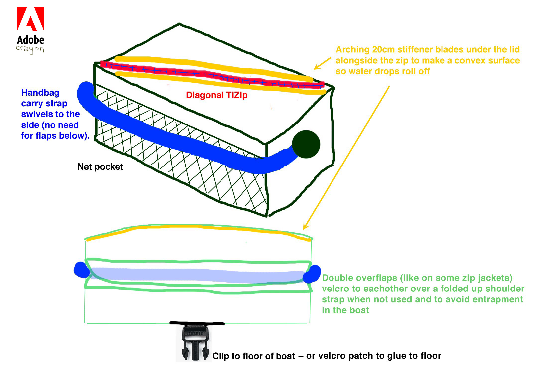
Several features are omitted from the Adobe Crayon blueprint at the top of the page:
• The overlap sleeve on the side to contain the shoulder strap to avoid entrapment. On rough water I’ll just unhook the shoulder strap and stash it
• Otherwise the full-length shoulder strap can adjust down to ‘handbag ‘length so there’s less is lying about
• No side net. Would still quite like this but not sure how to do it neatly
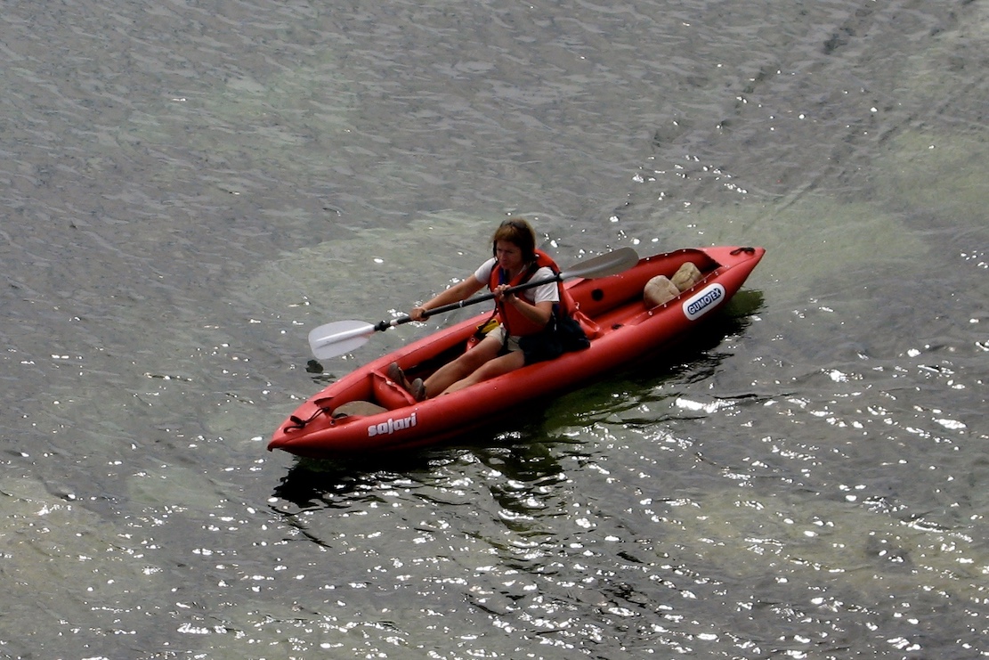
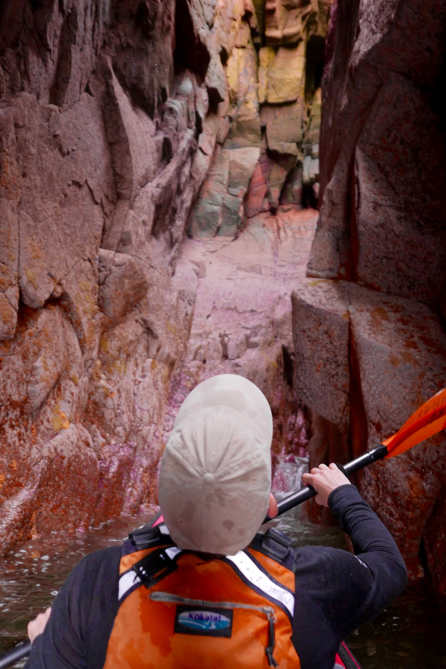
• TiZip is not diagonal – not important – but the arched stays idea underneath it may be. I noticed in France under the knees gets a lot of drips off the paddle (PSZ; right) which can get in when you open up. Convex top would be good but a shake of the bag may thrown off excess drips before unzipping
• Need to find a way to attach it to the packraft floor. Velcro might be low profile but with the repeated force of pulling apart, I’m not sure the shiny-backed stuff I have will glue to the bag or the floor well enough, even with proper two-part glue. So Ill just clip one of the strap rings a D-ring glued on, mid-floor
A few months later… using the Pakbag
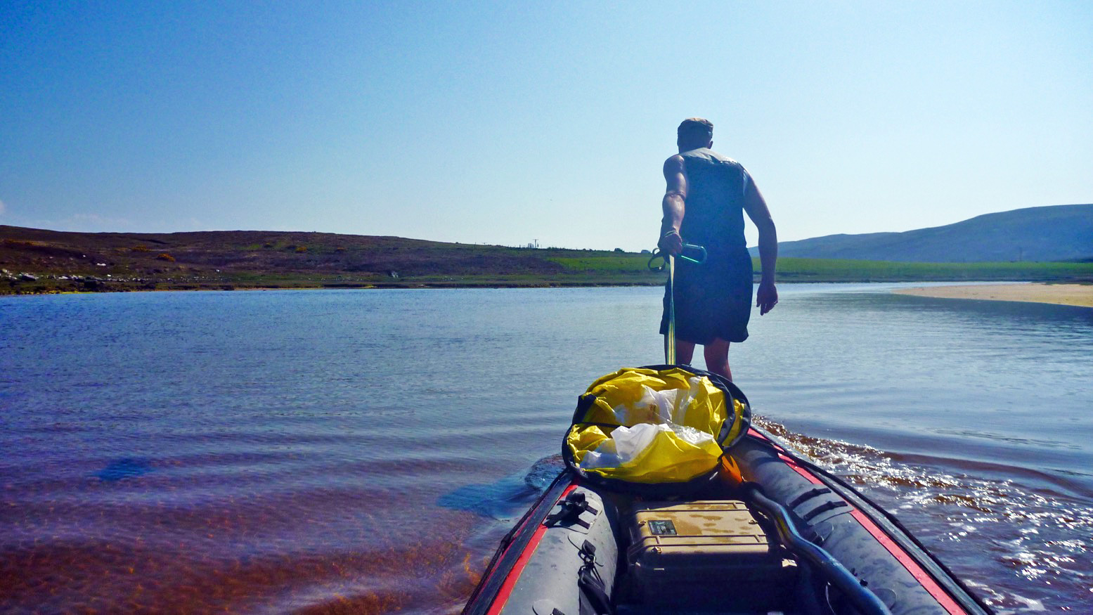
After paddling the Wairoa River in New Zealand as a day trip, I can boldly claim my MYO Pakbag is fit for purpose. It’s just the right size for a water bootle, camera, GPS and wallet, even if the easy-to-use zip is a tad short for easy access. One thing I didn’t appreciate is that, slung over the shoulder while sat in the boat, the bag is still handy to access but keeps off a wet floor and is always attached to you. No need to think where it is.
Sadly my glue or gluing skills are not so fit for purpose. I need to reglue the strap end-rings and a couple of corners. This time I’ll probably use 2-part glue which I know will tear off the coating from the fabric core before it separates from what it’s glued to.
What I’d really like is for someone to make this properly. The difficulty – as possibly mentioned above – seems to be that anything with TiZips requires the consent and approval of TiZip Inc before they supply a zip. It’s a way of ensuring a proper application to their tight specs is done so that their reputation is not harmed. Which is why many TiZip products, like my Ortlieb Travel Zip bag are unusually expensive. You’d think there must be alternative or knock-off TiZips around; I’m pretty sure I searched and searched.
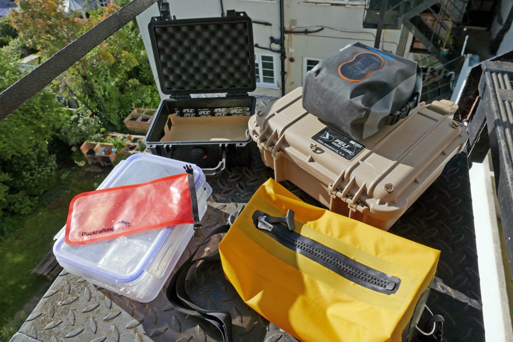
Clockwise from top left: Peli 1150, Peli 1400 with Aquapac camera bag on top, my yellow Pakbag; roll-top phone pouch; four-clip food container.
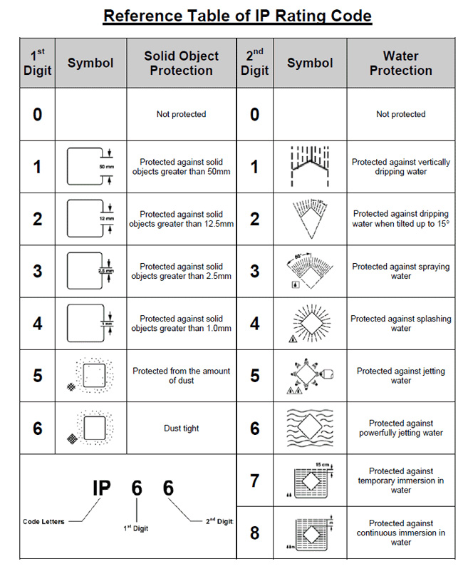
Whether on day trips or overnighters, how do you organise easy access to regularly used items and valuables, including stuff you want to carry when away from your packboat? I’m talking something capable of handling less than flat water, rated at least IP65 (right) to stash the wallet, phone, tablet, camera, travel docs, ammo and snacks. Stuff you want to keep dry in case of swamping or capsize, as well as being easy to get to on the water.
For walking or cycling, a daypack does the trick but that doesn’t really work in a paddle boat. The pockets and pouches in your pfd (right) have their uses, but they’re not waterproof. You want something that’s airtight when briefly submerged while easy to access on the water and portable off it. It’s actually quite a tall order.
Anfibio smartphone case. Submersible and keypad works through the plastic
Things like paper maps and nav aids (GPS, compass) I keep in a separate waterproof pouch like the SealLine (left) with a double ziploc seal, even if this is yet more clutter knocking about around your legs. Since I took that photo I’ve mounted a compass on the side of my Seawave IK – very handy as it’s always there at a glance. And I now use a IPX7-rated Garmin Montana with loads of mapping space, though I prefer to keep salty seawater off it where possible.
Waterproof waist bags A small, roll-top waterproof waistpack actually ticks many boxes as long as you don’t mind being attached to yet more clobber. There are quite a few out there between 2 and 6 litres, from OverBoard (2 sizes) to Aquapac and the bigger SealLine. The good thing is a waistpack sits up on your lap, out of the water and the paddle splash zone (PSZ), but well within reach.
The bad thing is they’re a faff to roll up and clip down quickly and reliably, and if you’re bobbing around in the water swimming after your boat you can be sure they’ll slowly leak. Read reviews and you’ll come across disgruntled accounts of ruined cameras or phones following a quick dip or even too much splashing. The problem, as usual, is the roll top; it needs to be tightly rolled down 2 or 3 times, then tightly clipped and even cinched down to the sides to make a good, dunk-proof seal. I believe a lot also depends on the nature of those sealing surfaces. As long as you avoid creases, smooth, shiny vinyl or PU pressing against the same will make a better seal than anything textured, like Cordura.
Hard cases For years the obvious solution seemed to be small ABS or polypropylene hard cases commonly used for camera gear. I started years ago with a 9-litre Otterbox in my Gumotex Sunny days (left). The Otter was lighter and cheaper than the well-known Peli cases, and with either, you know the box will be airtight, access quick enough and boxes make a handy solid footrest in an IK as well as a seat or raised surface on a beach.
After some years I changed to a Peli 1400, a bit less volume than the Otter, but a bit wider and flatter. Adding some retaining straps my Macbook Air fits neatly inside the lid (right), and below there’s room for everything I need in a day.
The only thing that spoils the Peli and similar boxes are the clamps which are hard to open or close effortlessly. Some sort of lever-arch mechanism would be better. Because of this I use the box less often than I would during a paddle. On top of that, a shoulder strap for hands-free carrying is awkward unless attachment rings are added. And at 2 kilos the 1400 is a bit hefty.
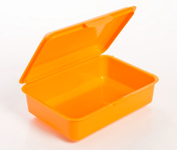
I really don’t need a PeliCase’s crush-proof ruggedness. All I want is submersion-proof airtightness up IP65 for which a lunchbox (right) or food storage box might do as well, as long as the durability and seal could be relied on.
Around the same time I got into packrafts I discovered Watershed dry bags. Most of them use an oversized rubbery zip-loc seal which is submersion-proof and therefore miles better than roll-tops. The yellow, 30-litre Chattooga (left) was also more chuckable than a hard case, made a good pillow, and for me had secondary uses for biking. It fits under the knees just about, but as many find, can be difficult to open and close. To operate smoothly and seal quickly the big seal needs lubing with 404 or silicon grease.
I finally got tired of my Chattooga’s tedious seal-closure and got a (now discontinued) Ortlieb Travel Zip (below left) for £100. It has has proved to be a perfect daybag, also at 30 litres. I’ve used this packrafting in New Zealand, motorbiking in Morocco and paddling in Sardinia. The TiZip sees to immersions and two outside mesh-zip pockets make easy access to things that can get wet. Inside are a couple of zip pockets and the carry straps come together with the clever and comfortable hard plastic handle. Add a comfy shoulder strap with a pad and you’re good to go. They seem to replaced it with a ‘40L‘ version (right) with backpack straps, but it seems to have the same dimensions as mine and so will be as good.
Camera Bags If you’re serious about paddling photos, get the best waterproof camera you can afford, like the Lumix FT7 – right – £400, or an Olympus TG5 Tough (left). You need a good one because the tiny lens must work within the housing so low-end ones are only OK while the light is good. Occasionally they’ll expose perfectly, but don’t bother the optical zoom beyond halfway unless it’s Elvis galloping on a unicorn. Any shots on this website from 2019 on, like this story, are shot with the Olympus. You can see the difference. Get one of these cameras and the whole section below on waterproof camera bags becomes irrelevant.
With a regular camera which I’ve also used, you need reliable water protection. I bought a used Aquapac camera bag (left). They’re just your usual roll down and clip jobbies, but inside the lid is a ziploc seal (right) which makes the bag much more dunk-proof than regular roll tops. Testing in a sink, bubbles only escape very slowly, but treading water with it attached to your waist might not end so well.
One flaw with these Aquapac camera bags are the flimsy belt loops. On mine I glued over one with a big tabbed patch (right). But really it’s too bulky to hang off a belt; I ziptie mine into one of the net pouches of my Anfibio Buoy Boy pdf, but only fold over and clip down when at sea. To properly close the seal is too much faffing and usually unnecessary – until it is.
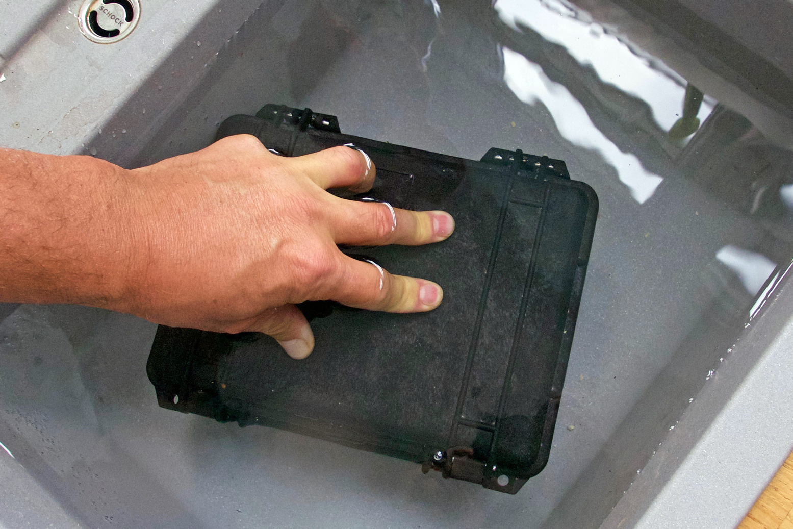
Doing a sink submersion test (right) reminds you of the difference between hard cases and sealed bags. A rigid box is unaffected by the increased pressure of light submersion. If anything, the pressure forces the lid down on the seal even more. With a bag it’s the opposite: even a few inches underwater compresses the bag, forcing the air out through any weak point, usually the closure. This is why submarines are made of steel, not PVC fabric.
On the Tarn I found the Chattooga under my knees too big in general, and too big to exit the boat easily (or in a rush). But I sure didn’t miss lugging the hefty Peli 1400 around. I thought a lot about my needs and for the Allier came up with an interim solution: a smaller 1150-like hardcase (left) of about 2 litres volume for my essentials, including the LX. It worked OK, bar the usual easy opening issues. I knew from the Tarn what I really wanted was a smallwaterproof under-knee ‘deckbag’ with a waterproof zip closure. The zip eliminates the bulk as well as dunking unreliability of roll-tops, while the bag weighs much less than a box and carries effortlessly and comfortably on a shoulder strap. I had the dimensions and design all jotted down in my head and eventually made one because…
Waterproof TiZip bags A lot of Googling later I realised no one makes such a thing. There are plenty of TiZip daypacks like the Lowepro Dryzone range, or larger, watersports-oriented duffles from the likes of Ortlieb or Aire (Frodo; right) or SealLine, which resemble my own YKK-zipped Watershed UDB – one of my favourite bags. But none of the above are smaller than my 30-litre Chattooga.
The closest candidates I’ve found include the IP67-rated Ortlieb Trunk Bag (right and left). At 8 litres it’s a bit on the big side (add up the claimed dims and it’s more like 11 litres). And these days it only comes with a fitting mechanism to lock it to a bike rack. Very clever but this all helps raise the weight to over a kilo and price up to £98. The fabric is also not your usual pliant and mildly carcinogenic Ortlieb PVC, but resembles Heavalon (with its distinctive hexagon patterning) which Gumotex use as decking on some boats.
The Trunk-Bag could suit a lot of paddlers but as it’s made for bikes, you do wonder if it’s actually dunk-proof. Tellingly, the product description says underwater resistance: ‘lower edge of product, duration: 30 mins‘. As well all know, it’s common to be paddling a packraft with a little water swilling around the floor, so unless you slaver the base of your Trunk-Bag in Aquaseal, water will slowly seep through. Not good.
You’d imaginefly fishing waist bags, are ready for dunking. But they’re so large they often came with an added shoulder or neck harness to help take the weight. Plus it seems fly fishing gear may be to outdoor gear like smoked salmon is to fish fingers – prices are nuts. Patagonia make the Stormfront (left), a 10-litre waistpack with an added shoulder strap – yours for as little as £180! It’s just a dunking PVC handbag with a zip!
You’ll find any number of other fly fishing roll-top bags at twice the price of hiking or SUPing examples pictured above. Note that many find waterproof zips like the plastic TiZip or brass YKK stiff to operate, just as they are on a dry suit. Ideally, you need a good T-toggle and some sort of tab to pull against. And I do wonder if incorporating TiZips to the required standards explains the high prices for gear using them. The full range of TiZips is not readily sold to consumers, only to manufacturers for products which use them. Anyway, long story long, I decided it might be fun to make my own TiZip deck bag. Read about that here.
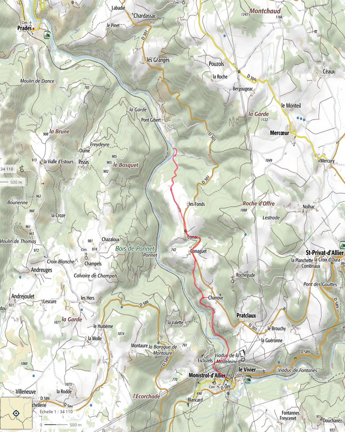
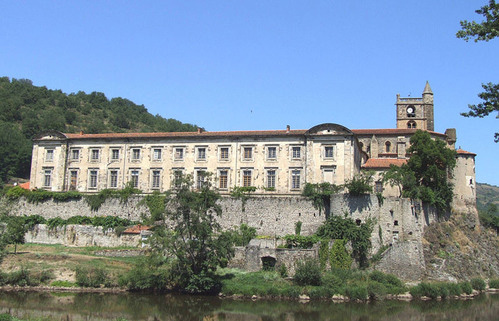
In 2005 the Dordogne and nearby Vezere were my first multi-day rivers in my Sunny IK, all helped by the discovery of the inspiring White Water Massif Central guidebook. The Dordogne was a good choice but to be honest, a bit easy. Ready for something un peu plussportif, I’d got it into my head from that book that the Ardeche was too hardcore, so I’d be better off on the less famous Allier between Chapeauroux and Brioude (big map, above).
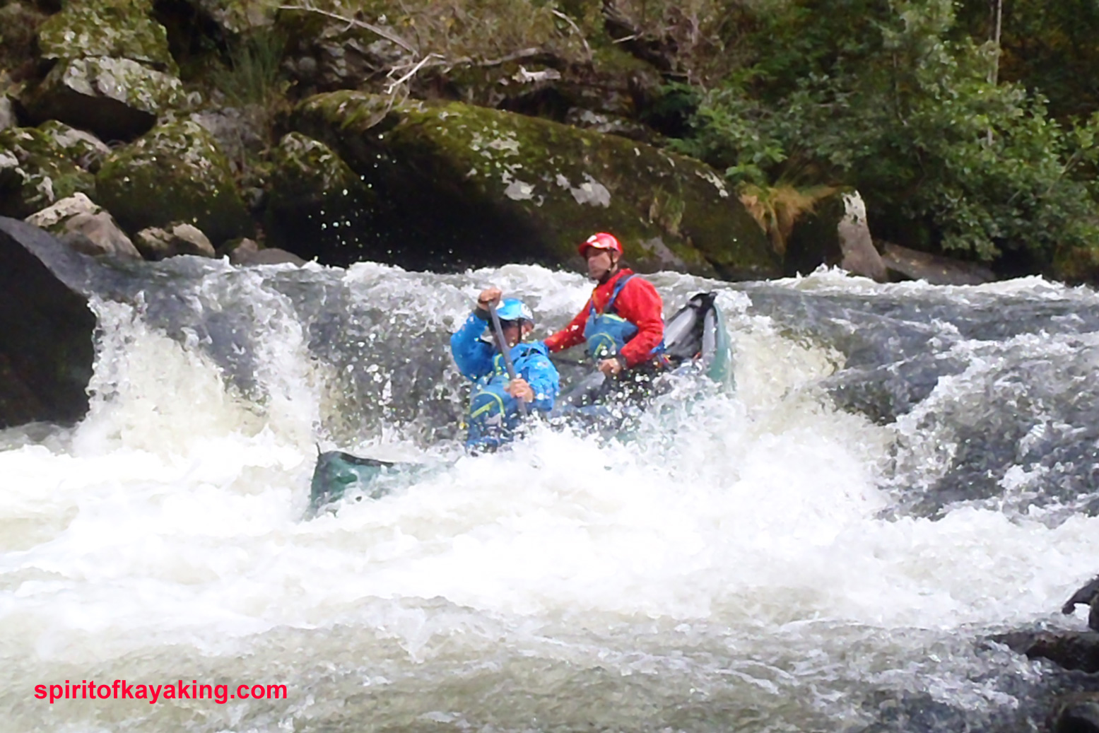
Gumotex IC and IKs paddling pros on the Allier, 2025. And they al trained back from Brioude – respect!
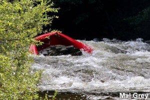
In fact, as you can read here (admittedly at twice the normal summer flow; video too, as well as the video above), parts of Allier can get tricky (left; a plastic canoe folded against a rock). Even though a railway carves and tunnels right along the gorge, on the first two days from Chapeauroux there are places where the rapids come at you fast and with no easy way out of the gorge if you get in trouble. Over the years stranded paddlers have been rescued by helicopter.
Not fully comprehending all this, in June 2006 I set off from Chapeauroux in my Sunny, and at the very first bend was flapping about like a salmon with a seizure, trying to stay on track. It went on like that for a while, then eased up and actually got quite pleasant by the time I reached Alleyras for the night. This was more like it; a wild river rather than the broad Dordogne lined with droning pumps irrigating the adjacent farmland.
Next morning a taxi transported me past the then-closed section dodging the Poutes dam below Alleyras (more below) and dropped me at Monistrol. Here again I failed to fully appreciate the greater challenges immediately ahead, even if the guidebook was clear: great fun in a creekboat, but an open canoe will fill up on the longer rapids. And if I didn’t know it then, I sure do now: the white water abilities of open canoes and IKs are closely matched, while IKs might easier to control for beginners (like me).
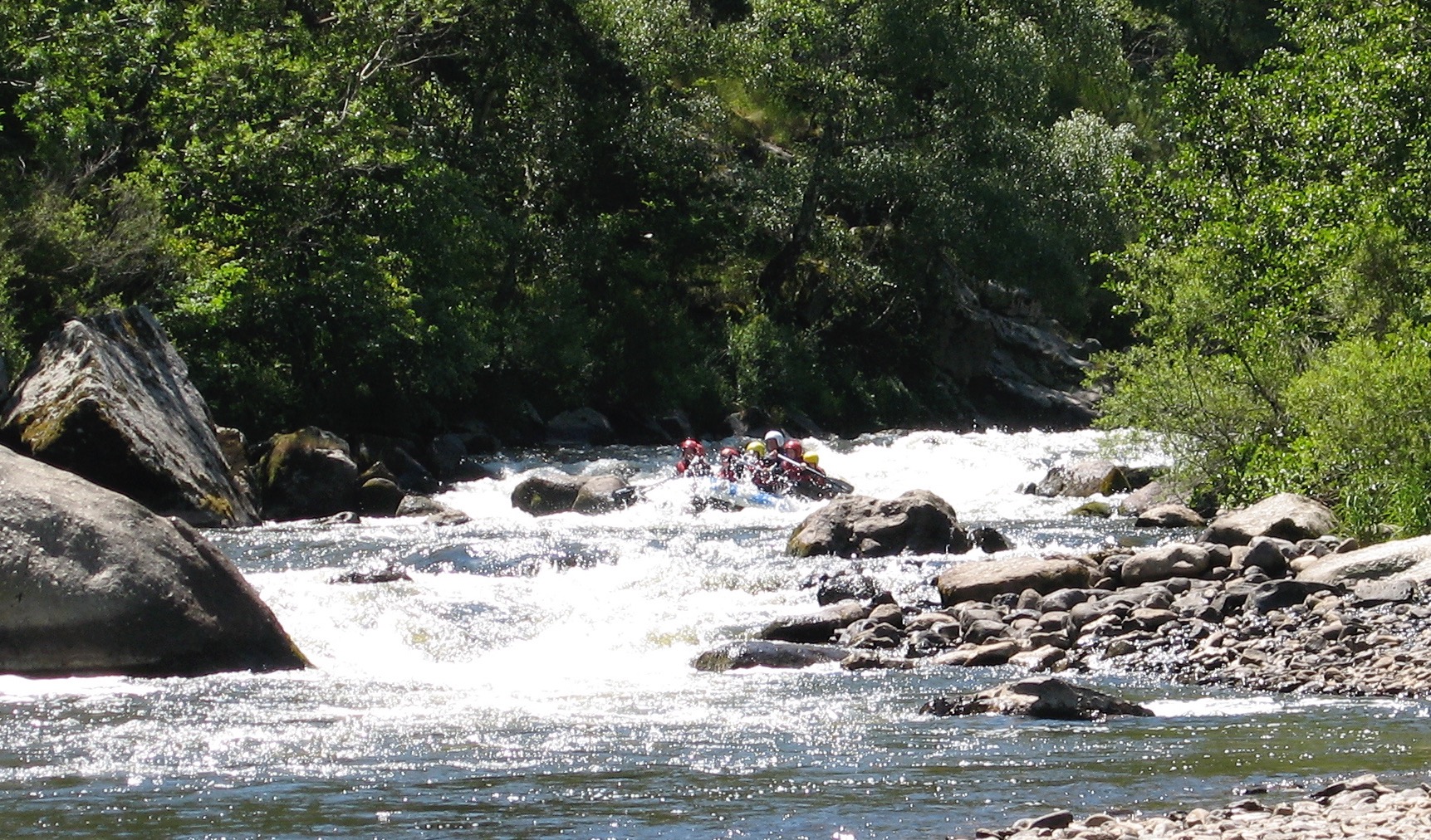
This Monistrol stage is run by commercial rafting trips (above), also a telling sign about the nature of this part of the river. I scraped through that day, exiting a few rapids with a boat full of water, and on one ending up swimming alongside it. Looking back, I’m pretty sure this was the exit of ‘La Barraque au Ponnet‘ (KM3.5; more below) with that raft above coming through soon after I stopped. It was all a bit of a shock.
Unless you’re confident, I’d suggest not following my example in doing this section alone. Consider a recce in the commercial raft if there’s one going that day, or ask if you can tag along for safety.Or find some paddle pals.
A few kilometres before Prades (KM12 from Monistrol) it all becomes less of a white-knuckle ride, and what followed all the way to the Brioude take-out were fun, Grade 2 rapids and a couple of thought-provoking chutes or easy portages. All manageable in open packboats. As you approach Brioude on the last day, the paddling eases right up so that you start harking back for a bit of eaux vivants.
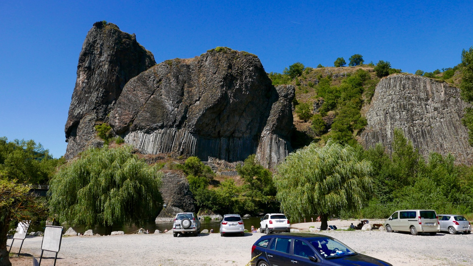
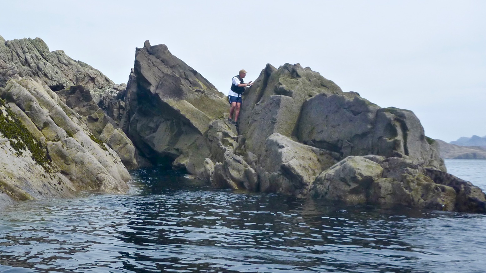
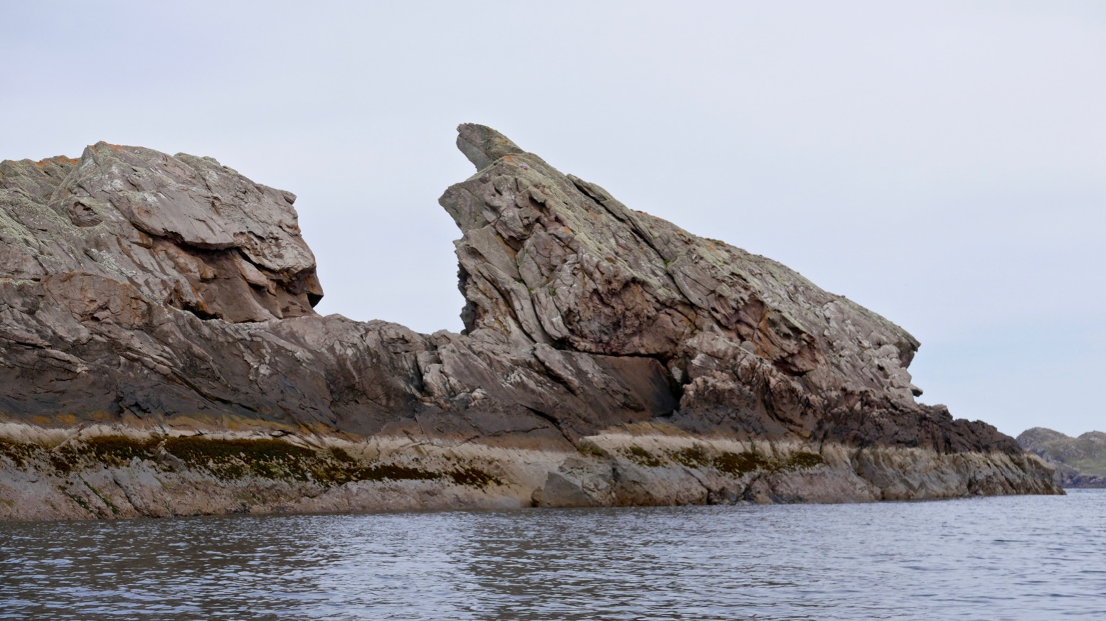
All along what they now call ‘one of Europe’s last wild rivers’ you’ll pass many striking outcrops of columnar basalt as well as pretty villages (like Chilhac, below) with adjacent campsites, boulangeries, quaint hotels – and not a chain store to be seen. Like the better known Ardeche and Tarn, the Allier is another Massif classic, still distinctively scenic but with non of the nose-to-tail traffic during busy holiday periods.
Getting there Although the daily trains aren’t frequent, with riverside stations at Brioude, Langeac, Monistrol, Alleyras and Chapeauroux, the Allier (left) is easy to get to with packboats. First, Easyjet yourself to Lyon, or Ryanair-it to Nimes or Clermont, two cities which are also linked by the scenic Ligne des Cévennes rail line (below). Brioude is an hour south of Clermont, and Chapeauroux is two hours over the hills from Nimes. Between them, Brioude and Chapeauroux span the scenic and paddleable 88-km section of the Allier.
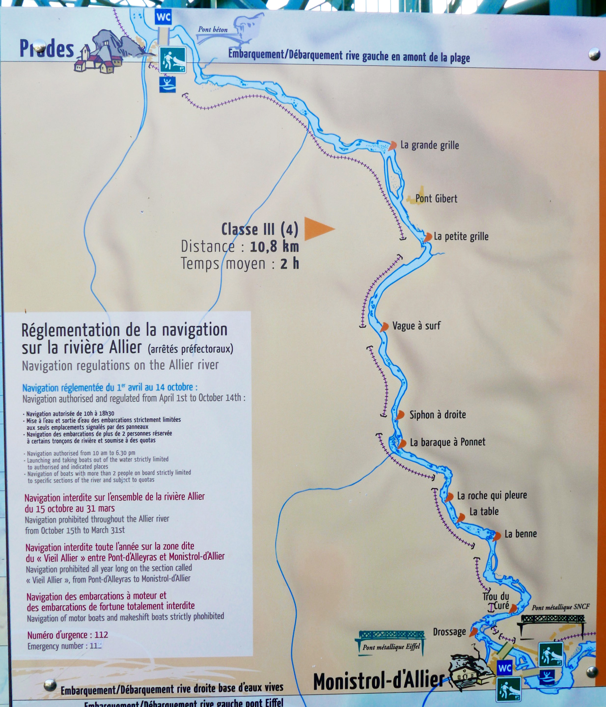
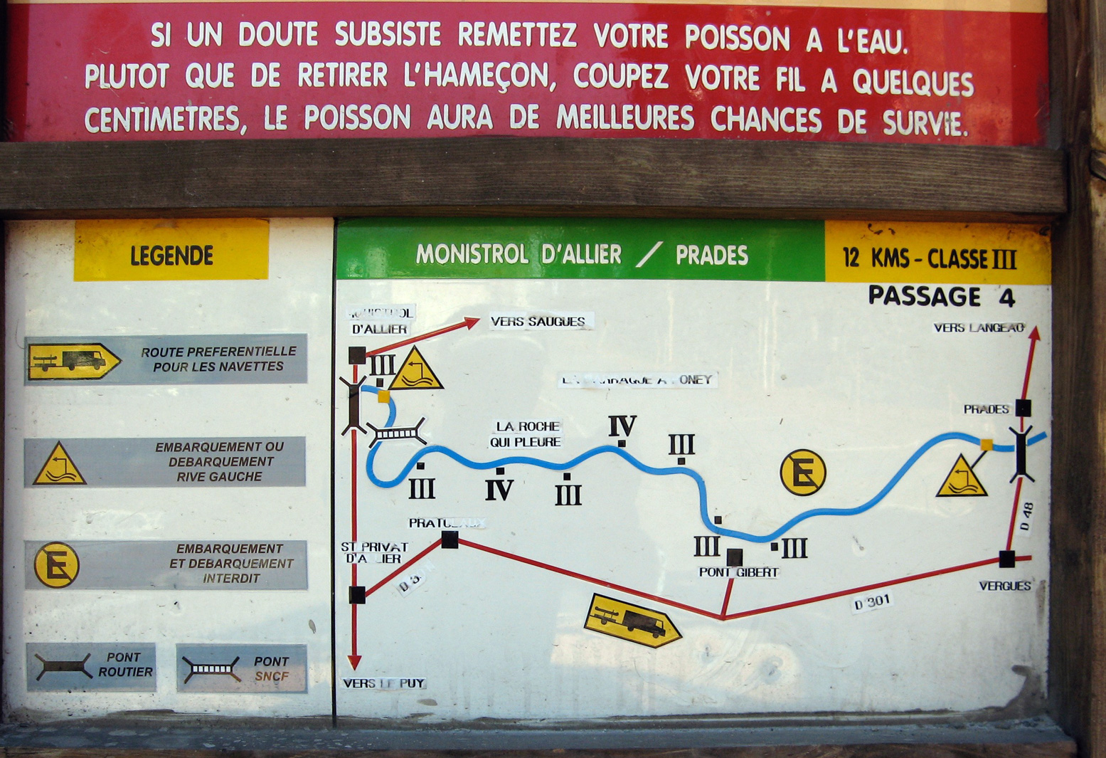
One thing worth considering if you’re unsure about the half-day Grade 3+ Monistrol–Prades section, is coming up on the train from Brioude or Langeac. It passes right above the gorge where you get a good view of the Barraque au Ponnet and a few seconds later the ‘Roche qui Pleure’ drop a few hundred metres upstream (left; Gumotex Scout canoe). I’m sure glad I looked when I came back years later.
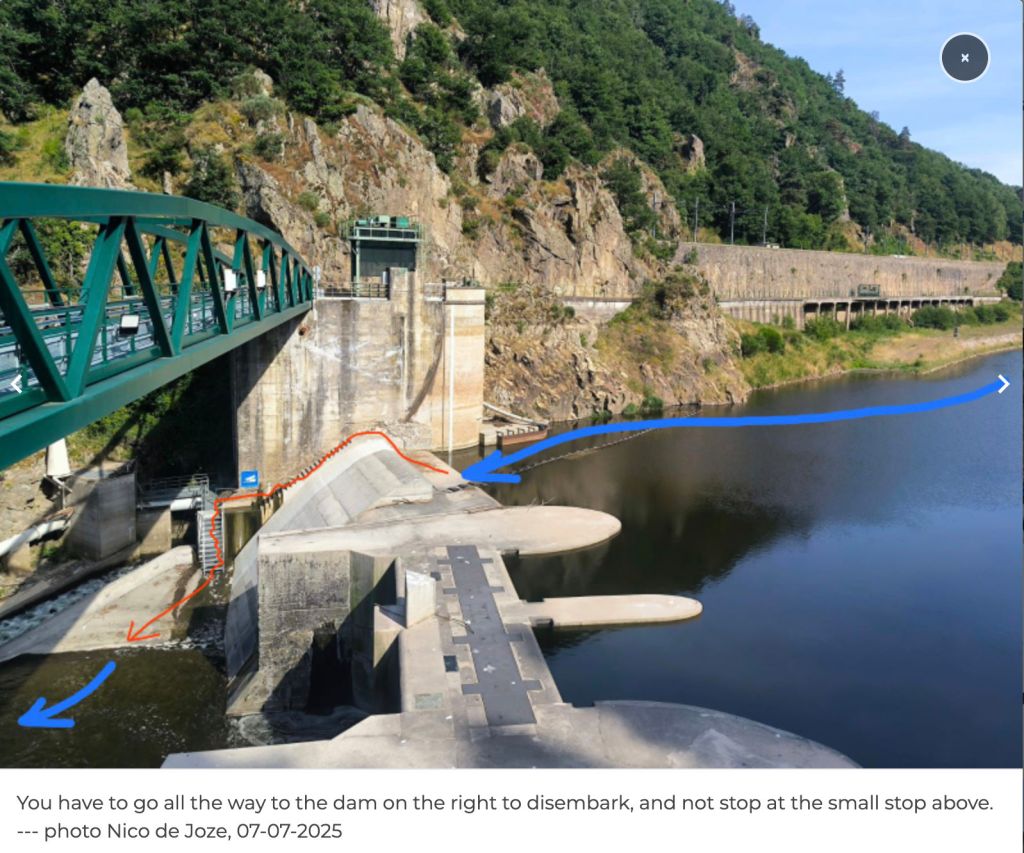
In 2018 I returned to the Allier, this time with a packraft. I flew to Lyon (cheaper and more frequent than last-minute Ryanair), caught the train via Clermont to Brioude (5hrs), and next day caught the first train to Monistrol (left). I planned to miss out the Chapearoux–Alleyras stage to save time and the taxi faff around the dam**. It left me three days to cover about 70 paddling kilometres back to Brioude.
Poutes Dam **Since around 2021 (click ‘P5’) the long-closed section between Alleyras and Monistrol reopened to paddlers, with a portage around the new Poutes dam (below), 3.5km from Alleyras station (the train line crosses the river right in front of it). See the video link above. As part of the Allier resalmonification programme, the dam was lowered by 10 metres d and fitted with a ‘ladder’ to help the fish get upstream and propagate – plus give anglers something to do. Local environmentalists fought a long battle to get this done.
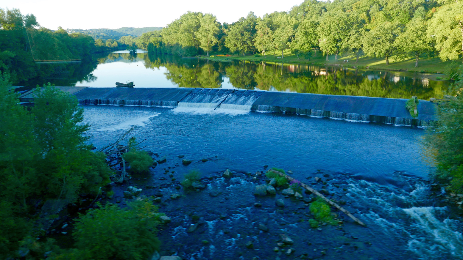
The train heading upstream passed right in front of the Brioude weir (left) where I’d be taking out in a couple of days. The line then rejoins the Allier at Langeac before heading for Monistrol. Soon it enters the wild gorge and looking down at the rapids below I thought… ‘Hang on a minute!’ which, a rapid or two later escalated to ‘WTjoF!?’.
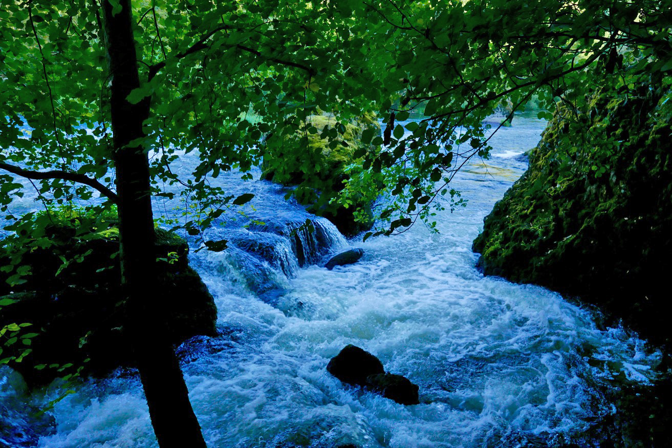
I recall being unnerved in 2006, but I’m sure they didn’t look this gnarly. I realised later that the first 100-m white plume was ‘Le Barraque au Ponnet’, easily recognisable on aerial maps. The other was ‘La Roche Qui Pleure’ – two of the plus fruitif chutes on this stage (map below left).
I got off at Monistrol, scoffed a petit dej at a deserted hotel and wandered around town wondering what to do. The river didn’t seem higher than normal; perhaps it was low back in June 2006 when I came through in the Gumboat? Either way, thanks to my train preview this stage seemed a bit too ripe for me; the Yak would be spilling over long before I was halfway through ‘Le Ponnet’.
For a while I actually wondered if I was suffering from false memory syndrome from 2006 and might have cause to claim compensation if I could find the right lawyer. But I definitely recall the old Monistrol hydro plant (right) and my photo record shows I took the picture of the board below at 9.03 and arrived at Prades beach by 1pm, invigorated but not inordinately traumatised. River pictures were few back then in that pre-wet camera era.
Later, trying to work out what was different (other than my aged nerves), I wondered if I’d just glanced down on Le Ponnet during a particularly hearty pulse of dam-released water? Looking at the vigicrues website later, the flow graph for that day (at Prades) does show it was high as I passed by around 8am – before dropping six inches around midday. I knew from the Tarn earlier this summer that following a stormy night, a six-inch rise makes a difference – it speeds up the flow but can also smother stony rapids and make them easier. The pulsed releases every 8 hours are the lumpy pattern you can see along the bottom of the graph below for the days before and after I came through. As you can tell, I am bending over backwards trying to find ways to rationalise my new-found timidity! Above left: from the Eiffel bridge in town, you can see the first rapid (looking back upstream). Like the book says: if you don’t like how this or the next couple of runs look, turn back. Otherwise – strap in for the ride!
Annoyingly, my GPS with good maps was at the menders. I took a look off a passing trekker’s map (Monistrol is on the GR65 Santiago trail) but at 1:100k, I was none the wiser. I’d have needed a 1:25k map to find any viable paths along the gorge.
La Benne?
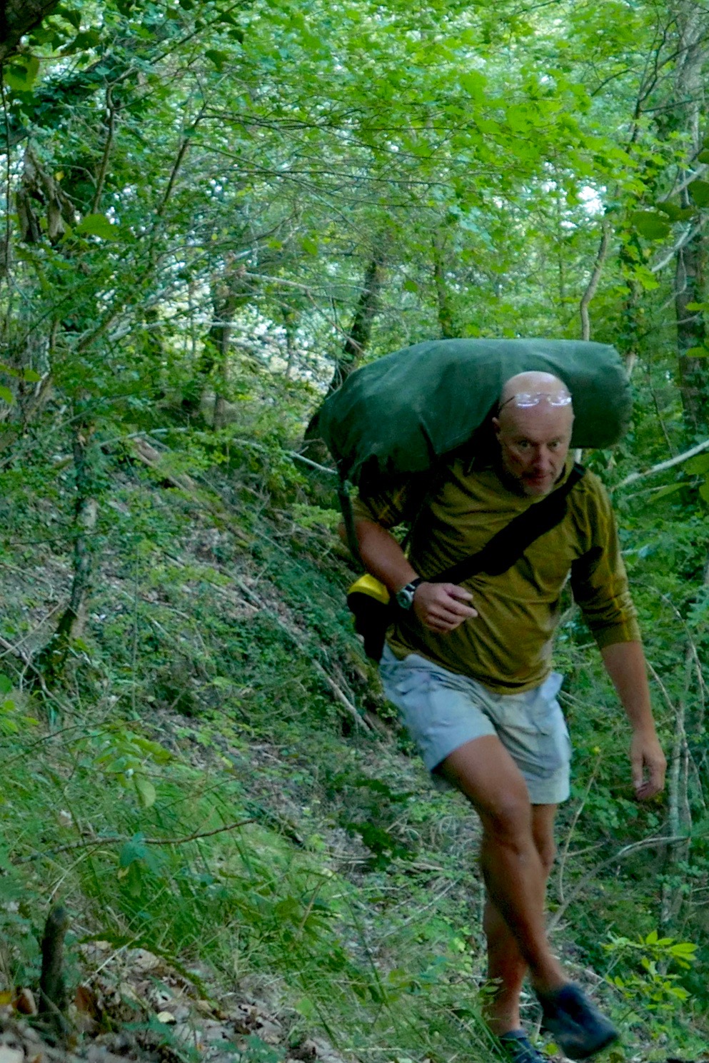
In the end I decided to follow a path by the bridge on the right side of the river, signed: ‘Viaduct, 1 hr’. It might continue along or above the gorge to a point where I could put in with the worst behind me. If it didn’t I could turn back and hitch or bus – or if desperate, clamber uphill to the D301 backroad to Prades. And that is what I did, but not without a huge amount of effort. Initially, the path followed the riverbank, passing a few Grade 3s (above, probably ‘La Benne’; KM1.8) which would have swamped my Yak like hot ‘creme anglais’ over a freshly baked rhubarb crumble.
Some three hours later, high above the valley and heading for dehydration (33°C in Brioude that day), I gave up trying to follow a path. Fallen trees, brambles, scree slopes, an intermittent path and the 1:1 slope all took their toll. After an aborted attempt climbing a loose cliff, I managed to hack my way uphill and emerged a sweaty mess on the D310 backroad, looking like I’d just escaped from a teenage slasher movie. Scratched, bitten, stung and grazed to buggery, I’d covered 3km in three hours.
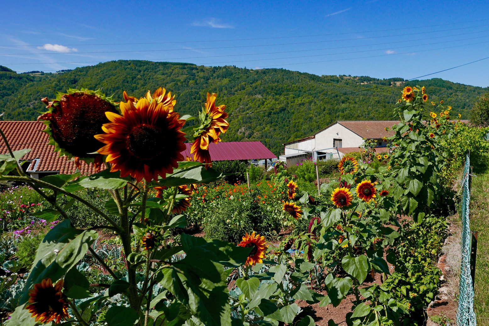
I washed in a cattle trough and passed through the sunflower hamlets of Conaquet and Conac, before splitting left down a side track and path leading back downhill, hopefully to rejoin the river below any enraged torrents.
This it did, just before Pont Gilbert and just below ‘La Petite Grille’, by chance nearly the last (and easy-looking) rapid, 8 river-kms from Monistrol. Although it didn’t feel like it at the time, this turned out to be pretty darn good route-finding without a map (left).
At one point earlier, while thrashing through the bush or teetering across scree slopes, I heard the telltale whoops of hyper-excited rafters far below. I realised that’s what I should have done: taken the fun option in a big-arsed raft as far as Pont Gilbert (if they’d take me, with baggage). I’d seen signs for a rafting centre near Monistrol station, but the town was so quiet I assumed they’d closed for the season. It would have been a great way to punch through the big rapids without a care in the world. Picture above: the ‘Le Ponnet’ viaduct down below with the long ‘Barraque’ rapid starting just around the corner and ‘Roche qui Pleure’ laughing menacingly from behind the trees on the left.
Dropping the kit bag and setting up by the riverside below ‘La Petite Grille’, it had indeed become hot enough to grill a salmon, but once on the water it sure felt good to flop down and float away like a stray log. Just like in the wilds of northwest Scotland, if you have the choice: float, don’t walk. Obviously part of me wondered if I could have managed the gnarly rapids upstream in the Yak. After all, I’d clearly scraped through years ago in the Sunny (still hard to believe). With someone alongside I’d have been braver but I’d followed my gut and felt happy with that.
Watch Belgian packrafter Dzjow’s video below from 2014. He enjoyed the Monistrol stage so much he went back up on the train and did it again with GoPros rolling. Watching it, I’m glad I didn’t. From Monistrol starts at 1:57 and he shoots down ‘La ‘Roche qui Pleure’ (the image below) at 2:28, soon followed by ‘Barraque au Ponnet’ which starts at 2:34 (note the railway viaduct) and goes on for a while to the big rock (3:19) you’ll recognise on the left in the rafting pic, above. Dzjow was a hardcore adventuriste I’ve come across before. The following year he went on to do a self-admittedly tough and not so enjoyable trip in wild Patagonia. He hasn’t written about packrafting since.
After about 4km I pulled into Prades beach (below left). I needed salt and I needed drink. And while I was at it, what harm would a handmade mini quiche, some bacon crisps and a tartes aux framboises do? None at all, mon brave.
Now dizzyingly revived but still worn out by the morning’s commando course, I knew there was a bit of a drossage (great word) just around the corner, but it was all fun knowing a few others were playing around too, including SUPs. What is it with these SUPs? I’ve never seen them doing anything more than goof about in the shallows but rarely actually go anywhere, yet they’re clearly ten times more popular than IKs and Ps combined. What does that say about the state of post-industrial recreation in the developed world?
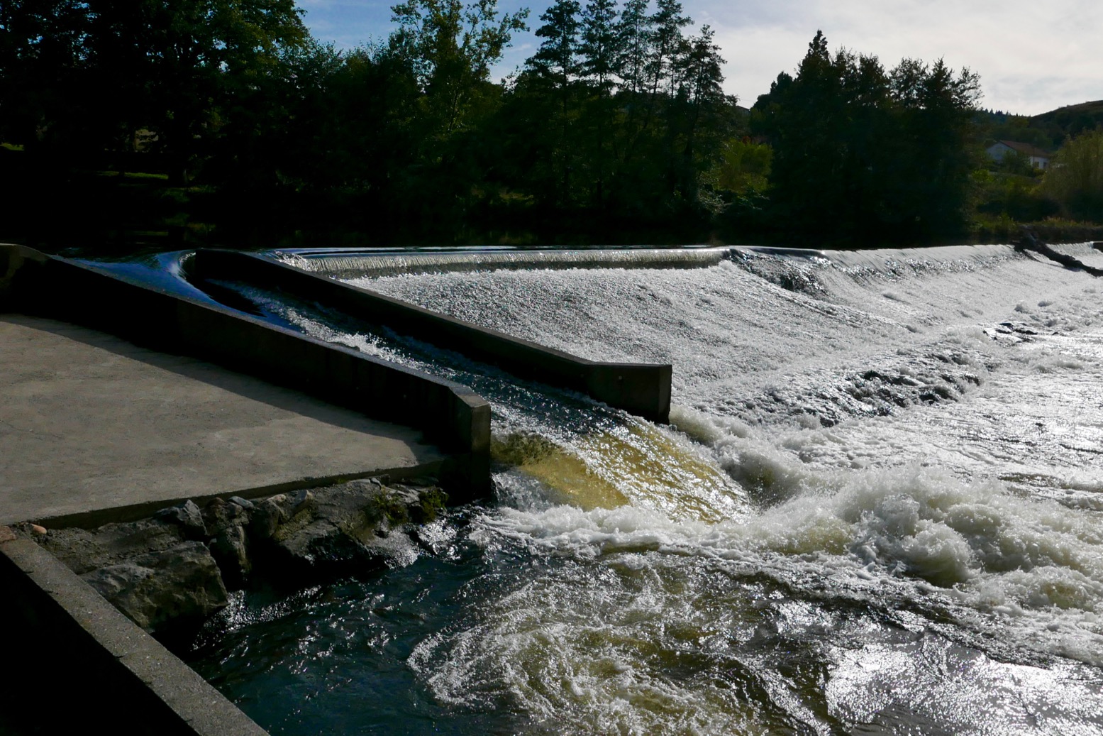
Unusually, I had a hotel booked at Reilhac, about 18km downriver, past Langeac. With just a couple of canoes on the water, the afternoon passed without drama, bar the odd wetting. But approaching Langeac, the din from the weir just before town was unusually intimidating. The canoe chute here (left) is well-known as being a bit of a drossage because it’s about 3 feet too short and so pumps a plume of water into a nasty backwave which not all boats can easily escape.
Spot the chute
And I do wish these Frenchies would mark the tops of their glissieres with two poles, indicating: ‘aimhere’. Above, show me the chute entry point while wearing a pair of sweat-smudged specs! Maybe the idea is by not having clear markers, paddlers slow down and look carefully. I did just that above and portaged round off a little beach on the right. I could not be arsed with hitting the churning pile to get catapulted over the bow like a 40-kilo sack of dried beetroots. I felt that no matter how far back I leaned, my short, light boat would plough ‘n’ flip, unlike a longer IK. Back in the water, I paddled on through early evening Langeac and an hour or so later was slumped on my Reilhac hotel bed.
The next day was just what I wanted; a short, easy run of just 13km, ending at the UNESCO-overlooked village of Lavoute Chilac where the charming Hotel des Pecheurs tottered on the slender gooseneck bluff above the Allier.
Three clicks downriver (6km from Langeac) was a double-drop weir-chute (below left). Easy enough providing you steer straight for the lower drop, but I walked it as I knew it would be a bailing job, and today was some 10 degrees cooler. Splish followed splosh followed splish down to Chillac (below, 11.5km from Langeac), another picture-perfect village sat atop a striking basalt plug with dreamy views over the Auvergnois countryside from the terrace by the church.
Half a click downstream from Chilac is an easy, short chute (left) on the far left. But once down it I realised the old weir passing below the mill on the right had pretty much been washed away, making the chute redundant and a fun ride down a long, shallow rapid. Clearly I was recovering my mojo if I was looking for some white water action again. Later, I read this weir has been flushed away for some years, but is another thing the new Canoe Trips,South of France guide had not updated.
Soon, the bluff of Lavoute Chilac rose into view. I pulled over left at the riverside park, let my gear dry, then walked into the village over the tall bridge (left). Les Pecheurs (white building on the right, below) was still on siesta, so I left the Yak by the steps and walked over to Le Prieure, the other creaky-stair hotel in the village, for a mouth-watering ‘Salade Auvergnate‘.
Wandering around the old church and the imposing, 18th-century facade of the abandoned priory (right, due for luxury flat conversion), I was staggered to see a July 1866 flood marker at the church’s back door. In the photo left my hotel room would have been submerged by a few metres. Perhaps the river’s acute 180-degree turn causes floodwaters to back up.
It’s the last day of my packrafting mini-break and by my estimates, I had about 22km of paddling, plus a 4km walk to Brioude station to catch the 4:10 to Lyon. I didn’t want to miss that so set off briskly, passing a canoeing couple (the only other boat I saw all day) until I could estimate my pace against a landmark. Before 11am I’d reached the bridge at Villeneuve meaning I’d covered 9.5 clicks in 80 minutes which gave me plenty of time. This Allier flows quicker than it looks.
The book talks of another old weir to ‘shoot’ at Villeneuve campsite, but there’s nothing here except a ford with poles marking the car crossing. Many of the book’s ‘shoot an old weir’ descriptions are out of date. There’s rarely anything more than a line of rounded boulders and a drop of a few inches, making you wonder: ‘was that it?’ But at Ville Brioude, just before the tall bridge, the book suggests you can shoot a modern concrete weir (left). Good luck with that and those boulders lined along the base.
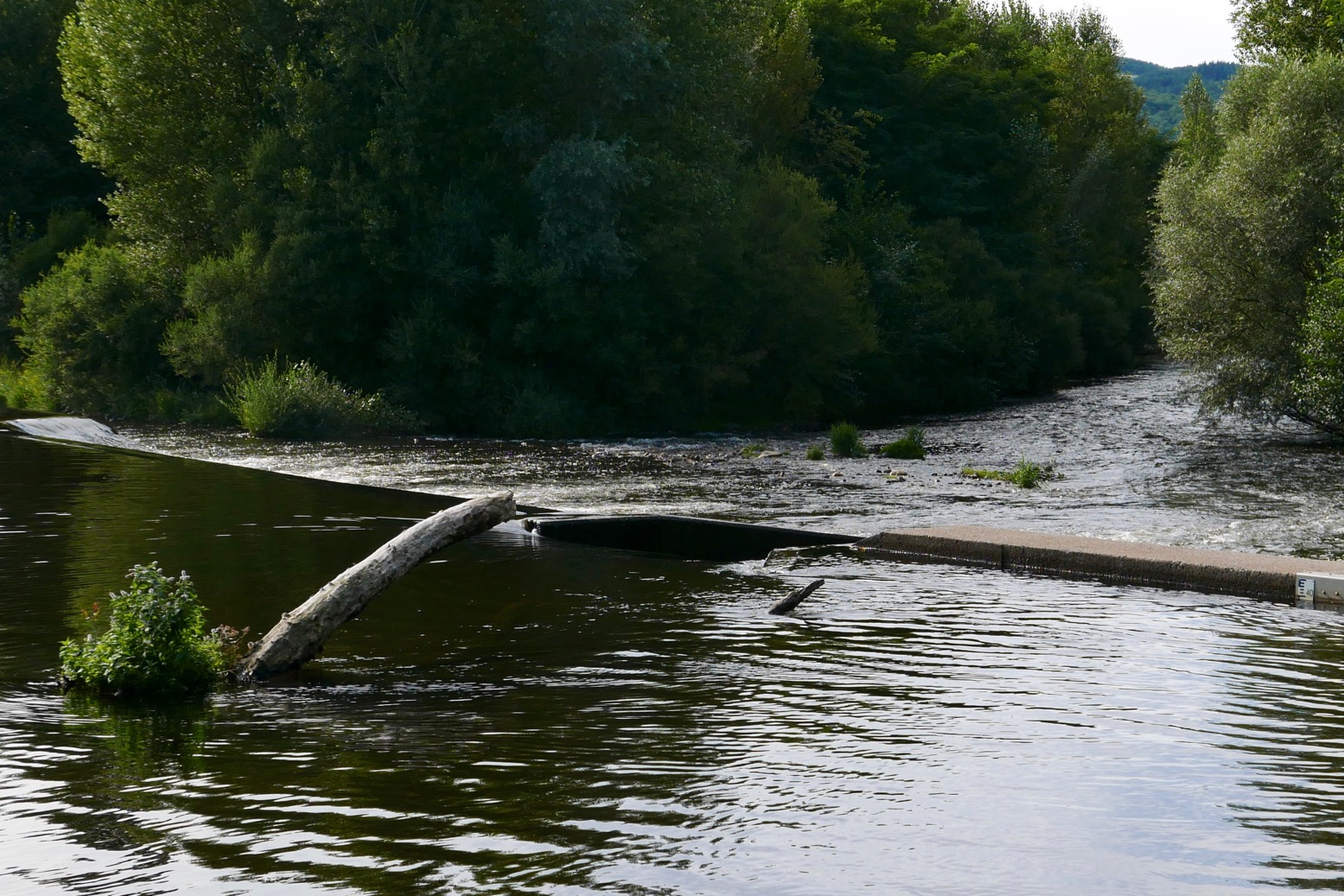
Finally I was back at the public beach below La Bargesse campsite (45.279097, 3.406962). Ahead was the big weir before the red brick rail bridge I’d crossed on the train a few days earlier (left). Here again the book now suggests ‘portage right’ and other convoluted options – perhaps a simple left/right mistake? Instead you simply take out at the grassy park, river left, walk over a little footbridge and put back in below the weir under the railway bridge and above a shallow rapid.
Once again, I’m amazed at the true amphibiousness of these packrafts, especially if not hauling camping gear on the trail. A long walk to dodge gnarly or closed stages is (potentially) easily done, even carrying an inappropriate kitbag. With plenty of time to catch my train, I dried off, got changed and walked over to Brioude for a coffee and cake in the town square below the basilica’s decorated tower. In the hills all around, the petrified volcanos and lush grassy valleys of the Auvergne countryside could easily sustain more exploring on foot, by pedal or with paddle.
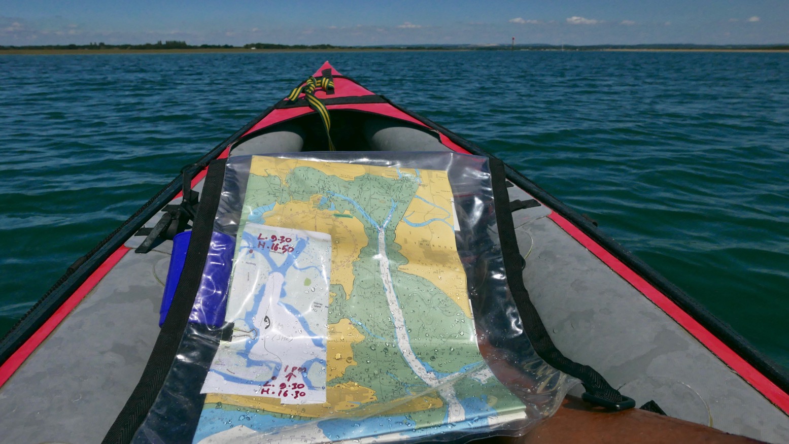
Time to knock out a long-planned circumnavigation of Hayling Island near Portsmouth while this amazing summer lasts! P-Day came along and by chance, the weather and tides lined up: high 20s °C with a 3-m neap and a calm morning before a 10mph onshore afternoon breeze.
I’d ridden down and recce’d the harbour entrances a couple of years back and last year we’d tried to reach the harbour along the canal from Chichester, but that plan didn’t work out. You’ll find lots of useful descriptions online, but it pays to recall (as I learned on a run to Brighton) that on the English southeast coast the tide (which floods eastwards and ebbs to the west) turns eastwards from two hours before high water to four hours after. So while the water is still dropping the current reverses. The Brighton post explains it (and I’ve since found an interesting animatable graphic here) and it may also explain why we passed deserted beaches and got to turn north into Chichester harbour entrance surprisingly quickly, even if it was near calm. Occasionally a rogue wake rippled in from a distant freighter out in the English Channel.
It was soon clear that my estimation to cover this 22km lap was way too long. Shooting along the channels visible on the map above, mudbanks to left and right limited side exploration and we ended up under Hayling bridge (KM13.5) in just 2½ hours including lunch and a few drifts.
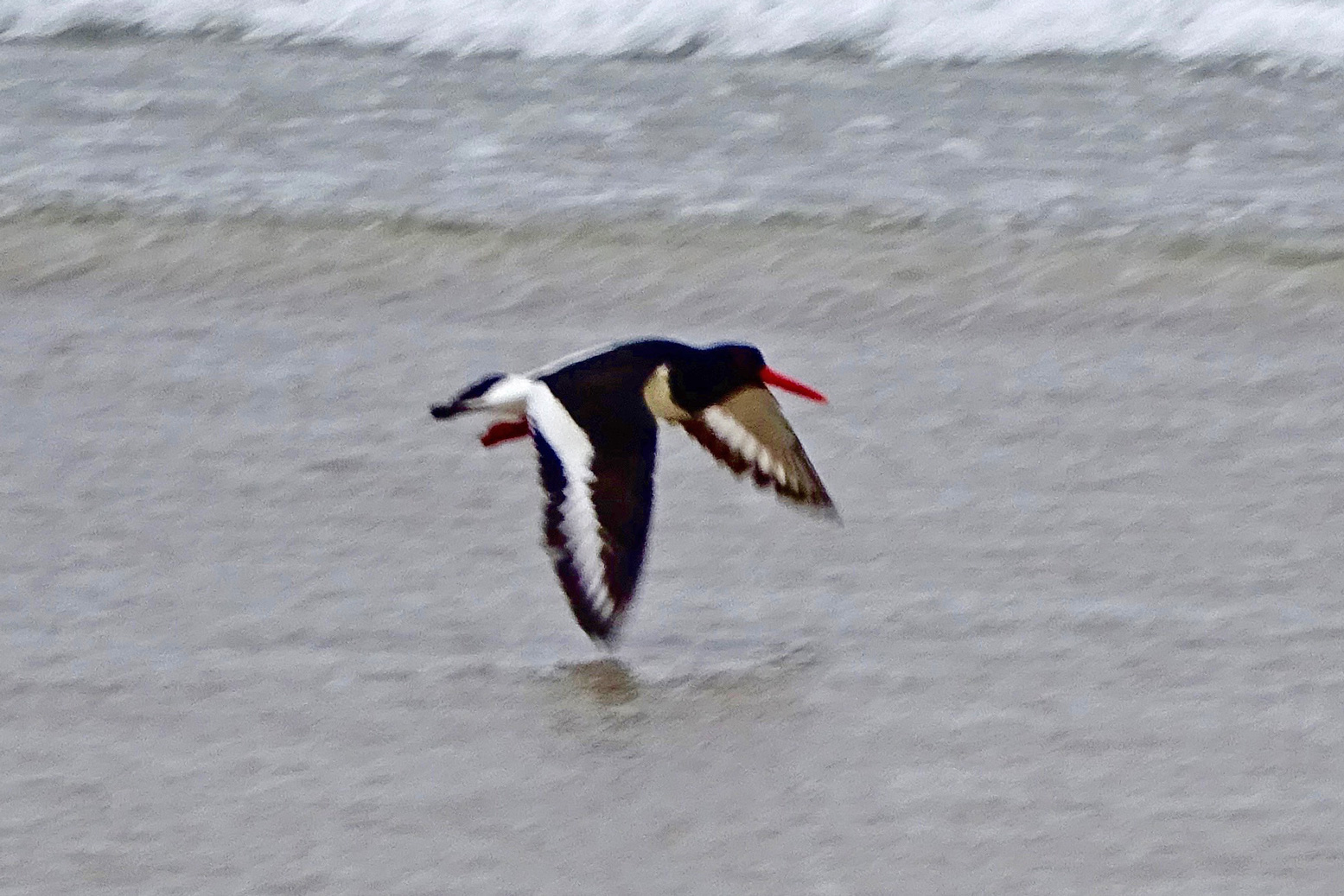
On the way we passed a lot of moss-covered sailing boats, lots of birds including oyster catchers (didn’t know you get them down south) and up nearer Northney marina, a brace of SoTs and a young couple struggling to control an under-inflated (or leaking) Sevy K2. Our high-pressure Seawave glided smugly by.
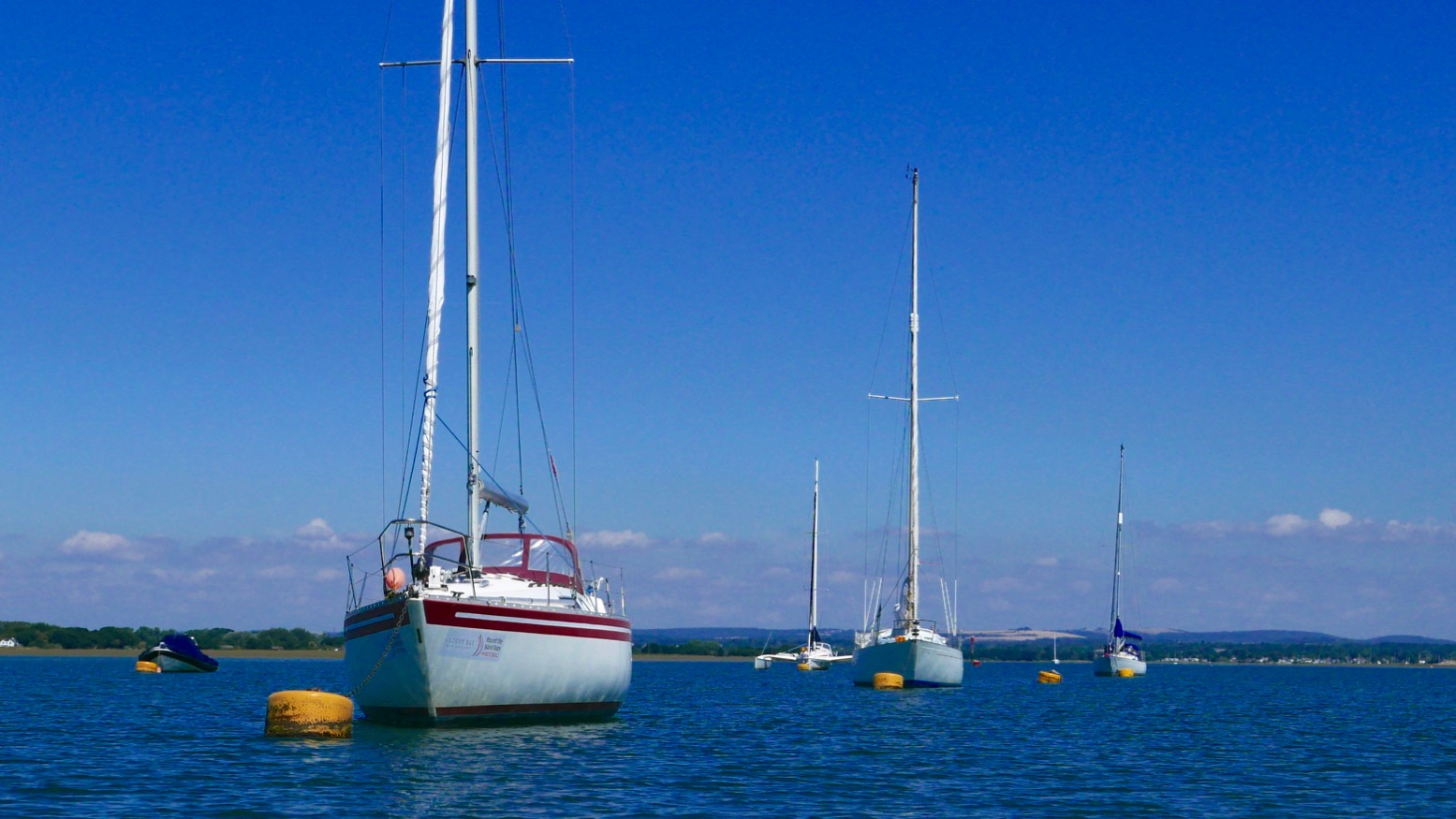
With less than half the tide in, there was already plenty of water to pass under the road bridge and between the stumps of the old railway span alongside. A huge rusting drum suggested a swing bridge to allow boats to pass; online later, sure enough, that’s what it was (left, see inset); a railway running from 1865 for just short of a century. When we drove off the island at about HW, it was the drum was only thing above water. Chichester harbour is packed with parked-up sailboats (‘moored’ some might say), but Langstone is virtually empty, possibly because i’s shallower and with a much narrower entrance. These natural harbours formed after the last Ice Age and take about seven hours to fill, but drain in only five. And because they drain right down to unfathomable mudflats on which even a gannet in snowshoes can barely walk, exploring side creeks can only be done with the high water clock ticking.
To aim for Langstone exit channel from the bridge, head for two tall poles visible to the SSW. By now the wind was in our faces giving a greater impression of speed, but the tide was coming in for another two hours (or do I add/subtract two hours? My brain hurts). We were way too early to catch a roiling ride out the 250-metre wide Langstone channel back into the Solent. We’d have to hack our way out along the side, like a Maori war party.
Long before we got there we could hear the intimidating wail of jet-skis haring up and down the channel. They have such a bad rep and the two-stroke din doesn’t help endear them. If they sounded like Ducatis or Bonnevilles we’d be queuing up for a go! We passed the famous Langstone Pumpkin (above; a lost novel by Wilkie Collins), and soon after, hopping out to wade against the tide over the shallow Sinah Bank saw me sink into the vile black quicksludge which Collins used for the demise of his fickle heroine.
Nearing the channel I sought to dodge the in-pouring current by passing under the gantry of the Hayling Island ferry. Then I announced ‘All hands on deck! Prepare for ten minutes of full steam ahead’. That ended up more like twenty, because keeping close to shore was made trickier by frolicking bathers, parked-up jet skis and inflatable goofballs. To the right the tide streamed past way faster than we could’ve paddled, but along the sides we managed to inch forward at a stroll’s pace; a yacht motoring out mid-channel was no faster. I kept eyeing up points where the current might splay out, but it was getting on for a mile out over the East Winner sandbank before the effort eased, the seas slapped us about a bit and we were out in the Solent for a choppy paddle back to the beach (above), now packed with frolicking sunbathers, paddleboarders and inflatable goofballs. Quite worn out, we beached the kayak and jumped back into the warm sea to wash off the salt and sweat.
It’s fun to try new stuff and paddle on a sunny day, but overall I’d say around Hayling was a bit boring compared to a sunny day in the Northwest Highlands. Who wants to pass Funland and beach houses, mudflats, marinas and more mudflats? Reminds me of Darwin harbour but without the crocs and mangroves. I suspect west of here, the Southwest coast has more promise. I still think the morning start anticlockwise from West Town is a good idea: knock out that exposed seafront stage before an afternoon breeze (and the concomitant rise in bathers, borders and hydrofoil kiteboarders hitting the sound barrier). But I’d aim to leave West Town 3–4 hours after LW. The unintuitive tide may be turning but once in the Chichester Harbour it gets you up and around to the Langstone exit channel around HW for a short paddle along the seafront back to West Town. There’s probably a formula for doing it clockwise from Eastoke and running the flood tide through the Langstone channel, but I’ll let you work that out.
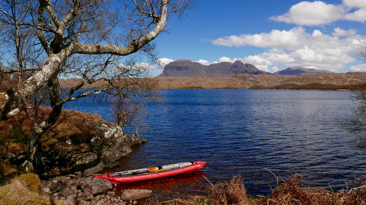
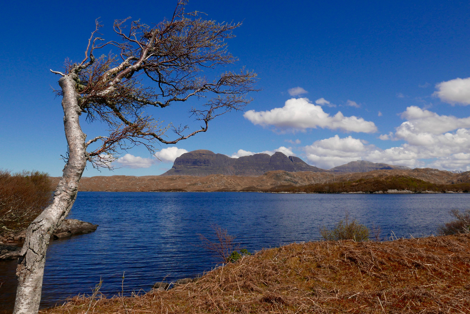
We decided to lap the tip (left) of the Coigach peninsula. Doing it clockwise put us in the lee of the afternoon’s southwesterly once in Enard Bay and better still, we’d catch high tide at Achnahaird, enabling us to paddle up the creek to complete a near full loop back to the car via the freshwater lochs of Ra and Vatachan.
I remember being quite nervous the first time I did this way back in 2013 in my Amigo – in the other direction from Achnahaird. Looks like I’m not the only one – I blame the Pesda guidebook. It felt like a long old slog west then north between the Ristol islands – the tidal Ristol channel was dry. But by the time we’d passed the reefs of Reiff and reached the sparkling beach at Camas Ghlais (below) we were already more than halfway round.
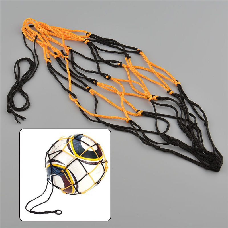
Sitting on the beach, on warm days like this and always looking to refine my set-up to a razorbill’s edge, I sometimes think a sturdy football-sized net bag to take a beach stone would be handy to anchor the boat out in the shallows. This way it won’t beach itself, get hot and purge air which can make the kayak soggy once back in the cool water. It’s one slight drawback of running PRVs on all 3 air chambers. I could probably find some washed up net up among the flotsam and make one. Or I could Buy [a ball bag] Now on ebay for a £1.62. Leaving the sandy bay, I give the Seawave a quick top-up with the K-Pump anyway.
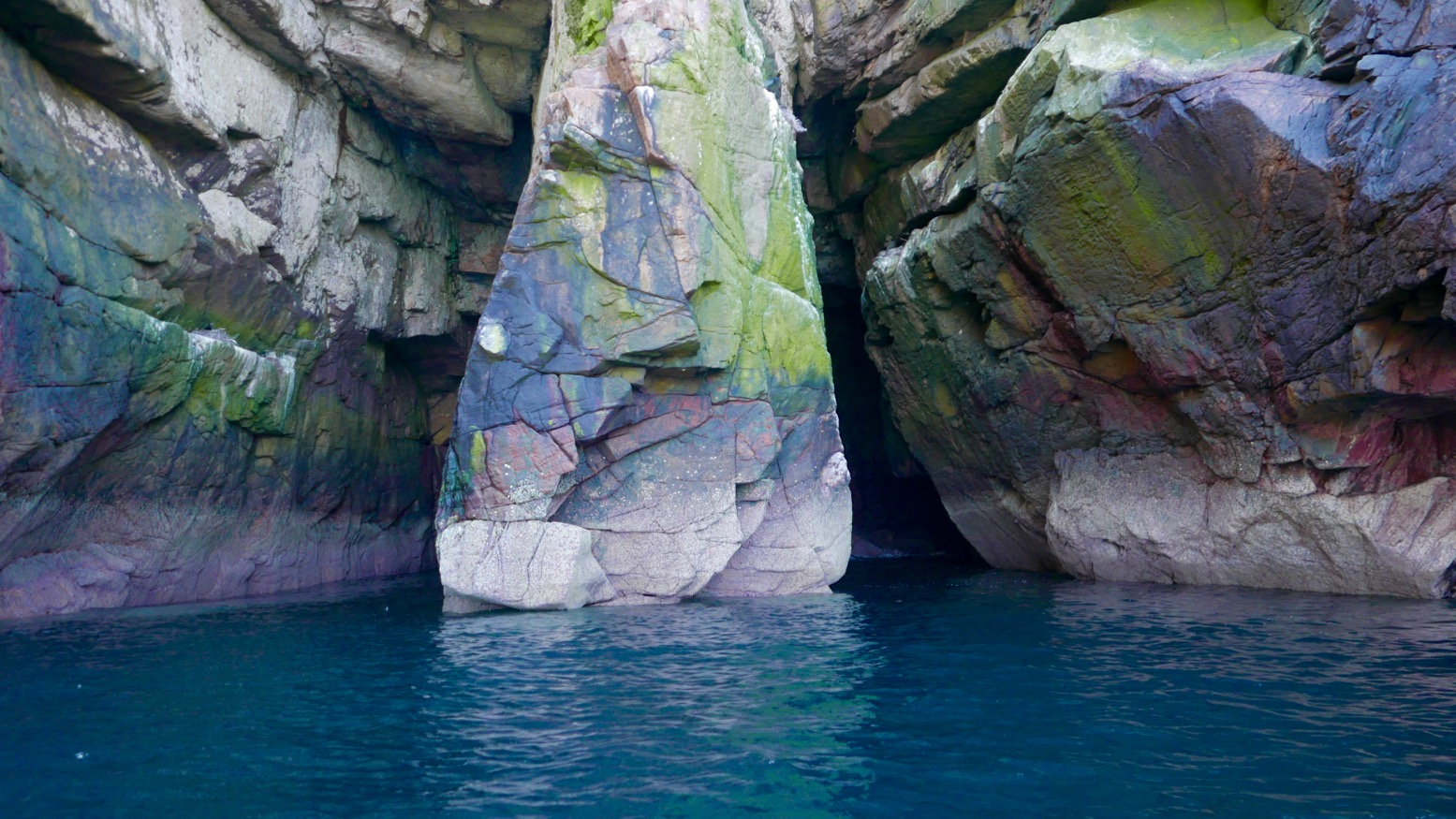
On the north side on the bay we nosed towards a slot cave, but white streaks running down from the ledges suggested nesting birds had hung out ‘Do Not Disturb’ signs. Either I’ve never noticed them before or there are lots more nesting birds around this year. It’s the end of May but there are still tiny snow patches on An Teallach and Beinn Dearg – maybe the season is late.
North of Camas the unrestrained swell was bouncing back off the low cliffs and small dazzling waves were breaking over semi-submerged rocks, making for a rough ride. But it’s all relative and showed what a sheltered life I lead, paddling mostly in and out of the protected Summer Isles.
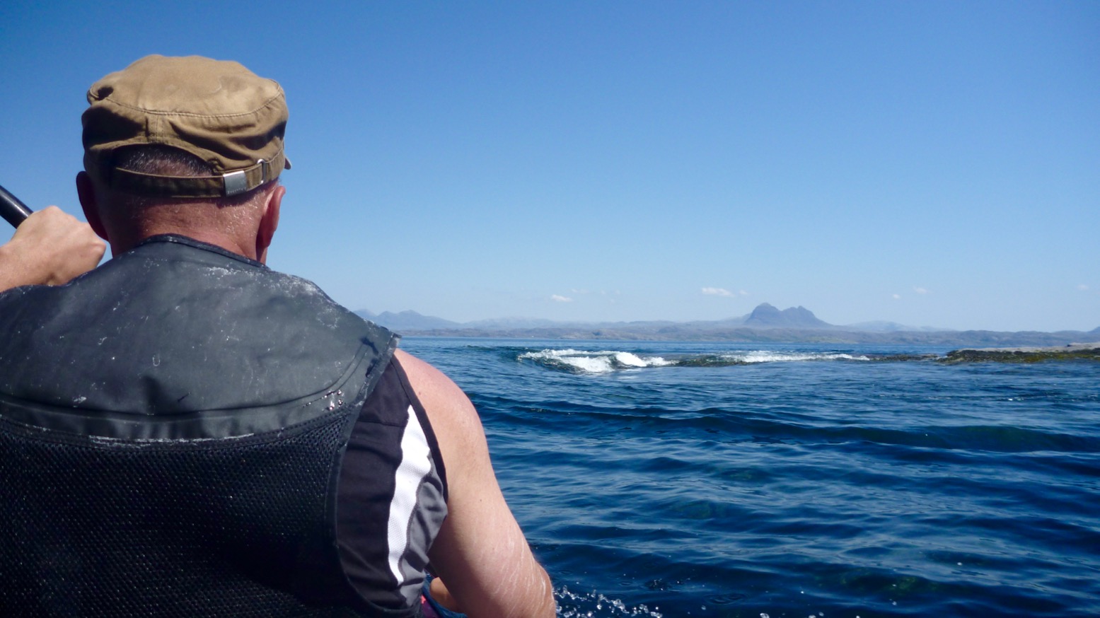
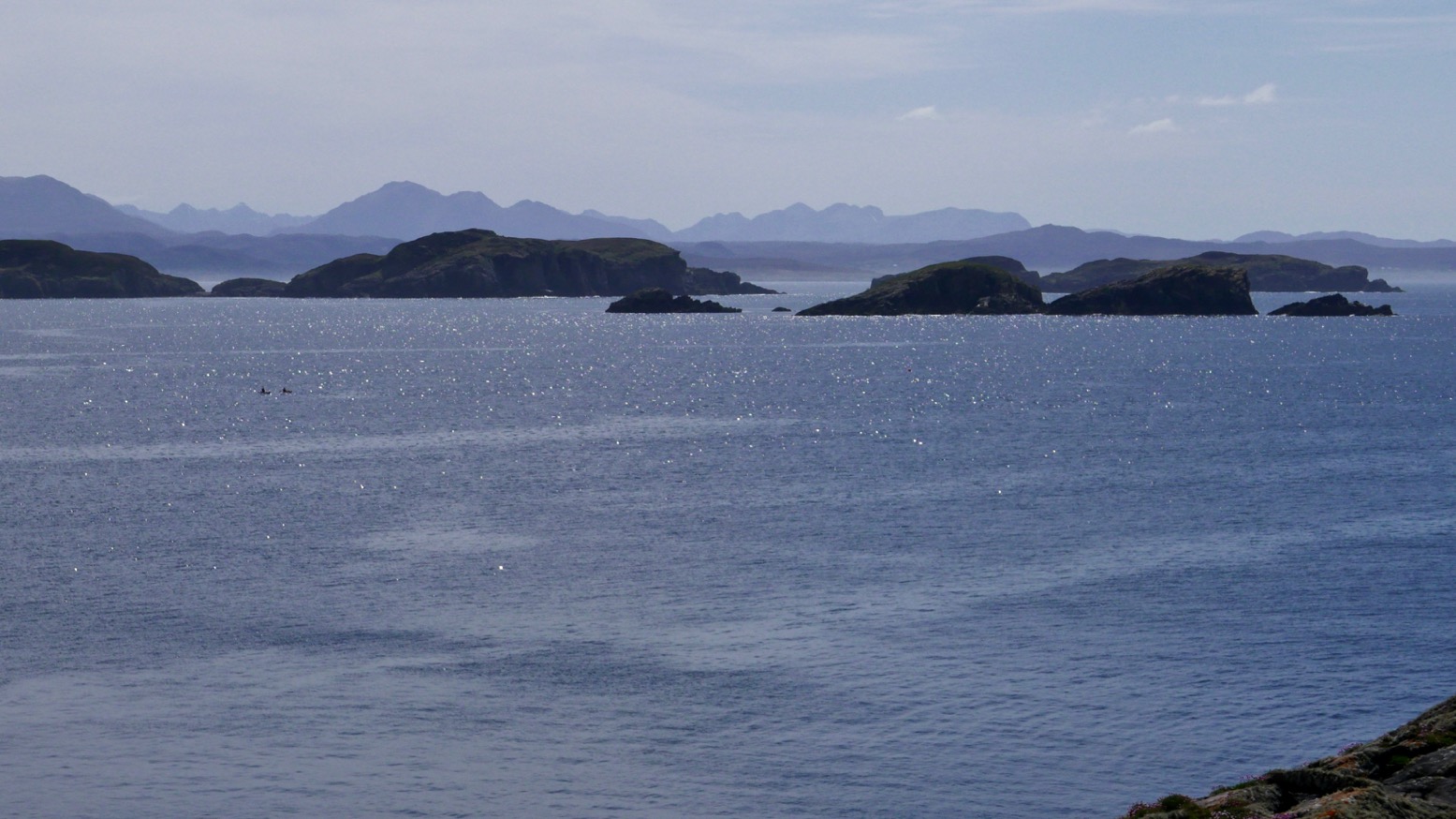
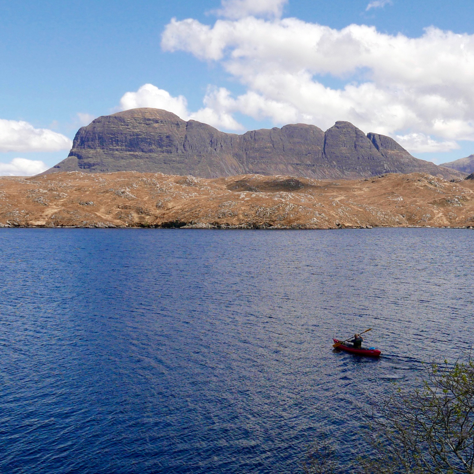
We passed on sandless Faochag Bay and on turning the point of Rubha Coigach all was calm as the grand panorama of the Assynt peaks came into view (above). From the right: Quinaig; Canisp behind Suilven, Cul Mor, Stac Polly in front of Cul Beag, and the group around Ben Mor Coigach. It’s one good reason to do the paddle in this direction. There’s a bigger version of the Assynt panorama here taken on the road above Achnahaird. I really must work out how to do that panorama photo-stitch thing.
Coming down the Enard Bay side, we tried to explore some other caves with green moss streaked with guano, but got dive-bombed by angry shags.
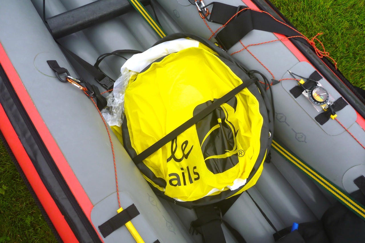
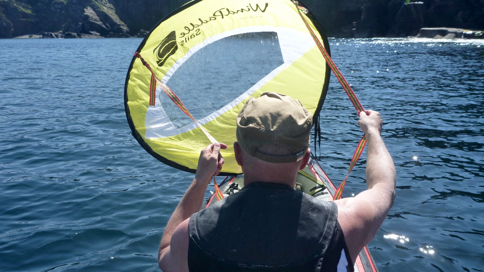
Back out in the bay an unpredicted northwesterly picked up – time to launch that WindPaddle which has been sitting in my kit bag unused for a year or more. Initially, the breeze barely reaches 6mph – we could have paddled faster – but it sure was fun to kick back, look around and let the boat waft quietly along, free from the splish-splosh, splish-splosh rhythm. I wonder if self-driving cars will be the same.
It’s been a while since I’ve done this but the WindPaddle definitely felt better than my homemade efforts from years ago, as well as the knock-off WP I bought a year or two back. I tried a V-sail too but have never really got the hang of kayak sailing. It seems the sweet spot is hard to find: either the wind comes and goes and the sail flops, or it blowing so hard the sail can’t handle it and you’re clinging on. Still, I look forward to giving the WP a spin in slightly windier conditions. For the compact size and light weight I get the feeling it may be worth keeping.
The breeze picked up and we chugged along at a brisk stroll. But even then the WindPaddle feels satisfying to use. I think the key is the sprung tension of the composite batten (rim); it retains the circular shape of the bowl which means it’ll stay up as the wind drops and keep shape as it rises, then can be confidently scrunched down to a packable size without breaking. Doing that during a bit of a blow may be tricky, but it can easily be pulled back and tucked down unfurled over the legs (right). It’s only a downwindish sail but as with previous disc sails, I like the way you can steer intuitively by pulling one line back; a skeg must help but there’s no need for paddle-rudder assistance.
It was nice to look around in the quiet but I also missed that thrill of thrust when a sail catches and holds a good passing gust. Eventually we could stand the relaxed pace no more and the geef paddle-assisted us towards a stony beach at the mouth of the Allt Loch Ra creek. Squawking oystercatchers were guarding their nests. Left, by the bothy at Badentarbet last year; don’t stand on the eggs.
Refuelled, we paddled upstream for a bit then I tow-waded the boat, reminding me of the shallows of Shark Bay in 2006 – a good way to rest after what felt like days of headwinds. The short wade brought us to within a couple of minutes’ portage of Loch Ra just over the road. Now on fresh water, we dragged through the reeds before another short portage over into the adjacent Loch Vatachan. Picking a passing place close to the shore, the geef walked off to get the car while I rinsed off the seawater – another good reason to paddle this loop clockwise. It’s 15 miles and about 5 easy hours to loop the Coigach loop.
Adding a rudder to the Seawave inspired me to drag out my cheapo disc sail. I last tried it three years ago on the Amigo (below) when it worked OK, even without a rudder. But of course, a rudder is much better for keeping the boat on the wind while sitting back with the paddle on your lap and your hands on the sail lines.
Pulling the sail out the 3mm fibreglass rod or ‘batten’ broke. I bought some more which, if anything, felt more pliable than the original but before I took it out it was broken in two places. Long sections of fibreglass rod in greater diameters can’t be sent bent so incur much higher postage charges which made reviving my KnockOffPaddle uneconomical. Worse still, removing the splintered rod from the sail (before I decided to ditch it) filled my hands with glass splinters for days. Nasty stuff.
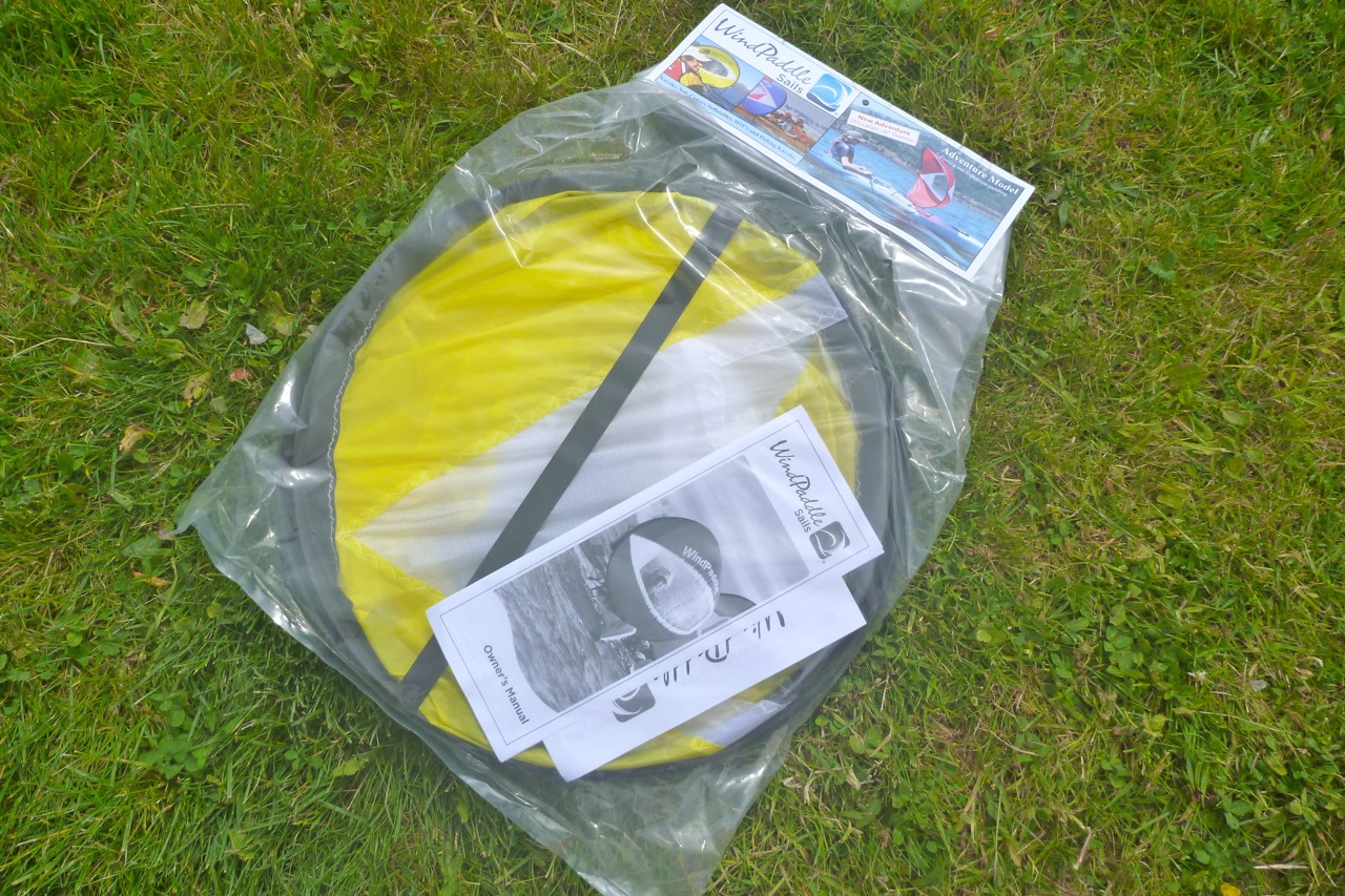
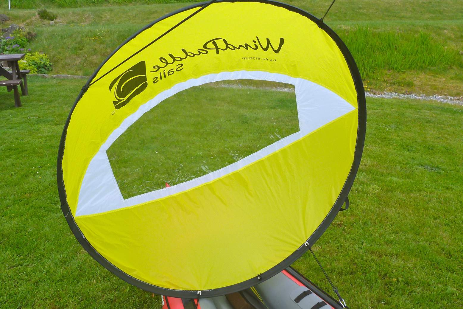
I looked again at the original WindPaddle whose prices have dropped in the UK. Their Adventure II model is up by 13cm to 119cm or 47″ in diameter, making a claimed area of 1.42m (as usual, π x r2. doesn’t add up to ‘1.42’ but never mind). It folds down to 42cm or 16 inches diameter but with squidge some more (ovalise) to tuck securely into the floor of your boat, and weighs just 400g (+30g for a control line). I asked about the cheaper Scout sail and why it’s rated at 4–15 knots when the new Adventure II is rated at 6–30kn. It’s not just the bigger area; the Adv II has a significantly stiffer composite batten to help hold its shape. That’s important and why ships don’t have rubber masts.
A problem with all sails is that they can start swinging from side to side in a recirculating frenzy before either settling down, collapsing or diving for the drink, possibly when the wind is more than they can handle. I recall with previous V and disc sails that lot of your time is spent managing that motion, rather than galloping across the waves like a flying fish, but the promise of achieving that is why I persevere. Update 2021: After having much better results with a AirSail on a packraft, I think some of this swinging could be down to clipping the sail to slack decklines, and not directly to mounts on the boat’s hull. I will try that next time.
When the £116 sail arrived, it certainly had a better quality feel than my smaller knock-off which went for under £20 on eBay and are now under a tenner. The sail fabric feels thicker and the crucual perimeter batten isn’t a regular GRP rod-like in a tent, but a flat flexible composite band about 8mm by 1mm. It takes significantly more effort to fold the Adventure II three times into its 16-inch hoop, but that should result in a more stable sail in action. Sea trials here.
A few shots from our first visit to the Summer Isles in 2006 with my original Gumotex Sunny and Mk1 Safari and when it seems the weather was unusually good for August. One day we paddled out as far as Tanera Mor and Tanera Beg, as well as Achnahaird and Loch Sionascaig and Osgaig and thought it was all a huge adventure.
But I knew before I got on the water the tide was not with me and nor was the wind. Hauling myself through the Tanera channel, by the time the cheese-wedge profile of Angus came into view to the southwest it looked a long way away, with only Glas-leac Beag (on the right, below) between it and the inky depths of the Minch.
I paddled out into the Summers the other afternoon to see how far I’d get. What I was really eyeing up was Stac Mhic Aonghais or ‘Precipitous rocky feature of Angus’, one of three skerries bobbing just south of the Tanera islands. I only really clocked it on last year’s crossing from Carn nan Sgeir to Tanera Beg. I suppose now I’ve visited just about all the Summer Islands I’m looking more closely at the bits in between.
So I swung east around the south side of Tanera Mor and, now with the wind and tide behind me, at the last minute decided to make a ‘training dash’ towards ‘Goat Sound’ (left) – the tidal passage between Horse and ‘Goat’ island which I guessed was flooded by now. From there it was a weary hack back against the squalls to the beach and an XL dinner.
A few days later I persuaded visiting paddlechum Jon that a tour of the Summer Isles Skerries was good use of his holiday up here. He’d just returned from a gruelling, two-day bike ride through the Assynt – part of the HT550 – so his arms were in need of some exercise.
As skerries go, the supposedly 78-foot-high (26-m) Stac of Angus (see below) has a dramatic profile. From some angles a homesick Norseman pining for his mead might even call it a dragon’s tooth. It also looked fairly easy to climb to the top to get a nice shot of a kayak below.
Stac Mhic Aonghais, Sgeir an Aon Iomairt and Sgeir Ribhinn or Revan. All three line up with about a kilometre between each; long thin skerries aligned on a SW/NE axis, as is much of the lower elevation topography up here; valleys and trenches carved I assume, by glaciers advancing from Scandinavia. This report suggests that 12,000 years ago during an anomalous cold spike following the end of the last Ice Age ‘…climatic factors, combined with the availability of large quantities of subglacial debris, led to the development of distinctive glacial landsystems, which may have no direct modern analogue.’ As we know, the dramatic Assynt has no topographic analogue elsewhere in Scotland and the angular claw of Stac of Angus is one of its many remnants. (Btw, that marine chart screenshot above left is from a very handy and editable online nautical ‘mapp’).
Planning paddles up here is of course a lottery but came the day, by some miracle a High had parked itself over the northern British Isles, put on the handbrake and tipped the seat back. The 4.5-m tide may have been at the peak of its fortnightly cycle, bottoming out at 2.30pm, but that could be handy if we used it right. If we left Stac around low tide, it should be an easy ride back up to Old Dornie, assisted by the rising afternoon breeze. We paddled down between the Taneras with the tide, passing some other kayakers on the way. I mentioned the Tanera Beg arch just round the corner to them, but after a quick check the tide was too far gone to thread the arch.
In little more than an hour we were approaching the gnarly, storm-wracked northern prow of Angus. It’s hard to think how the 1:25,000 OS map arrives at the oft-repeated height of 26m. The picture below of Angus’ high point is about 90 minutes before a low spring tide at around 0.5m above Ordnance Datum – which is the lowest astronomical tide – ‘LAT’ – at Newlyn. So even if you add about 2m or 6 feet to measure the skerry at LAT, or just use the more likely MSL, there’s no way that adds up nearly 80 feet; it’s more like half that. It’s odd because the two other skerries we were heading for had entirely plausible heights.
Anyway, we paddled along the exposed west side looking for a landing spot but found nothing but 45-degree slopes. I was sort of hoping that low tide might reveal a platform or at least give us more rock surface to choose from, but very low tide also exposes seaweed, kelp and other crap; there’s probably as much chance of getting alongside a handy ledge at higher tides.
As we passed between the two outcrops on the south end, Jon smacked me in the head with his paddle (left). Lifted through by a 1-m swell, on the inshore side we found the least unlikely looking parking slot, where between bigger swells I could crawl out (right). If you think about it, sitting as you are on the floor of a bobbling narrow boat at sea level, there’s nothing harder to get out of than a kayak, especially once you’ve attained a certain age. IKs are easier than a proper sea kayak of course, but even a canoe’s bench seat might be easier to spring or step off.
Stac Angus is nearly bisected by a punched-out breach (left) through which storm waves tumble; the higher part is in the north. Problem was getting there from the lower half of the skerry where I’d landed. Even if it wasn’t 26m above MLWS or LAT or even M&S, accessing that northern spike was a lot more of a rock-climbing challenge than I was prepared to take on. So I left it to the squawking guillemots and settled with just enough elevation to get an OK shot of Jon gliding by (below), then scrambled back down to the slot and hailed down my water taxi.
With Stac of Angus ticked off, we scooted over towards Sgeir an Aon Iomairt (in the picture above, on the right), hoping it would provide an easier landing for a civilised terrestrial lunch.
Iomairt has a similar NW-facing cliff and on its NE corner has a parking slot of sorts (right) where a kayak can wedge itself as the tide drops away below it.
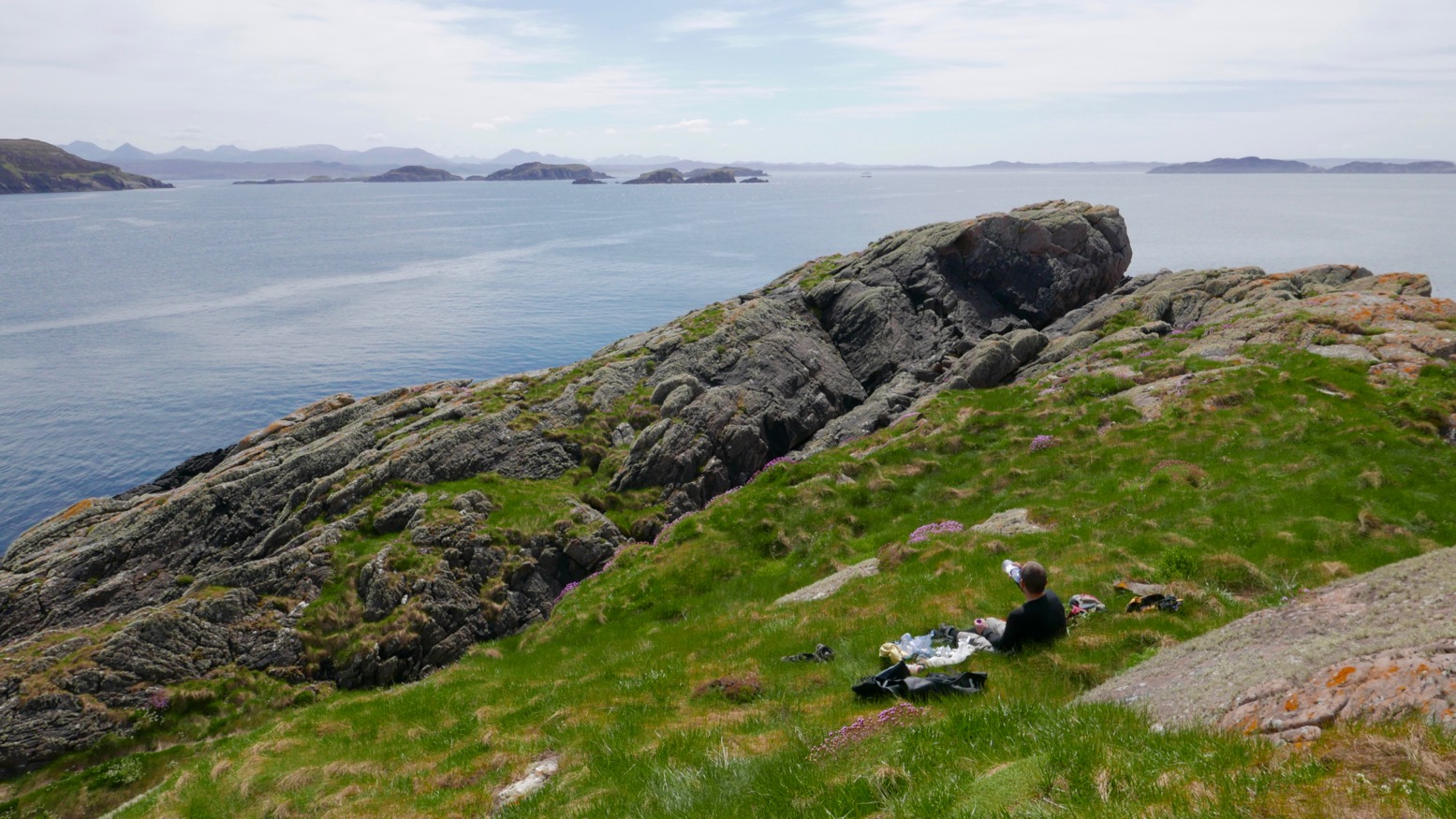
The surprise here was the thick cushy duvet of soft grass and thrift flowers which capped the island. Picture left: looking south from, near the summit towards the Carns, Bottle and Priest Island. Whatever it is that makes Iomairt agreeable to lush vegetation and sea pink thrifts, while Angus makes do with lichen and bird shite, it’s found here. Perhaps because it’s less of a jutting flake and flatter, with many crevices where rainwater and sludge can gather and foment.
Who knows, but it was nice to be able to walk around, rather than teether on acute, barnacle-covered slabs, as I’d just done on Angus. We settled down out of the breeze – May temperatures are still barely in double figures up here – and unpacked our munchies. We had with less than an hour before the tide turned and lifted the Gumotex away. As we ate we spotted another couple of paddlers enjoying the calm conditions out to the southeast, near the two Carns which join up at low tides, like today. Though you’re not spoilt for choice out here in the Summer Isles, you could easily camp on Sgeir an Aon Iomairt. There’s brackish water in some pools, good enough for a wash, and enough flat patches to sleep in comfort. Hardshell or IK, for peace of mind you’d still want to lug you’re boat above the high water line unless you can find a bombproof anchorage. And the elevation of around 16m is, you’ll be pleased to know, about right. When our time came the tide had dropped a metre but was on the turn. Getting back in was as always an awkward shunt, slipping around on kelp and slimey molluscs to get the Seawave back on the water, but once in the pool it did manage to paddle itself out over the slimy kelp towards Sgeir Ribhinn (‘Maiden’s Skerry’), the last of our Summer Island skerries.
Coming round the eastern side of Ribhinn, even this skerry managed to sustain a small capping of grass. We nosed into a kayak-wide geo and found ourselves in a twin-arched cave, another paddleable arch (above) to add to my list.
All that remained was to paddle back the way we came through the western passage of ‘Tanera Sound’, between Tanera Beg and Eilean Fada Mor. With the spring tide still low, all the shell beaches were out sunning themselves. After looking for it for years, I finally recognised a cove and beach on Tanera Beg (left) where we’d spent a lovely afternoon 12 years ago with my Gumotex Sunny and ancient Safari when we first started coming to the Summers.
Back to now, I hopped off at Eilean Fada to top up the air that had purged while out of the water over lunch, and to get a shot of Jon floating over the azure Bahaman sands (below). My kayaks have got a lot better since 2006, but the Summer Islands remain the same great place they always were for a quiet paddle.
First paddle of the year and it’s nearly May! I need to get out more. It was a calm day but as we’d not been there for ages, we decided to go inland to the ever-reliable Loch ‘Sion’, spread below a cirque of dramatic Assynt peaks. From the lay-by on the WMR it’s a half-a-mile’s trudge down to the west shore at Boat Bay, dipping through the hazel woods then tip-toeing over rotting walkways spanning slimy quagmires.
Down at the bay – bother! The skeg, clipped to hull through a zip tie, was MIA. The zip tie had probably succumbed to the UV, as they do. Oh well, I claimed years ago these IKs are controllable without a skeg, let’s see if that’s still true.
Below Suilven
On a flowing river, finessing the paddle strokes while solo, it works well at the cost of some flat-out speed. But two-up and with a tail breeze – that aeolian nemesis of paddlecraft – we scratched a scruffy traverse out to the mouth of Boat Bay where it was quicker to let the funnelled wind push us out into the main loch. Suilven sat to the north, Cul Mor was straight ahead and the ever-popular Stac Poltroon was to the south where panting lines of day-trekkers were eyeing us right now, some with what I liked to think was mild envy. By and by we reach Eilean Dudh, the islet just north of Eilean Mòr, where I went for a solo spin to see if the boat was easier to track solo. It was a bit, especially once off a tailwind.
That done, we paddled over to Eilean Mòr, parked up on the east side out of the breeze and found a flatish, dryish patch where some woodsman had made a rudimentary camp. I went off for an explore through the mossy-barked woodlands, like something from a fairy tale, then up to the unusually bald summit which in a month or two will be waist-deep in thick, green ferns. or is it bracken? All around the heather-clad hills still clung to the tawny hues of late winter and the branches of gaunt, leafless trees, deformed by the prevailing winds, reached northeast like some toga-clad heroine in a Romantic painting. May’s reliably sunny spells will soon put an end to all this drabness.
When the time came to paddle back, set against the wind the skegless Seawave was much easier to handle and satisfying to paddle. In fact I got so engrossed in the effort that amid the perspectiveless blur of yellows and browns I missed the small entrance back into Boat Bay and was steering us west towards the Polly Lochs.
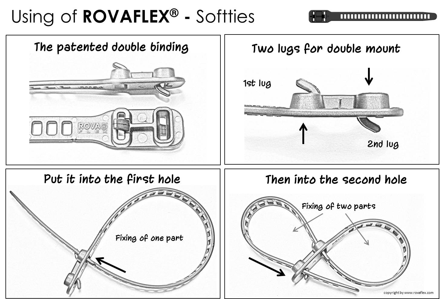
‘This doesn’t look right’. And I was right, it wasn’t. A quick glance at the map and a turn to the northwest delivered us back to the right shore. Back home, the skeg lay in the gravel by the wall alongside a broken zip tie. Have I mentioned tough, TPU RovaFlex reusuables yet?
A fortnight later (that’s the frequency of sunny days up here) we looked down on a new perspective of Suilven and Eilean Mòr island from the windless 2800-foot summit of Canisp mountain, still clinging to the last of the winter snows.


 but the arched stays idea underneath it may be. I noticed in France under the knees gets a lot of drips off the paddle (PSZ; right) which can get in when you open up.