Sunday morning Jon and I went to try out his new boat, another Intex Sea Hawk, but the one-man version this time which goes on amazon for under 20 quid. For that money a pump is extra, but we managed to fill it up, though maybe not as firm as it could have been. Once inflated it dawned on me rather belatedly that the Sea Kork is indeed a row boat; and it’s not just the rollocks and the rocket launchers – sorry, rod holders – that give it away. It’s the fact that the rounded bow has, like a new Alpacka, a lot more volume – and so buoyancy than its flat stern. This is a boat that you’re supposed to row facing backwards – like a rowing boat. If you sit at the less buoyant back end facing the bow the trim goes to pot, much like it could be on an old-shape Alpacka with heavy person in it. Jon is only 80kg so could get away with it, but with me – in all my gear right on the Kork’s 100kg limit – I felt better kayak-paddling it backwards. Better trim (levelness) means less yawing.
We decided to go over to Achnahaird Beach where, as luck would have it, the surf was kicking off the scale with some rollers up to knee height and kept up by a light offshore breeze. I am joking of course, but a few weeks ago the Achnahaird surf was looking pretty damn good (above) at up to a yard high, so even if today was a nothing special, it can be fun here.
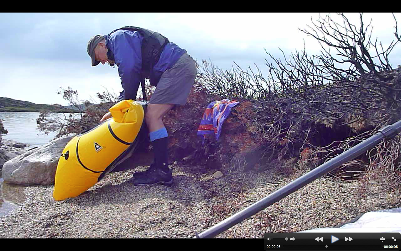
I can’t help laughing whenever I see an Intex in action, but it’s as much in amazement that you get so much boat for 20 quid. Out on the water, the first order of the day was to attack the Sea Hawk with the pointy bow of my yellow Phoenician warship (left). Poor Jon had only been 60 seconds in his brand new boat before I was trying to tip him over, like a log-rolling contest.
Kayak paddling from a standing start the Yak left the Sea Kork far behind – no great surprise there. Jon then took his TNP apart and tried rowing which ought to be more efficient and so faster. But all he did was a backward zig-zag; maybe that takes some practice – or a rowing boat.
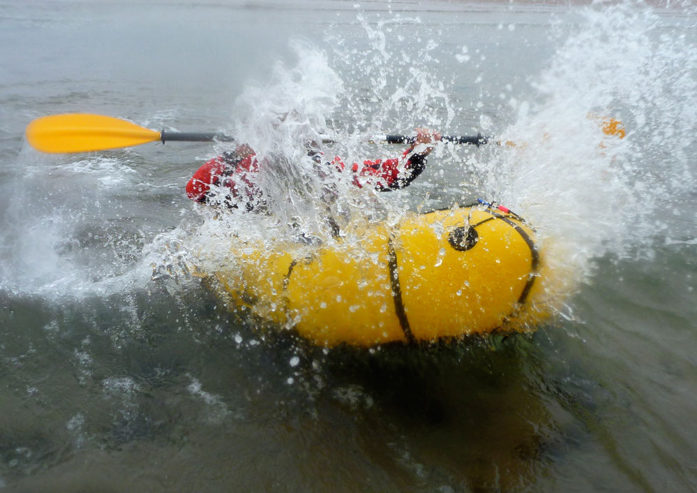
By now we were nearing the surf zone where we spent the next hour having a laugh. Neither of us had ever tried this so the semi-surf was just right; we couldn’t tip our boats over whatever we tried, but if we caught a good one on time we could get a good ride and then head back out to try and ‘wheelie’ off the next one coming at us (left and below).
We swapped boats and confirmed the obvious; the $1000 Alpacka blows a hole in your wallet, but it also blows the Intex inflatable squid off the water. They weigh about the same, but it’s down to the Yak’s shape, lesser width and a snug fit to give you control, as well as no rollocks or fish launchers to bash your hands on as you paddle along. By the time I got in the Sea Squak the inflatable floor was already limp so I was sitting about six inches lower than my feet, not an ideal paddling stance in a boat that’s a metre-wide. On the way back I tried kneeling, but that soon got uncomfortable. Even then, sunk down and paddling ‘backwards’, stern to front, the Sea Stork still tipped along at 2.5mph without much yawing. So as a packraft the Intex does the job and has got to be one of the best value neo-packrafts around.
I’m told one of the shots on this page was published in the 2012 Alpacka Calendar.
Rounding it all up over the years and my packboating footwear has narrowed down to: Teva Omniums for light duty day paddles and Lowa Desert Elite boots for heavier tramping with loads.
Otherwise, this is what counts
No membrane
No mesh uppers, butatough,quick-drying fabric that can take the knocks and is salt water tolerant. Durability is more useful than the lightness and wet grip.
Good draining – particularly at the heel rather than the instep, as that’s how you drain a shoe when sitting down in a boat with your legs sticking out over the sides.
A thick, chunky sole, ideally from a boot not a trail shoe. One that offers solid support over rocky terrain and good grip in mud or wet grass. Custom insoles for comfort tuning can always be added later by the owner.
Proper laces. Forget velcro and cinch-cord locks – that’s for cag cuffs and stuff sacks. Laces may not be high-tech, but they’re field repairable and still the best way to get a shoe or boot to fit a varyingly sized human foot securely.
A wide fitting (for me).
Some provision to stop stones getting in and possibly wearing holes in a latex drysuit sock (though wearing socks over drysuit socks is probably a better solution).
And great build quality.
Until that distant day comes I’ll stick with my Teva Omniums (now on my second pair), even though they’re rather more for day-use than overnighting. Update here.
With an IK you hop in, paddle away and hop out. You’re not normally tramping for days carrying your gear. Even Neoprene booties will do, or just an old pair of trainers. Packrafting footwear (that is, trekking the moors and paddling the lochs, usually with a camping payload) requires an amphibious boot which will drain and dry quickly while giving you support on the trail.
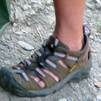
Of course you can just use any old boot and let it get wet. But anything with a membrane (GoreTex) can take quite a while to dry. On my first ever overnight packraft trip I used Keen Arroyos (left) and paid the price. I made the mistake of putting water duties (drainage/easy drying) above ground support for trudging cross-country with an 18kg load. With the thin soles and feeble, slip-prone lacing Still used by Keen), I didn’t feel at all secure in the rough, and when I got to a long, road-walking stage the feet soon got sore. On any kind of rocky terrain or path they’d have been worse. Having said that, when my current Teva Omniums wear out, I may give the Keen Newport H2 a go. They’d drain a lot faster from the heel.
Keen Newport H2
I then adapted a pair of less flimsy Karrimor Meridian trail shoes (left)I got for 30 quid, by pushing draining holes through with a red-hot poker. Shame, as they have an eVent membrane, of which I hear good things. They weren’t a great full-on hiking shoe and under my 95kgs the sole got mushy and the tread offered little grip in steep or wet Scottish conditions, partly why I find a packstaff so useful. But they were better for loaded, rough-country walking than the Arroyos. And it has to be said they’re survived a regular sea-water soaking, rinsing, airing and drying pretty well for a pair of cheapies. Nothing came apart but it can’t be far off.
Brasher Lithiums (left) fitted me OK, had an usually stiff sole which also happen to make good MTB boots and they passed a test on the Fitzroy in Australia, although much of the time we were wading or even sinking in quicksands which were easier to get out of barefoot.
After a couple of nights I poked through drain holes (below) on the instep and above the heel so they drain as the feet point up in a boat. Back home on regular day walks the Brashers turned on me, rubbing blisters at the heel and then squishing the small toe as they were too narrow.
Another idea could be some Crocs. Remember the Croc Craze a few years ago? Their Swiftwater Mesh Deck Sandal (below) is an acquired look, like regular Crocs (left), but goes for under 40 quid on ebay and weighless than the Tevas. For something which gets squeezed out of a tube every few seconds in an Asian factory, with that mesh upper I’m no convinced they’ll last very long.
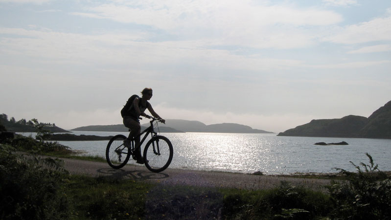
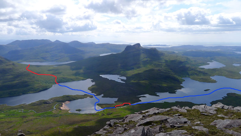
The forecast was good and with time running out, such days cannot be ignored. ‘Let’s go and do Suilven‘ I said to the Mrs. ‘Better still, let’s take the bikes and the packraft, park the car at Inverkirkaig, cycle to the trail head, climb up the north side, down the south side, and paddle Fionn Loch into the River Kirkaig for the footpath back to the car to get the bikes.’
‘What was the last bit again?‘
It’s a hilly 6-mile ride from Inverkirkaigalong the WMR and up to Glencanisp Lodge where the road ends. From that angle Suilven rises like a sperm whale’s head over the gorse and lochans. Maybe it was the sunshine, but Glen Canisp that day looked like something out of a Scottish Tourist Board advert, and was made all the more appreciable by the easy quadbike track we followed east. One time that would be great walk to follow the 14 miles all the way through to Cam Loch and the A835 near Ledmore.
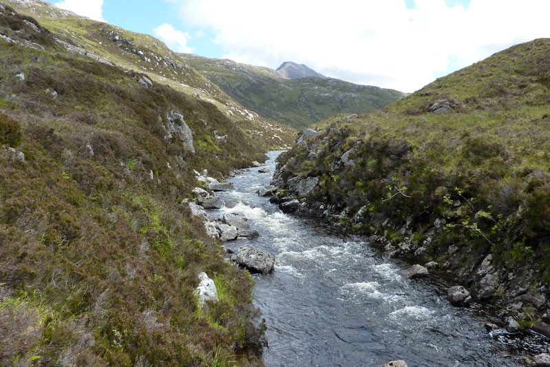
Of course, as ever these days, I was eyeing up the pack-potential of the Abhainn na Clach Airigh river too; actually string of easy lochans and gorges (left), linked with flat or frothy river stages. That too would be a great run, more probably from the Ledmore end, and with a handy bothy at Suileag. Or cook up any combination you like; with boots and a paddle the possibilities here or anywhere in northwest Scotland are infinite.
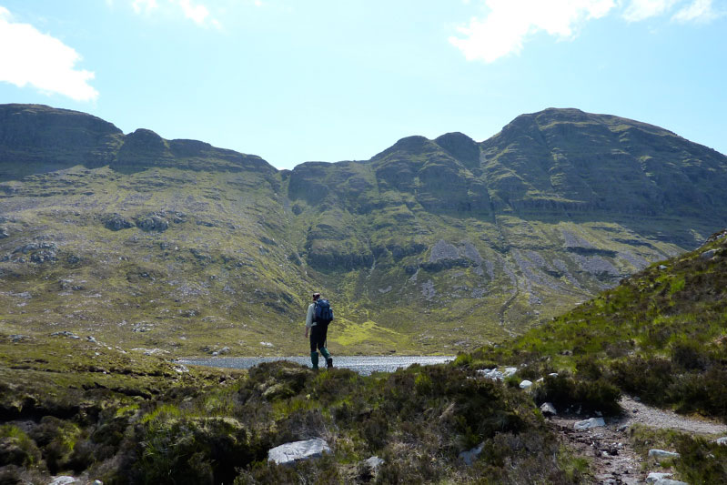
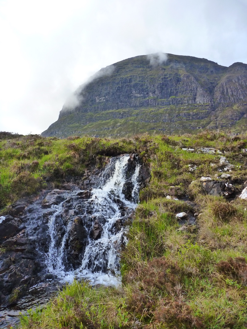
There comes a point directly north of Suilven’s twin-peak saddle (right) where you have to leave the easy track and head south into the bogs and up. You can’t see a path up the side of Suilven, but it pretty much follows the creek running down from the saddle; an hour and a half’s slog from the quad track that’s as steep as any track can be, without using your arms. And yet, as long as you keep chipping away (left), it’s always quicker and easier than it looks. And it’s quite a thrill to approach the saddle and have the Loch Sionascaig vista erupt before you (below right) as you catch your breath.
G/f decided to rest here while I took on the last 130 metres up to the summit, about 20 minutes away. For some reason a ‘magnificently pointless’ dry stone wall straddles the summit ridge near here. A quick look on the web came up with no convincing reason to its origin, though it does extend downwards enough on each side to stop agile stock either leaving or getting to the summit. And on the actual top there’s certainly enough room to graze a few sheep as well as curiously closely cropped grass. We’d not seen a sheep all day so unless deer make the climb you do wonder what grazed the grass up here? More Suilven summit mysteries.
From anywhere up here we could see the way back; the put-in near last week’s camp and the 2-odd miles along Fionn Loch to the entrance of the River Kirkaig (left). These waters define the border between the counties of Ross & Cromarty and Sutherland. While I was planting the flag, G had been scanning the scene below with binoculars and had spotted the waterfalls on the River Kirkaig we very much did not want to get sucked into.
We set off back down the looser south side slope, don’t want to go on but it was another validation of the knee-sparing Packstaffing Way. Without it it’s hard to see how anyone would not stumble or slip a couple of times. Passing the spot I reached last week, strange barking sounds emerged from the heather. A grouse in distress? Turns out G with better eyesight had seen a couple of dashing deer right in front of me.
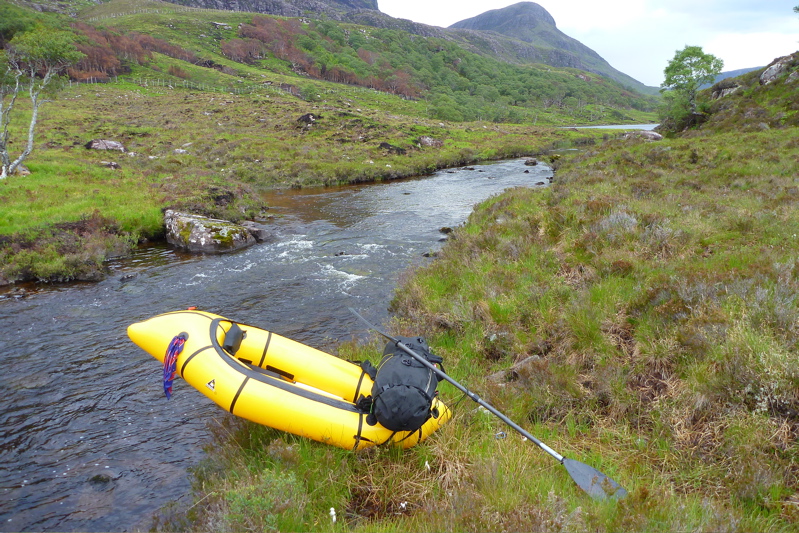
Down by Fionn Loch I wasn’t convinced two-up in the Yak was going to work or be safe. But we tried fitting in on the bank and in fact it was roomy enough with my legs out over the sides. So we put in and pushed off west across the loch (left) for the river, initially following the shore. Then as it became clear the 3-kilo boat-in-a-bag managed its 160kg (350lb) load fine, I set the engine for full ahead against what I perceived [incorrectly] was a slight current as well as a breeze. Amazingly (or perhaps not) I’ve never seen my packraft track so well with the near-perfect trim.
About 40 minutes later the entry point to the river loomed, with a mild rushing sound caused by the race of water flowing off the loch. We were a little edgy, knowing a deadly waterfall lay not far ahead. We let ourselves get swept in and as soon as I entered the river the boat handled differently, like a kayak in a backwind. It was the current of course wafting us onward. I went as far as I dared and stopped paddling for a moment – a louder rumbling of white water became evident. Two up, sluggish and with no BAs, we didn’t risk it and headed for the bankside footpath.
Rolling up and looking back, it seemed hard to believe we come up and over ‘Pillar Mountain’ as the Vikings had named the prominent maritime landmark of Suilven. By taking to the water we’d saved a bit of time over the path and rested the legs for the last hour’s trek back to the car and a short drive back to Glen Canisp Lodge to collect the bikes. All up, a great day out; 7 miles cycling, 2 paddling and a dozen on foot. And the Yak had proved itself as able handle the two of us for similar flat water transits.
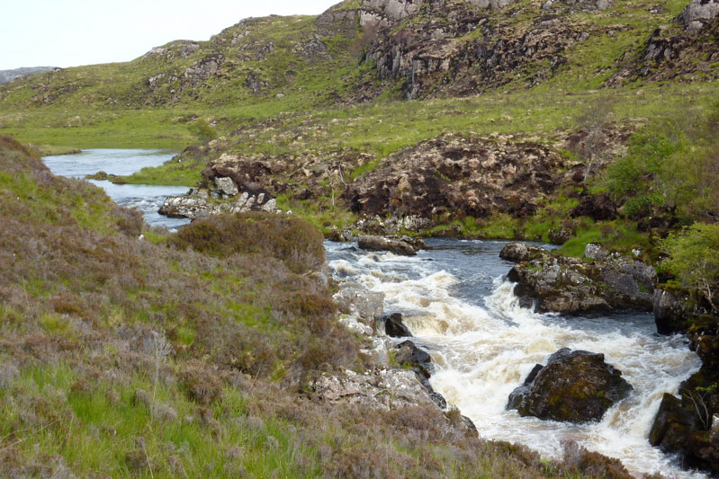
Packrafting the River Kirkaig The minor waterfall (left) we took out before might be rideable by the likes of Roman Dial and his intrepid chums, but the thundering 100-foot Falls of Kirkaig (see map, above left) would only appeal to gonzo hairboaters high on Red Bull and Go Pros. From there though, the river far below the track seemed packable to the brave, certainly at a point where the path drops down right alongside and the river where it broadens out, just under a mile or so from the road bridge. All grade II or less; even I could manage much of it. Beyond the bridge, it’s just half a mile to the sea at Loch Kirkaig, which would be satisfying to pull off, but even at the relatively high levels (now dropping), it gets pretty shallow in places and would not be a clean run. But don’t take my word for it. I read the river is listed in the SCA whitewater guide.
Impressions of some of the gear I used on the Suilven trip.
Packstaff™ Made of the two shaft sections of my Aqua Bound paddle and now with a metal- tipped ‘nib’ riveted to a piece of old Lendal. In the terrain I was tramping over, this is such a great walking aid. No need to expend energy balancing over tussocks and rocks with a pack on your back; take some of the strain off your legs and knees and just lean on the pole like a handrail, use it to probe a boggy patch that could be firm or knee deep; use it to vault over ditches, use it as a monopod to rest a camera on full zoom; use it as a tarp pole, tent peg – you name it, it will do it. Mine happens to be well balanced, just the right thickness to grip securely (warm, too), and because you can easily slide your hand up and down as a sleep slope requires, it’s much more useful than a pair of trekking poles with a moulded cork handle. And when you get to the water it converts into a paddle!
I’m now using it for all our mountain walks around here, and most of the time it’s much more useful than a burden. Of course it’s nothing more than a shoulder-high stick which any self-respecting medieval pilgrim would have used along the way, but mark my words, some time soon a packstaff will be re-invented and become the new must-have trekking accessoire obligé.
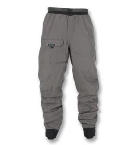
Kokatat Swift Dry Pants I’ve been looking for an alternative to my full-on drysuit for less lethal packrafting (as opposed to sea kayaking), and the Swifts look like the lower half of the solution – the top half is yet to be pinned down, but will a regular walking cag will do. I’ve only used them for half a day but I was not sweaty and they did not leak, but then I didn’t wade around up to my waist and was wearing the long SealSkinz over the top like riding boots. XL is my size which fits great, the waist is high and there’s a very handy thigh pocket – always useful on a packboat or open IK with no deck. I deliberately chose dry trousers with no sewn-in socks as my drysuit has those. With the Swifts in future I’ll just wear short Seal Skins and have no worries about the sewn-in socks getting holed by gravel. Time will tell how they wear and perform. They cost me around £100 from i-canoe in Ireland. Since then I glued on latex socks.
SealLine XL Mapcase Never had a mapcase but now I find it very useful on the water for the obvious reasons. Ortlieb does a roll-top; SealLine uses a ziploc which as you can see on the left, works fine. The size means you can have a large map area or other info on view and so don’t need to open it unnecessarily, and there’s a ring in each corner for attachment. Again, time will tell how it wears.
Seal Skin long socks I know, I look a bit of a knob wearing these in shorts. But the fact is these socks genuinely extend your wading ability while keeping your feet dry. The feet may get cold as you step into deep water and ‘feel’ wet, but that’s just foot sweat getting chilled – they soon warm up again. In the tent what to do with wet, muddy socks? Take them off and turn them inside out! No mess. They’re like a pair of ‘Wellington socks’ or mini waders. As I left for Suilven I realised I should have grabbed my knee-high gaiters too, mainly to protect my woolly wellies from the brush. Sure enough, at the end of the trip there were bits of twig knotted into the woolly fabric, which was all roughed up and scuffed. Next time I’ll know; wearing gaiters may reduce the prat-effect too. They cost about £30. Quite a lot for a pair of socks and tbh, I expect them to leak eventually.
Watershed UDB Hats off again to the UDB as a land and water submersible backpacking haul sack. No complaints, although I was only carrying 10-12 kilos. It just sits on your back like a coal sack and best of all you know it won’t take in any water and can act as a back-up buoyancy aid. More UDB here.
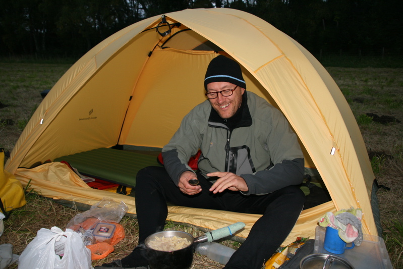
When I got back from this trip I was all set to give up on my Black Diamond Lighthouse (now called a HiLight) – a single-skinned tent using ‘Epic‘ ‘breathable’ fabric – I bet that’s now gone the way of Ventile from the 1970s. Reviews of the BD-L here – the lower rated ones reflect my feelings. It worked OK last year over two rainy nights, but as so often happens with Epic tents, it has its off nights which can mean a miserable experience: what you might put down to condensation (which is easily managed) is actually rain dripping off the top cross poles. If I’m to be doing more packboat touring in Scotland I’m going to need a waterproof tent. Using Todd Tex fabric, the famous Bibler Ahwahnee is exactly the same design as mine, but at double the price and double the weight (so what’s the point you wonder?). But it is actually waterproof. I spent hours on the you-know-what researching possible alternatives. Although outside the stuff can go under the upturned raft, I do miss a porch as well as external clip- or sleeve poleage for easier pitching without opening the tent in a downpour. I considered a 1.1kg Tarptent Cloudburst 2, or a Macpac Macrolight. Luckily I didn’t get as far as Terra Nova or Hilleberg websites before I figured there’s nothing that wrong with my tent that a splash of Fabsil proofing over the vulnerable flat-to-the-rain roof section might not cure. Plus the fact that back at the house, while it was drying, pegged out in the garden, a gust of wind picked it up, blew it over our house, over the road, over the store and into the field behind before it caught on a wire fence. It survived all that without a scratch as far as I can see, so I’ll give it another chance. The steep sides can’t let rain in anyway, and it really is such a light and compact shelter that’s roomy for one and OK for two, it dries in a shake, stands without pegs (I never use guys), and has a nice big door. If the Fabsil doesn’t do the trick or makes the condensation much worse, I may have to give up on the BD for packboating in Scotland and go double-skin. I do like the idea of a tent that pitches fly first and can be used just fly, or just inner. There must be tents like that. Or maybe I should get a Nemo Morpho airtent to go with my airboats… More on tents here.
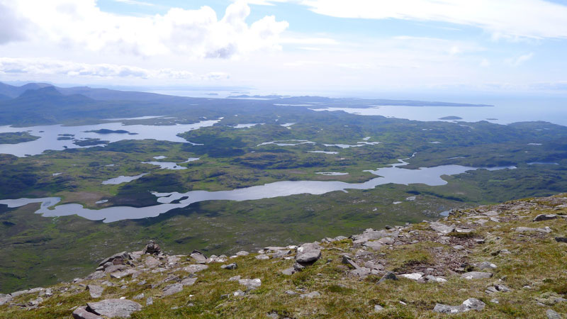
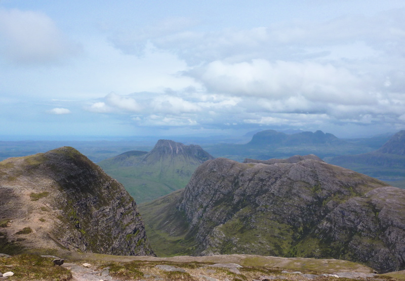
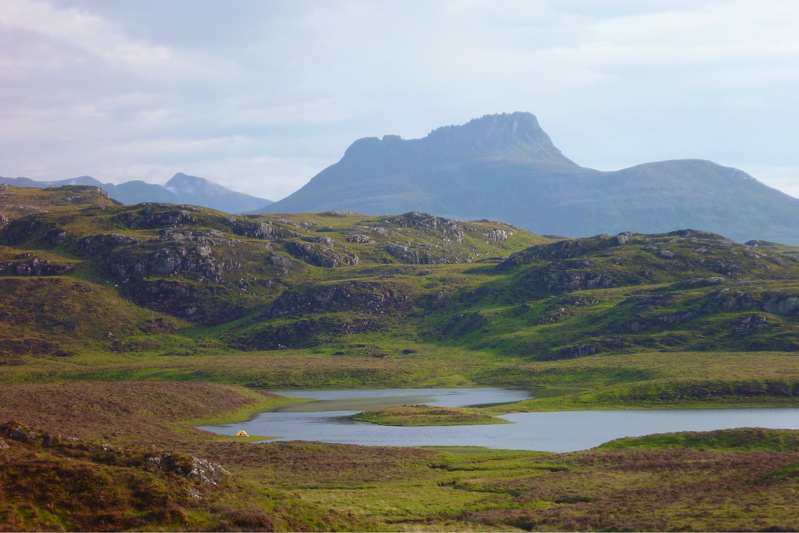
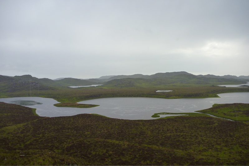
Anyone who’s climbed up the fin-like ridge of Stac Polly will see a wild, lochan- and bog-speckled vista spreading north across the Assynt. Just a couple of miles away are the peaks of Cul Mor and Suilven (main hill, left), relics of a glacier that ground down the land between them as it inched towards what’s now the sea.
The OS map shows this area as a Nation Nature Reserve, but it actually lost this designation a few years ago. And although it looks wild – so wild there’s no grazing, nor inhabited dwellings – this 100 square-miles of barely-fenced bog, rock and water is unusually accessible, bordered by quiet roads to the south and west, the A835 to the east, but not much to the north apart from the path passing below the north slope of Suilven. So seeing as this region of Coigach/Assynt has so few packable rivers, these lochans are a great place for short-range packraft exploration following some of the routes suggested on the graphic, right. It’s not just me that thinks so, the local sea kayak outfitter as well as a couple of intrepid canoeists have been coming here over the years. For them the inter-lochan portages require some commitment. But not in a packraft!
You can make up a route to suit yourself here; climb every mountain, ford every stream, visit every island. I chose a pretty easy overnighter and got dropped off by the road at Linneraineach below Cul Beag. There’s nothing at Linner’ bar a footpath which leads north to Loch an Doire Dhuibh (right viewed from Cul Mor).
My packplan was to paddle across Doire into the small adjacent loch, follow the channel into the main Loch Sionascaig, pay a visit to Eilean Mor, the biggest island hereabouts (and one of hundreds of Eilean Mors – or ‘big island’ in Scotland). From there I’d paddle among smaller isles towards the northeast shore of Sionascaig and walk past the ruin of Shieling over the saddle to the short river that links Fionn Loch to Loch Veyatie. With a paddle over to the south side of Suilven mountain, I’d find a dry spot to camp and take it from there. Suilven is only 731m or 2398 feet high, but it does have a strong draw on the imaginations of hillwalkers in far northwest Scotland, as do many of the Assynt’s peaks.
I think much of it stems from its Ayers Rock- or Matterhorn-like separation from its surroundings; a distinctive mountain shape, like the much more accessible Stac to the south. Add the lochans below and the open sea just a mile or two away, and mountain summits around here add up to something special. The picture right is taken from Ben Mor Coigach (743m) looking north over to Stac, Suilven and the distant peak of Quinaig. That’s another thing – the mountains have nice names around here with, you’d like to think, a touch of the Norse about them. This is after all Sutherland, or ‘the South Land’ in the mind of a Danish bloke in a horned helmet, circa 900AD. If you like hills there’s a panorama of some Sutherland mountains below, taken from the tip of the Coigach peninsula looking northeast.
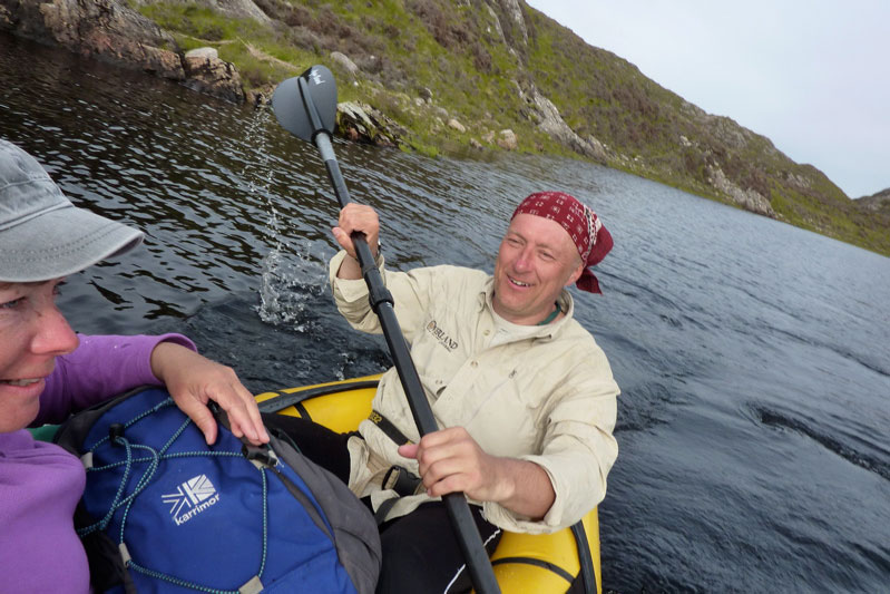
Back to the boating; this was my first proper run in my Yak and as I pulled smoothly away from the shore of Loch Doire (left) it struck me how cool it is to trek over the hills with a pack of only 10-12 kilos, inflate your mini boat and set out across a body of water with your kit slung over the bow. In fact I’m convinced a frontal load makes packrafts faster as, despite the wind drag, the weight reduces the left-to-right yawing.
Very soon I was surprised to see the GPS reading a steady and sustainable 3mph (4.8kph, 2.6 knots) on the calm, windless loch. “What’ll it do?” I wondered, as you do. About 4.1mph, as you ask, but only for a few seconds, unless there’s a Great White on your tail. I’m sure that was more than I ever registered in my old-shape Llama, and I dare say more than I could average walking along the surrounding terrain which was mostly pathless. When I got back a speed graph (right) extracted from the GPS spelled it out: tramping across the pathless hilly bogs – about 2.3mph; on the water, out of the wind – 3mph; on the water into the wind – 2.4mph but with some effort.
The channel that led west to Loch Sion (below Stac Polly, right) looked promising on the map, but even with the current high water levels following the deluge that was May, it soon got too shallow over the couple of metres drop to the next loch, and with a wince-inducing scrape the Yak hung up on a rock, requiring a short portage (left). That done, moving out onto Loch Sion a breeze was now in my face as I edged along the shore. Past Eilean Dubh I squeezed through another inter-island lead and out into the main loch, heading for Eilean Mor island. Even with the mild buffeting, it struck me how safe I felt alone in my raft; safer than I often feel initially in my Incept kayak at sea in similarly tame conditions. I think not being at sea had much to do with it, with no kind of wave or ill wind that could blow the Alpacka out to the wrong side of Greenland.
Eilean Mor is a natural focal point in Sion loch – what can it be like, an island set deep within in a wilderness? Many paddlers are fascinated by these tiny wooden islands on Scottish lochs, I assume like me, because they think it must be a UNESCO-like example of a hyper-pristine natural habitat beyond the reach of prolonged human intrusion.
On the southern tip I can tell you there’s certainly a spacious, grassy camping spot (and now, a finely-built cairn), but as I half fell out of my boat and staggered ashore (left), the latest shower passed by as I beat my way inland towards the Eilean’s summit, through a forest choked with ferns, birch, hazel and their fallen, decaying predecessors. As I bushwhacked upwards, an owl not 10 feet to my left flew off noiselessly, and in places the ferns hummed with a flouorescent green glow (above).
At the summit, about 100 feet above the loch I looked over to the entrance to Boat Bay, a mile or so to the west (above left). To the north Suilven was a dark, uninviting rampart while to the south I imagined the walkers who daily take the short trek up Stac Polly (right) looking down on the progress of the little yellow boat far below and thinking, heck that looks fun!
I set off northeast, passing other inviting but unnamed isles (left and right), around Rubha Sionascaig with its alluring isthmus and up to Creag Sionascaig. Arriving at the shore, new shoots of grass poked through the blackened peat, scorched by the bushfires of early May which have been well and truly doused by the series of lashing gales which followed. I rolled up and headed up a creek line towards a saddle, passing a ruined croft which, as in so many remote locales in northwest Scotland, makes you wonder what on earth the people lived off up here?
Squelching over a novel mixture of burned peat crust spongebog mush (left), at the pass I looked down and saw half a dozen tents and a couple of canoes (right, barely visible) pitched at a meander in the river at a point where it was quite probably fordable. I’m sure the water there was running eastwards from Fionn into Loch Veyatie [it doesn’t], but if that’s the case then Fionn Loch is unusual in that it drains both ways, east and also west via the River Kirkaig to Lochinver and the sea. A geographical oddity? who knows [I do now; it isn’t]. I walked directly to Fionn, deployed the Yak and paddled across the channel (left). A short walk out of sight of the campers found a flat shoreline where I pitched beneath the looming mass of Suilven.
At times I’d wondered whether there even was a path up the south side of Suilven mountain (left) – I’m sure I’d read it somewhere. Then, during a short spell of sunshine a steep path became briefly illuminated; straight up alongside a scree slope, then off at an angle to the saddle-ridge between the two peaks. But now it was raining steadily, I was pretty damp and not in the mood for a hefty slog across contours pressed together up like the teeth of a comb, but I feared once I got in the tent I’d probably slob out. So after a light feed, I set out, packstaff in hand, to locate the path up the hill and once on it, followed it till 8pm. If nothing else, it was a good way to warm up and dry off.
It would be nice to report a stirring vista some 400 metres below the summit of Suilven, but a leaden gloom pressed down on the sodden land. I’d called the Mrs – tomorrow would bring more rain, but the winds would return too first thing in the morning. Back in the tent and soon after sunset, the rain arrived early and lasted most of the night. It was all a bit much for my single-skin tent which, though amazingly light and compact, is not rated as waterproof. The drips soon came through the fabric of the flat roof as I dozed, soaking my legs and chilling me. Half-awake, I lay my cag over the drip zone, after which the night passed well enough and I woke reasonably dry. The next day was not one for shorts; today I was going to try out my new Kokatat Swift Dry Pants (see Suilven Gear). I’d half a mind to catch the twice-daily bus at 11.15 from the junction (see green graphic, top of the page) and estimated it would take 4 hours to get there, so breakfast at 6am was cereal in warmed up loch water. It wasn’t raining yet which meant it would be shortly, so I packed up quick and scooted back over Fionn Loch, taking a different route back southwest, past Na Tri Lochan to an inlet on Loch Sion (see satellite image bottom of the page). It was a longer land stage, but would put me into a better position to dodge the predicted southwesterlies while paddling back west towards Boat Bay. I’ve been reading a lot of sea kayaking literature lately and the lessons were paying off.
Let me tell you, walking over the pathless mire following a night of rain is merely a necessary means to get to the next bit of fun paddling. My knee-high Seal Skin ‘Wellington socks’ were working fine – last night my feet had been bone dry – but it’s a tiring, rhythmless slog over this crap; any sheep trails are merely conduits for more running water and mud. Again, the star of the Gear Show has to be my packstaff; it makes walking on uneven ground, descents and climbs so much more secure, especially with a load.
I reached the inlet bang on time which took me by surprise. Was this some un-noted lochan, no it was Sion – I’d not read the inlet’s shape on the map closely enough. Once back on the water, initially my leeward paddling ploy worked well. Then I turned a corner and suddenly the wind was onto me and the bow was bouncing on the waves (left) as I hacked past the shore at barely 1mph. For a while I thought I’d have to give up and take to the shore but again, as sea kayaking lore states, wind is often exacerbated round a point or headland, even on a lochan. Near normal speeds resumed, in fact just a fraction under the still-and-calm 3mph cruising of yesterday, but at a heavy cost to the arms and shoulders. I couldn’t have done this all day but luckily, I didn’t have to so I got stuck in. Again I was surprised how safe I felt out here, alone and ill-dressed and where stopping to fiddle with the cameras pushed me back nearly as fast as I paddled forward.
Finally I entered the mouth of Boat Bay, back onto known ground. The end was in sight. Last September I couldn’t even paddle the Sunny out of this bay in a stiff easterly. Now I dug my way onwards to the tiny beach inlet which was notably smaller than last year. I rolled it all up and hiked up to the nearby road. Within a couple of miles g-friend’s hatchback popped over the hill and I was home and dry for lunchtime – a 15-mile, 24-hour mini packboating adventure completed, with lots more ideas for future exploring of the lochans below Suilven mountain.
Below: almost the entire route seen from Cul Mor summit, looking southwest and west. Stac and Summer Isles in the distance.
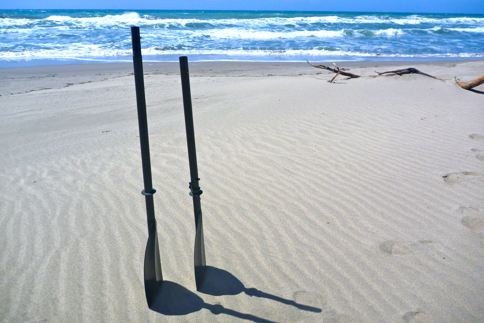
Like most beginners I started my IK-ing with a super cheap 3-piece TNP shovel. Then, after picking up a much better used 2-piece fibreglass Lendal Archipelago which soon seized up, for Shark Bay in 2006 I splashed out on a decent light, rigid, bent-shaft, adjustable offset, low angle 2-piece, 230cm Werner Camano. At £230, it cost more than my first two boats but in all those [17] years I have no regrets. The Camano just works.
High angling with a low-angle paddle.? All the gear with no idea
To me bent shafts and an indexed, ovalised grip make ergonomic sense for steady, all-day paddles rather than pulling fast moves in rapids. It’s just more compatible with the non-rectilinear human form. I did notice that when I swapped back to theslightly heavier straight Lendal (before it seized) there was noticeably less flex, but over a decade and a half later, the Camano is in great shape and is still my favourite for anything where a compact four-piece is not needed.
The Camano is a low-angle paddle, but I think my style, if you can call it that, is high angle, and in fact I read that high angle is the right way to do it. I find that wide, high-sided and relatively unresponsive IKs and packrafts encourage or require an energetic ‘digging’ style compared to a smooth gliding hardshell.
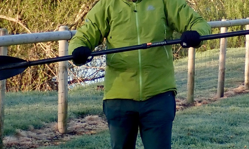
A paddle for packrafting The way I see it, even more so than most IKs, a packraft has high and fat sides and you sit low inside. So that ought to mean a long paddle to get over all that plastic and into the water. Paddling with the 220cm, big-faced Aquabound paddle, I didn’t really notice any issues other than some squeaking as I rub the sides occasionally. Longer would not have made much difference.
Manta over the Corry; not much in it
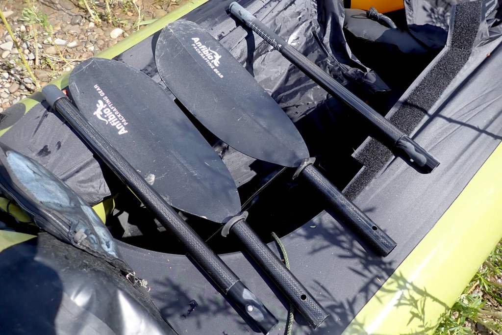
At around 3kg a packraft is extremely light but it’s not an efficient shape for gliding through water like a swan. However, once on the water with a paddler in it, the total weight is nearly the same as a more glidey IK, so it boils down to the need to propel the hull using a paddle with a large surface area. Some might say a bigger blade will mean more yawing, but I figure you just dig less hard and anyway, with practice, yawing is easily controlled once moving. Providing you have the strength, a bigger face ought to give the speed which packrafts and IKs lack. There are times (mostly at sea or on white water) when speed and power can mean safety. In the US I got myself an Aqua Bound Manta Ray 4-piece high-angle in carbon (above right, 220cm). Weighing under 900g this one feels more flexy than the Camano, but fits right in the bag and so makes a great packrafting or back-up paddle – apaddleinyourpack, so to speak. Mine has the two-position snap button offset which I run at 45°. You can now get an infinite-position Posi-Lok version. The compact and light Manta Ray (70cm longest section) is ideal on short day trips with public transport and with no load to haul on the water. It was fine for a decade of UK packrafting and makes a great packstaff, too, but it didn’t always come apart easily like the Werners. Dry or wet, don’t leave it assembled for days or weeks, especially after sea use (that probably goes for all multi-piece paddles).
I used my Manta sea kayaking in Australia as well as packrafting – it was fine for both. For the price this is a great paddle – so good I sold it to my Ozzie mate and bought another right away. I’ve never seen a 4-part Manta for sale in the UK, but in Germany the Anfibio Packrafting Store sells TLC Mantas as well as their own Anfibio Vertex 4P (left).
Err, how does this work then?Anfibio WaveAll adjustable
Or they used to. Now they sell their range of own-brand sticks. I recently padded with a chap with their four-part Wave which weighs 991g and comes with infinite angle and 10cm of length adjustment (210-220cm). I would guess the blade is <650cm2. The longest section is 64cm and all that for €125 is very reasonable.
Corry 721cm2 • Camano 650cm2 • Manta Ray 677cm2
I also have a straight, fibreglass-blade Werner Corryvrecken (£200 years ago). It’s the biggest paddle Werner do in 210cm+ 2-piece touring paddles: 721cm2 blade area compared to the Camaro’s middle of the road 650cm2. and 677cm2 for the Manta Ray.
At 220cm (same as the Manta Ray) I’ve also gone as short as I dare to get over the fat sides of a packraft. There’s no indexing on the straight, carbon shaft, just a little ovalisation as on the Aqua Bound. The Corry’s face is a tad bigger than the Manta Ray (left and above) but the whole stick feels much more rigid (it’s 2-piece). It’s 7% lighter than the Manta Ray and 17% lighter than the stiffer Camano – initially you notice this. I compare my Corry and Camano in my Incept sea kayak here.
More weights & measures According to the kitchen scales the weights of these paddles are:
Werner Camano 230, 2-piece – 988g – stiffest
Werner Corryvrecken 220, 2-piece – 816g – lightest
Aqua Bound Manta Ray 220, 4-piece – 880g – least stiff but cheaper
Anfibio Vertex Multi Tour 210-25, 4-piece – 890g – cheapest; multi-use
So now I have a long, comfy low-angle Camano for long, loaded IK or packraft sea trips; a straight, I sold the rigid, light, shorter big-faced Corry, and the Mrs likes the thin-shafted Anfibio Vertex Multi Tour 4-piece.
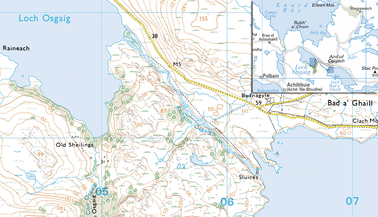
While dodging stray sheep and oncoming traffic along the ‘Wee Mad Road‘** that leads off the peninsula to the outside world, I often throw a pack-hopeful glance over to a creek called the Abhainn Osgaig. It runs for a kilometre or two down from Loch Bad a Ghaill to Loch Osgaig, which in turn drains into the sea at Enard Bay. Most of the time what you can see from the road looks a bit boney, but the other day, following a week of gales and squalls, it was full enough to catch the eye. Driving back from a recce for another packrafting plan, I squelched over the bogs for a closer look, as most of it appeared hidden in a gorge. Sure enough, from some nasty-sounding sluices at the west end of Loch Bad, the river drops briefly into a narrow gorge you can’t even walk along. Viewed from the bottom end it was running hard enough to put me off. If I was thrown in I suppose I might surprise myself with some quick moves and get through without dumping, but I don’t fancy any white water that looks like it needs head protection. It’s a bit frustrating to be such a ninny; a creekboater wouldn’t shake a cag at this one, but I can just see myself flailing around like a squid in a blender, bouncing out of control from rock to rock.
Below the gorge (2nd and 3rd pics, left) it spreads right out so even I could acquit myself; if anything it looks like I’d need to step out in the shallows once in a while. Back in the car and driving on slowly, I spotted at least one more waterfall I’d not want to drop in on uninvited, but there’s plenty of room to walk round that one so it would be fun to bike out there one time, tramp upstream from Osgaig loch for a good sticky beak, and put back in for the 10-15-minute ride back down. Although I’m always on the look-out, there aren’t many packworthy rivers close by, so while the Osgaig runs deep enough to float my boat – and at a time when it’s too windy to do any other boating of substance – that is this week’s mission in the Yak. Right now it’s pelting down again and the sea is heaving. I’ve just heard the Shipping Forecast out in the Atlantic (Rockall, Malin, etc) is F11, just below a hurricane so the prospects for rain and high water are good.
A few days later I got fed up waiting for a break in the weather – it’s the worst May for 37 years they say, and most of the time too windy for solo sea kayaking in my Incept. So we schleped up to the Osgaig between downpours, and I took a bit of a run at the lower half just below the uninviting waterfall.
I miss the fun sensation of scooting down a river in a packraft, but I wasn’t really getting any this day. Even in what passes for spate round here, the Osgaig is just too shallow and I winced as the poor Yak scraped over the boulders while being relieved I got Alpacka to spec it with a butt patch. Bouncing off, or hanging up on rocks lined me up all wrong at times, but in an Alpacka one firm pull lines you back up. Fact is, there was no rhythm or flow and I felt like someone with a flash new toy desperate to find somewhere to play with it. It wasn’t even worth running the remainder of the river down to the loch.
Day-boating like this is not really my thing anyway. I’m more into pack-rafting and have a great one- or two-nighter lined up round the back when the cabin fever hits the red zone. Of course no one comes to Scotland for a sun tan,, but at least I have the Ardeche Gorge to look forward to in late July. No two ways about it, that will be a great run. See this: same river a year later.
I’d parked the RV at the end of a 55-mile track south of the highway at Hole in the Rock, the top of a gully which drops 500 feet down to Lake Powell and which is bit of a scramble in places. If this was the Australia that I know, the chasm would be plastered with ‘Gorge Risk‘ signs. Looks like the Americans have got over all that, if it ever existed here. What you see – a steep, boulder-chocked gully where you want to take care – is what you get.
Getting down and back up from the lake wore me out for a day, but what was I complaining about? In 1880 Mormon pioneers spent six weeks here lowering two dozen wagons to get across what was then the Colorado river (read right) to get to a new settlement on the far side. Once on the water I only went for a bit of a splash-about in a flooded arm off the main body of the lake as it was a bit windy and I wasn’t sure what weather lay ahead. By the time I got back to the top it had clouded over and stayed that way till I left the GSENM a few days later. Changes on the conventional-looking pre-2011 rafts are summarised here: pointy ends, greater length, extended stern, 2-part backrest/seat and a deck that zips right off. I also have a feeling the floor’s made from a chunkier or stiffer fabric and so the extra butt-patch I had specified (left – done for free) may not be so necessary – but it sure feels worthwhile when scraping along a boney Scottish burn.
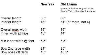
On the water first impression was not so good – oh dear the 4-inch shorter Yak was seemingly narrower at the front than my old Llama and I couldn’t put my feet side by side when pressed against the front (left image on the right) – this wearing size 11 Keen Arroyos (fairly wide). But deflating the backrest from full gave my legs more room and I actually found that both feet placed flat on the floor below the bulge of the side tubes worked fine (right image above right), just not so sure if this is so intuitive for brace control. I checked the front interior width of my Llama against the new Yak and it’s only an inch wider. In the picture left the new Yak and Llama fronts seem near identical in interior front width.
Getting back in the longer Llama, I now see the reason my feet didn’t jam was that I had a few inches gap between the front of my feet and the inner front of the boat where it tapered off. Sat against the back I could never reach the front to brace which is why I got the Yak. Also, the UDB on the new Yak may have constricted my feet a bit that day. Paddling a few days later without the UDB, I can’t say I noticed the foot jam. Got all that?
Other fascinating facts from my comparative measurements (above right) show the new Yak is only 8 inches longer then the Llama, so a new Llama ought only be 12″ longer, not 20 inches as estimated from the Alpacka website’s measurements at the time. The new Yellow Yak is nominally 4 inches shorter inside than an old Llama.
Other than that it feels much like the old Llama. Like they claim, turning/spinning doesn’t seem to be affected by the increase in length, but I’m sure the Yak’s bow yawed less from side to side as I paddled, due I suspect to the extended tail damping the paddle-induced pivoting effect, rather like a rudder or skeg. I did have my part-filled UDB strapped to the front where any weight tends to reduce yawing anyway. It was the first time I used the UDB on the water and have to admit the added guarantee of its girth and buoyancy was reassuring should a Colorado river barracuda make a bite at my Yak. Couldn’t really do any speeding in the conditions – it may be just half a mph faster, but that’s still some 20%.
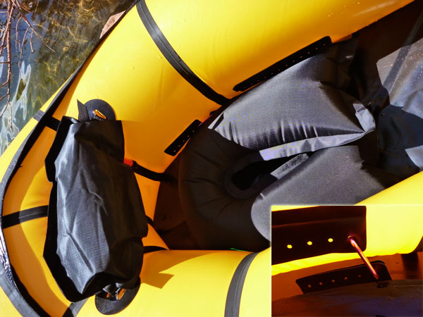
As anticipated, the new 2-part seat is a real improvement. No more having the backrest flop down as you’re trying to get in quick off a steep bank or into a fast flow with a need to line up or burn. Like on my Llama, I just clipped the seat base onto the hull tabs with a single snaplink each side (inset, left) rather than mess about with the string they supply. Makes taking it out and drying/cleaning the insides easier.
Later on, washed up on the wrong side of the Virgin River Gorge in northwest Arizona, I also found the part-deflated backrest a handy way of portaging the empty boat – a bit like a Sherpa’s headband (left). So, bottom line, not a huge difference in operation apart from less yawing which was never that bad anyway once you compensated for it. Can’t say I noticed any added buoyancy/better trim with the longer back, but it might be noticeable from the other PoV. The zip-off skirt is a nice idea; one less thing to unroll and dry after. The added snugness I dare say I’ll appreciate in rougher conditions and it sure is nice to have a yellow boat for a change! There was a discussion on BackpackingLight about the new shape and here Roman D gives his opinion for a harder core of white water utility. More pack-Yak adventures this summer.
My latest flawed packrafting plan had been to try my new Yak down the Escalante River in the spectacular and relatively remote GSENM – a place I’d been wanting to visit for years. But after a long trek down to Lake Powell for a quick christening on the Yak) on top of what would probably turn out to be a day’s effort required to position my borrowed vehicle, the forecast for the next few days (top right) was not so promising: rain or possibly snow on top of high winds. I expected things may not work out exactly as planned and didn’t mind as I knew the GSENM and southern Utah in general had plenty of wilderness action off the water.
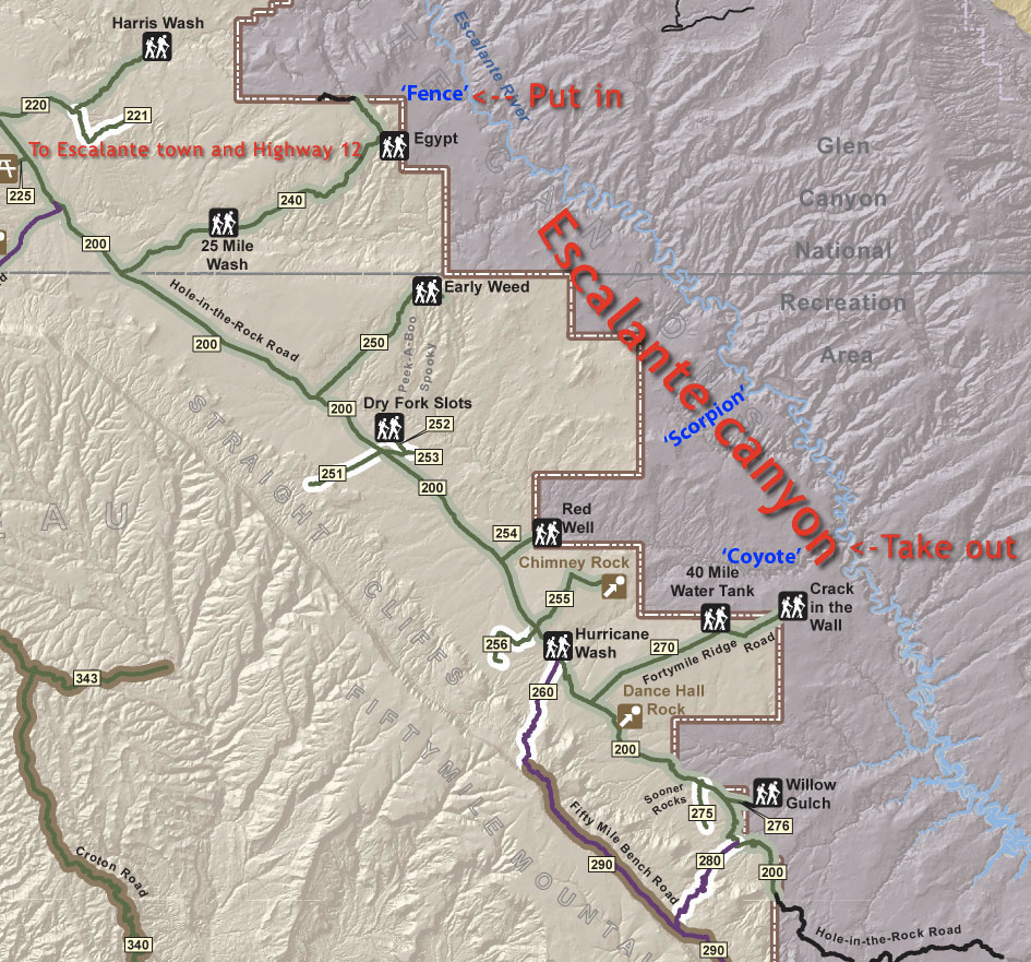
In the end, I’d have happily settled for a couple of day-runs on the Escalante but park HQ explained the river was all or nothing. I checked out an uninspiring local dam; any natural lakes in the area were high up and all still frozen I was told. Most put in at Egypt trailhead, aka Fence Canyon (see map) and take out 40 river miles later, either following Coyote Gulch upstream 13 miles to Red Well trailhead close to the main Hole In The Rock track, or up the dune to Crack in the Wall close to Fortymile Ridge trailhead which was 10 miles or so from the main HitRock track. Or you can head onto Lake Powell and arrange to get picked up by a boat out of Bullfrog Marina, but that’s expensive and unnecessary with packrafts.
However, it’s up to a 1000-foot drop from the trailheads on the bench down to the river and if the Escalante was that easy, many more boaters would be paddling it. I think that’s why it’s become a packrafting classic; they’re the only practical boats to run the Escalante river without getting bogged down with a pick-up off the Lake. So in the end and in the time I had, I settled for a foot recce of the Escalante’s access points, while hoping I wouldn’t get snowed-in in the park before my plane left.
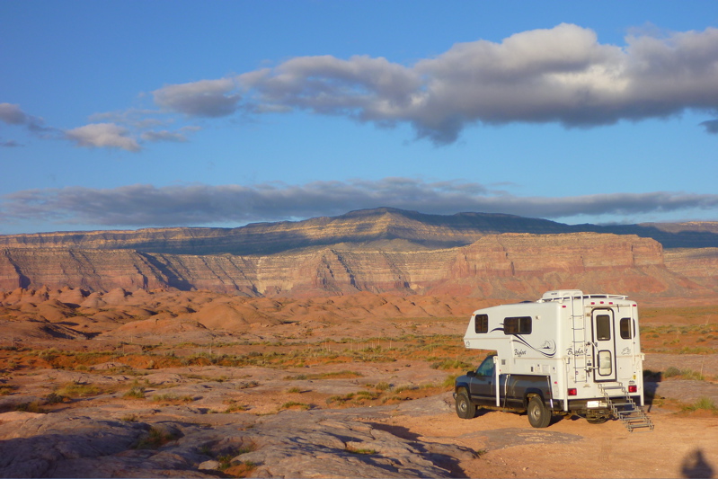
On the bright side, I got lent a GMC Sierra 4×4 truck camper by a guy at a travel show I’d attended in southern Arizona the previous weekend. With heating, a fridge a big bed and a week’s worth of food, staggering back to the van after a day on the trail sure beat windblown tent camping alongside a rental car. And as it was, the bottom-of-the-range rental car I cancelled at the last minute would have struggled to get to places like Egypt trailhead without leaving parts of its undercarriage in the dirt.
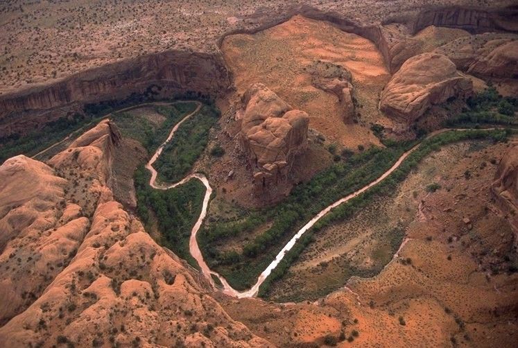
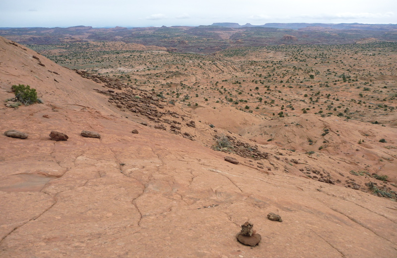
I got to Fortymile trailhead overlooking the take-out the same day I’d crawled down to Lake Powell and back from Hole in the Rock (HitR; N37° 15.385′ W110° 54.09′) so was a bit pooped. The last couple of miles’ drive to the trailhead were sandy but a few regular cars were parked there. Getting that heavy Sierra bogged down would have been a headache. From the trailhead car park (N37° 24.227′ W111° 00.533′; 4705 feet) it’s only a couple of miles following faint cairns to Crack in the Wall (N37° 25.152′ S110° 59.108′; 4413 feet) on the Escalante canyon’s rim where you get an impressive view to the northwest (above left and right) over the river below, with Stevens Arch behind and the shrubby dune slope dropping to the river’s edge.
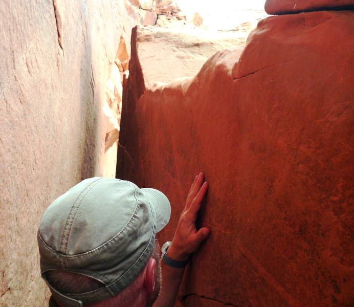
They’re not kidding when they suggest a length of rope to haul your packs over the outside of Crack in the Wall, a slab separated from the cliff by a foot or so and that’s the way down from the rim to the top of the dune slope. Once you drop into it it remains just wide enough to squeeze through if shuffling sideways. Alone coming up might involved more complicated roping. It was late in the day when I got here, howling and gloomy overhead so I didn’t trek down to the river’s edge far below. Instead, I drove away from the exposed trailhead and camped out of the wind down in Hurricane Wash on the main HitR track. Next day I drove the short distance on to Red Well trailhead (N37° 25.790′ S111°08.776′; 4508 feet), just a couple of miles off the main track.
From here – the most popular hike in the park they say – it’s 13 miles to the Escalante following the increasingly narrow Coyote Gulch, which is the same spot I was looking over the day before. The walk takes a full day or more, especially if coming back up with your gear. I set off towards the river and managed less than half that distance in 3 hours or so, walking through the broader, wooded part of the deepening canyon in and out of the river to about a mile before the point where Hurricane Wash joins Coyote from the south. Later they say it gets more interesting, narrower and much slower as you wade full time through the stream, around waterfalls and past arches. As a way of getting off the Escalante river, following Coyote upstream has the advantage in that there’s water to drink right around your feet to within a mile or so of the trailhead at Red Well. This itself is only a mile or two from the main track and so a manageable way of getting a lift out back to Egypt trailhead, if you left a car there.
After having clocked the two take-out routes off the river, I drove over to Egypt trailhead, a fun 4WD side track for which you’d need a high-clearance vehicle, and passing a surprisingly different desert environment of pinon trees on limestone? The trailhead is also more impressively located that Forty-mile, right on the rim (N37° 35.581′ W111°13.099′; 5646 feet) where the bench drops over 3.7 miles down via Fence Canyon to the river, 1100 feet below. It took me about 2 hours to get there with a bit of wandering after lost cairns. You have to be vigilant not to lose track of these although the way is fairly obvious: down.
It’s a fun walk and there’s a bit of room to camp down by the river (N37° 36.744′ W111°10.745′; 4550 feet), though I was surprised how narrow the river was here, just 15 feet wide and moving past at walking pace. A cliff blocked bank access to the south so it wasn’t possible to explore downriver without talking a swim or crawling over the cliff. According to the GPS from the put-in here to the take out is only 17 miles as the crow flies, but of course 40-odd miles along the tightly meandering canyon. One reads this is an access point to the lovely looking Neon Canyon slot on the far side of the river, a place that would have been fun to explore in warmer weather.
By the time I got back up to the car up on the rim, it had got much colder and as I left Escalante NM for the drive back west to Arizona, Bryce and Zion parks (left) were all under a few inches of snow, with more falling that night at Glendale.
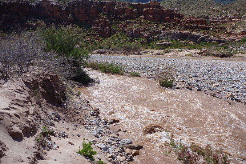
The next day I wanted a scoot down a short section of the Virgin river canyon in Arizona, where I’d stopped late one night a week earlier on the way up from Vegas. The recreational and camping area even had wifi and the Virgin below included a fast narrow chute of a couple hundred yards running at around 15 mph. Surely I could manage that in my slick new boat? I recce’d it all and thought so, but as I approached the chute in the Yak I lost my nerve and scurried for the stony bank a 100 yards or more to where it slowed a bit. Probably a good idea as even though there were no big rapids, at water level it looked rather more intimidating, and if I’d flipped the boat it would have been long gone before I got my bearings.
I put back in after the rush and scooted along a mile or so downstream before I took out in another probably unwarranted panic ahead of some unrecce’d rapids. Unfortunately, the only way out short of grabbing trees and bushes, was the other side of the river from the camp site but no worries, it’s a packraft so I hiked up the hill and upstream with the boat on my head, and did a quick ferry to the camp side where getting out was easier. I drove back north to St George and took the road east back into AZ, past the North Rim of the Grand Canyon to Lees Ferry on the Colorado river.
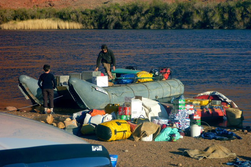
Never been to the North Rim but it was still closed for the winter, although the drive on past Vermillion Cliffs (below) was well-timed with the dropping sun. Down at Lees Ferry I chatted with some rafting guides loading up for the first tourist run of the season down the Grand Canyon the following morning; two weeks and 220 miles down to Diamond Creek. Their rigs included the biggest raft I’d ever seen, a huge 7 or 8 metre load-carrying pontoon with added side chambers and an outboard, while the clients took off in regular 4m rafts.
So there it is, Escalante packrafting recce for your reading pleasure. Knowing what I do now, I feel more confident about diving in for 3-4 days worth, leaving the car at Red Well, getting a lift somehow back to Egypt and then setting off downriver and coming out via Coyote back to Red. Although they said the bad weather had come in unseasonably late, these are high altitudes where anything can happen. I reckon up to a month later – mid-May – would have been a good time to try the Escalante, even if it means higher temps and lower levels requiring more portaging. Better to enjoy a slow ride with time for exploration of the side canyons in sunshine and warmth. In fact on getting back, the May issue of Canoe & Kayak magazine had a little feature on great rivers in the American West which included the Escalante. It recommended using packboats and mid-May as the best time. I was in the area in early April so took a chance.















































 Inflatable Kayaks & Packrafts