I’d parked the RV at the end of a 55-mile track south of the highway at Hole in the Rock, the top of a gully which drops 500 feet down to Lake Powell and which is bit of a scramble in places. If this was the Australia that I know, the chasm would be plastered with ‘Gorge Risk‘ signs. Looks like the Americans have got over all that, if it ever existed here. What you see – a steep, boulder-chocked gully where you want to take care – is what you get.
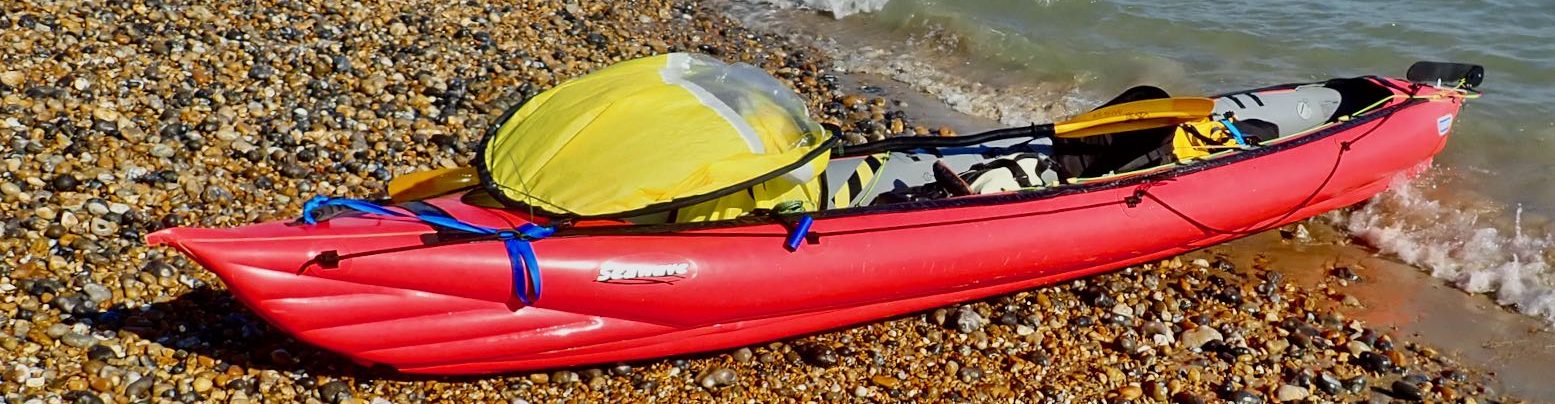
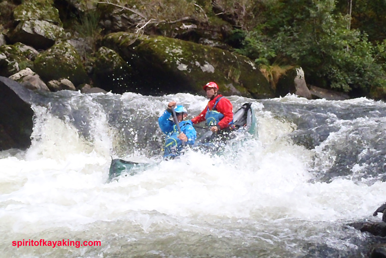
Getting down and back up from the lake wore me out for a day, but what was I complaining about? In 1880 Mormon pioneers spent six weeks here lowering two dozen wagons to get across what was then the Colorado river (read right) to get to a new settlement on the far side. Once on the water I only went for a bit of a splash-about in a flooded arm off the main body of the lake as it was a bit windy and I wasn’t sure what weather lay ahead. By the time I got back to the top it had clouded over and stayed that way till I left the GSENM a few days later. Changes on the conventional-looking pre-2011 rafts are summarised here: pointy ends, greater length, extended stern, 2-part backrest/seat and a deck that zips right off. I also have a feeling the floor’s made from a chunkier or stiffer fabric and so the extra butt-patch I had specified (left – done for free) may not be so necessary – but it sure feels worthwhile when scraping along a boney Scottish burn.
On the water first impression was not so good – oh dear the 4-inch shorter Yak was seemingly narrower at the front than my old Llama and I couldn’t put my feet side by side when pressed against the front (left image on the right) – this wearing size 11 Keen Arroyos (fairly wide). But deflating the backrest from full gave my legs more room and I actually found that both feet placed flat on the floor below the bulge of the side tubes worked fine (right image above right), just not so sure if this is so intuitive for brace control. I checked the front interior width of my Llama against the new Yak and it’s only an inch wider. In the picture left the new Yak and Llama fronts seem near identical in interior front width.
Getting back in the longer Llama, I now see the reason my feet didn’t jam was that I had a few inches gap between the front of my feet and the inner front of the boat where it tapered off. Sat against the back I could never reach the front to brace which is why I got the Yak. Also, the UDB on the new Yak may have constricted my feet a bit that day. Paddling a few days later without the UDB, I can’t say I noticed the foot jam. Got all that?
Other fascinating facts from my comparative measurements (above right) show the new Yak is only 8 inches longer then the Llama, so a new Llama ought only be 12″ longer, not 20 inches as estimated from the Alpacka website’s measurements at the time. The new Yellow Yak is nominally 4 inches shorter inside than an old Llama.
Other than that it feels much like the old Llama. Like they claim, turning/spinning doesn’t seem to be affected by the increase in length, but I’m sure the Yak’s bow yawed less from side to side as I paddled, due I suspect to the extended tail damping the paddle-induced pivoting effect, rather like a rudder or skeg. I did have my part-filled UDB strapped to the front where any weight tends to reduce yawing anyway. It was the first time I used the UDB on the water and have to admit the added guarantee of its girth and buoyancy was reassuring should a Colorado river barracuda make a bite at my Yak. Couldn’t really do any speeding in the conditions – it may be just half a mph faster, but that’s still some 20%.
As anticipated, the new 2-part seat is a real improvement. No more having the backrest flop down as you’re trying to get in quick off a steep bank or into a fast flow with a need to line up or burn. Like on my Llama, I just clipped the seat base onto the hull tabs with a single snaplink each side (inset, left) rather than mess about with the string they supply. Makes taking it out and drying/cleaning the insides easier.
Later on, washed up on the wrong side of the Virgin River Gorge in northwest Arizona, I also found the part-deflated backrest a handy way of portaging the empty boat – a bit like a Sherpa’s headband (left). So, bottom line, not a huge difference in operation apart from less yawing which was never that bad anyway once you compensated for it. Can’t say I noticed any added buoyancy/better trim with the longer back, but it might be noticeable from the other PoV. The zip-off skirt is a nice idea; one less thing to unroll and dry after. The added snugness I dare say I’ll appreciate in rougher conditions and it sure is nice to have a yellow boat for a change! There was a discussion on BackpackingLight about the new shape and here Roman D gives his opinion for a harder core of white water utility. More pack-Yak adventures this summer.
First sunny spring day around here so we went out to try out the flip-out disc sail I made over the winter on my Llama and Steve’s Big Kahuna. Wind was forecast at about 8 mph but was gusty – a bloke in a dinghy sailboat said it was up to 15 mph. Folded and clipped on the packraft, the sail sits out of the way and can be opened and – more importantly – closed easily with a twist, as long as you have a clip of some sort to keep it closed (and that clip is attached to the sail so it does not spring off and sink to the bottom of the lake…).
Initial impressions were disappointing, I did not rip off across the reservoir like a hooked marlin out of a Roadrunner cartoon. But watching the vid back it’s clear the boat did noticably drift downwind across the reservoir with the sail aloft, often at speeds similar to paddling (about 3 mph). Problem with the sail on the Alpacka was the boat soon turned off the wind one way or the other, swinging left and right. The pointier Kahunayak was better, especially once Steve trailed his paddle like a skeg. Didn’t get to try that on the Llama as I was fiddling about with the string trying angle the sail so as to steer the boat into the wind. This worked quite well in correcting the direction as you can see in the vid, but staying in that position was a problem. Could this be due to ‘wind-spill’ off the flat disc sail which lacks dishing like a WindPaddle? Maybe. It will be interesting to try it on my ruddered Incept IK when it turns up, as well as the new-shape Alpacka which I am picking up next week. More testing to come this summer up in windier Scotland with my all-new packboating flotilla. Or just enjoy this 2014 video from Finland by JP. More here at leftbound.
Just like their bikes and many other things, in southern France those Frenchies dig their recreational paddling. Unlike the UK, they don’t care if it’s an inflatable, a canoe, kayak, packraft or two bin bags and a stick. And unlike England and Wales, (see green box below), no river permits or licenses are required; just adhere to sensible regs. Add the fresh food, good camping, inexpensive ‘creaky stair’ hotels, great weather, natural spectacle, easy access by rail or bus, plus beautiful medieval villages with weekly markets and you’ve got a great packboating holiday with as much easy white water action as you like.
The sorry state of paddling in England & Wales
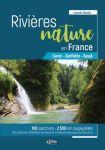
Did I miss anything? Yes: the long-overdue second edition of Rivers Publishing’s guide (left) which originally opened up this area’s potential to me. Generally aimed at ‘family’ canoeing, Best Canoe Trips in the South of France has river descriptions so you don’t have to worry too much about what’s downriver. As a serious guidebook it could be better, so if you read French, Rivières Nature en France (right) has better maps and covers many more rivers.
Massif – loadsa rivers
Extending south from the city of Clermont Ferrand 200km to the former Roman colony of Nimes, the Massif Central is an undeveloped and relatively unpopulated upland region of extinct volcanoes and 1000-metre limestone pleateaux or causses. About the size of Belgium, the highest peak is the 1885m (6184ft) Puy de Sancy in the Parc des Volcans near Clermont. Now you know where all that Volvic mineral water comes down from.
Early morning train from Brioude.
Getting there from the UK The key airports to access the region include Clermont, Montpellier, Nimes, Lyon and Rodez with Easyjet, Ryanair and FlyBe, among others. Nimes is probably the most useful, but Easyjet (Lyon, Montpellier) has daily rather than weekly Ryanair flights with better prices when booked late. There are also fast TGV trains to Nimes via Paris, taking just 6-7 hours from London (red lines, left) but elsewhere or beyond, things slow down considerably as you head for the Massif (blue area on map, left), so it’s unlikely you’ll get to a river on the same day as leaving the UK. A train is a much more agreeable than flying of course, but even in summer and once you pay for baggage, budget airlines work out much cheaper and as fast or faster, depending on where you start.
Dordogne (red) then Vezere with the Mrs. My first French paddles in 2005. We took out at Tremolac, the first big barrage and 40km from the airport at Bergerac.
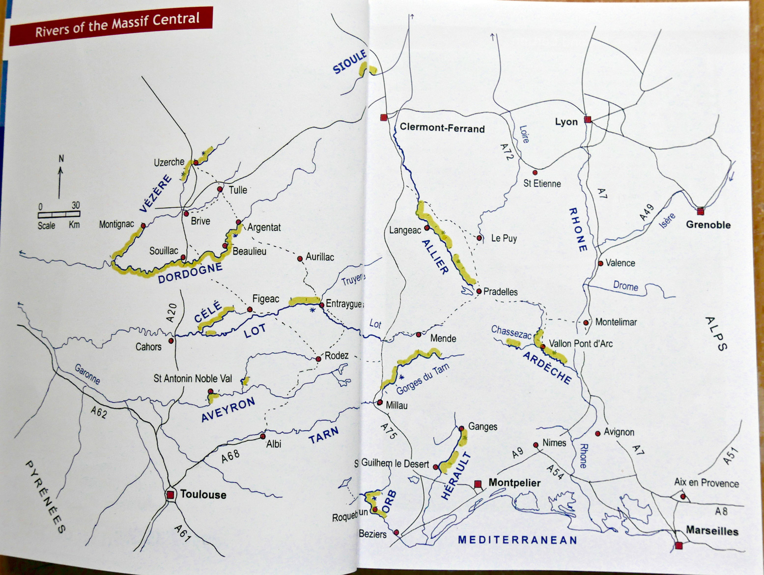
Rivers Take your pick from the easy Dordogne and Vezere, more challenging but easily accessed Allier, a Herault day trip, Tarn, Ceze, Chassezac which joins the Ardeche. Then there’s the Gardon and little-known but slightly greasy Lardon. Come August the biggest danger on the Ardeche is getting nutted by an out-of-control plastic rental kayak. In 2018 I did the Tarn again, from Florac all the way to Millau in a packraft, and a few weeks later the Allier too. Maps below from the Best Canoe Trips… and Rivières Nature guidebooks.
English guidebookFrench guidebook
They’re all fun in an IK provided the boat is not too long. With a long boat problems occur when the front noses into slower water or catches a rock, while the back is still in a fast current; the boat swings sideways, high sides and tips you out. In a slightly slower but much more stable and agile packraft I’d pick the frothier rivers like the Allier, the Tarn and Ardeche, because a packraft makes sub-Class 3 whitewater easy and safe. Packrafting the Tarn in 2018, I’m pretty sure I’d have struggled to control my 4.5-metre Seawave IK in some rapids.
But then again, packrafting the Allier a few weeks later, I was pleased I decided to walk round an 8-km gorge section of relatively sustained Class 3 rapids (left; a self-bailing Gumotex Scout) which would have swamped my Yak again and again. Here a decked or self-bailing packboat works better. And from what I’ve seen, two-up in a kayak or canoe makes things even more complicated unless both are experienced. If you do these rivers early in the season (June, July) there can be more flow, frothier rapids and certainly fewer crowds than early August. But summer storms can raise levels overnight.
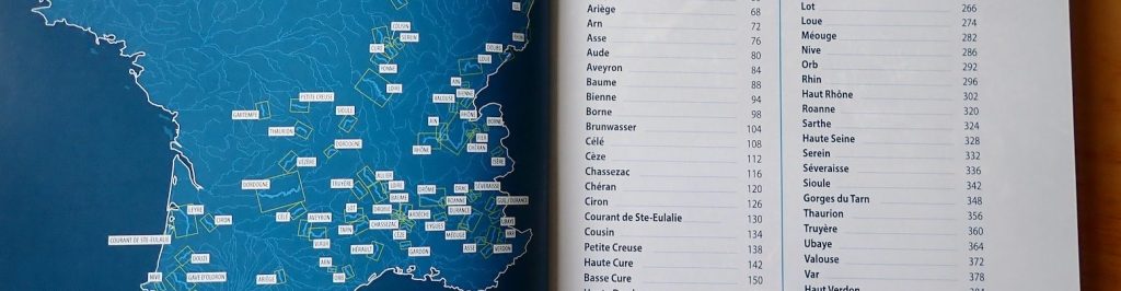
Maps and river levels There’s a very good official website for live river levelshere with more about it here. For general mapsof France right down to 1:25k scale and beyond, have a search here, or download the IGN Rando app and download for offline use. As the Best Canoe Trips… guidebook says, IGN maps better than Google Maps, just as OS is in the UK. All that’s missing are markers identifying canoe chutes on the weirs.
Evening on the Allier
The rivers TheAllier is a good choice for packboating as you can get a train from Clermont via Brioude all the way to the village of Chapeauroux, where the easier section flows right back to Brioude. Note Alleyras to Monistrol is now open (see link) but beware the first 8km out of Monistrol to Prades through the gorge. Long version in the link above, but you’ll see it from the train coming upstream and may be alarmed, as I was in 2018, even though I’m pretty sure I kayaked it 12 years ago as a clueless newb.
The Ceze and Herault are car and shuttle-with-bike day trips. The classic Tarn Gorge starts from Florac (noon bus from Ales) and cuts 85km below the Causse Mejean to Millau with its famous viaduct just beyond. A great run with easy rapids, bar one or two not mentioned in the guidebook. Being out of the Massif, the Dordogne-Vezere (map above) are easier paddles, but iirc took me a bit of bus and train’ing after a Ryanair to Rodez and out from Bergerac. Perfect for your first IK adventure, but it could be slow and a bit dull in a packraft.
And if you don’t have a packboat or can’t be bothered to bring yours, no worries. Get down to a river and rent an SoT for as long as you like. It’s all set up for you. Click the river links for more galleries.
Eats, Chutes & Lodges On any big Massif river there’s a well-established riverside campsite and canoe/kayak/SoT rental scene, so that by August flotillas of holidaymakers pack out popular rivers like the Ardeche and Tarn. Plus, at any time you can pull over to wander through a village which will very often have a basic hotel from 40 euros, like the one left on the Allier.
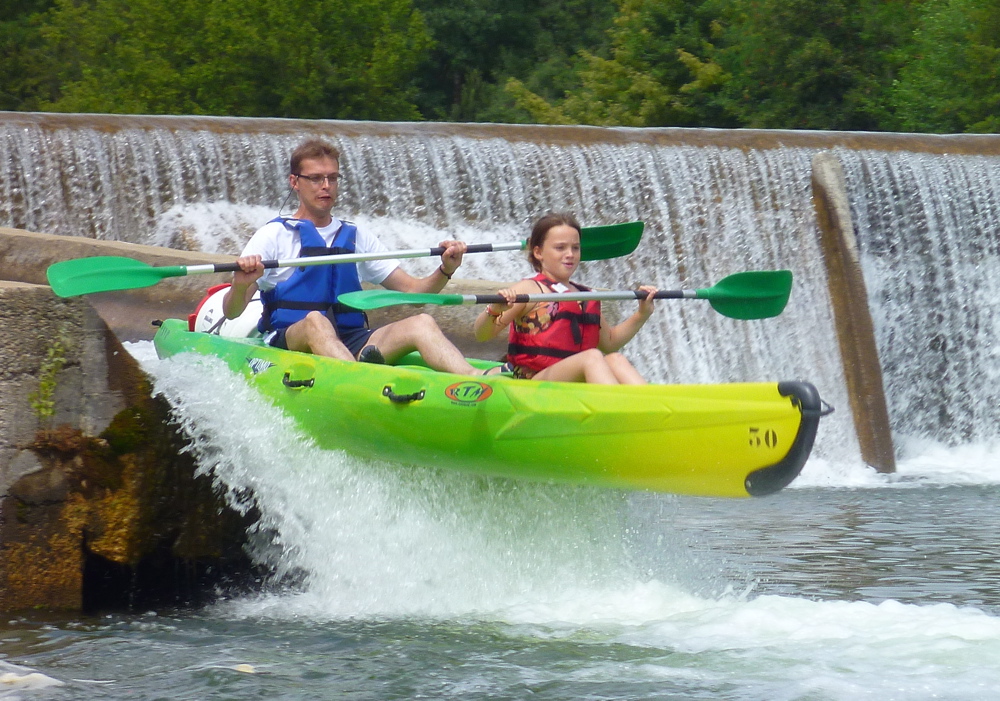
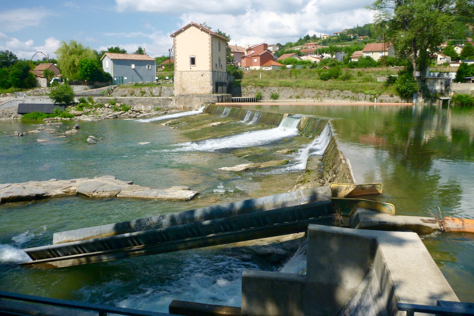
Some of these rivers cut through spectacular gorges and are strung out with easy rapids up to Class III, weirs to portage round or tip over and which often have a glissiere or canoe chute (left and below) which shoot you down the face of a weir without the need to get out and carry. Great fun and often easier than they look. There are no locks until you leave the Massif and enter the intensively farmed lowlands by which time the fun is over.
The Medway is not a river I’d choose to run in mid-December. I’ve kind of given up on English rivers, with all the access hassles, angling aggro. The Southeast of England is more congested than most, with a lot of canalisation and locks. But the other day, a week before Christmas, Steve and I drove down to Tonbridge to give Kent’s historic river a try.
He’d invited me to take his Feathercraft Big Kahuna folding kayak for a spin. The Medway would be just as wet as the Thames, but a bit nearer and easier to train back to the car. Feathercraft‘s Big K was a folder I was thinking of getting at the time so it was a real fluke when I realised one of the few people I knew who was into paddling actually had one. Then, as we tooled up in the town car park I realised I’d forgotten the Sunny’s pump. what a plonker! It had been a while since I’d paddled my Gumo Longboat down south but luckily I’d also brought the Alpacka packraft which Steve was curious to try. A slick Feathercraft paddling alongside the dumpy Denali was not how we’d planned it, so having messed about looking for the right put-in (the map guide above was not so clear) we decided to just get as far as we got before dark and train back to Tonbridge.
Either they’d built the dock platforms extra high to discourage canoeists, or the water level at the Tonbridge’s Town Lock was a good 2 or 3 feet lower than normal. It made launching the Kahuna 4 feet below the dock too awkward. Even getting into the Alpacka would have been tricky, so we plodded on into the woods out of town and found a muddy bank from which to deploy our portable water craft. Watching Steve assemble the Kahuna proved it was a pretty quick job – maybe 25 minutes out the bag. I can’t say I was hanging about twiddling my thumbs by the time I’d pumped up my packraft, put on a drysuit and clamped the two halves of my paddle together with that satisfying ‘click’.
‘Merdeway’ Steve had called it, not having done it either and expecting the usual jetsam slalom through a neo-urban river’s boat-stabbing detritus. The Kent countryside is not like the wilds of Scotland and the Medway didn’t exactly look like the Everglades in springtime. He’d picked up the official river guide somewhere but it looked a bit basic to me. If we’d looked online right here or here we’d have found out why the river was low. In fact Steve had checked online and just saw ‘Green – All Clear’ at Allington, rather than a skull and crossbones. Having paddled the Medway several times since, I have the Environment Agency officers or whoever a bit slack with announcing river level anomalies which could affect paddlers The river hereabouts had actually been closed for boating a few days earlier because Eldridge Lock – the first out of Tonbridge – was about to get a make-over and was wide open, running a dodgy, 3-foot drop followed by a train of nasty-looking eddies (below). This is how paddlers come to grief. You’d think they might have put up a red flag or a boom or something! It’s just as well we’re not hard of hearing because whatever that ominous rushing noise was, we wanted a look first which meant clambering through more cloying mud up the exposed river banks and onto the lock. I’ve since been informed that there should have been signs at Town Lock and the bridge 500m upstream of Eldridge Lock saying “Danger – Works ahead – River closed” but I can’t say we saw them.
Never tried but they say man-made recirculating drops like this are deadly for kayaks.
Looking down on it (above), with a fast run up a long boat like the Kahuna would probably have speared itself over, but I’m pretty sure that with half the available speed, the Alpacka would’ve merely plopped over the edge like a wet mattress and promptly flipped backwards (or ‘bandersnatched’ as they call it in America). Soon after, I’d get sucked into some lethal hydraulic tumbler with all the plastic bottles and dead badgers. Urgh, gives me the creeps. I don’t like canal locks at the best of times.
Just past here we swapped boats; I eased myself into the yellow Feathercraft and shoved backwards off some rocks. Without any anatomical adjustments, first impressions were not good. The seat back was too inflated, pushing my shins off the foot rests up onto the underdeck. Plus Steve’s Bending Branches paddle, hand carved from a narwhal’s tusk by a blind Inuit shaman, seemed all wrong in my hands. It took me 5 minutes before I even managed to turn the 14-foot boat round but once Steve deflated the backrest I felt more at home.
Man, it sure is nice to g li d e smoothly and quietly along a river after half an hour pack-splashing left to right like a ferret in a whirlpool. This surely is at the heart of kayaking’s appeal: smooth, quiet, weightless, waterbound progress. The £2200 Big Kahuna was a pleasure to paddle, once you’re in it’s all go, but getting in an out was the usual ballet on barbed wire for me, and there are a lot of locks on the Medway Canoe Trail. It can’t be all that bad though. Last summer Steve has spent weeks and weeks Kahooning down the Danube (above) with a posse of Germanic Rührschaufellen.
Back on the dreary Medway, there was a conspicuous lack of complaining emanating from my Glorified Green Inner Tube. Could Kahunaman be secretly enjoying the little packboat? We swapped back to our own paddles, much better for me. I was breaking in my new oversized and super-light Werner Corryvrecken, and could now really shift the Big K. Every stroke translated to a breeze across the face. It had been a long time since I felt that in a packboat!
I knew there was a canoe chute somewhere on this river, which added an un-Kentlike thrill. I never even knew the Brits were into these like they are in France where they’re called glissades and are a lot of fun on a hot summer’s day (let alone the portage aggro they save). Porters Lock was the chute – or ‘canoe pass’ as they call them here – but suddenly the idea of being hurled down it wrapped in a rubbery sarcophagus of alloy tubes filled me with horror. I really do have a problem with these SinKs! We got out and recce’d the raging sluice which drops all of a metre or maybe even two over 10 metres or so. That done we deduced confidently that at least one of us might survive the drop and crawl to the bank alive to paddle again.
We swapped back to our own boats and interestingly, Steve admitted afterwards he had a lot of bother regaining control of the long Kahoo and thought I’d sawn through one of the tubes as a jape. It transpired that just a short spell of nuance-free packrafting – requiring as it does all the poise and balance of sleeping cat in a sofa – had been sufficient for his cerebral cortex to delete eons of kayaking skills. Or so he thought, though actually increasing the pole tension on his FC at the swapover had altered the hull dynamics to tippier and less turnable. Eventually he lined it up and slid down the chute like a component on a production line. No big drama; nor for me in the raft.
Clambering over the next lock, we came across a barge lady chopping up wood in advance of the next cold spell forecast in a few days time. Three more locks to Yalding she said, our planned take-out at Mile 8 by the famous thatched Anchor pub. As we dropped the boats in we realised this stagnant back channel was actually under an inch of mostly intact ice. No problem I thought reboarding the Kahuna, the pointy end will cut through it like an icebreaker making a nice sound effect and a path for the Alpacka to follow. No it won’t. Instead the bow will ride up onto the ice sheet and start tipping the boat sideways if the ice didn’t give way in time. Yikes! Even in a drysuit I was getting chilled and didn’t fancy tipping myself into the pea-green, near-freezing waters of the Merdeway. Meanwhile, propped in the handy packraft, Steve attacked the ice with his sturdy narwhal tusk as the boat bobbed and spun around.
He had more success in the raft because the kayak’s distant prow was too far ahead for me to reach up and hack at the ice – plus my super-light Corry didn’t have the clout to do any more than scratch and slither over it. The patch of iced-up river was only about 30 metres long and Steve bashed on through along the bank like a contestant from whatever they call It’s a Knockout these days, until we were free again and on our way to Yalding. Now you know, when the Ice Age returns, packraft better than long kayak.
By the time we got to Sluice Weir (below, another time) I was back in the packboat. We could see the chute on the right but access was blocked by a big tree trunk (above). I nipped out to have a look from above and was a bit shocked: this chute was twice as steep and twice as long as Porters. Where were we, Alton Towers all of a sudden?
Juicy Sluicy
Rather tellingly the Medway Canoe Trail website features lots of shots of wholesome young couples with great posture shooting down Porters chute with toothsome smiles, but you won’t find a trace of the Juicy Sluicey Weir chute other than sexed-down refs that it’s a bit on the steep side for long boats [which may bury their nose and send you flying]. In a packraft: who knows how it would handle it, but on a warm summer’s evening it would be fun to find out. A couple of degrees above freezing in winter had less appeal and anyway, Steve was paddling commando with no skirt or dry suit and was already feeling the chill. Had the bank been accessible and not a scrum of brambles I’d have tried wading in and pulling the tree away, but a few minutes in that near-freezing water would have got nasty, let along the worry of slipping and getting sucked on a boatless ride down the chute. Maybe we’ll go back with a saw and a rope some time. [Again, I’m told a more explicit sign warning ‘Warning: steep chute’ is in the pipeline.]
From then on it got to be a a bit of trudge for me in the packboat towards Yalding. Steve was getting cold hanging around waiting for me and I was getting puffed out trying to keep up, and both our feet were numb from the cold. In the end he instructed me to hook up and towed me along by my packrafting ears. The GPS had proved what was fairly obvious, the Kahuna was easily twice as fast as the Alpacka and as you’ll see in the vid, a pointless head-to-head race had me thrashing at the water like a drowning addax, while Steve pulled ahead calmly, lighting a cheroot and texting in bids to his broker.
We arrived at Yalding and managed to haul ourselves up a wall onto the pub’s forecourt where they screw the ashtrays to the tables. We rolled up our boats and inside had a tea and a burger, waiting out the icy chill until the train back to Tonbridge was due. All of 8 miles we did in 4 hours or so. The classic run is from Tonbridge right through to Allington in Maidstone, 20 miles it says. And from there as far again to Rochester is on the estuarine tides and beyond the reach of river byelaws. But once the Eldridge lock is fixed up and with four other chutes on the way to Yalding, the Medway sounds like a fun run between the tame flatwater stages and portages. The river agency have certainly done a good job building in kayak-friendly infrastructure.
I’ve paddled the Medway several times in inflatablekayaks and packrafts – it’s fun. Search ‘Medway’
I should have been off to France in early November to packboat down the Allier River, but the current job drags on. So despite the very short days, it struck me I ought to finish off my summer’s packrafting plan. On that occasion, I ran out of time at Fort William while realising my idea of traipsing merrily across the bogs of Rannoch Moor from loch to river was – as usual – over-ambitious. Being my first packing trip, I also learned a bit about what gear works for this sort of travel. End of November I’ll walk southeast for two days down from Fort William to west Rannoch along the West Highland Way, like any normal person. Then I’ll put-in near the road bridge at Loch Ba and paddle northeast for two slow days onto Loch Laidon for Rannoch station to train back home. Another perfect mini adventure!
Looks like the forecast is freezing and snowy, so I’m a little concerned that a weekend of sub-zero temperatures may be enough to thinly freeze the lochs by Monday when I reach Loch Ba, making it too thin to walk on but too hard to paddle across. (a couple of weeks later we indeed experienced a paddling-through-ice scenario on a local river. Wind is forecast at 18mph headwind, but not till Tuesday which on top of -2 ought to chill things down. But that’s the final day’s paddle to the station so it can be endured or walked.
On the way I’ll be trying out some new gear:
Full-length Seal Skin socks for bog-wading immunity.
Self-draining trail shoes (normal hiking shoes with a hole melted through the sides). My Keen Arroyo drainers were not up to loaded walking.
Watershed UDB drybag/backpack and W’shed Chattooga day bag.
A waterproof Panasonic FT2 camera that can just hang off the neck come rain or splash. No more scrabbling with a Peli box while watching out for camera-killing drips and the rocks ahead.
December 5 ~ All Pack and no Paddle
I ended up only packwalking for three days, reversing the West Highland Way (WHW) from Fort William to Bridge of Orchy. It was nice enough, especially the last day after a bit of snow to improve grip. The only other person I met was this guy who’d cycled the WHW from Glasgow (95 miles) in 2 and a bit days. Pretty good going as I soon found out it’s not all rideable or even easily walkable in icy conditions.
On the first day I misjudged what I needed to wear a couple of degrees below freezing and ended up overheated and worn out after a long climb out of Fort William. After 13 miles I descended to Kinlochleven, a former ally-smelting company town for which the Blackwater reservoir had been built a century ago. From above it looked like some sinister gulag hidden in a valley. With snow on the hills I thought the hostel here would have been packed out with climbers, but there were only 4 others in and close up Kinloch doesn’t look so bad. The smelting works have now been converted into an ice climbing centre, while I imagine plenty of excess hydropower still pours down the pipes to get fed off to Fort William.
Day 2 was a slog up along the pipeline towards the reservoir and then breaking off on the WHW path towards the walk’s 560-metre high point at the Giant’s Staircase before dropping to Glencoe. From the top the Blackwater reservoir looked grim but was clearly unfrozen which boded well for tomorrow when I hoped to paddle the nearby lochs to Rannoch station.
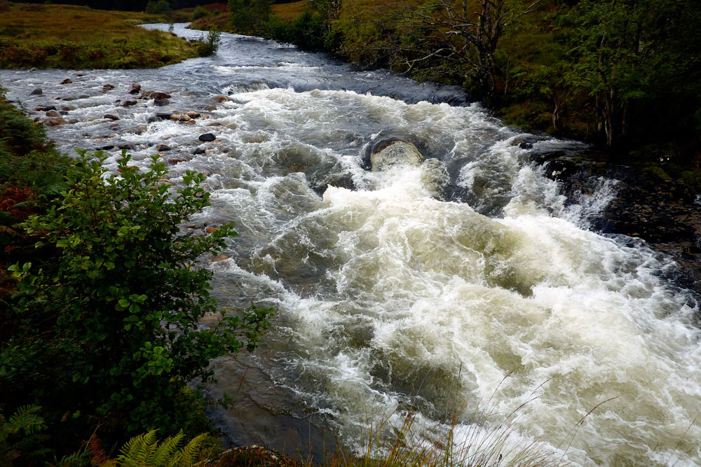
For the second time that day, I went flying on ice, ripping off my metal watch strap, tearing my trousers, and bashing my knee. The heavy pack amplified the impacts. Then later, walking on the flat towards the isolated Kingshouse Hotel at the head of Glencoe, I slipped again on and landed hard with the heel of my hand on a sharp rock which hurt a lot. With three similar falls on the previous day, after 9 miles I staggered into the hotel feeling pretty beaten up, but what a lovely cosy old place to spend the night! There was a fantastic view out of my room across to the pyramid peak of Buachaille Etive Mòr, while deer gathered below my window in the dusk.
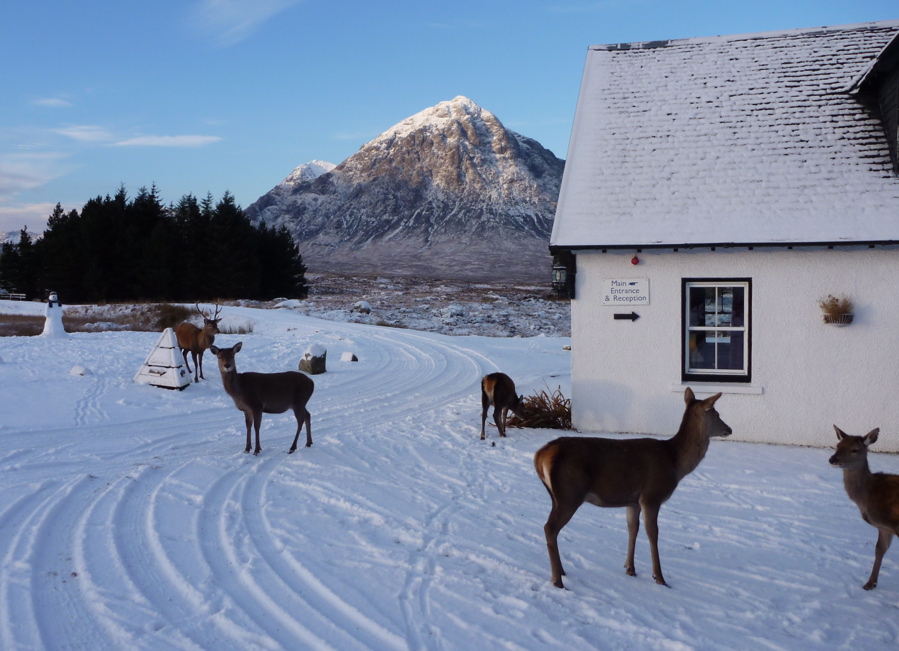
It snowed overnight and leaving Kingshouse Hotel, after a few miles I was expecting to get a view east over to Loch Ba from a high point cairn on the WHW, to establish whether it was worth schleping cross country to get to the water. The previous night had been forecast at -10°C and at the viewpoint all to the east was just a snowy tundra, with a small, snow-covered frozen loch south of Loch Ba for sure. Was Loch Ba frozen too? I couldn’t see from there nor from any other point further on the WHW, despite scooting without a pack up a hill for a better recce. Only back home when I zoomed in on the photos could I see a thin blue line of the bigger Loch Laidon which was clearly unfrozen. So I probably could have managed it after all.
It has to be said it was a lovely sunny day on the trail with only me, the stags, and some scurrying tracks, so with days short, I was happy to stick with what I knew and plod on to Bridge of Orchy station, rather than paddle to Rannoch station (the next one up) as planned.
So, a 40-mile walk in the snow with a heavy load. Nothing new there. What I should have done is taken the path from Kingshouse east to Rannoch, passing north of the lochs, but that would have missed out Loch Ba and the easy and shallow chute between the two lochs (though that may well have been frozen).
If nothing else it proved that you can set off for a walk with a camping load including a packraft as an option. If the walking is more pleasant or the packrafting not worthwhile, the modest extra weight is no drama. It would have been nice to go for a paddle but it’ll all be there next time and on the way to the station at Bridge of Orchy I was sizing up the Orchy River which drains from the moor to enter Loch Awe which I’d never heard of but whose north end is right on the Oban rail branch line. Sounds like a couple of nasty waterfalls need the be walked around on the Orchy soon after the bridge, but in tame water that’s too low for any hardshell it could be another little adventure with packboat and paddle. With roads, rails, and trails, the more you look at a map of Scotland, the more packable stuff is out there.
A week back home and the temperatures have jumped, even in Scotland, so the papers have to write about something else. Today, December 10th, the webcam at Kingshouse is the standard miserable Scottish highland vista. We’re going back in a month to walk back from Orchy to the hotel and from there to Rannoch station. Bring on some more Siberian winds.
I was back in the area a month or so later in mid-January 2011 – still snowy but less thick cover. This time I could clearly see the path off the WHW leading down to the road bridge being repaired, the rushing torrent of the river Ba leading to the loch, and even the isles on the loch, not totally icebound. Maybe my eyesight improved over Xmas.
Gear
Seal Skin socks – very good while they last. Warm but not sweaty considering they’re initially waterproof. The knee-length ones ought to make great waders.
Self-draining Karrimor trail shoes. No real wading to test them, but certainly better to walk in with a heavy load than the thin-soled Arroyos, even if proper tight lacing (which could be adapted onto the Arroyos) had a lot to do with it. I may adapt a decent pair of decent trail shoes from Meindl or whatever with a better sole, if some turn up half price. It would be nice to get some plain, non Gore-tex trail shoes for packboating but I don’t think they exist these days.
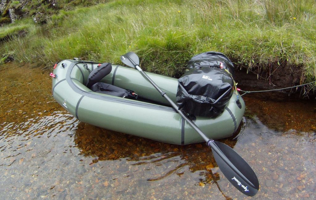
Watershed UDB drybag backpack was surprisingly good when you consider the 16kg load I carried just on shoulder straps with another smaller yellow Watershed over the front. Part of the tolerable comfort I feel was that the UBD’s relatively rough fabric grips across the back like weak velcro and so spreads the load. The packstaff paddle shaft saved a few tumbles and so means the 4-part Aquabound paddle is well suited when trail walking and paddling.
The Panasonic FT2 never got to be splash tested either but was otherwise easy to use (once you know Pana interface) and took some great shots and video. It does lack the full 25mm width of my normal Lumix TZ6 and I wonder if on full zoom the relatively tiny lens is on the limit. A great back up camera for watery places. I’m still using one in 2016.
I hopped on the Go-Pro bandwagon way back in 2010 but was shocked by the crumby, underexposed results above. They’ve clearly got a lot better since, but I just film with my P&S camera now.
It was a bank holiday weekend in Scotland and the West Highland Line from Glasgow to Mallaig was packed out, but only one person got off the train at Morar station. Me. There was nothing here other than a few houses, a B&B and a lovely sandy beach facing the isles of Rhum and Eigg. The waters of Loch Morar spill out onto those sands and meander down to the sea. I was heading the other way, inland alongside the loch’s 20-km long north shore on a back road that turned into a track and finally a narrow path rising above the waters.
I was of course taking a very keen interest in the state of those waters. As must be normal around here, the wind off the North Atlantic was blowing up the loch with me, but not enough to make hauling the 20-kilo backpack on soft rafting shoes any easier. It looked like a downpour had recently smothered the area; transient waterfalls were running down the valley sides and occasional squalls rushed up the glen. By the time I got past Swordlands Lodge – a WWII-era spy training base for the predecessors of MI5 – all I wanted was a flat patch of dry land to pitch. I’d got further than I thought, covering about 14kms in 4 hours and was now just 7kms direct from the bothy (refuge) at the far end of the loch. The wind had calmed, but the bothy could wait till the morning. I spread out on a narrow jetty, inflated the boat and went for a walk north over to Tarbert Bay, a few houses on the tidal Loch Nevis where a ferry drops in from Mallaig every other day on a circuit serving the otherwise inaccessible community on the Knoydart peninsula. The paddle up Loch Morar and short portage over to Loch Nevis to follow the coast back to Mallaig was a popular day trip for sea kayakers.
Never mind about that. The thought of my first real, fully loaded packrafting paddle alone on the 1000-foot deep Loch Morar was a little unnerving. Even fresh water inland lochs like this are prone to sudden storms that have drowned ill-prepared canoeists. How would my boat handle in a swell with a 12-kilo pack strapped to its bow? When the time came next morning I found I just went through the motions, knowing that I’d done my best to get it right. Sealed inside a heavy dry suit, I pushed off and tried to keep a respectful distance from the steep shore, as the bay I’d sheltered in overnight opened out into the winds. Out there, funnelled in by the 1000-foot ridges, whitecaps furled the foot-high swell, but despite my dry mouth and hyperactive paddling, there was really nothing much to worry about other than worrying too much. With an open deck and the wind to my back, the loaded raft sat on the water as reassuringly as a wet mattress.
At one point the sun came out and soon after the white speck of Oban bothy came into view at the base of the narrow, cloud-filled valley which would lead me over to the next loch. Coming back to shore I felt a small sense of achievement; I’d managed seven whole kilometres across a windy loch carrying all my needs. With the wind and hard paddling, it had taken only one and a half hours, much faster than following the shore on foot, but that was enough adventure for one day. Though it would put me behind schedule, I decided to spend the rest of the day in the bothy, drying out the tent soaked by overnight rain and my dry suit soaked by over-anxious paddling.
On the map only intermittent paths lead to Oban bothy which seems rarely visited and as you can see from the video, is pretty basic but a very welcome shelter set in a brilliant location. Across the loch abandoned crofts reminded me that that this part of Scotland was not always the wilderness we like to think, but a land abandoned two centuries ago when poverty and inland expulsions to enable sheep rearing forced the inhabitants to the coasts, cities or overseas. Amazingly, in the next bothy the logbook showed a recent visit by some Canadians whose forbears had abandoned Glen Pean in 1793. With the gear drying on the line I went for a walk up the valley to confirm just how mushy the track would be. Later that evening I scooted off in the empty raft across the loch just because I could.
Over the pass Next day was going to be a short-haul, just 8km by GPS up the valley and down the other side to another bothy in Glen Pean. I’d rather taken to bothy life. Though these places are basic and grubby, with no facilities other than a fireplace, some bed bases, left-over food and rubbish, the simple presence of space, shelter and mouse-eaten furniture is so much better than sodden tent camping.
While a packraft does open out your mobility options, especially in the Scottish Highlands, it does increase a typical 12kg camping payload by 50% once you add in a dry suit. Carrying that sort of load over the boggy, hummock-ridden terrain, where the high summer grass and reeds obscure knee-deep ditches and peat channels is probably more dangerous than bobbing around in the middle of a windy loch. To this end I’d adapted a sawn-off piece of paddle shaft to slot on the end on my AquaBound paddle to make a packstaff – something I’m still using over a decade later. It proved to be one of my best ideas on this trip, useful as a probe boggy-looking ground that was often actually firm (and vice versa) and a balancing- or weight-bearing aid. Climbing or descending, it helps take the load off the kknees and saved a lot of the energy expended in avoiding or trying to hop over peaty trenches which could suck you in down to your knees. I’ve been using the pack staff for packrafting and Scottish hill walks ever since. This attempt at dancing around the mire while hauling 25% of my body weight was partly what had worn me out on the walk in from Morar station, not helped by trying to keep my feet dry in my quick-draining ‘canyoneering’ Keen water shoes. Today I decided to try out my Seal Skinz socks which had ssat in a drawer for years. Even though once wet, wool socks keep warm, the waterproof but bbreathable Skinz were as good and should mean less chance of trench foot. All I need for next time is a wade-proof, knee-high pair, though I soon learned the waterproofing or membrane in the Seal Skinz doesn’t last. With an improved packing set up, I set off for the pass, no longer skirting the puddles and putting my weight onto the packstaff when needed. Taking it slow, I felt much safer with the staff as I plodded steadily up to the watershed. Here, still surrounded by boggy the steep valley sides, a faint sheep trail descended steeply to a water-logged valley where it disappeared altogether. Even with a staff and wet-proof feet, the valley still took some negotiating, inching around outcrops while leaning on the firmly planted staff which would have pretzeled a Leki walking pole. In the end, it was simpler to follow the stony river bed. Presently I came upon Lochan Sagairt as marked on the map, unreached by paths from either side and jammed in among dense contours in a gorge. Either side would be a tiring climb with the load I carried and so here was a perfect evocation of the Packrafter’s Choice: to expend effort but possibly save time by keeping on land – or to deploy the raft and scoot across the lochan effortlessly and maybe even catch a bit of a ride off the stream on the far side. (If you’ve watched the vid, it’s here that the film and my photos end – my 8-gig SD card filled up). It took just 12 minutes from stopping to paddling out through the reeds onto the lochan. (Here’s another version.) Following the stream gave me up to a kilometre of paddling distance, but soon that became too shallow and worse still, up ahead seemed to drop through a small gorge. Very keen to play it safe, I rolled up the boat and took to what was now a quad bike track which brought me through a jungle of ferns to the deserted bothy in Glen Pean, nine kilometres walk and four hours from Oban.
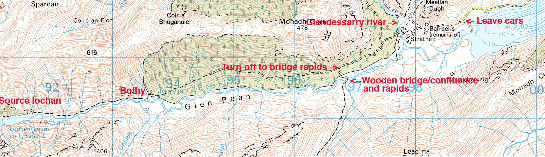
Glen Pean The plan here had been to track the Pean river on foot and put-in as soon as it became paddleable, hoping that that would lead smoothly into Loch Arkaig, the next big body of water. I had my doubts it would be as simple as that, and after lunch set off, first up to an interesting-looking waterfall on the far side of the valley, and then back down into the valley to recce the river downstream. This exposed one of the flaws of packrafting in this sort of wild terrain. Walking the water courses in the valley bottoms, you’re in the worst, waterlogged terrain, fit only for birds and slugs trapped in a squelching morass of saturated peat and spongy moss. Up here the meandering Pean river flipped between deep, Guinness-coloured pools and clear, shingly shallows. No big problem in an unloaded raft as I’d found in France where we’d spent the last few months, but with a load you ground out sooner, meaning getting out and pulling or even unpacking and carrying; not an efficient use of energy. I tramped downstream around the deepest mire where the forest plantation met the river, and up ahead noticed an ominous dip in the tree line between two knolls. Deadly, Alpacka-shredding rapids!
A perfectly walkable track led through the forest to the head of Loch Arklaig and a group of houses known as Stathan. I looked closely at the 1:50k map and sure enough, where a path came down the valley to bridge the river and join the forest track to Strathan, two 25-metre contours crossed the river within a quarter kilometre. To confirm that paddling the Pean may be more effort than it was worth, at 6pm I set off along the forest track to that bridge and suss out the river. An hour later I looked down on a two-metre drop before it led into a boulder-chocked funnel. My hunch had been right, though of course, terrified as I am of being swept unwittingly into a mini Niagara, I’d have surely heard the waterfall and done something about it.
Back at the bothy, I was satisfied with my recce. The upper Pean was navigable with a little effort for about 4kms from the bothy to the bridge, but at the bridge you’d need to pack up and haul up a messy track into the forest and walk on down to Strathan, or stagger along the banks until the river cleared up. (I’ve since returned and paddled the Pean from that bridge down to Loch Arkaig).
Loch Arkaig to Gairlochy Next morning I stood on a bridge in Strathan, a few buildings of the Glendessary estate at the west end of Loch Arkaig. Below me the Glendessary river rushed towards the Pean in a tumble of white water, while the Pean river itself wound placidly into Loch Arkaig. Like Morar, Loch Arkaig ran for 19kms end to end, a long paddle that might take most of the day and certainly most of the day’s energy. A back wind was rushing along, maybe only a little worse than on Morar; here would be a good place to experiment using an umbrella as a sail. A narrow road also trailed the loch’s north bank and having lost a bit of time hanging out in the bothies, I thought I’d try and hitch a lift towards the Great Glen and Loch Lochy where the Lochy River lead south to Fort William. If I could get there tonight I’d have caught up with a chance to carry on to Rannoch as planned. Plodding along the road eyeing up the loch, I passed a bunch of young canoeists on a course and figured if I couldn’t get a ride I’d be better off getting on the water and riding the swell down to the east end. Before that decision became necessary, a car squeezing past saw my thumb his mirror and half an hour later dropped me at the loch’s east end. Rich worked for the local Outward Bounds kids camps and spent his spare time adventuring himself on the islands and highlands. He told of some canoeists last winter who’d portaged the way I’d come yesterday. One ended up breaking her leg somewhere near Lochan Sagairt and getting helicoptered out (in fact I found the thread on that event here and there’s a video here). Portaging a canoe from Loch Morar? Have these people not heard of packrafts?! Either way, I was sure glad I didn’t have to trudge down that long, lochside road; I’m sure whitecaps or not, eventually I’d have taken to the water. It brought up another flaw in my gear: I was wearing Keen Arroyos which gave little more support. Luffing a 20-kilo load over rough ground, I should be wearing boots for hiking. They did the job but the insides of my Arroyos were being ground to a pulp and my feet were beginning to suffer. Rich dropped me off somewhere near Clunes, a shopless wooded hamlet surrounded by retirement homes. I was back in tourist lands on the Great Glen Way footpath. Possibly as a result of yesterday’s efforts, I suddenly became ravenous and tore into my food bag to boil up a mug of soup and some stew-in-a-bag paste while the wind howled through the trees. The freeze-dried food I’d been eating was pretty tasty and very easy to prepare, but for once, I wasn’t eating enough. Twenty kilometres away, Fort William would see to that.
All that remained to see was whether Lochy loch was paddleable in all this wind. Sure enough, the west bank was sat in a wind shadow. With a swell running at a couple of inches, this was a loch I could do business with. No need for the drysuit, just zip on the skirt to keep the insides try. How nice it was to paddle on a calm loch. Back in phone range, I called the g-friend to fill her in on my triumphant achievement. A lighthouse marked the top lock on the canal: right for the canal and Gairlochy, left for a weir which led down to the river. Camping by the lock on trimmed grass was free, and many recreational boaters were berthing for the night. Fort William and a seafood basket with salad, chips and a cappuccino would have to wait. I pitched the tent, de-aired the raft, and went to suss out the state of the Lochy River from the towpath. Between the trees and the wild raspberry bushes I spotted some fly fishermen by a couple of sporty rapids and found a good place to put-in tomorrow just past the lock. I was getting a bit desperate for proper food, but Gairlochy had nothing except all-you-can-eat wild raspberries. The nearest resto was up towards Spean Bridge, more than my blistering feet could manage.
River Lochy to Fort William: Riding the Wavy Trains I was fairly sure I had the measure of the River Lochy, a canoeable river that led down to Fort William and tidal waters, interrupted only by one Grade 3 rapid which the Scottish canoe guide warned of but didn’t locate. A look on Google Earth had pinned down the probable location where the river took a hard left with a telltale smudge of white. I put it in my GPS. I set off down the Lochy, knowing I’d be having a lunch of real food off a plate, not out of a bag. It was great to be riding the wavy trains again, with nothing above WW1 as long as you chose the right chute. At one point I hit 14.5kph (9mph) according to the Garmin and safe in my drysuit, what control I had steered me from tedious shallows or boat-flipping boulders. The grade-three waypoint was right on the money, where some young boys where being tutored in the art of fly fishing by a ghillie (river gamekeeper) dressed in full regalia, including a deer-stalker hat and a crimson face. Inspecting the rapid, I’d have been curious to see how even a proper kayaker could manage to fly down the chute and stay upright where it ramped up to the left to flip you right, straight onto the rock. UK Rivers rates the Lochy quite lowly and barely mentions this rapid, but then goes on to add that a poacher and no less than a dozen commandos have drowned here over the years. The mossy, muddy portage was another job for the packstaff, and now a little braver, I took the hardest lines through the remains of the rapids and presently rocked up at the rail bridge at Inverlochy, a suburb of Fort William.
Loch Ossian It was Wednesday lunchtime and my train out of Rannoch was due in 48 hours. If I was to make it I’d have to move on that afternoon, but after checking into a hostel I was dizzy with hunger. The afternoon would have to be spent answering the call of the stomach. In between I paid my respects to the outdoor gear shops in search of bargains, but merely confirmed the daunting truth: other than a couple more dried meals and some 2-for-1 mini karabiners, there was nothing I needed. The next day the train dropped me off at lonely Corrour station, a mile away from the lovely wind-powered SYHA hostel alongside Loch Ossian. All that remained was to spend the afternoon paddling down with the wind to the Corrour estate lodge at the far end of the loch and walking back along the shore to satiate another ravenous appetite.
I now have an idea about packrafting in Scotland: what sort of routes are optimal and what gear works best. The recce around Glen Pean made me realise that no matter how up for it you might be, hiking cross-country across bogs and tussocks as I’d planned to do from Glen Nevis over to Blackwater and from there to Loch Laidon, would have been a hiding to nowhere while hauling a heavy pack. If I’d had the time I’d have followed the West Highland Way out of Fort William to Kinlochleven and on to the Kings House hotel in Glencoe (40kms – two days). From there an eastbound moor path passes close to Loch Laidon (we did it years later, below); either can be taken to reach Rannoch station.
Speeds The raft can be pretty quick on a loch, paddling hard with a backwind, even with a load, and so some sort of sail would reduce the effort and so give more range. I never expected to try and paddle the full length of Morar or Arkaig (19+ kms). Loch Ossian (6kms long) was surprisingly slow as at one point I headed across the width of the loch with a stiff sidewind to see how the unloaded boat handled (pretty flappy but probably more secure than an IK).


