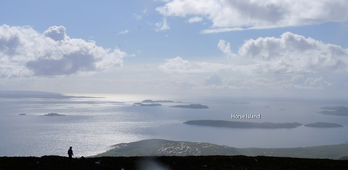
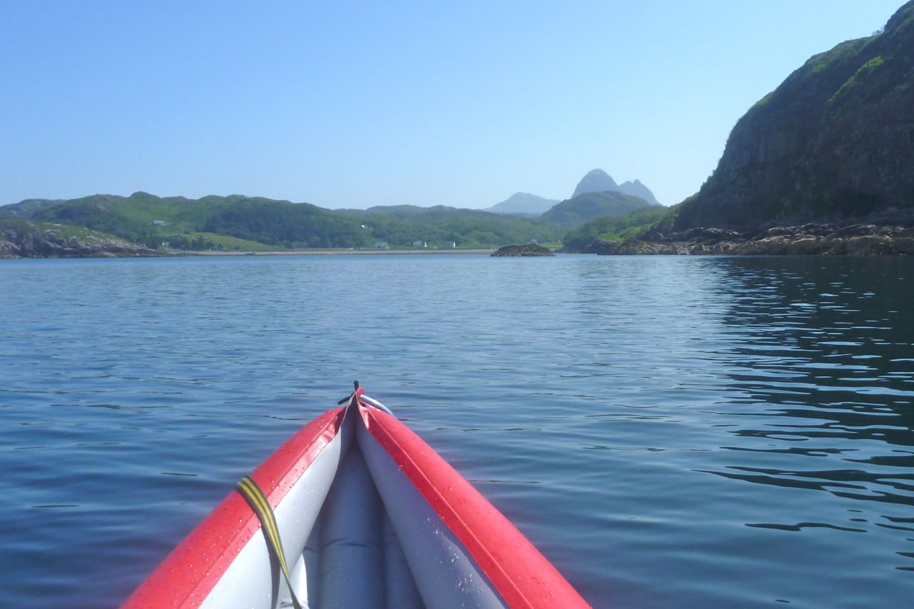
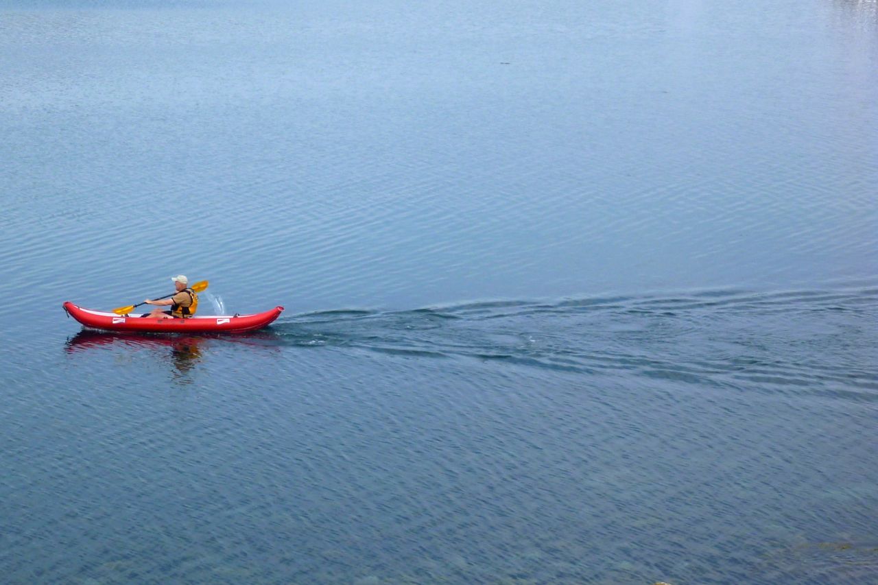
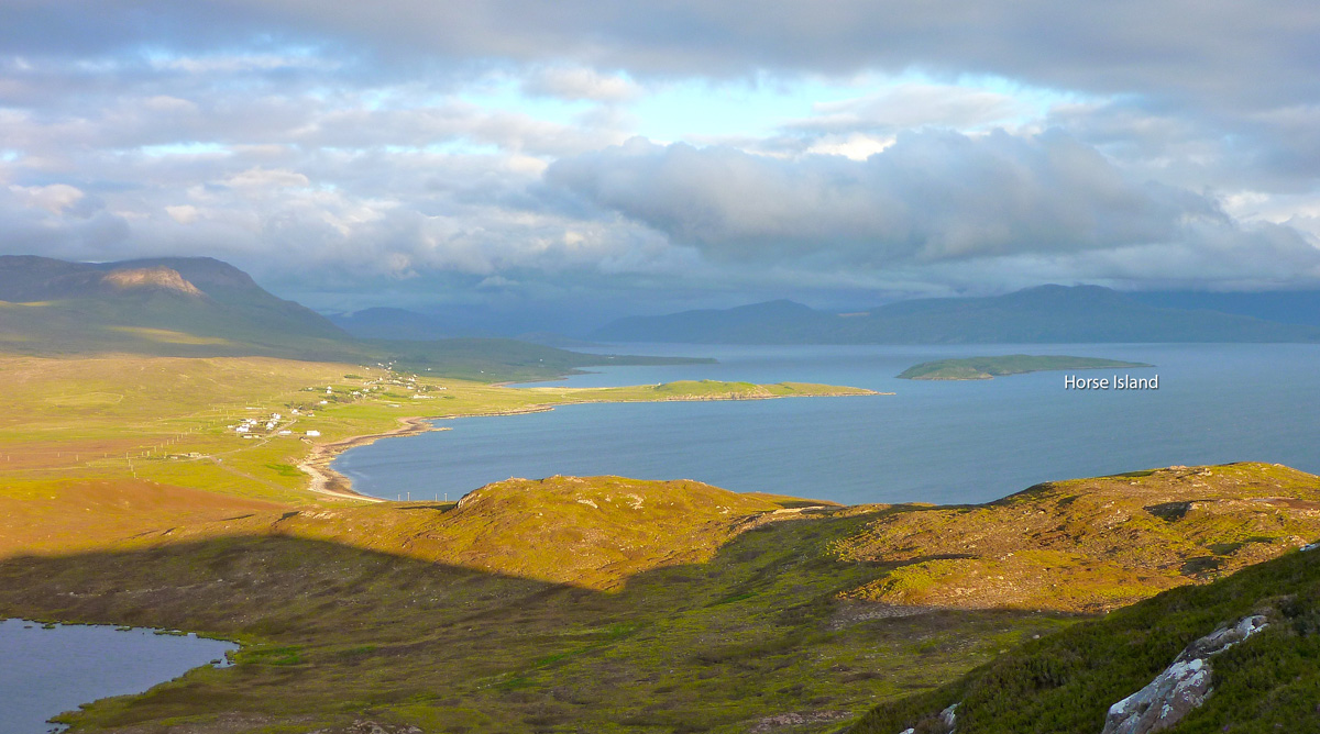
Another calm day, another island paddled around; a quick one to Horse Island which I visited last year. On that occasion the two islands of Horse and the smaller Meall nan Gabhar were separated by a stony, seaweed-drapped causeway. Today, leaving Badentarbet beach 40 minutes after HW, I expected to paddle between the two. On the way out I noticed that the way I’d clipped the new backrest was not so good, so at Runha Dunan point (map left) I pulled over to try something less bad (right). I definitely need to come up with something better, and for the rest of the trip avoided leaning against the strap for fear of damaging the lugs. That may have contributed to the fatigue, if not actual low speeds (see below). Expensive but stout Grabner D-rings and an SoT backrest are on the way. At 2.7 miles out a wide channel separated Horse from its northern neighbour (left). In the absence of distracting wind and at today’s tide (3.6m, max can be 4.7) I wanted to see if I could detect any currents in places like this channel. Maybe not yet only 1.5 hours after HW, but by the time I closed the loop a flow – I imagined against me from east to west – ought to be noticeable. Down the inland side of the Horse I passed the small seal colony (left) we spotted on our way to Ullapool last year. And at around 70 minutes and 4 miles out I turned around the south end of Horse Island (left) and experienced the slight turbulence I expected, possibly as the tide flowed round the point against a rising southwest breeze. Up the outside of the Island I felt a bit exposed so pressed on against the chop and as I returned to the gap from the south side the back end of the kayak kicked out a bit. A ha, something’s happening two hours after high water, getting through the gap may be a struggle. I felt the nose of the boat pull off course unless I kept straight on against an imagined current. But as the speed graph shows, I was actually going faster than an hour 20 minutes earlier and the seaweed below wasn’t showing any signs of flow, so if anything it was a light current pushing the back around. All very confusing. Perhaps the ebbing tide backing out of Loch Broom around the island creates a back eddy through Horse Channel. The fifty-minute paddle back to the beach turned into quite a haul, but that’s the way I like it sometimes and somewhere on this stage the GPS’s trip log (if not the track log, left) recorded the magical 5 mph! All up, 8.1 miles in 2 hours 20 at a moving average of 3.5 mph. About 10% faster than my other solo trips over the last week to Lochinver and around Rubha Coigach, but as a training run and without a proper back rest, the effort wore me out. As for tides and tidal movements, for the moment I remain baffled.
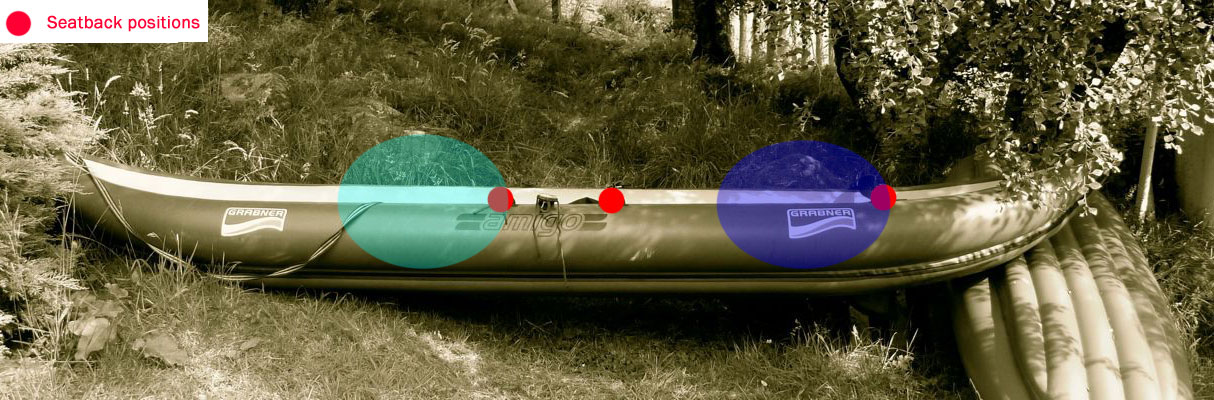
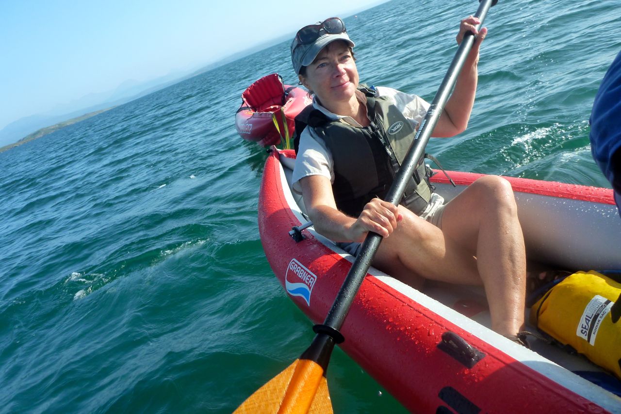
The calm continued and with it the paddling. Today we tried the Grabner Amigo two-up around Tanera Beg island out of Old Dornie. I’d <a class="wp-gallery mceItem" style="color: #000000;" title="Summer Isles Overnighter camped on the island with Jon one time but have never been right round it. For some reason I assumed better the greater weight of me in the back and half-my-weight Mrs out front. But looking at the seating positions (image below right), back is quite far back and full frontal is only a little more forward than the solo position. So the heavier person out front centres the mass a little better on the boat which must be better for control and response.
We set off me in the back, but suggestions on improving the forward operator’s poor technique and asymmetric delivery led to discord and erratic progress, as the speed recordings below testify. To be fair the g is way out of practice and also hadn’t had two hard days of paddling to tone up. However, claims that her inability to paddle straight was due to my diet and general girthlyness in the stern will have to be settled in due course by BCU lawyers.
Meanwhile, in the narrower back it was a tight squeeze for my (allegedly fat) arse and soon my legs – like my ears – were going numb. I’d initially perched on a spare Gumotex thwart but that felt unstable. It was better sat on the floor, jammed in. In this position my feet were against the back of the gf, so there’s only just enough room for my legs. As we passed between the two Taneras where a fishing boat was checking pots, I spotted an easy portage over Eilean Fada Mor, an island between the two Taneras. It gave a bit of a short-cut, but more usefully a chance to restore circulation in my legs.
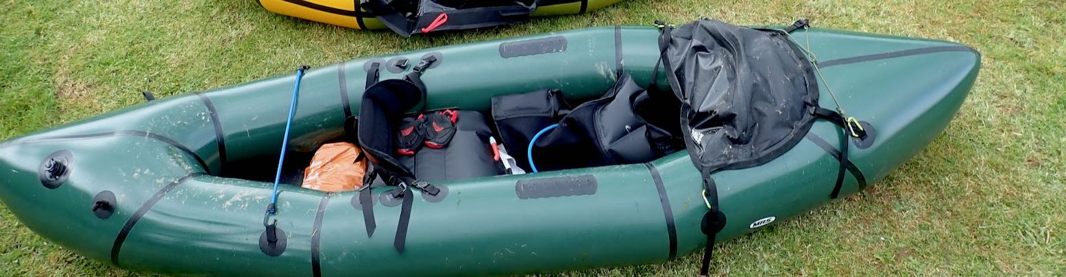
We swapped places here too, although one lean back on my new q/d back strap arrangement (left, a replacement for the alloy Grabner bar which bends too easily) broke the black plastic clip. I fed a spare krab through the seat strap and tied off the other end with some cord so that clip wouldn’t break too. I was expecting such issues and anyway, big karabiners are easier to use when swapping seats (see Grabner Mods). With the force on the Grabner rubber mounting lugs now coming from an unintended angle rather than directly back when using the seat bar, I’m trying to spread and articulate the loads with cord. But with only 3 square inches of contact, even if the lugs were factory glued, I feel I ought to glue on some 4.5-inch ø D-rings instead (as on the Solar; over 15 square inches of contact). Whether it’s just my clumsiness or all this weight I hear about, it’s clear that the strain on seat mounts is greater than I thought, especially with footrests to push back off. As it was, with no footrests in the full-forward position I couldn’t rest fully against the prototype back strap, but as I noticed before, proper paddling is much easier out front as the boat narrows towards the bow. That’s another thing with big, single sidetube IKs: they’re over wide for good paddling. As it happens, should I want a footrest tube I do have a D-ring glued on the front floor in about the right place.
Back to the story. We were now back in paddling harmony and heading into mare incognita, the southeast corner of Tanera Beg where I’d heard there was an arch. And there it was – a very nice one too that could be paddled right through (this was 90 mins after spring HW). Its exposed position made the roof deeply scalloped by storms and weathering, reminding me of the similarly carved limestone walls of northwest Australia’s Geikie Gorge which we packrafted a year or two back. Amazingly, out here on the ocean-side of the Summers there was barely a swell or a breeze to disturb our composure. Though an hour’s paddle away, Priest Island looked enticingly near. And from Priest it’s less than 5 miles to Mellon Udrigle beach at the top of Gruinard Bay on the south side of Loch Broom. Or from either Tanera island you can take a 10-mile loop south to Priest and back north via the smaller Eilean Dubh and a few other ‘Outer Summers’. One for the next calm day and a paddling chum for back up.
We felt like we were making good speed across the south side of Tanera Beg, although rarely got over 4mph. At the southeast corner was a huge cave – big enough to break the GPS signal. With a small window at the back this will become another full arch by around AD6565. This whole exposed side of the island has deeply weathered Torridon sandstone cliffs full of interestingly rounded cracks and fissures. Tanera Beg, like the bigger Mor has the same ‘waisted’ kidney shape presumably carved by the icecap along existing fault lines. Like mountain col, the ‘waists’ usually correspond with bays backed with a handy stony beach though flat camping needs a bit more of a walk. Had the Ice Age been a bit longer (or when the polar ice caps are gone) there’ll be a few more Summer Isles to go round.
We then paddled below the 20-m cliffs on the north edge of the island (left). On a stormy day they reflect the brunt of the swells and throw up plumes of white spray over the cliffs themselves which can be visible from the road, miles away. Today, all we had to worry about was the peak of the ebbing spring tide in an hour’s time. Who knows if it mattered, but I’d deliberately circumnavigated Tanera Beg clockwise so as not to be in the inter-island channel where the current ebbing against us might have been more noticeable.
Heading back to Old Dornie the speeds indeed seemed to drop, even though we were going as fast as possible in an effort to catch the weekly fish van down in Achiltibuie. At one point the kayak slowed right down as it passed over some unseen current or eddy thrown out by Isle Ristol. But that soon passed and with a quick turnaround in Old Dornie, it’ll be fresh local halibut for dinner. So, closely analysing the data in the speed graph it seems that two-up doesn’t make the Amigo much faster than solo after all – perhaps it’s the same with tandems? I suppose the additionally weighted hull can only be pushed through the water so fast and then an IK’s unsophisticated hydrodynamics come against a wall. Instead, two-up enables greater potential duration as the paddling load is shared – and let’s not overlook the companionable element of two in a boat, as long as everyone is sitting in the right place and on form.
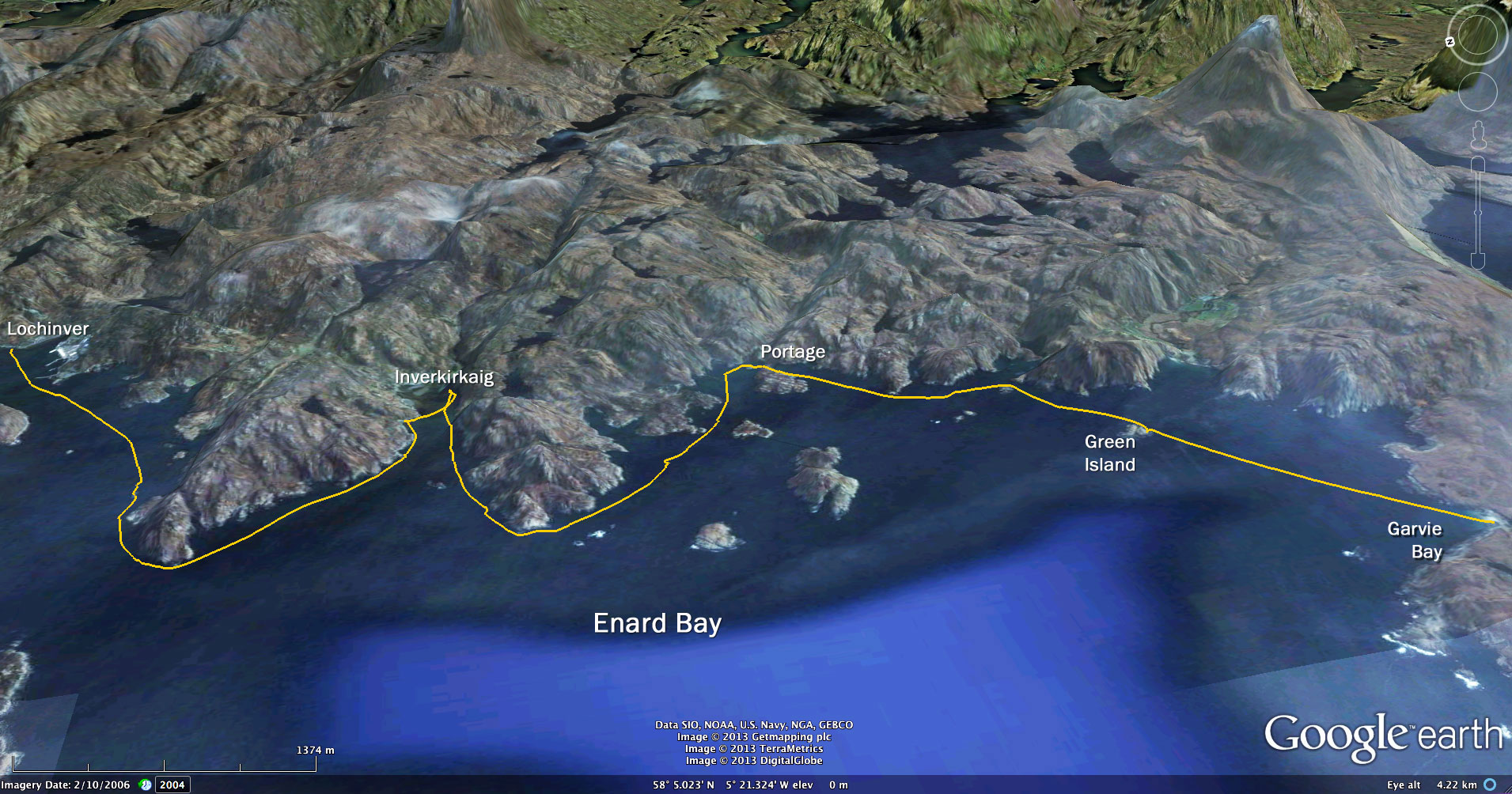
I set off from Achnahaird thinking I’ve left it a bit late. I must get to Rubha Coigach – the northern prow of the Coigach peninsula – by 11.40 BST or my kayak will turn into a sea pumpkin and my paddle into a wicker broomstick.
I was reversing Route #25 from the Scottish Sea Kayaking guidebook, a ‘Grade B’, (C being the hardest). And although spring tides were kicking off next day, the forecast was for very light winds and a warm sunny day; a good day to try and ‘turn the point’. Knowing that capes and headlands can be hairy places, I’d given this local ‘Cape Wrath’ a wide berth, but current conditions could not have been more benign. So for once I RTFM closely and decoded the perplexing tidal calculations of when not to be seen dead in a bloat at Rubha Coigach, the headland of Rubha Mor. The red period started at 11.40 which didn’t quite make sense in respect to slack water, but tidemaster and experienced NW Scottish sea kayaker Gael confirmed my calcs. I wasn’t going to argue.
It’s about 3.5 miles from Achnahaird northwest to the tip, and as I paddled along I tried to visualise possible scenarios. What unpredicted Corrywrecken-like horrors awaited me up there if I strayed into the red zone and got caught in a frothing maelstrom of lashing foam and bruised fish? A north-easterly breeze pressed in from the right and a gentle swell lifted the boat pleasantly. Up ahead white foam was periodically slapped off low rocky shelves, but it was nothing I couldn’t handle, and it was easy enough to turn back. I neared the jumbled cliffs which we’d walked to a few weeks earlier (some pics here from then), knowing that whatever it’s like now, it’ll be different once I got round the corner. And I was right.
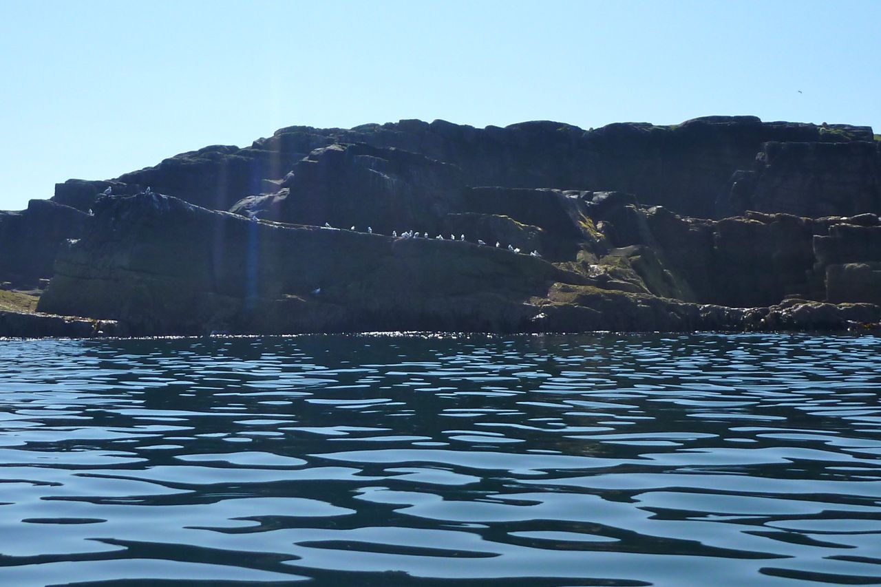
On turning Rubha Coigach the chop dropped right away and I entered a windless Caribbean calm, divided by a hazy line far to the west blurring sea from sky. Lined up along a ledge to my left, a welcoming committee of seabirds nodded approvingly then waved me on with oily wings, pointing insistently at their watches. You don’t want to be here at 16.36 tomorrow, sunshine.
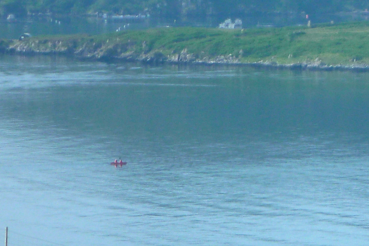
I could afford to take my foot off the pedal now, but cut across Faochag Bay anyway; up ahead what I thought was a cluster of bobbing gannets miraged into a party of a dozen sea kayaks (left), presumably being guided round to Achnahaird by one of the local outfitters. That was more kayakers than I’d seen here in six weeks or more. The amazing weekend weather had brought them all out likes midges.
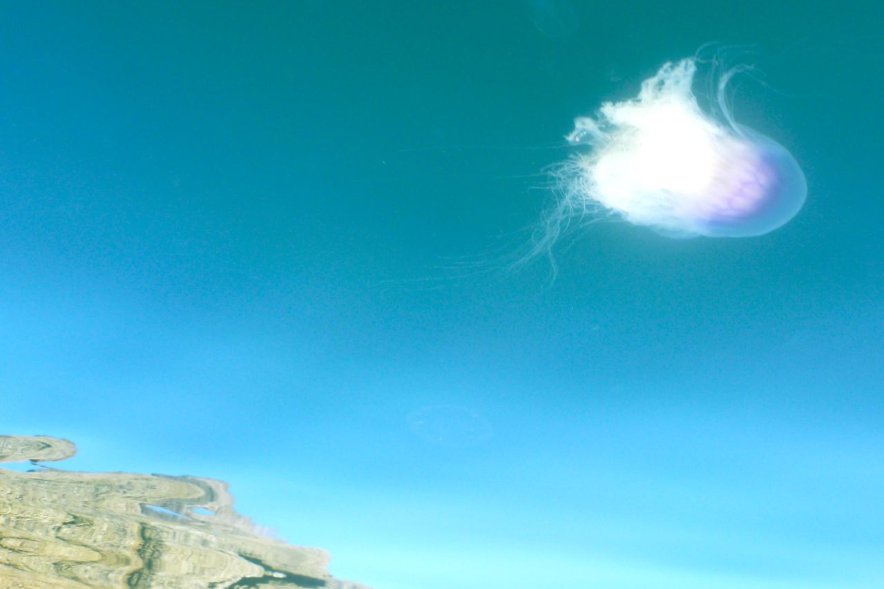
Like yesterday across Enard Bay, the land kept what breeze there was off the sea making a surface as smooth as polished bronze. Beneath that, at least half a dozen varieties of jellyfish morphed and drifted weightlessly like organic spaceships. I’d never seen so many here; do jellyfish spawn? I was intending to keep going after Reiff where Route #25 started, so before I got there I turned in at Camas Eilean Ghilais bay and an unknown sandy beach. Unfortunately, a lone sunbathing couple sent out bad vibes, so knowing that feeling, I moved on following a quick look around. There were plenty more secluded spots I could reach that most couldn’t.
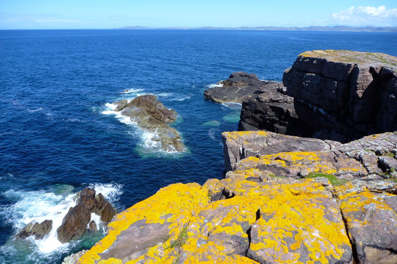
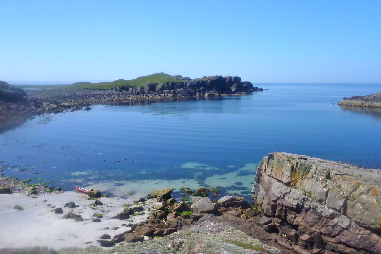
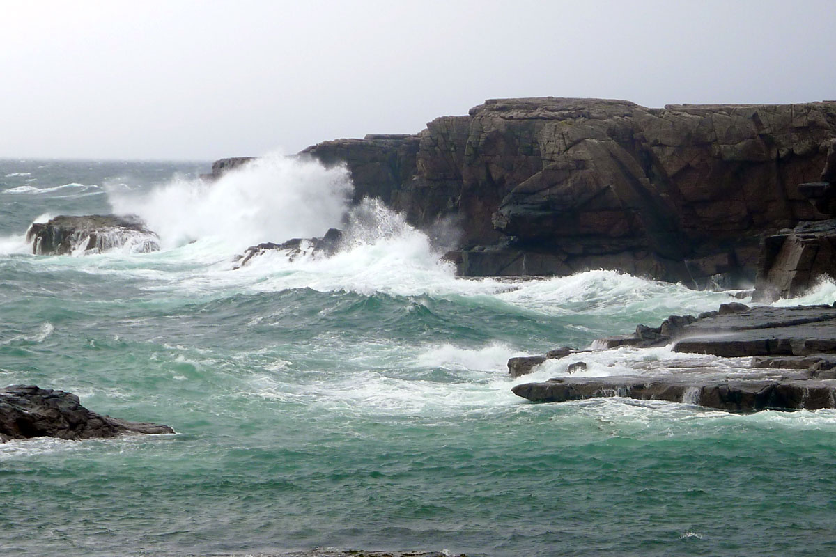
Just south of here are some crags popular with rock climbers and a few were out today. I also knew this was a great place to watch Atlantic storms beating against the same cliffs (left), although today was as calm as an atoll. The low reefs at Reiff which the SSK guidebook warned about were easy to miss and the sandy seabed off Reiff beach itself (below) maintained the tropical theme.
I was hoping to get up the tidal channel that led under the bridge into the Loch of Reiff. The loch holds water once the tide drops and I’ve been on the bridge at a spring tide with the water rushing in to top up the loch, making a fun-looking horizontal version of a Medway chute. But today I needed at least two more metres of water to get into the loch; a portage looked like too much work.
Just as I was thinking I must come back to shoot the chute in the packraft, one of the R-clips holding the Amigo’s backrest bar in place gave way and fell in the drink. So after lunch I wandered up to a sheep fence and broke off a bit of stray wire to replace the missing pin. That Grabner seat bar is reaching the end of its probation. I suppose the problem is I inadvertently treat it like a fabric IK seat, leaning back to pull out the thigh straps or adjust the seat base. Doing so bends the bar slightly and alloy can only be bent back so many times. Rigid objects attached to an IK (including a skeg) don’t work so well. I’ve a strap-based alternative in the works which will doubtless appear on the Grabner Mods page.
I trickled on down the unknown shoreline from Reiff to Althandu, nosing into geos crammed with yet more jellyfish, and then headed across to Old Dornie harbour. Other IK-ers and canoes were fanning out from the campsite, enjoying the sunny weekend, but by the time I got into the harbour with 10 miles behind me I was beginning to feel it. Over a forgotten Snickers bar I pondered over heading out to the Summers for a look around.
The breeze had now turned to the southwest, running with the incoming tide although it was still flat enough to roam. I headed out towards Tanera Beg, but about halfway across admitted that the anticipated sugar rush wasn’t happening. I’d had a great day out, ticked off the feared headland and found some nice places to revisit, so headed for Badentarbet. As I did so I noticed the occasional 10mph gust was pushing the back round; not quite enough to require double ‘correcting’ stroke, but noticeable. Add some swell, waves and more wind and the stern would get pushed offline for sure, but then that’s IKs for you. Not a suitable craft for very windy conditions at sea, although a deeper skeg (old-style Gumotex) and a full payload might minimise this weathercocking. To make up for my sloth and with a Cadbury’s power surge coming on, I had nothing to lose by hammering away at the last half mile, hoping to crack the 5 mph barrier. But that wasn’t happening either; 4.9 was the best I could wrench from my strangled paddles. Today’s tally: 13.1 miles in about 5 hours and a moving average of 3.2 mph. On the beach I hauled the Grabner over to the freshwater pool for a rinse and called in the taxi.
The heatwave which we hear has been tormenting the southerners finally crept onto the Coigach last weekend, like an overdue dog looking for its dinner. Warm, sunny and no wind. Hallelui-yay!
I planned to diligently hug the coast east round to Polly Bay were the Polly river drained Sionasgaig Loch, a fun stage which I packrafted last year. But once I actually got out on the water Green Island looked a doable 2km across mackerel-infested water rippled by an easterly breeze, so I took the direct line with wavelets slapping at my boat.
This was my first long solo run in the Amigo and initially, the usual neuroses bobbed to the surface: ‘must get a paddle leash’; ‘what if fish farm toxins have caused mackerel to mutate into piranhas’… and so on. In fact, the biggest problem was the heat. I’d put in already dripping from the walk to the beach and would stay like that for most of the day. They’d forecast a pleasant 21 but I’d guess it got well over 25.
By the time I pulled alongside Green Island I’d calmed down enough to spare time for a quick look around. Finding a place to get out elegantly without slithering across a web of slimy boulder-covered seaweed was tricky, so I jammed the Amigo up a barnacle-covered slot and stumbled ashore.
These tiny, uninhabited and unsheeped islands preserve a unique ecology, or at least a distinct botany that makes them look different to the mainland. I climbed over the sooty lichen rocks into the sweeping grass and wildflowers, causing an avian scramble, and a few minutes later planted a footprint on the 20-metre summit. I looked all around and as before, imagine Newfoundland was like this, a wild, windswept panorama under a pale northern sky with a surrounding coastline ground down by long-extinct ice caps. To the east was a sandy beach at Polly Bay – one for next time – with Suilven rising behind. In the other direction was Rubha Coigach which I was also eyeing up as a paddle during this calm spell. Heading back to the boat (‘what if it’s drifted off…?’) I came across a lone pink Croc flung into the grass during an especially violent winter storm.
I headed for the mainland, squeezing between an islet to what looked like a dormant fish farm above Rubha Phollaidgh (‘Dun’ on the map). We’d cycled to this point a couple of weeks ago, following the private road past Inverpolly Lodge which controls the freshwater loch fishing around here. Pushbiking seemed safely innocuous, but you’re never quite sure if some irate ghillie in a tartan strop will come after you. I’ve read of kayakers getting aggro for trying to put in at that bay.
As I left the bay something felt wrong, had I caught some weed in the skeg, was the boat going flat or a current suddenly against me? There was no sensation of speed as I clawed at the water although I was moving. I checked the GPS – 4mph, good enough. It seems the 4mph breeze was now directly behind me and I was paddling in a bubble of perfectly still air – never noticed that before. I became uncomfortably hot and soon began pouring with sweat; the insulating pfd didn’t help. On a day like today adapting the pfd to hold a 2-litre bladder loaded with Nuun tablets was a good idea, but it reminded me how much more satisfying it always felt paddling into a wind, even if you weren’t going so fast.
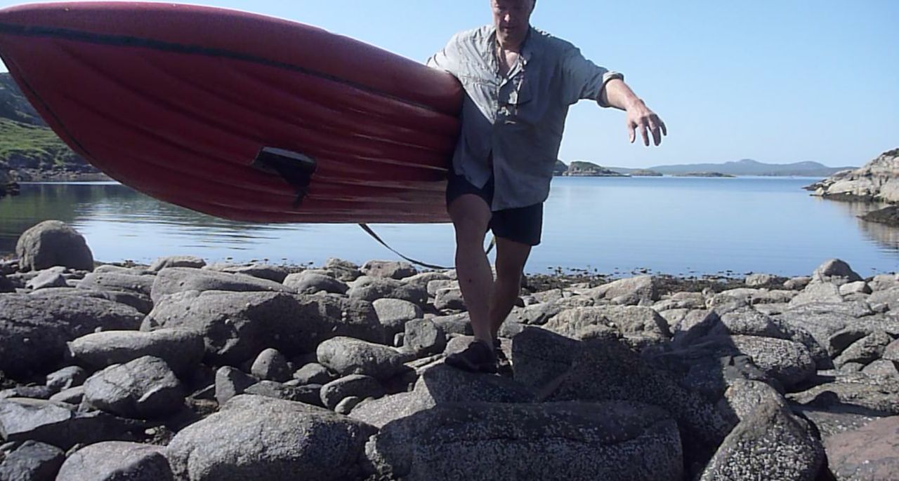
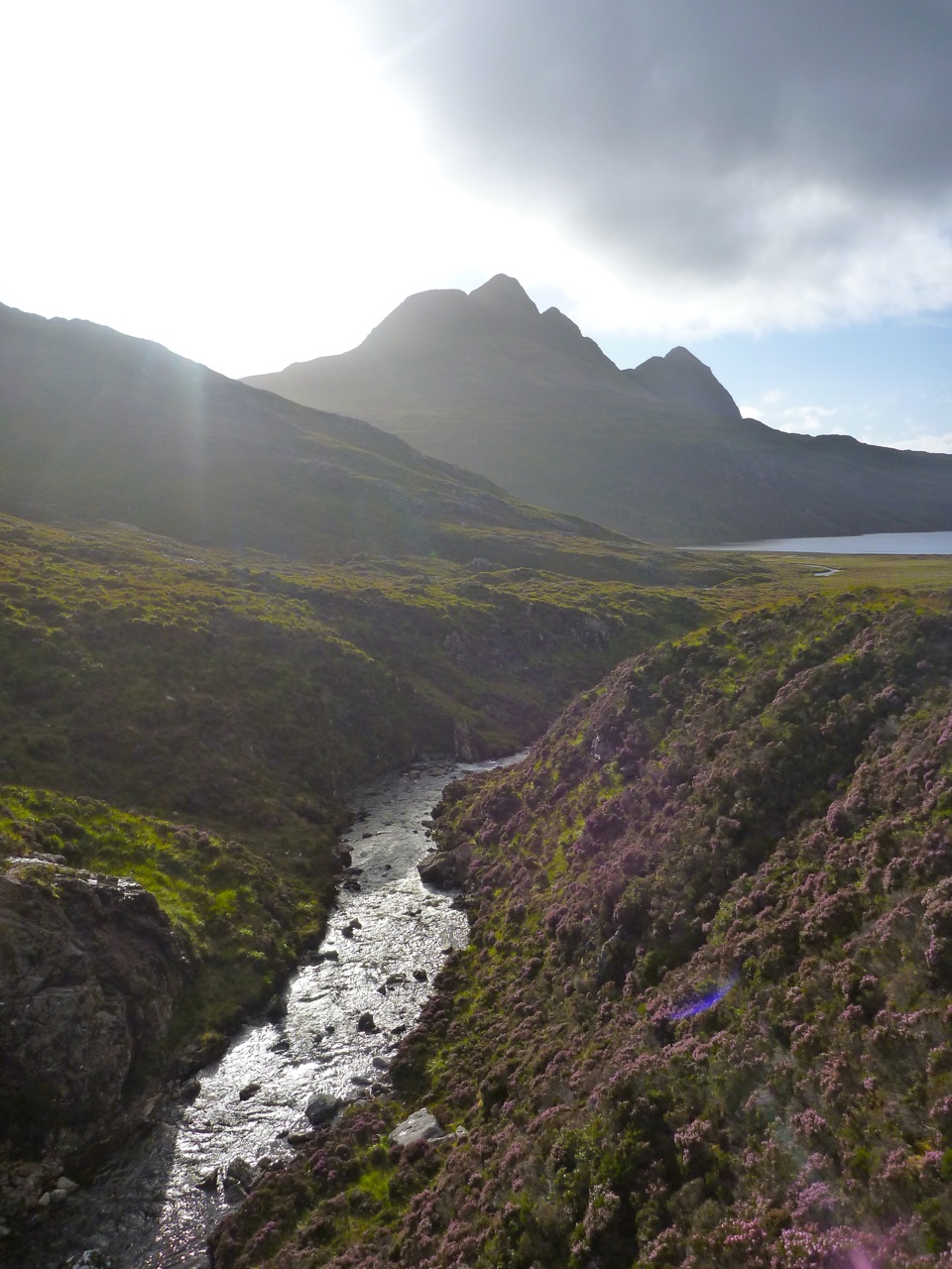
The single-track WMR comes right down to the sea at a bay known as Loch an Eisg Brachaigh. When driving or cycling by I’d long wanted an excuse to splash a paddle around here; it looked like a magical sheltered place. From the south the map showed a short cut into the bay over an isthmus linking the tidal isle of Rubha Bhrocaire. Had I arrived at high water I might just have scraped over with a few inches to spare. As it was, my timing was right off, but a wee portage (right) is always good for the legs and the bladder.
I plopped around the bay’s islets, scaring a seal that may have been a glistening mermaid just moments earlier. I seemed to be making better time than expected, too. Closer to the shore I was in the lee of the breeze and gliding over a flat calm. But it sure was hot and my eyes were permanently stinging with sweat which I presumed a sea wash would do little to alleviate. North of here the rocky, cove-riddled shore lead round to another deep inlet; the hamlet of Inverkirkaig on the WMR. A short, steep river ends here, running off Fionn Loch below Suilven and another great packrafting excursion, although the river itself seems usually too boney to packraft for more than a short distance.
Less than two-and-a-half hours from Garvie, I paddled in at low water where I found it was too much of an ankle-twisting bother to get to the distant shore and a bench. All around was manky seaweed so I satisfied myself with a desalinating rinse in the estuary and headed back out for lunch on a sandy beach on the north side. Refuelled, I decided sod this pfd, I’m as likely to drown in my own sweat and the RNLI would be stretched to the limit on a day like today. So I stripped off and cooled right down. At the rate I was going I was looking good to meet the Mrs passing through Lochinver at 3pm and turned Kirkaig Point for the final 2.5 miles into Lochinver seafront.
On the way in I got a striking view of Quinaig mountain (on the left) which rises over 800m like the rim of a crater behind Lochinver town. (A couple of days later we walked the three summits of Quinaig – definitely one of the best of the Assynt mountains.) And south of that was the reliable dome of Suilven behind Strathan hamlet, also a great climb as is well known. Past the harbour and marina and the baronial Victorian edifice of the Culag Hotel which had the misfortune to have an ugly fish factory built right in front of it. There are more nice old pics of Lochinver here.
So there we have it. Calm conditions or perhaps a pessimistic estimate meant I got to Lochinver at 2.10, just 4.5 hours from put in. The GPS logged 3.5 paddling hours and a 3.1 mph moving average over 11 miles. Peak speed was an unnoticed 4.6 coming in with the tide into Lochinver. In fact that compares well with the only other long run I’ve done here: Ullapool run, though that was into the wind at times and clocked up 15 miles.
Conditions this time couldn’t have been easier; it’s so often windy up here compared to just 60 miles down the coast in the vicinity of Skye. I felt like I could have paddled any open crossing that day and so Enard Bay proved a bit of an anticlimax. The Amigo didn’t feel especially slow or tiring to paddle just because it’s not a K40, and so now I have a better idea of what the Grabner can manage in a day.
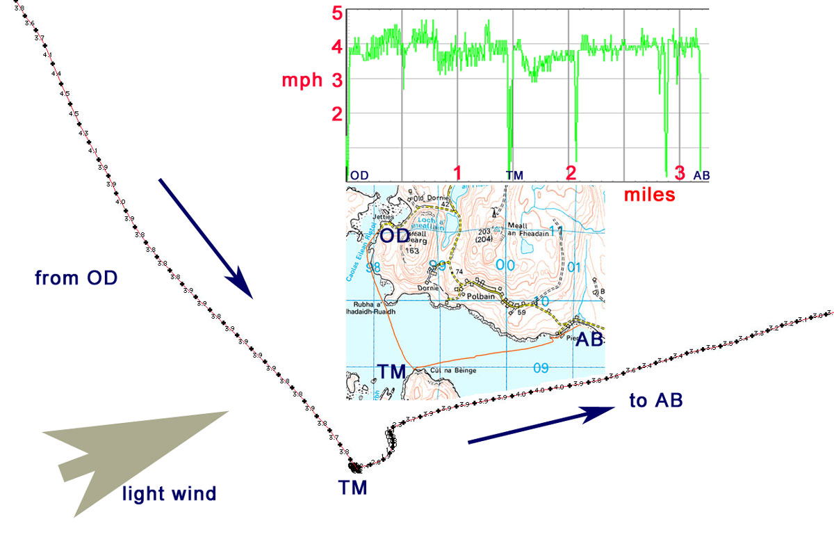
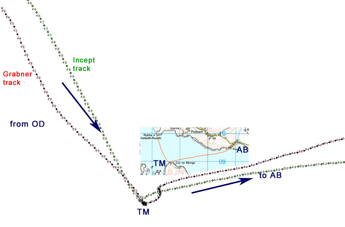
A couple of years ago I did a speed test on my then-new Incept K40 over three and a bit miles from Old Dornie to Badentarbet beach via Tanera Mor island.
I recall setting out flat-out on a cool, calm evening, cruising hard close to 5mph at times, with a burst after a rest up to 5.2, after which my energy levels tailed right off because I was well and truly pooped. I recently decided to replicate that route in similarly calm conditions and see how my new Grabner compared.
Prior to that we were out yesterday in windier and choppier conditions when, with a 10-15mph back wind I averaged about 4mph with a burst up to 5.3. Coming back into the wind we decided to try the Amigo two-up, as it only requires the front backrest moving forward. Towing the Solar together we managed a steady and sustainable 3mph with a burst of 3.8 into the stiff breeze. And on a quick spell downwind we got up to 4.8mph. It’ll be interesting to see what we can manage two-up when not towing a kayak
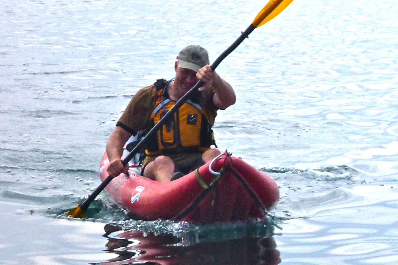
Though twice the weight of the g’f, I sat in the front and got pretty wet from the chop, but up here found the Amigo’s narrowed beam and lack of annoying finger-snagging seat lugs made paddling easier, even without a footrest to brace off. We seemed to clash paddles less than the last time we did two-up in the Sunny on the Vezere in France. Perhaps there’s more space between the seats in the Amigo even though it’s overall 10cm shorter than a Sunny.
As it happens once back on the beach, a French couple in a motorhome were drying off their Gumotex Solar 410C. They’d also been put off from exploring the Summer Isles by the offshore wind. They set out this morning and I see that the two seats do look quite close (ropey photo at max zoom on the right). I mention this because, as a reminder, I rate my discontinued Grabner Amigo as very similar to Gumo’s Solar 410C (see table below). Main difference is more pressure in my Amigo make it a stiffer and probably faster boat – but at twice the price of the Solar while you can still buy it. Back to the speed comparison test. Today was a calm day with a light wind from the southwest and when I set off the tide just beginning to ebb.
I’m getting accustomed to the thigh straps and the homemade footrest is great. Pulling inwards with the knees to brace off the straps and so transmit more power in the stroke isn’t something I could do for too long, I decided. I think the straps are more useful for last-ditch bracing against tipping in rough seas or rapids. But even then, allied with the footrest they do help connect you as well as you can be in an open-decked IK. Yesterday I’d found the backrest made my back hurt, perhaps because I have those footrests to push off. I’m still not convinced by this rigid backrest arrangement anyway. The cut-down packraft seat is fine (while it lasts) but that bar keeps disengaging from the rubber lugs (since fixed) and I think I’ve already bent it just be leaning too hard while moving about. It won’t be too hard to either get a thicker-gauge backrest bar made or dispense with it altogether and fit something like an Incept blow-up seat using the current lugs (although I see from what I thought here that maybe that’s not the answer). And as mentioned, those forward lugs painfully snag my fingers every once in a while.
Anyway, with barely a break I belted across to Tanera as fast as I could, leaning on a bit of karrimat taped to the seat back which did the trick. I averaged just under 4mph where the Incept had managed about 4.6. That’s also the top speed I clocked in a flat-out burst in the Grabner just before reaching the island, although on both occasions this sort of effort was not sustainable.
On the second leg back to the beach I had a light wind behind me but as I neared the pier I thought I could feel the pull of the outgoing tide. Unlike in the Incept, my energy and speed didn’t drop off much as I approached the beach and I got across at what felt like an all-day sustainable 3.8, with some spells recorded at up to 4.5mph without trying.
What the heck does it all mean? Well, it’s the not-so-startling revelation that the slimmer and two-foot longer Incept K40 was indeed a faster IK than the Grabner (two tracks overlaid on the left). Overall the Grabner is around 20% slower than the Incept.
At times at sea or on near-still rivers I do feel like I’m pushing the wide-nosed Grabner like a packraft. That’s another benefit of twin-side tubes, I now realise: a sharper bow is formed, as found on Grabner’s Holiday models too. On the right you can see that’s more plough than bow and must add up to a more effort over a long day, limiting compatibility with hard-shells for full-day runs like this.
And look at that wake I recall forming a similar conjecture (picture) about how the Sunny ruffled the water when compared to a hardshell’s sculpted bow. Or indeed look again at the Incept’s moderate wake at the top of the page. But then this is all for flatwater operations. In a swift river like those of the <a class="wp-gallery mceItem" style="color: #000000;" title="Kayaking and packrafting in southern France Massif I’m sure the shorter Amigo will be easier to handle than a K40 and so the compromise stands. It’s just that up here the best paddling is in the sea. Surprisingly I don’t miss the Incept’s rudder, having spent years in skeg-only IKs before getting the Incept.
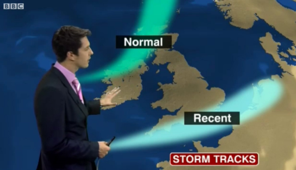
In 2011 I met Gael after he ran out of time and weather to complete the second stage of the Scottish Sea Kayak Trail he started in 2010 in his Grabner H2. According to the guy who wrote the guidebook, the SSKT is a 500-km run through the Inner Hebrides from the Isle of Gigha off the Kintyre peninsula to the Summer Isles, but with no shoreside infrastructure as such, most just follow their nose with the book’s help. In 2012 Gael returned to Skye for another go, now in the ex-demo Incept K40 be picked up from Sea Kayak Oban. In March that year Scotland experienced some very fine weather while England got the converse – a result of a misplaced jet stream (right). And so it was for Gael who managed a comparatively trouble-free run all the way to Ullapool where he rolled up his boat and bussed back to his car on Skye.
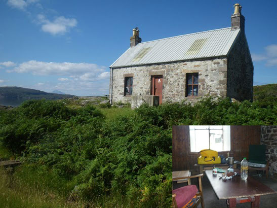
Day 1 – Kyleakin to Uags The trip began rather badly. I arrived around midnight in Kyleakin after an interminable drive from Paris with an exhausting final crossing through the Highlands mostly in the rain. I set up my tent quickly on the grass by the hostel’s backyard. Once in my sleeping bag, I fell asleep right away, lulled by the pounding of rain on the canvas and the rustle of leaves in the wind gusts. Early next morning I woke up with my feet feeling cold and wet; during my deep slumber I’d pushed them under the edge of the tent. Fortunately, my sleeping bag fill is synthetic and the nylon shell water repellent enough and with relief I found it was still dry inside. The ground all around was drenched and I could now test the effectiveness of my new Seal Skinz socks. It was still raining, so I donned my foul weather gear right away before proceeding with the usual pre-launch routine (inflate kayak, rig the accessories, sort food and equipment before closing the bags). Like last year I went to Kyle of Lochalsh Police Station to report my departure, then to the Co-op to stock up on McEwans in case I got shipwrecked.
Early in the afternoon, after a quick snack, I launched in Otter Pond by the Skye bridge. A fresh easterly was blowing out of the Loch against the flowing tide, raising the inevitable chop. I crossed the channel towards Kyle, then let myself be blown under the Skye bridge, leaving Eilean Ban to port. I paddled to Erbusaig Bay through the relatively sheltered Black Islands but decided not to proceed directly to Uags under the current crosswinds. Instead, I hugged the coast upwind towards An Dubh Aird from which the crossing would be much shorter. After vain attempts to take a picture of the two little otters which turned around me, I left the lee of An Dubh Aird and rushed towards the south coast of the Applecross peninsula. Two-thirds of the distance into the crossing I bore away and took a direct course to Uags, pushed at speed down the wind blowing along the axis of Loch Carron. Sadly I couldn’t surf the best waves though because the stern was too heavy with the beer. I landed around 6pm in Uags, and moved into the empty bothy.
Once installed, I hung my tent and sleeping bag to dry, then I rewarded myself this interesting first step with a hot tea and a thick slice of chocolate cake. Outside rain was still pounding.
Day 2 – Uags to Red Point I woke up at dawn feeling numb as my old foam sleeping pad had been of little comfort on the floorboards. The temperature was 5°C; so much for this jet stream. I went out to stretch my body and surprised a little doe grazing in the meadow below the ruined Uags hamlet. It scampered away before I could fetch my camera (this is a double entrendre called ‘lacking reflex’). But – it had stopped raining, the air was clear and visibility was excellent. The snow-capped peaks of the Cuillins stood out beautifully against the sky (below left) but the chill air from the northeast soon sent me back inside.
Once on the way from Uags an unexpected SE tailwind pushed me gently toward Sgeir Shalash but the breeze then turned NE, as expected. In the protected lee of the shore I paddled on north without difficulty, up to Camusteel, but when I reached the mouth of Applecross Bay, I had to fight against the wind. It funneled unhindered along the valley, whipping up the waters and raising an uncomfortable chop, until I reached some shelter in the lee of Rubha na Guailne. From there the long way north to Loch Torridon seemed a never-ending trudge. The wind had picked up to the point of pushing me hard offshore whenever I got 50 meters from the shore. I kept hugging the coast, despite the uncomfortable chop and the occasional breakers, because the wind was shifting SE, thus pushing me northward. When I eventually passed Rubha na Fearna I found myself facing the wind blowing right out of the Loch.
Loch Torridon greeted me with one of its customary gusts of which I’d had the humiliating experience the year before. I took shelter as soon as I could in a tiny cove hidden behind a natural breakwater. I badly needed a feed. After a snack and some rest, I pushed off to cross the Loch. I paddled a mile inland to gain an upwind margin of safety then I headed north. Wedged into the seat, with my legs holding tight on the thigh straps and squeezing the footrest, I blithely crossed the choppy zone, kept an eye on the most threatening peaking waves and checked off some landmarks in transit which I used to control my leeward drift with the other eye while admiring the spectacular scenery of the mountains towering over Loch Torridon (yes, all at once).
I returned to quiet water in the lee of the north shore, laid the paddle across the boat and started bailing. My open decked Incept kayak had ridden well on the waves but had shipped a fair share of water which was now swashing in the bilge. I pulled ashore in the early evening on a beautiful beach near Red Point.
The ebbing tide had just retreated beyond the tombolo that connects Eilean Tioram islet to the mainland, thus forming a placid lagoon. Some cows and sheep were grazing in the dunes undulating behind the beach. I pitched my tent in a hollow, barely sheltered from the chill NE breeze and crashed out.
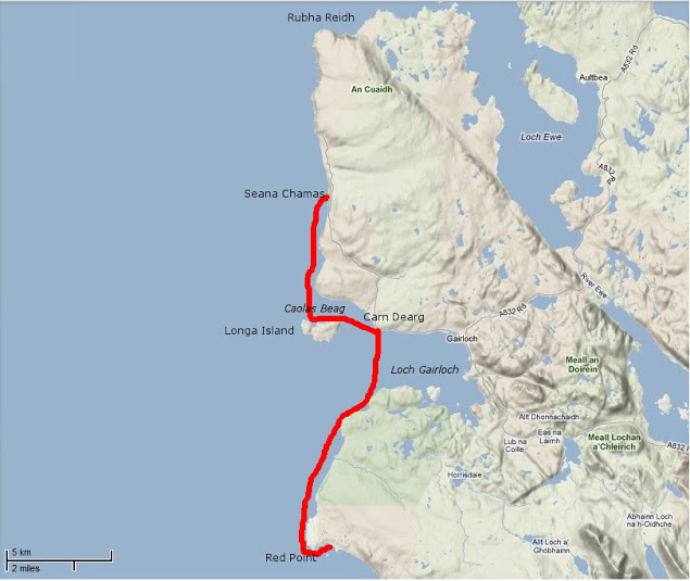
Day 3 – Red Point to Slaggan Bay The night had been cold but the clear morning sky made me hope for a warmer day. When I shoved off I didn’t know that I was about to enjoy one of the most beautiful days of my paddling life. Passing Red Point I noticed with satisfaction there was almost no swell. For once I wouldn’t be shaken by the rebounding waves and could explore the nooks and crannies of this craggy coast.
The sky became overcast and the NE wind picked up as I approached Loch Gairloch. The temperature dropped rapidly and I paddled more vigorously towards Carn Deag in an attempt to stay warm. I made a brief stop on the beach at Big Sand (left) but the chill breeze urged me on. I passed downwind along Longa Island with the hope of discovering a sheltered cove for lunch but found none. I then went on across Caol Beag, passed Rubha Ban and kept paddling north with my stomach gurgling. The beauty of the coast was worth the inconvenience of being cold, numb and hungry; huge sections of sandstone cliffs that had fallen in the sea provided an extraordinary maze of narrow passages that I enjoyed threading through. Erosion had also cut multiple geos and caves also worth exploring (I didn’t know what a geo was before reading the SSKT guidebook). I eventually reached Seana Chamas beach, largely uncovered by the outgoing tide and where I landed and dragged my kayak a few yards on a carpet of seaweed.
The sea was empty except for birds and a view that stretched westward to the Outer Hebrides. The Shiant Islands were clearly visible, standing out like a motionless line of battleships. I finished my lunch just as the tide returned up to my boat. The sky began clearing as I left and when I got past Melvaig all around me glistened under the sun.
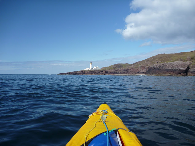
After half a mile of boulders the coast turned to sandstone crumbling cliffs again and I could resume prowling in and out of caves and geos under the bright light of this sunny afternoon. Quite suddenly behind another headland appeared – the dreaded Rubha Reidh and its striking white lighthouse. I felt the mid-tide current pick up as it dragged me over to the other side of the promontory. The whitecaps of a faster tide rip were visible out to sea but right under the lighthouse the sea was rippling gently against the reddish rocks. One of the most exposed stages on this route passed without event.
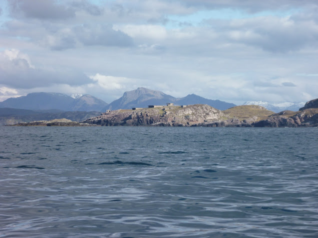
The NE wind that had been blowing since I left Kyleakin had dropped too, but there was still some swell from the north, preventing me from sneaking through the rocky labyrinth that stretched between Rubha Reidh and the beautiful beach of Camas Mor. Beyond Rubha Reid to the east the extraordinary snow-capped skyline of the Wester Ross mountain range rose from the horizon (left). Put in a trance by this sight, I carried on on an eastward course and arrived at Caolas an Fhuraidh. I took stock at the mouth of Loch Ewe before an exposed 4km crossing over to Slaggan Bay. To the SE lay Rubha nan Sasan still with it’s WWII bunkers and gun emplacements. At that time Loch Ewe had been the starting point for many Russia-bound convoys and a haven for Allied shipping. There’s still a NATO base there today. As I paddled to Ploc an t-Slagain I hoped I’d not be rammed by a nuclear submarine entering or leaving Loch Ewe; I’d read reports elsewhere in the Hebrides of these subs rising so fast the resulting wash tipped sea kayaks bow over stern. I reached Slaggan Bay at 7pm finding another perfect landing place, a crescent of fine sand surrounded by empty dunes.
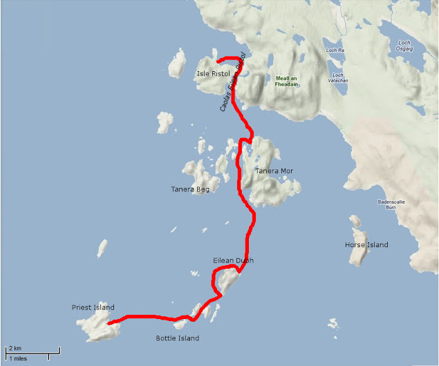
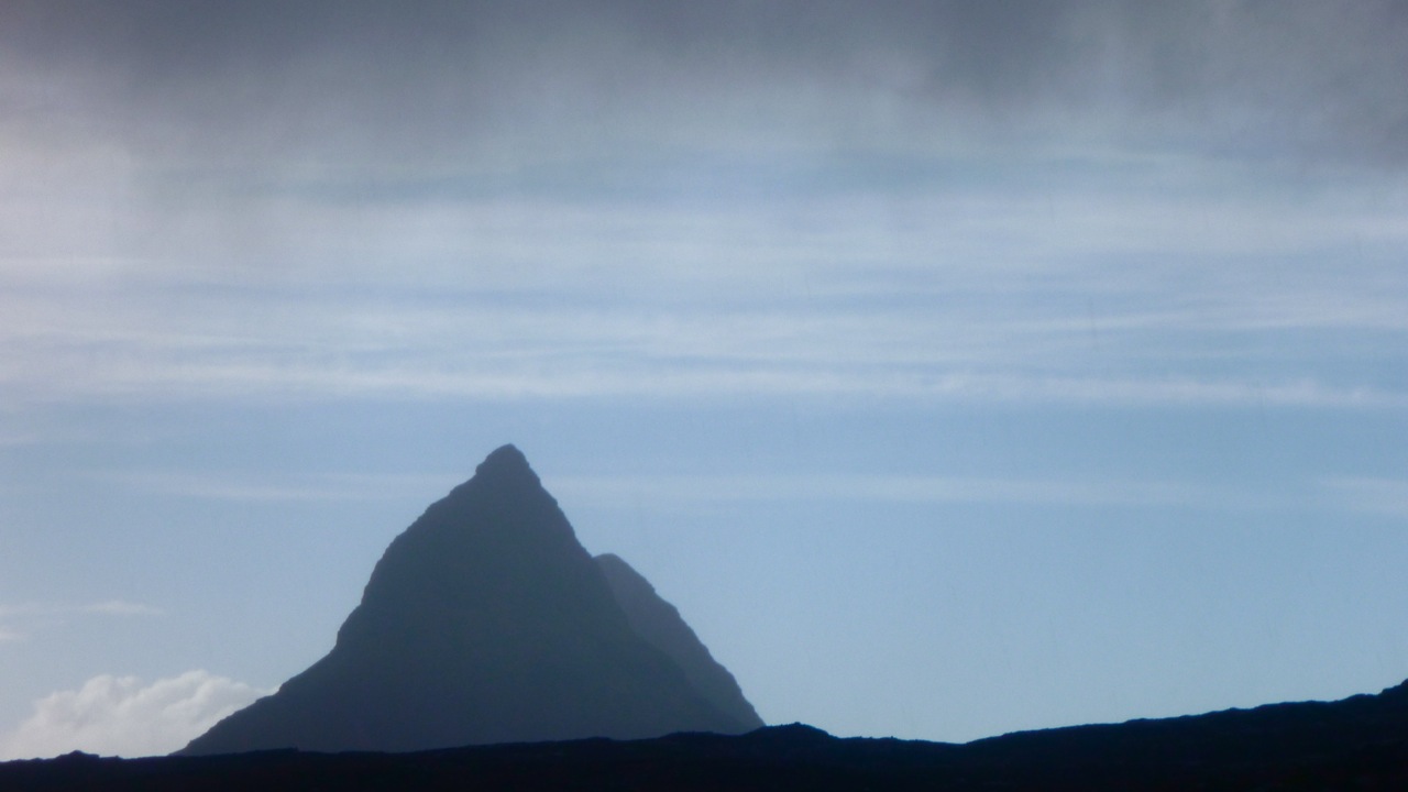
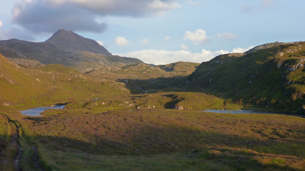
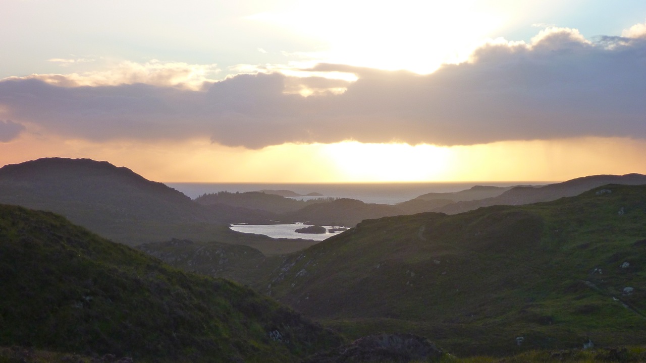
Day 4 – Slaggan Bay to Isle Ristol Under ideal paddling conditions I hugged the coast towards Greenstone Point, the last critical passage of the SSKT. The Point was flat and bare and proved even less dramatic than Rubha Reidh, although its rocky shoreline was wild and beautiful. From Greenstone I paddled on to Rubha Beag. In the distance the conspicuous peak of Ben Mor Coigach was towering over the horizon and to the NW lay a scattering of islets; the long-expected Summer Isles.
I headed towards the closest, Priest Island some 5km away. Halfway through the passage, the wind died off and the sea glassed over. The uncanny cries of the guillemots emphasized the eerie atmosphere; I felt like I was entering an unearthly space. From the SE tip of the Priest Island, I carried on around the west side. It was another paddling paradise with endless features to explore in the good company of seabirds and seals.
Once I completed this circumnavigation I paddled back to a cove called Acairseid Eilean a Chleirich (it’s quite a challenge to try to explain to other people the places I visited) where I pulled ashore onto a tiny uninviting boulder beach (left). As the afternoon progressed I uneventfully hopped through the convenient chain of islets lying between Priest Island and Tanera Mor, the biggest of the Summer Isles. I had intended to land near Althandu as I needed some of the facilities of the Port a Bhaigh campground, mostly their electrical hookups to charge the batteries, freshwater and even a shower, why not? There was also a pub close by.
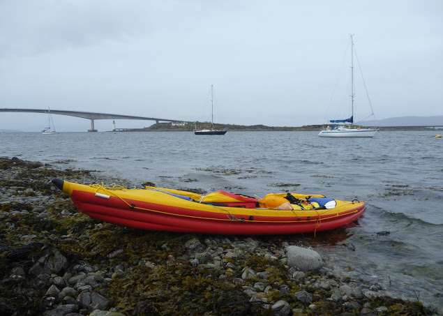
But as I paddled through Old Dornie harbour I came within sight of the campground and within earshot too. The place looked packed and was definitely too noisy. After four days of solitude with no other sounds than the sea and the birds, I couldn’t stand it. So much for the camera, shower and a beer. I swung my boat south towards the lovely nearby beach of Traigh an t-Sean Bhaile on Ristol. I pitched my tent on thick grass which promised a comfortable night and the chilly cold kept any irksome midges from hatching.
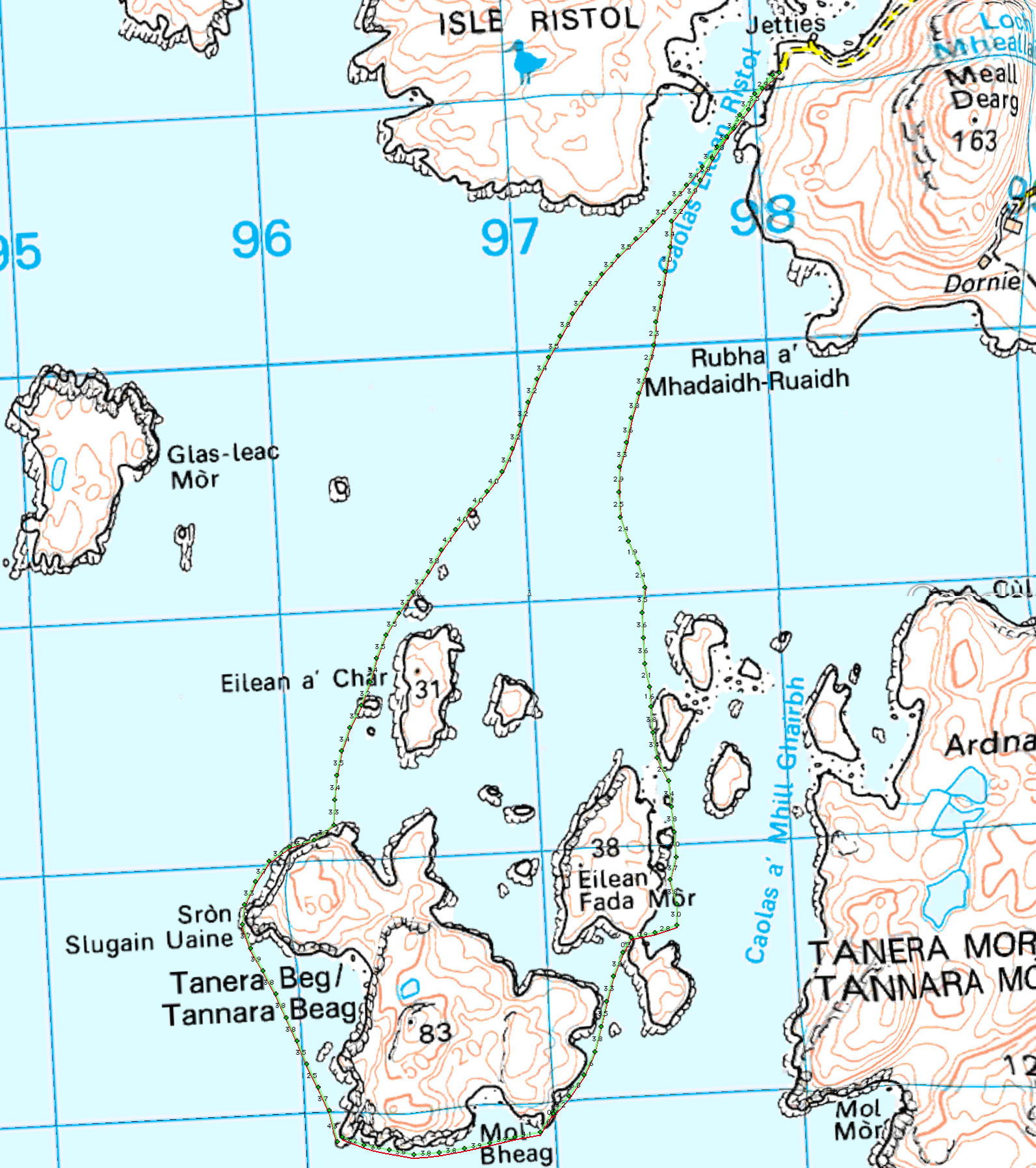
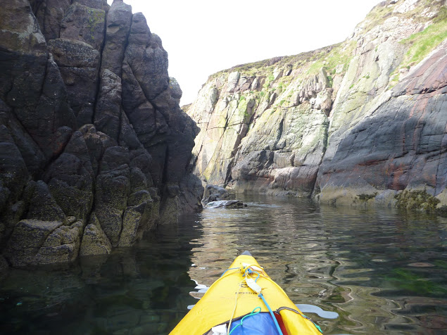
Day 5 – Exploring the Summer Isles I devoted this day to exploring the archipelago as all these islands offer the type of craggy shore most sea paddlers are looking for. The sea conditions were again at their best for squeezing through narrow channels between rocks, under arches or into caves with almost no swell and light winds. I proceeded anti-clockwise around Ristol, paddling along its west coast then circumnavigated Eilean Glas Mullagrach and Glas Leach Mor.
Shags had built their nests in the crevices of the cliffs overlooking the sea. They were not easy to spot as their colour merged with the cliff but their unmistakable angry squawks betrayed their presence above me whenever I got too close. From Glas Leach Mor (the ‘large green stone’ a good description actually) I crossed to Tanera Beag. Here I gave a wide berth to a skerry occupied by a large group of singing seals that I didn’t want to disturb. The haunting sound suited the scenery perfectly.
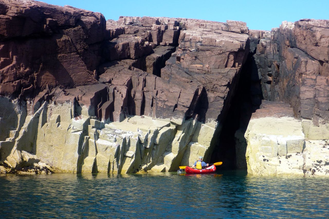
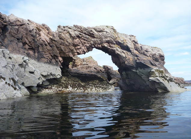
Tanera Beag is considered the most beautiful of the Summer Isles by the experts. Close to its SW corner is a cave deep enough for a tourist boat to get in and with a very high ceiling after which it’s called Cathedral Cave. Its SE corner is adorned with an elegant arch, which is another place of pilgrimage by all paddlers visiting the isles.
After completing the circumnavigation of Tanera Beag I pulled ashore for an overdue snack and a nap in a pretty little cove where the outgoing tide had left a broad sandy beach. Between Tanera Beag and Mor Eilean Fada I entered a kind of shallow lagoon of clear water. The tide was low and I saw my kayak’s shadow skip along the sandy bottom.
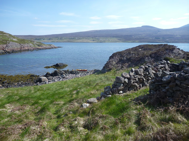
Later I landed in the Anchorage on Tanera Mor, a sheltered bay that opens to the east and filled with salmon pens. There is a floating dock for the tourist boat but the tea shop/post office where I’d intended to indulge in a brew and some piece of cake was closed. Tanera Mor (currently for sale) enjoys an offshore status which allows this tiny post office to issue its own stamps but no brew, no cake and no stamps for me today.
I hopped back in the boat and crossed the Anchorage diagonally and skirted Rubha Dubh, the east corner of the island. Here I entered a narrow cove choked with seaweed and backed with a pebble and boulder beach. High spring tides and gales had filled the depression beyond the beach thus forming a lovely pond, An Lochanach. I pulled ashore soon after two other kayakers. The guy didn’t look very happy to see me and curtly turned down my offer to help them to carry their heavily loaded sea kayaks. So I minded my own business, as I had just been advised to do. His wife came and offered remorsefully to give a hand, but I declined politely.
It had been a hot afternoon and I’d paddled without cag and without a cap for the first time in five days. But cold came back after 7pm and the Franco-Welsh relationships in the cove did not improve. Although our respective pitches were located 300 meters apart, each on one side of the beach, no invitation to share dinner was exchanged. It nice to be alone of course, but I like chatting with other paddlers too. Another time perhaps.
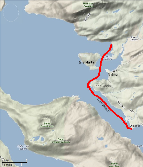
Day 6 – Tanera Mor to Ullapool On a beautiful sunny morning I headed SE towards Loch Broom and Ullapool. Sunny but cold, chilly indeed, so chilly that I had my breakfast in my sleeping bag.
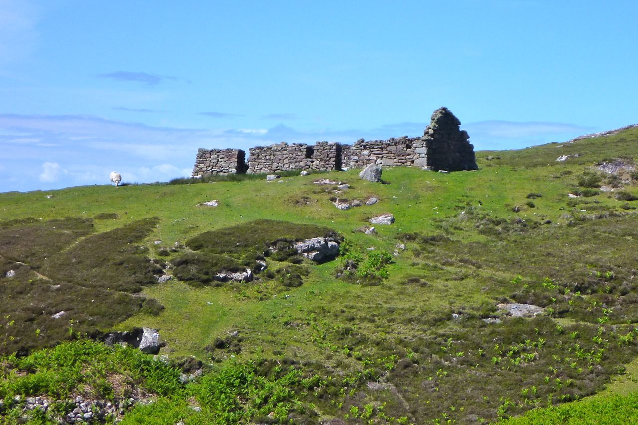
In the meantime, the wind had shifted SE so I slogged against it all the way to Horse Island. I paddled through the tidal gap which divides this island from its northern tip, Meall nan Gabhar. Once through I pulled ashore and found a very convenient pitching spot. I regretted not having carried on to this place yesterday, instead of staying next to unsympathetic paddlers. So seemed to say the half-dozen seals romping about behind me. The sky was promising some fair weather that had been a long time coming. As the breeze didn’t abate I took shelter in the lee of Acheninver. But as soon as I got past Rubha Dubh Ard I fought the headwind again until I reached the base of Ben Mor Coigach.
Then I paddled below the sheer slope of the mountain until I got to what looked like the white sands of Camas Mor beach. Actually, it’s a pebble beach facing Isle Martin and the guidebook said amethysts can be found here, but I didn’t find any. By 2 o’clock clouds covered the sky and some chill air forced me back into my cold-weather gear.
I shoved off shortly after lunch and enjoyed passing the last natural monuments of the Trail. I rounded Rubha Cadail, addressed the last salute to Ben Mor Coigach and entered Loch Broom. The wind unexpectedly veered NW and pushed me gently towards Ullapool.
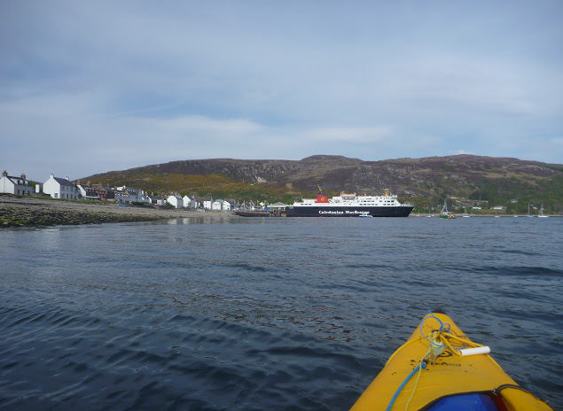
Once ashore I pitched my tent under the stares of some motorcyclists wondering where the hell I’d come from. A leather-clad fellow told me the owner was already gone and would return early next morning to collect the fee. Meanwhile, I washed the Incept to remove the grit scattered in the bilge, wiped it dry, deflated it, rolled it, and pushed it into my huge 160-l Ortlieb Kanurucksack. The K40 doesn’t fold as compactly as my good old hypalon H2 but I was relieved it crammed into the bag. I enjoyed dinner at the water’s edge overlooking at the now placid waters of Loch Broom, glowing in the satisfaction of my achievement. It has taken three years and two different boats, but I’d completed the SSKT in an inflatable sea kayak along with one of Europe’s most striking shorelines. Celebrations continued at the Ferry Boat Inn where I e-mailed friends and family, sipping some good beer, the sound of music replacing the soothing sound of the sea lapping the shore.
Ullapool to Kyleakin The weather was set to improve in the following days and I wondered whether to paddle north and round the Point of Stoer, take the ferry to Stornoway for a glimpse of the Outer Hebrides, or complete the exploration of Raasay and Rona that I’d started the year before. The first two options required maps that I was not sure to find in Ullapool. and I was also missing sailing directions.
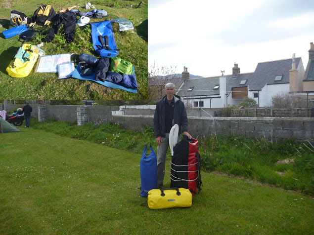
So I packed all my gear in my three-bag travelling arrangement: boat and paddling gear in the 160l Kanurucksack, camping gear and clothes in the 59l XPlorer bag, food, cooking gear, books, maps, tools and all the rest in the 49l Rackpack. The result was portable but heavy and I had a half mile walk to the bus station by the ferry terminal. Luckily the owner came by for the fee and gave me a lift. Soon we were en route to Inverness by bus; an alternative would have been leaving the bus at Garve railway station, halfway to Inverness and hopping on a train to Kyle of Lochalsh.
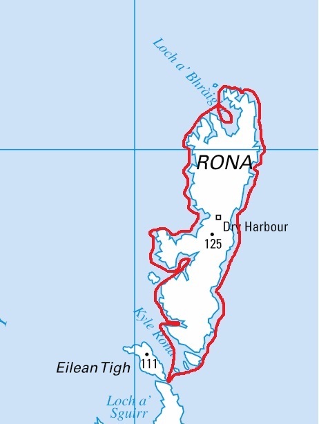
Eventually, I decided to park up in Kyleakin on Skye and undertook a very enjoyable three-day tour around Raasay and Rona. The year before I’d experienced the charms of these islands despite the unsettled weather – this time conditions were ideal. Back at the pier three days later, I was giving the Incept a wash on the slipway when a Land Rover towing a trailer full of sea kayaks turned in. A party of men got out of the truck, unloaded the kayaks and started putting paddling gear on. As they carried the boat to water they came over to say hello and asked about my boat and my trip. They were attending a kayak class beginning this very day. Their first-day program was a shakedown paddle in sheltered waters before a guided multi-day run to Sandaig. The guide joined the conversation and yet again I endured the usual hardsheller’s drivel about IKs. Ten minutes later I watched the student awkwardly clambering in their kayaks; for some of the clumsier it took quite a while. I told them they were lucky modern kayaks had such larger cockpit coamings – but not as big as mine! By the time I got to my car the temperature inside was like an oven, despite the screen I’d fixed over the windshield. My chocolate bars had melted. In northwest Scotland? Whatever next.
Don’t get excited, we’re talking a few hundred metres of Class 1.1, but that’s as good as it gets around here. We’ve had a lot of rain in the last week, enough to make the only paddleable river – the short Osgaig – worth a poke with a paddle. I was here with the Yak last year at slightly lower levels, so this time was expecting a smoother run in the Solar (now with an improved seat-foot set up), followed immediately by a comparison run in the Alpacka Yak.
Gumotex Solar IK The good thing with the Solar is it’s old, worth next to nothing but tough, so can be dragged like a hardshell with the Yak in the back. I considered jury rigging some thigh straps; it could be done now through the new footrest pipe and around the seat mounts, but looking at the river as I drove up, it wasn’t really worth it. Thigh straps are what makes any deckless boat – air-filled or hard-shelled – much more controllable when things get choppy. Even WW packrafters insist straps are the way to go.
With the skeg off, it’s easy to seal launch off a grassy bank and into the scrum just below the waterfall which looks a bit complicated so was no less inviting this year. As I spilled over the first little step I tried surfing like people do. But the Solar wasn’t especially dynamic or there wasn’t a strong enough recirculation going on to make it feel interesting. So I swung round and set off. Even at full flow, the Osgaig is a shallow, bony river better suited to an injection-molded TNP ‘spaddle’, not 220 quid’s worth of carbon-light Werner Corry which was picking up new scrapes as I jabbed at the water to keep the boat on line. It was really quite effortful with the Solar, at 3m or nearly 10 feet it’s perhaps a bit long for this sort of thing. I hit the one or two rapids full face, kicking up a satisfying splash and remembering that ‘bring it on’ exhilaration when trying an IK and white watering for the very first time on the Salmon River in Idaho all those years ago.
The river branched near the Loch; left looked all froth but too shallow so I swung right but again scrapped and shoved from one bar to the next. I was hoping to make it all the way to Loch Osgaig but up ahead I saw the tree strainer I recalled from last year so, stuck on another rock and by now steaming out of the ears in my heavy drysuit, I stepped out and walked back upriver.
Alpacka Yak Packraft A few minutes later I hopped into the snug Yak, spun round and slipped over the first drop. Spinning back, I tried to surf as I’d just done in the Sunny but it wasn’t happening. I guess the Yak is just too wide, light and too much drag to fight the flow. Off I went downstream, trying to avoid getting snagged while lining up to take the peak of what waves there were. Jammed in the yellow tub, sat lower and with higher sides, it felt much more responsive than the longer Solar and so was less effort to ride. Perhaps part of it was that a good line is less vital; most of the rapids I could have taken backwards and that added up to more fun. So there it is: a tight-fitting packraft is more fun on easy white water than a 3-metre IK. When I got snagged towards the end, I just stepped out, threw the boat ashore, and staggered out over the slimy boulders.
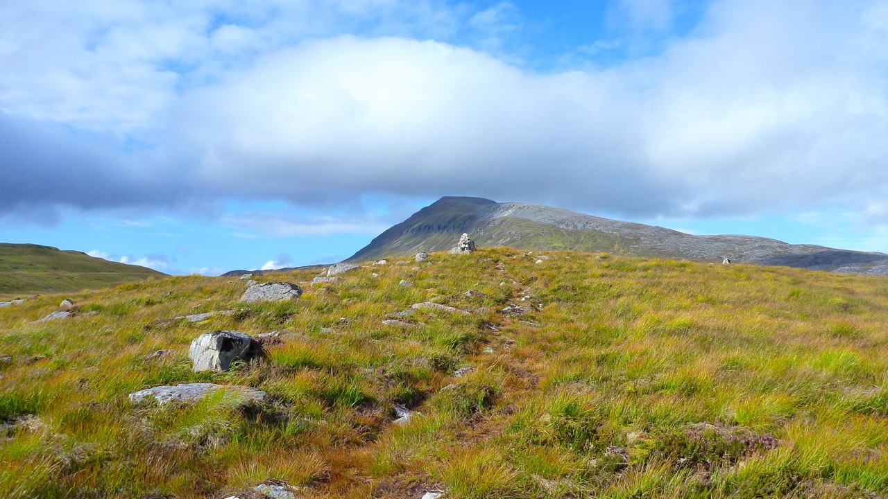
I’ve already done a couple of great packrafting excursions around the charismatic mass of Suilven mountain (left, viewed from the east). Last year we did a ‘triathlon’ loop up one side and down the other using bikes, feet and two-up in the Yak; and before that I did an overnighter from Loch Sion to have a look around. That second link has an intro to the region you may like to read.
So you’d think I’d know the local pack-potential well, but looking yet again at the map, I clocked an interesting if lengthy day out, packrafting around Suilven. I could walk east out of Inverkirkaig past the Falls to Fionn Loch, then paddle several miles of continuous water south of the mountain to cross a headland and then another short loch. From there I’d turn back passing a couple more lochs to Lochinver back on the coast. That was around 23 miles, plus another 3 or 4 back to the motorbike at Inverkirkaig. An eleven hour day for sure so unusually, I packed a torch.
The day of least bad weather arrived (today’s grim weather, right): overcast and 12°C with winds building up to 25mph bringing showers and afternoon sunshine. It would have to do; the rest of the week was forecast as much worse and at least I’d have backwinds paddling out.
Should they become hard to handle I knew I could hop ashore – that’s the great thing about packrating. But I also knew that cross country hereabouts is usually a gnarly combination of boot-sucking mires, moss-clad boulders and ankle-snapping tussocks of clump grass. Unless you’re a ground slug or sport a rack of antlers, when off piste in the trackless wilds of the far northwest, you’re often better off in a boat.
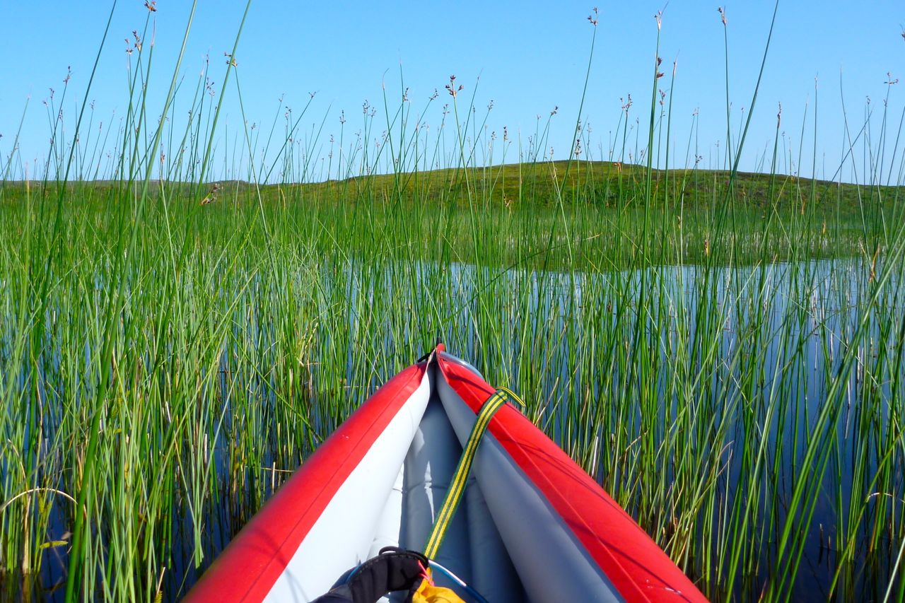
Nine 15 and I was out of Inverkirkaig with two fat sandwiches, two bananas and a cup. The thickly wooded valley with it’s not quite paddle-worthy river rose up to the 60-foot Falls of Kirkaig, but with filming and whatnot, it wasn’t till 11am that I paddled onto Fionn Loch (left) under a ceiling of thick cloud on the verge of incontinence. The rounded west prow of Suilven loomed above, trailing its cone-like tail like the giant goldfish in the Singing Ringing Tree.
I was reversing the section we paddled last year on the triathlon, and at a narrow point passed some small standing waves indicating a current flowing back to the river. Hmm, strange I thought. Approaching the mile-long narrows which maps call Uidh Fhearna, it was a stage which I’d somehow got into my head flowed eastinto Loch Veyatie, based partly on this picture I took last year. Turning south round a reedy bend and fighting what I thought was just the headwind, I took another turn and, like some astonished Victorian explorer, found the water flowing west, right at me. Of course it does. At the other end Loch Veyatie, Cam Loch drops through a series of waterfalls, and if Fionn here did the same, where did Veyatie drain – down some tectonic plug hole? There would be no Fellowship of the Royal Geographical Society for me this year.
Even with a backwind, there was no paddling up this Uidh (left), though I’ve read of hardcore canoeists poling it. So I unplugged the Yak and set off along the north bank to the far end where the Uidh opened out onto Loch Veyatie and lost its current. With no free ride to help outrun the afternoon’s predicted winds, my schedule slipped away. As the OS map shows initially, there’s a path as far as a stream a mile away. Who knows why, maybe that’s where folk fish, but of course the path itself becomes a mini river. I should have worn my long Seal Skin socks today, the short ones were already sodden but they still kept my feet warm. After fording the river I decided to continue cross country until it became too hard. That took less than 20 minutes by which time I’d already stumbled twice and, while negotiating one steep bank, actually feel a few feet into the loch! Luckily, no damage done so just up ahead I set my sites on a beach to deploy the raft. It was now 1pm and with that walk covered at around 1.5mph and getting slower; better to get on the water. But first, for amusement purposes I filmed myself from unrolling the Yak to paddling away. It took 8 minutes, something that you’ll see below is made a little less boring to watch by speeding up fifteen times.
An exposed hour’s paddle down Loch Veyatie ensued. I turned out of the cove into the wind, hurrying for the south shore to get into the southwesterly’s lee until the next narrow point where I’d cross back to the windier north side to line up for my take-out. As I passed across the mouth of the sand-spit inlet of Loch a Mhadail, gusts blasted out fetching up some whitecaps. It’s all in the mind of course, but I really don’t enjoy bobbing about alone, mid-loch and out of sight on a chilly September’s day without a drysuit or PFD. One good thing with the Animas backpack I was using for the first time was that like my UDB, it doubled as a reliable float bag. Although there was virtually nothing in it bar my lunch and a cag, that was the reason I sealed it full of air.
The overhead gloom and rising wind was eating up a lot of nervous energy, but that wind was also pushing me along at what turned out to be 3mph, more than double what I’d have managed staggering along the shore, and more direct too. Another reassuring surprise was spotting the buildings at Elphin on the A837 at the head of the Loch. I’d forgotten how close I’d be getting to the other end. Paddling with the wind past the south shore, cascades ran off Cul Mor and scraggy patches of original woodland clung to the foreshore. I counted them off on the map as markers to my take-out, and with a dash over to the north side, that came up just as it looked on Google Earth last night. What a great WYSIWYG navigation aid GE is. Let Google harvest all my dreary browsing data to throw back at me as targeted ads. It’s a price worth paying for their sat mapping services.
It was only when I crawled out of the boat and stood still that I realised how strong the wind really was, roaring over the hills and bating down the grass. Even though it was less than a mile’s walk to the other side of Creagan Mor headland, there was no chance of leaving the Yak inflated. Instinctively I headed for higher ground, scattering some deer far ahead, but my route soon led to a cliff so I dropped back into the bog and tussock valley that brought me to Cam Loch’s shore. Here I felt I could relax sufficiently to eat something. My cup was MIA, out on the loch somewhere, so I scooped up a drink by hand.
One more loch to cross; easily done no matter how windy it’s become. Somewhere on the north side the map promised a path that led 12 miles back to Lochinver. All I had to do was slot myself onto it and ride it out for as long as it took. Whitecaps rolled passed me as I neared the north shore of Loch Cam, but what had had an edge of dread on Veyatie just an hour or two ago was becoming familiar and a bit of a laugh as the promised sun stuck its nose out for a sniff at the day. After airing down I soon hooked up with the stony trail, but found I was wavering a little, probably through not eating or drinking enough. It was now 3pm; six hours on the go but I’d only actually walked some 4 miles up to that point, so the legs had plenty left in them and there was drinking water running down the paths.
On occasions I’ve harboured thoughts of cycling this path from Lochinver to the A road, but from the state of it at this end I’d not get 10 feet. It followed a hard, white rim of exposed stony rubble that’s visible on a sat image, but I suppose was better than the mush to either side. Light grey and crystalline, I’ve since read it’s Lewisian gneiss or quartzite which gives the appearance of snow to some of the Assynt’s mountains like Canisp or Foinaven (see long image below). This whole region is marked with monoliths, the most striking of course being the remnant sandstone outliers like Stac or Suilven which resisted their brush with the glacier’s claw as it passed through, exposing the ancient base of lighter coloured gneiss.
I’ve kept missing the interesting ranger-led talks at Knockan Crag, just south of Elphin, he site of the Moine Thrust which literally turned geology on its head a century ago.

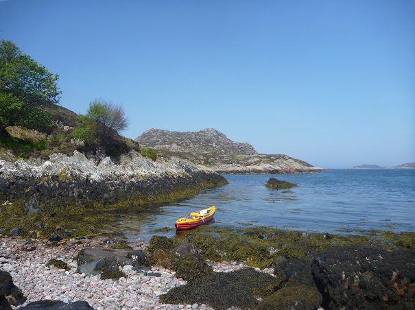
 Another calm day, another island paddled around; a quick one to Horse Island which I visited last year. On that occasion the two islands of Horse and the smaller Meall nan Gabhar were separated by a stony, seaweed-drapped causeway. Today, leaving Badentarbet beach 40 minutes after HW, I expected to paddle between the two.
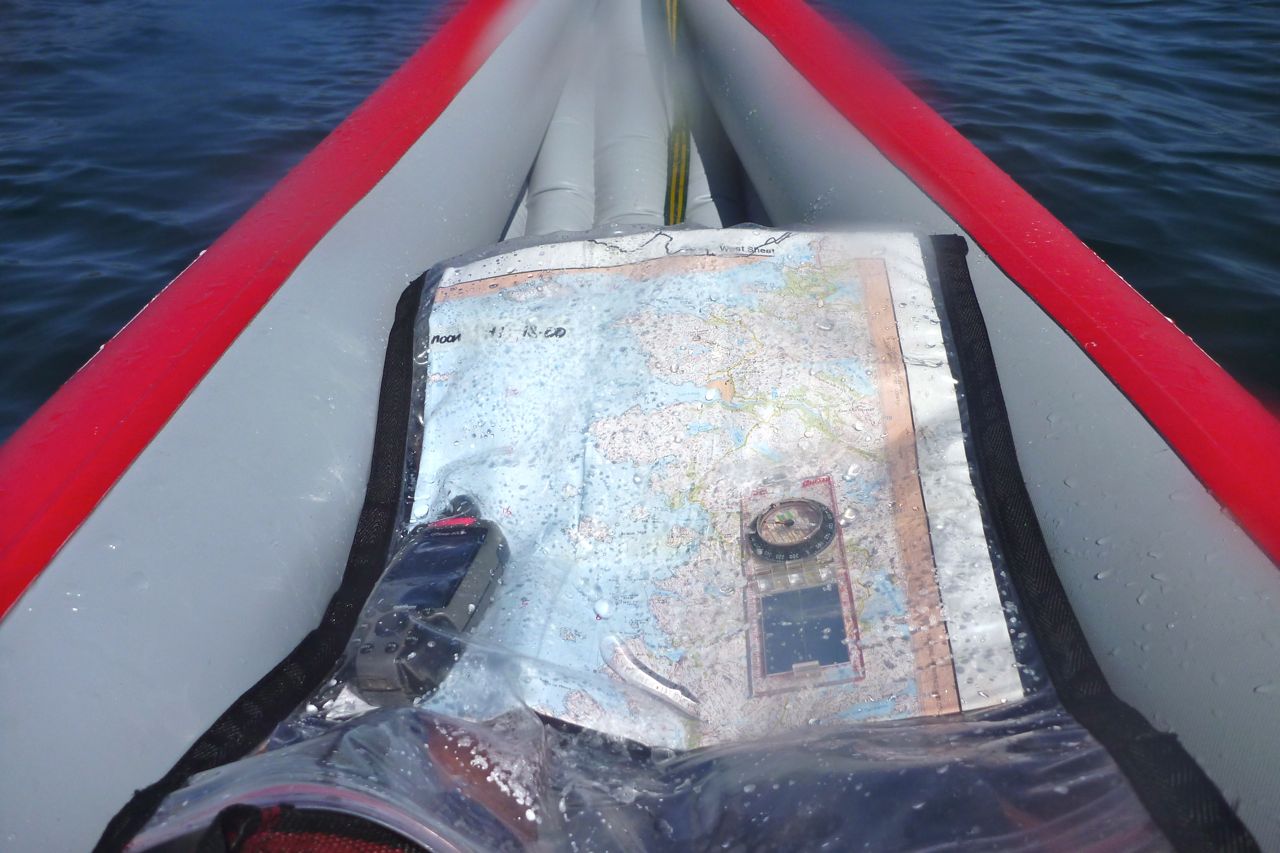
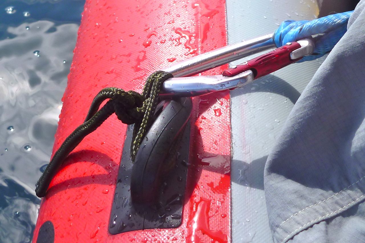 I definitely need to come up with something better, and for the rest of the trip avoided leaning against the strap for fear of damaging the lugs. That may have contributed to the fatigue, if not actual low speeds (see below). Expensive but stout Grabner D-rings and an SoT backrest are on the way.
 At 2.7 miles out a wide channel separated Horse from its northern neighbour (left). In the absence of distracting wind and at today’s tide (3.6m, max can be 4.7) I wanted to see if I could detect any currents in places like this channel. Maybe not yet only 1.5 hours after HW, but by the time I closed the loop a flow – I imagined against me from east to west – ought to be noticeable.
 Down the inland side of the Horse I passed the small seal colony (left) we spotted on our way to Ullapool last year. And at around 70 minutes and 4 miles out I turned
  around the south end of Horse Island (left) and experienced the slight turbulence I expected, possibly as the tide flowed round the point against a rising southwest breeze.
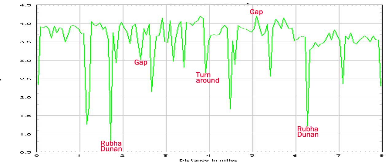 The fifty-minute paddle back to the beach turned into quite a haul, but that’s the way I like it sometimes and somewhere on this stage the GPS’s trip log (if not the track log, left) recorded the magical 5 mph!